July 17, 2024
Mountain heights: 2602 m, 2812 m
Total elevation gain: approximately 1700 m
Ascent time to
Helen: 3:35
Traverse time
to Flinsch: 1:40
Descent time
via Pitamakan Pass: 4:55
Solo scrambles.
Two days after a
mind-blowing (and heart-stopping) ascent of Painted Tepee, I was back in the
Two Medicine Lake area in search of more mind-blowing views and scenery; but
hoping to avoid the heart-stopping component!
Blake
Passmore’s statement, 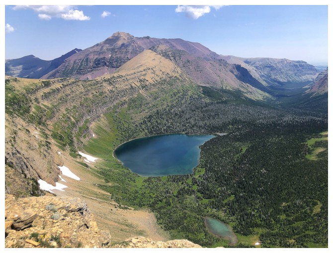 “Views don’t get any better than this”, in reference to the
summit panorama from Flinsch Peak was more than enough motivation to give the
mountain a go. Although I did toy with the idea of running up Rising Wolf
Mountain for a second time en route to Flinsch (the weather hadn’t been kind to
us the first time), I also wanted the option to ascend Mount Helen. Doing all
three would jeopardize my chances of getting back across the border before it
closed.
“Views don’t get any better than this”, in reference to the
summit panorama from Flinsch Peak was more than enough motivation to give the
mountain a go. Although I did toy with the idea of running up Rising Wolf
Mountain for a second time en route to Flinsch (the weather hadn’t been kind to
us the first time), I also wanted the option to ascend Mount Helen. Doing all
three would jeopardize my chances of getting back across the border before it
closed.
With the stage
set, I hit the Dawson Pass Trail around 6 am. The 10 km of mostly utilitarian
hiking to the pass went fairly quickly. I did detour en route to check out No
Name Lake – yes, that’s its actual official name! From the pass, I turned left
and made my way easily to the summit of Mount Helen.
Disappointingly, the view was a little hazy from forest fire smoke. It seems
our Painted Tepee ascent would potentially be the last completely smoke-free
day of the summer. 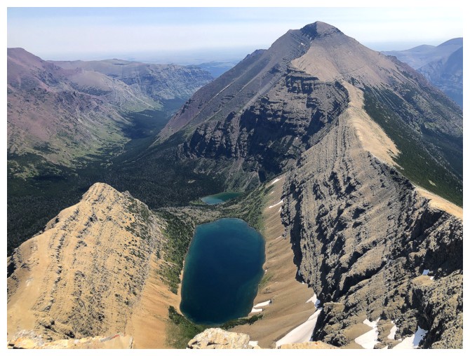 Even with the haze, however, Helen sported a terrific
panorama, filled with beautiful peaks and several lakes.
Even with the haze, however, Helen sported a terrific
panorama, filled with beautiful peaks and several lakes.
My motivation to ascend Flinsch waned a fair bit as I made my way back
down
towards Dawson Pass. Once there I decided to go for it - the driving
and the
hike up to the pass are a considerable distance to cover for Mount
Helen only, which many would consider more of a consolation prize than
anything. I also started to toy with the idea
of returning to the parking lot via Pitamakan Pass. This would add
about 8 km
to the descent, however, the route via Pitamakan is reported to be one
of the
best in the park. Many hikers complete the Dawson/Pitamakan passes as a
loop route each
year.
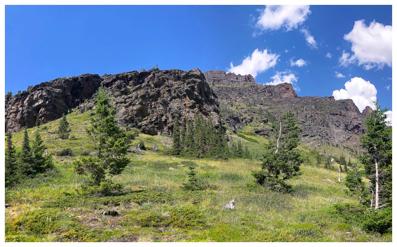
Flinsch turned out to be quite easy from the south side. A prominent trail in
the scree led all the way to the summit block. The moderate scramble to
the summit was short but enjoyable. And the summit view? Slightly below par,
due to the haze, but otherwise every bit as magnificent as advertised by Mr.
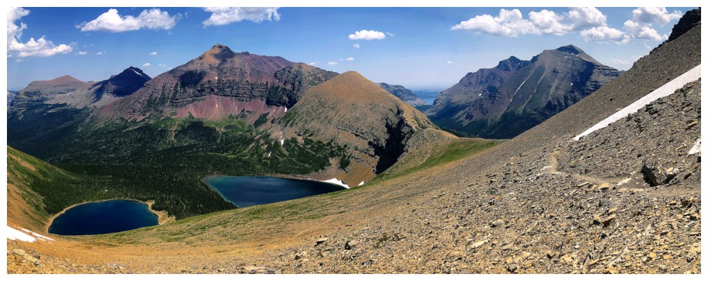
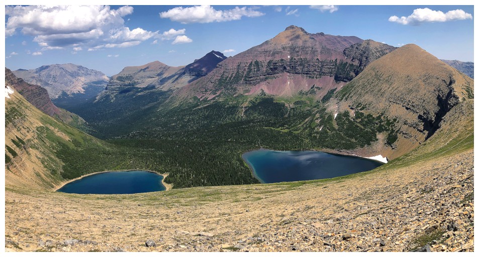
Passmore. Oldman and Young Man lakes added significantly to the overall
spectacle.
I had already made up my mind to complete the loop route via Pitamakan Pass,
now more at ease with the slight disappointment of hazy views. The loop
promised even more lake-filled vistas and I knew this would not be an isolated visit to this stunning area of the park anyway.
Not much to say about the Pitamakan Pass route except Holy @$&:! The
numerous lakes were breathtaking, as were all the familiar mountains - Red
Mountain eliciting a flood of great memories from less than a year earlier.
Good thing the route was incredibly scenic because incredibly short it was not!
And all on a searingly hot day. Metres away from the parking I walked right
into the middle of Two Medicine Creek in my hiking boots and stood there for 10
minutes. My feet were so happy!
Aside from the haze, a wonderful day in the U.S.A. Definitely not the last time
I will visit the remarkable environs of the Two Medicine Lake area. I’m already
determined to repeat Rising Wolf and Flinsch on a perfect smoke-free and cloud-free
day.
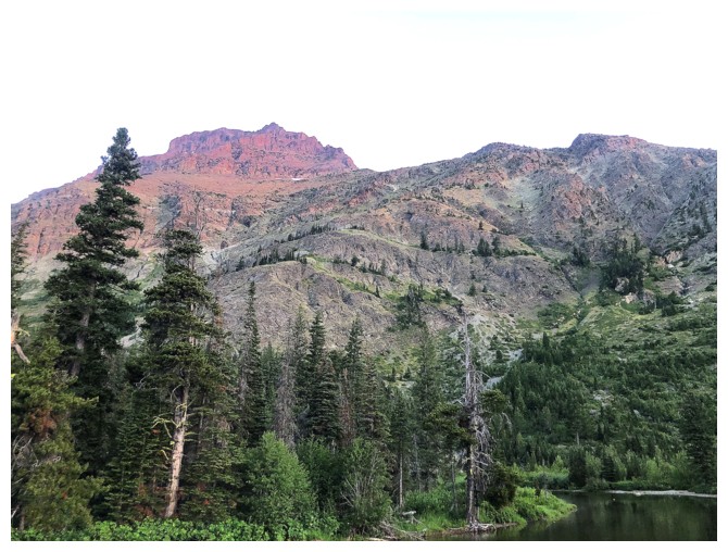
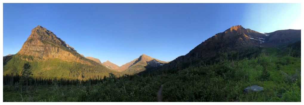
Some of the southeast side of Rising Wolf Mountain
Left to right: Never Laughs, Grizzly, Painted Tepee, and Sinopah
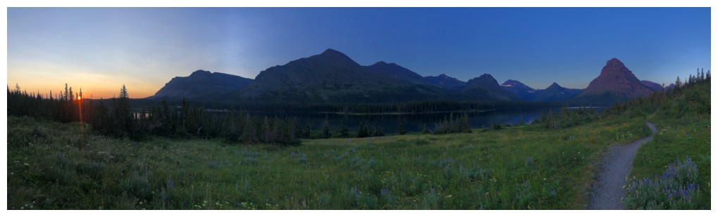
Sunrise
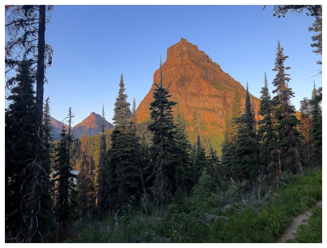
The Sun hits Sinopah in full force
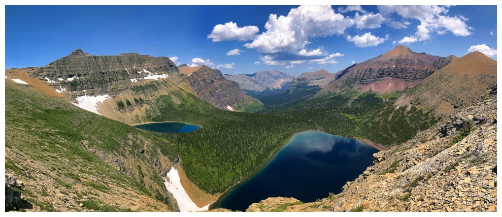
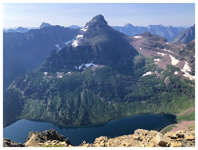
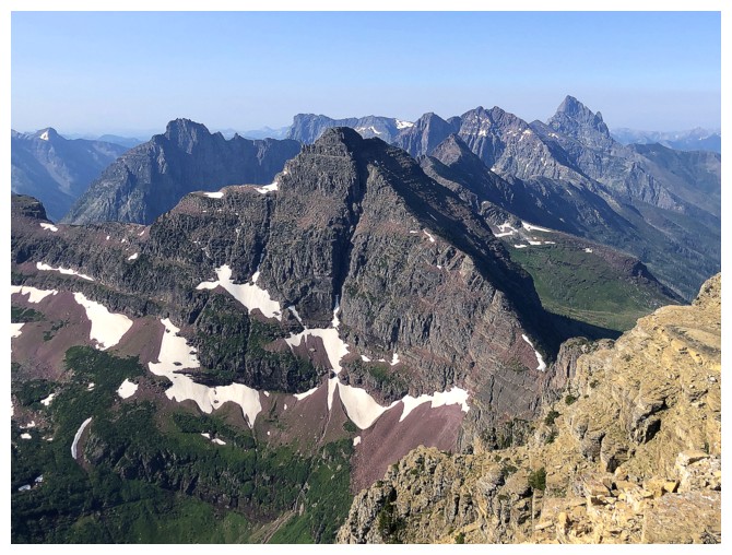
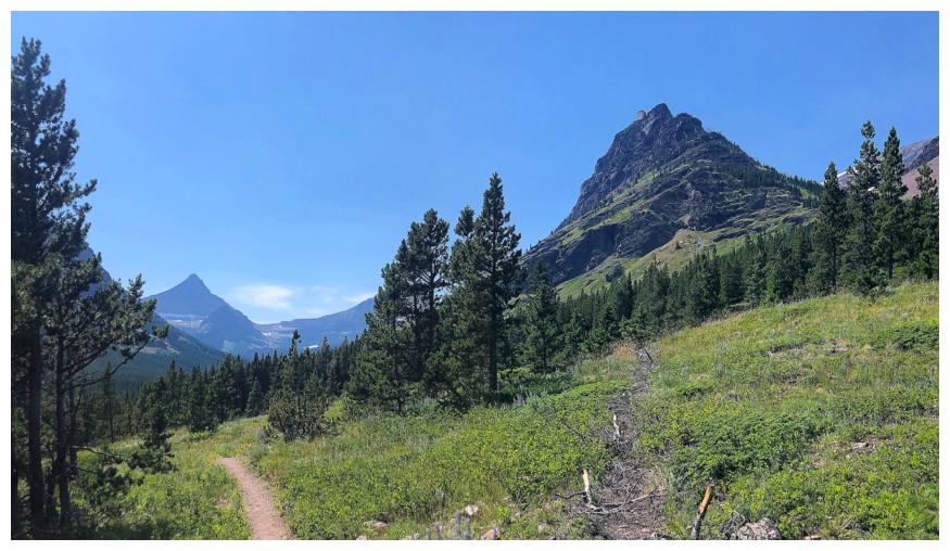
Distant Mount Helen in the centre. Lone Walker Mountain is the small peak to the left of Helen.
The striking peak at the right is called Pumpelly Pillar and is part of Mount Helen
Close-up of Pumpelly
Without the trees blocking the view
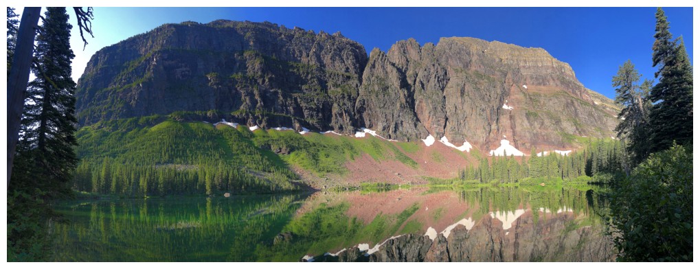
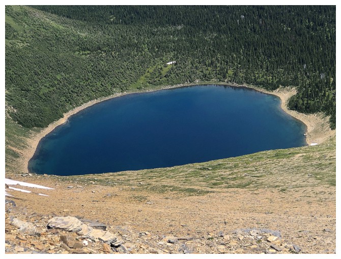
No Name Lake
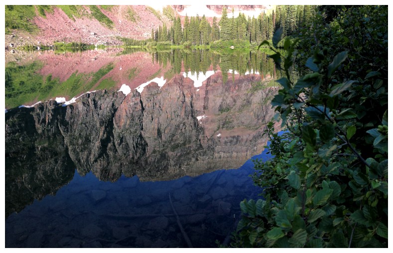
Nice reflection in the lake
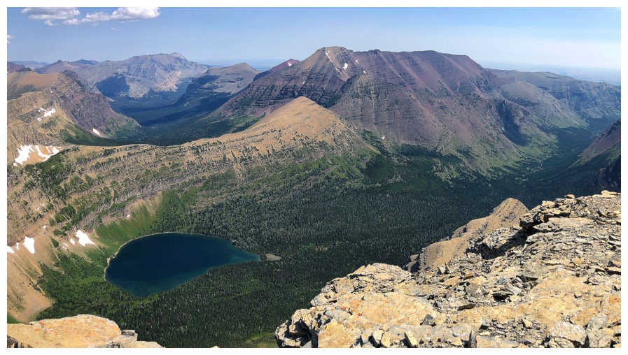
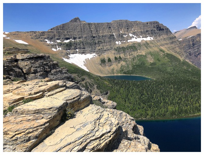
The lower eastern summit of Mount Helen
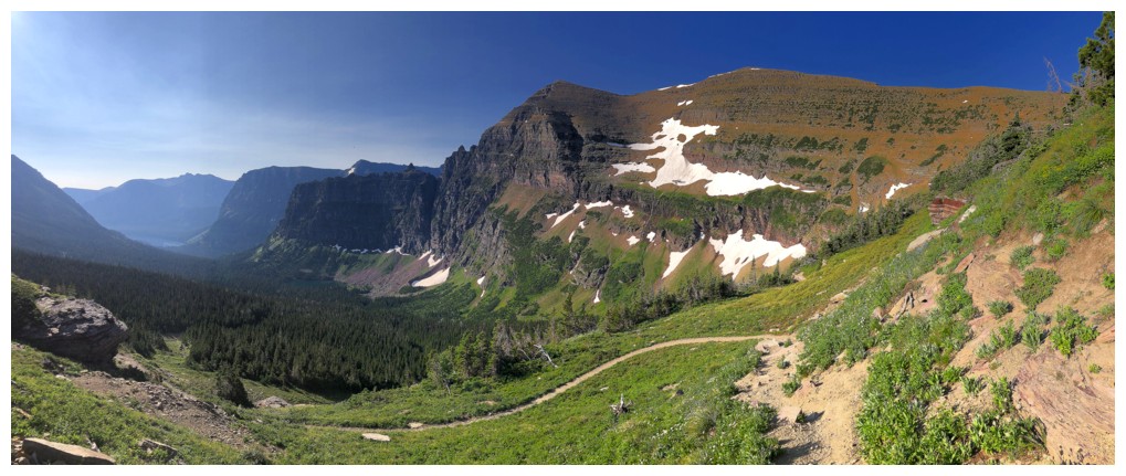
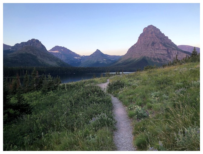
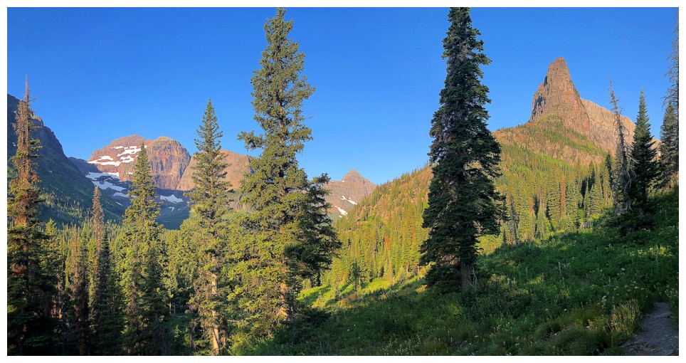
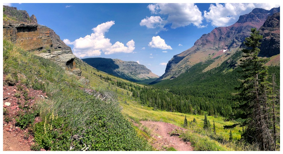
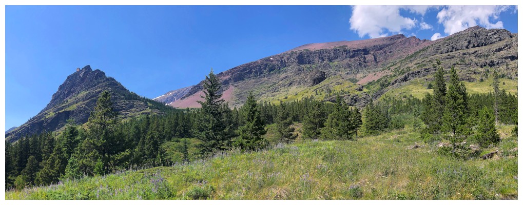
The views start to open up on the Dawson Pass Trail
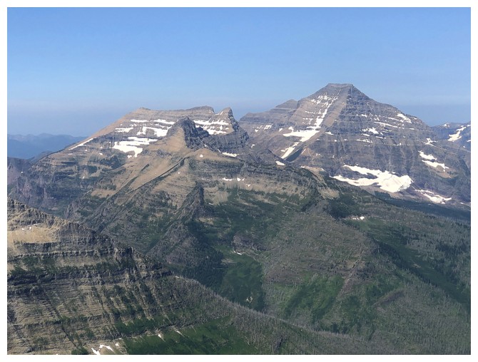
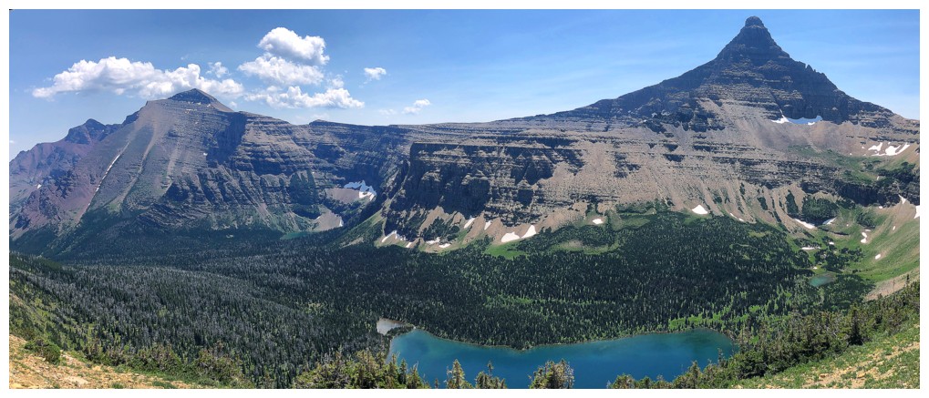
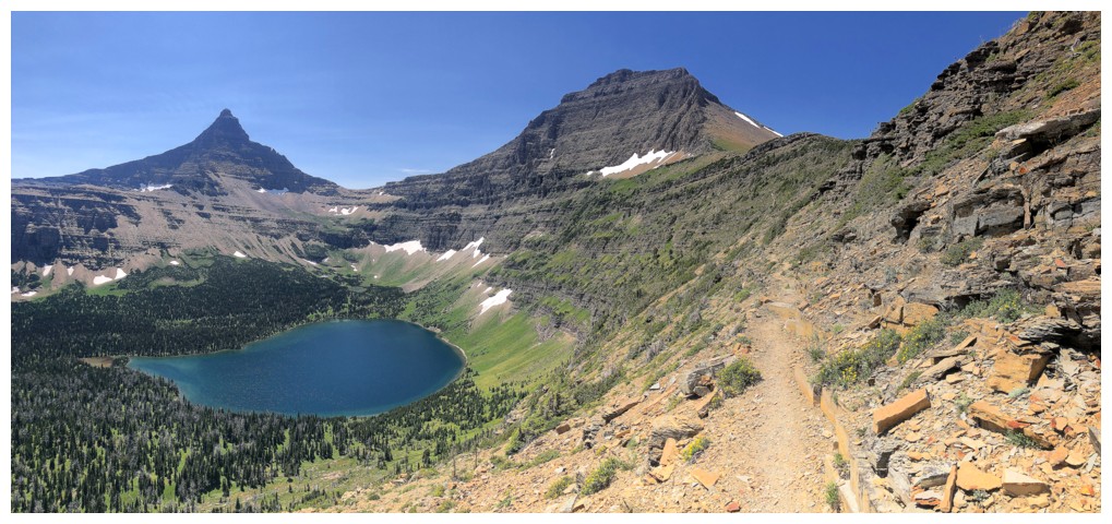
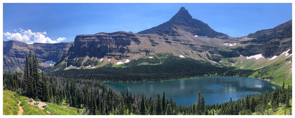
Flinsch Peak to the north
Mount Helen to the south
Mount Phillips is the first big peak you see approaching Dawson Pass
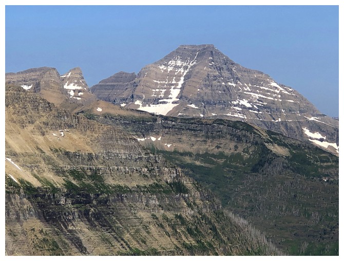
Mount Stimson - one of the six 10,000er's in GNP
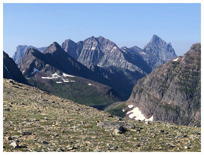
Mount Saint Nicholas at the right. Battlement Mountain and Vigil Peak left of Nicholas.
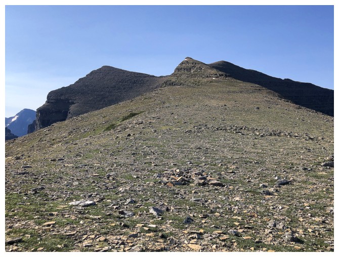
The easy route up Mount Helen
Blast from the past - Mount Logan
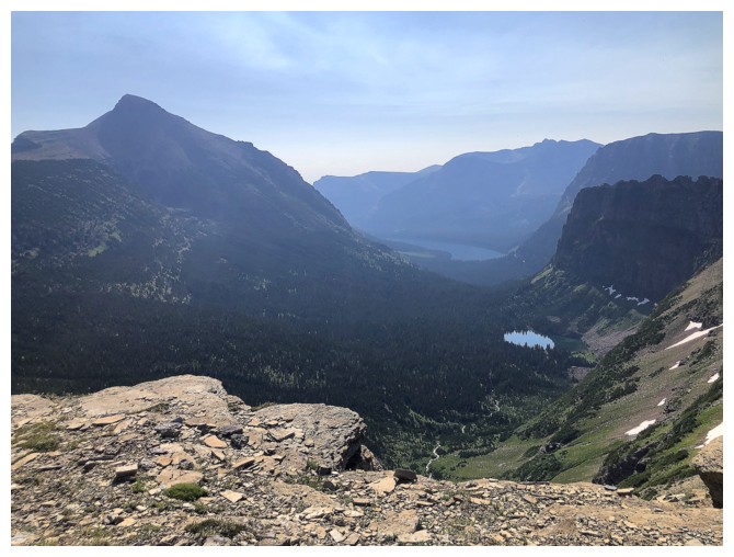
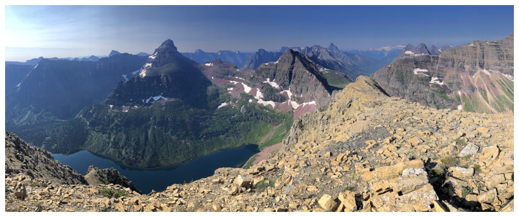
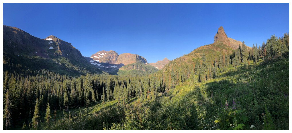
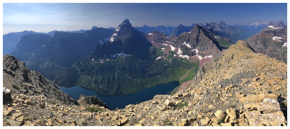
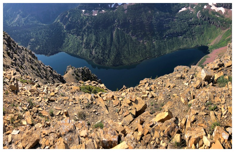
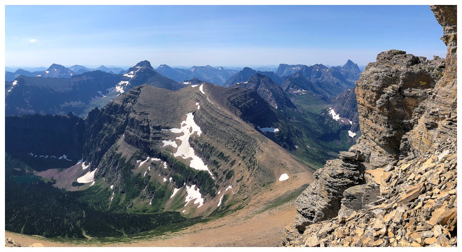
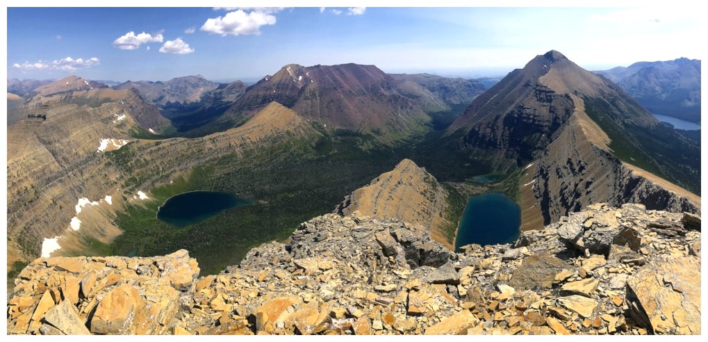
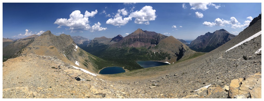
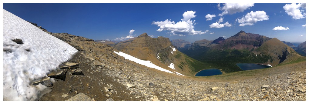
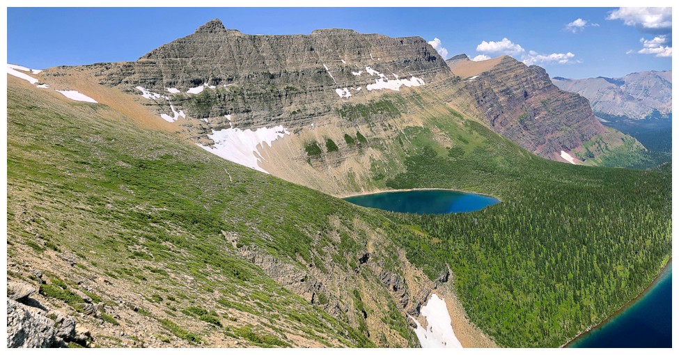
The slightly hazy view back towards Two Medicine Lake
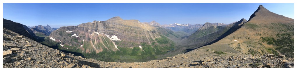
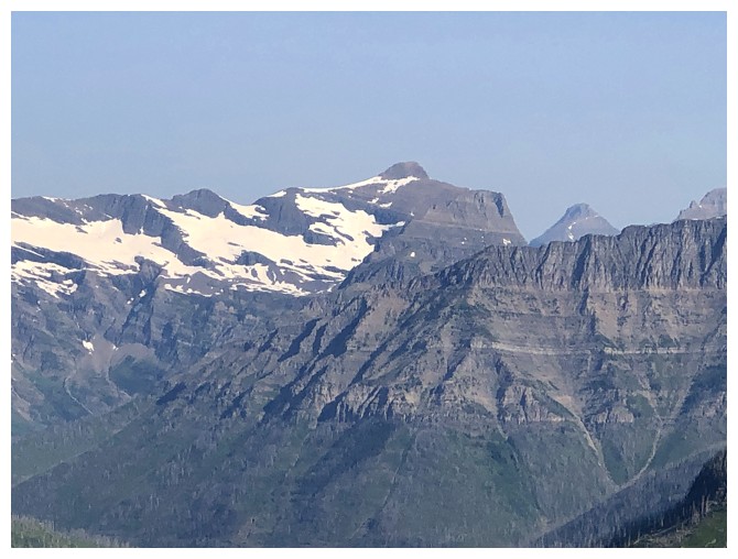
Phillips, Flinsch, and others
The
slightly lower east summit of Helen. Had the skies been less hazy I
might have traversed over to that one for a good view of Two Medicine
Lake.
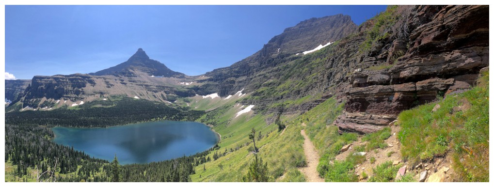
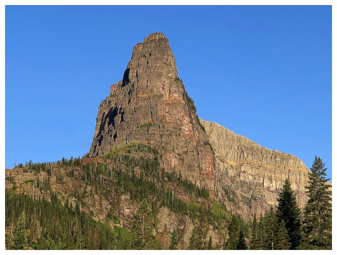
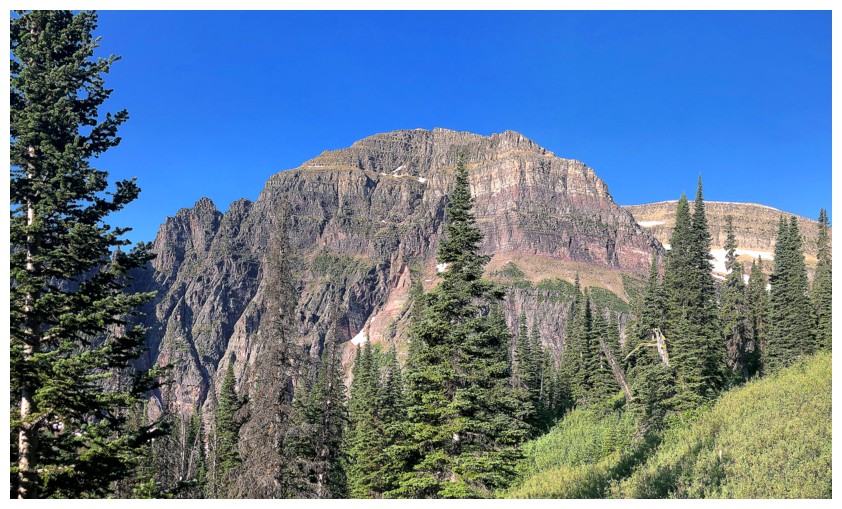
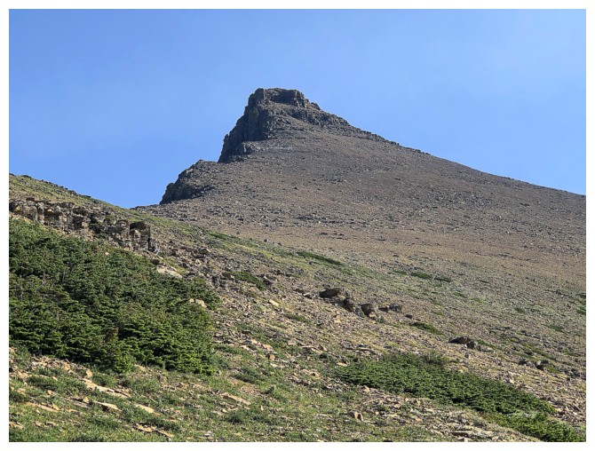
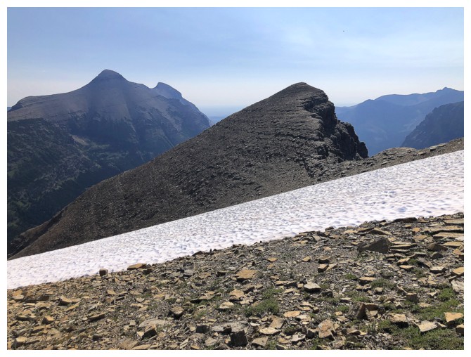
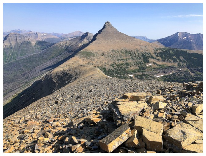
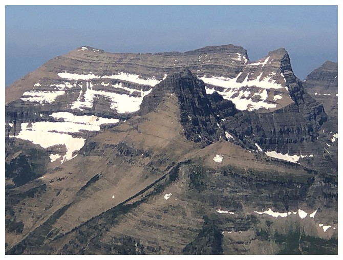
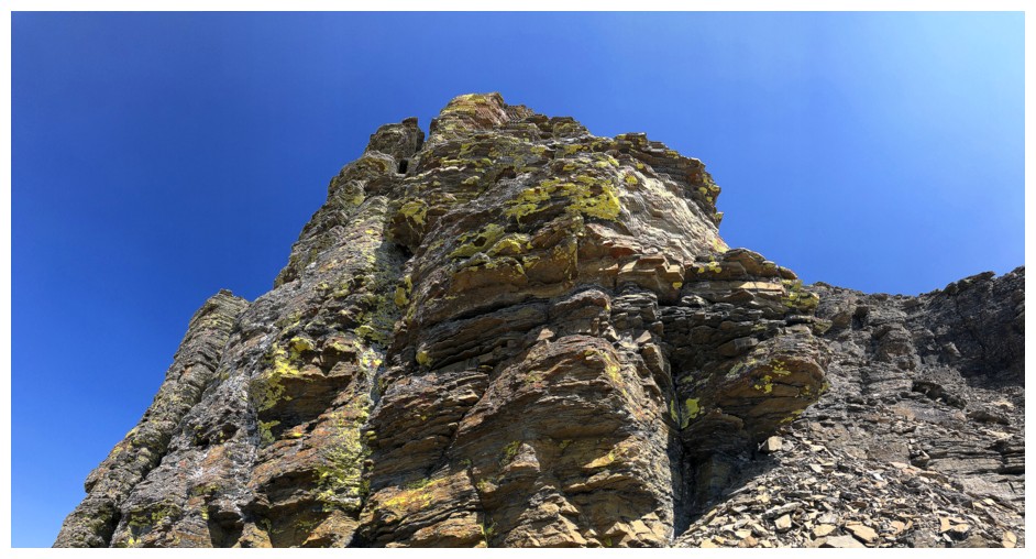
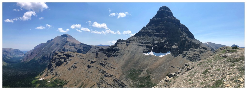
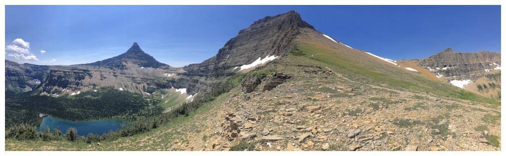
Flinsch is quite distinctive
At the summit

View to the west
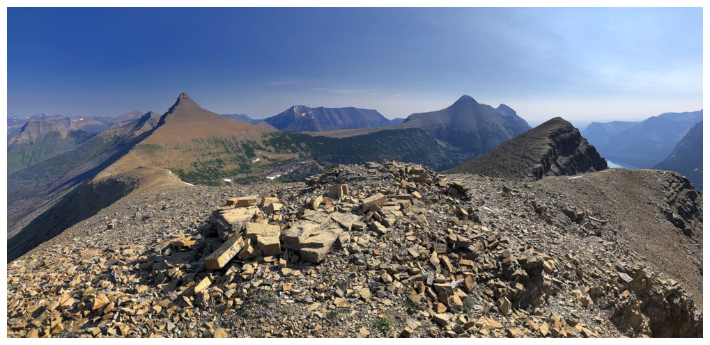
The north
The south
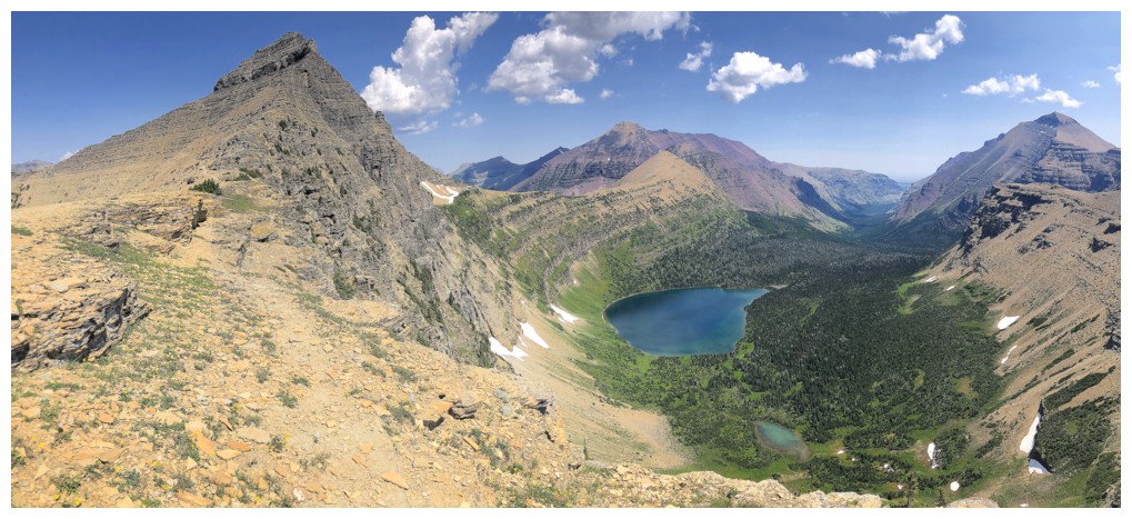
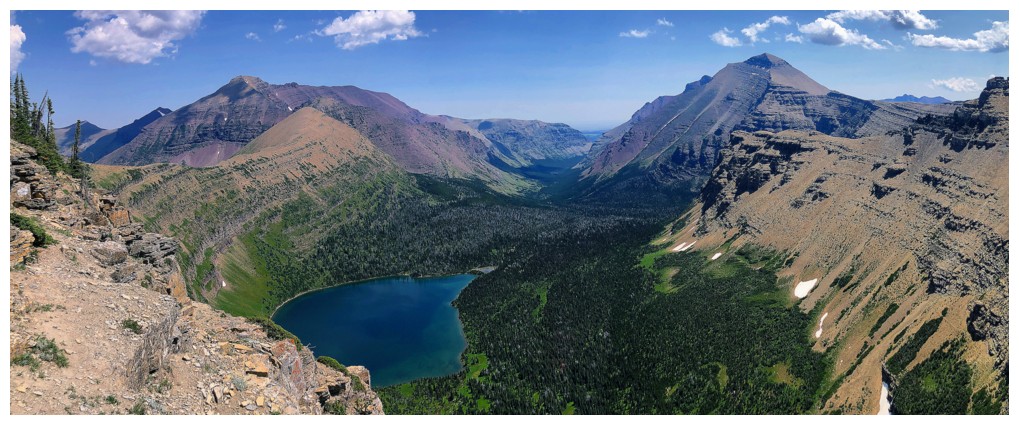
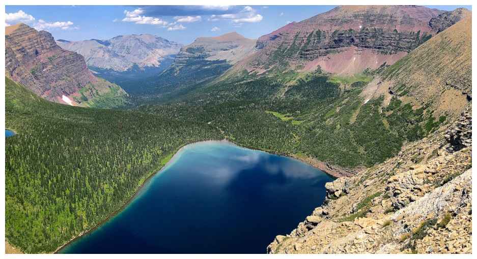
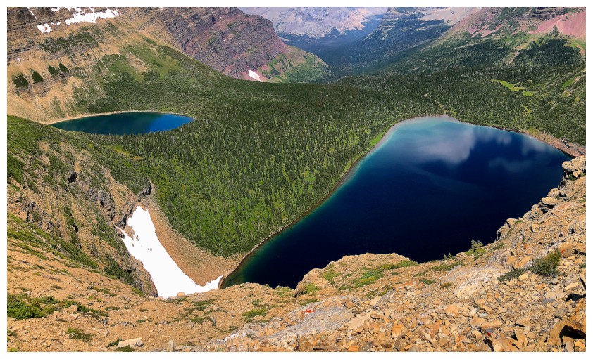
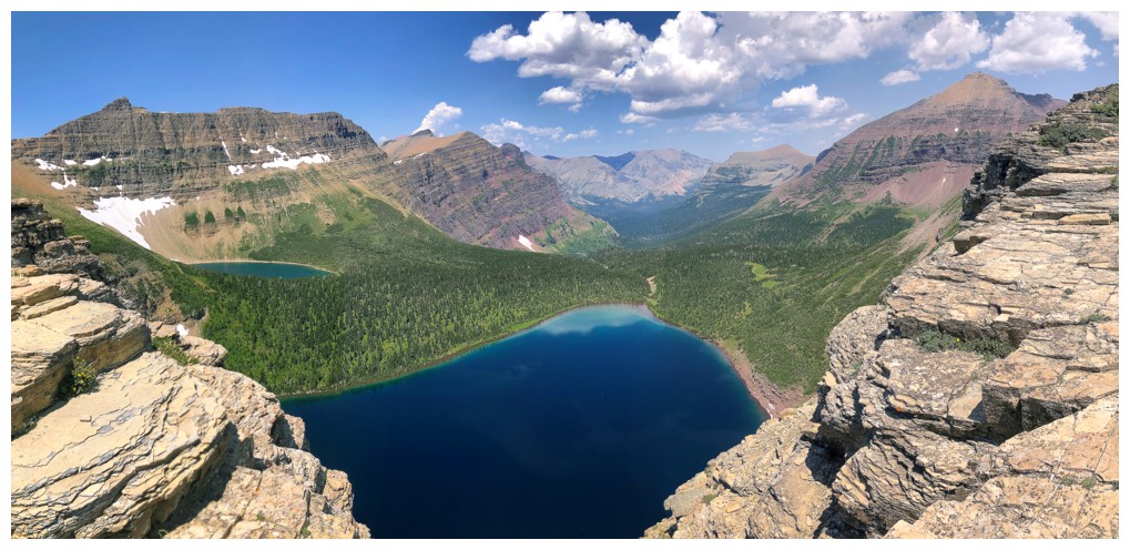
Upper Two Medicine Lake
Mount Rockwell. After hiking right by it en route to Painted Tepee, this massive peak has moved up on the priority list.
Lone Walker Mountain sits immediately south of Helen. Apparently you can reach Lone Walker from Helen.
Last look at Flinsch from Helen

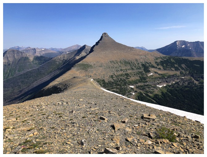
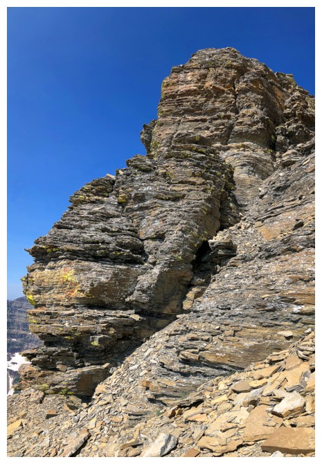
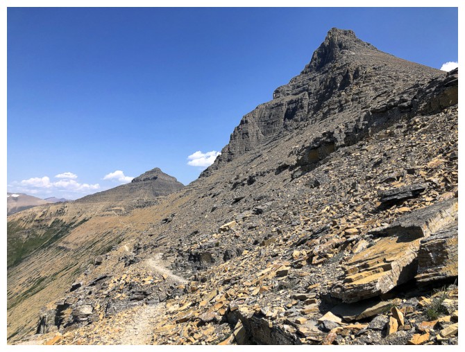
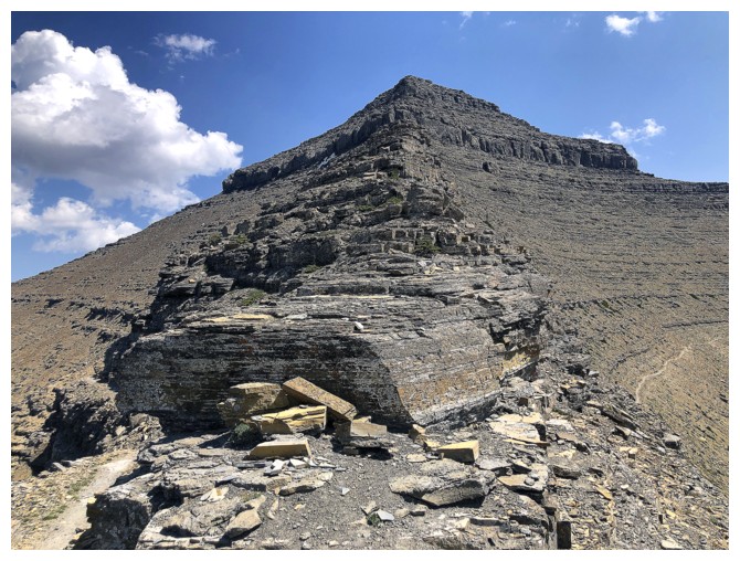
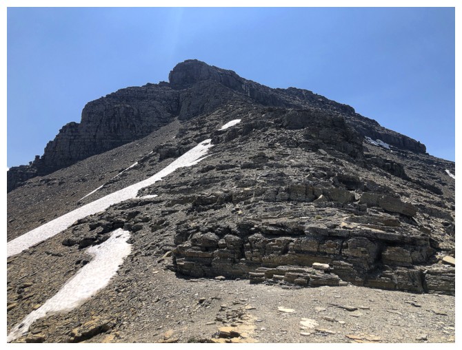
Sometime later heading up the south ridge of Flinsch
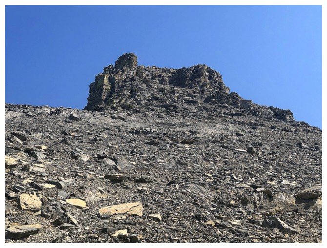
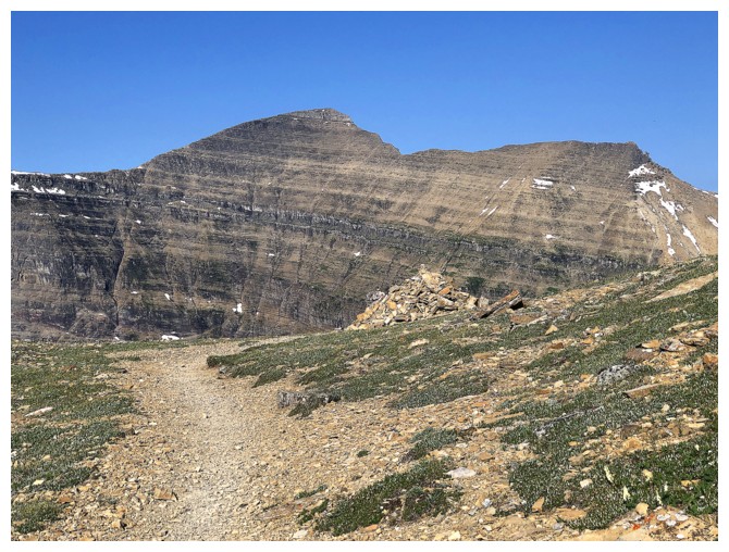
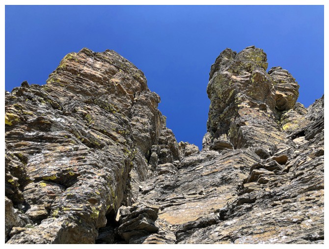
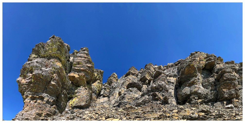
The summit block
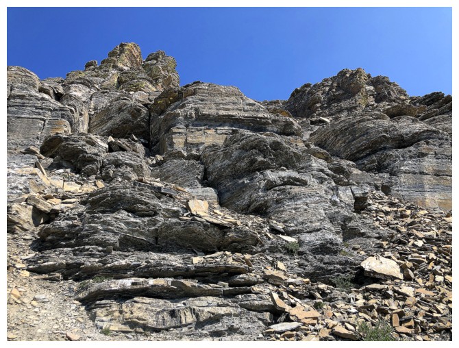
After slogging up scree slopes for most of the ascent, the terrain gets interesting for the final push to the top
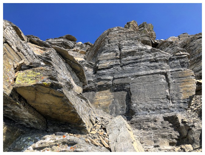
Same as above
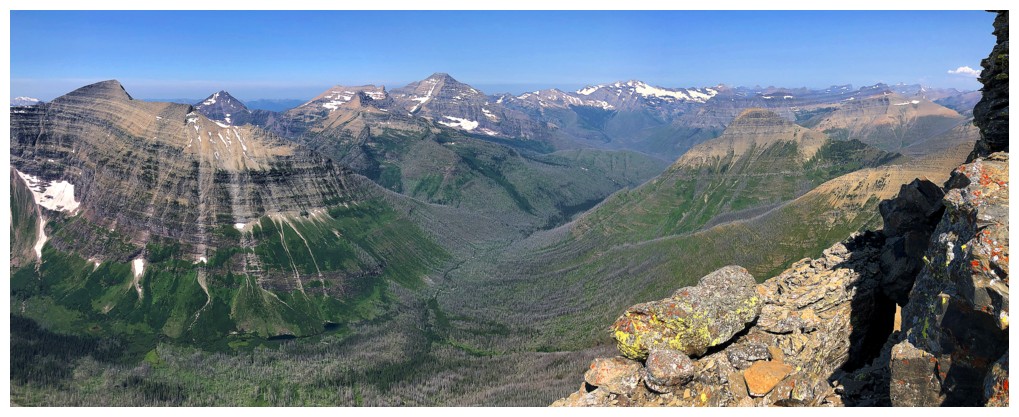
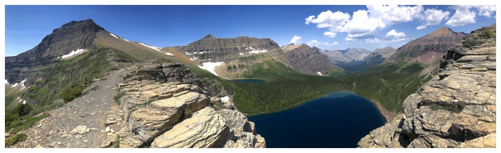
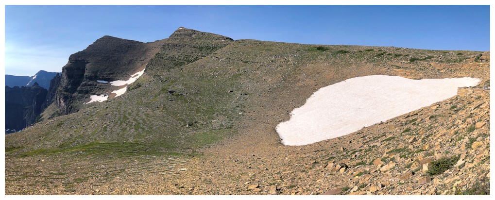
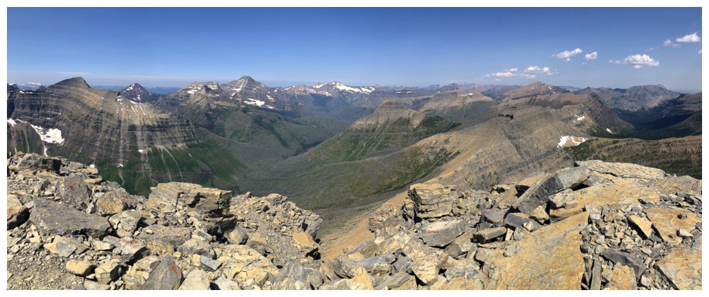
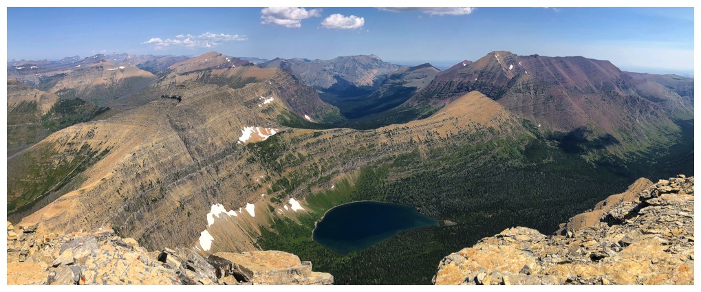
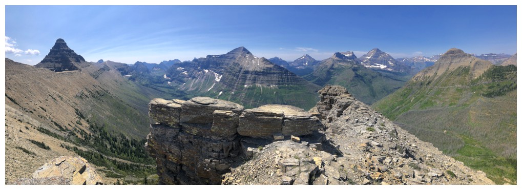
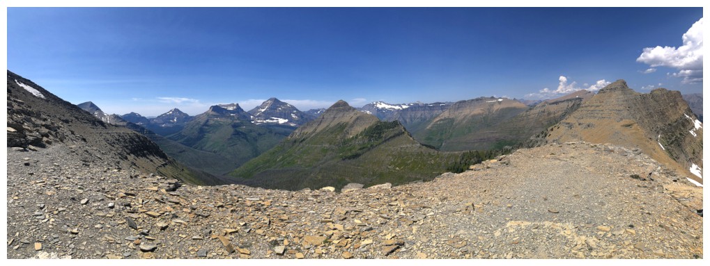
Pano to the west and northwest
Mount Stimson and Mount Pinchot
Pinchot is very eye-catching
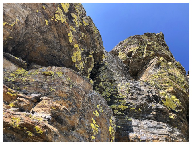
Lichen time
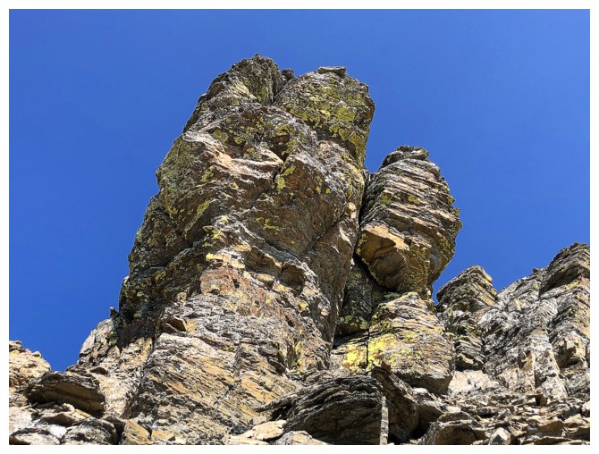
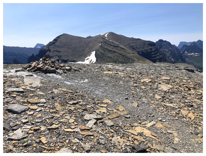
The summit block
Looking back to Helen

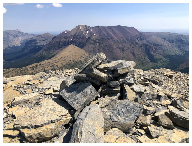
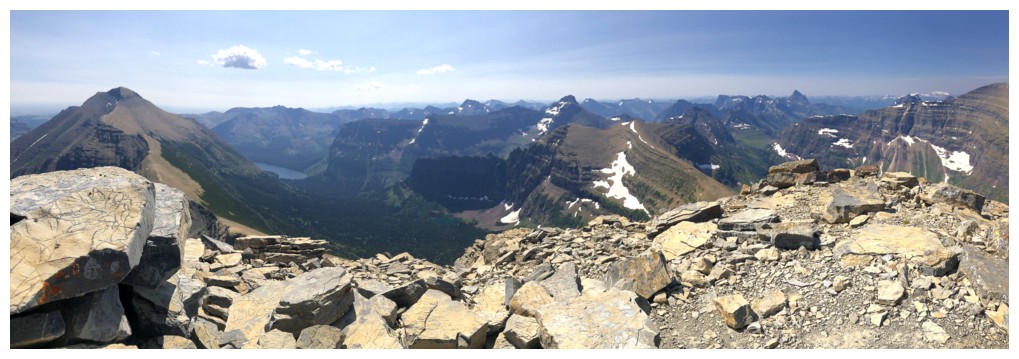
At the summit
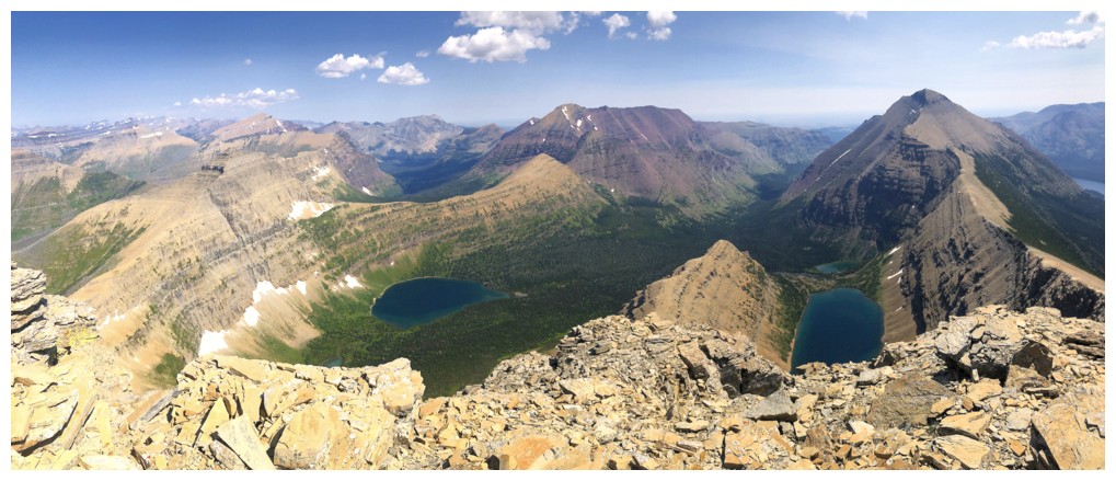
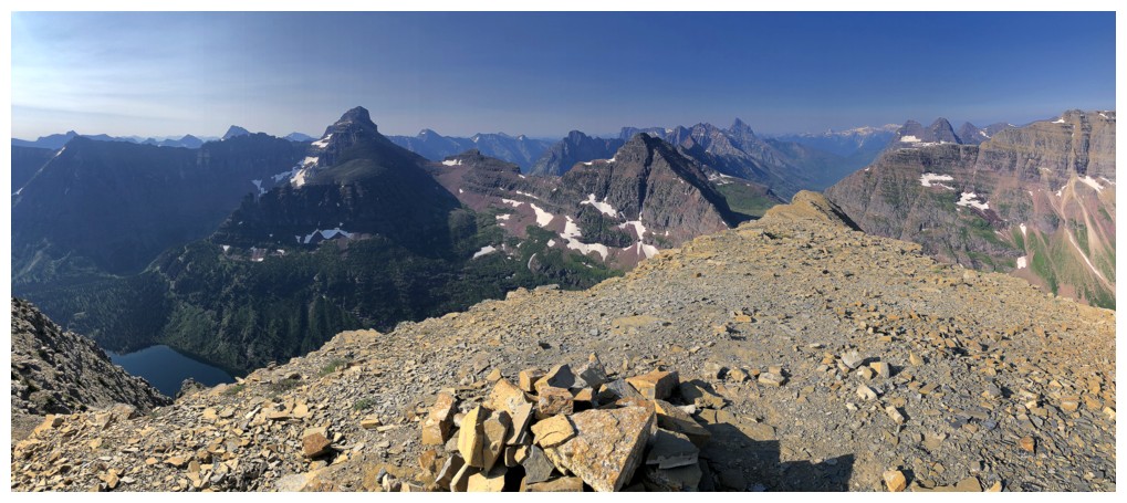
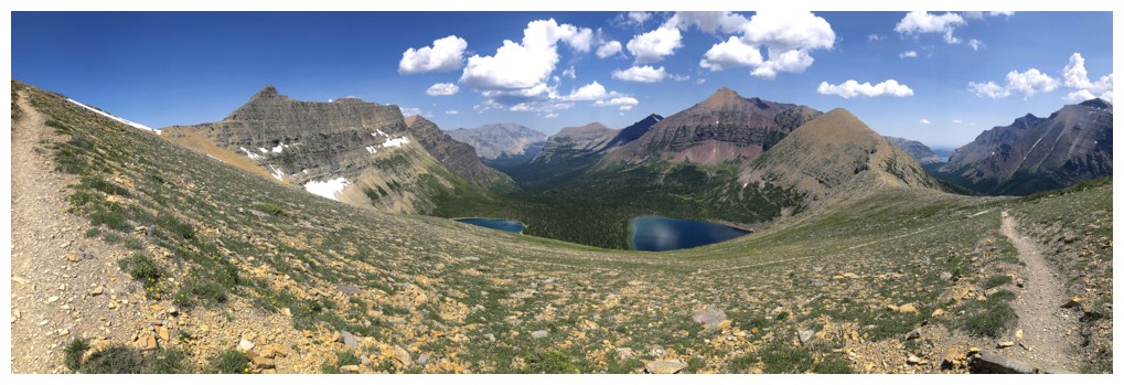
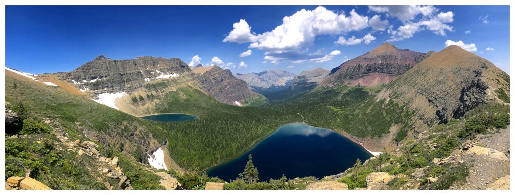
Oldman Lake and Red Mountain to the north
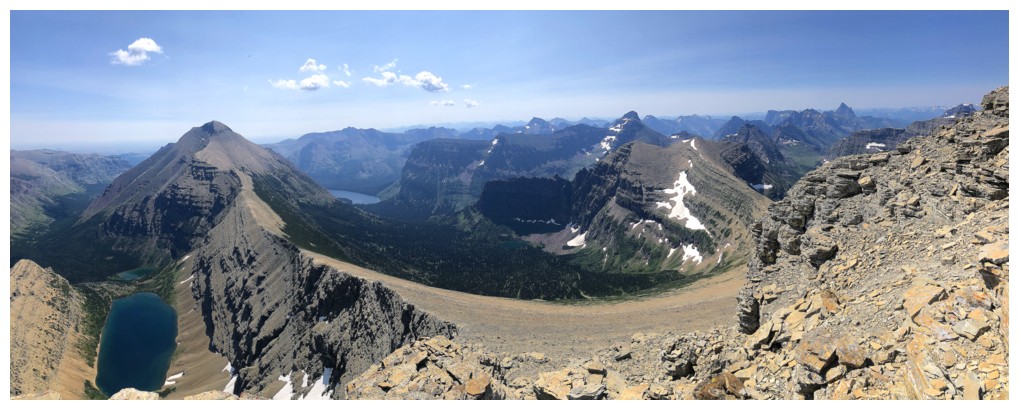
West and northwest
East and southeast
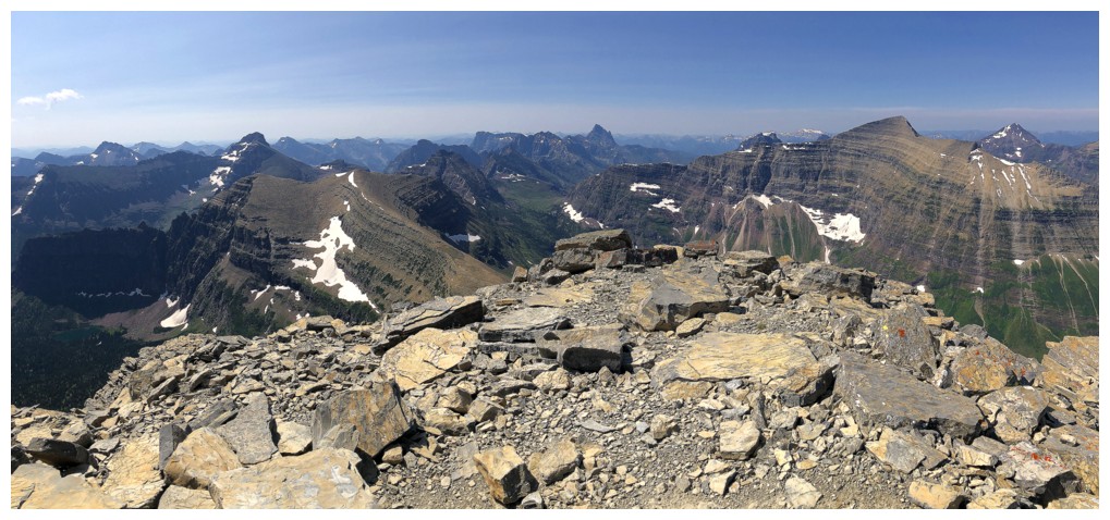
Many directions!
This would have been the killer view had the skies not been a little hazy
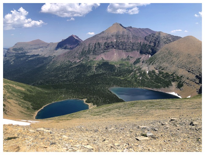
Young Man Lake and Boy Lake, below Rising Wolf Mountain
More summit views after descending the east ridge a short distance
Back down at Dawson Pass
The trail from Dawson Pass to Pitamakan Pass traverses the west sides of Flinsch Peak and Mount Morgan
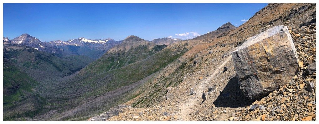
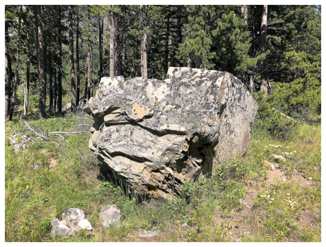
BIG boulder and BIG view
Between Flinsch and Morgan
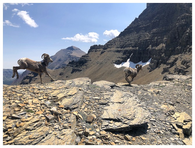
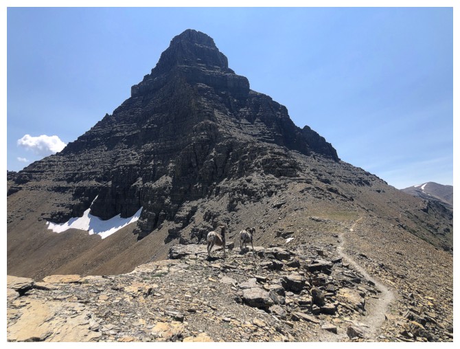
These two bounded past me at Mach 4
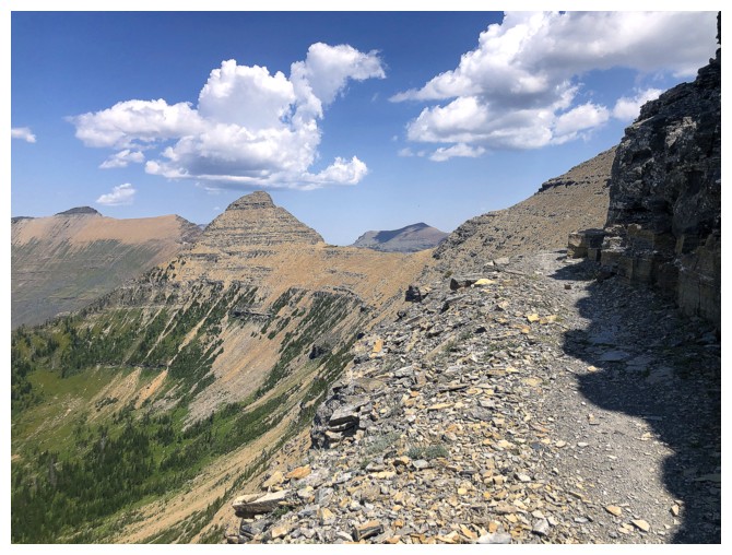
Looking back to the Rams (so ready for the upcoming NFL season!) and Flinsch
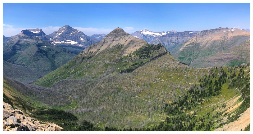
Morgan at the left, Oldman Lake in the centre, and Rising Wolf at the right
Rising Wolf and Flinsch
One of the best views of the day
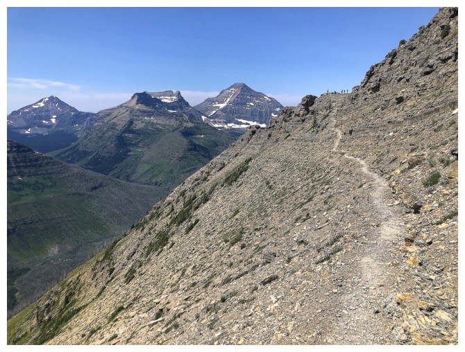
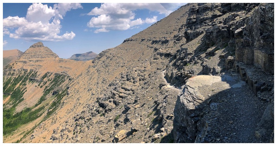
The very cool trail, with a group of people at the end
On the west shoulder of Mount Morgan
Great view from a perch on the west shoulder

Same as above
The trail resumes on the northwest side of Morgan
...and traverses over to the left side
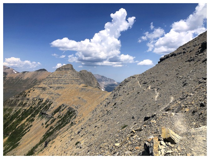
Still traversing on the well-defined trail
Same as above
Tinkham Mountain in the centre
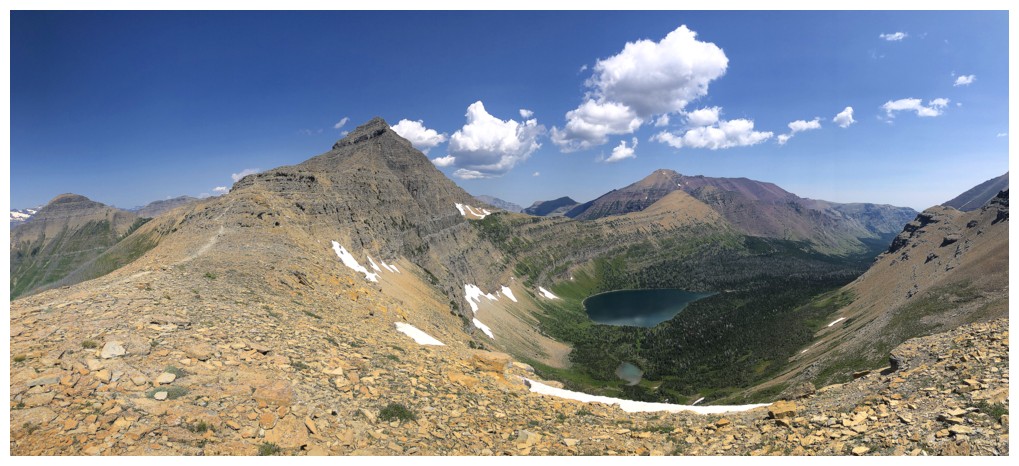
Arrived at Pitamakan Pass
Seven Winds Of The Lake and Pitamakan Lake, below Red Mountain, are going to receive considerable photo attention!
View from the west to the north from the pass
Seven Winds Of The Lake
Looking
up Mount Morgan's ascent route. For the Doug Lutz's and Devan
Peterson's of the world, a great day would be to ascend Rising Wolf,
Flinsch, and Morgan (possibly throwing in McClintock) as a day trip -
way beyond my present physical capabilities!
Rising Wolf at the right joins the spectacle
Snow!
Right to left from Red Mountain: Eagle Plume, Bad Marriage, and Kupunkamint
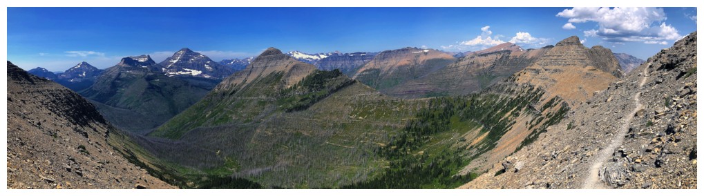
Pano from this awesome trail
Flinsch, Morgan, and McClintock Peak at the right
Oldman Lake on the south side is going to garner as much attention as the other lakes
Back to the north
McClintock Peak above Seven Winds Of The Lake. The peak to the right is the higher peak south of Medicine Grizzly Peak - one of the most rewarding scrambles in the park.
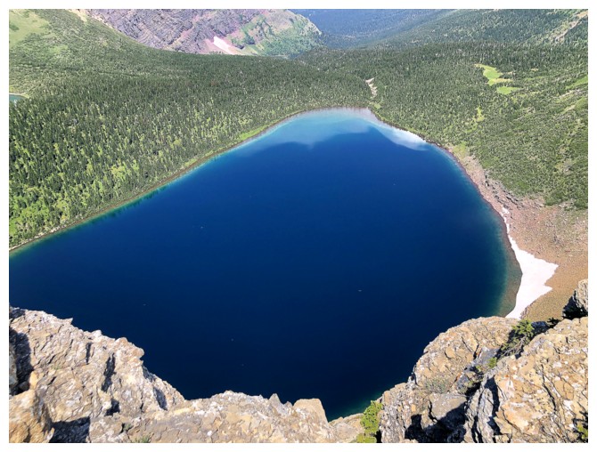
Pitamakan Lake
McClintock appears to be a straightforward ascent from Pitamakam Pass
This scene and lake reminded me a little of Fish Lake en route to Minnow Peak

Now on the north side of the incredible stretch of ridge that grants views of both valleys
The super cool trail switchbacks down towards Oldman Lake
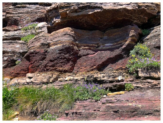
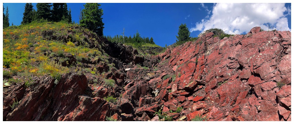
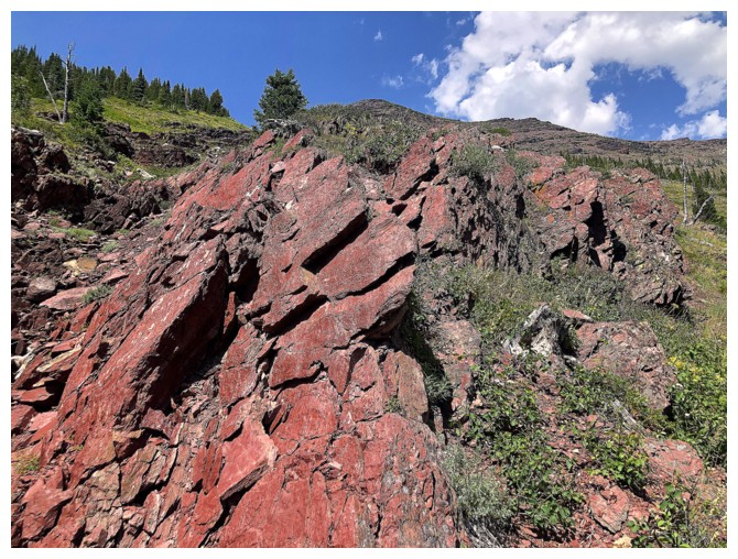
Not a ton of red argillite on this route but enough to satiate
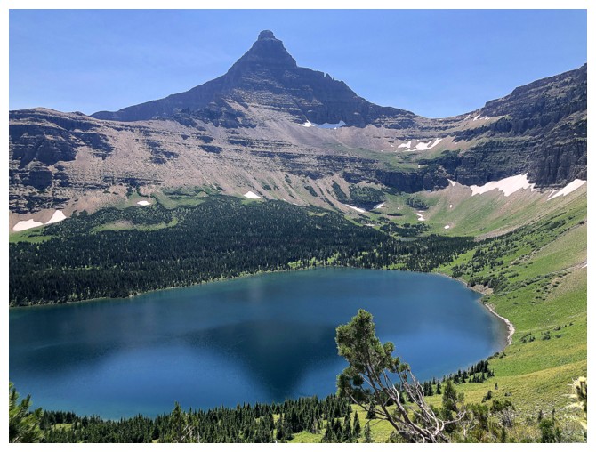
Flinsch slightly reflected in Oldman
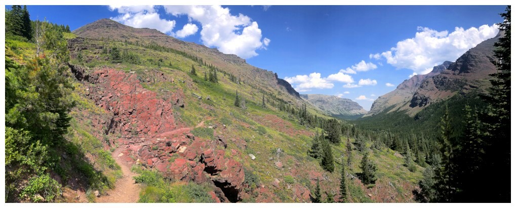
Much further down the valley, the trail cuts through another section of red rock

It's a long but scenically rewarding hike back
Tons of cool terrain that begs exploration
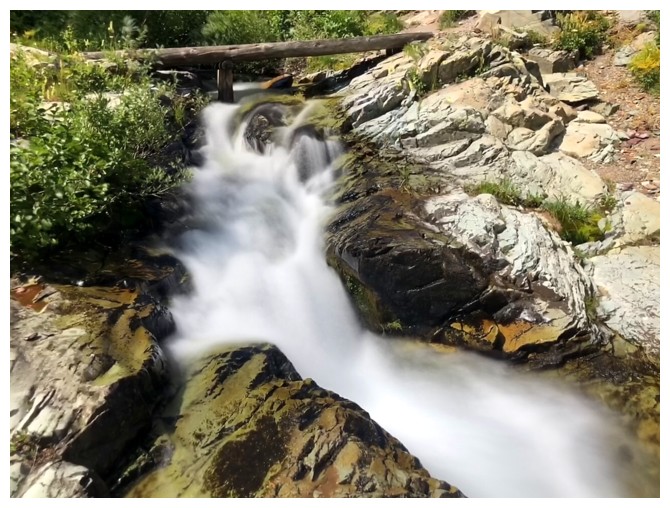
Just when I thought I'd go an entire day without a long exposure photo!
The southeast side of Red Mountain and a distinctive outlier of Red that I would love to explore someday at the left
The outlier at the right now and Flinsch at the left
Nostalgic encounter with the boulder Doug and Raff bouldered near the end of our Red Mountain trip
The End
LOG