Mount Kidd Lookout II and "Packenham Junior" II
January 6, 2010
Mountain height:
2128
m
Elevation gain:
600
m
Ascent time:
2:35
Descent time:
1:00
Solo snowshoeing.
Since my list of “Peaks to do again with
better weather”
seems to be getting disproportionally large, I decided to take a small
bite out
of it by returning to the former site of the Mount Kidd Lookout. Mark
and I had
enjoyed an easy trek up to the lookout in April
of 2007,
but in rather gloomy weather conditions. We did the ascent on foot, but
I took
snowshoes for this excursion, thinking I would stroll to top in no
time. That
turned out to be a delusion of significant proportions!
Upon leaving the official snowshoe trail I
stumbled onto a
fairly recent set of snowshoe tracks heading in the right direction.
Instead of
breaking new trail all the way up, I decided to follow them. At first
this was
easy, but higher up the tracks went quite far over to the northeast
side of the
peak, home to thick stands of alders and other bushwhacking obstacles.
Hats off
to the individual who broke the trail because even following it was
very
strenuous at times.
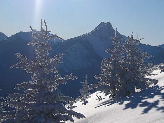
A solid two hours of grueling travel up the treed slopes followed, before the terrain finally started to open up. To my surprise the tracks abruptly ended, just before reaching the ridge, indicating the individual had turned around. Thankfully, breaking new trail to the summit from that point was short-lived and also incredibly scenic. Snow-covered trees and vegetation and a perfectly clear sky were cause for many photos.
As impressive is that scenery appeared, it was no
match for
the summit view. The distinctive forms of Bogart, Ribbon, Sparrowhawk,
and Wind
were fantastic and the north ridge of
Though the ascent left much to be desired, the summit views more than made up for the drudgery of getting there. An excellent trip!
The moon over Mount Kidd
Trees and snowy slopes
Snow-covered brush
The terrain starts to open up
Looking northeast; visible peaks include McGillivray, Skogan, Lorette, Mary Barclay, Baldy, and Wasootch Peak
Snow-covered trees, the Sun, and The Wedge

A cropped view of the above photo
More snow on tree tops
The same tree as above, but from a different angle
The first view you see, upon reaching the ridge; L to R: Sparrohawk, Wind, Allan, and Collembola
Another ridge view: Bogart (left) and Ribbon
Wind
Sparrowhawk
A close-up of Sparrowhawk
A close-up of Bogart
McGillivray, Skogan and, Lorette
The north ridge of Mount Kidd
Snow-covered vegation
My descent route
“Packenham
Junior” II
Mountain height:
2295
m
Elevation gain:
630
m
Ascent time:
2:10
Descent time:
0:50
After completing the Mount Kidd Lookout ascent, I
had about
4 hours of daylight in which to try something else.
“Packenham Junior”, as
named by Calvin Damen, was the first peak that came to mind. Though the
weather
for my ascent in December
of 2007 was fairly decent, there was room for improvement and
I suspected
that the view of
Only my dwindling energy level made this ascent
difficult.
Again, there was a good trail to follow most of the way up. Even the
lower
portion of the mountain sported amazing views of snowy
Upon clearing tree-line, I traded my snowshoes for
crampons
and an ice axe and finished the ascent up steeper slopes. Like the
Mount Kidd
Lookout ascent, earlier in the day, I would have to wait until I
reached the
summit to fully experience the summit view. That wait was worth it in
more ways
than I can say. The views towards
Were it not a brisk and bone-chilling wind, I would have stayed at the top to watch the Sun set.
Except for the steeper sections, the descent was fast and easy.
An absolutely fantastic day of incredible scenery
in perfect
weather conditions. Also, another reminder that even many of the
“puny”
mountains and outliers in the
Mount Packenham (left) and Mount Hood
My water bottle (a nice gift from Kevin), Hood, and King Creek Ridge (right)
A shattered tree stump
Mount Brock
My water bottle again
Things got a little out of hand with the water bottle shots
Hood
Lichen on rock
Hood
The view to the east: Evan-Thomas, Packenham, Hood, Brock, Blane, Elpoca (very distant right), and King Creek Ridge
King Creek Ridge
The ascent route to the Grizlzly Peak/Evan-Thomas col
Packenham