Mount Mercer attempt
August 25, 2025
Mountain height: 2970 m (we made it to 2880 m)
Total elevation gain: approximately
1400 m
Round-trip
time: 12:35
Death
scrambling with Doug.
Mount Mercer
had been on my do-to list ever since seeing Vern’s report in 2024. After a cool but slightly
disappointing trip (weather-wise) up Owl Mountain a
few weeks earlier, I was looking for something that would grant a similar
but not identical view. 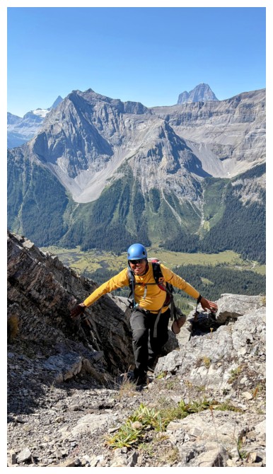 Mercer seemed fitting, I had a willing partner in Doug,
and the weather was forecast to be perfect. All the ingredients for a stellar
day were there. Turns out we didn’t mix those ingredients quite right!
Mercer seemed fitting, I had a willing partner in Doug,
and the weather was forecast to be perfect. All the ingredients for a stellar
day were there. Turns out we didn’t mix those ingredients quite right!
The
biking/hiking approach was long, but enjoyable and not overly physically
taxing. We had downloaded Vern’s track and followed it loosely up the lower
slopes of the objective. The scrambling soon started, mostly up steep but solid rock.
Everything seemed to be going smoothly and the scenery on the mountain and
views to the west were magnificent. Unfortunately, we eventually hit an impasse
and decided we were in the wrong gully. This required a stiff downclimb and
wasted about an hour of time, but upon resuming upward travel in the next gully
we were optimistic the route would unfold with a little more ease.
Not so. Again,
we made good progress but were now climbing up even more intense terrain.
 Looking down what we would have to downclimb was far from a pleasant
experience!
Looking down what we would have to downclimb was far from a pleasant
experience!
Doug led the
way throughout, scrambling up a section that gave me a few major heart
palpitations. Now only 80 vertical metres from the summit we were hoping the
scree ramp Vern mentioned would appear. To our dismay that slope what
conspicuously absent. Above Doug lay only steeper rock bands that neither of us
wanted to upclimb or downclimb. We agreed that we were again in the wrong gully
and decided to bail on the ascent.
Even
downclimbing what we had already climbed up was extremely time-consuming,
requiring intense focus and care. Doug had wisely chosen to wear approach
shoes, while I had very unwisely opted for hiking boots. The boots were no
match for this terrain, and my descent was painstakingly slow. Much later
than sooner we made it down to easier terrain where more than a few sighs of
relief were breathed.
The remainder
of the return trip was obviously mercifully easy, and we were both extremely
thankful for our e-bikes to get up that gruelling hill before the Watridge Lake
turn-off.
Not making the
summit was disappointing, however the fantastic scenery throughout softened
that blow. Will I (we) return to try again? I guess only time will tell!
Glimpse of Mount Turner on approach
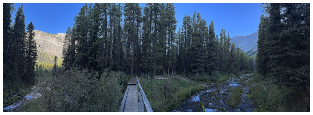
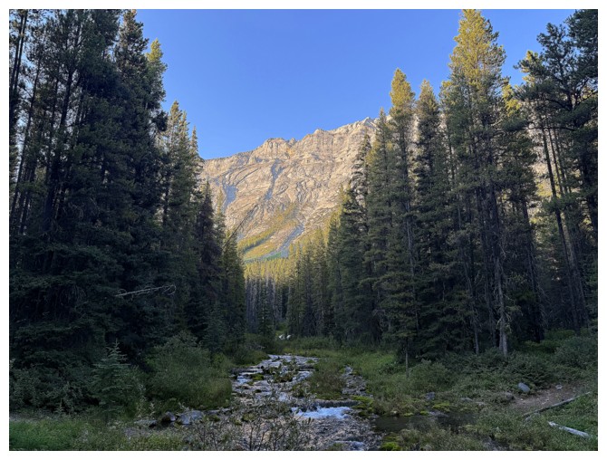
Creek crossing by the Big Springs campground
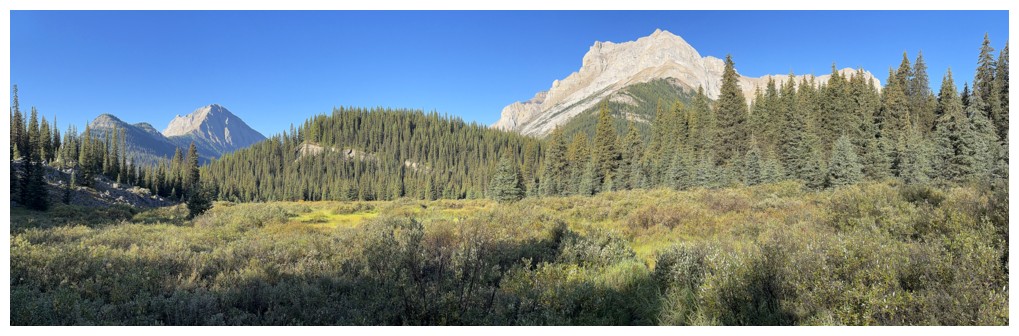
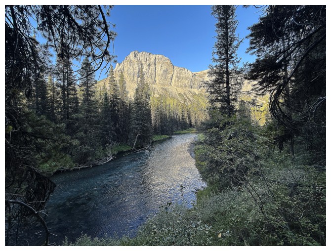
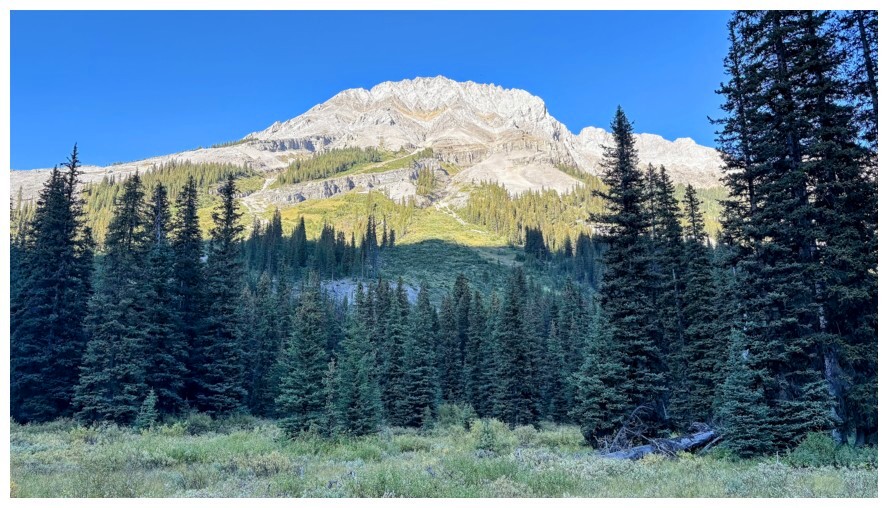
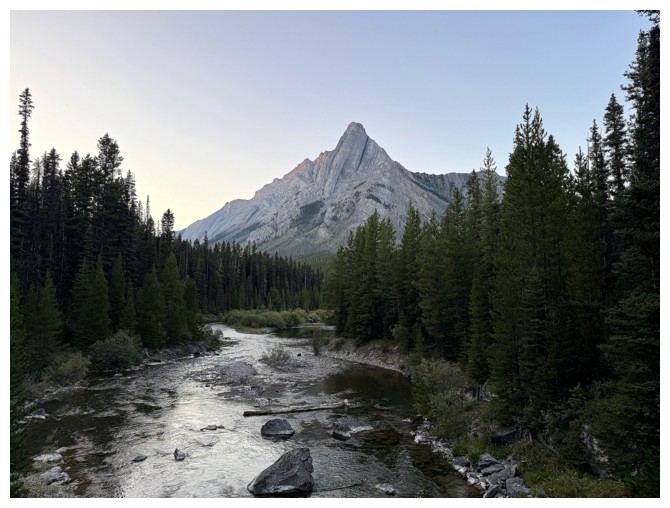
First open view of the day
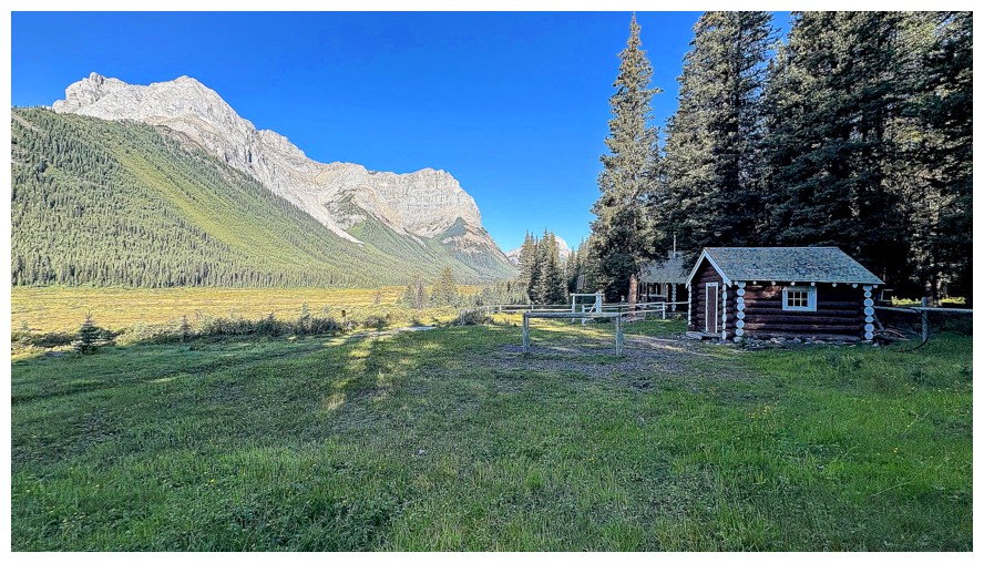
The Bryant Creek Warden cabin at the right (photo by Doug)
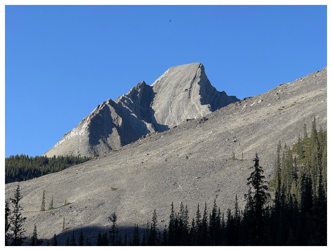
Great rock on the east side of Mount Cautley
The Subpeak of Ely's Dome
Eon Mountain
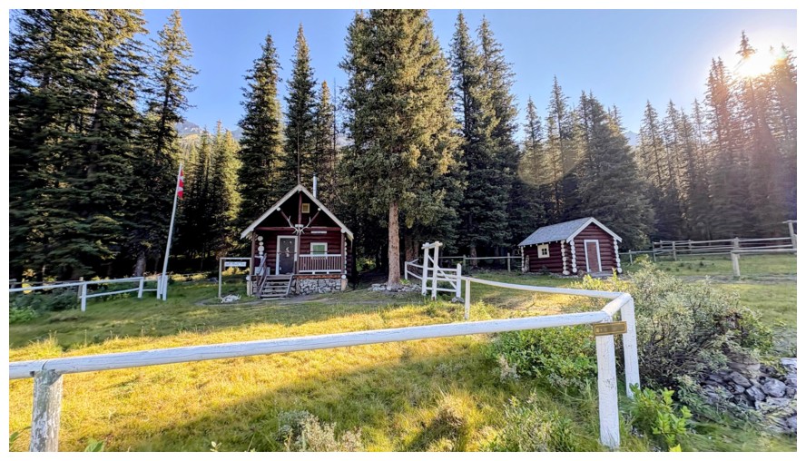
The Warden cabin only (photo by Doug)
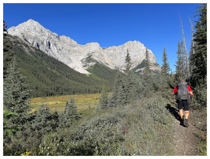
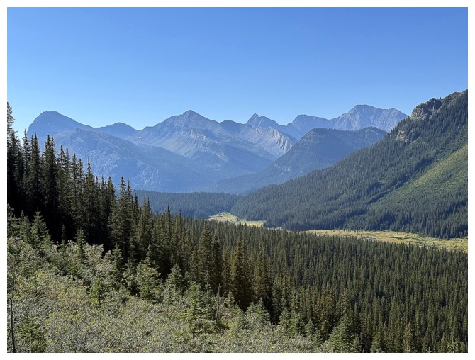
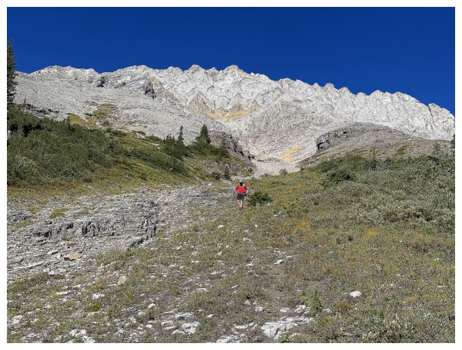
Continuing north, along the Assiniboine Pass Trail
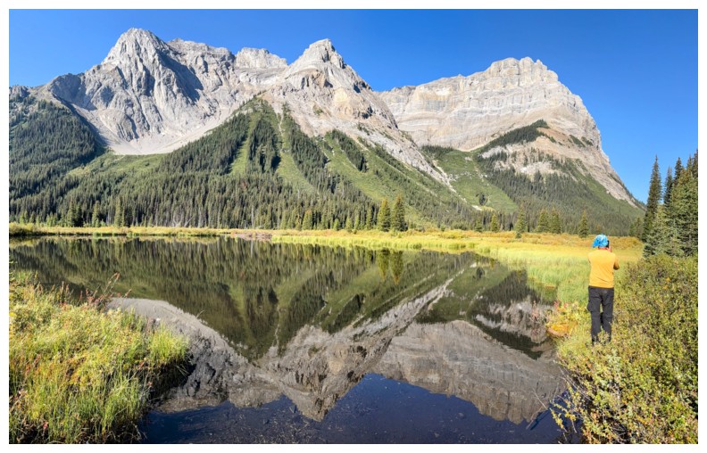
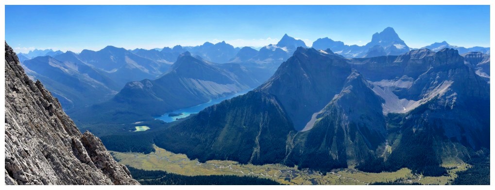
Perhaps the best views of the day occurred right here, just off the west side of the trail
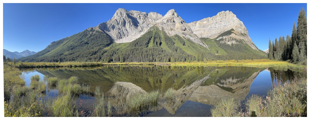
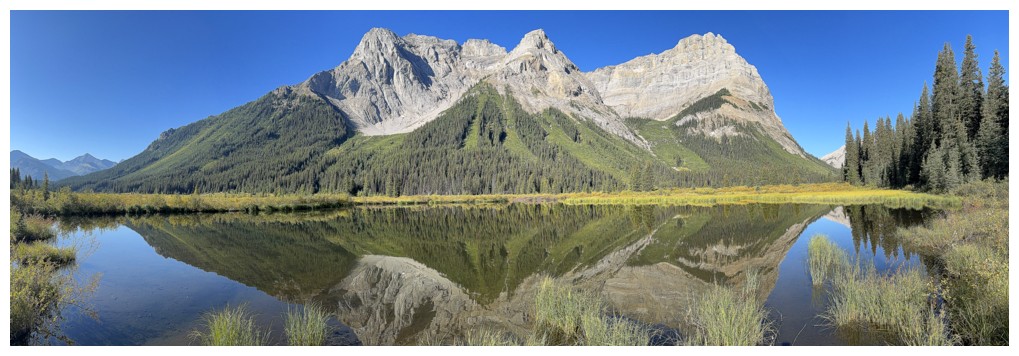
Fantastic reflection
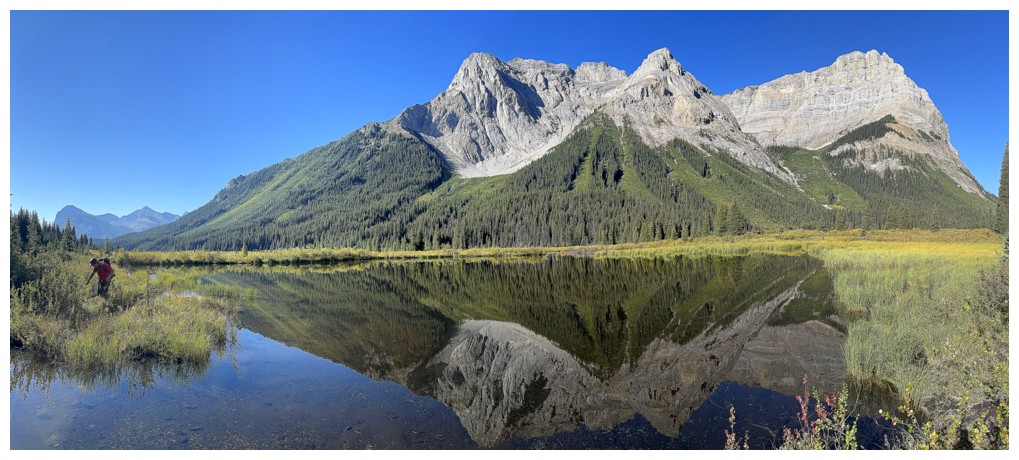
Doug's perspective (photo by Doug)
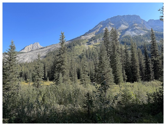
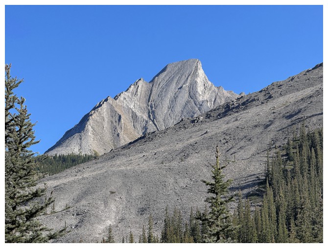
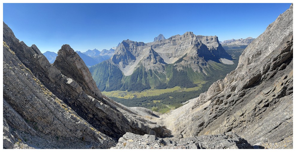
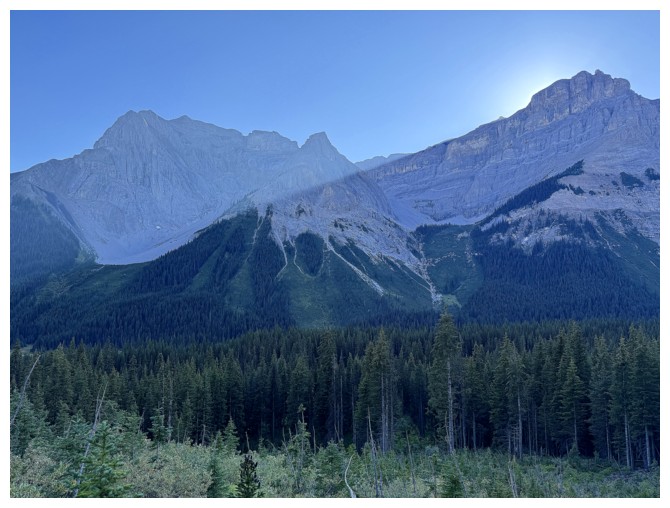
Time to turn our attention to Mercer
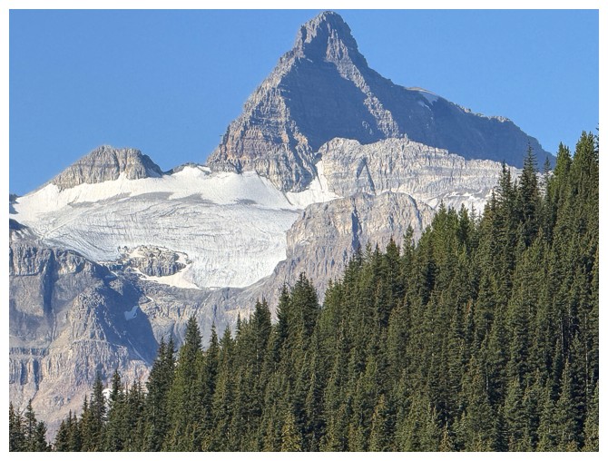
The very striking west summit of Mount Allenby
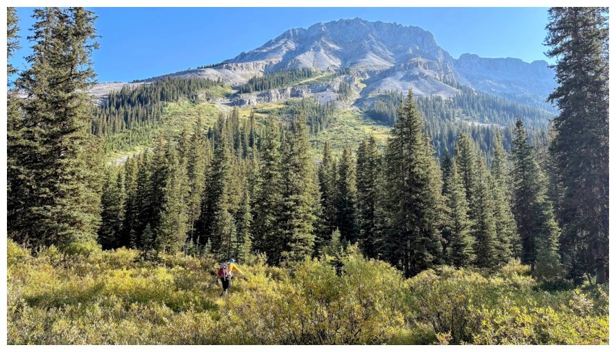
Working our way to the lower slopes (photo by Doug)
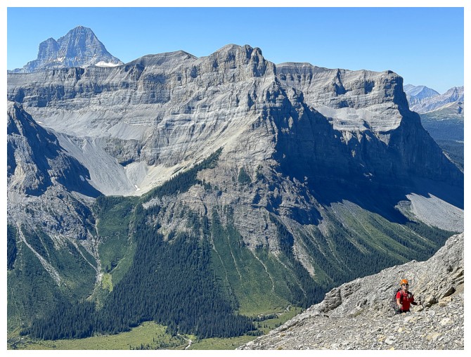
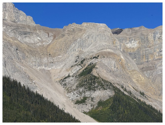
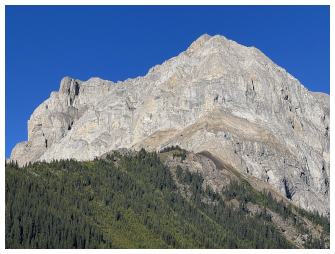
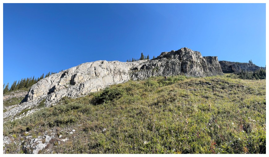
The east side of the Mount Cautley massif is going to garner lots of attention
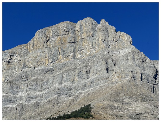
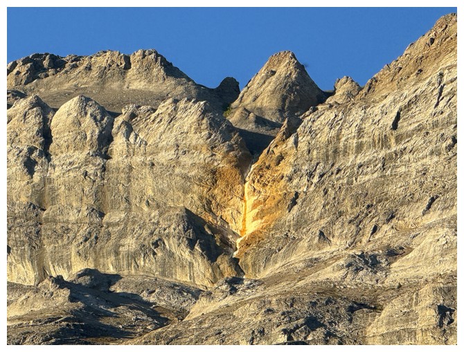
Close-up of a section of it
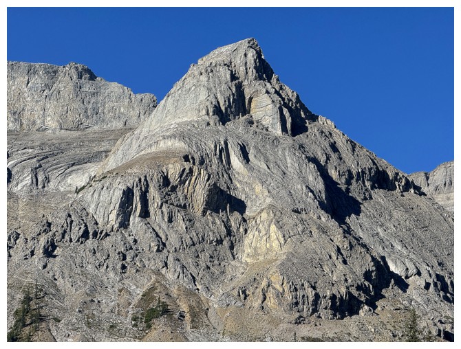
And another
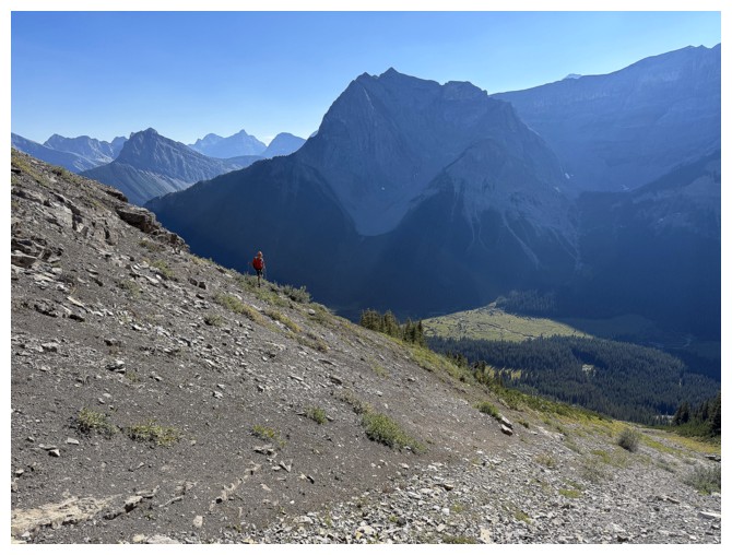
Mounts Turner, Morrison, Owl, and Byng to the south
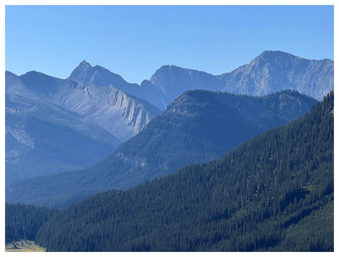
Owl Mountain at the left
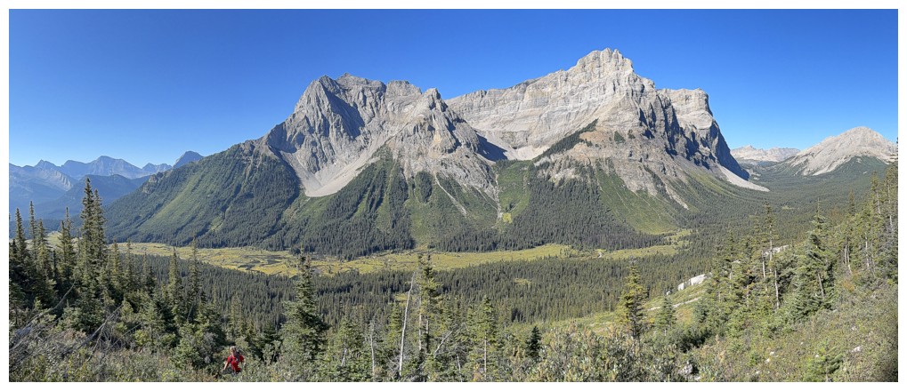
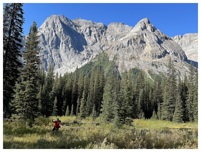
Doug works his way through some brush. The whole of the Mount Cautley Massif is revealed.
Aiming for a weakness in the middle of this rock band (photo by Doug)
The route up is at the right
Going up the weakness (photo by Doug)
Doug follows

Lots of interesting terrain on the lower slopes
Now in the main gully (photo by Doug)
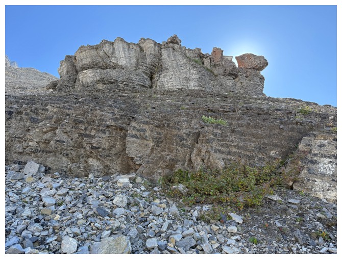
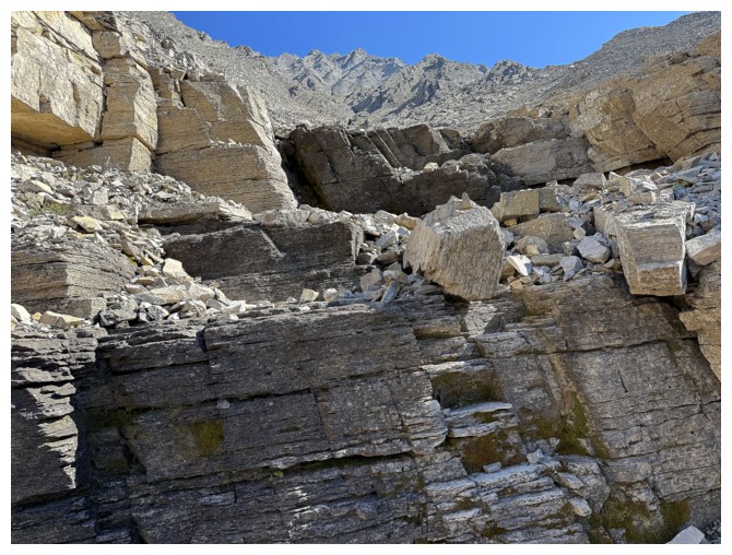
Neat rock formation
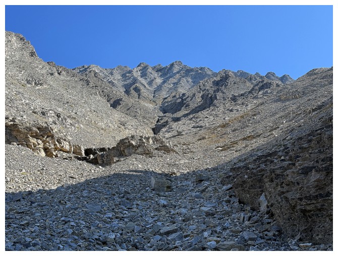
The route ahead is straightforward for now
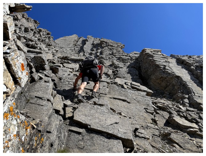
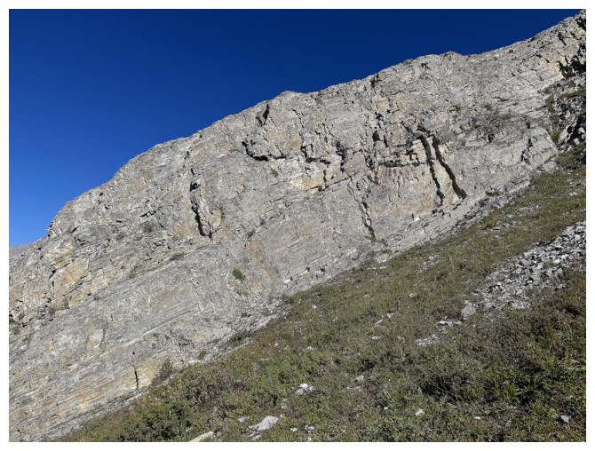
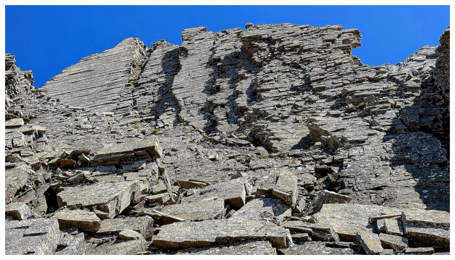
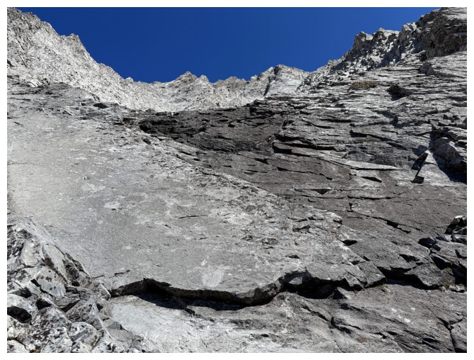
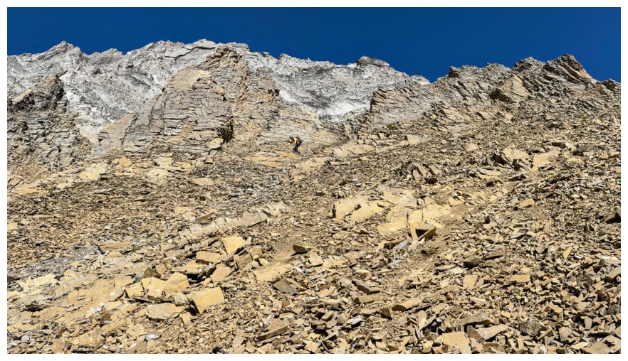
Close-up of the upper slopes. They are much steeper than they appear.
Steppy terrain
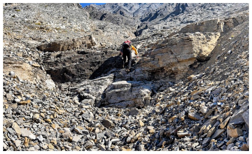
Ascending it (photo by Doug)
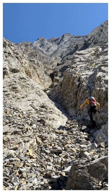
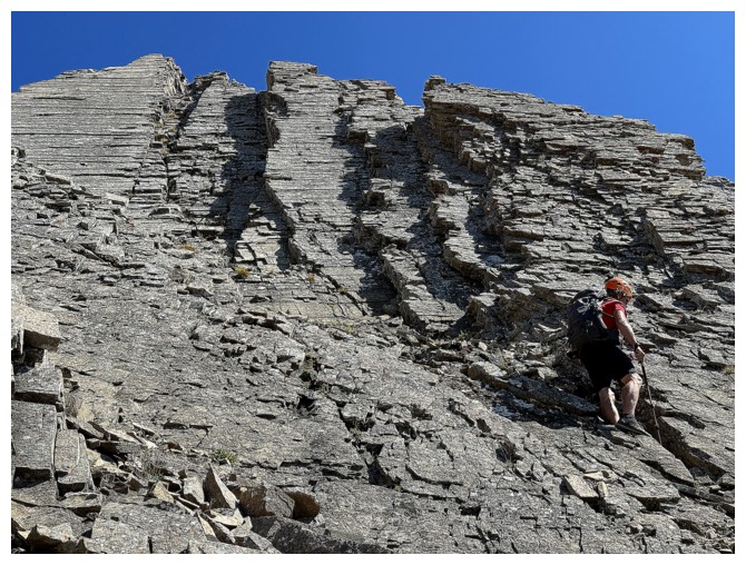
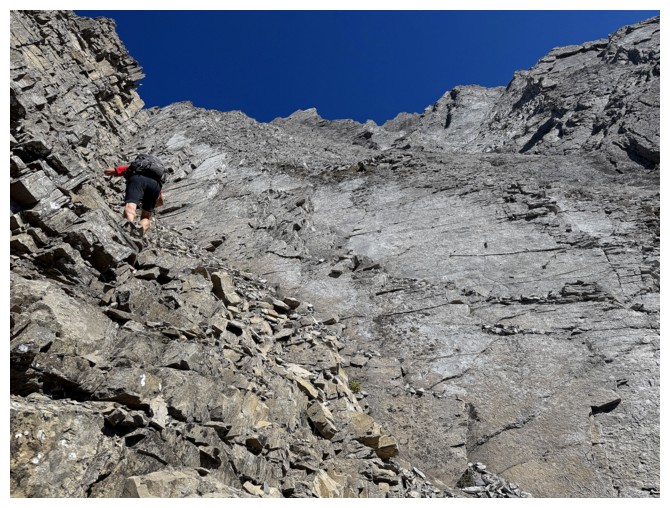
Approaching more serious terrain (photo by Doug)
That view of Cautley again
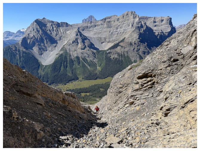
Fun scrambling
And terrific views
A little downclimbing to get the adrenaline flowing (photo by Doug)
Still enjoying the scrambling
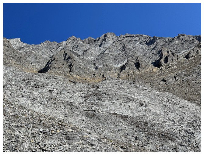
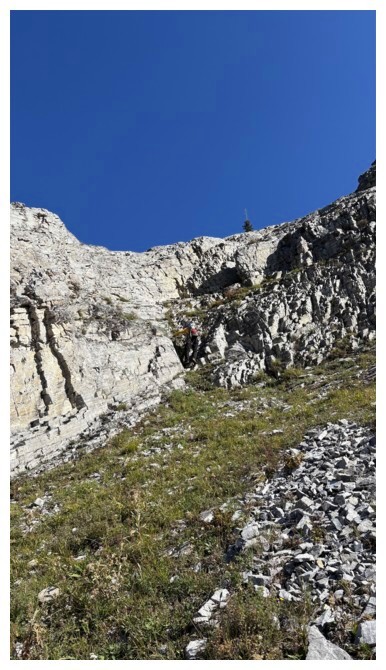
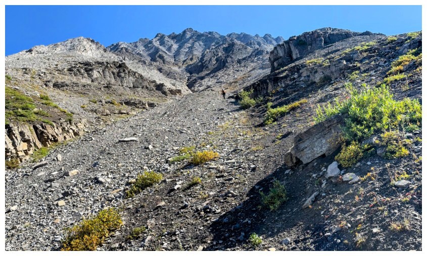
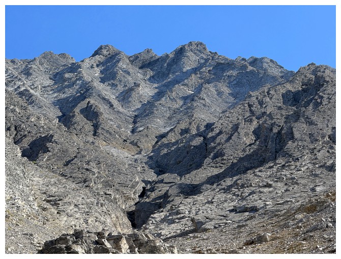
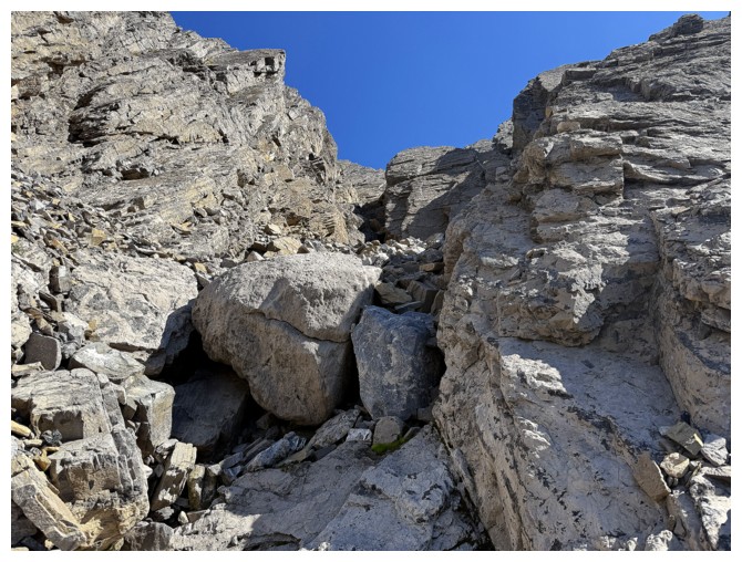
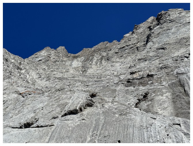
Almost at the upper slopes. There are many gullies to choose from and we chose poorly.
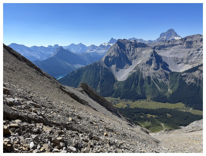
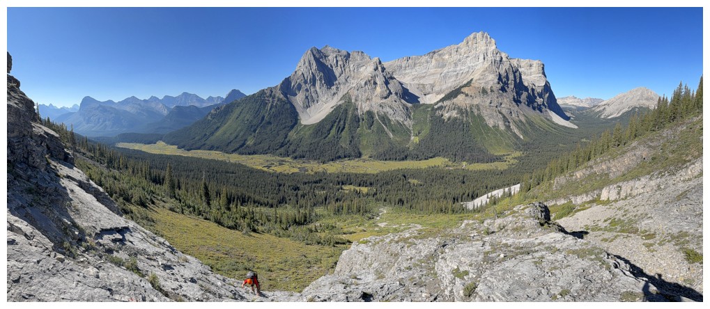
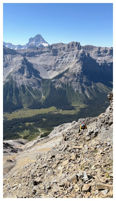
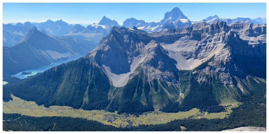
First good view of Mount Assiniboine at the right
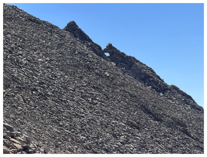
Another neat rock formation
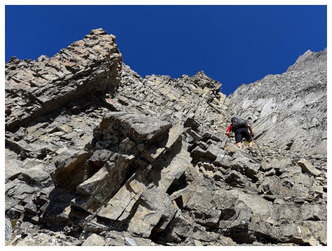
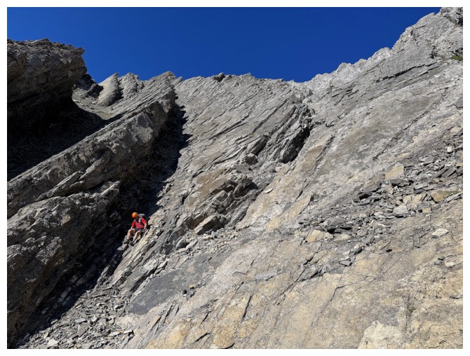
Awesome looking rock, but it's also a crumbly mess to ascend (photo by Doug)
Doug looks for a way up
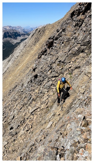
Having
chose poorly, now traversing into another gully. The angle of the
terrain in general is represented by the photo on the left (photos by
Doug).
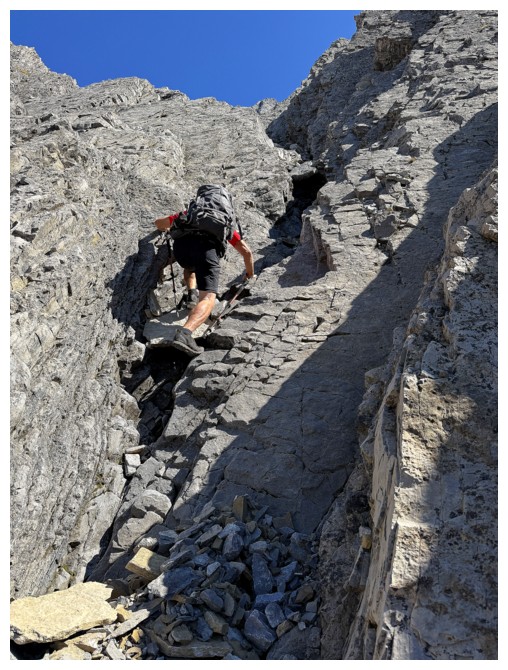
Doug leads the way up the next gully
The terrain ahead looks doable for now
Doug still has his hiking poles out, so the grade is manageable...
... however, the poles are going to be put away for this section
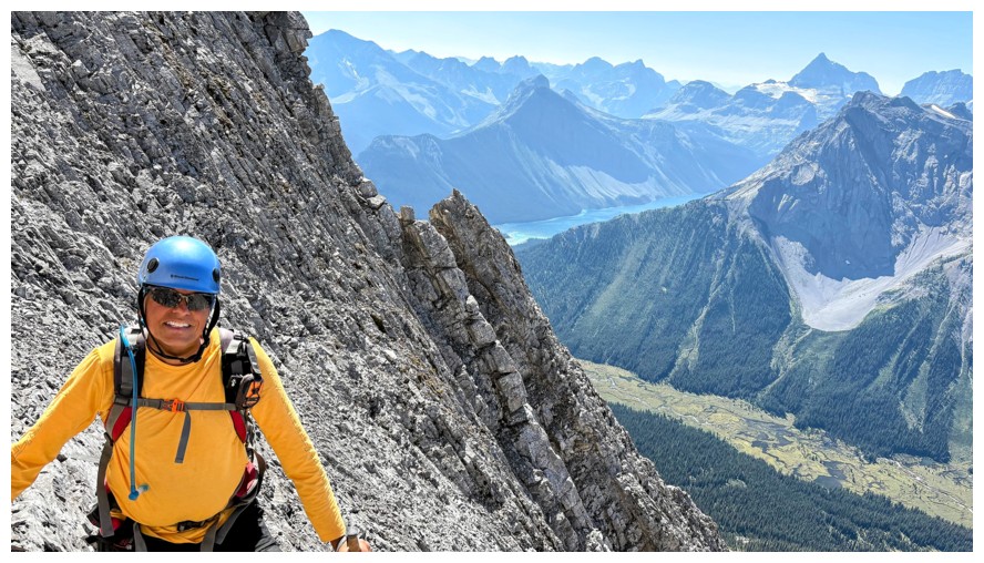
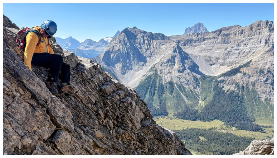
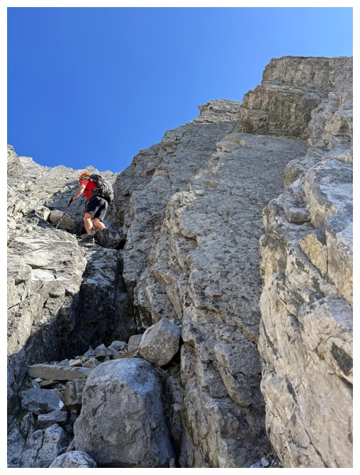
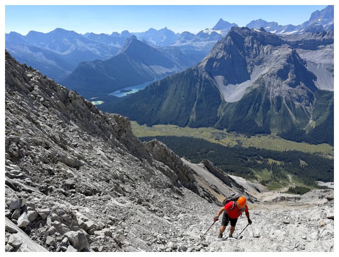
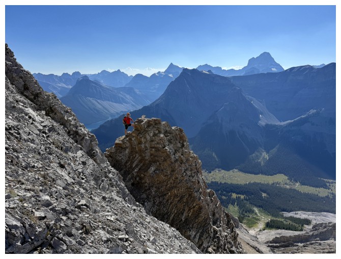
Happy about the view to the southwest and the fact that I haven't tumbled down the mountain and died yet (photo by Doug)
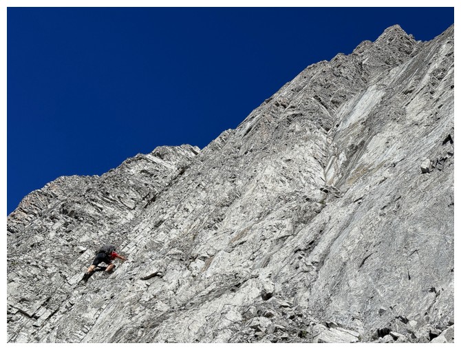
Doug tackles a particularly steep section
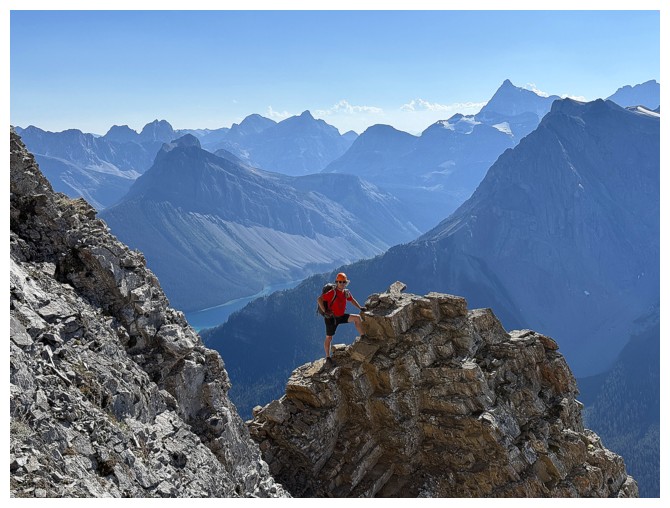
Stunning view to the west (photo by Doug)
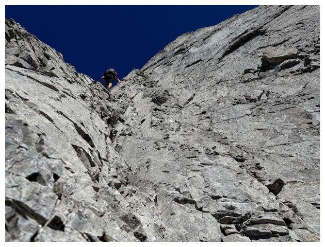
Brave Doug. He climbed to the top of this gully to find nothing but
steeper and scarier terrain. That was the end of the line for both of
us.
Doug's view from his highpoint (photo by Doug)
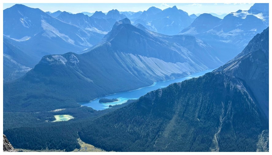
Same as above. Marvel Peak above Marvel Lake (photo by Doug).

Heading down. The wide-angle camera view makes the grade of the terrain look shallow, but it's very steep here.
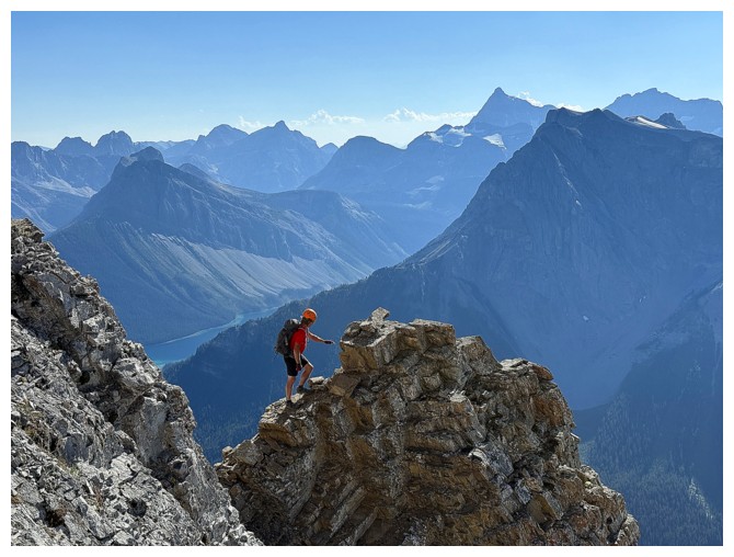
Brave Doug again, on a super cool outcrop
Same as above
Looking back up the colourful west face (photo by Doug)
Lots of careful downclimbing required
Finally back down to easy terrain
Leaving Mercer behind
The last of the Sun's rays slice over Cautley
Parting look at Mercer (photo by Doug)
There's an interesting feature on the west side of Cone Mountain
Close-up of it
Cone Mountain - didn't get to the top of that one either
The End
LOG