Owl Mountain
August 10, 2025
Mountain height: 2870 m
Elevation gain: 1400 m
Ascent time: 7:00
Descent time: 5:50
Scrambling with
Geoff and Jean-Francois.
Mountain trips
are almost always memorable; and then there are the ones that are MEMORABLE!!
Owl Mountain will forever reside in the latter category – for the good elements
and the bad.
Owl is an
unofficial mountain, east of Mount Byng, but its summit sits above everything
in the immediate area except Mount Byng. 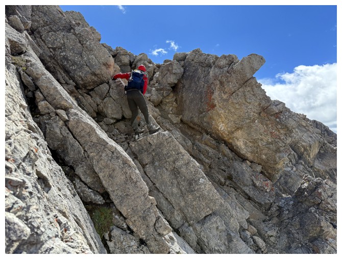 After an amazing but smoky trip up
Marvel Peak in 2022, I had been in search of something close by that, like
Marvel, would grant an outstanding view of Mount Assiniboine and company. Enter
David Jones terrific guidebook, Rockies South. Two routes up Owl are outlined
in the book and the easier one (class 3) was the logical choice. Having said that,
this is an “old-school” class 3 rating, which could mean anything from moderate
scrambling to low 5th class climbing. Mr. Jones clearly describes
the distinction between “old-school” and “new-school” and I was sure to make a
mental note of it.
After an amazing but smoky trip up
Marvel Peak in 2022, I had been in search of something close by that, like
Marvel, would grant an outstanding view of Mount Assiniboine and company. Enter
David Jones terrific guidebook, Rockies South. Two routes up Owl are outlined
in the book and the easier one (class 3) was the logical choice. Having said that,
this is an “old-school” class 3 rating, which could mean anything from moderate
scrambling to low 5th class climbing. Mr. Jones clearly describes
the distinction between “old-school” and “new-school” and I was sure to make a
mental note of it.
The first “Good”
of the trip was fortuitously eliciting the fine company of Geoff Hardy and
Jean-Francois Richy for the day. 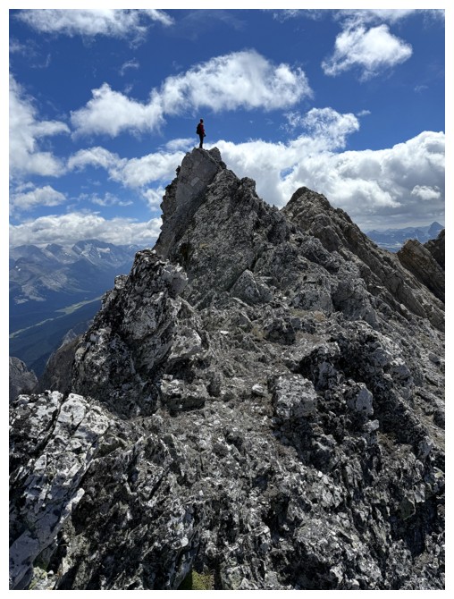 Geoff and I had communicated via email over
the years, but we had never met or done a trip together. It was a pleasure to
finally meet Geoff and a pleasant surprise to hear his slick New Zealand
accent. Also sporting a wonderful accent, of the suave French variety, along
with a friendly smile was Jean-Francois. It was likewise a pleasure to meet JF.
Geoff and I had communicated via email over
the years, but we had never met or done a trip together. It was a pleasure to
finally meet Geoff and a pleasant surprise to hear his slick New Zealand
accent. Also sporting a wonderful accent, of the suave French variety, along
with a friendly smile was Jean-Francois. It was likewise a pleasure to meet JF.
And so a
New-Zealander, Frenchman, and Englishman set off on their bikes from the Shark
Mountain Trailhead in a quest to summit the great Owl Mountain of Assiniboine
Provincial Park. (Sounds like the start of a very intriguing adventure novel or
a very bad joke!). 6.7 km of biking, followed by 9 km of hiking brought us to
the shores of Owl Lake. The skies were disappointingly cloudy (the first “Bad”),
but a few blue patches granted us some measure of optimism.
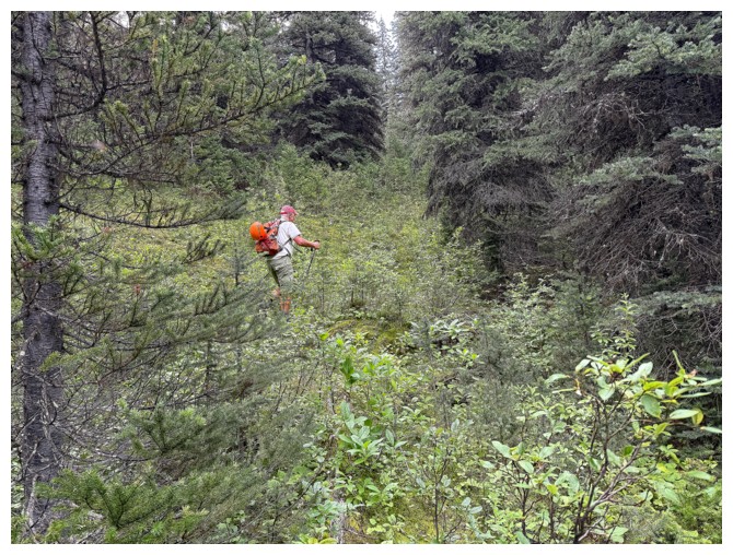
After hiking
around the east side of the lake, it was time to dive into the bush. About 3 km
of forest separated us from the base of Owl and negotiating that 3 km could end up being the crux of
the trip. It was not. Geoff led the way, finding easy routes through any
difficult terrain. He also stumbled upon an excellent animal trail that expedited
travel immensely.
About 3.75
hours from the parking lot, we exited the forest and made our way to the lower
slopes of Owl’s west face. A good look at the face did not reveal any obvious
lines up and it was impossible to tell where the actual summit sat. Of course,
those facts weren’t about to deter us from trying and Geoff again led the way
up the left side of the face, towards the north ridge. We were hoping to
intercept the ridge at a point above the 4th class climbing section
Jones describes in the north ridge route.
And I still
can’t say if we did or didn’t. A fine view over the other side of the mountain
awaited at the ridge; so did much colder temperatures and all the extra layers
of clothing were put on. Also waiting for us was a puzzling look at the terrain ahead. “Fierce” would
perhaps be a good, though hardly illuminating, adjective to describe the ridge
above us – definitely upper 3rd class, very exposed on the left side
and alarmingly steep on the right. Geoff made a stab at the ridge but quickly
decided that traversing below the ridge on the steep west face was preferable.
Fortunately, that steep face was also littered with grassy ledges, allowing
relatively easy, though often exposed, traversing.
At this point,
Jean-Francois decided against continuing. We were almost 6 hours into the trip,
had completed about 1300 metres of elevation gain, and were all tired and
getting a little ragged from the mental as well as physical exertion. JF would
wait for us in the valley below. (Aside: unfortunately, “Bad #1” only got worse
to the west. Assiniboine and company would not be making their star-studded
guest appearances).
 Geoff and I
continued traversing, looking for a feasible route up to the ridge. “Good #2”
was watching Geoff scramble and route-find his way up this challenging terrain.
The terrain may have been fierce but so are Geoff’s scrambling abilities! I was
very impressed and happy just to follow his lead. We passed under what could
have been the summit, eventually regaining the ridge between two summits of
seemingly equal height. Routes to both looked beyond fierce!
Geoff and I
continued traversing, looking for a feasible route up to the ridge. “Good #2”
was watching Geoff scramble and route-find his way up this challenging terrain.
The terrain may have been fierce but so are Geoff’s scrambling abilities! I was
very impressed and happy just to follow his lead. We passed under what could
have been the summit, eventually regaining the ridge between two summits of
seemingly equal height. Routes to both looked beyond fierce!
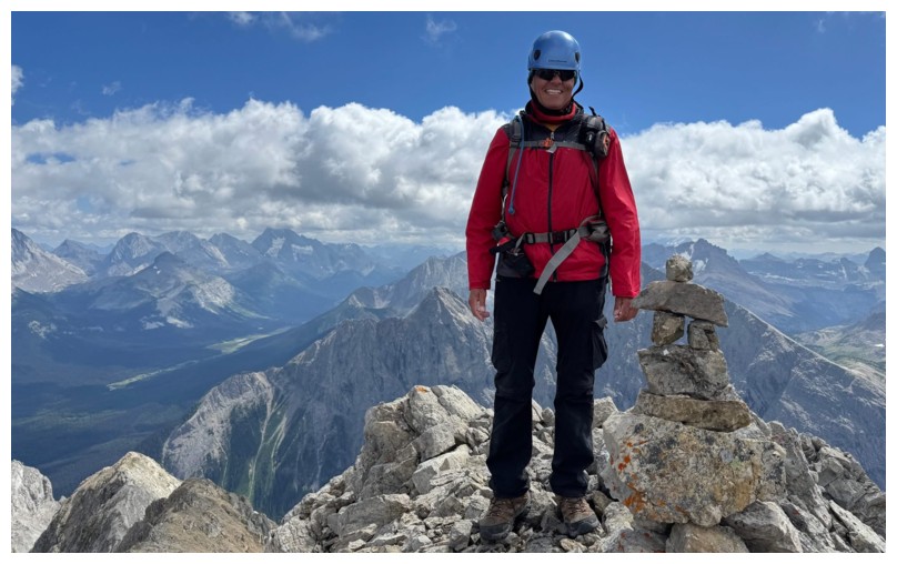
Once again
Geoff stepped up to the plate here, finding a manageable route through all the
difficulties to the south summit. We were both elated to reach the top. There,
we took some time to soak in Good #3, while trying to ignore a disappointing continuation of Bad #1. 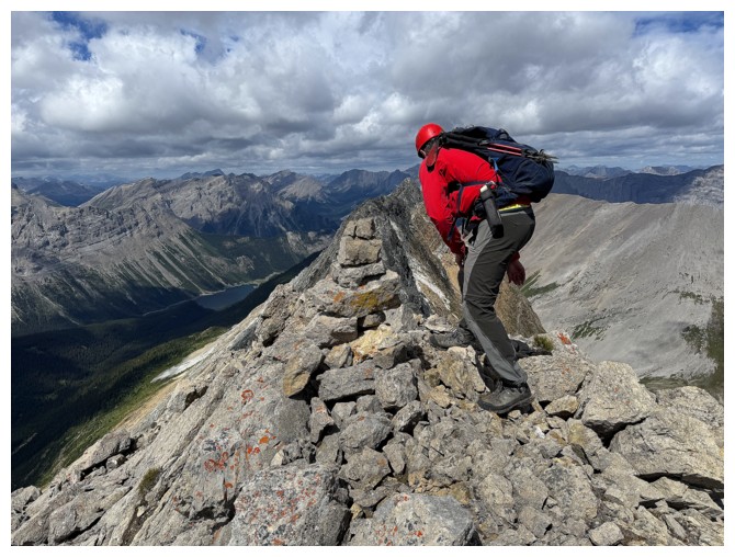 The view to the east was Good #3 – though still cloudy, an enormous
array of fine and familiar peaks littered the horizon. A beautiful tarn below
Mount Morrison provided the icing on the cake for the view in that direction.
And the view to the west was, in fact, quite respectable, but would have been
quite mind-blowing if Mount Assiniboine showed up to the party.
The view to the east was Good #3 – though still cloudy, an enormous
array of fine and familiar peaks littered the horizon. A beautiful tarn below
Mount Morrison provided the icing on the cake for the view in that direction.
And the view to the west was, in fact, quite respectable, but would have been
quite mind-blowing if Mount Assiniboine showed up to the party.
After adding a
few rocks to the cairn, it was time for the Kiwi and the Brit to reunite with
the Frenchman in the valley. It was also time for Bad #2 to rear its hideous
head, in the form of (you guessed it!) an attempt to get down the mountain via
a completely different route. Both Geoff and I were quite convinced we could
find an easier way down than our challenging route up.
And it actually
started off quite well. We lost elevation and then made our way over to the
south side of the face where a very promising gully going all the way down to
the valley sat. Geoff arrived first and delivered the bad news – the snow and ice-filled gully
promised nothing but a bumpy, messy (and probably fatal) ride down should you
slip. Instead, we had to choose between going all the way back up to use our
ascent route or attempt to traverse and descend at the same time. We chose
the latter. The routes (we took slightly different ones) were far from trivial,
featuring an unhealthy dose of exposed ledges and tricky downclimbs, but thankfully
we made it down unscathed. A short break to refill our water containers and gather
ourselves from the mental trauma of the descent was needed once back on safer
ground.
Given the
inordinate amount of time we had spent on the mountain itself (about 5.5 hours)
and the unexpectedly cold temperatures, Jean-Francois had decided to start back
to the parking lot. 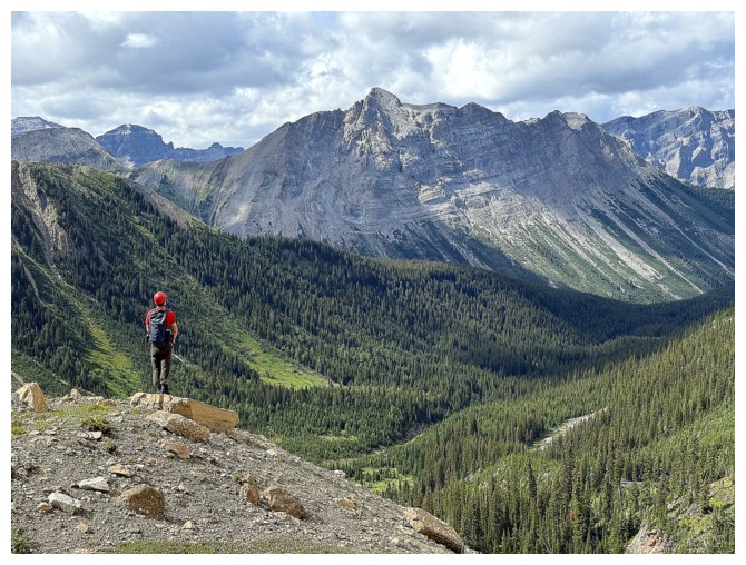 Even with Geoff’s brisk hiking pace it was unlikely we
would catch up to JF, who also hiked at break-necks speeds. (The Brit was by
far the slowest of our little United Nations trio!).
Even with Geoff’s brisk hiking pace it was unlikely we
would catch up to JF, who also hiked at break-necks speeds. (The Brit was by
far the slowest of our little United Nations trio!).
Arriving
back
at Owl Lake Geoff bravely went for a quick dip in the lake’s chilly
waters. I
did not. Brave, in my little world, is eating a sandwich with mayonnaise in
it that I accidentally left on the kitchen counter overnight – I no
longer have the stomach
for severely exposed situations in the mountains but I’m still good
with
questionable food choices!
Both
rejuvenated, we continued the return trip, now back on mercifully easy, well-used
trails. Similar to a recent trip up See Peak, it was sheer relief to be
reunited with our bikes and the promise of being off my feet. The return bike
ride, requiring a significant elevation gain up a long, steep hill, was much
easier for the “cheetah” on an e-bike, but once atop that hill we coasted back
to the parking lot, where a joyous reunion with JF awaited.
What
a day!
Huge thank you to Geoff and Jean-Francois for joining me on this
amazing
adventure in a somewhat remote area of the mountains. I would not have
reached
the summit without Geoff’s skillful lead. A return to Owl Mountain is
highly
unlikely, but this Englishman (really a true Canadian now, after being
in this wonderful country for 46 years) hopes he has the honour of
hiking and scrambling
with the New-Zealander and Frenchman again!
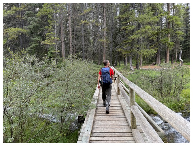
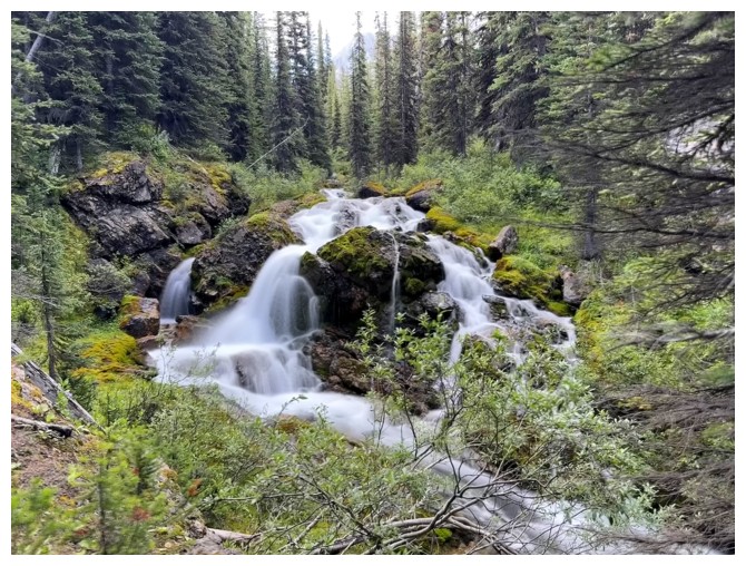
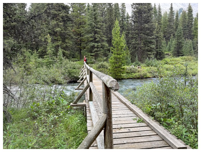
Geoff strides across bridge just before the Big Springs campground
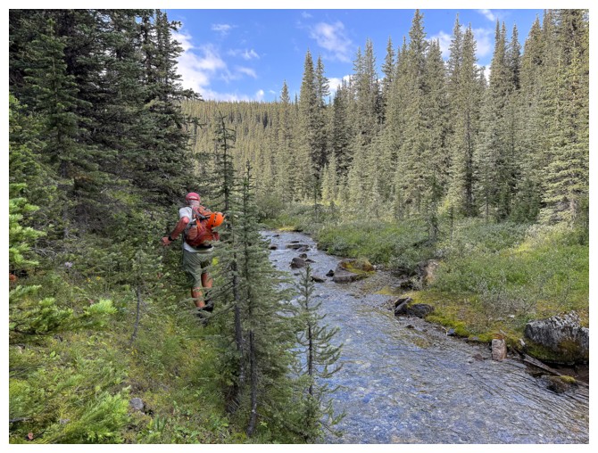
Now on the Owl Lake Trail. Marvel Peak in the background.
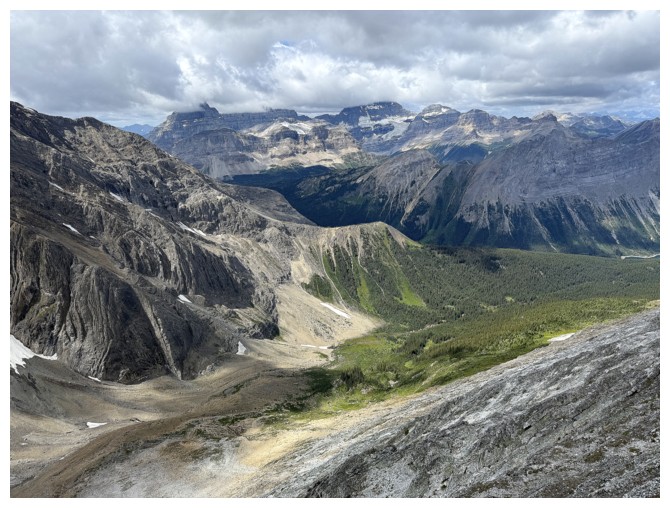
The beautiful valley northwest of Mount Morrison. Morrison is left of centre.
Getting close to Owl Lake and Mount Byng appears to the left
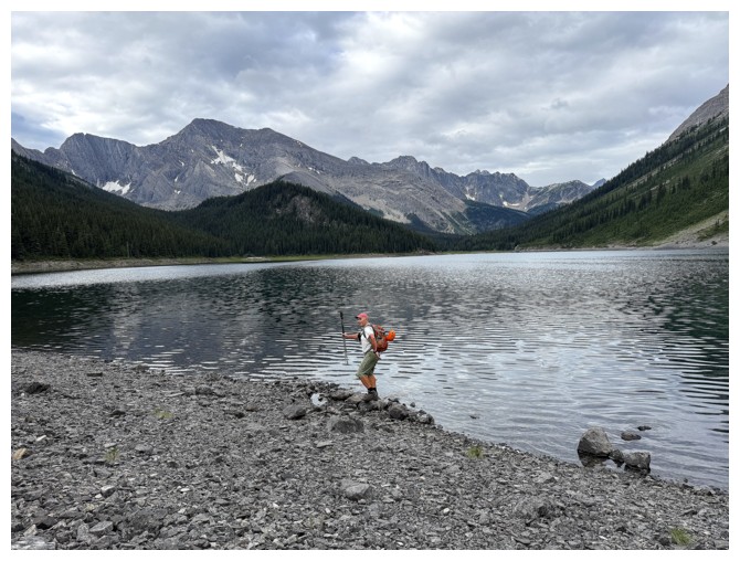
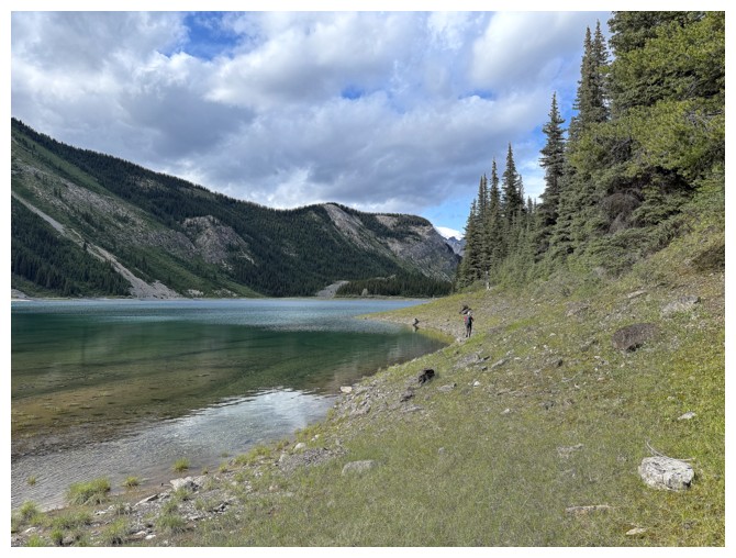
The boys arrive at Owl Lake under disappointingly grey skies
JF models
The blue sky that was cause for optimism (photo by Geoff)
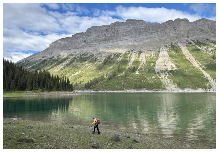
JF leads us around to the southeast side of the lake
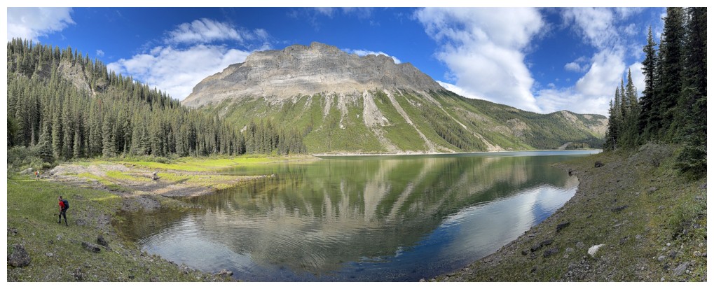
A Marvel(ous) lake reflection
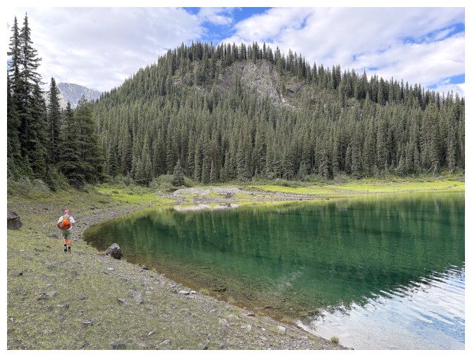
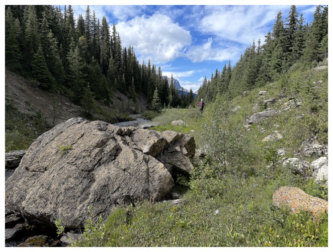
Last look at Owl Lake before we dive into the bush
Oh no! The Aliens are here!
JF has no fear of any species with nasty movable mouths and acid for blood
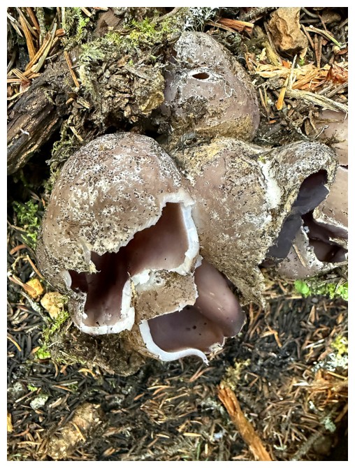
Bizarre mushroom (photo by Geoff)
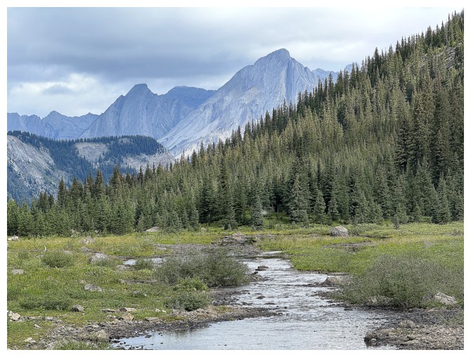
Views of the creek we were generally following were few and far between, but rewarding
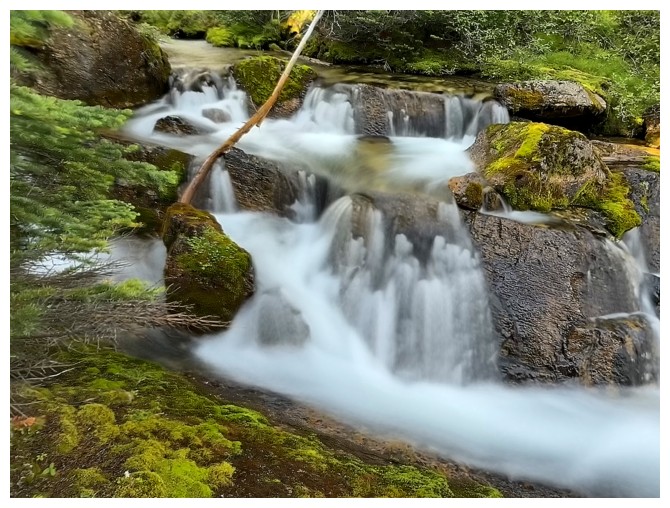
Same as above
JF and I decided to see if travel alongside the creek was easier, but it turned out to be a marshy mess
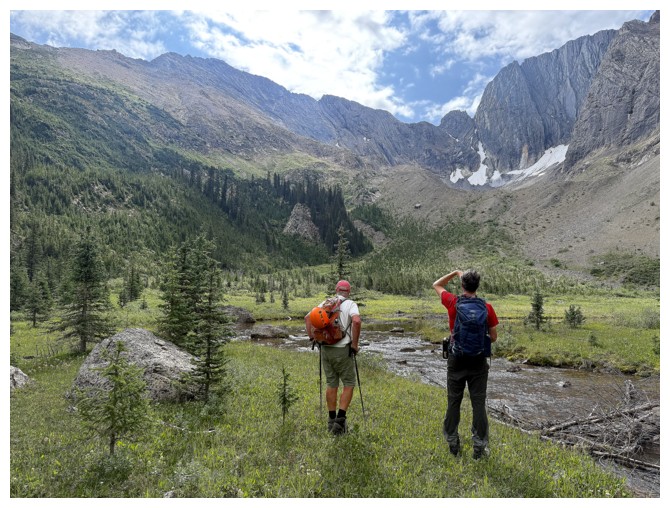
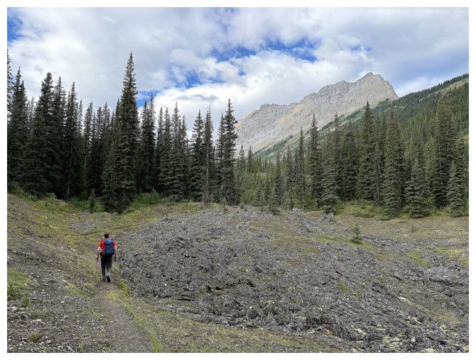
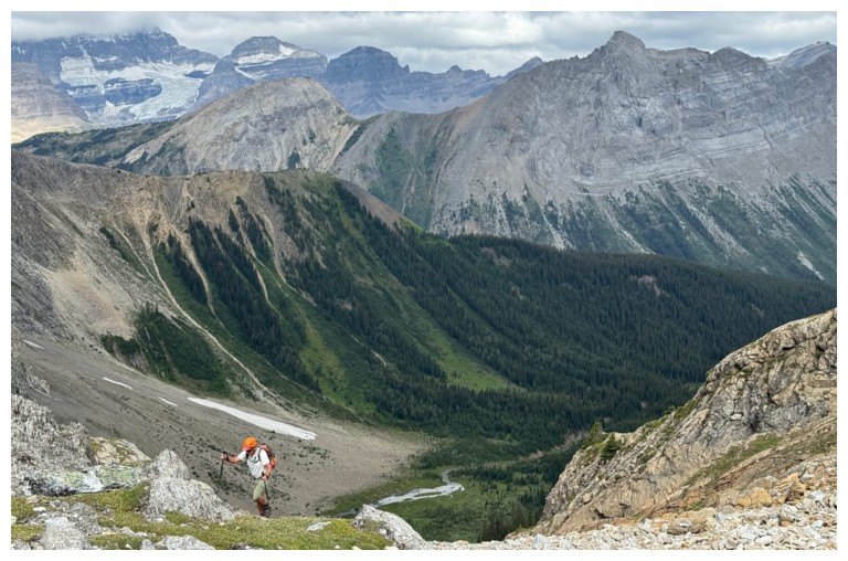
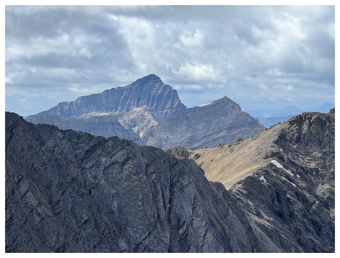
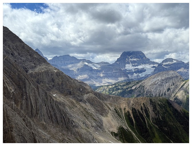
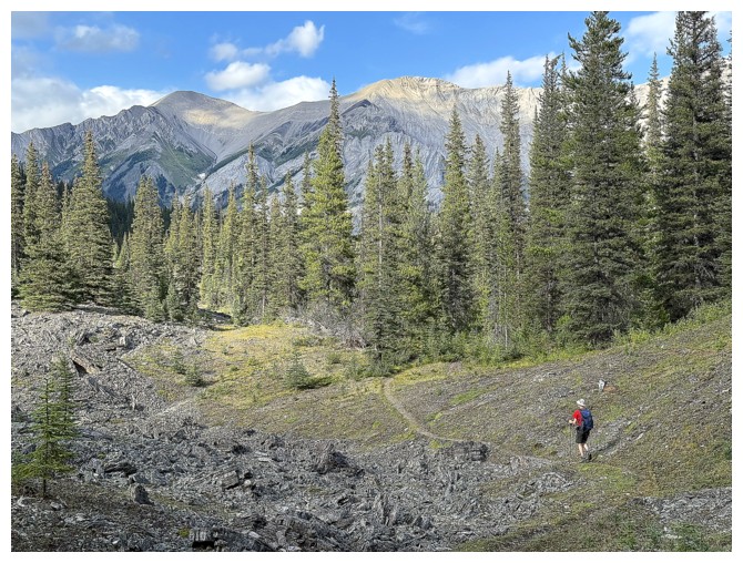
Finally out into the open, with Owl Mountain at the left and Mount Byng at the right
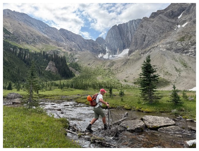
JF uses downed trees and rocks to cross the creek
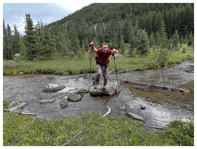
Superman can leap small creeks, as well as tall buildings!
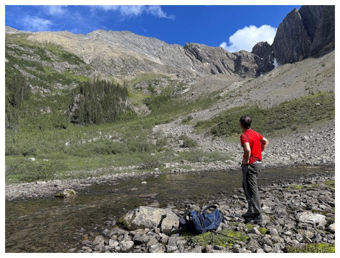
Geoff and I check out the objective from afar (photo by JF)
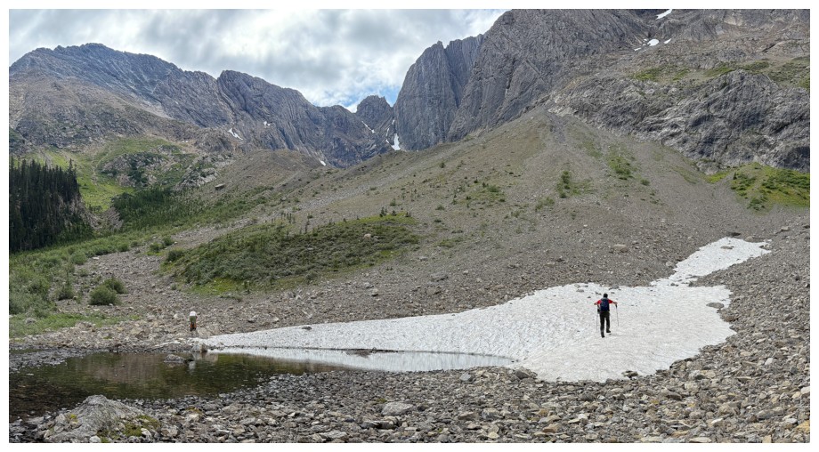
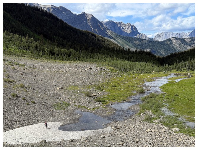
Crossing a very persistent snow patch. Owl Mountain at the left.
The straggler, through most of the trip, follows (photo by Geoff)
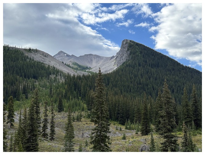
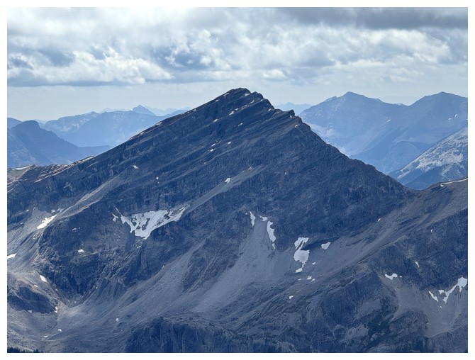
Mount Mercer is on the to-do list
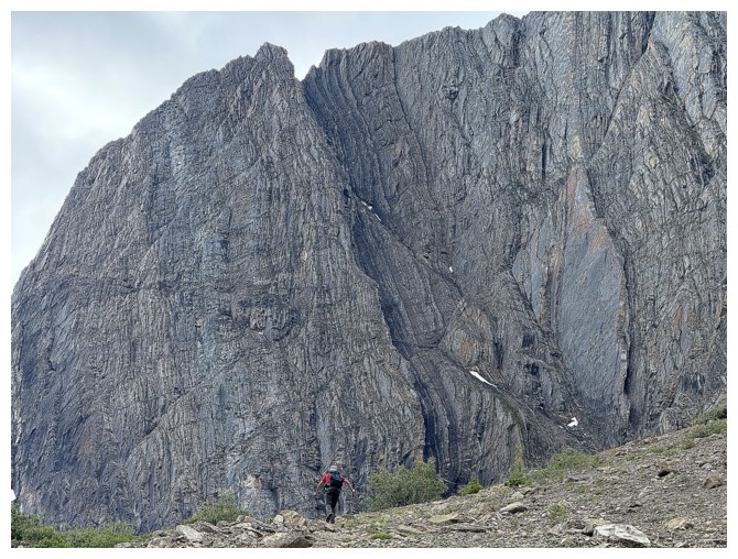
Geoff is dwarfed by the massive walls of Mount Byng
More walls
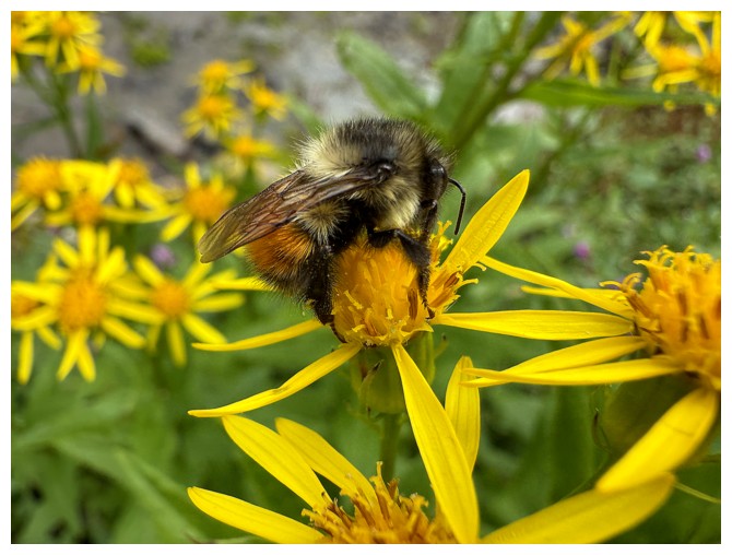
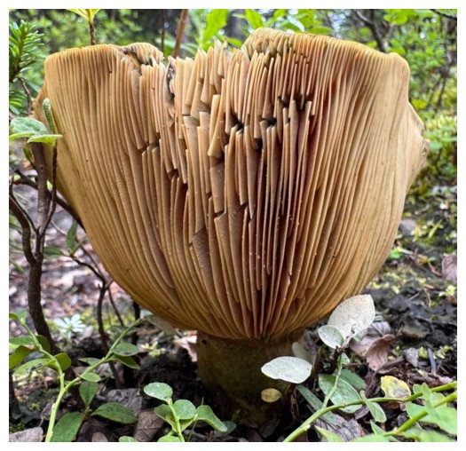
Can't forget the small stuff too
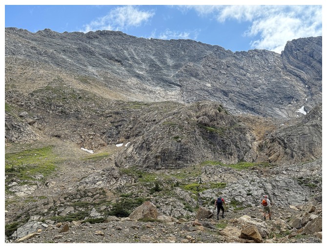
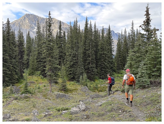
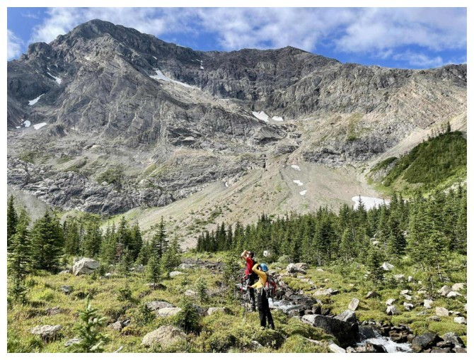
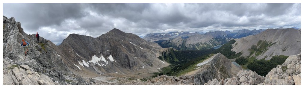
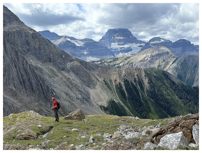
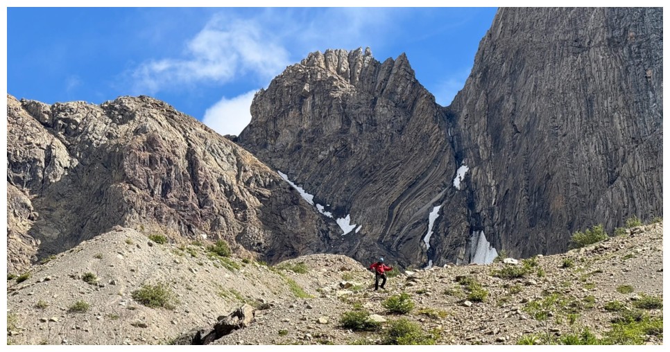
Geoff and JF lead the way up the lower slopes. From this point all the
way to the summit it was near impossible to tell where the highest point was.
It's actually over to the right.
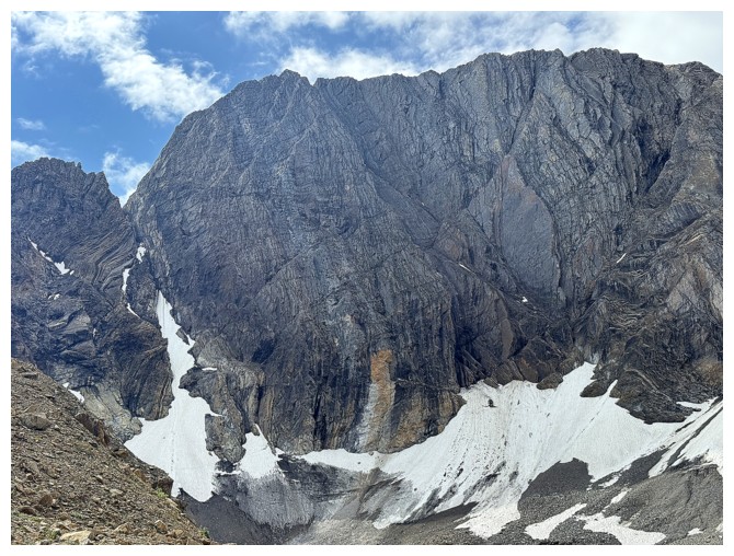
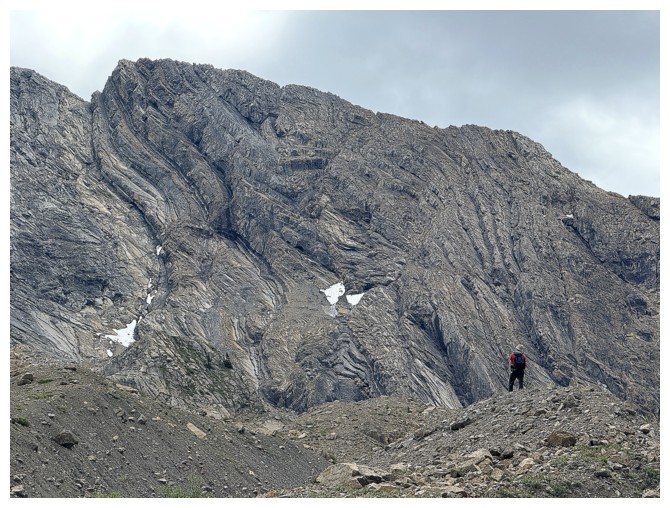
The last of what was probably once a pretty big glacier on the northeast side of Byng
Geoff spotted a cool line up the rock band at the left
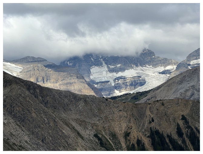
Boo! Mount Assiniboine is behind all that cloud.
The line we took
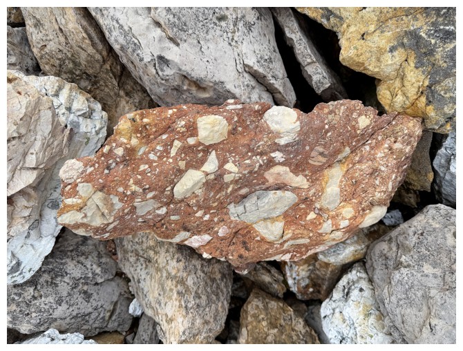
Sweet conglomerate rock
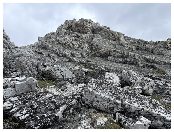
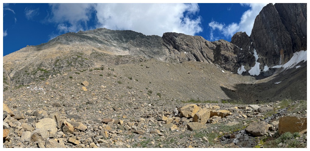
The very nondescript west face of Owl
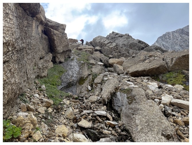
JF approaches the north ridge (photo by Geoff)
Geoff is already there
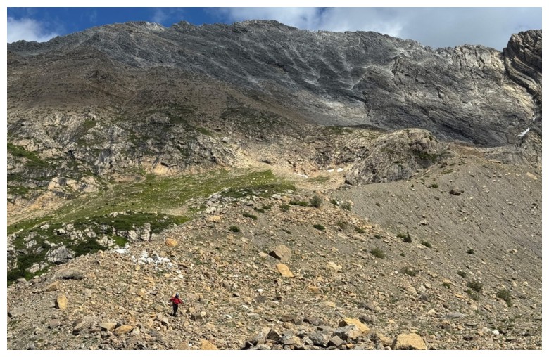
And the straggler comes in last (photo by Geoff)
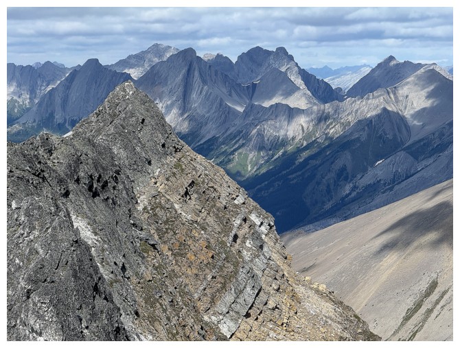
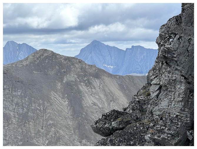
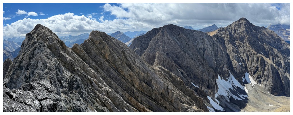
Fantastic views from the ridge, except for the annoying clouds
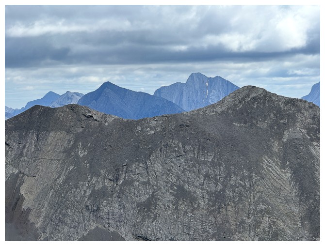
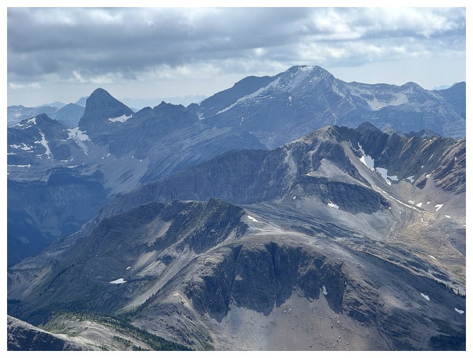
Mount Engadine and The Tower beyond Mount Morrison (foreground right)
Mount Galatea
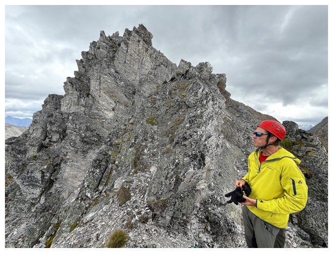
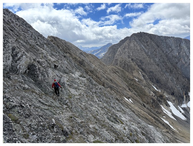
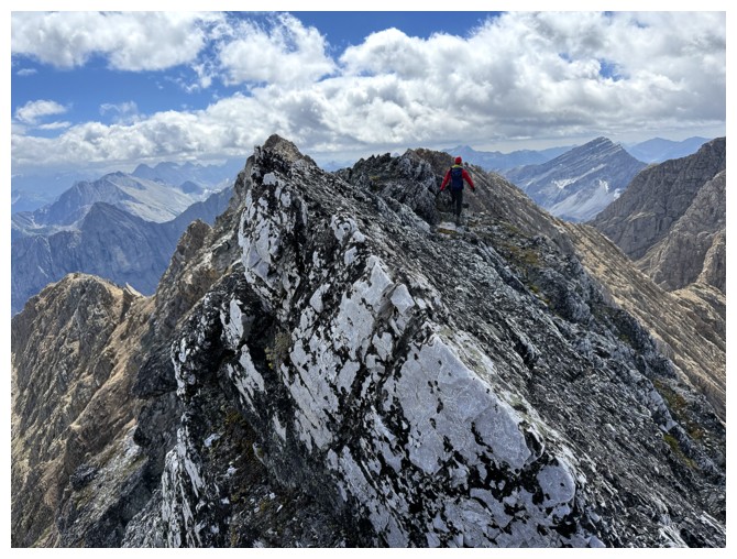
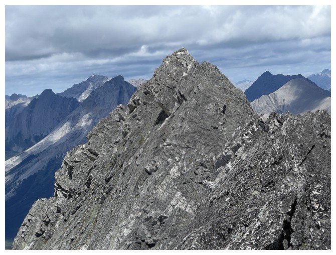
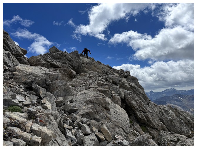
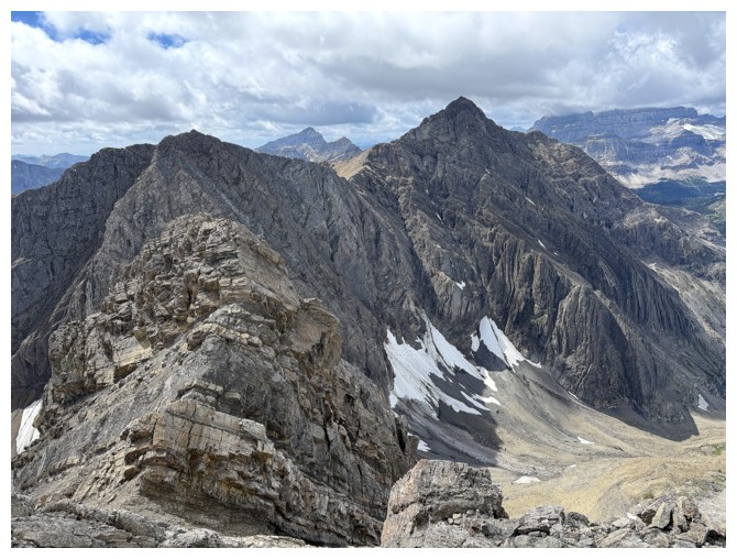
Geoff and the fierce north ridge
Mount Turner
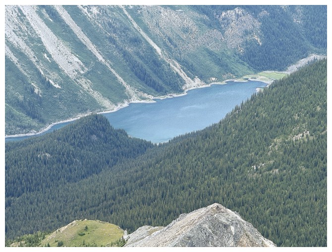
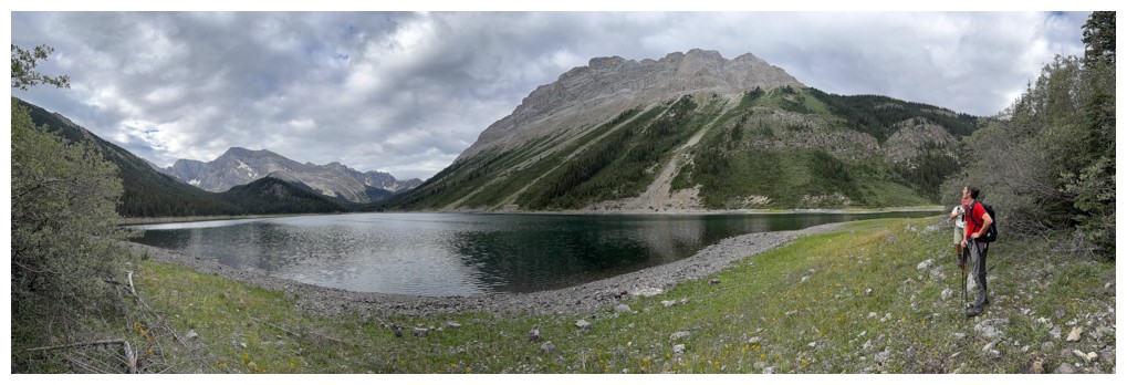
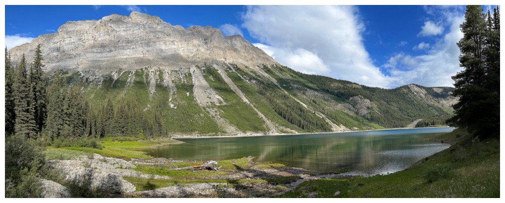
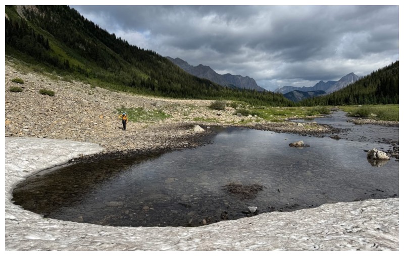
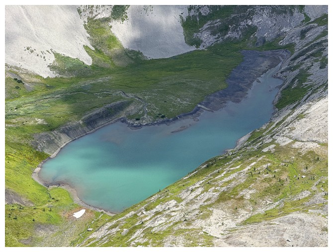
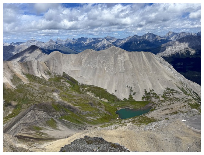
Owl Lake
Time to layer-up. Temperatures were surprisingly cold (photo by JF).
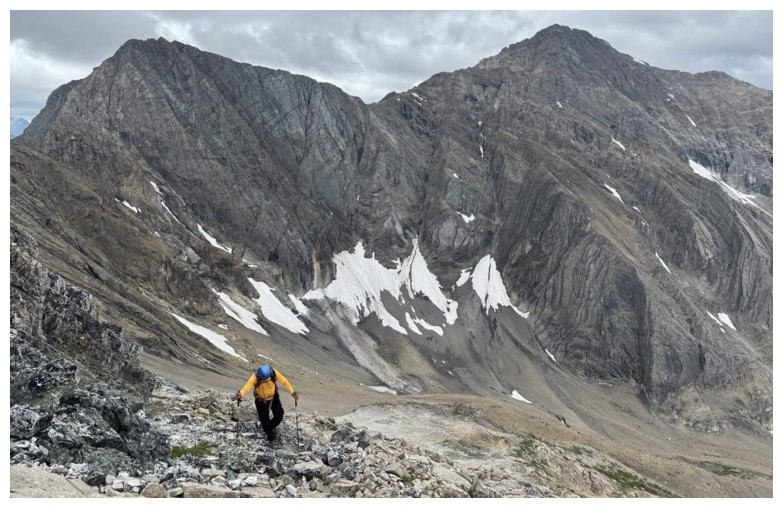
Geoff and JF start up the north ridge
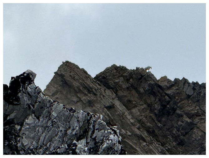
Several mountain goats were moving along the exposed ridge to the south as if it was highway-wide!
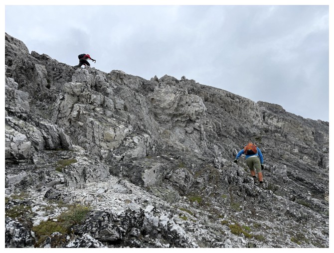
Geoff checked out the ridge while JF and I stayed below it
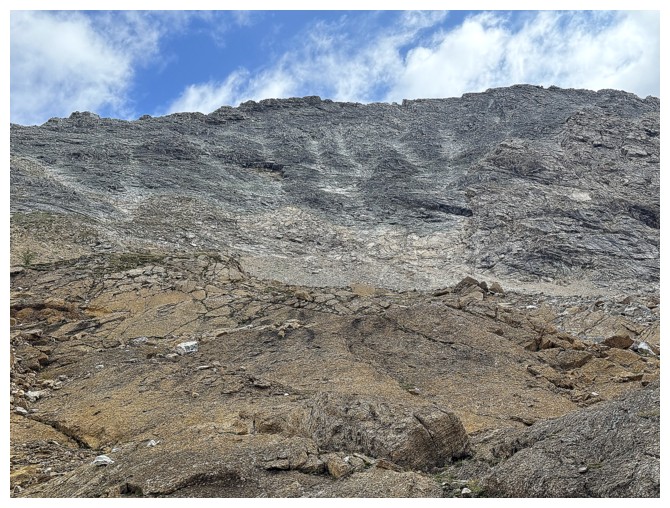
Cool quartzite rock, but quite different from the quartzite you will find on Edith Cavell's famed east ridge
Geoff takes advantage of the solid rock
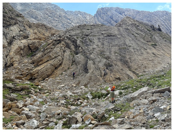
Lots of going back and forth up the face
The face has lots of ledges that assist in traversing
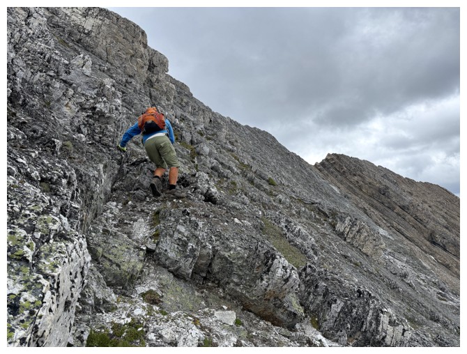
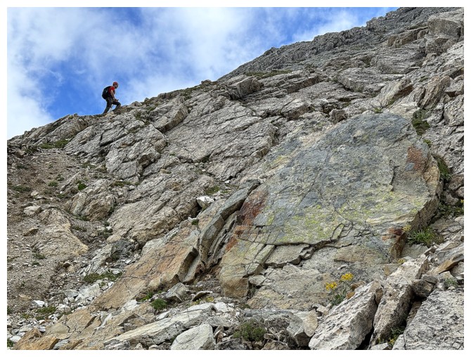
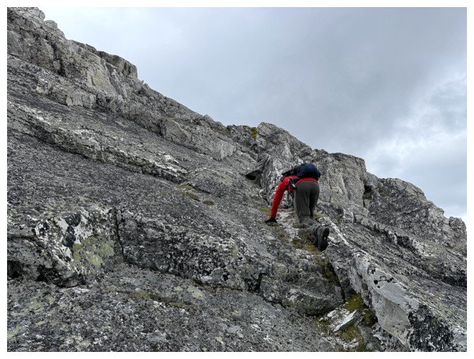
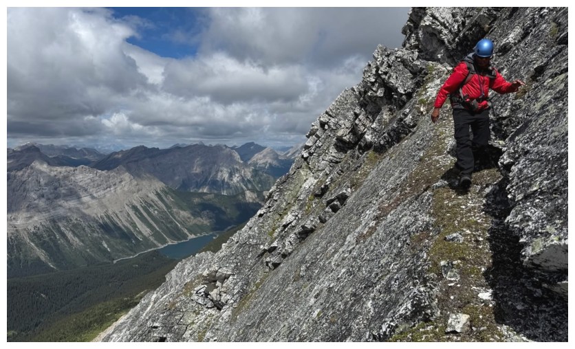
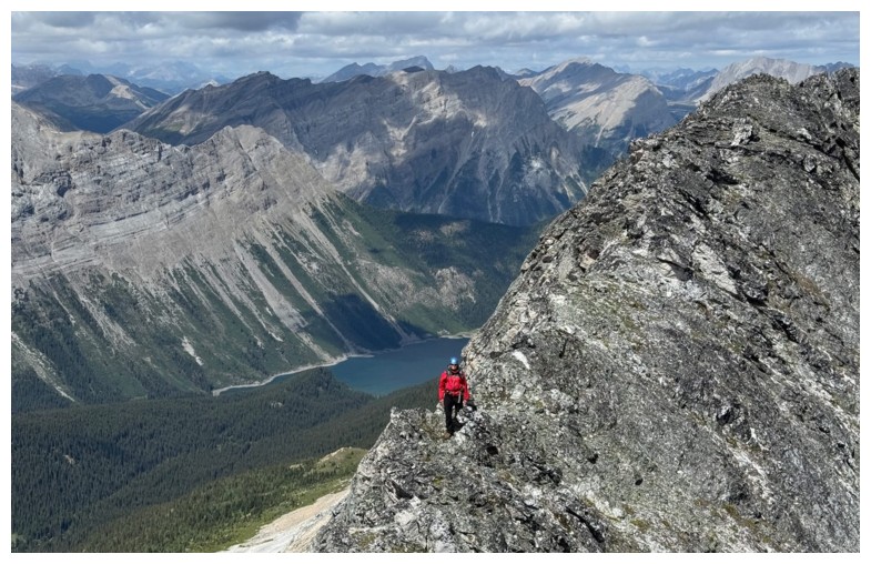
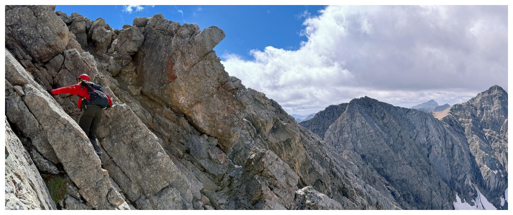
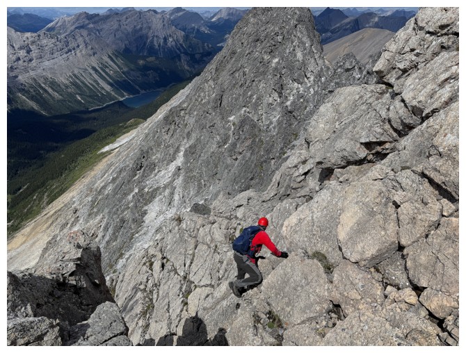
A
nasty, exposed step. Geoff made it look easy; I made it look more awkward
than a 14-year old boy in the adult section of a video store! (photo by
Geoff)
The view towards Assiniboine we are not going to get
Good representation of the angle of the terrain
One of those beautiful grassy ledges (photo by Geoff)
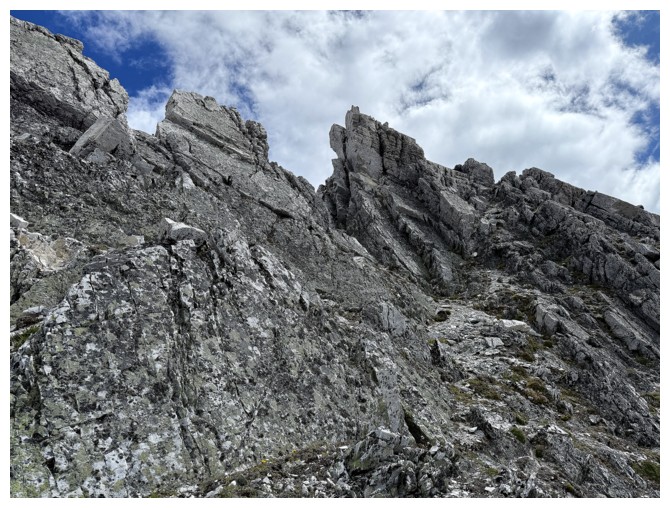
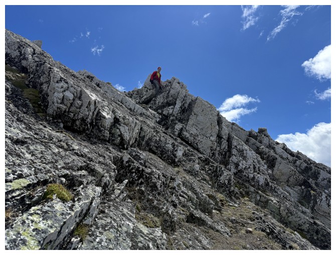
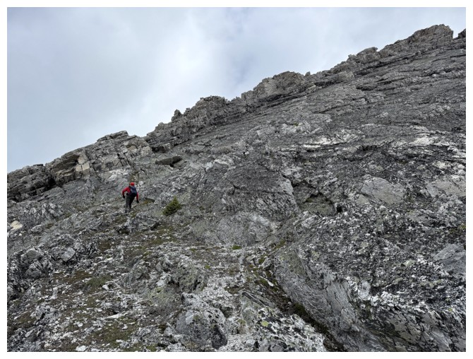
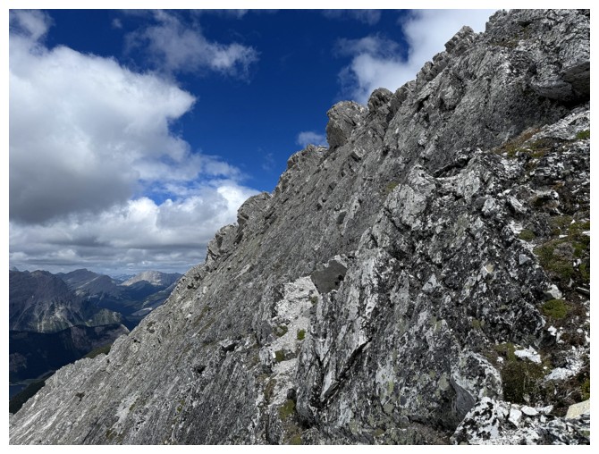
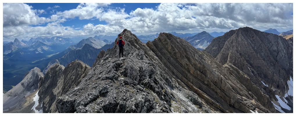
Heading up to the jagged ridge
On the ridge, looking to the route ahead
View towards Birdwood, Smuts, etc.
View towards the 14-year boy and other stuff (photo by Geoff)
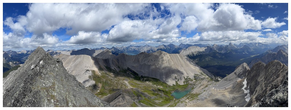
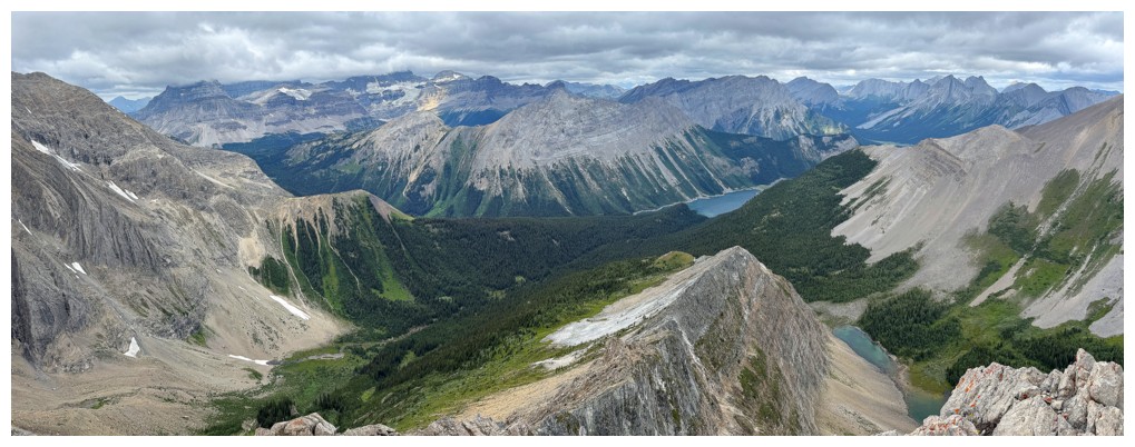
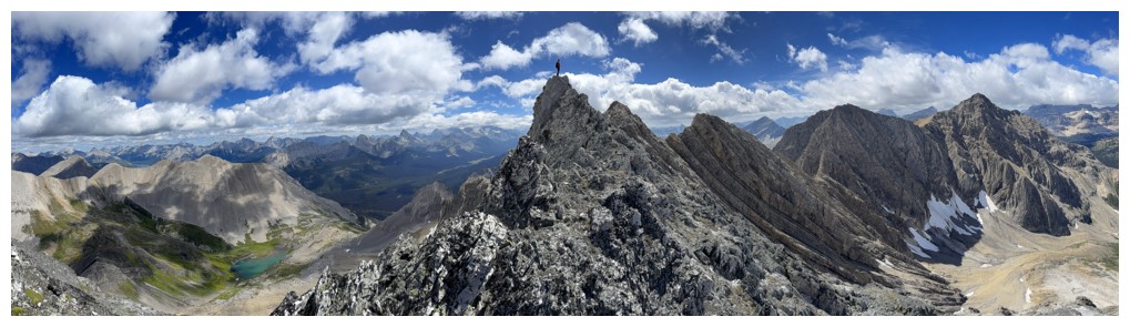
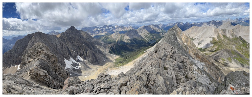
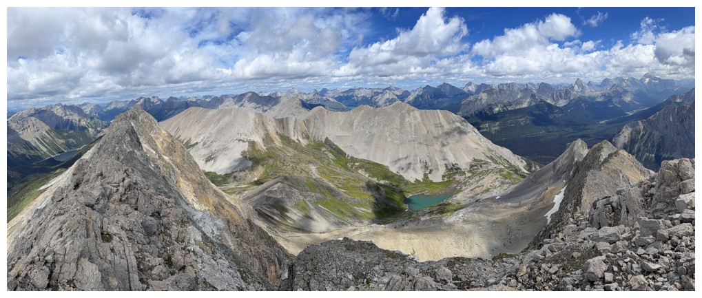
Pano of the view, featuring a beautiful tarn below Mount Morrison near the right
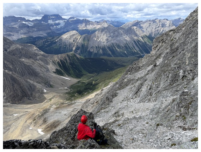
Geoff enjoys the view
JF is down there, somewhere
Following the ridge south
Big views in that direction
Smaller view
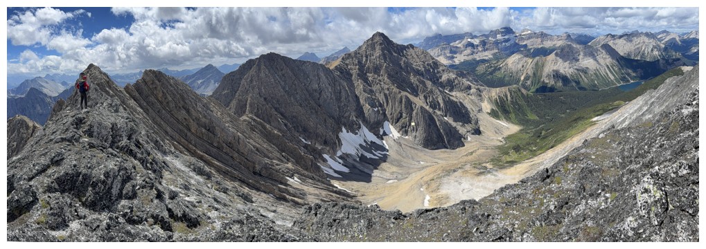
Back to bigger but more to the west
The tarn
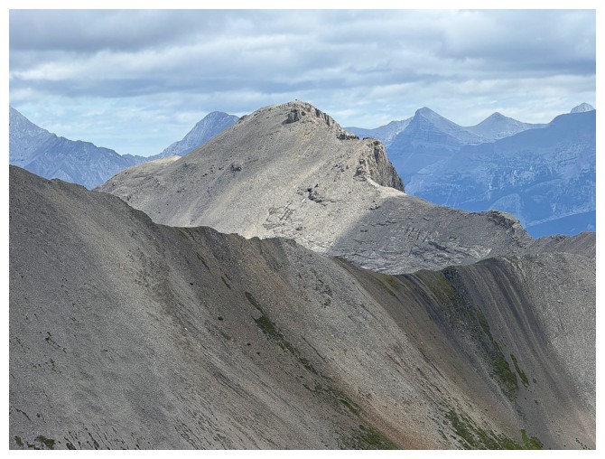
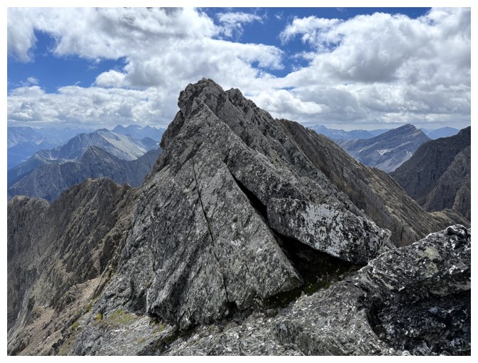
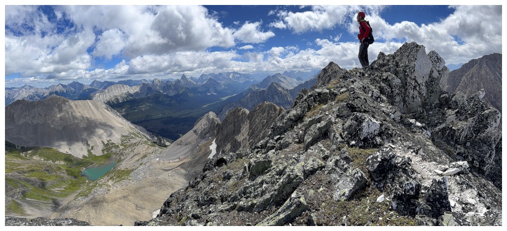
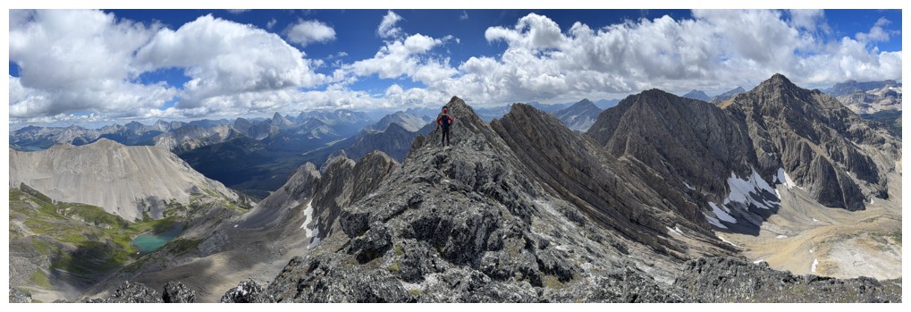
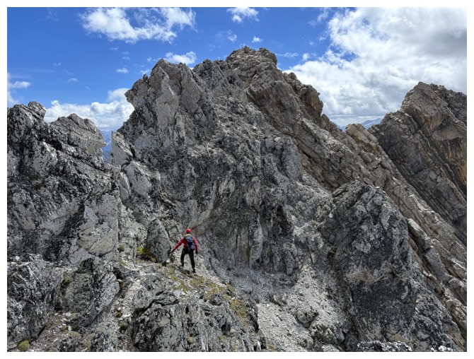
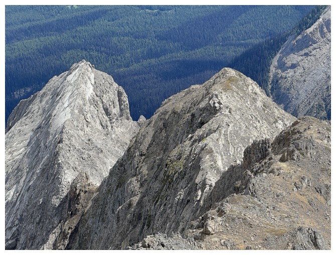
The north highpoint
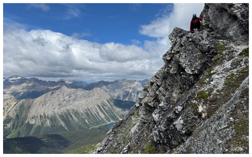
Geoff reaches a super cool highpoint along the ridge, but he's still not at the summit
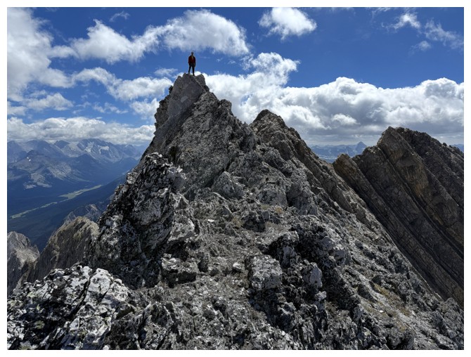
Same as above
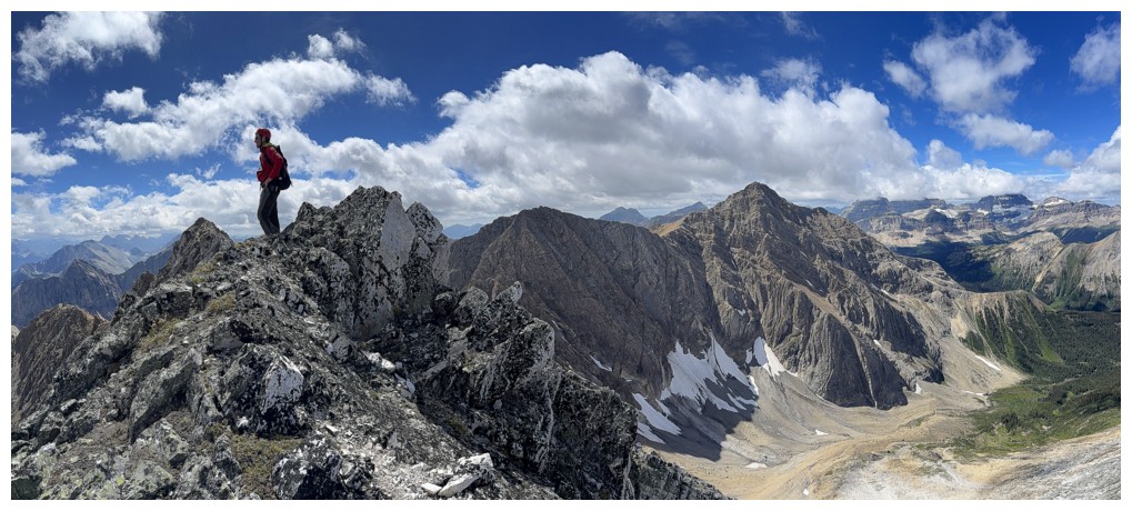
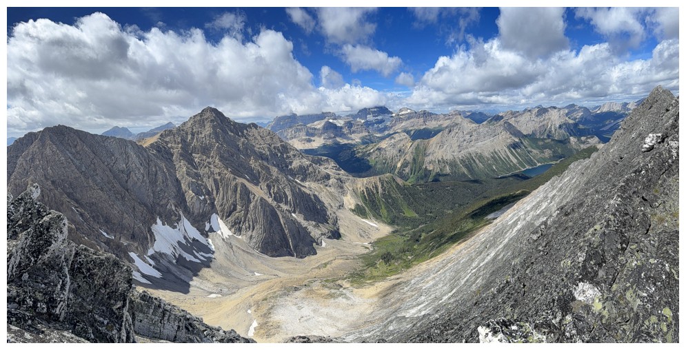
From Geoff's highpoint the summit is finally visible at the left. The
next peak to the right is where we saw the mountain goats and Mount
Byng sits at the far right.
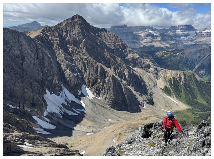
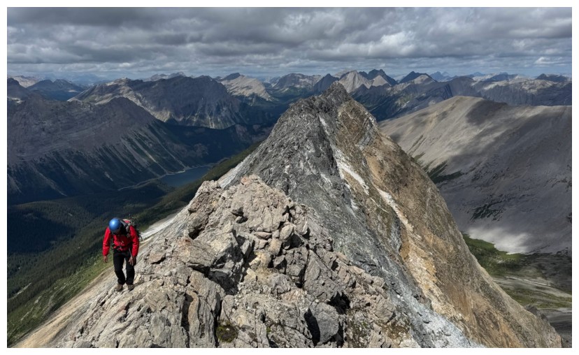
Getting to the top is not without some route-finding and challenging terrain
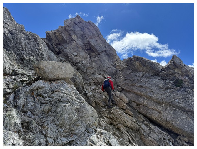
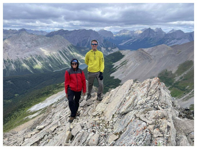
Geoff leads us to glory!
The crux of the summit block. Luckily the rock was solid.
Geoff takes the final few steps to the summit
Always a groomsman, never a groom (photo by Geoff)
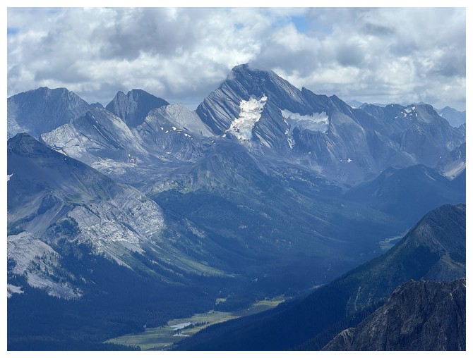
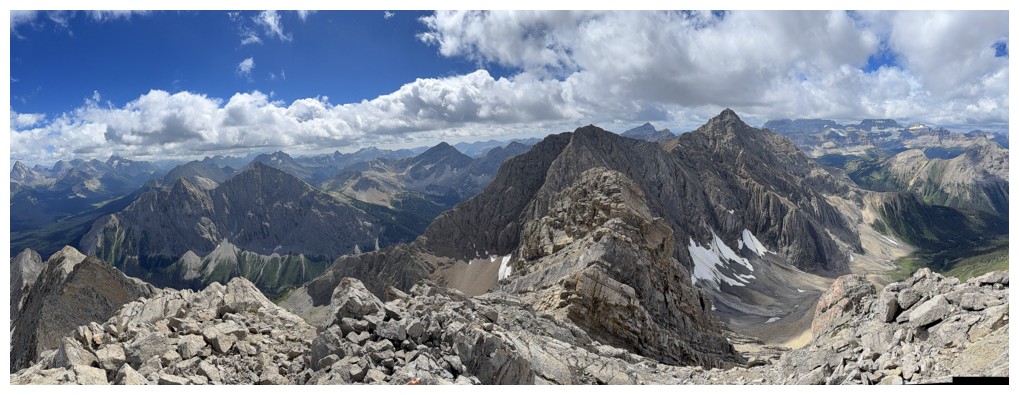
Mount Sir Douglas
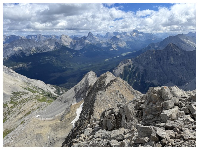
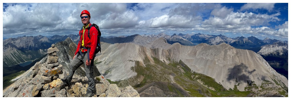
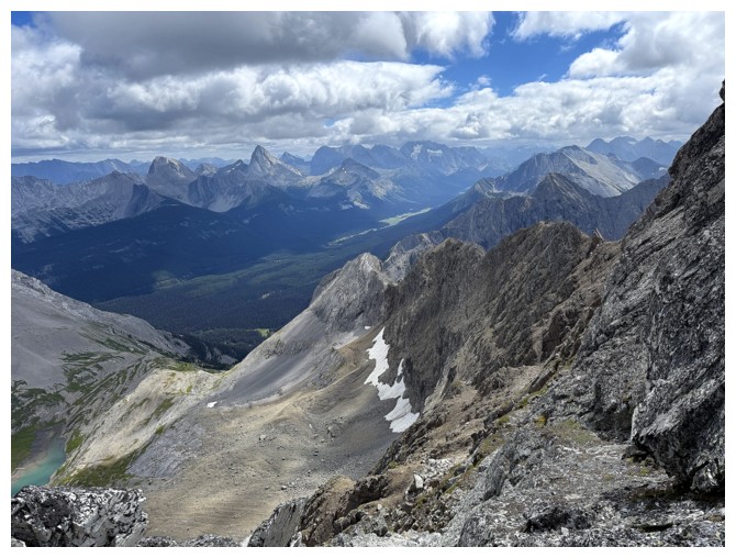
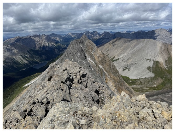
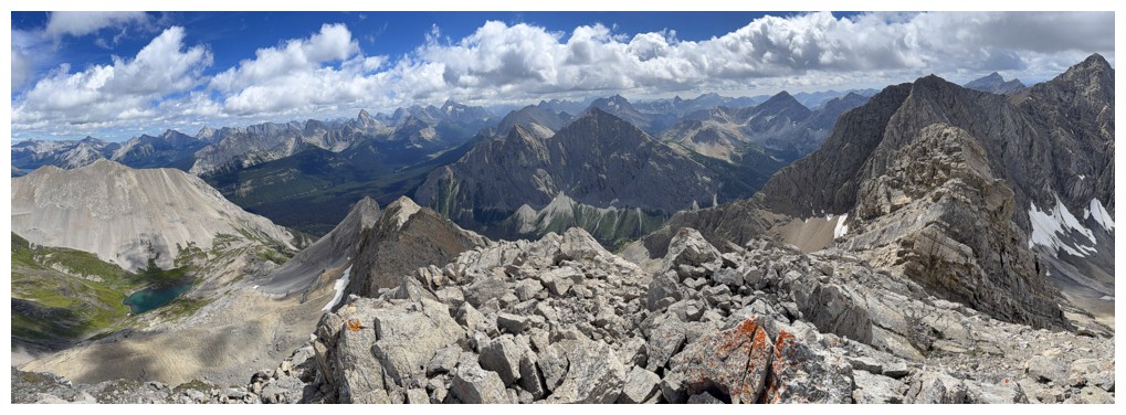
At the summit. The view to the southeast.
Close-up of the southeast ridge
View to the north
Mount Soderholm (right) and Sharkfin Peak (Talon Peak) at the left
Red Man Mountain, I think
Mount Alcantara
Mercer, Allenby, and lots more to the north
Morrison and the tarn
Byng
Summit panos
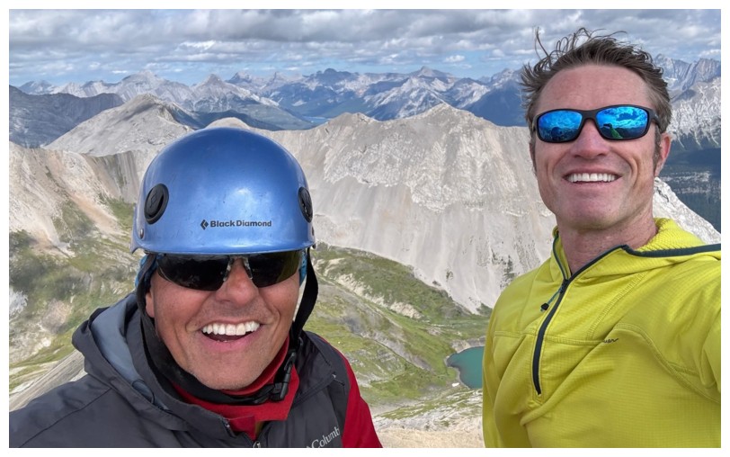
Superman and The 14-Year Old Straggler (not necessarily from left to right) (photo by Geoff)
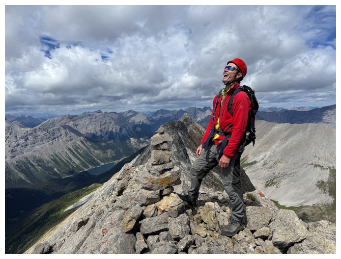
Geoff lets out an evil bellow
Geoff is also a skilled cairn builder (photo by Geoff)
Descending
Geoff checks out some potential lines down
Assiniboine wants to come out to play, but in the end was a no-show
Much later and finally back onto easier terrain
Looking back up. The terrain looks so innocuous, but such is not the case.
Still straggling, but I'm so good at it! (photo by Geoff)
Same as above (photo by Geoff)
Geoff is already back at the snow patch
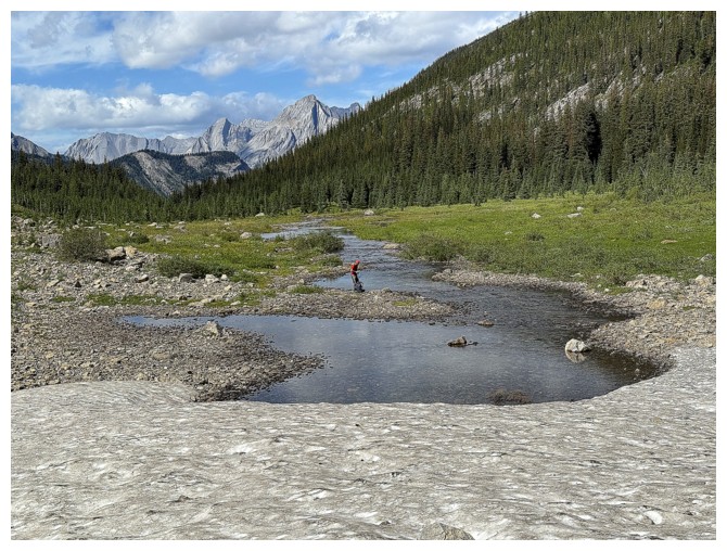
We both needed to refill our water supplies here
Checking out what we just descended
Out we go
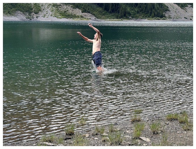
Back at Owl Lake
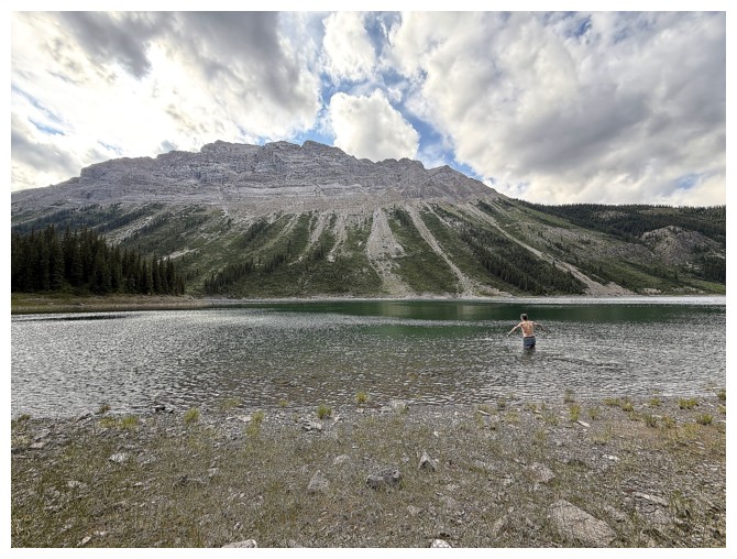
Geoff may be part fish - that water was insanely cold!
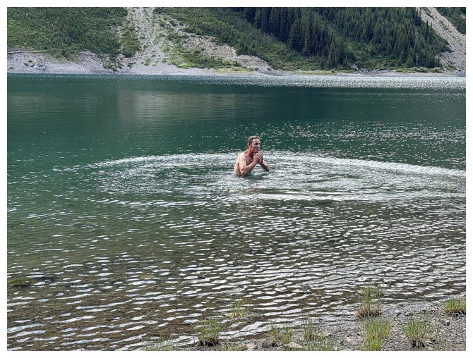
Brave man

Bye to Owl and Byng
Nice to be back on good trails for the remainder of the day
Recrossing Bryant Creek
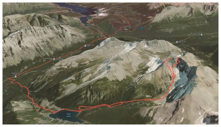
Our route (map by Geoff)
The End
LOG