Merlin Peak
October 15, 2022
Mountain height: 2840 m
Elevation
gain: should
have been 1800 m but I took the highly unrecommended 2000 m route!
Ascent time: 8:00
Descent time: 5:05
Solo scramble.
After a breath-taking trip to the Skoki
Lakes, eight days earlier, I needed an excuse to return to this magical area. And,
wouldn’t you know it, Vern and Wietse gave me exactly that. The duo had
ascended Merlin Peak (a route credited to the legend Graeme Pole) coincidentally on the same day as my Skoki Lakes trip.
Seeing a few more lakes, Merlin and Castilleja, as well as attempting Merlin
had great appeal.
 With an invitation to a week-delayed
Thanksgiving dinner in the evening, I left Calgary at 4:30 am, hoping to be
back in the city by 7 pm - my deluded optimism never ceases to amuse me! A 4
km headlamp bike approach and 4.7 km of hiking and I arrived at Boulder Pass,
feeling pretty good about my pace up to that point. I (almost) successfully
resisted an extended stop at the Skoki Lakes, having experienced them in full a
week earlier. However, the reflections and colours in Myosotis were “Simply
Irresistible” (oh, how I love the music of the ‘80’s – though the videos can be
somewhat questionable when viewed in 2022!).
With an invitation to a week-delayed
Thanksgiving dinner in the evening, I left Calgary at 4:30 am, hoping to be
back in the city by 7 pm - my deluded optimism never ceases to amuse me! A 4
km headlamp bike approach and 4.7 km of hiking and I arrived at Boulder Pass,
feeling pretty good about my pace up to that point. I (almost) successfully
resisted an extended stop at the Skoki Lakes, having experienced them in full a
week earlier. However, the reflections and colours in Myosotis were “Simply
Irresistible” (oh, how I love the music of the ‘80’s – though the videos can be
somewhat questionable when viewed in 2022!).
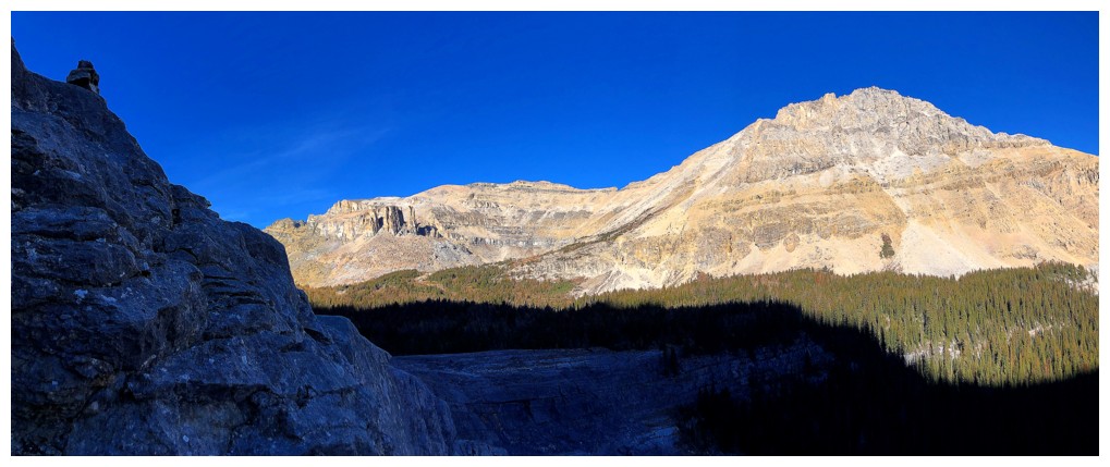
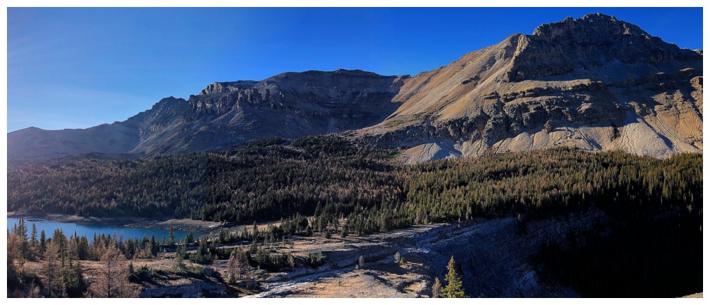
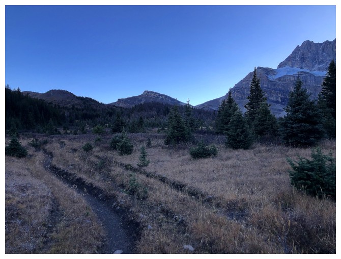
The next part of the trip involved
hiking around the amazing Wall of Jericho and into the Merlin valley on the
northwest side. While pleasant, featuring good views of Jericho and Skoki
Mountain, this section felt more utilitarian in nature. That situation
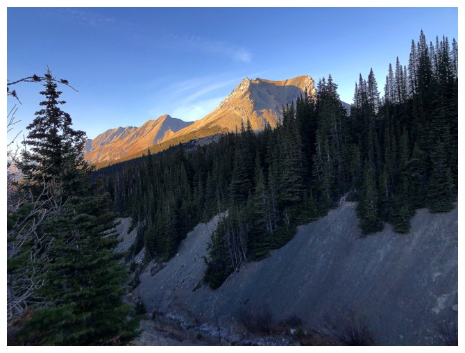
dramatically improved upon gaining some elevation heading up towards Merlin
Lake. The view suddenly opened up, with great views of Cyclone and Pipestone
mountains. Equally impressive was the Merlin Lake trail, that side-slopes the
steep northwest face of Jericho and then neatly winds its way up the headwall
to Merlin Lake. Along the way Castilleja Lake provided some scenic interest far
below the trail.
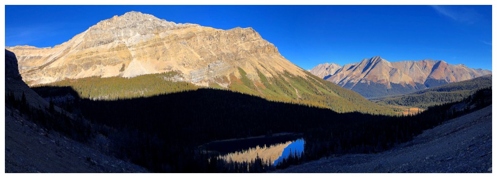
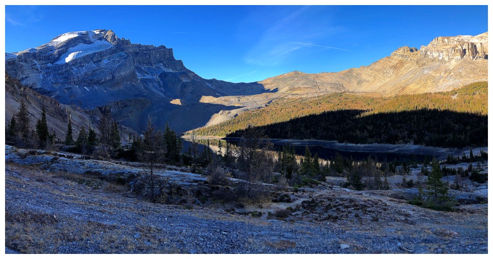
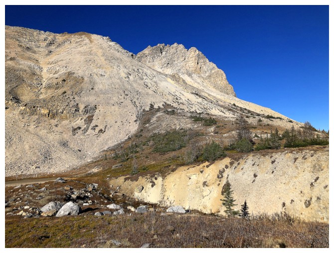
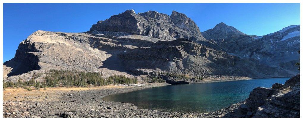
Merlin Lake was expectedly impressive,
though at this time of the year and early in the day, the lake resides in the
shade of The Wall. 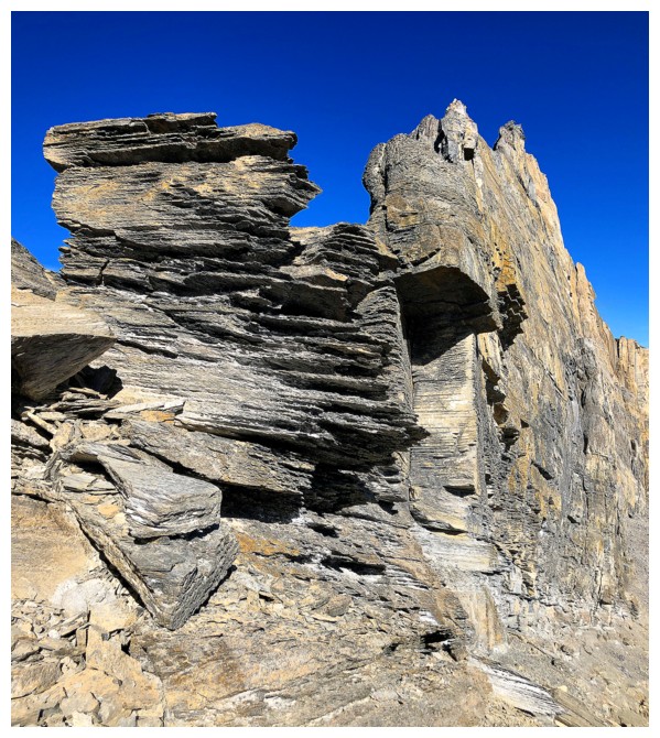 Unfortunately, in my zeal to check out as much of the lake
as possible, I hiked right past the obvious ascent line to Merlin Ridge and
ended up on steep and tedious moraine. That was followed by a very
foreshortened slog up to the ridge. Nevertheless, I still had hopes of reaching
the summit in less than 7 hours, and at this point, the views and scenery were
outrageously good in all directions.
Unfortunately, in my zeal to check out as much of the lake
as possible, I hiked right past the obvious ascent line to Merlin Ridge and
ended up on steep and tedious moraine. That was followed by a very
foreshortened slog up to the ridge. Nevertheless, I still had hopes of reaching
the summit in less than 7 hours, and at this point, the views and scenery were
outrageously good in all directions.
And had I read Vern’s report with more
attention to detail I might have made that goal. As Vern points out staying
directly on the ridge is beyond the realm of scrambling and so I started
side-sloping the right side, below a significant rock band. I completely missed
the weakness to get above that band and by the time I discovered my error, I had
lost a considerable amount of elevation and passed right by the summit. Between
trudging back up to find the weakness or trying to find another way up I chose
the latter.
The route I ended up taking was far
from trivial, on loose, steep, and sometimes exposed terrain. Eventually I
reached the ridge, east of the summit, and then embarked on another less than
trivial scramble towards the summit. Numerous drop-offs required circumventing
or carefully downclimbing. Finally, at the 8-hour mark of the day I arrived at
the summit, relieved but exhausted.
The summit panorama was amazing and
featured views of many familiar mountains but from totally different angles. Unfortunately,
due to my lengthy ascent time, an extended summit stay was not an option. Even
more “unfortunately”, there was no way I was going to make Thanksgiving dinner –
as a lifelong bachelor eating a classic not-so-great bachelor diet, missing a
delicious “real meal” was but a small dagger in my cholesterol ravaged heart! Surprisingly,
I had a phone signal at the top and was able to inform my generous hosts of the
situation – all the more good food for them, I guess!
Doing a portion of the descent in the
dark was a forgone conclusion and so I opted to follow Vern’s and Wietse’s
descent route, instead of a more direct route I had seen during my unplanned
detour. This turned out to be a fantastic way to get off the mountain. The
terrain was easy to traverse and the rock scenery spectacular. In addition, the
route visited another small but scenic lake, before descending to Merlin Lake
on a great trail.
Once below Merlin Lake, the scenic
interest of the trip had run its course and so followed a mad dash to complete
as much of the return to the parking in the limited remaining daylight. Given
that I had never hiked the trail from the Skoki Valley up to Deception Pass I
used that route instead of the more interesting Packer’s Pass trail. It’s
perhaps a little longer but the trail is super easy to follow and gently graded
– not a bad thing when confronted with about 280 m of elevation gain near the
end of an already very long day! I made it Boulder Pass just as the Sun set,
thankful that the remaining 8.7 km of the trip were all downhill. A brisk hike
and then a slower than normal (but ridiculously easy) bike ride by headlamp
brought me back to the parking lot about 13.25 hours after leaving.
Not an easy trip by any means, but one
of the most scenic and satisfying trips I’ve done to date. I am so much looking forward
to returning to this valley to further explore. Big thanks to Graeme, Vern, and Wietse and
for paving the way.
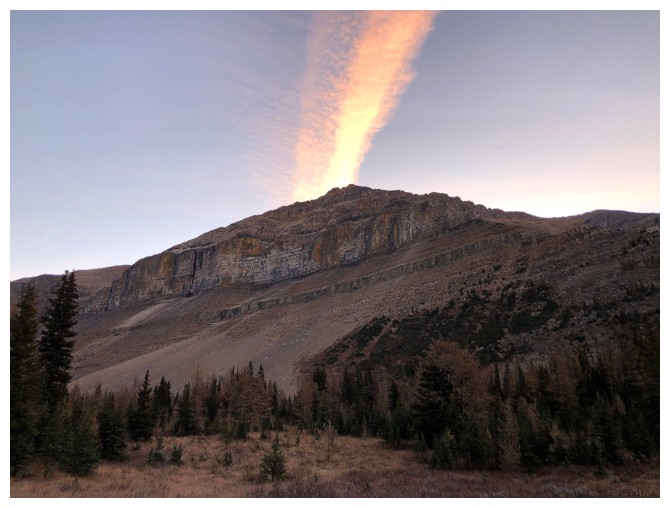
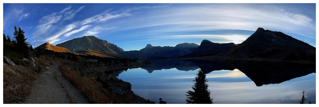
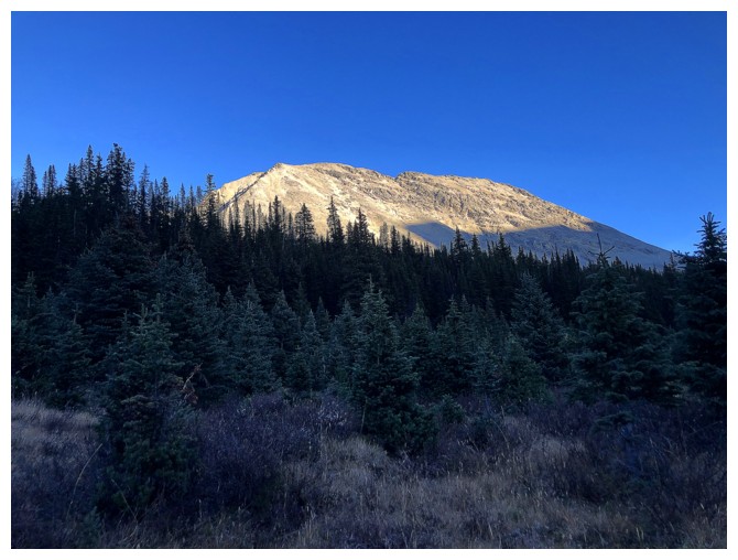
Early morning clouds over Redoubt Mountain
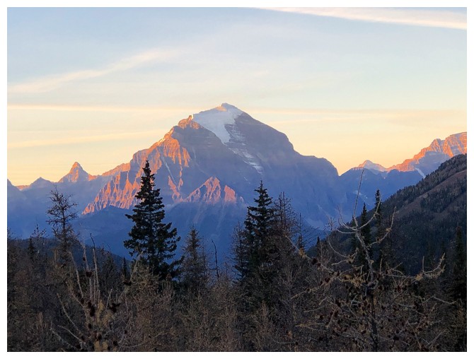
Early morning light on Mount Temple

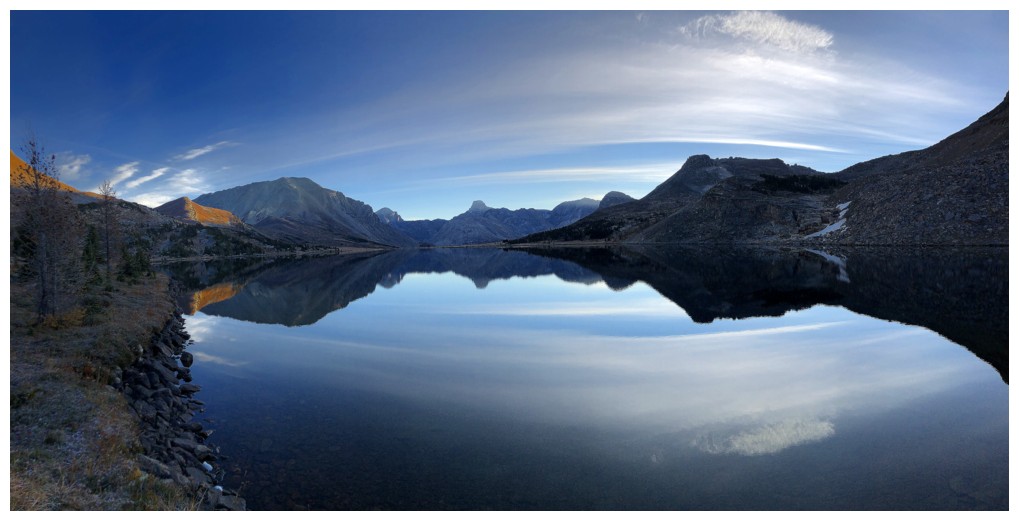
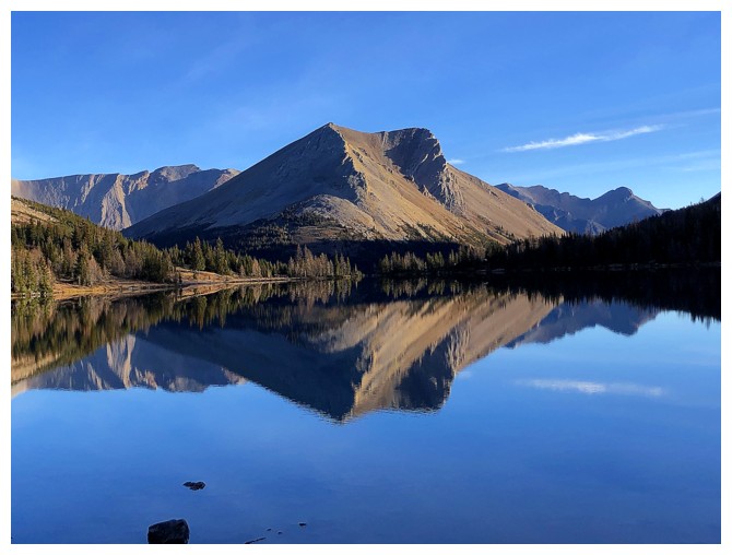
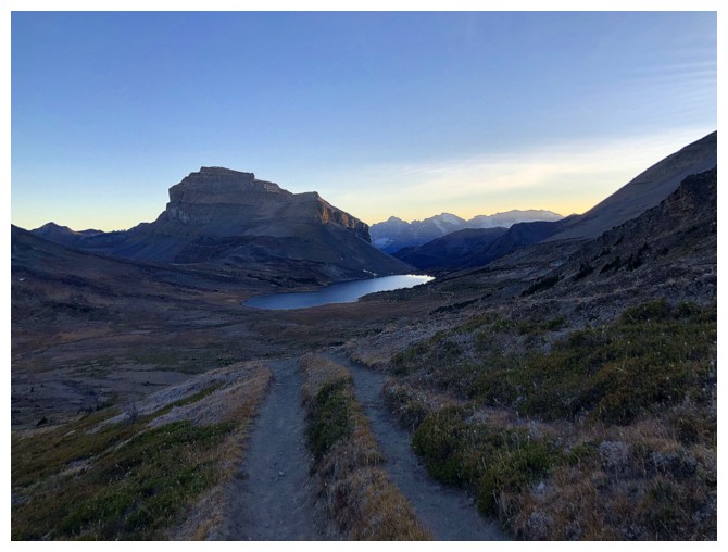
The Big Boulder and Ptarmigan Peak - a "must stop" everytime!
The view to the east and northeast from Bolder Pass - also a "must stop"
 ]
]
And a "must take a million reflection photos"!
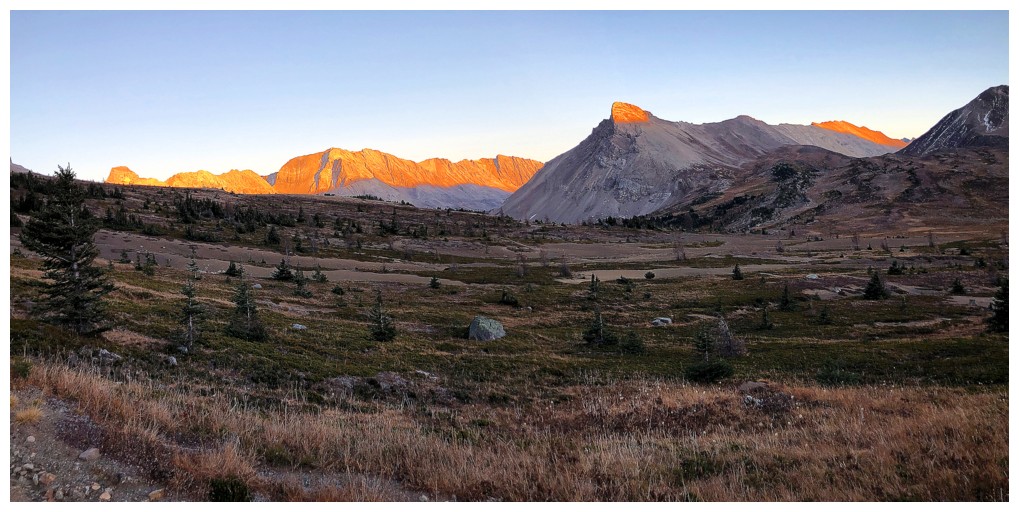
Shockingly, lowly Packer's Pass Peak, at the far left, is seeing the Sun before all the much higher surrounding peaks
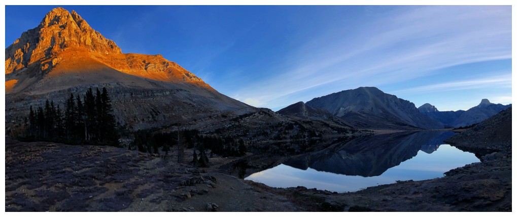
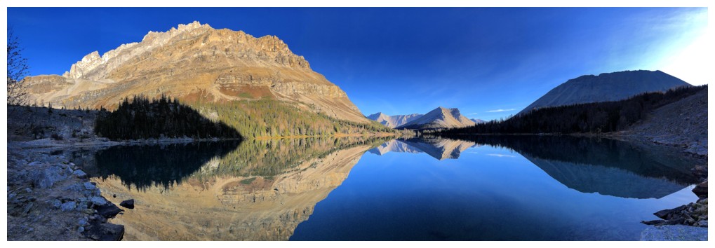
The southeast side of Ptarmigan Peak is colourful and beautifully aesthetic
PPP and Fossil
Redoubt
Ptarmigan, Redoubt, and Heather Ridge at the far left
The east side of Ptarmigan is also stunning
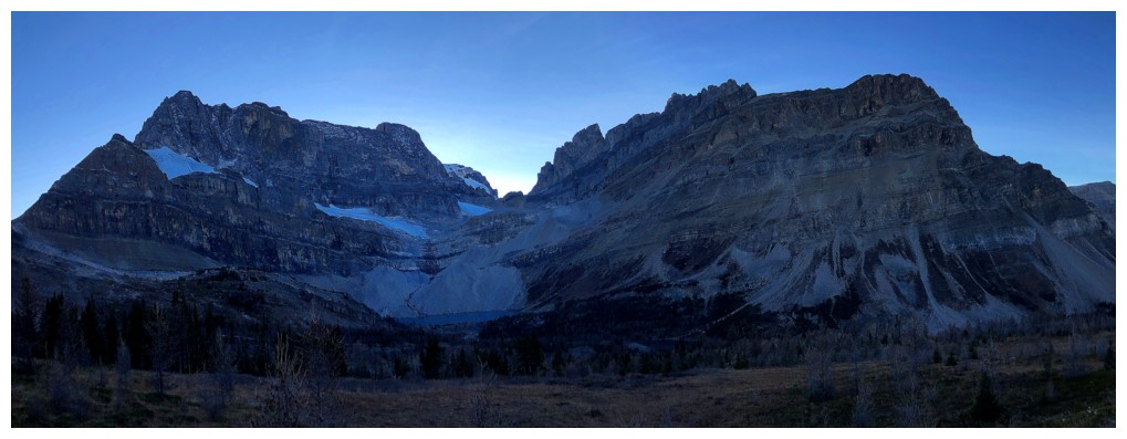
Hard to find words to describe the beauty of The Wall of Jericho and Zigadenus Lake
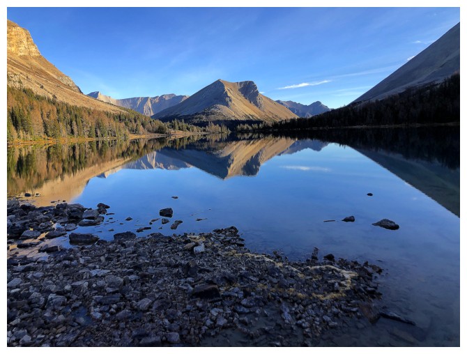
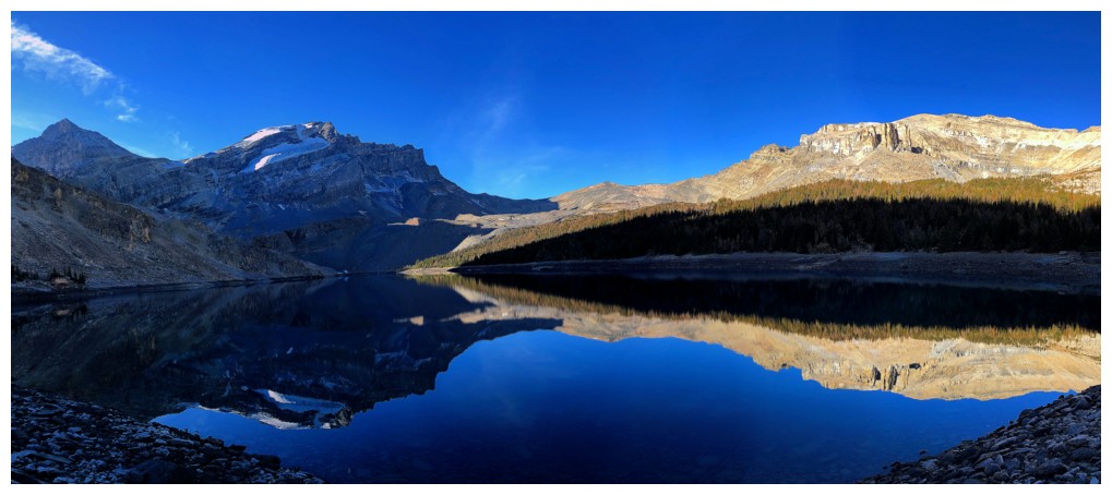
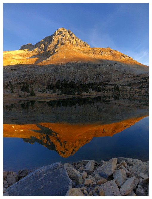
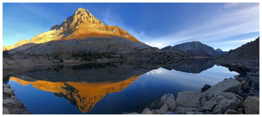
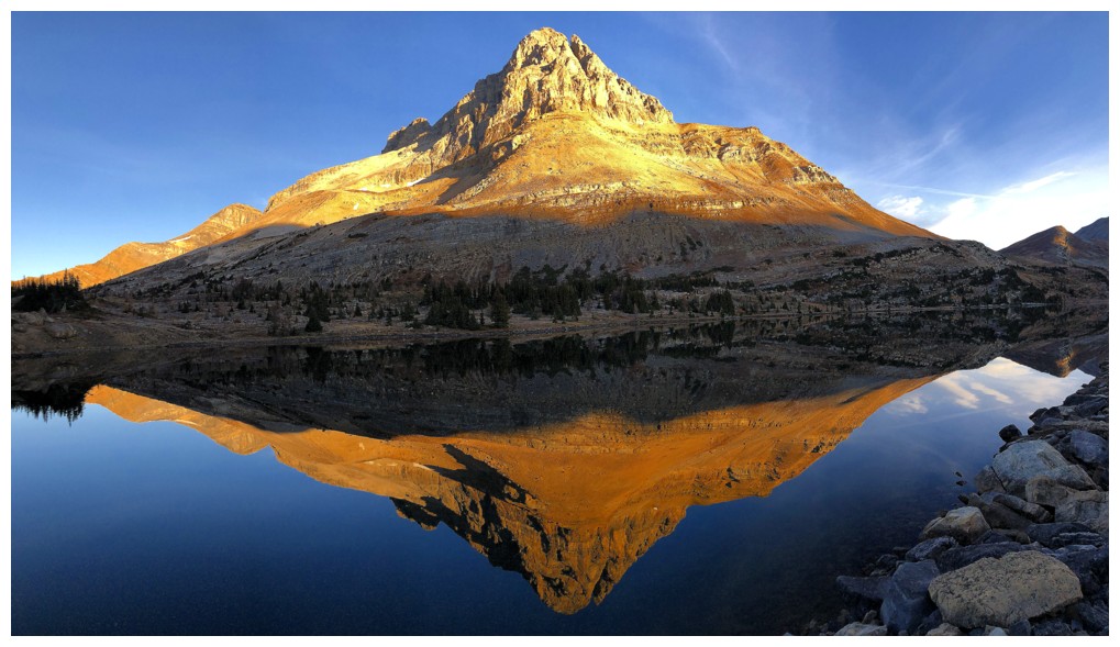
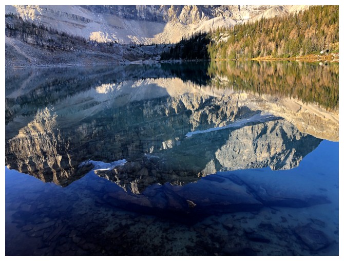
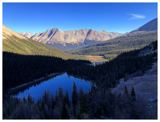
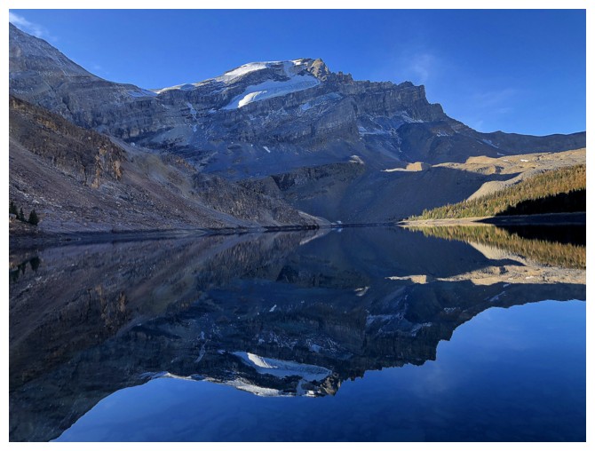
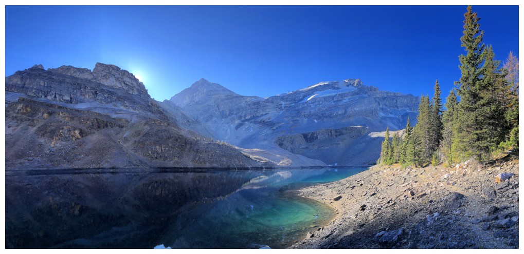
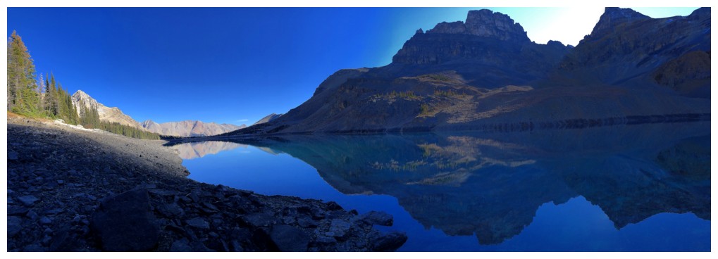
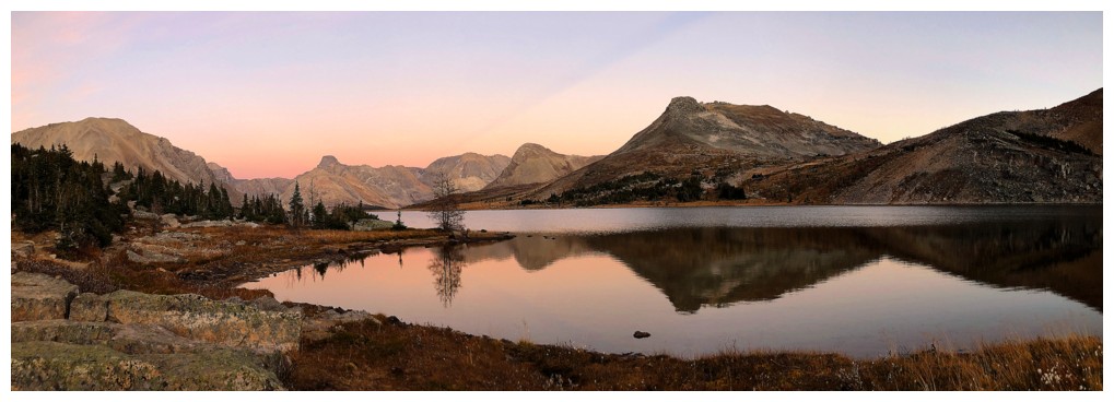
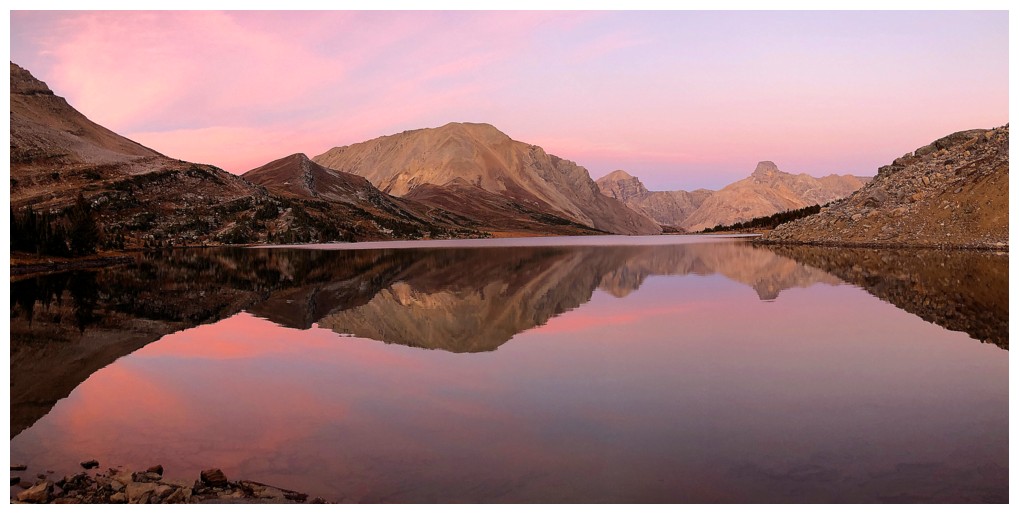
At the shores of Myosotis Lake
Skoki Mountain reflection - if Merlin wasn't a go, Skoki was the back-up plan
Although
I successfully resisted the urge to visit the shores of Zigadenus for a
ridiculous number of repetitive photos, Myostis is inescapable and
quickly has you under its spell
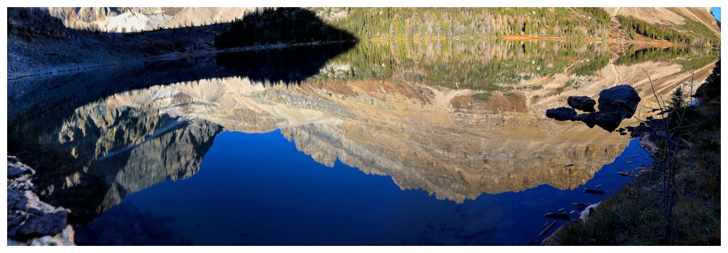
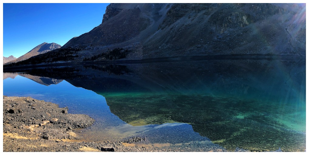
The reflections were perfect
...as was the view of Ptarmigan and The Wall of Jericho
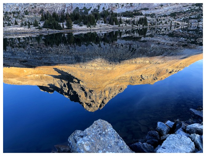
I did get a little carried away with photographing the reflections without the original
..but eventually reeled myself in and went back to both!
Looking up the neat little route that descends the headwall below Myosotis
Sweet quartzite
Down into the valley and excited to travel new terrain
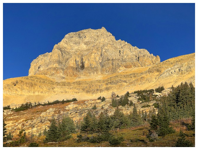
Jericho continues to be a source of awe
Looking back to Packer's Pass Peak and Ptarmigan Peak
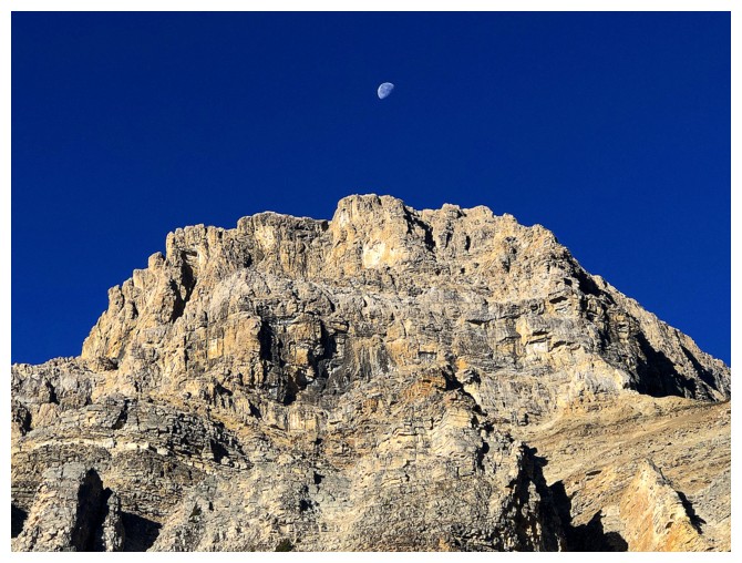
The Moon and Jericho
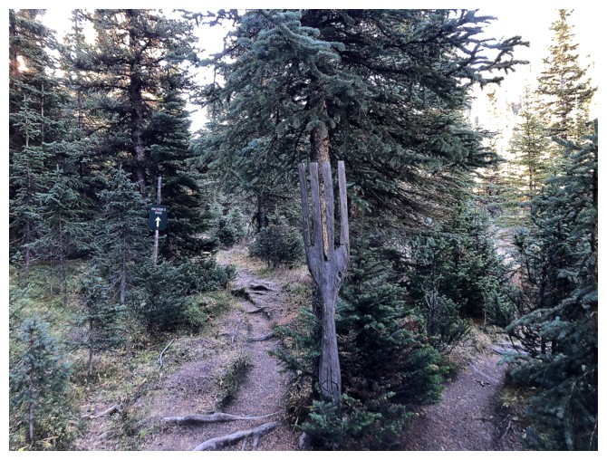
Best "fork" in a trail in the Canadian Rockies!
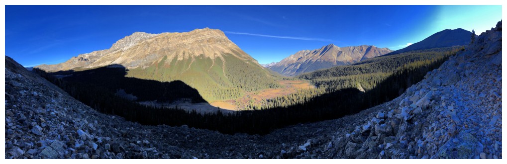
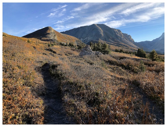
Sometime later, above treeline and heading into the Merlin Valley
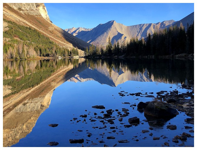
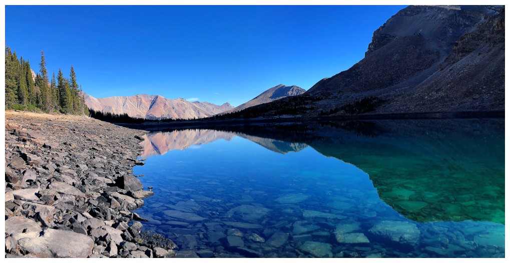
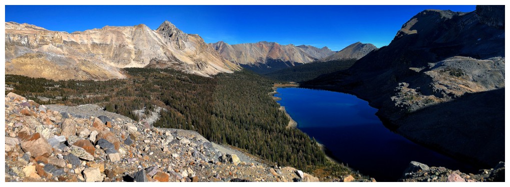
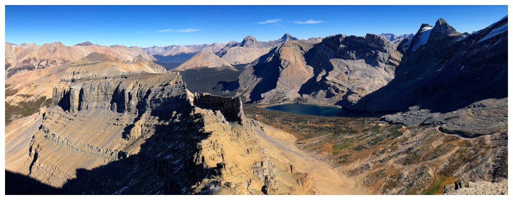
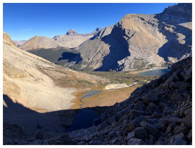
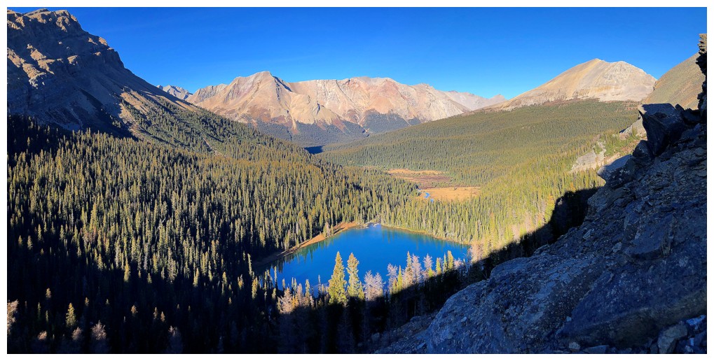
The far east end of Merlin Ridge and Castilleja Lake
Cyclone and Pipestone mountains to the northeast
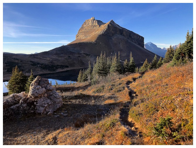
At the Merlin Lake headwall. The trail neatly winds its way up to the left.
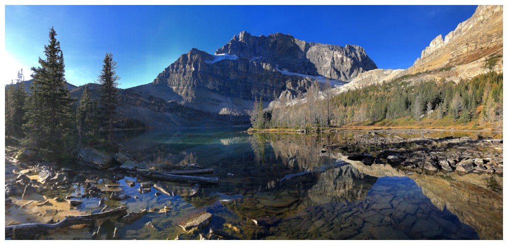
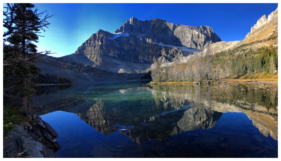
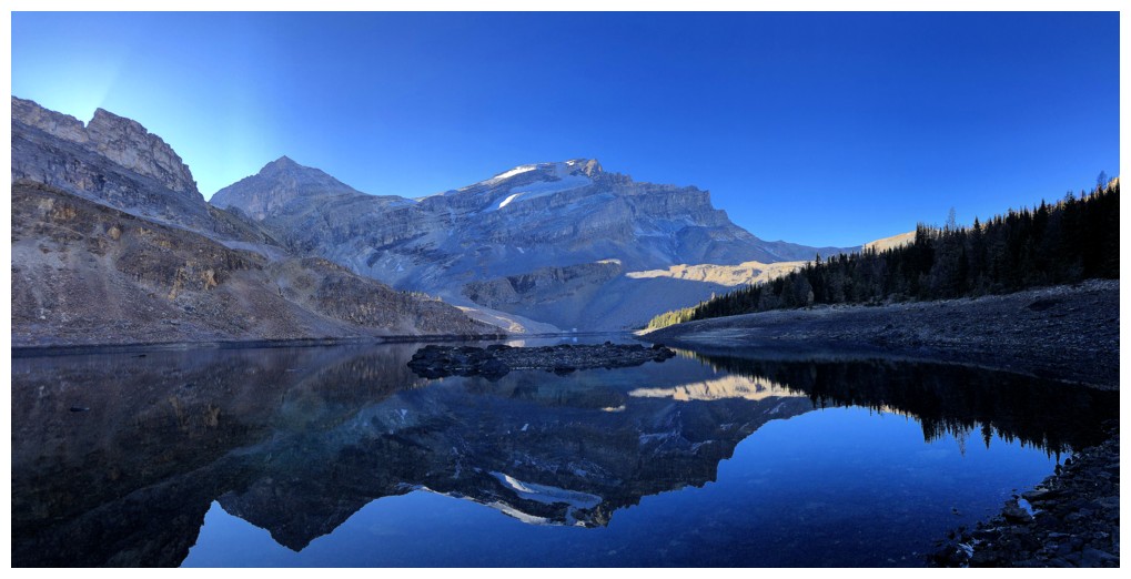
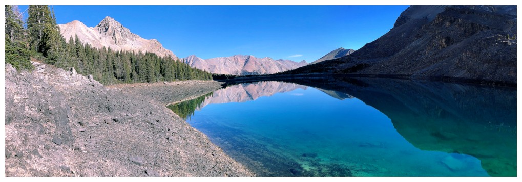
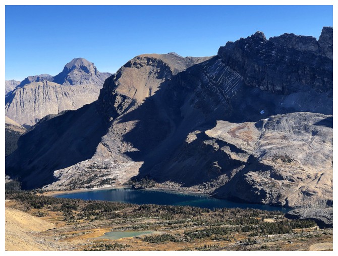
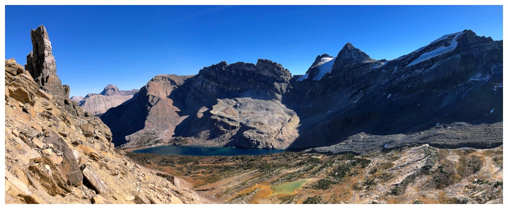
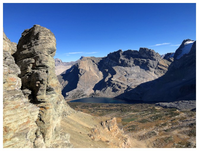
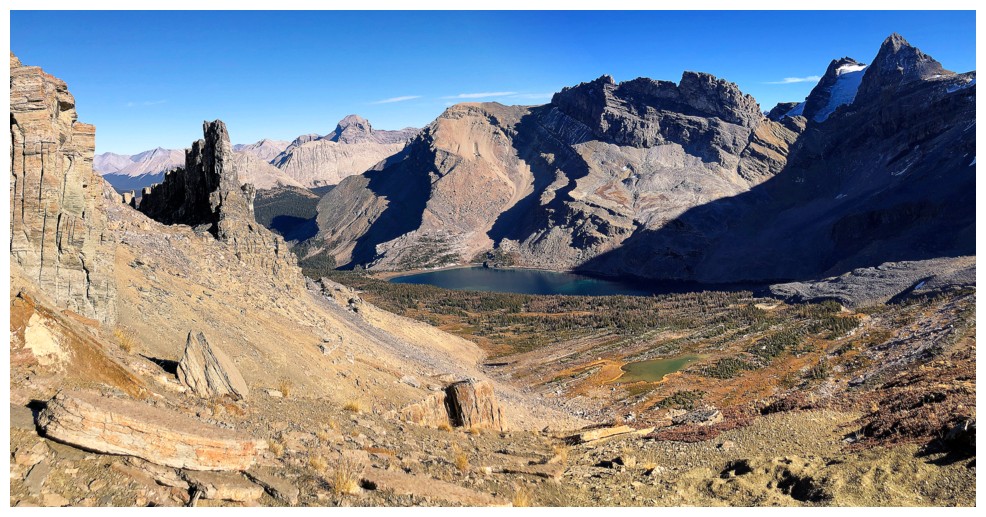
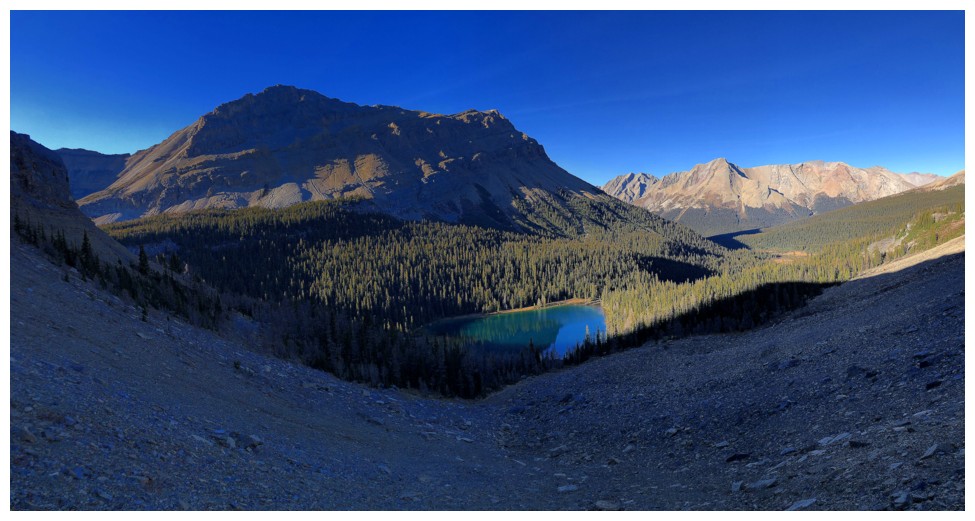
First view of the Merlin valley and Merlin Lake
The north sides of Jericho and Mount Richardson
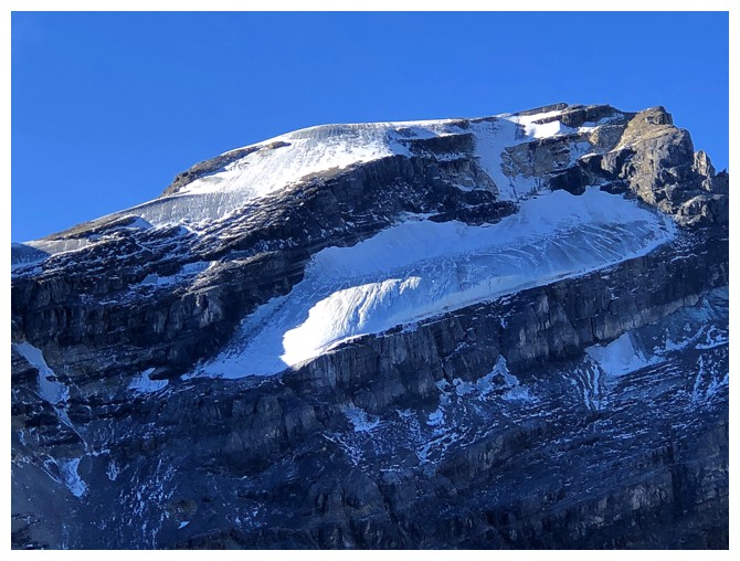
Close-up of the glaciated north face of Richardson
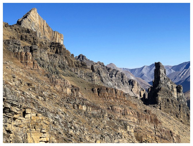
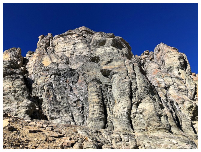
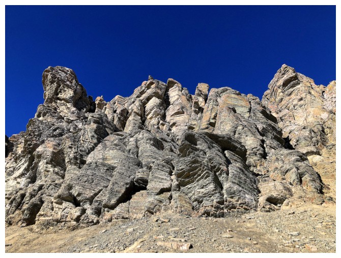
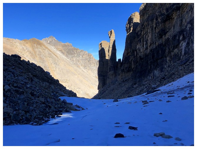
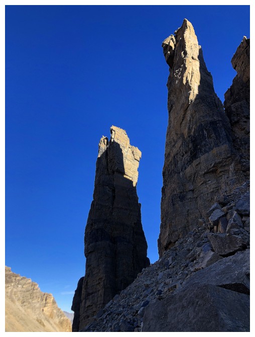
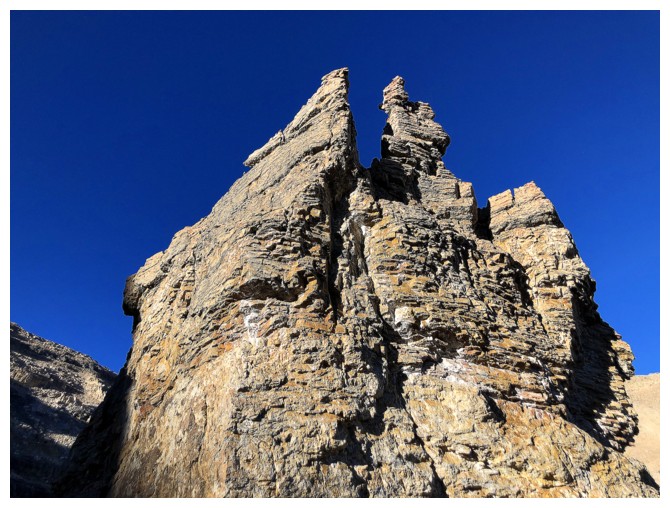
Close-up of a group of amazing pinnacles and towers on the south side of Merlin Ridge
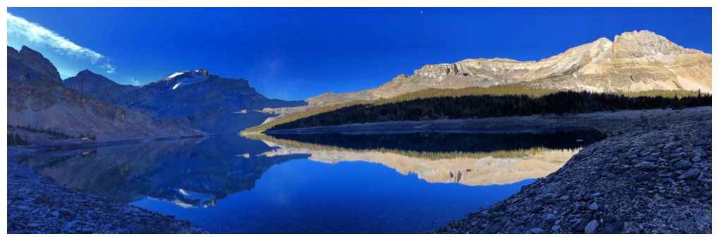
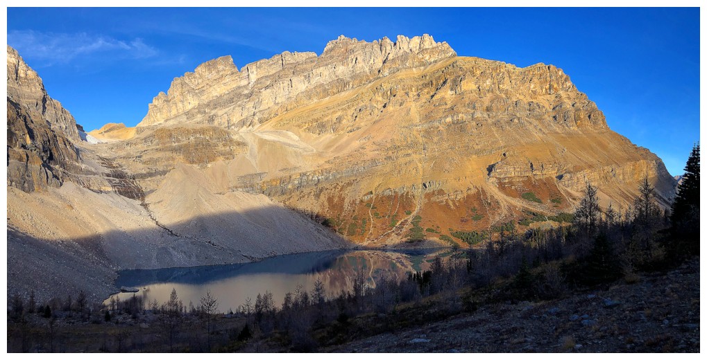
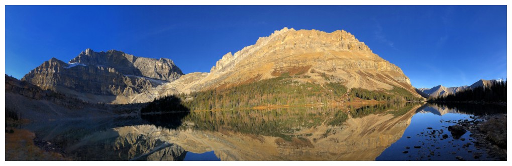
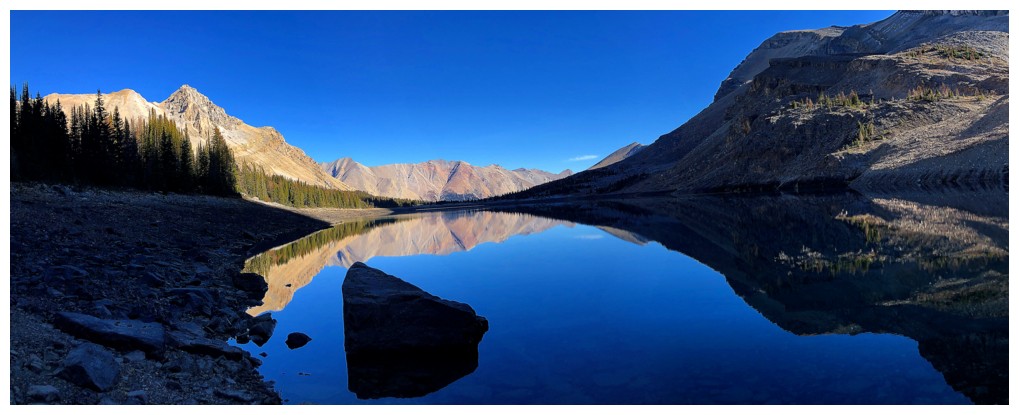
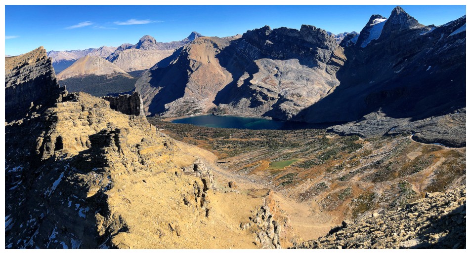
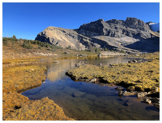
Merlin Lake is another beaut, best seen a little later in the day when the Sun 's rays have reached the water
However, that didn't stop me from taking another extensive round of reflection photos
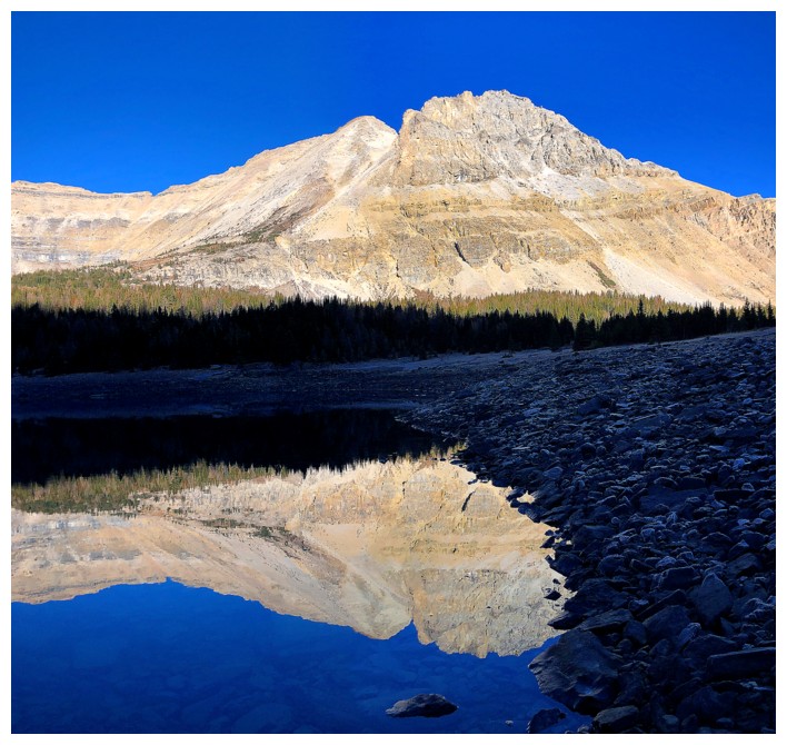
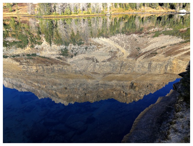
The hue of the water is finally revealed as the Sun rises over Jericho
...it's green
At
this point I should have been near the trees in the distance, but
insisted on following the lakeshore until I ended up on this mess -
rubble cemented into hard dirt (and it's far steeper than it
appears)
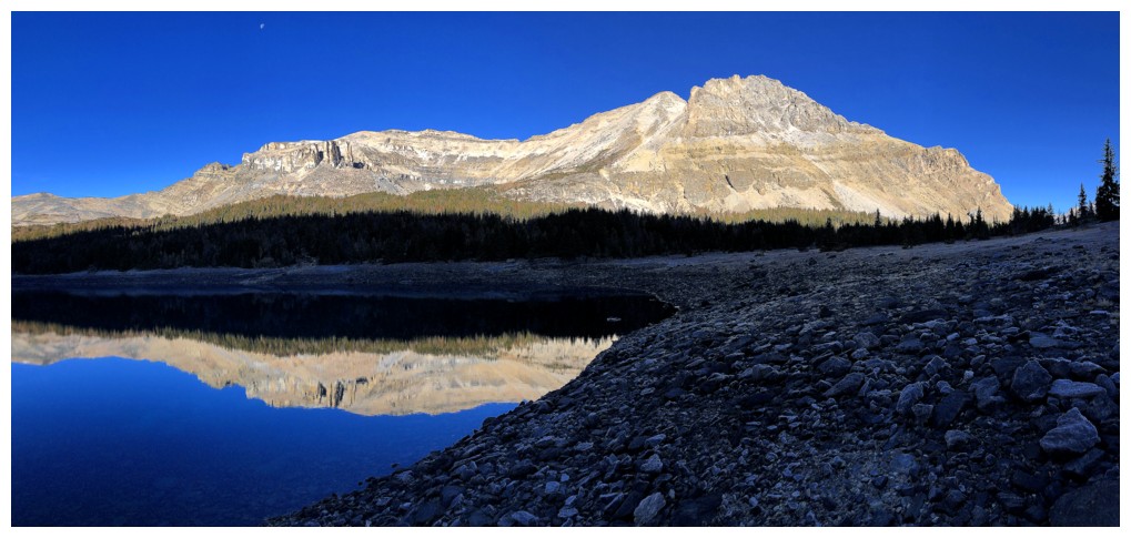
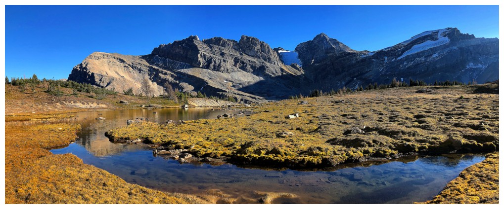
Merlin Lake certainly enhances an already spectacular environment
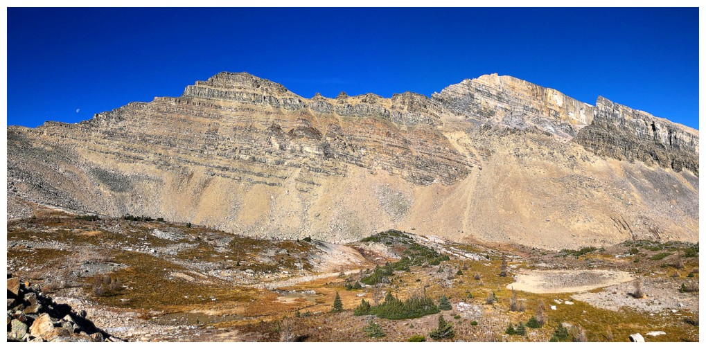
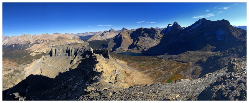
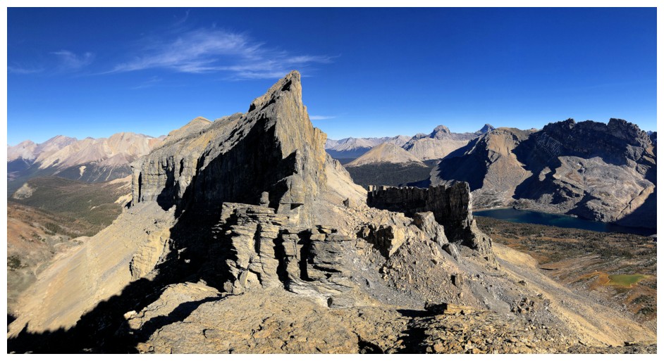
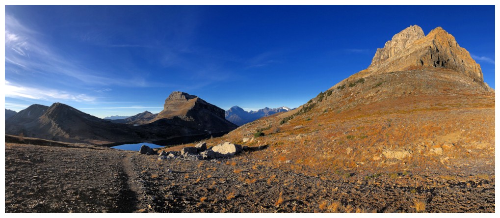
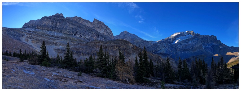
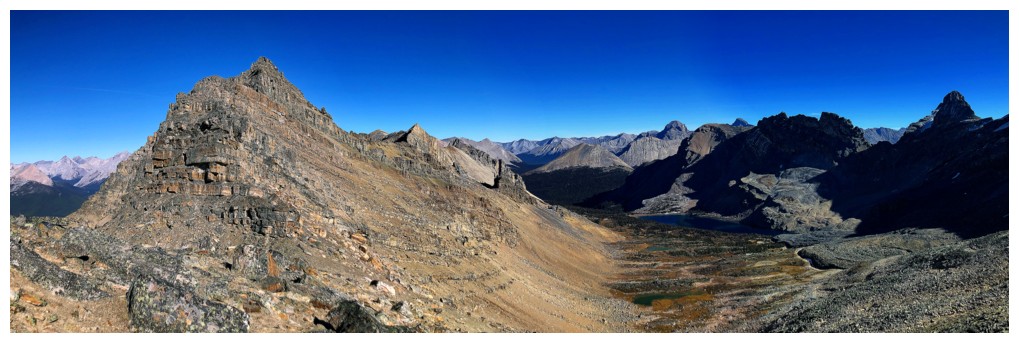
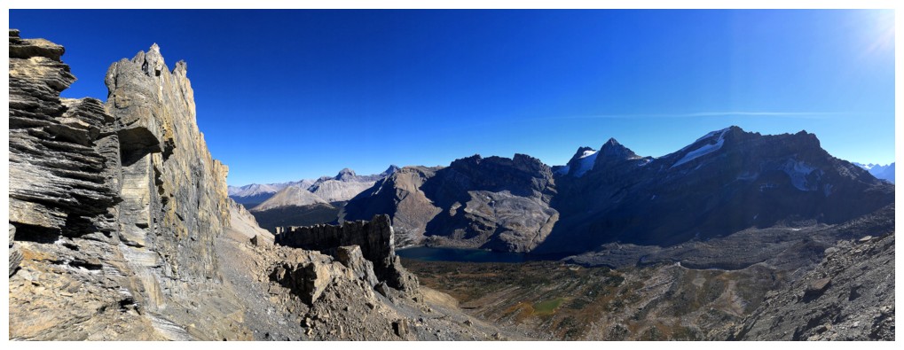
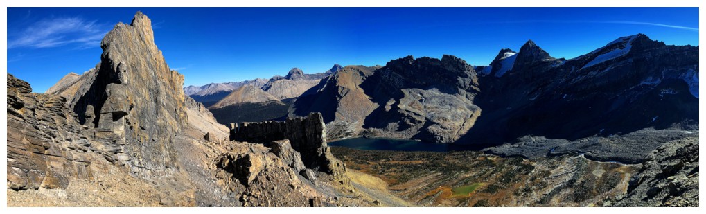
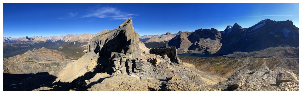
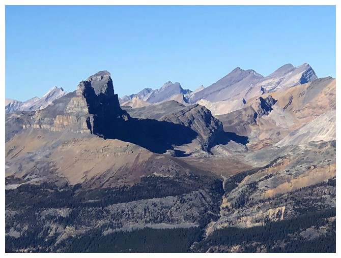
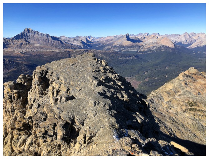
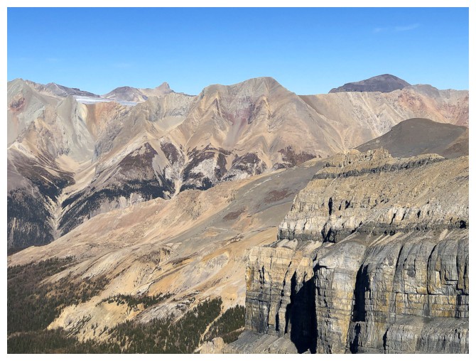
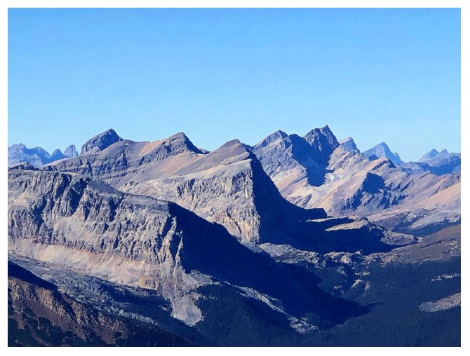
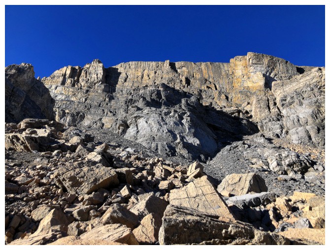
The main part of Merlin Ridge. The highest point is Merlin Peak at the left.
The lower easterly highpoint has some impressive rock
Almost at the ridge with Merlin Peak ahead
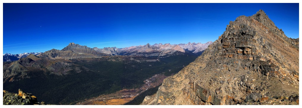
View to the east from the ridge
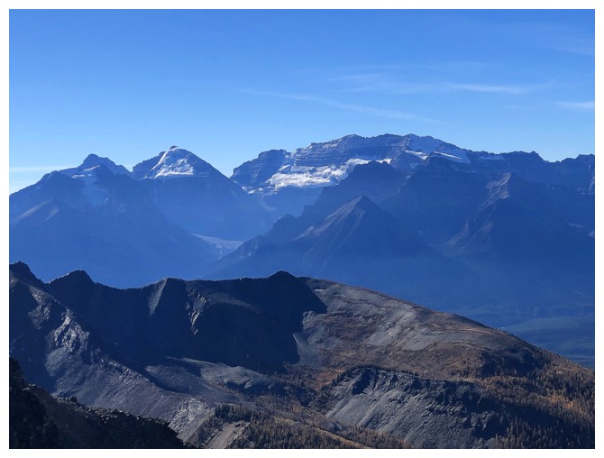
Mounts Lefroy and Victoria to the southwest
Mount Balfour
Mount Hector
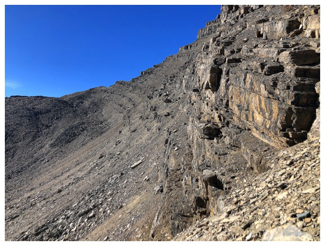
Following the ridge is easy at first
And views of the surrounding area are excellent
View to the north
Looking down into the Pipestone Valley
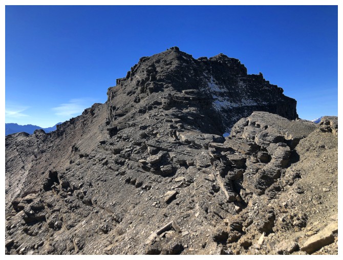
End of the easy travel
The side-sloping begins
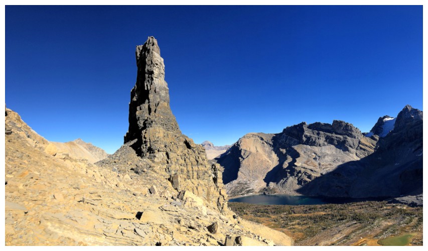
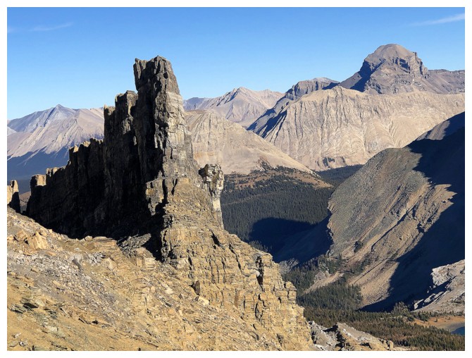
I would eventually end up near the pinnacle in the distance
Perhaps the beautiful rock distracted me too much from finding the shorter route
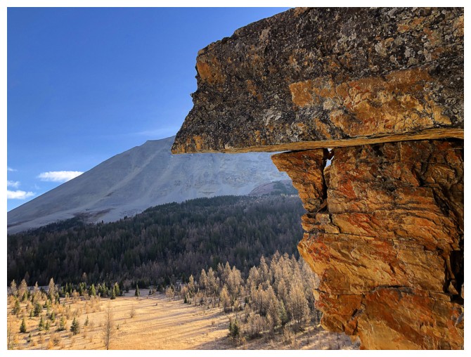
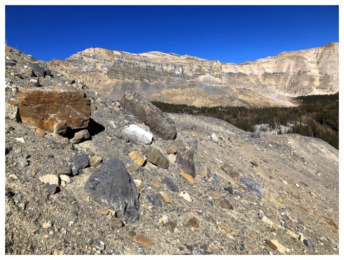
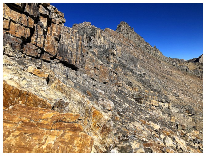
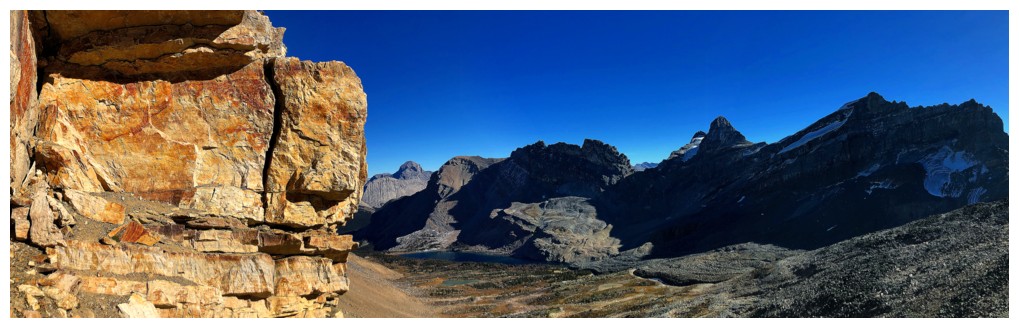
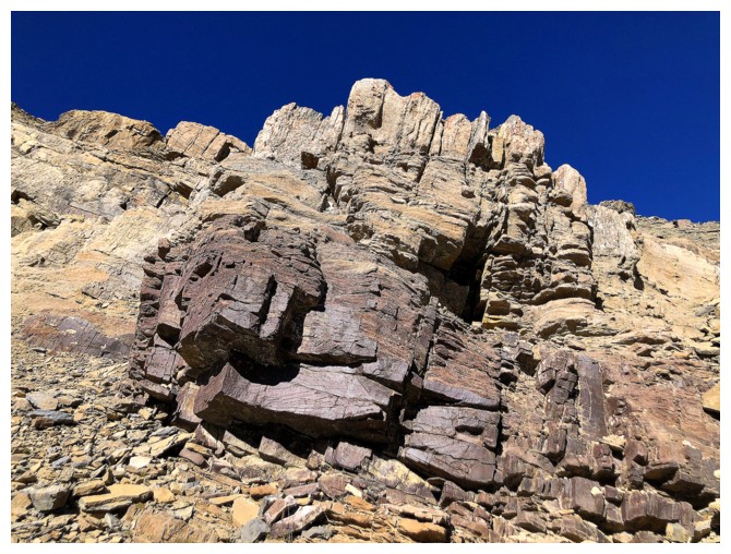
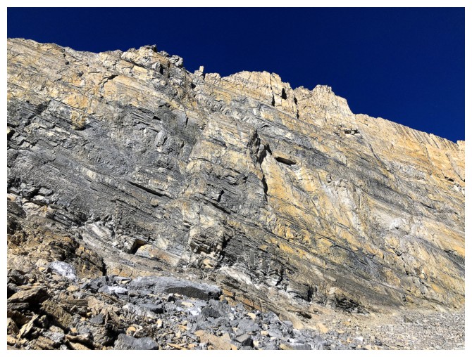
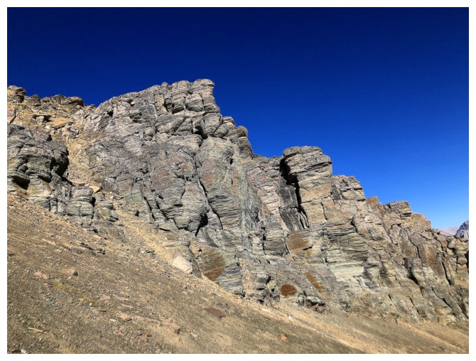
Quartzite: the red argillite of the north! (Bertha Minor)
Approaching
the pinnacle at the right. At this point I have side-sloped way past
the summit and lost a huge amount of elevation - oops!
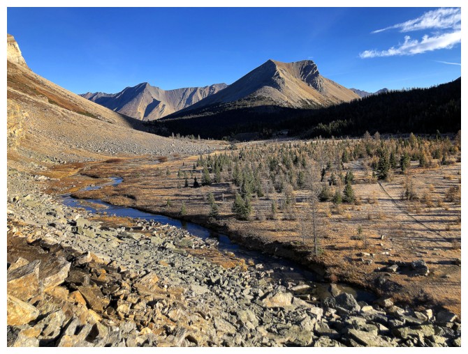
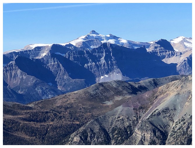
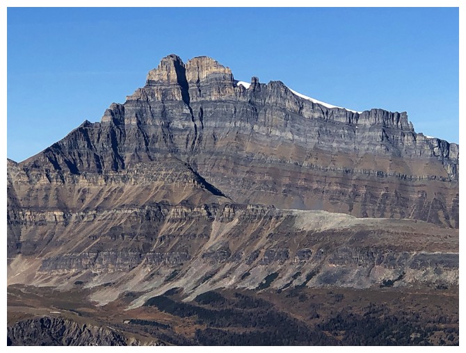
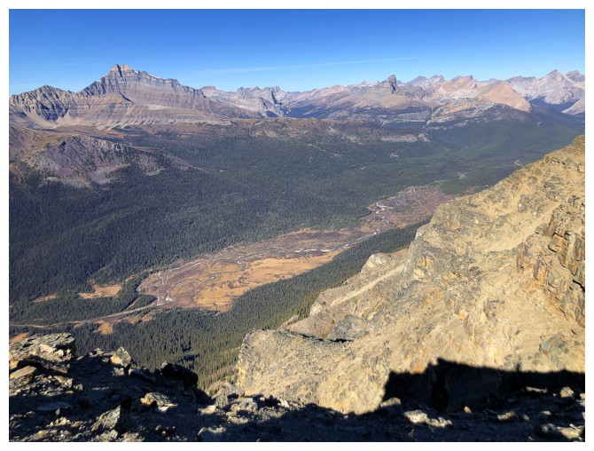
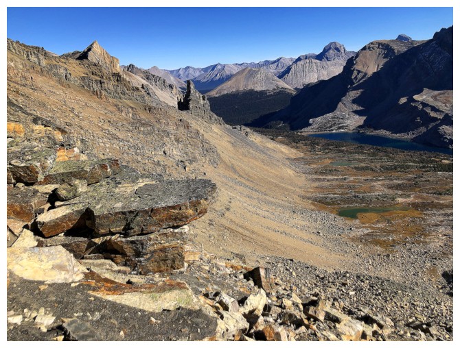
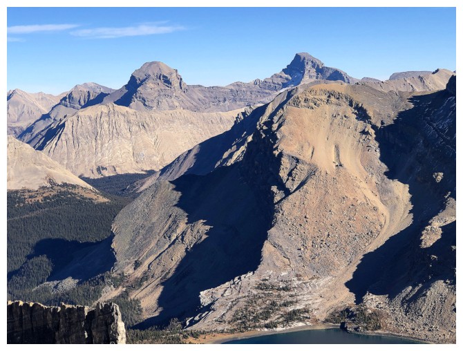
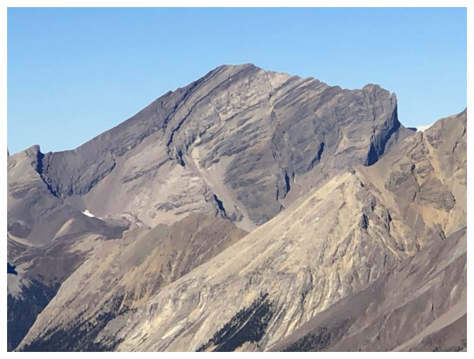
Massive Mount Douglas at the far left, Merlin Lake, and others
The quartzite is still distracting me from...
...this. Looking back at all the side-sloping and elevation loss
Stunning rock
And stunning views
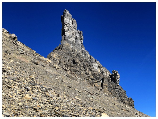
The close-up view of the pinnacle was totally cool and worth the extra distance and elevation loss
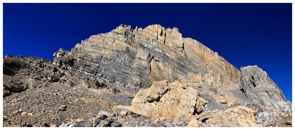
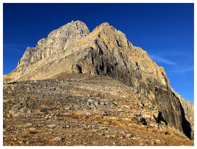
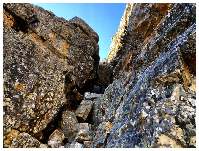
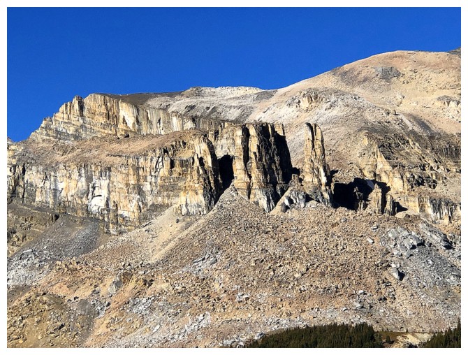
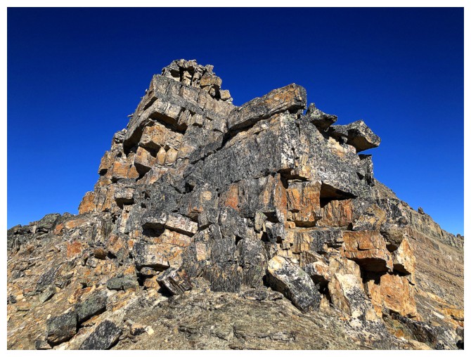
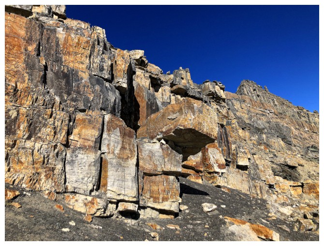
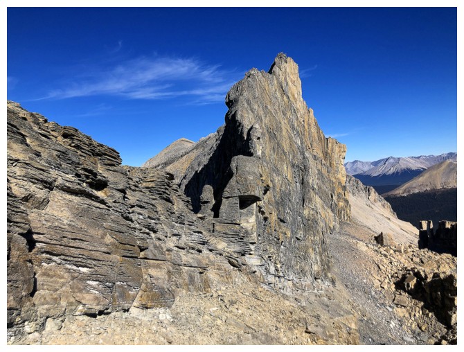
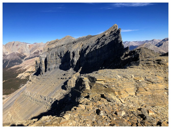
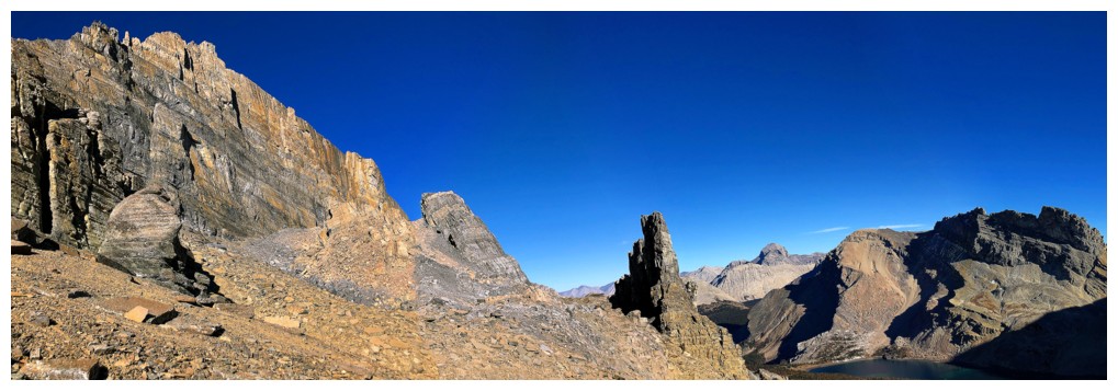
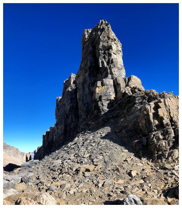
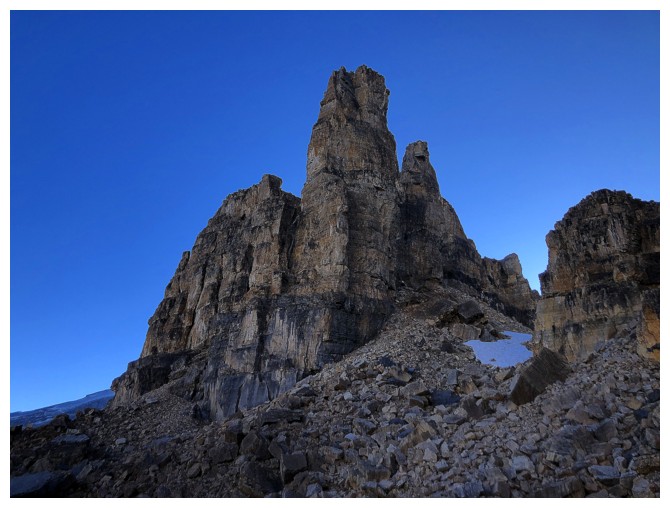
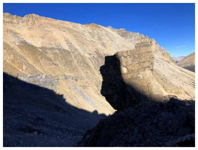
Finally heading up again, towards the ridge at the far left. This area is identified as Merlin's Castle on some maps.
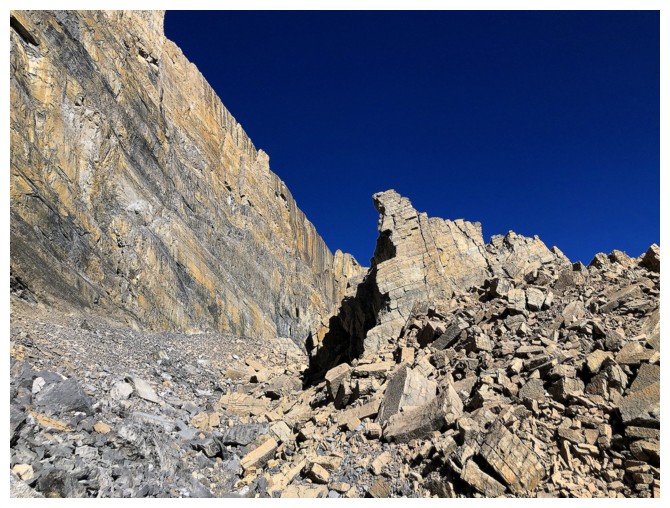
Horrible terrain underfoot but sweet rock in Merlin's Castle
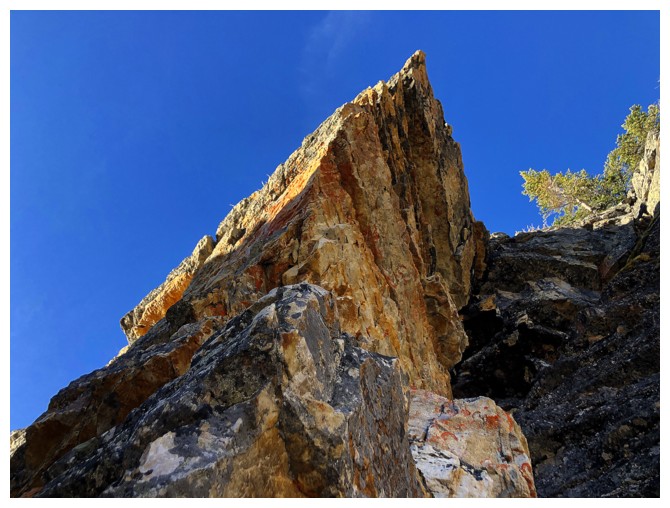
Almost at the immense wall of the castle
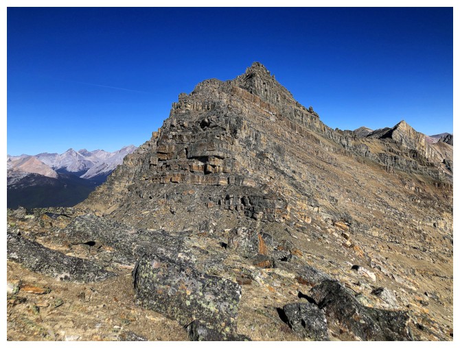
Almost on the ridge
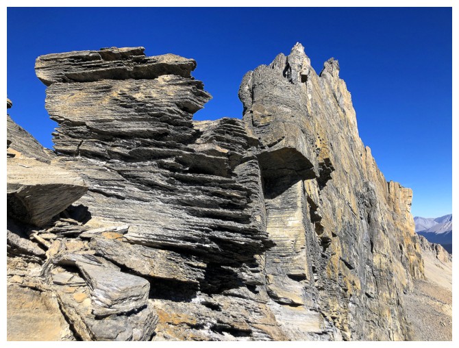
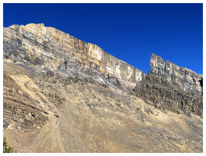
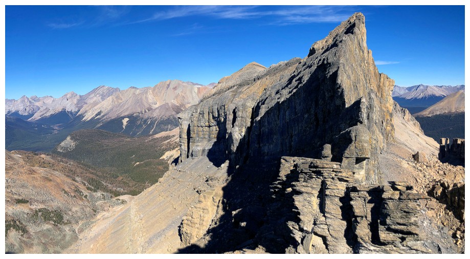
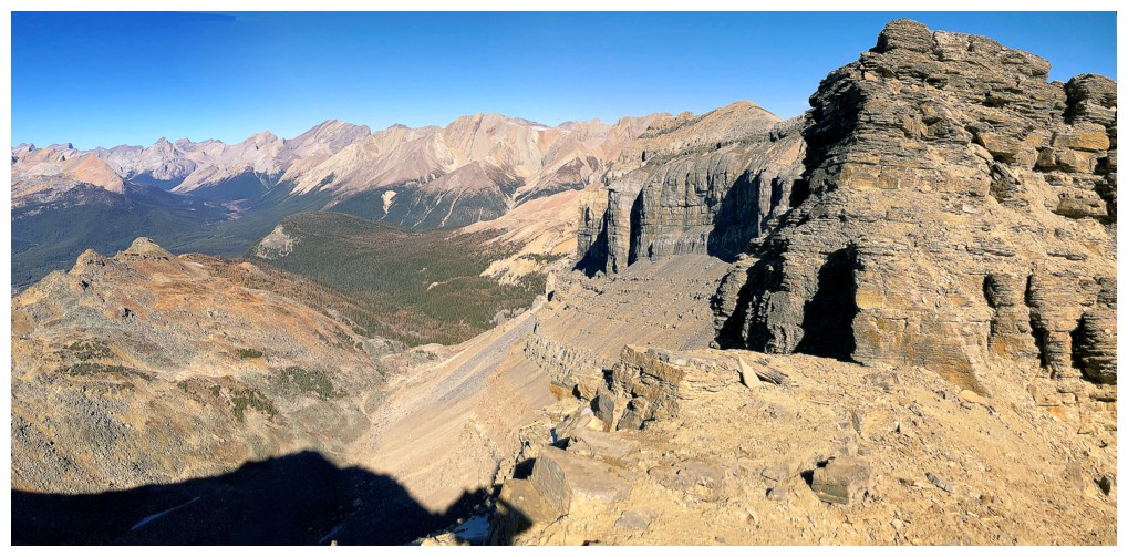
On the ridge. The narrow wall of Merlin's east ridge (Castle) is a geological wonder.
Absolutely mesmerized by this
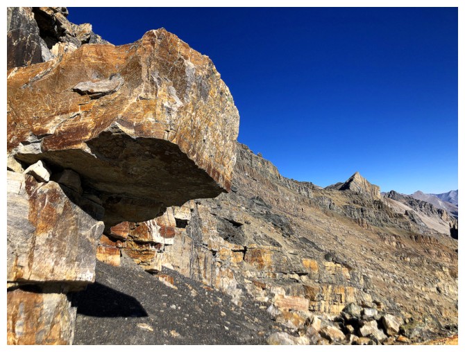
The summit block ahead. Unseen are several drop-offs along the ridge that required downclimbing or circumventing
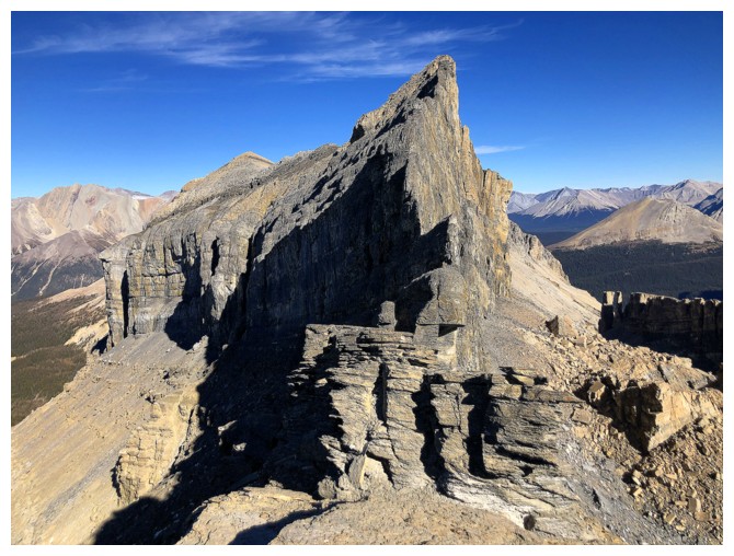
A more complete view of Merlin's awesome east ridge
A more complete view of everything to the east
And to the northeast
Traversing the ridge towards the summit took much longer than anticipated
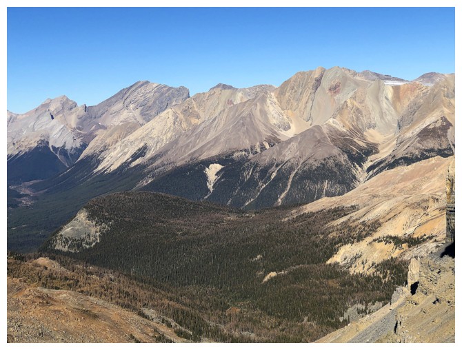
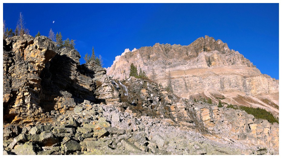
Cataract Peak near the left and of host of unnamed but super inviting peaks to the north
A very unique view of Molar Mountain and Molar Tower at the left. The Willingdons at the right.
Looking back to a necessary elevation loss at the right
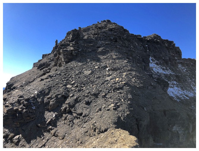
Finally getting close to the summit
Once again, the breath-taking view is making the considerable effort to reach the summit more than worthwhile
Success!
Pano to the east
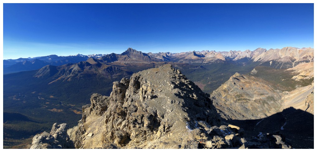
Pano to the north
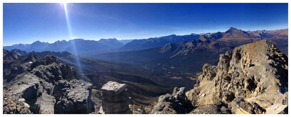
Pano to the west
Unnamed stuff
Mount St. Bride to the right of Douglas
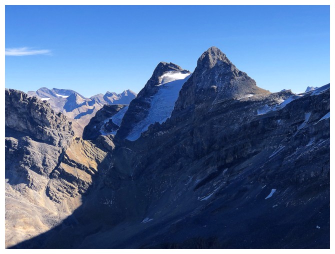
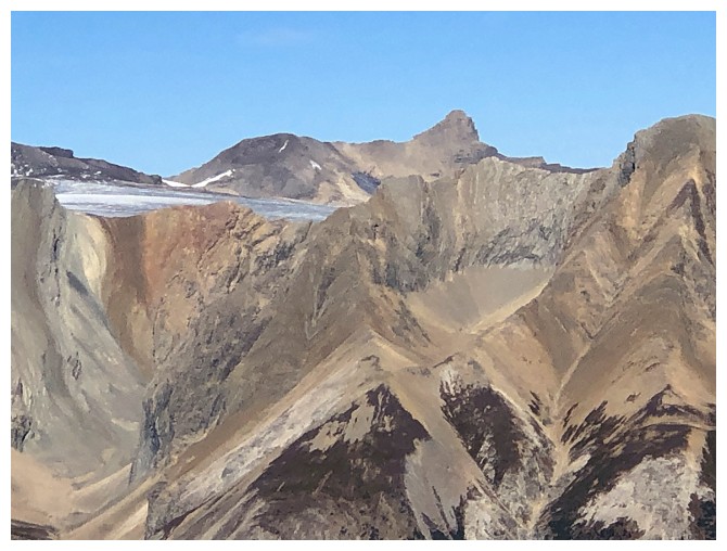
Pika Peak and the glacier between the East and West summits
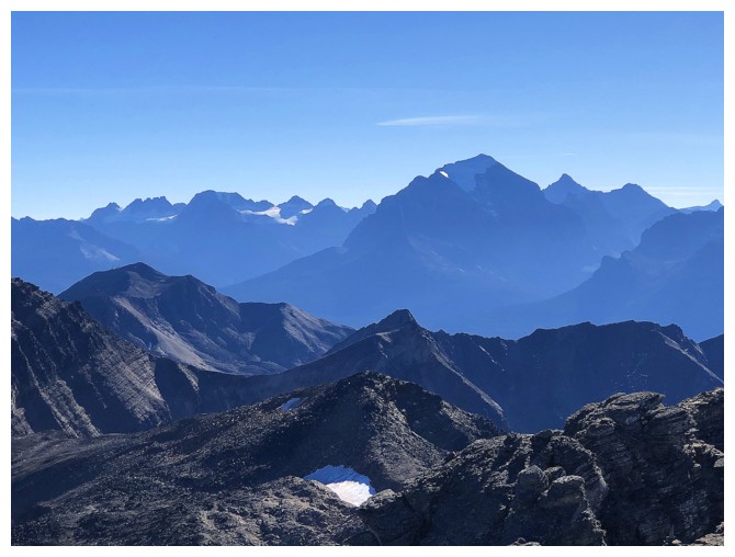
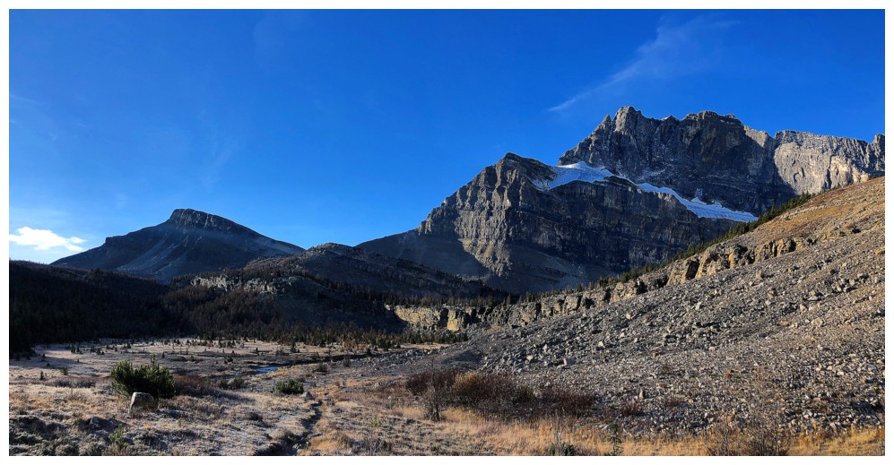
Mount Temple dominates the southwestern horizon
Noseeum Mountain, just left of centre - very cool mountain and a super interesting ascent
Close-up of Cataract Peak
More interesting, unnamed stuff to the northeast
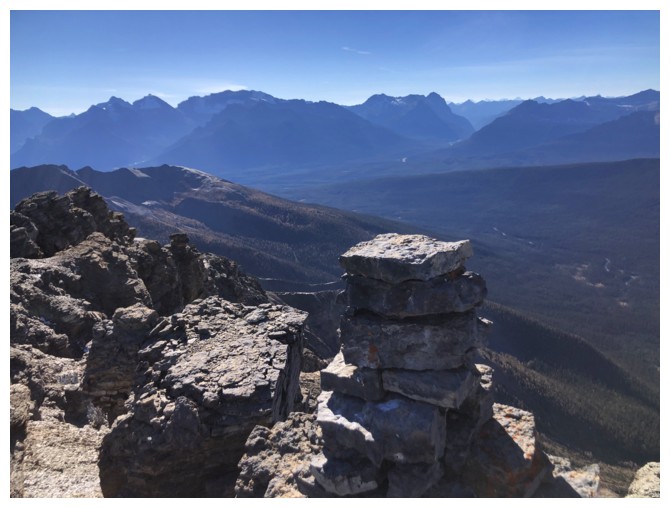
The summit cairn
Heading down
Traversing well below the ridge was awesome, due to all the great rock scenery
Same as above
Same as above
My camera can't get enough of this view
The pinnacle and Douglas
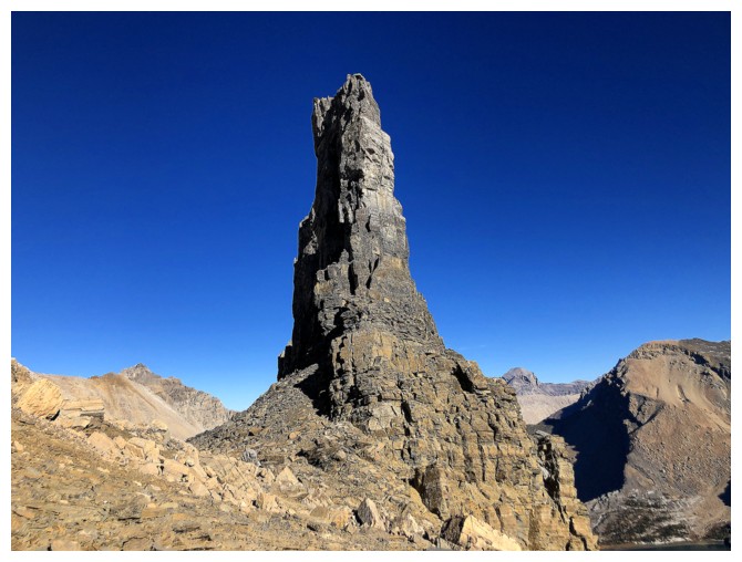
Deja vu - the western-most pinnacle in a line of them
Looking up the ascent route I took earlier
Following Vern and Wietse's alternate descent route
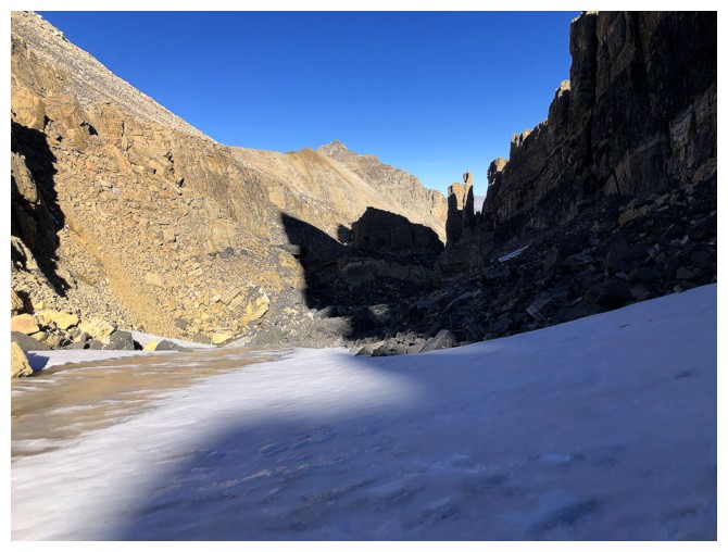
The route goes between the "immense rock wall" and the pinnacles
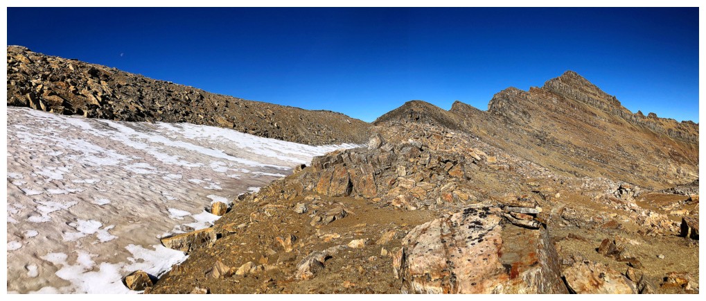
Passing through the mini valley between the two
There is a small glacier here still
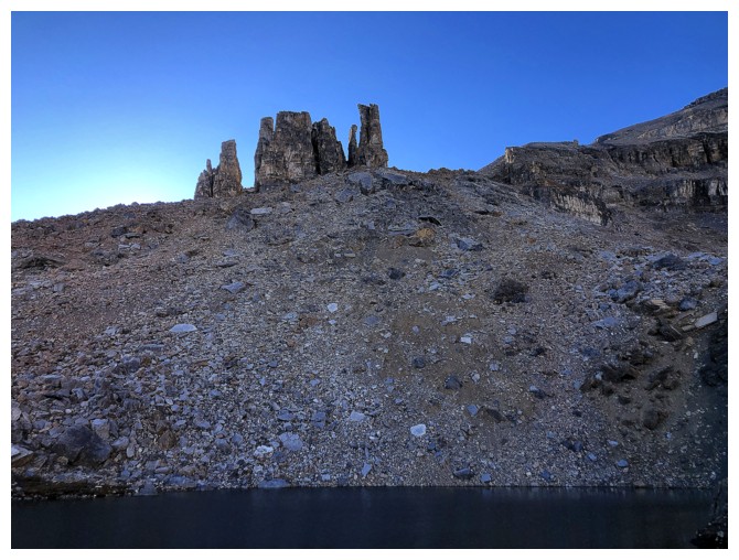
The eastern-most pinnacles
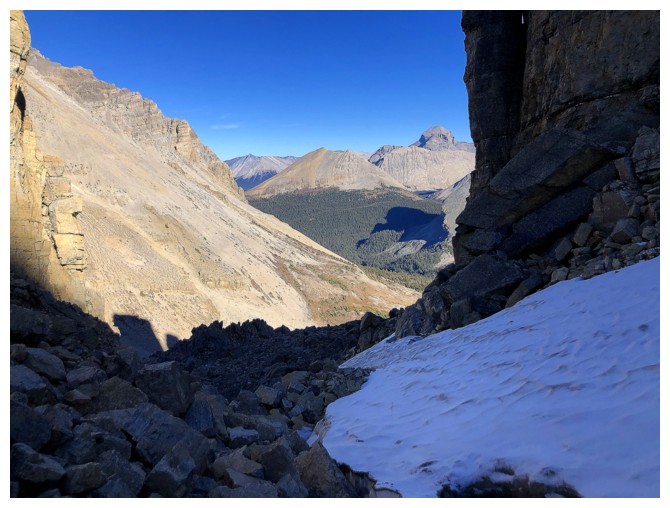
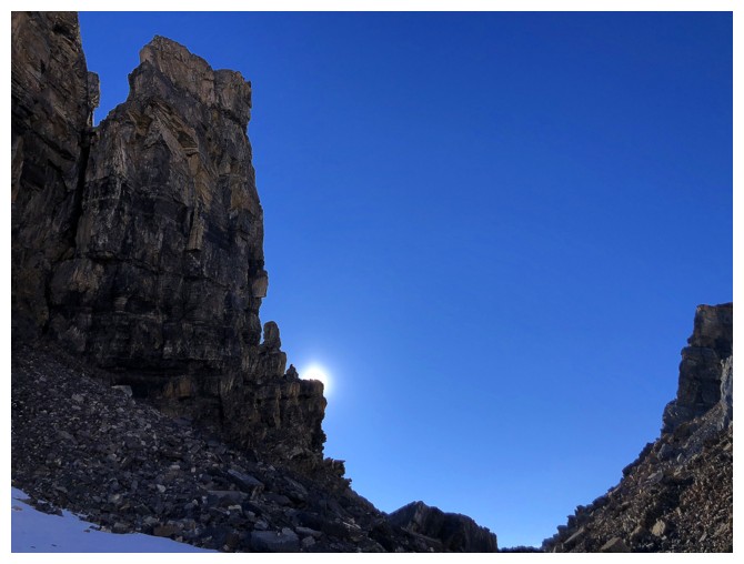
Approaching the steep, rubbly exit
Looking back at the last pinnacles
The Sun is starting to set
Unfortunately, I didn't make it down to the first of the two small tarns below, before the Sun's rays left it
They hadn't left this though. The formation on the right reminds me of Ancient Art - still one of the coolest things I've ever done in the mountains (and would never repeat!)
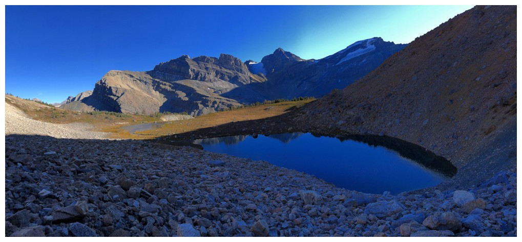
Arriving at the first tarn
The tarn is in the shade but the remainder of the view is still amazing
Looking back to the pinnacles
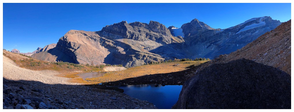
The second tarn is still enjoying some Sun
Same as above
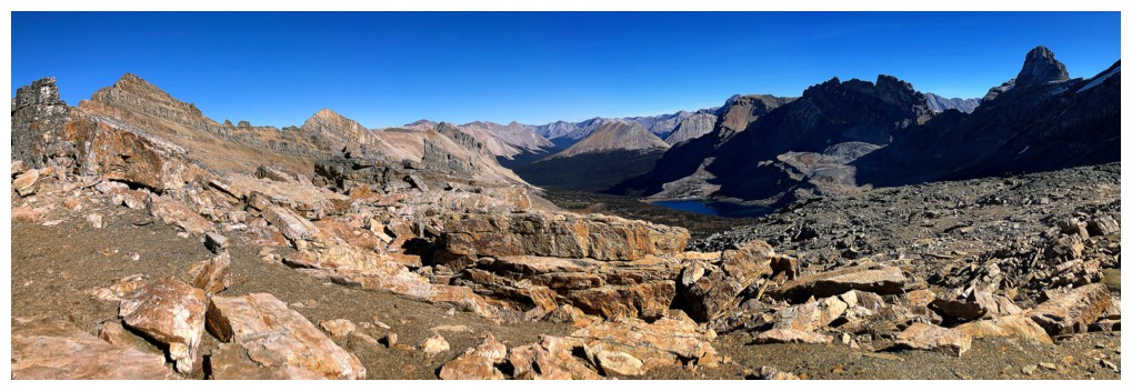
Lots of other interesting terrain to explore along Merlin Ridge
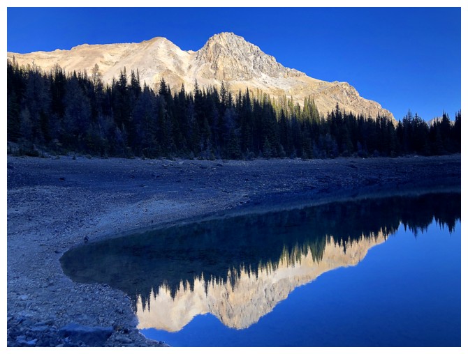
Back at Merlin Lake
Looking back to Merlin Peak (left) and the extending ridge to the east
Castilleja Lake and Mounts Cyclone and Skoki look much better later in the day
Add the east end of Merlin Ridge
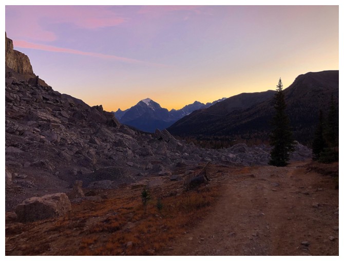
Race
against the setting Sun. I set a goal to make it to Deception Pass
before the Sun ray's left Fossil Mountain. I just made it!
The trail to Deception Pass is well-worn
Skoki Mountain looks more formidable from this angle, but it's reportedly a very easy ascent
Ptarmigan and Jericho late in the day
Deception Pass - it's pretty much downhill from here on
The last of Sun's rays catch the peaks to the east
Back near Boulder Pass
Last of the umpteen lake reflection photos of a most amazing trip
Mount Temple in the distance. The headlamp came out shortly after.
The End
LOG