Ruby Ridge IX
October 30, 2023
Mountain height: 2420 m
Elevation gain:
870 m
Ascent time: 3:35
Descent time: 2:10
Solo scramble.
 Unfortunately, clear
skies and decent air temperatures for the day were negated by a fierce and
biting wind, as I prepared to do a trip in or near Waterton. Driving into the
park, I decided that a conservative objective was probably best. Approximately
a year earlier a new route up Ruby Ridge’s east peak had provided a more than
entertaining experience and so I chose a repeat ascent. However, this time, instead
of veering right and gaining the southeast ridge I would try to follow the
drainage between the two peaks of the mountain.
Unfortunately, clear
skies and decent air temperatures for the day were negated by a fierce and
biting wind, as I prepared to do a trip in or near Waterton. Driving into the
park, I decided that a conservative objective was probably best. Approximately
a year earlier a new route up Ruby Ridge’s east peak had provided a more than
entertaining experience and so I chose a repeat ascent. However, this time, instead
of veering right and gaining the southeast ridge I would try to follow the
drainage between the two peaks of the mountain.
Surprisingly, the
strong wind was noticeably absent as I started the ascent – the Akamina Parkway
often doubles as a wind tunnel! Nevertheless, I was committed to trying a
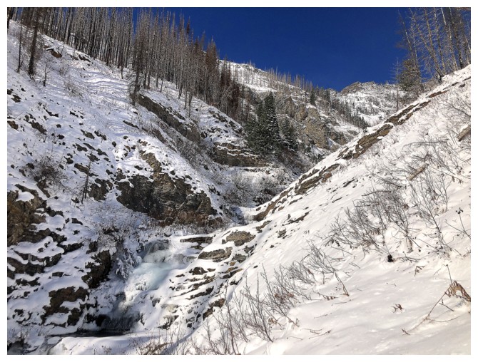
slightly different route up and once a little elevation was gained, I traversed
into the drainage. Unfortunately, it quickly became clear that staying in the
drainage was not a possibility, due to running water and treacherously icy
footing. As such, I followed the waterway, but some distance above it. A few
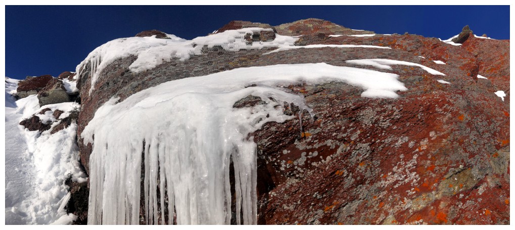
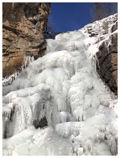
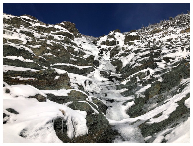
cool ice features were encountered, including a decent sized frozen waterfall early in the trip.
Traversing over
to the colourful southeast ridge was tempting at several points, but I wanted
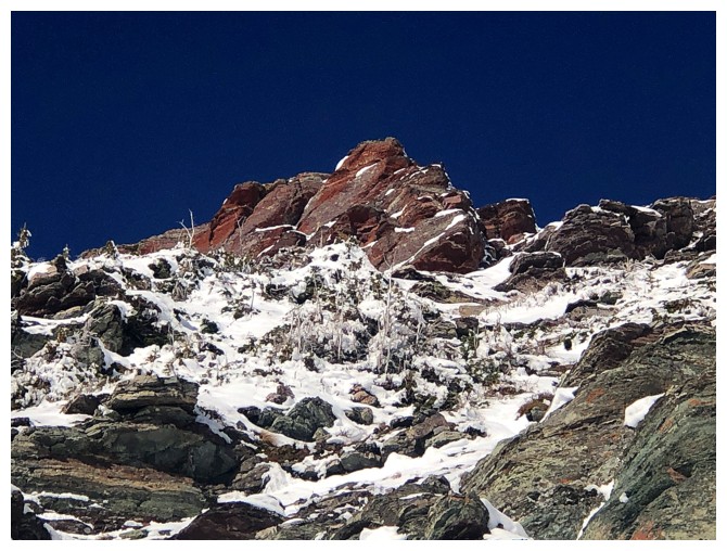
to explore the rock bands of argillite that line the summit ridge from the
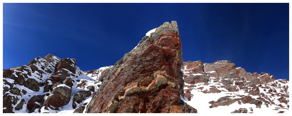
south side and so I stayed near the drainage. Not surprisingly, the striking
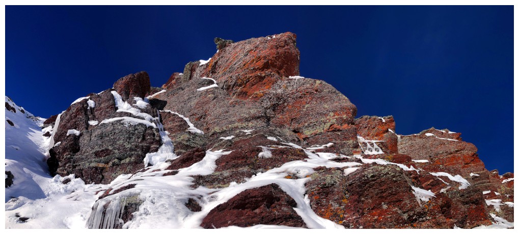
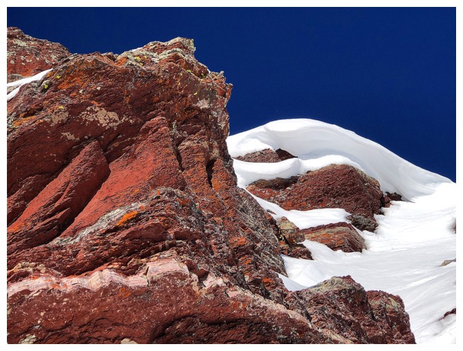
bands of incredibly vibrant red rock were the highlight of the day. I found an
easy route up to the ridge, where the summit was a short distance away.
After a brief
summit stay, I decided to descend the southeast ridge instead of retracing my
route. However, the snow on the ridge turned out to be much deeper than
expected. Once about a third of the total elevation was lost, I traversed back
to my ascent route. Following the footprints you’ve made in the snow going up is
always a treat going down!
Another
fantastic day out on a lowly peak that always delivers!
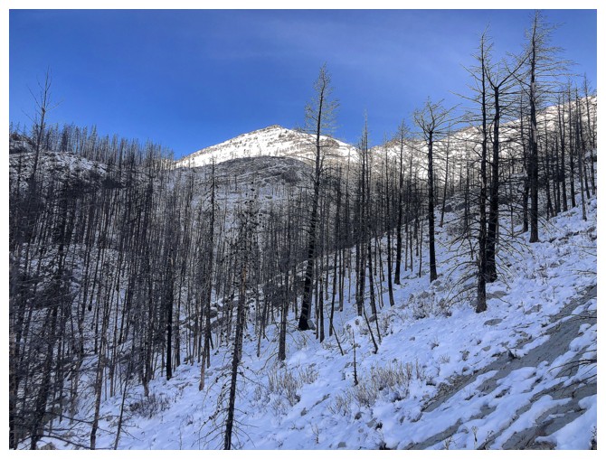
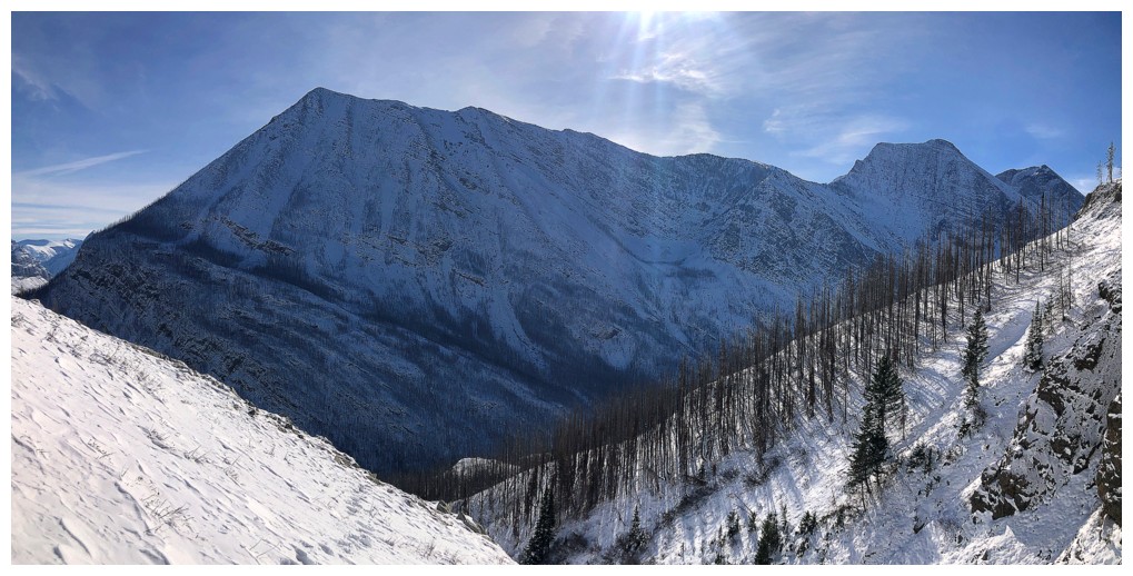
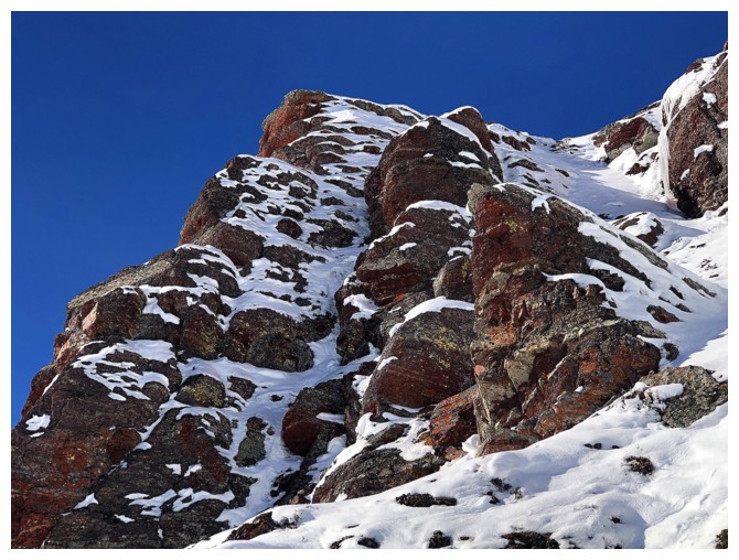
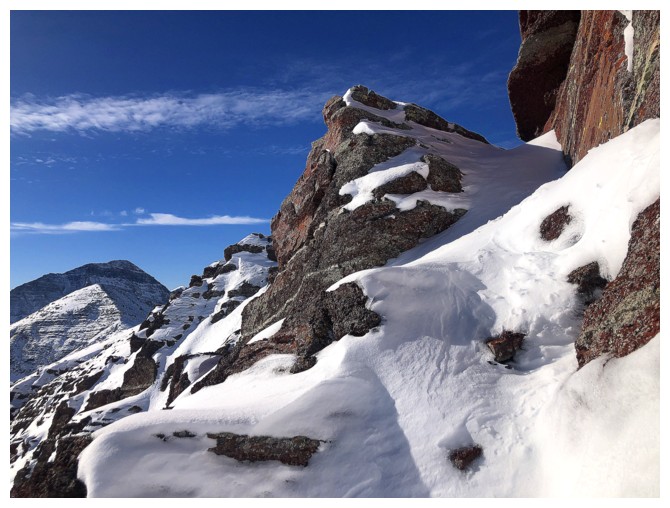
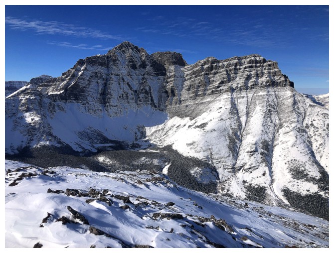
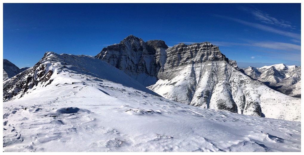
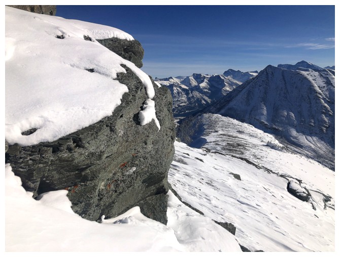
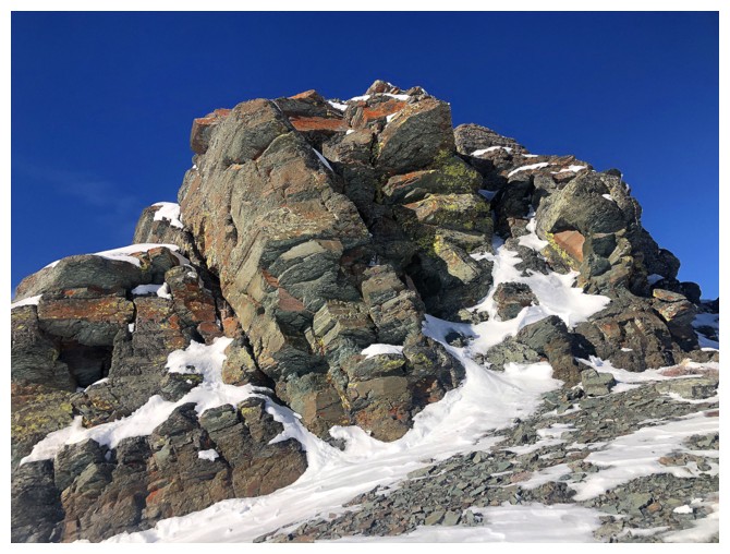
Looking up to the end of the southeast ridge of Ruby's east summit
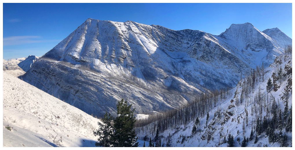
Mount Crandell
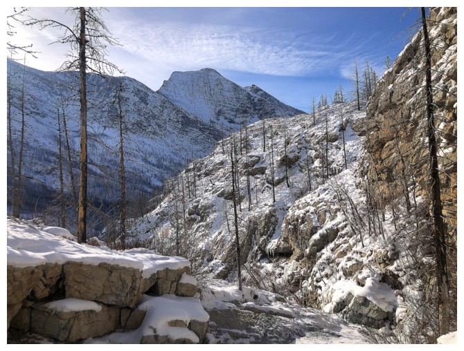
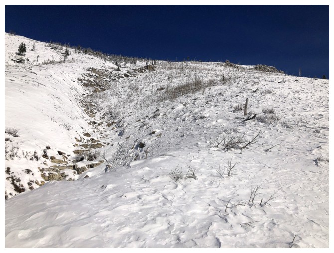
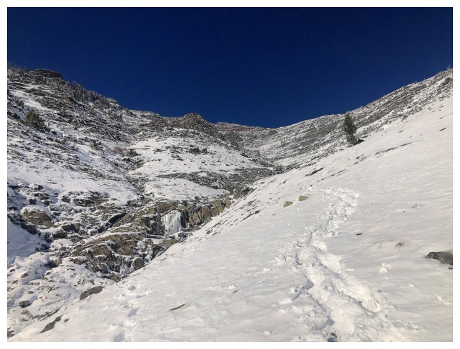
Traversing towards the drainage
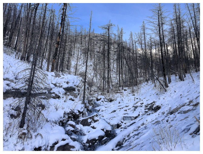
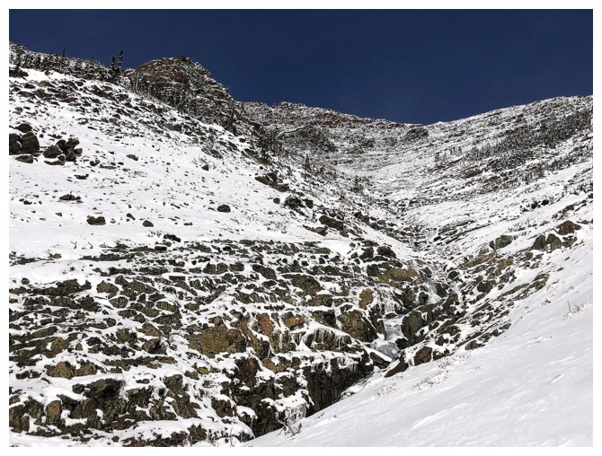
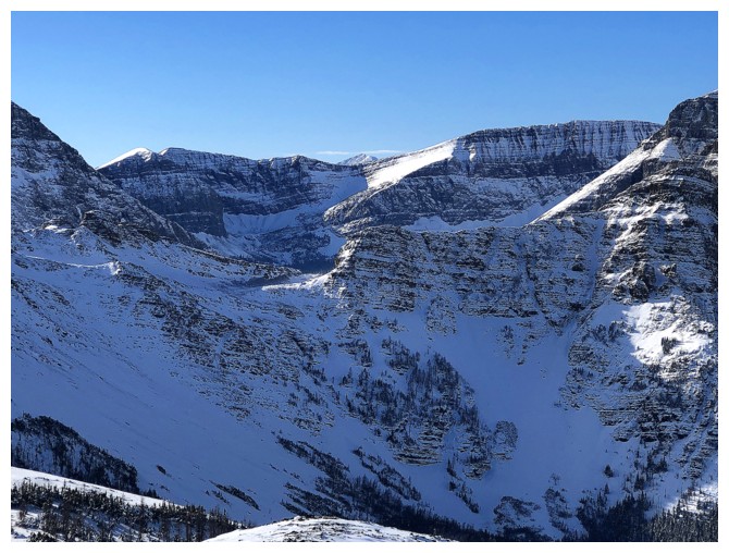
The drainage
The lower part of the drainage had the most interesting terrain
Love the initial signs of winter
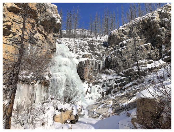
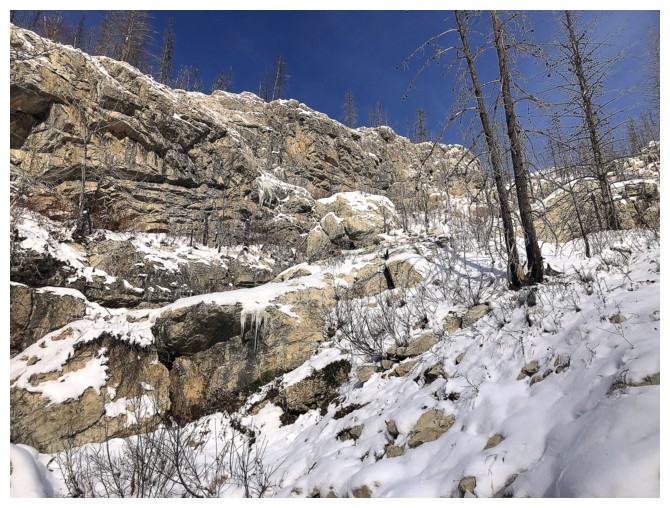
Approaching a small but impressive frozen waterfall
Once fully formed this might make for some relatively easy and fun ice climbing
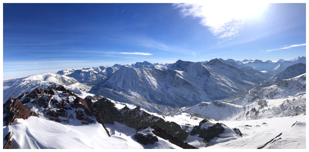
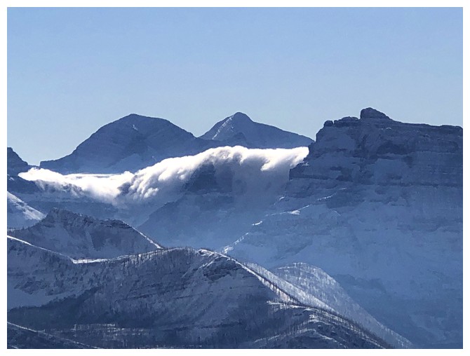
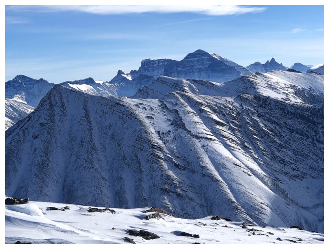
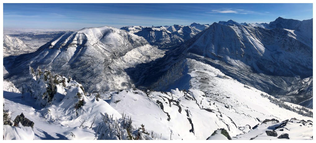
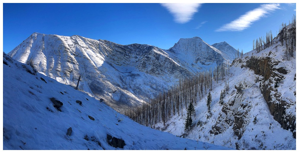
The middle peak of Buchanan Ridge makes an appearance
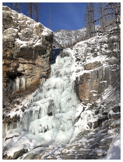
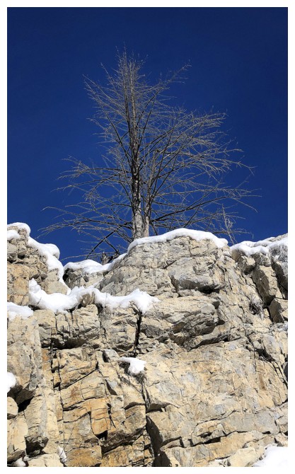
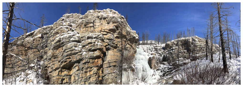
The frozen waterfall and a lone tree nearby
Back near the drainage
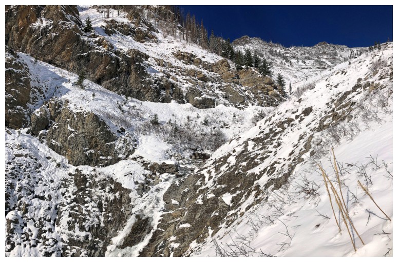
Too sketchy to get into the drainage so I just followed it up, but from a distance
Buchanan Northeast
One of the points where I could have traversed up and over to the southeast ridge
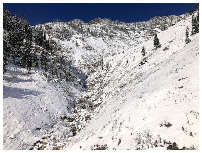
Stayed near the drainage instead
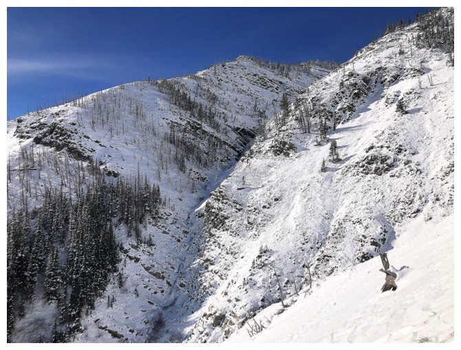
The left fork of the drainage would lead to the south ridge of Ruby's true summit
The route ahead and the summit at the far left
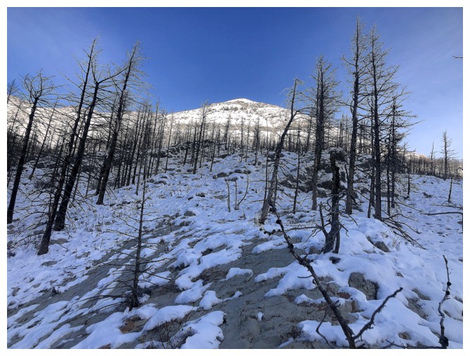
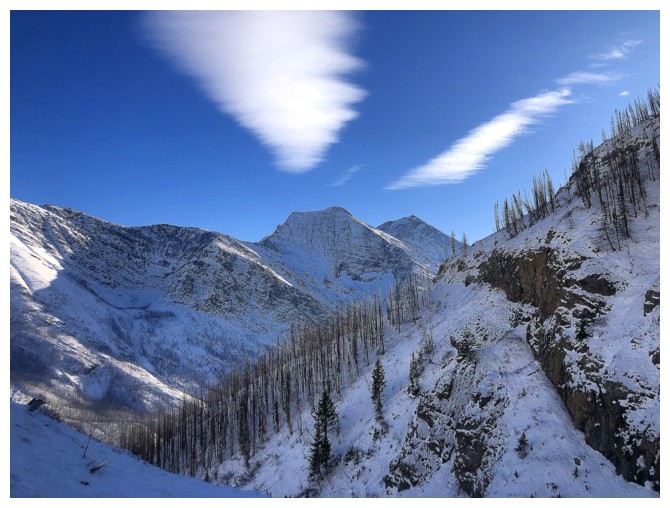
More cool signs of winter
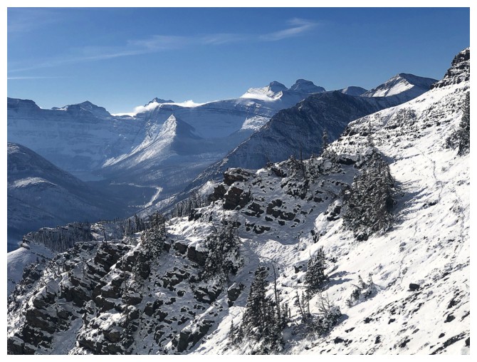
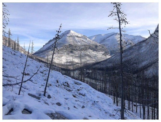
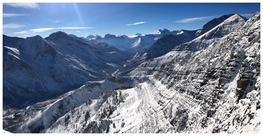
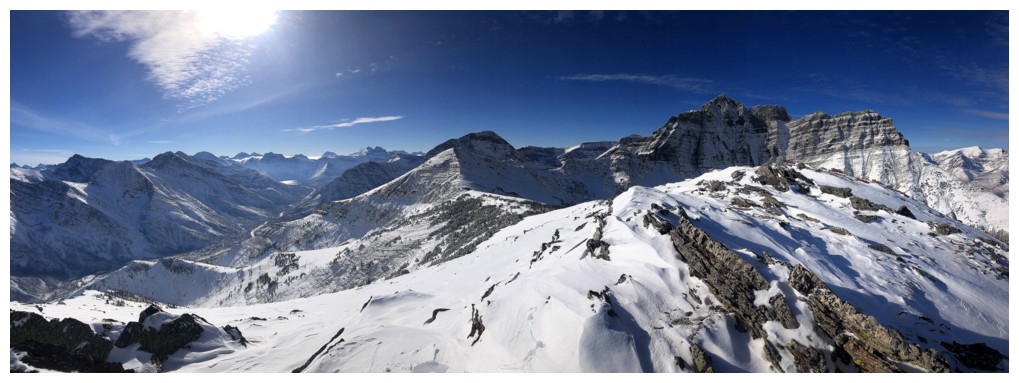
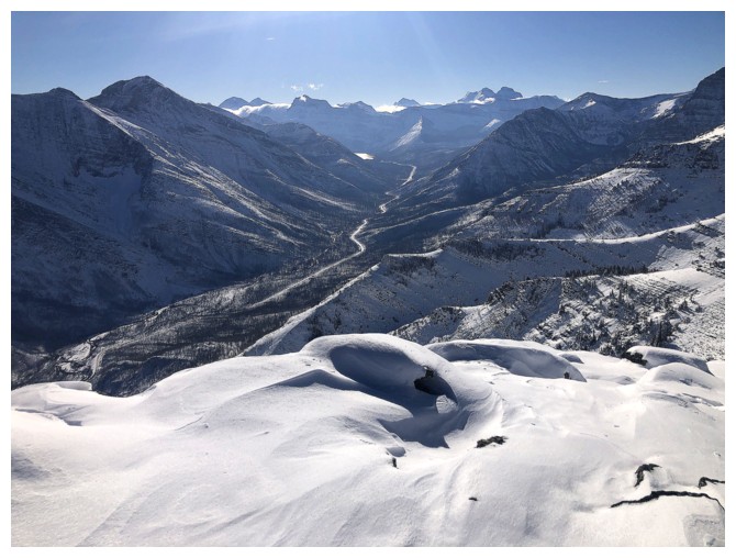
Bigger peaks to the west are starting to appear
Mount Peabody in Montana peaks over Forum Peak in Alberta/B.C.
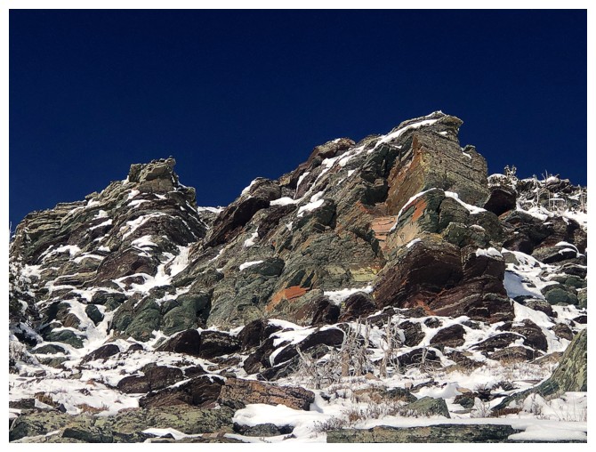
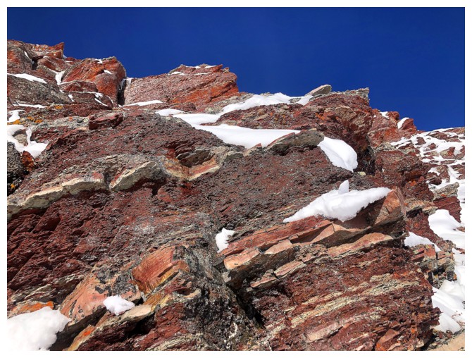
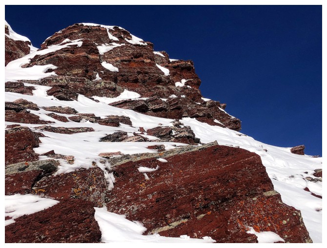
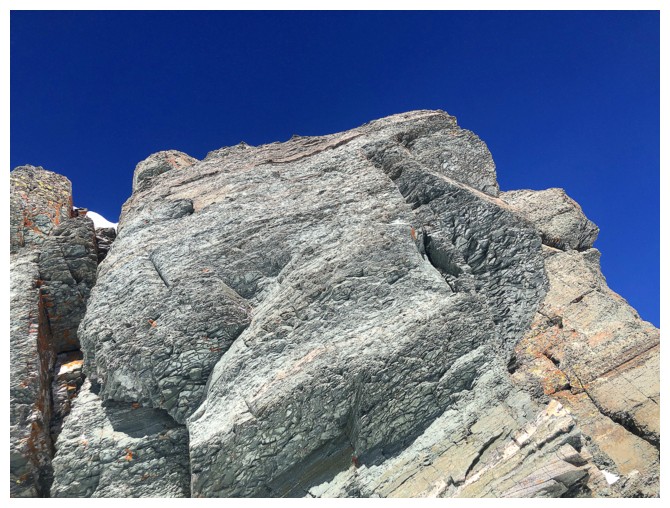
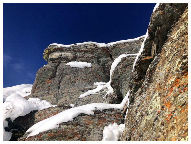
The colourful rock of the upper mountain starts to appear
There's some red argillite magic up ahead
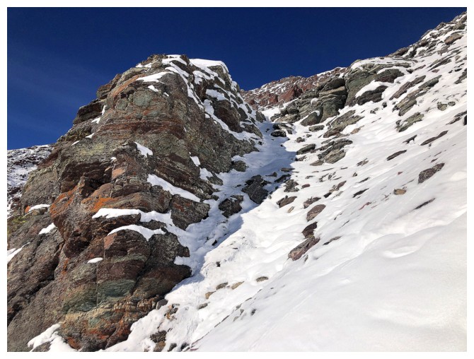
Looking across the increasingly steep face of the mountain
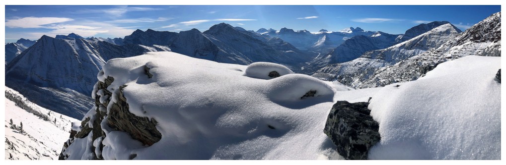
Sweet, snow scenery, Round 1
Round 2
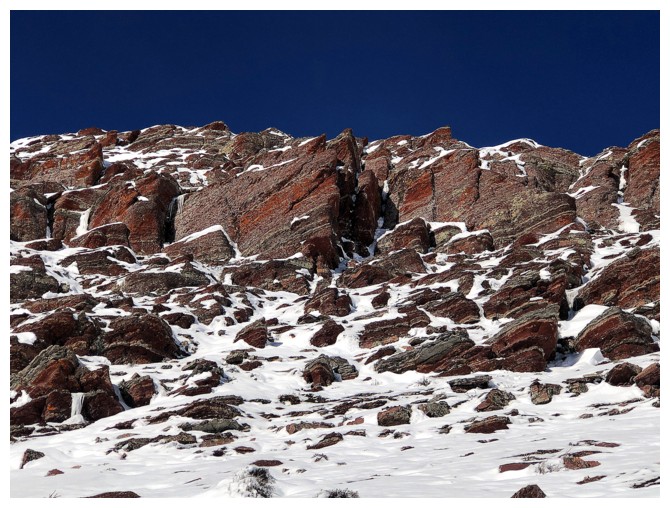
Back to the argillite
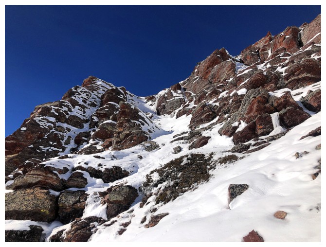
Picked a route alongside the outcrop at the left
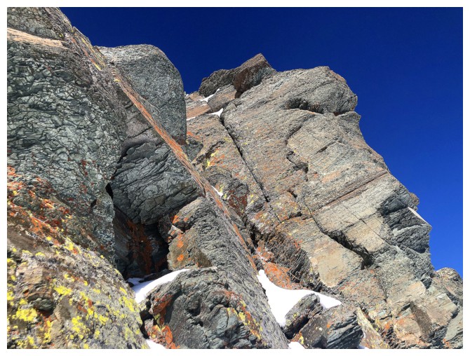
A very beautiful outcrop
Great rock on both sides
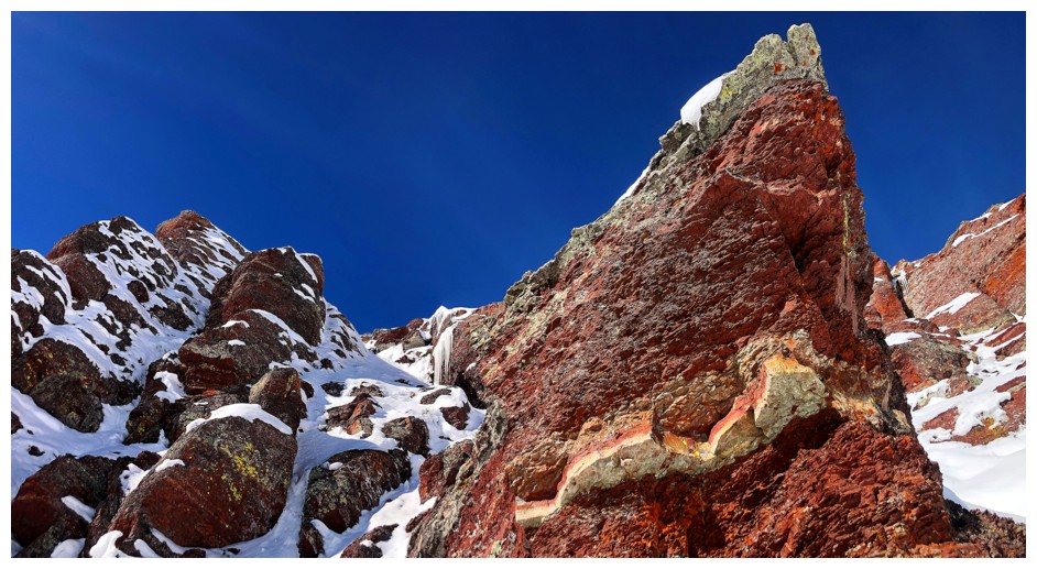
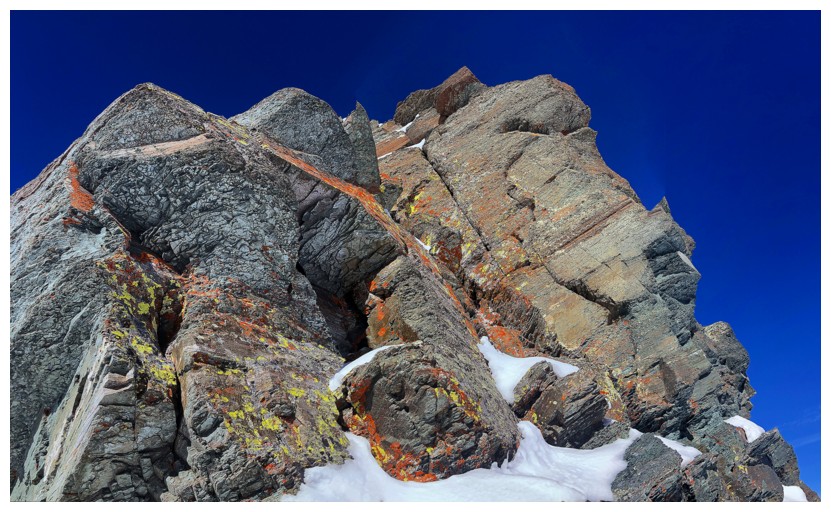
The most striking scene from the upper section
Close-up
Still more to come
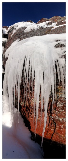
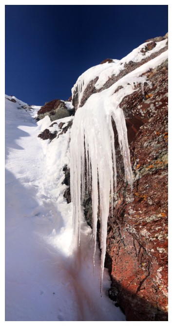
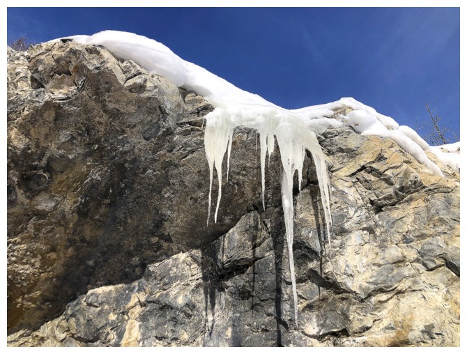
Icicle formations are always one of the highlights of winter
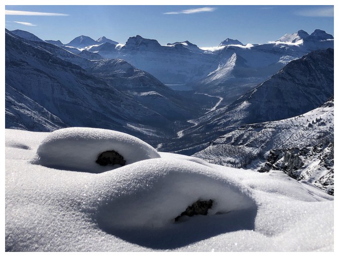
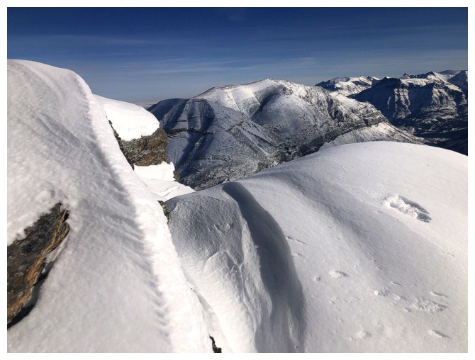
Cornice scenery also fits into that category
Snuck up to the ridge via through the gap near the right
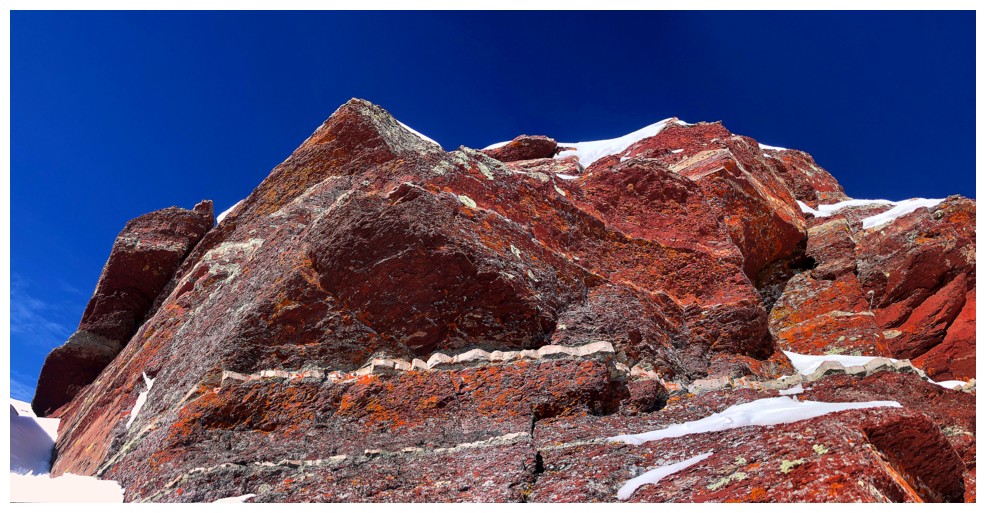
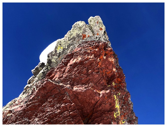
But not before a last red rock encounter
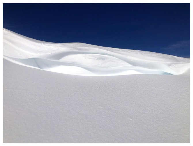
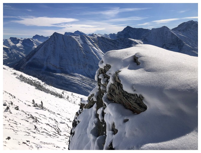
Small, but sweet cornice
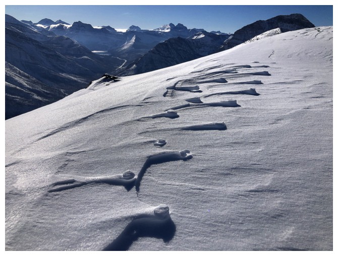
The wind does more than just create cool cornices
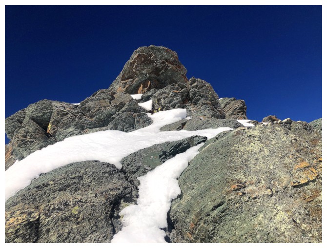
Steps away from the summit
Same as above
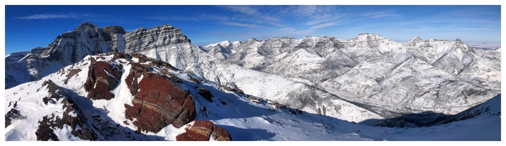
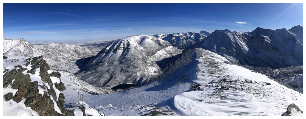
View to the southeast, south, and southwest
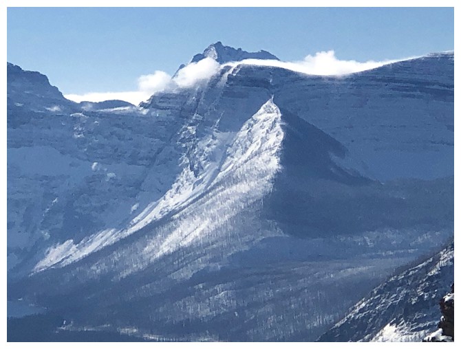
Mount Blakiston
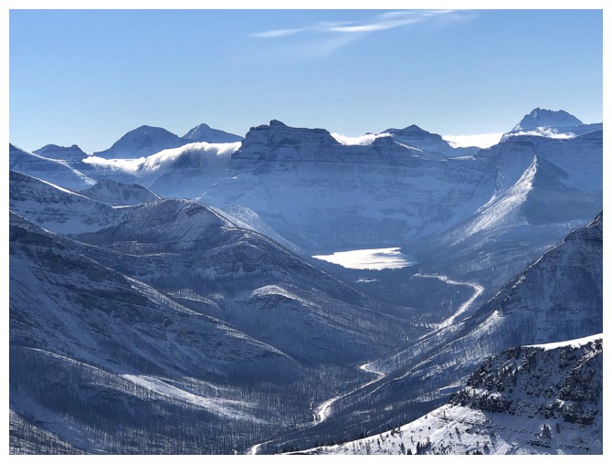
View towards Cameron Lake
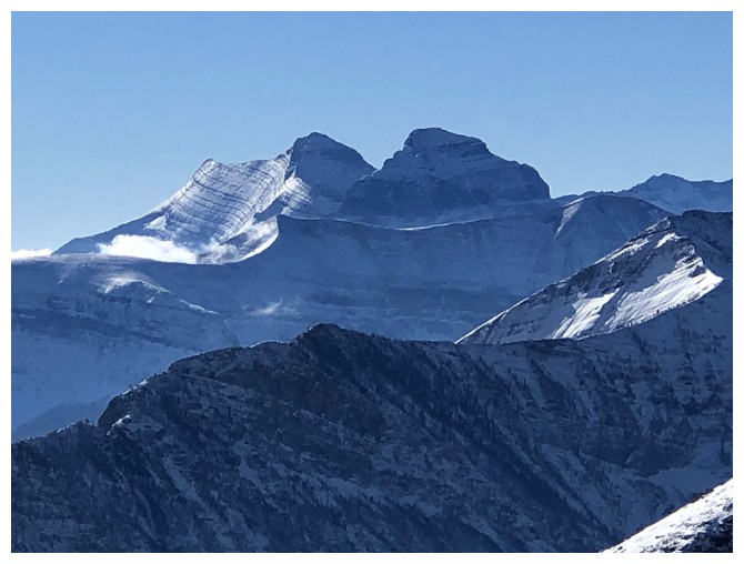
Chapman Peak, Thunderbird Mountain (I think), and Mount Custer
Custer and Cameron Lake
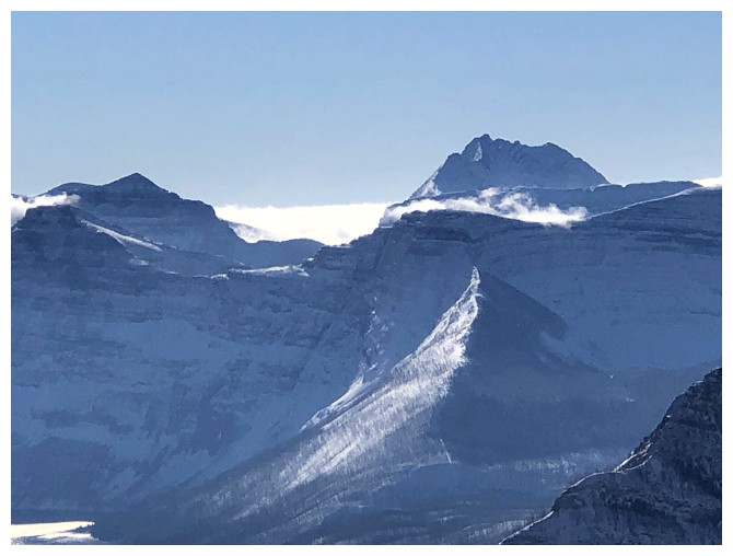
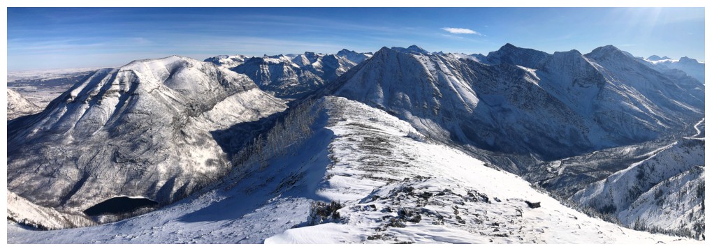
Forum Peak and Peabody again
Kintla and Kinnerly
The minor peak in the foreground (unofficially named "Igneous Peak") has become one of my favourite trips in Waterton
Mount Cleveland
Heading down the southeast ridge
Last look at Blakiston
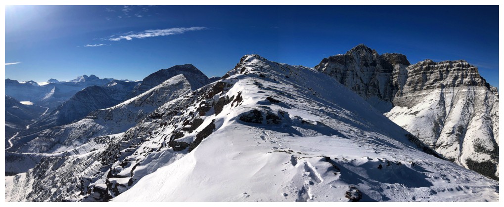
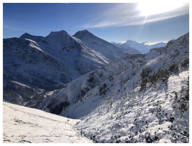
Looking down the generally easy and very scenic southeast ridge
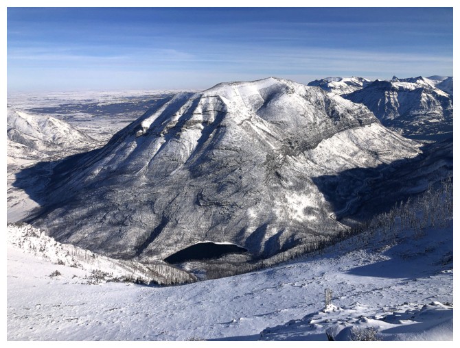
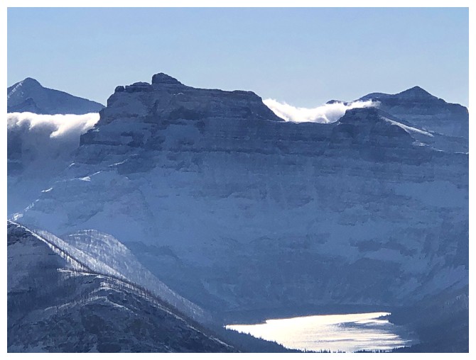
Crandell Lake below Mount Crandell
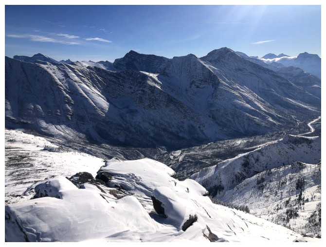
The Buchanans
Dodging a few rock bands to get down the ridge
More beautiful rock to ogle
One of the coolest rock bands on the ridge
There's definitely a face somewhere in the rock at the right
Passing another band
Great views down the ridge
Same as above
The snow became quite deep at this point
But boy was it beautiful!
The last of the bands
Traversing back onto my ascent route
Looking back up the route
The Buchanan's are looking better later in the day
Cool cloud
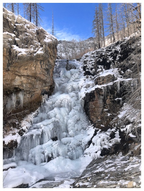
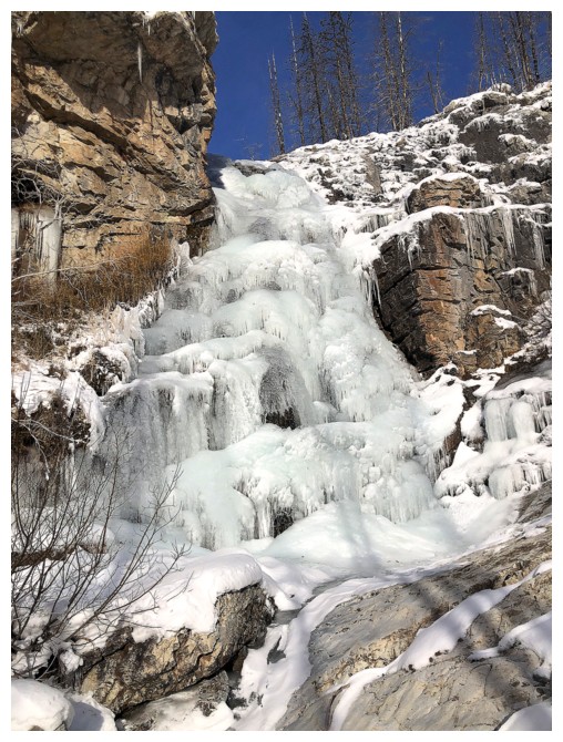
Back at the frozen waterfall
The End
LOG