“Igneous Peak”
Ruby Ridge VI
March 14, 2021
Mountain heights: 2415 m and 2420 m
Total elevation gain: approximately 1200 m
Ascent time to Igneous: 3:50
Traverse time to Ruby: 0:55
Descent
time: 1:40
Solo scramble.
After an amazing 12-hour day on Cloudy Ridge
Junior the day before, I was simply looking to get a few hours of easy exercise
up a known route, on a very familiar mountain. Ruby Ridge checked all the boxes
and so I set out to ascend the straightforward southwest side route to the summit
and then take the direct route back to the start that I had completed a few
months earlier, but under cloudy skies. The weather looked perfect (no clouds
and very little wind) – this was not a day to be indoors even if I was still exhausted
from the previous day.
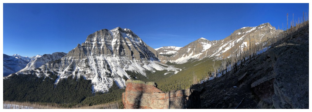
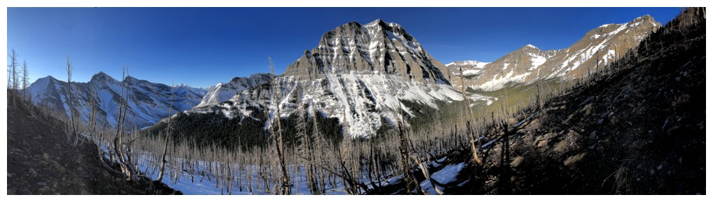
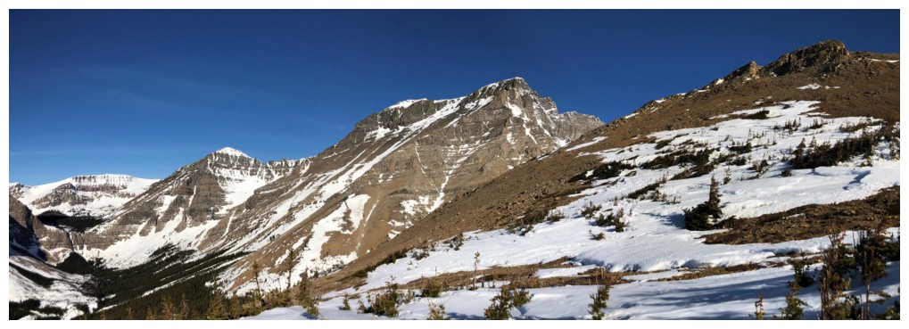
 After following the Lineham Falls trail for
about 1.8 km, I turned upslope and headed straight towards the summit. Crampons
and an axe ice were welcome here, the snow rock-hard and the grade relentlessly
steep. Views of Mount Lineham and the surrounding peaks were pretty darn
sweet and only improved with each metre of elevation gained.
After following the Lineham Falls trail for
about 1.8 km, I turned upslope and headed straight towards the summit. Crampons
and an axe ice were welcome here, the snow rock-hard and the grade relentlessly
steep. Views of Mount Lineham and the surrounding peaks were pretty darn
sweet and only improved with each metre of elevation gained.
About halfway up I decided that running up to
the top and then down again would be a waste of perhaps the most perfect
weather day I had experienced this season. Instead, I decided to check out the
col between lowly Ruby Ridge (2420 m) and statuesque Mount Blakiston (2910 m), recalling from a previous trip that
there appeared to be some interesting rock in that general area (odd to
remember that fact when less than 24 hours earlier I couldn’t remember
repeating an entire ascent of Cloudy Ridge Junior!!).
 Thanks to the stellar weather (more
specifically the direction I was traveling in relation to the Sun) and a
stunning variety of “interesting” rock, this little detour quickly turned into one
of my favourite of all time. Yet again, my abnormally long ascent time was
due more to the fact that I couldn’t take more than five steps without bumping into
something new and awe-inspiring (and of course I had to take umpteen photos of
every scene!).
Thanks to the stellar weather (more
specifically the direction I was traveling in relation to the Sun) and a
stunning variety of “interesting” rock, this little detour quickly turned into one
of my favourite of all time. Yet again, my abnormally long ascent time was
due more to the fact that I couldn’t take more than five steps without bumping into
something new and awe-inspiring (and of course I had to take umpteen photos of
every scene!).
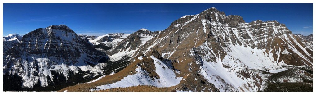
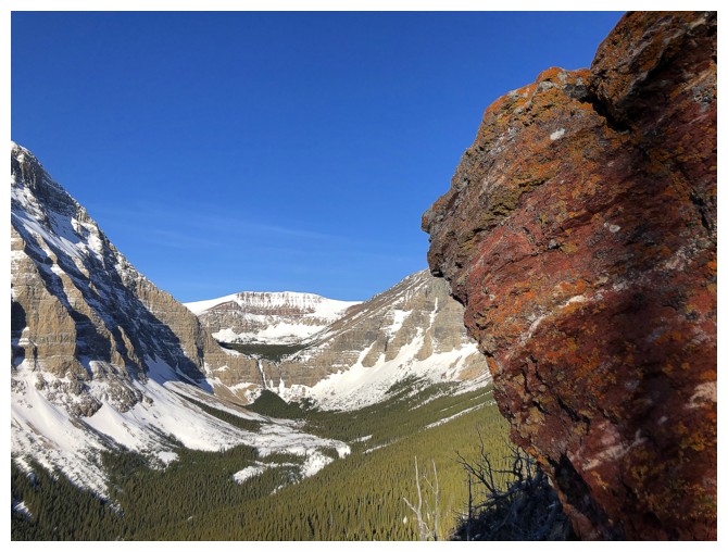
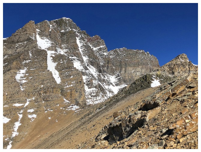
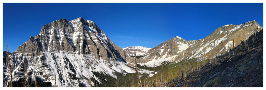
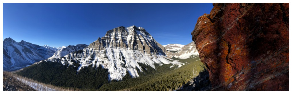
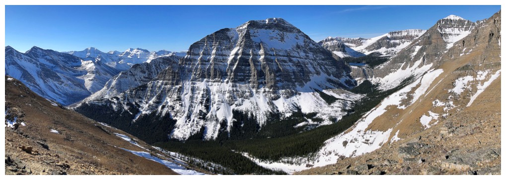
Reaching the col revealed not only a terrific
view of the familiar peaks to the east (Galwey, Dungarvan, Cloudy Ridge), but
also two significant highpoints between the col and the awe-inspiring southeast
face of Mount Blakiston. The first, guarded by steep walls on the southeast
facing side, was going to require a fair elevation loss to find a weakness in
those walls. Initially, I decided against making an attempt, fatigue starting
to set in. However, as stated, the weather could not have been better, and I
probably would have kicked myself later for not at least trying.
Besides, what seemed like 100 m of
elevation loss but was probably closer to 50 m, the ascent was easy and of
course led to a wonderful summit view. Throughout, I swore to myself that I
would not to go to the other highpoint, as I had to drive back to Calgary that same
day, and I had already passed my "starting making your way back" time.
Starting down, my feet and
legs were suddenly taking me in the wrong direction - towards the higher summit I
had vowed not to attempt. I should know myself better by now!
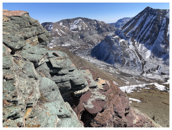
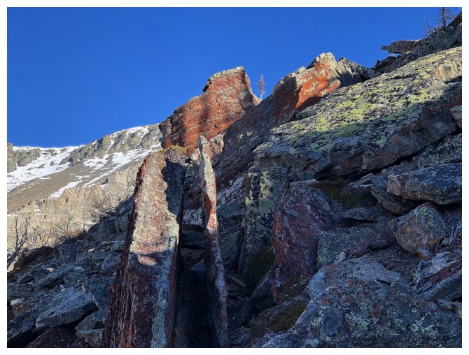
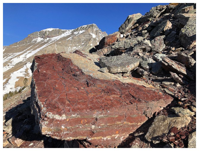
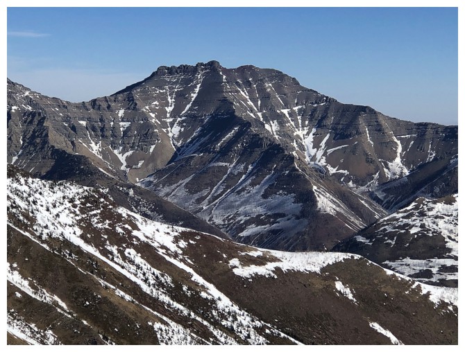
The higher summit was not too far away but
more importantly stood alone, proudly displaying its stunningly beautiful
layers of colourful rock. Erosion had claimed these layers from the summit I
had just visited. Along with a big section of the descent, scrambling up to
this summit was clearly the highlight of the day – in a day that had so many
highlights.
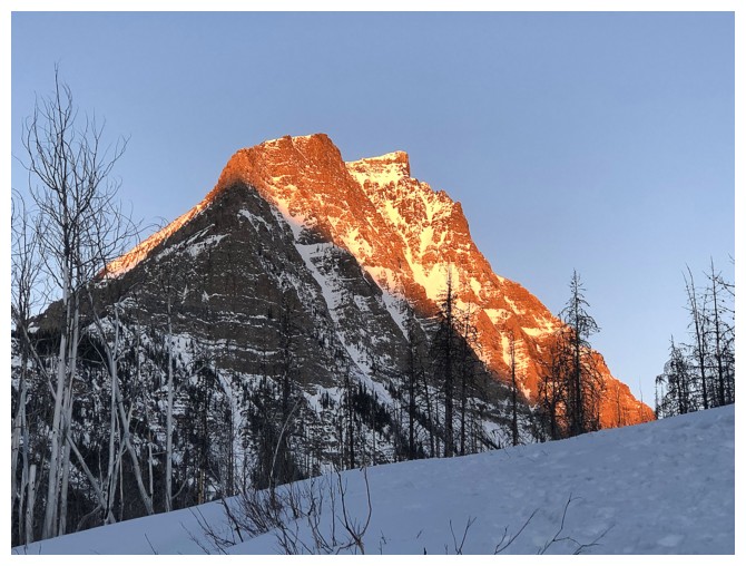
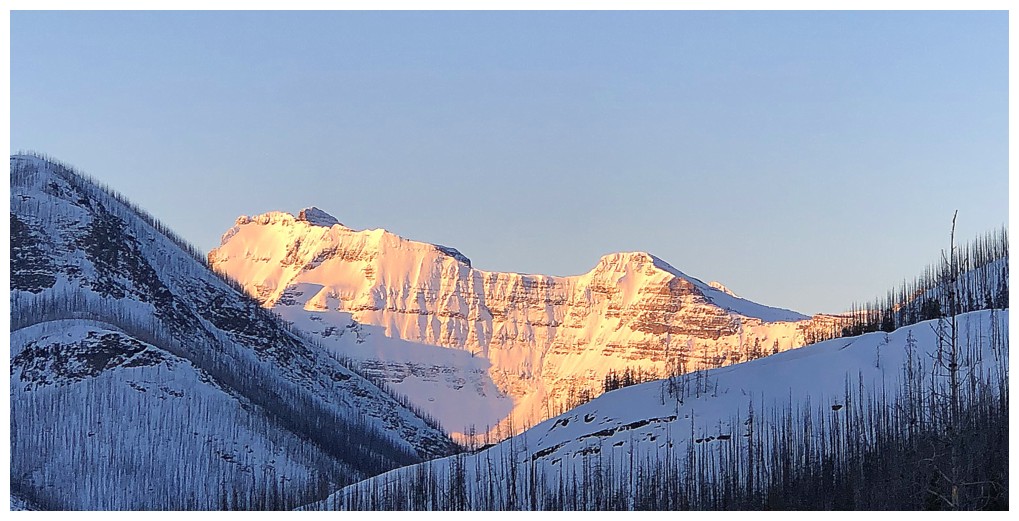
 Though severely eclipsed by its next-door
neighbour, Mount Blakiston, in stature this summit rivalled that of Ruby Ridge.
That and given the considerable effort required to make it to the top I thought
an unofficial title was in order. My first thought was “Ruby Peak” but because
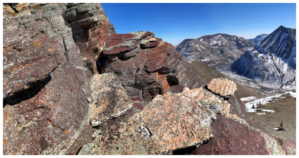
of the gorgeous band of igneous rock it sits upon I decided to go with “Igneous
Peak”.
Though severely eclipsed by its next-door
neighbour, Mount Blakiston, in stature this summit rivalled that of Ruby Ridge.
That and given the considerable effort required to make it to the top I thought
an unofficial title was in order. My first thought was “Ruby Peak” but because
of the gorgeous band of igneous rock it sits upon I decided to go with “Igneous
Peak”.
Decision time again. Right below me lay a
super tempting snow gully that would lead easily back to the Lineham Falls
trail. However, I had that alternate descent route off the summit of Ruby on
the brain and try as I might that pesky voice was not going to be denied. On to
Ruby!
I did manage to avoid unnecessary elevation
gains and losses by staying on the left side of the ridge proper – a snowy and
therefore scenic route in itself. From the summit of Ruby Ridge, I snapped maybe one or
two photos and then started down, excited to see some of the coolest rock on
the mountain, down it’s south ridge. That rock did not disappoint in the least,
especially with clear skies above. And since en route I had decided stay in
Waterton for the night and then drive back to Calgary super early in the
morning, I had plenty of time to enjoy every rock and every vibrant colour!
Even with extra time I was not able to fully
explore the ridge and will return someday to do so. The day ended on beautiful
snowy terrain, still under perfectly clear skies.
Of my six visits to Ruby Ridge, this one was
definitely the most enjoyable trip, courtesy of the amazing weather and the
addition of “Igneous Peak”, a stunning little mountain that will likely see me again.
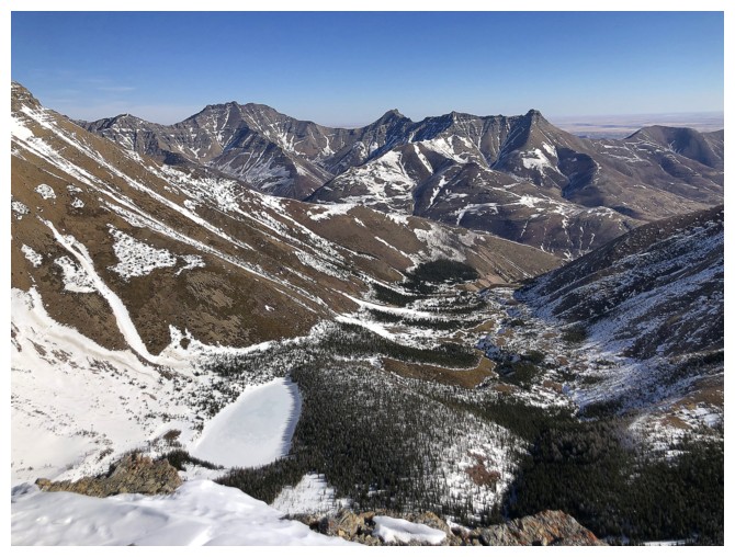
The first of many views (and photos!) of Mount Lineham
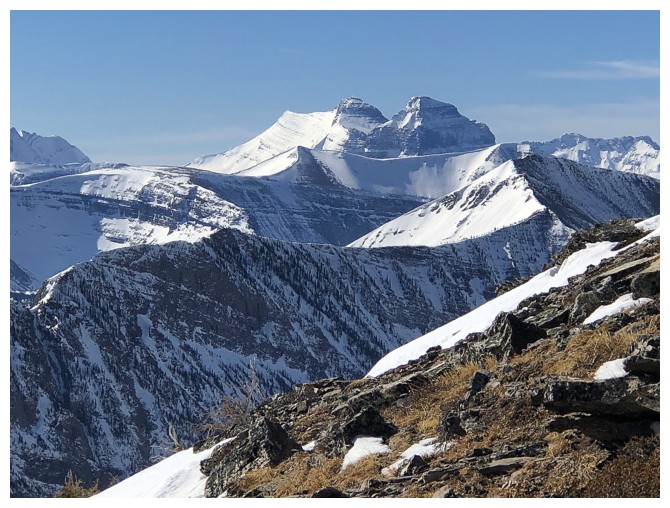
Mount Custer (left ) and Forum Peak. One in the U.S., the other in Canada.
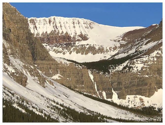
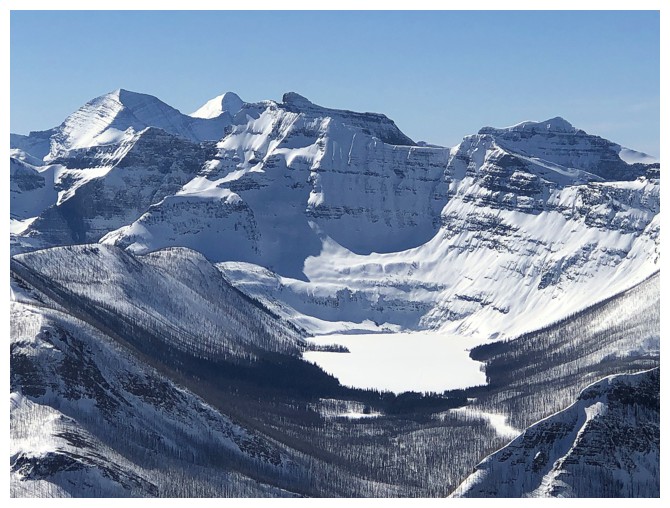
Frozen Lineham Falls below an outlier of Mount Hawkins - part of the deservedly popular Blakiston Horseshoe route
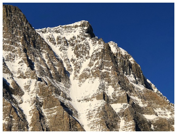
Close-up of the scary east side of Lineham
Lineham and part of Mount Hawkins at the right
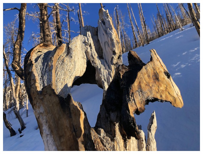
Interesting casualty of the Kenow fire. I thought the part at the right looks like a horse's head.
Lineham and the surrounding mountains are going to get lots of photo attention throughout
Yes they are!
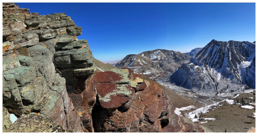
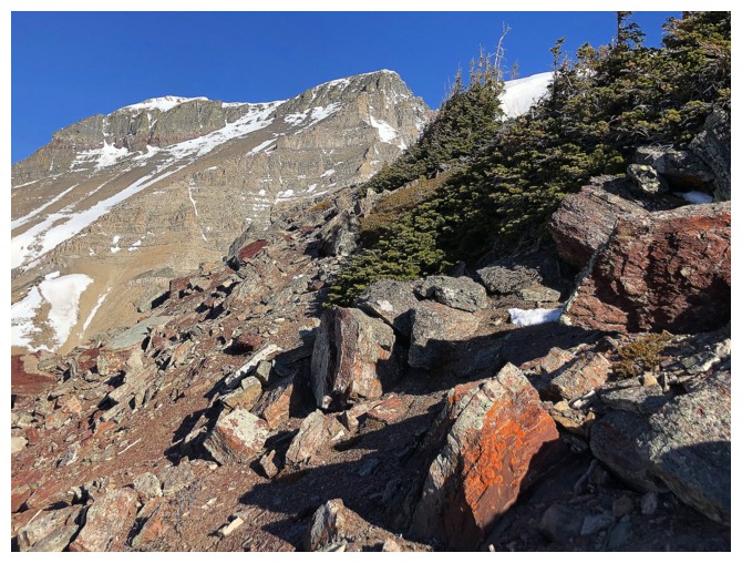
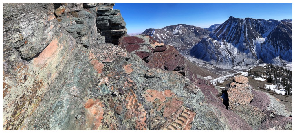
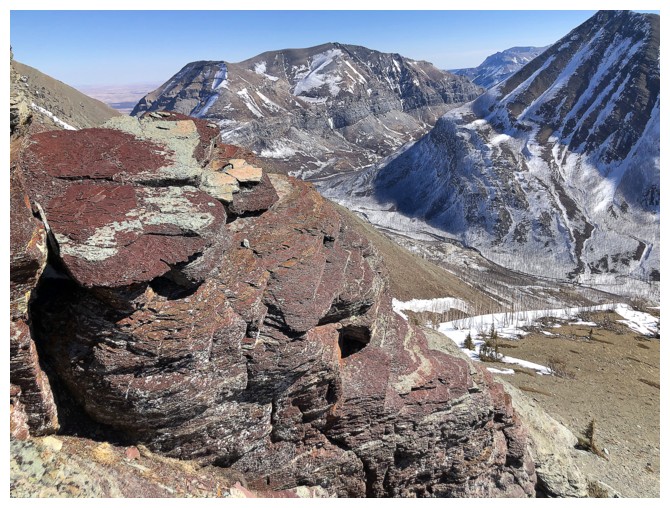
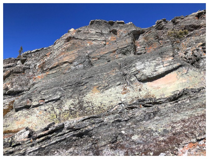
Starting to see some red argillite
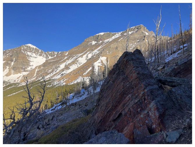
Still early in the day and the Sun has yet to reach this chunk of glorious red rock!
This cool combination of rock layers was one of the highlights early in the day
A huge chunk of ripple rock
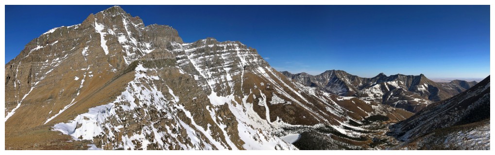
Mount Blakiston (as well as the red argillite) will soon be the centre of attention for a long time period
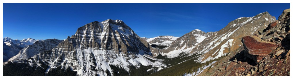
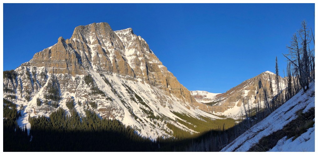
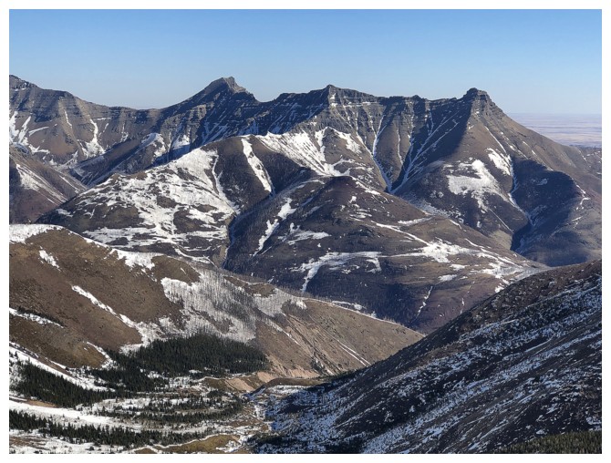
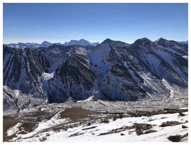
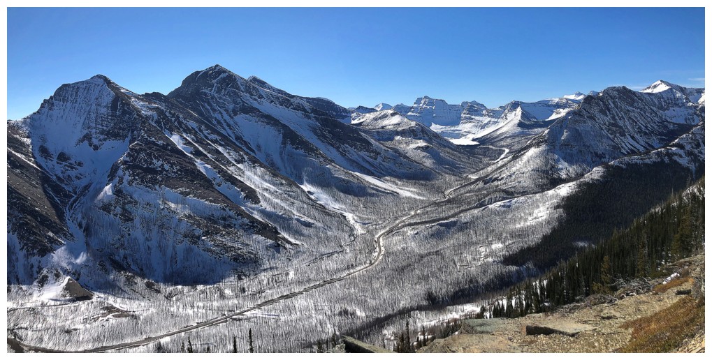
Much of the Blakiston horseshoe can be seen here: up Blakiston's gentle
west side, followed by a high-level traverse to Hawkins, then to
Lineham and down Lineham's easy west side (not visible here).
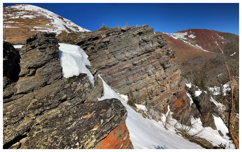
There is not a huge amount of red argillite on this side of the mountain, but certainly enough to get your attention
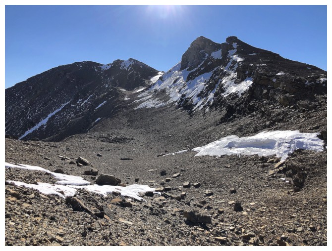
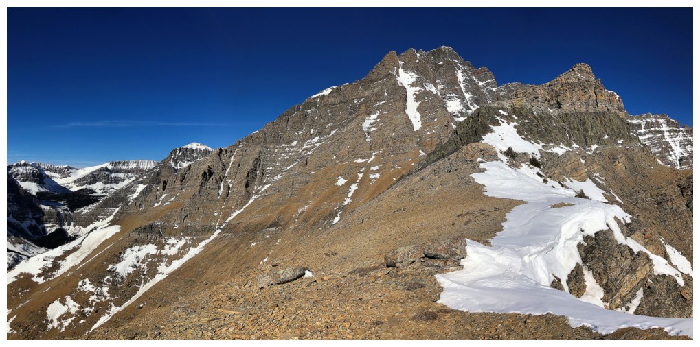
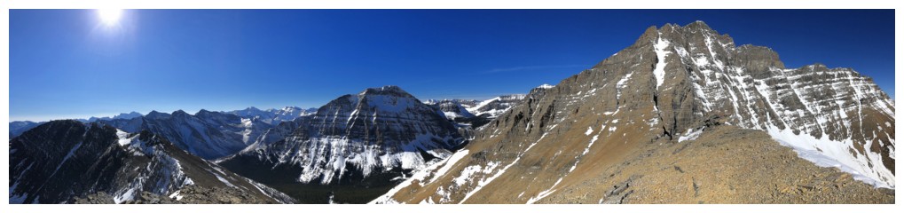
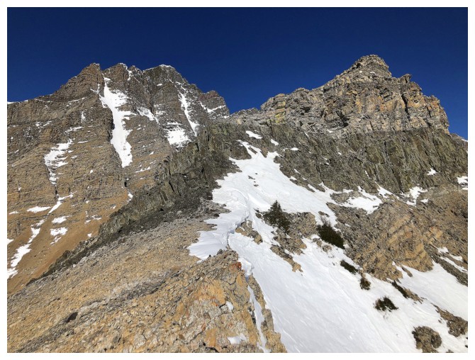
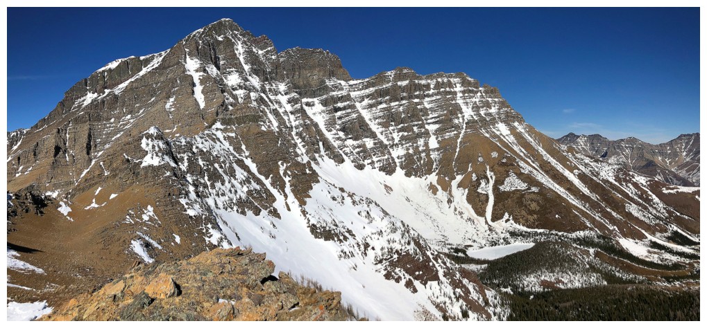
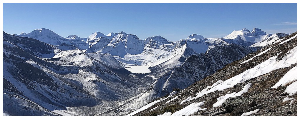
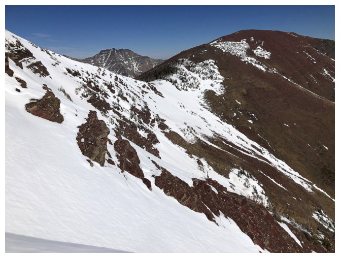
The route ahead. I went towards Blakiston and then over the shoulder to the Ruby/Blakiston col.
It ain't red argillite, but it ain't Whistling Dixie either!
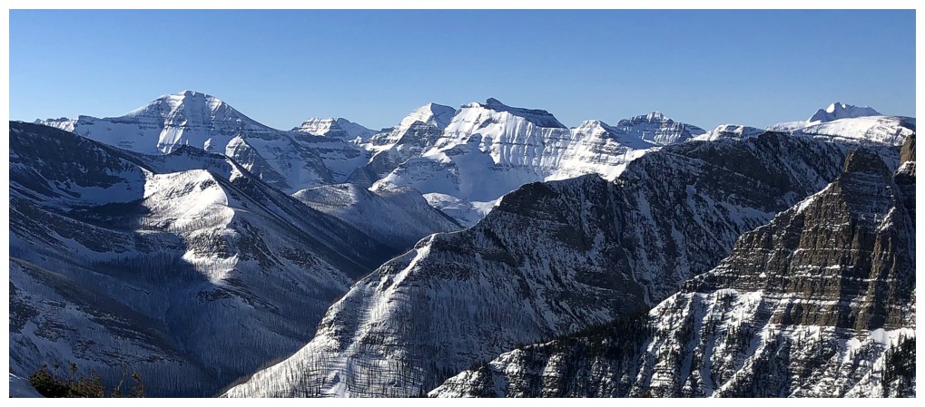
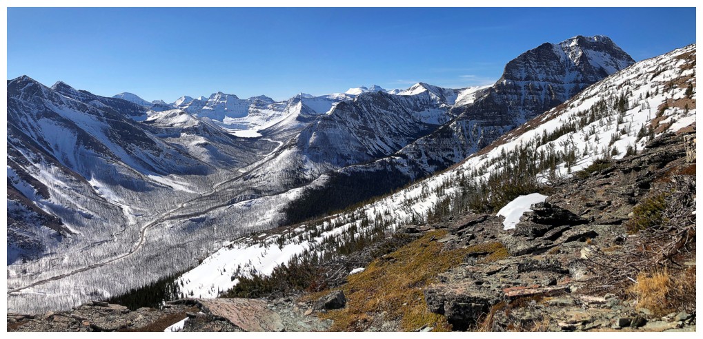
The ever-improving view to the west features many mountains in Glacier National Park, Montana
The ever-improving view in front of me features only Mount Blakiston in Waterton National Park, Alberta!
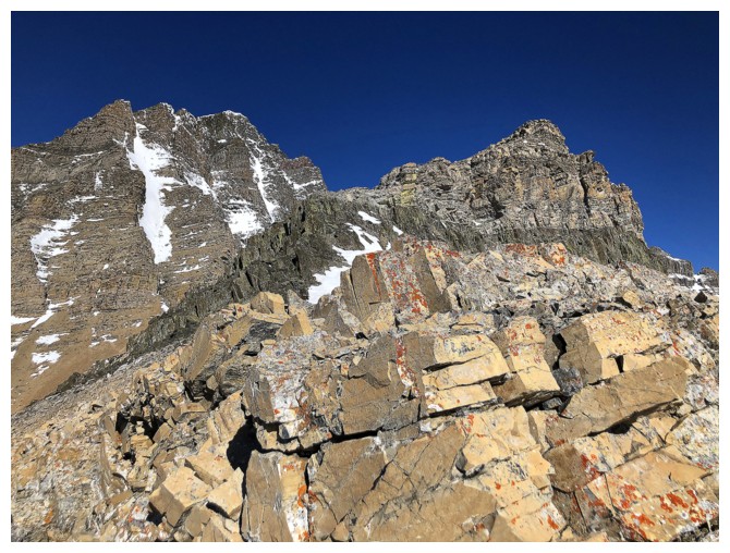
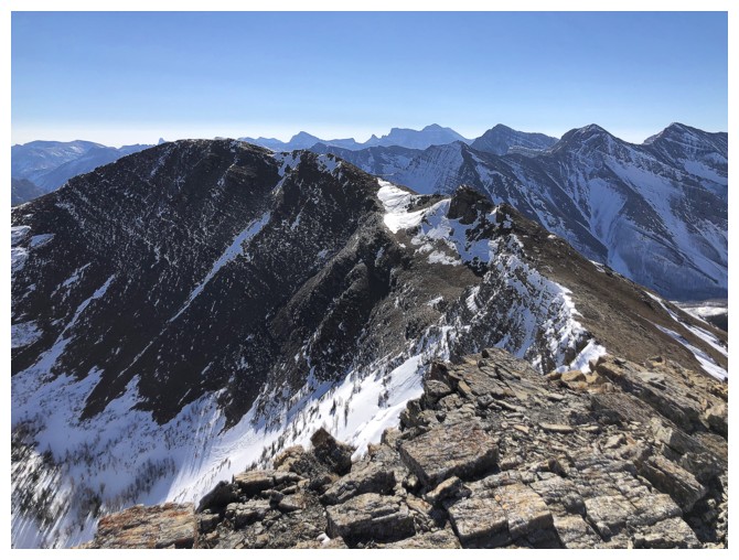
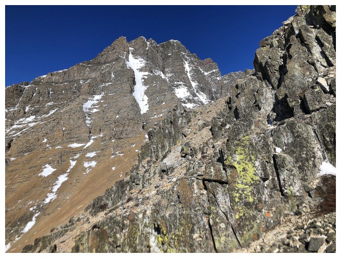
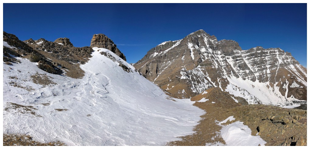
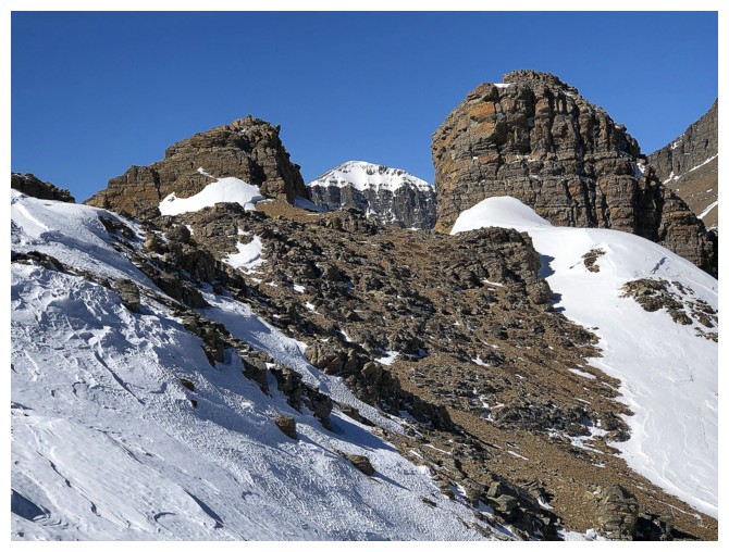
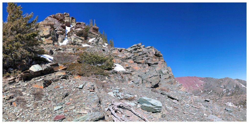
At the col. The first highpoint is just right of centre and requires an elevation loss down the left side
East goes to the summit of Ruby Ridge
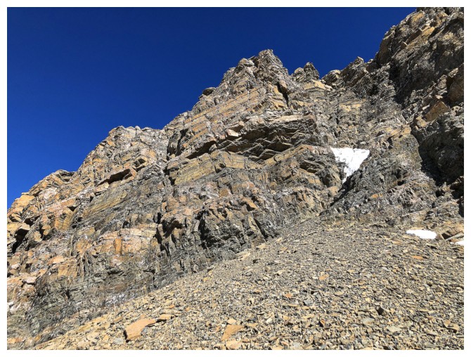
Instead I went west and was soon confronted with this wall of beautiful rock
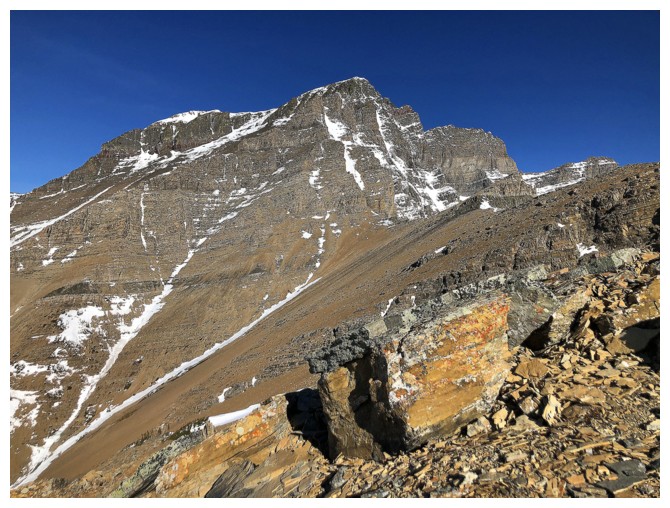
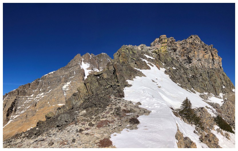
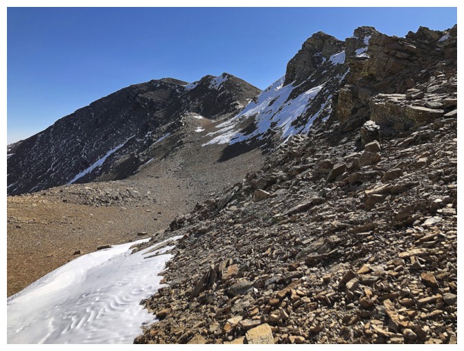
Slogging up to the first highpoint, with Igneous Peak at the far right
Summit view of Ruby Ridge from the first highpoint
Blakiston and many others
Lineham is still as alluring as ever
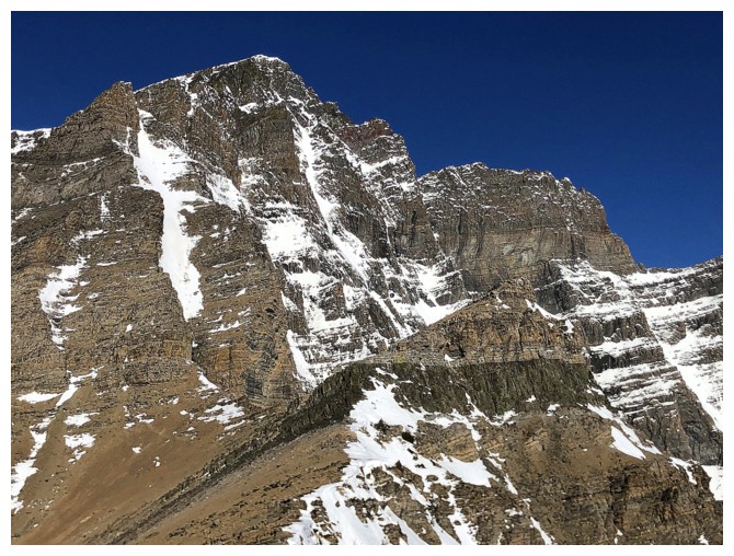
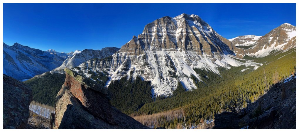
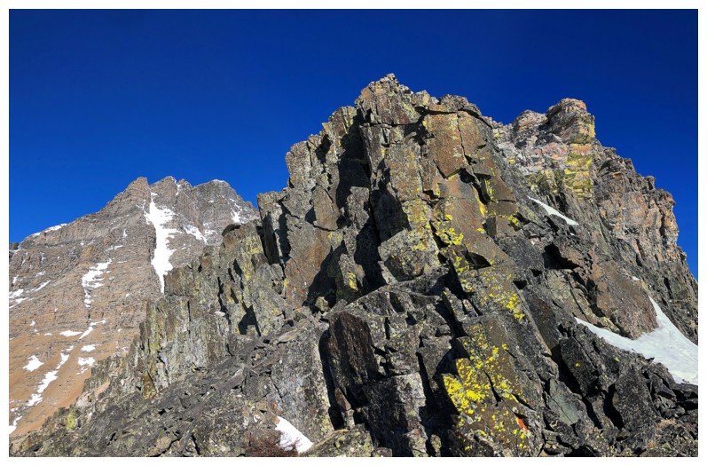
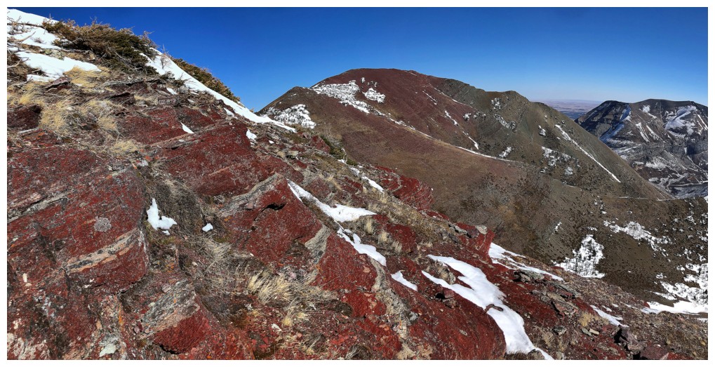
Closer look at Blakiston's awesome east side and Igneous Peak, in camouflage to the right
Mount Dungarvan
Rogan Peak (left) and Mount Galwey (right)
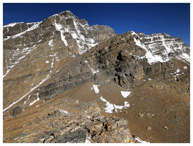
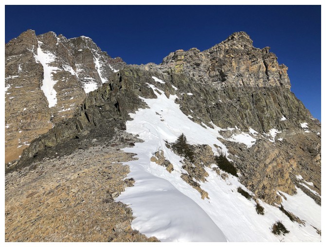
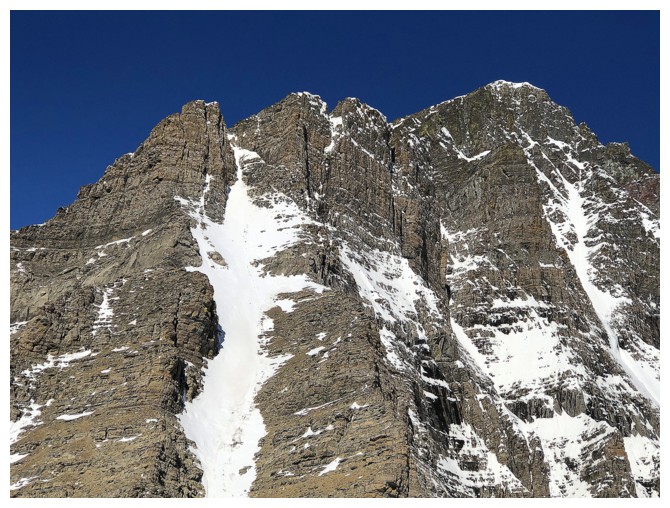
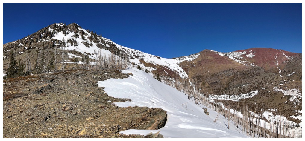
Unexpectedly heading towards Igneous Peak
Getting closer, it's easy to see why my feet took me here, even though my head was saying no!
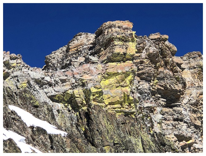
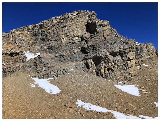
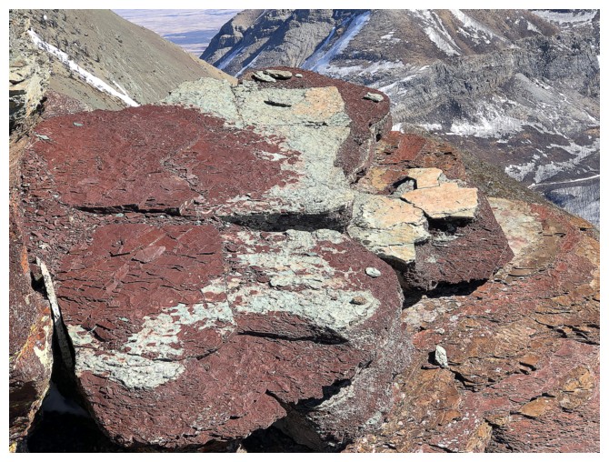
Approaching the igneous band of rock that was inspiration for the unofficial title
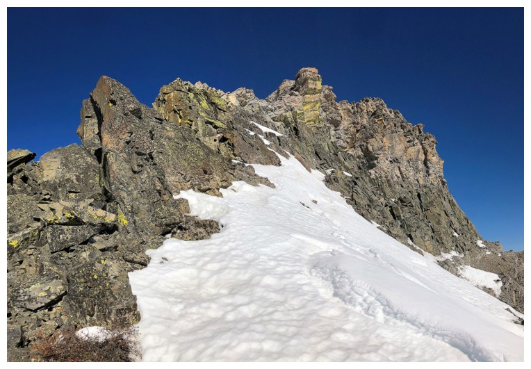
Getting closer
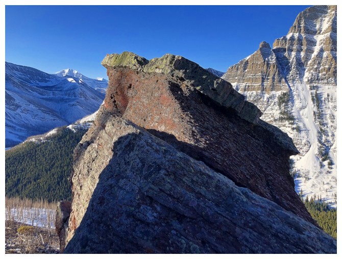
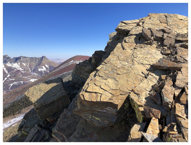
And there it is
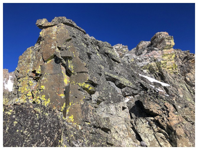
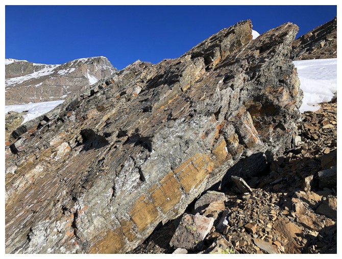
If I had to pick a second favourite type of rock (red argillite
obviously being #1), yellow lichen-covered, solid magma might be it!
At the summit. Ruby Lake below.
Click HERE to see a short summit video
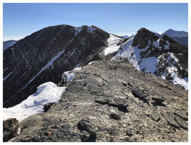
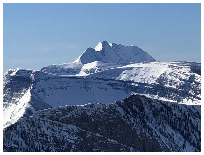
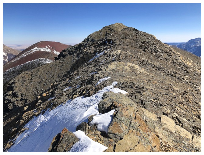
Looking over to Ruby Ridge. Igneous Peak is only a few metres lower than Ruby.
Blakiston. Brad would love that snow couloir on the left!
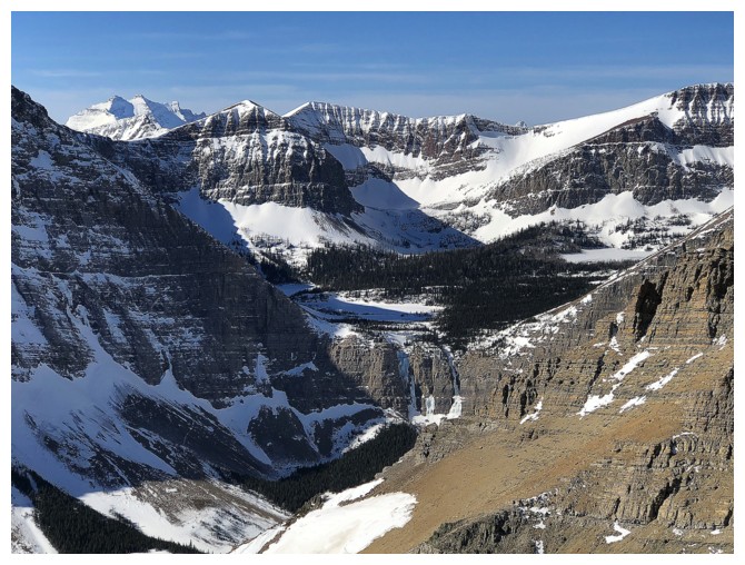
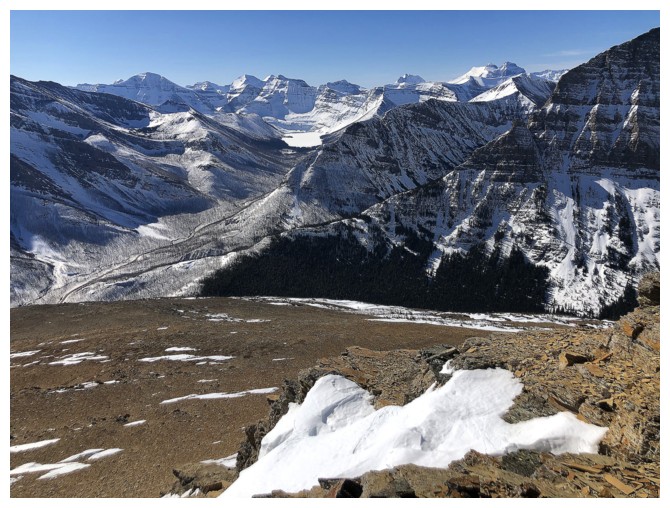
View towards the Lineham Lakes, part of the horseshoe route, and Long Knife Peak (distant left)
Summit view of Blakiston and Lineham
Parting look at Blakiston
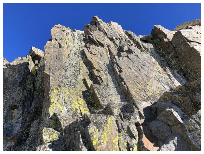
Parting look at the igneous band, but not really
Close-up of some of the sweet rock and lichen
There's the parting look!
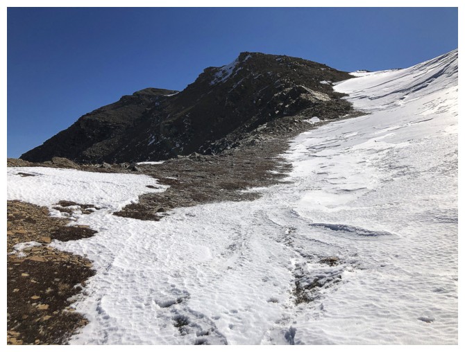
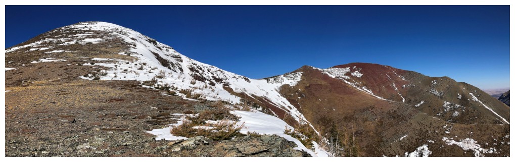
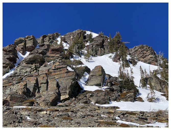
Back at the col and heading for the summit of Ruby Ridge at the left
Looking back at the first highpoint
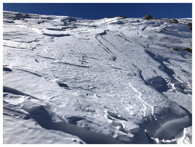
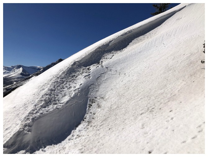
The hard snow was welcome here and made the ascent a little easier
Snow patch and Blakiston
You simply can't escape the awesome views of Blakiston on any Ruby Ridge trip
Nice to spend some time on the snow
Part of the ridge that I bypassed by staying on the north side of the mountain
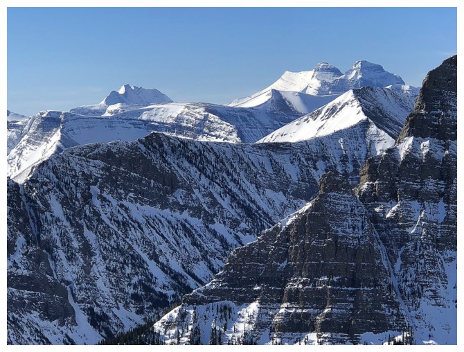
More Glacier Park gems start to show up
Mounts Kintla and Kinnerly
Mount Peabody
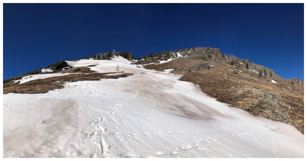
Back to more immediate concerns - the top of Ruby Ridge
Summit ahead
Views towards Cameron Lake
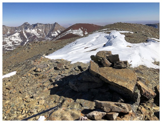
Summit cairn
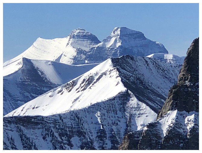
Cameron Lake, with Custer and Forum Peak again
Kintla and Kinnerly again - beautiful peaks!
A few other favourites. Right to left: Carthew, Buchanan, Alderson, and distant Mount Cleveland - the tallest mountain in Waterton and Glacier.
Heading down, but still fixated on the magnificent view to the west
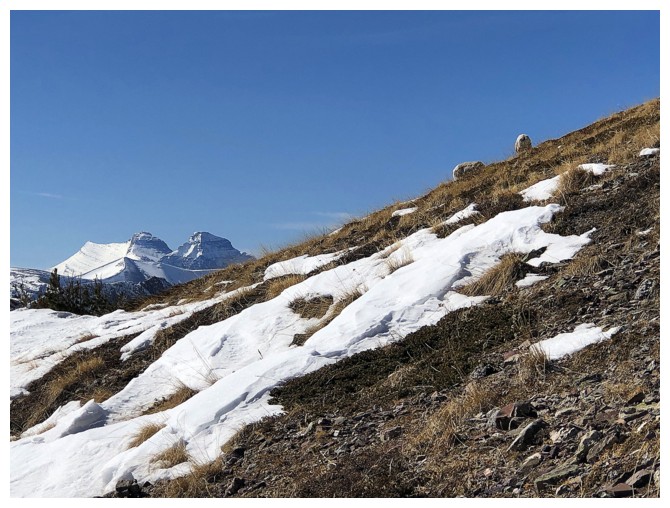
The first part of the descent was very snowy. Dungarvan peaks through the gap between the two summits of Ruby
A welcome lack of snow lower down reveals why Ruby Ridge is named as such
Had to detour to get around these two sheep
Looking back at both summits of Ruby
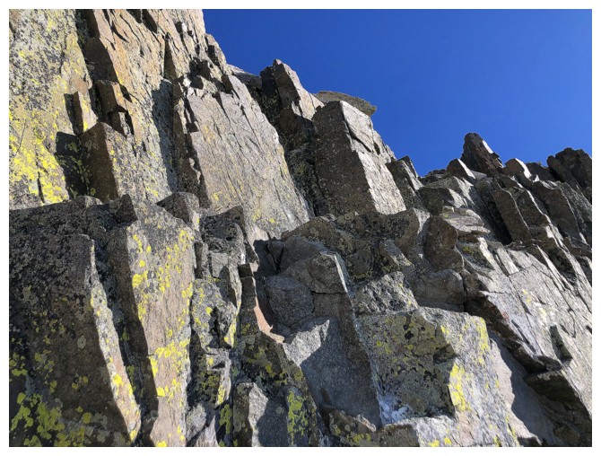
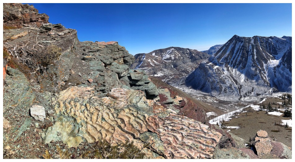
The start of the stunning rock scenery of the south ridge
Distracted again
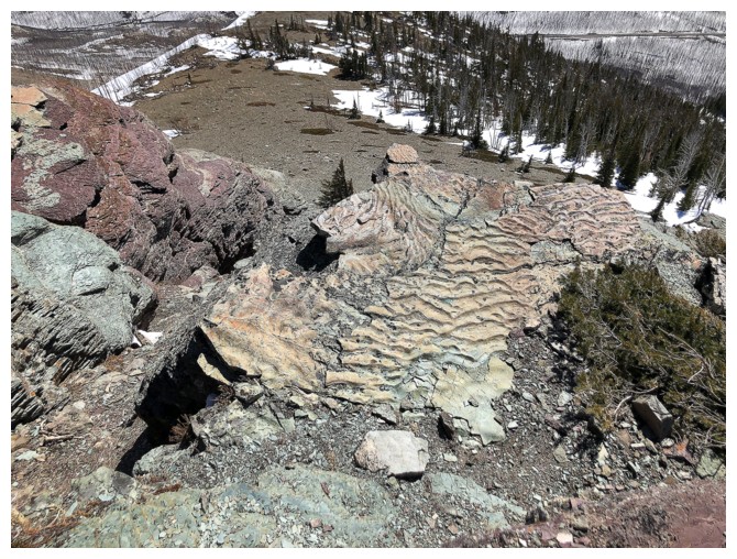
Pronounced example of ripple rock - evidence that this rock was once at the bottom of a sea
Same as above. The peak at the right is unofficially called "Buchanan Northeast" and is a terrific trip
Striking layers of green and red argillite, along with the ripple rock
Same as above with the latest route up Mount Crandell we took earlier in the season, going from left to right
Lots to see
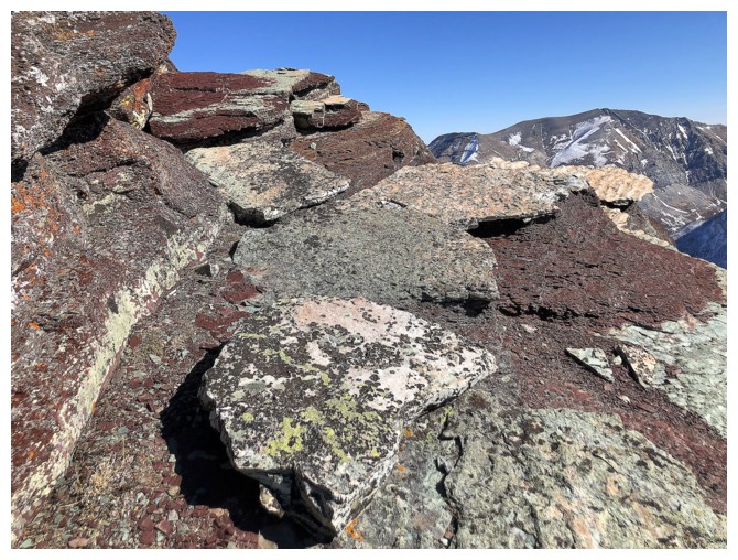
Lots!
Reluctantly leaving, having only explored a small portion of the area
Will definitely be returning here someday
Looking back
Back onto beautiful snowy terrain to finish the descent
Looking back up my descent route
Still experiencing excellent views to the west, even at a low elevation
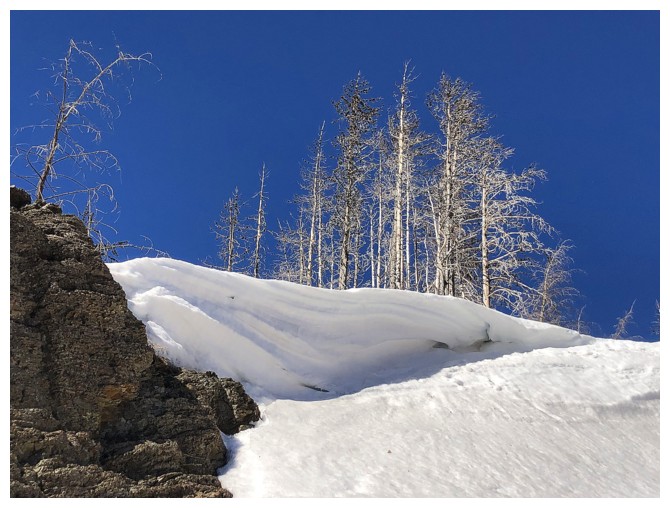
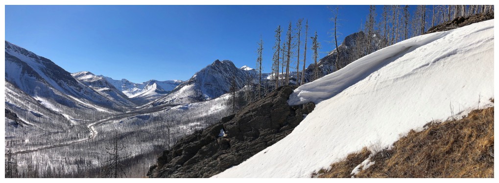
Having seen limited cornice scenery this season, I'll take what I can get!
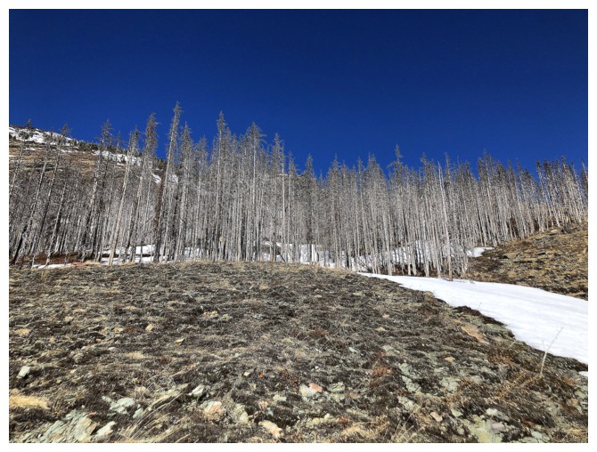
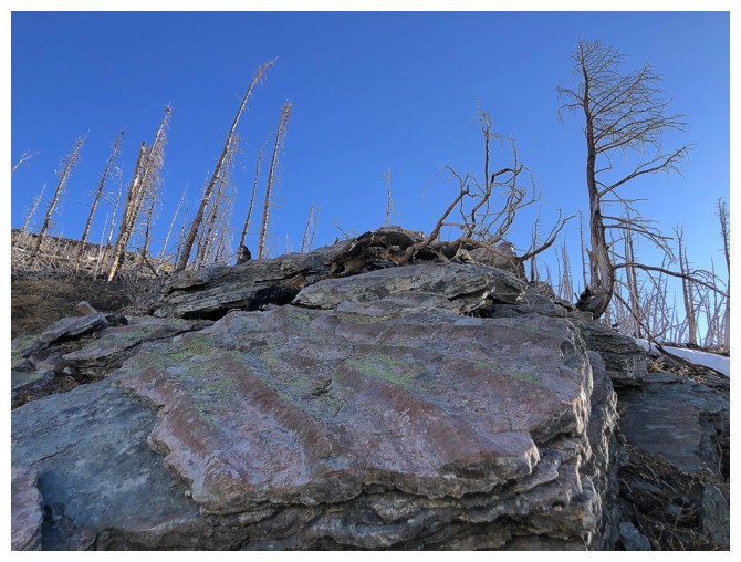
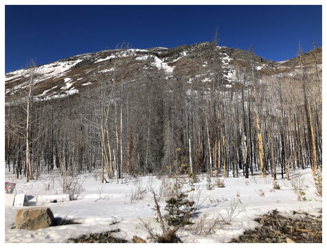
The burned trees have made easier work of a once more bushy descent
Backing at the start looking up the south side of Ruby Ridge
The End
LOG