Buchanan Northeast II
July 26, 2022
Mountain height: 2424 m
Elevation gain: 1100 m
Round-trip
time: 6:25
Solo scramble.
Having looked
longingly at the southeast ridge of Buchanan Ridge’s northeast summit for many
years, an attempt of the route was considerably overdue.
Starting a few
kilometres up the Akamina Parkway, I descended steep slopes to Cameron Creek,
crossed it, ascended even steeper slopes to gain the southeast ridge of the
objective and then embarked on a long and very interesting hike/scramble
towards the summit. The theme of the ascent quickly became “dare I scramble that or
not?”. 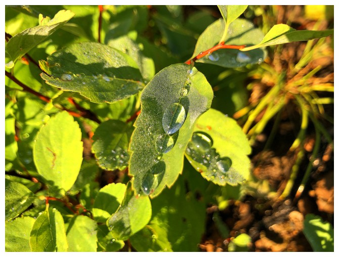 Except for a couple of short sections where there was no choice but to
scramble up the steep, somewhat exposed rock, I chose the “or not” on every occasion –
my “risk-taking days” are thankfully in very short supply these days! Fortunately, most of the really
daunting sections had bypass routes on the right side of the ridge and I availed myself of that side often.
Except for a couple of short sections where there was no choice but to
scramble up the steep, somewhat exposed rock, I chose the “or not” on every occasion –
my “risk-taking days” are thankfully in very short supply these days! Fortunately, most of the really
daunting sections had bypass routes on the right side of the ridge and I availed myself of that side often.
In addition to
the interesting terrain, the weather also provided some unadulterated entertainment.
While the skies were initially clear, as I made my way up the ridge, low-lying
clouds were forming all around. I arrived at the summit in pretty much whiteout
conditions, but patience rewarded me with the occasional glimpse of the
wonderful surroundings.
Choosing a
descent route eventually became the crux of the day. Fastest would have been to
retrace my route, however, the rapidly changing weather was disconcerting. 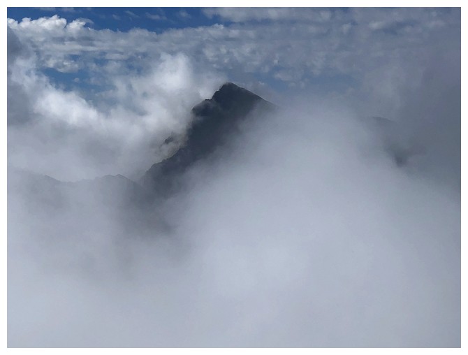 I
decided that descending the northwest side of the peak would be the safest
(though longest) route down – as stated, no unnecessary risk-taking!
I
decided that descending the northwest side of the peak would be the safest
(though longest) route down – as stated, no unnecessary risk-taking!
My only concern with
this descent line was The Three Bears. While scouting out the route in the
morning, I spotted a mother and her cub, and then another bear a little further
up the parkway. Both sightings occurred in the vicinity of the bottom of
Buchanan Northeast’s northwest route, right where I would be recrossing Cameron
Creek. Needless to say, the descent throughout was one of my noisiest ever! Thankfully the three
were nowhere to be seen.
After crossing
the creek all that remained was a less than welcome 6 km road hike back to the
start. I tried to look as pathetic as possible, hoping someone would offer me a ride
but traffic was sparse. No one stopped!
Overall, an
awesome day on a very cool route that I would love to repeat someday. However,
I will be taking a partner with his/her own vehicle, so we can leave one at the
northwest trailhead. This would make for a super entertaining trip without the
6 km drudgery at the end!
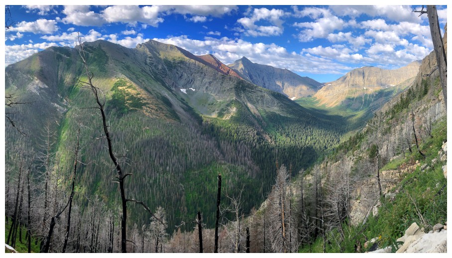
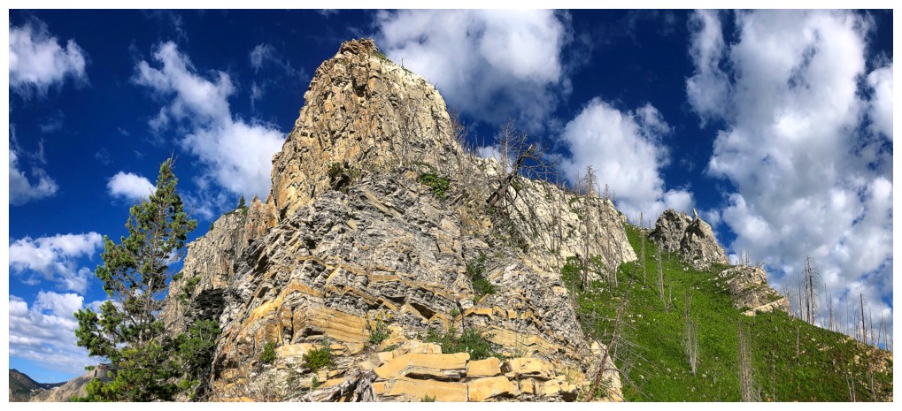
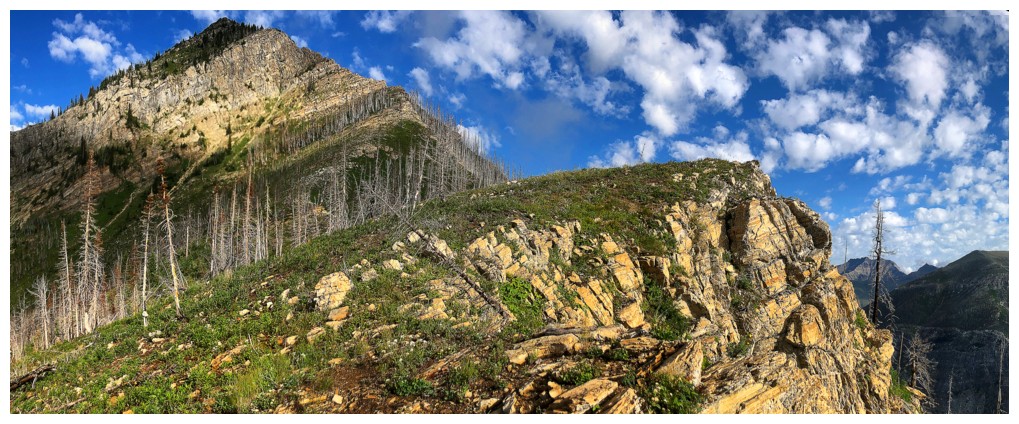
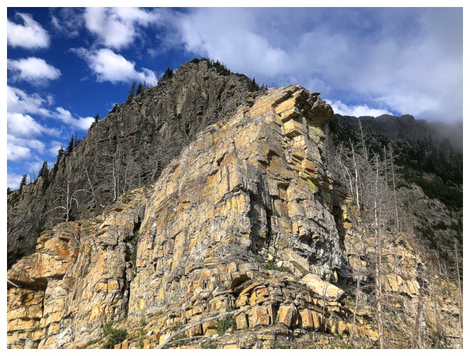
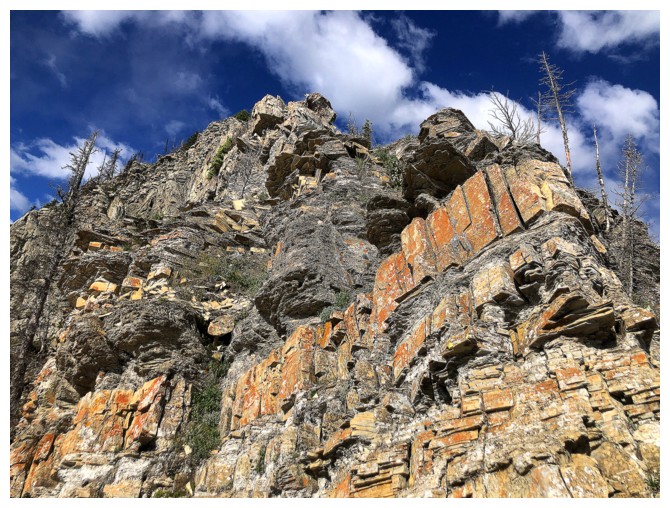
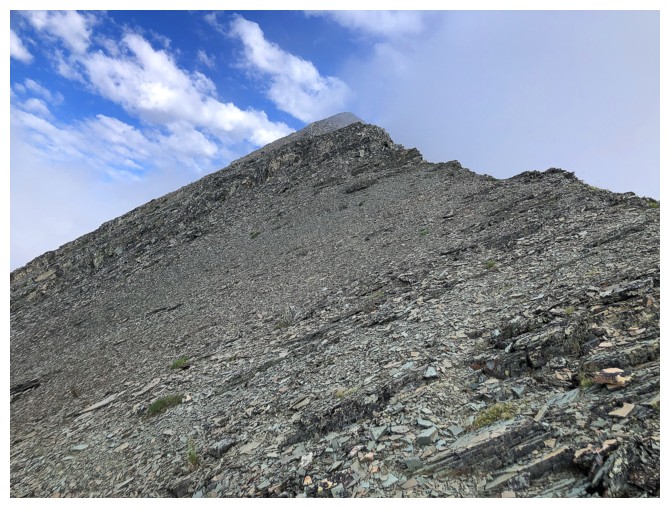
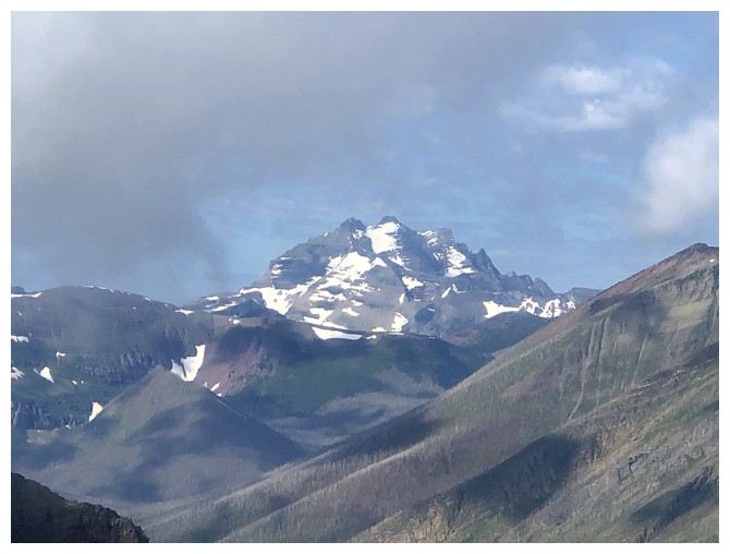
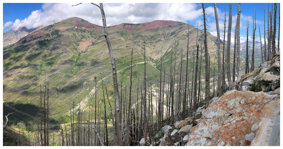
The objective and its southeast ridge
Glimpse of Mount Boswell, while descending to Cameron Creek
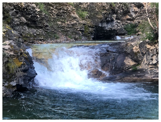
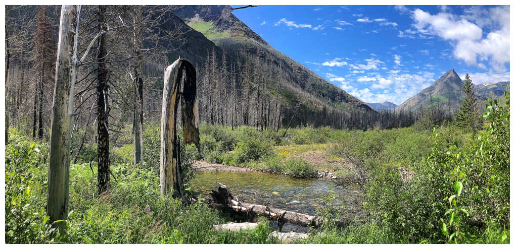
The creek
Glimpse of Vimy Peak, while ascending the steep slopes on the other side of Cameron Creek
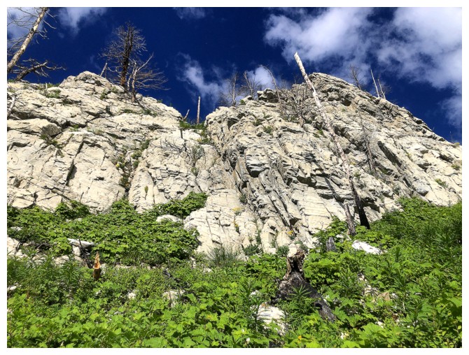
Onto much easier terrain
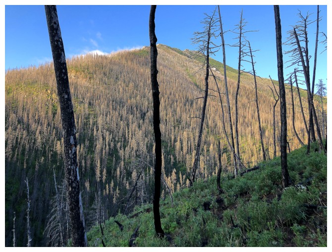
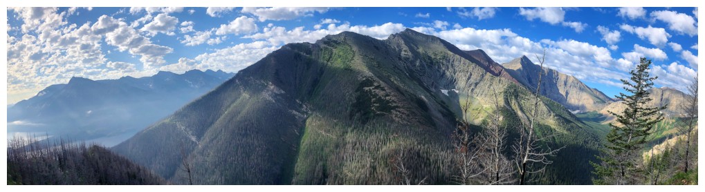
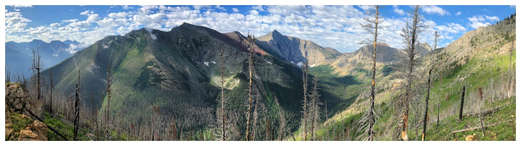
Looking south to the northeast ridge of Bertha Peak
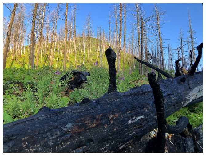
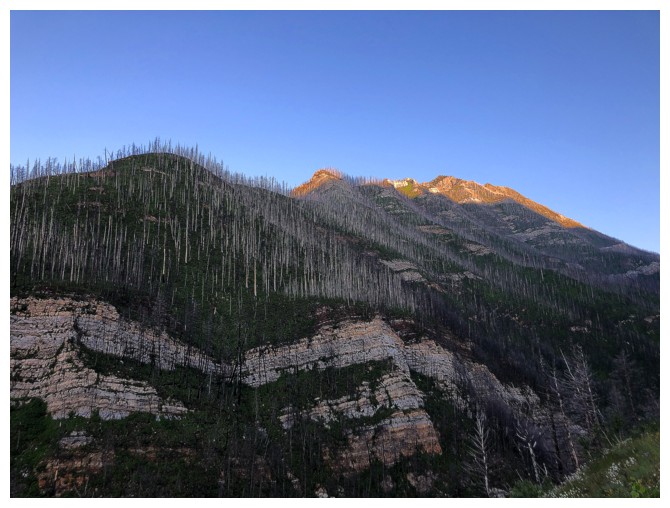
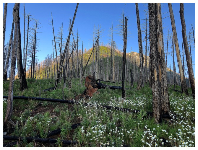
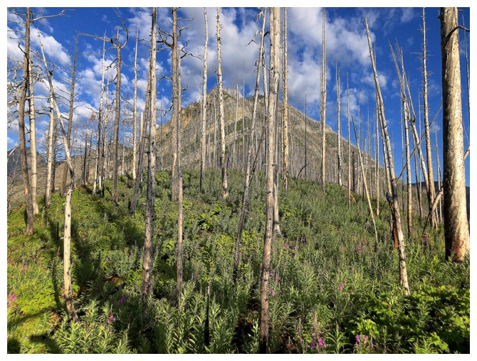
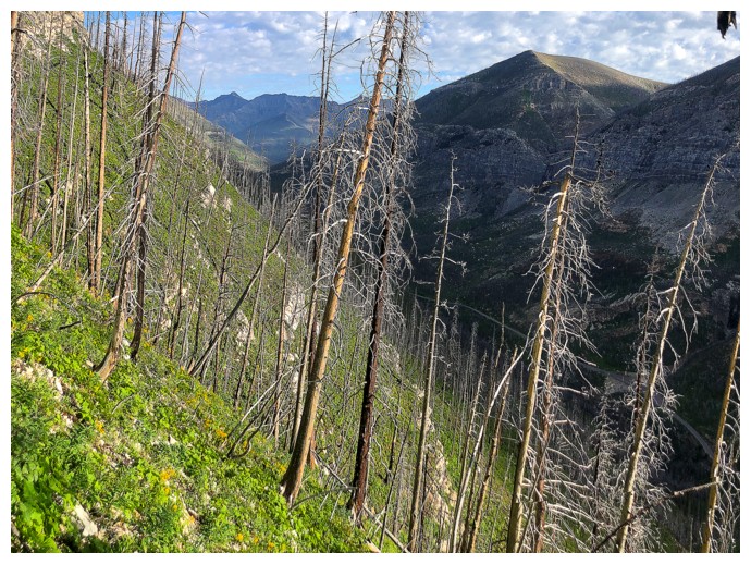
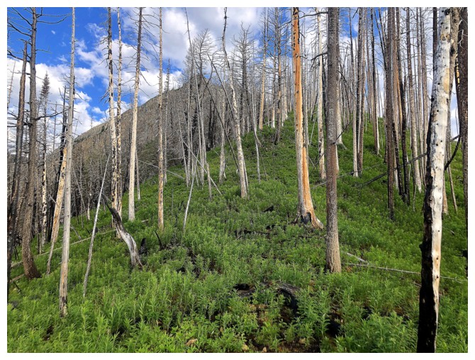
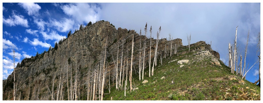
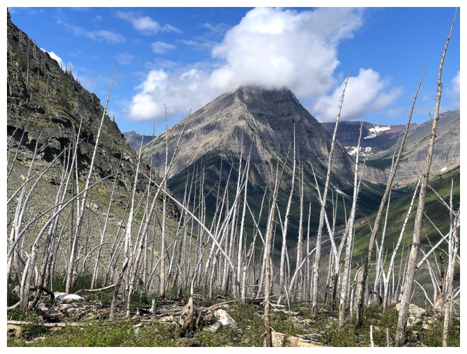
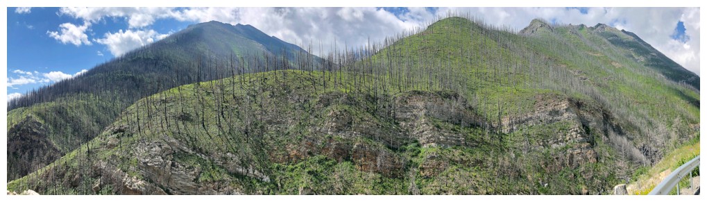
Some of the visually-arresting results of the Kenow fire: blackened trees and the lush green of fireweed
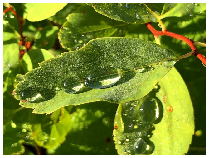
The vegetation on the lower slopes was drenched (as were my legs after
wading through it for thirty minutes), so I took some time to
photograph some rain droplets.
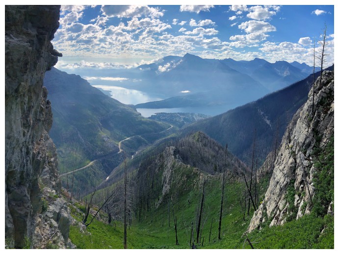
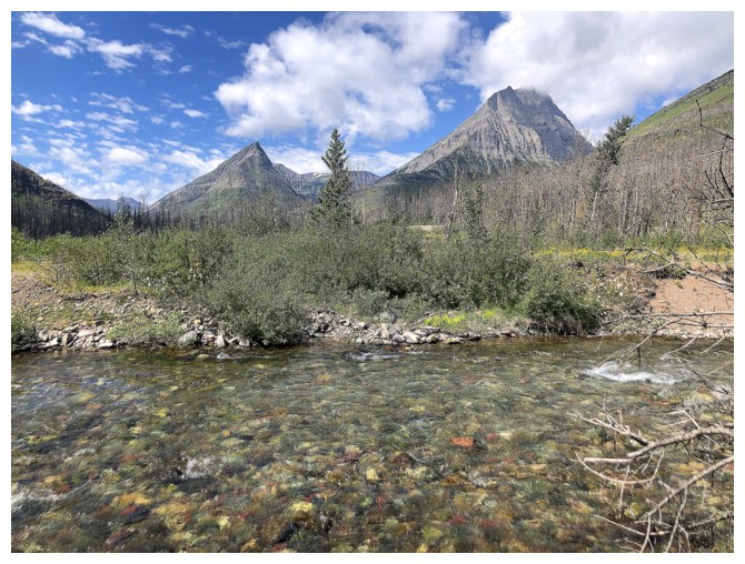
Views of Vimy continue to improve
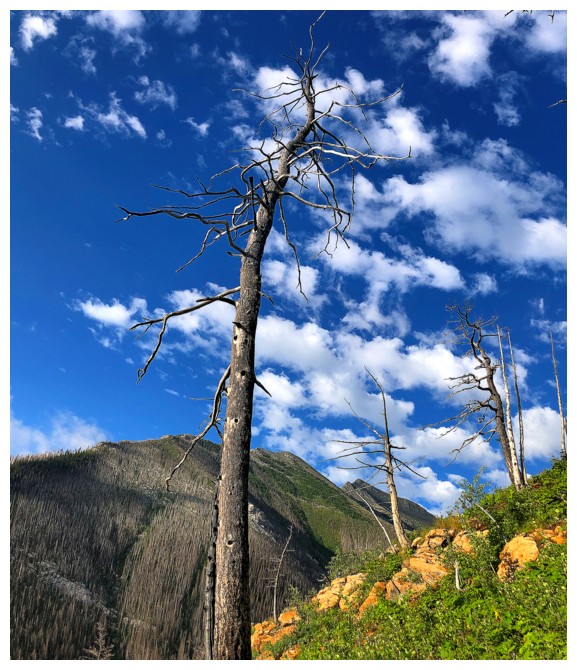
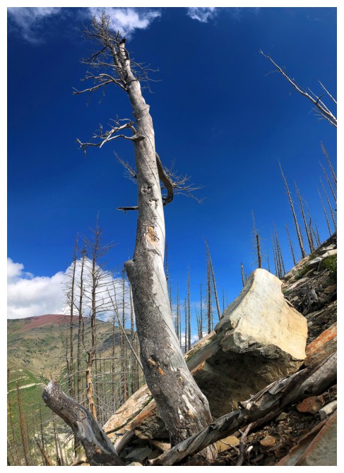
So does that of a lone dead tree
...or trees!
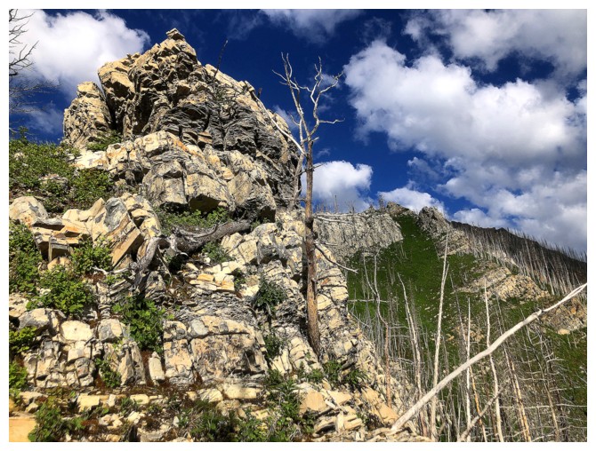
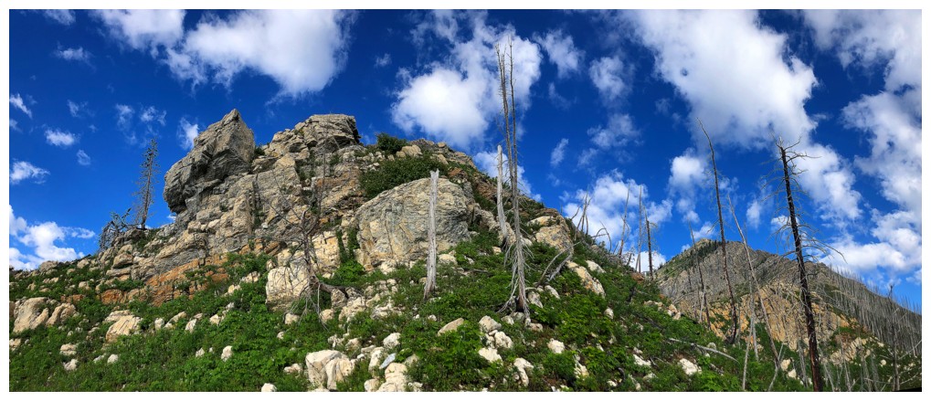
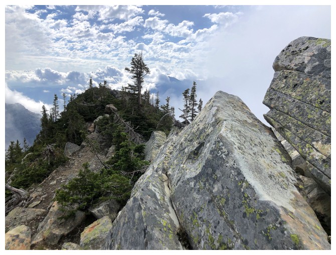
Approaching the first challenge of the ridge
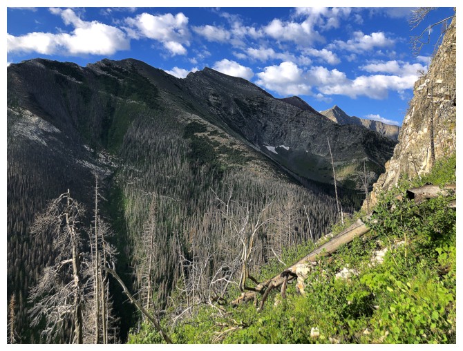
Avoiding the challenge by staring at the northeast side of Bertha Peak. Alderson Peak getting some Sun near the distant right.
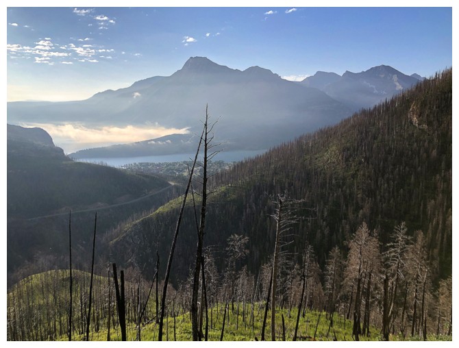
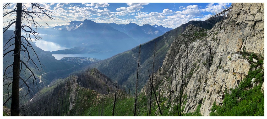
The view back towards the Waterton Lakes was also a good distraction
Tackling the challenge by avoiding it. Went around the right side.
Traversing steep, grassy slopes to get around the rock band
Back onto the ridge
Another obstacle, also avoided on the right
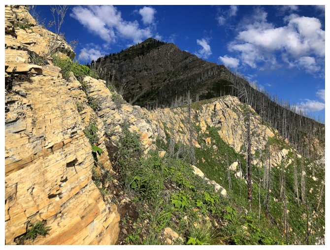
Better view of Akiiohtaikiistakoo (Bertha Peak) and Alderson. Buchanan Peak is now getting the Sun near the right.
Same as above
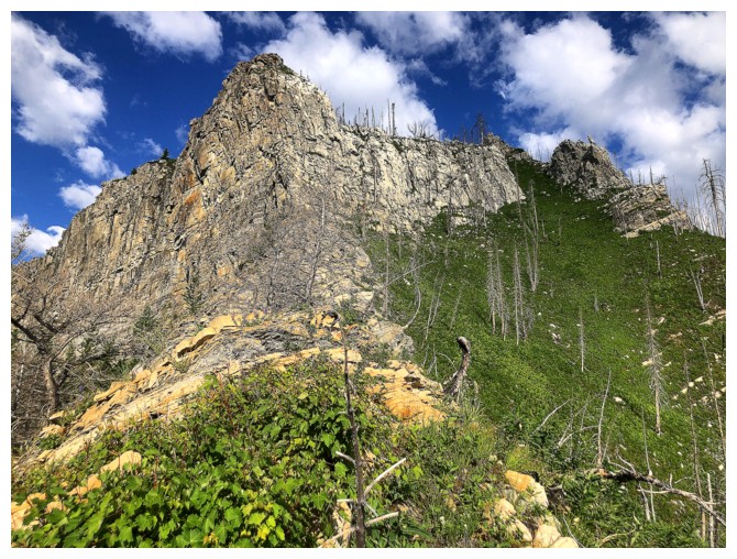
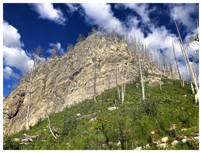
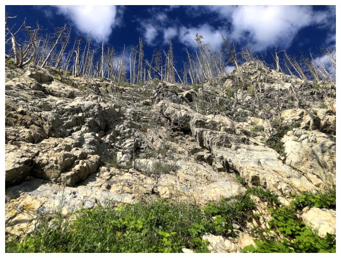
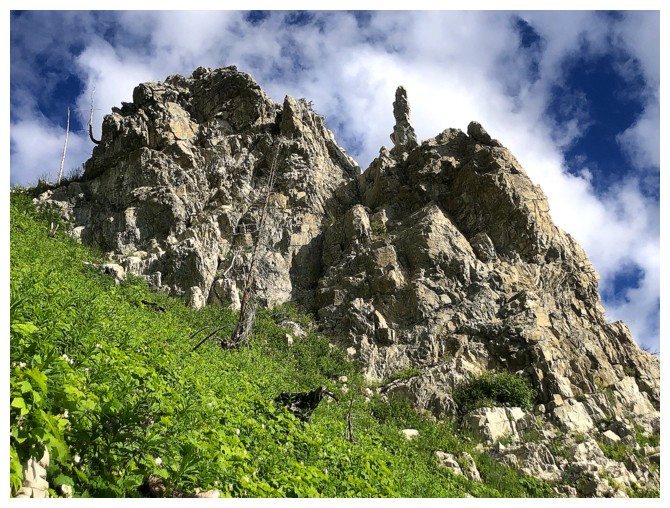
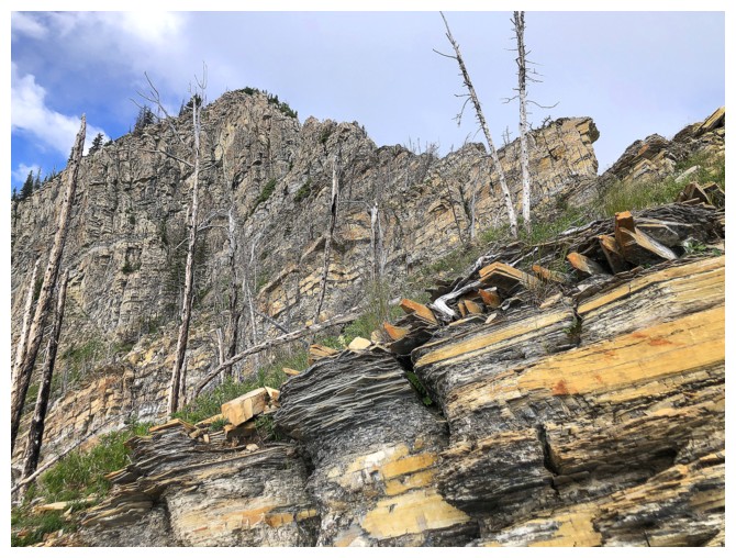
Obstacle #3 was a dousy!
Zoomed-in shot of an interesting rock band to the right of the ridge
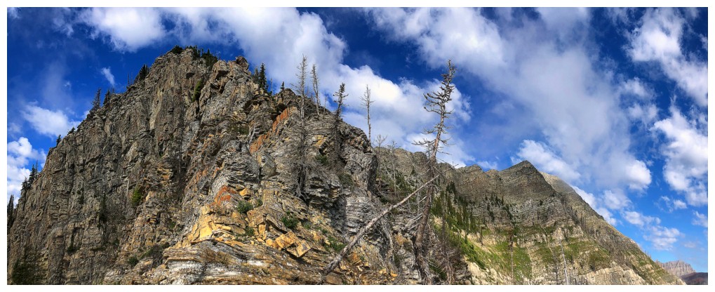
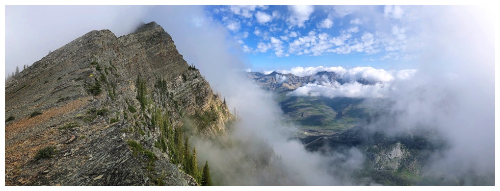
Definitely going to avoid this one on the right. This view was probably the scenic highlight of the trip.
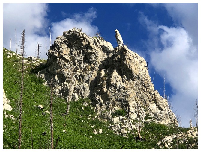
I was tempted to scramble up this section to regain the ridge earlier, but opted not to
Looking back at the section I opted to not scramble
Passing by the "zoomed-in" rock band
Looking back again. A portion of ridge I had just ascended is visible.
Same as above
Back on easier terrain, but the summit is still a long ways off
The next section
Same as above
Views to the west continue to open up
Approaching the most serious part of the ridge
Clouds are starting to build
EEK! That looks scary
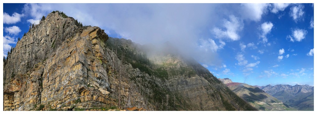
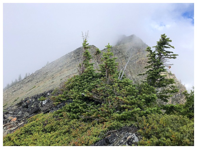
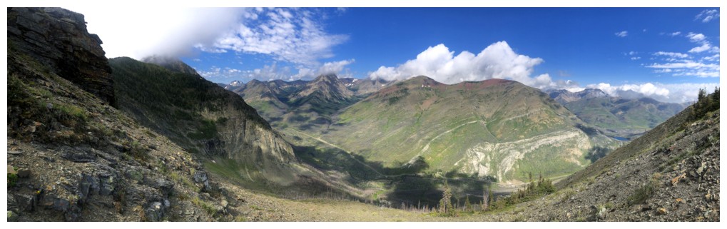
The upcoming ridge and the summit in the clouds
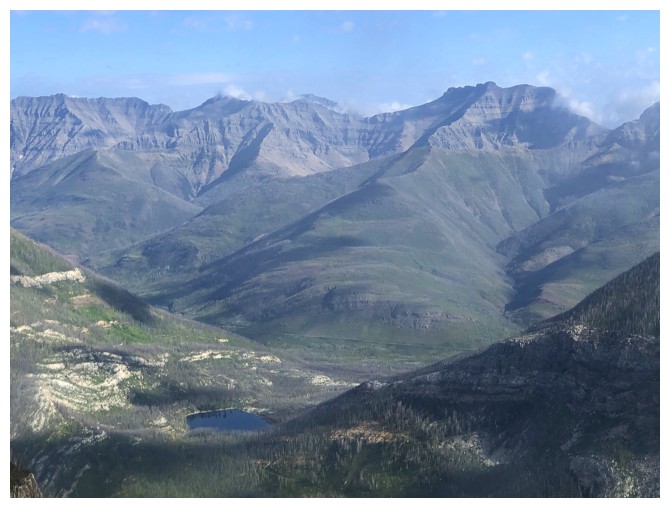
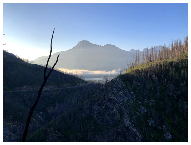
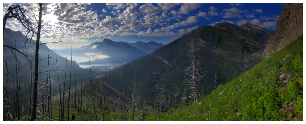
Crandell Lake and a host of great peaks to the northeast: Cloudowan, Cloudy Ridge, Dundy, and Dungarvan
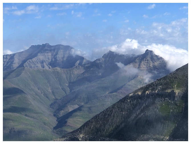
Dungarvan at the left. Clouds are starting to consume Rogan and Galwey.
At the crux. Managed to avoid the really steep stuff, but there was some tricky terrain to negotiate here.
At least the rock is cool and colourful!
The very steep east side of the objective
Some fun scrambling here
And here
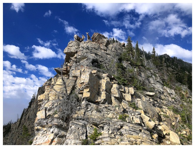
Bumped into a small herd of sheep
Oo! That doesn't bode well for a perfect summit view.
Rogan and Galwey are now consumed, Dungarvan next
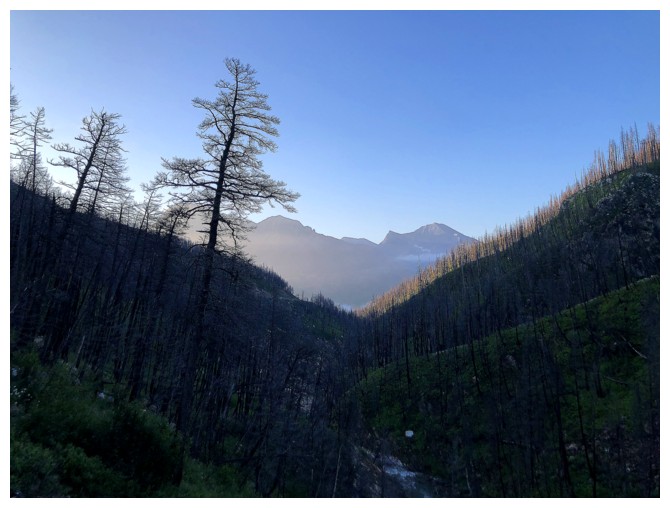
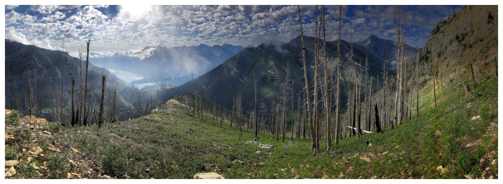
Clouds forming far below
Clear, then cloudy would be the theme for the remainder of the ascent and most of the descent
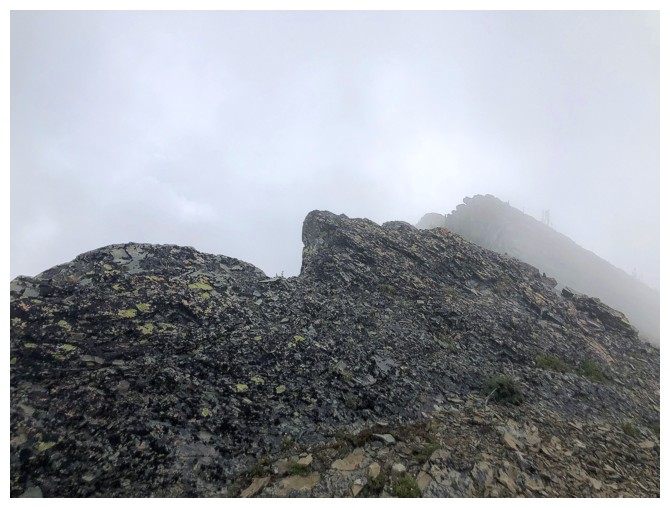
Some sweet white rock to go with the total whiteout
And trees
The weather couldn't make up its mind
But was definitely leaning towards a total whiteout
Hope again for clearing
And then less hope
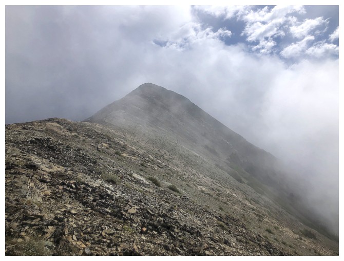
The summit is finally in sight and it could be clear
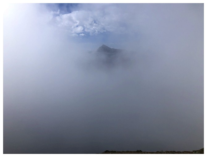
...or not
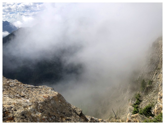
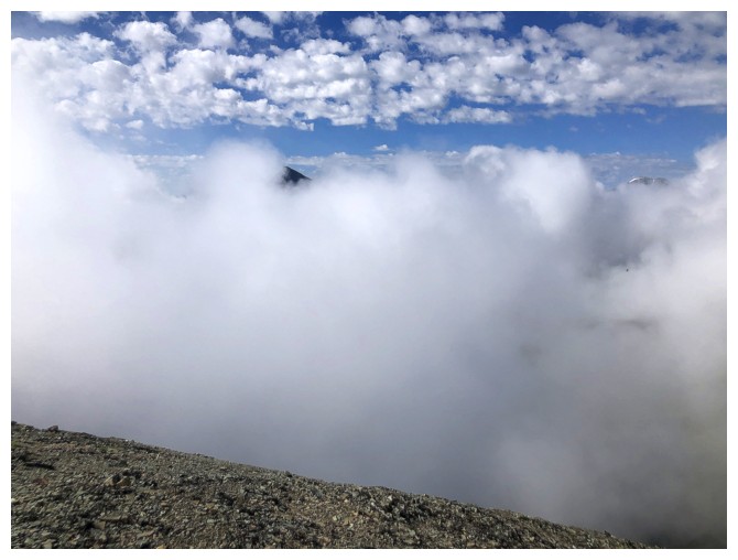
Total whiteout at the summit
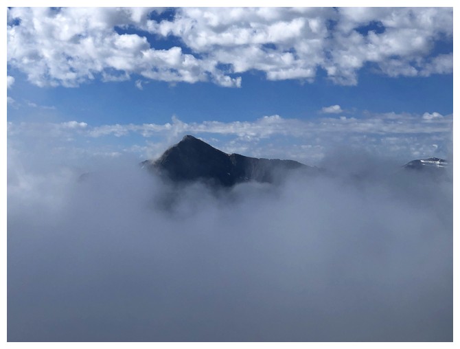
Only Anderson Peak is tall enough to poke through the clouds
...or not!
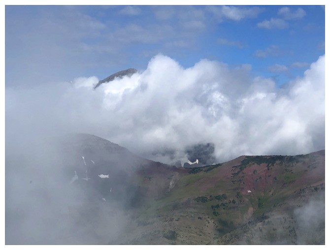
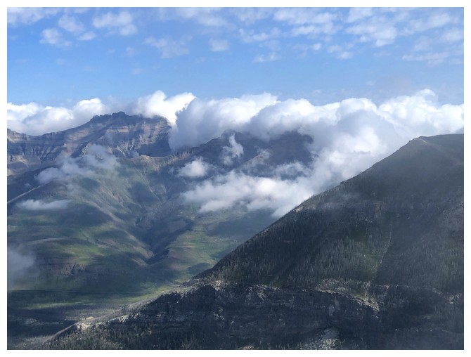
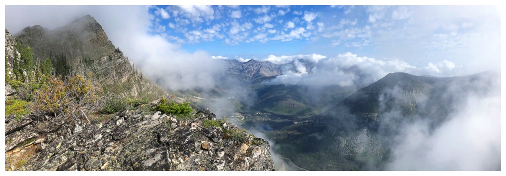
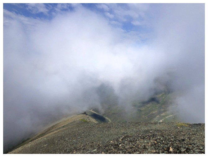
Glimpse of the view to the northwest
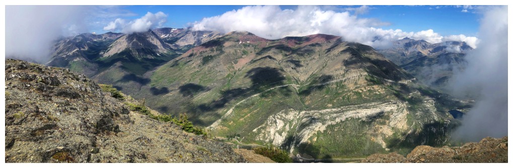
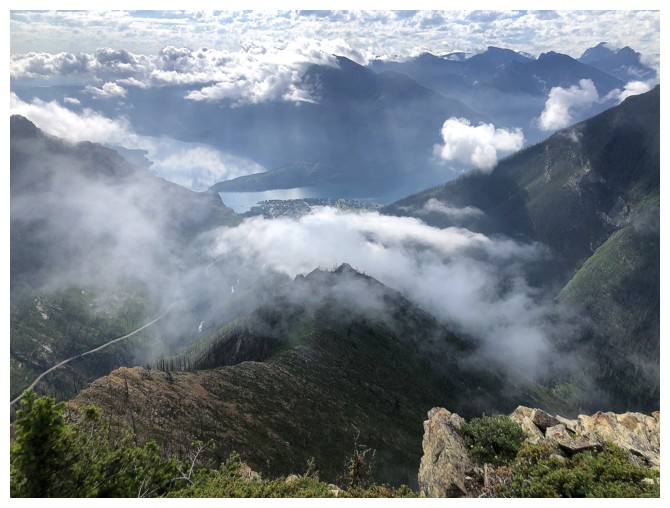
The best view of the day, but it didn't last
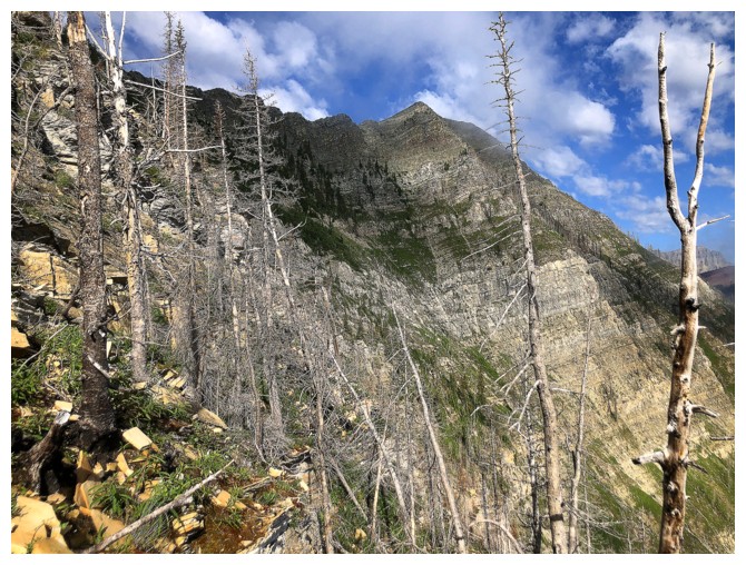
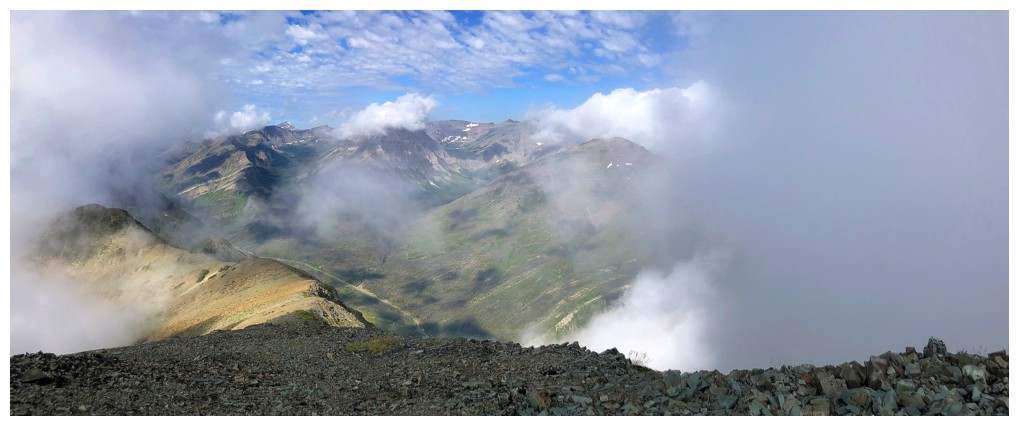
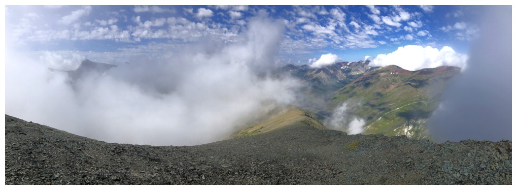
The increasingly cloudy conditions that prompted the alternate descent route
Descending the northwest side of the peak
Long Knife Peak - always so happy to see this striking mountain
Decent views of Ruby Ridge
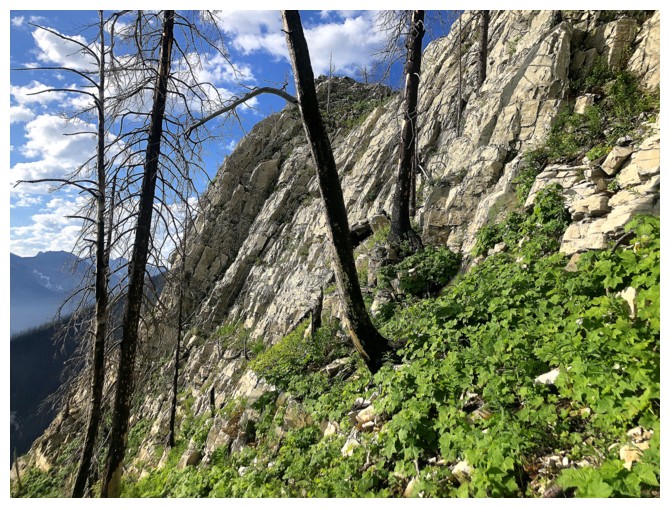
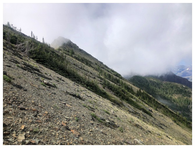
Typical terrain on descent
Ruby Ridge again
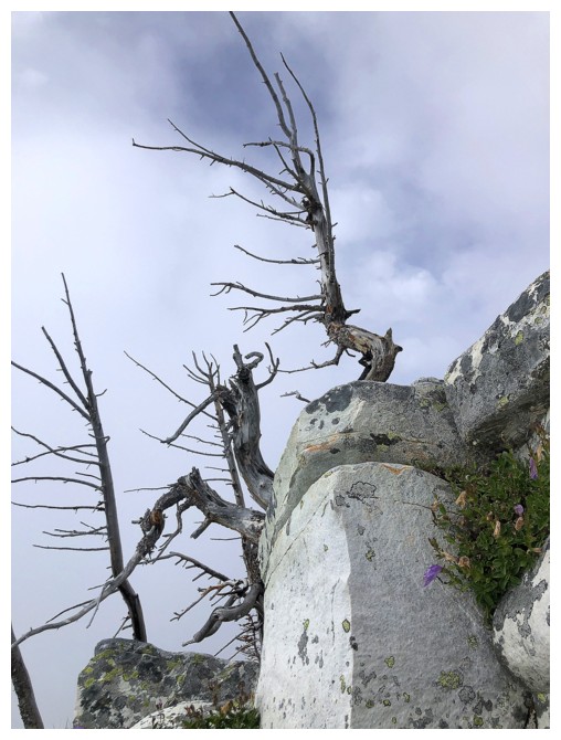
A matching lone tree on the other side of the mountain
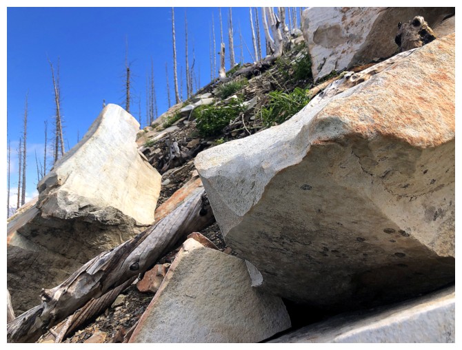
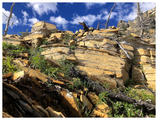
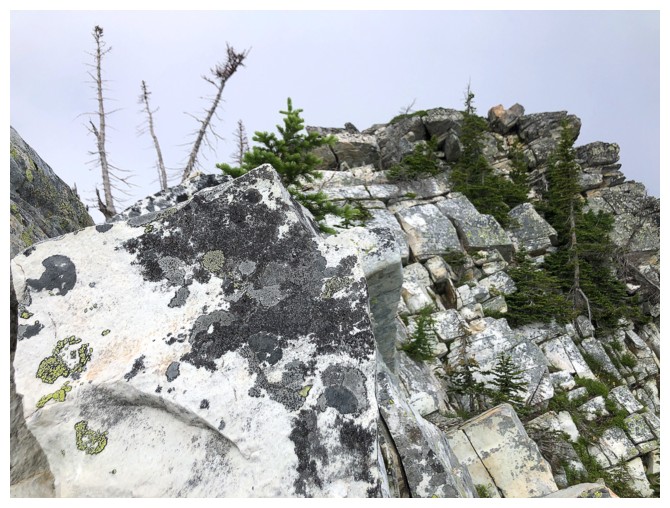
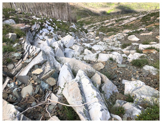
The white rock (dolostone I think) is solid and picturesque
A cloud over Mount Lineham
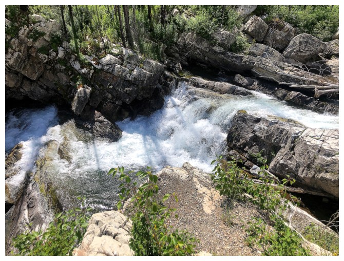
Approaching Cameron Creek
The creek, with Rowe and Lineham
On the other side
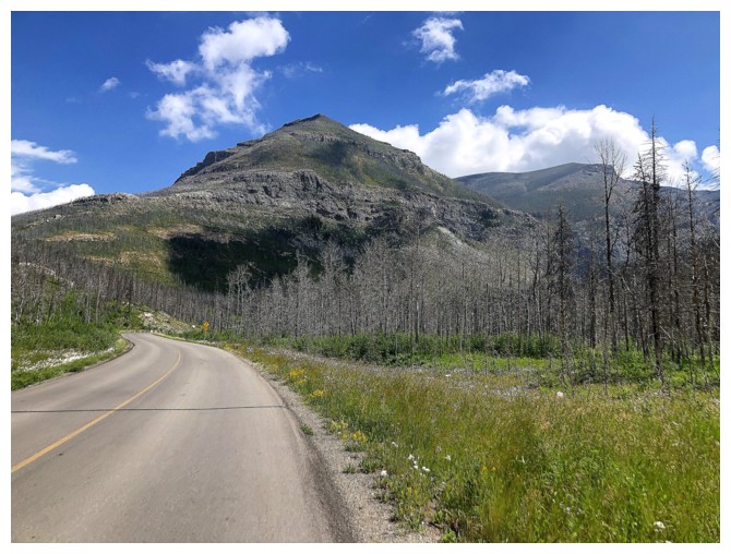
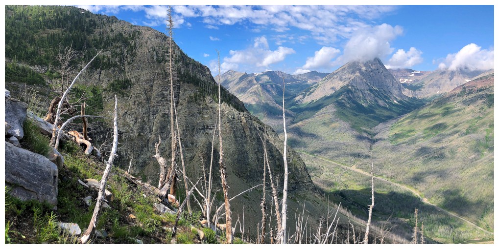
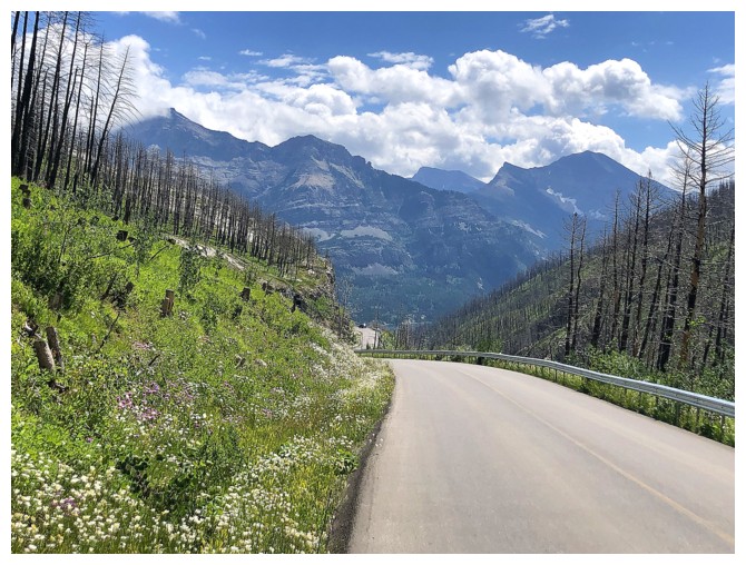
The start of "The (6 km) Long and Winding Road". Mount Crandell is a constant companion throughout.
An hour later, still walking
View of the route (left to right) from back at the start
The End
LOG