Mountain height: 2,782
m (9,128 ft)
Elevation gain: approx. 1,500 m (includes elevation loss from
Ascent time:
Descent time:
Scrambling with Mark.
A second attempt at
the northerly neighbour of
We stole the “
After roping up, to belay each other across a snowy and mildly exposed ledge, we arrived at the aforementioned weakness in the upper rockband and started up the 5 metre step. It proved to be far more challenging than expected and required the placement of 2 of the 4 cams we had brought with us and the use of a very fortuitously placed tree branch hanging over the top of the step. I wish I could say that I ascended the step with grace, finesse, and nerves of steel, however, near the top, while hanging on to the branch, my right foot slipped off the rockface and I started shrieking like a co-ed in a “B mad-slasher movie” – lucky Reinhold wasn’t there to witness that!
Once atop the step (and fully recovered from my little
panic attack), we continued up the easy, but very long
The upper third of the route was made more challenging by
icy, hardened snow, requiring numerous elevation losses and considerable
route-finding to negotiate the tricky terrain. We arrive at the summit at
With only 2 hours of daylight remaining, we were left with
a dilemma, regarding descent routes. Returning the same way we came, would have
been very long, slow and tedious on the icy terrain, and so we opted to go out
on a limb and try to descend one of the many gullies of the west-facing slopes
and then follow Stony Creek out to Highway 541, leaving us approximately 3 km
from the car. With a little route-finding luck (many of the gullies led to
significant drop-offs, but we found one that was steep, but manageable and led
directly down to the easy terrain of the lower bowl), we made it down to the
creek in about 1.25 hours, took a short break and the headlamps out of our
backpacks, and started, what we thought was going to be, the easy part of the
descent. GPS revealed that, in a straight line, we were 5.2 km from the highway.
Given the circuitous nature of creeks, we made a conservative prediction of
1.5-2 hours to make it there. It ended up taking us 4 hours of painstakingly
slow travel: climbing over deadfall, innumerable crossings of the creek,
side-sloping steep terrain, nasty bushwhacking, ascending when we should have
been descending; and all of it by headlamp. You’d think that after Dungarvan
and Glendowan last month, we’d be expert at following creeks out in the dark!
We staggered back to the car at
Overall, a fantastic day, on a most interesting mountain, with amazing scenery – hopefully, selective memory will take care of the less than enjoyable descent.
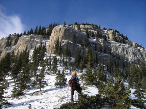
Looking up at the first cliffbands
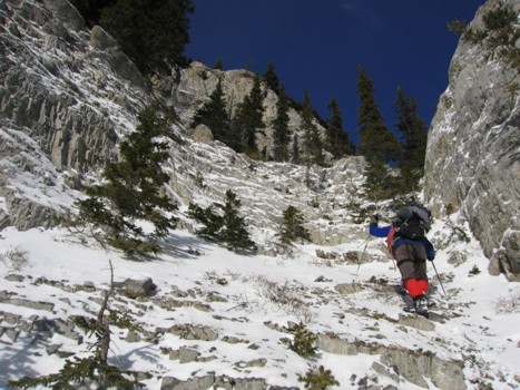
Mark ascends the weakness in the first band
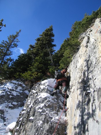
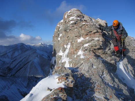
Ascending the crux; this is where I slipped, while hanging onto a tree branch; contrary to its appearance in the photo, this 5 m rockstep is almost vertical
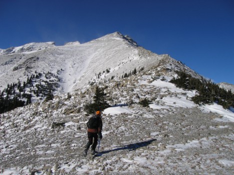
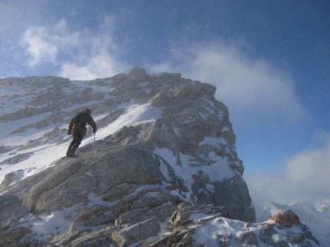
Above the crux and looking at the east ridge and summit (far left)
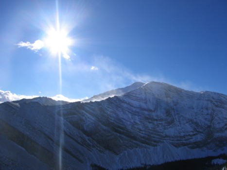
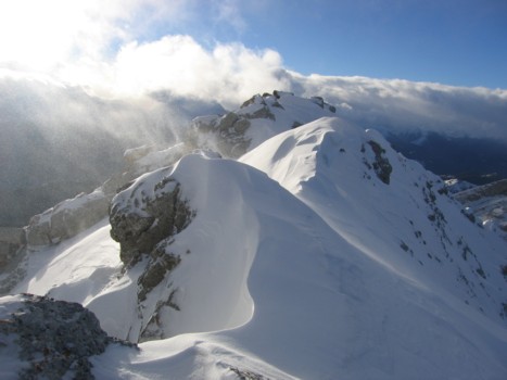
Snow blowing off Holy Cross
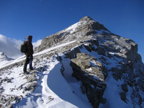
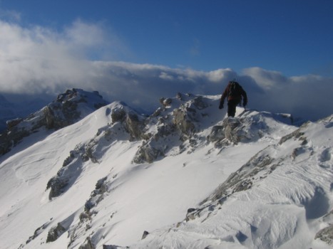
More of the easy section of the ridge
Same as above, with a little swirl of blowing snow
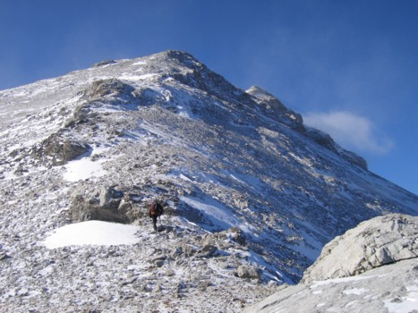
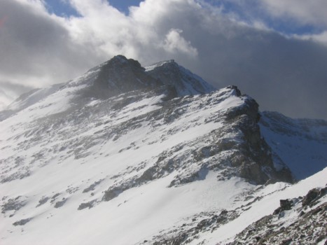
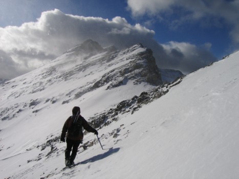
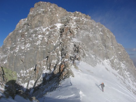
Approaching the second highpoint of the ridge
Same as above; unfortunately we didn't time to hit the summit of this highpoint and traversed around it on the left
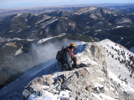
Looking down the ridge, with the foothills and prairies in the background
Looking at the upper section of the ridge
A closer look at the final third of the trip
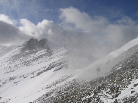
Same as above, but this time I got caught in a swirl of blowing snow
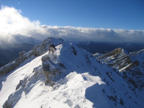
More ridge
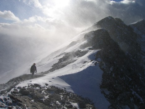
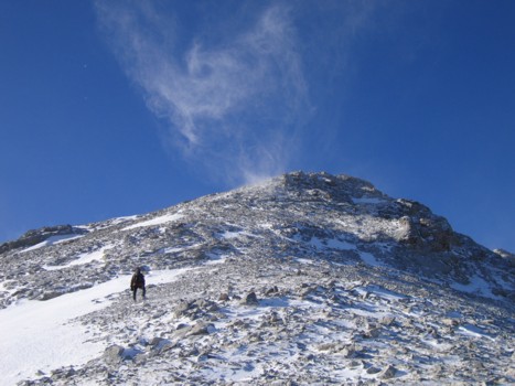
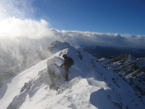
The higher we got, the more violent the wind was
I'm in there somewhere
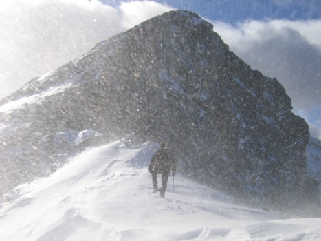
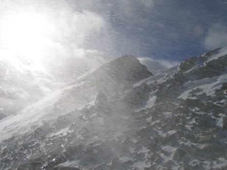
More ridge, more blowing snow
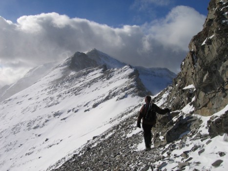
Mark comes up the ridge; we went to the top of this highpoint and then had to lose elevation and traverse around it
Mark enjoys a brief reprieve from the wind
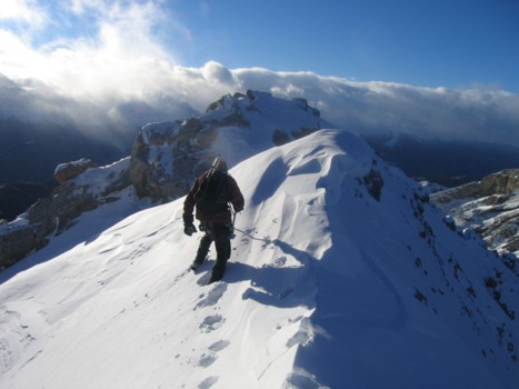
Mark descends a mildly exposed section of the ridge
Same as above
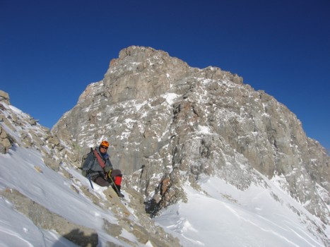
Approaching the summit ridge
The summit ridge
Same as above
Same as above
Almost at the summit
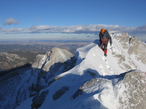
Mark traverses the final few metres of the route
An interesting cornice right before the summit
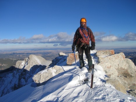
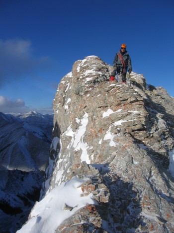
Me at the summit
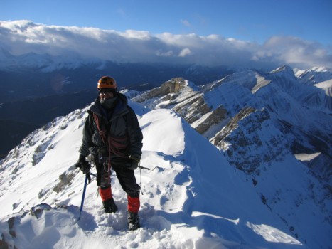
Mark at the summit
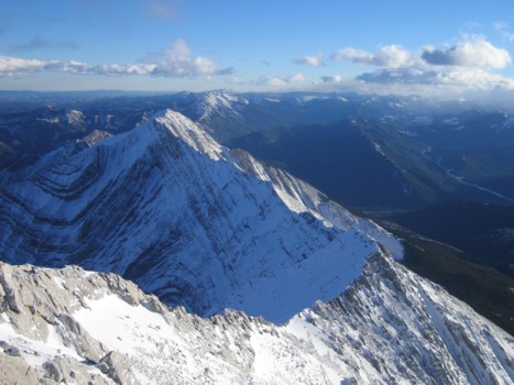
A magnificent view to the north
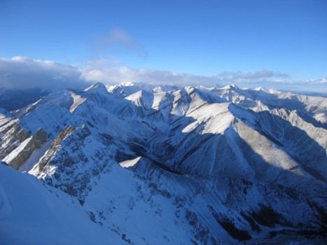
Same as above
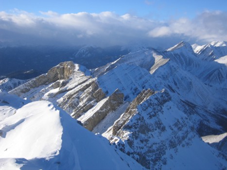
Holy Cross Mountain and the connecting ridge
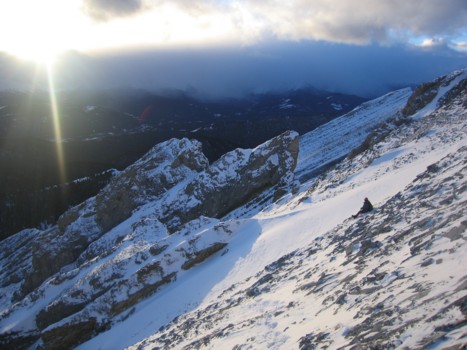
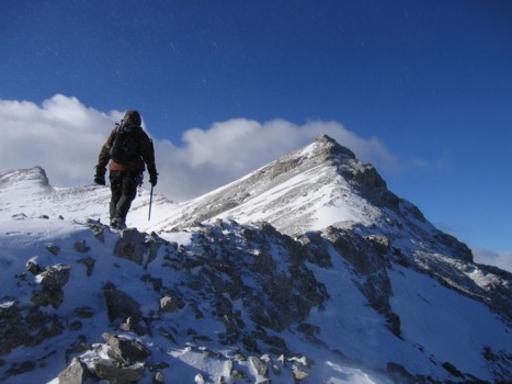
Mark waits for me, as we (and the sun) descend