Loaf Mountain VI
(middle summit, aka "Pastry Peak")
May 9, 2020
Mountain height: 2450 m
Elevation gain: approximately 900
m
Roundtrip time: 8:45
Mountaineering with Mark.
Crazy, cool day! We didn’t achieve our objective – the true summit of
Loaf Mountain – but the trip was a huge success, thanks to the never-ending
supply of amazing, stupendous, outrageous, astounding, awe-inspiring, breath-taking
rock scenery on the south side of Loaf.
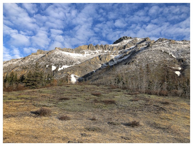
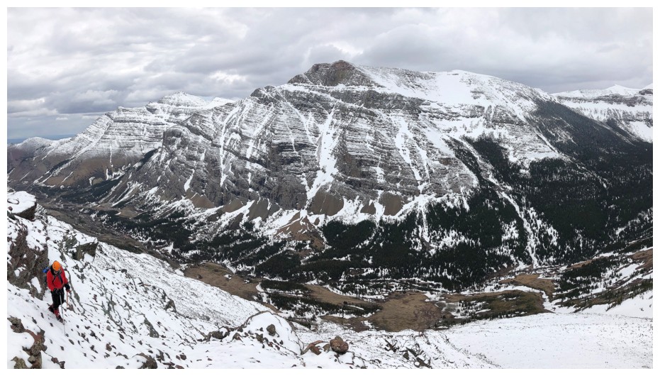
 With a great early morning weather forecast, but a not-so-good system
arriving late in the morning, we left relatively early and biked the 5 km
approach. Disappointingly, clouds started to form all around during that
approach, although they are more the “impressionist painting” type clouds, than
the annoying blank wall of white.
With a great early morning weather forecast, but a not-so-good system
arriving late in the morning, we left relatively early and biked the 5 km
approach. Disappointingly, clouds started to form all around during that
approach, although they are more the “impressionist painting” type clouds, than
the annoying blank wall of white.
Initially the plan was to follow my 2013 route – one of
the more scenic and direct routes to the summit. However, a short distance up
the drainage, when I told Mark we needed to go to the left, he suggested we try
the right side of the drainage instead – game on!
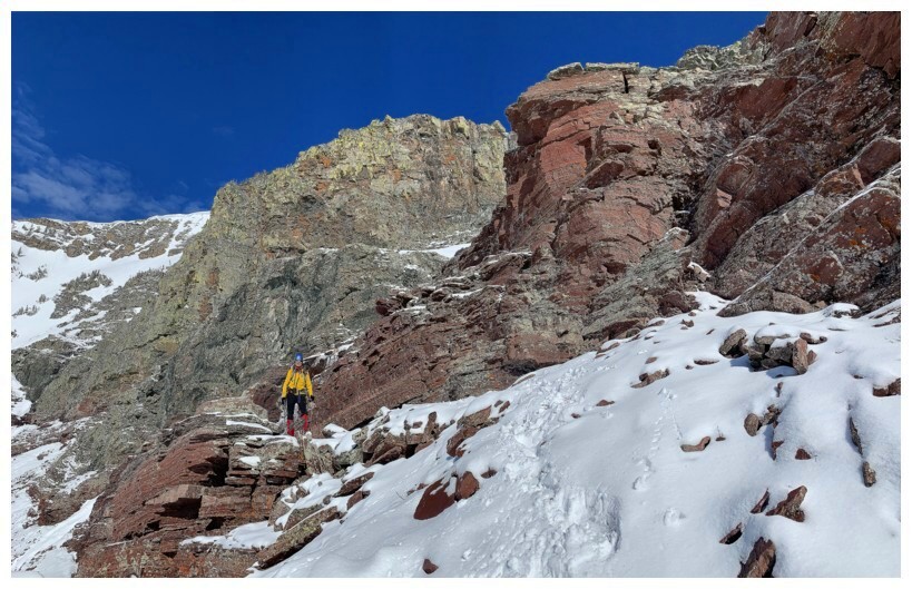
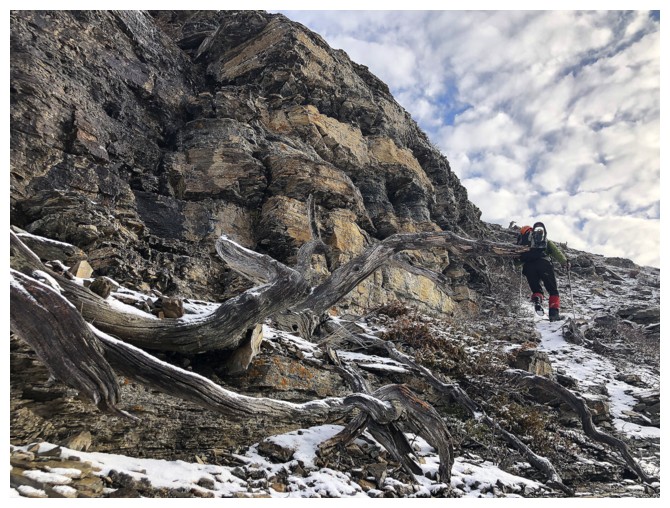
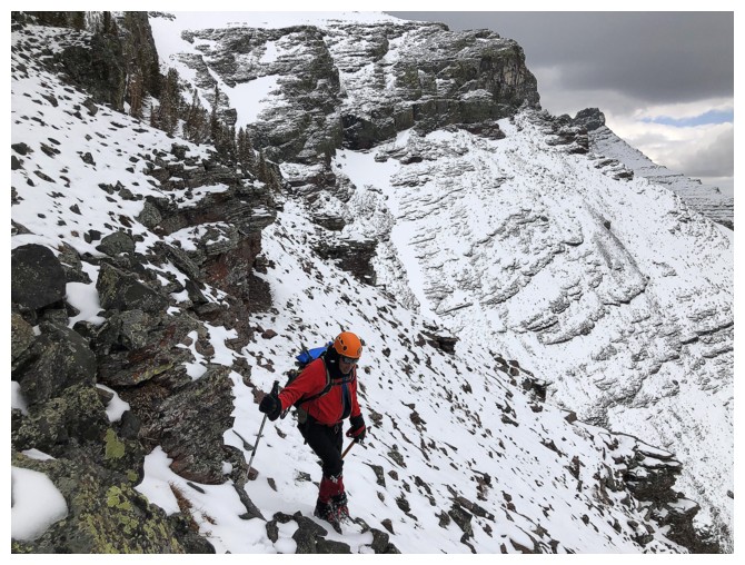
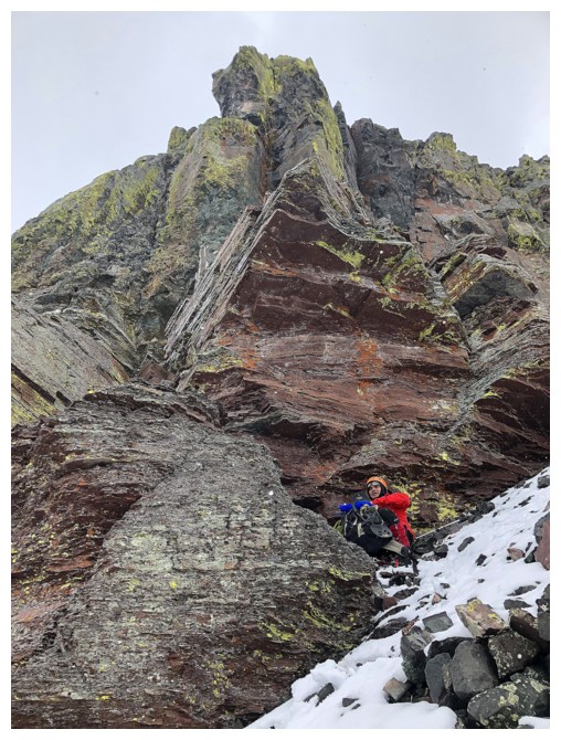
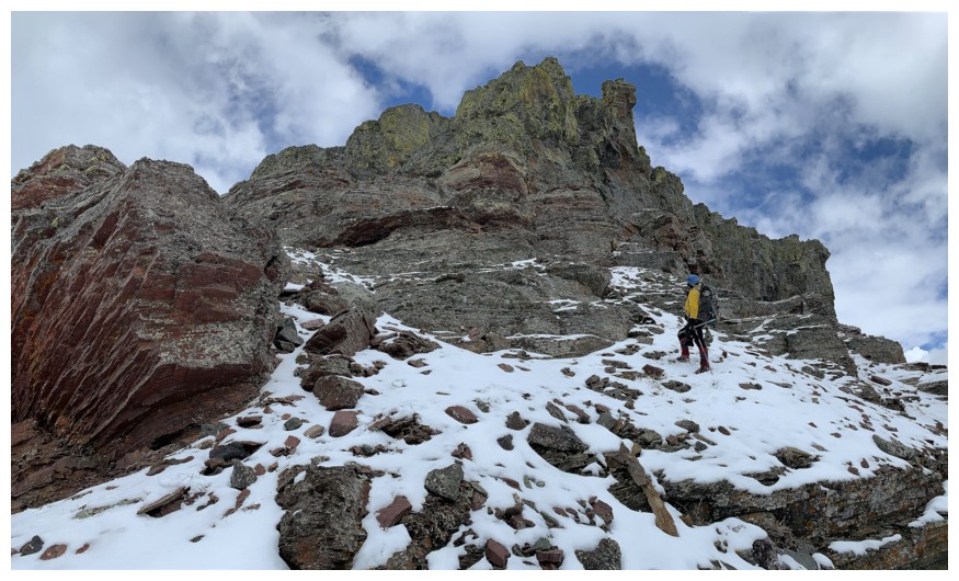
 We quickly reached a steep rock band that was not going to grant us easy
access to the top of it. Mark eventually found a weakness and scrambled up it with
relative ease – I wasn’t so graceful and squirmed up the weakness with a
decided level of awkwardness. Above that, we continued up, going even farther
right to a very striking wall of rock above. The clouds persisted but there did
appear a glimmer of hope that they would clear to the east.
We quickly reached a steep rock band that was not going to grant us easy
access to the top of it. Mark eventually found a weakness and scrambled up it with
relative ease – I wasn’t so graceful and squirmed up the weakness with a
decided level of awkwardness. Above that, we continued up, going even farther
right to a very striking wall of rock above. The clouds persisted but there did
appear a glimmer of hope that they would clear to the east.
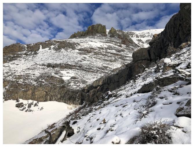
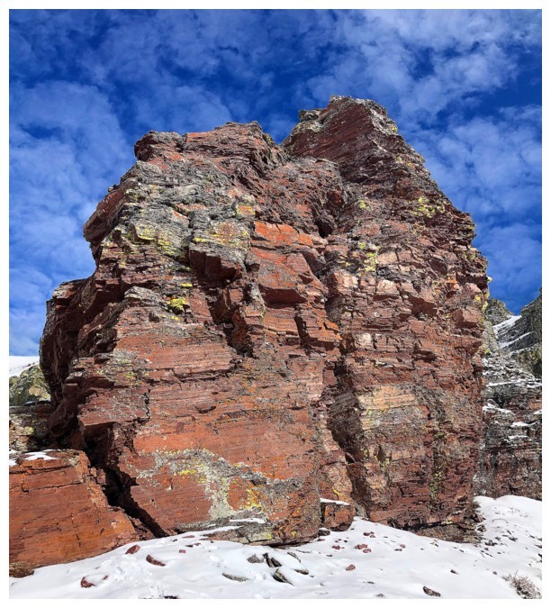
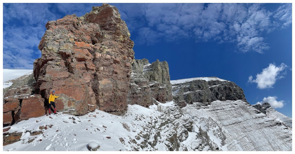
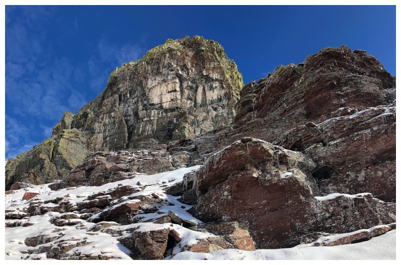
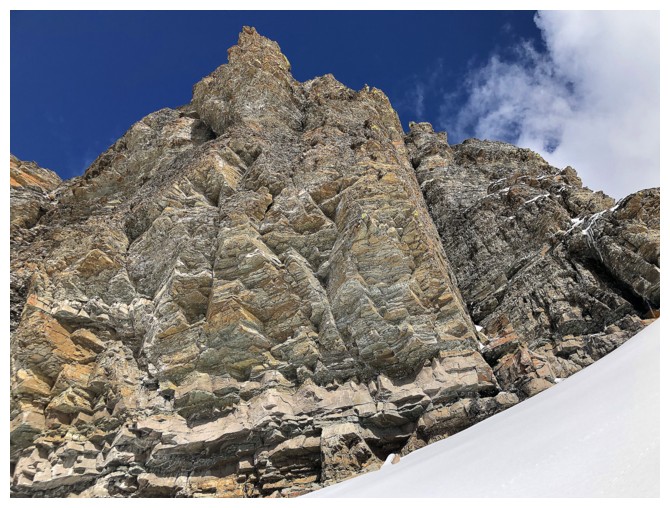
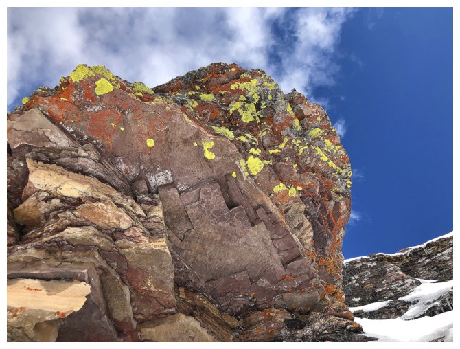
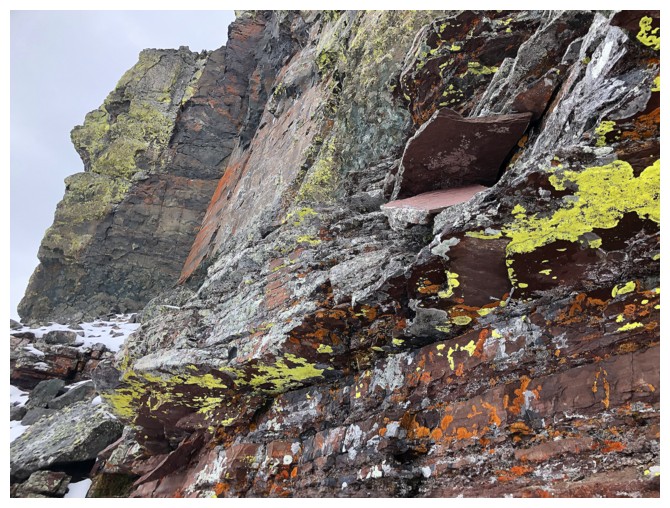
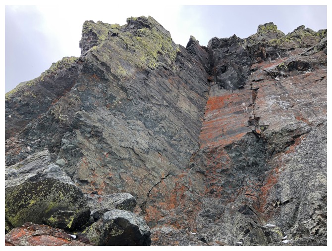
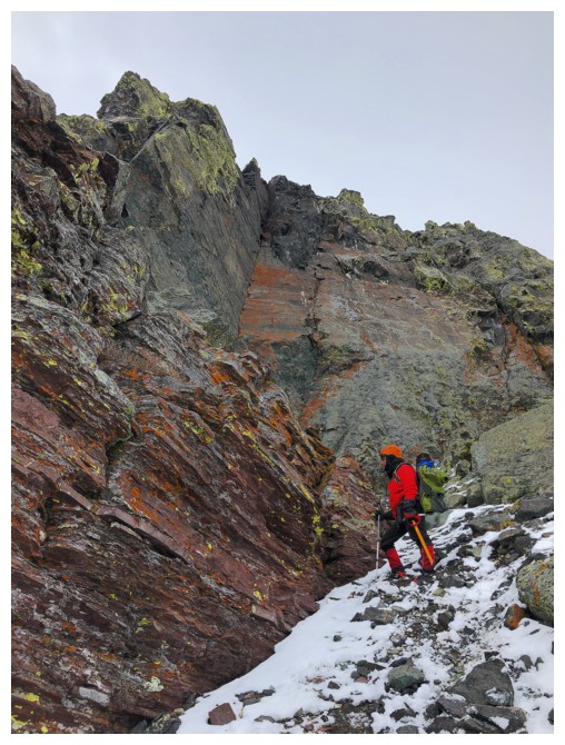
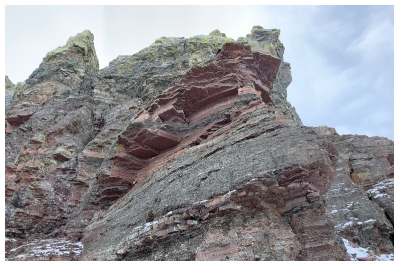
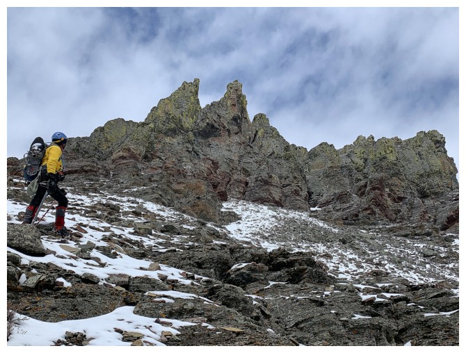
That striking wall turned out to be exactly that - absolutely stunning!
And luck seemed to be on our side for the time-being, as the Sun escaped the
cover provided by the clouds and lit up the colourful rock. That stunning rock
band also halted our upward progress, but this too turned out to be a stroke of
luck. We were forced to lose elevation alongside the steep rock, enjoying more
breath-taking rock scenery and unreal colours.
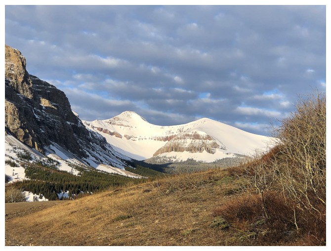
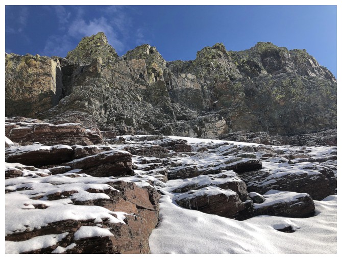
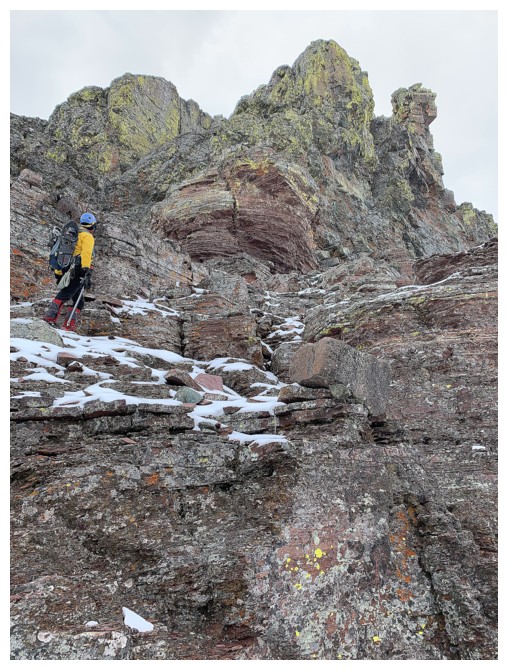
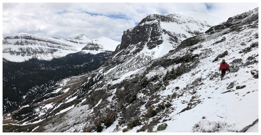
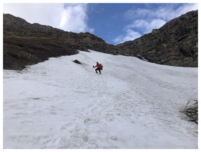
A route up eventually appeared and we embarked on a grueling but
intensely scenic slog towards the ridge. The amount of snow on the upper part
of the mountain for this time of the year was shocking to say the least – far
more than on both my previous visits to this side of the mountain (New Year’s Day, 2013; April Fool’s Day, 2013). Thankfully,
innumerable scenes of stunning Castle rock alleviated the tedium along the way.
 The downside of our route choice throughout was its tendency to trend towards
of the east side of Loaf,
not the west, where the true summit sits. Upon
reaching the ridge, we found ourselves very close to the middle summit,
but
still about 4 km away from the true summit. Dave had humorously named
the middle summit "Pastry Peak", in keeping with the baked goods theme (The Muffin, The Croissant, Bakery Peak, Pastry Peak, and Loaf Mountain) and so we took a break on Pastry, eating granola bars!
The downside of our route choice throughout was its tendency to trend towards
of the east side of Loaf,
not the west, where the true summit sits. Upon
reaching the ridge, we found ourselves very close to the middle summit,
but
still about 4 km away from the true summit. Dave had humorously named
the middle summit "Pastry Peak", in keeping with the baked goods theme (The Muffin, The Croissant, Bakery Peak, Pastry Peak, and Loaf Mountain) and so we took a break on Pastry, eating granola bars!
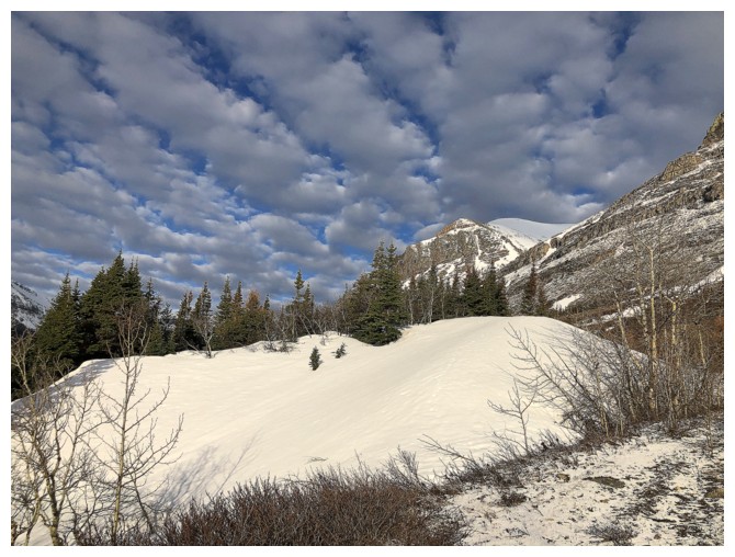
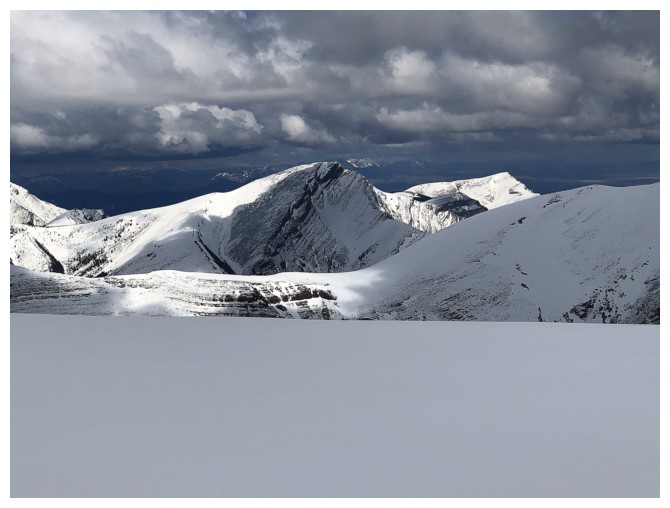
The weather had collapsed at this
point and we decided to call it a day. A worthwhile summit stay on Loaf Mountain requires
two things: completely clear skies to take in a magnificent 360-degree panorama
and very little snow to appreciate the beauty of the red, snake-like ridge
going east from the top. We had neither – time to go down!
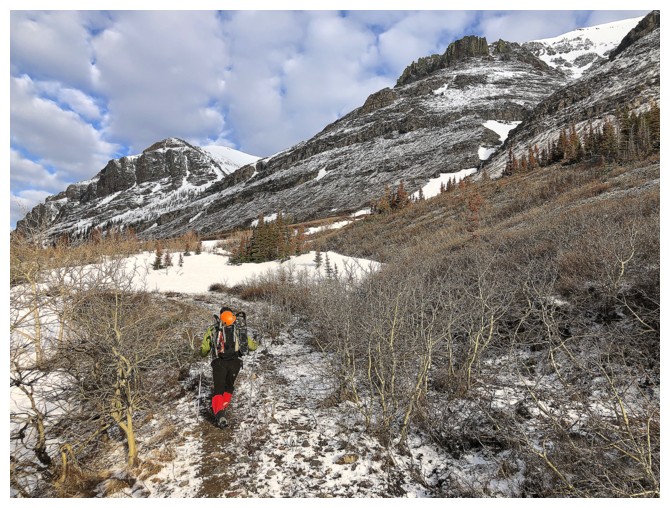
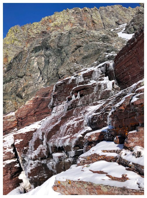
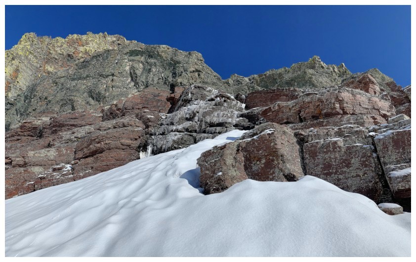
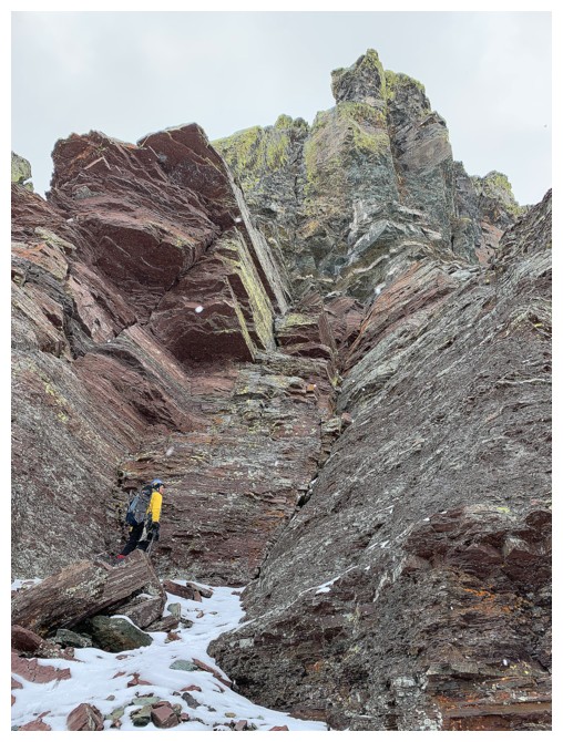
The easiest way off the mountain was definitely going to be descending
the route we had intended to ascend. Thankfully, the correct descent gully, cutting
through a significant rock band, was easily found and in very short order we
were below all the steep terrain and ready to finish the trip. But not before
checking out more of the wild rock on the extensive south face of the mountain.
Initially, we just wanted to see what was around the first corner, but this
turned into a lengthy side-trip (ironically now heading towards the summit), as
some of the rock and colours here were the best of the day – stunning doesn’t
even come close to describe it. Cloudy skies dampened the spectacle somewhat
but gave us a perfect excuse to return another day.
The remainder of the descent was straightforward, save a long traverse
to find a weakness through an unseen rock band. The day finished with a fast
and exhilarating bike ride back to the car.
A challenging, but totally awesome day out on one of The Castle’s
finest!
Epilogue: my selective (failing) memory continues to be a mild source of humour.
It turns out, I had visited the first “stunning rock band” on my April 1, 2013
trip, just from a different direction. No wonder I'm doing so many repeat ascents these days!
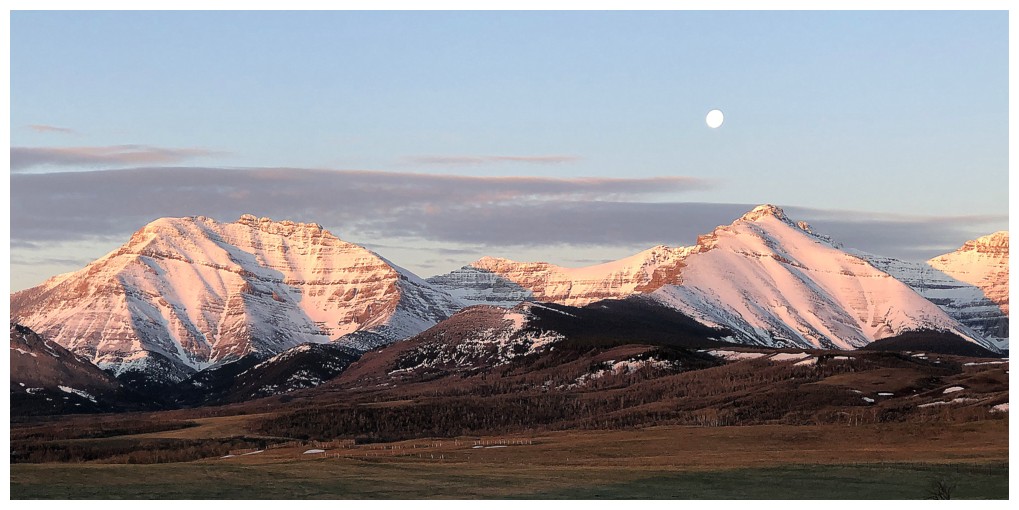
Pleasant Sun-rise, Moon-fall over Mount Dungarvan (left) and Cloudy Ridge Junior
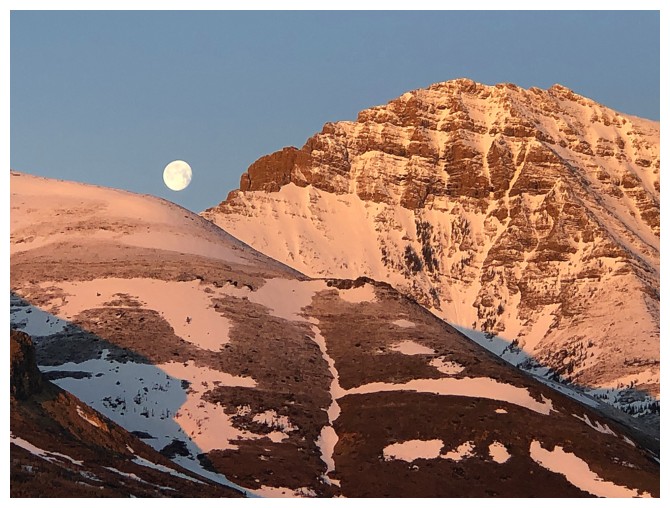
The Moon between Yarrow Ridge and Mount Yarrow
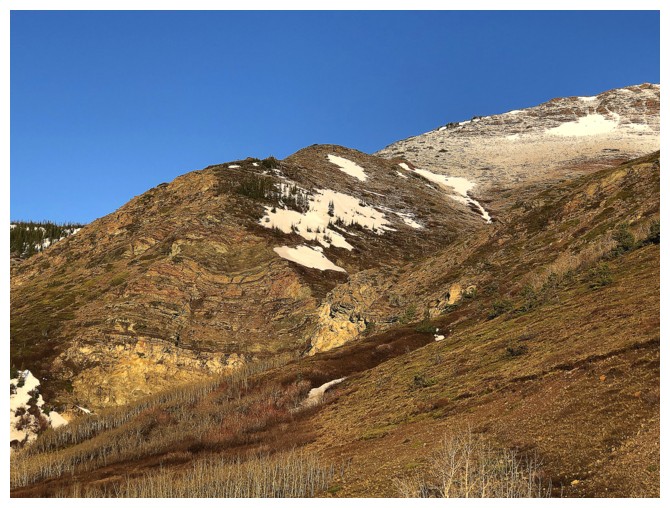
Some of the route up The Muffin and The Croissant: with Dave; with Mark; solo
The "impressionist" clouds have formed
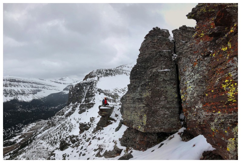
The summit of Spionkop Ridge - hands down one of the best summit views in the Southern Rockies
More interesting but not -so-welcome clouds
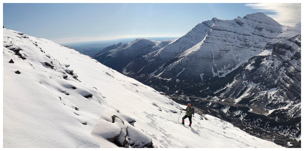
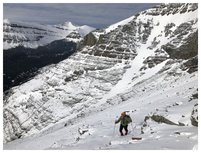
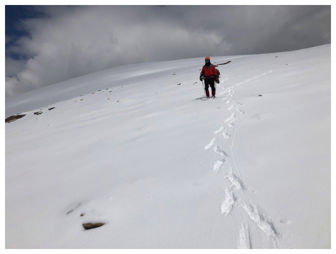
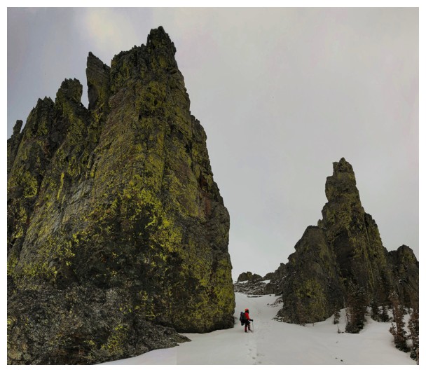
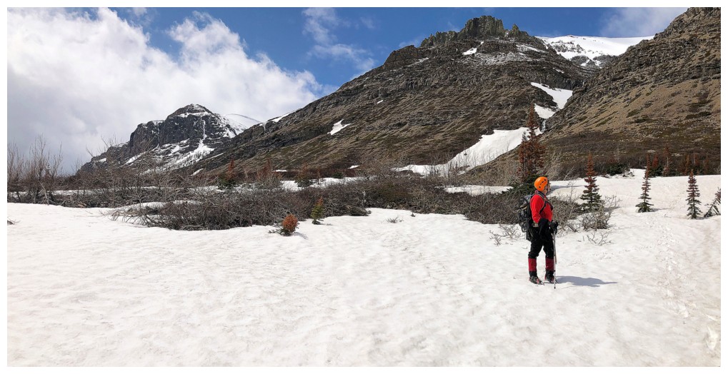
Approaching the ascent drainage
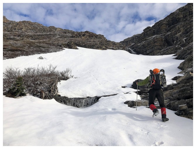
Heading up the drainage. We intended to go to the left but ended up going right
Going right
The clouds are getting cooler and the Sun will eventually escape their cover
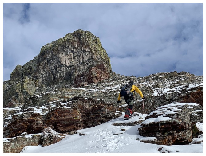
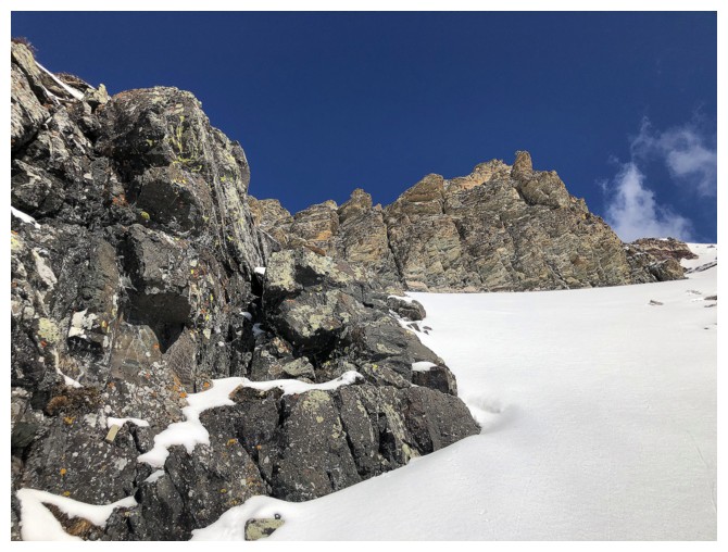
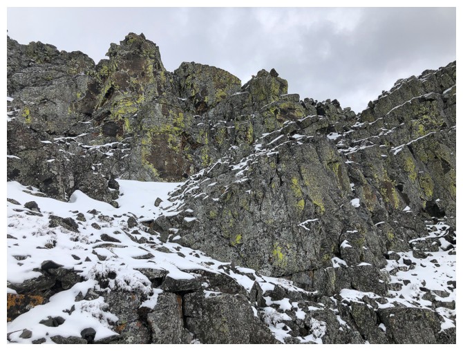
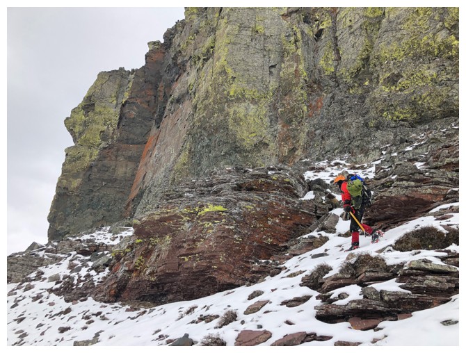
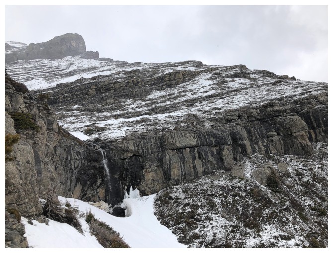
Looking over to the intended route. Note the gap through the rock band in the centre
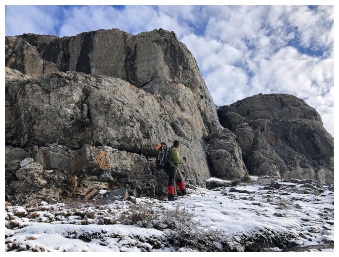
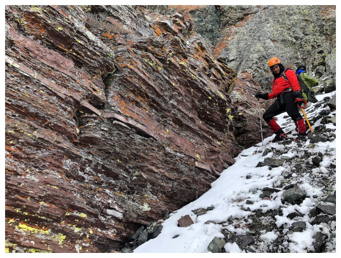
Mark looks for a weakness in the steep band that lines the face
The band does peter out for a small section on the left side of the drainage. Guess that's why I took the left in 2013!
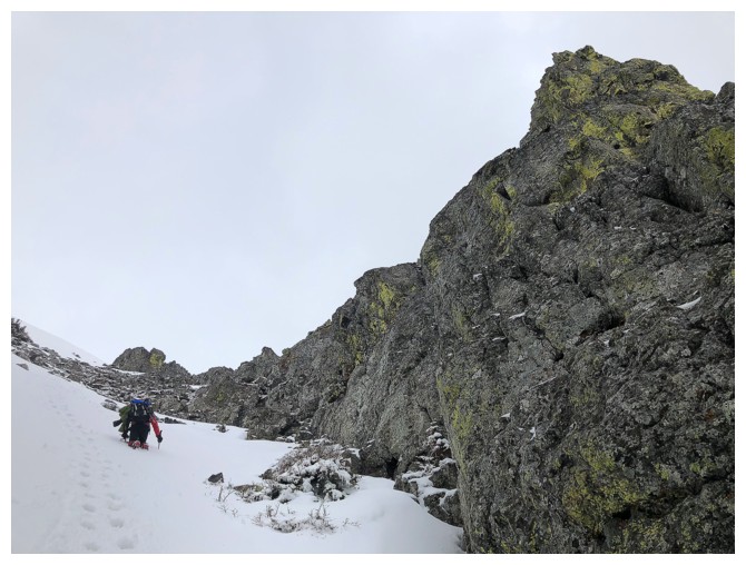
More traversing
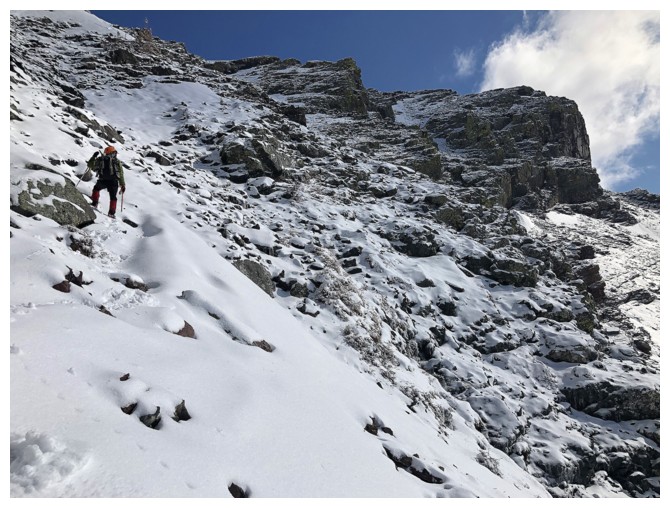
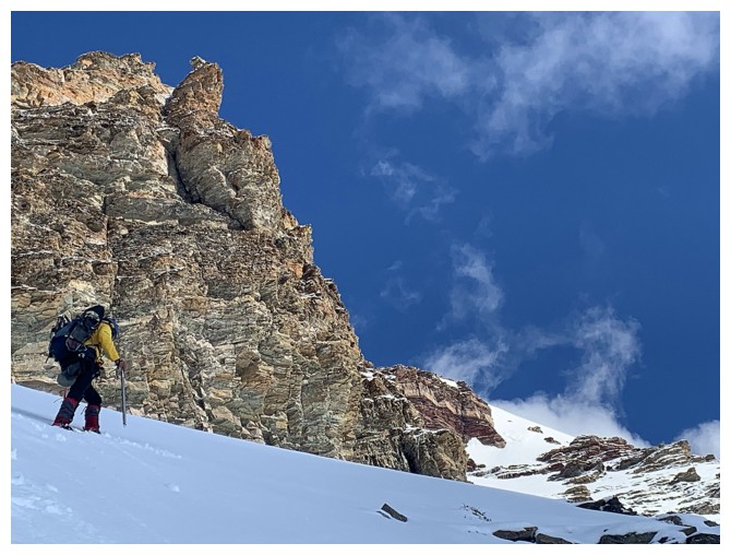
Mark scrambles up a steep weakness
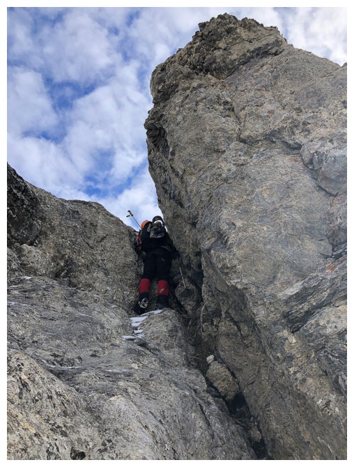
Tackling the steep finish
My turn - after the "squirming"!
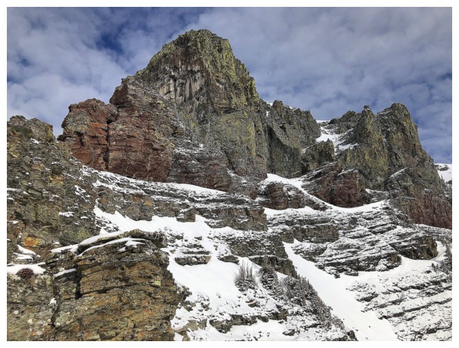
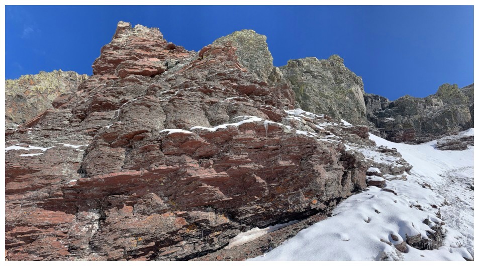
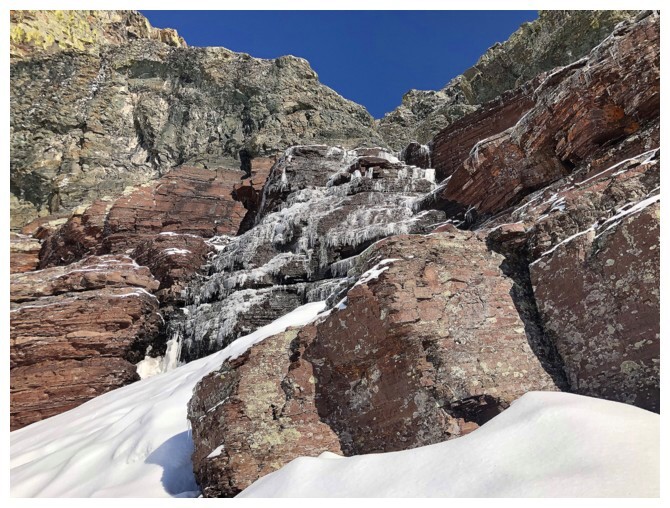
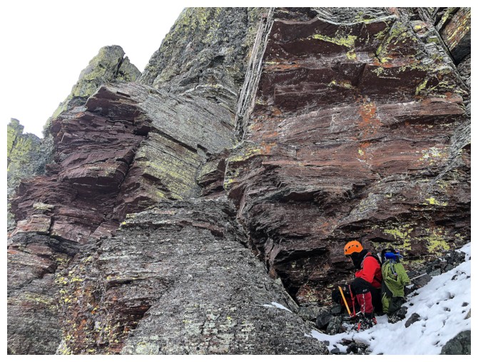
The first striking rock band
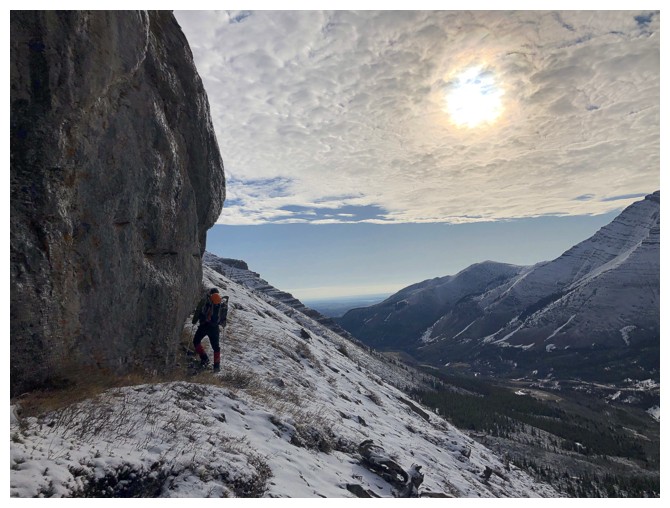
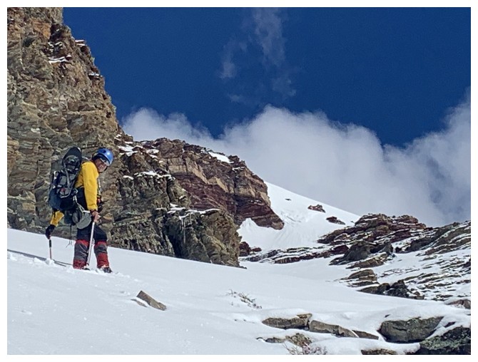
Getting close and hoping the clouds will go
Definitely looking better to the east
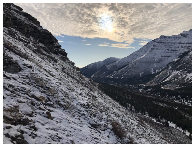
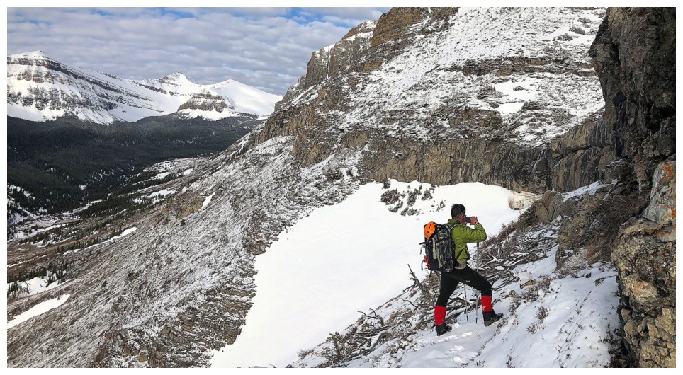
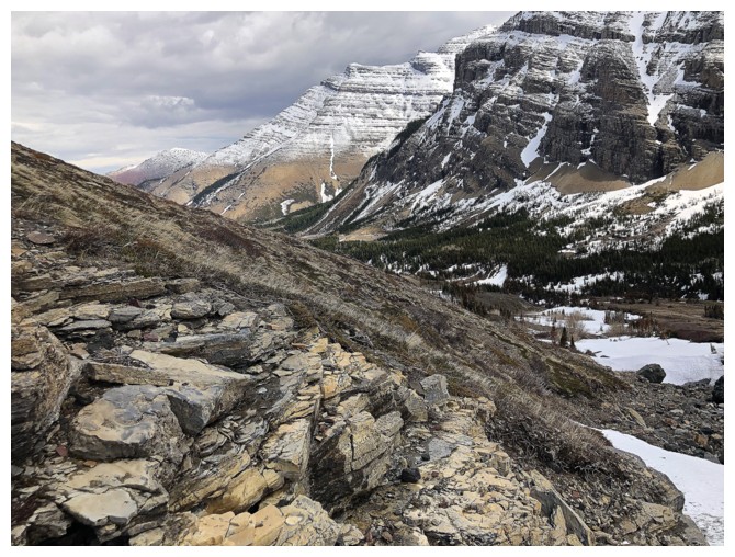
Looking down to the valley
Still not as Sunny as we would like, but improving
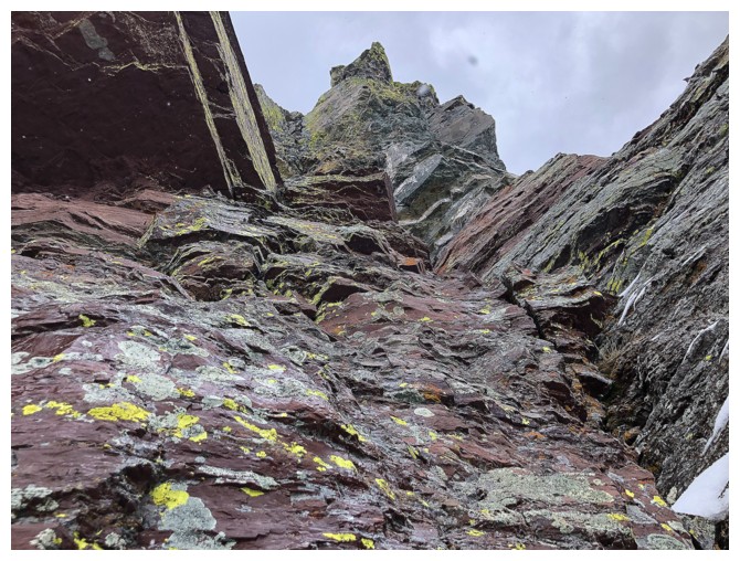
This rock wall/face begs some exploration
Still cloudy to the north as we arrive at the rock band
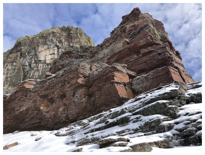
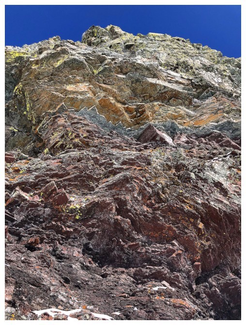
Big band of red argillite ahead
Big field of snow behind
I love this s#$@!
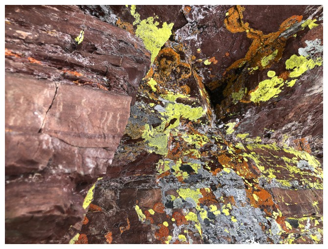
Of course I need to get up close and personal with the amazing rock
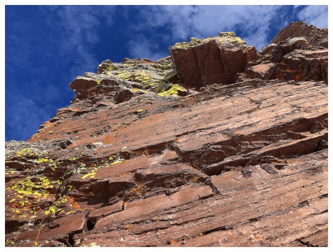
Looking up
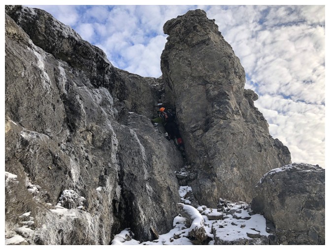
Traversing the rock band to find a weakness through it
Not there
Not there either
Another intimate moment
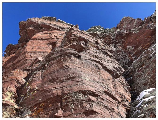
Superb
There was potential to ascend this way, but the icy conditions made it somewhat precarious.
I would later realize this is the route I took on my 2013 trip
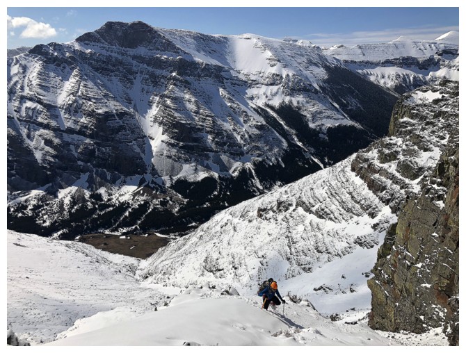
Losing more elevation to find the easier ascent gully we had spotted from the first striking rock band
I got stuck ogling at this
Definitely the route up I used before, but it was way easier
Heading up again
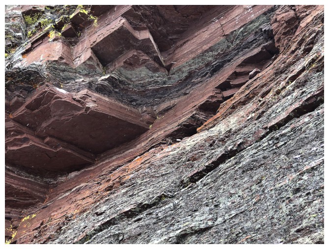
Definitely one of the coolest rock bands we've ever seen
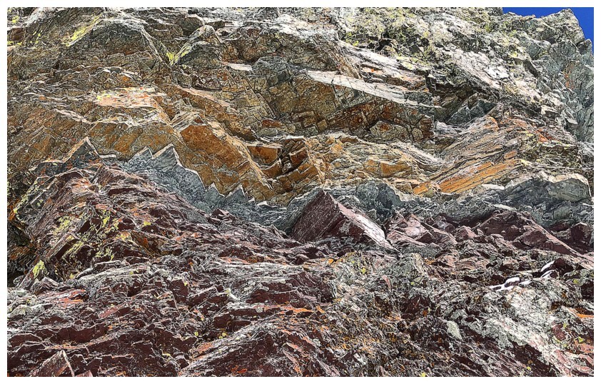
Close-up of the amazing layers of rock
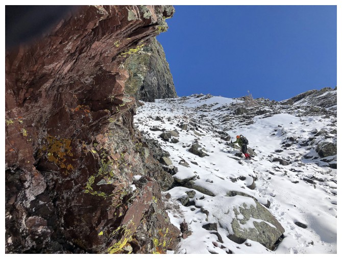
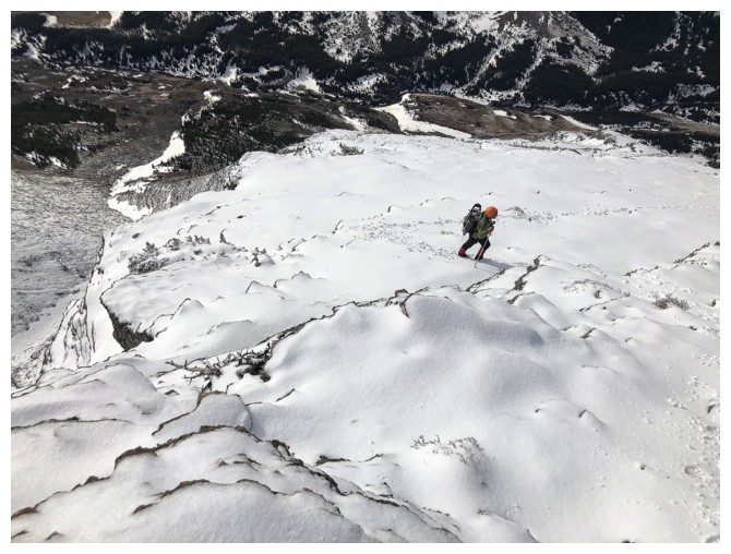
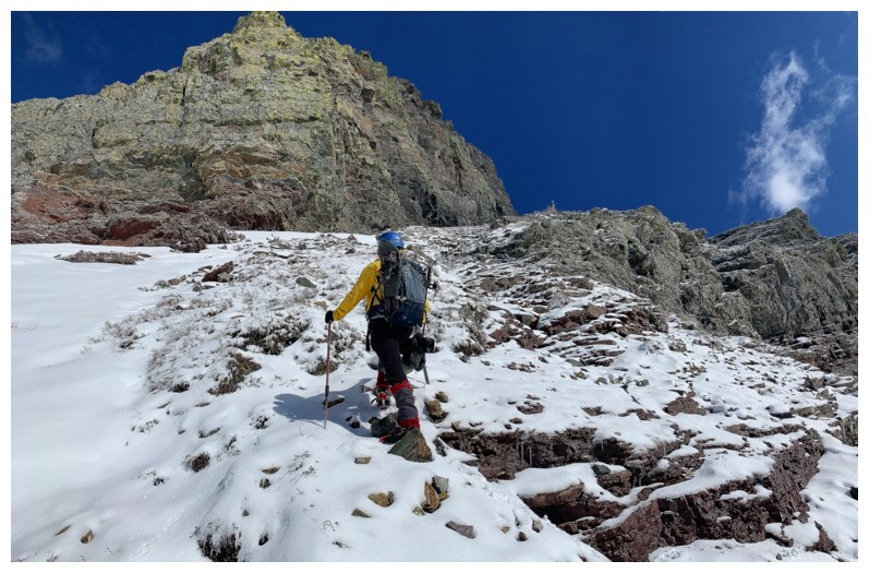
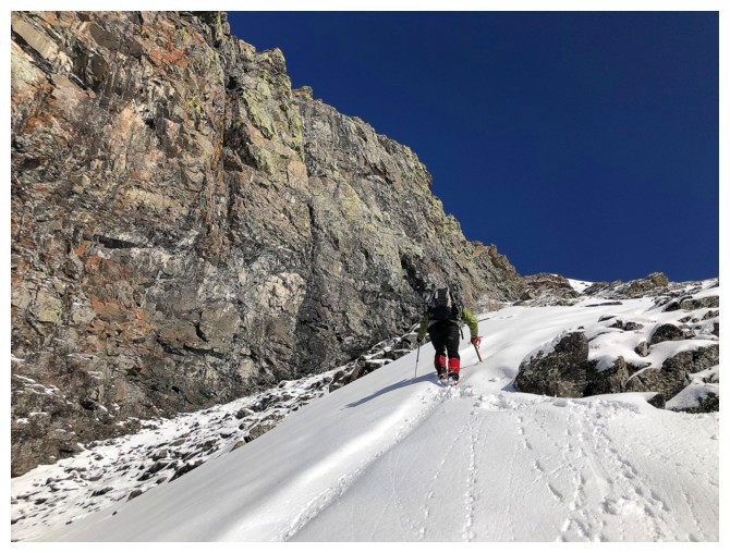
Continuing up the steep, snowy terrain
Going up alongside this colourful rock band was strenuous, but very scenic
Case in point
Looks like the angle is easing up, but in fact it just got steeper and steeper
At least it's scenic!
Good times!
Looking down the gully we came up and across to Mount Roche (Spionkop Ridge)
The awesome rock never ends
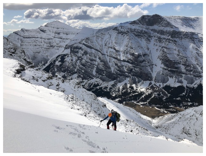
Still slogging up steep snow
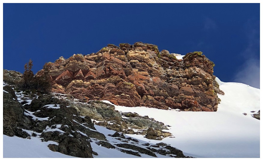
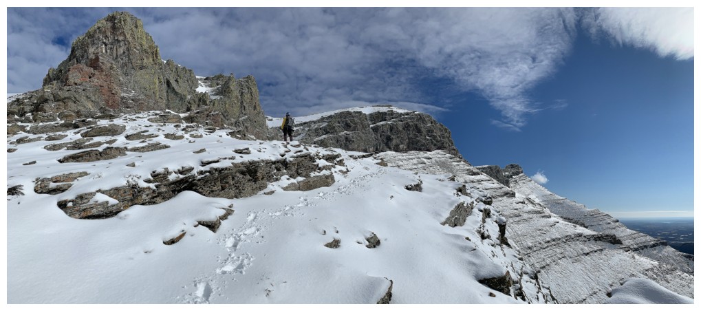
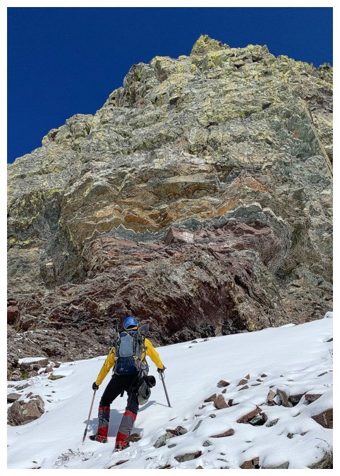
One more beautiful rock band to overcome or circumvent before reaching the ridge
It wasn't circumvented with ease, the snow being waist-deep in places
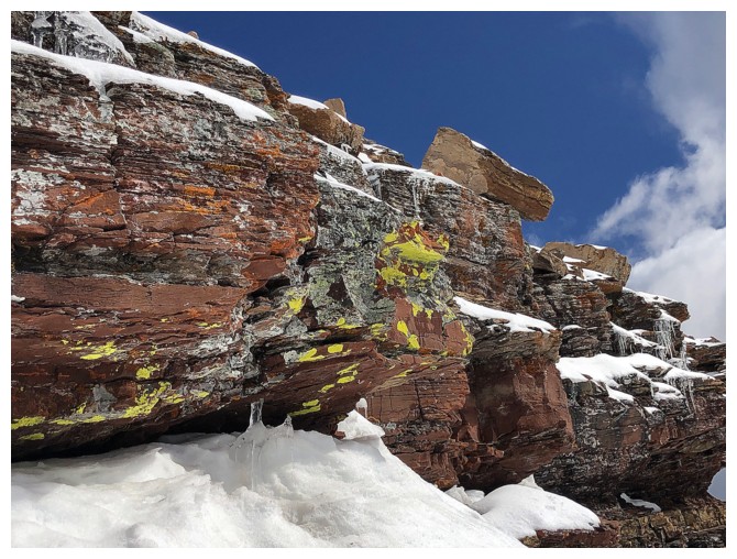
If you are going to post-hole to your waist, might as well do it ridge next to some red argillite with yellow lichens
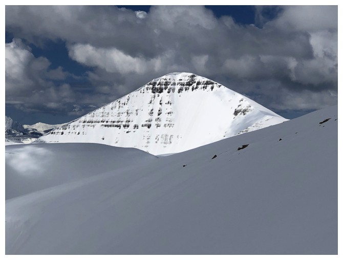
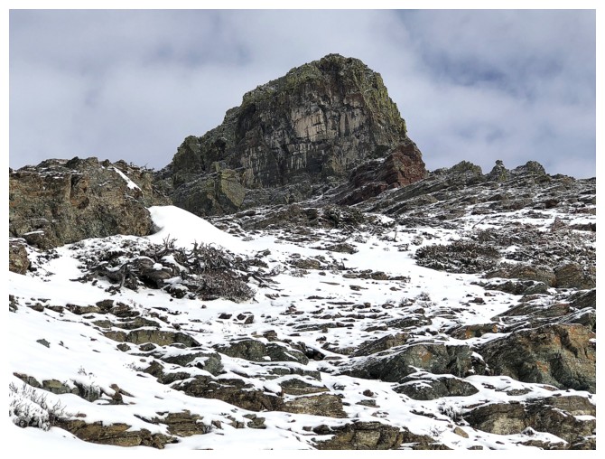
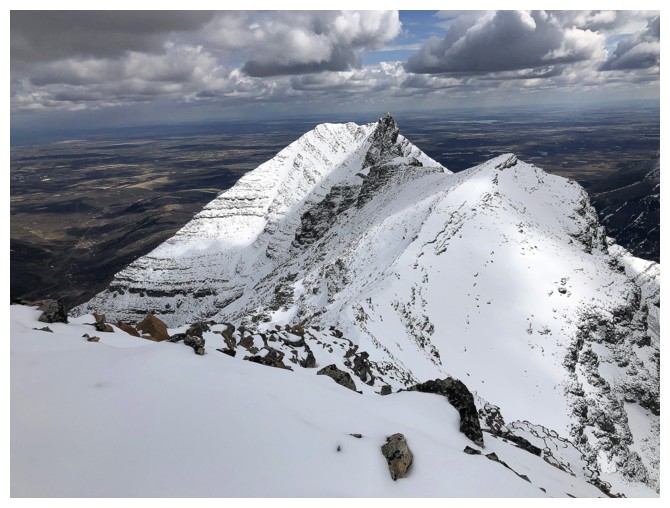
Zoomed-in first view of Loaf's true summit
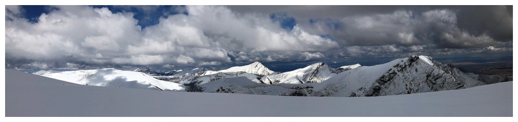
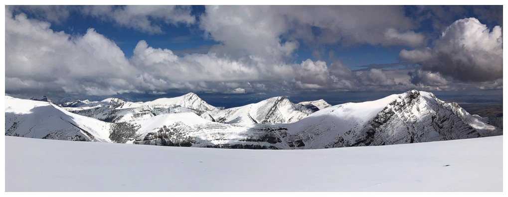
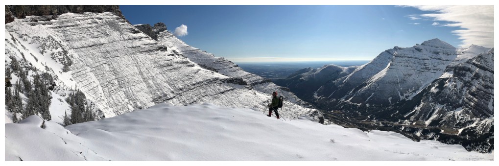
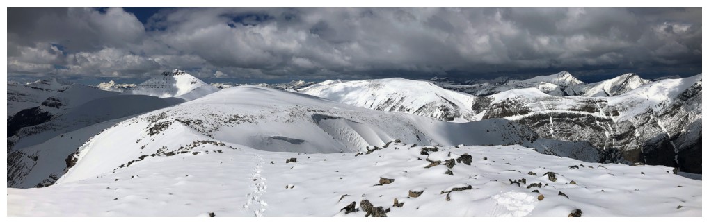
The view to the north from the ridge
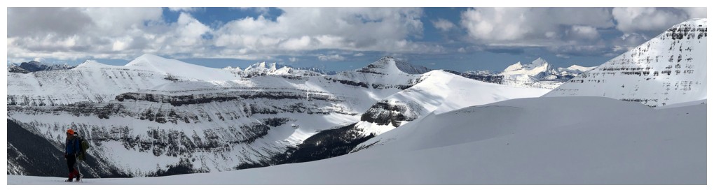
View to the west
Pincher Ridge
Heading west to a minor highpoint
Victoria Peak, right of centre
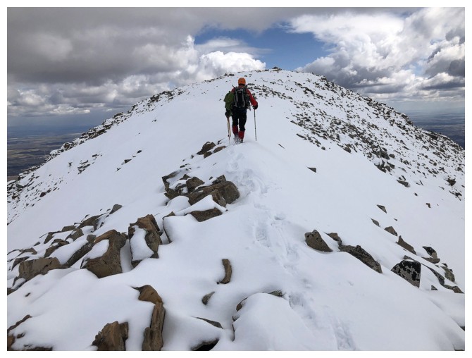
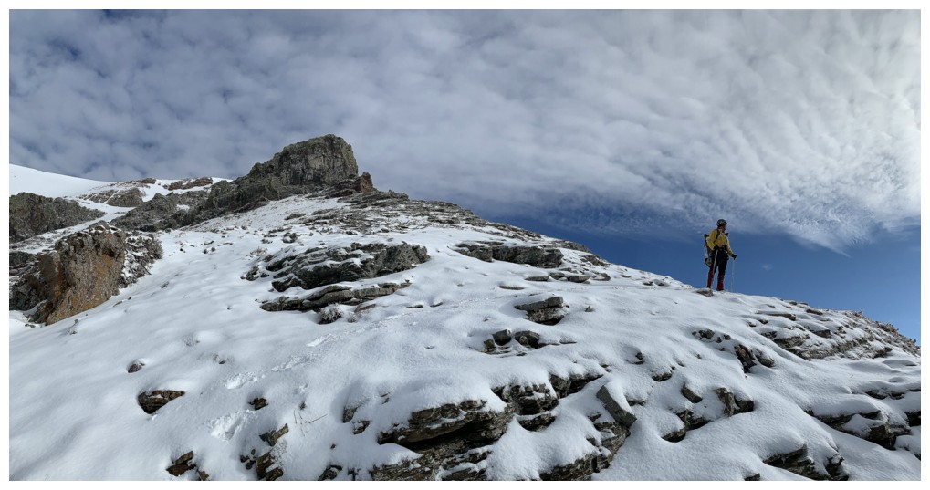
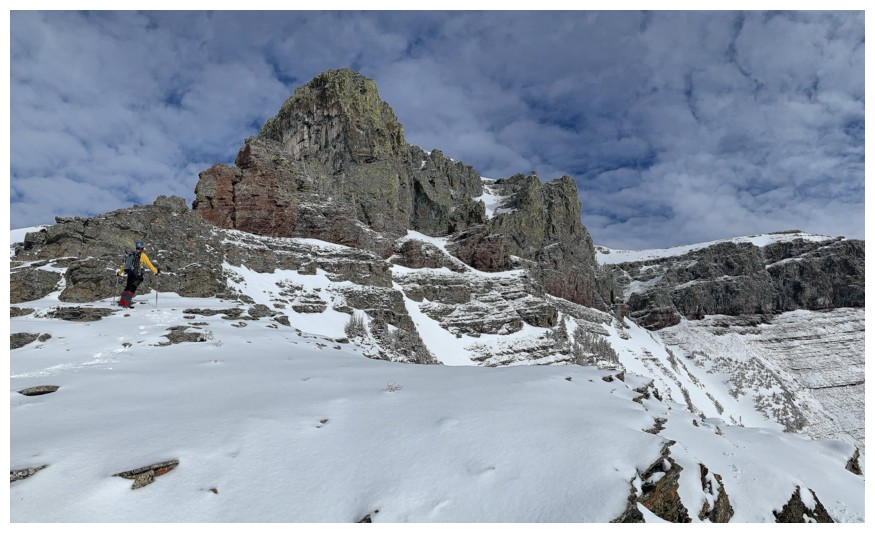
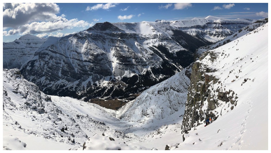
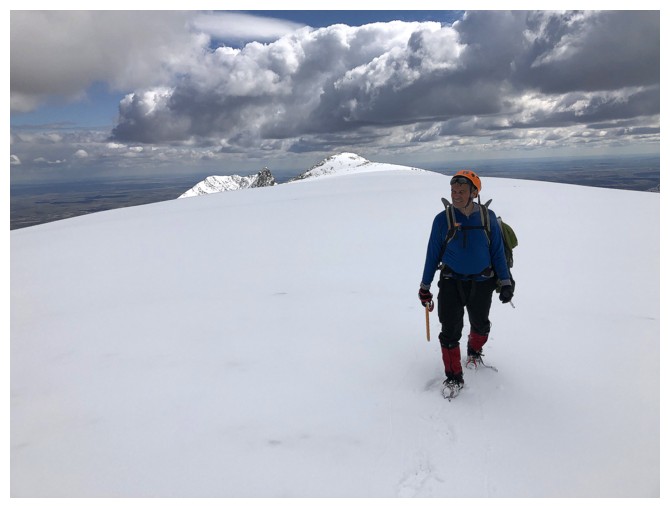
Heading east to the middle summit
View along the challenging east ridge of Loaf. Dave and I made to to the highpoint at the right.
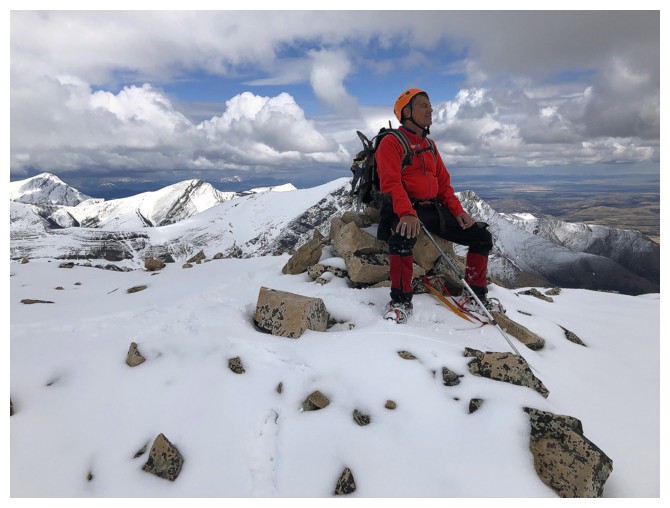
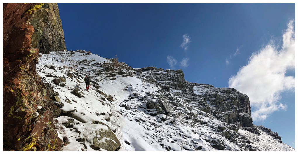
Good sized cairn to rest upon
Heading back to the west to find the descent route. The true summit of Loaf, at the left, is still 4 km away.
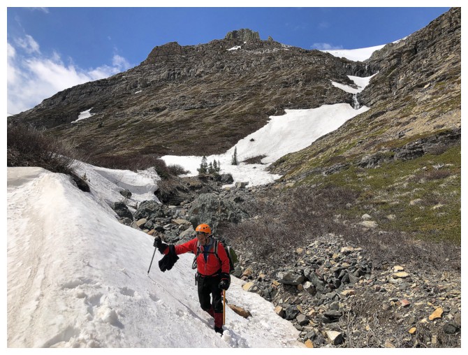
Easy slopes to start with
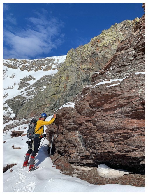
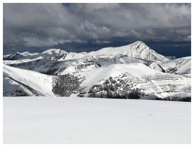
The gray/black rock band with yellow/green lichens is the key to the descent
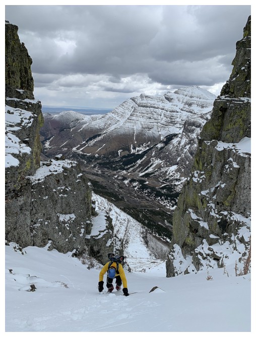
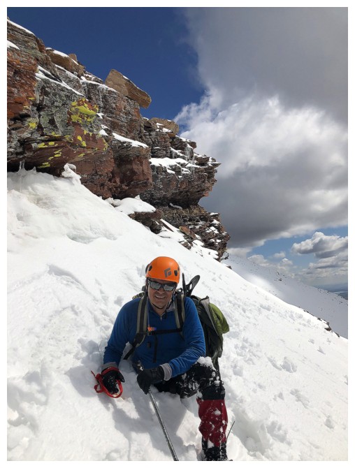
Getting steep enough to have in face in
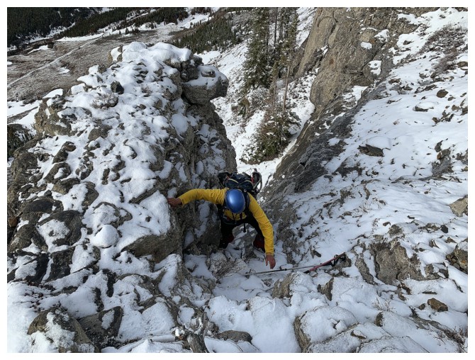
Mark follows
Mark in the key gap. With clear skies this would be a magnificent scene.
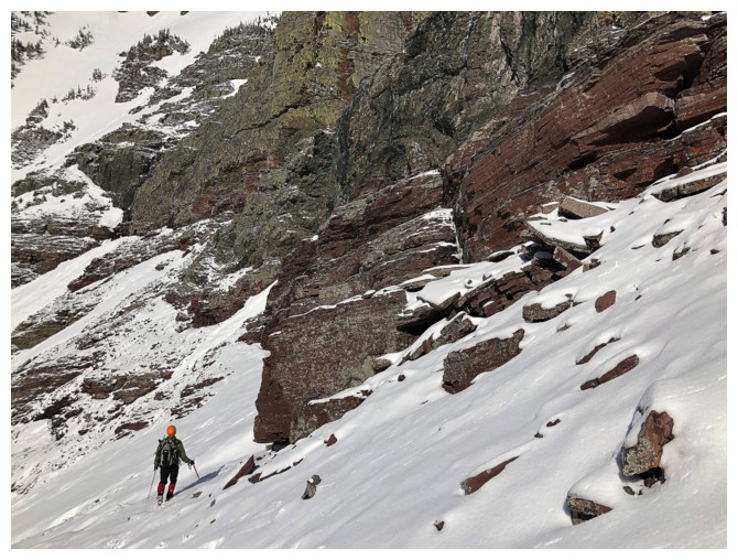
Traversing the south side of the mountain to check out the rock
Lots to see
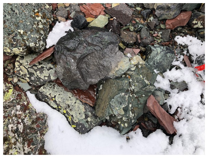
And lots of different coloured rock
Mark rests at the end of this section of rock. There was a potentially great scrambling route up from that point.
Last look before finishing the descent
One more
The somewhat long traverse to get back to the easiest descent route
There the first striking rock band again, at the left
Back in the drainage
Sucker patch of blue sky appears. It clouded over again a short time later.
The End
LOG