Buchanan Northeast Outlier
July 27, 2025
Mountain height: 2246 m
Elevation gain: approximately
1200 m
Ascent time: 3:40
Descent time: 3:05
Solo scramble.
With clear
skies forecast for the morning and cloudy ones for the afternoon, I decided to
take the opportunity to follow through on a trip that “went awry” three weeks
earlier. This time I was committed to sticking to SOISTHEMAN’s route up to the
ridge between Buchanan Northeast and The Senator and then make my way over to a
minor outlier just off the main ridge. I thought the outlier may provide decent
views over to the Waterton townsite and of course a big splash of red rock along the ridge
provided the ultimate motivation!
Short hike to
Cameron Creek, cross the waterway, up the lower slopes, and before I knew it, I
was back at the section of the valley that had blown me away earlier in the
month. Naturally, with perfect weather, I was going to revisit this area. And
also naturally, it blew me away even more!
I then resumed
travel, paralleling the enormous walls of stunning rock above me. This section
too proved to be engaging and surprisingly scenic, featuring a blanket of
bright green, vegetated slopes, contrasting with the fine red argillite scree.
And if that wasn’t enough, a completely unexpected run-in with a super cool
snow cave definitely put this part of the trip over the top.
The snow cave
was followed by bit of a slog to the ridge. Throughout that slog, I couldn’t
help but think that of the numerous routes up the west side of the Buchanan
massif I’ve taken over the years, this is easily the most rewarding one – thank
you SO!
A short break
was needed once I reached the ridge. Also some decision-making. During the
latter part of the ascent, I had been staring at the steep slopes leading to
The Senator, but more importantly the shoulder I had used to access Lake
Dormaar, earlier in the year. From some angles the slopes looked doable and from
others too steep. However, the idea of checking them out was now seeded in
my brain and an attempt would be inevitable.
But first – the
beautiful red ridge and the outlier. Both provided easy travel and
awe-inspiring views. However, that view of Waterton I was looking for appeared
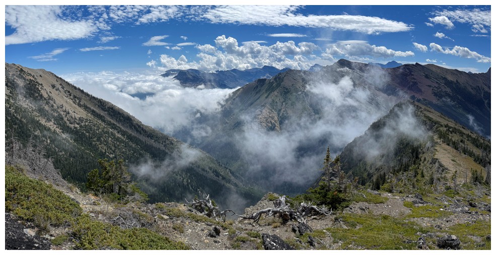
to be in jeopardy. The area was blanketed in low-lying clouds, providing very
cool, atmospheric scenery. By the time I reached the summit of the outlier, the
clouds had thoroughly consumed the townsite. No complaints here, however – with
sunny, clear skies to the west and socked-in conditions to the east, views from
the top were surreal.
Although I had
toyed with the idea of returning to the main ridge, then going up to Buchanan
Northeast, the forecast cloudy conditions were coming to fruition; although I
was surprised that the wall of approaching cloud was streaming in from the
east. A better plan would be to head west and check out that potential route up
towards The Senator.
After an easy
and fun ridgewalk back, I started up the steep slopes, hoping to stay close to
the ridge. That didn’t happen. Almost immediately I was forced away from the
ridge, steep rock bands blocking the route. A little zigging and some zagging later
and I was able to get to a cool viewpoint on the ridge, but this would be the
end of the line. The terrain above was increasingly steep, and I became
concerned about downclimbing that terrain should I get to the top. Once back
down to safer terrain, I took a more direct route down the mountain, enjoying
some new scenery once again.
An absolutely
fantastic day on a route that I’m highly likely to repeat.
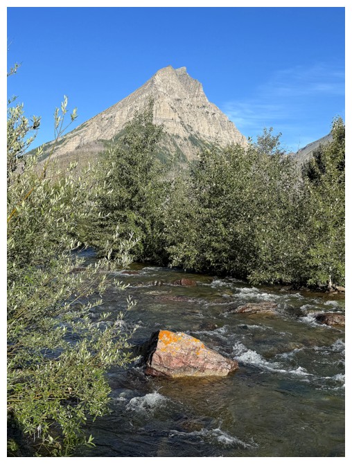
The Senator from near the start. The route I want to take goes up the drainage and then over to the left side.
Mount Lineham and that cool rock I saw previously, from the other side of Cameron Creek
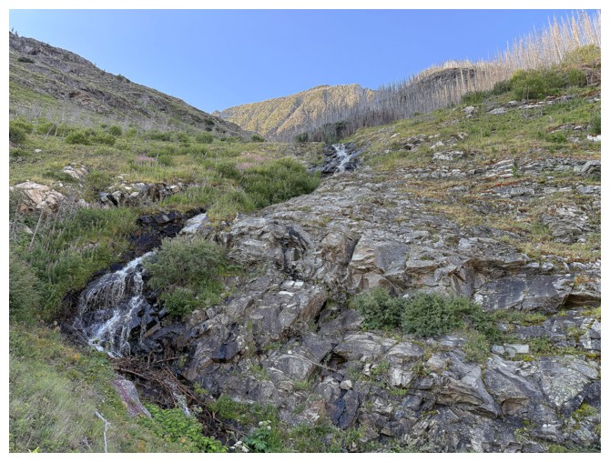
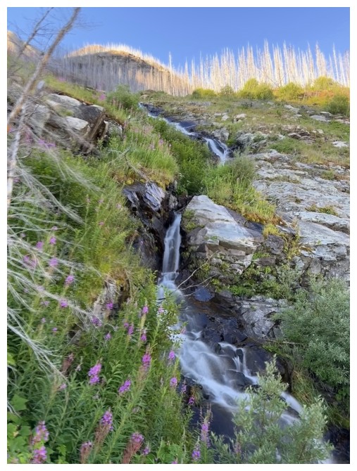
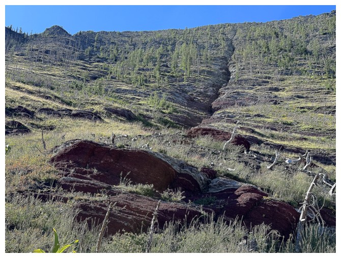
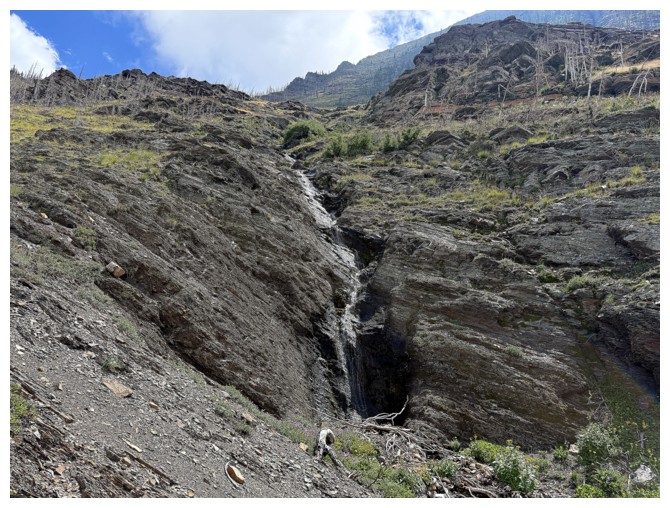
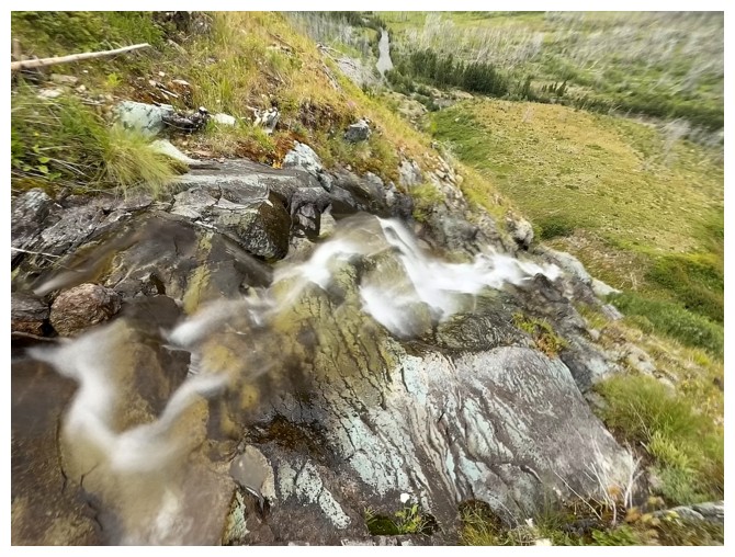
Some of the lower part of the drainage
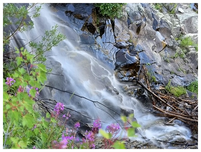
Lineham gets lots of love near the bottom of this route
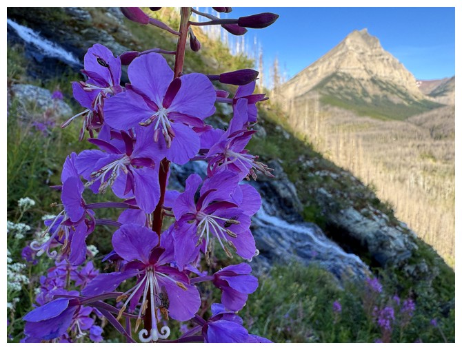
So does Monkey Flower (Mimulus lewisii)
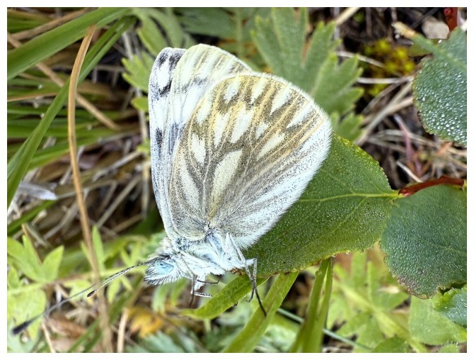
Cool butterfly
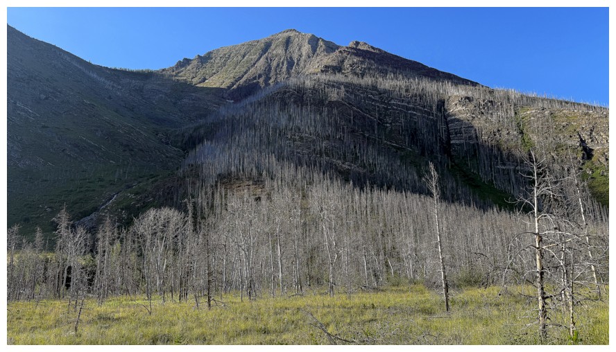
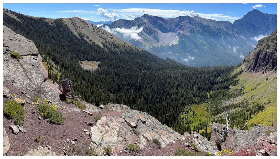
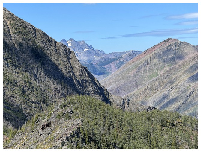
The second section of the trip is a cool hike up towards the rock walls above
Not sure what that is but I like it!
I like this too
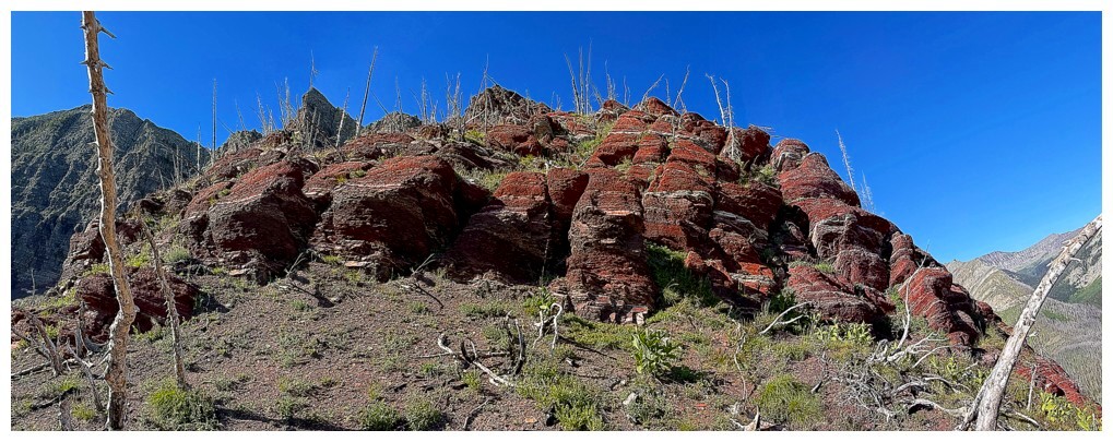
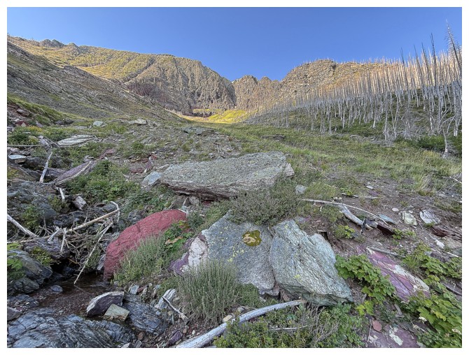
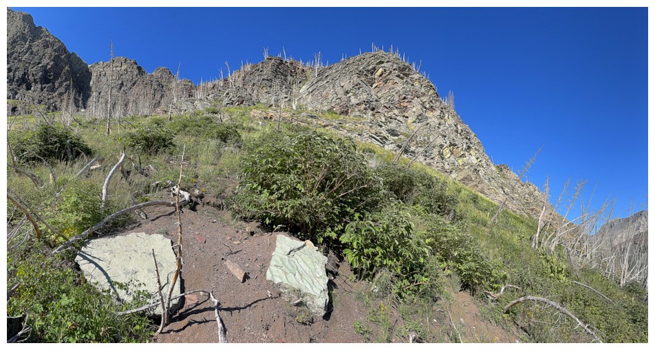
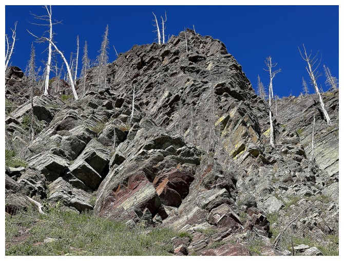
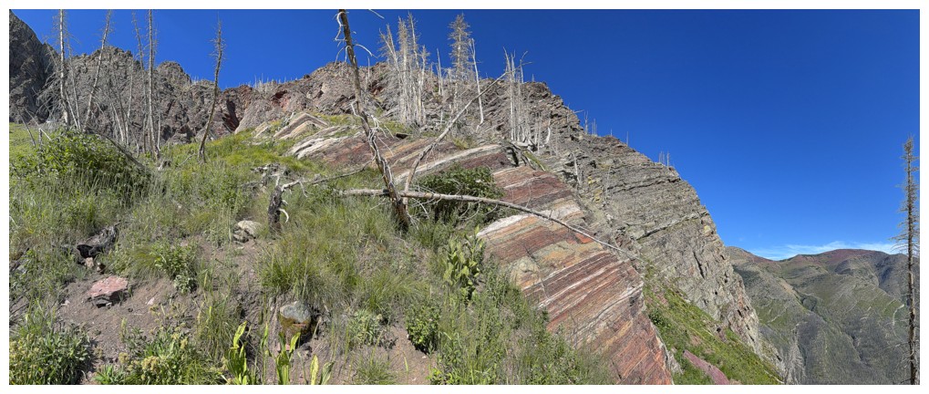
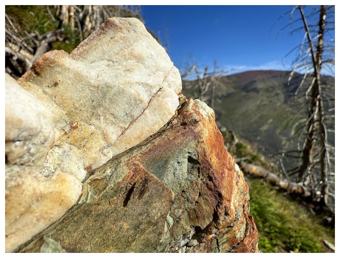
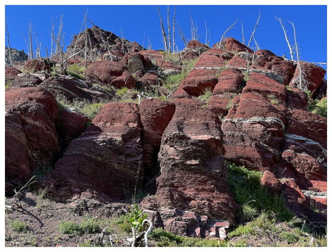
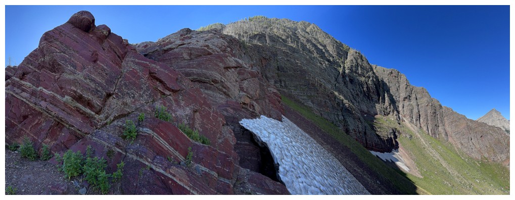
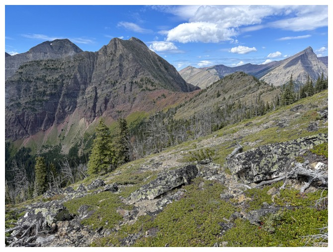
The chunk of red argillite had me swooning 3 weeks earlier
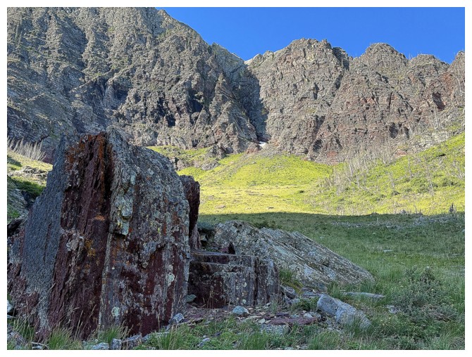
And I'm still swooning
Still
The ridge I should be going towards, but am not
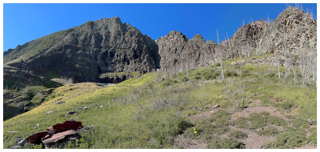
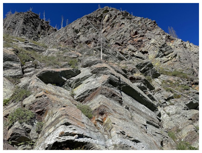
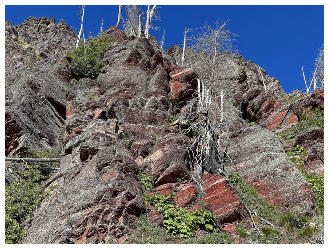
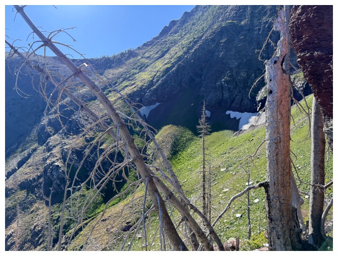
Excited to revisit this amazing area of stunning rock
The stunning rock...
Not rock, but interesting, with cool rock behind
Could it be windy here?!
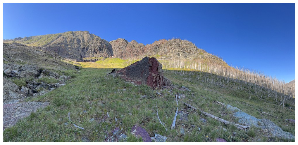
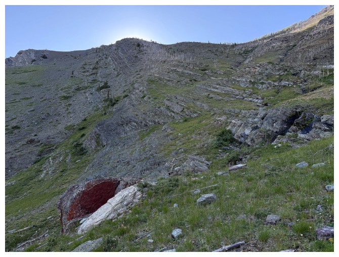
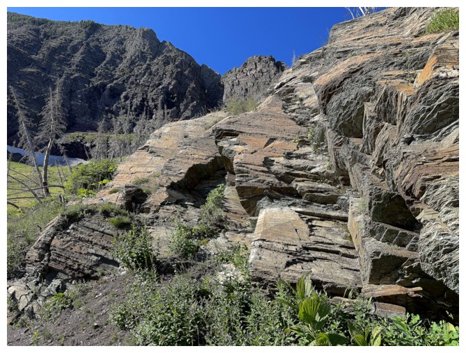
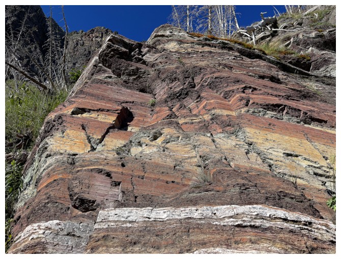
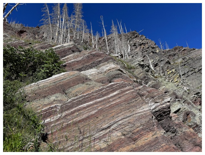
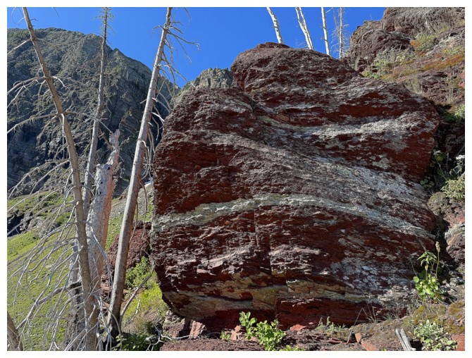
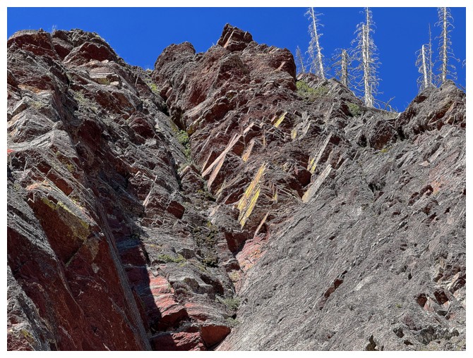
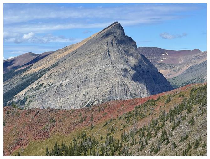
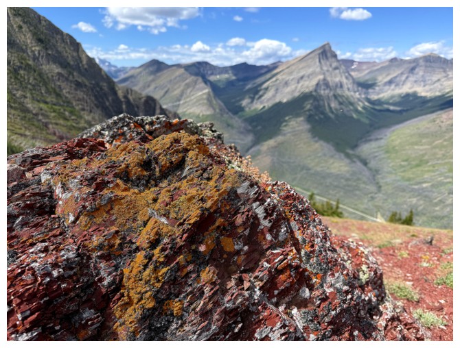
The red argillite band that prompted me to ascend The Senator several weeks earlier
Some of the biggies of Waterton
Again, looking to where I eventually want to go
Back on the side of the ridge that leads to the col
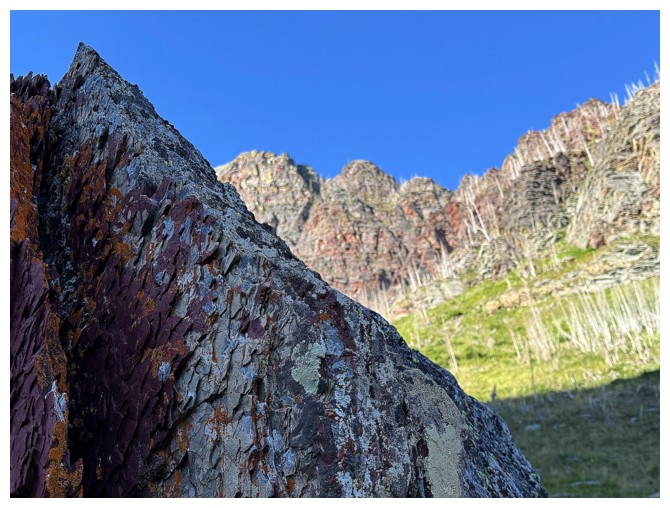
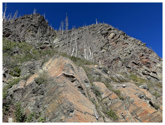
And the stunning rock continues
Finally ready to head towards the ridge
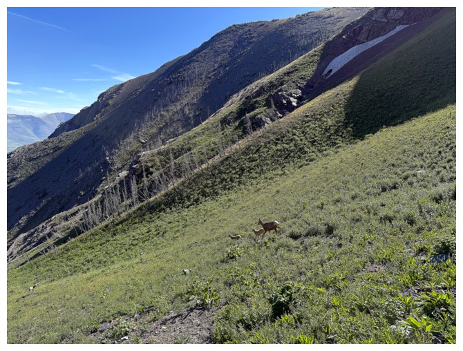
Sheep sighting
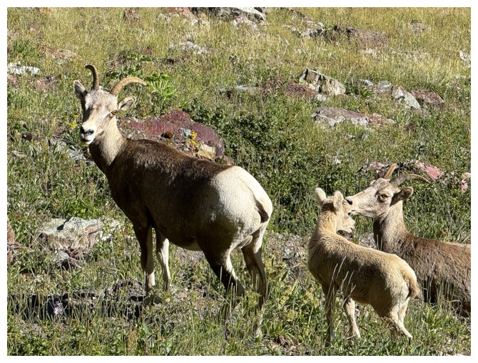
They didn't seem to concerned about my presence but gave me some space
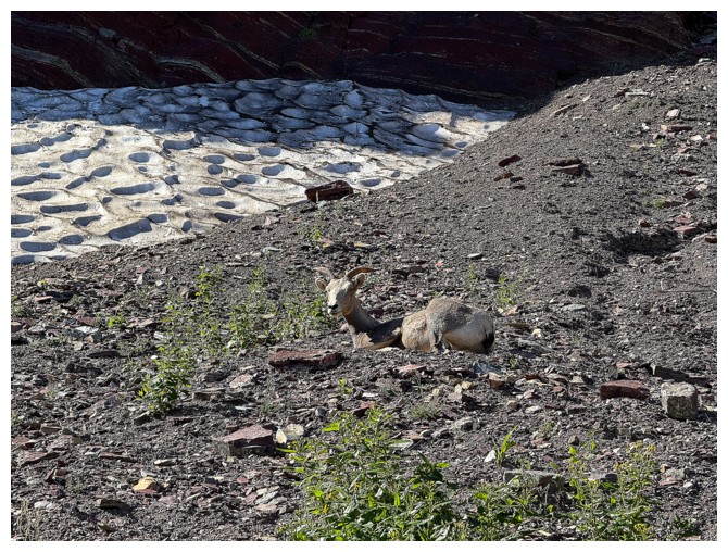
This guy didn't even budge as I inadvertently hiked right passed without noticing
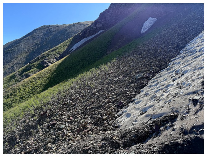
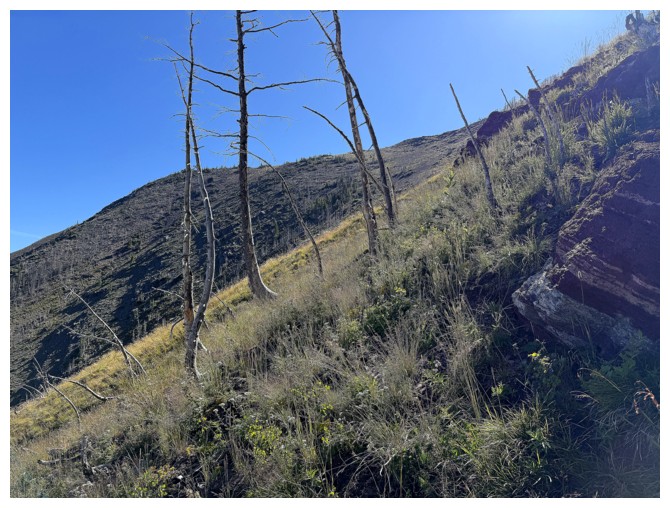
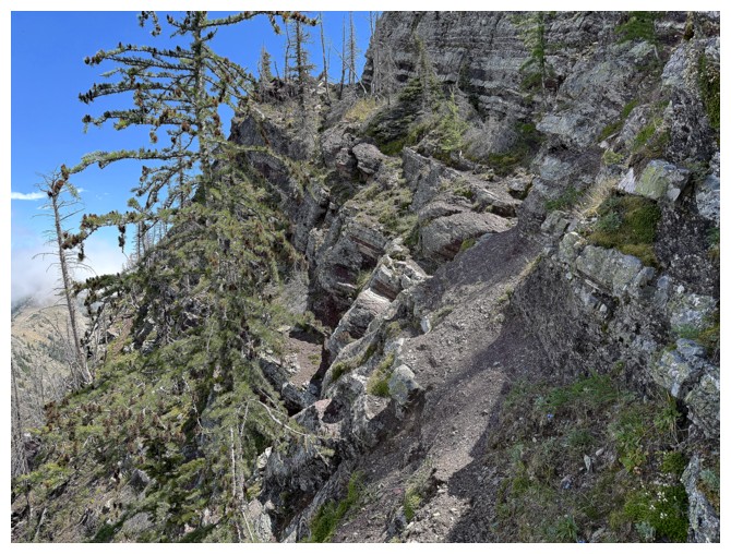
Typical terrain on the traverse
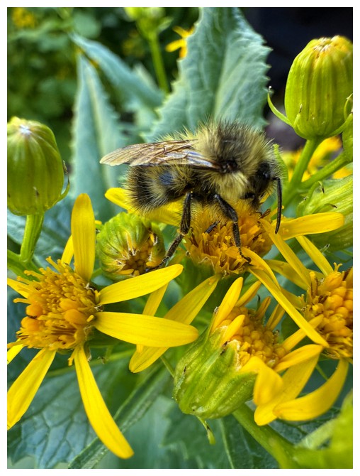
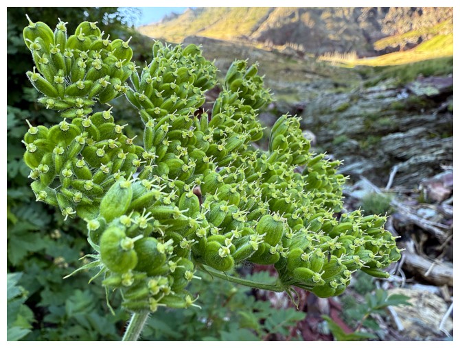
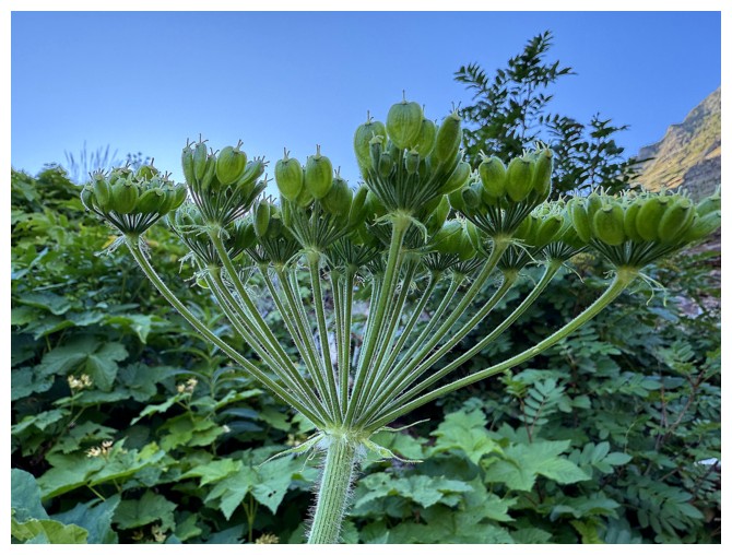
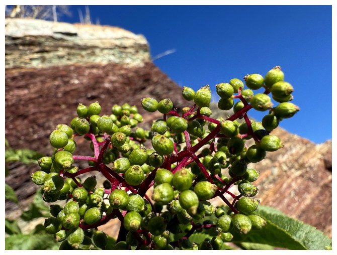
Typical pollinators doing their thing
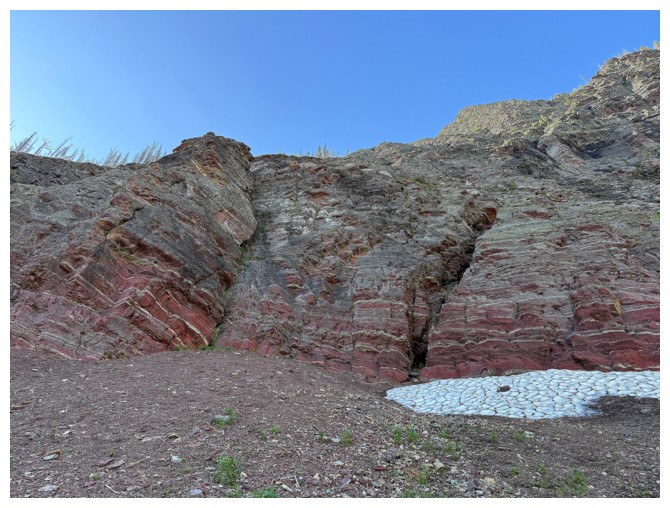
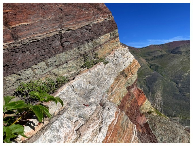
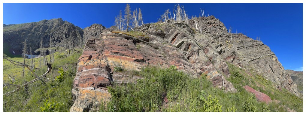
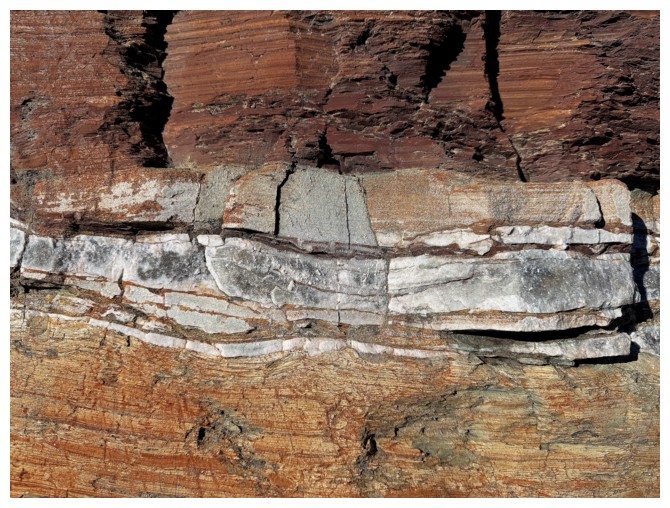
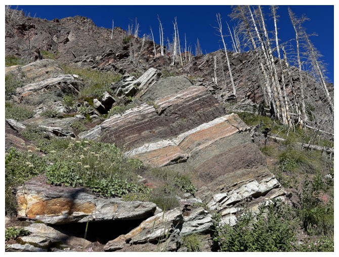
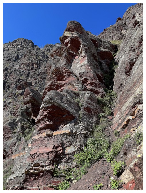
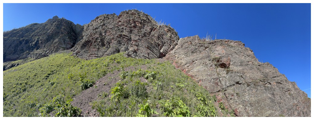
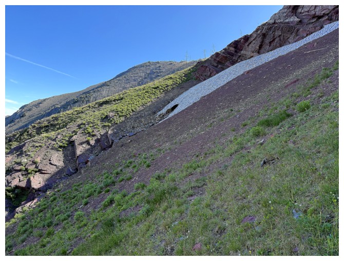
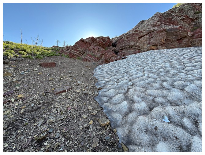
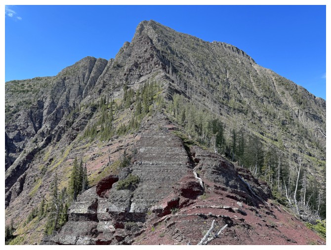
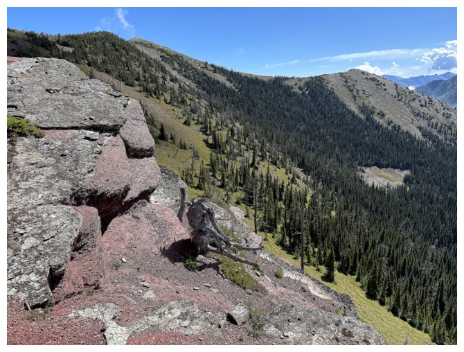
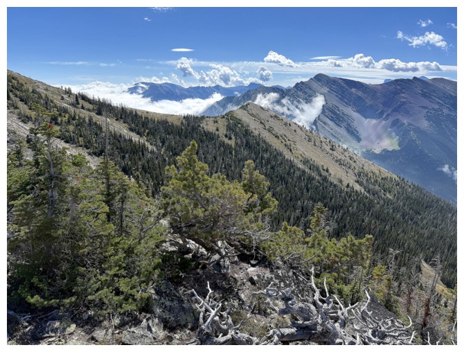
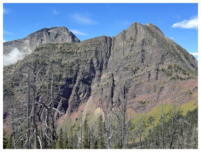
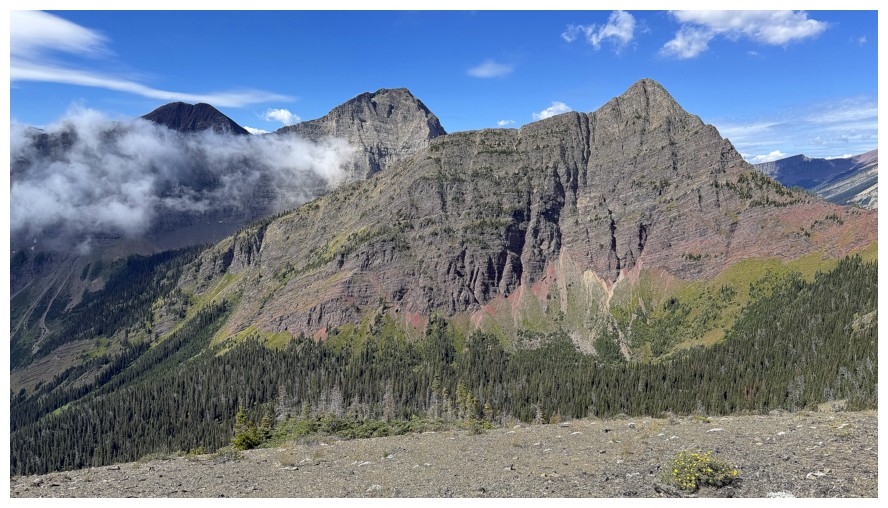
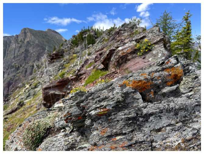
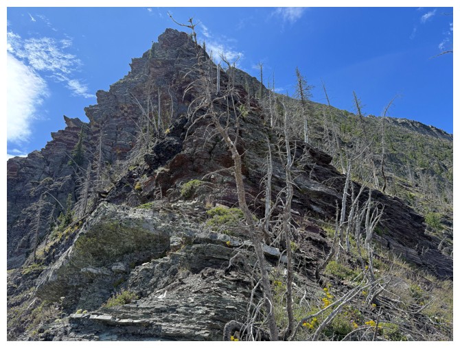
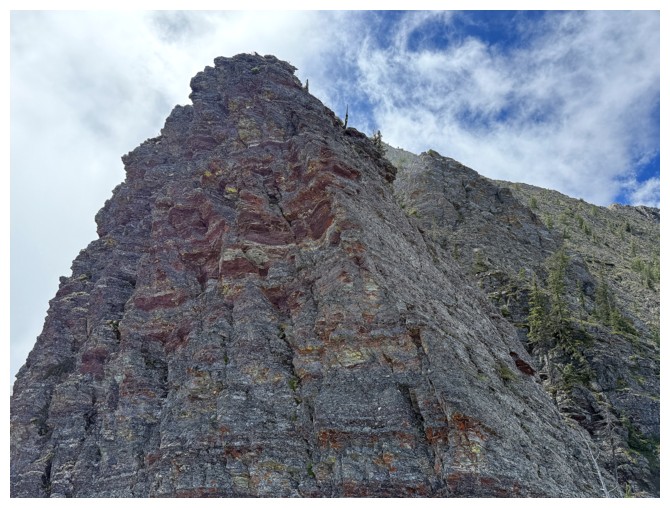
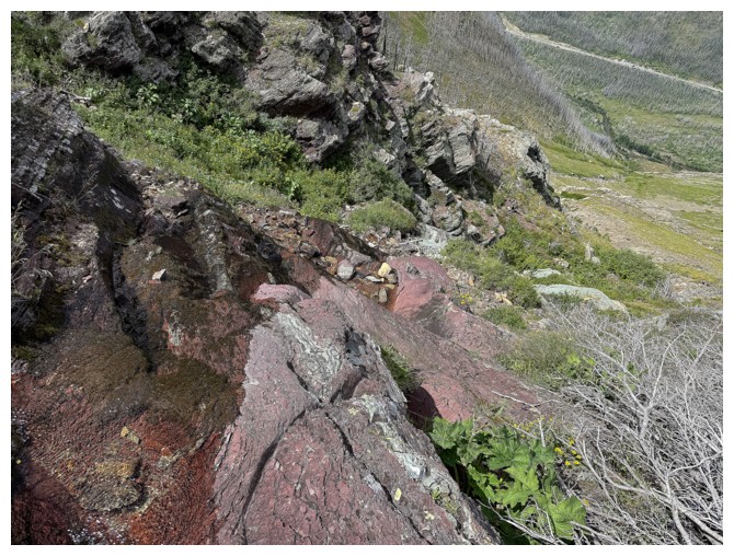
The entire face is red argillite
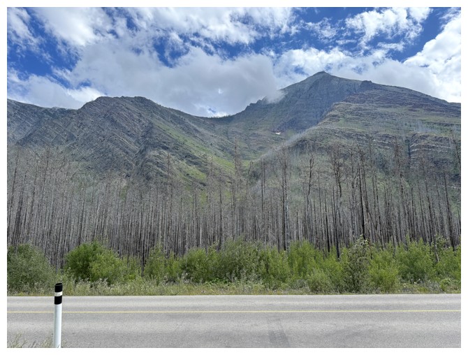
The Galweys
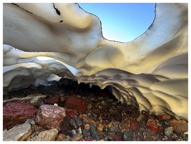
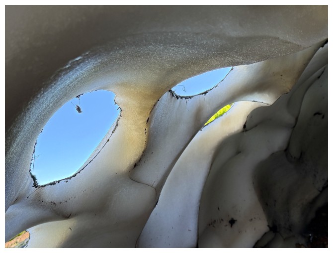
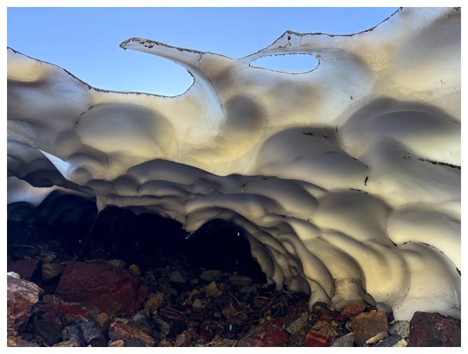
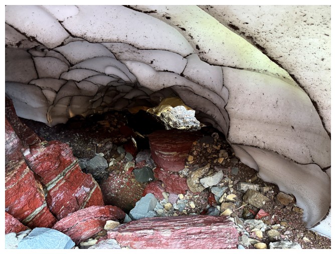
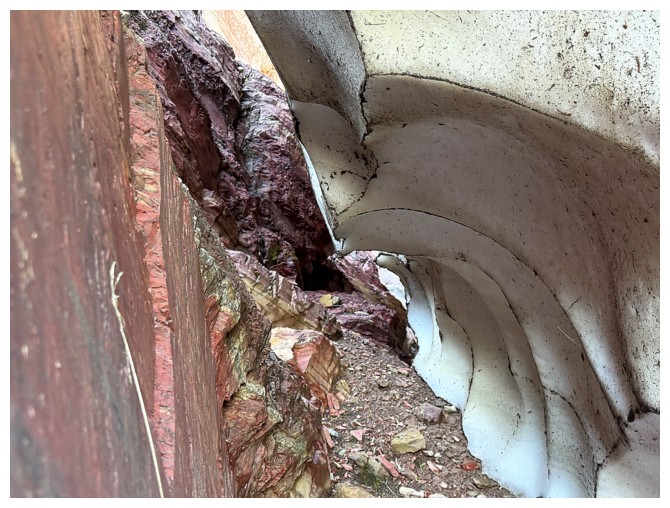
Approaching the snow cave
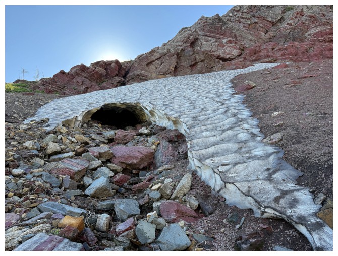
There is it. Still intact in late July - impressive!
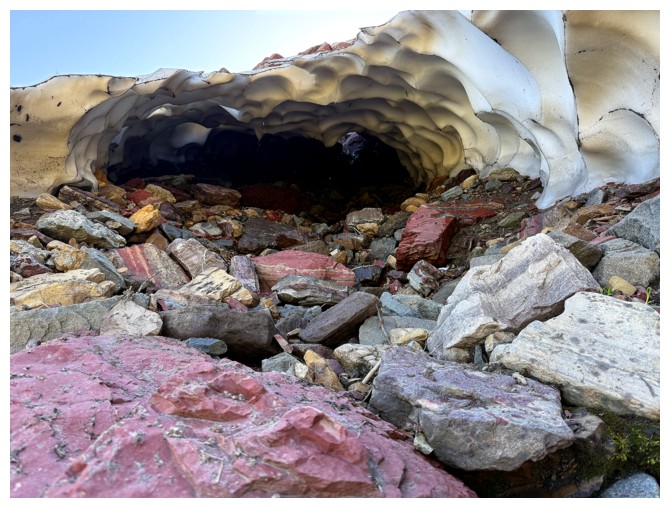
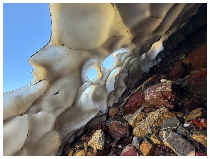
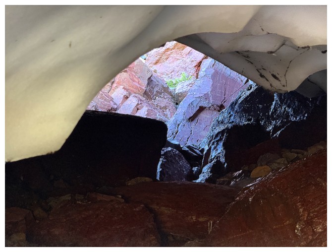
The Cave
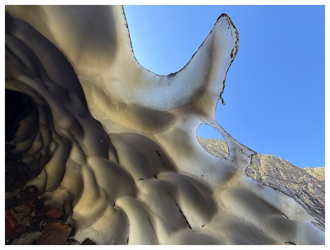
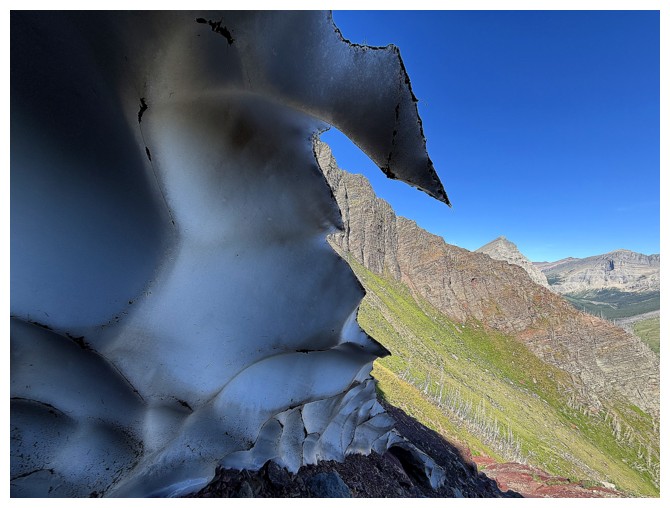
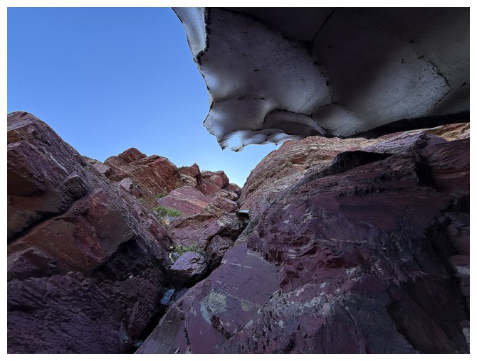
Open end at the other side
Heading up to see the opening at the top
Too band the Sun doesn't reach this area (although the snow cave wouldn't exist if it did)
Looking down the opening at the top
Tight squeeze to get by here
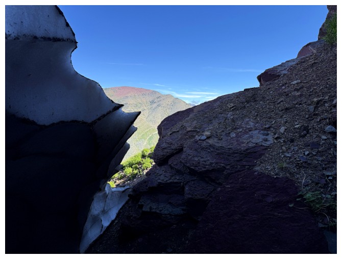
The east end of Ruby Ridge through the gap
Leaving the cave
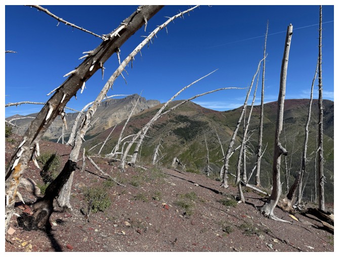
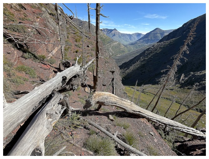
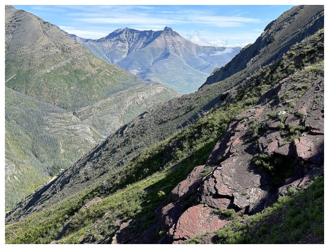
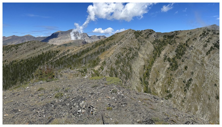
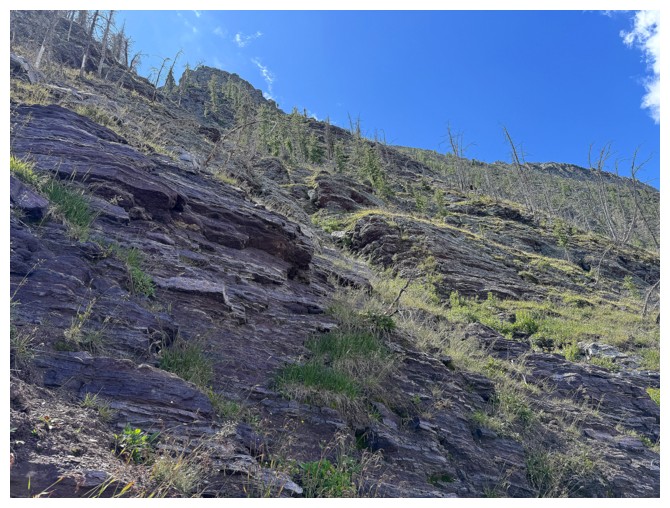
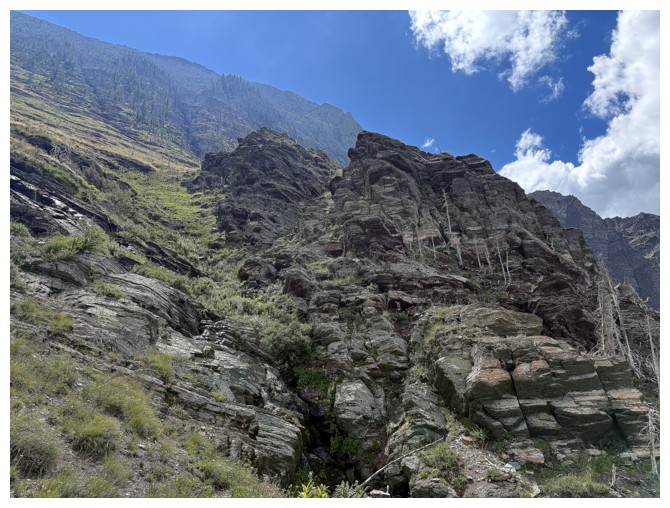
The route to the ridge is straightforward
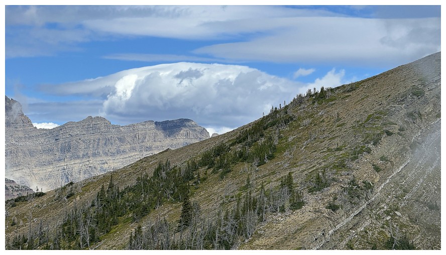
The first signs of weather instability over the Galweys to the east
But still clear to the west and north
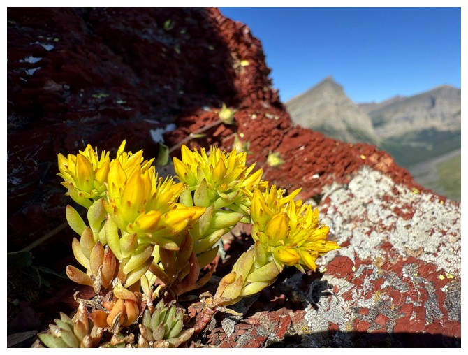
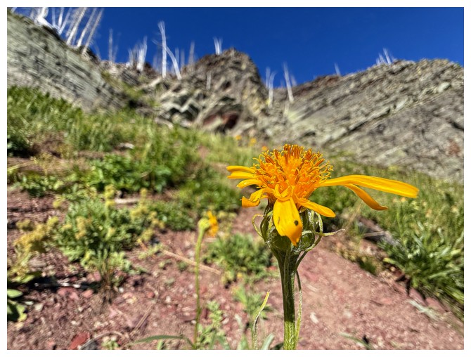
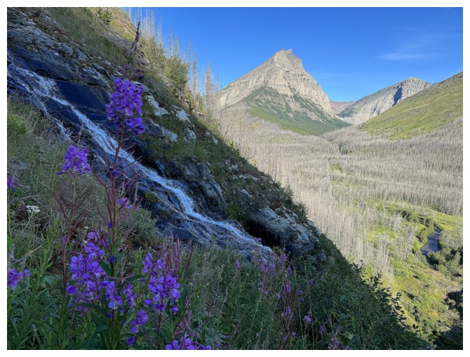
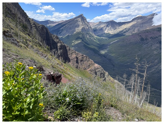
Pretty yellow flowers to compliment the red rock
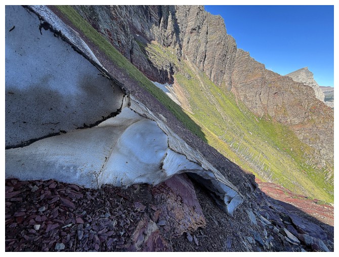
The slope I would later try to ascend. It's much steeper than it looks.
One of those views that just keeps on giving
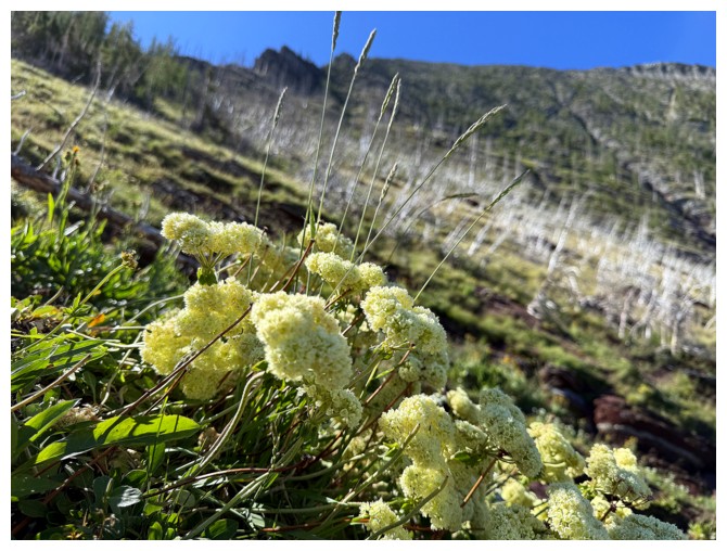
More pretty things
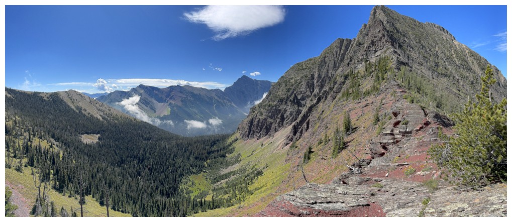
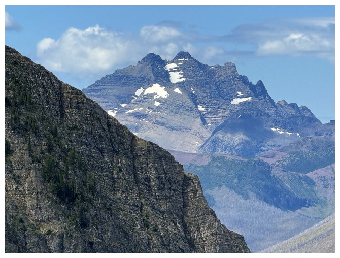
On the ridge, looking west to a false summit of The Senator
The view to the east is far less dramatic
The objective at the right
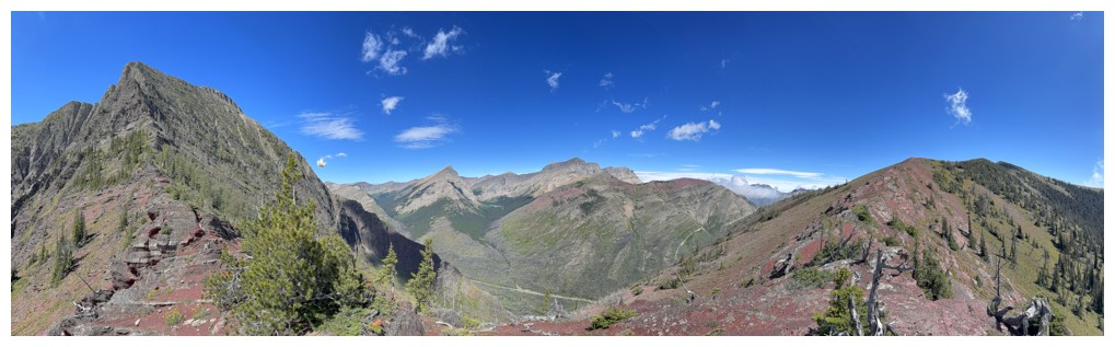
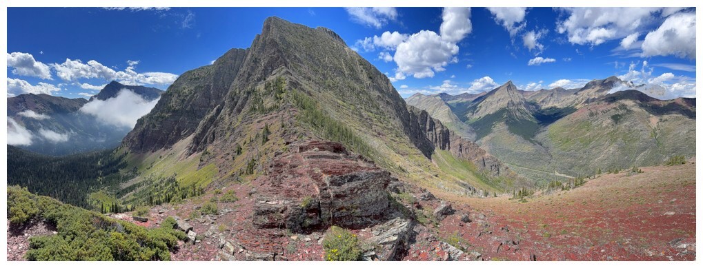
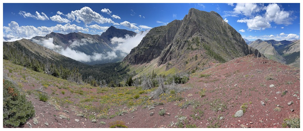
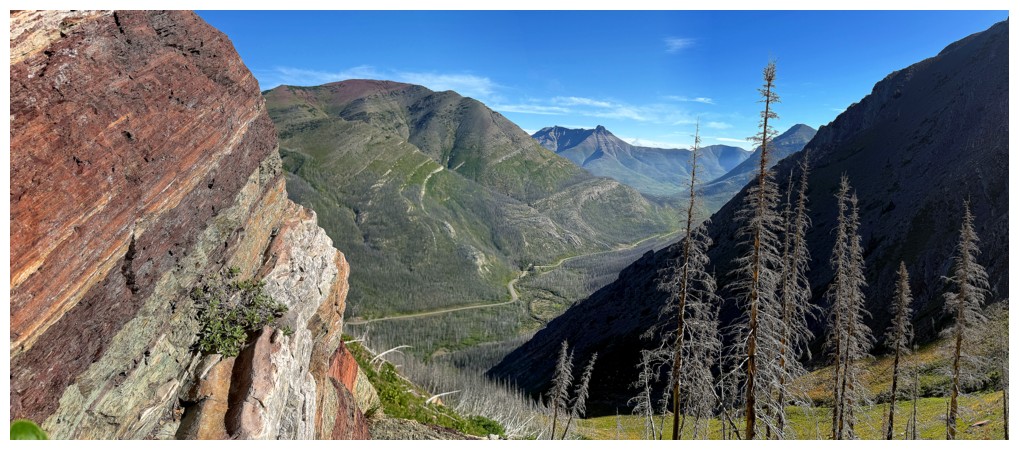
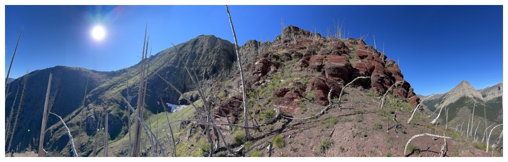
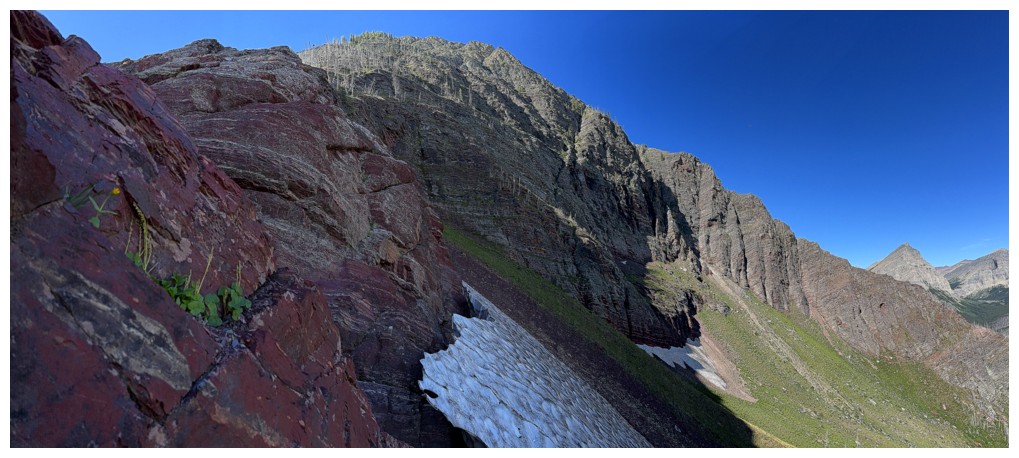
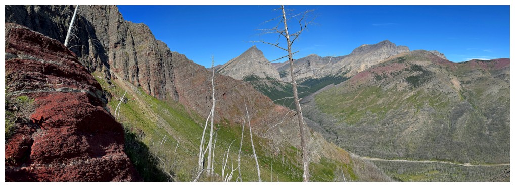
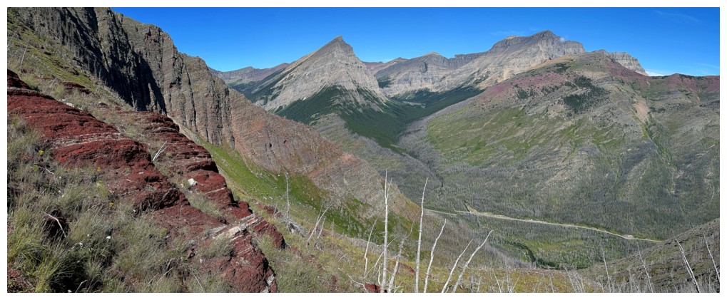
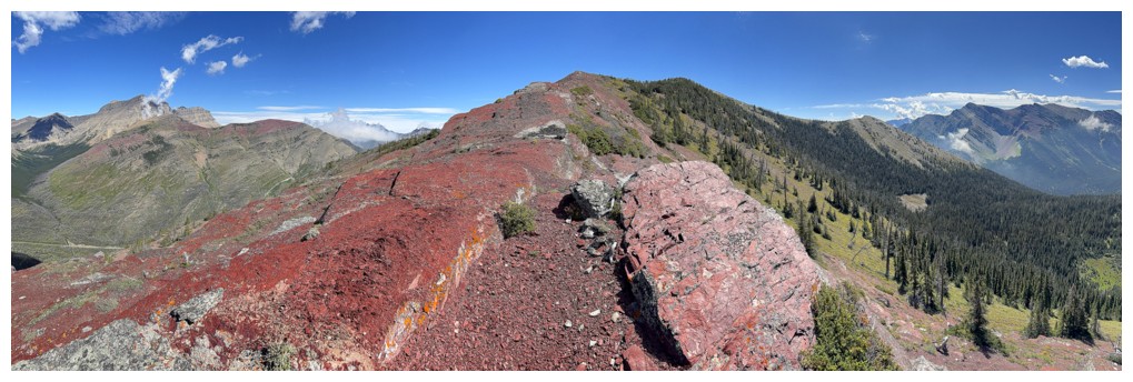
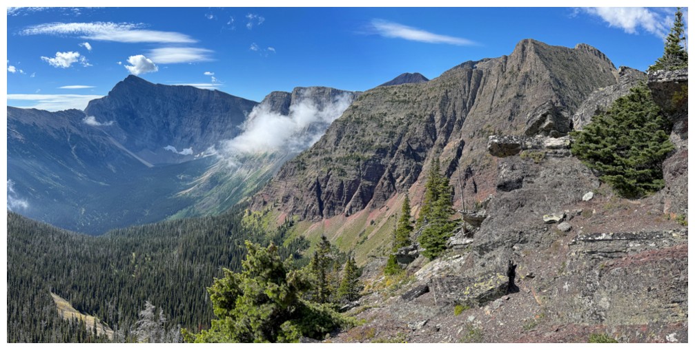
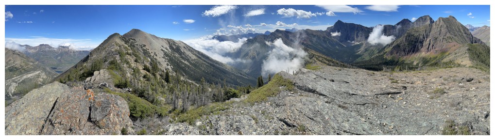
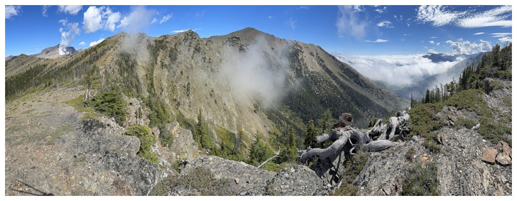
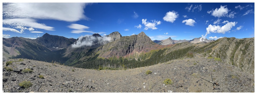
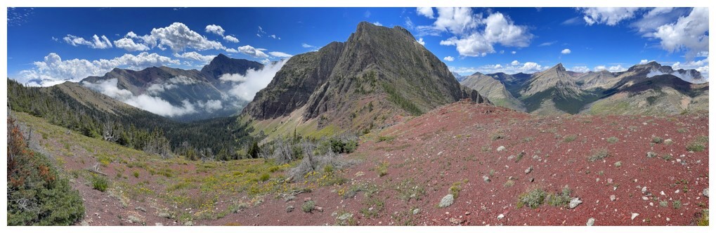
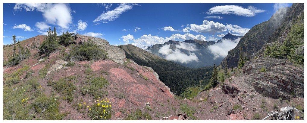
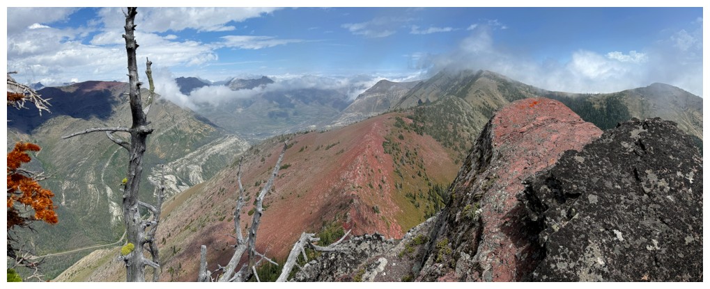
Obligatory pano
Same as above
Three curses at my poor photographic skills, cutting the top of the mountain off!
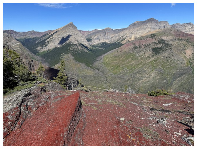
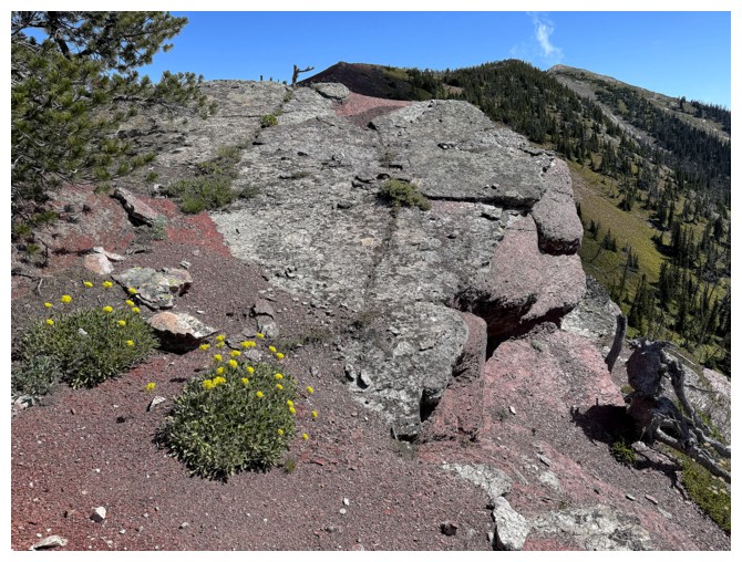
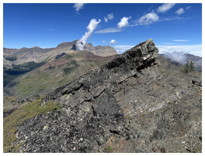
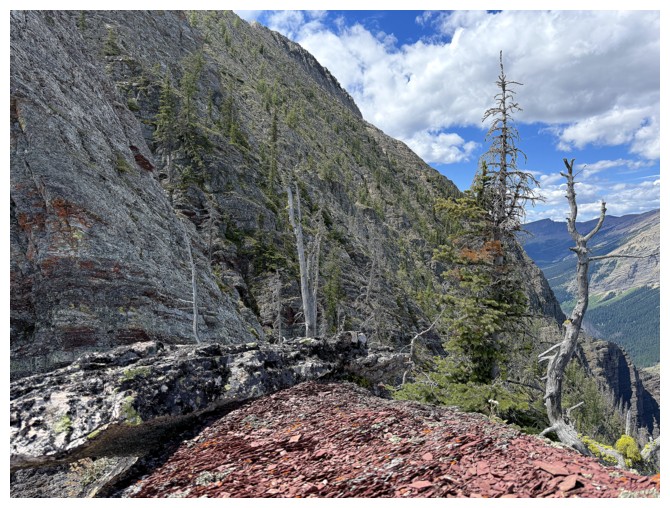
The red argillite that was my primary motivation for doing this route
View to the south. I crossed the forest in front during my third attempt at getting to Lake Dormaar
The Galweys are gone
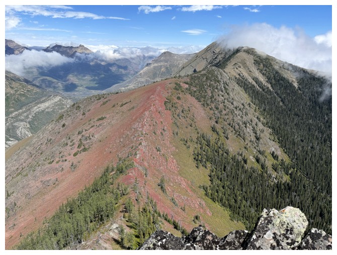
Easy, fun, and rewarding ridgewalking
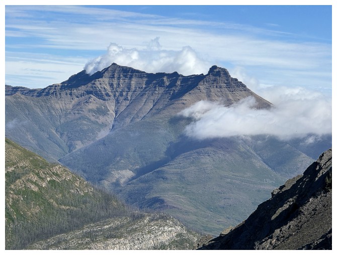
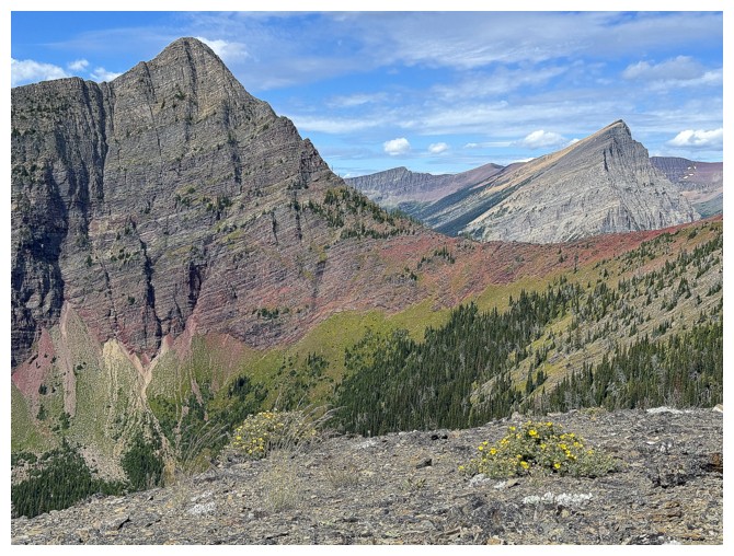
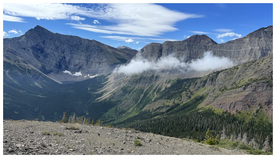
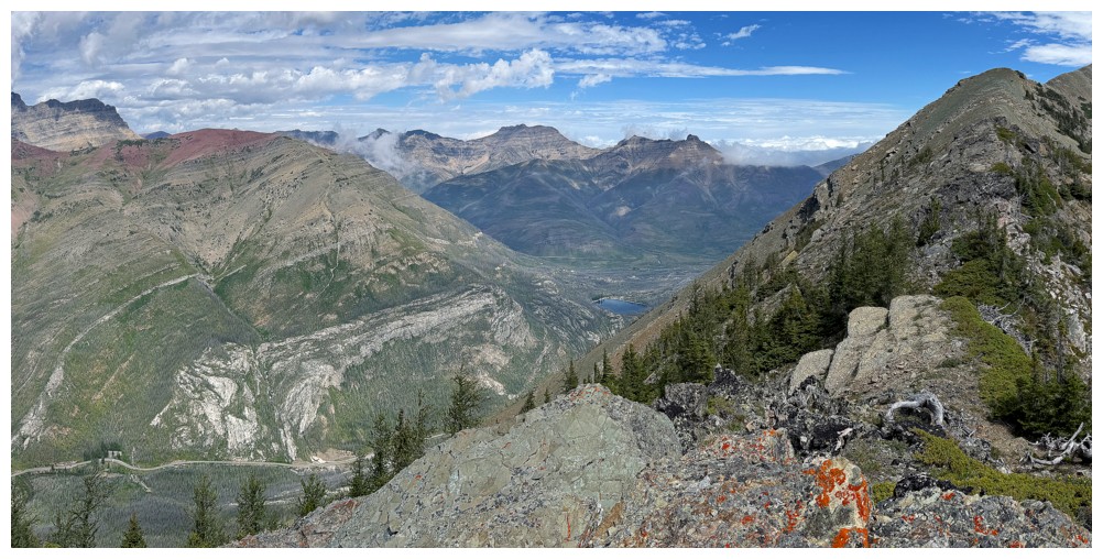
The objective in the centre
Mount Alderson at the left
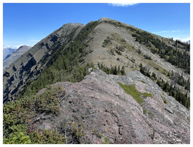
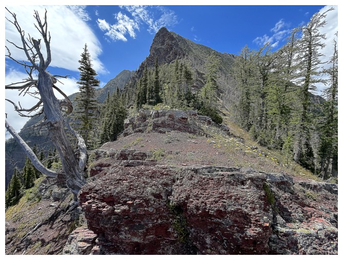
The best route to the outlier goes to a highpoint along the ridge first
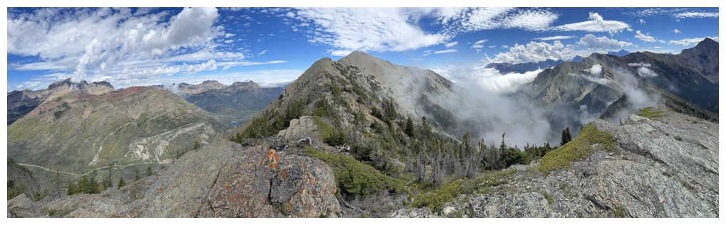
Clouds now forming around Mount Blakiston
Long Knife Peak makes an appearance
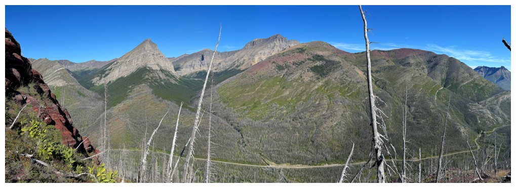
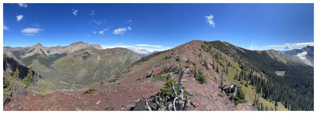
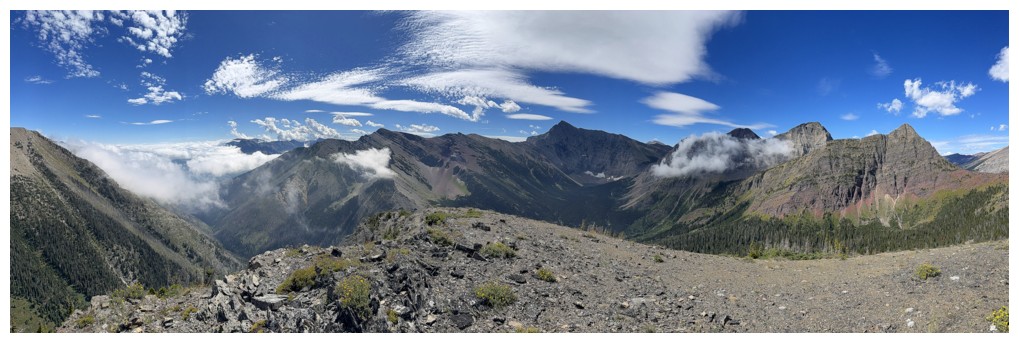
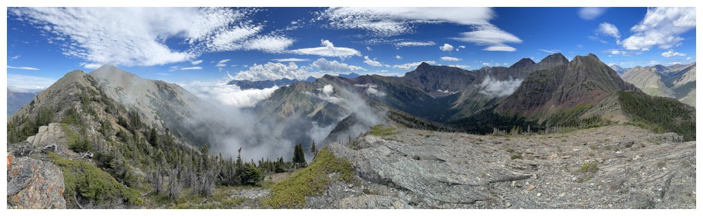
Pano from the highpoint
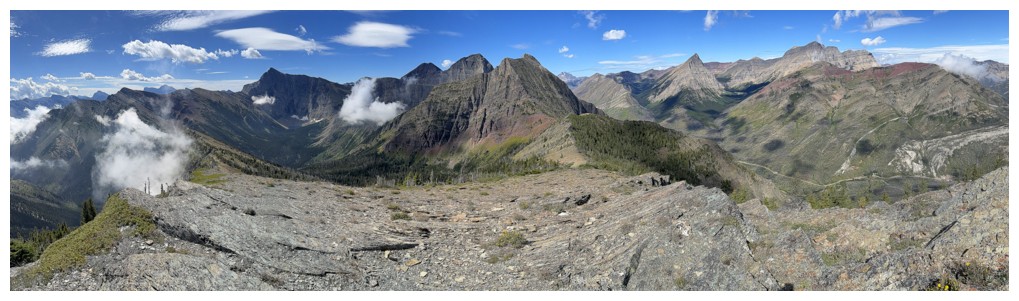
Same as above
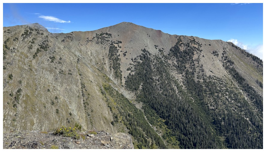
Buchanan Northeast, just left of centre
The other Buchanans: Buchanan Ridge and The Senator
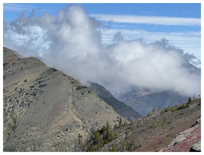
The weather is definitely changing
Clouds have now formed over the Waterton townsite
Mount Lineham
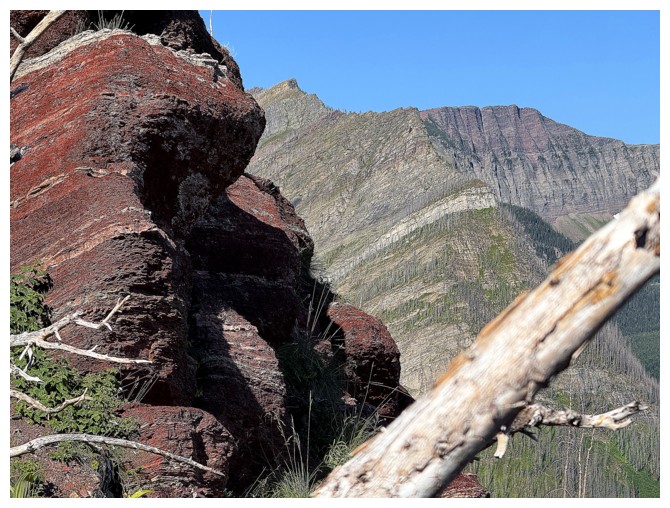
Close-up of the ridge to The Senator (right side)
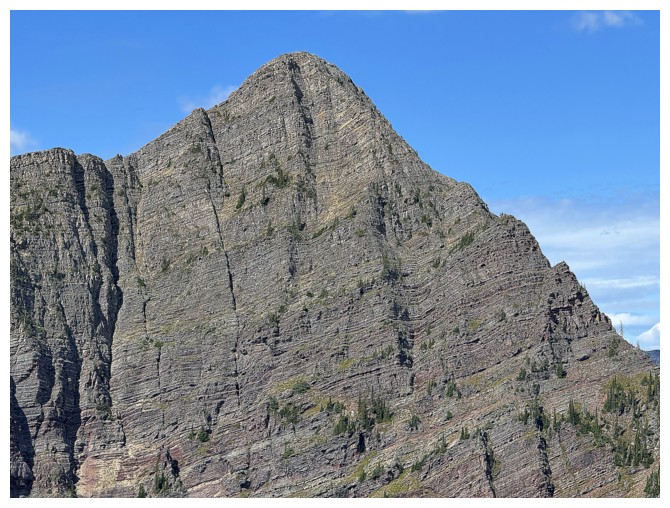
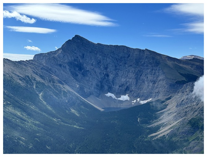
Close-up of the second highest summit of the Buchanan Ridge massif. The highest summit is Mount Carthew.
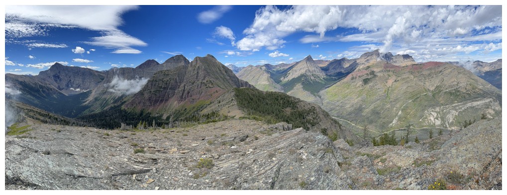
At the summit of Buchanan Northeast Outlier
View to the west
Mount Carthew (left) and
Buchanan Peak (not seen here and much lower than the others) are the
only official summits of the entire Buchanan Ridge massif
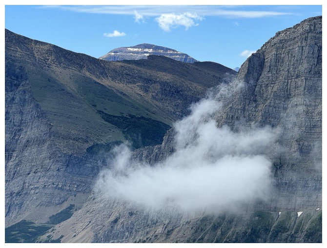
Blakiston looks like he's smoking!
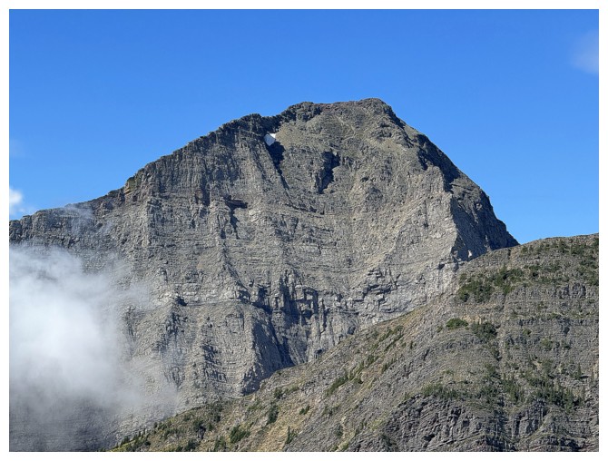
Buchanan Northeast
The clouds continue to build to the east
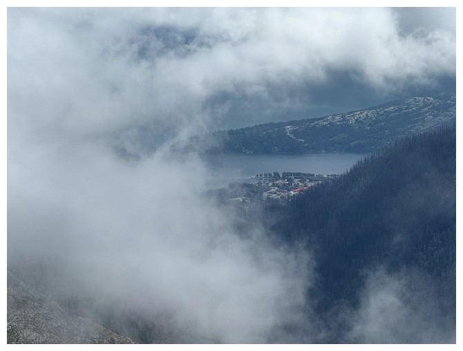
There's the townsite
Mount Alderson
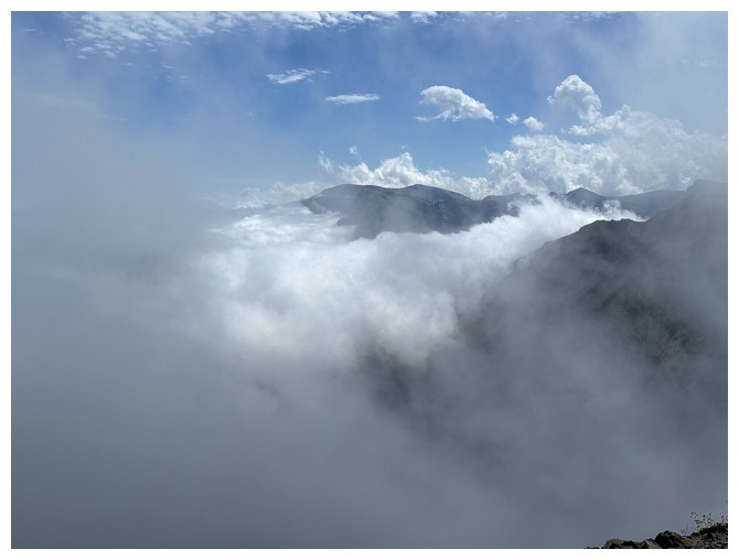
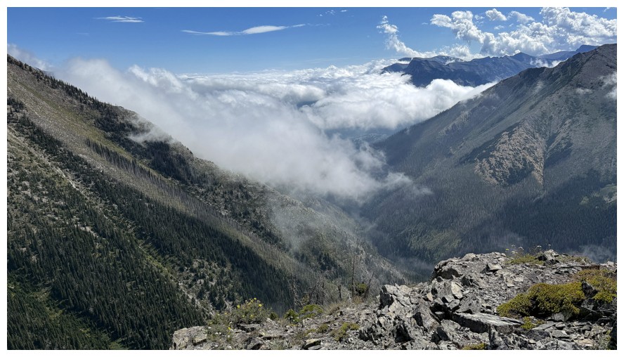
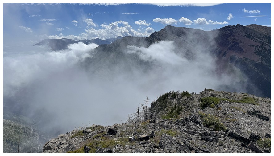
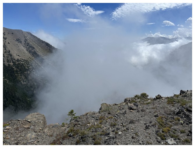
The clouds are really coming in now
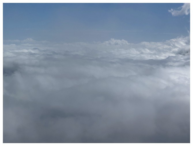
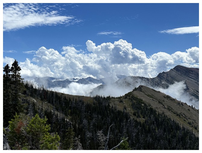
Total whiteout
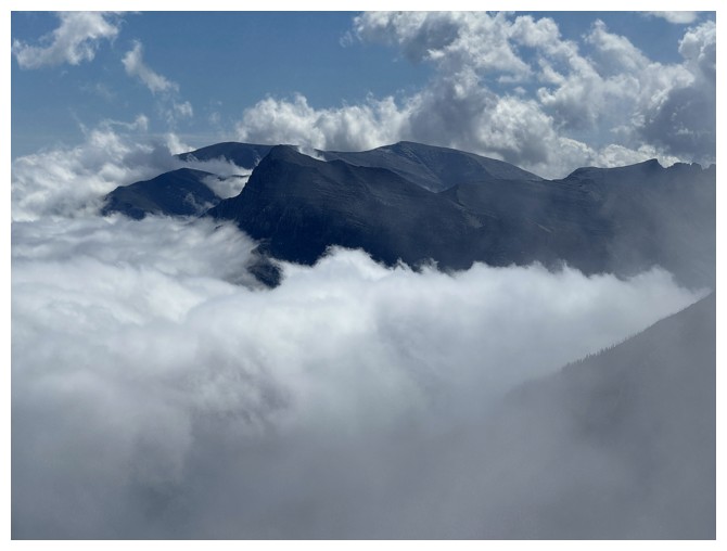
But the tops of Vimy Peak and Sofa Mountain are still visible
So is the cockscomb section of Mount Crandell
Still surprisingly clear skies over The Senator and Lineham
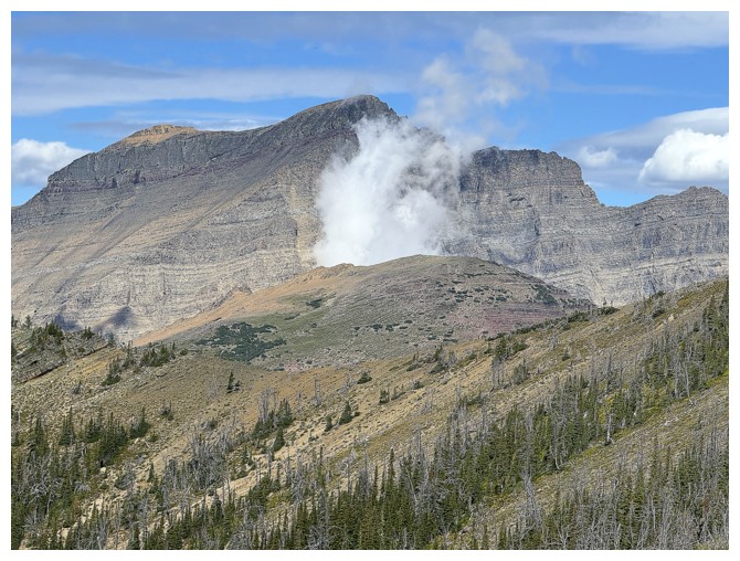
Blakiston stopped smoking but is now on fire!
Mount Chapman in GNP
Summit panos
Interesting cloud over the east side of Blakiston
Time to leave before I'm in a whiteout
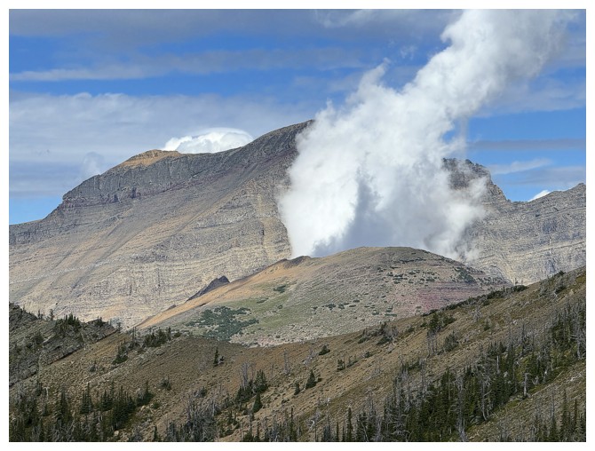
Smoking AND on fire
Close-up of Crandell's cockscomb
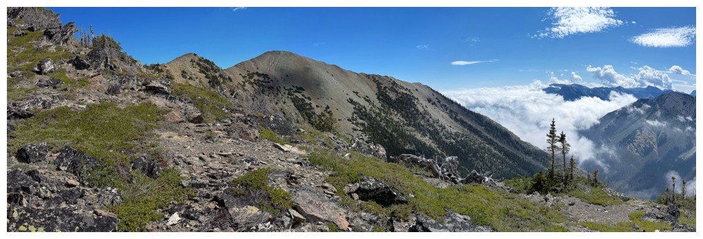
It would have been possible to side-slope here to avoid going to the highpoint again...
...but the views from the highpoint are worth seeing, AGAIN!
Much better view of Long Knife Peak
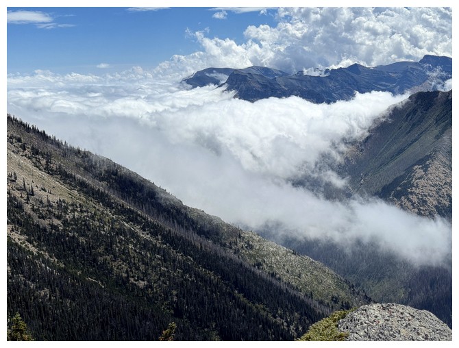
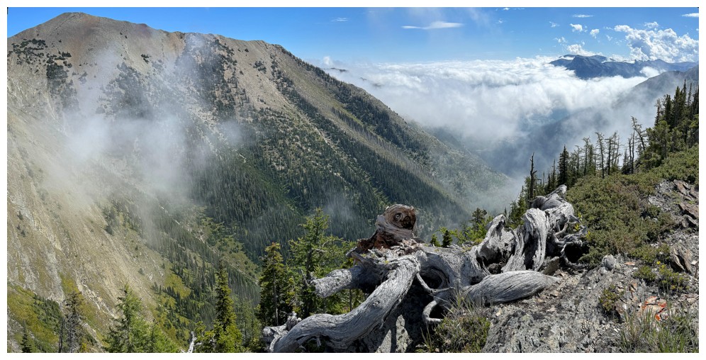
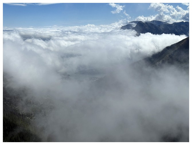
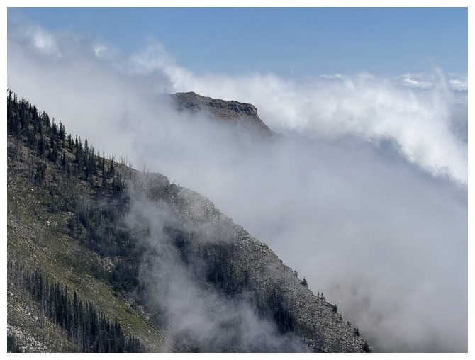
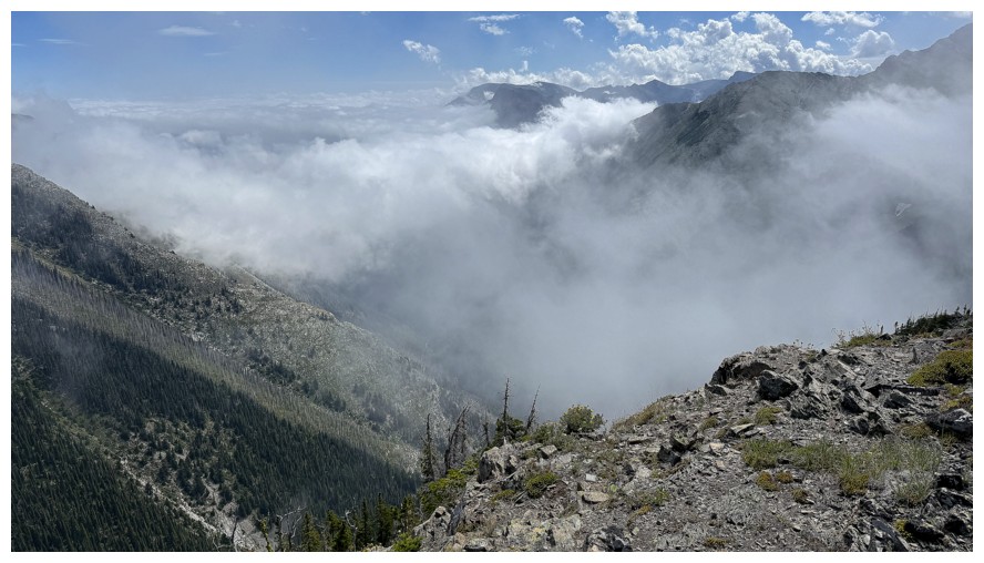
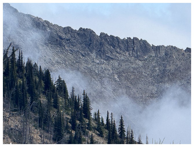
Last of the low-lying cloud views
Now we have some higher clouds forming
Heading back across the ridge
Same as above
Back at the col and ready to see if I can get up to the shoulder below The Senator
Up we go
Approaching the first significant rock band that will force me to go to the right
Around the rock band, but the terrain is getting increasingly steep
Followed this ledge to get a view over the edge
The view from the ledge looking up is cool but not encouraging
A good representation of the grade of the slope (and why I chickened out!)
View from the edge of the ledge
Bigger view
Back down on much easier terrain and ready to descend
New route down the mountain
Looking back up some of the route
Same as above
Back to the drainage
Same as above and now the clouds have moved in
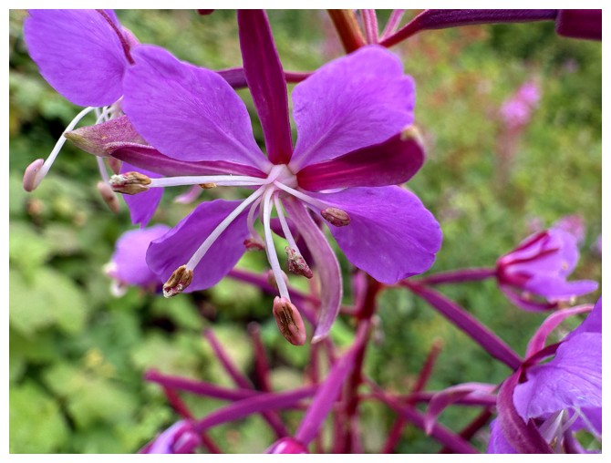
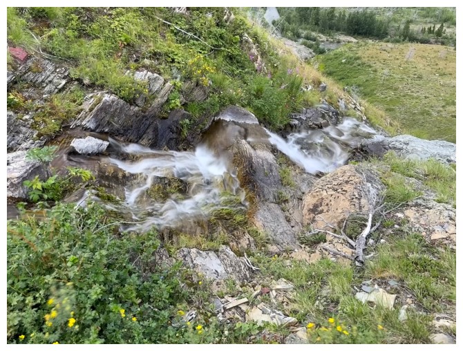
Back to the Monkey Flower
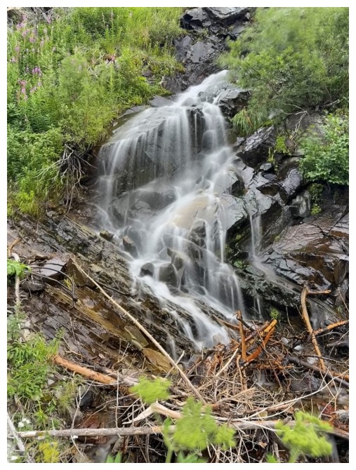
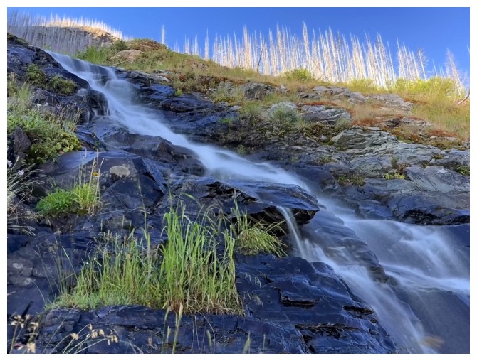
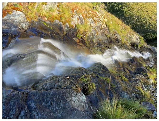
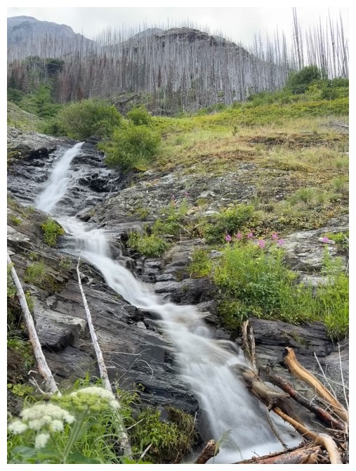
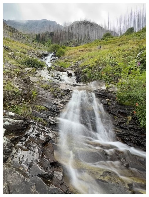
The first and last waterfall of the day
Rewarding look back at the route
The End
LOG