Cataract Mountain
(GNP)
September 24, 2024
Mountain height: 2500 m
Elevation gain: 700 m
(1700 m if you count the Sperry Glacier attempt)
Ascent time: 2:35
Descent time: 2:45
Solo scramble.
Lowly Cataract Mountain, in Glacier
National Park, saves the day!
 Still riding a
high from seeing the beautiful environs around the Sperry Chalet area, the goal
of this trip was to make it up to the Sperry Glacier, between Edwards Mountain
and Gunsight Mountain. This spot is reported to be one of the most stunning in
the entire park.
Still riding a
high from seeing the beautiful environs around the Sperry Chalet area, the goal
of this trip was to make it up to the Sperry Glacier, between Edwards Mountain
and Gunsight Mountain. This spot is reported to be one of the most stunning in
the entire park.
After spending
the night at the Apgar Campground, I was off to an early start and hit the
trail at 6:15 am in full darkness. And that was the beginning of the end of
this trip. Even with a headlamp I neglected to see a small sign off to the left
that stated the trail that branches off to the Sperry Glacier (10 horizontal kilometres
and 1000 vertical metres ahead) was closed because of bear activity. 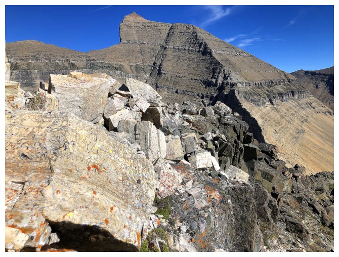 Of
course,
Raff and I had been here only 3 days earlier and so I didn’t suspect,
for a second, that the status of the trail had changed since then.
Of
course,
Raff and I had been here only 3 days earlier and so I didn’t suspect,
for a second, that the status of the trail had changed since then.
As such, I
hiked the entire 10 km, bumping into a very friendly couple from Missoula, who
informed me of the closure, only a few hundred metres before reaching it. They
also told me they had seen a mother grizzly with two cubs near the trail to
Gunsight Pass. There were no options but to turn around and hike back to the
trailhead. From there I could try something else or call it a day and go home.
The perfect
weather was definitely a factor in my decision to try another mountain. Mount
Oberlin, the shortest trip in the park, was an obvious choice. Having already
hiked for 20 km with a significant amount of elevation gain, short and easy
would have to be the main criteria for any ascent. 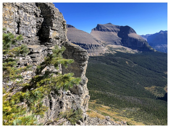 As I drove past congested Logan
Pass, however, I remembered Raff mentioning Cataract Mountain. I knew it was a
small peak that could easily be ascended from Piegan Pass and since Raff and I
had completed Oberlin in 2018, Cataract (really just a conspicuous bump on the
west ridge of massive Mount Siyeh) seemed to be a better option for me. A
cursory glance at the Gaia map led me to believe the ascent would only require
400 metres of elevation gain – careless mistake Number 2 on my part!
As I drove past congested Logan
Pass, however, I remembered Raff mentioning Cataract Mountain. I knew it was a
small peak that could easily be ascended from Piegan Pass and since Raff and I
had completed Oberlin in 2018, Cataract (really just a conspicuous bump on the
west ridge of massive Mount Siyeh) seemed to be a better option for me. A
cursory glance at the Gaia map led me to believe the ascent would only require
400 metres of elevation gain – careless mistake Number 2 on my part!
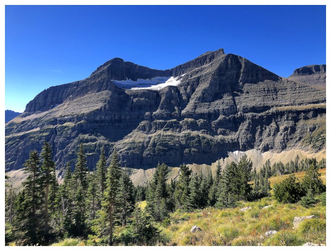
The map
indicated Cataract to reach of height of 2216 m. This figure became a little puzzling when I
checked my elevation several kilometres into the trip. Apparently, I was almost
at the same height as the summit even though I was nowhere near the mountain. 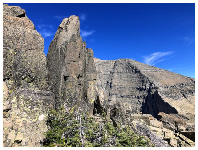 In
addition, the topo lines indicated the trip was all uphill to the top. A more
thorough examination of the map revealed an error in the location and height of
Cataract – the mountain was closer to 2500 m. Not a huge deal, but I certainly
was starting to tire at this point, and this was not welcome news!
In
addition, the topo lines indicated the trip was all uphill to the top. A more
thorough examination of the map revealed an error in the location and height of
Cataract – the mountain was closer to 2500 m. Not a huge deal, but I certainly
was starting to tire at this point, and this was not welcome news!
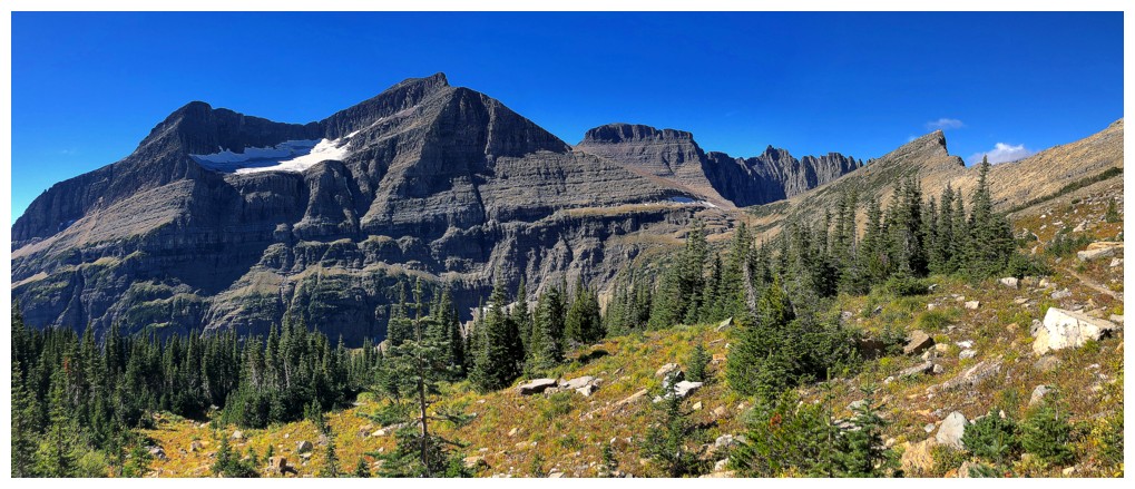
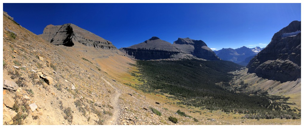
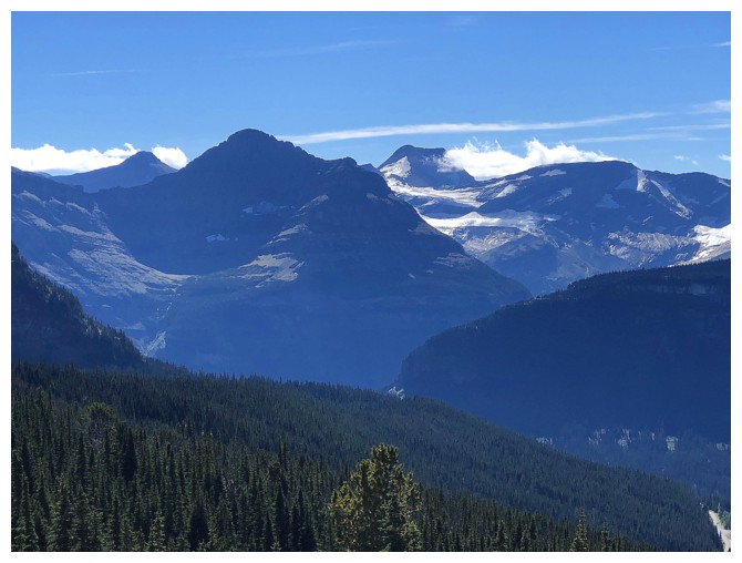
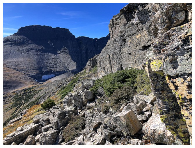
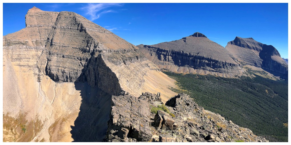
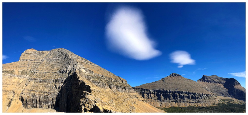
That
dramatically changed upon emerging from the forest to see the mountain and its
surroundings for the first time – wow! It's
a small peak, but Cataract’s profile is quite striking. It sits immediately east of a trio
of beautiful peaks Mark and I had ascended many years earlier – Piegan, Pollack,
and striking Bishop’s Cap. Mount Gould’s soon joined the showed and of course
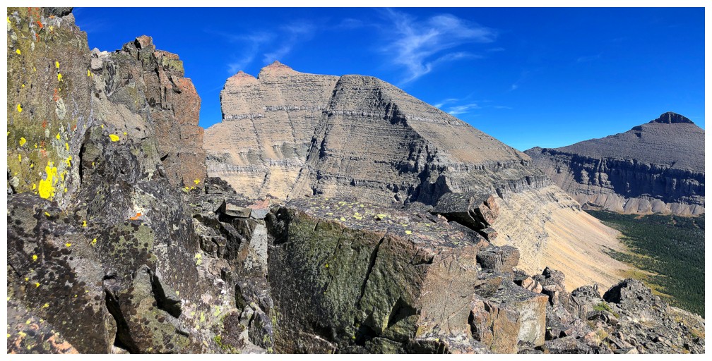
Mount Siyeh was front and centre throughout.
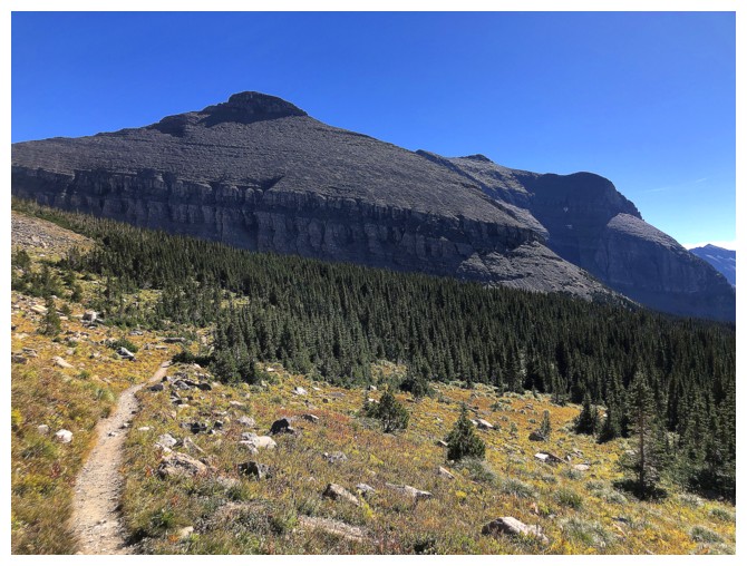
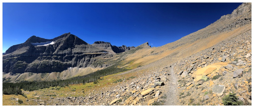
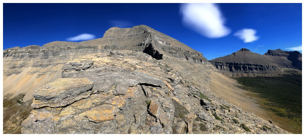
Though tempting
to try a more direct route up the Cataract’s far more interesting east
ridge/south face, I decided to err on the side of caution and take the much
easier west ridge. Once at Piegan Pass that route unfolded with ease. It was
also a surprisingly scenic and fun route, featuring boulder-hopping up stable,
lichen-covered rocks and vertiginous views down the left side of the ridge. The
summit view was also much better than I was expecting, with far-reaching views
to the north.
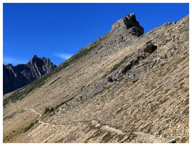
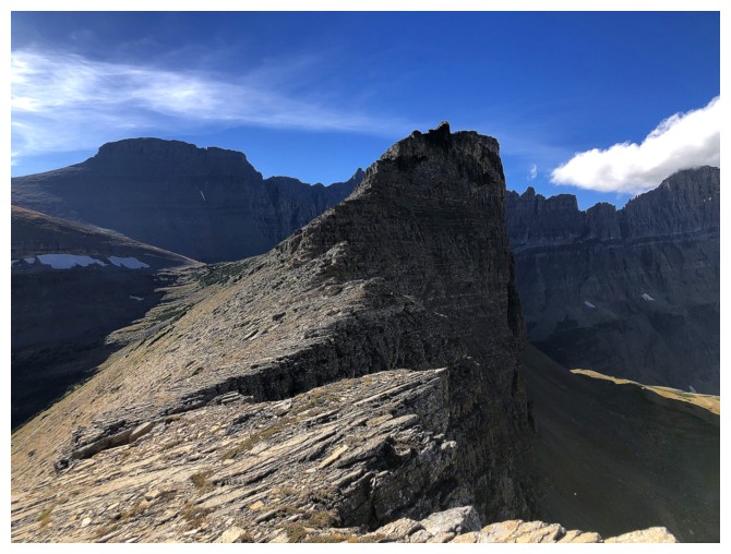
After a short
but rewarding break, I decided to see how much of the east ridge I could
actually descend. There were several near-vertical drop-offs that would have to
be circumvented, but I was confident I find a way down. The route turned out to
be the highlight of the day, replete with a variety of amazing rock and lots of
route-finding. I also probably took a record number of photos of Siyeh’s
awe-inspiring west and northwest sides. Were I ever to repeat Cataract, I would
go up the east ridge/south face and down the west ridge.
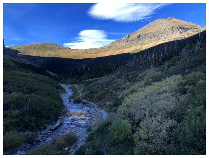
The hike out
felt longish, but that was more the consequence of the day’s earlier events.
Overall, an outstanding trip on an unappreciated little peak.
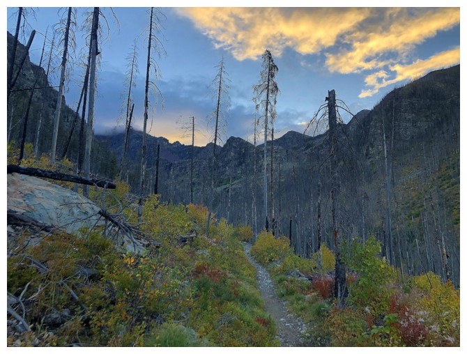
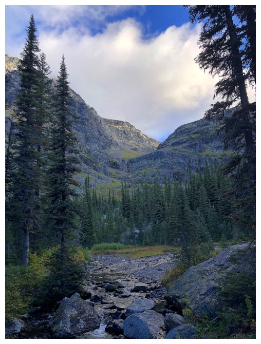
Hiking the Sperry Glacier Trail again, 3 days later
The scenery is still satifsying
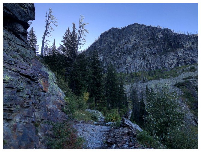
No Sun on that lichen-covered boulder though
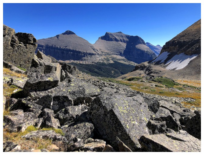
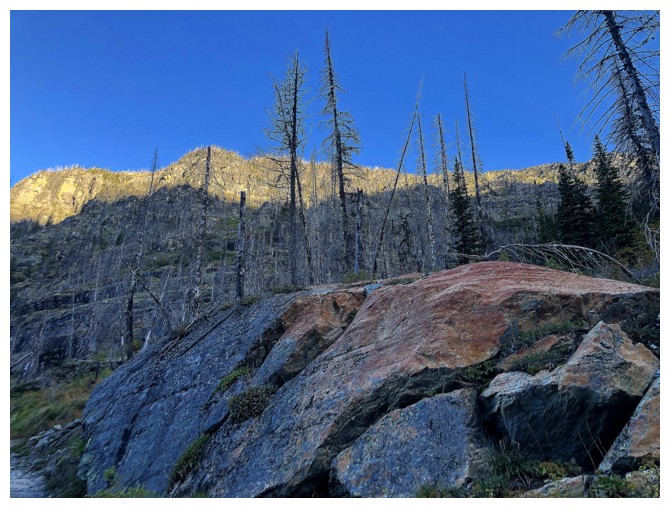
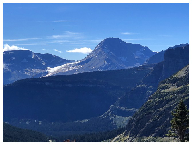
Lincoln Peak
Where I thought I would be going. Had to turn around shortly after.
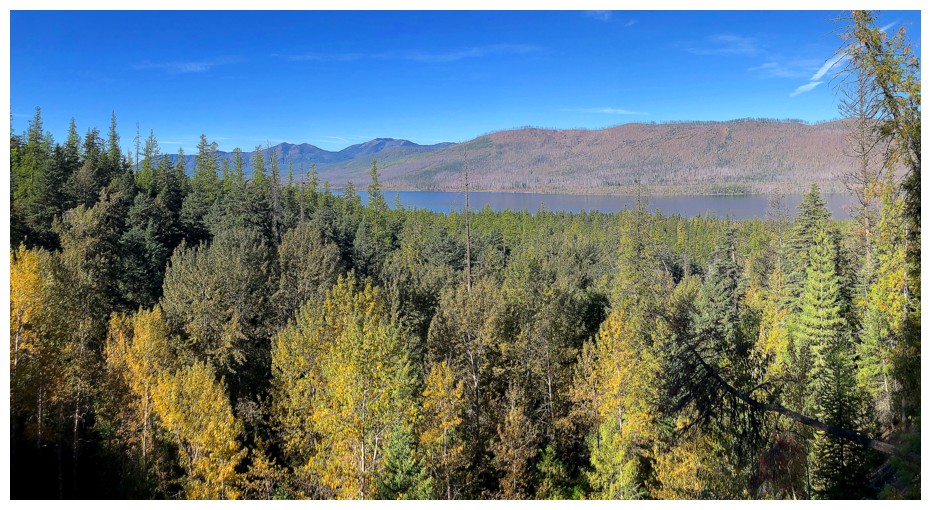
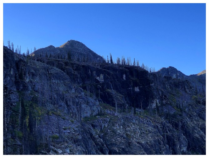
Decent view of Lake McDonald as I race down the trail in hopes of finding another objective
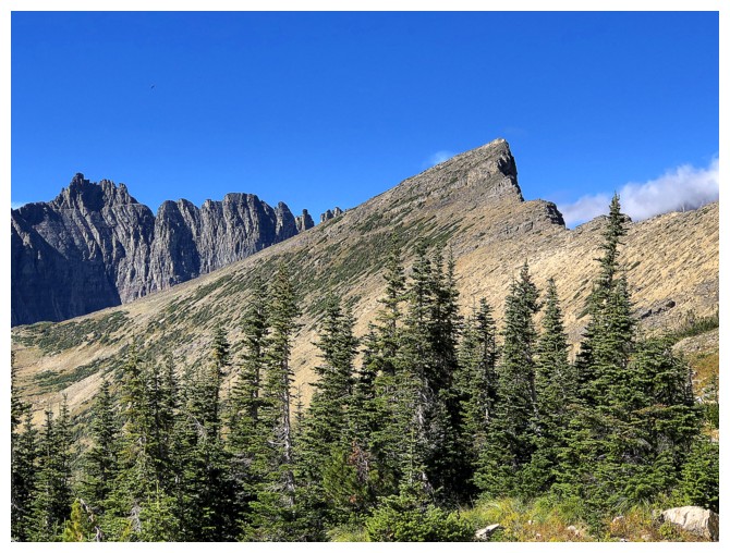
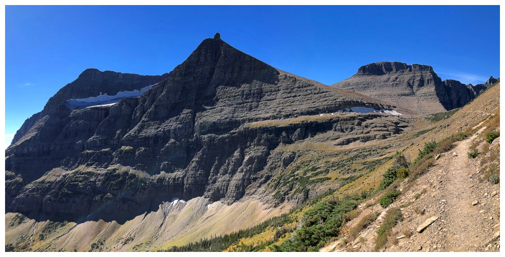
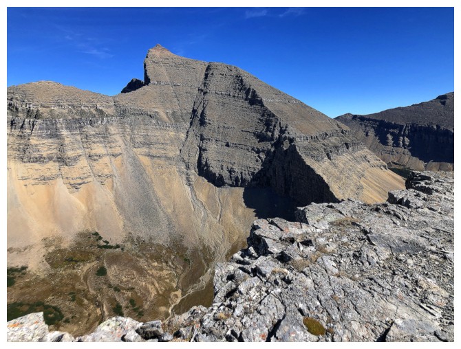
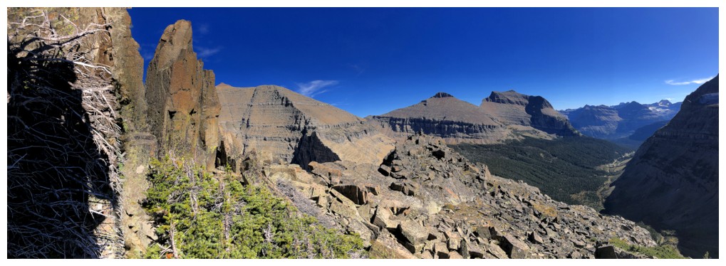
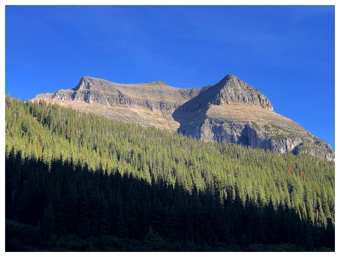
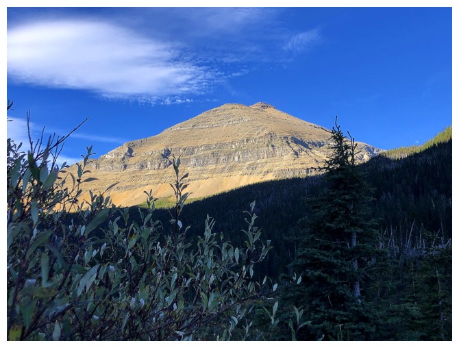
An hour later at Siyeh Bend. Mount Siyeh at the right and Cataract Mountain, looking very non-descript, at the left
Siyeh. I was tempted to repeat this terrific ascent, however, I knew I didn't have the energy
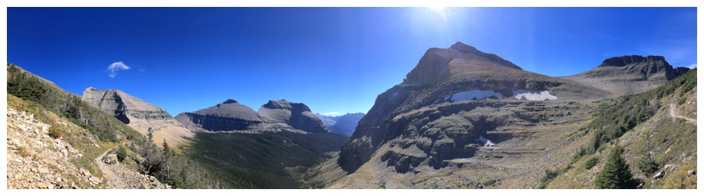
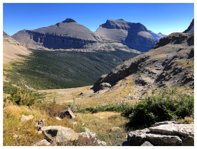
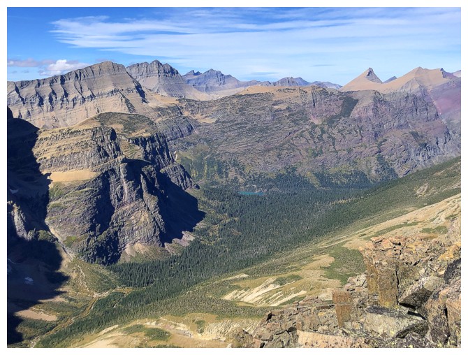
A magnificent scene unfolds, with the first good look at Cataract
(small peak near the right). Piegan Mountain is the big one near the
left.
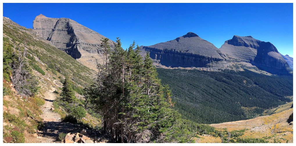
Cataract
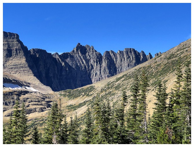
Bishop's Cap
Pollock Mountain
True summit of Piegan
Both summits
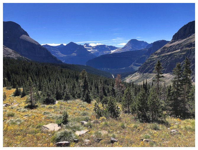
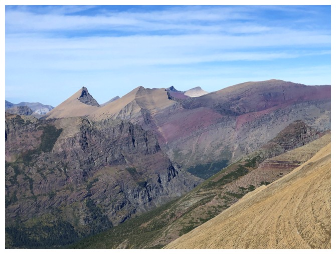
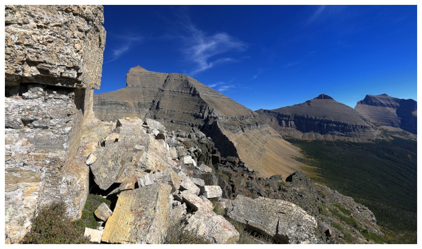
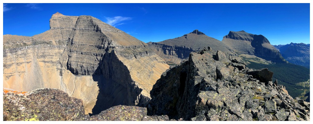
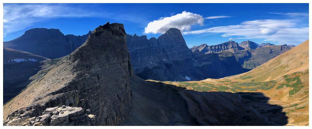
Looking south to the Mount Jackson area
Jackson
Left to right: Logan, Citadel, Blackfoot
Matahpi Peak will get lots of attention
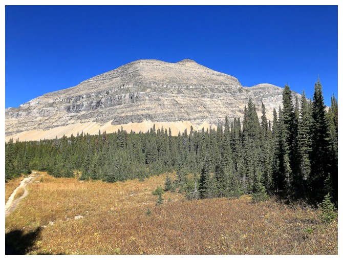
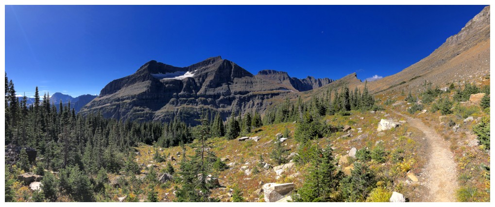
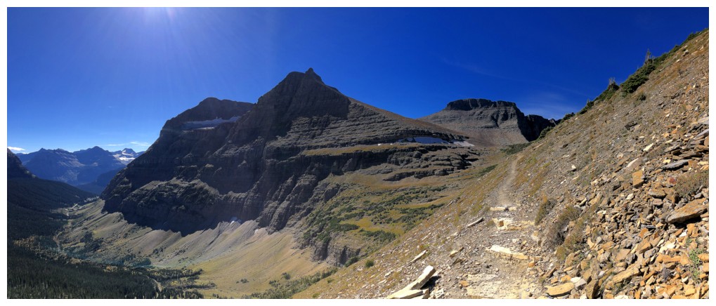
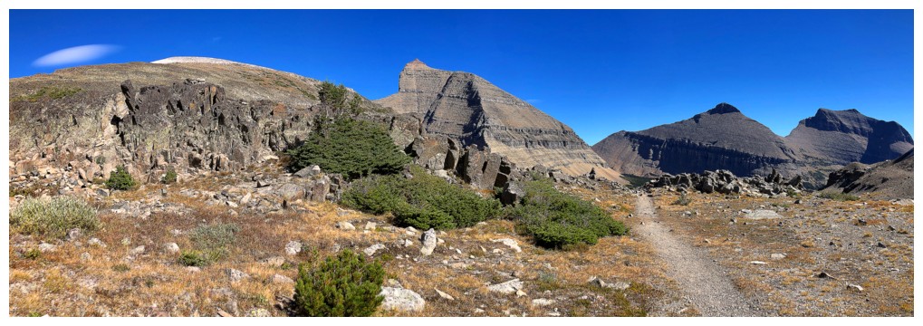
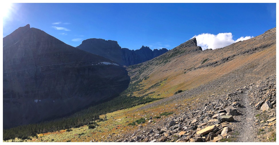
Piegan Pass is just left of centre and a fine, well-worn trail leads you there
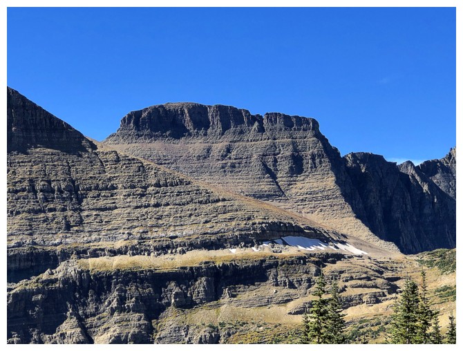
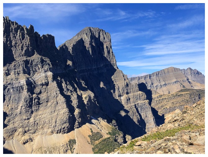
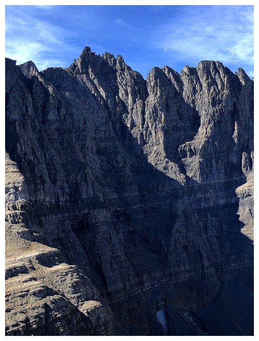
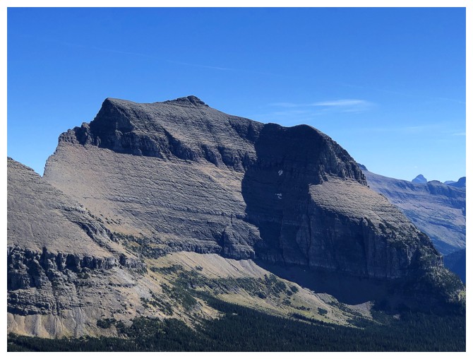
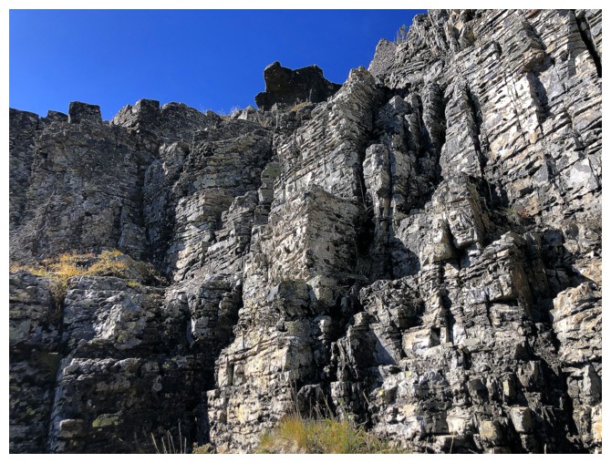
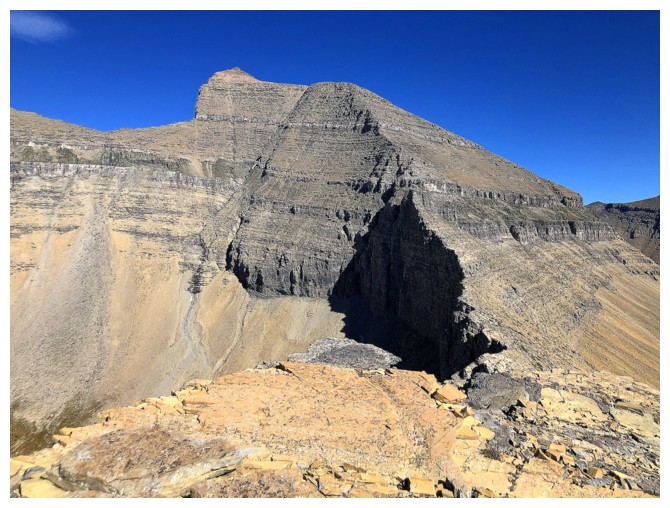
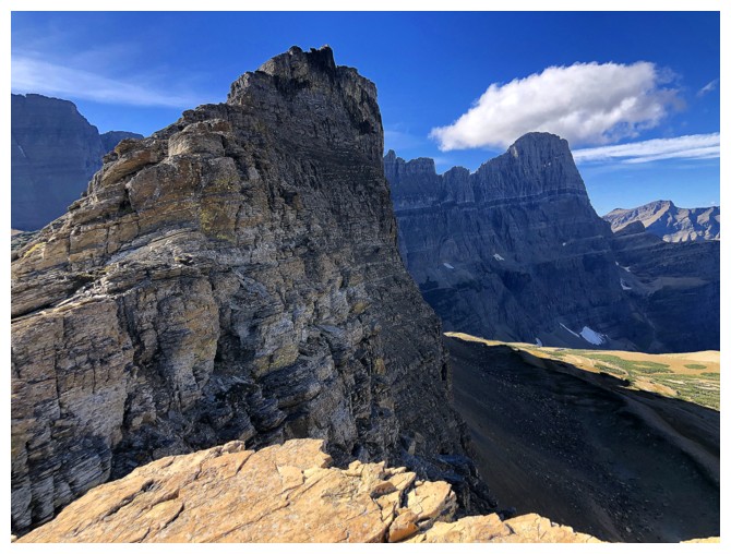
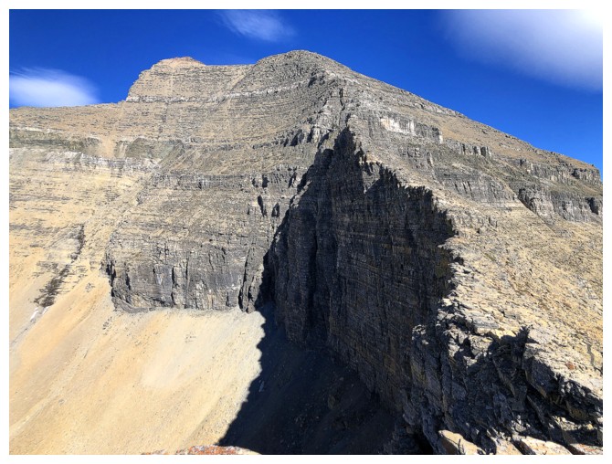
Cataract's impressive east side
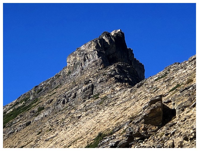
Close-up
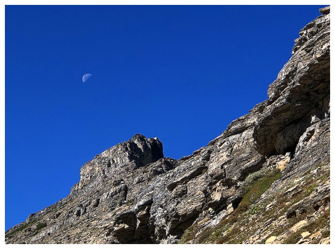
Surprised to still see the moon at 1:30 pm
Piegan and Pollack are also going to be getting some attention
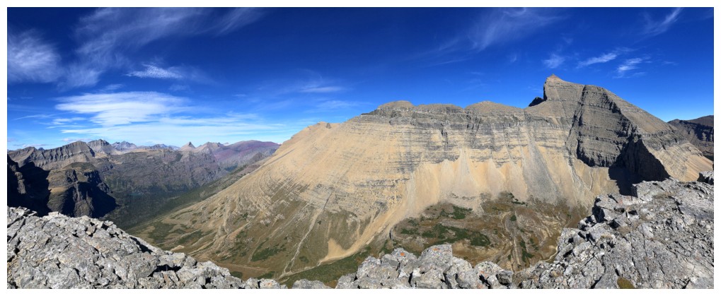
Mount Siyeh, Matahpi Peak, and Going-To-The-Sun Mountain (GTTS for
future reference) - this view will definitely get the MOST
attention!
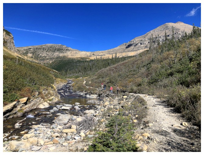
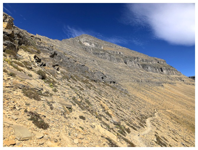
The excellent trail to the pass is longer than it looks
But views are also excellent
They certainly are!
A different perspective of Piegan
This view dramatically increased my motivation to attempt GTTS Mountain
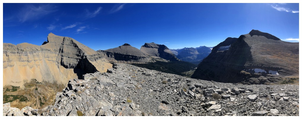
At Piegan Pass
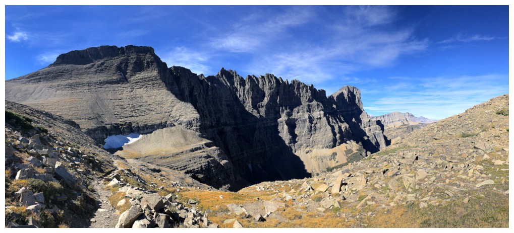
The view on the other side of the pass
Mount Gould's east face is ultra steep
So is Bishop Cap's
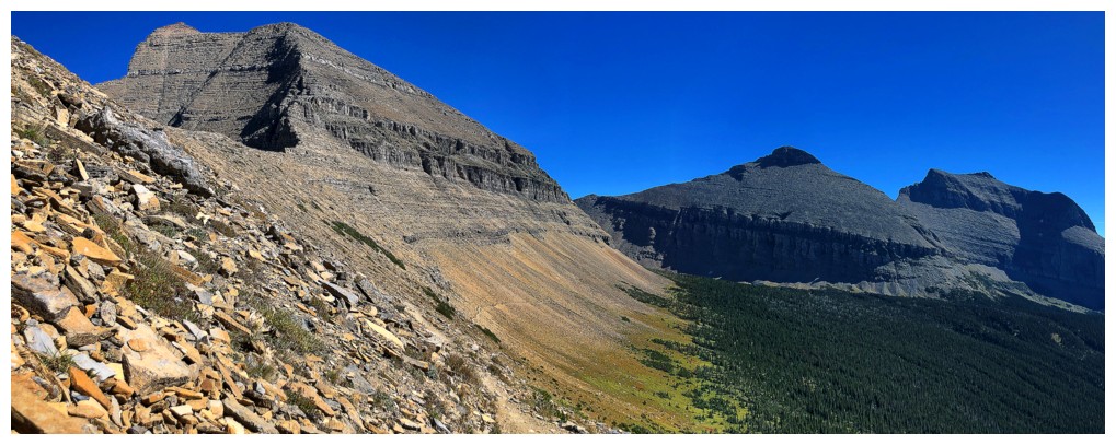
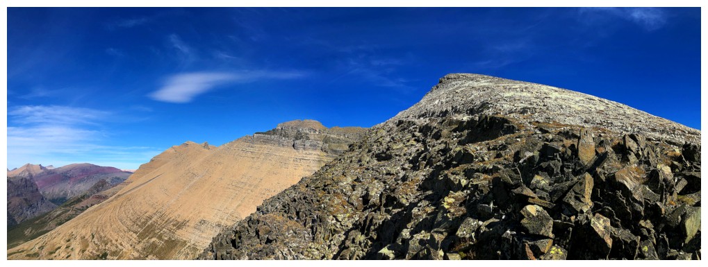
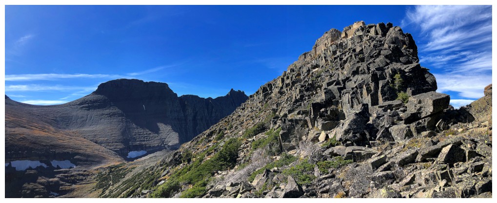
The west ridge ascent route goes up the left side
But first, another look to the view to the north
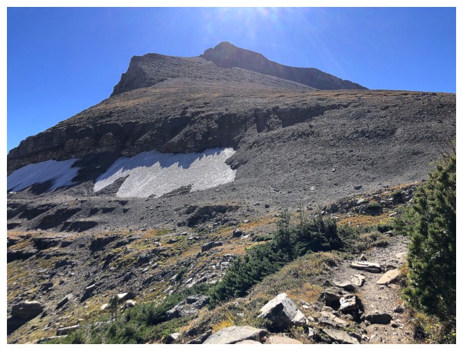
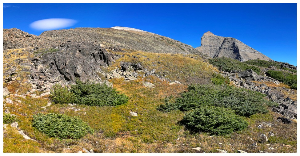
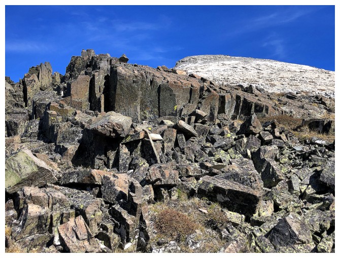
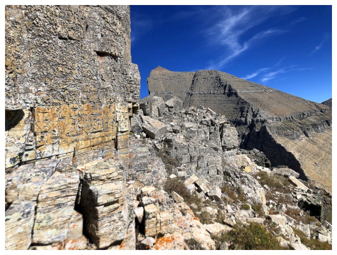
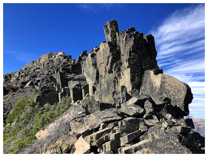
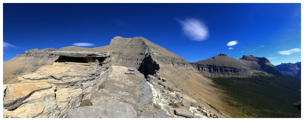
Typical rock on the ascent route. Lots of boulder-hopping but mostly on stable boulders, in sharp contrast to a recent ascent much farther north
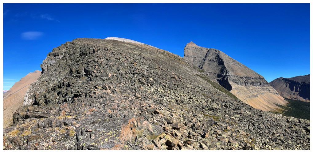
The light coloured rock is the summit
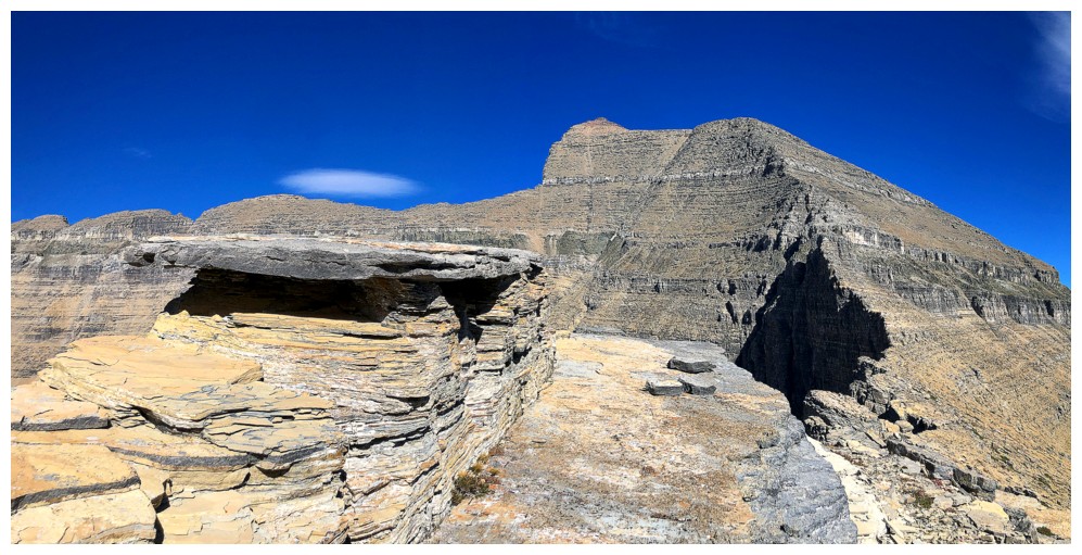
The rock near the edge was very solid
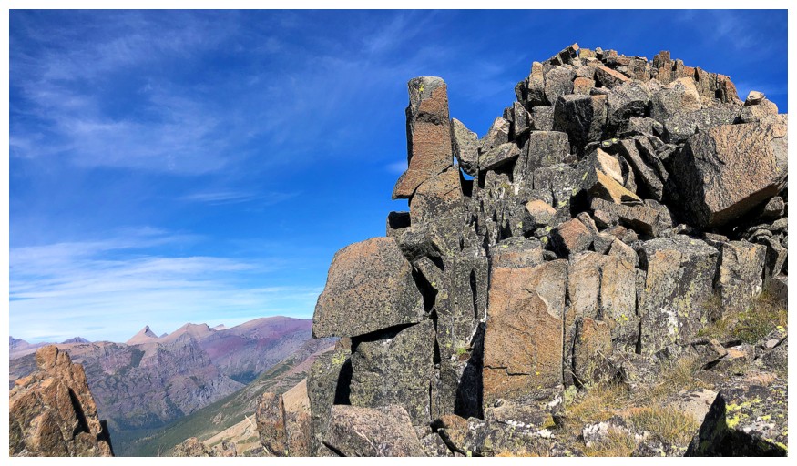
...and very picturesque
North again

Closing in on the light coloured rock
Last section of solid rock
Grinnell Lake looks tiny from here, but it's actually a fair sized lake
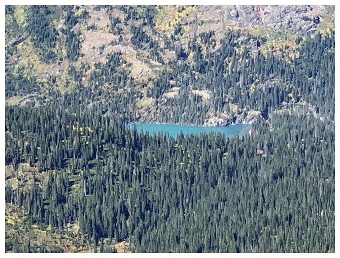
Close-up
The northwest wing of Siyeh at the left
Cool patterns in the rock
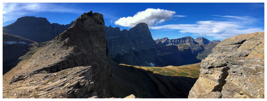
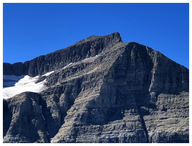
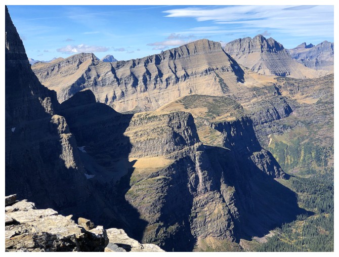
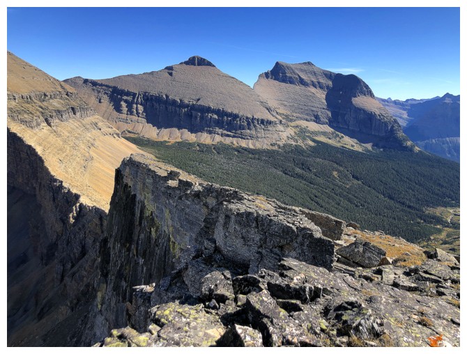
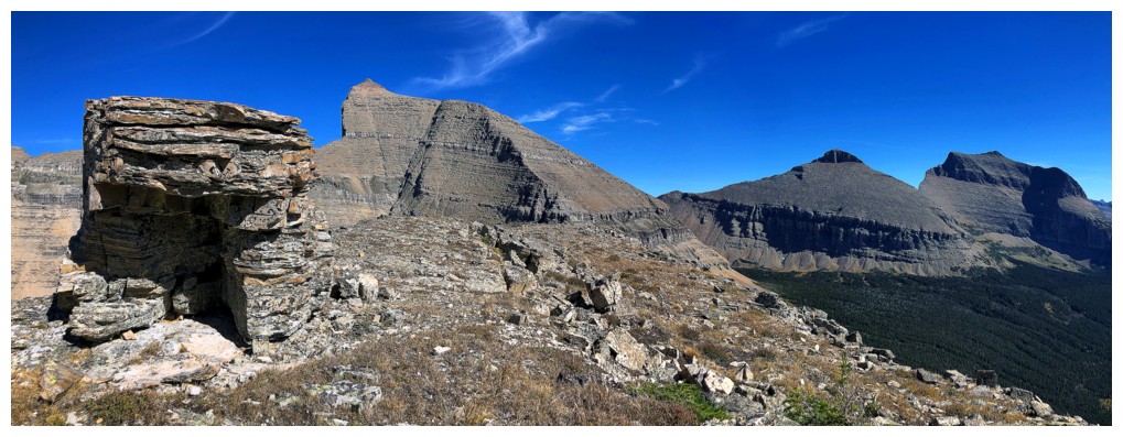
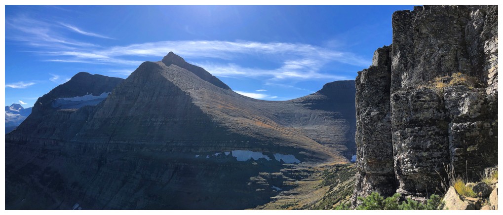
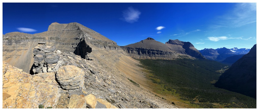
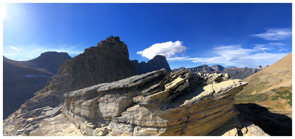
At the summit. The striking profile of Siyeh will be heavily photographed from here until I'm back down to the trail.
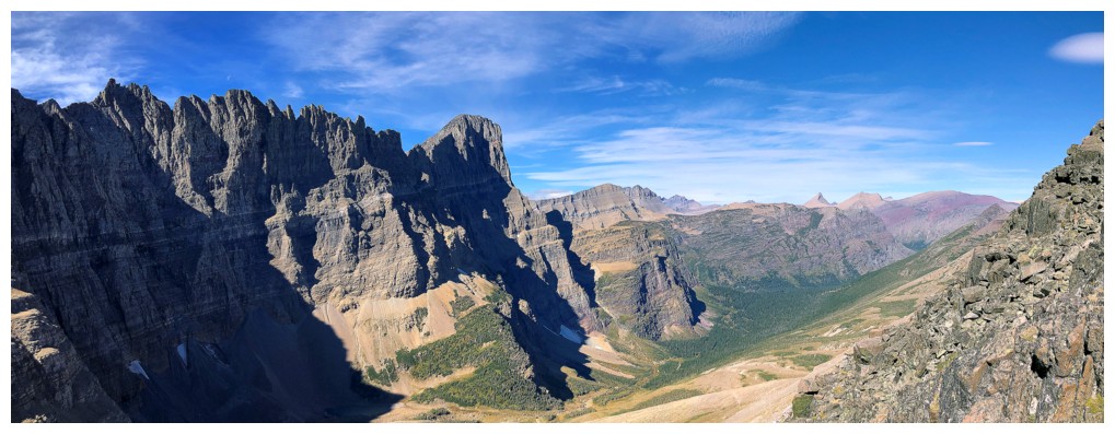
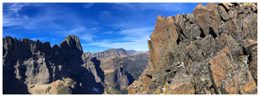
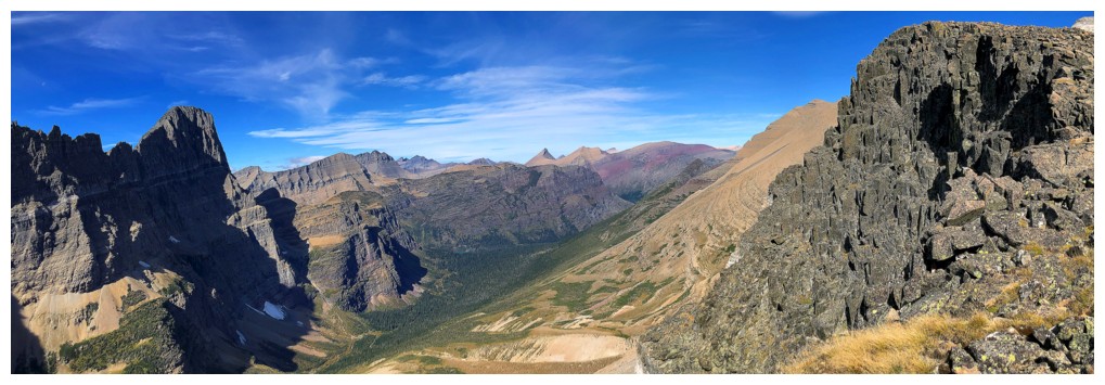
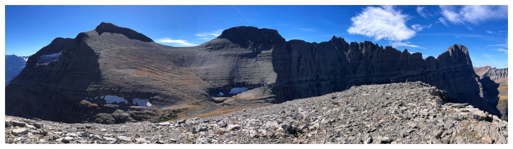
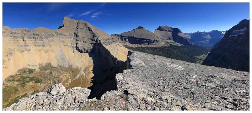
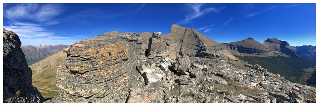
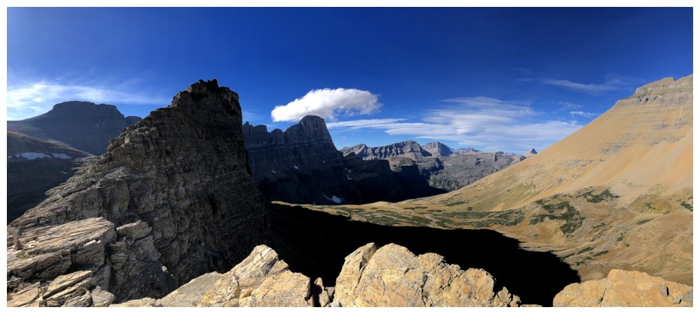
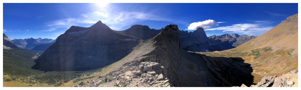
Pano from east to south
Pano from northwest to east
 Three GNP favourites: Angel Wing (middle centre), Mount Grinnell (above Angel), and Mount Wilbur (right)
Three MORE GNP favourites: Crowfeet, Henkel, and Apikuni

The killer profile
GTTS
The PPBC trio
The SMGTTS trio
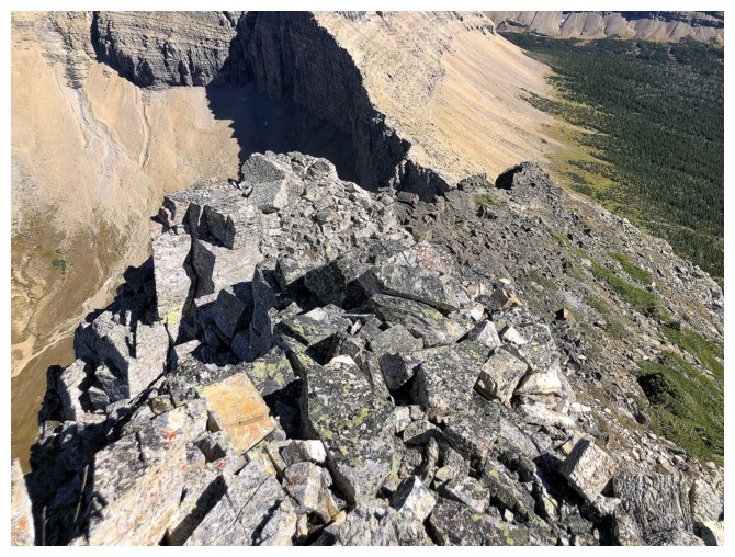
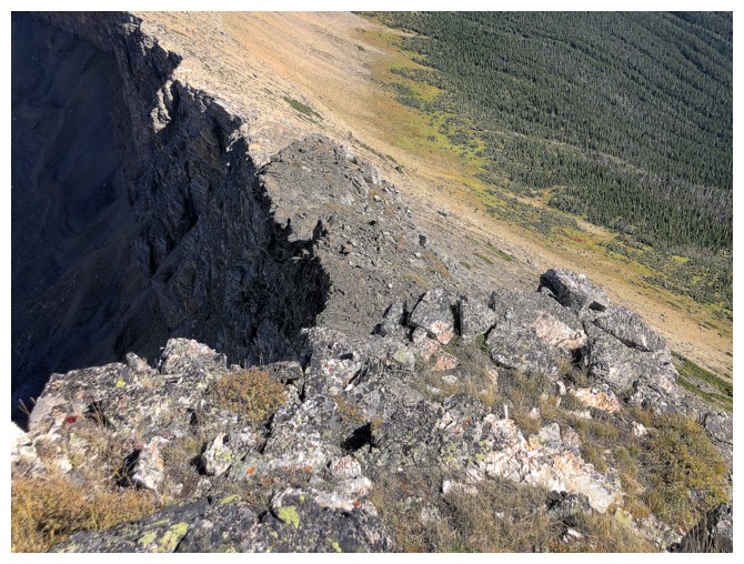
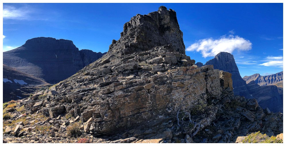
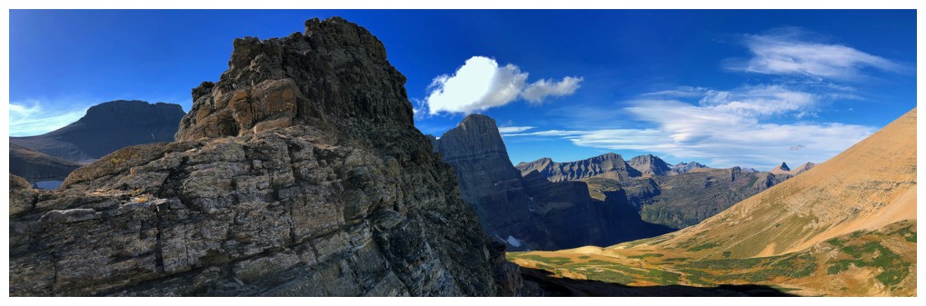
Heading down Cataract's east ridge
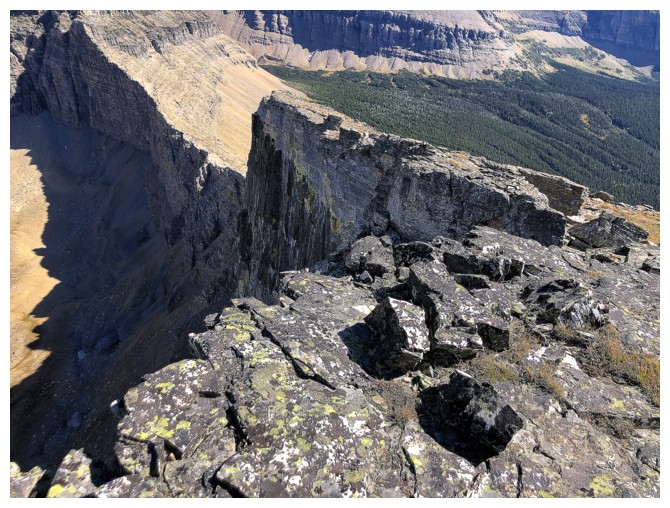
The north side of Cataract is also vertical
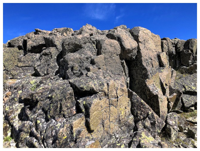
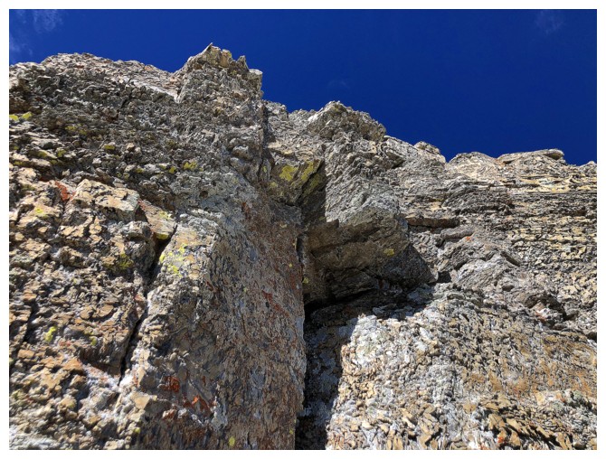
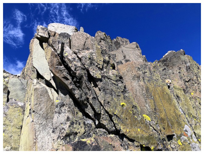
All kinds of super cool rock encounters on the ridge
#2
#3
Big drop-off here that I had to circumvent
Below the vertical step
Looking up it
Looking back along the route I had to use to get down
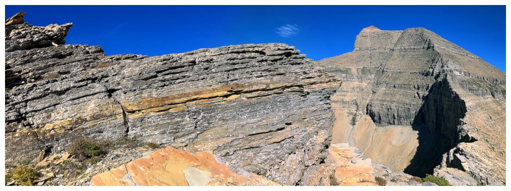
Solid, cheese-grater rock
Heading back to the ridge
#4
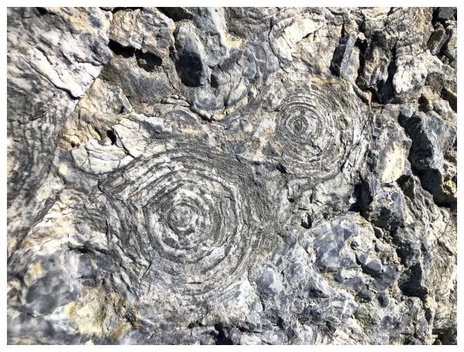
Rock of the Purcell Sill
Same as above
The photographic assault on Siyeh continues
Looking back again
#5
#6
Another drop-off
Downclimbed this on very solid rock
Traversing below the band
Rounding the corner
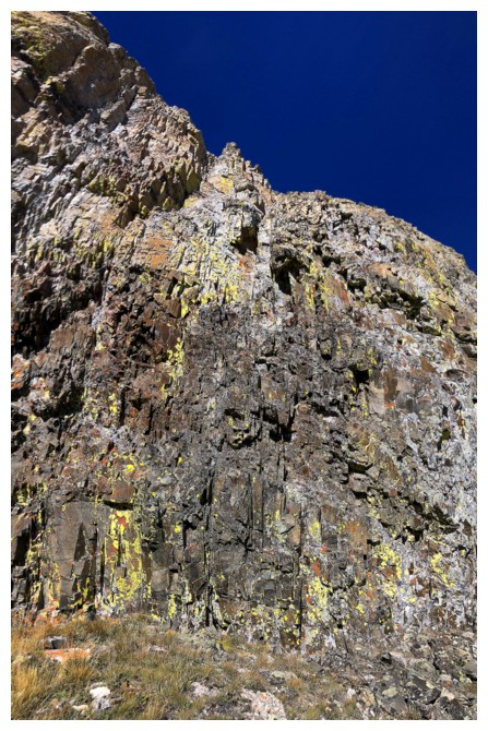
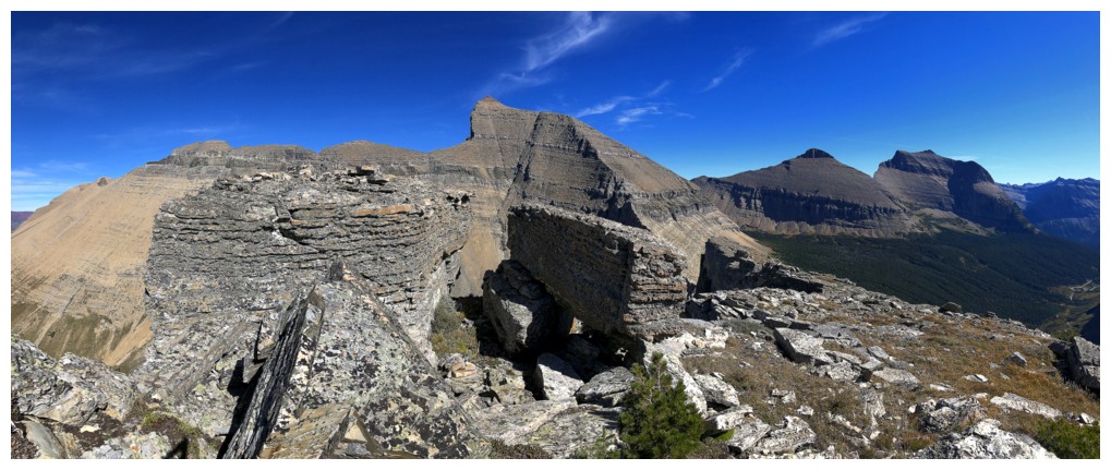
Amazing rock wall
Back on the ridge yet again
More scenic stuff behind me
#7
#8
#8 plus more
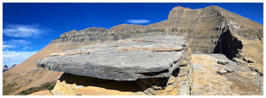
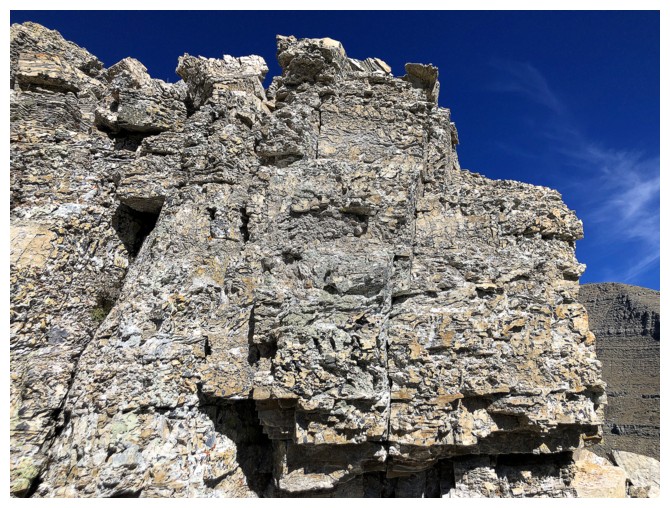
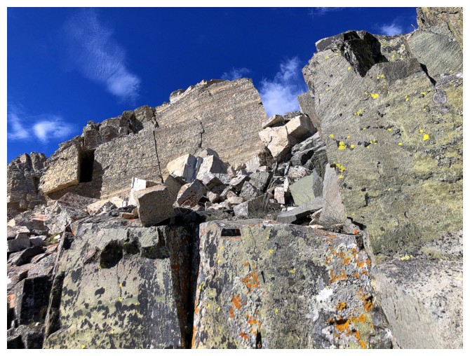
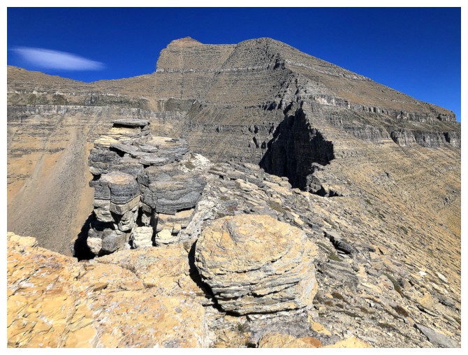
#9 was the coolest
It featured this huge slab of rock balanced atop more rock - like a giant table
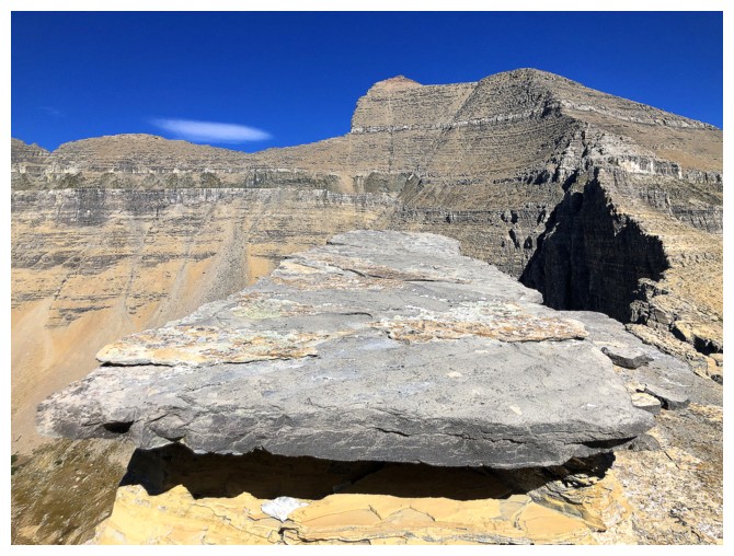
Same as above
Different angle of the table

The northwest ridge of Siyeh looks interesting but very challenging in a few sections
A couple of interesting clouds forming above Matahpi
#10
That vertical face of Cataract
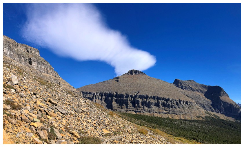
Gould seems to be creating its own cloud
Last the Siyeh photos (from this angle)
Almost back down to the trail
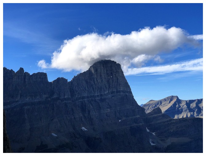
The Matahpi cloud
Parting look at Cataract and the others
Back near the start
GTTS
Mount Siyeh gets the last word
The End
LOG