Mount Grinnell
September 2, 2023
Mountain height: 2692 m
Elevation gain:
1197 m
Ascent time: 5:30
Descent time: 4:20
Scrambling with
Mark.
Unbelievably
awesome trip, where making the summit was merely the “icing on the cake”.
Earlier in the
week I returned to Glacier National Park, after a 4-year absence. Of course, that
mind-blowing single visit (and another the day after) was more than enough for me to want
more – much more! 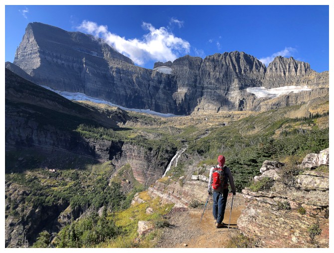 As such, even though Mark had only a single day to do a trip,
we left Calgary at 4 am, in order to maximize our time across the border and
ensure we would make it back into Canada before the border closed.
As such, even though Mark had only a single day to do a trip,
we left Calgary at 4 am, in order to maximize our time across the border and
ensure we would make it back into Canada before the border closed.
En route, we
decided that Grinnell Mountain, via its south face would be the day’s
objective. Raff and I had set out to summit Grinnell in September of 2019.
However, foul weather had redirected us to the summit of nearby and much lower
Angel Wing. Also, I had fortuitously downloaded a GPS track from Sonny’s
website to help with the route-finding.
By 7:50 am we
were at the Grinnell Glacier trailhead (along with a hundred or so other
people) and ready to rock! Surprisingly the trail was closed for maintenance. I
had hiked it only four days earlier on an aborted attempt of Grinnell Point. 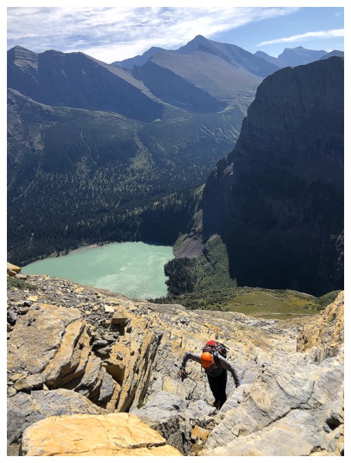 This
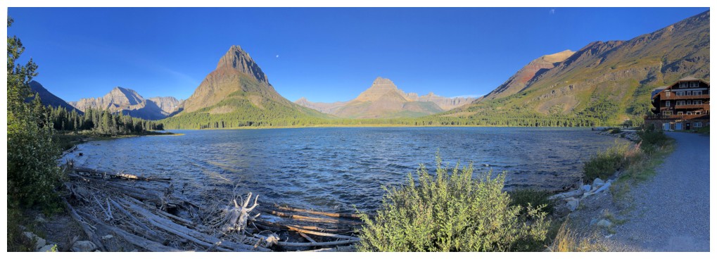
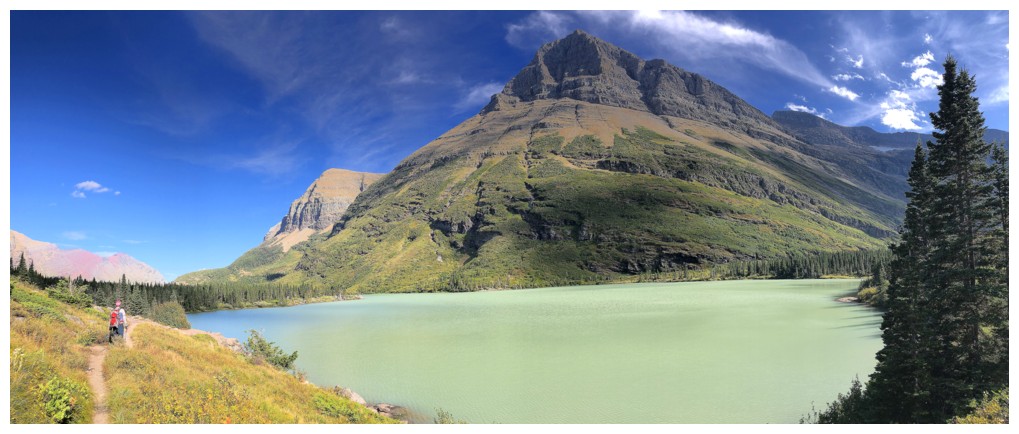
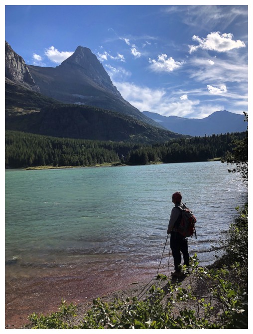
turn of events required about 30 minutes of extra hiking around the north and
east sides of Swiftcurrent Lake, but at least the detour afforded us the
classic view of the lake and surrounding mountains from near the Many Glaciers
Hotel.
This
turn of events required about 30 minutes of extra hiking around the north and
east sides of Swiftcurrent Lake, but at least the detour afforded us the
classic view of the lake and surrounding mountains from near the Many Glaciers
Hotel.
Eventually,
we
did hit the Grinnell Glacier trail and started up – and more
enthralling it
could not have been! This was my second time on the trail and very much
reinforced
the sentiment that this trail is one of the most enjoyable hikes in all
of GNP,
Waterton, The Castle, Kananaskis, Banff, and Jasper. The route is
essentially a goat trail that gently and magically ascends terrain on
the south
flank of Grinnell. The scenic treasures along the trail are too
numerous to discuss
in detail (see photos).
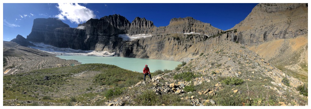
Even though the
trail goes past the start of the ascent route to Grinnell, you cannot hike that
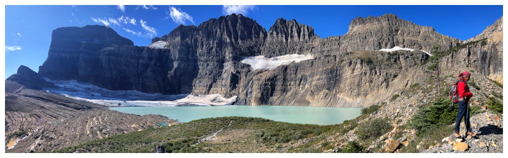
trail without visiting Upper Grinnell Lake first. Backdropped by the near vertical
north face of Mount Gould with the Grinnell Glacier below, this is a jaw-dropping
place of rare beauty. The aforementioned one hundred or so other people were already there
when we arrived, enjoying the sublime scenery.
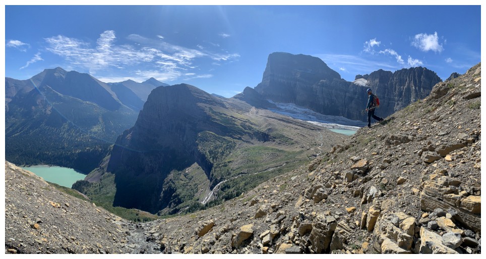
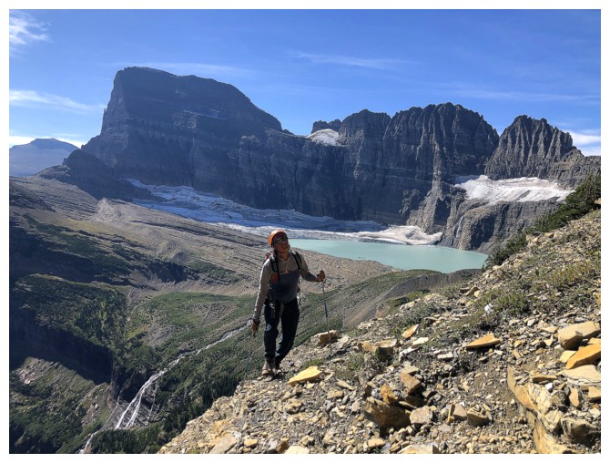
After an all
too short break at the lake we backtracked a little and then embarked on a long,
slightly ascending traverse across the south face of Grinnell. While the terrain
underfoot was considerably better than your average traverse in Kananaskis, it
was still a gruelling and less than aesthetic affair. That changed dramatically
when we reached a significant water-worn gully. Going up the gully would put us
slightly off-route, but we couldn’t resist.
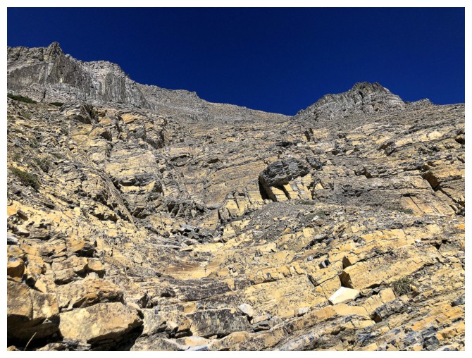
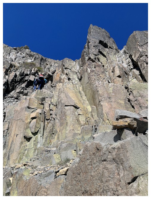
Eureka!!
This was possibly
the best gully we ever been up – solid, step-like rock, with a positive slope, that
was super fun to scramble up – and it went on forever! The route very much
reminded us of the moderate scramble route up Anderson Peak in Waterton. And to
top it all off – the diorite sill; a band of igneous rock that is both beautiful
and super solid (the GNP equivalent of granite, or quartzite). We last climbed
a section of this amazing rock while ascending nearby Mount
Wilbur, in 2009.
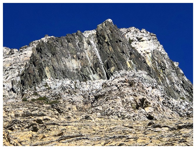
Above the diorite,
a short slog brought us to another famous layer of rock (actually more infamous!).
The grey limestone band is a staple of all many peaks in GNP, Waterton, and The
Castle. Getting above the band is usually the crux of those ascents.
Thankfully, we only had to traverse a short distance to get above it and onto
the final ascent slope. This slope was much steeper, but some zigging and zagging
made easy work of it.
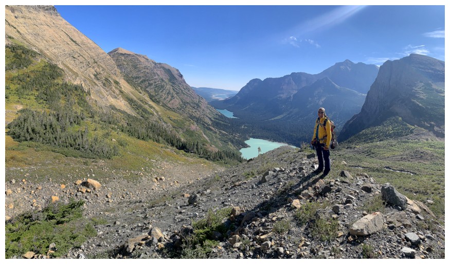
Gaining the
ridge of any mountain usually means a whole new view and Mount Grinnell was no
exception. Having spent the entire trip marvelling at the wonders of the Grinnell
valley, in an instant the entire Swiftcurrent valley was unveiled. 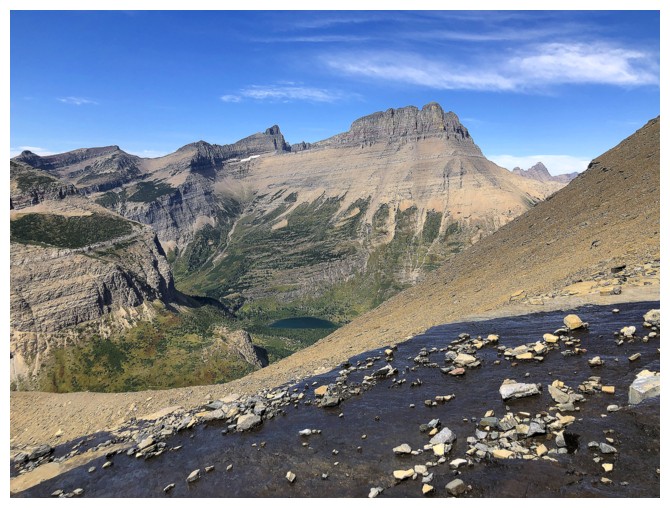 And that
valley certainly ain’t no slouch either! In addition to the beautiful forms of
Mount Wilbur, Swiftcurrent, Henkel, Allen, and many other, seven lakes were now
visible – stunning!
And that
valley certainly ain’t no slouch either! In addition to the beautiful forms of
Mount Wilbur, Swiftcurrent, Henkel, Allen, and many other, seven lakes were now
visible – stunning!
The summit was
a short distance away and likewise boasted an awe-inspiring panorama. It also was
soon to boast two other visitors. Like the Canadian Rockies, GNP has seen a dramatic
increase in the number of hikers on the trails, but when the trail ends so do
the people – also like Canada. This would be only the third time in GNP where
we would share the summit with others. 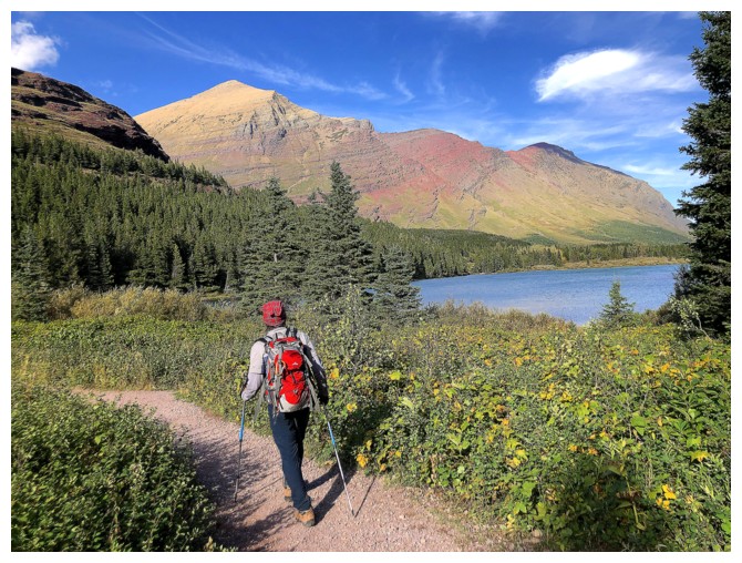 The two gentlemen had ascended via the Grinnell
Glacier Overlook. Tanner and his partner were super friendly, and we quickly
shared our ascent stories, before ducking below the ridge to escape the
wind.
The two gentlemen had ascended via the Grinnell
Glacier Overlook. Tanner and his partner were super friendly, and we quickly
shared our ascent stories, before ducking below the ridge to escape the
wind.
At this point,
we need to heartily thank Sonny and Zosia for their trip report and Sonny’s GPS
track. We are not sure where Sonny got the idea to descend into the
Swiftcurrent valley, but it was a bold stroke of genius! From above, the route
appeared to end where a huge cliff interrupted the descent. However, unseen
there existed a steep but easy route all the way down to the valley and the amazing
Swiftcurrent Pass Trail. Using Sonny’s descent route, afforded us an up-close
visit to the Swiftcurrent Glacier, a whackload of new and interesting scenery,
and an easy walk out back to Many Glaciers. As the final bonus of the day, the trail
ended right in front of the Swiftcurrent Motor Inn General Store, that, of course, has
ice cream!
Definitely, one
of the best routes and most memorable days we’ve had in the mountains south or
north of the border. Thank you, Sonny, and thank you Glacier National Park, Montana!
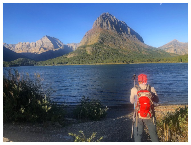
The classic view of Grinnell Point from near the Many Glaciers Hotel
Same as above. Mount Gould to the left of the Point and Wilbur to the right.
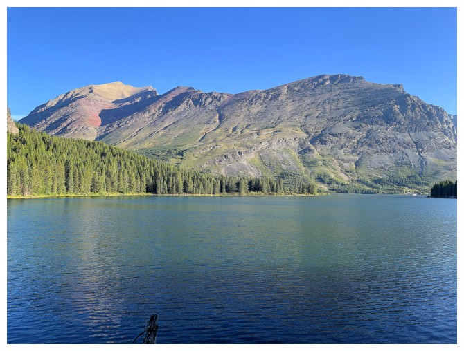
Mount Henkel at the left. To this day, one of my favourite scrambles ever!
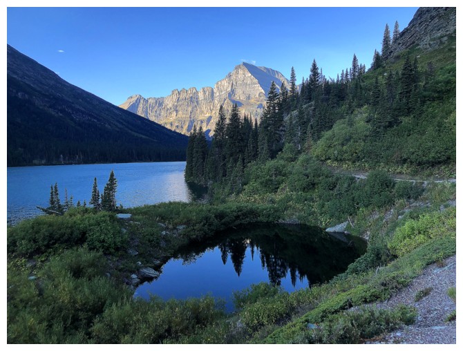
A small pond, Lake Josephine, and Mount Gould
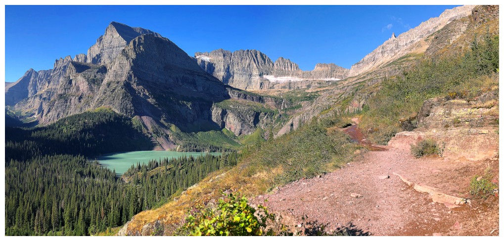
Here we go! Highlights of the fantastically awesome Grinnell Glacier Trail.
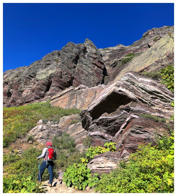
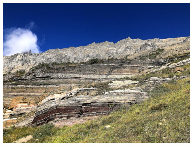
Naturally, there is red argillite to boot!
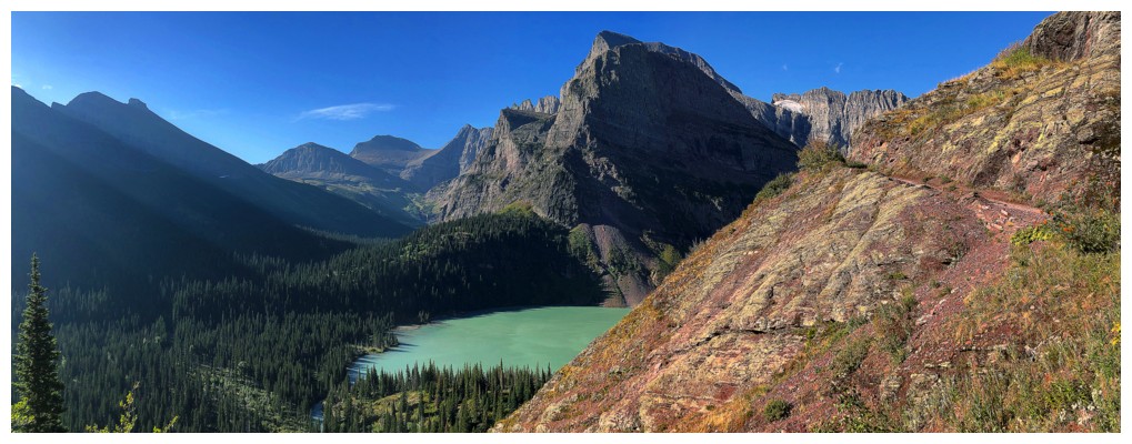
Then you throw in Mount Gould and Lower Grinnell Lake
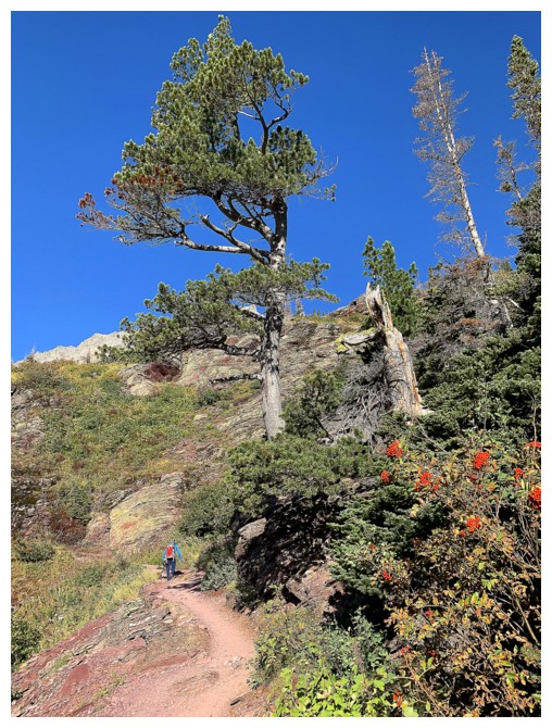
A few big trees and berries
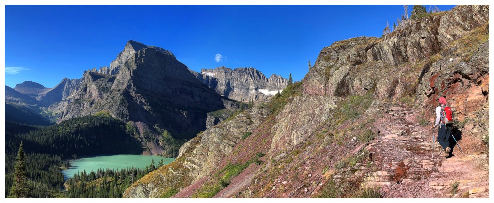
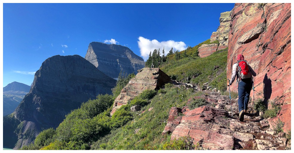
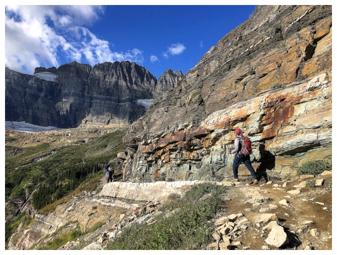
Note the trail snaking its way around the mountain
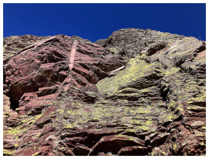
Note the beautiful lichen-covered rock
First glimpse of Mount Grinnell at the right
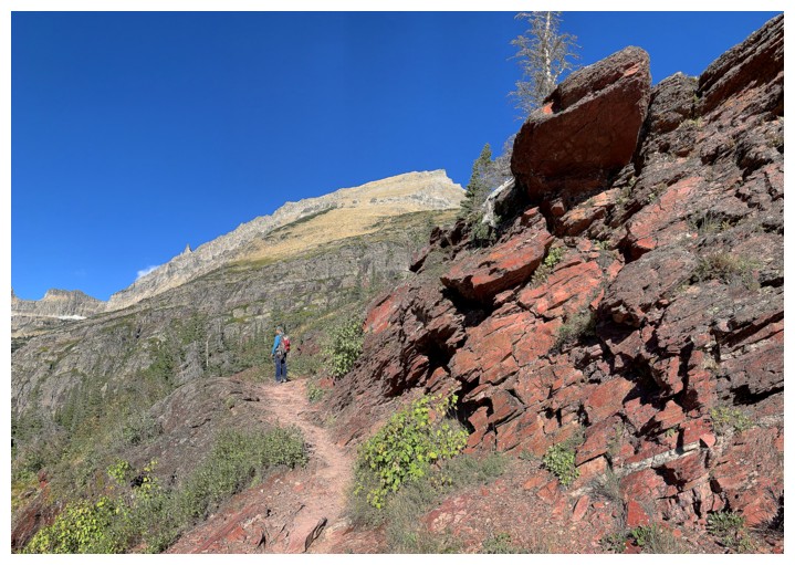
Grinnell and argillite
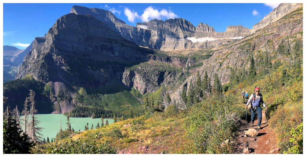
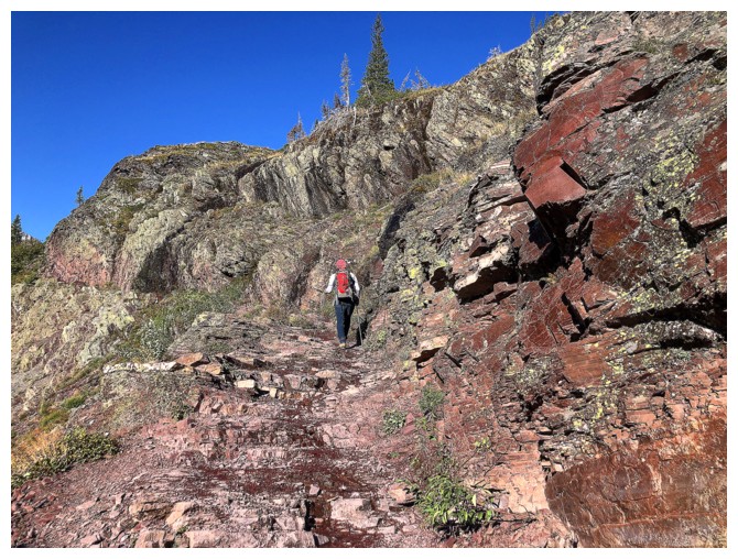
One of the few switchbacks of the trail. 99% of it goes right alongside
the mountain face - mountain goats are very efficient trail builders!
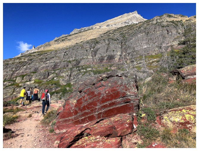
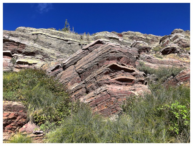
Grinnell and some very brightly coloured argillite
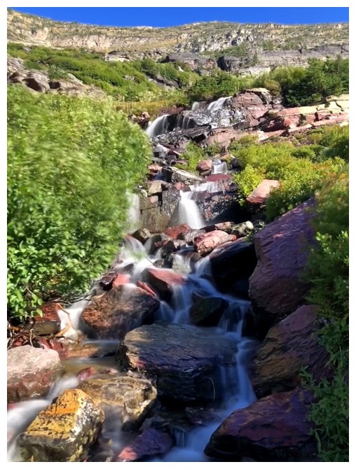
One of several drainages on the south face
We considered leaving the trail here to attempt a more direct route to the ascent line. But then we would have missed.....
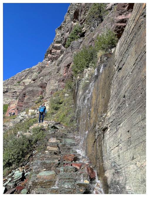
...this! One of the coolest sections of the trail features a dripping wall above a staircase of green argillite.
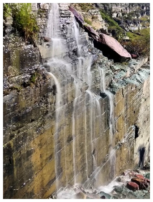
A better view
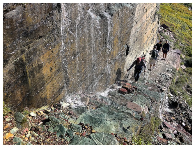
Mark comes up the staircase
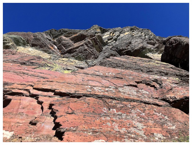
Back to my red argillite obsession
Ditto
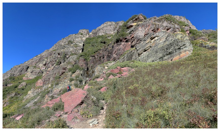
Awesome bands of rock above the trail at every turn
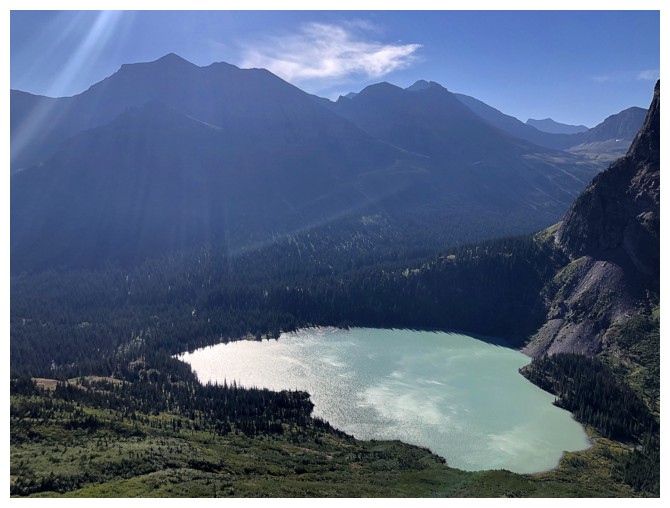
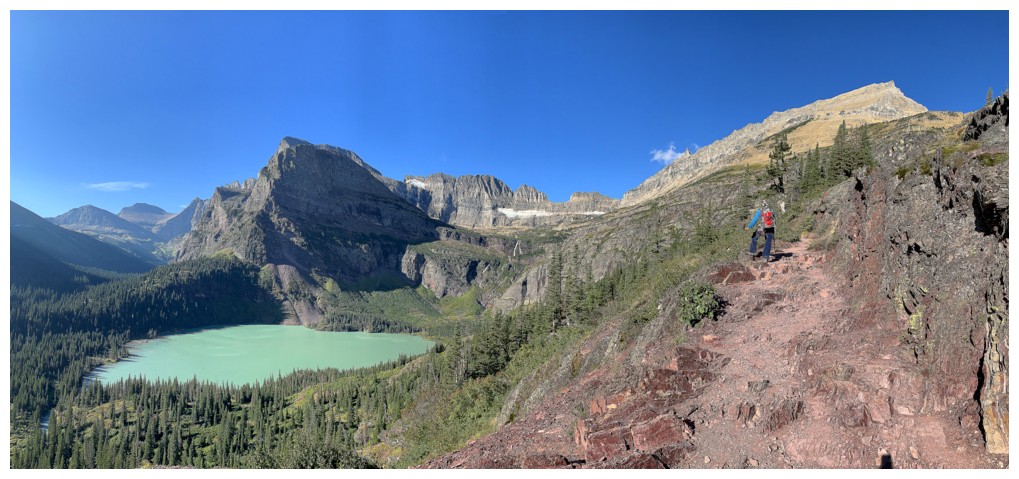
Allen Mountain towers above Lower Grinnell Lake
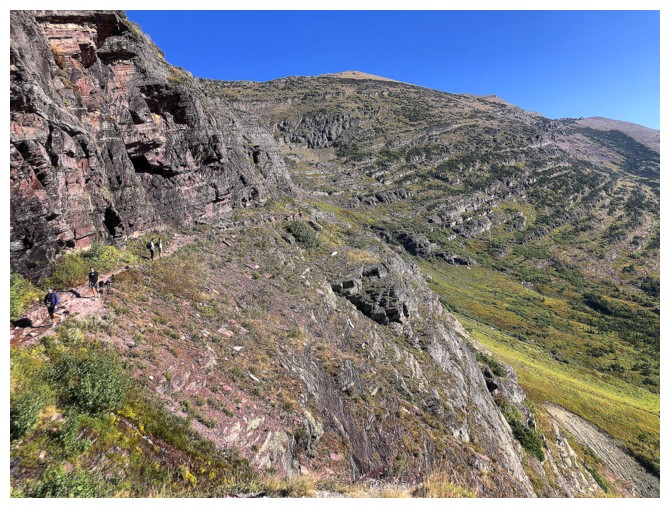
Looking back at the train of other hikers on the trail
But the rock is way more fascinating
The narrow ridge on either side of Mount Gould is called the Garden Wall and its super cool!
Back to the cool rock on Grinnell
Same as above
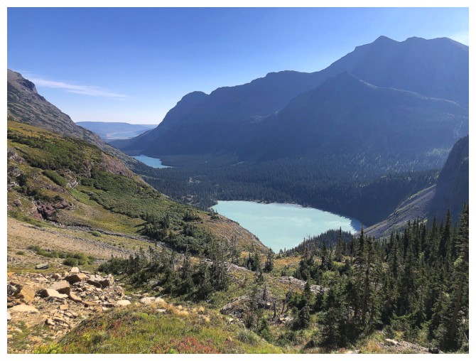
Josephine Lake is now visible too
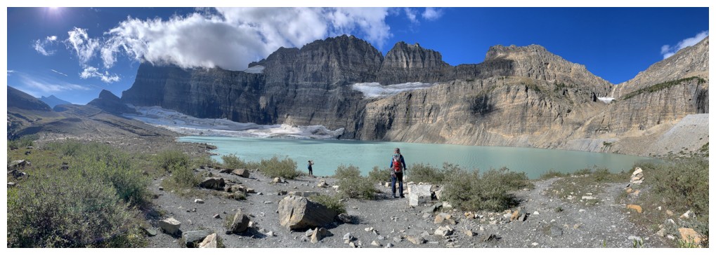
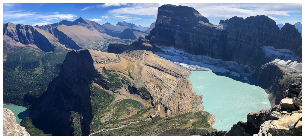
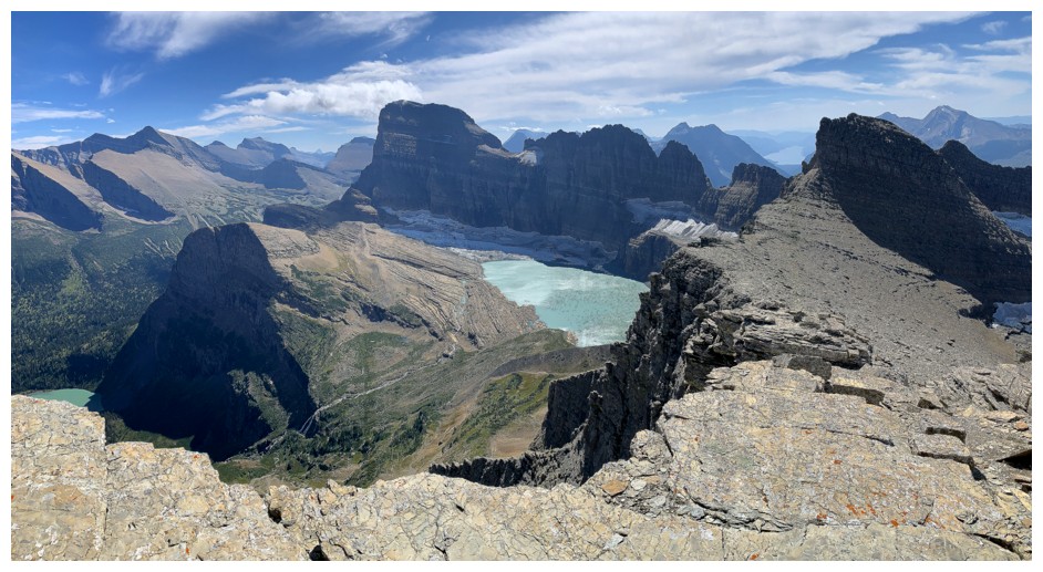
Upper Grinnell Lake. Looks great from here....
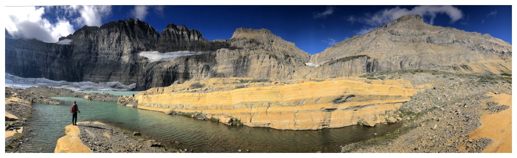
...but looks incredible closer to the shore
Ponds around the lake and Mount Grinnell
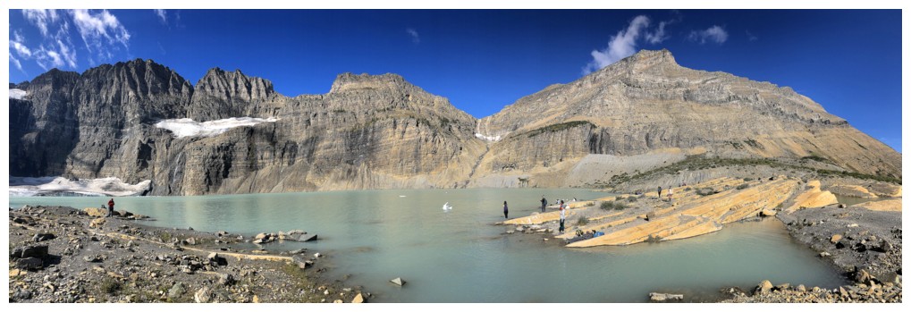
Lots of people enjoying the surroundings
A rare shot without other people
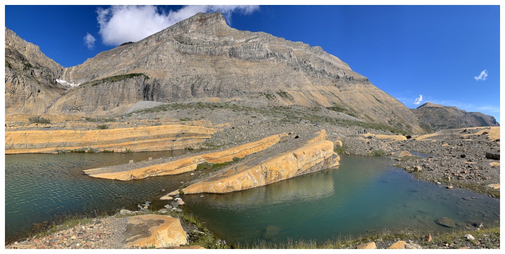
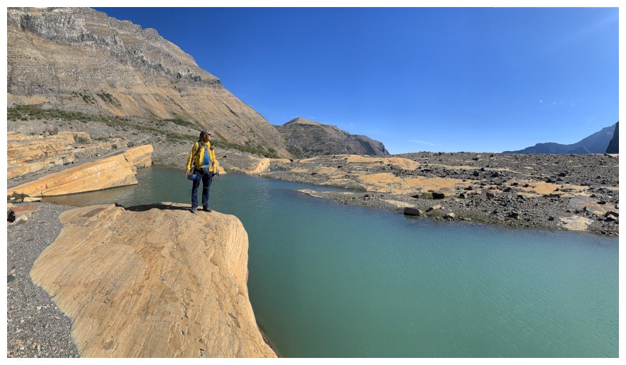
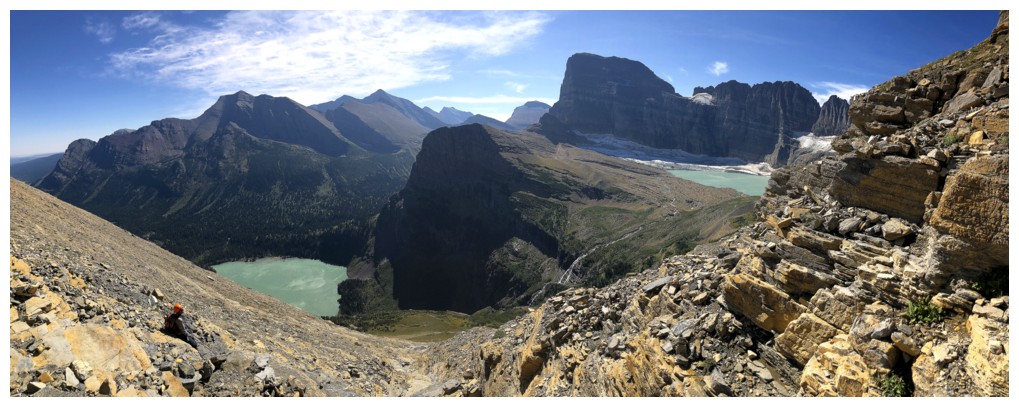
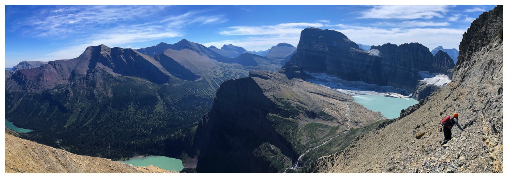
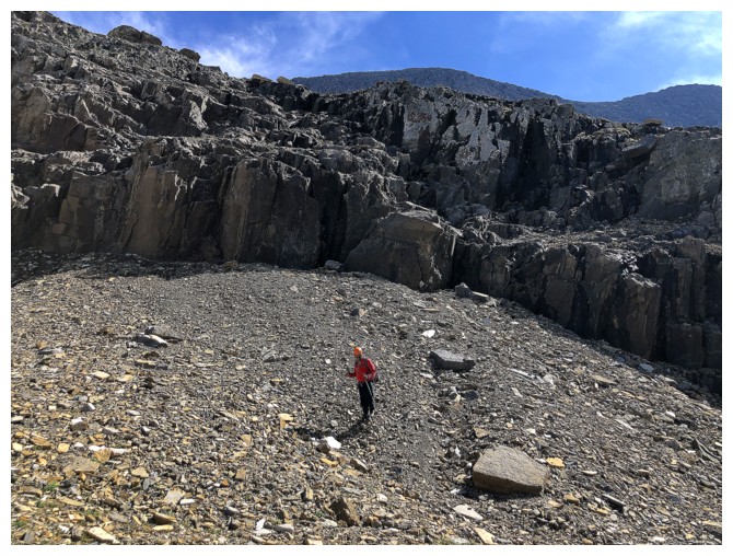
Off the trail and all the people are gone
Same as above, looking the other way
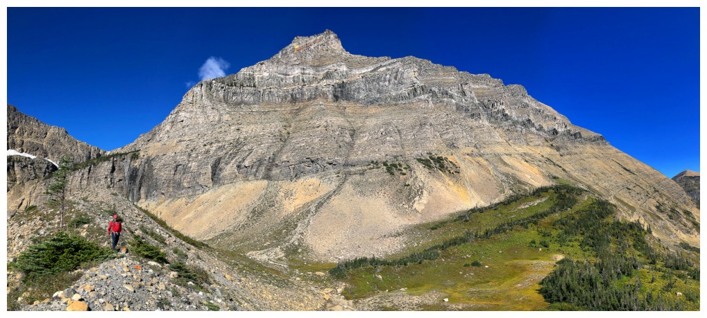
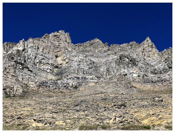
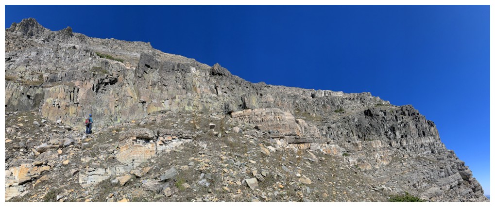
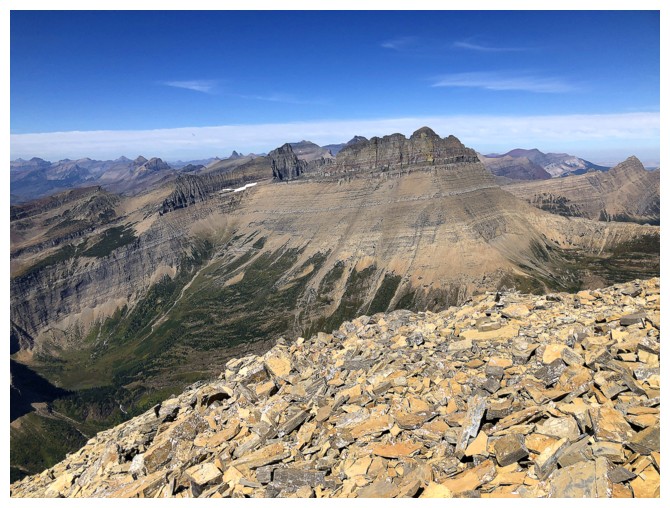
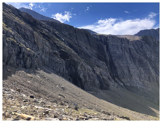
Mount Grinnell's magnificent south side. The ascent route goes all the way to the right side and then up.
Of course, I'm still fixated on the Upper Lake environs
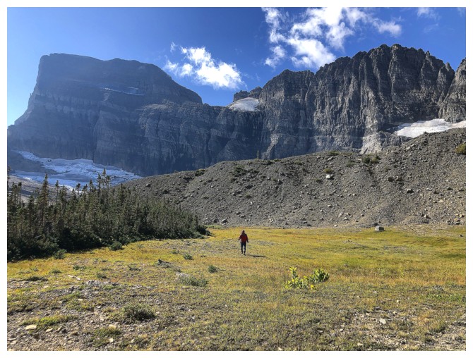
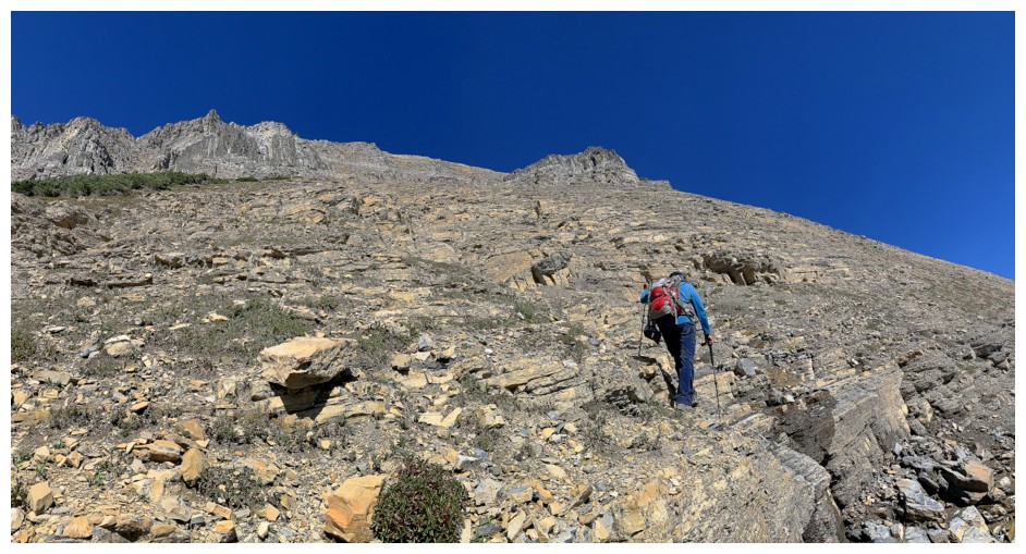
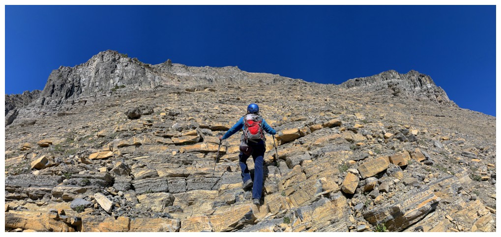
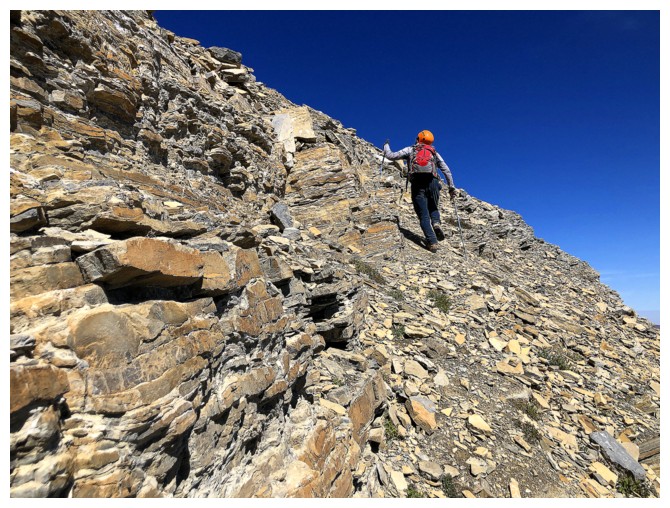
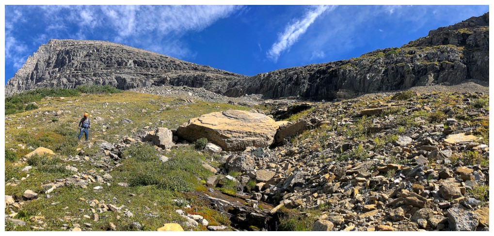
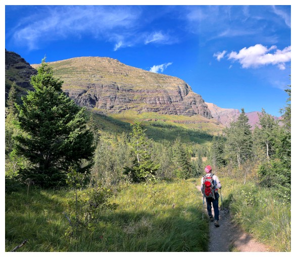
Pleasant stroll across a meadow before the real work begins
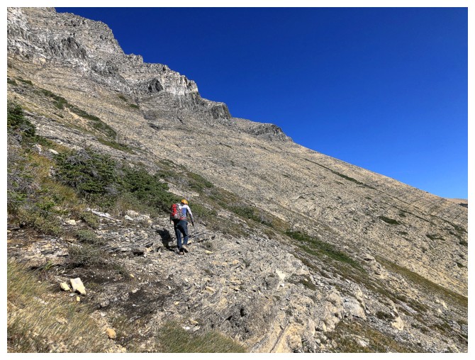
The real work
Steep rock bands prevent a direct route to the summit ridge
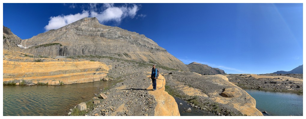
Found a water source to refill our water packs
Angel Wing is the big, but low peak just left of centre. It's a totally worthwhile ascent.
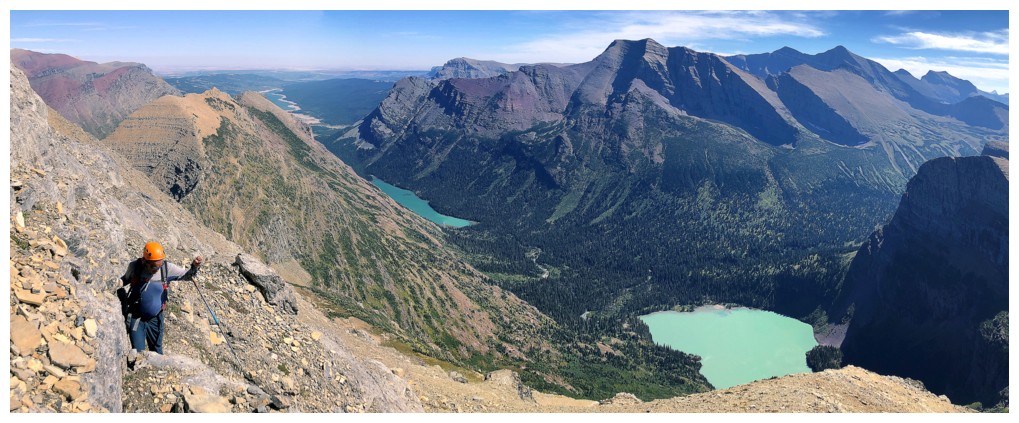
Diorite alert!
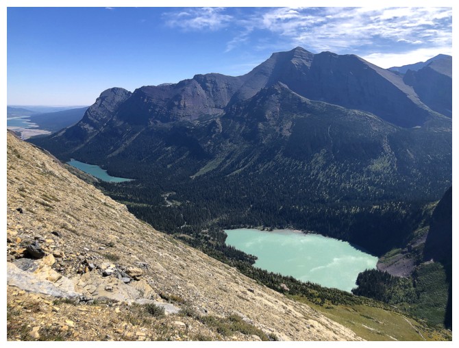
Earth's rotation and the Sun shining on them cause Josephine and Lower Grinnell lakes to take on more vibrant hues
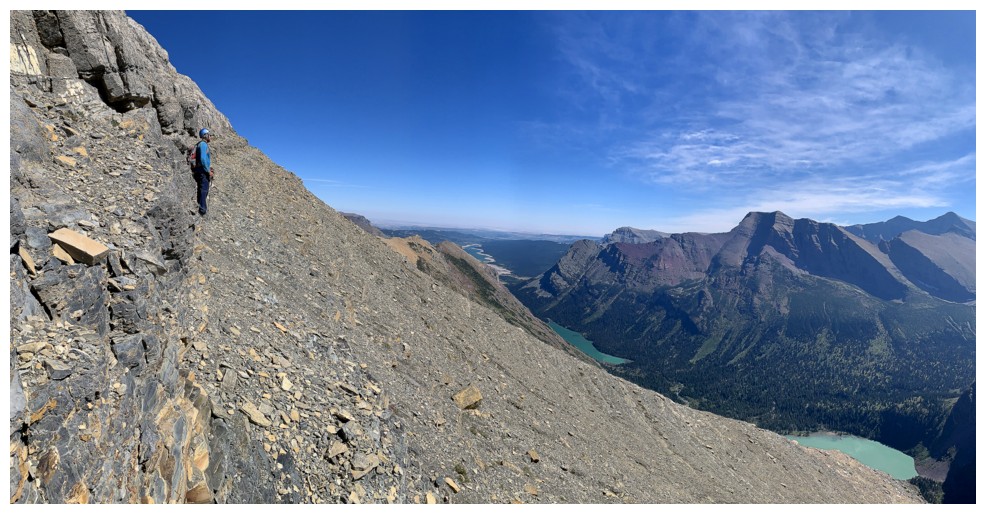
Still traversing
Mark has spotted something
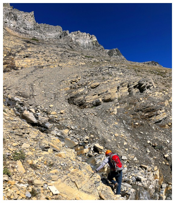
It's a very inviting water-worn gully
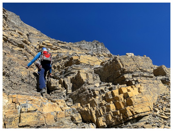
Up we go
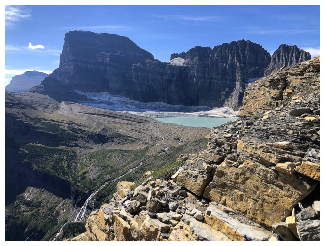
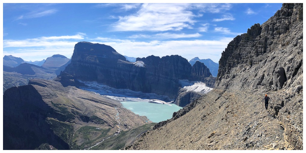
But the views over to Gould, the lake, the glacier, and The Garden Wall are still commanding attention
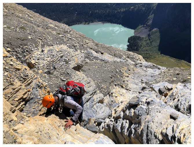
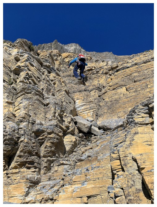
Mark ascends a step
The solid step-like rock was a dream to ascend
As good as the rock was, we couldn't ignore these views
Still on the staircase, but it's coming to an end
Approaching the diorite sill
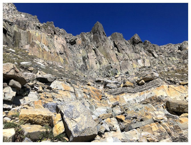
Getting excited to make contact with the rock!
Sweet diorite
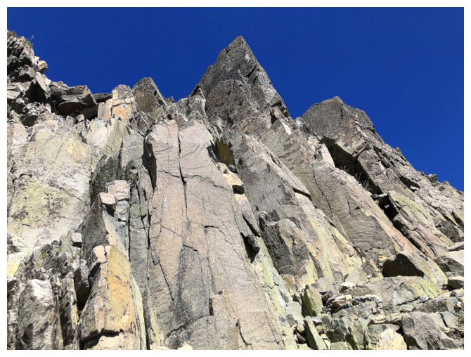
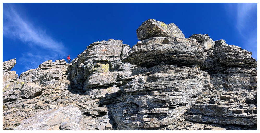
Starting up the solid rock
Halfway up
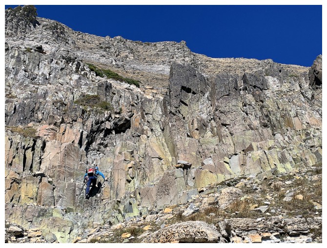
Mark tackles the diorite
All too soon it's over, but a great view awaits at the top
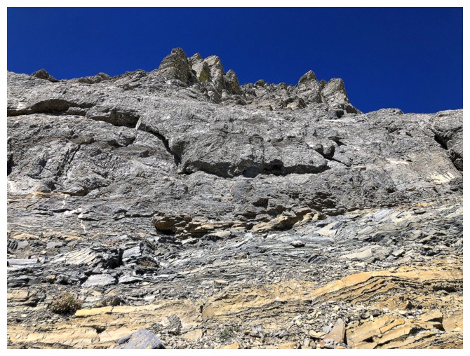
Approaching the limestone band
Mark does the same
The band is too steep here but peters out to the east
Mark walks below the band
First good of Mount Henkel from up high
Some of the zigzagging and the amazing view over the Grinnell valley
Almost at the ridge
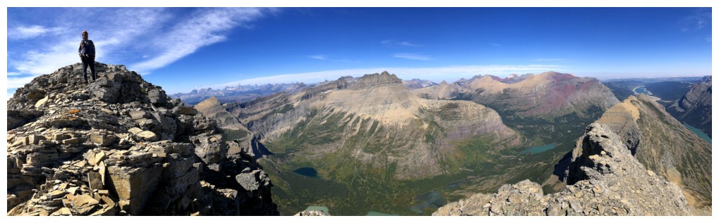
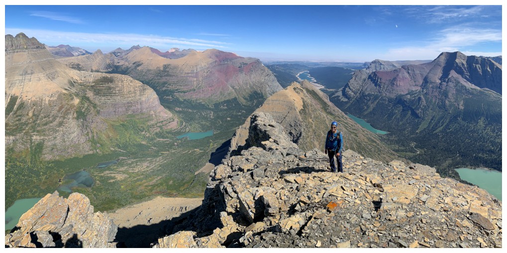
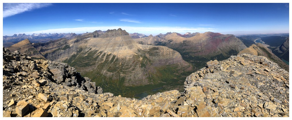
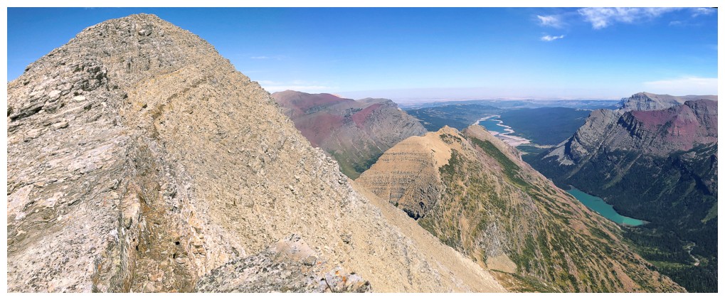
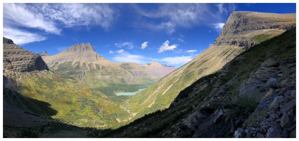
On the ridge and taking in the first views of the Swiftcurrent valley
Same as above. Seven lakes are now visible.
Below Mount Wilbur sit Bullhead Lake (light turquoise) and Widowmaker Lake (the darker lake above)
Redrock Lake sits under Bullhead Point
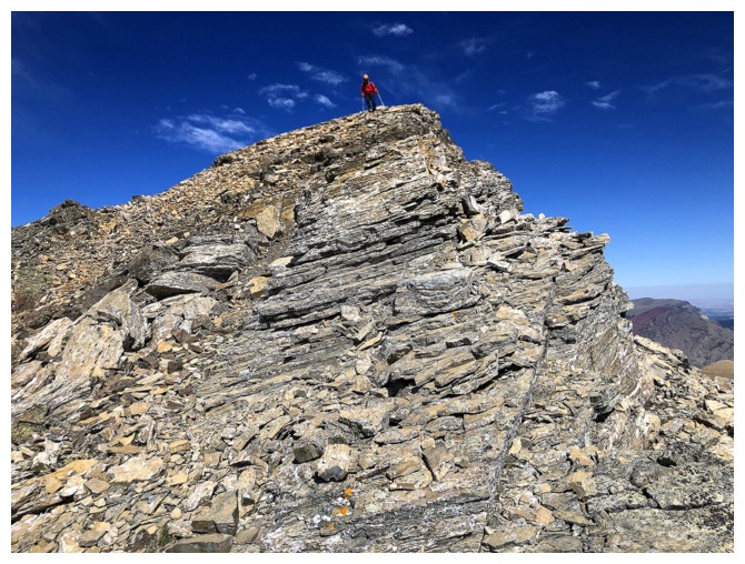
At the summit
The light coloured peak near the right is Swiftcurrent Mountain
Magnificent Mount Wilbur
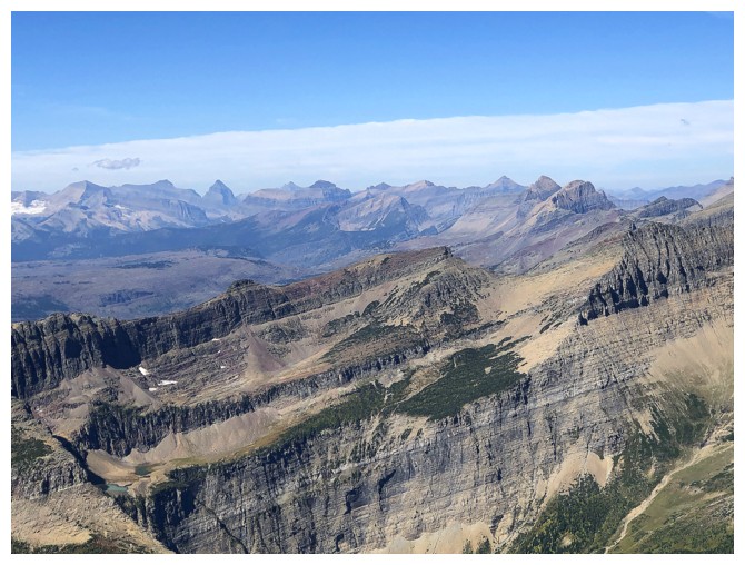
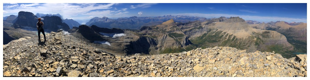
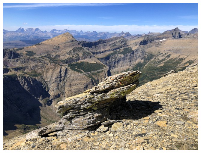
A sea of peaks to the northwest
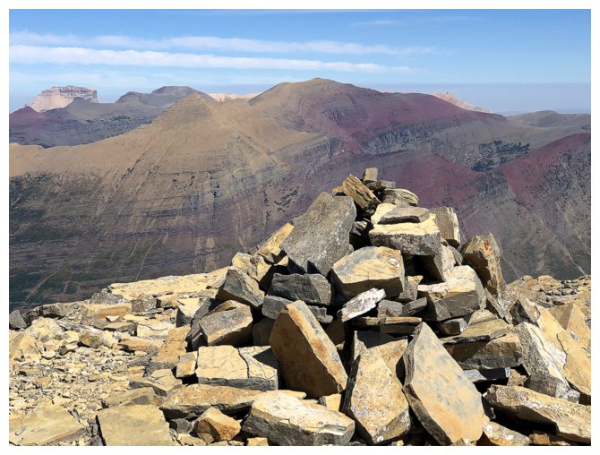
The summit cairn and Henkel. Chief Mountain at the distant left and slithers of Yellow Mountain behind Henkel.
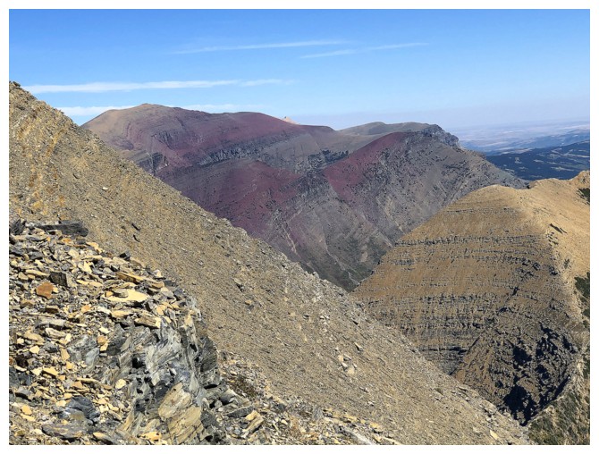
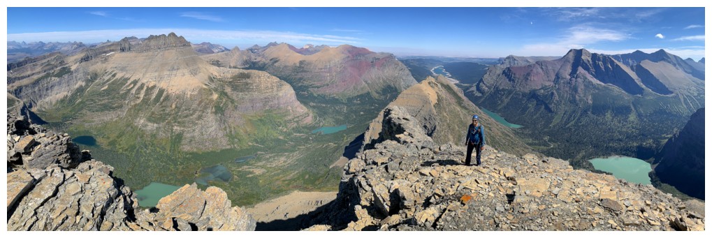
View to the east, southeast, and south
View to the north, northeast, and east
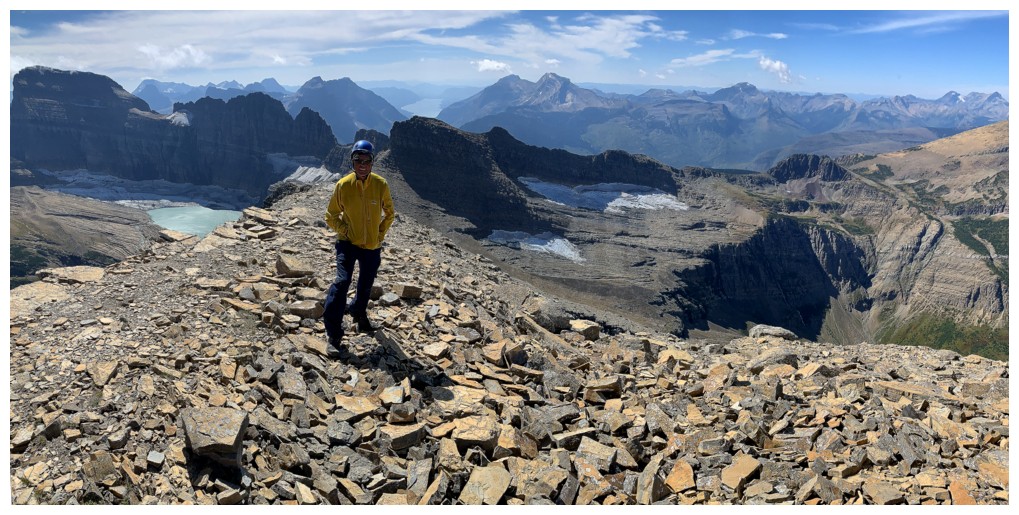
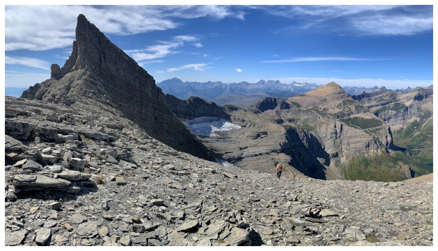
Another great view (minus the dude in yellow)
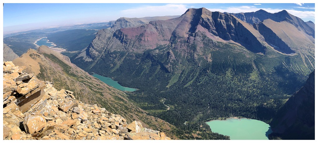
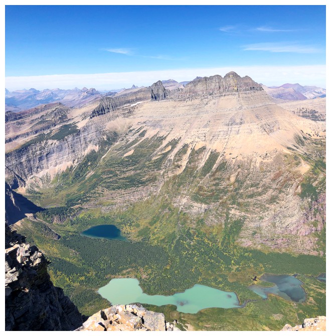
Three lakes (Sherburne, Josephine, and Lower Grinnell) and Allen Mountain
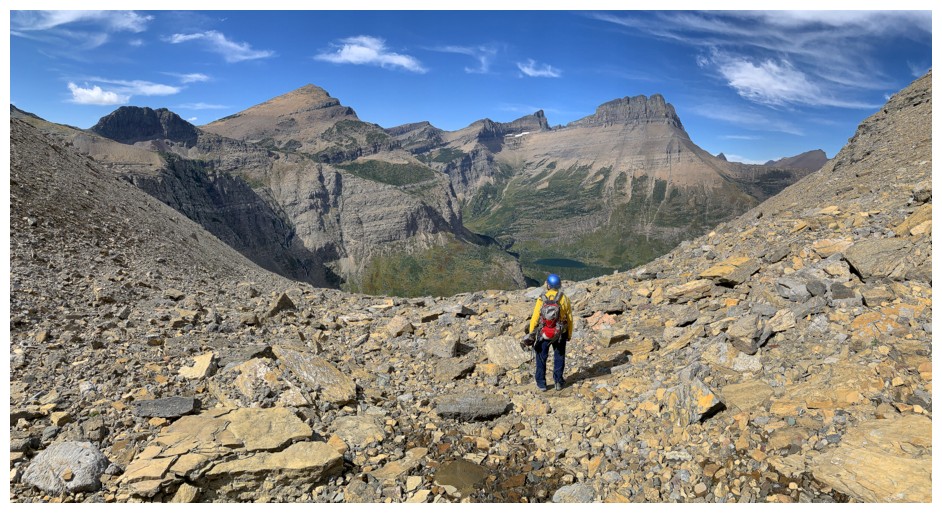
Starting down Sonny's alternate descent route
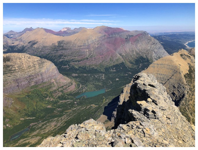
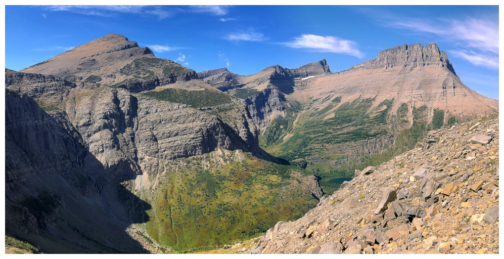
Looking back to the summit and other cool things
No summit, just other cool things
Mark descends the easy southwest ridge
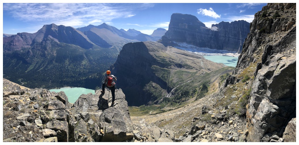
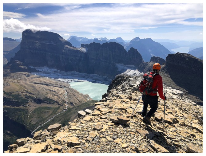
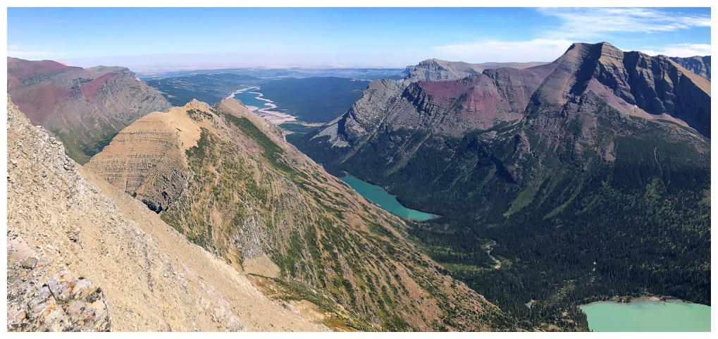
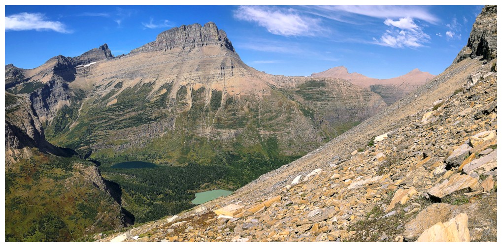
The view towards Upper Grinnell Lake and company is inescapable
The terrain gets more complex but is still an easy ride down
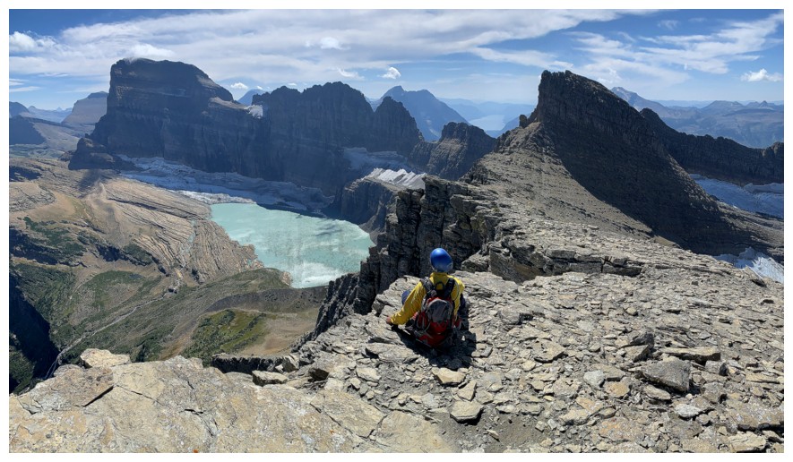
One last look at that inescapable view
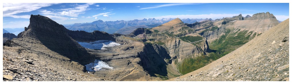
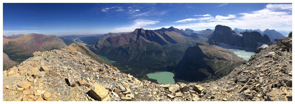
Pano without the lake
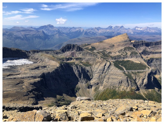
The minor summit at the left looks super dramatic as we lose elevation. You can get the top of it from the west side.
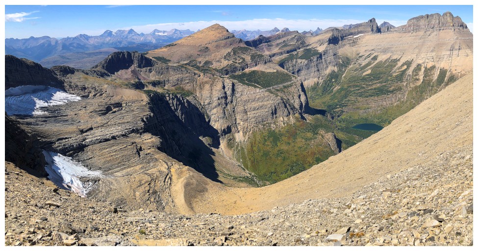
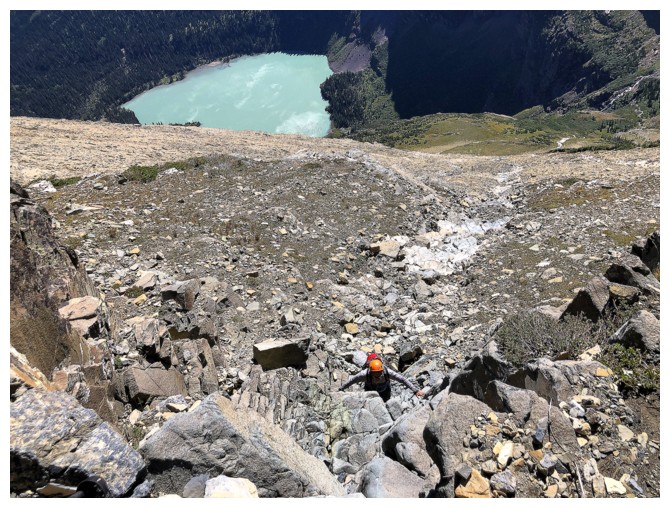
Looking down the improbable descent route: right down the middle. We visited the Swiftcurrent Glacier at the left first.
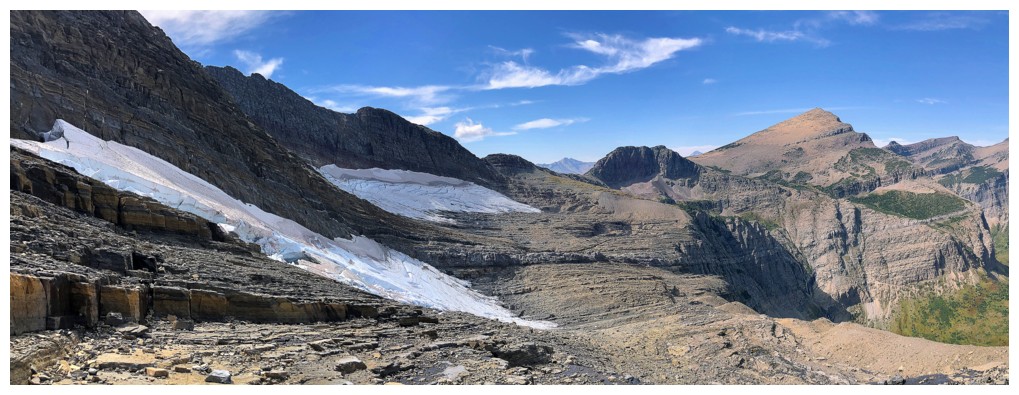
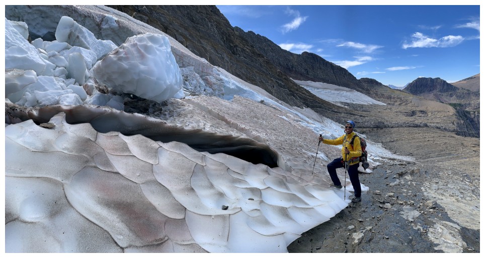
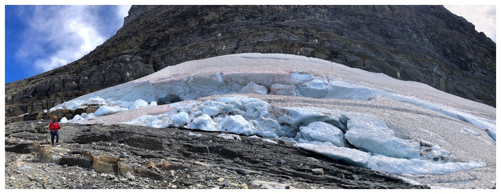
Approaching the glacier
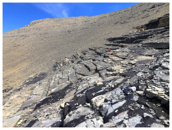
The rubble and scree change to slabs
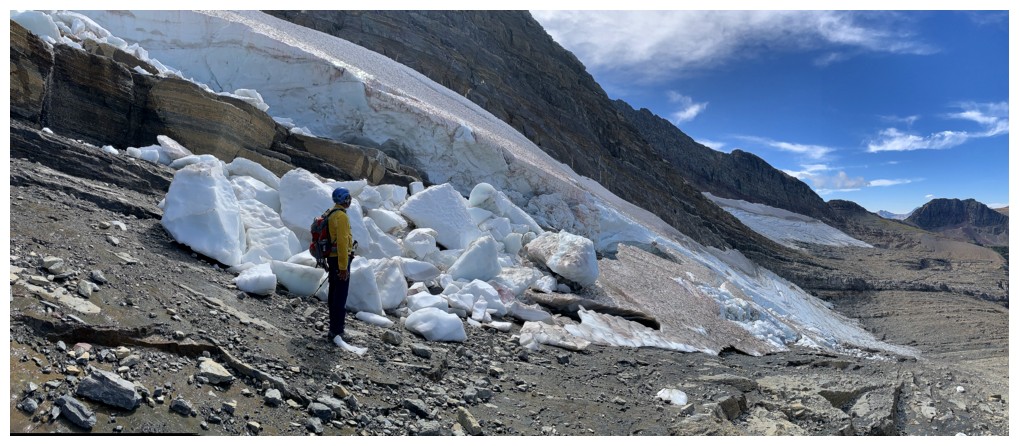
No matter how small they are, it's always so fascinating to be close to any glacier
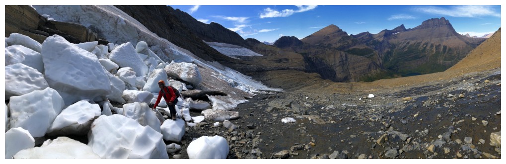
Mark explores the massive snow boulders
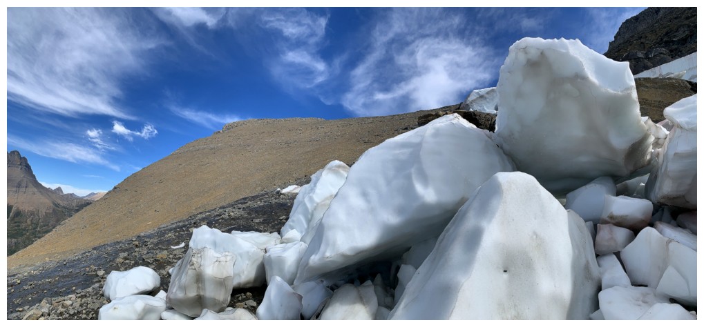
His view
His view of me
Leaving the glacier
At this point, the descent still appeared to end abruptly at the edge of a cliff
At least views of Mount Wilbur were tantalizing
Swiftcurrent Mountain looks bigger than Wilbur from this angle but its not
Magic! As stated, Sonny's route was a bold stroke of genius. This was
the only challenge of the route and even it was quite easy.
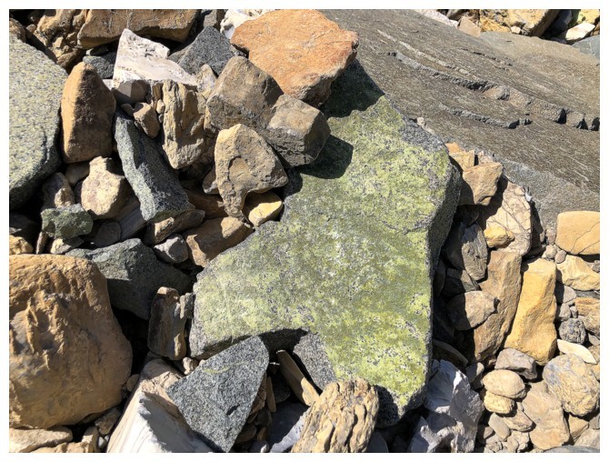
A very cool coloured rock that reminded me a little of the Star Trek communicator badge!
Looking over to the cliff that we thought would prevent this descent route from working
Mark descends easier terrain
Bullhead Lake appears
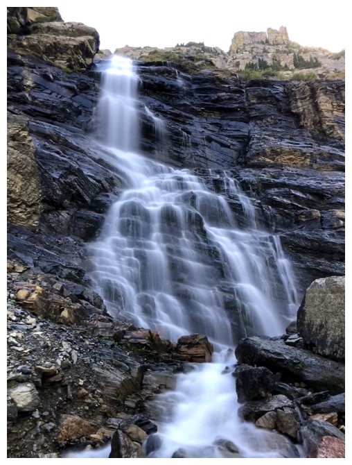
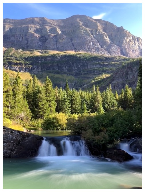
Took a short detour to check out some of the waterfalls pouring down the headwall
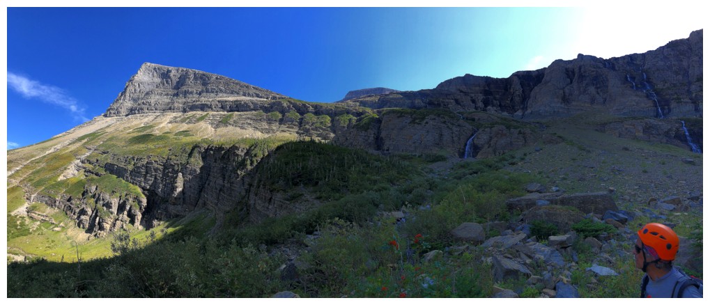
Looking back at the descent route and the waterfalls
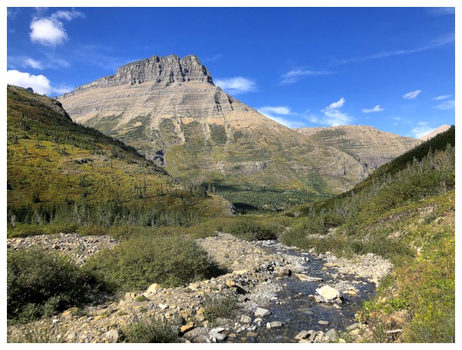
At the creek that eventually intercepts the Swiftcurrent Pass Trail
Bullhead Lake and Grinnell
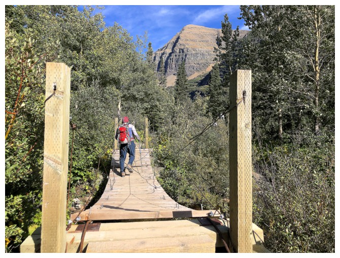
Nice bridge
Bullhead Point
Small waterfall
Mark takes a final and satisfying look at Mount Grinnell
The End
LOG