GC20
(NNW of Molar Mountain)
September 5, 2024
Mountain height: 2810 m
Total elevation gain: approximately
1200 m
Ascent time: 6:00
Descent time: 5:00
Solo scramble.
Two things:
1.
Who knew doing
a “Radius search” on Bivouac would reveal a plethora of unofficial titles/designations for
many of the innumerable unnamed peaks/outliers in the Canadian Rockies? Apparently,
everyone but me!
2.
GC20 (as designated
on Bivouac) is one of the best trips I’ve ever done (with some caveats!)
I realize that the
phrase “one of the best trips ever” appears frequently in my reports. However,
if someone were to ask me to list my favourite Rush songs or Bach compositions,
those lists too would be huge; if asked to make a video of the best plays in
NFL history, it would be a very long (and totally awesome) video. 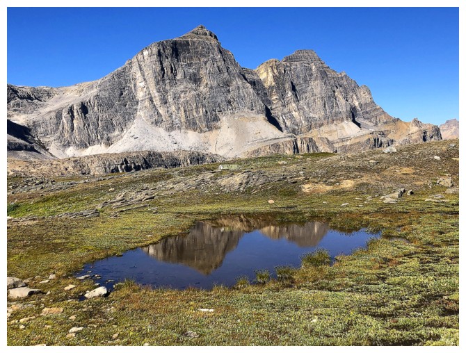 So, here’s
another in my growing “Best ever” list!
So, here’s
another in my growing “Best ever” list!
I first spotted
this unnamed, northern outlier of Molar Mountain (and/or western outlier of
Minnow Peak) on a magnificent Graeme Pole inspired trip up Molarstone Mountain
in 2016; then again, but from a different angle on another magnificent Vern
Dewit inspired trip up Minnow Peak in 2022. Several approaches to GC20 seemed viable,
and I chose one via Molar Pass.
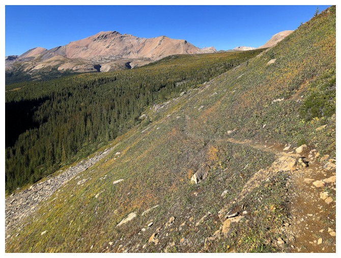
The 10.5 km hike
to pass went with relative ease, yet again featuring wonderful views of Noseeum
Peak’s awesome northeast side. From that point, the general plan was to head
towards the north end of the ridge (south of The Fang) and take whatever line
presented itself. 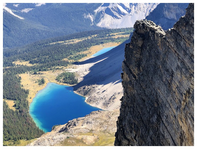 One eventually did, but in retrospect it’s not a line I would
repeat. Steep fields of unstable boulders and rubble conspired to render a less
than aesthetic experience, somewhat reminiscent, but not quite as bad, as a
recent ascent of Iceface Peak. And it wasn’t short either, one false top
following another, following yet another.
One eventually did, but in retrospect it’s not a line I would
repeat. Steep fields of unstable boulders and rubble conspired to render a less
than aesthetic experience, somewhat reminiscent, but not quite as bad, as a
recent ascent of Iceface Peak. And it wasn’t short either, one false top
following another, following yet another.
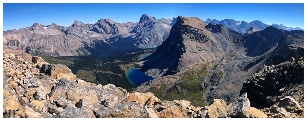
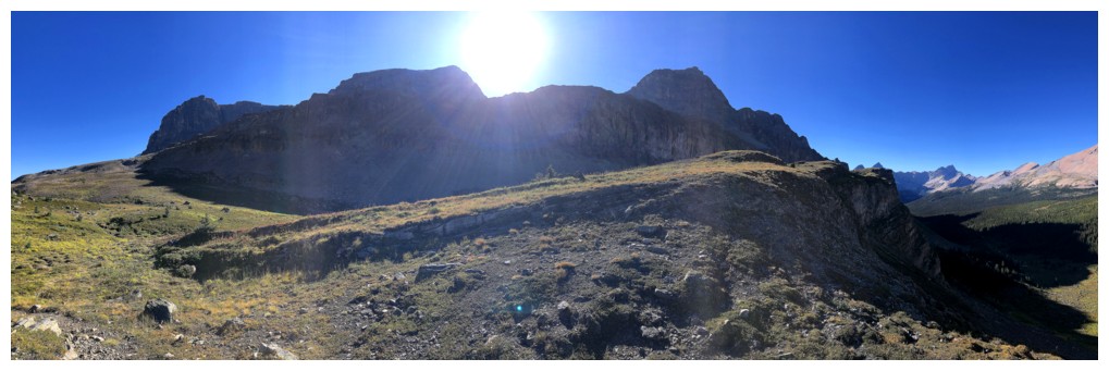
I eventually
reached the ridge, very much feeling like I lost that battle! The good news:
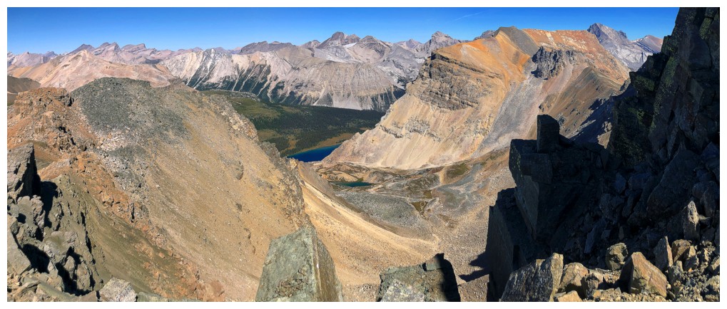
the panorama from the ridge was outstanding. The view to the west had me
star-struck throughout up to that point, but adding the remarkable view to the
east took all the sting out of the soul-sucking ascent. Especially eye-catching
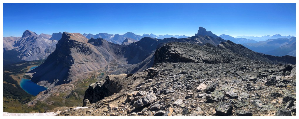
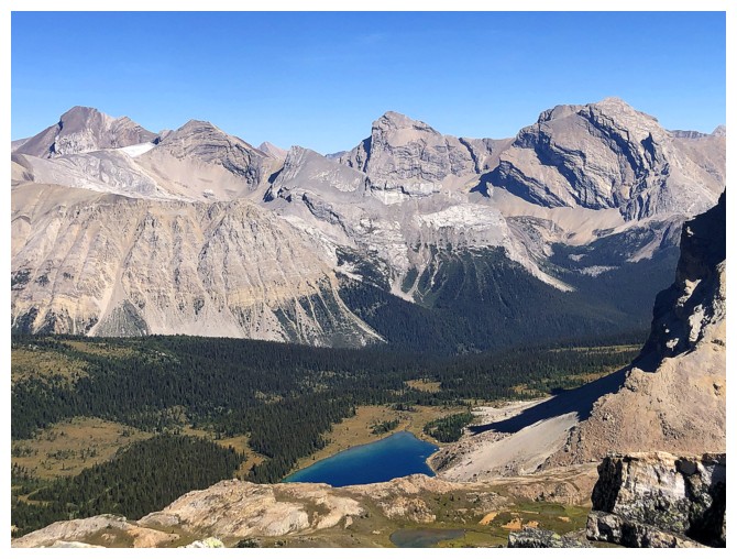
were the beautiful Fish Lakes below Minnow Peak.
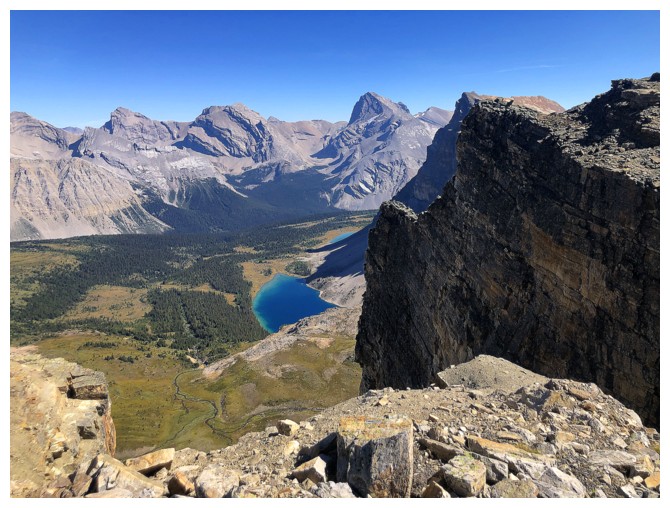
The ridgewalk
to the summit was also far from a “stroll in the park” – more of a “climb over
never-ending, precariously balanced boulders in the park”! However, the views
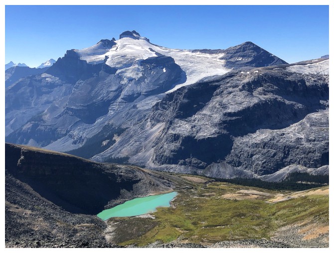
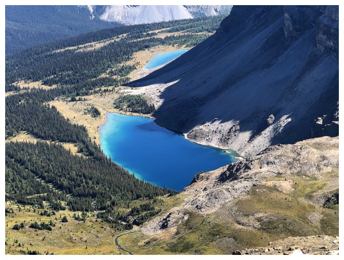
continued to amaze, now featuring a stunning turquoise lake in the valley
below, on the west side. Visiting this lake on descent instantly became a trip
priority.
A few ups and
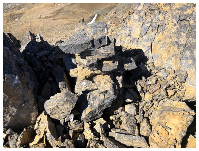
downs later (much later) and I was finally heading to the summit. The terrain
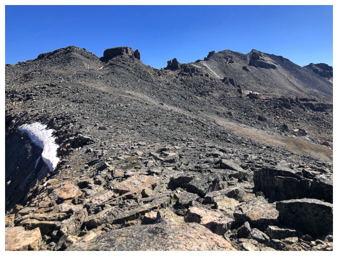
here was much easier and very interesting - pinnacles and rock stacks lining
the ridge and sand-like terrain underfoot. Six hours after leaving I arrived at
the first of two closely spaced summits, 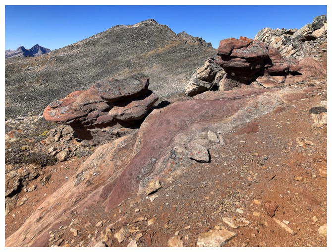 tired but almost overwhelmed with the
scenic beauty of the entire ascent and of course a spellbinding summit view.
Only the absence of the aforementioned lakes was slightly disappointing. I then
went to the marginally higher second summit but returned to the first because of its
superior view.
tired but almost overwhelmed with the
scenic beauty of the entire ascent and of course a spellbinding summit view.
Only the absence of the aforementioned lakes was slightly disappointing. I then
went to the marginally higher second summit but returned to the first because of its
superior view.
In regards to
footing and ease of terrain, the descent was the polar opposite of the precarious,
boulder scrambling trip up. 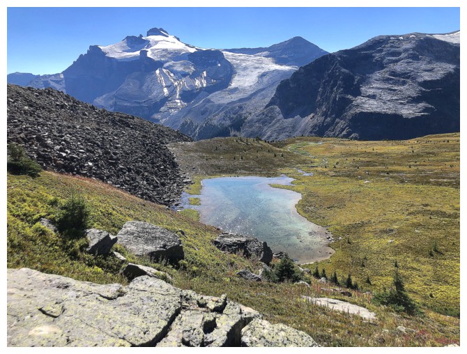 In other words – fantastic! I had already scoped
out an alternate route down the west side of the mountain that would allow me to
see the turquoise lake from high above. However, in the end that didn’t happen.
What did occur was an easy and magical descent, complete with three lake visits
and some of the most rewarding scenery I’ve ever been exposed to.
In other words – fantastic! I had already scoped
out an alternate route down the west side of the mountain that would allow me to
see the turquoise lake from high above. However, in the end that didn’t happen.
What did occur was an easy and magical descent, complete with three lake visits
and some of the most rewarding scenery I’ve ever been exposed to.
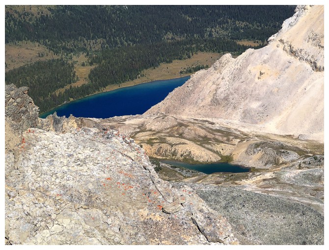
The first lake
was a surprise, given it doesn’t exist on any maps. In fact, I enjoyed this one
the most. I did manage to get a "sort of" birds-eye views of the turquoise one,
after traversing beautiful grassy slopes and then gaining the ridge just above
the lake. The third was bit of a bust as the Sun had descended enough to leave
the lake in shade. Nevertheless, I could not have asked for a more enjoyable
descent route. I did briefly entertain the idea of finishing the trip via
Noseeum Lake, but like our recent Seward Mountain descent, opted for the longer
but easier route. If I were to do the peak again, I would probably use the
Noseeum approach and then go up my descent route for GC20.
Yet another
resounding triumph for obscure, unofficial peaks everywhere. I’ll say it again, “One of the best trips
I’ve ever done”!
The same photo I always take of O Peak - one of my favourites trips in the area
OX Peak joins in at the left - NOT one of my favourite trips in the area
The Quartzite, Ramp, Mosquito trio - also a view I can't help taking a photo of every time!
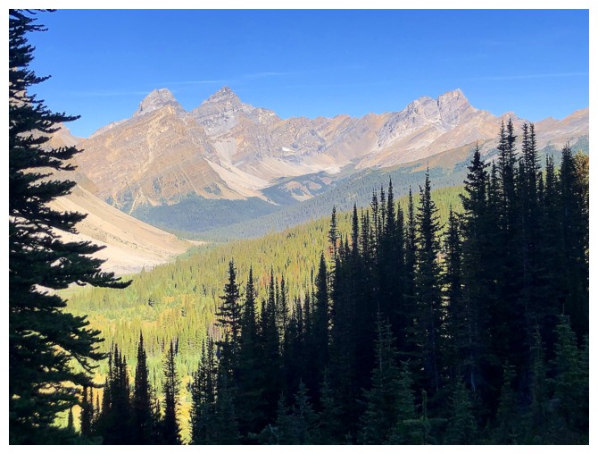
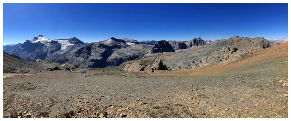
The magnificent and also heavily photographed northeast side of Noseeum Peak
Same as above
OX Peak, OXO Peak, and Watermelon Peak
Molar Pass (sometimes referred to as South Molar Pass) near the left
Mosquito
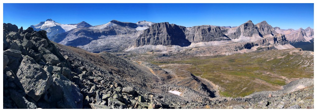
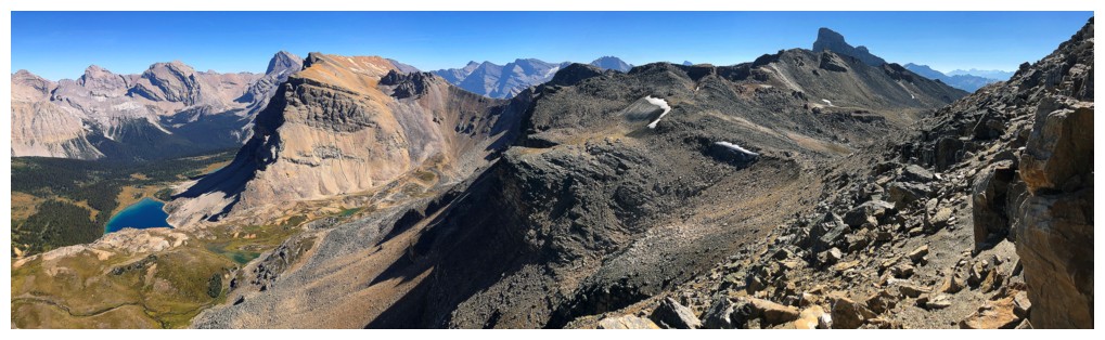
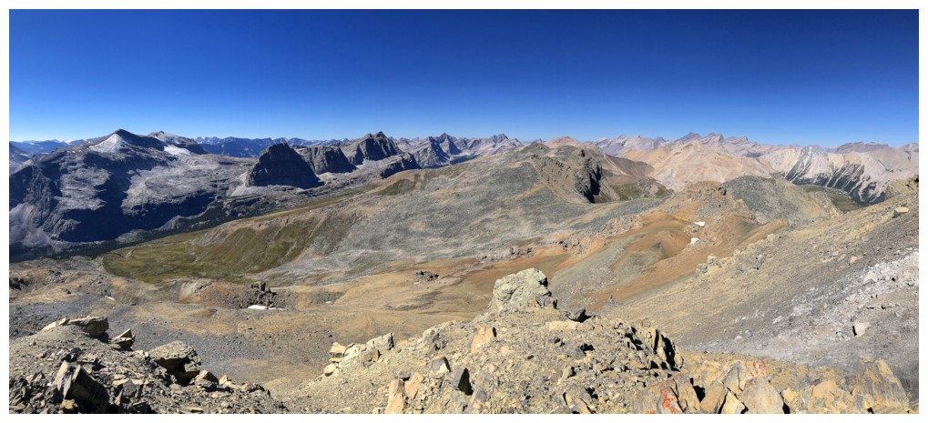
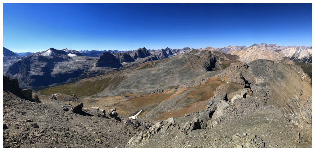
All the aforementioned mountains
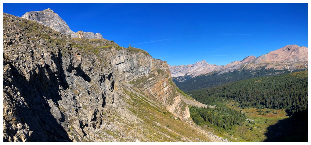
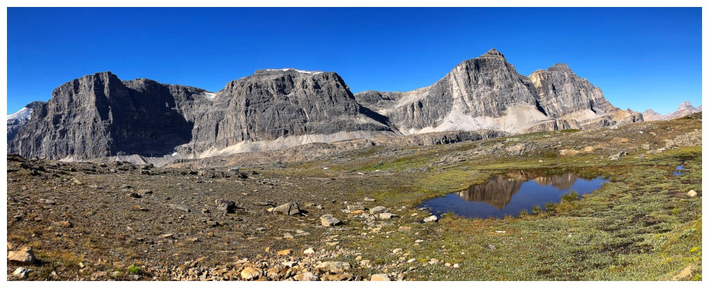
At Molar Pass
View from the pass
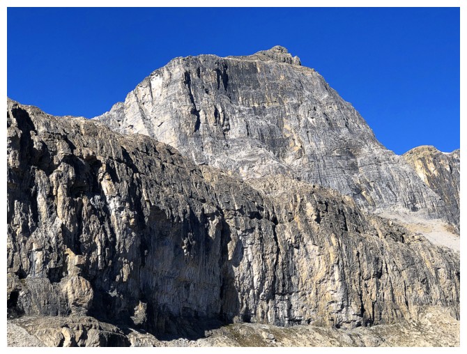
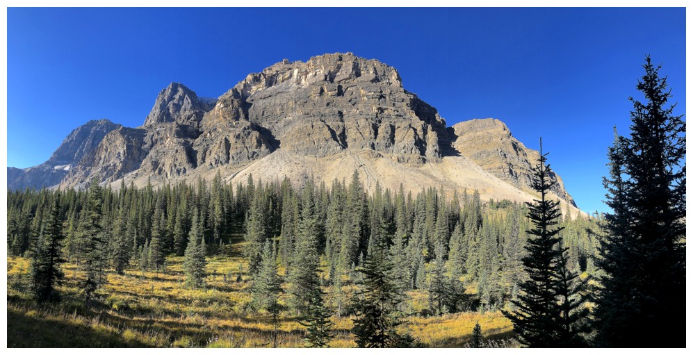
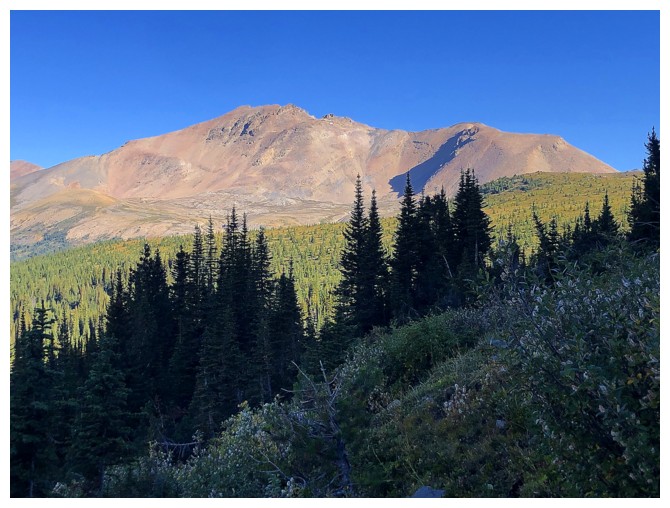
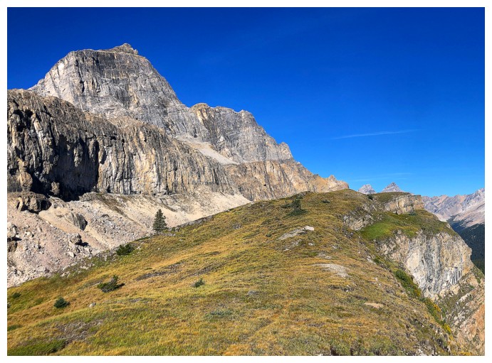
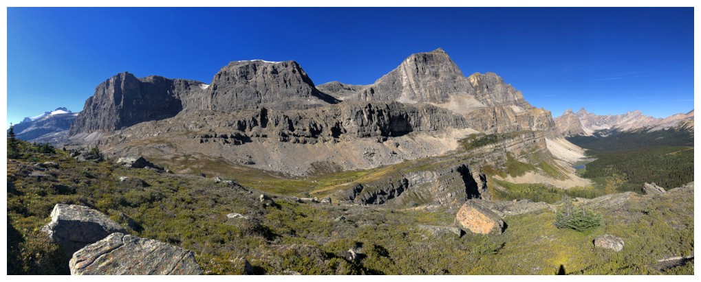
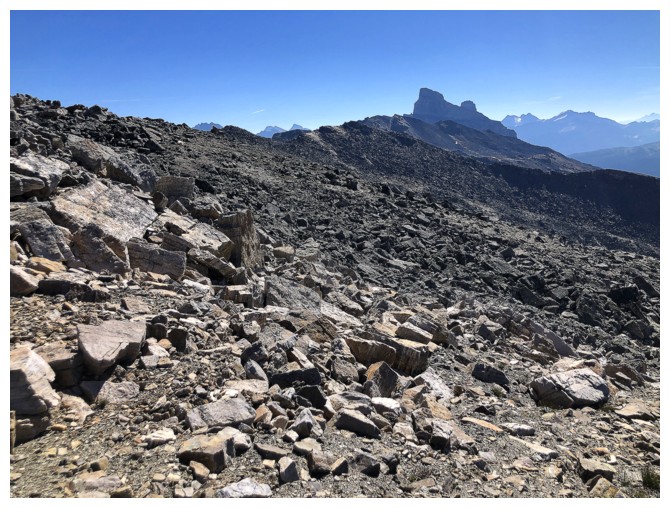
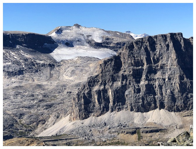
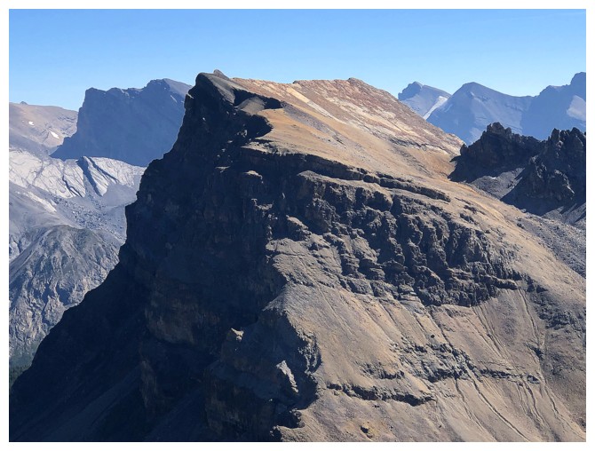
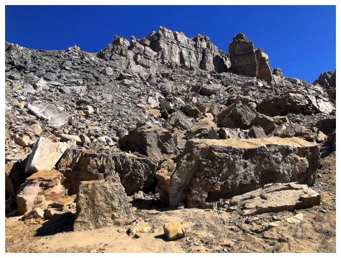
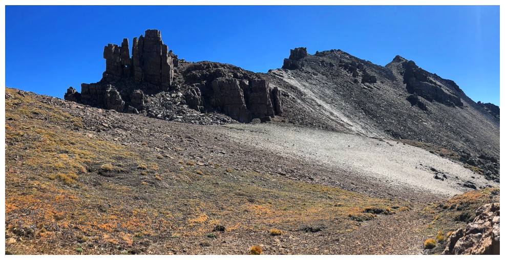
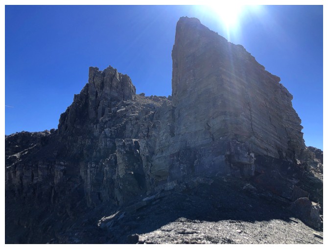
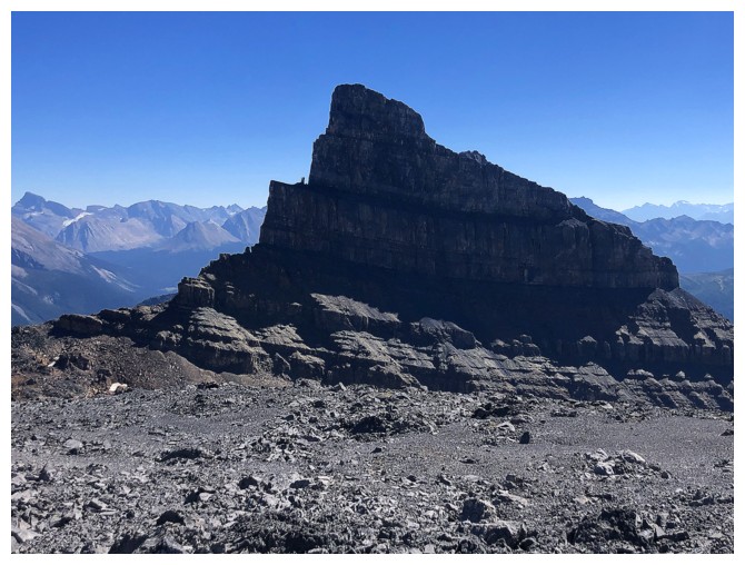
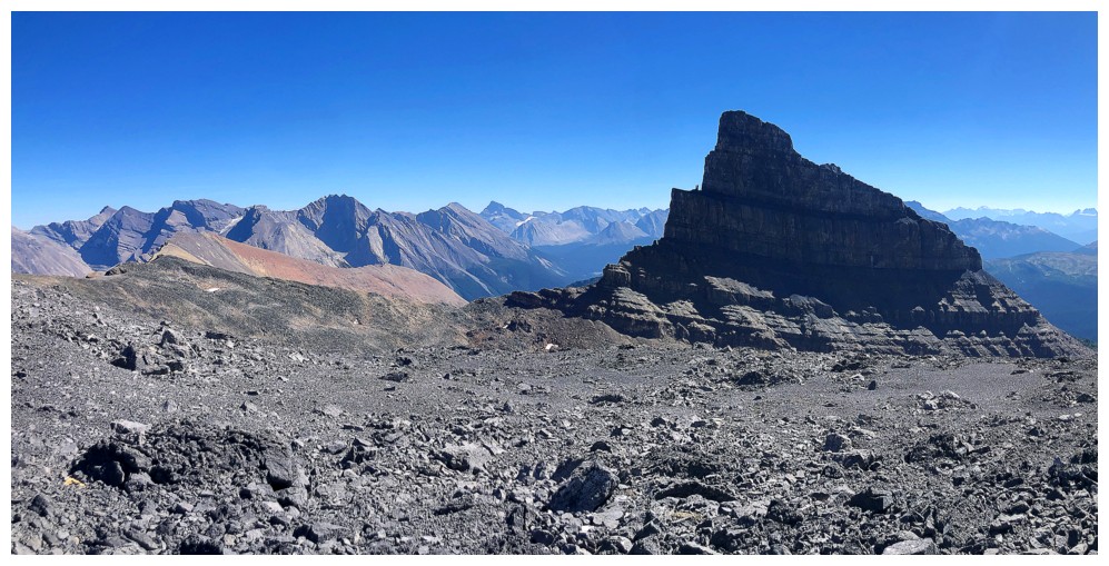
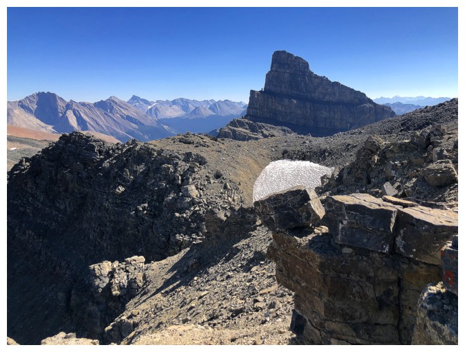
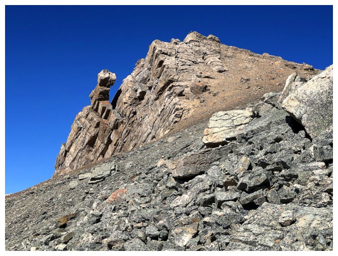
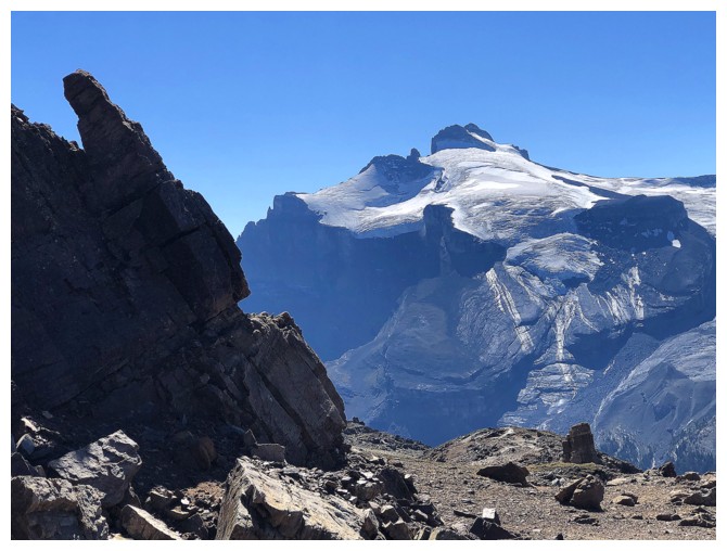
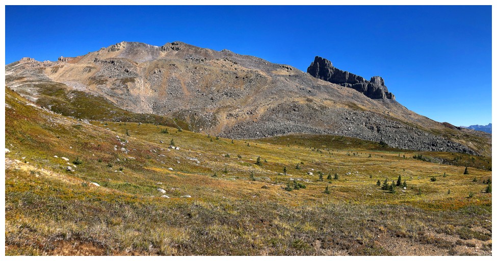
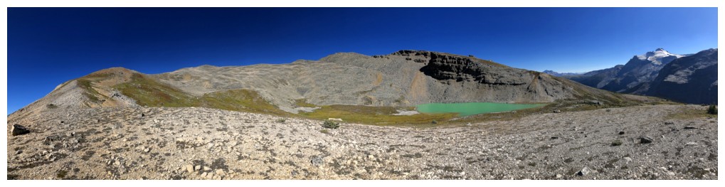
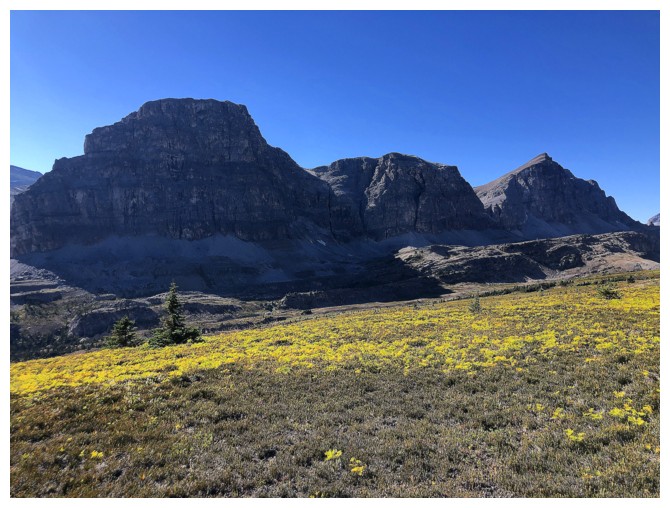
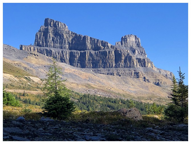
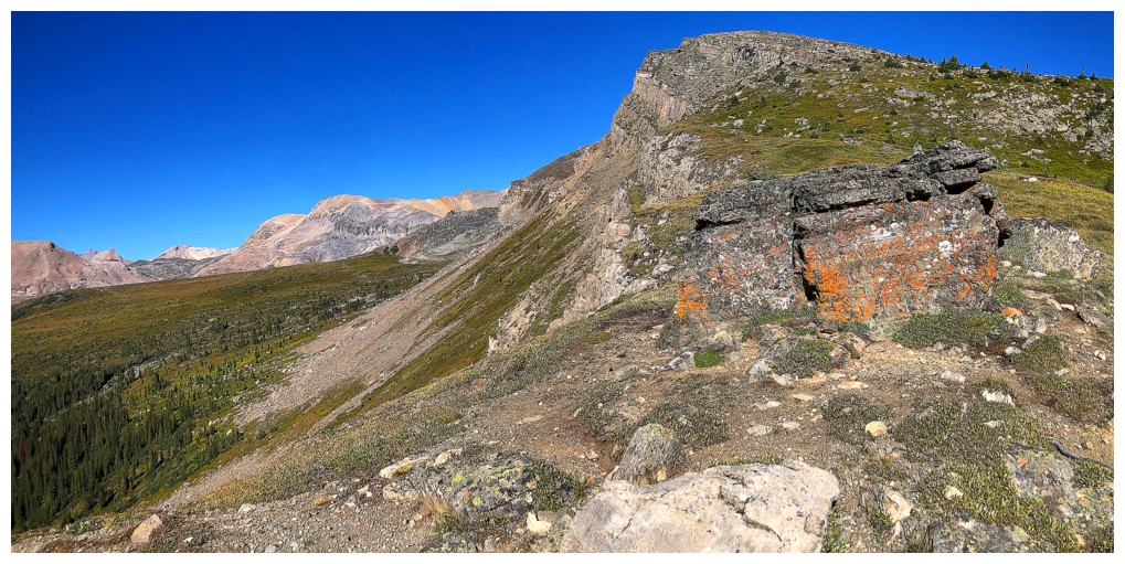
Bivouac identifies this very distinctive outlier of Noseeum Peak as GC48 (Bearskin)
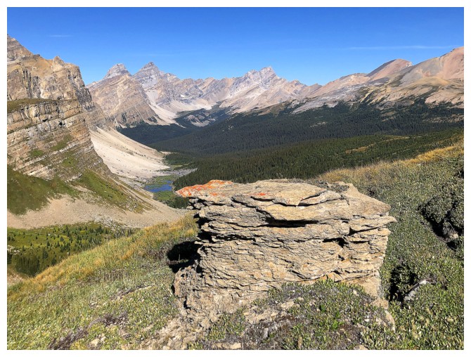
Nice perch to admire the surroundings
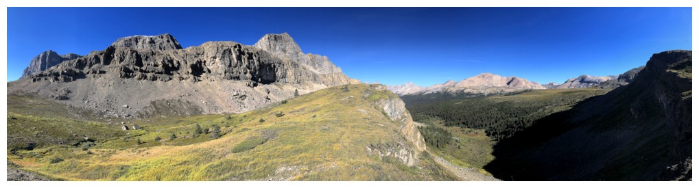
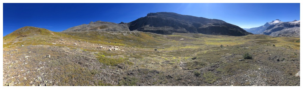
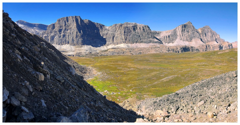
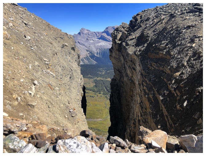
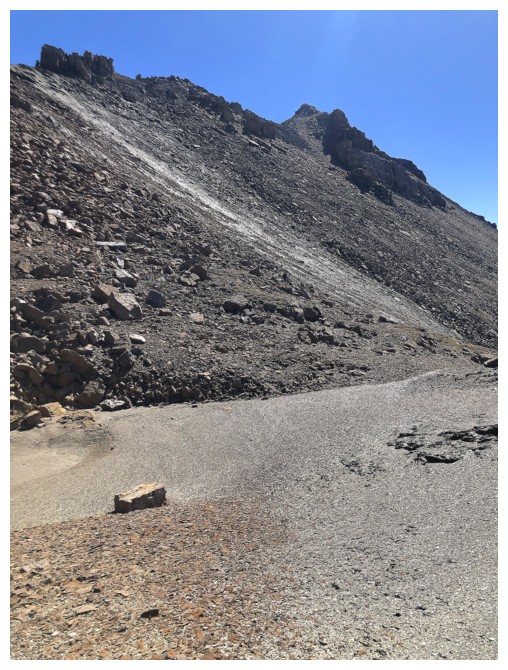
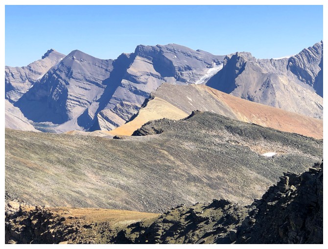
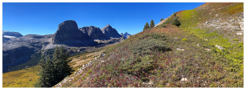
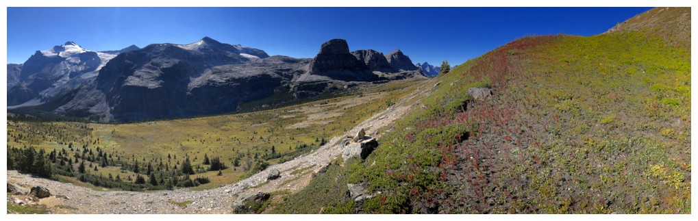
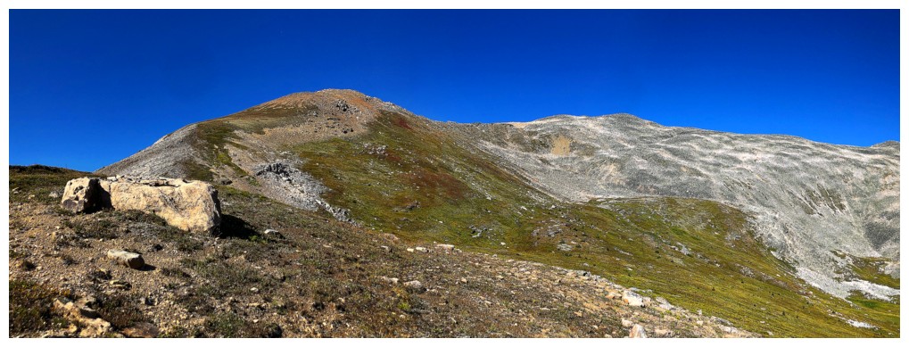
Gaining elevation towards the col between The Fang and the ridge that leads to GC20
Veering off to the right to cut down the distance to the ridge. In
retrospect I probably should have stuck to the col route, though it
would not have avoided all the "bouldering".
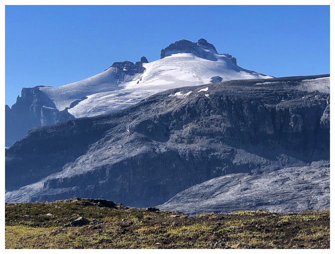
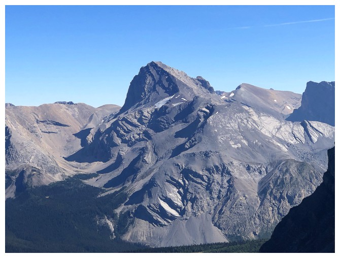
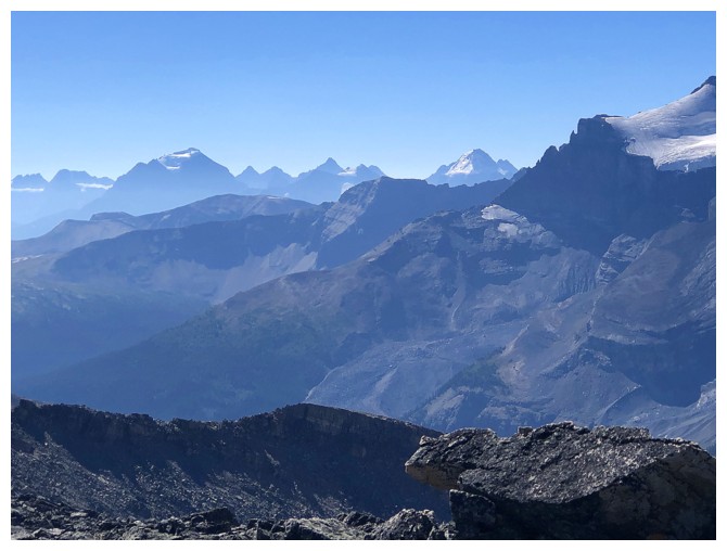
Mount Hector was stunning throughout
Hector and the three southeastern outliers of Noseeum
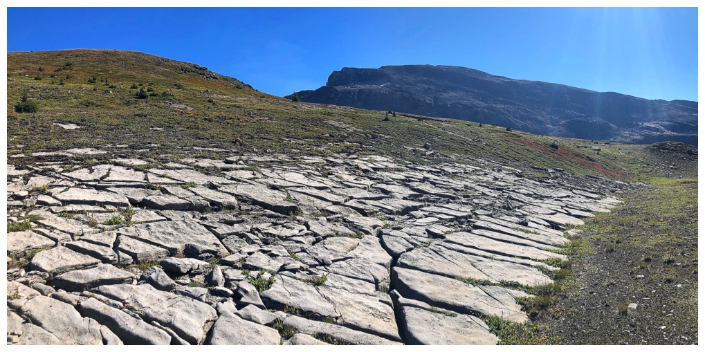
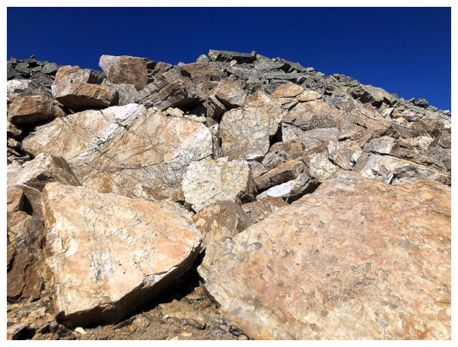
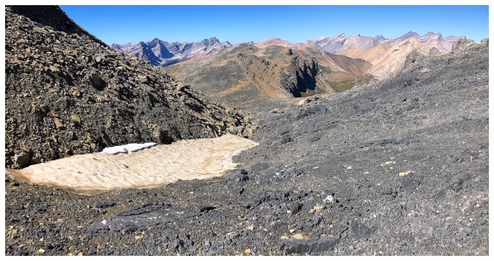
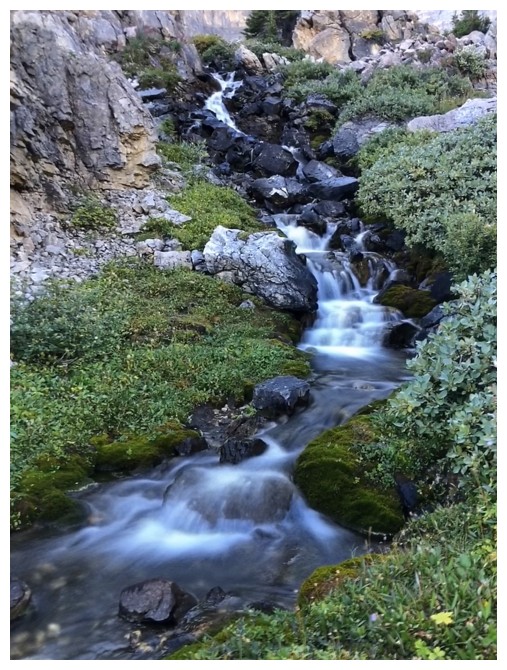
Cool karst pavement
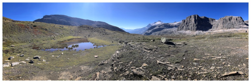
The small tarn at the left turned out to be very cool also
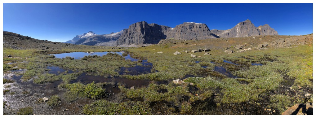
It's reflection time
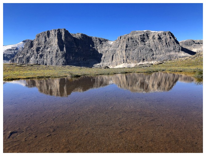
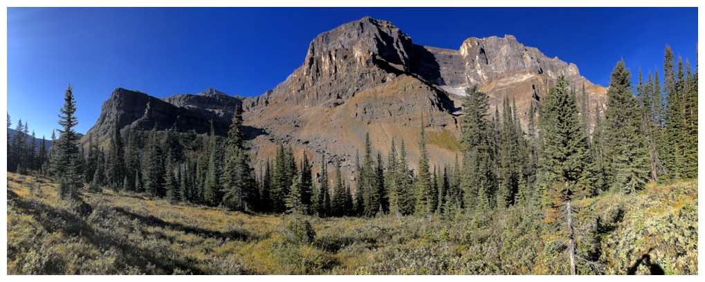
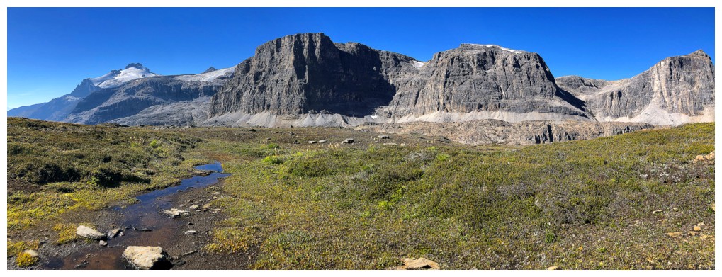
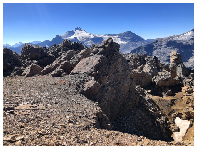
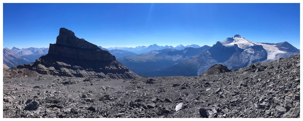
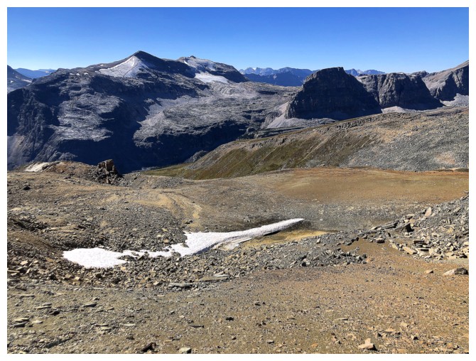
Bearskin and Noseeum
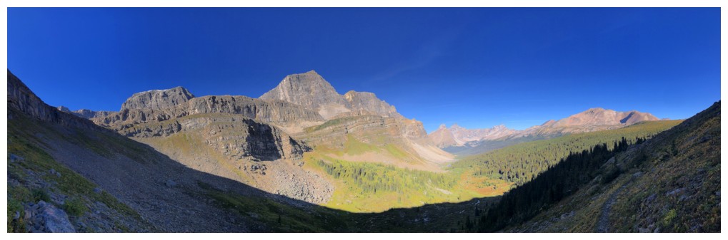
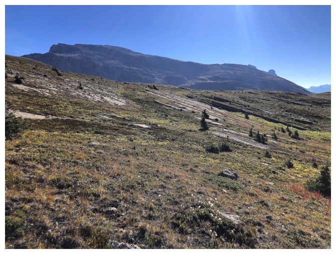
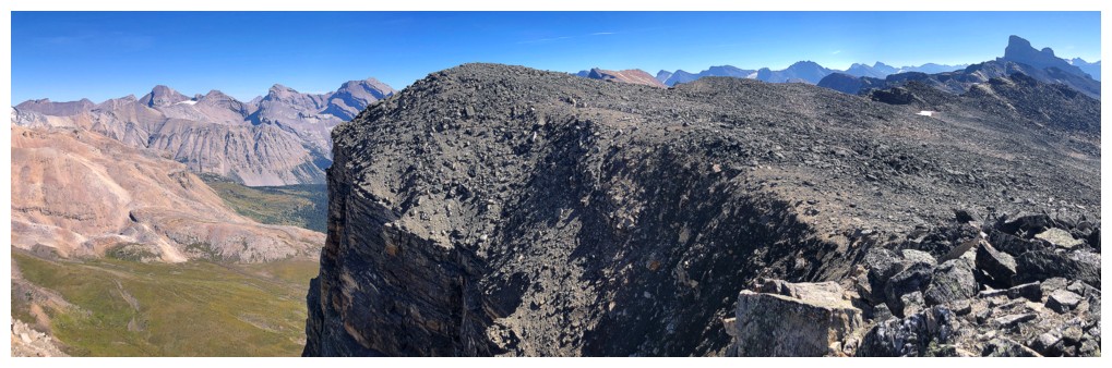
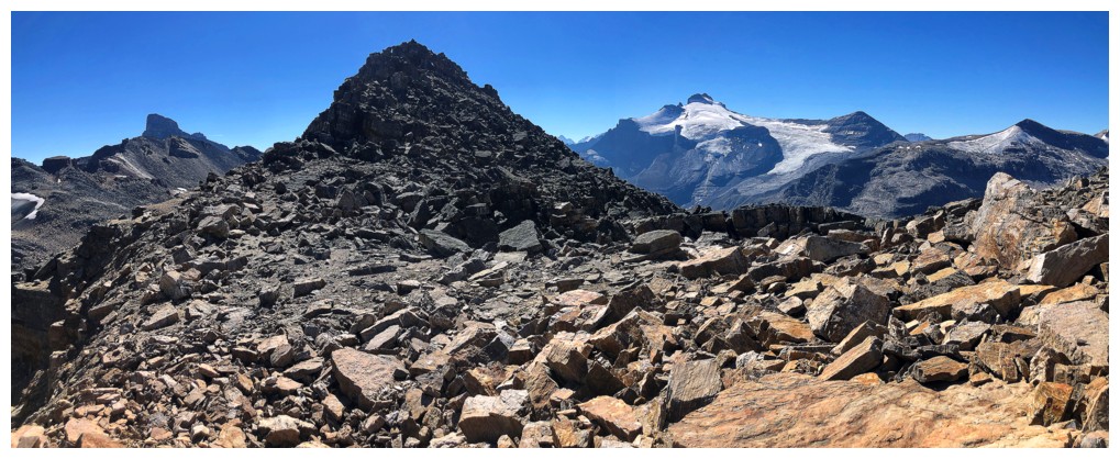
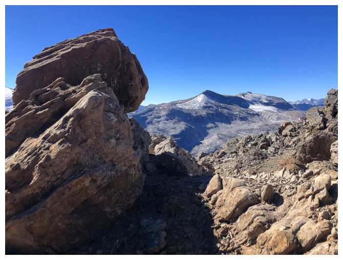
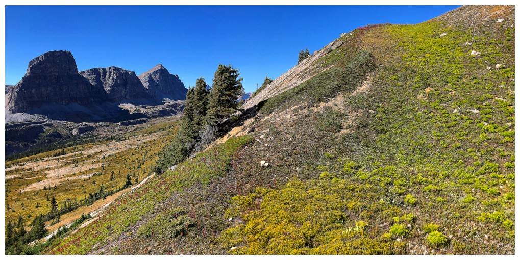
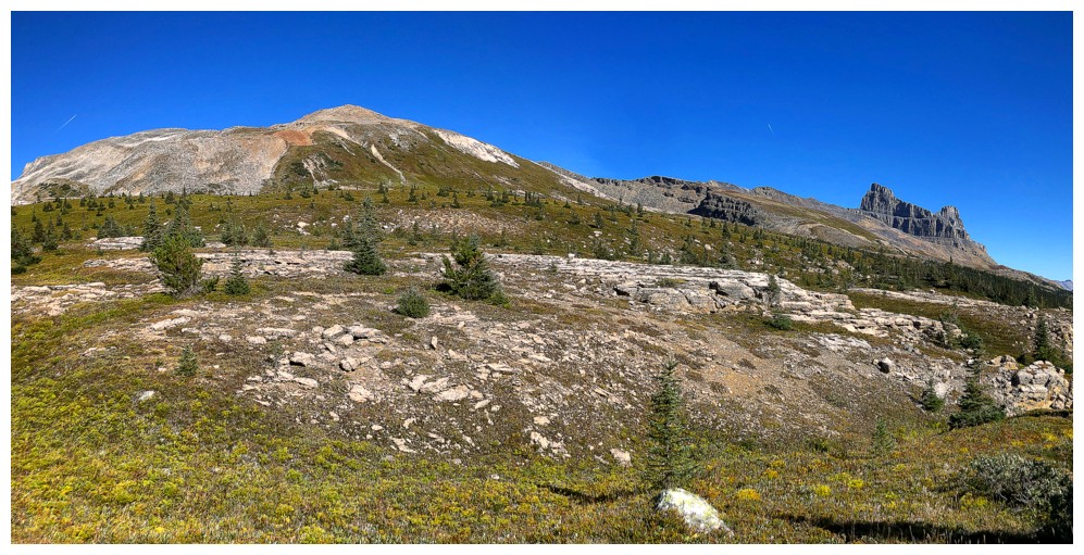
The route ahead
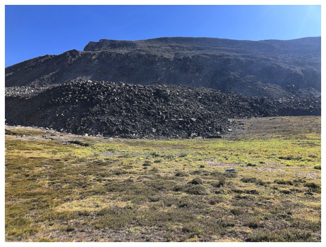
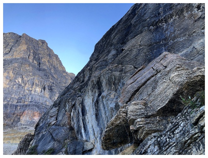
Approaching the start of the real work. I probably should have veered left here, but instead I went right up the middle.
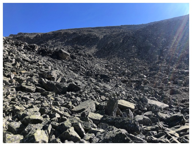
Looks straightforward, but it gets steep and is very foreshortened
Typical steepness shown on the left
Looking back to where I came from
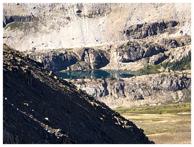
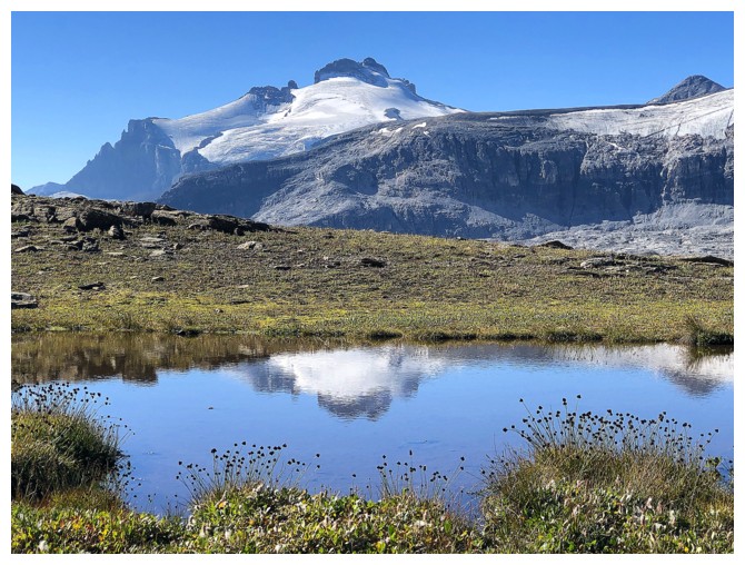
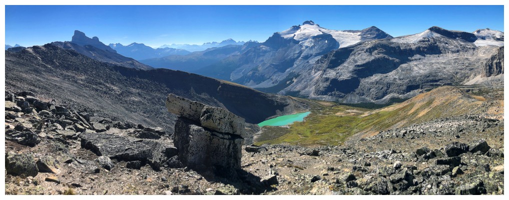
Zoomed-in shot of the last lake I will visit underneath the southern-most outlier of Noseeum
Typical boulder scrambling on the route
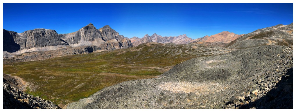
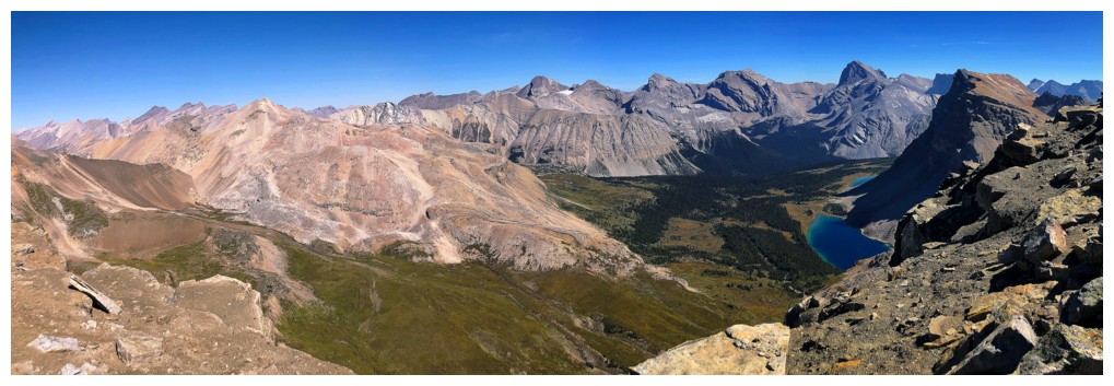
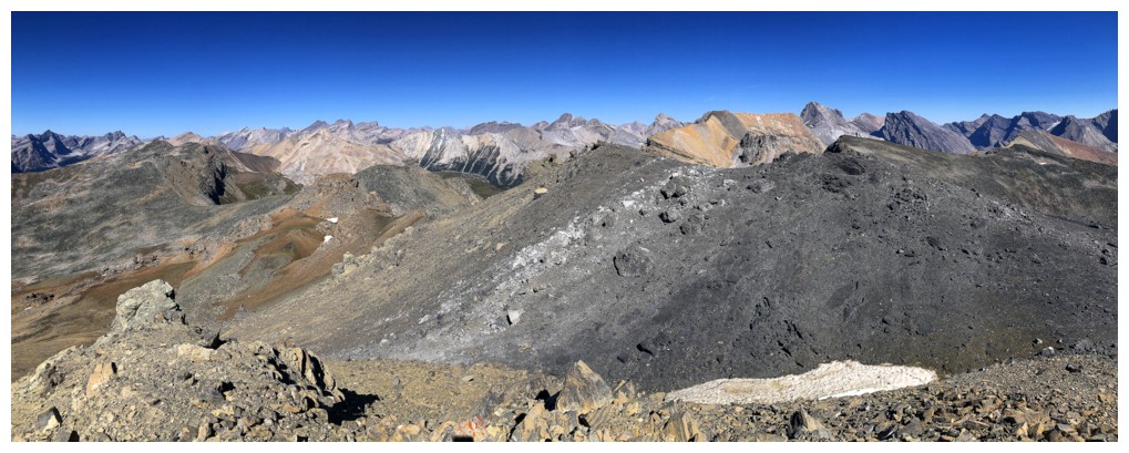
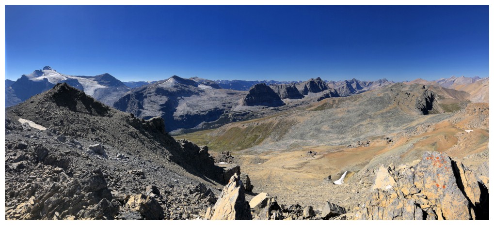
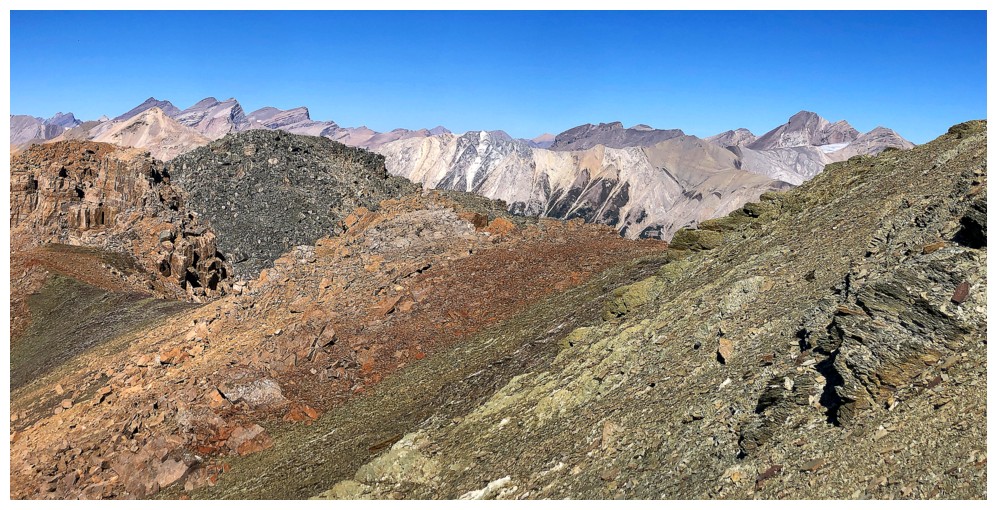
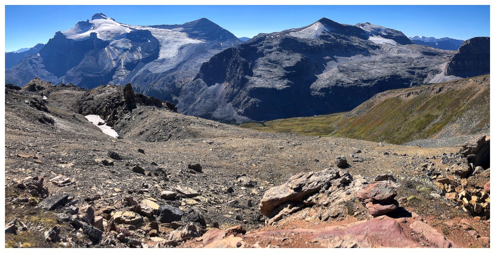
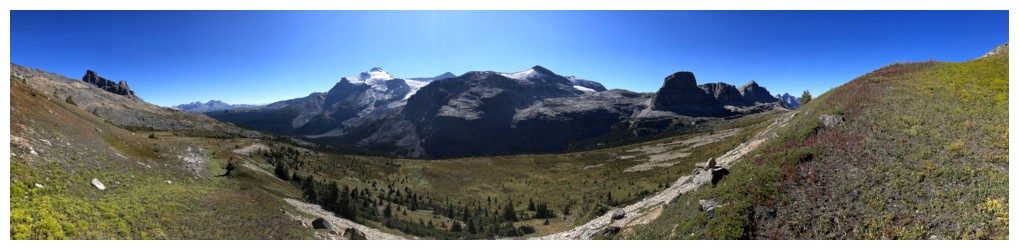
Getting a fuller view of all the peaks to the west
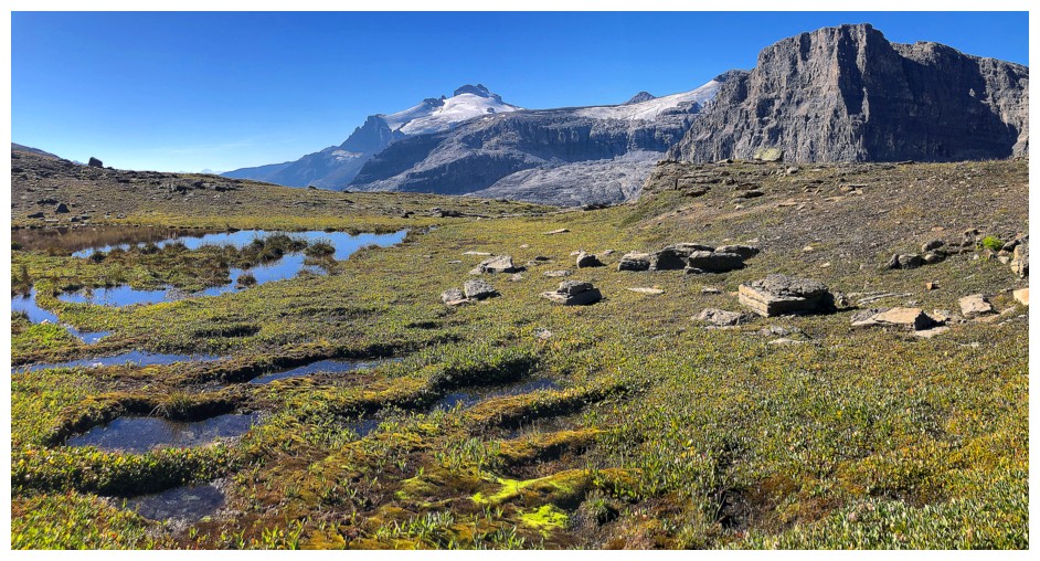
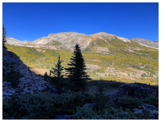
First sighting of Molar Mountain
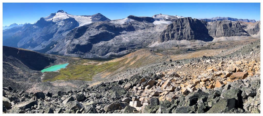
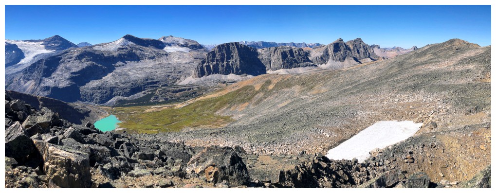
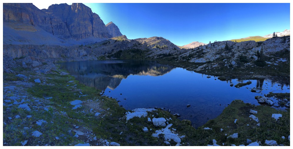
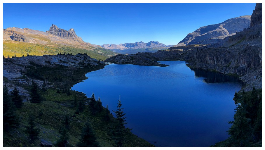
First sighting of the stunning lake on the west side of the ridge
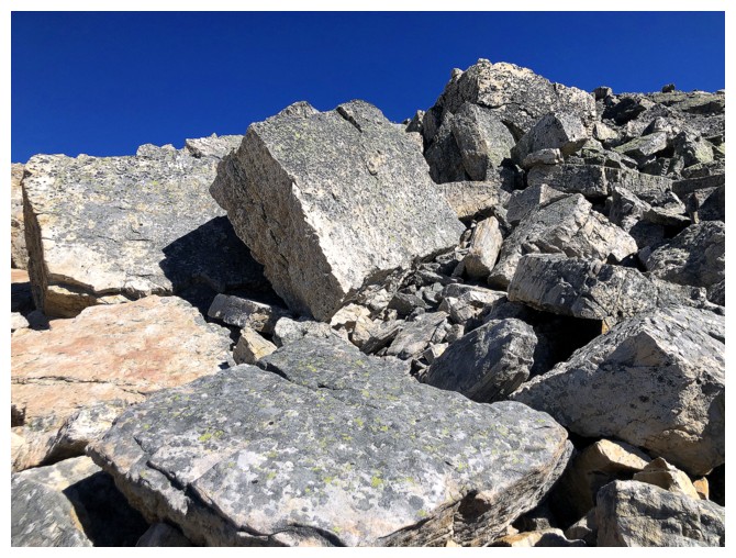
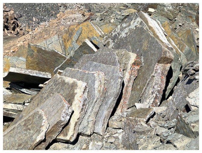
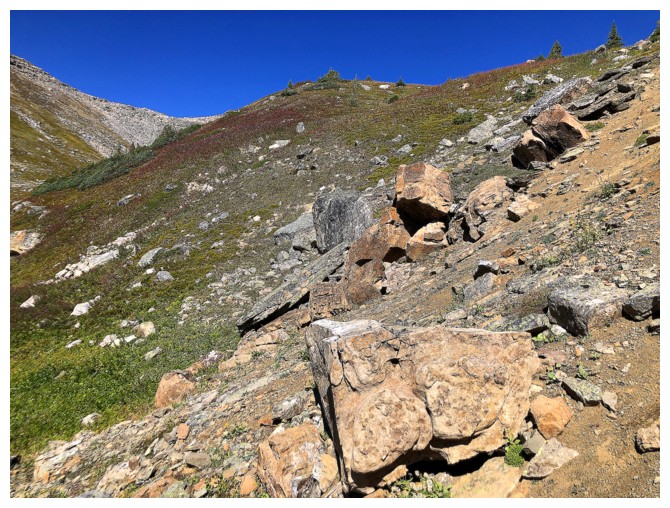
Though tedious to ascend, the boulders were beautiful to look at
The Unnamed peak attached to Mount Andromache
The lake was the centre of attention for quite a while
The valley on the other side of the ridge is equally scenic. Molarstone Mountain at the left.
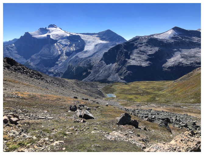
Hector and the lake
Approaching one of several highpoints along the ridge
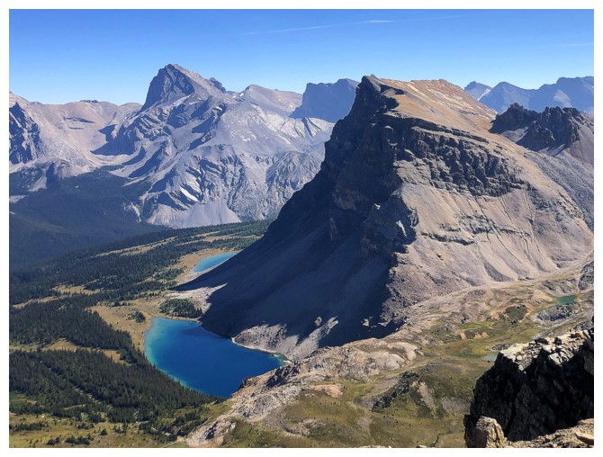
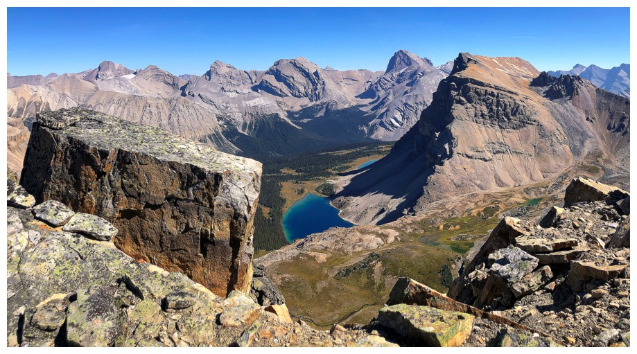
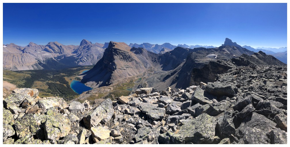
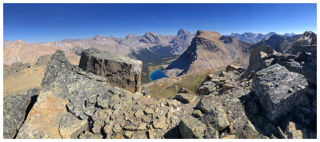
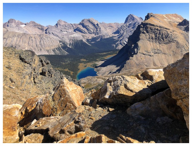
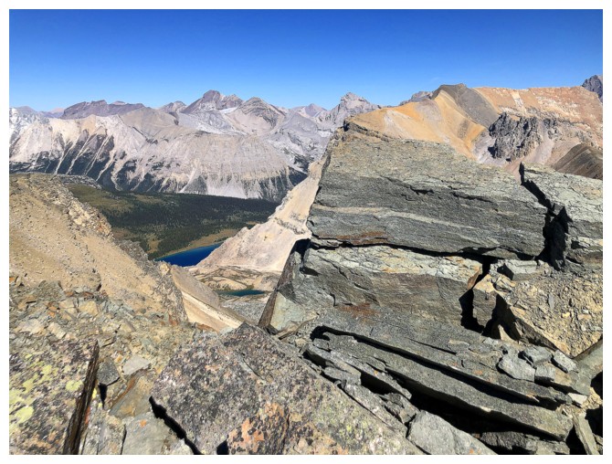
Ouch! The Fish Lakes have taken over as the scenic interest.
The big Fish Lake is one of the most beautiful lakes I've ever seen
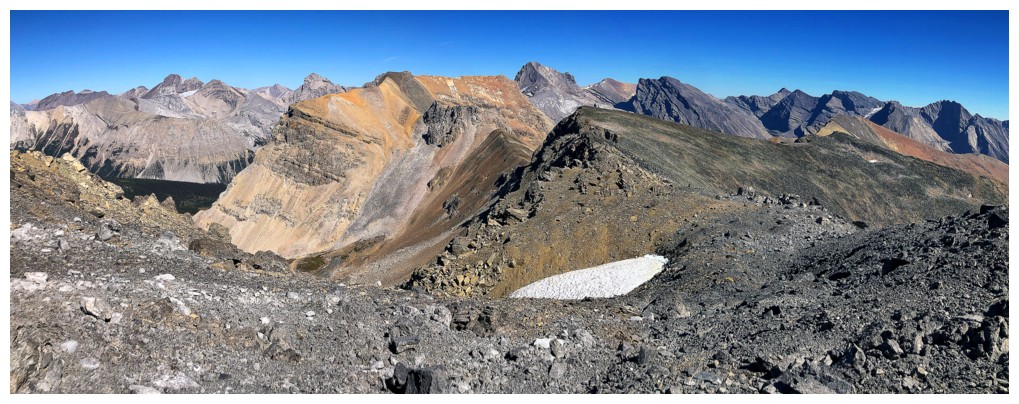
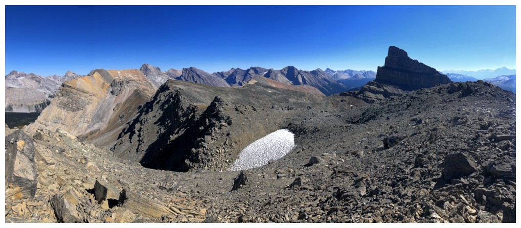
View from that highpoint. The summit is still some distance away.
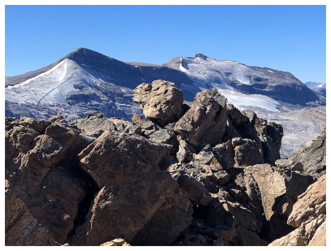
Minnow Peak - killer view from that one too
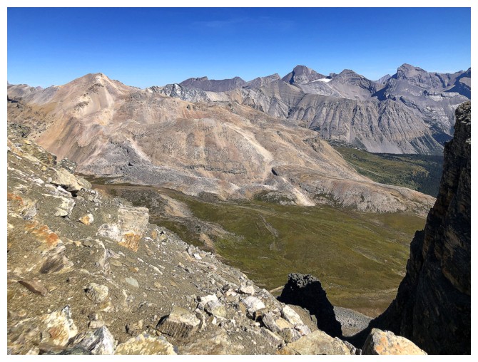
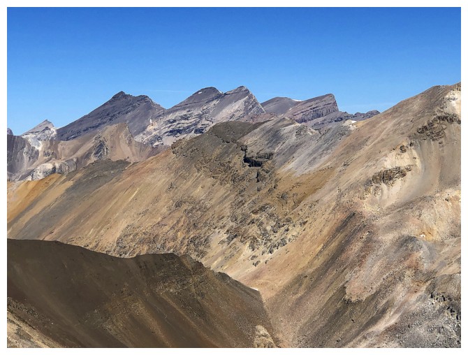
Cataract Peak
I think the peak right left of centre is Deluc Peak
The Willingdons
Big peaks around Lake Louise including Temple, Deltaform, and Lefroy
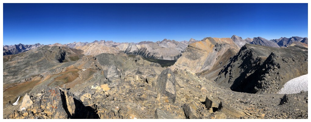
All of it to the northeast, east, and southeast
More to the south
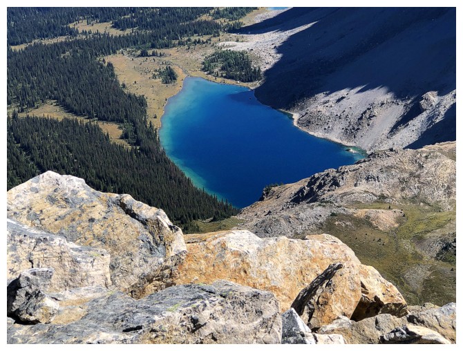
Definitely smitten with the Fish Lake
In fact, smitten with it all
Big gap
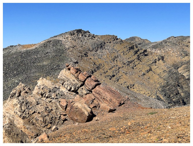
The immense rock fin at the right was super impressive
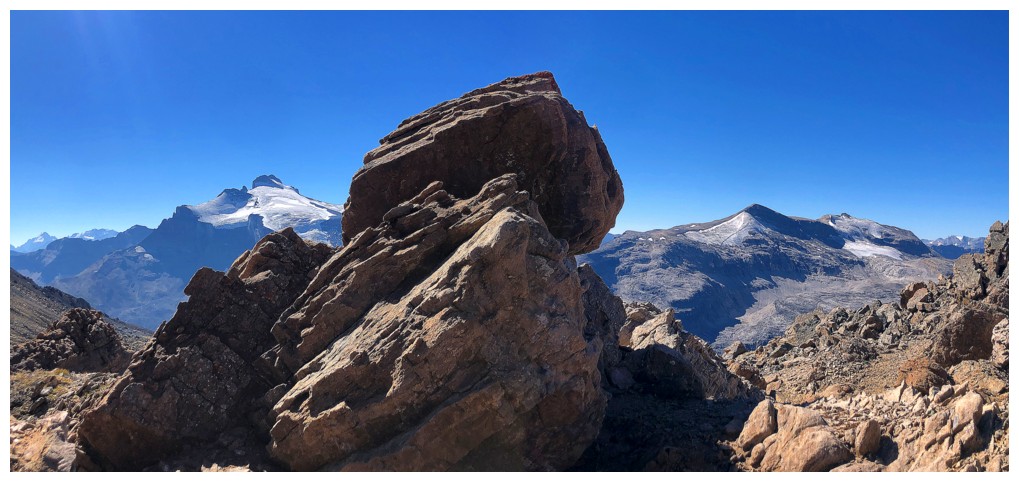
Speaking of smitten and impressive!
Another of my favourite views of this trip
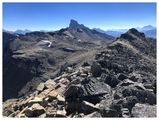
First good view of the summit. Not the big peak in the centre (that's Molar), but the one directly in front of Molar.
Managed to get the beautiful lakes on both sides of the ridge into one photo, though they are small

Fish Lake has very regrettably disappeared from the view
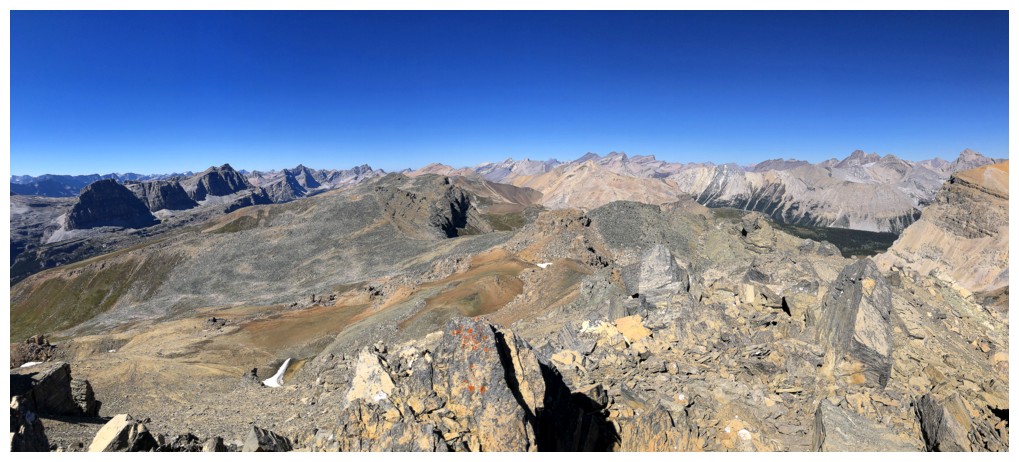
Another highpoint ahead but I'm going to bypass this one on the left
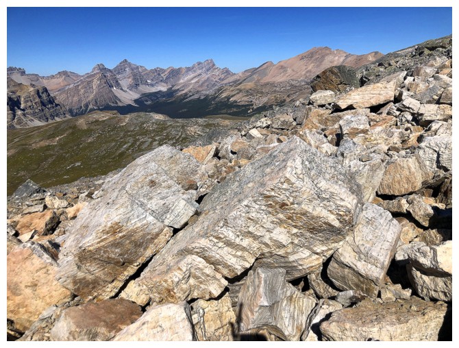
Clambering over these types of boulders was the theme of the ascent route
Fish Lake is back!
Approaching the bypass
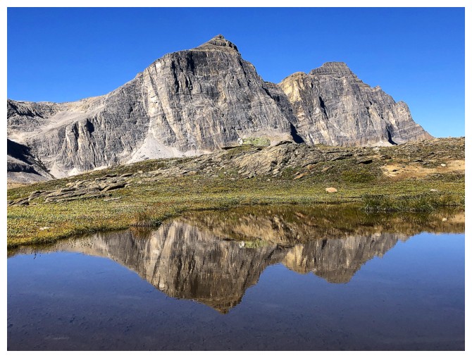
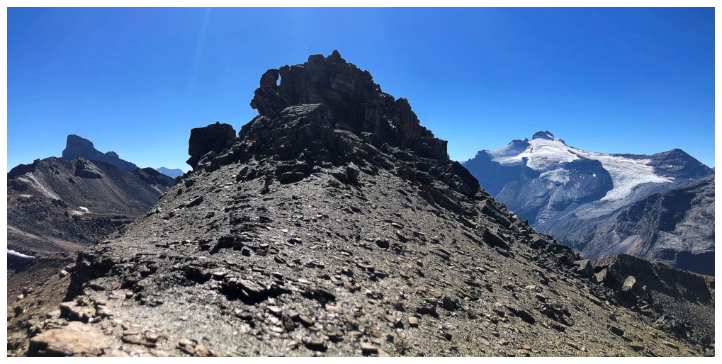
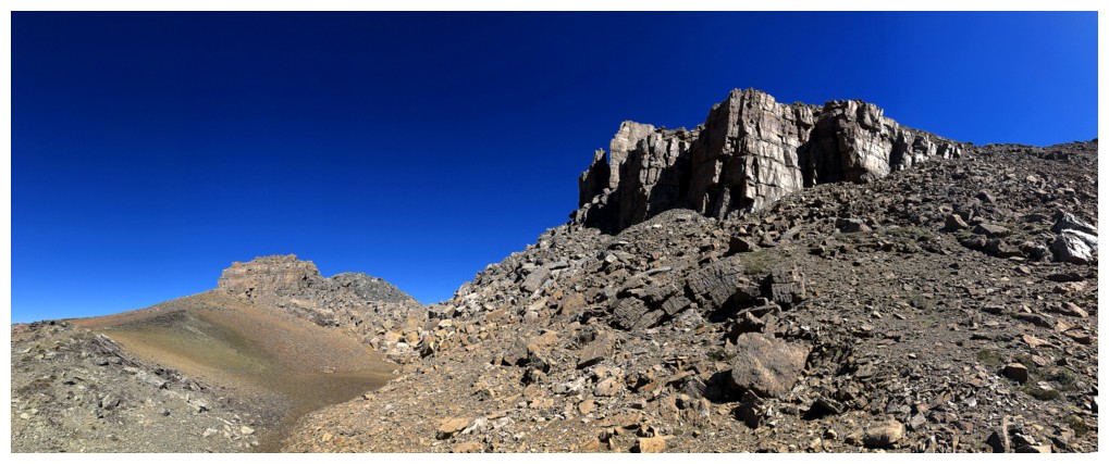
There it is
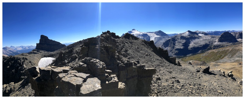
Summit of GC20 near the right
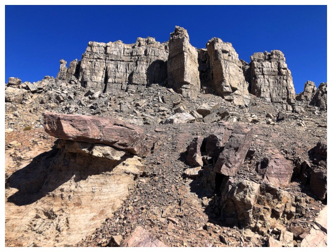
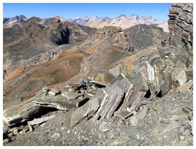
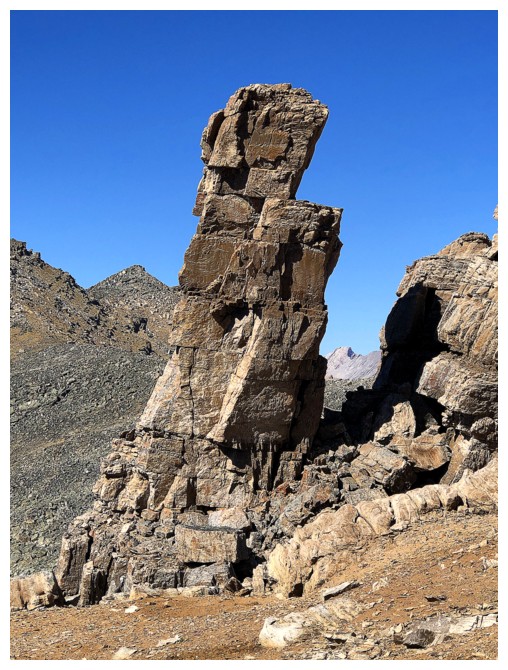
Lots of cool rock features en route
Looking back at the last highpoint
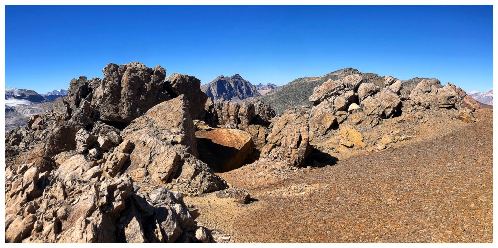
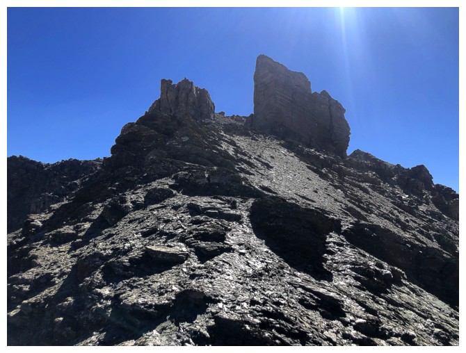
In terms of terrain, this whole section was the highlight of the ascent, due to its uniqueness
Good balancing act
Closing in on the summit. The light coloured ground was a sand-like consistency
On the sand-like terrain, ready to ascend the slope ahead, which was also comprised of finely ground rock
On the ridge again
This obstacle was easily circumvented on the right
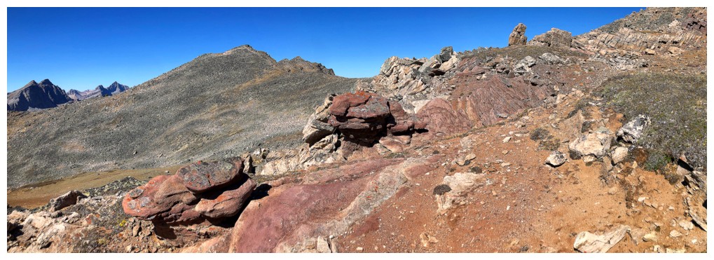
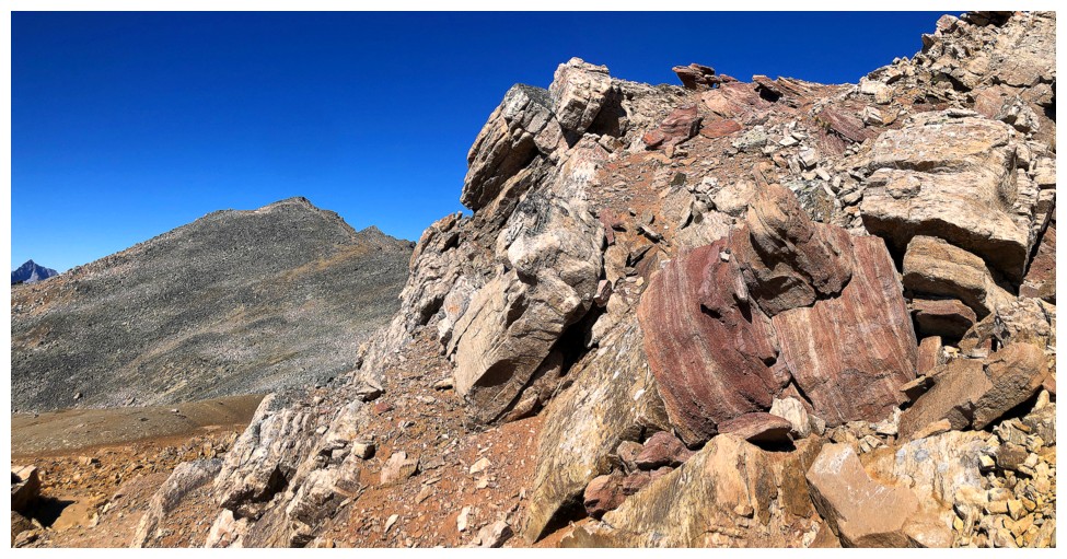
Crazy, cool colours
The very flimsy cairn I built at the summit. No doubt a strong wind will take it down.
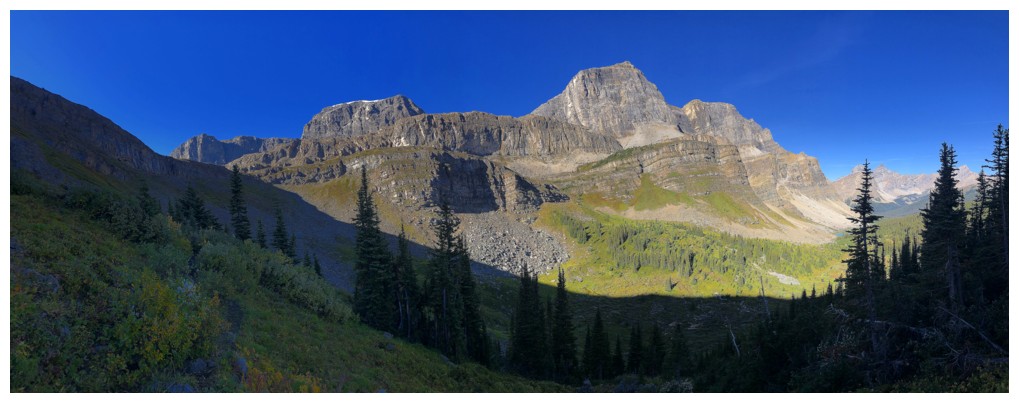
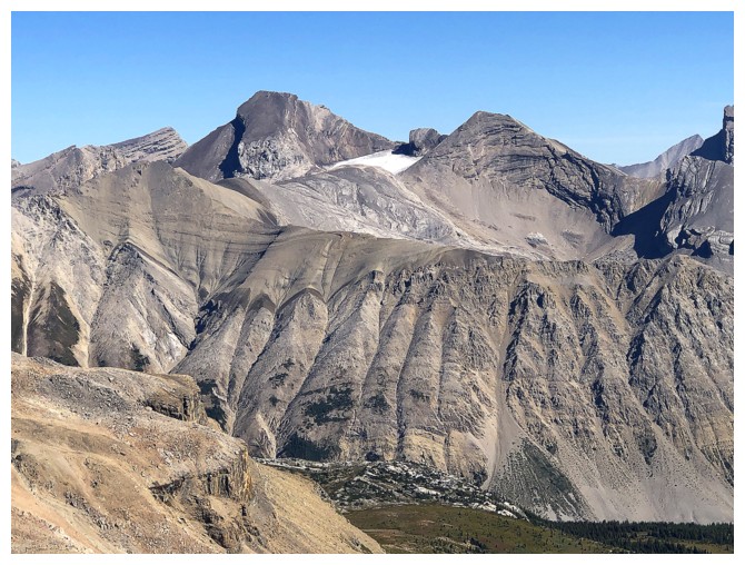
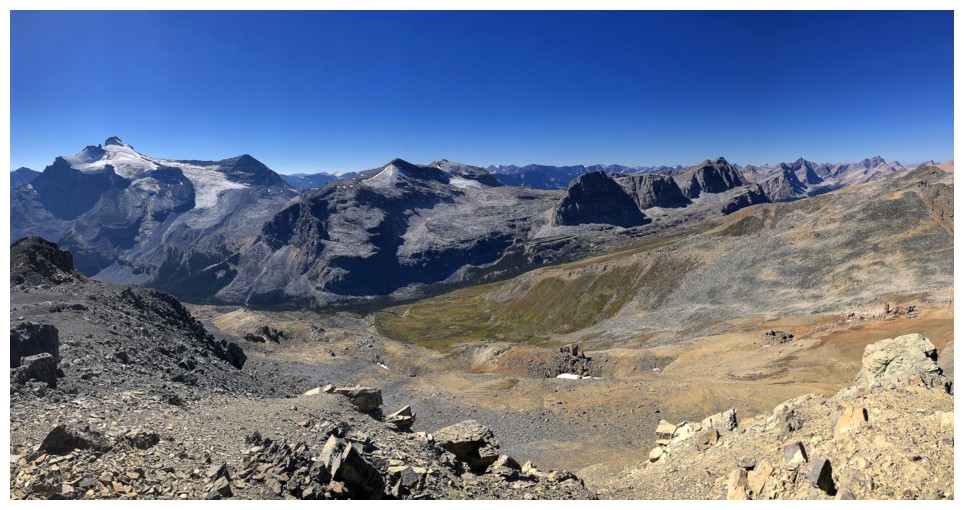
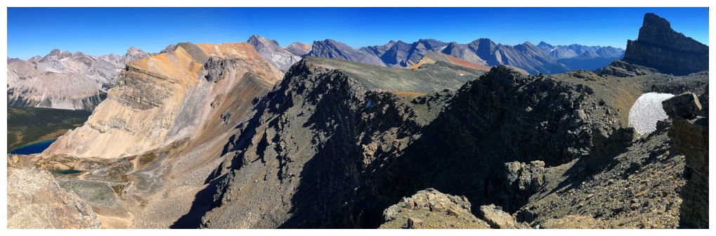
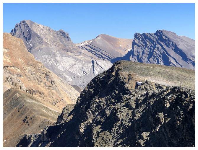
Pretty darn good view of Molar's Mountain's fierce north face
Molar and southeast
Molar and southwest
No Molar
View to the southwest and west
Northwest and north
Tenacious snow patch between the two summits
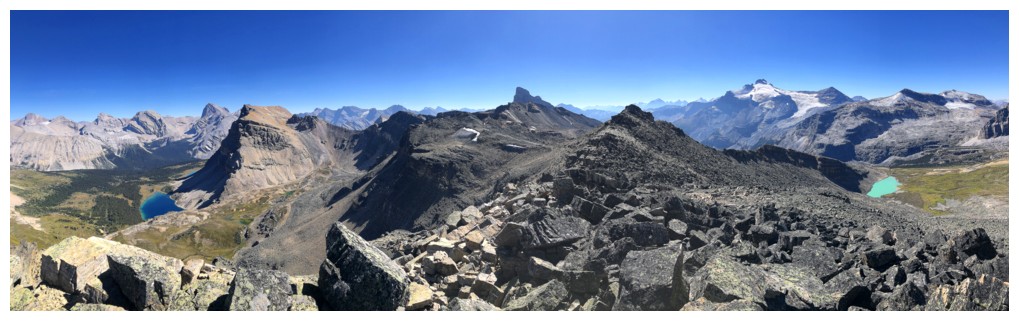
East from the true summit
Built an equally flimsy cairn here - lucky it's not my day job!
Had to take all the summit views again!
There may be a route to Minnow from here, via the right to left trending ridge
Descending
The big Fish Lake and one of the tarns en route to Minnow Peak
Cataract and others
More others. Again, the colours all around were remarkable.
Last look at Molar from this angle
Last glimpse of the big lake
The rocks in front looked like a deck of cards
Close-up
Colour overload
Looking down some of the alternate descent route. The goal at this point was to traverse over to the ridge at the centre right.
The descent route also featured many cool rock formations and colours
Some oxidized rock in front, to make me feel like I'm in Southern Alberta or Northern Montana
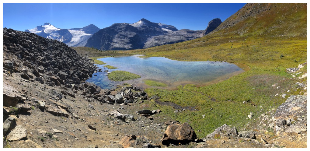
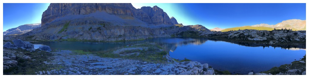
The small lake that doesn't appear on any maps makes its first appearance
Originally I planned to be descending this ridge to see the turquoise lake from high above
Instead I went down directly to the other lake
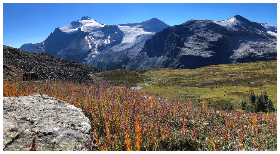
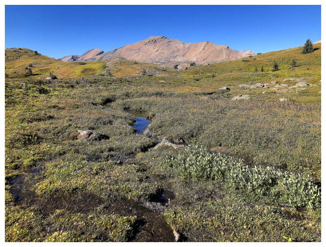
The autumn colours are starting to appear
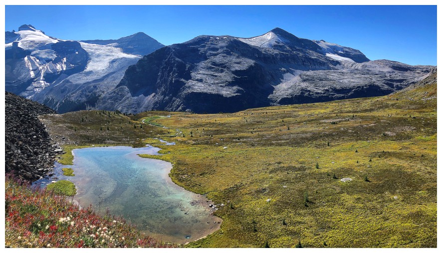
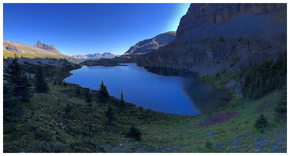
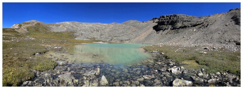
Getting closer to this gem of a lake
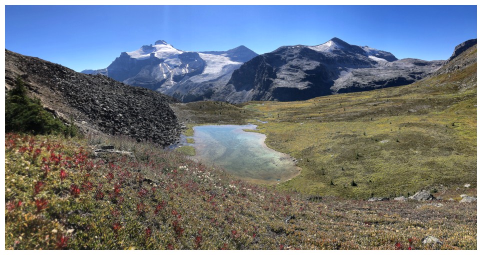
And closer
And closer
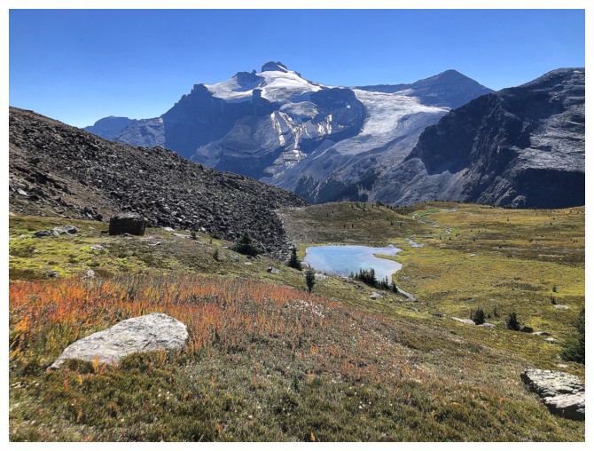
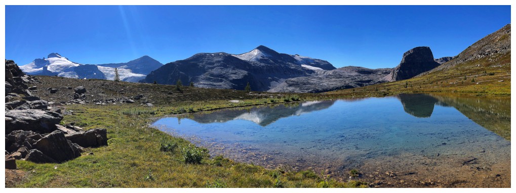
It doesn't hurt to be backdropped by Mount Hector
Looking back at some of those autumn colours
Arrived at the lake
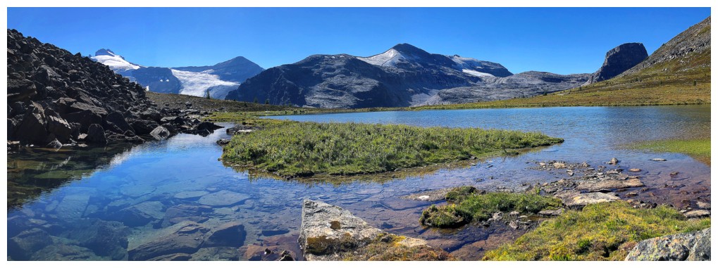
Needless to say I had to check out the lake from many different angles
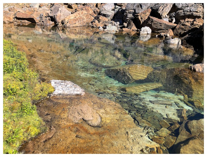
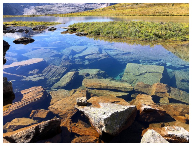
Crystal clear water
Probably my favourite viewpoint of the day
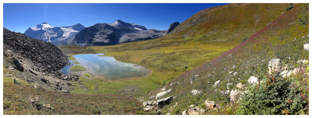
At the southwest end of the lake
Looking back to the summit and Molar Mountain
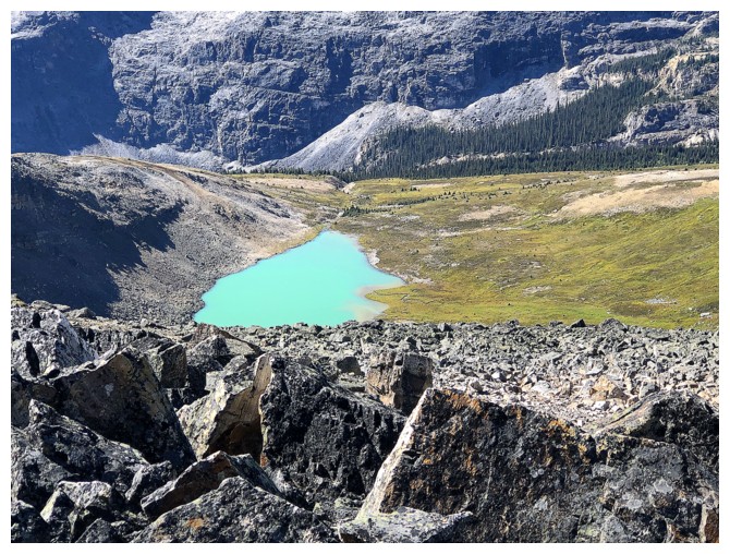
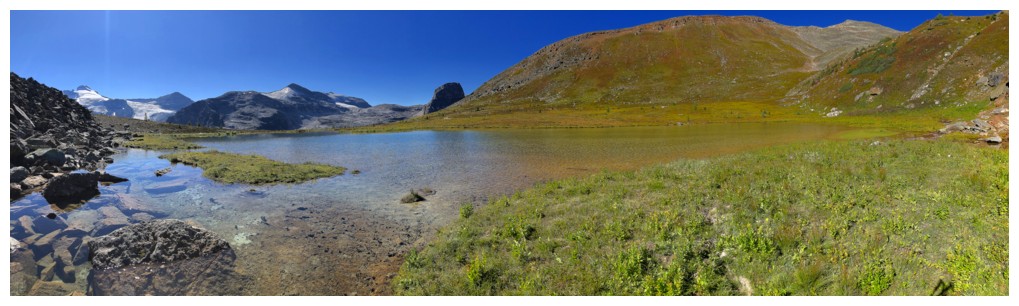
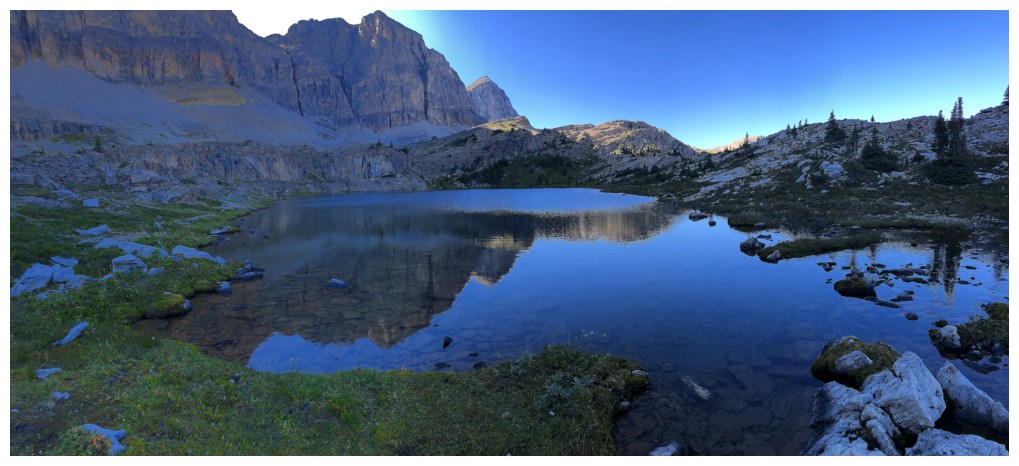
Traversing (and gaining a little elevation) over to the turquoise lake
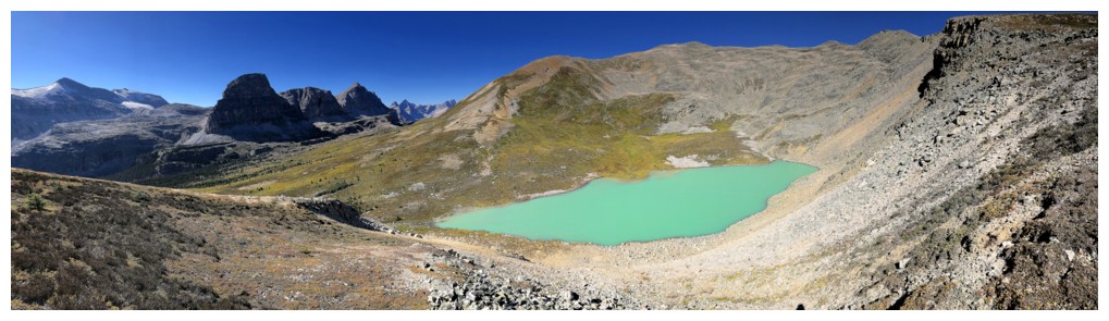
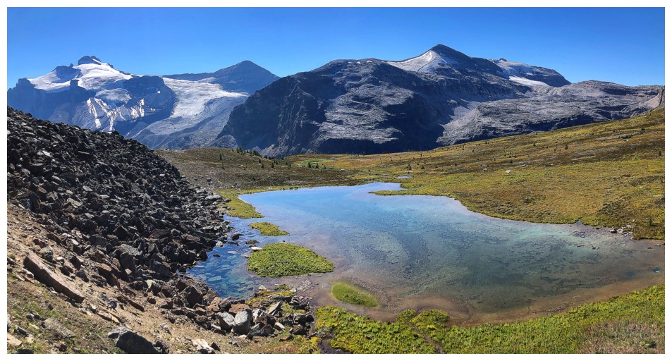
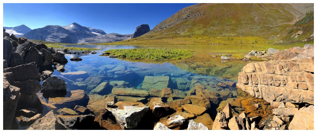
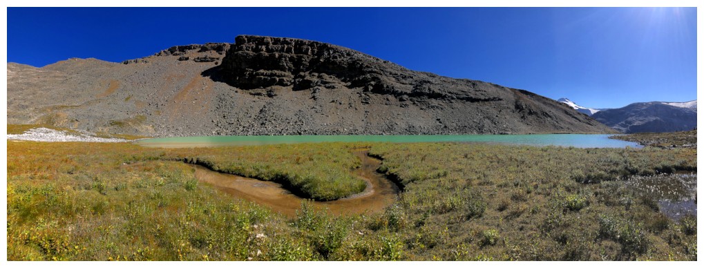
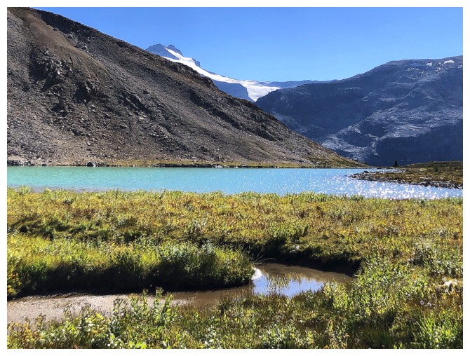
The turquoise lake was about as eye-catching as it gets
At the lake outlet
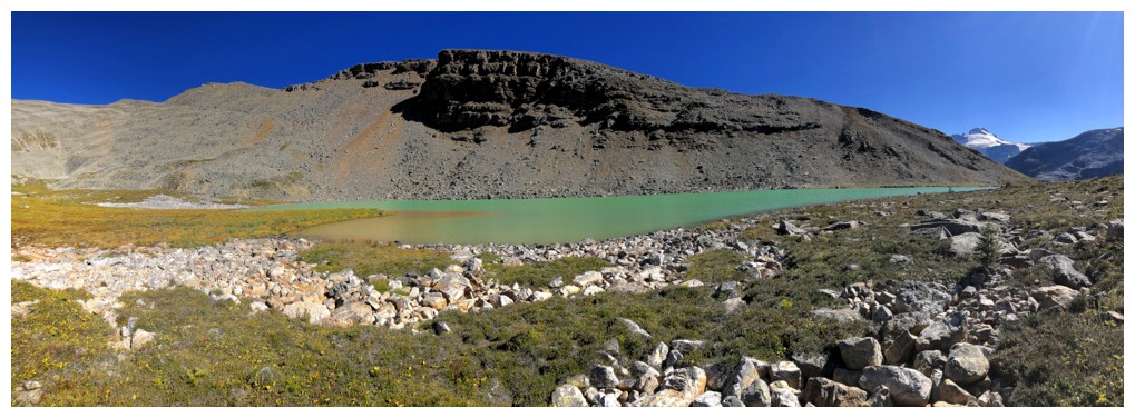
I also felt compelled to go around a big portion of this lake
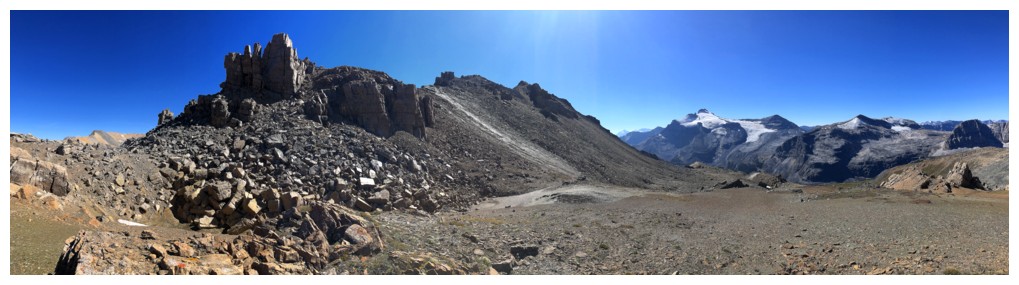
Another descent (or ascent) option for GC20
Leaving the area
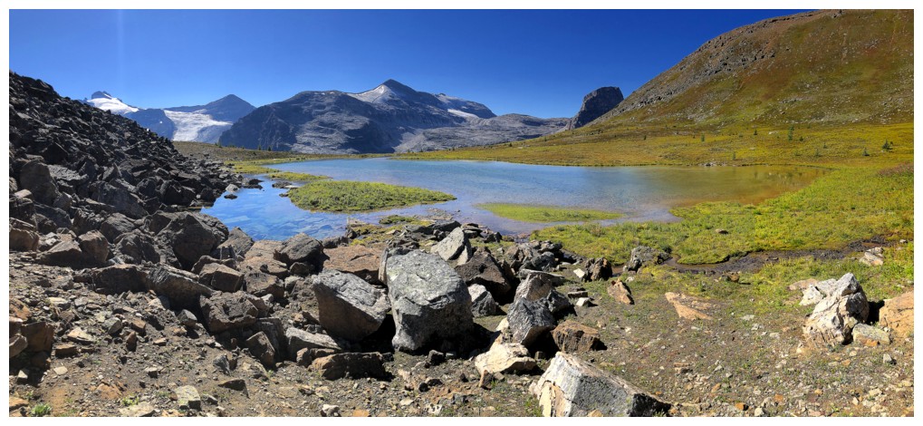
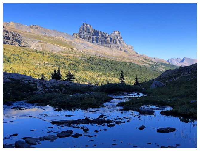
Heading towards the third lake, under the outliers of Noseeum Peak
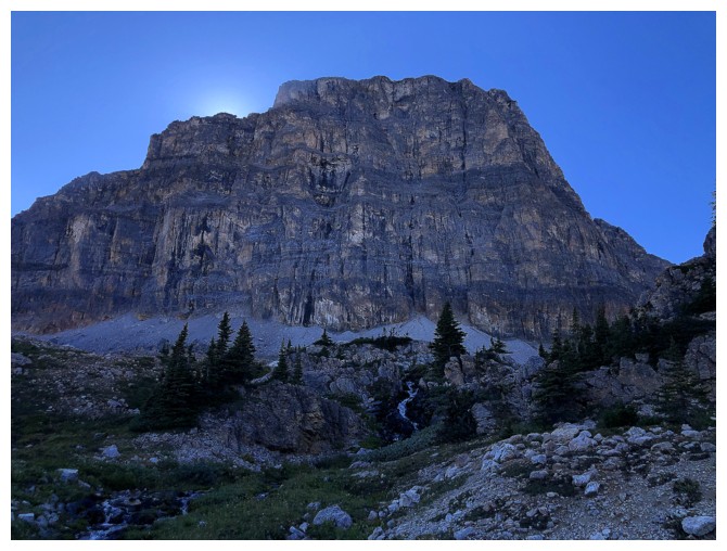
Striking Molar Mountain and Molar Tower (right). The Mountain is a long, moderate scramble; the Tower is a 5.8 technical climb.
The lake sits under the southeastern-most outlier
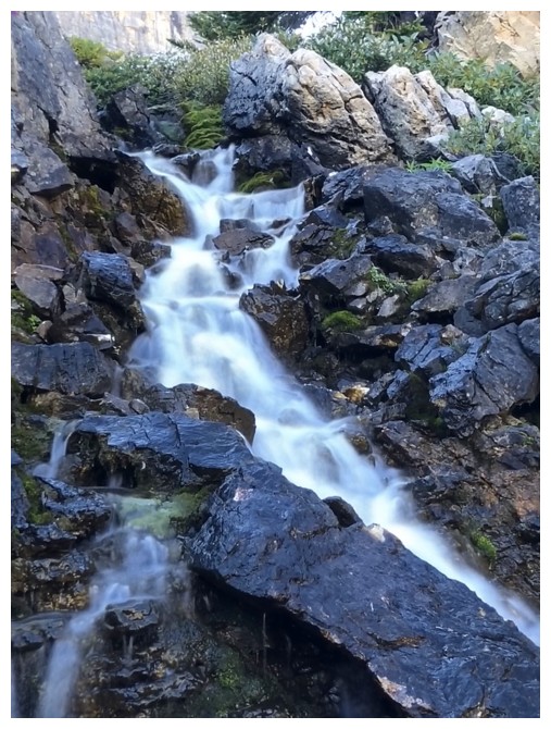
Following the outlet stream to get to the lake
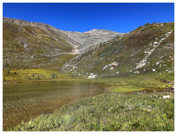
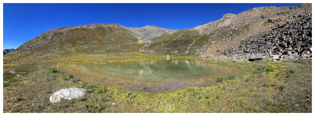
The third lake
Using the "pano" feature on iphones sometimes does weird things with light, Sun, and sky
But I like it!
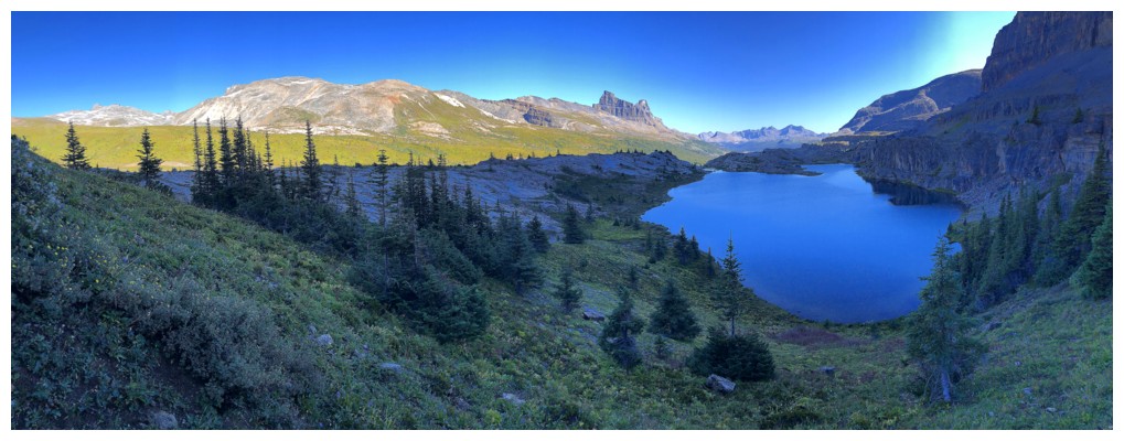
View from the northwest side of the lake
Steep rock above the lake
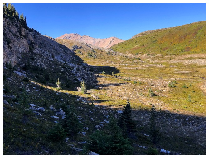
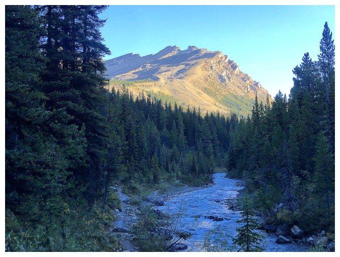
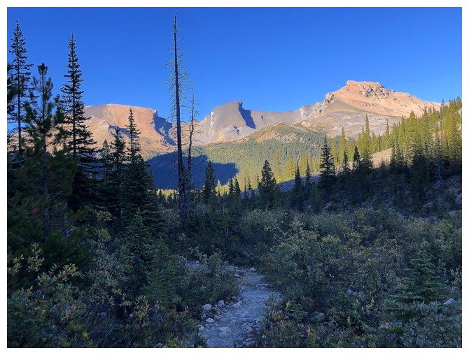
Heading back to Molar Pass
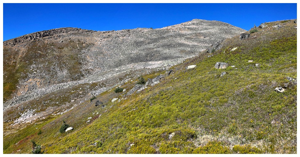
Mosquito Mountain is a welcome sight
At the pass
Noseeum looks very different later in the day
Love the trail that descends from the pass
The QRM trio always look better later in the day
So does the southwest side of Noseeum. Always the last view before
heading into the forest on the Mosquito Creek Trail. Only a couple
kilometres left of a totally awesome trip.
The End
LOG