Cloudowan Peak II
June 18, 2022
Mountain height: 2570 m
Elevation gain: 1263
m
Round-trip
time: 8:49
Scrambling with
Dave.
What a crazy,
cool day in Waterton!
Initially, both
Dave and I were tempted to cancel the trip altogether, as Waterton and the
surrounding area were bombarded with torrential rains and thunderstorms all
night and early morning. Miraculously the skies started to clear around 7:15 am
and by 8 we were gearing up at the Red Rock Canyon parking lot.
 Given my very hazy
recollection of the first trip up Cloudowan with Mark in 2007, I was totally up
for a repeat ascent. As well, Mark and I had approached the ascent as a technical
climb, though we did find a non-technical way down; on this day Dave and I would
be searching for a scramble route up but something a little more “scrambly” than
2007’s descent route.
Given my very hazy
recollection of the first trip up Cloudowan with Mark in 2007, I was totally up
for a repeat ascent. As well, Mark and I had approached the ascent as a technical
climb, though we did find a non-technical way down; on this day Dave and I would
be searching for a scramble route up but something a little more “scrambly” than
2007’s descent route.
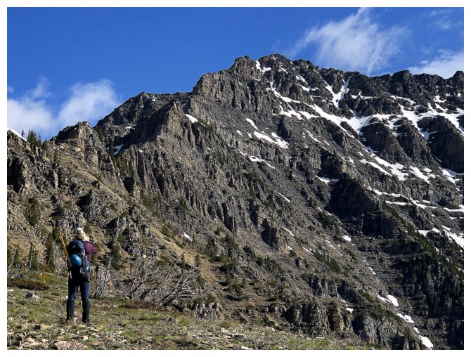
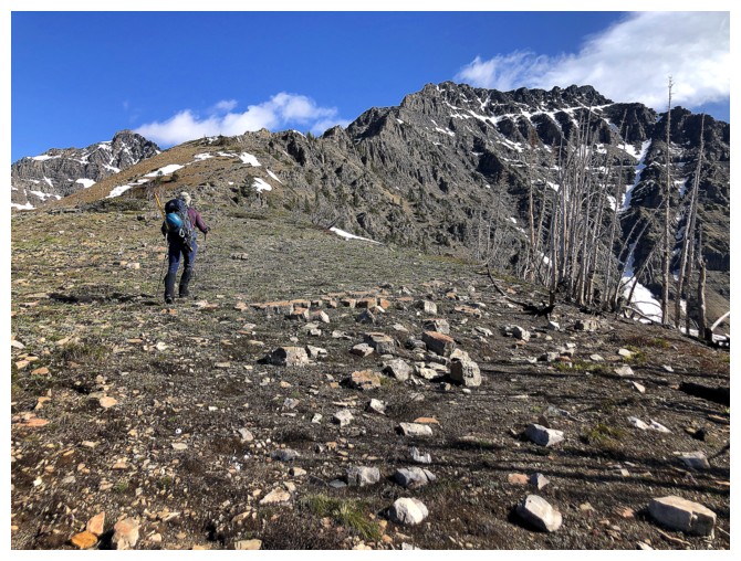
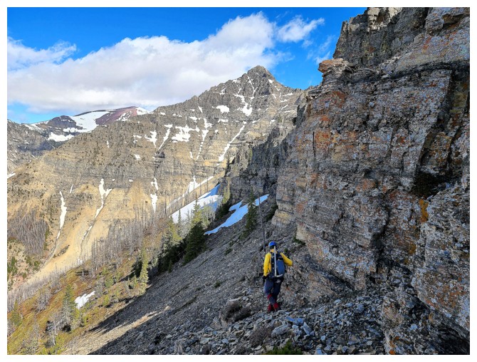
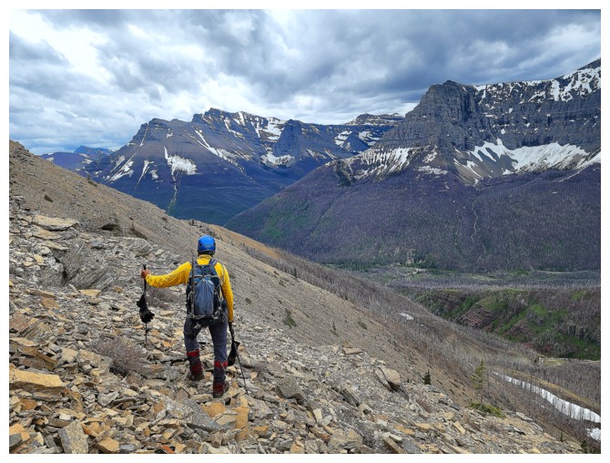
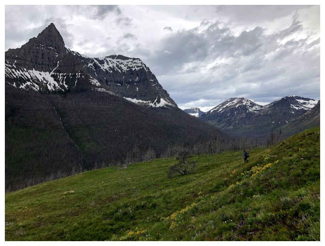
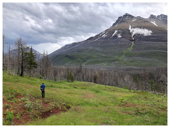
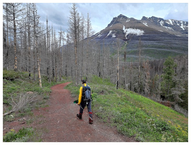
After hiking the
Snowshoe trail for about half a kilometre, we turned right, up grassy, flowery (and
very wet!) slopes towards the ridge. The surroundings were beautiful and the
mountain air wonderfully refreshing – already the trip was a success and we
had barely started.
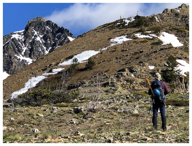
Hiking the ridge
was no-less captivating and rewarding. A huge bank of firm snow on
the right side provided great footing, as well as scenic interest. 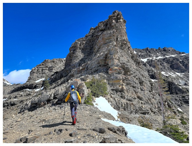 Both Dave and
I agreed that getting up to this point alone was a worthy endeavor. And then
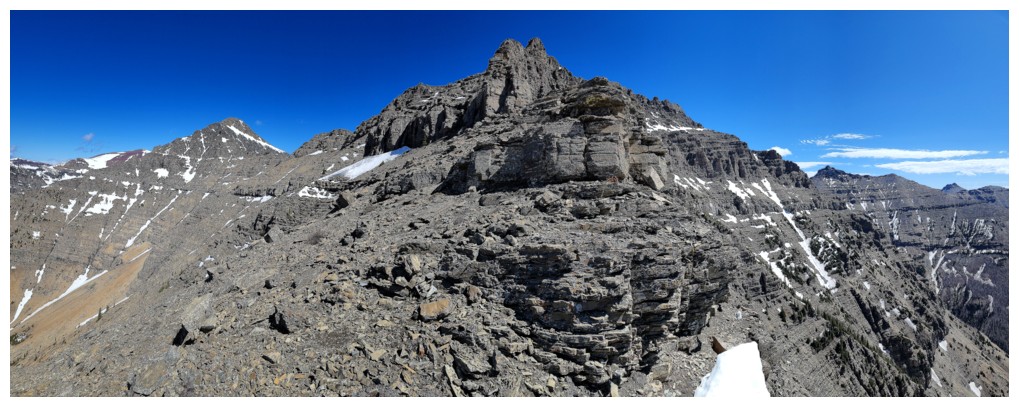
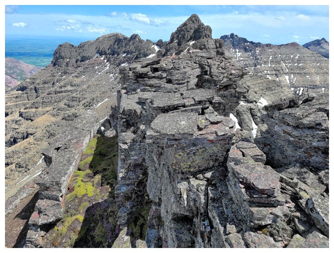
the fun starts….scrambling and route-finding your way through up sometimes easy but sometimes complex terrain.
Both Dave and
I agreed that getting up to this point alone was a worthy endeavor. And then
the fun starts….scrambling and route-finding your way through up sometimes easy but sometimes complex terrain.
The only real
downside of the trip reared its not so pretty head right away – and that was
the wet rock. While neither Dave nor I were “slip, slidin’ away”, the condition
of the rock was enough to zap our confidence in places where confidence was
needed. As such, we bypassed several challenging routes in favour of more
conservative ones.
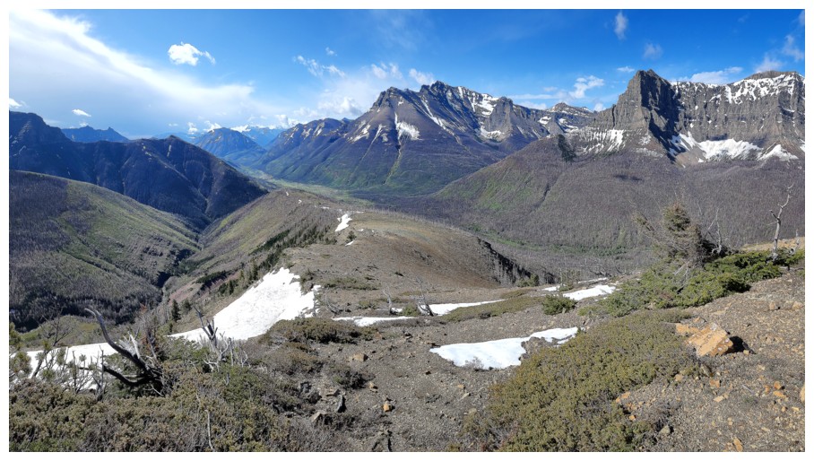
Nevertheless,
the route we took was fun, interesting, and full of nice surprises. Dave did
the brunt of the heavy lifting, leading us up a steep snow slope and finding a
nice scramble route through the challenging limestone rock band that lines most
of the area peaks. Above the limestone band more route-finding decisions
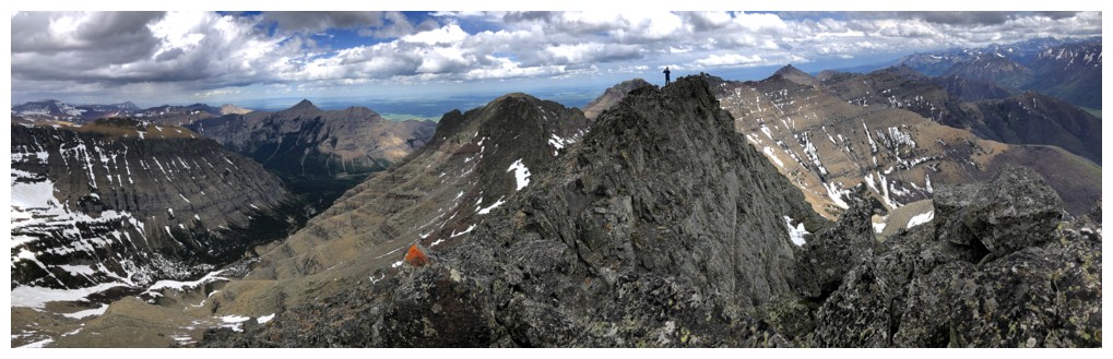
awaited, but soon enough we topped out at the end of the summit ridge and a
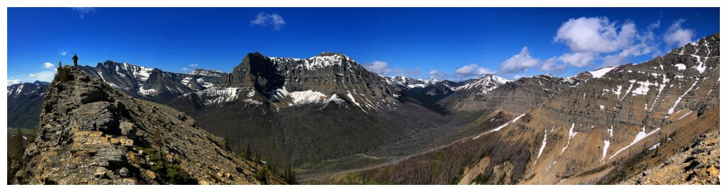
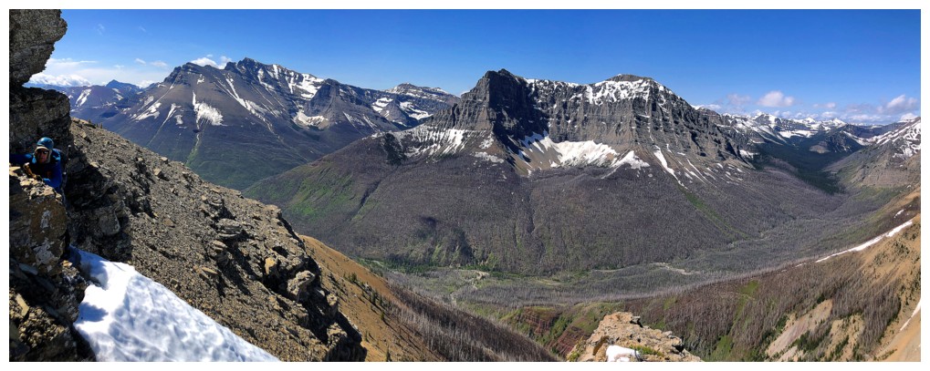
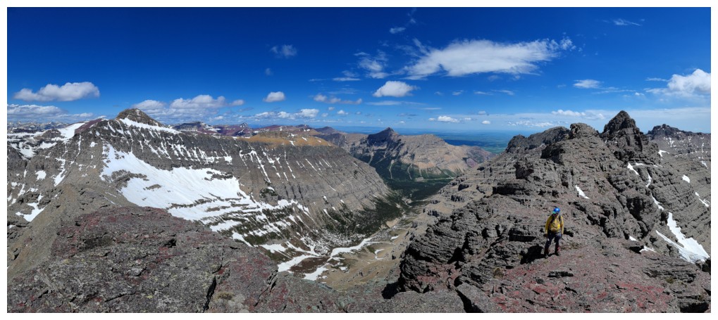
magnificent panorama in all directions.
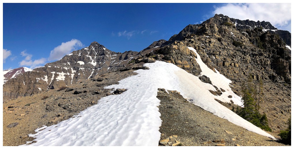
I thought we
were home-free at this point – a scenic ridgewalk followed by a steep gully
ascent to the summit. I did recall that Mark and I had used a rope to ascend
the gully, but we had downclimbed it on descent. The ridgewalk unfolded as
predicted, the summit block not so. We hiked right past the correct gully and
ended up at the east end of the summit block, hoping it would yield with
relative ease. It did not and we reluctantly decided to call it a day, somewhat
baffled about our failure to find the route to the top.
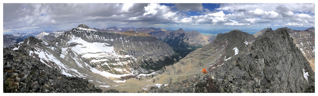
On return, we
spotted a gully that I thought might be the correct one, but it looked insanely
steep and very exposed. Dave started up the gully and in fact made it about
two-thirds of the way up. Although he could have made the summit from this
route, once again the wet rock and moss was cause for concern and he wisely
backed down. And then we found it! The correct gully was the first one. Dave
led the way and within ten minutes we were up on each of the two closely spaced
summits.
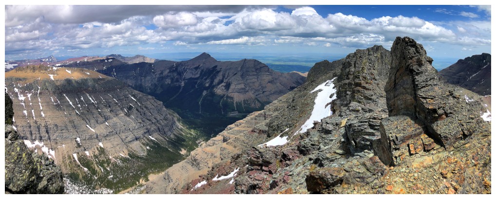
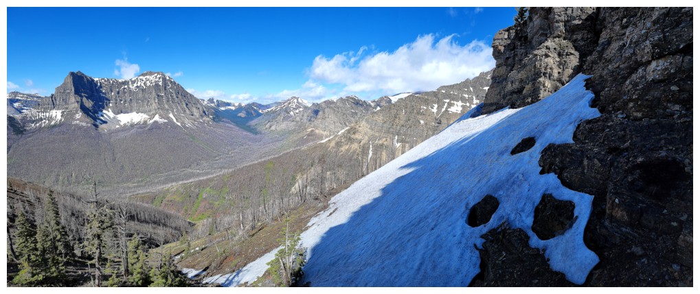
Clouds had formed
all around at this point, but no apparent threat of a thunderstorm yet. We
stayed long enough to enjoy the terrific summit view and then started down, just
case the “apparent” became less so! Downclimbing the gully required slow and
exact moves but was not as crazy exposed as Dave’s other route. More or less following
the remainder of our ascent track provided a relatively easy and fast way down.
An amazing second
run up Cloudowan! Big thanks to Dave for leading most of the trip, punching
steps for me in hard snow, and just being a delightful human being to be around!
Click HERE to see Dave's fantastic report
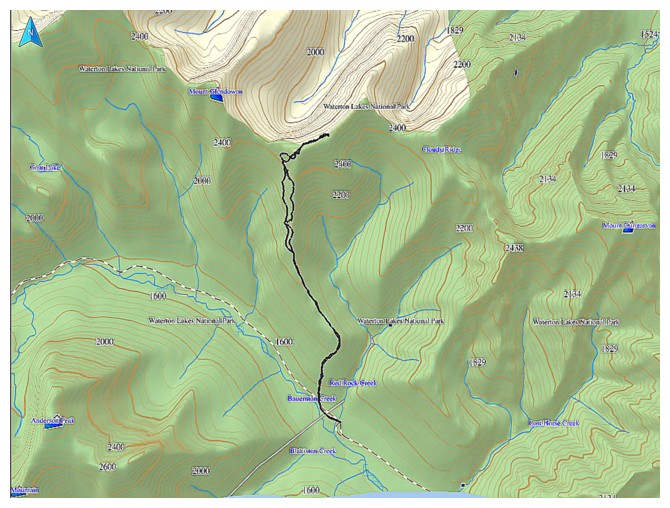
Dave's map of the route
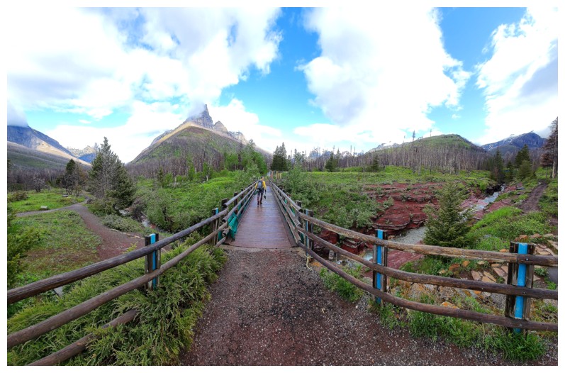
The trip starts at amazing Red Rock Canyon (photo by Dave)
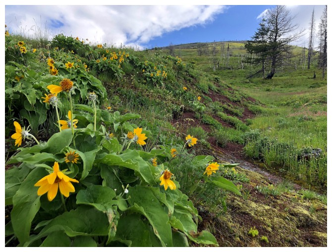
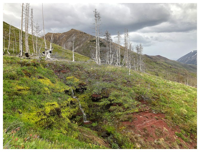
The lower slopes of the objective are littered with arrowleaf balsamwood (had to check Dave's report to get the name!)
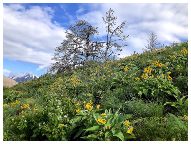
Very few trees. Hard to believe Mark and I endured a hideous bushwhack
directly from the parking lot, when these open slopes are less than a
kilometre away.
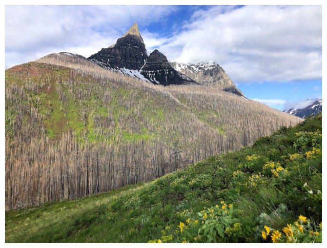
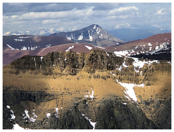
Anderson Peak is an aesthetic beaut! And also has one of the best scramble routes in Waterton.
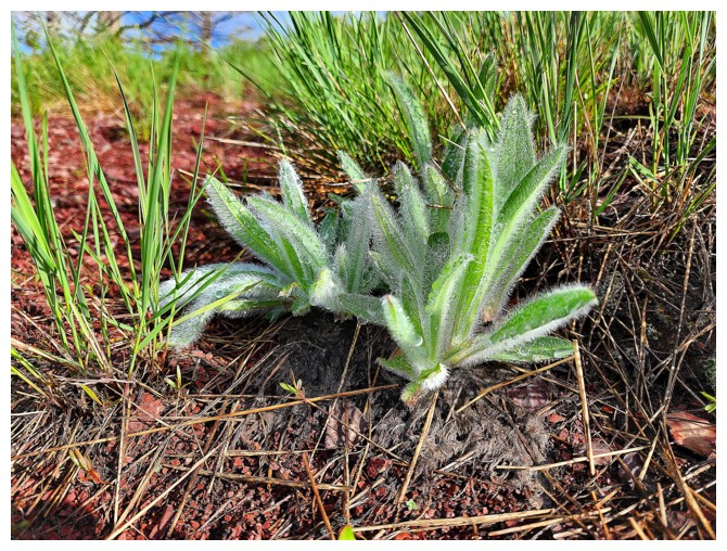
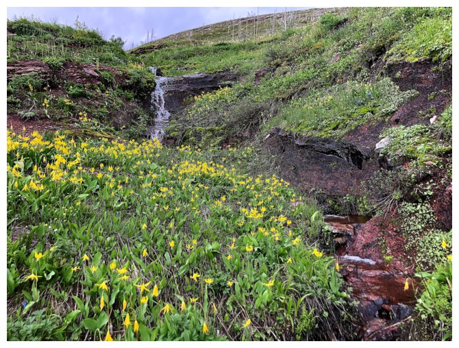
Another weird plant whose identity is a complete mystery to me! Thankfully Dave knows - it's wooly weed (photo by Dave)
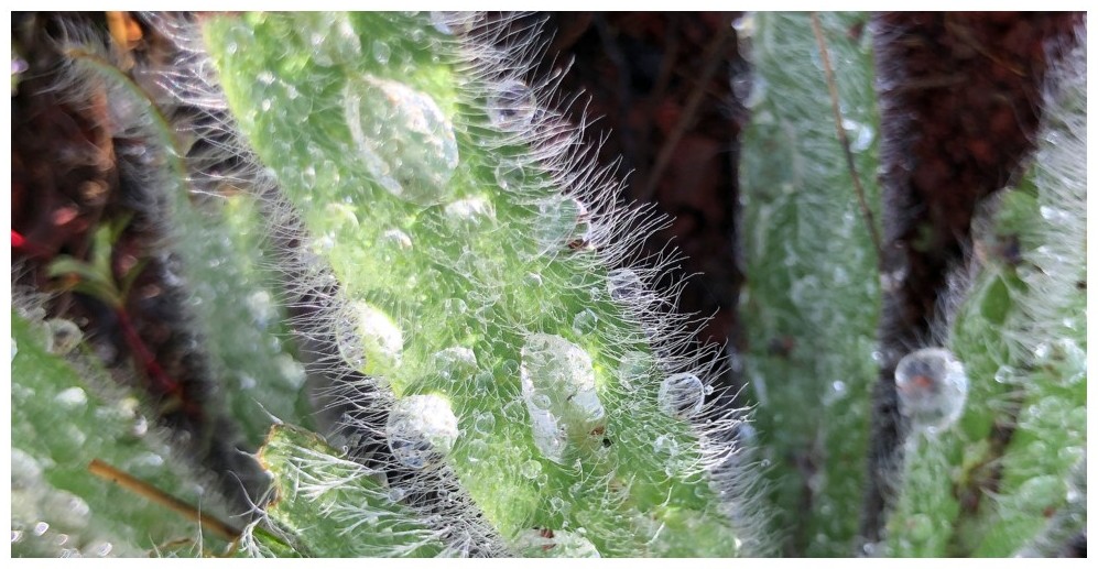
Close-up of dew on wooly weed
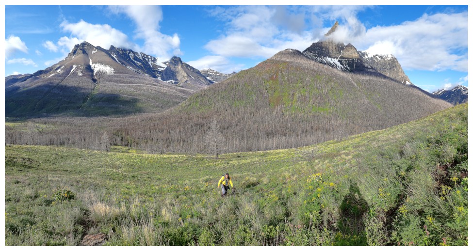
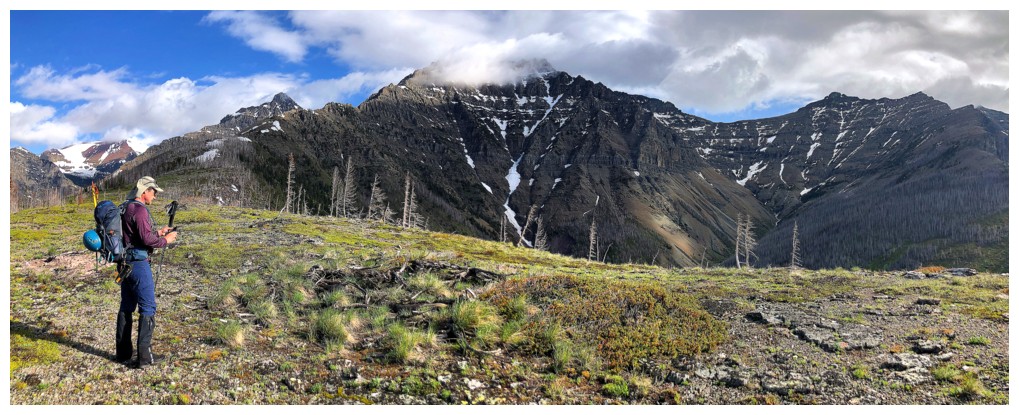
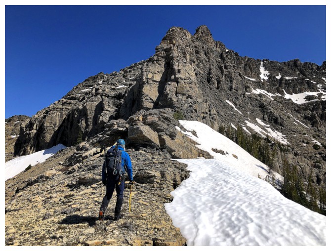
Ascending easy slopes, with Mount Blakiston (left) and Anderson Peak behind (photo by Dave)
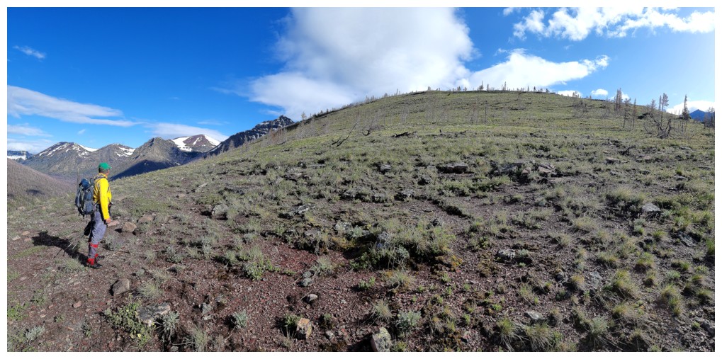
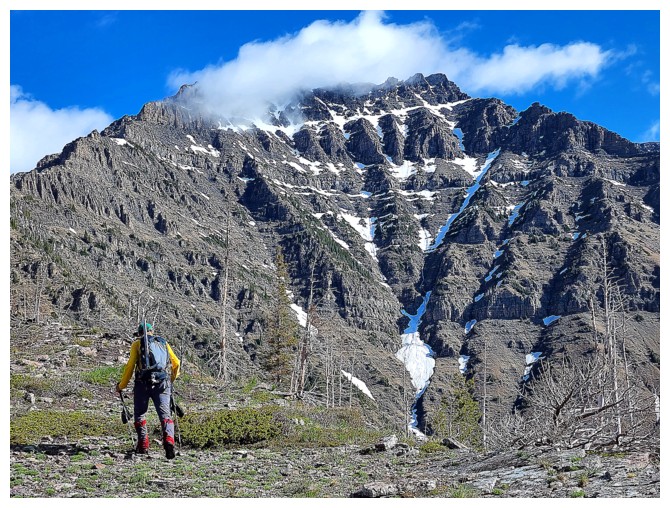
Straightforward route ahead, but it's quite foreshortened (photo by Dave)
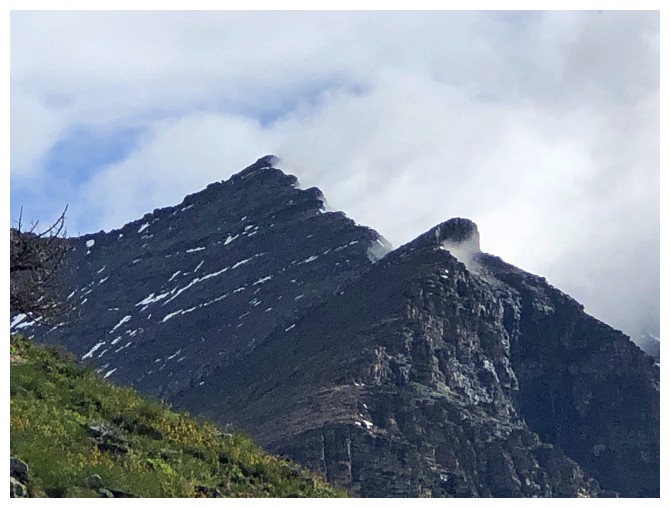
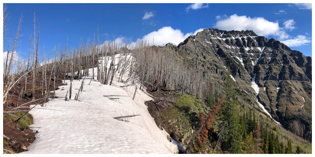
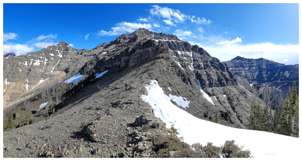
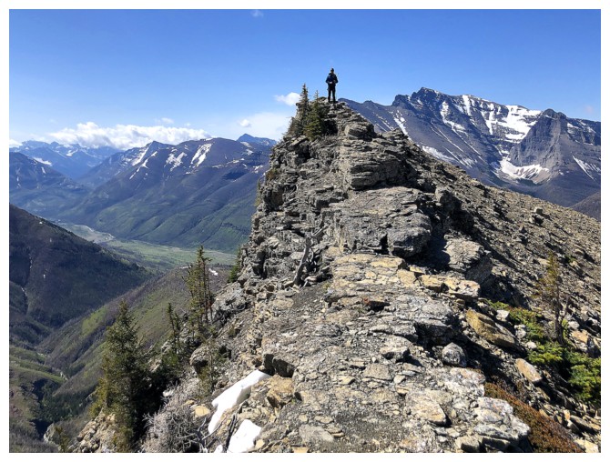
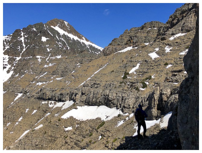
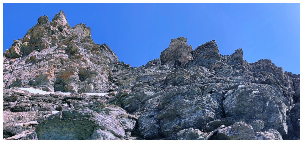
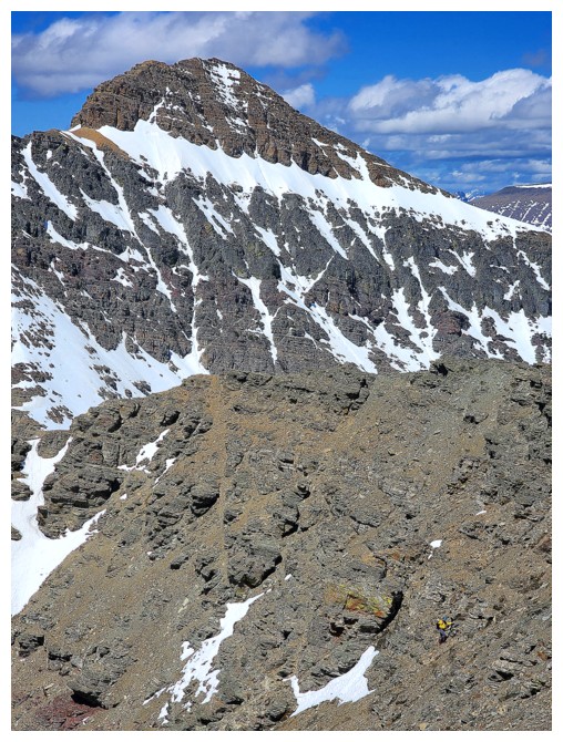
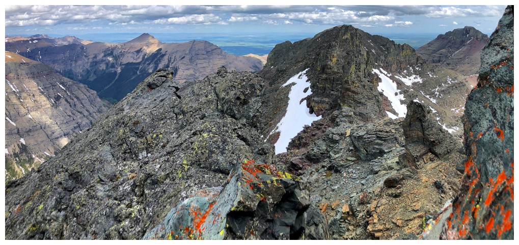
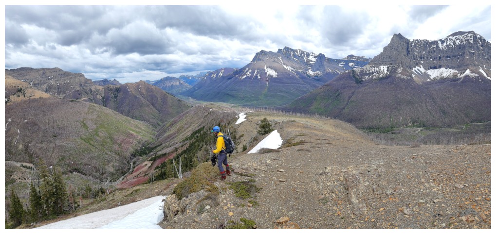
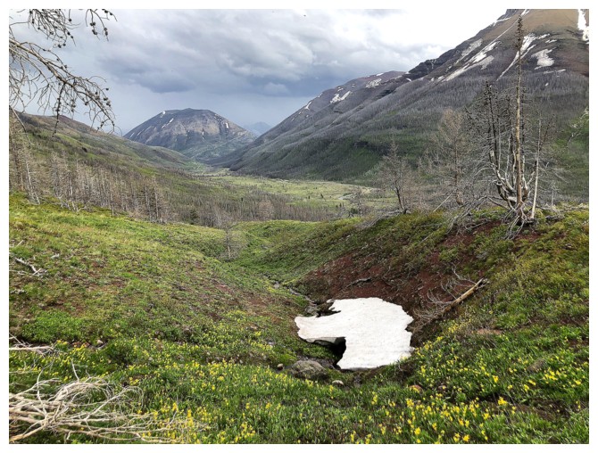
Cloudy Ridge is living up to its name
Atop the ridge, with Cloudowan front and centre
Cloudowan is also sporting a "cloud hat", but will soon be gone (photo by Dave)
Approaching the cool snow bank
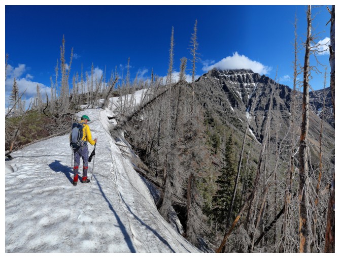
Wonderful hiking up the ridge (photo by Dave)
Dave takes a break from the snow to see how the ridge is
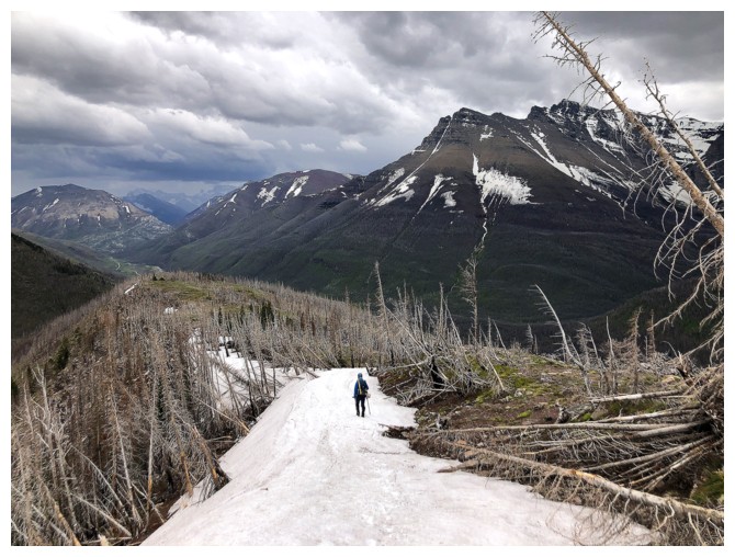
The road ahead
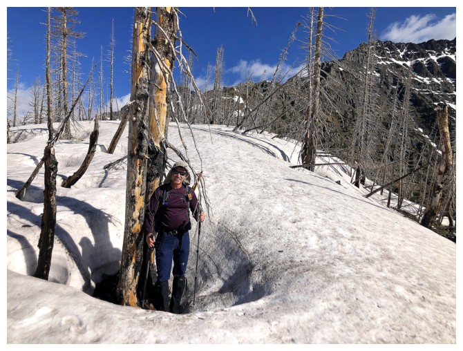
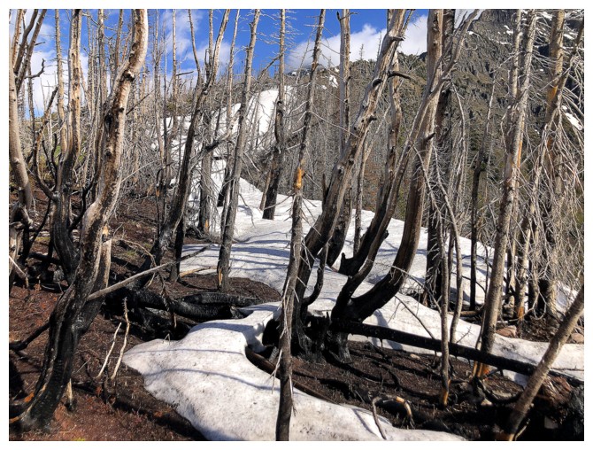
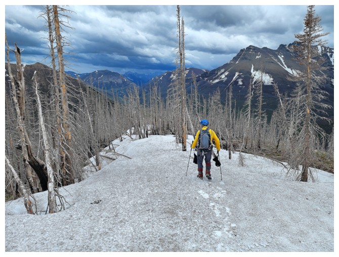
Dave in a small tree well. Some of the wells were well over 1 metre deep.
The snow ends
Dave and Mount Glendowan
Looking back (photo by Dave)
Yeah - more snow!
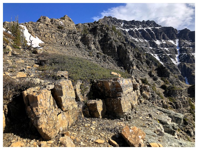
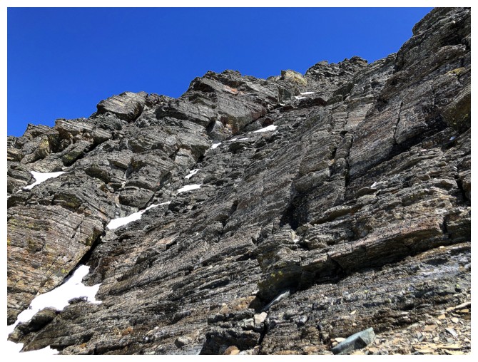
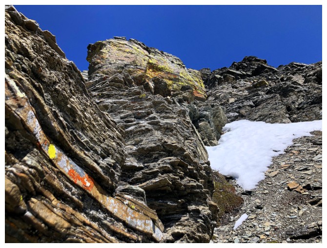
And then it's replaced with classic, blocky, colourful, Waterton rock
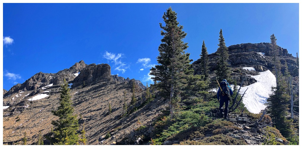
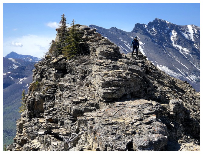
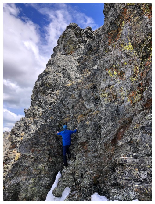
Dave on one of many small pinnacles along the ridge
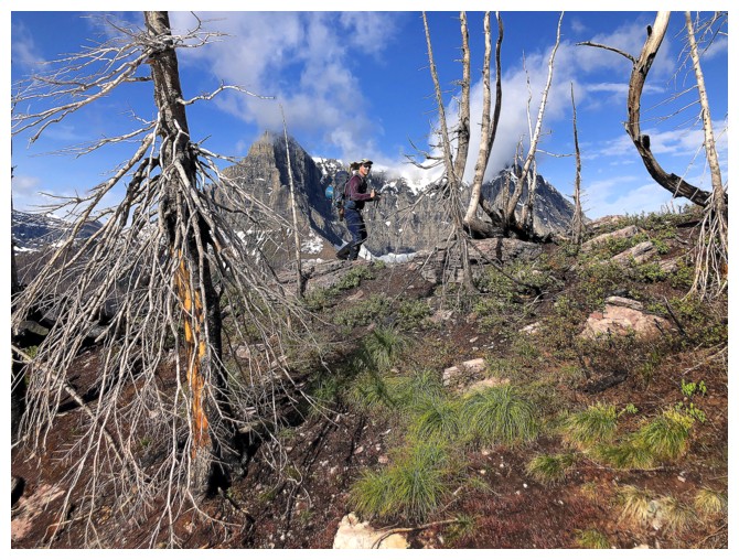
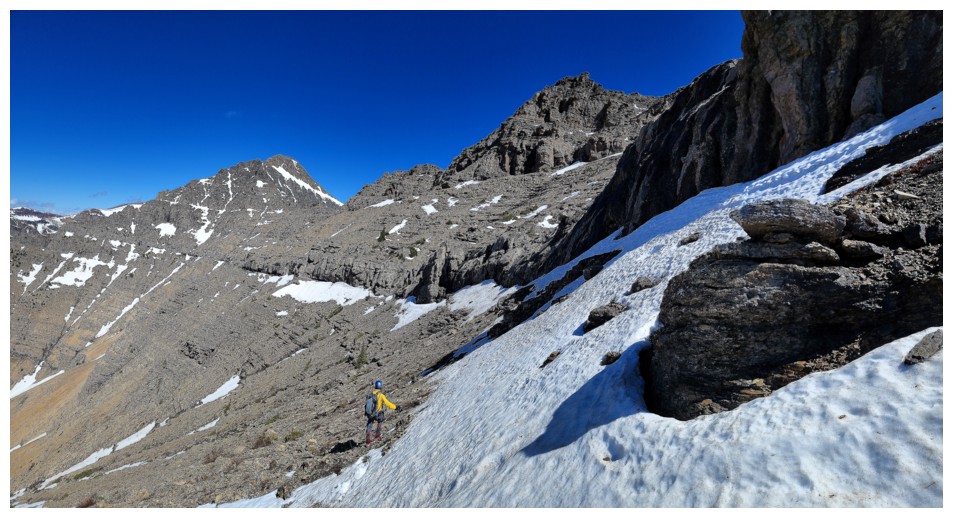
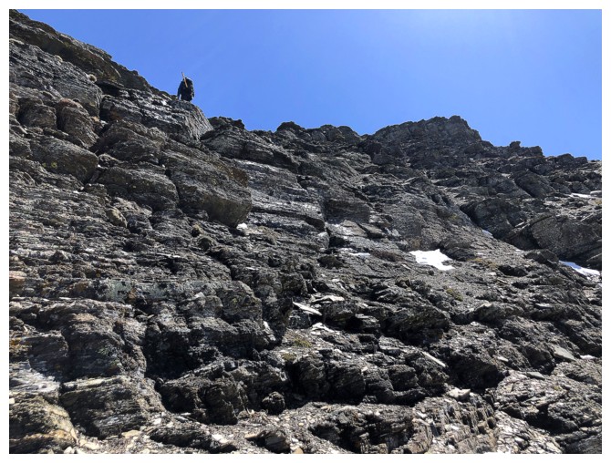
Closing in on more serious terrain (I'm well camouflaged on the ridge) (photo by Dave)
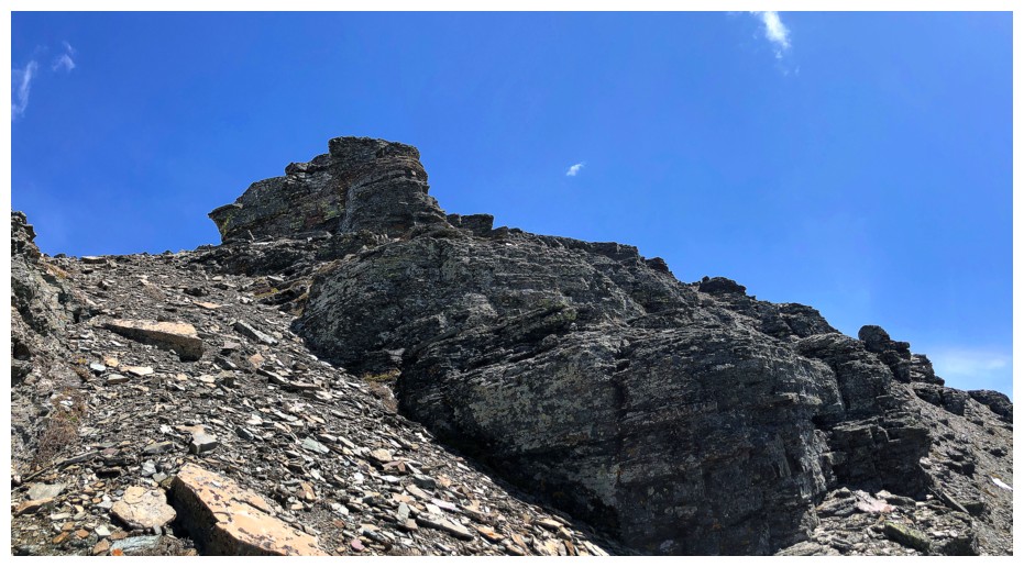
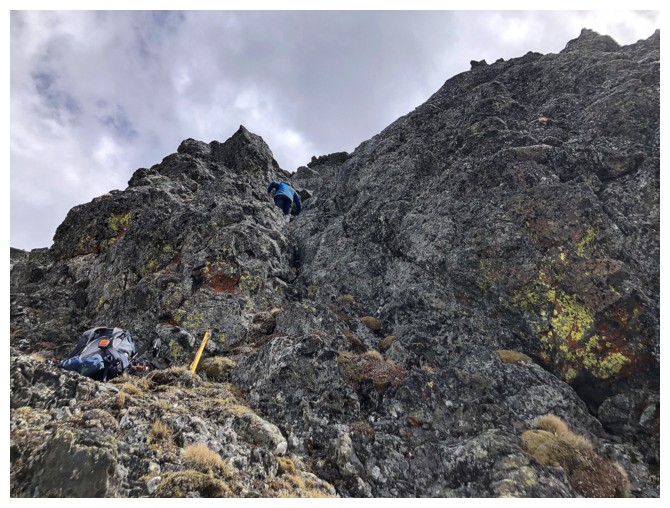
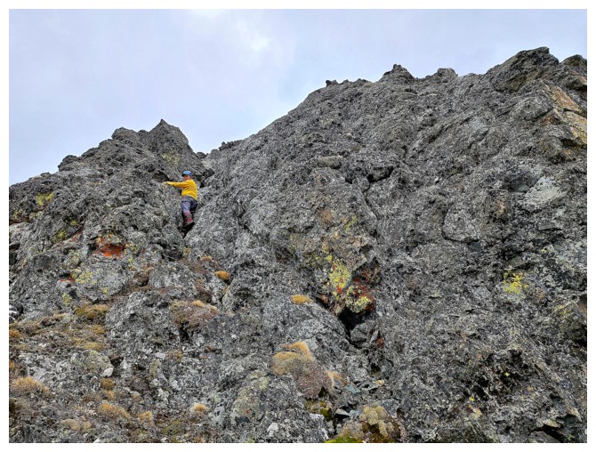
Dave tackles the first challenging step along the ridge
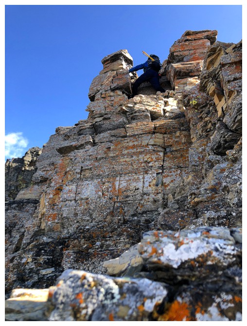
He's up the first part, but the terrain beyond is steeper and the rock is wet. He wisely backed down.
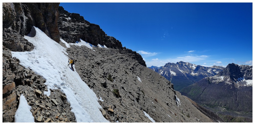
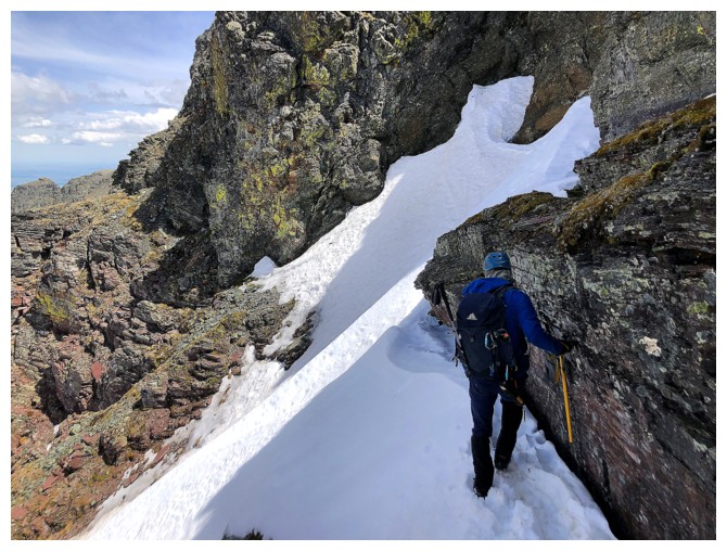
Traversing left would become the theme of the day from here on in (photo by Dave)
Lots of colourful rock to ogle at while going sideways
We
tried to hug the rock and stay above the snow, but it became too
dangerous and we backed down here too and went around (photo by Dave)
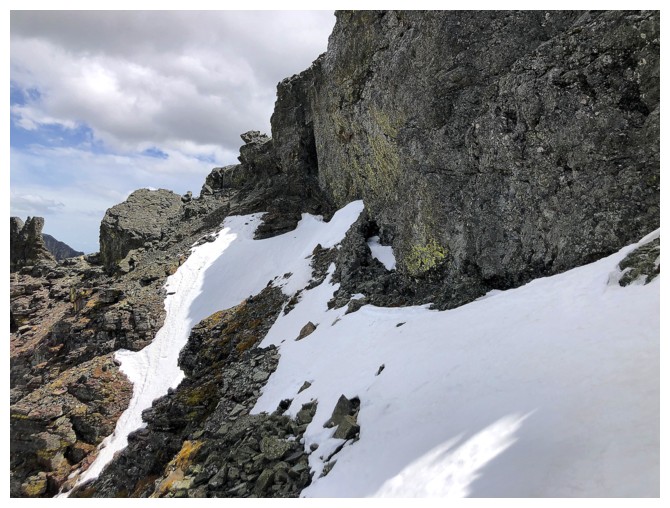
Around the first obstacle and heading back to the ridge
The great weather continue to surprise us; the great views are not surprising (photo by Dave)
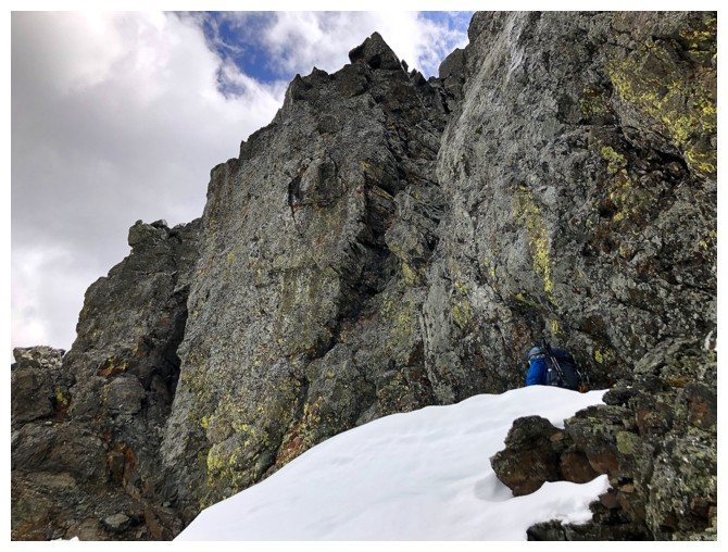
Another section of easy and scenic ridgewalking before Challenge #2 (photo by Dave)
Dave gets another highpoint
....with a serious drop on the left
Same as above
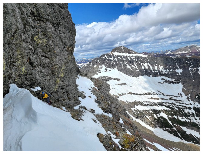
Already we can see the need to traverse left again
But it's always cool to get right up to the rock first. Dave checks out the daunting formation.
Dave at the far left, traversing left
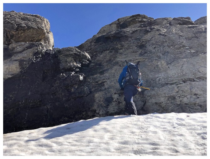
Dave leads a steep snow slope
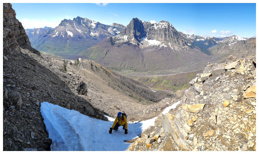
I follow (photo by Dave)
My turn to lead (photo by Dave)
Back on easy terrain again (photo by Dave)
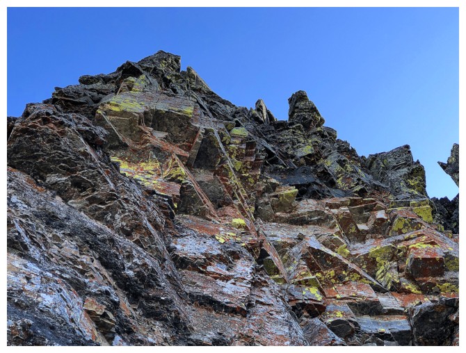
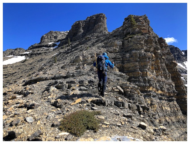
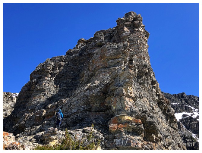
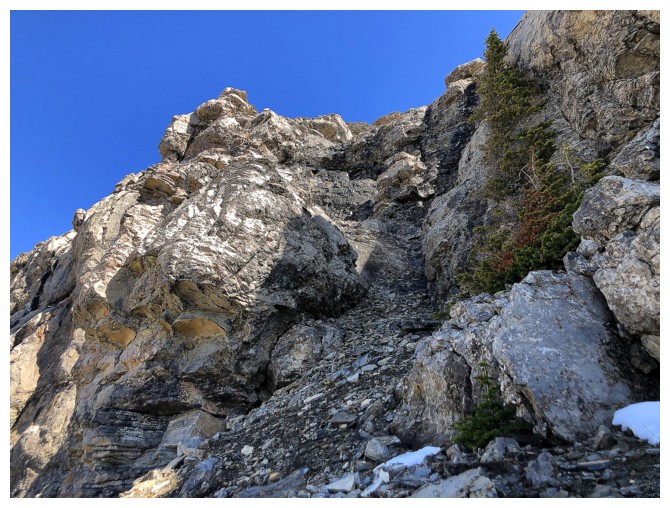
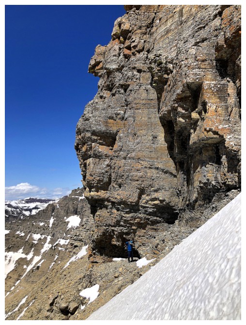
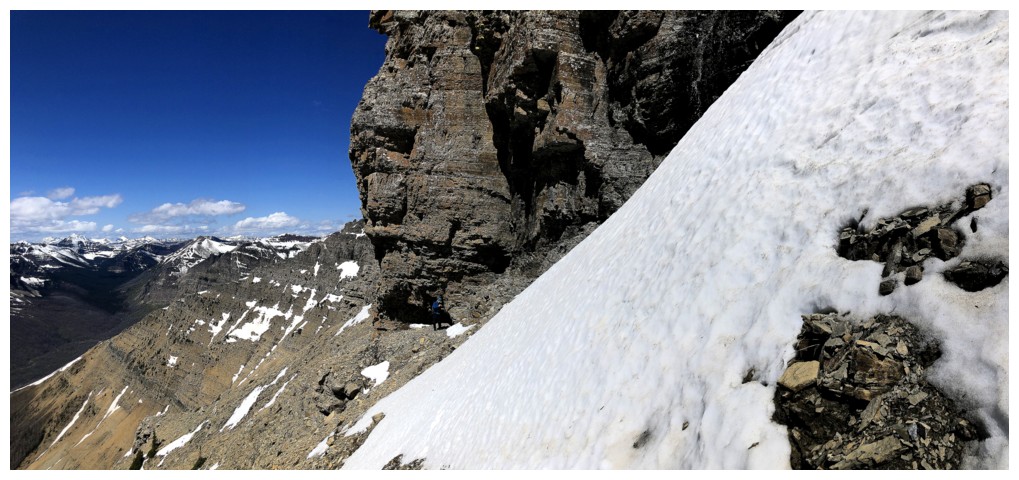
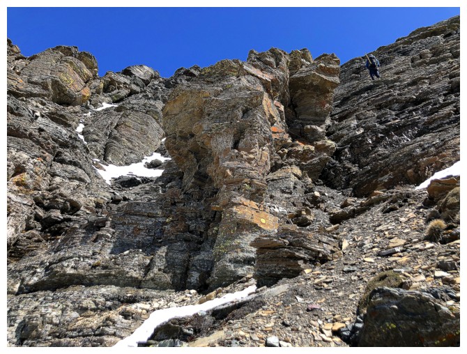
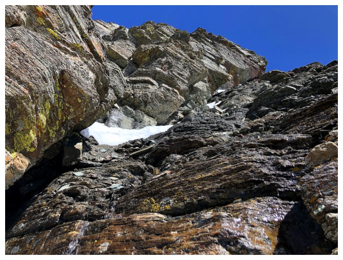
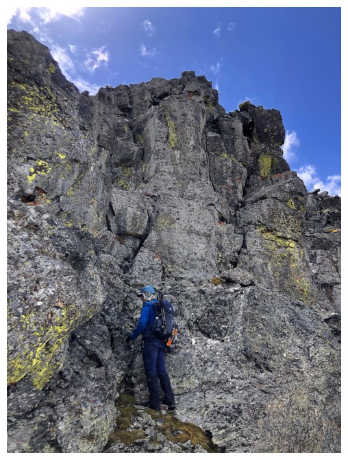
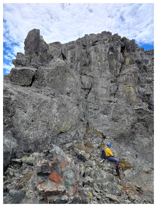
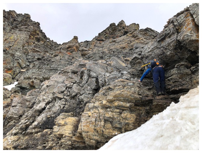
But not for long. The limestone rock band is dead head and on most mountains in the area presents a real challenge.
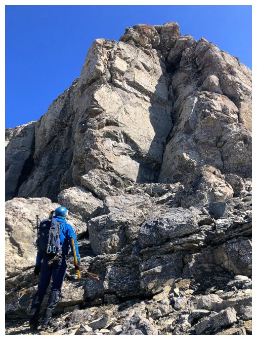
Dave sizes up the rock band
And then we traverse left!
Looking up the route Mark and I took in 2007
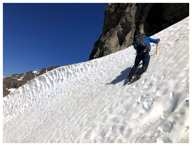
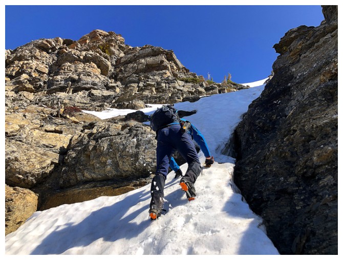
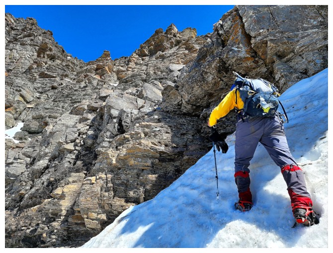
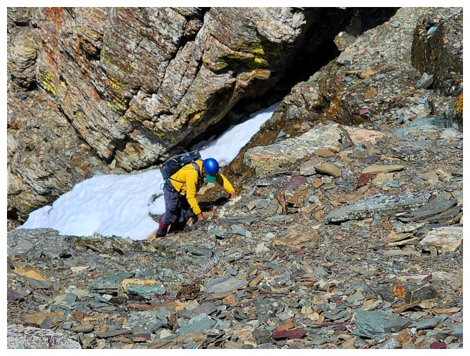
Dave attacks another steep snow slope. Good thing we brought crampons and ice axes.
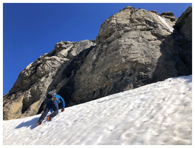
Almost at the top
I get to benefit from the steps Dave has kicked
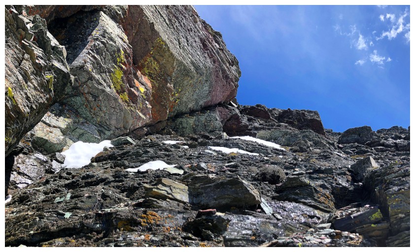
Still looking for a weakness in the limestone band
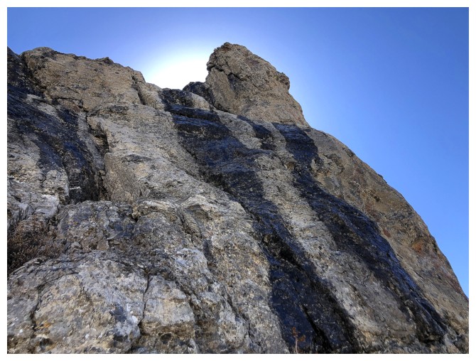
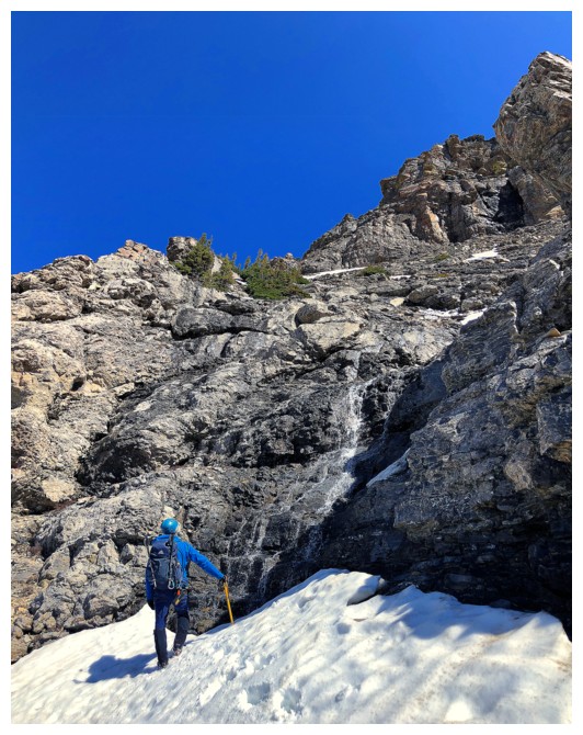
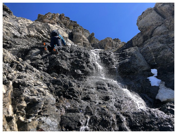
Water was pouring down much of the rock
Still traversing - at this rate we'll be in danger of summiting Glendowan (left) first!
Dave looks at another potential route. Glad he didn't go all the way
because a much easier one was waiting right around the corner
And there it is
Up he goes
Admiring the Master from below! (photo by Dave)
My turn (photo by Dave)
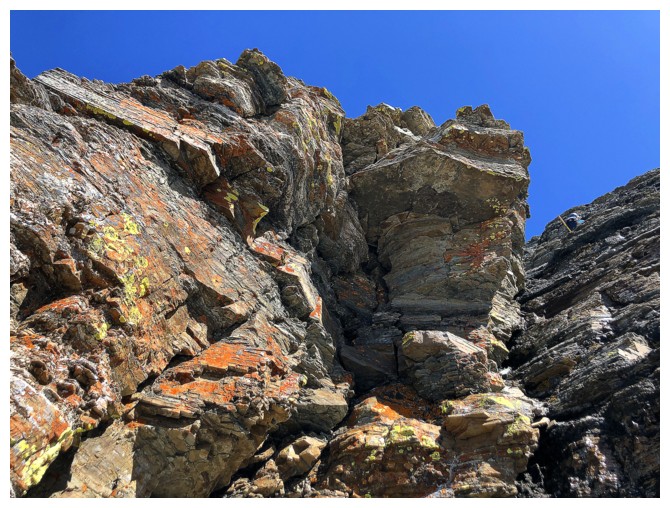
 Some really cool rock folding
 Scampering up to the next challenge (photo by Dave)
Traversing to the right!!! What's going on??
Dave conjectured we could break through the rock band just past the snow (photo by Dave)
Check out the skull looking down on Dave and the monkey in profile. Dave's take: "Kong: Skull Island"!
Once again happy to have crampons and an ice axe to traverse this slope
Dave's conjecture turns out to be correct. Only a couple of moves of easy scrambling to get onto easier terrain (photo by Dave).
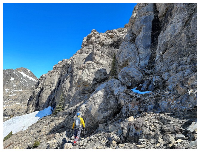
Interesting terrain ahead
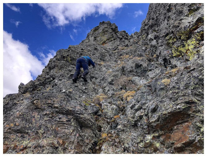
Dave leads the way up scree and step-like terrain
Lots of cool rock to see on the way
At this point I veered off to the left then went up, along side a small rock wall. It looks steep, but is very steppy.
Dave continued going up to the right
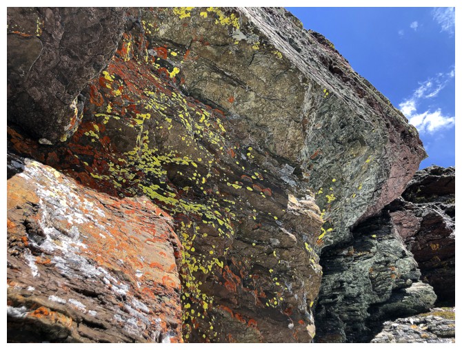
The lichen-covered and colourful rock is what caught my attention (hardly shocking!)
The zoom on Dave's phone camera is amazing. We were at least 200 m apart at this point (photo by Dave).
Approaching the rock I veered off to see
There it is
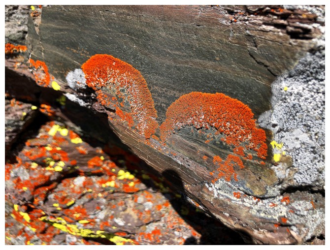
Lichen eyebrows
Another cool view
Spotting Dave on the skyline
Dave's view of me (look for the yellow jacket) and Glendowan (photo by Dave)
Almost at the ridge
Dave's view upon reaching the ridge (photo by Dave)
My view upon reaching the ridge
Slowly catching up to Dave
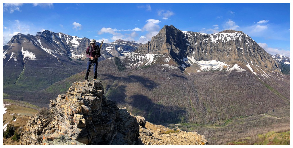
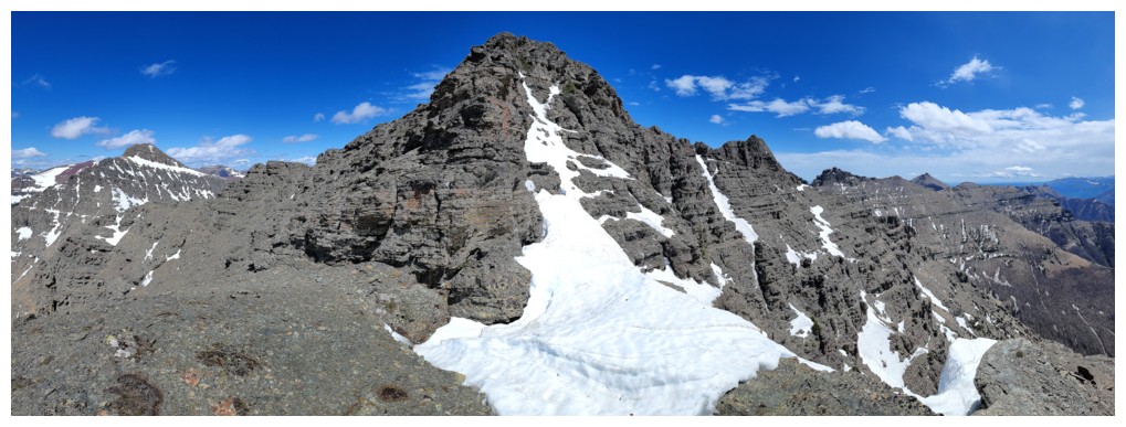
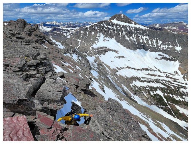
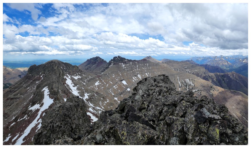
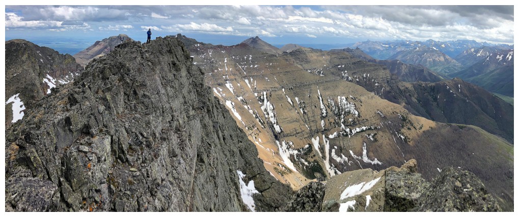
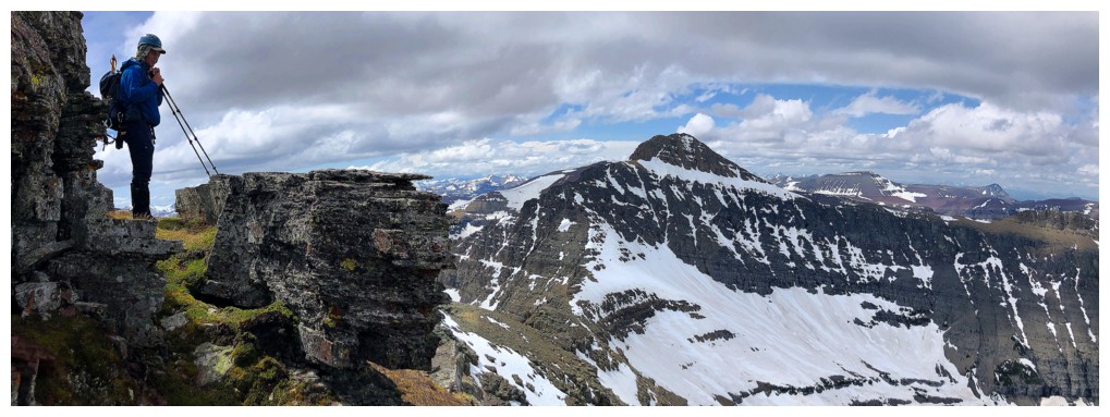
Reunited. The ridgewalk and summit of Cloudowan at the right (photo by Dave)
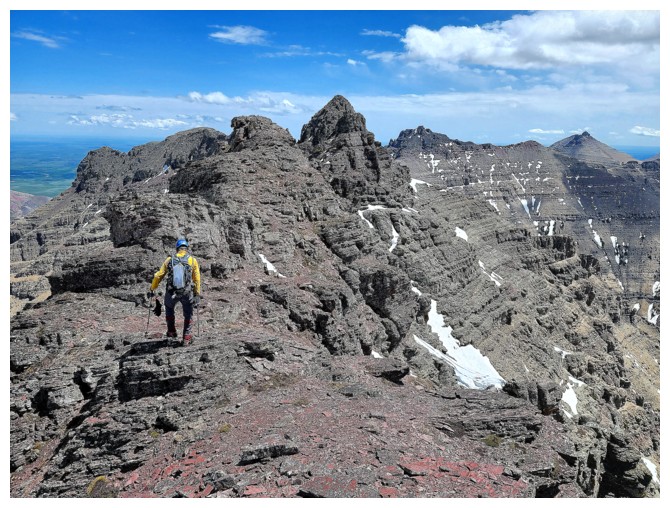
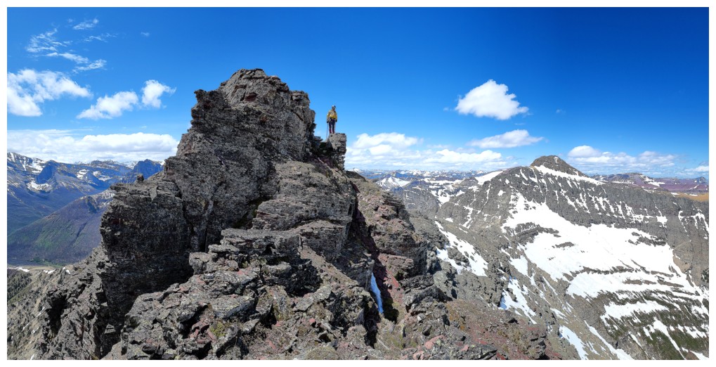
Embarking on the fun and interesting ridgewalk (photo by Dave)
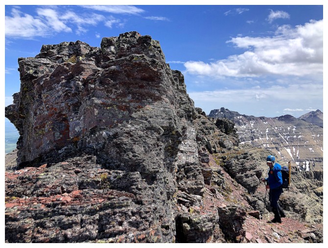
Lots of bypassing pinnacles on the ridge
Bypassed this one on the left (photo by Dave)
Dave captures a terrific photo on the bypass (photo by Dave)
Not sure what side we took here
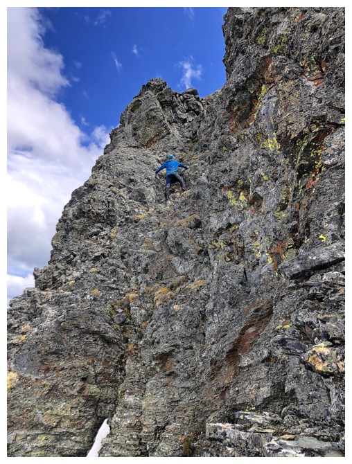
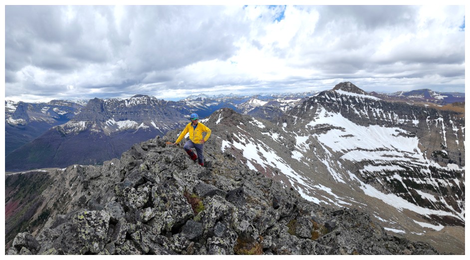
Back on the ridge and enjoying pleasant scrambling in fantastic surroundings
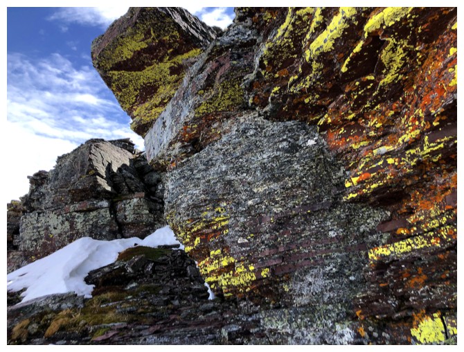
Gratuitous lichen shot
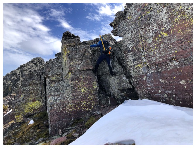
Dave scrambles back up to the ridge
Some stemming required (photo by Dave)
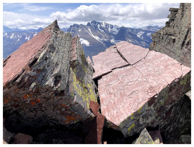
Always a treat to see Blakiston framed between two huge chunks of red argillite!
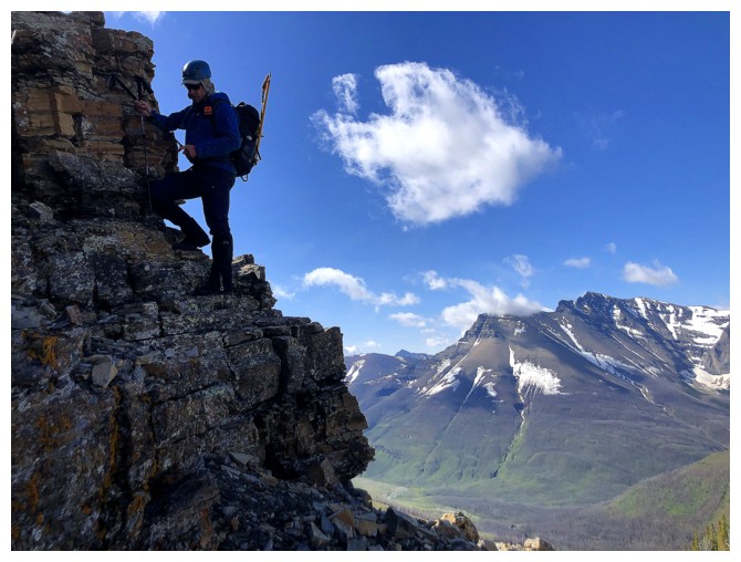
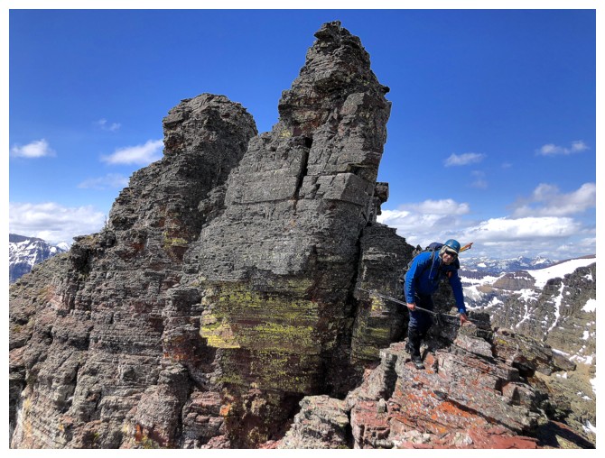
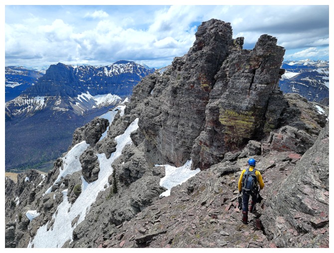
Dave closes in on the summit block
And the great weather is still holding (photo by Dave)
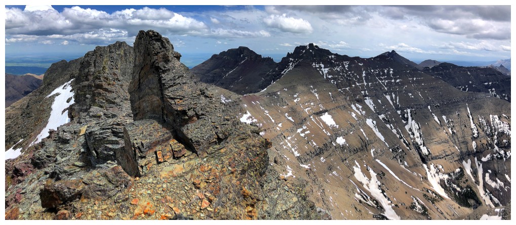
Mount Roche (left) and Mount Yarrow (photo by Dave)
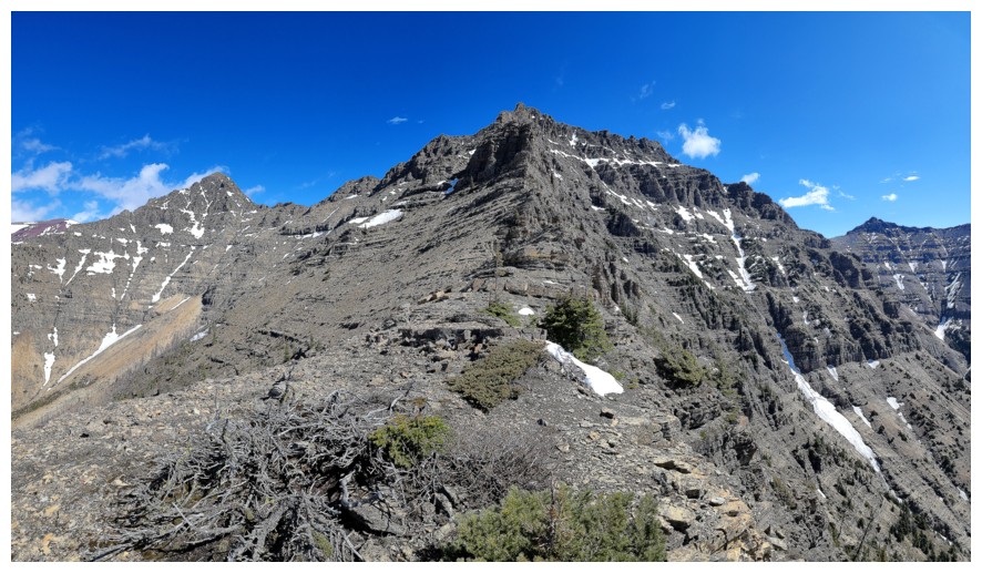
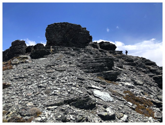
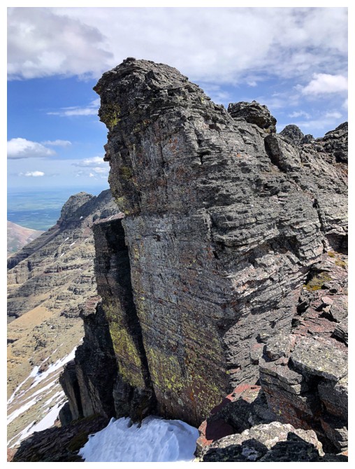
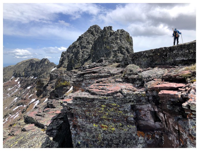
 The summit block
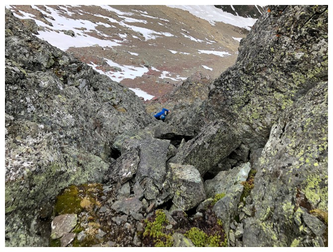
 Traversing around the left side to find the ascent gully
 Still traversing. These snow slopes deserved respect
.
 Once again, Dave leads the way
 And I follow (photo by Dave)
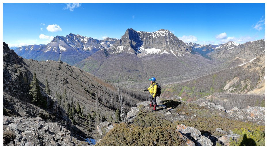
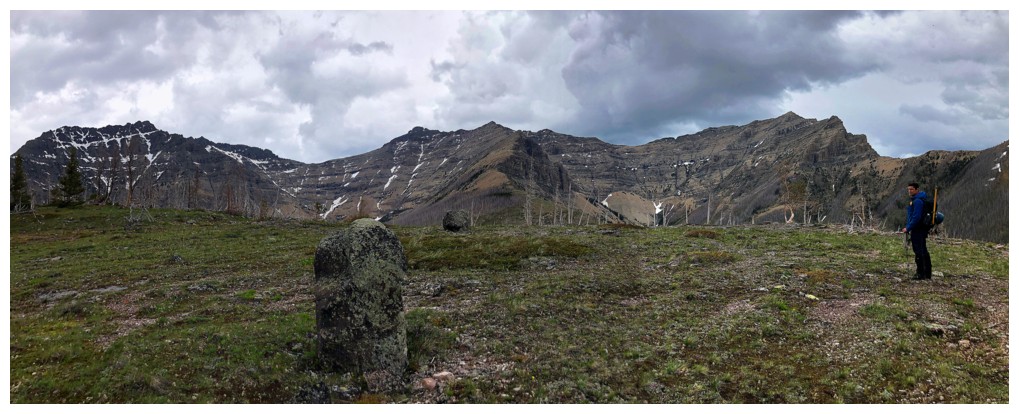
 At the east end of the summit block. The pinnacled ridge continues east
to a lower summit that I'd love to attempt one day from the Yarrow
Creek side.
At the east end of the summit block. The pinnacled ridge continues east
to a lower summit that I'd love to attempt one day from the Yarrow
Creek side.
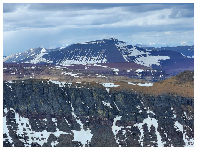
 Left to right: Cloudowan's east ridge, Cloudy Ridge Junior, Cloudy Ridge, Dungarvan, and Dundy
Dave attempts a very steep route on the east end
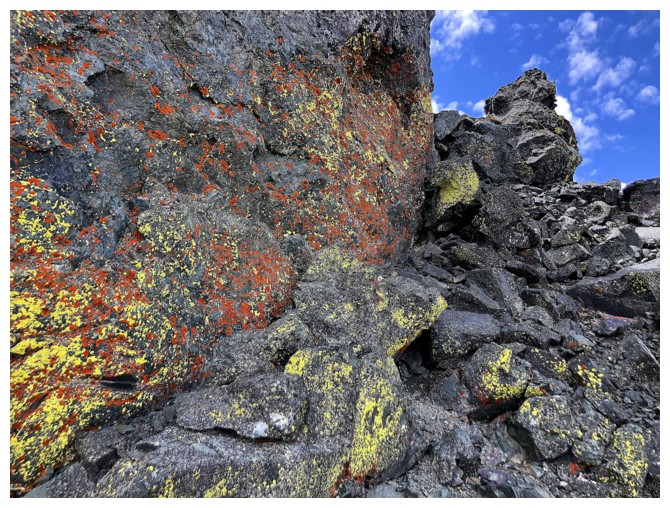
As always I'm distracted by lichen!
We took a short break here to contemplate our options. Decided to call it a day.......
 .....or
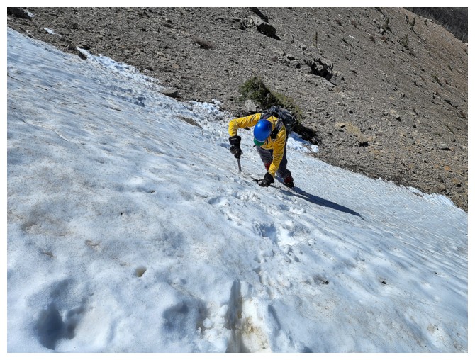
not. In a last ditch effort, Dave starts up the very challenging second
gully (left photo), and gets about two-thirds of the way up (right
photo).
.....or
not. In a last ditch effort, Dave starts up the very challenging second
gully (left photo), and gets about two-thirds of the way up (right
photo).
After deciding the wet terrain was too risky, Dave carefully downclimbs
 Victoria Peak
 Dave leads the first and correct gully
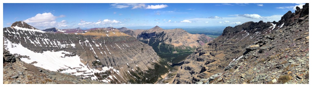
Dave's to the east view from the summit (photo by Dave)
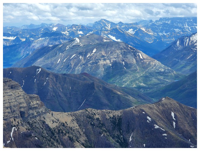
Diminutive Mount Crandell has many routes up (photo by Dave)
So does Loaf Mountain (photo by Dave)
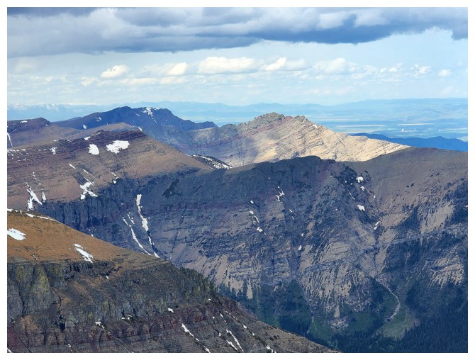
Bakery Peak (getting Sun) is the east end of Loaf and has an awesome scramble route (photo by Dave)
My view of Dave....
.....his view of me (photo by Dave)
View to the east
View to the north. The clouds are rolling in so it's time for us to roll out.
Insanely contrived pose! (photo by Dave)
Dave carefully downclimbs the gully
I do too (photo by Dave)
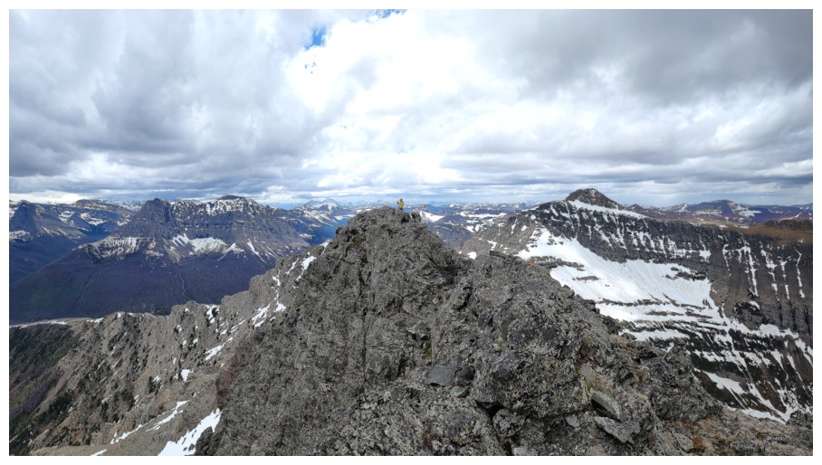
Back on the summit ridge (photo by Dave)
Dave at the location of the great photo
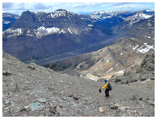
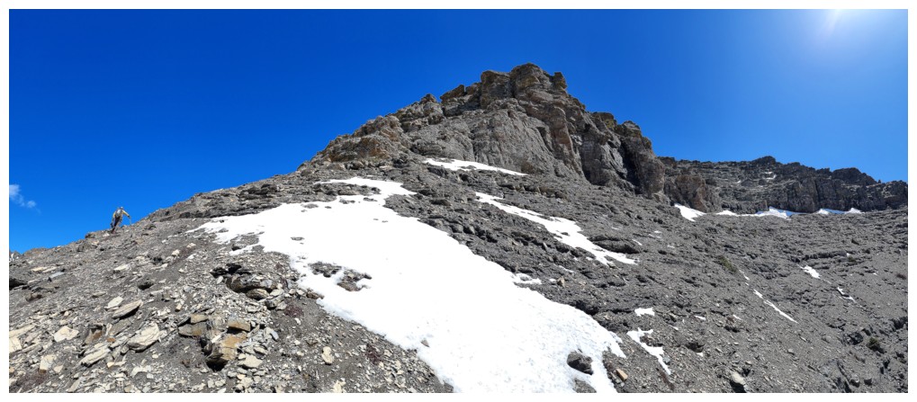
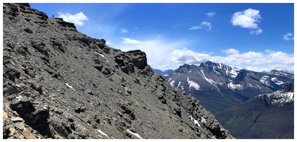
Searching out good scree slopes made easy work of the descent (photo by Dave)
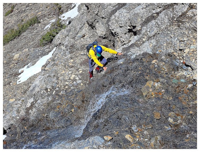
Still a few steps of scrambling required, but nothing too challenging
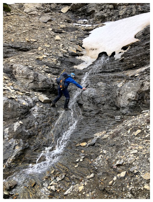
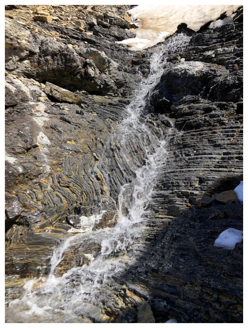
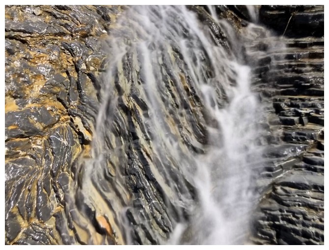
And one careful step across a small waterfall
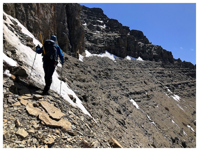
The
only downside of our descent route was a fair amount of traversing
(left to the left, given that we are now going in the opposite
direction!) (photo by Dave)
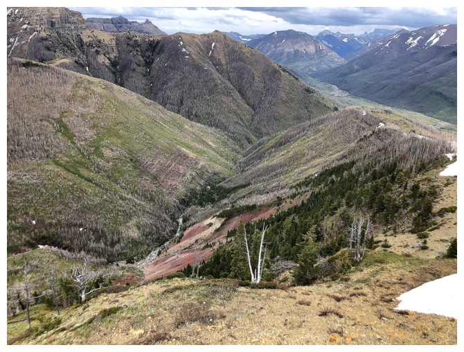
The noticeable patch of red argillite kept drawing my attention. It
would be accessible by following Red Rock Canyon - future trip!
Yep....still staring at it! (photo by Dave)
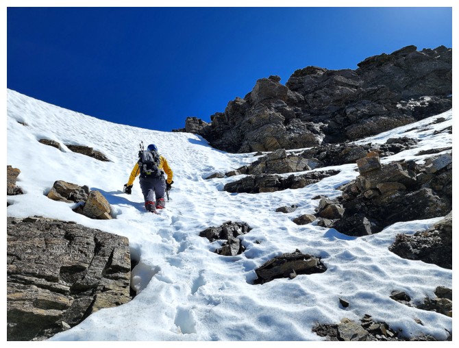
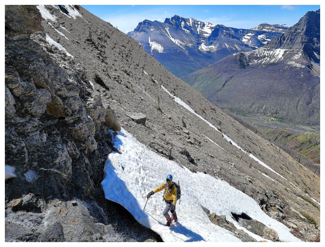
Descending the snow was super easy and fun (photo by Dave)
Ominous clouds ahead
Back at the end of the ridge, checking out a random rock and the view of Cloudowan, Cloudy, and Dundy
No more blue skies, but Anderson still looks good
Dundy Junior
Following a small but scenic stream down
Same as above with Crandell
Dave is almost back to the trail and we seem to have escaped the predicted rain
Back on the Snowshoe trail (photo by Dave)
The End
LOG