Dolomite Peak
Southeast Ridge
March 6, 2022
Mountain height: 2730 m
Elevation gain: 875
m
Round-trip time: 5:55
Solo snowshoe.
I hope Mike Potter is getting the love he
deserves for his outstanding guidebook Ridgewalks in the Canadian Rockies.
The book is a goldmine of excellent trips, some of which are overlooked because
they do not reach the true summit of a mountain, or perhaps because they lack a
specific name – for the latter, “Black Brett” comes to mind; excellently
described in the 2001 edition of Ridgewalks, Potter identifies this significant
mountain as “Unnamed peak in Massive Range”. The unofficial name of “Black
Brett” seems to have been coined recently and thus the mountain has also received
more attention.
 The other aspect of Mr. Potter’s book that I
love is his commitment to thoroughness. It is clear that he has fully explored
all potential routes up his objectives, often creating terrific loop routes in
the process – “Molarstone Mountain” stands our here. Although I initially
received my inspiration for this peak from another star of the Canadian
Rockies, Mr. Graeme Pole, Potter has this outstanding peak covered in his book and also
with multiple route options.
The other aspect of Mr. Potter’s book that I
love is his commitment to thoroughness. It is clear that he has fully explored
all potential routes up his objectives, often creating terrific loop routes in
the process – “Molarstone Mountain” stands our here. Although I initially
received my inspiration for this peak from another star of the Canadian
Rockies, Mr. Graeme Pole, Potter has this outstanding peak covered in his book and also
with multiple route options.
Admittedly, I’m guilty of skipping over the
odd Potter trip and the Southeast Ridge of Dolomite Peak was one of them. The
Matthew’s and Sandra
enlightened me to the error of my ways with great trip reports from
2021. And so, the stage was set. Unfortunately, my snowshoeing
partner for the day bailed at the last second, turning the trip into a
solo
one.
I parked at the Mosquito Creek parking lot,
necessitating an extra 1.1 km of walking each way, but all on the road.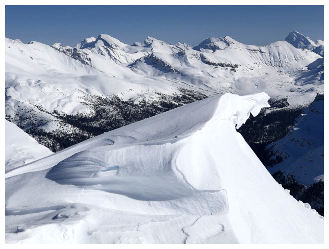 With
snow piled high on either side of the road and only half the shoulder visible,
I didn’t think for a second that parking off to the side was an option – the
proliferation of vehicles doing exactly that proved me wrong when I returned 6
hours later!
With
snow piled high on either side of the road and only half the shoulder visible,
I didn’t think for a second that parking off to the side was an option – the
proliferation of vehicles doing exactly that proved me wrong when I returned 6
hours later!
The trip could be broken down into three
sections: 1. An easy ascent to treeline, following one of several packed down
trails; 2. A slightly more strenuous ascent to a point near the summit, where I
broke new trail throughout; 3. A brutally strenuous slog through waist-deep
snow to complete the final few metres of the trip.
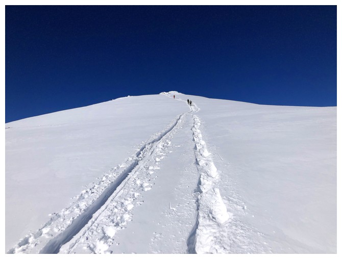
Above treeline, the views were outstanding
and only got better with each metre of elevation gained. Surprisingly, on what
was a perfect weather day, I appeared to be the only person on the peak. When
the packed down trail disappeared, I was forced to break new trail.
Fortunately, the snow underneath the fresh layer was firm and consolidated,
making for generally easy trail-breaking, even as the grade of the terrain
increased considerably near the end.
The last few vertical and several hundred
horizontal metres of the ascent, however, were a totally different ball game. In
short, it took me about 30 minutes to make a 10 m path through super deep, unconsolidated
snow, to a minor highpoint and then make a slow, sometimes tricky traverse over
to the summit, not more than 100 metres away. I took my snowshoes off for this
section and had my ice axe ready to employ. The terrain wasn’t super exposed,
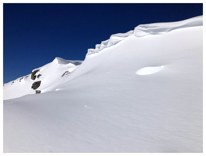
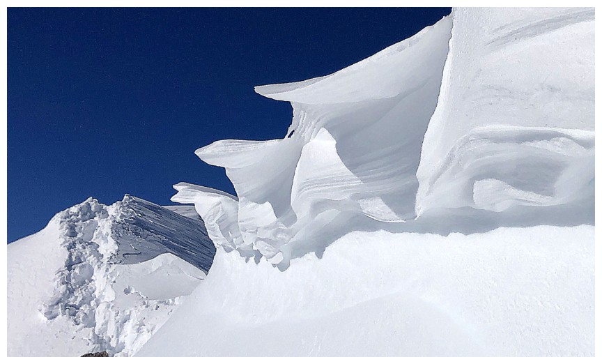
however, large cornices were cause for slow and cautious travel and lots of
probing. One particularly cornice, at the beginning, was also cause for a
billion photos – cornices are clearly my “winter red argillite”!!
My summit stay wasn’t long (the ascent had
taken a full hour longer than expected), but what a view! Of course, the
striking, stegosaurus-like summit block of Dolomite Peak blocked much of the
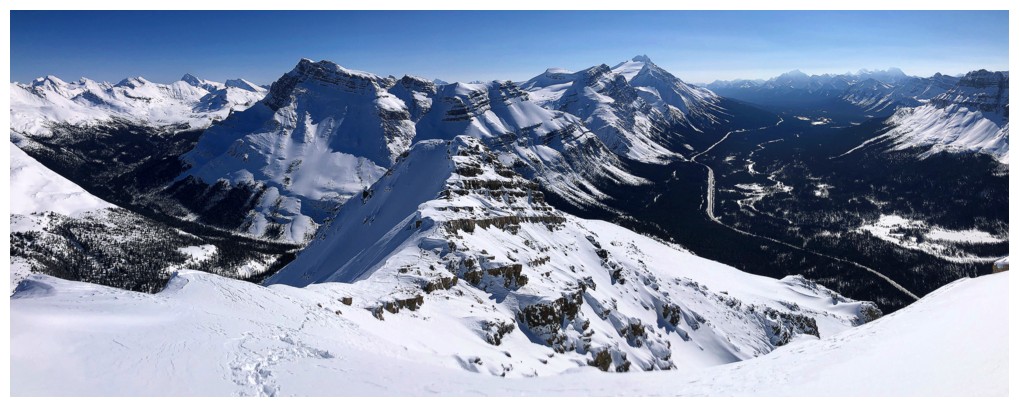
view to the north, but the panorama in every other direction was fantastic.
Seeing a few old favourites, like Mosquito Mountain, Noseeum Peak, and OXO
Peak was especially nostalgic.
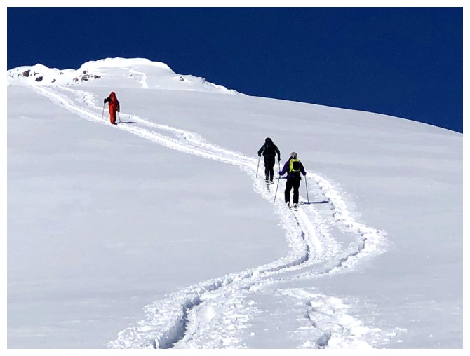
On
descent, another round of cornice photos
preceded a super easy and almost effortless descent. Along the way I
stopped
and chatted with several very friendly skiers on their way up, and then
a few
more. As it turns out, I was far from the only person on the mountain
and saw at least
10 other humans, including a trio of (again) friendly snowshoers. They
had
ascended from the west side of the peak, as opposed to the east side
where the majority of tracks were. Never wanting to pass up on an
alternate descent route I
followed their tracks with ease to a point a few hundred metres north
of where
I left the road at the start.
A wonderful day with the best of everything.
Thanks to Matt, Matt, and Sandra for their trip reports and of course to Mike
Potter – a day after the trip I’m poring through his book for other ideas.
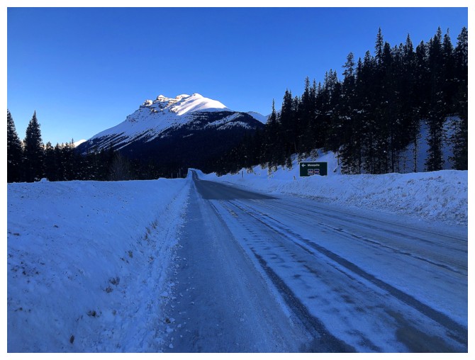
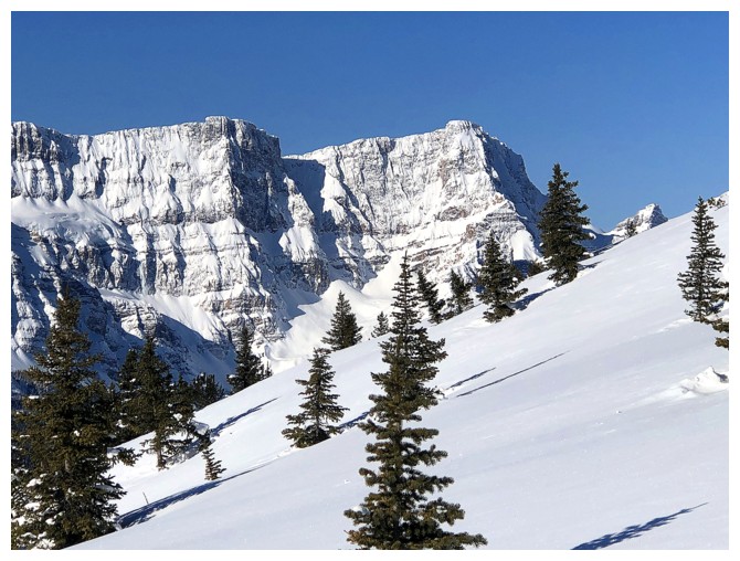
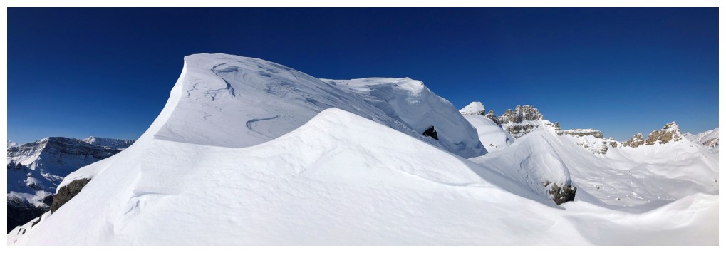
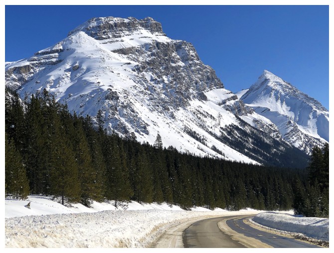
Dolomite Peak from near the Mosquito Creek parking lot. The southeast ridge is the getting lots of Sun already.
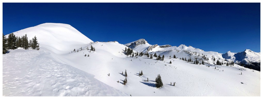
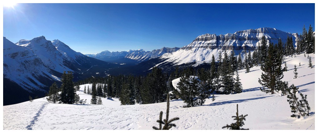
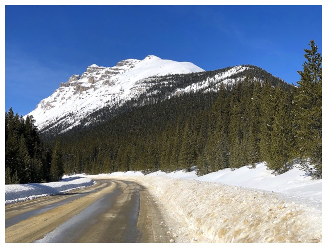
After a lengthy stint with limited views, the open slopes of Dolomite start to appear
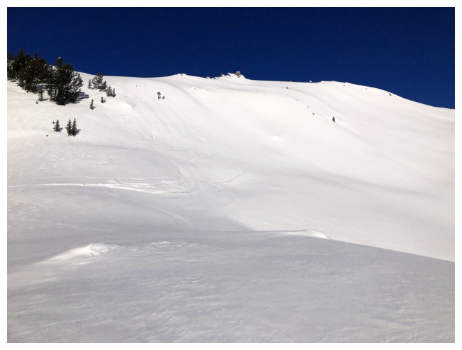
And then they REALLY appear!
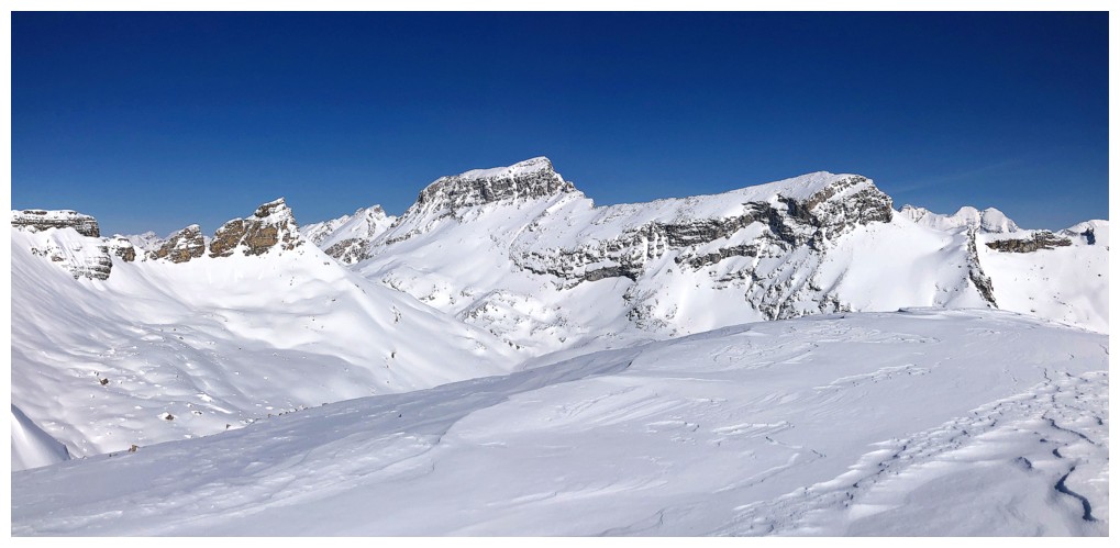
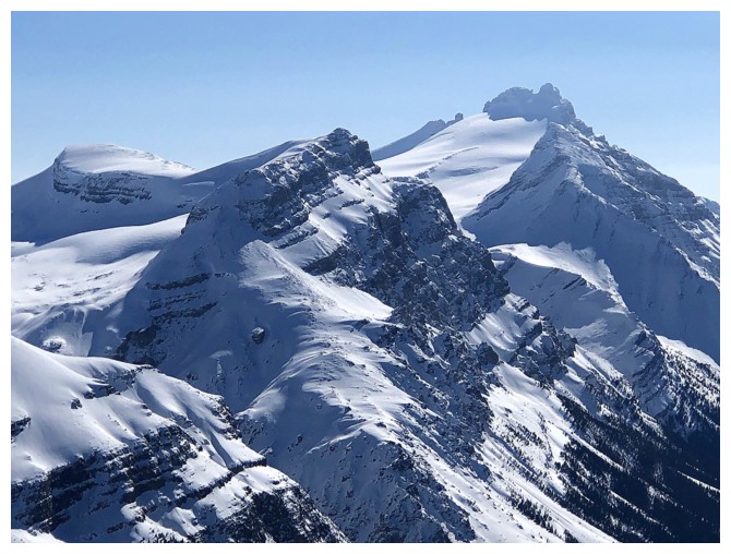
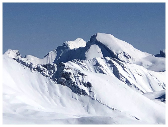
First view of the Quartzite, Ramp, and Mosquito trio. The peak to the left is an outlier of OXO.
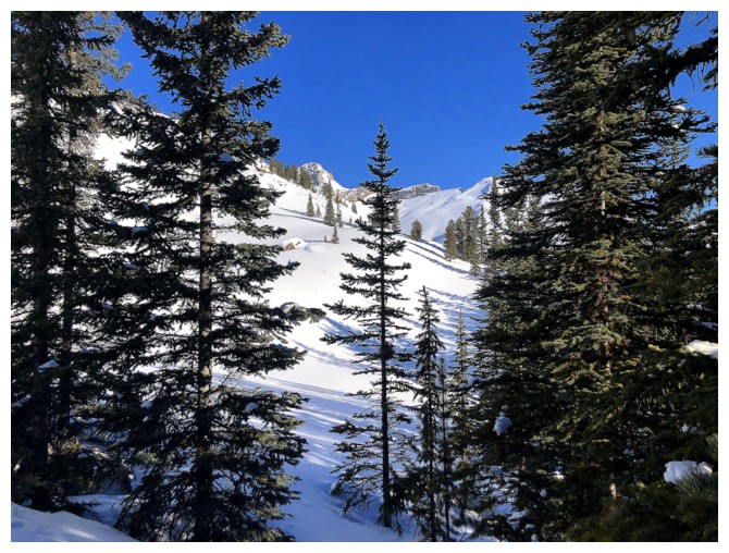
Back into the trees for a short section
And then right back onto the beautiful, open slopes
The view to the south is starting to open up
Closer look at the southern most highpoint of OXO. It's an easy and enjoyable ascent.
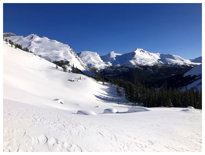
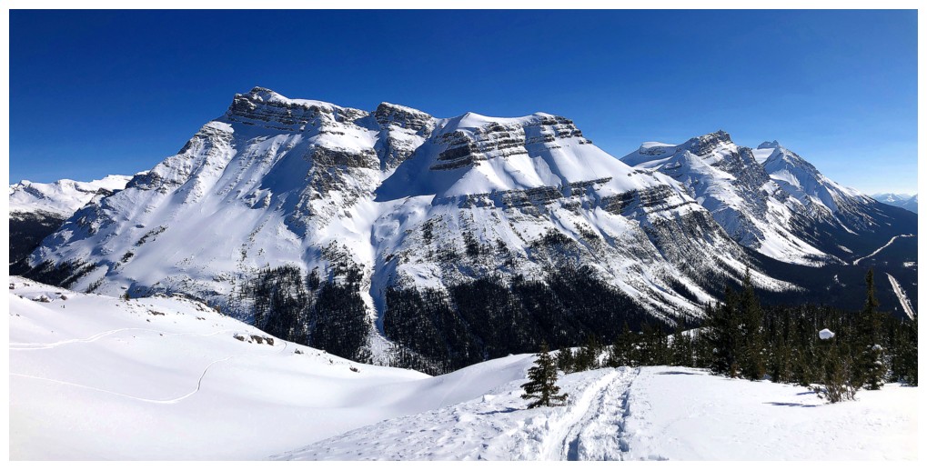
Ramp and Mosquito
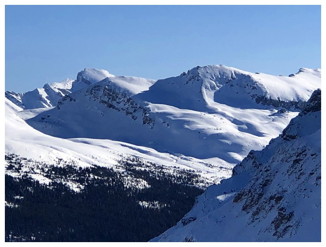
The north end of Molarstone Mountain
The north end of Crowfoot Mountain
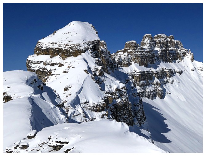
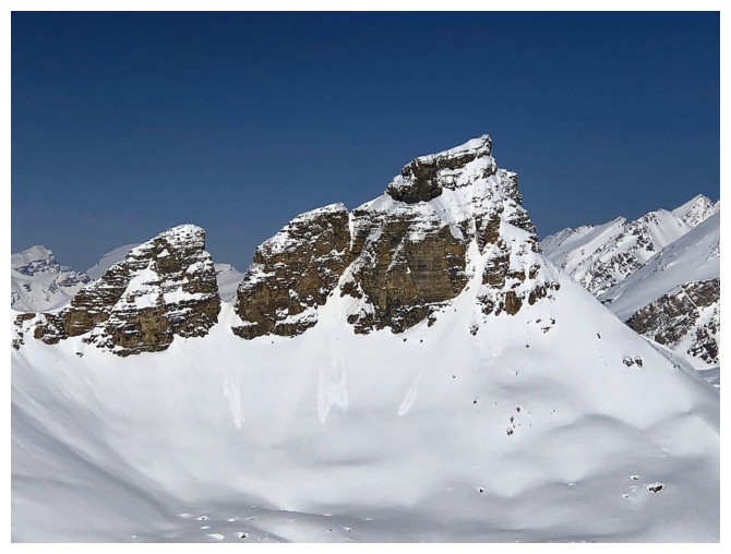
The second highest highpoint of OXO. Let's call it "OX Peak".
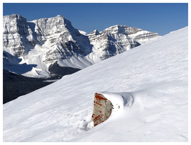
The 3rd - has to be "O Peak"! This one has some striking red rock on it.
Easy to see how Ramp Peak earned its unofficial name
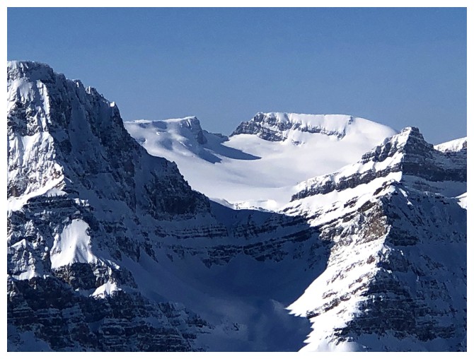
Portal Peak (left) and Mount Thompson on the Wapta Icefield
Given I was unlikely to see lichen on rock anywhere on this trip, I had to take a quick detour to see this
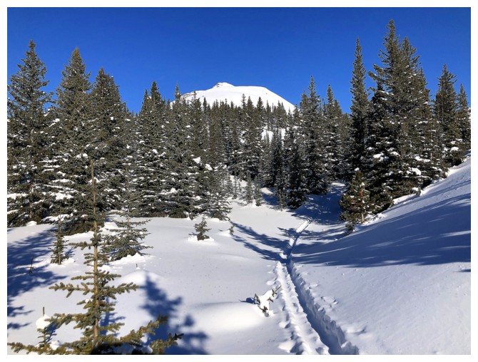
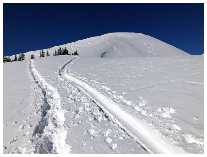
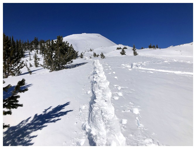
Breaking new trail, but it was easy breaking
Near 11,000 er Cataract Peak is framed between Molarstone and The Fang
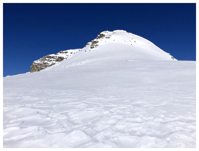
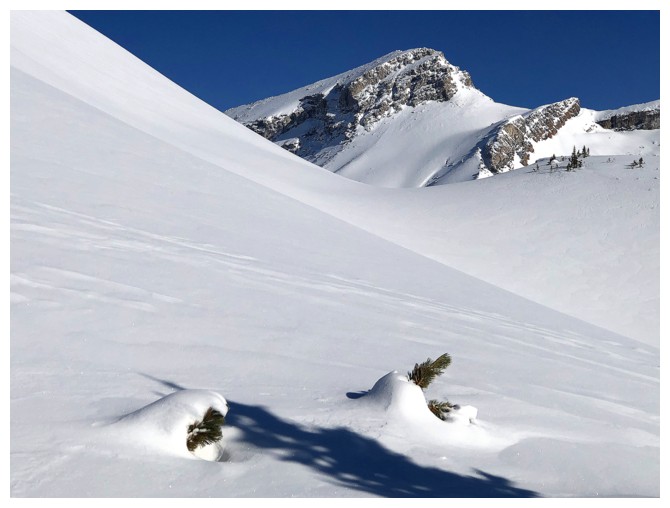
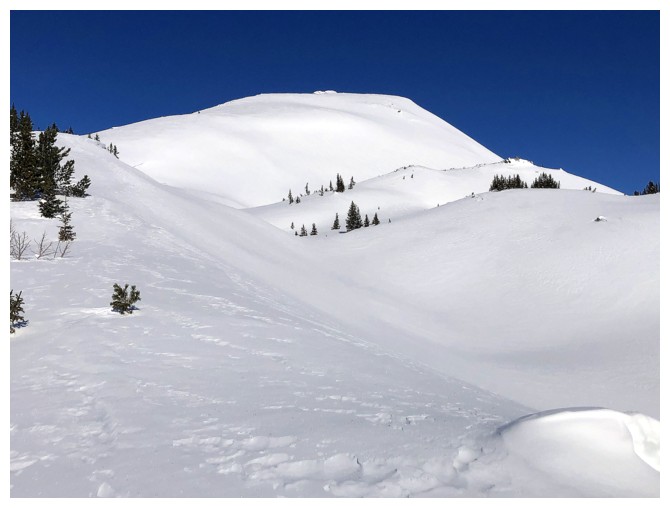
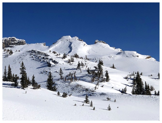
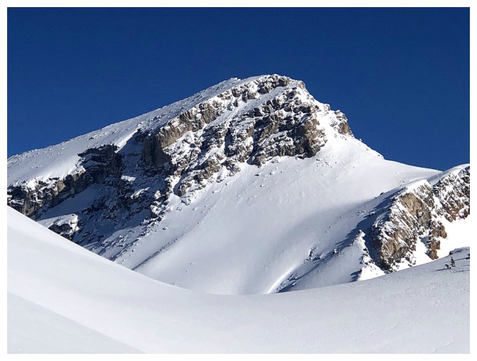
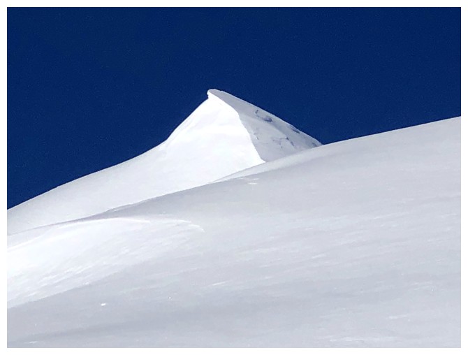
The upper slopes of the objective
Massive Mount Balfour
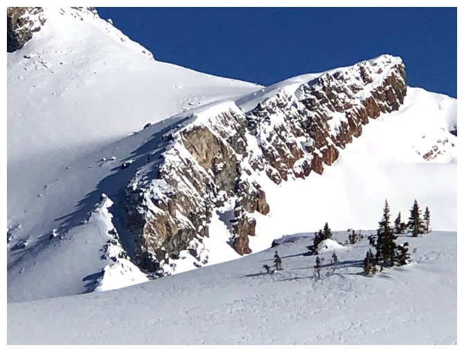
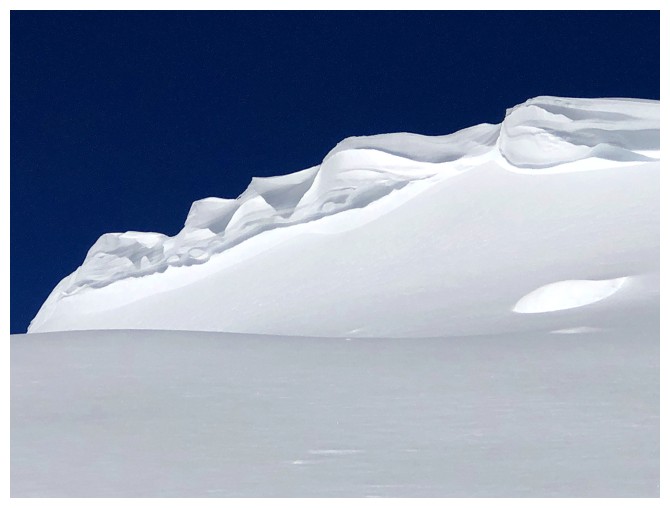
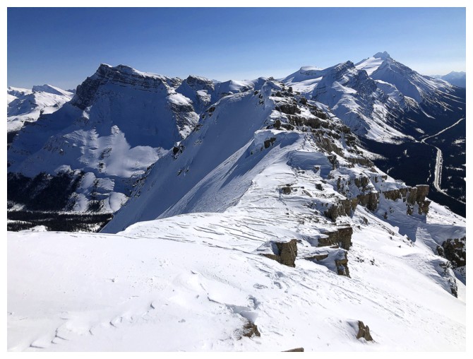
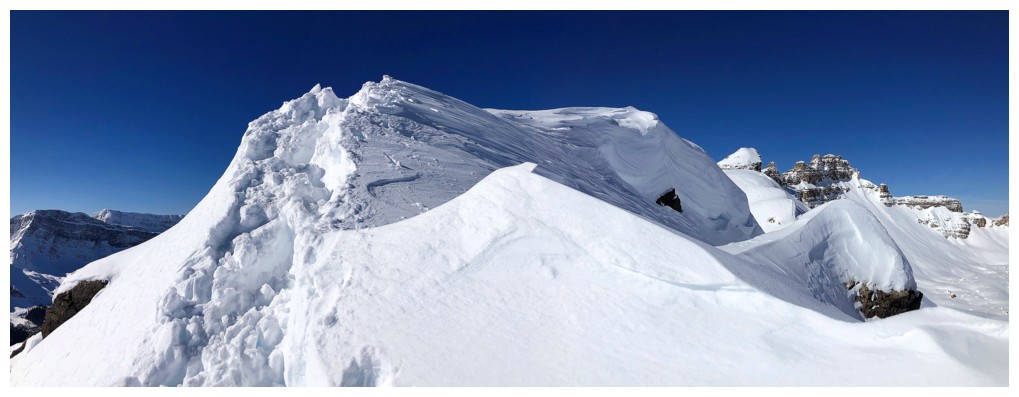
Approaching the upper section and crux of the trip
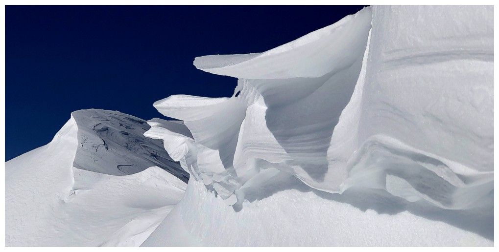
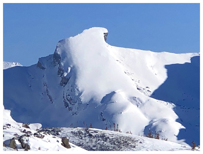
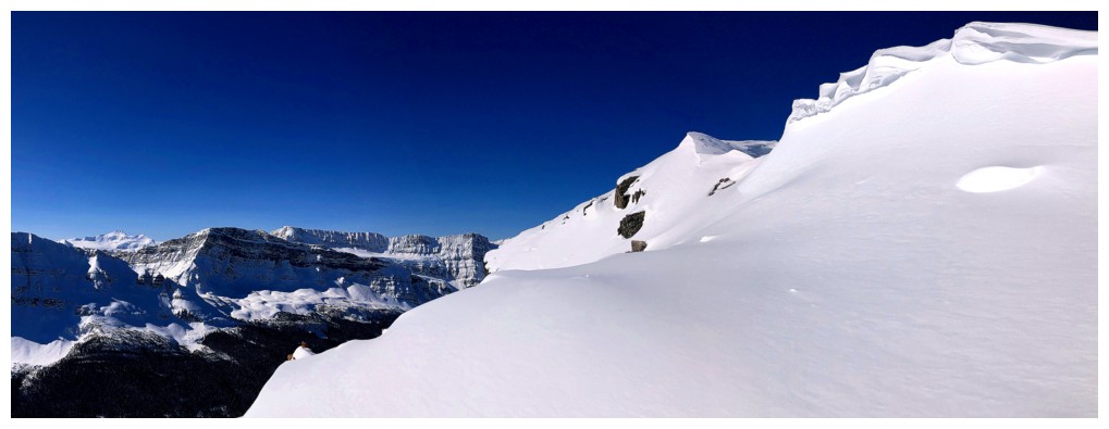
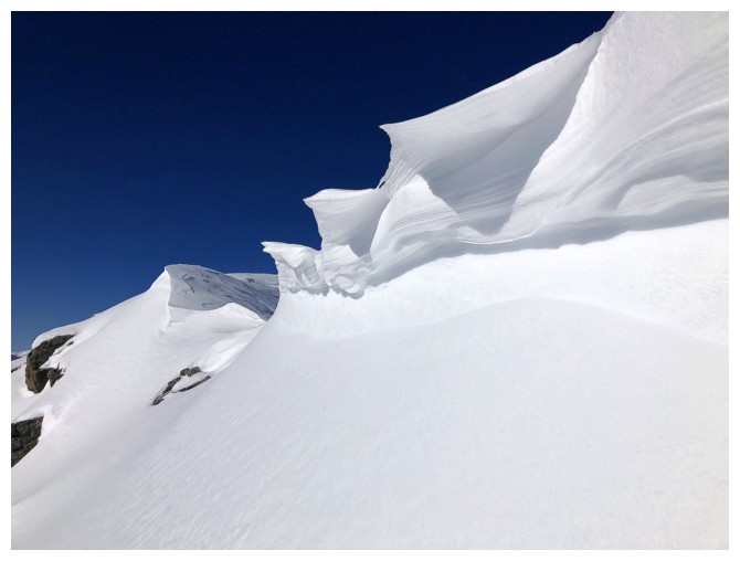
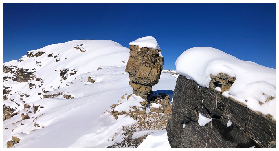
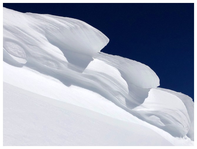
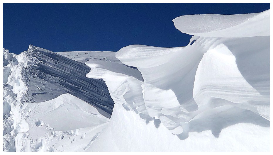
I knew right away that these snow features would suck me in - I have no willpower when it comes to red argillite and cornices!!
Close-up of one
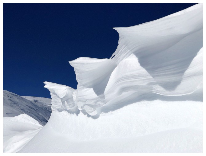
Closer look at the other, but of course I had to get REALLY close!
The southwest orientation of this cornice is a little unusual
Not a huge cornice but certainly shapely and unique
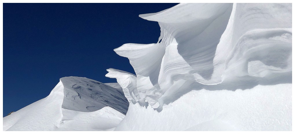
Mesmerized!
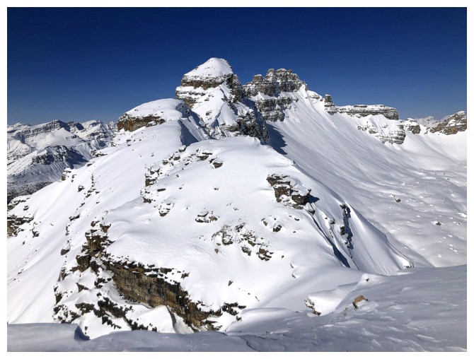
Past the cornice is this section. Although very short and
innocuous-looking, it took me about 10 minutes to wade through
about 20 m of snowy terrain.
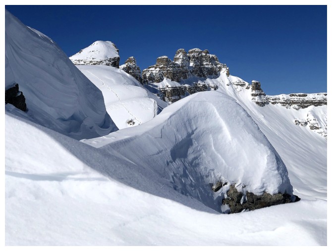
Great views though! OXO Peak and its outliers are featured to the north.
Lots of probing here. There wasn't much "mountain" on the right side
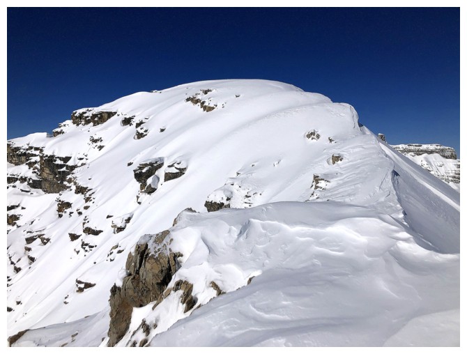
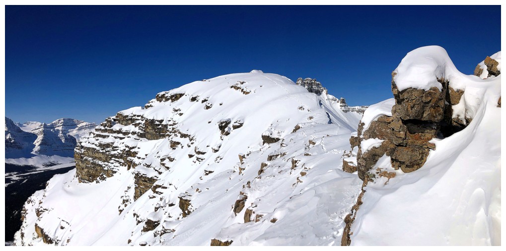
Atop the first section and looking to the summit. Again, traversing
this short section took way longer than expected because of the snow.
Looking back
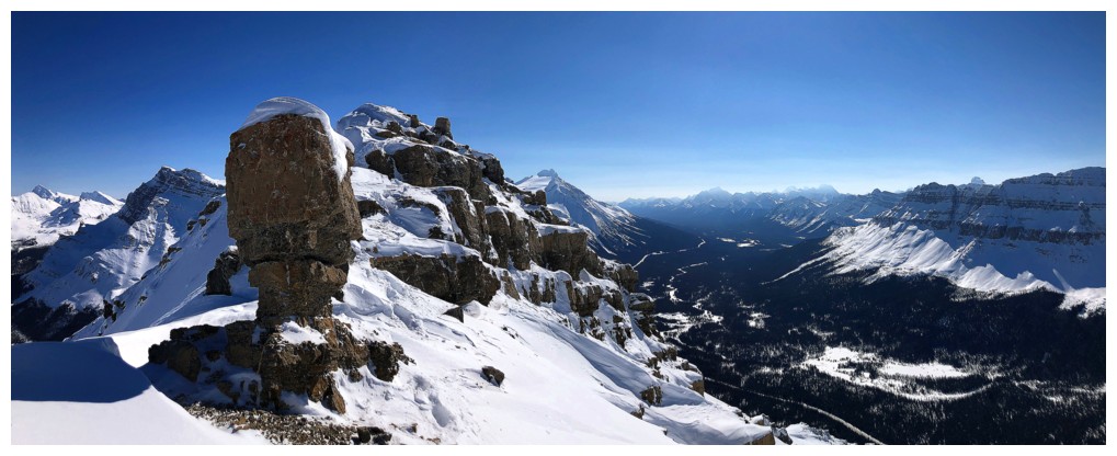
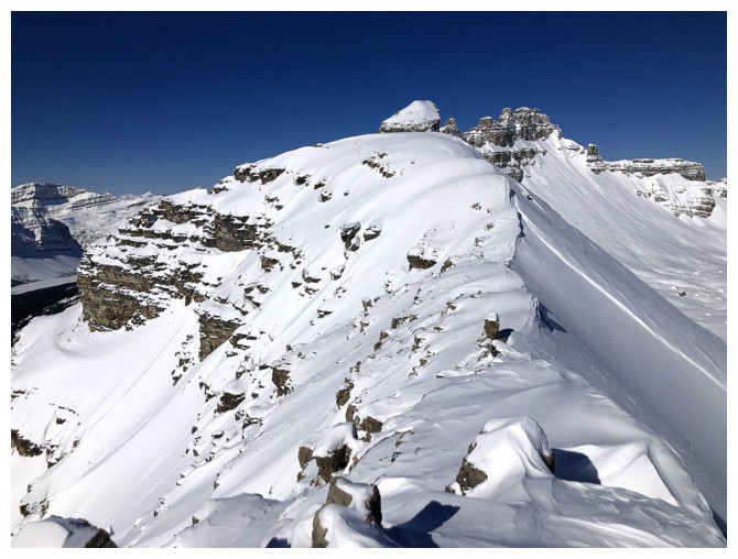
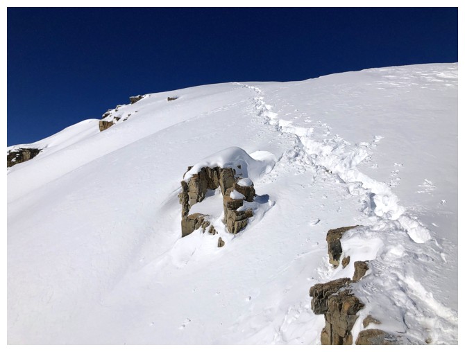
Interesting rock pinnacle on the ridge
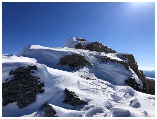
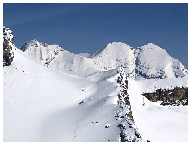
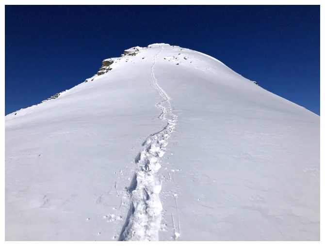
Almost there!
Looking back again - need to catch my breath
Finally!
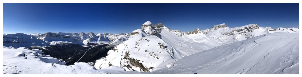
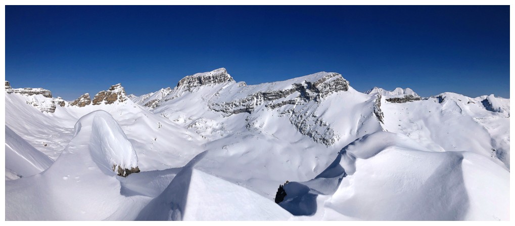
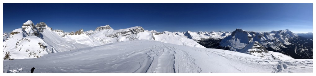
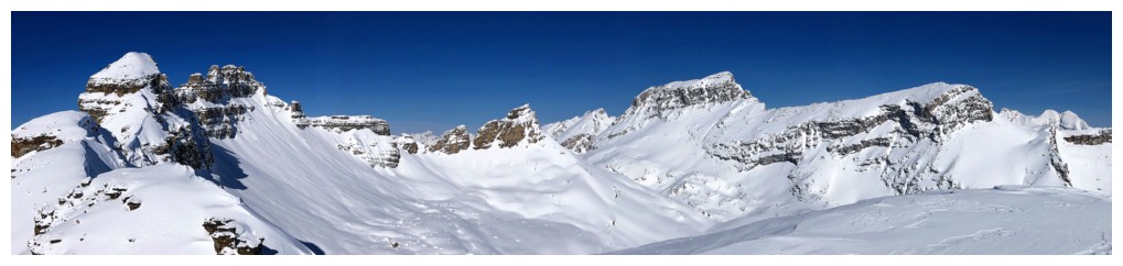
Summit panorama 1
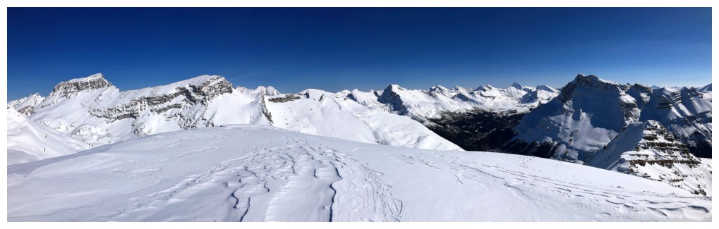
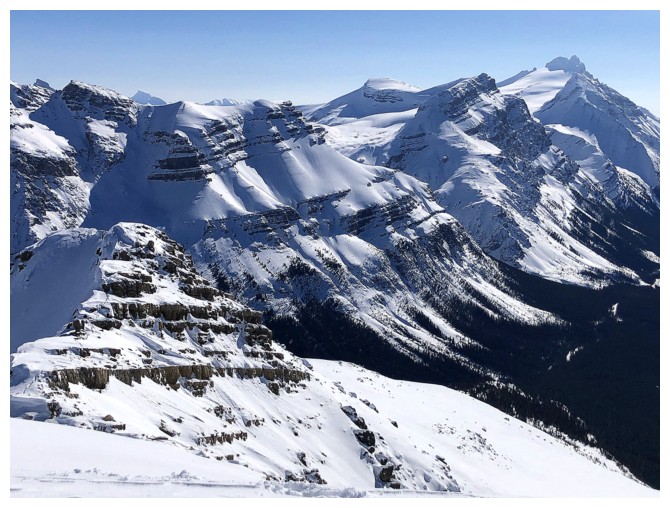
Summit panorama 2
Summit panorama 3
One of the true gems of the area - Noseeum Mountain. Another amazing Graeme Pole trip.
South of Noseeum sit Andromache, Little Hector, and Mount Hector
The Willingdons
OXO again
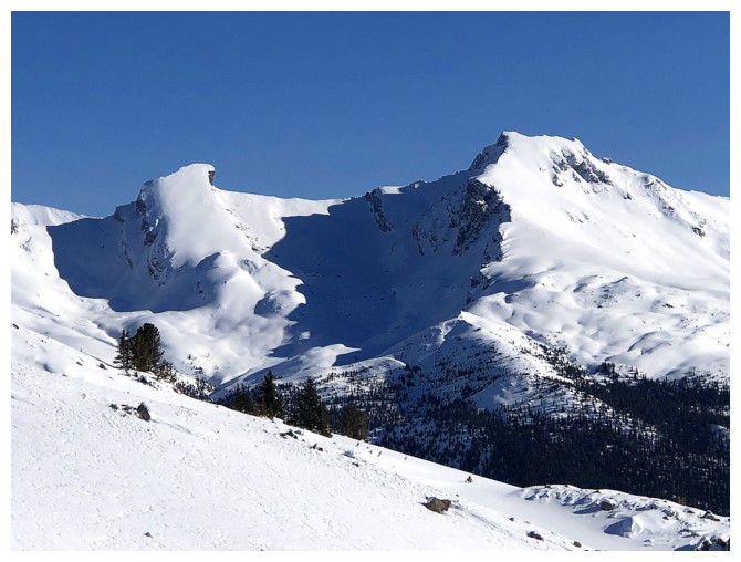
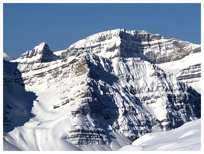
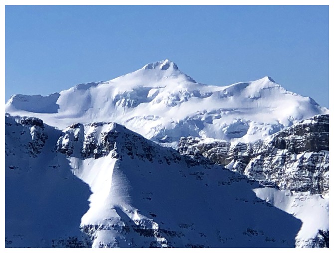
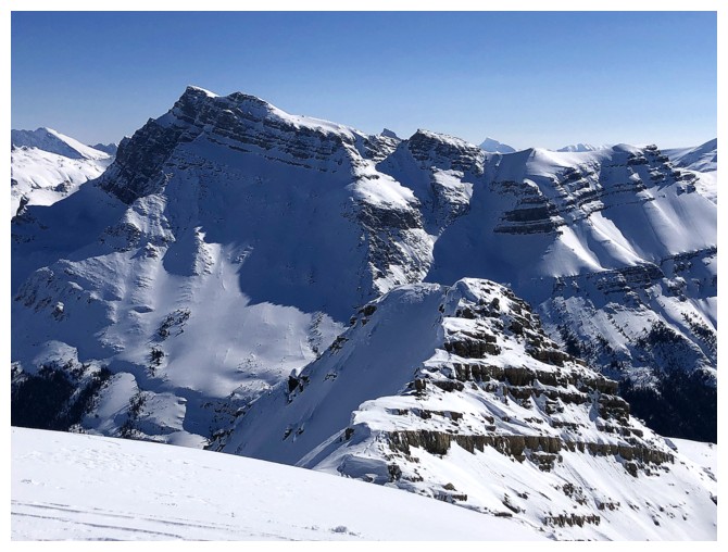
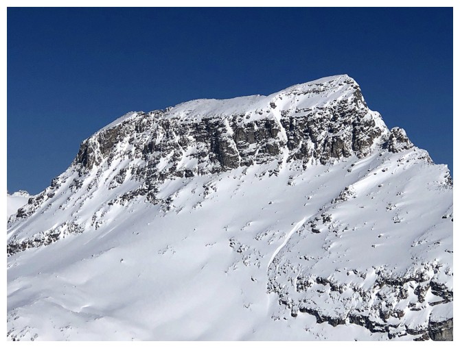
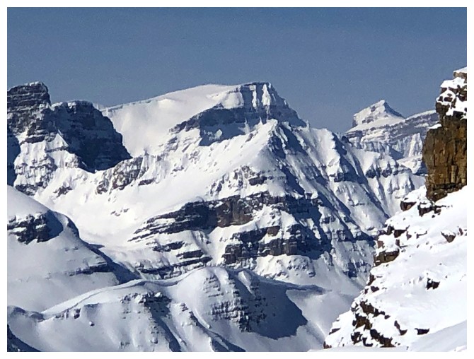
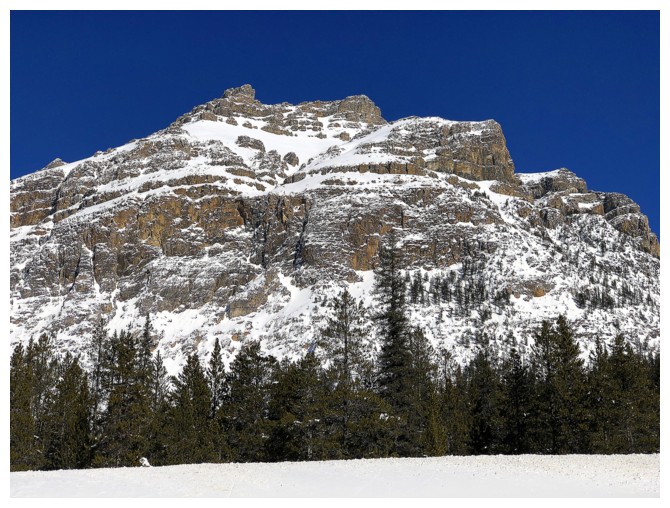
Closer look at Dolomite Peak
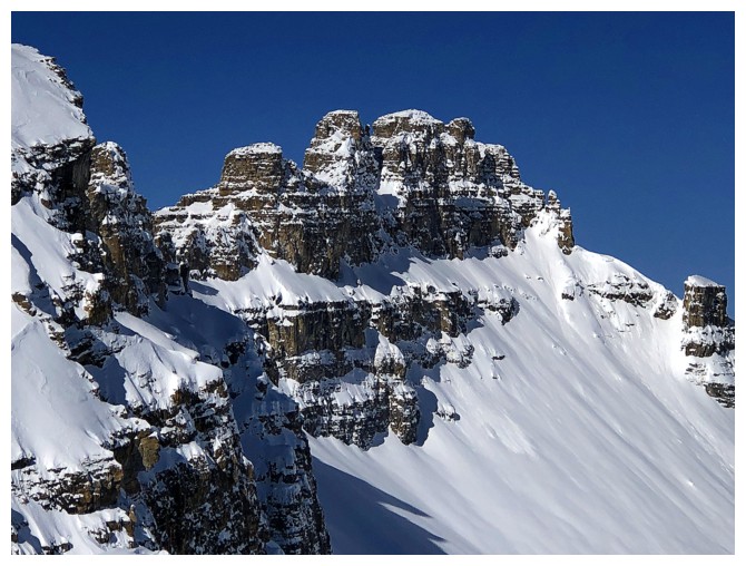
The summit block is made up of four distinct towers
Mount Rhondda (left) and Mount Habel
Close-up of Hector
Close-up
of the main summit block of OXO. Don't go near the west face route if
there are others ahead of you. Insane rockfall hazards and challenging
terrain!
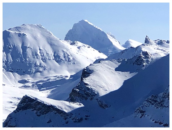
The northeast outlier of Dolomite is an impressive sight by itself
Nice peaks, but I'm not sure what they are
I think that's Mount Patterson, but don't quote me on it
Starting down

Back at that cool pinnacle
Took a slightly different route on return to avoid a short, but exposed downclimb
The short section that took 10 minutes on ascent. It was closer to 10 seconds on return.
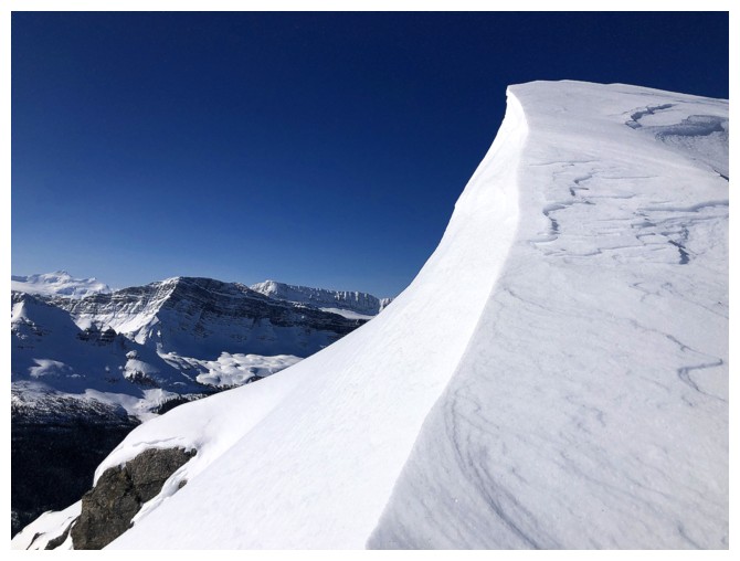
Curves of snow and Dolomite
Round 2 of cornice magic
Looking back to the summit block
The skiers with whom I had a nice conversation
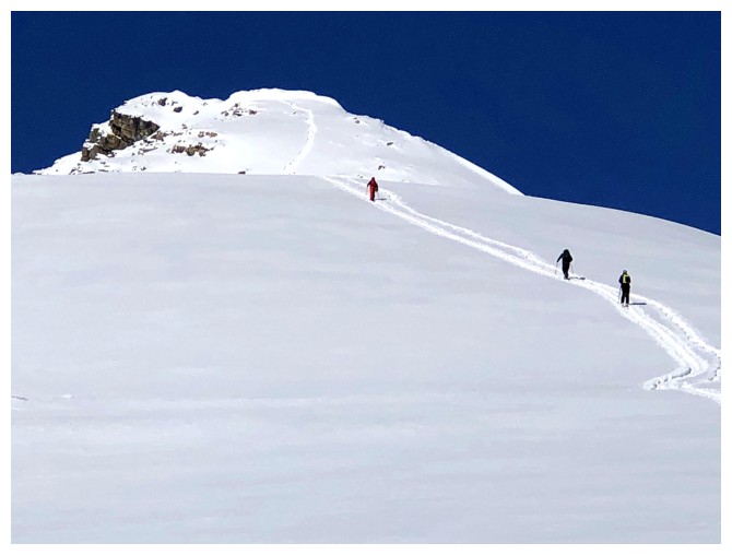
The slope to the right has seen a few turns during the day
Noseeum again
Parting look at those stunning, open, snow slopes, before heading into the forested terrain on the southwest side of the peak
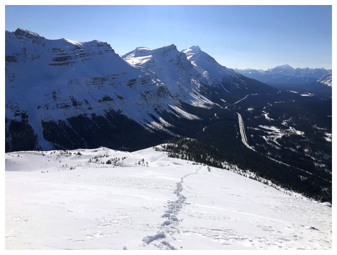
Hiking the road back to the parking lot and enjoying the impressive views of Andromache and Little Hector
The west side of the Noseeum Horseshoe
Last look at the objective
The End
LOG