Drywood Mountain VI
January 21, 2023
Mountain height: 2464 m
Elevation gain: 820 m
Round-trip time: 6:20
Solo scramble.
An odd but fantastic day out on a new route up Drywood Mountain.
My initial plan
was to attempt the “normal” route up, via a 4 km bike and ascent up the south
face. Unfortunately, my bike had a flat tire and so I resorted to hiking the
gas road. Two things prompted a change in plans: 1. a very strong headwind; 2.
a desire to be in front of a TV to watch the first football game of the NFL
divisional playoffs, at 2:30 pm. 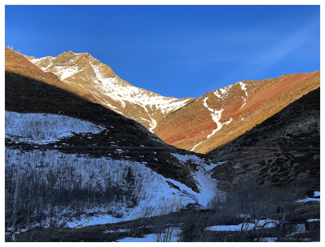 This weekend of football a year earlier had been the most
incredible weekend of football in my 44 years of watching the sport: 3 games
won on the last play of the game, and one in overtime, where 25 points were
scored in the last 2 minutes of the game to send it into OT. The Chiefs eventually beat
the Bills (42-36)
in overtime in what I would call the most entertaining game
in NFL history - at least in my almost 4.5 decades of watching!
(Actually, maybe tied with the 2018 classic Monday Night Football game
where the Rams beat the Chiefs 54 - 51 - given that I've been a Rams fan since 1979, a very biased opinion!)
This weekend of football a year earlier had been the most
incredible weekend of football in my 44 years of watching the sport: 3 games
won on the last play of the game, and one in overtime, where 25 points were
scored in the last 2 minutes of the game to send it into OT. The Chiefs eventually beat
the Bills (42-36)
in overtime in what I would call the most entertaining game
in NFL history - at least in my almost 4.5 decades of watching!
(Actually, maybe tied with the 2018 classic Monday Night Football game
where the Rams beat the Chiefs 54 - 51 - given that I've been a Rams fan since 1979, a very biased opinion!)
About 3 km into
the trip, I decided to bail on the normal route, the wind becoming more than a
mere annoyance. Reaching the top of a small highpoint on the ridge above my
present position seemed like a decent way to salvage the day. 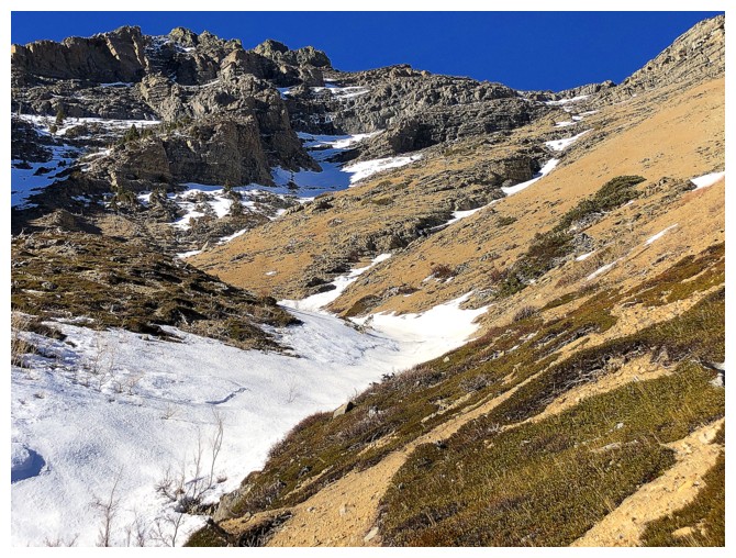 There did appear
to be a potential route all the way to the summit ridge of Drywood, but I was
quite convinced the wind would take exception!
There did appear
to be a potential route all the way to the summit ridge of Drywood, but I was
quite convinced the wind would take exception!
The ascent
started with a brief section of drainage, followed by a steep scramble to get
out of the drainage, and then the scenic highlight of the trip in the form of –
you guessed it – a stunning band of red argillite and rock of many more colours.
Easy terrain sat above the band and so I continued up, trying to stick to the ridge
as much as possible.
Eventually,
multiple rock bands of significant challenge forced me to leave the ridge and
into a drainage but the lay of the land continued to offer an easy route up.
Having said that, I could already see the infamous limestone rock band that was
sure to either stop me dead in my tracks or at least provide significant resistance
to upward progress. To my delight, I found a weakness through the band in short
order. The 5 m rock step was near vertical, but replete with great foot- and
handholds - felt like climbing a ladder!
Above the step,
the summit of Drywood was suddenly a real possibility. After slogging my way up
to the ridge, I found myself on familiar terrain between the summit and the false
summit of the northeast ridge route. A short scramble later and I was on the
summit, enjoying the fantastic view, but not the chilling wind that had been a
non-factor throughout the ascent.
Given the snowy mountain
conditions and the bitingly cold weather, descending the route I came up was
the only logical/sane way to get down and that’s what I did. After carefully down-climbing
the rock step and then slowly working my way down some tedious terrain, I was
rewarded with a decently long section of good scree surfing to end the
descent. The tailwind helped made easy work of the road hike back to the start.
Yet again, not
what I set out to do, but the mountains of Southern Alberta are full of
surprises, each peak offering a seemingly infinite variety of routes up to
their summits. Drywood Mountain delivers another terrific experience.
Epilogue: And
how was the Divisional weekend in the NFL? Well, it was no 2022! Two
games were blowouts. The other two salavaged the weekend with some intense and entertaining
moments. Onto the
Conference finals for next weekend!
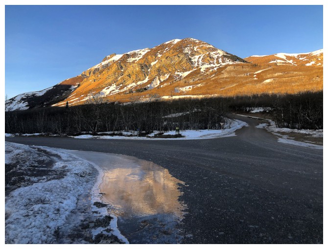
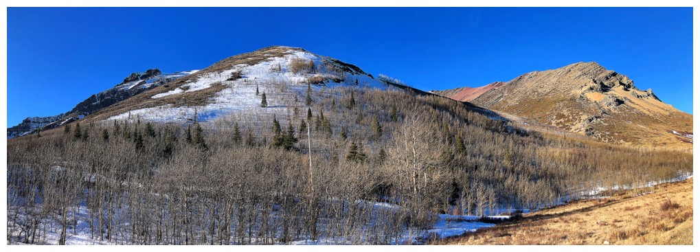
Drywood's eastern outlier, that we routinely call "Woody", slightly reflected in a frozen puddle
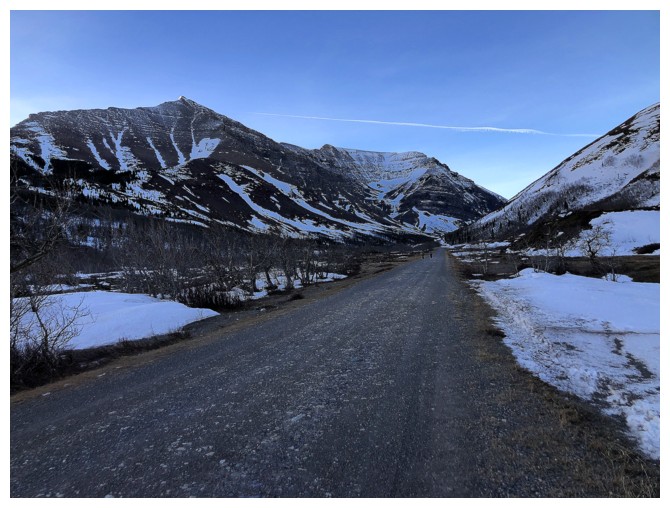
Hard to see but a couple of guys on bikes are heading up the valley
too. The wind was so strong, I almost caught up to them at one point.
They had to walk their bikes up everything that wasn't flat.
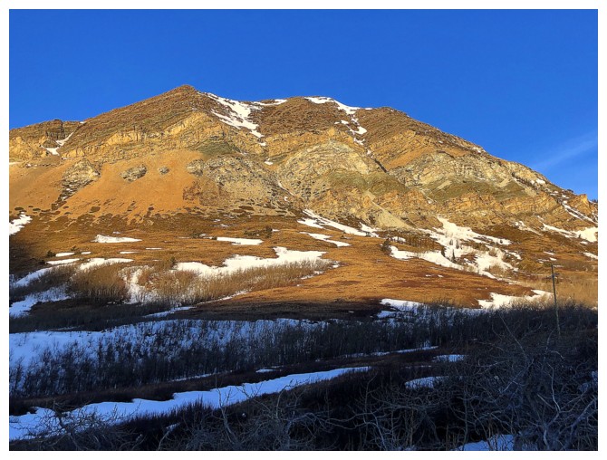
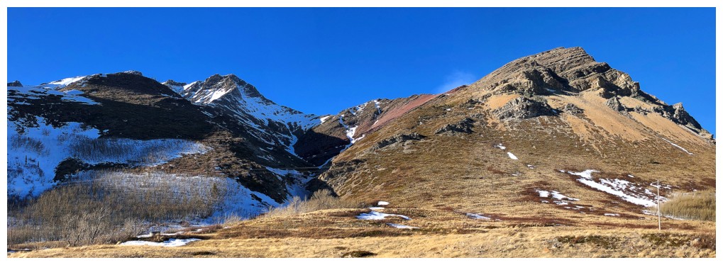
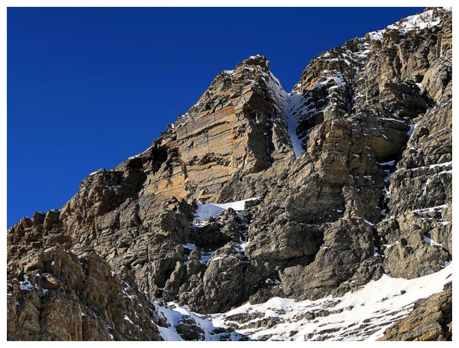
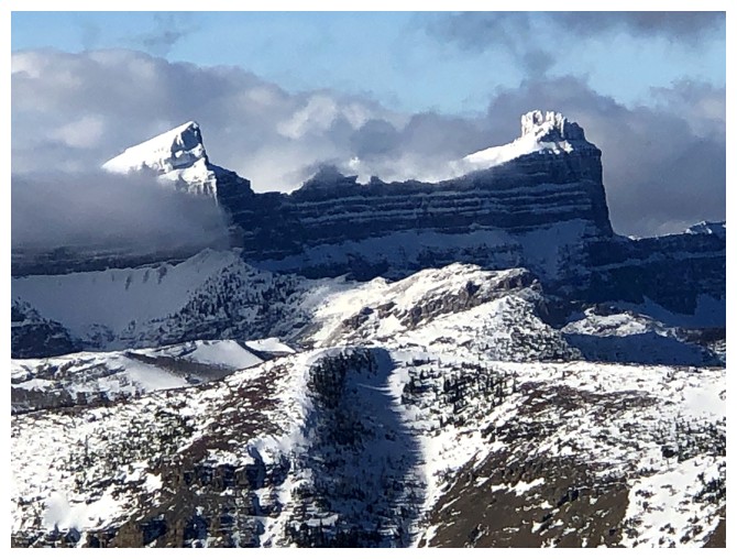
The southeast side of Woody is amazing and has numerous routes up though up its colourful rock: I, II, III, IV, V
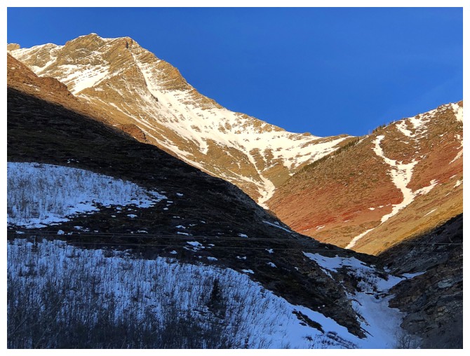
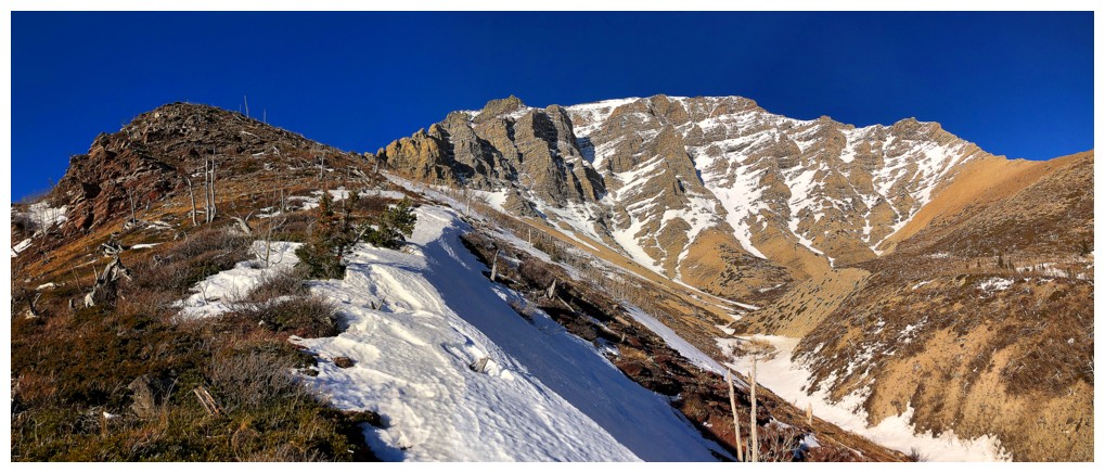
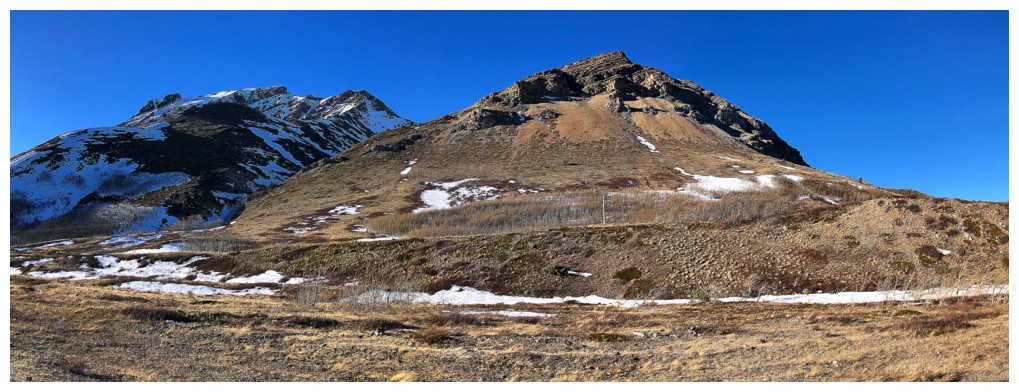
"The Knot", at the left, is a significant highpoint along the northeast ridge of Drywood Mountain and worthy of a visit
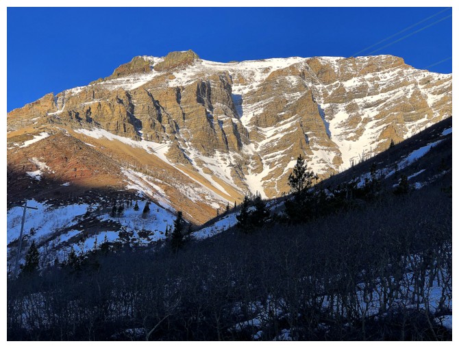
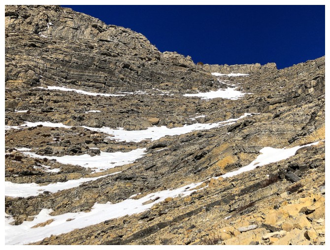
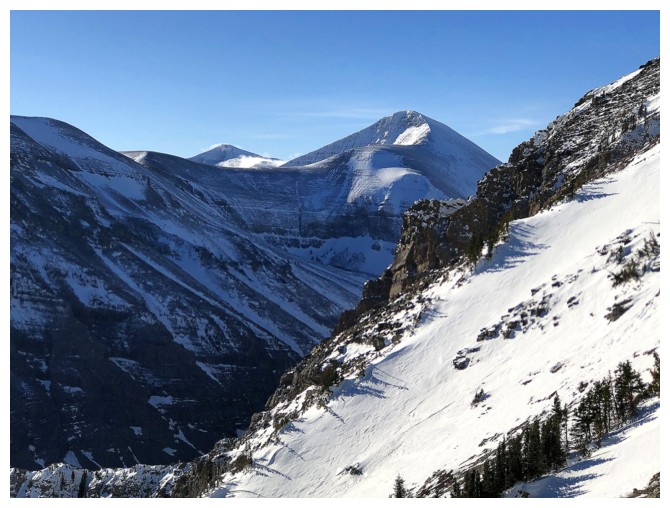
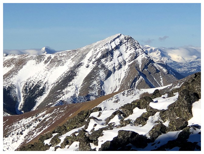
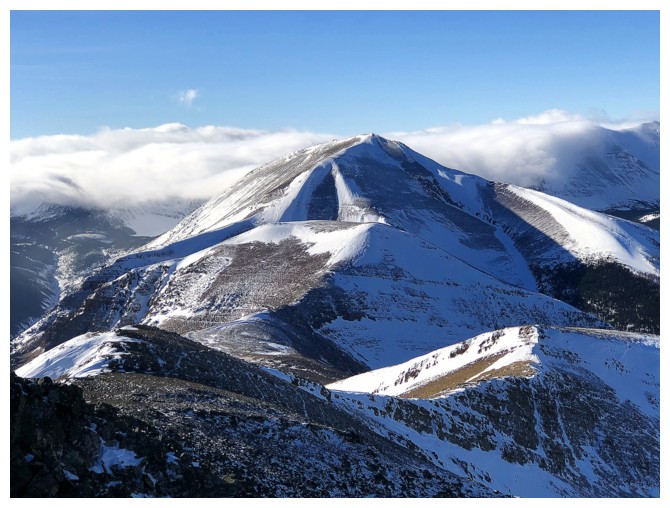
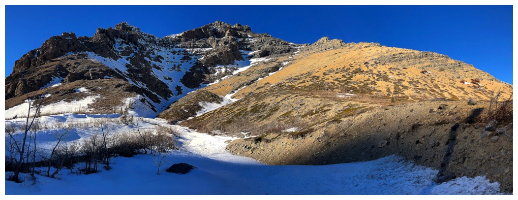
Drywood Mountain. The route I ended up taking goes to the left side,
then traverses right and up to the ridge in the centre, and then back
to the left to the summit.
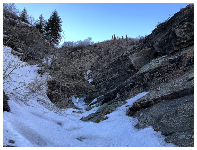
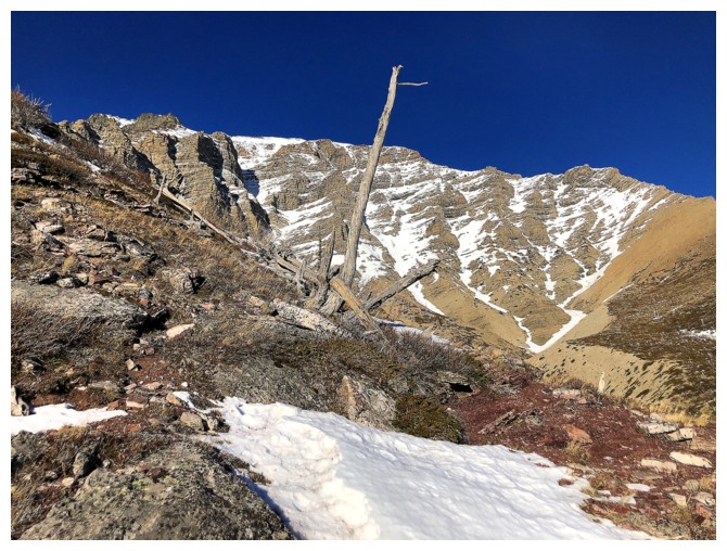
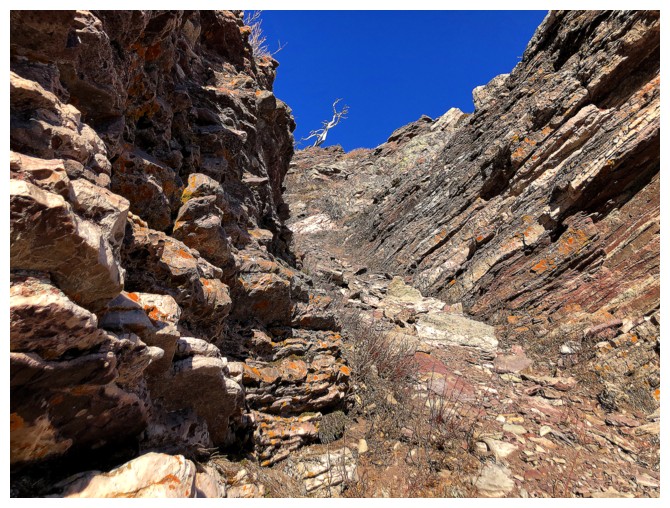
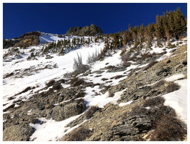
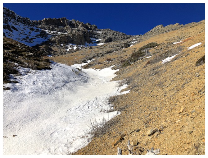
The start of the drainage I initially ascended
Without a couple of ice tools I'm not getting up this
Above the drainage and the start of the cool rock scenery
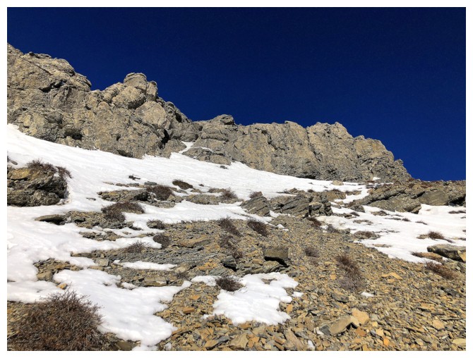
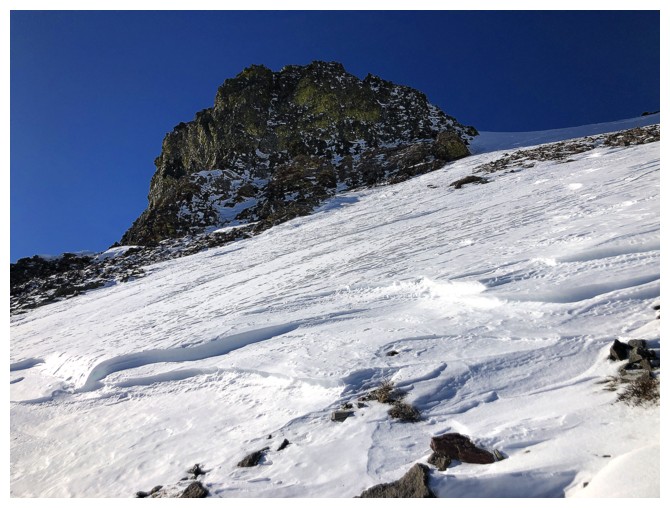
The highpoint ahead is the objective
Looking over to Drywood's northeast ridge
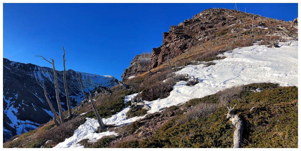
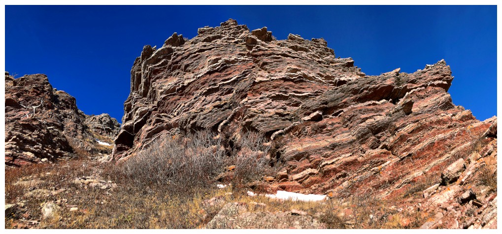
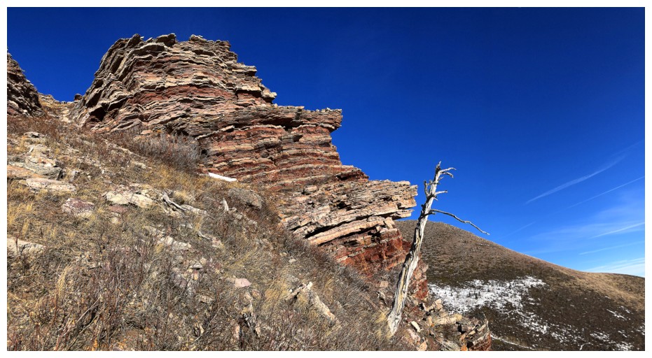
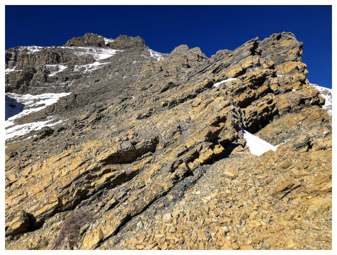
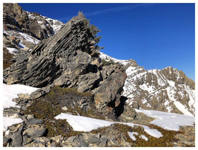
Approaching the highpoint. It appears to be comprised of my favourite type of rock
Things are looking good
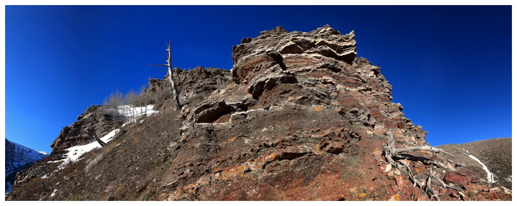
Confirmed. It's going to be red argillite heaven for a few minutes!
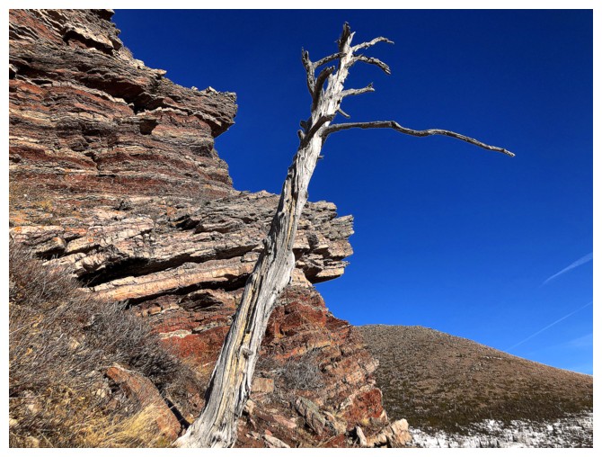
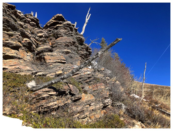
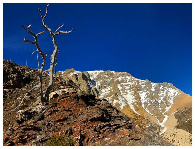
And a solitary dead tree to add to the magic
All of the above
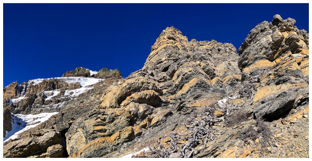
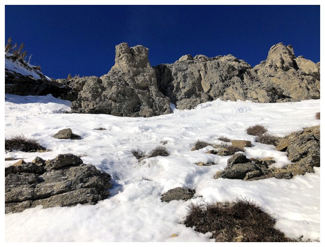
Heading up through a weakness in the rock band
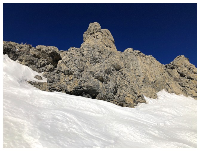
The top of the highpoint (left) is a short distance away
Another solitary tree and the beautiful northeast ridge
Atop the highpoint (that actually wasn't even a highpoint) the next section of the route is revealed, going left to right
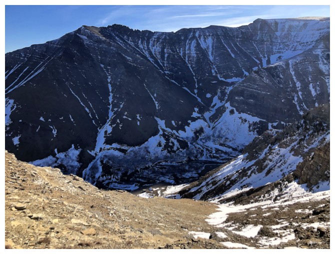
The east side of the ridge is very steep
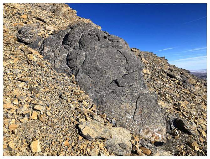
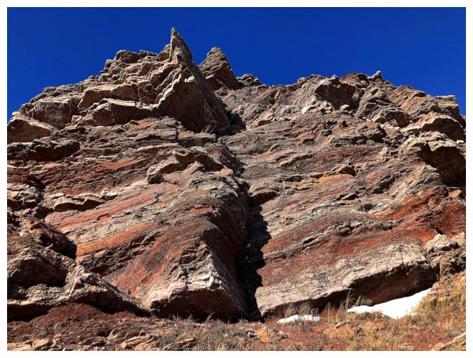
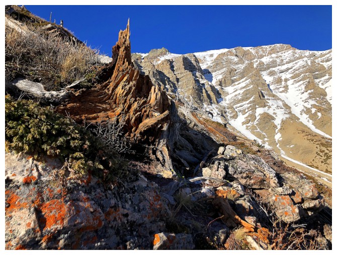
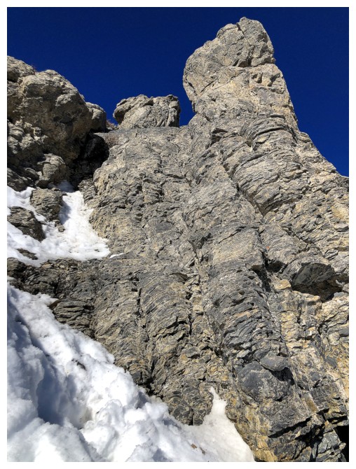
Red argillite is not the only cool rock on the mountain
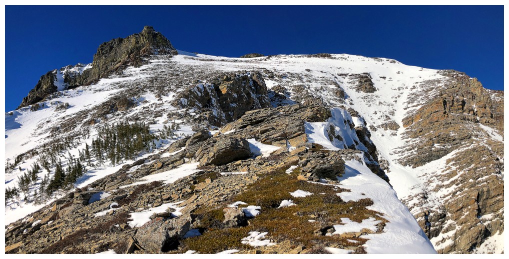
Approaching the first of a series of vertical rock bands that forced me to go left
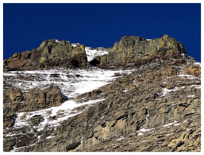
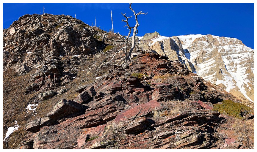
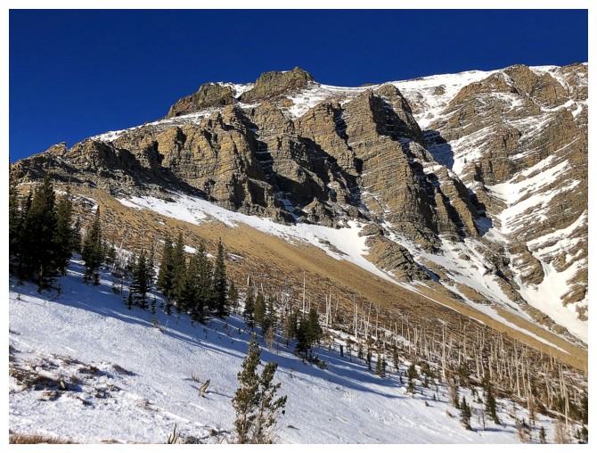
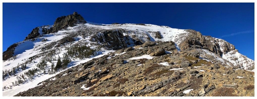
Like many peaks in the area, the summit block of Drywood is comprised
of a band of dark igneous rock, atop a band of red argillite

Folded rock
Looks like I'm going left again
Very cool rock face on the next ridge over, to the west
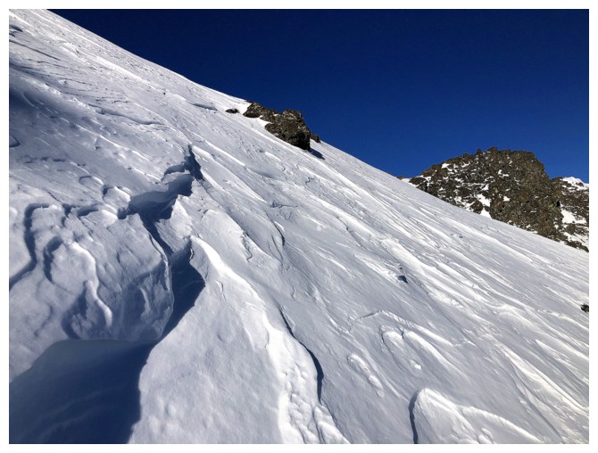
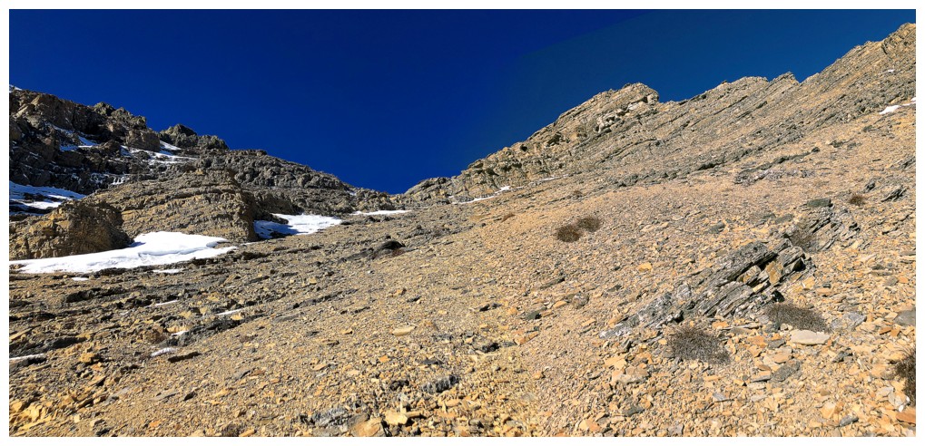
Going left wasn't the worse thing. The route ahead looks straightforward for the time being.
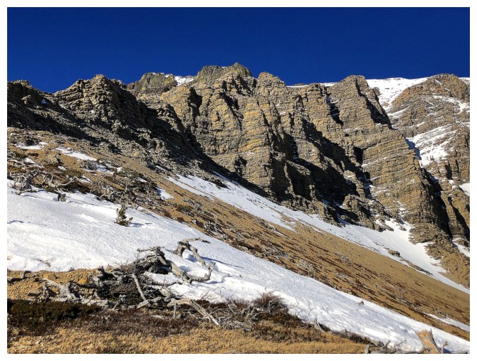
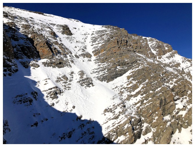
The imposing limestone rock band is dead ahead. A successful ascent of the band was 50/50 at this point
...until I found a weakness behind this tower
There it is. The route goes straight up the centre and has great foot- and handholds
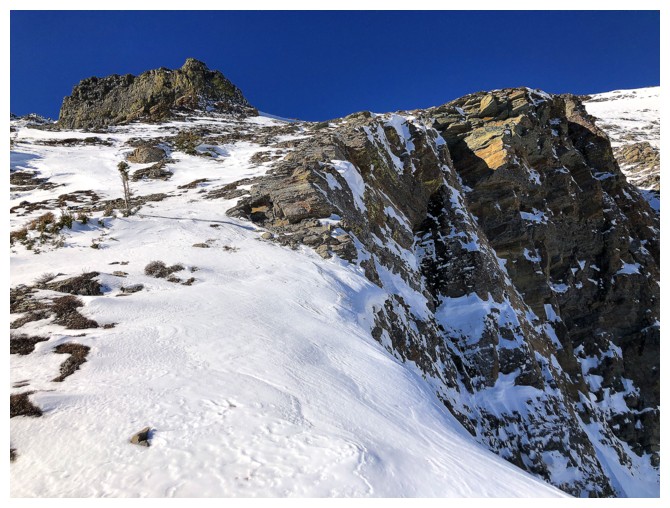
Atop the crux, the summit is still a fair distance away, but the grade of the terrain eases up
Looking back down the route
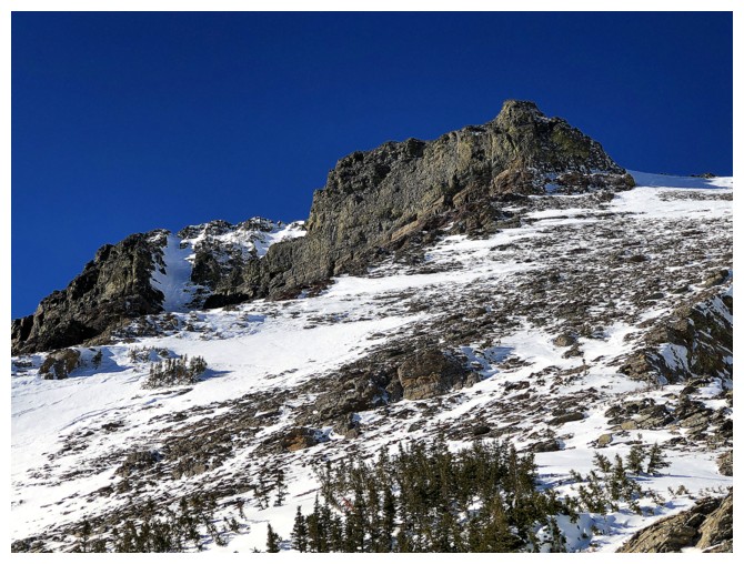
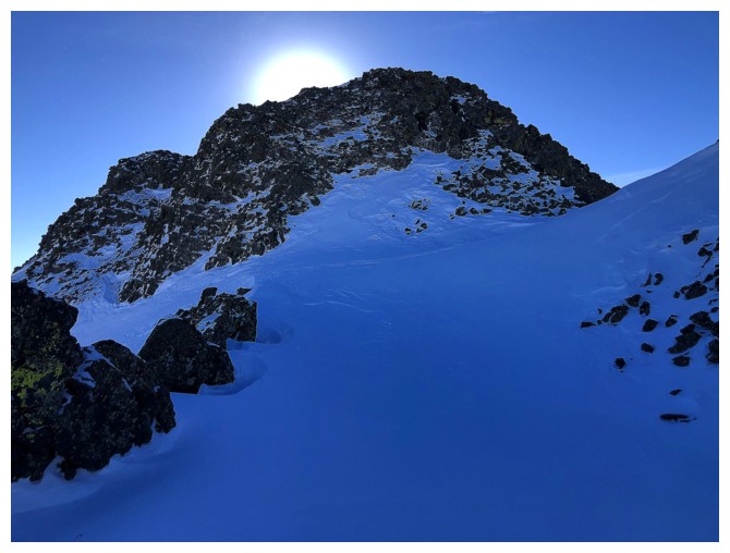
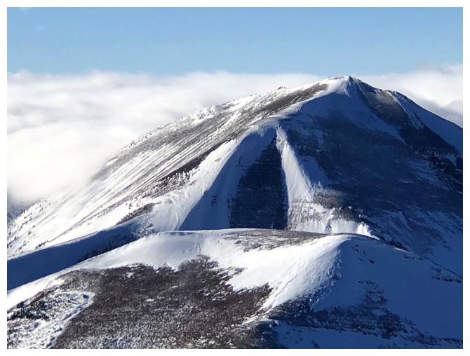
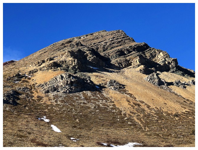
The striking summit block
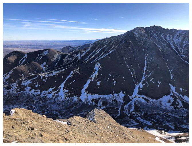
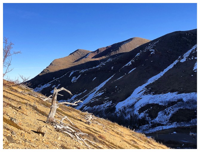
Loaf Mountain: talk about a peak with multiple routes to the top!
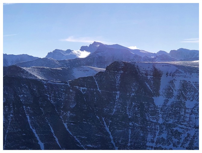
The VERY imposing southeast side of the northeast ridge
Thankfully I'm on much easier terrain
The red argillite side of Woody
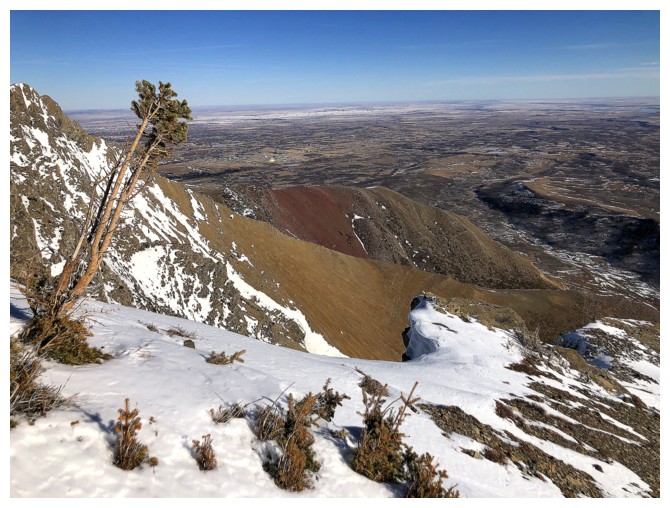
The summit block. Unfortunately, with my time constraint, I had to pass
on checking out the seemingly scenic south side of the block. Also, at
this point of the ascent, the summit appeared to be much farther east
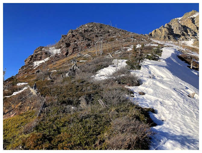
Typical terrain to get to the ridge
On the ridge. This section is very cool when snow-free - the igneous rock has been ground down to a fine sand
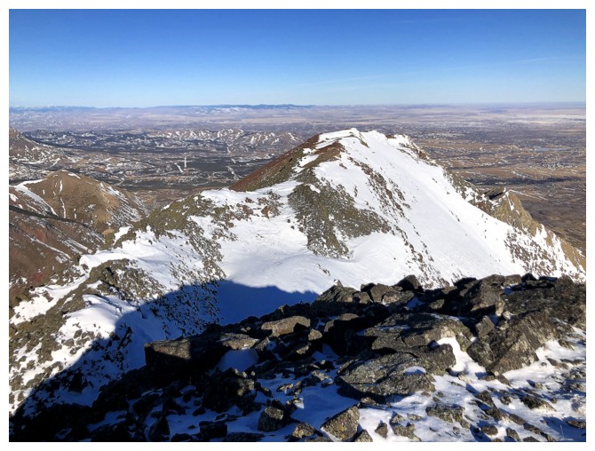
Looking over to the false summit of the northeast ridge
The reward of reaching the ridge is a great view of Victoria Peak
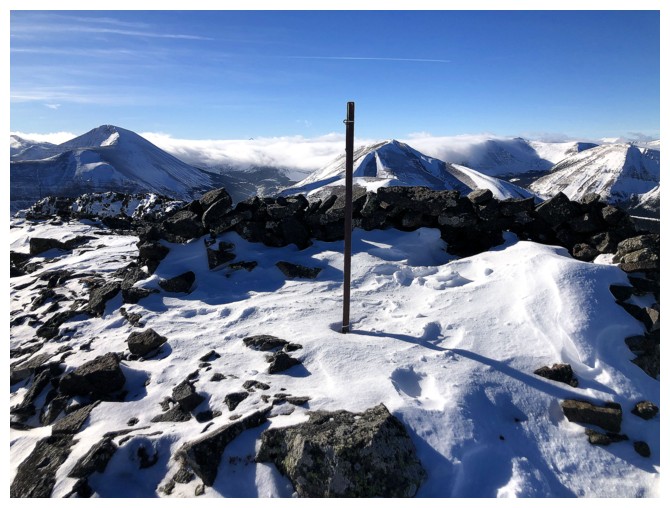
The summit pole
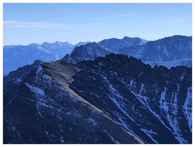
The northeast ridge
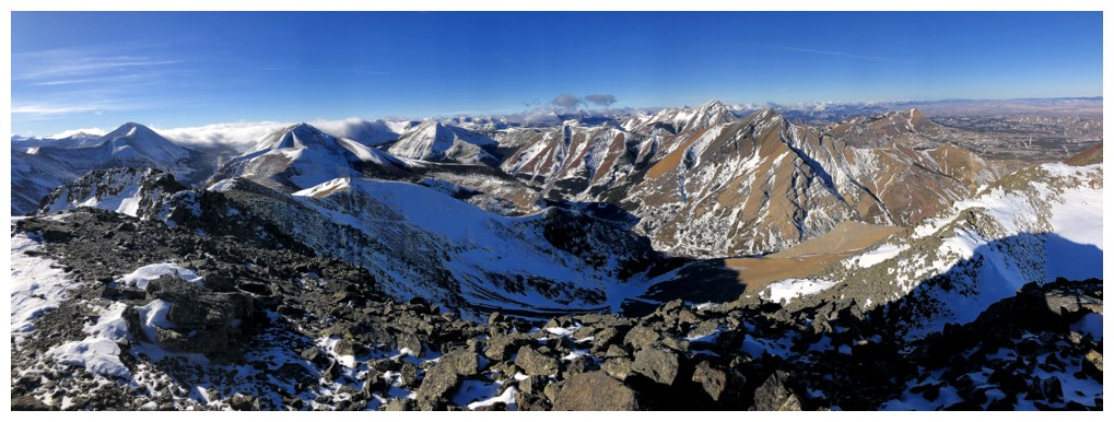
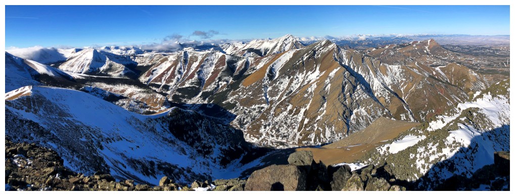
Summit view west, northwest, and north
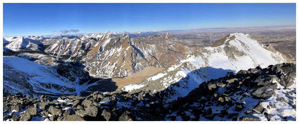
Summit view northwest, north, and northeast
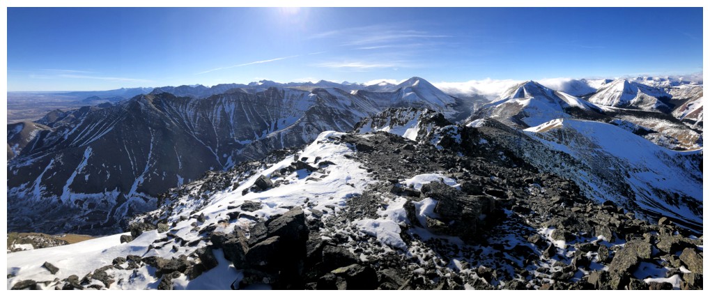
Summit view south, southwest, and west
Another to the west
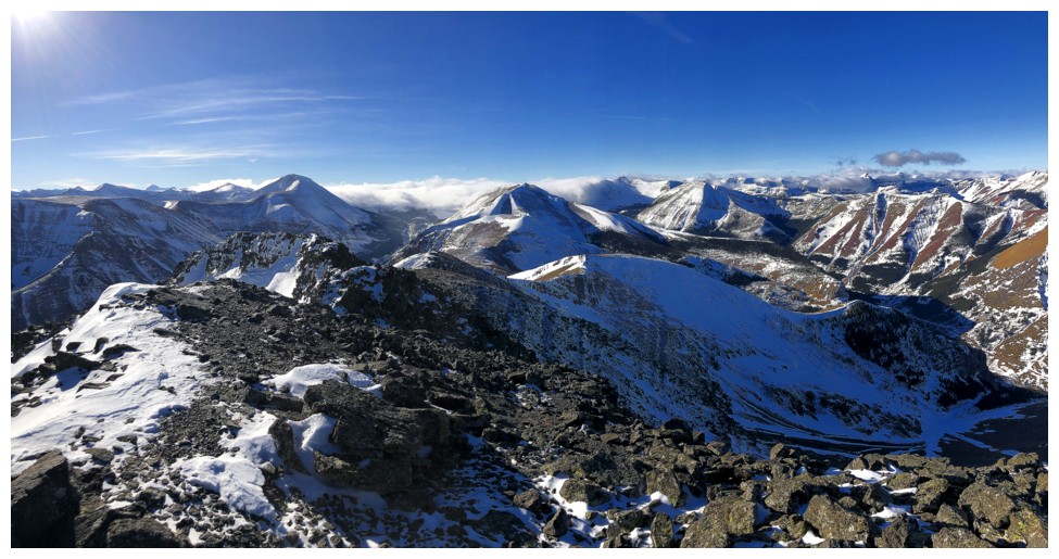
Loaf Mountain
The west summit of Drywood
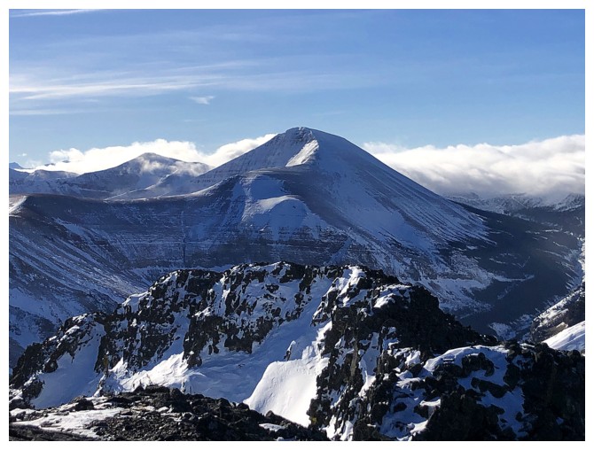
One of the main highpoints of Loaf Mountain in the foreground - Pastry Peak
The eastern highpoint - Icing On The Loaf Peak
Victoria Peak again and Pincher Ridge
Windsor Mountain and Castle Peak
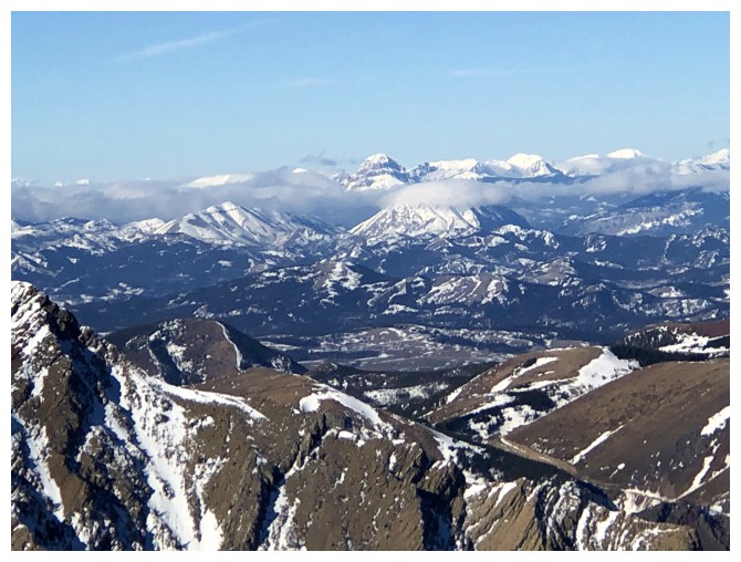
Very distant Crowsnest Mountain (centre) and the High Rock Range
Clouds were building to the west but they didn't seem to be moving east
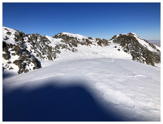
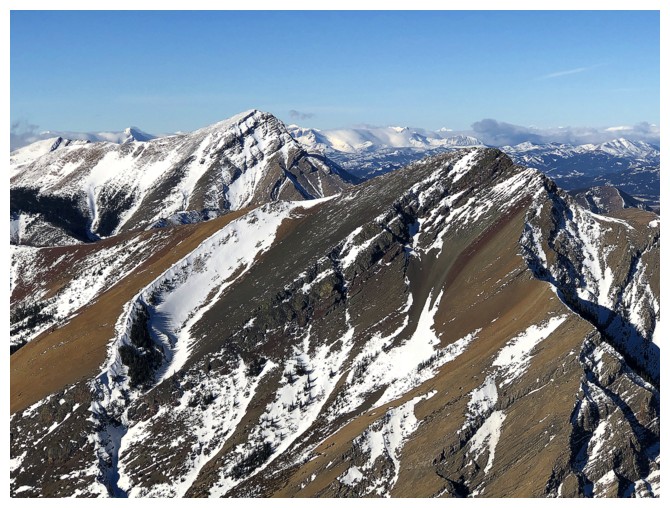
Looking back at the route up
Another interesting example of rock folding
Looking back up to the crux
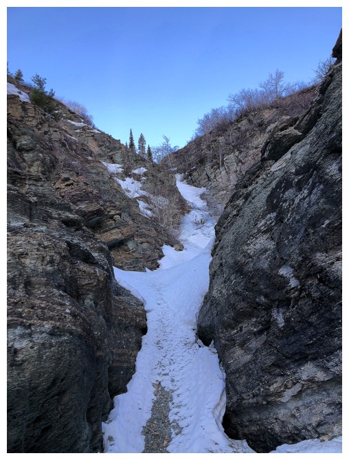
Staying in the snowy drainage throughout the remainder of the descent
may have been an option, but one of my crampons broke on ascent. No way
was I going onto steep, hard snow with one crampon!
The descent route
Decided to the finish the descent near the drainage
The Muffin and The Croissant
At the bottom of the drainage. From this angle the ascent route went up the right skyline.
The drainage I started in
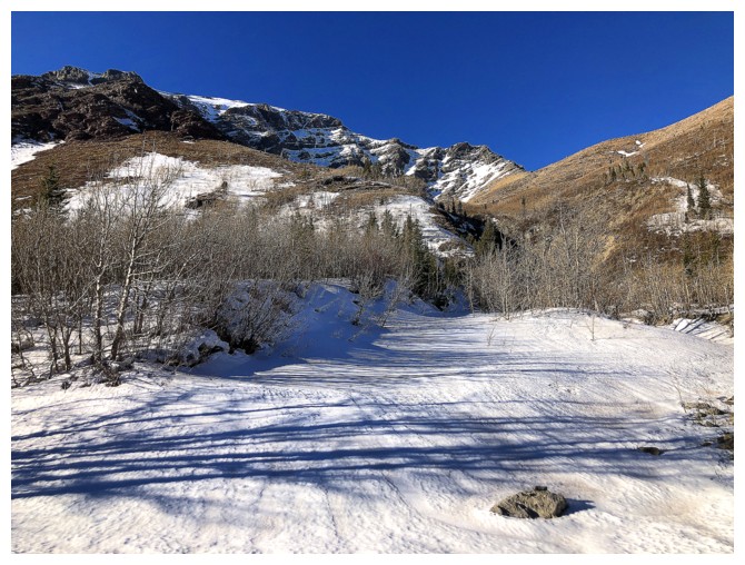
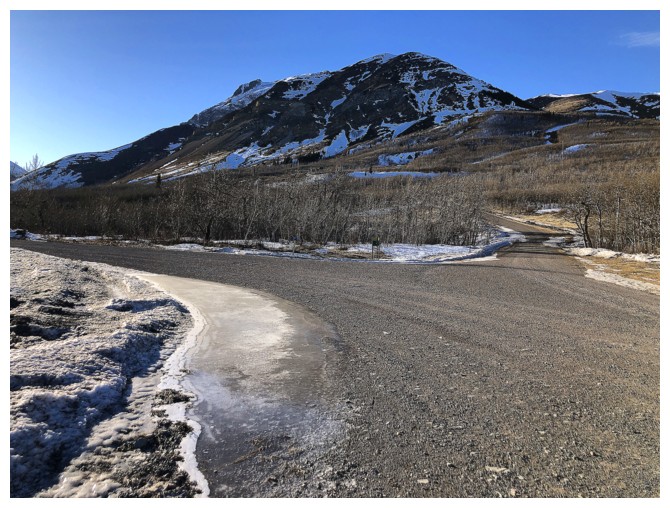
Easy, wind-assisted hike back to the start
Woody
Drywood and Woody
Back to the frozen puddle - no reflection
The End
LOG