Gilligan Peak
Skogan Peak III
August 28, 2021
Mountain heights: 2622 m and 2662 m
Elevation gain: approximately 1550 m
Round-trip
time: 7:25
Solo scramble.
The Mount McGillivray/Lorette massif is
another interesting example of peak-naming in the Canadian Rockies. The massif
has four prominent summits, but only the peaks at the far north end
(McGillivray) and south end (Lorette) have official names. Those peaks are also
the two lowest ones, both exceeded in height by unofficial Skogan Peak and the
unnamed peak north of Skogan – at least I thought it was unnamed.
 Scouring through Cornelius Rott’s outstanding
website, Spectacular Mountains, I happened to come across an excellent trip
report for that unnamed peak - humourously given the name Gilligan Peak (McGillivray,
Skogan) by Cornelius.
Scouring through Cornelius Rott’s outstanding
website, Spectacular Mountains, I happened to come across an excellent trip
report for that unnamed peak - humourously given the name Gilligan Peak (McGillivray,
Skogan) by Cornelius.
This appeared to be a great objective and yet
again, I had an “Ace in the Hole” for the trip, in the form of my e-bike. The approach
towards Skogan Pass is not excessively long or steep, but is a consistent
uphill grind that would probably test even very fit cyclists. My aging quadriceps
were not up for the task, but my e-bike certainly was!
After ditching my bike, I followed Cornelius’
GPS track up and over a ridge, down into the next valley, and then onto the west ridge of Gilligan. The
terrain was fascinating throughout, with improving views and interesting
weather to the west. Cornelius provided two routes to the summit, one moderate
with a few difficult moves, the other an easier moderate route. I chose the easier
route and was at the summit in no time, enjoying an awesome summit panorama.
After a long summit break, I decided to check
out the ridge going south towards Skogan Peak. The goal was to look for an
alternate descent route via the valley south of Gilligan. 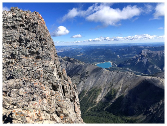 However, travel along
the ridge to Skogan was surprisingly easy and suddenly Skogan’s summit was
within striking distance. Naturally, I couldn’t resist another run up that peak,
as my previous visit in 2006 with Mark had been a thoroughly engrossing and
enjoyable trip.
However, travel along
the ridge to Skogan was surprisingly easy and suddenly Skogan’s summit was
within striking distance. Naturally, I couldn’t resist another run up that peak,
as my previous visit in 2006 with Mark had been a thoroughly engrossing and
enjoyable trip.
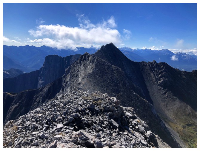
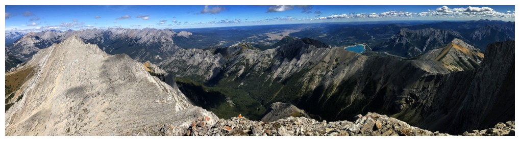
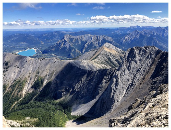
As the highest point of the entire massif,
Skogan does sport the best view, especially towards Barrier Lake, looking pleasantly
turquoise. My summit stay was short but very nostalgic. I then started descending
the west ridge of Skogan. The hope was that I could stay on this ridge
throughout and eventually join up with the ascent route, thus avoiding an
elevation gain and bushwhack to get back up to the ridge. Unfortunately, an
overhanging rock band near the low col thwarted that plan, but the scenery and views
throughout were amazing under a clear blue sky. After scrapping many trips
throughout the summer of 2021 because of insanely smoky skies, seeing a
smoke-free (and cloud-free) sky was more than gratifying.
From the col, I lost elevation into the aforementioned
valley and then regained the ridge and the ascent route. 30 minutes of light bushwhacking
later I was back on the main trail. Needless to say, the 6 or so kilometre bike
ride back to the parking lot was a riot – zero pedaling and lots of braking! No e-bike needed
here; it’s all downhill.
A wonderful day of adventure and new scenery!
Huge shout-out to Cornelius and his partner for the day, Trevor, for paving the
way on this one.
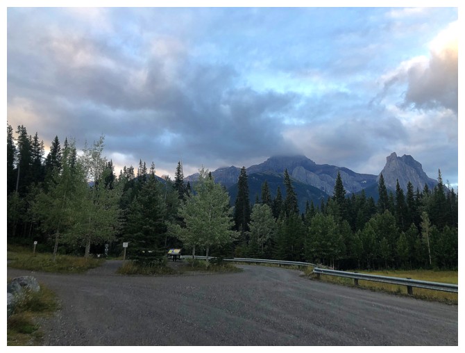
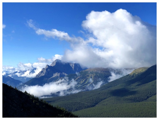
Cloudier than expected view of the first peak of Mount Lougheed and The Windtower from the parking lot
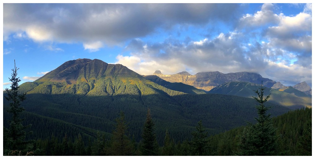
The Sun's rays creeping up Mount Collembola
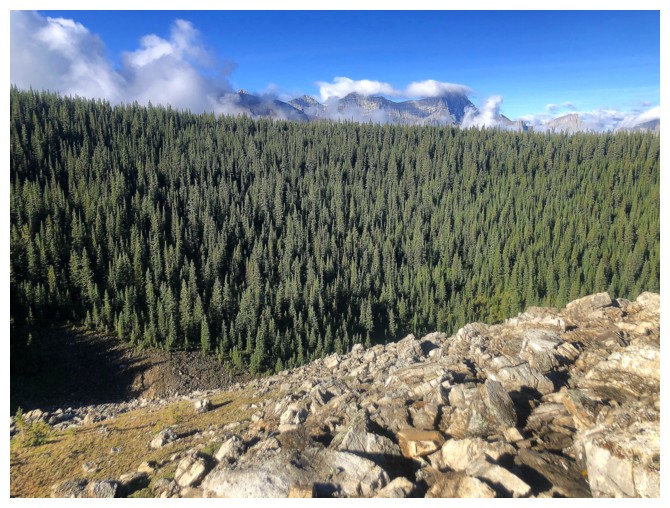
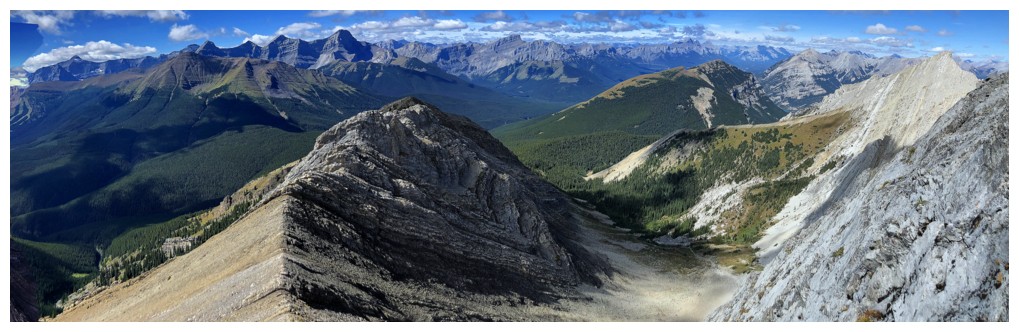
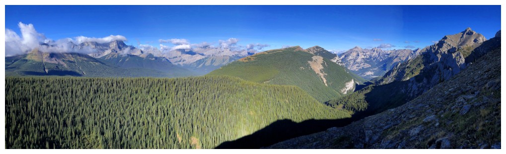
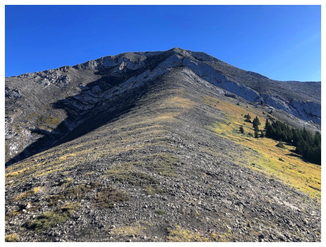
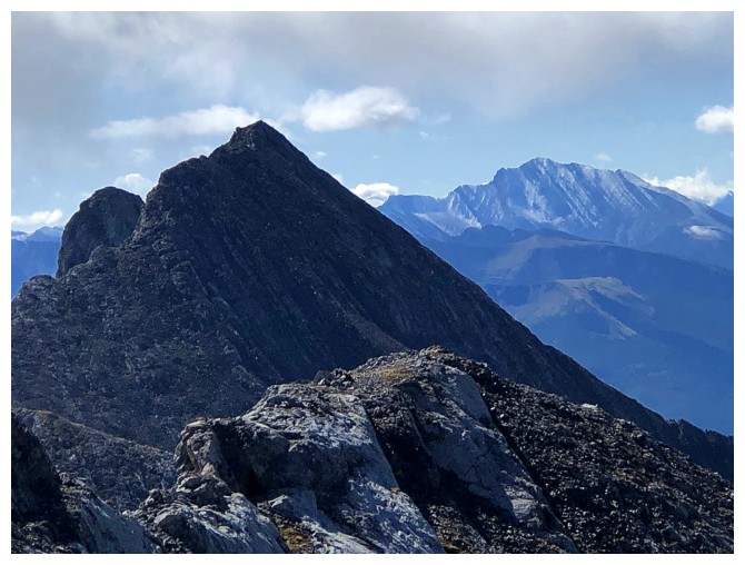
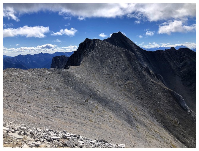
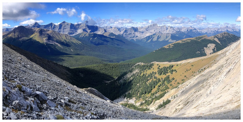
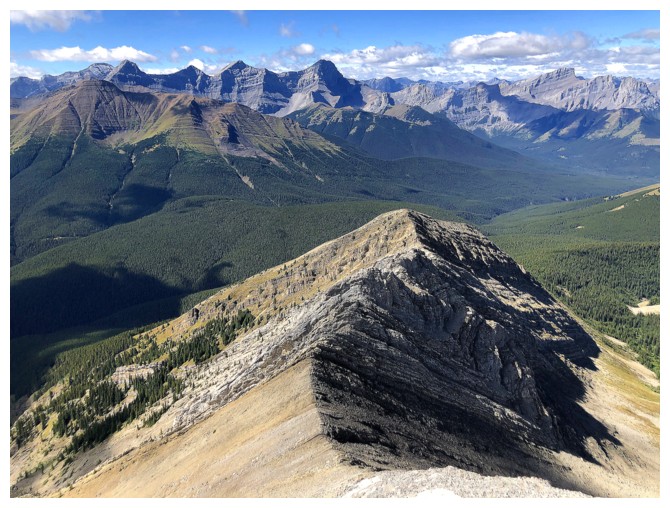
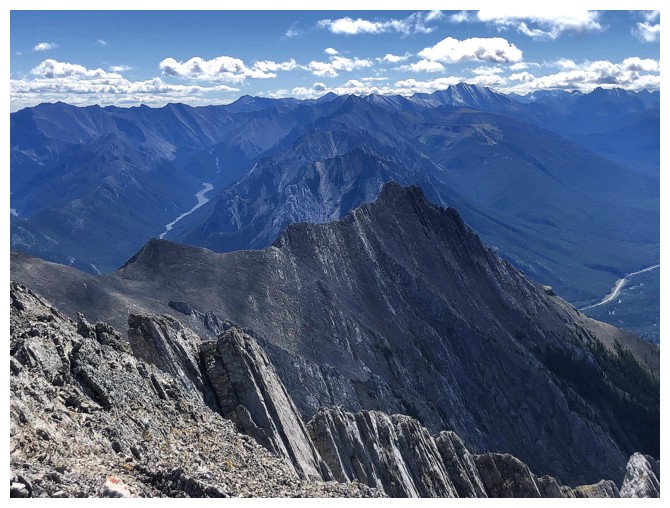
On the west ridge of Gilligan, looking back to the ridge I just came over
Up we go
Clouds are less annoying when they are crawling up and over the mountain tops
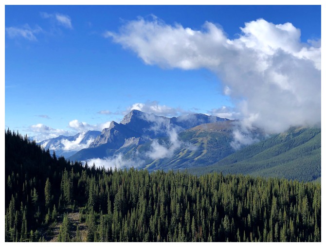
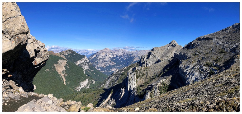
Gaining elevation and getting some good views. Mount McGillivray at the far right.
The clouds refuse to leave the 3 summits of Lougheed and Wind Mountain
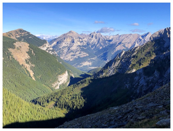
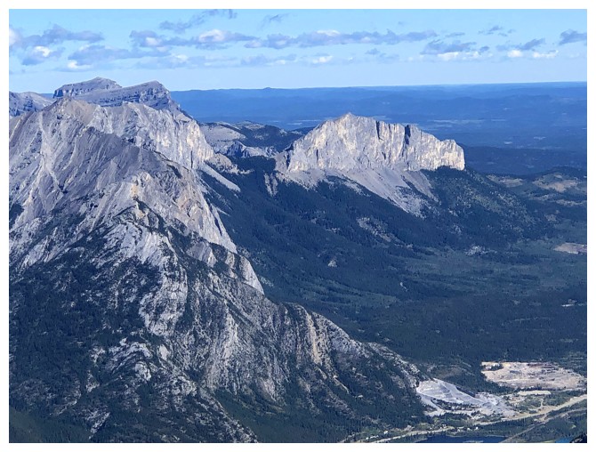
Grotto Mountain in the distant centre
Close-up of McGillivray
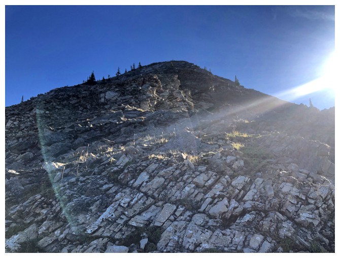
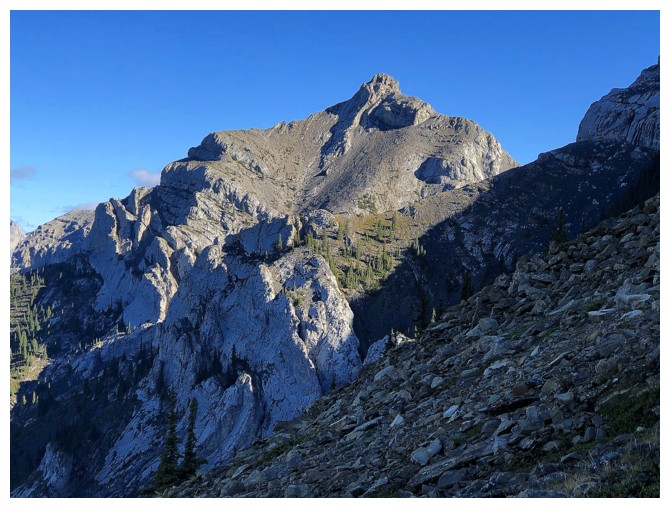
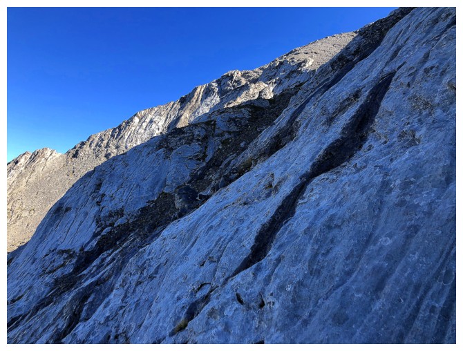
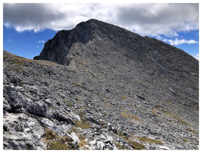
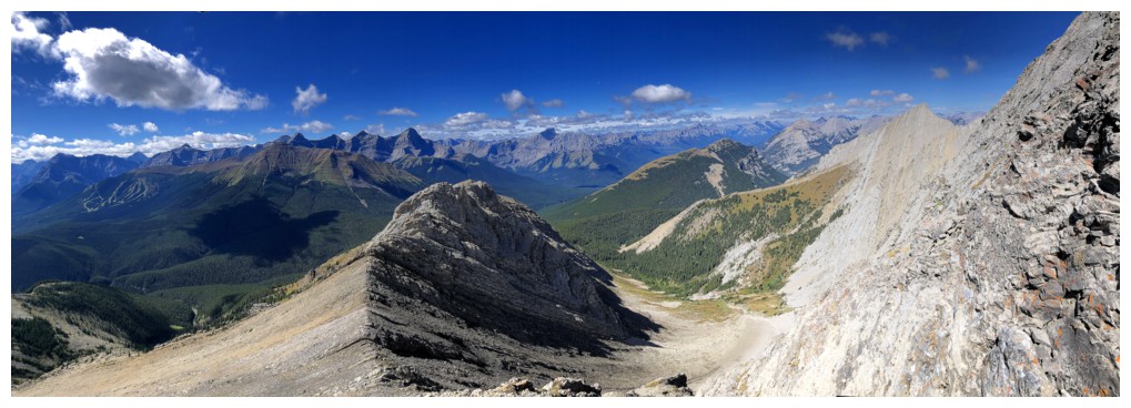
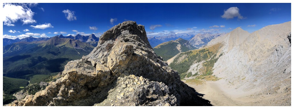
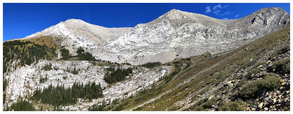
Looking up the main part of Gilligan's ascent route
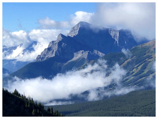
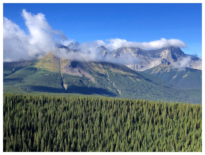
Very interesting weather over Mount Kidd
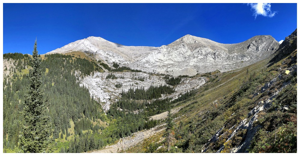
Easy travel lower down
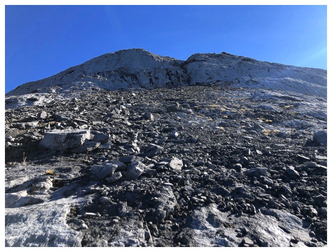
Approaching the steeper part of the ascent. Cornelius and Trevor went
straight up on ascent and then took the easier route over to the left on
descent. I took their easier route going up and neither coming
down.
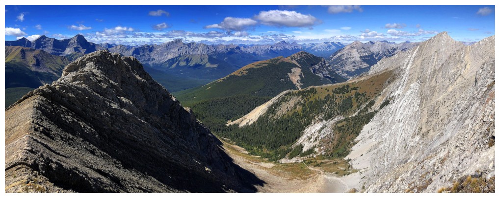
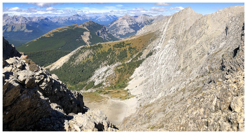
Looking down the ascent route and across the valley
The easier route. There are still some steep slabs to traverse unless you lose a bunch of elevation first.
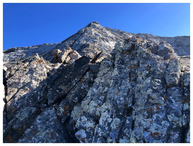
A small and too uncommon section of solid rock
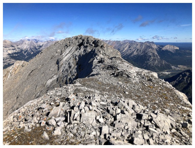
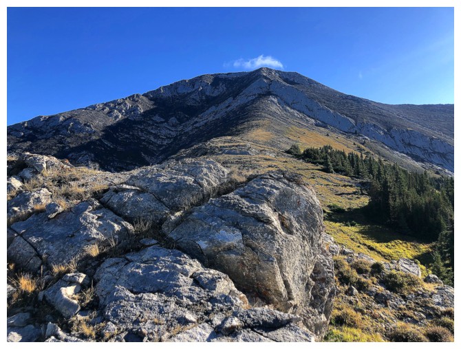
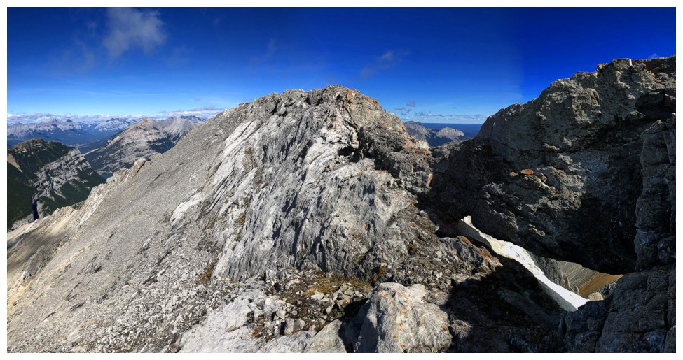
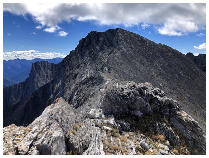
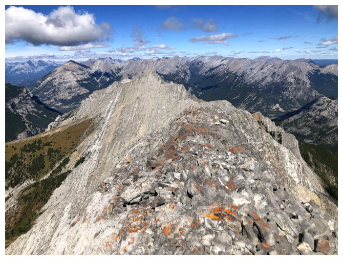
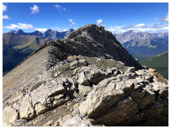
On the ridge and heading to the summit
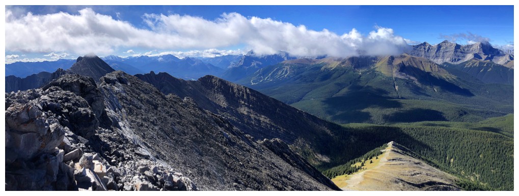
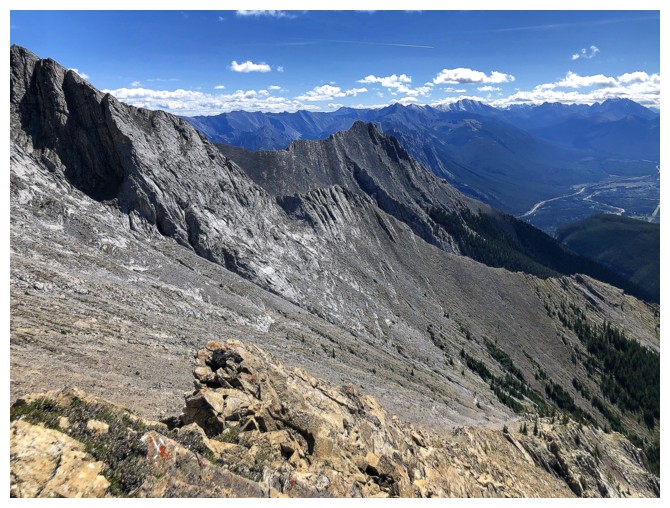
Skogan Peak to the south
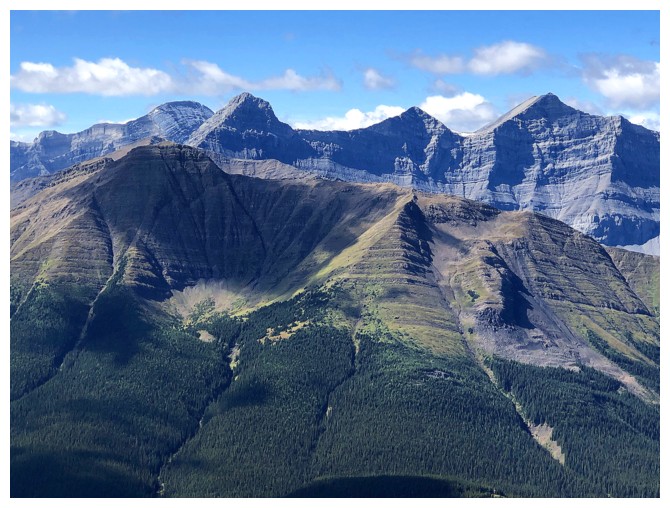
Part of the ridge trending south from Heart Mountain
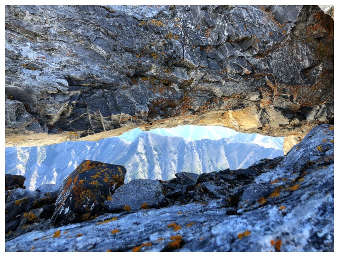
A rock window
Same as above
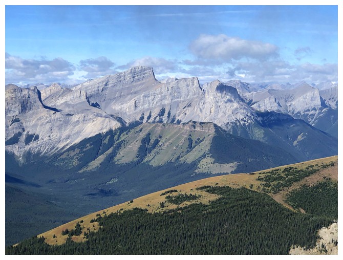
The Three Sisters
Fisher Peak to the right of Skogan
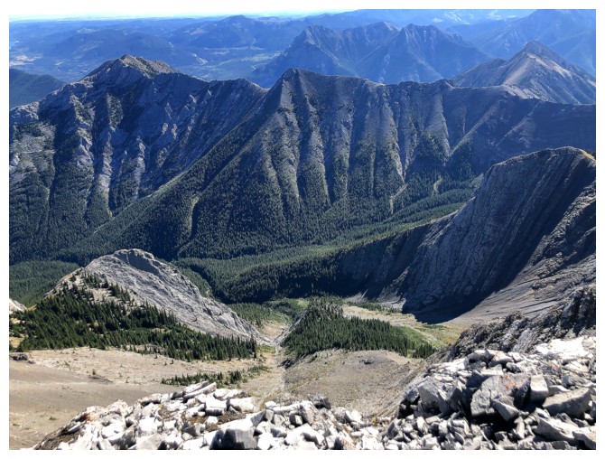
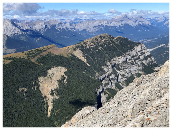
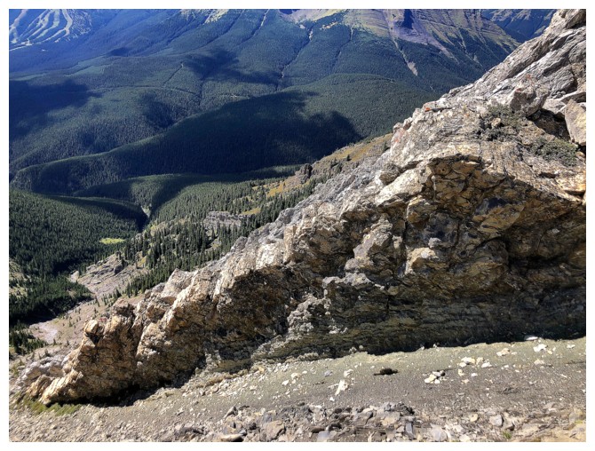
Looking down the impressive northeast ridge of Gilligan
Yamnuska (of course!)
The clouds are finally moving on
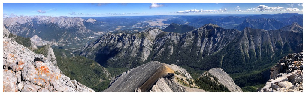
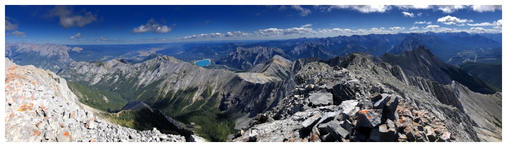
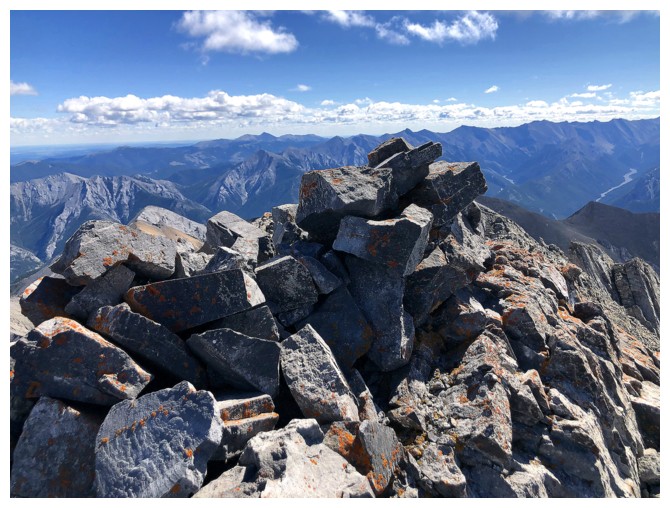
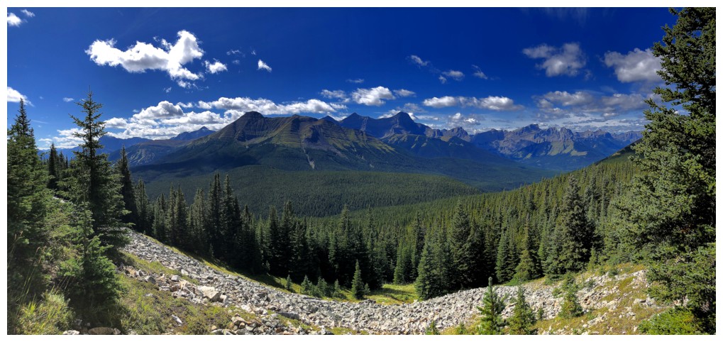
Summit view to the northeast
Pigeon Mountain in the foreground
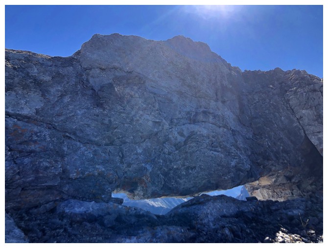
Passing by the rock window again on the way to Skogan
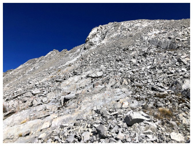
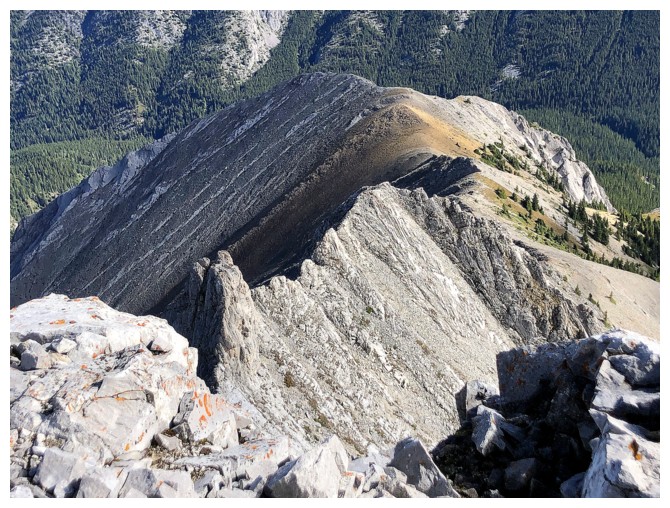
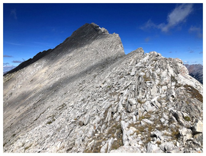
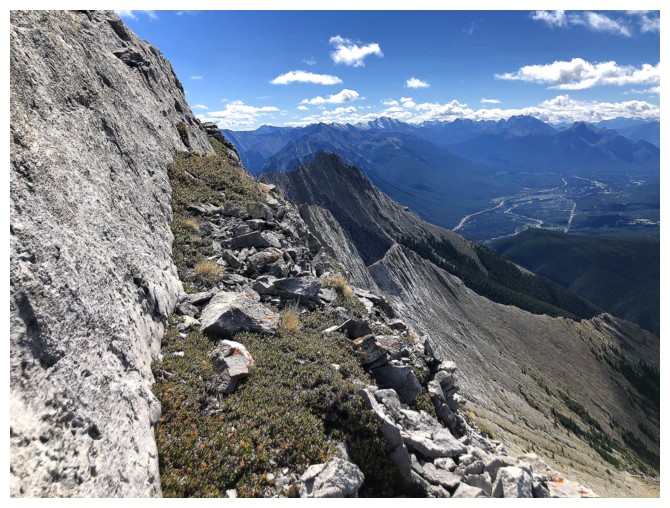
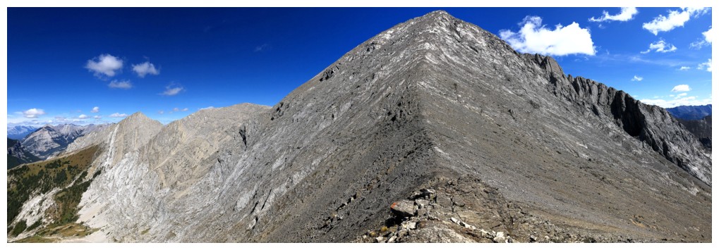
Typical terrain on the traverse
Traversing back to the ridge after circumventing a steep rock band
Straightforward travel once back on the ridge
Looking back to Gilligan
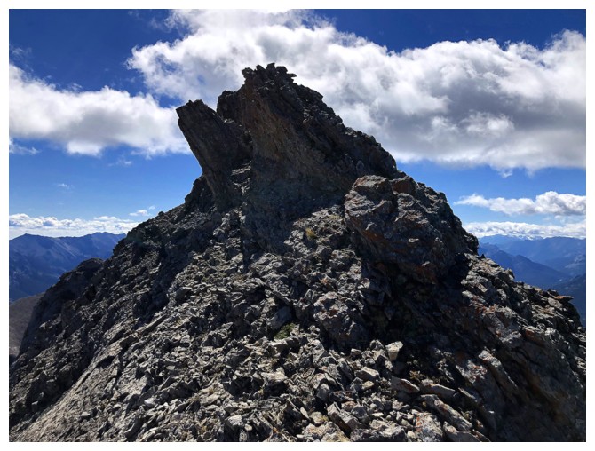
Summit of Skogan is dead ahead and requires only a couple of moves of scrambling
The view to the northwest is looking better by a second
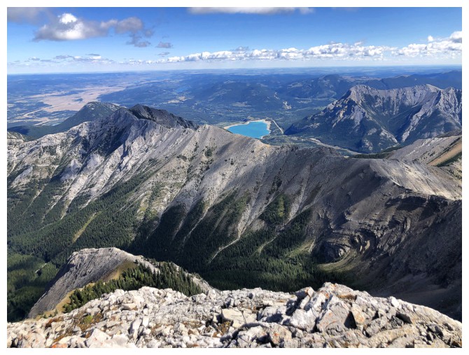
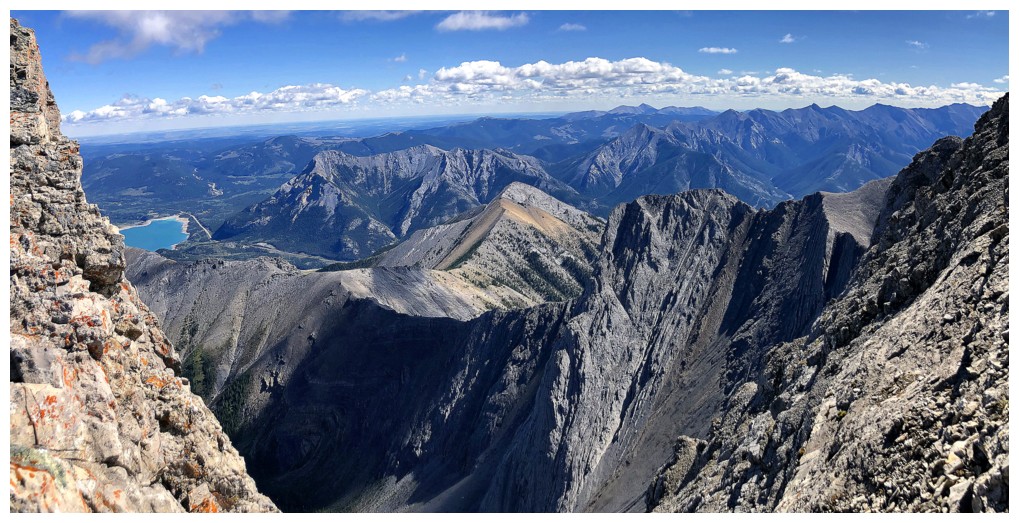
Barrier Lake makes its first appearance
The addition of Barrier Lake and Mary Barclay Mountain (the one at the
right with the orange scree) very much compliment the view
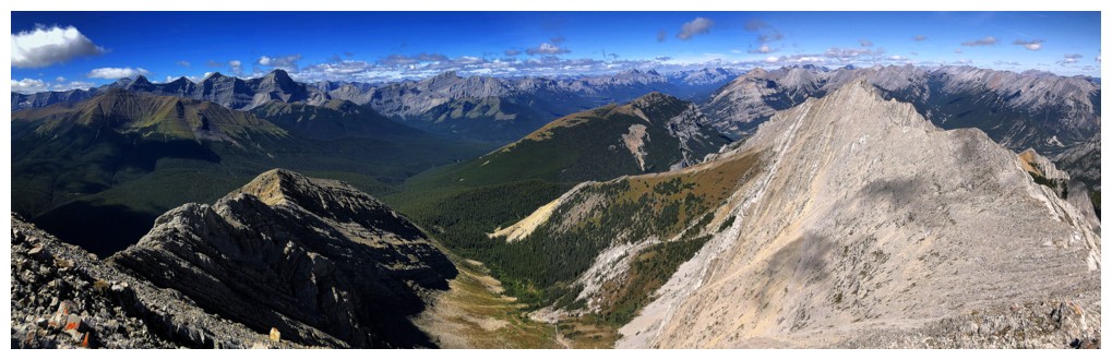
Gilligan at the right and the ridge I descended off Skogan at the left
Barrier and Mary Barclay again
One more obstacle on the ridge, but it was easily circumvented
The long, overdue return to the summit of Skogan Peak - It's Been Awhile
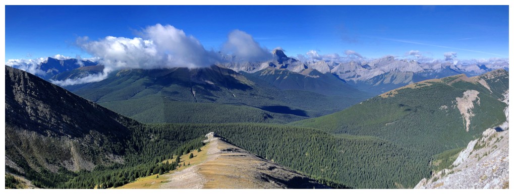
Looking down the descent route of Skogan. Now cloud-free over Wind, Lougheed, The Windtower, and The Three Sisters.
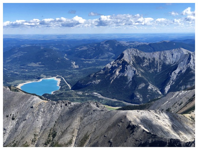
Barrier Lake doing a very convincing imitation of Peyto Lake
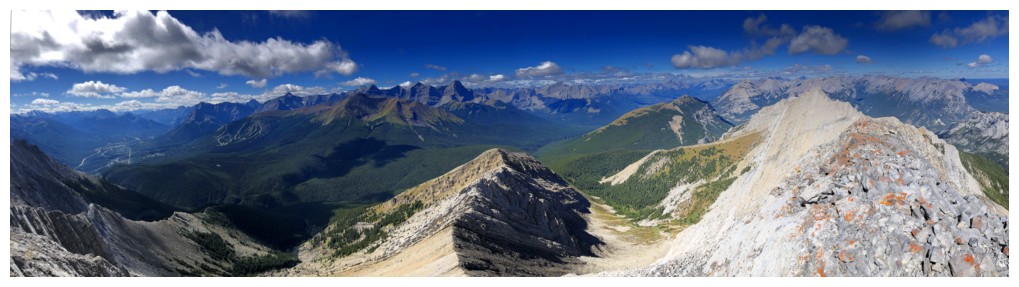
Summit view to the northwest, west, and southwest
View to the north
Looking south along the ridge and down to Mount Lorette
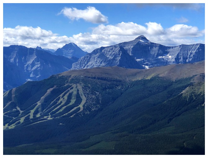
The Nakiska Ski hill, Mount Bogart (right) and Mount Galatea (left)
Closer look at two of Lougheed's three summits (right) and Wind Mountain. Collembola in front.
Nice ledge on descent
Some of the best views of the day occurred while descending the west ridge
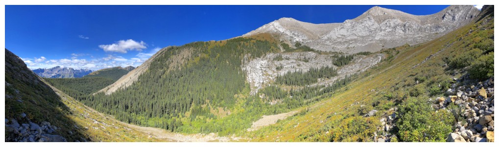
Eventually I ended up going down into the valley in the middle
Negotiating the minor ups and downs of the ridge at col
End of the line for the west ridge descent
Losing elevation down here might have enabled me to continue along the ridge, but I didn't think it was worth the effort
Even the low col appears to be around the same height as Mount Lorette
Looking back up the west ridge
Descending into the valley, looking up to the connecting ridge between Gilligan and Skogan
Final view to the west before the light bushwhack and ridiculously easy bike ride down
The End
LOG