Mount Yamnuska VII
January 26, 2020
Mountain height: 2240 m
Elevation gain: 880 m
Ascent time: 3:50
Descent time: 2:25
Scramble with Mark.
 I often refer to mountains in southern Alberta area as peaks that just
“keep on giving”, simply because they offer a variety of interesting routes to
their summits, are superbly scenic, and are not excessively long, thus allowing
multiple visits and lots of exploration – Pincher Ridge, Drywood Mountain, Loaf
Mountain, Table Mountain, Whistler Mountain, and Prairie Bluff to name a few.
Of course, exactly the same can be said of mountains in every quadrant of the Canadian
Rockies. Closer to Calgary, Mount Baldy fits into that category quite nicely and
as of January 26, 2020, Mark and I can safely add Mount Yamnuska to that list. Outstanding
rock scenery, interesting scrambling, and terrific views make this a trip that
never gets boring.
I often refer to mountains in southern Alberta area as peaks that just
“keep on giving”, simply because they offer a variety of interesting routes to
their summits, are superbly scenic, and are not excessively long, thus allowing
multiple visits and lots of exploration – Pincher Ridge, Drywood Mountain, Loaf
Mountain, Table Mountain, Whistler Mountain, and Prairie Bluff to name a few.
Of course, exactly the same can be said of mountains in every quadrant of the Canadian
Rockies. Closer to Calgary, Mount Baldy fits into that category quite nicely and
as of January 26, 2020, Mark and I can safely add Mount Yamnuska to that list. Outstanding
rock scenery, interesting scrambling, and terrific views make this a trip that
never gets boring.
 There are hundreds of climbing routes on the essentially vertical south
face of the mountain but only two scramble routes – one up the east side and up
the west, usually completed as a loop. Although Mark and I had completed two
climbing routes on the mountain (King’s
Chimney and Grillmair Chimney), our last
scrambling adventure occurred 16 years earlier, coincidentally also in January.
A return to this iconic mountain seemed in order.
There are hundreds of climbing routes on the essentially vertical south
face of the mountain but only two scramble routes – one up the east side and up
the west, usually completed as a loop. Although Mark and I had completed two
climbing routes on the mountain (King’s
Chimney and Grillmair Chimney), our last
scrambling adventure occurred 16 years earlier, coincidentally also in January.
A return to this iconic mountain seemed in order.
For the day’s adventure we chose the more logical east to west traverse,
as opposed to our 2004 ascent in the opposite direction. The hike to the east ridge
was fantastic, great weather and the amazing rock of the mountain providing us
with lots of photo opportunities and an interesting little detour to a pinnacle
on the southeast face.
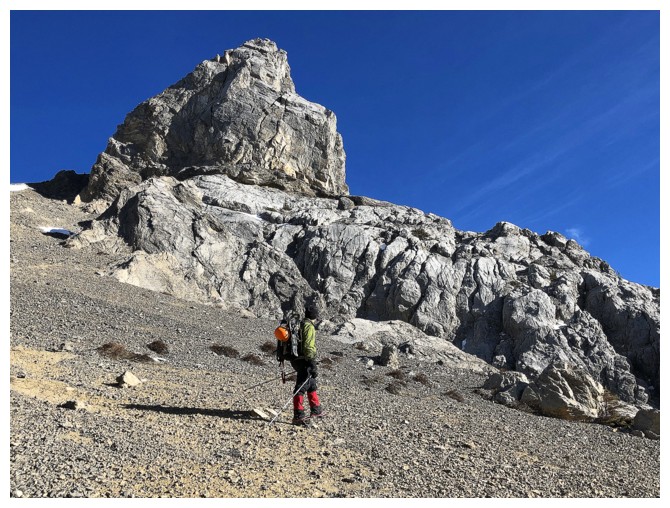
 The north side of the mountain was surprisingly devoid of snow.
Microspikes worked perfectly and the snowshoes strapped to our backpacks would
stay there throughout. We tried to stay on the ridge as much as possible to
enjoy the vertiginous views down the south face of the mountain.
The north side of the mountain was surprisingly devoid of snow.
Microspikes worked perfectly and the snowshoes strapped to our backpacks would
stay there throughout. We tried to stay on the ridge as much as possible to
enjoy the vertiginous views down the south face of the mountain.
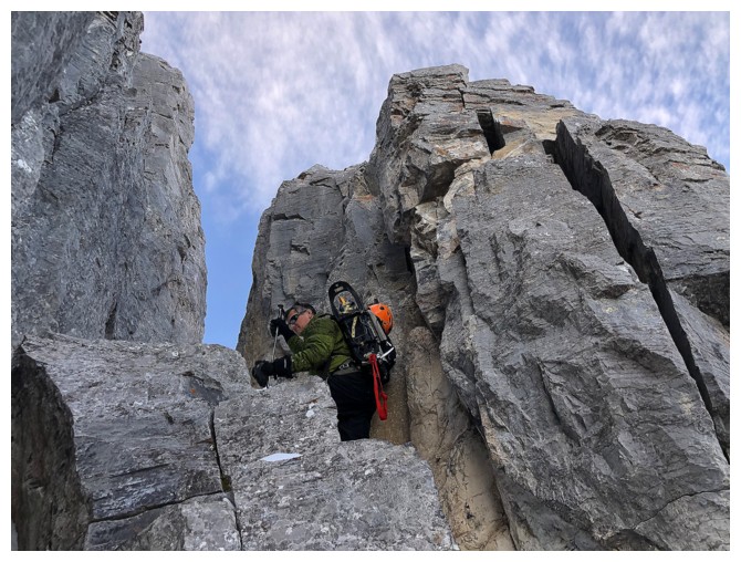
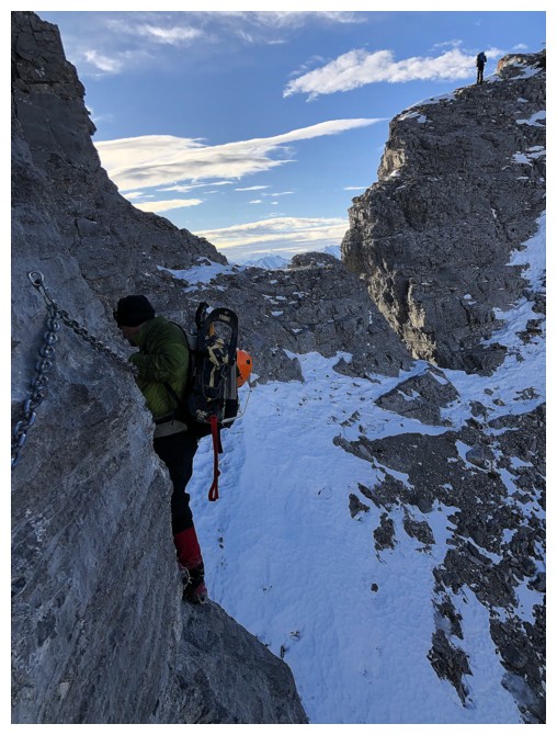
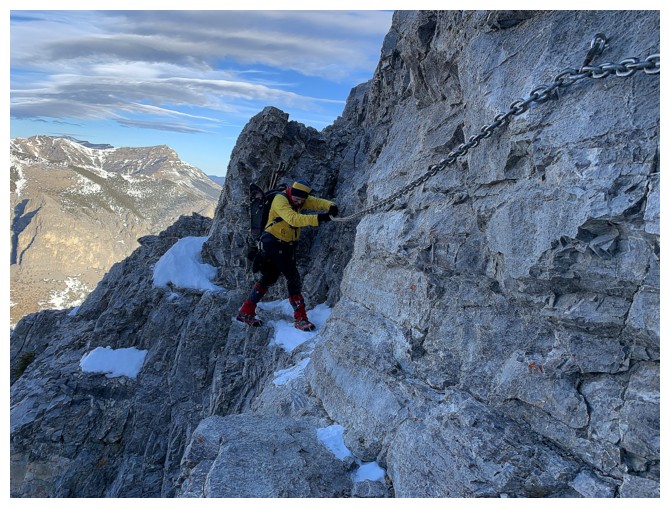
Of course the infamous chain section (the 2004 wire has long since been
replaced by a much meatier chain) takes you away from the ridge, but is fun and
super interesting.
With near perfect weather, the summit views were expectedly awesome,
many of the surrounding peaks taking on a very nostalgic aura – East Peak of Mount
Wendell, Goat Mountain, Association Peak, to name a few.
For descent, again we tried to stay as near to the edge of the mountain
as possible. This yields some fantastic views that are missed if one follows
the usual descent trail. Down at the Goat/Yam col, the west side of the
mountain did not disappoint in the least. It definitely has some of the most
impressive and aesthetically pleasing rock scenery on the mountain, especially
when backed by a deep, blue sky. The remainder of the descent was easy and
enjoyable, though we didn’t find a good scree run down to the trail.
A fantastic day on a
totally awesome mountain. Fun and nostalgic!
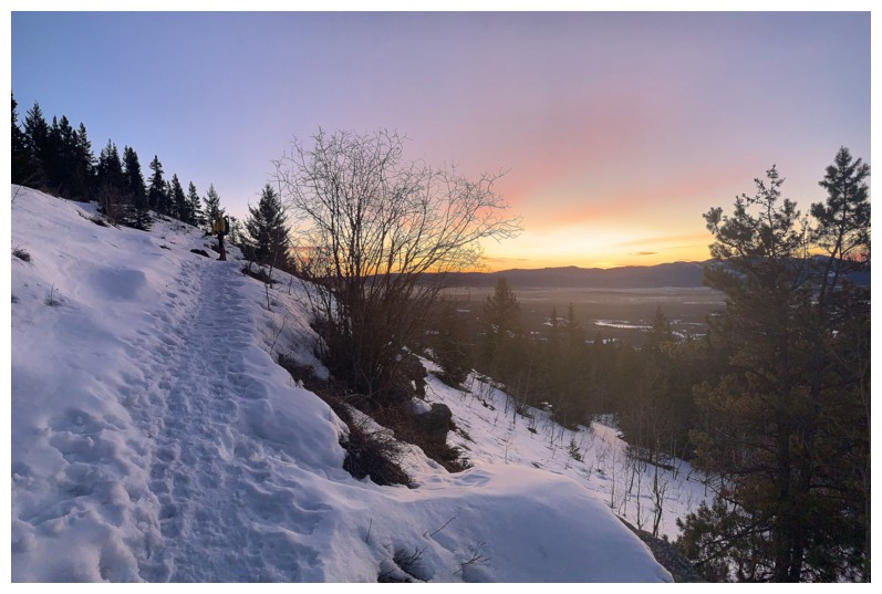
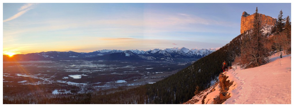
A pleasant sunrise, as we hike the well-trodden trail
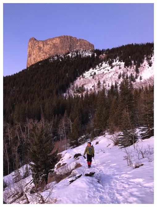
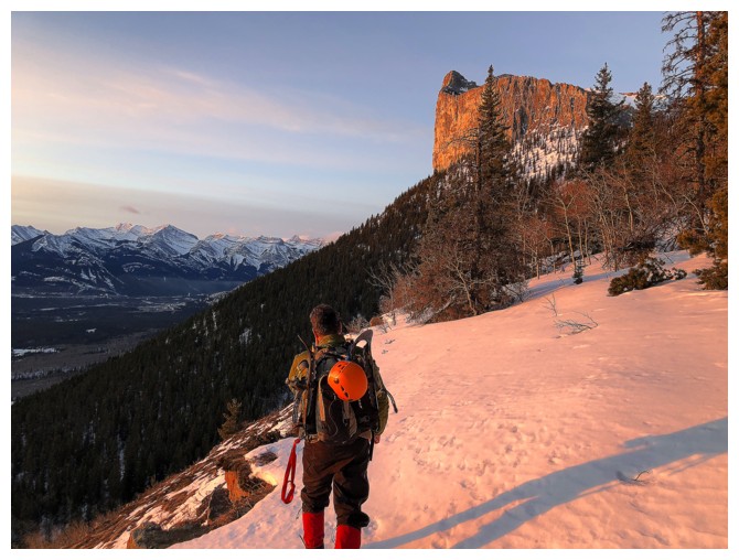
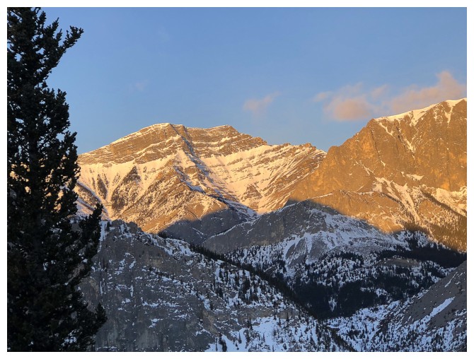
The east side of Yamnuska makes its first auspicious appearance
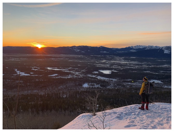
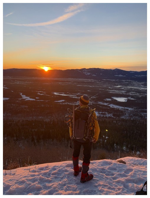
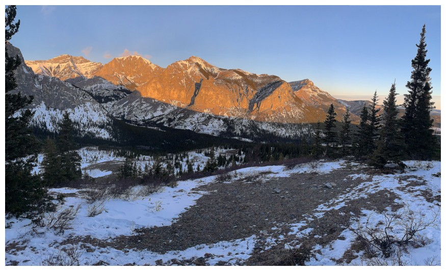
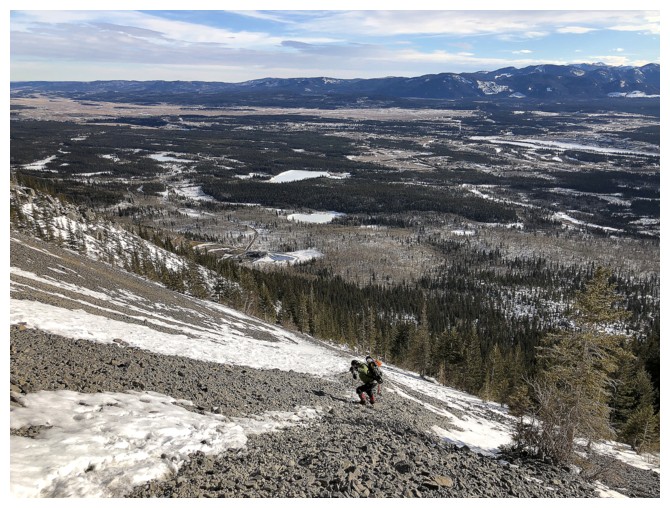
Admiring the sunrise and views across the foothills
Wind Mountain (left) and the third peak of Mount Lougheed
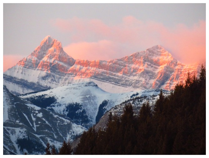
Yamnuska is getting some morning Sun
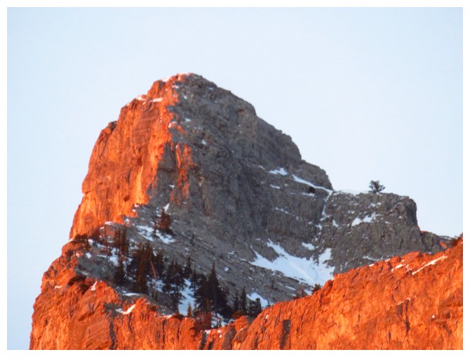
Not much snow on the peak for late January

The hike to the east side is occasionally interrupted by terrific views of the objective
The CMC valley is also getting morning Sun
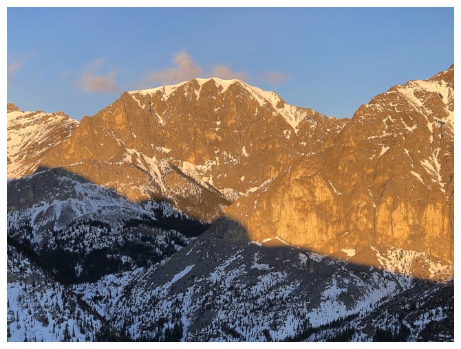
Wendell Mountain
The East Peak of Wendell Mountain
Morrowmount
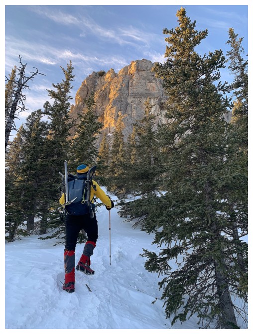
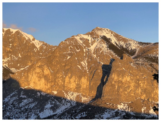
Getting close
Love the morning light
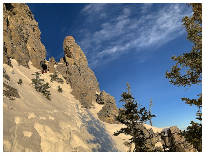
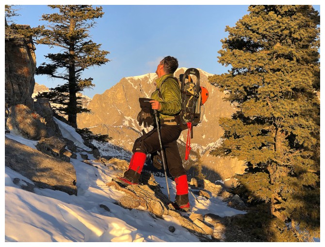
Is there a scramble route up? Probably not - it's much steeper than it appears
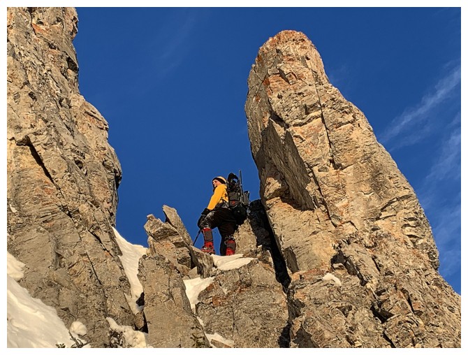
Beautiful rock and better indication of its steepness
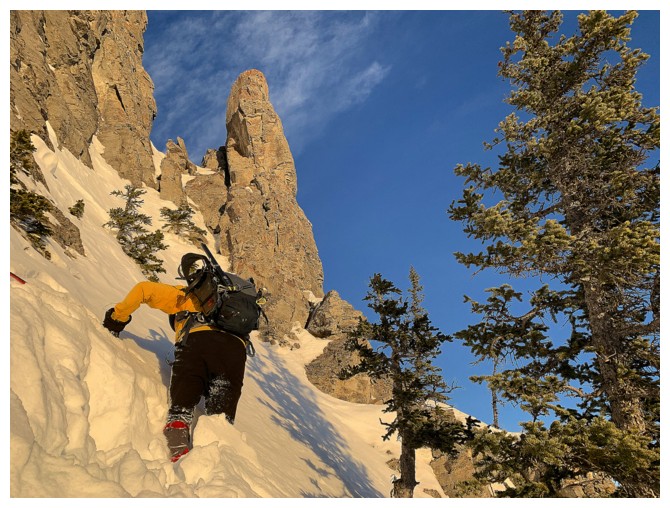
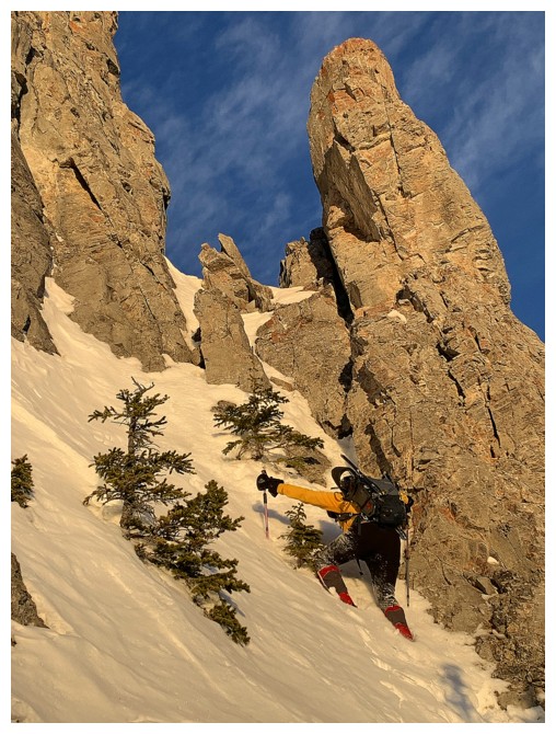
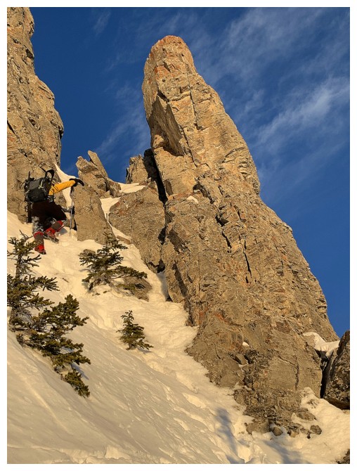
Little side trip up to a pinnacle
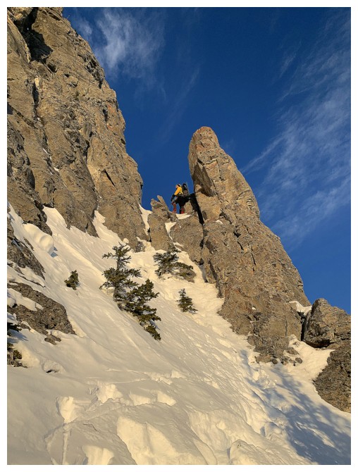
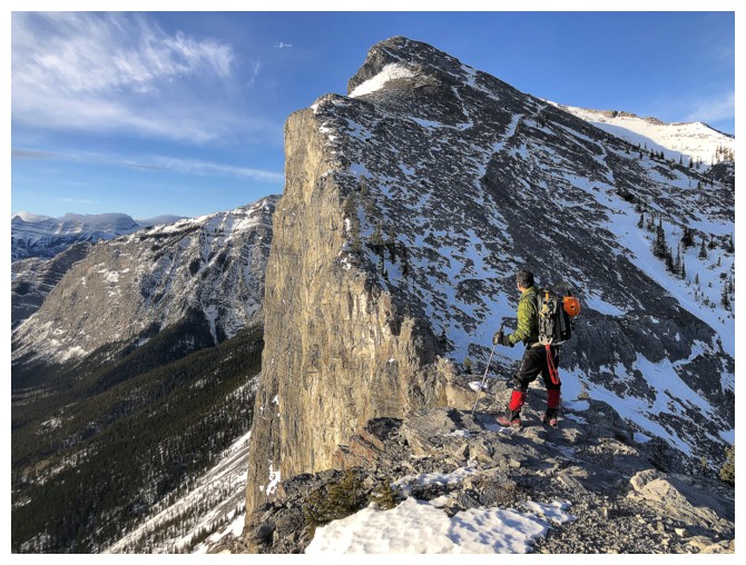
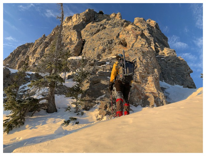
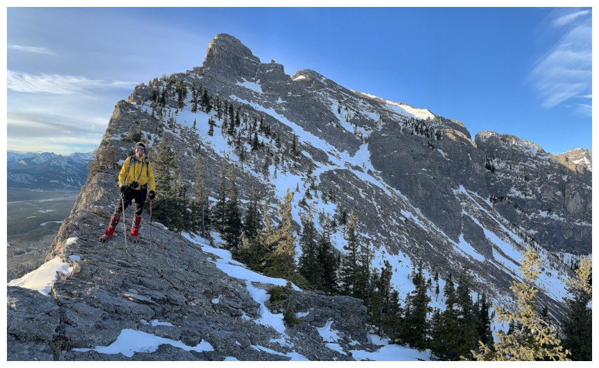
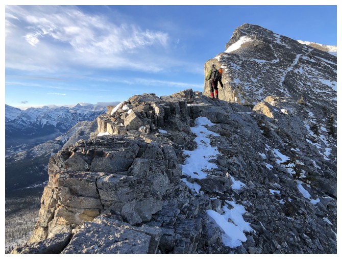
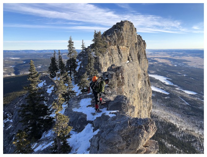
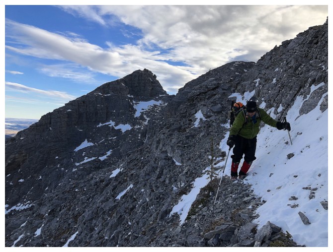
Back on route, on the northeast side of the mountain
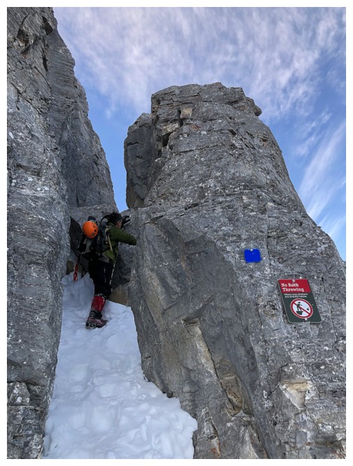
Blue markers and paint mark the route very well
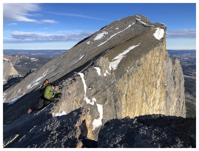
Some easy scrambling to get by the first obstacle. The super-polished rock attests to the popularity of the route.
My turn
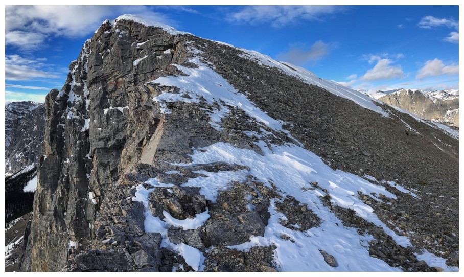
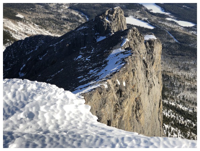
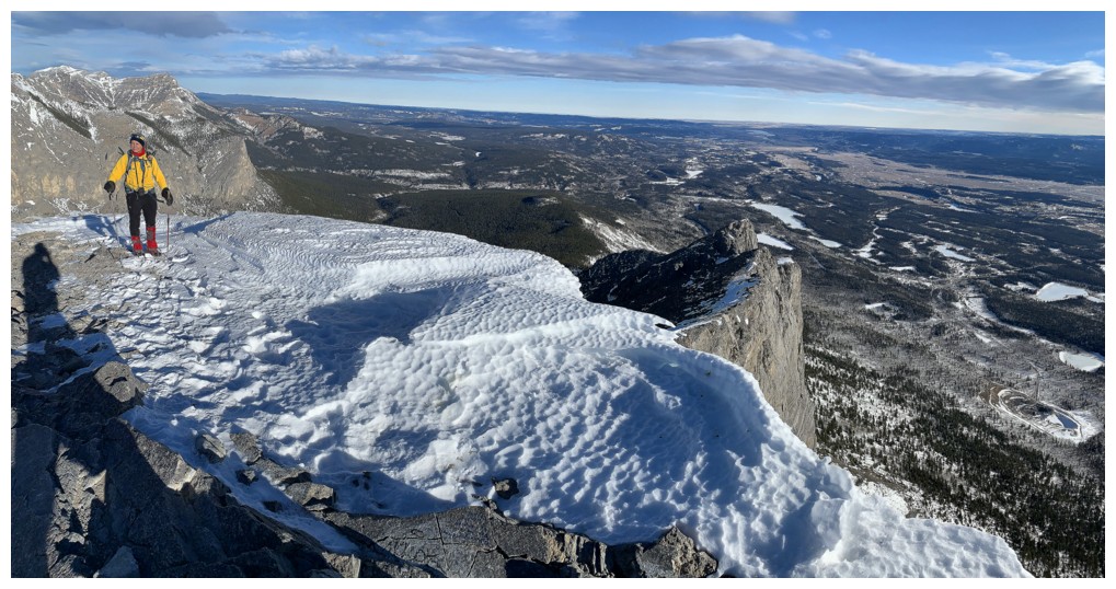
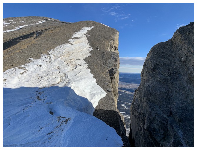
The backside of Yamnuska
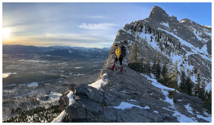
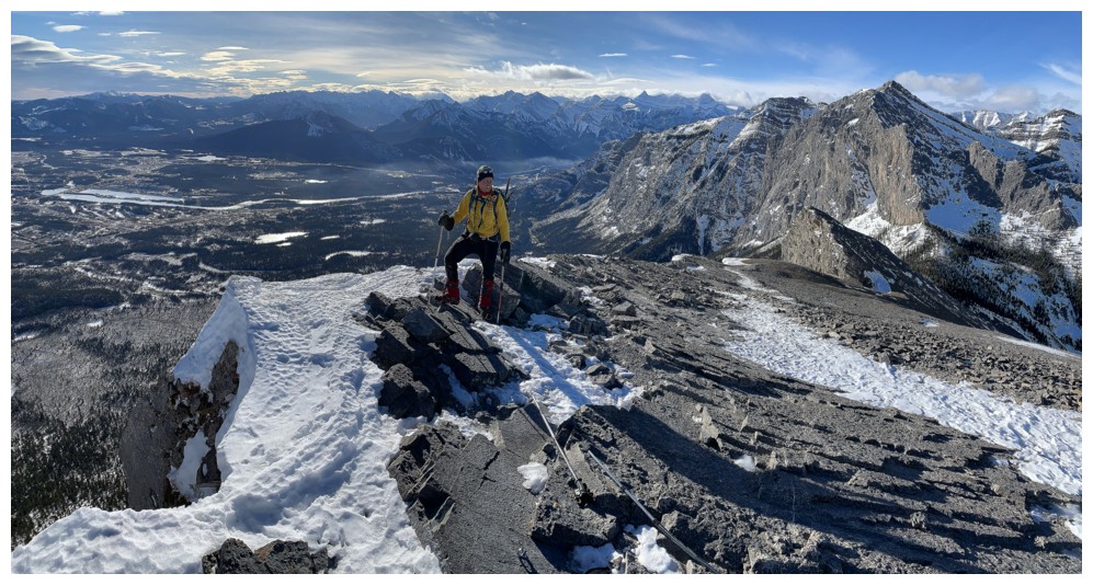
On the ridge, looking down the vertical face
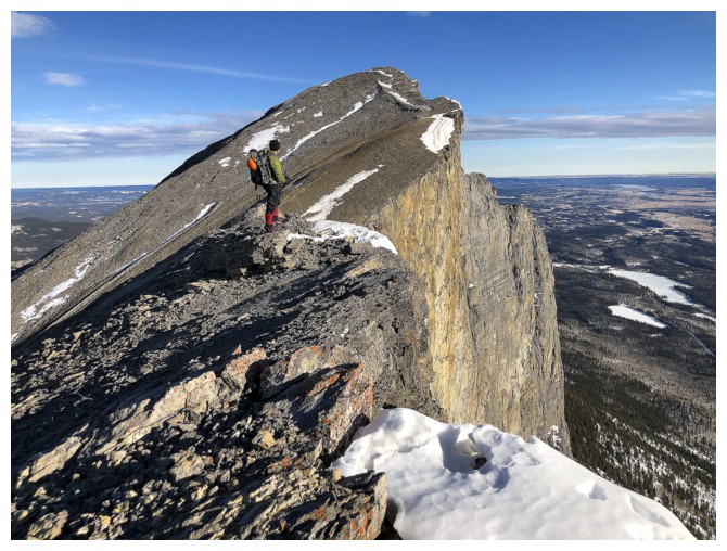
It's possible to stay on the ridge up to the really steep section
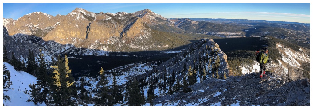
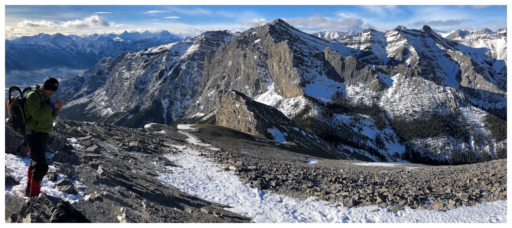
Mark and the CMC valley
Fun ridgewalking
Easy does it here
And here
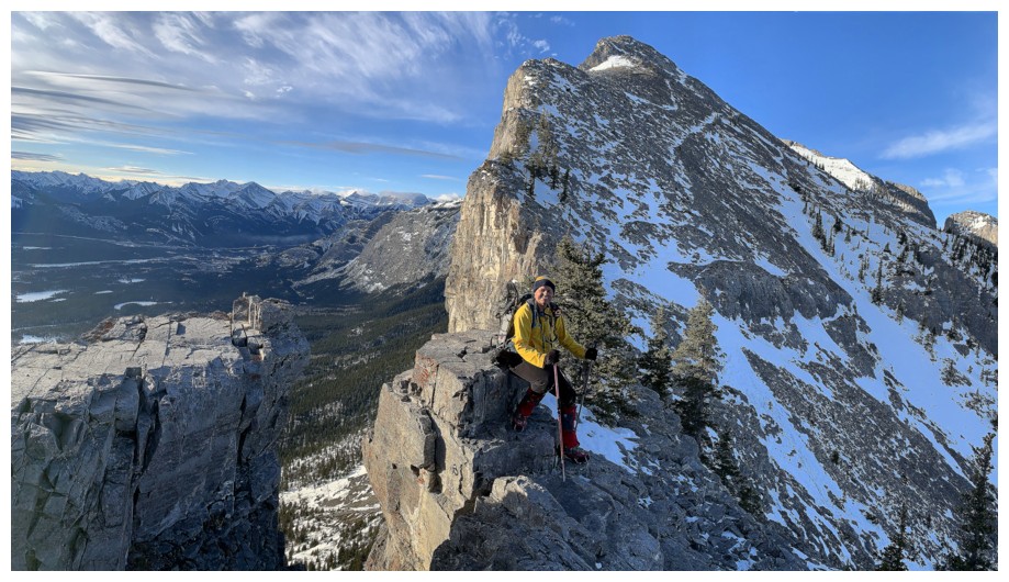
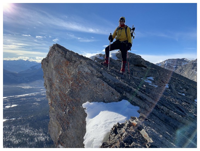
Great place for an awkward pose!
The classic spot on the ridge for vertiginous photos
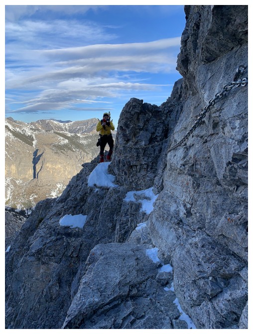
The Chain traverse (so famous it gets capitalized!)
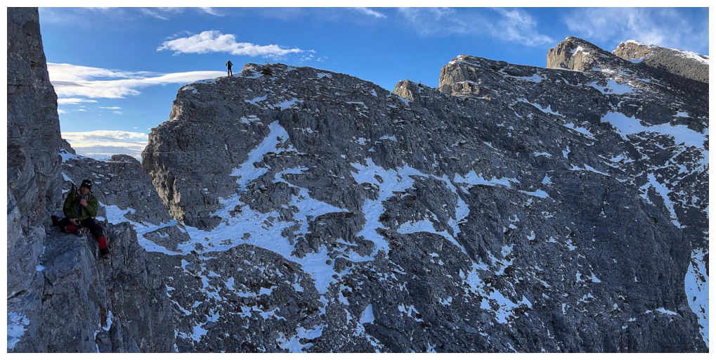
Mark sits on the Chain ledge, while another hiker enjoys the views
The ledge here is quite wide compared to what it becomes soon after
Looking back at the Chain traverse
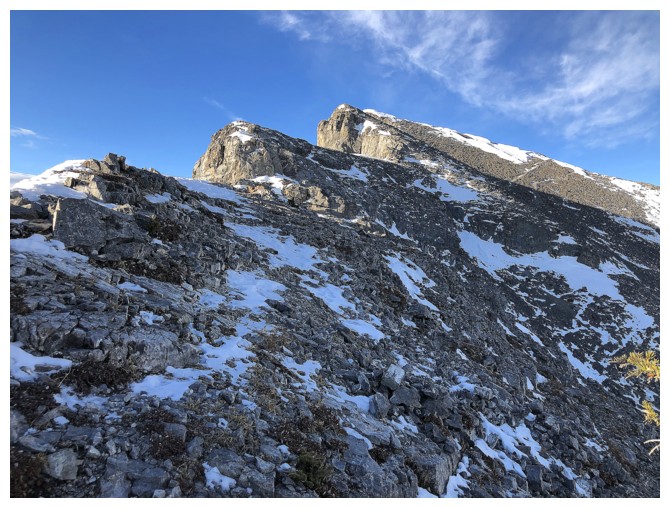
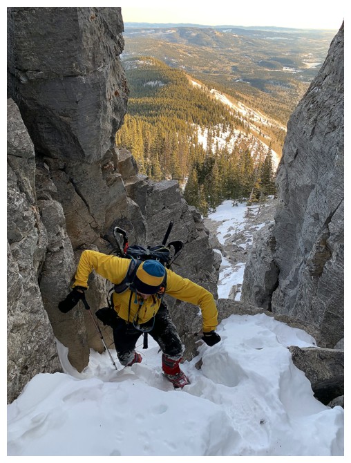
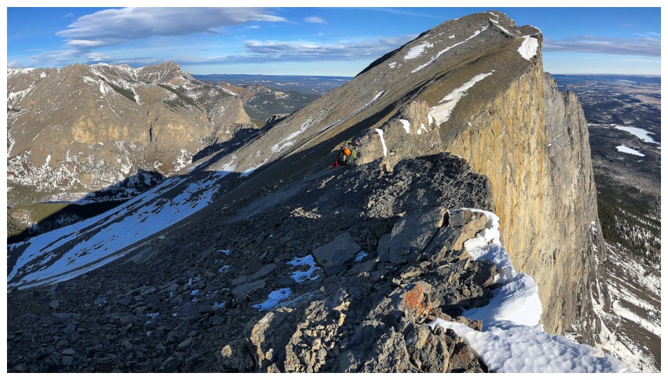
The route forward
Had to leave the ridge for this section
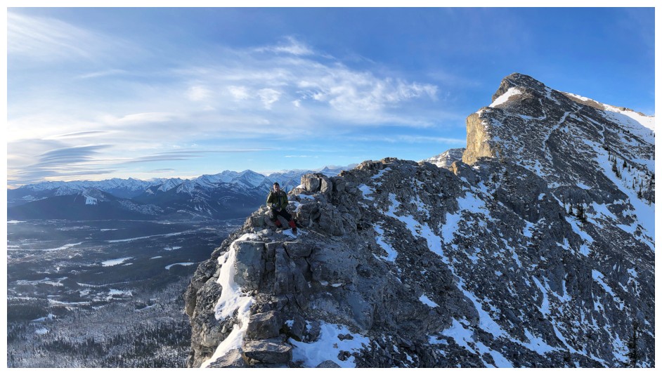
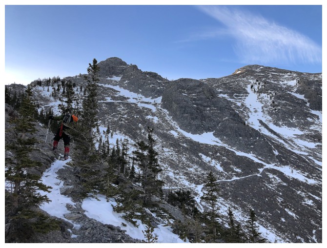
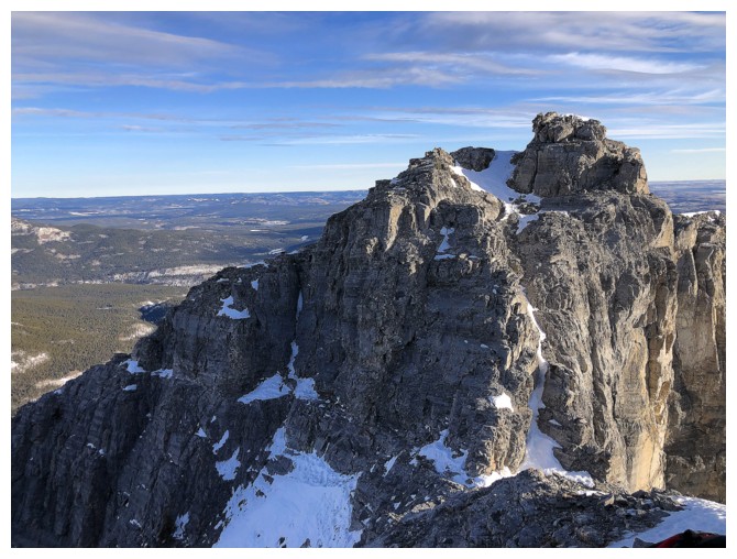
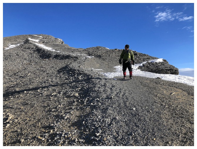
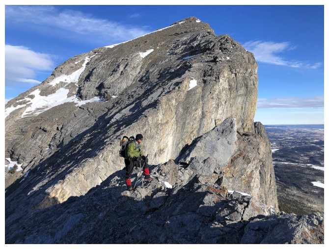
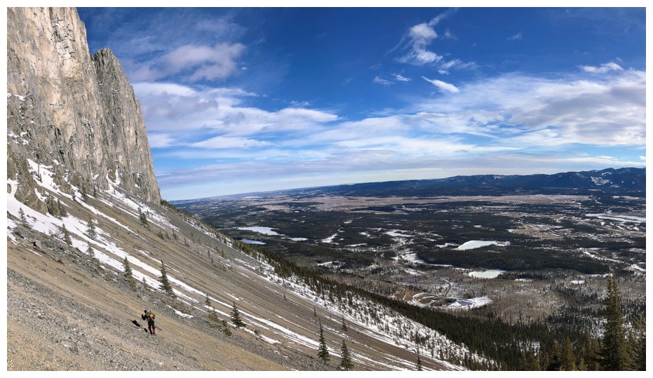
Mark (little dot at the right) makes his way up to the summit
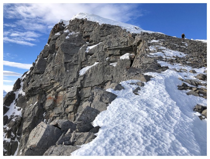
Almost there
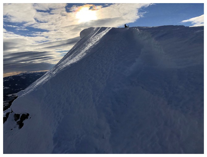
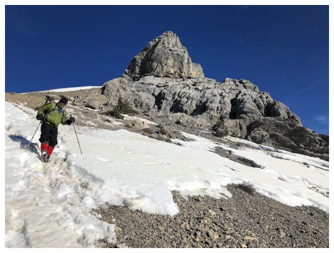
Snow scenery for the day
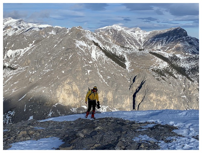
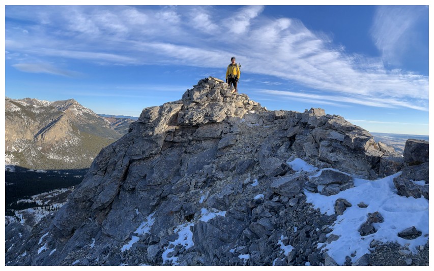
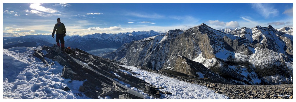
Last few steps for me
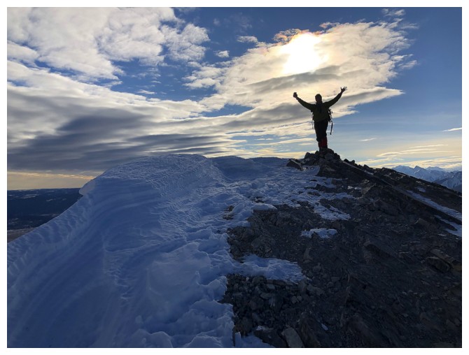
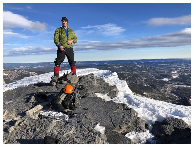
Success!
 \
\
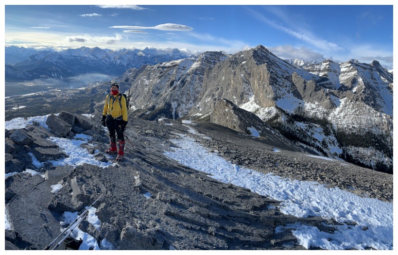
Summit view to the west. Goat Mountain is prominent - an old and not so old friend!
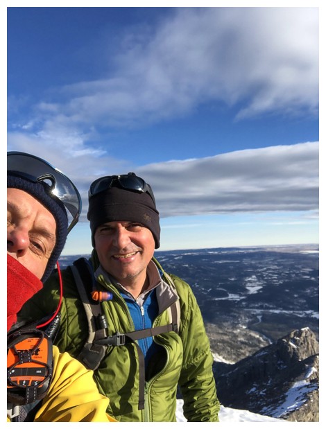
"I don't do selfies often, but when I do they are always poorly framed."
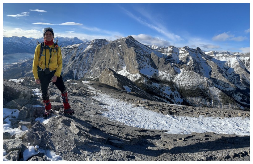
Super happy to be back on The Yam
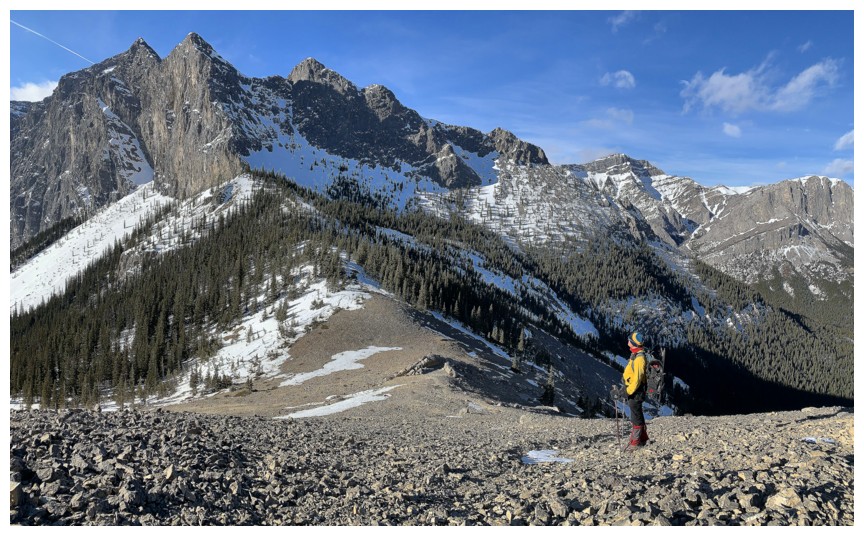
The east ridge and south face
The west ridge and south face
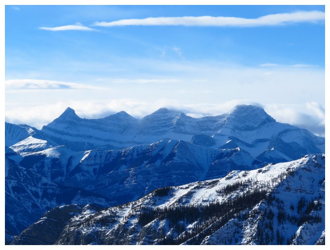
The three peaks of Mount Lougheed and Wind Mountain
Hassel Castle (right) and Mount Fable peaking over the ridge
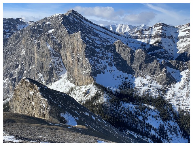
Goat again
A few more summit shots before the slow, but wonderful descent
Heading down
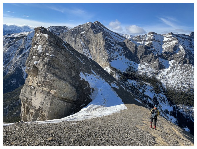
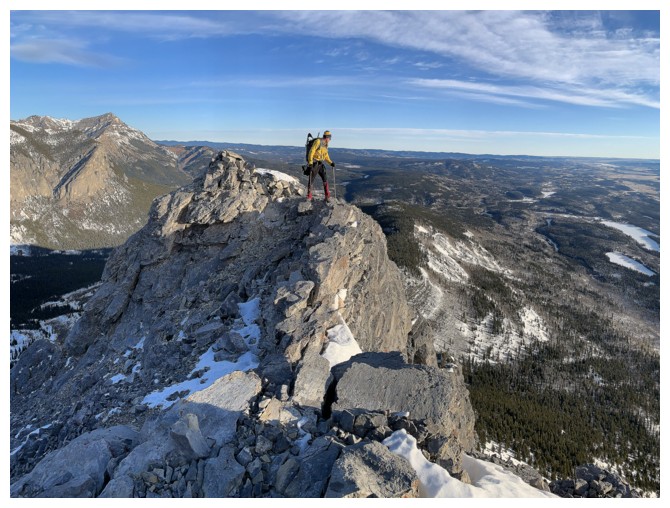
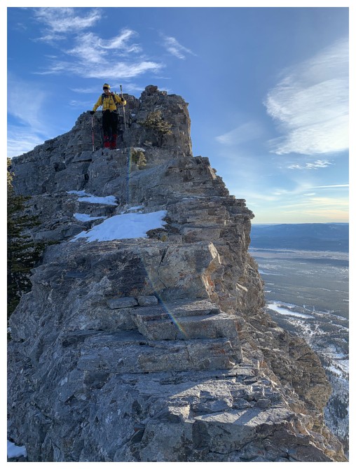
There are several highpoints on the west ridge that are worth checking out
Looking back to the summit
The first highpoint
Mark peaks over the edge
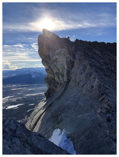
The next highpoint featured this wickedly curved slab of rock
Almost down to the Goat/Yam col
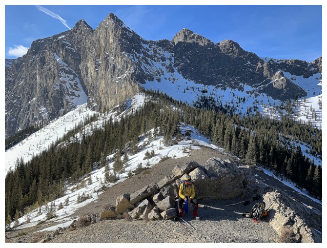
There's a naturally formed rock shelter near the col
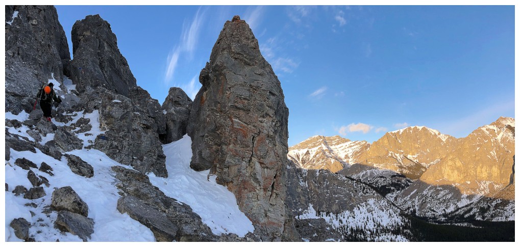
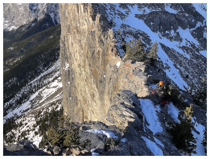
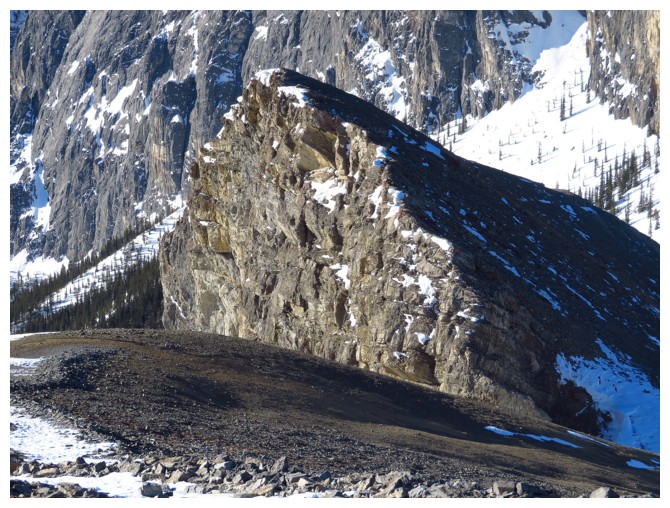
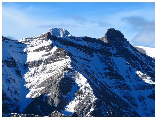
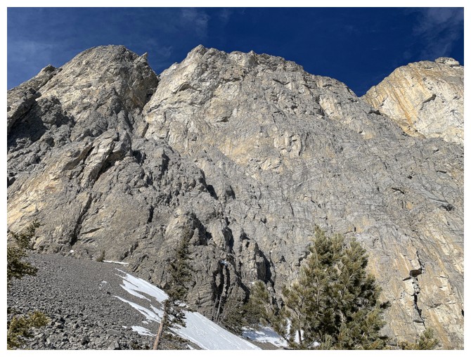
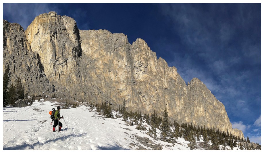
The west side of Yamnuska is hands-down my favourite part of the mountain
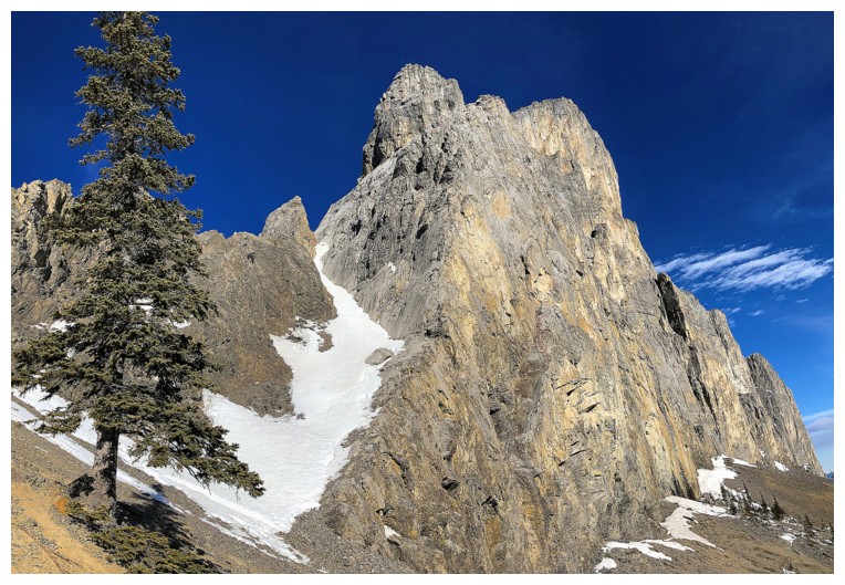
And it just gets better as the south face becomes visible
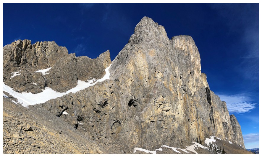
No substitute for a clear, blue sky here
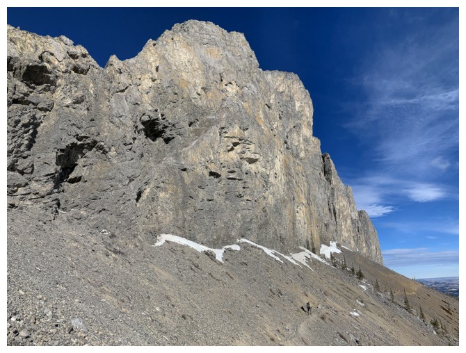
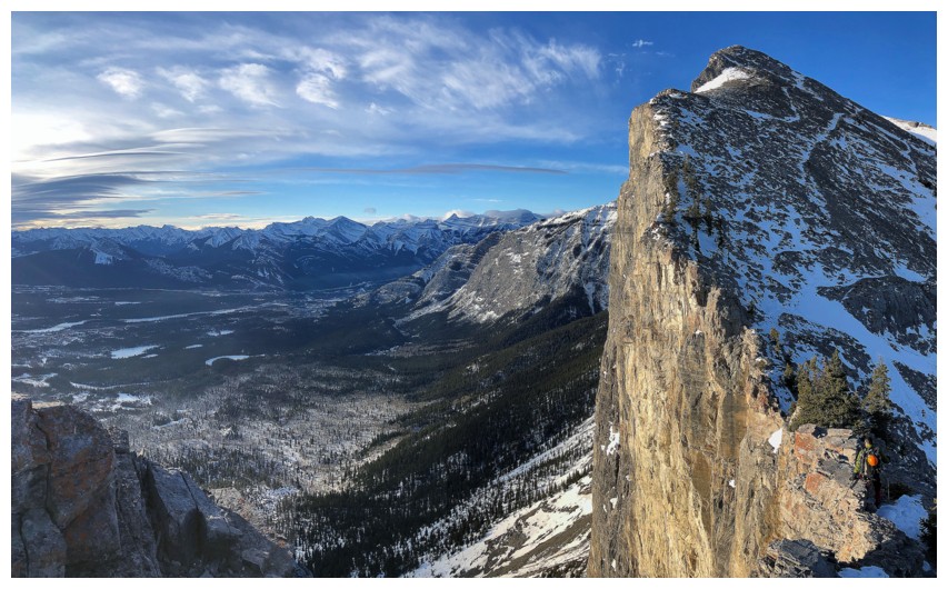
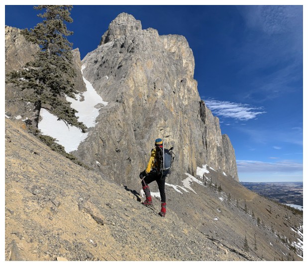
Traversing the south face
Fantastic views of the south face as we traverse
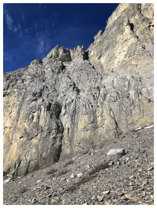
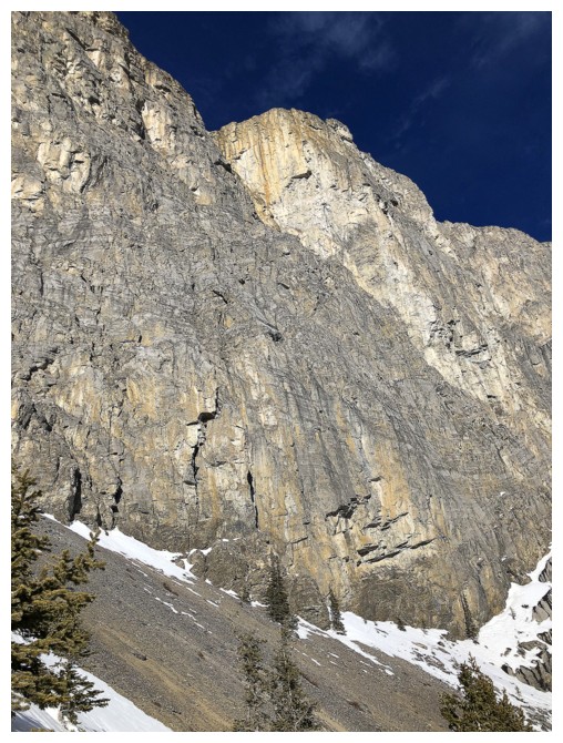
Looking up the Windy Slabs. Easy Street, King's Chimney routes
The west side is littered with another interesting routes
Almost ready for the scree descent
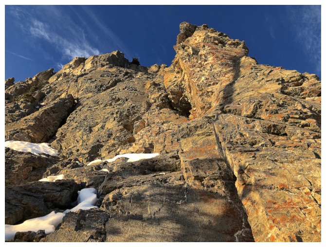
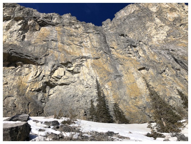
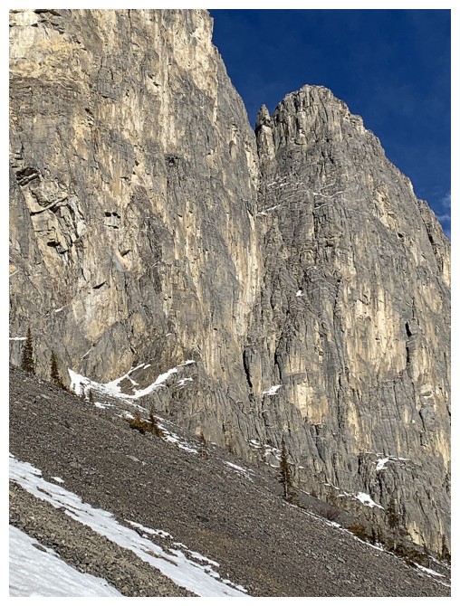
Very cool looking yellow rock face up high
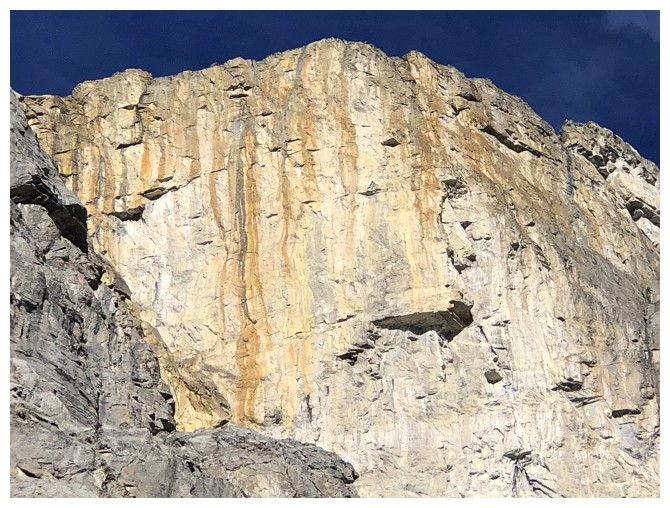
Close-up
Many of the big climbing routes reside in this area of the face
Down Mark goes
Looking up Grillmair Chimney before I go down
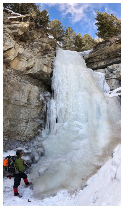
Waterfall ice
Parting view of the iconic mountain
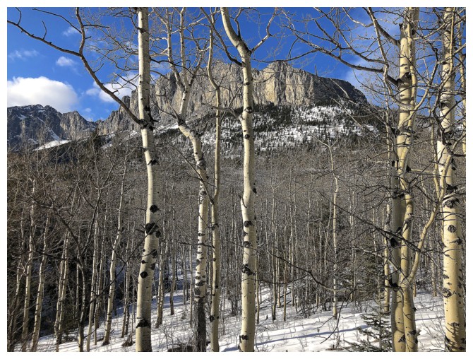
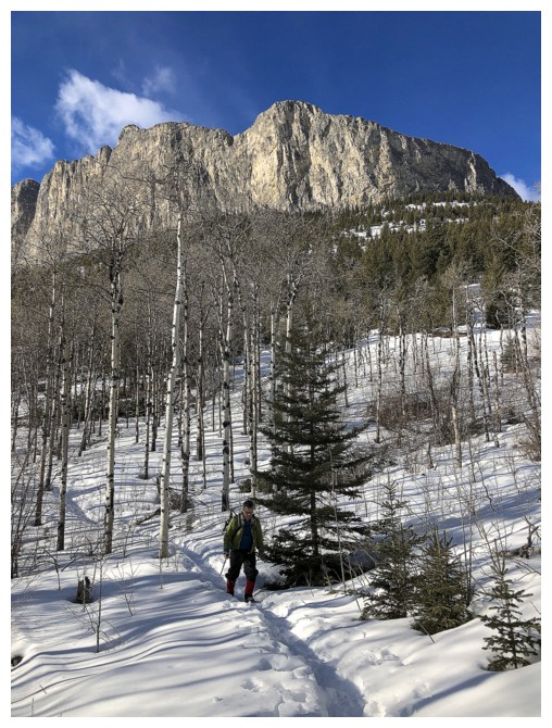
One more through the trees
The End
LOG