Newman Senior V
August 27, 2022
Mountain height: 2640 m
Elevation gain: 1743 m
Round-trip time:
9:27
Scrambling (for
our lives) with Dave.
I’ve had my
share of epics in the mountains, but this one takes the cake – and all on lowly
and innocuous Newman Senior!
Actually, at
2640 m unofficial Newman Senior is hardly “lowly” – tied in height with the
highest mountain in The Castle, Loaf Mountain. Since Senior sits on the
Waterton National Park border, you could also consider it to be a part of
Waterton, where it would rank as the 7th highest mountain. However, the peak does appear as an inviting, rounded red lump of joy; hardly a mountain to be feared!
The easiest
route to Senior starts at Red Rock Canyon, first goes to Goat Lake and then
approaches the summit from the west. Dave and I had a much different route
planned. 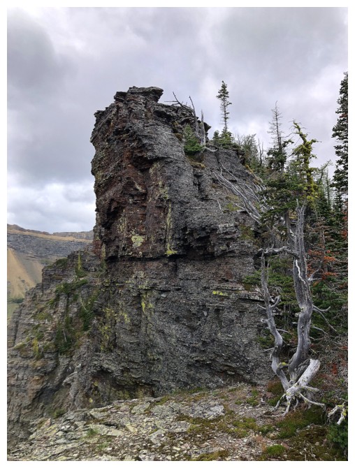 We would start from the Yarrow Creek trailhead, bike up and then down
to the Yarrow Creek gas road, hike the trail for a few kilometres, route-find
our way up to Senior’s northeast ridge, and then follow that ridge to the
summit.
We would start from the Yarrow Creek trailhead, bike up and then down
to the Yarrow Creek gas road, hike the trail for a few kilometres, route-find
our way up to Senior’s northeast ridge, and then follow that ridge to the
summit.
And that part of
the plan went quite well. Granted, the initial section of the bike ride and the
bushwhack up to the ridge were far from pushovers, but perseverance and some
good luck with route-finding served us well. The ridgewalk/scramble to the
summit was definitely the highlight of the day, the usual glut of incredible
rock scenery and colours keeping our cameras busy. Unfortunately, cloudy skies
prevailed, but a clearing trend was forecast and so we proceeded without
concern, eventually reaching the summit.
That forecast
was a ruse – and a vicious one at that! 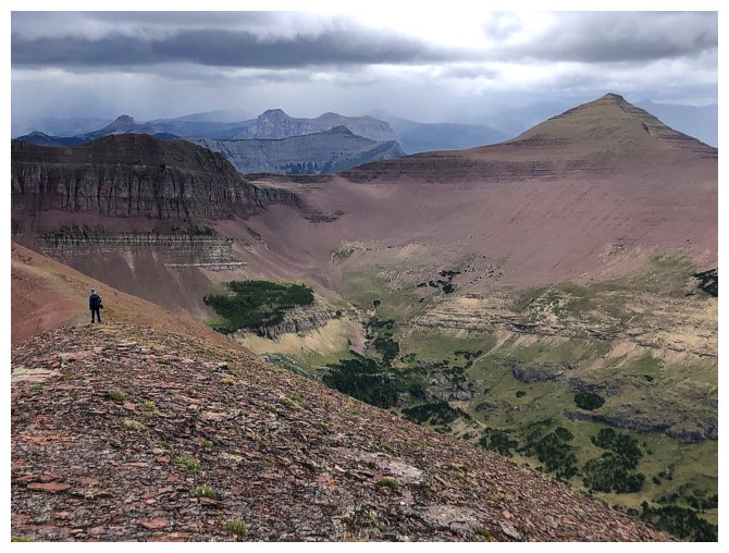 We reached the summit in increasingly
windy conditions and the threat of rain. Still, we were more disappointed than
concerned and continued heading west towards Newman Peak. And then the threat
became a sobering and frightening reality! With little warning, all hell broke
loose upon us: insane winds, horizontally flying ice pellets, an extreme drop
in air temperature, and absolutely nowhere to seek shelter. Stopping to put on
extra layers and/or rain gear would have been impossible in the hurricane-like
conditions. It was so bad I was actually afraid for both our lives at one
point!
We reached the summit in increasingly
windy conditions and the threat of rain. Still, we were more disappointed than
concerned and continued heading west towards Newman Peak. And then the threat
became a sobering and frightening reality! With little warning, all hell broke
loose upon us: insane winds, horizontally flying ice pellets, an extreme drop
in air temperature, and absolutely nowhere to seek shelter. Stopping to put on
extra layers and/or rain gear would have been impossible in the hurricane-like
conditions. It was so bad I was actually afraid for both our lives at one
point!
 We had no choice
but to either battle our way to the summit of Newman or backtrack and attempt
to descend the north side of the ridge. We chose to backtrack and within
minutes Dave skillfully guided us down into a less hostile
environment. Still, we were both soaking wet from the sleet and numb from the cold. Even
wearing gloves, I didn’t get full feeling back in my hands until almost at the
valley bottom. The upside of all this was finding a very interesting route down
to the tarn below, where a good trail back to the gas road sat.
We had no choice
but to either battle our way to the summit of Newman or backtrack and attempt
to descend the north side of the ridge. We chose to backtrack and within
minutes Dave skillfully guided us down into a less hostile
environment. Still, we were both soaking wet from the sleet and numb from the cold. Even
wearing gloves, I didn’t get full feeling back in my hands until almost at the
valley bottom. The upside of all this was finding a very interesting route down
to the tarn below, where a good trail back to the gas road sat.
We did get some
reprieve from the rain, but that did little to improve our thoroughly
water-logged status. After a short break at the tarn, all that remained was an
easy but long hike back to the bikes and the bike back to the start. The rain
held off for a while, but we ended the trip in a steady downpour (not that it mattered!).
Cool route, but
scary day! A sobering reminder that conditions that change in an instant out
there. Having said that, when the trauma from the day subsides, I would
actually consider repeating this route on a clear day, just to relive that amazing
ridgewalk – summer of 2027 it is!
Click HERE to see Dave's harrowing account.
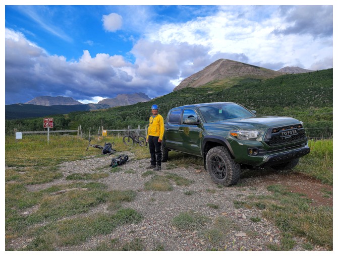
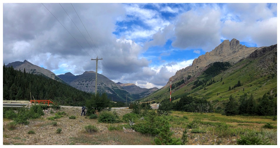
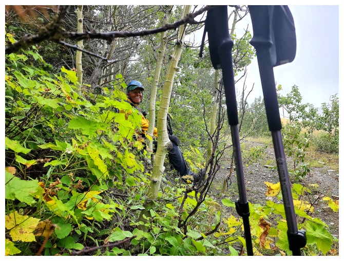
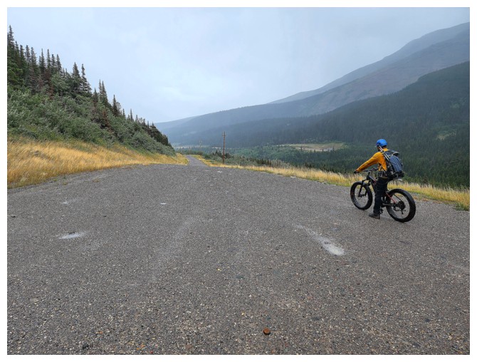
Gearing up at the trailhead (photo by Dave)
And off we go (photo by Dave)
Passing by the magnificent east face of Yarrow Ridge
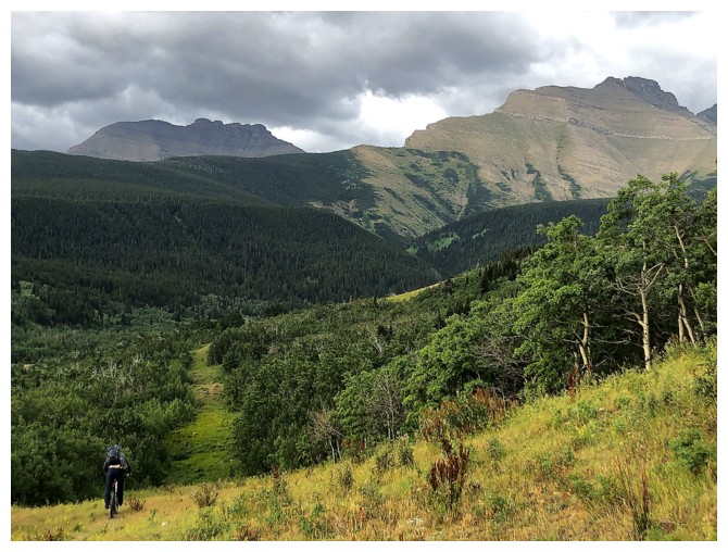
A welcome elevation loss on the bike in that is severely unwelcome on the ride out!
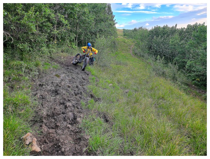
On second thought, it was unwelcome both ways! The trail here was a muddy mess (photo by Dave).
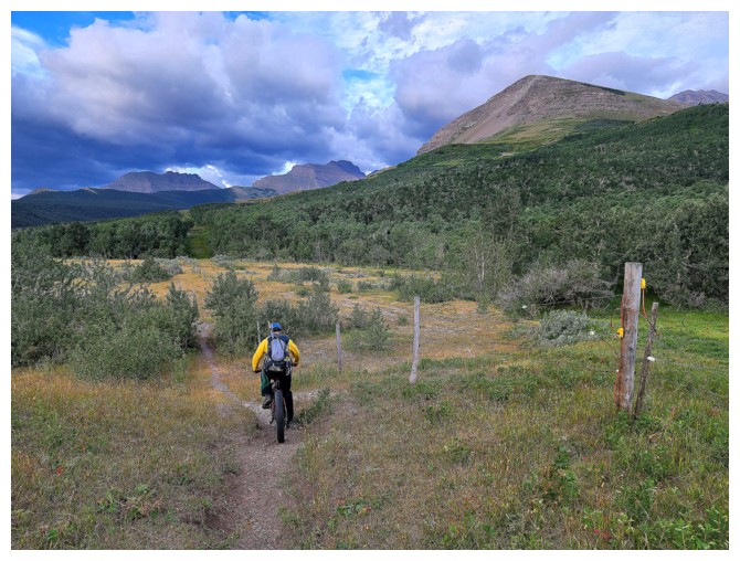
Onto flatter terrain. Cloudy Ridge Junior at the left and a northeast outlier of Cloudowan Peak at the right.
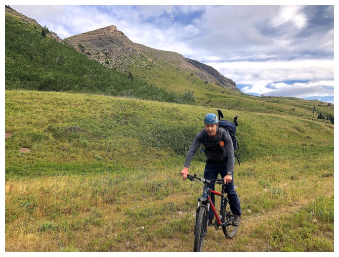
Dave is happy about the easier terrain
Almost onto the gas road
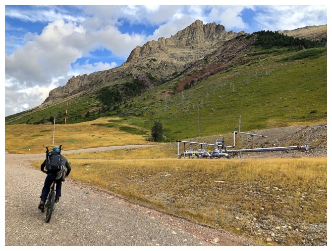
Dave can now hit Mach 2. Mount Yarrow dominates the view.
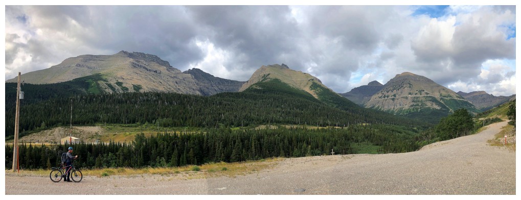
Cloudy Junior, the outlier, and the eastern outlier of Mount Glendowan are getting some Sun. Cloudy Ridge and Mount Glendown are the darker forms between.
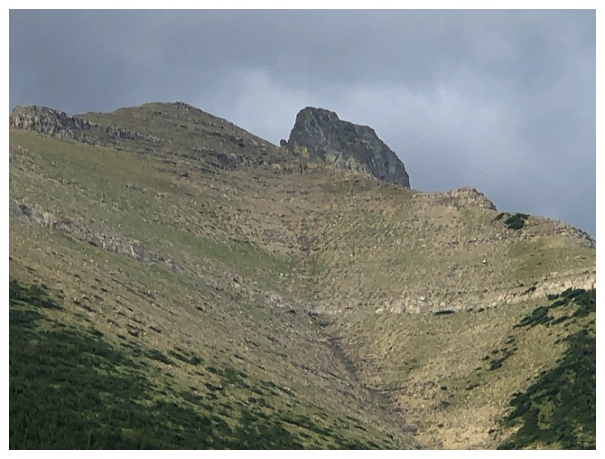
Close-up of that outlier
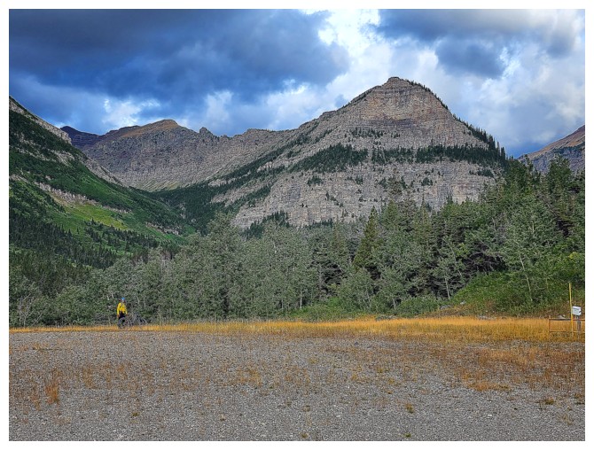
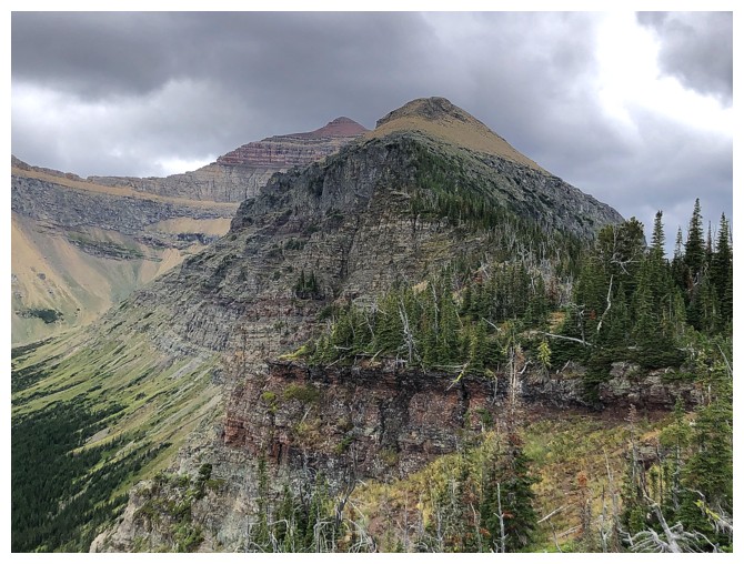
The end of the bike approach. The northeast end of Newman Senior looks impressive from this vantage point (photo by Dave).
The northeast end of Glendowan looks considerably tamer (but probably difficult to get to)
Crossing the drainage that we used for our previous ascent of Mount Yarrow (photo by Dave)
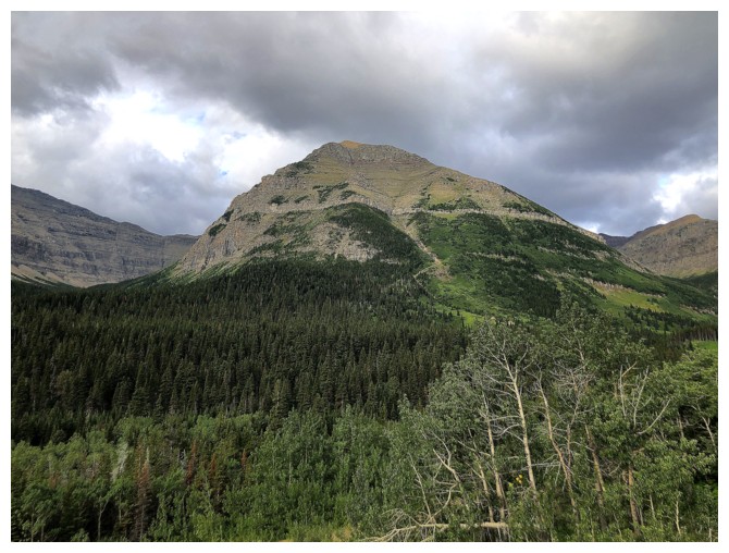
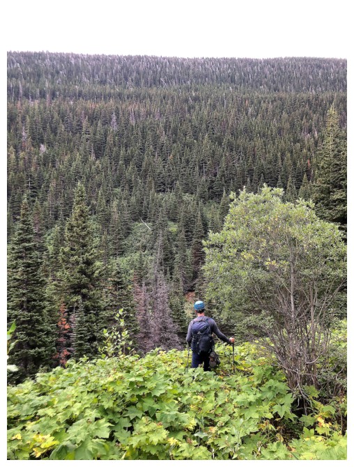
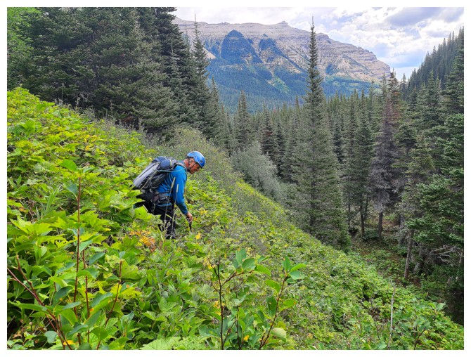
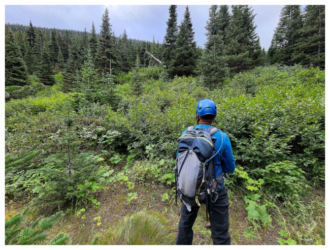
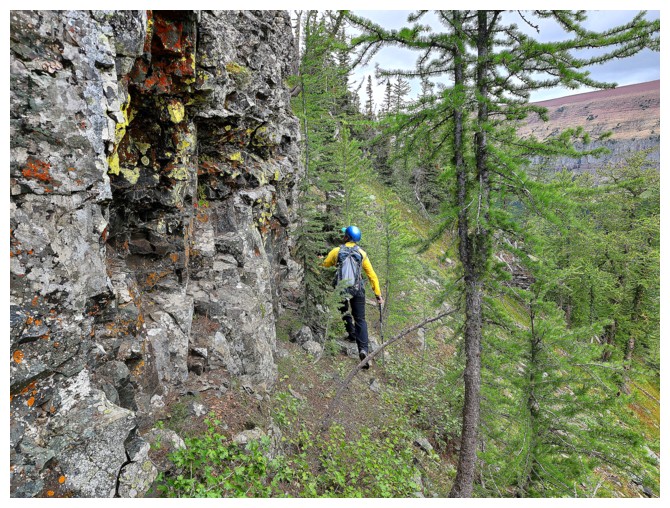
The heavily treed side of our objective (and our ascent route) appears
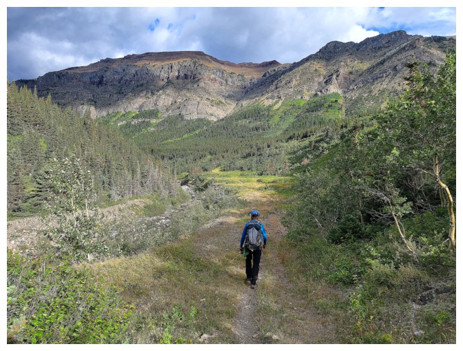
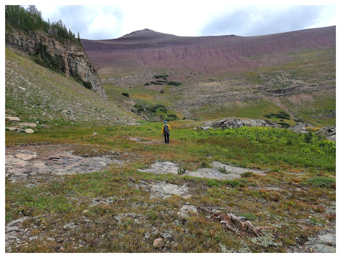
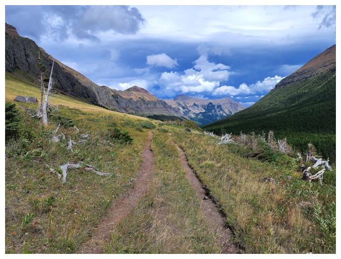
A very nice open area along the Yarrow Creek trail (photo by Dave)
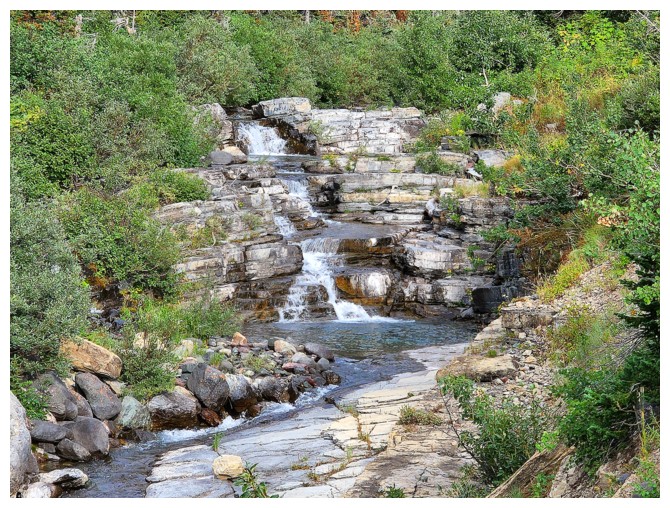
Yarrow Creek
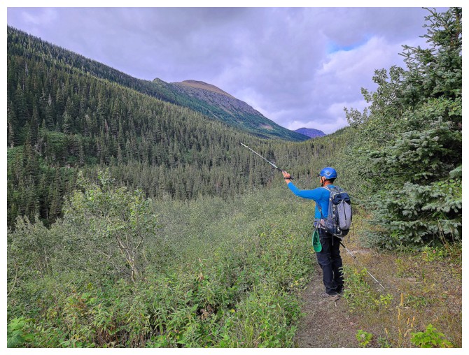
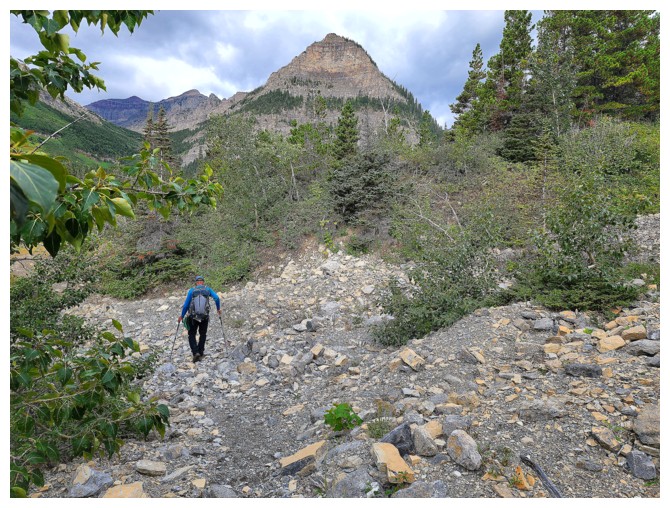
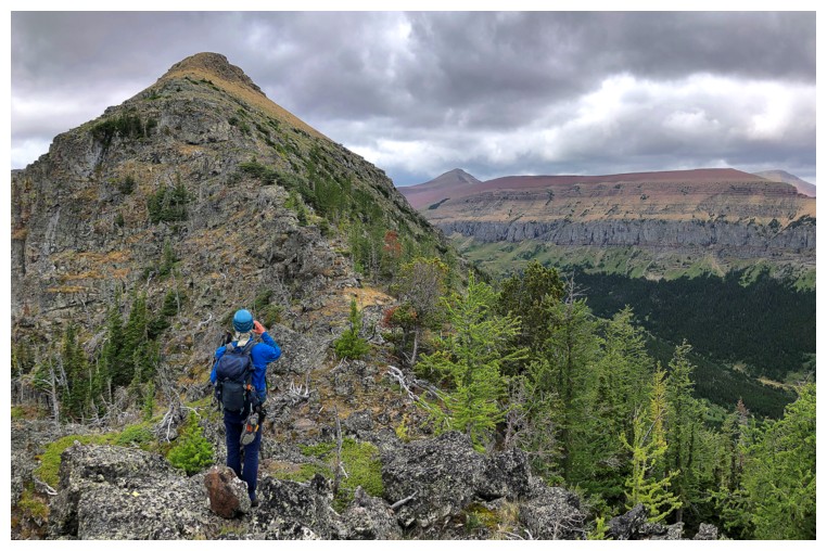
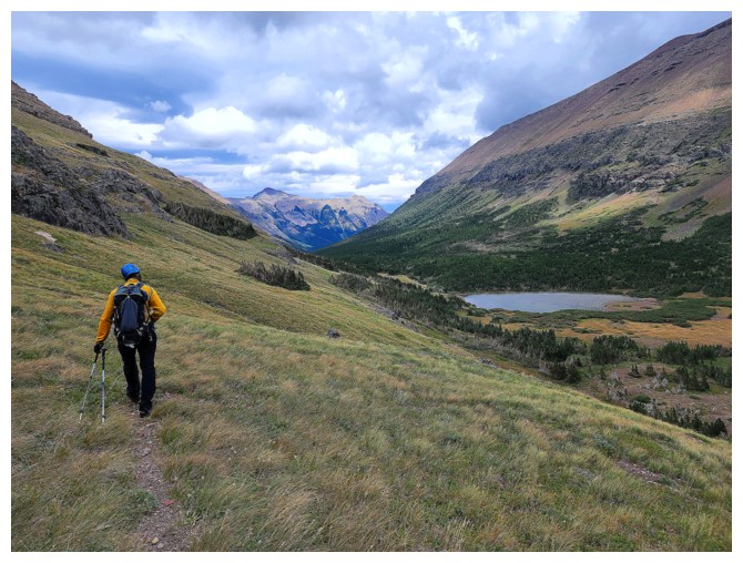
Pointing out the obvious ridge above that we need to get to (photo by Dave)
Unfortunately, that what exists between us and the ridge
Descending to Yarrow Creek (photo by Dave)
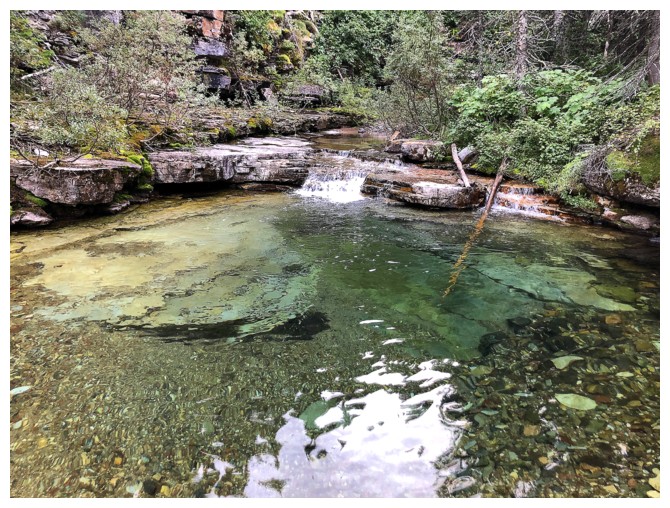
The creek
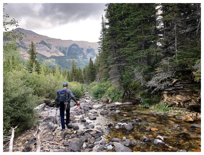
Dave finds a place to cross
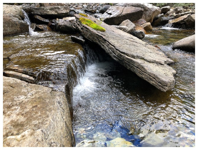
Nice, but not crossing here
What we are confronted with on the other side (photo by Dave)
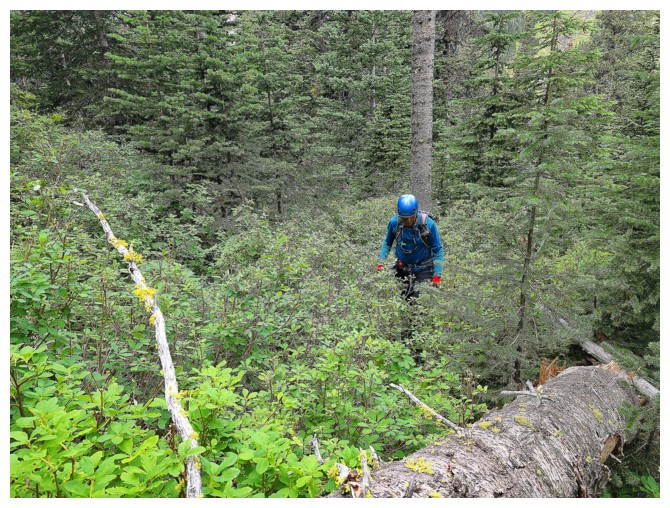
Tolerable (photo by Dave)
Dave tries to find a more scrambly route up
Still tolerable (photo by Dave)
On the ridge, but Dave is going the wrong way
View to the east (photo by Dave)
Mount Glendowan at the far left (photo by Dave)
Going the right way (photo by Dave)
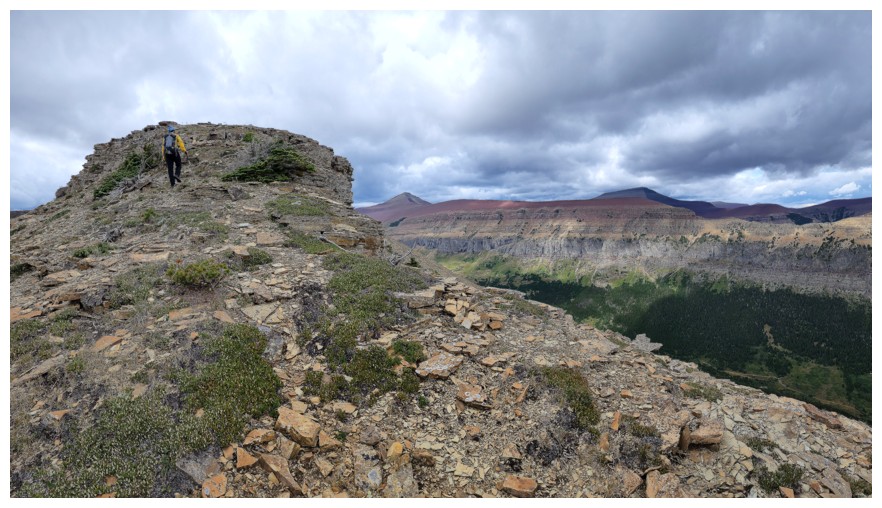
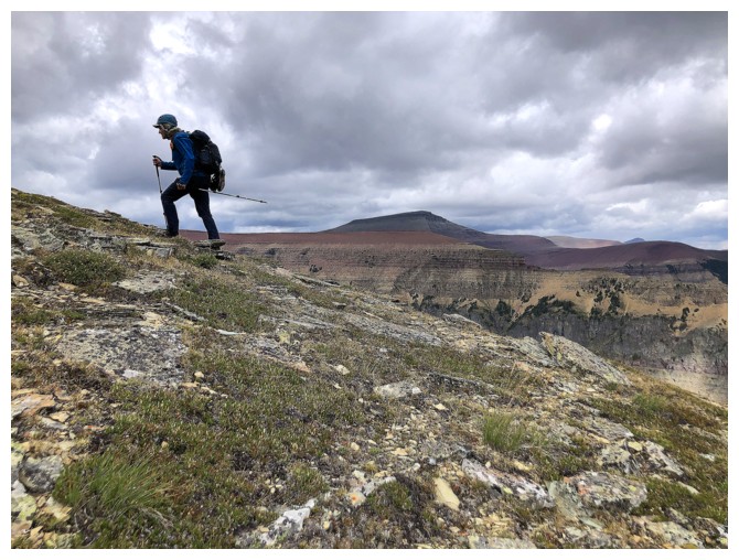
The ridge ahead looks interesting
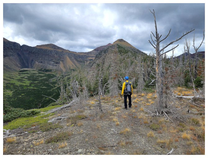
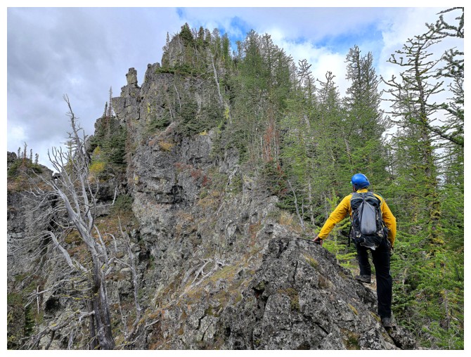
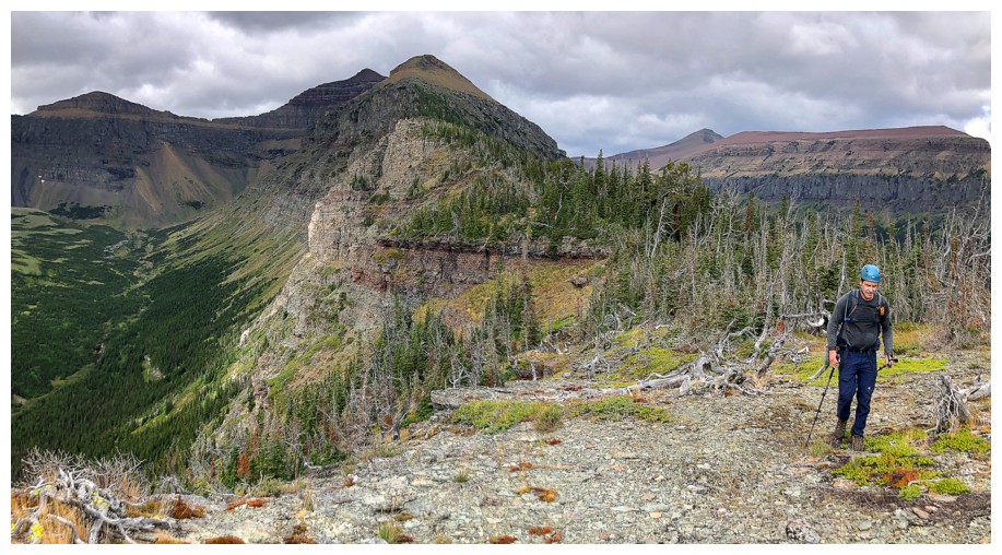
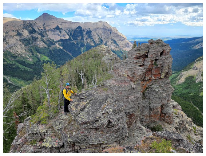
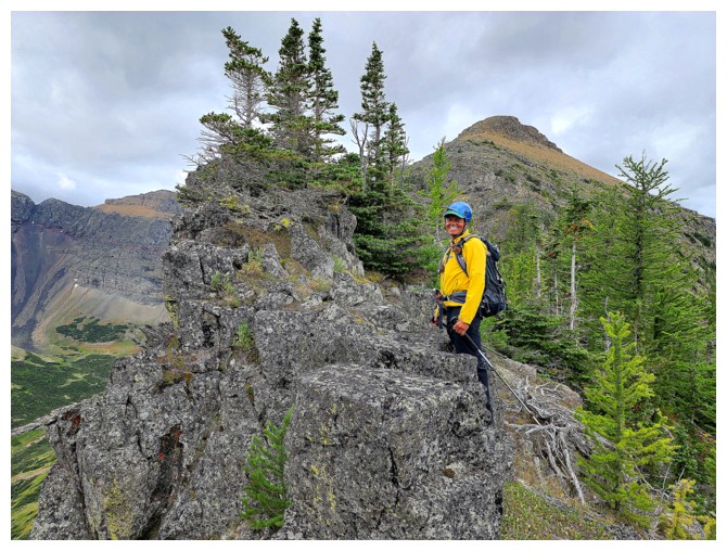
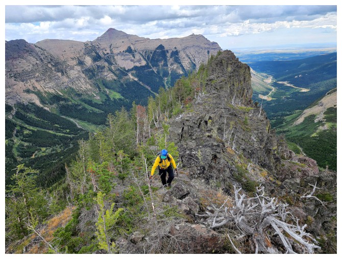
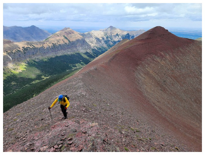
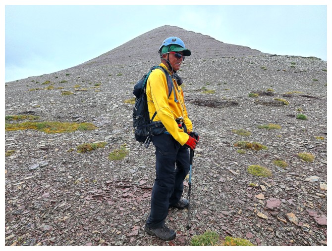
Yellow jacket time (photo by Dave)
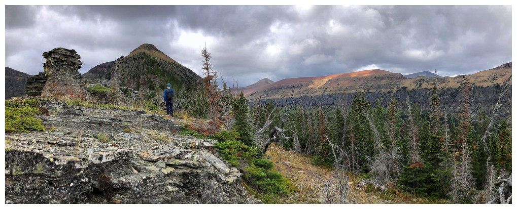
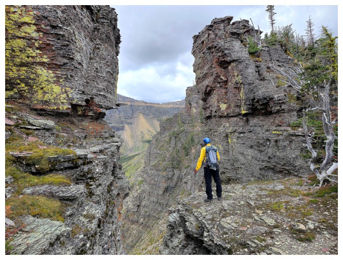
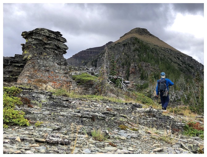
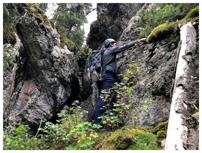
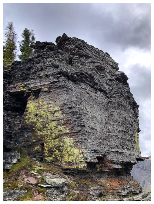
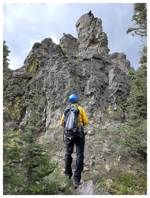
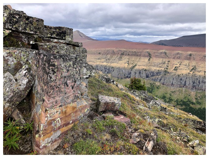
Dave passes a cool rock feature at the left
The south side of the ridge has many vertical rock bands
There's one
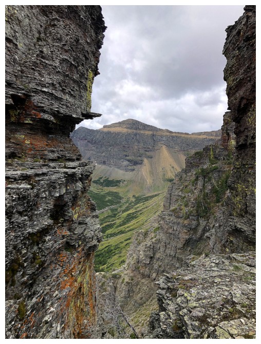
Looking through a gap at one of the two minor summits between Glendowan and Newman Senior
More cool rock at the left and the northeast wing of Glendowan at the right
Passing by the cool rock (photo by Dave)
With clear skies this ridge would have been breath-taking (photo by Dave)
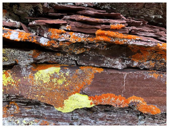
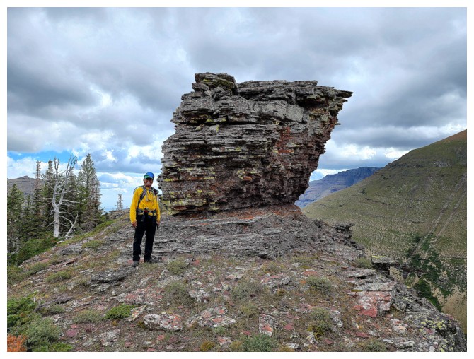
Mandatory orange and yellow lichen on red argillite shot
One cool rock feature...
...after another (photo by Dave)
Not getting up that (photo by Dave)
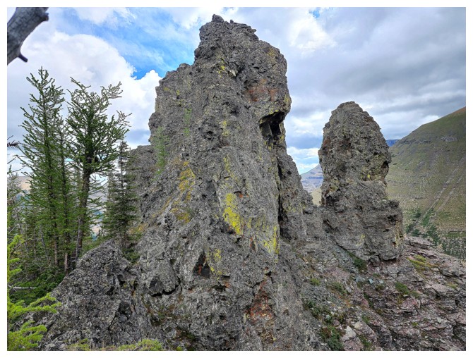
Same as above, but from the other side (photo by Dave)
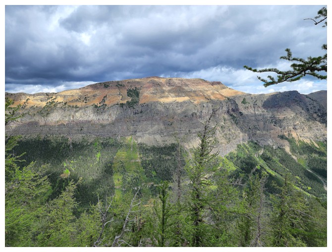
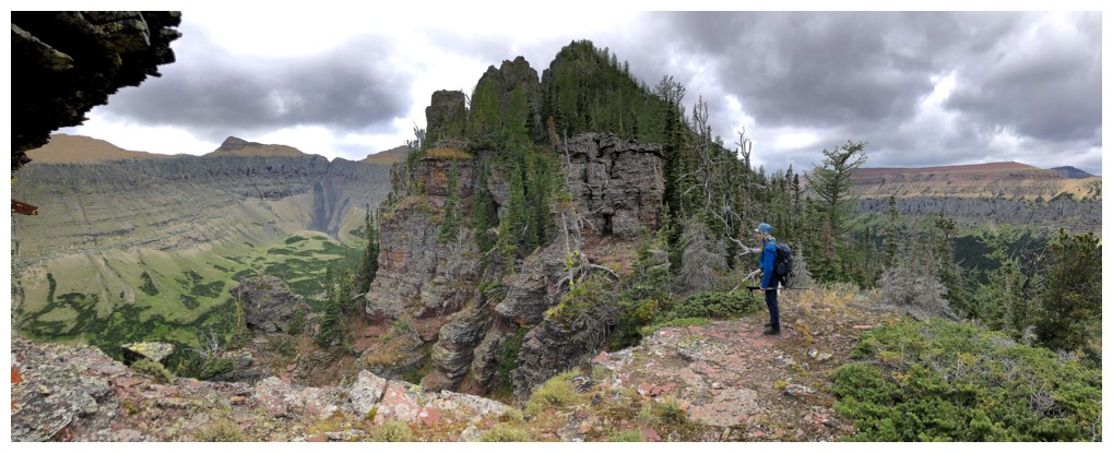
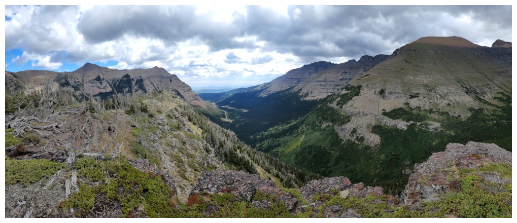
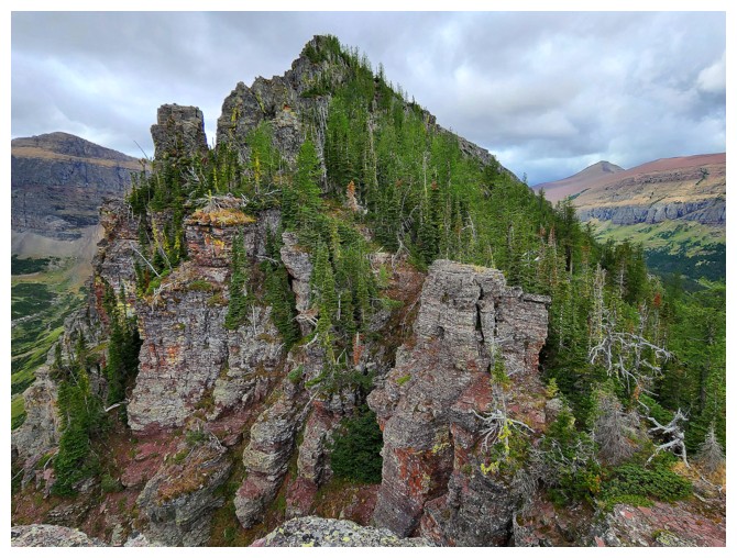
The east section of lengthy Spionkop Ridge (photo by Dave)
Going around an obstacle (photo by Dave)
The west part of Spionkop
Regaining the ridge
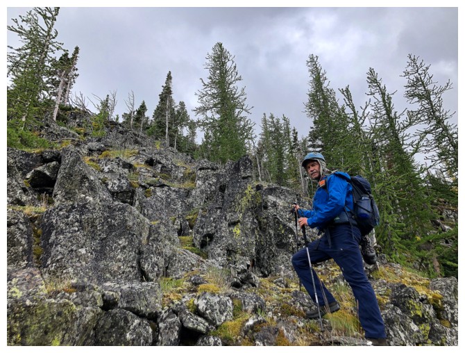
Obviously happy to be back on it (photo by Dave)
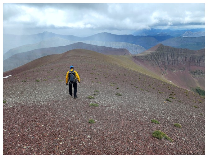
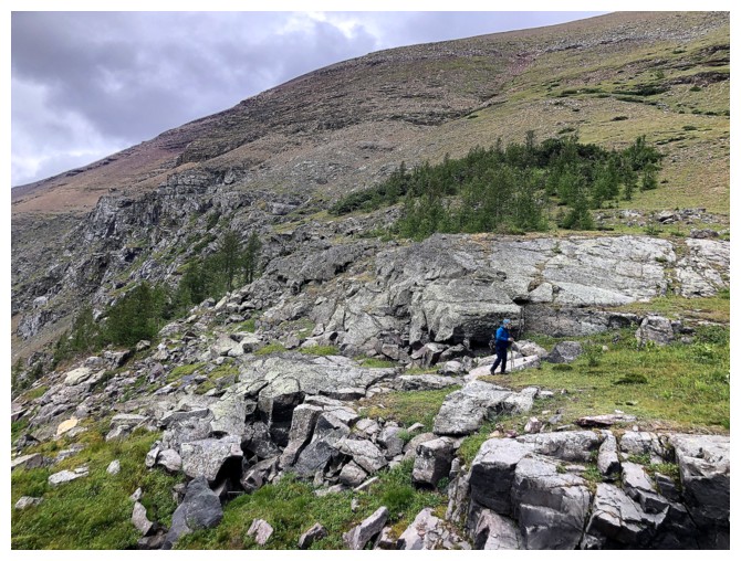
Dave surveys the easier terrain ahead
And the terrain behind (photo by Dave)
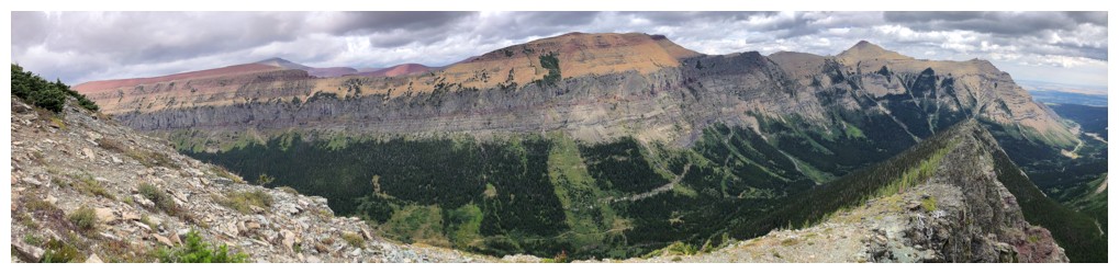
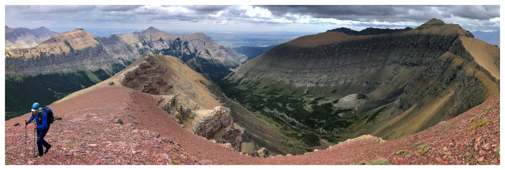
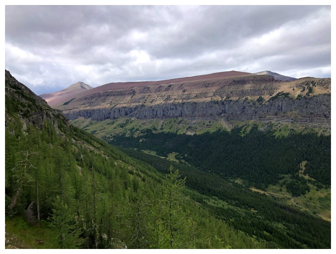
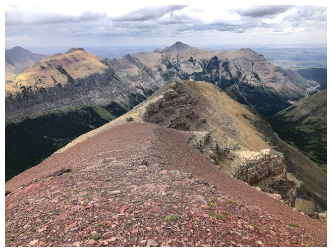
Almost all of Spionkop Ridge. Mount Roche and Yarrow at the right.
The trees are gone; it's all rock from hereon in (photo by Dave)
Same as above, with Spionkop (photo by Dave)
Loaf Mountain in the distant centre
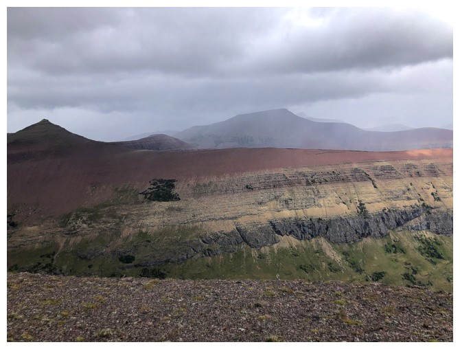
The colourful rock layers of Spionkop are emulated by the rock at the left
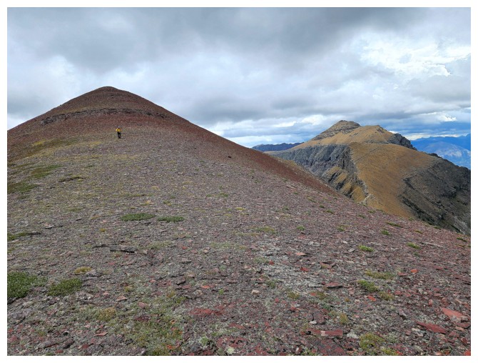
The second minor summit, west of Glendowan (photo by Dave)
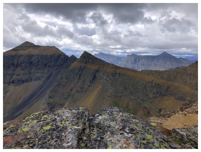
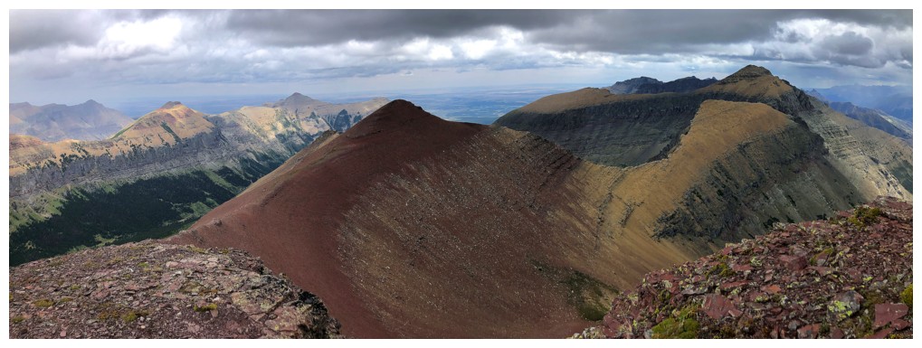
The traverse from Newman Senior to Glendowan is generally straightforward, except for the notch, just left of centre
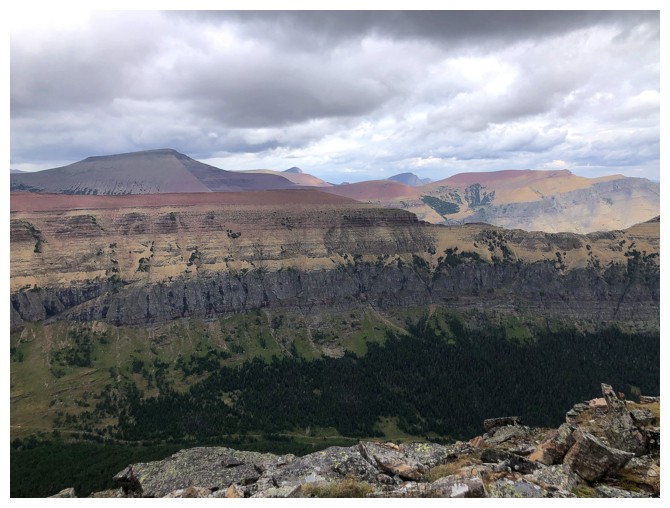
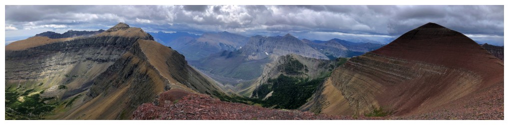
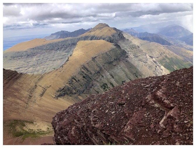
Many of the gems of The Castle East, including Loaf, Victoria, Pincher, and Drywood
Glendowan and the minor highpoint (that doesn't look very "minor" from here) (photo by Dave)
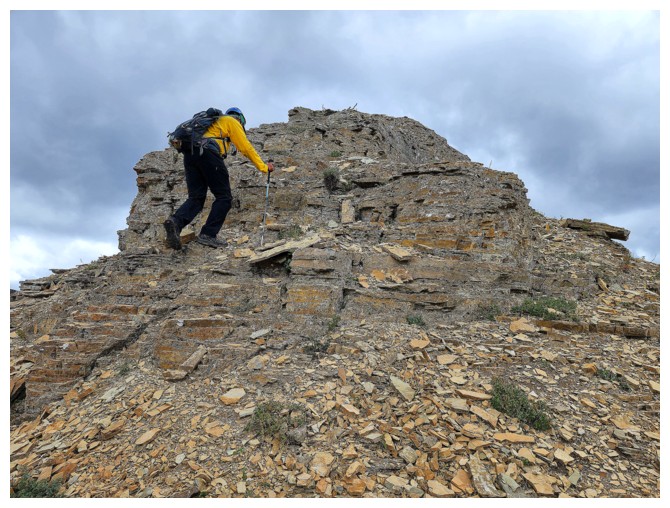
It's red argillite time
Looking back
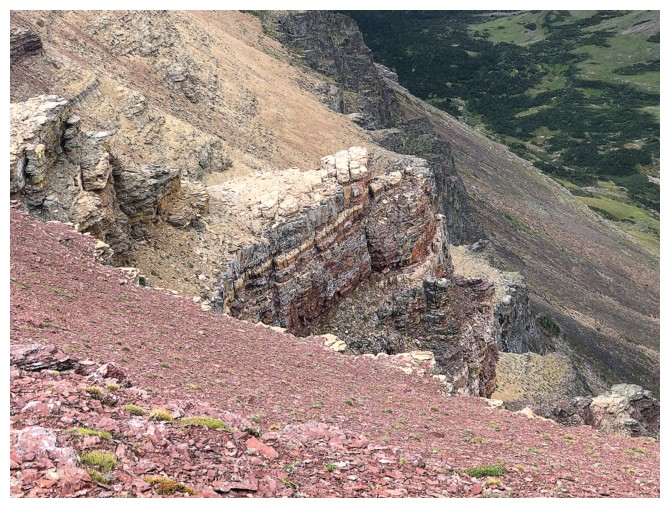
Rock layers on the south side of the ridge
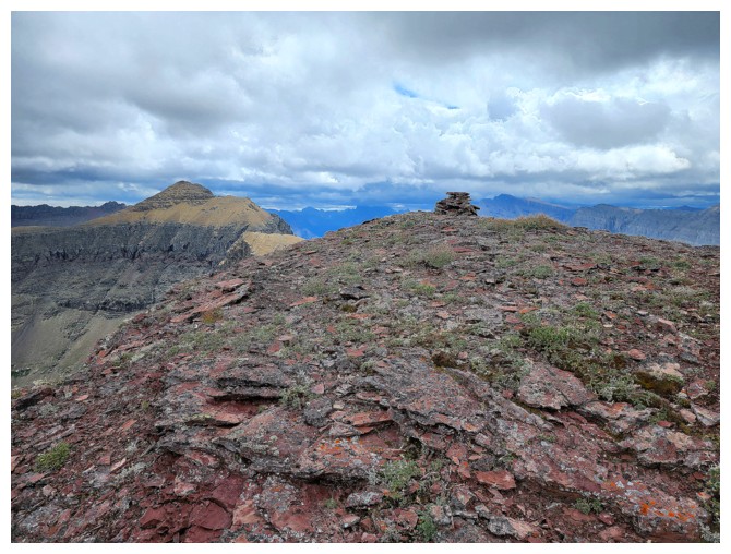
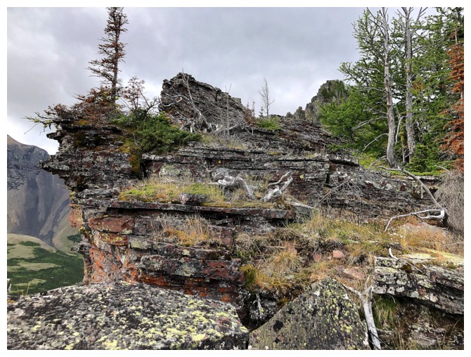
The minor highpoint has a cairn (photo by Dave)
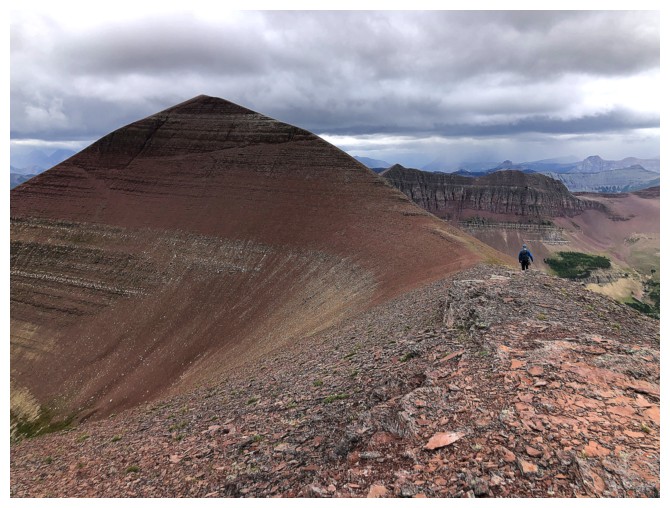
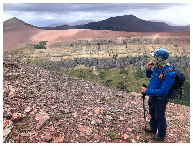
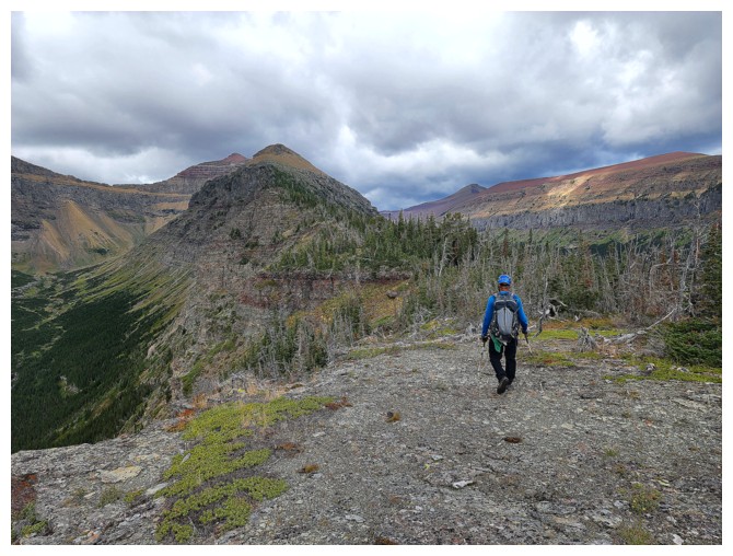
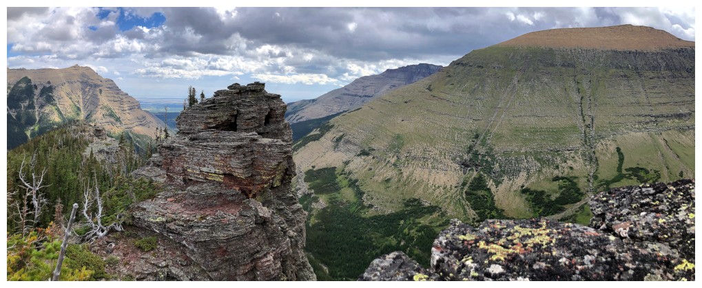
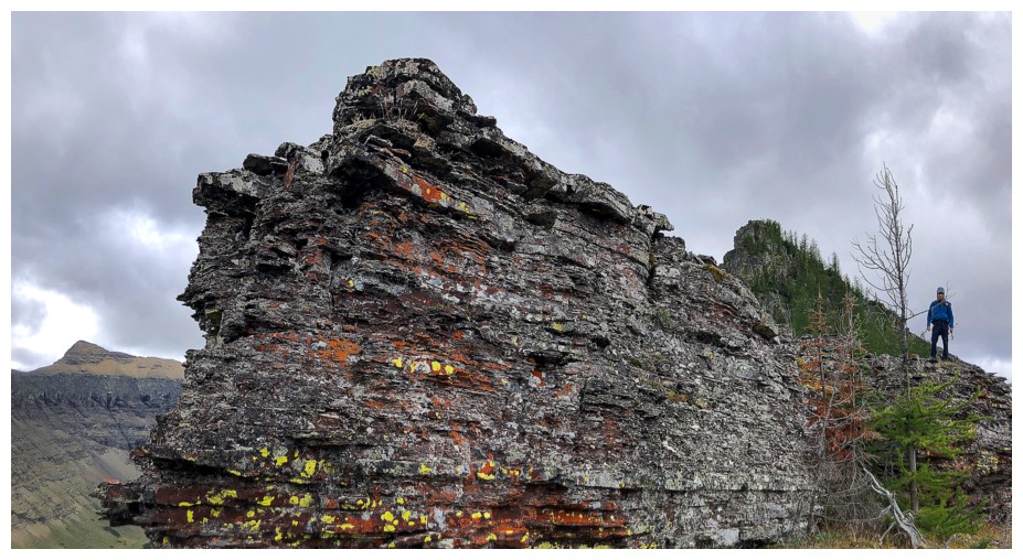
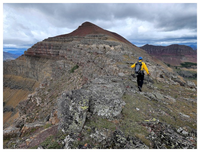
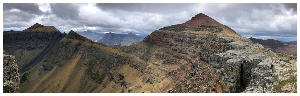
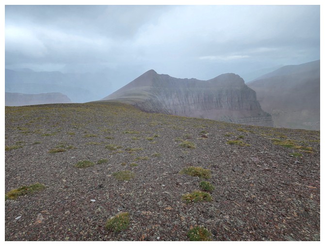
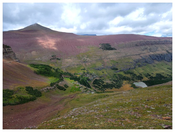
Newman Senior, with Newman Peak at the right
Right to left: the route I took going from Senior to Glendowan. Were I to repeat that traverse I would do it in reverse - difficult up, easy down.
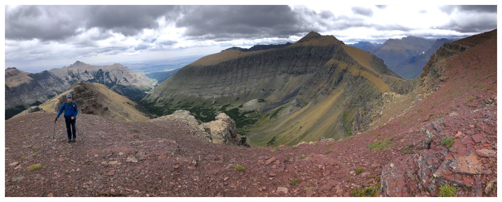
The summit of Spionkop, at the right, can be reached from multiple directions, including from Newman Peak, Yarrow Creek or a breath-taking traverse of the entire ridge
Leaving the highpoint behind (photo by Dave)
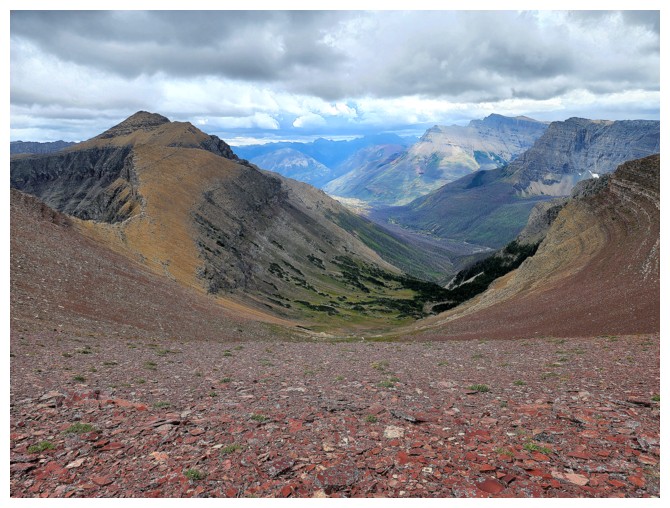
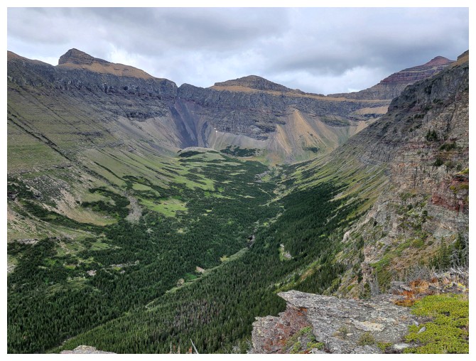
The valley between Glendowan and Senior looks very pleasant (photo by Dave)
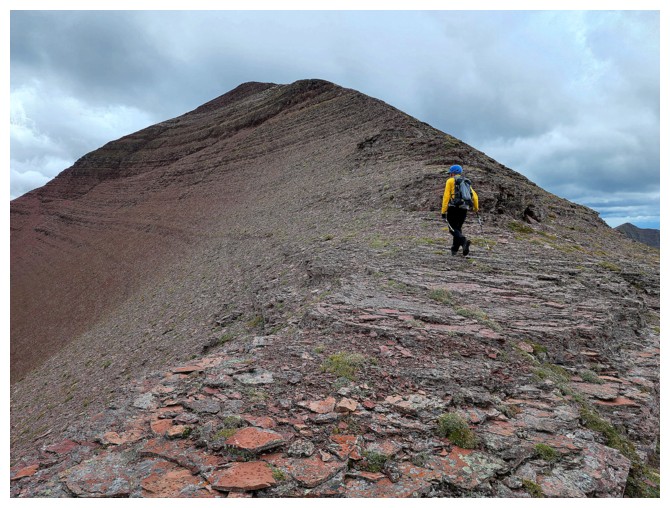
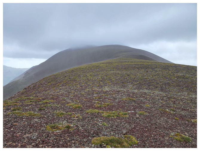
Finally heading up to the summit of Senior (photo by Dave)
Both the highpoint and Senior are comprised almost entirely of red argillite (photo by Dave)
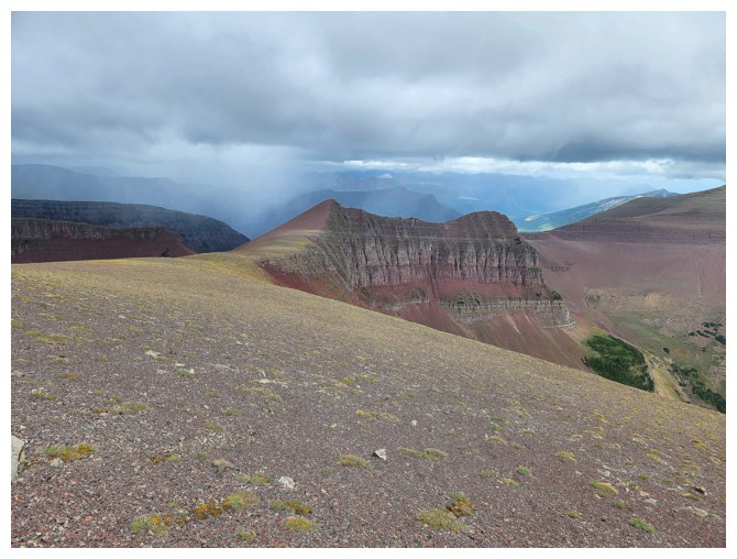
Looks like a little rain over Loaf
Some of the route to Glendowan
Same as above with more
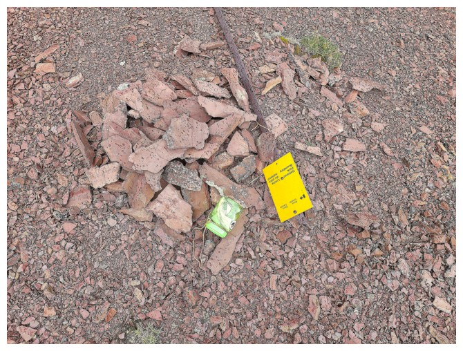
Senior's feeble summit cairn (photo by Dave)
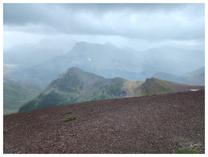
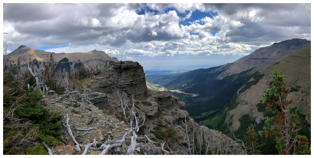
Definitely some bad weather over Blakiston now (photo by Dave)
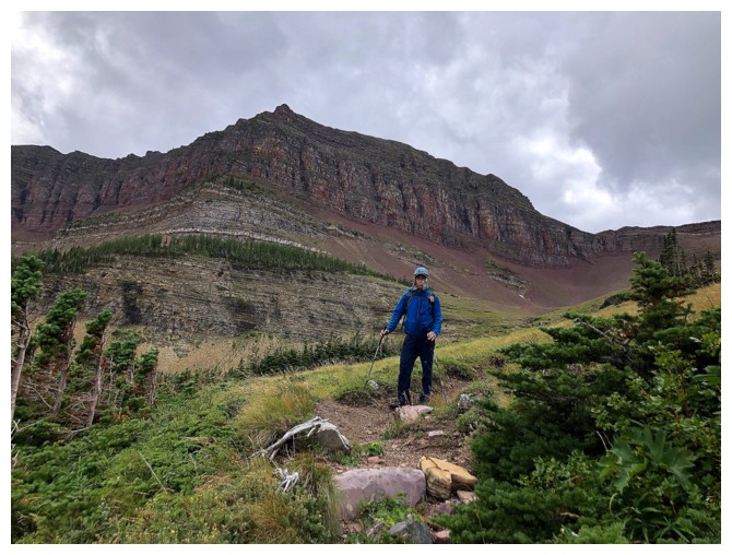
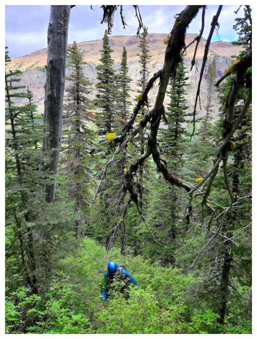
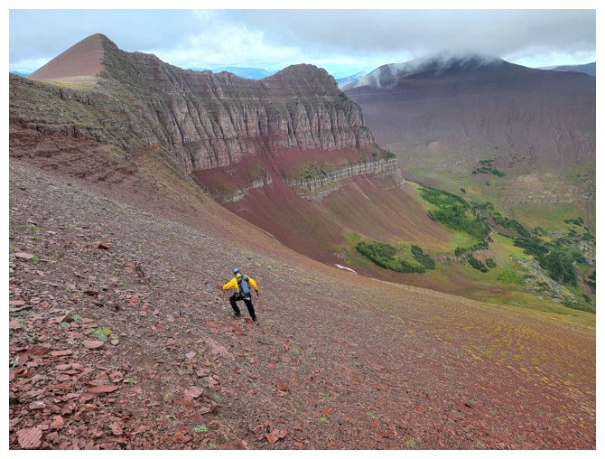
Heading down towards Newman Peak (photo by Dave)
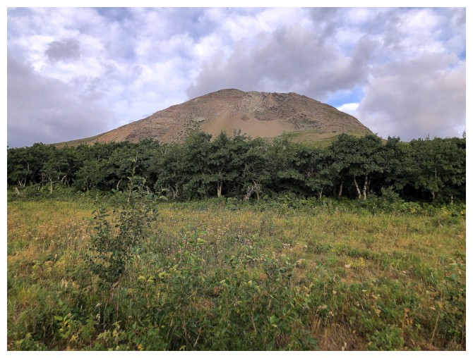
Newman Peak is quite a colourful mountain too (photo by Dave)
Suddenly its not so colourful. Several minutes after this photo was taken, all hell was unleashed upon us (photo by Dave).
Dave managed to snap a quick photo of me shivering in the cold, but it was all bets off after (photo by Dave).
He got one more of Senior off (photo by Dave)
Gettin' out of Dodge! Luckily, we were able to bail on the ridge down this slope to get out of Armageddon! (photo by Dave)
The new route down turned out to be an excellent one (photo by Dave)
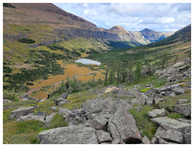
Aiming for the tarn below (photo by Dave)
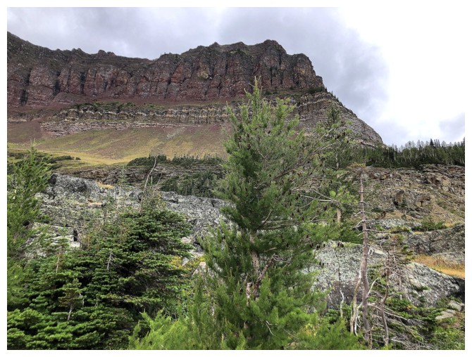
Part of Newman Peak
There are some very cool rock bands to route-find your way through en route to the tarn
We took slightly different routes down (photo by Dave)
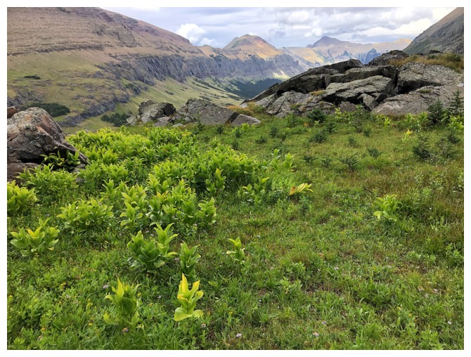
Beautiful greens
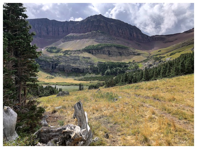
The tarn is still some vertical and horizontal distance away
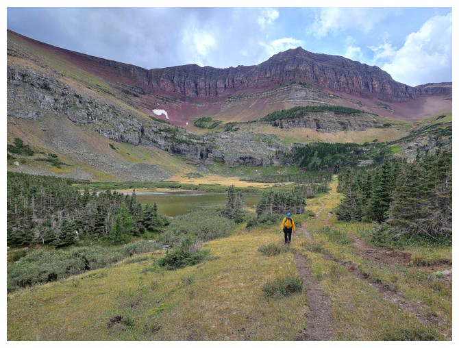
Almost there (photo by Dave)
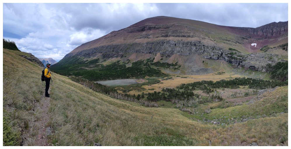
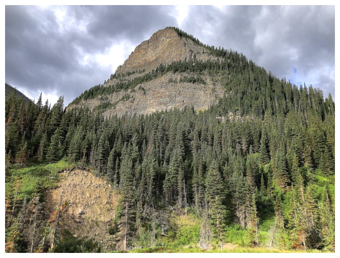
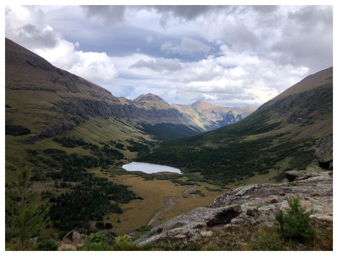
Newman Senior towers above the tarn (photo by Dave)
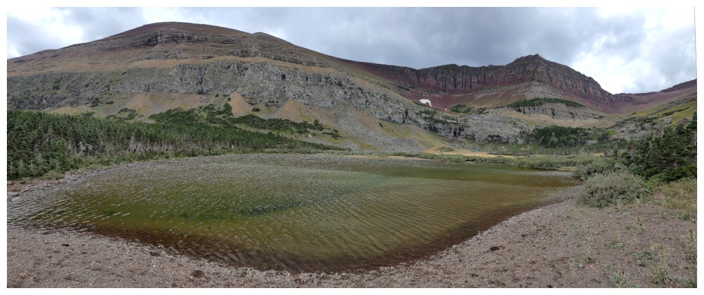
At the tarn (photo by Dave)
Leaving the tarn. It's a very long walk and bike back to the start (photo by Dave).
Parting look at Newman Peak
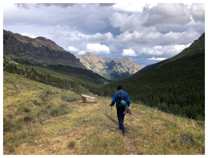
Enjoying better weather for now, but that wouldn't last (photo by Dave)
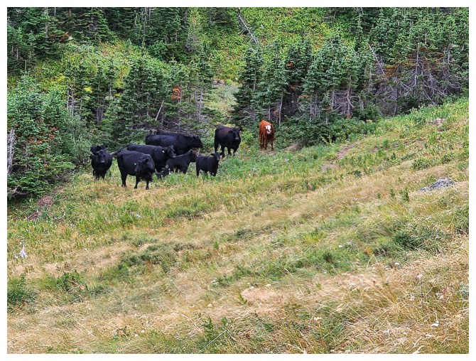
These guys don't fret about the weather! (photo by Dave)
Roche and Yarrow are visible throughout, but we need to be on the other side of them
Short break and taking shelter from the next onslaught of rain (photo by Dave)
Happy to be back on the bikes, but not happy to be riding in the rain (photo by Dave)
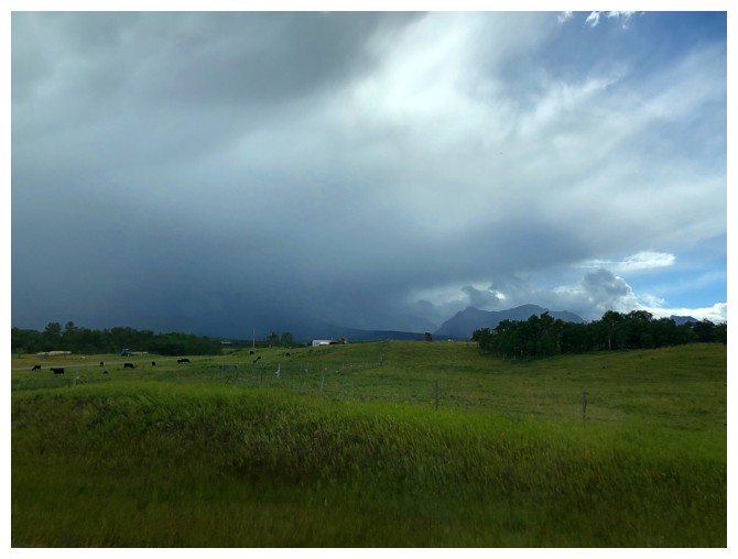
Back near the start, thankful we are not in the middle of that!
The End
LOG