See Peak
(east end of Kishinena Ridge)
June 17, 2025
Mountain height: 2692 m
Total elevation gain: approximately 1700 m
Ascent time:
7:05
Descent time:
5:40
Bike-bashing, bushwhacking,
and scrambling with Ephraim and Doug.
“The See
was angry that day my friends, like an old man trying to send back soup in a deli”.
See Peak was
not, in fact, angry on June 17, 2025. The mountain welcomed us with open arms –
the approach did not!
Having drooled
over this beautiful, but remote peak from several vantage points, I was elated
to receive a surprise message from Ephraim Roberts expressing a desire to make
an attempt. The only information on unofficial See Peak (the east end of
Kishinena Ridge and not so be mistaken with Kishinena Peak further north) can
be found on Bivouac.  Rick Collier, Mardy Roberts, and Paul Roberts ascended the
mountain from Starvation Lake in 2001. The trio approached via a Forest Service
Road from the west. Our trio – we were lucky enough to have the excellent
company of Doug Robson along for the ride – would be starting in Waterton and
biking up and over Akamina Pass. Ephraim had mapped out a potential route up
See that would avoid the 5.4 climbing Collier and company had encountered.
Rick Collier, Mardy Roberts, and Paul Roberts ascended the
mountain from Starvation Lake in 2001. The trio approached via a Forest Service
Road from the west. Our trio – we were lucky enough to have the excellent
company of Doug Robson along for the ride – would be starting in Waterton and
biking up and over Akamina Pass. Ephraim had mapped out a potential route up
See that would avoid the 5.4 climbing Collier and company had encountered.
The stage was
set and so just before 6 am we set off towards Akamina Pass, all riding ebikes.
The ride to the pass went with “electric” ease, at which point we expected an
even easier 10-12 km coast down the other side on a wide, open, old fire road.
Not so!! My only experience hiking this road was on return from Festubert
Mountain in 2006.  I erroneously assumed the road would not have changed, but it
changed, “oh, how you have changed!” New growth and old growth have over-run
the road, reducing it to a narrow single track, with copious amounts of deadfall
overlying the track. And our journey would have ended not 10 minutes from the
pass were it not for the heroic efforts of Steven Noel, Cyrus Pischke, and
Xander Wilkie. The trio had spent two full days in May, cutting a path through
the deadfall. The numbers of trees they had to saw through was epic – I would
say at least 500-700, if not more. Huge shout-out and thank-you to the
lads!
I erroneously assumed the road would not have changed, but it
changed, “oh, how you have changed!” New growth and old growth have over-run
the road, reducing it to a narrow single track, with copious amounts of deadfall
overlying the track. And our journey would have ended not 10 minutes from the
pass were it not for the heroic efforts of Steven Noel, Cyrus Pischke, and
Xander Wilkie. The trio had spent two full days in May, cutting a path through
the deadfall. The numbers of trees they had to saw through was epic – I would
say at least 500-700, if not more. Huge shout-out and thank-you to the
lads!
To add to the
challenge of the descent were numerous sections of the trail that were
essentially streams, and others that were a marshy/boggy mess. Riding through
these was not an option and progress slowed considerably. Approximately 10 km
from the pass, we arrived at an open area near Akamina Creek, where we could
leave the bikes and take a shortcut over to the Grizzly Gulch trail. The trip
so far had taken 1 hour, 25 minutes – considerably longer than predicted.
An immediate
crossing of Akamina Creek was required. Ephraim had wisely brought approach
shoes and simply walked through the water. Doug and I used a couple of trees
spanning the waterway to keep our feet dry. We should have just walked through
too, as several unbridged creek crossings would be in our near future.
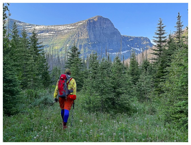
We eventually
found the Grizzly Gulch trail and once again started to gain elevation. At this
point we were 100 vertical metres below our starting point and 300 m lower than
Akamina Pass. Elevation gain to the summit would be about 1100 m from here.
The Gulch trail
did not start off well – lots of deadfall to climb over and crawl under – but
eventually changed to surprisingly wonderful. Like the descent from Akamina
Pass, the hike up Grizzly Gulch was “The Opposite” of our expectations.
We were all
delighted to be making good progress up the valley and hoped our luck would
continue. It did for a while, but sooner or later we were going to have to
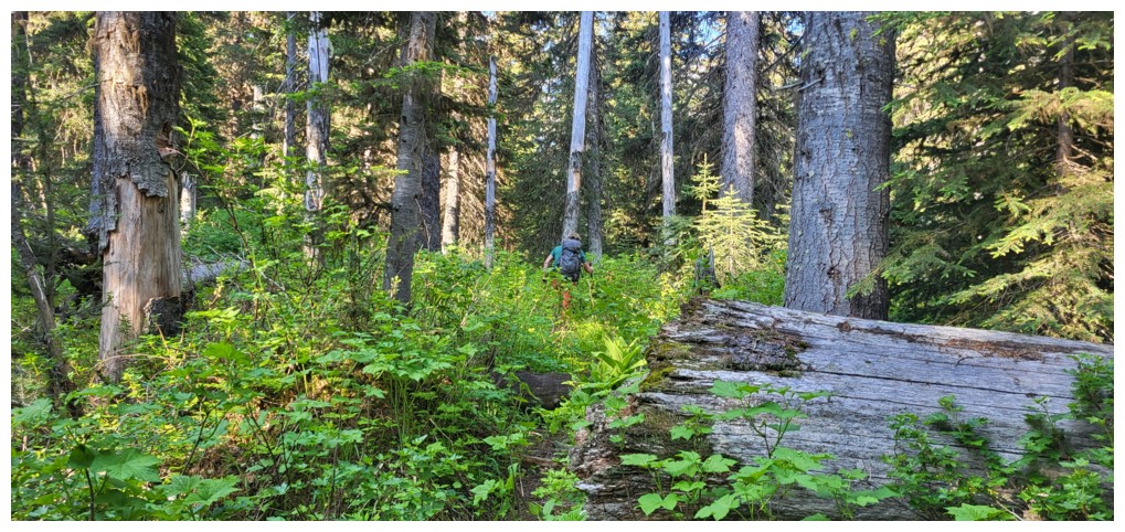
“bite the bullet” and dive into the trail-less bush. Just passed the turn-off
to Ashman Lake we did just that.  Ephraim led the way, and though teeming with
deadfall and other unpleasantries, the Man of the Hour weaved an excellent path
through and up to easier terrain.
Ephraim led the way, and though teeming with
deadfall and other unpleasantries, the Man of the Hour weaved an excellent path
through and up to easier terrain.
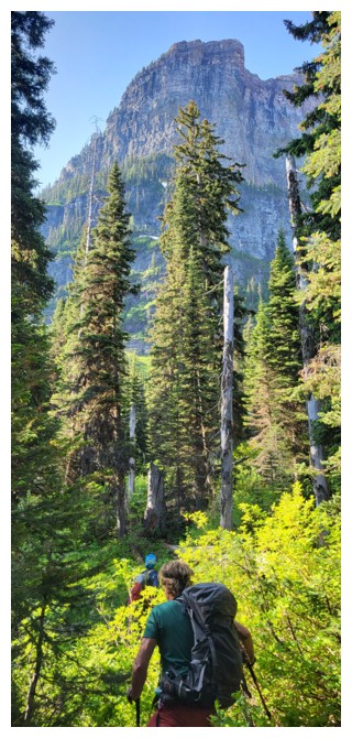
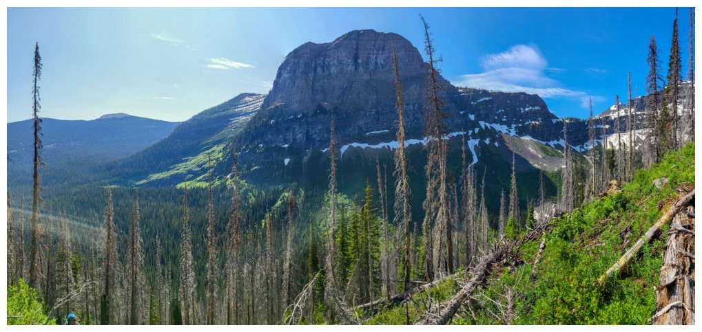
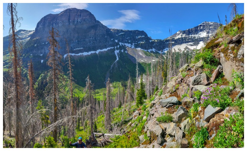
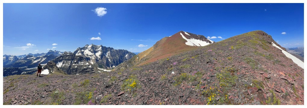
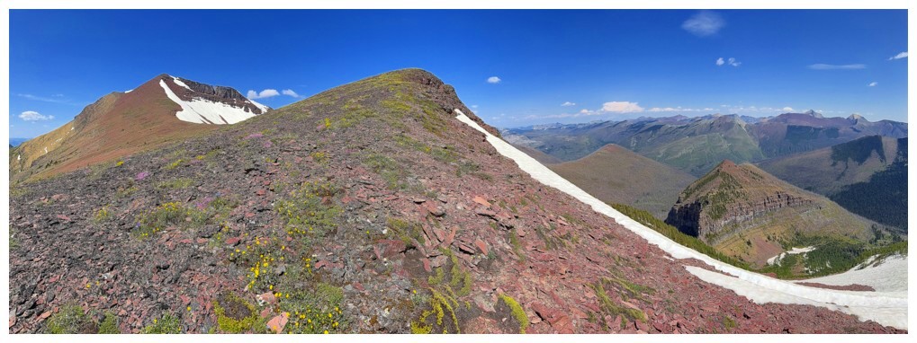
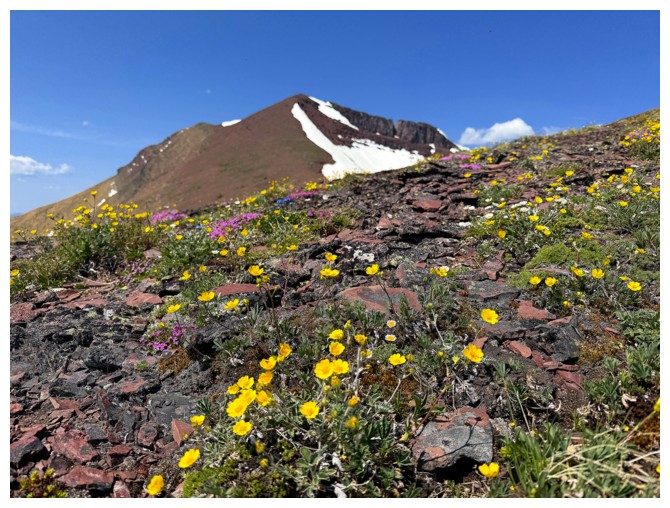
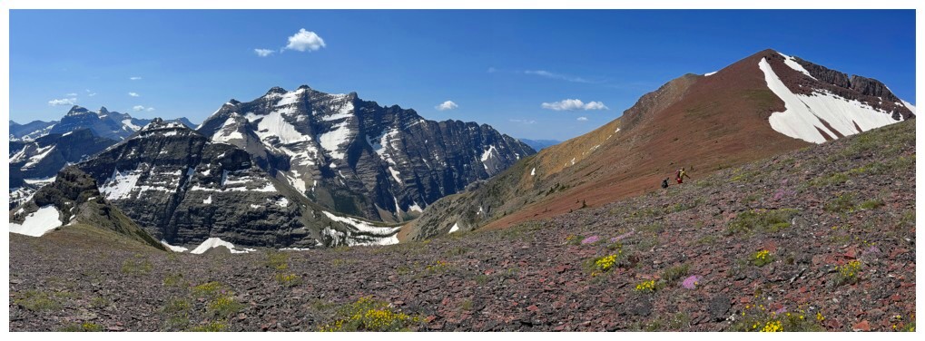
Once above the
deadfall and dense vegetation, the ascent graduated to “jaw-dropping” status!
Outstanding views became more so, familiar mountains, but from totally different
vantages points, popping up with every 100 metres of elevation gained. Hues of
bright green vegetation and trees contrasted beautifully with surrounding
mountains; purple, yellow, and white wildflowers littered the slopes; and of
course, the entire upper section of See is sweet, bright red argillite – what a
way to finish an already remarkable ascent!
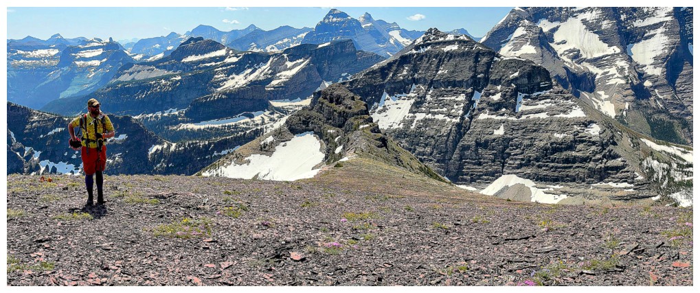
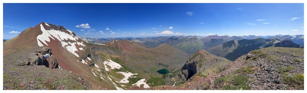
Our summit stay
was long and as gratifying as gratifying gets. “In your face” views of King
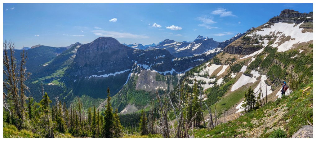
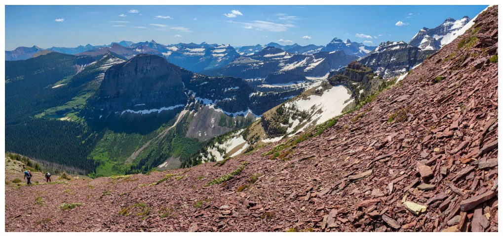
Edward, Starvation, and Long Knife peaks were cause for many gasps of amazement
and an equal amount of photo attention. With much of Waterton, The Castle, and
the northwest section of Glacier National Park stretched out around us, we had
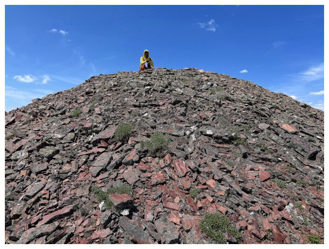
plenty-a-peak to pick out. While I quickly ran over to the nearby highpoint to
get a look at Starvation Lake, Ephraim and Doug built a new cairn and Ephraim placed
one of his classic summit registers.
About an hour
after arriving, we reluctantly had to leave.  Given the necessary 300 m of
elevation gain and some challenging terrain that would be slow to descend, we
expected the return trip to take approximately three quarters of the ascent
time. More or less following our ascent line, the descent went very well.
Although all three of us were not terribly excited about the bike ride back up
to Akamina Pass, several hours down we wanted nothing except to be off our sore
feet. Arriving back at the bikes was a big relief.
Given the necessary 300 m of
elevation gain and some challenging terrain that would be slow to descend, we
expected the return trip to take approximately three quarters of the ascent
time. More or less following our ascent line, the descent went very well.
Although all three of us were not terribly excited about the bike ride back up
to Akamina Pass, several hours down we wanted nothing except to be off our sore
feet. Arriving back at the bikes was a big relief.
And the third
sincere thank-you of the day goes to our ebikes! (perhaps more so, the person who
brought electric motors into our world – Michael Faraday). The return ride was
far less exhausting and traumatizing than expected, courtesy of those wonderful
inventions. In fact, the primarily uphill ride took only a few minutes more
than its mainly downhill counterpart on the way in.
We arrived back
at the start almost 14 hours after leaving, physically spent but still mentally
buzzing from the high of the ascent. “Always prepared Doug” had chairs and
chilled non-alcoholic beers waiting for us. We drank and laughed, reliving some
of numerous highlights of the trip.
What an
incredible day! Huge shout-out to Ephraim for planning the route and to both
Ephraim and Doug for their terrific company. This day will resonate with me for
a very long time and I’m sure the same can be said for my awesome companions. Yet another of the "Best trips I've ever done"!
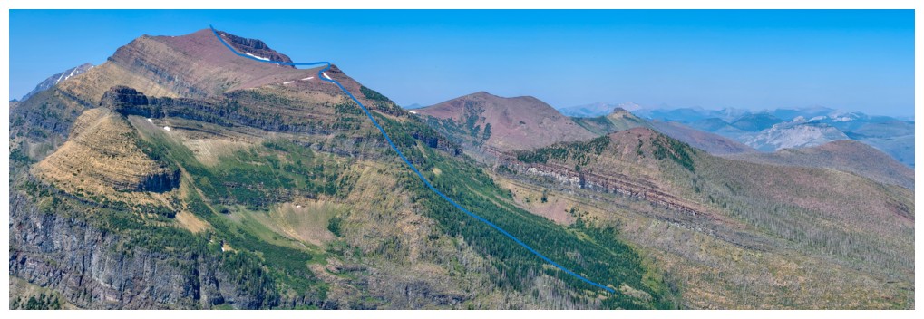
See Peak (left) and Ephraim's planned ascent route, as seen from Mount Ashman (GR073337) (photo by Ephraim)
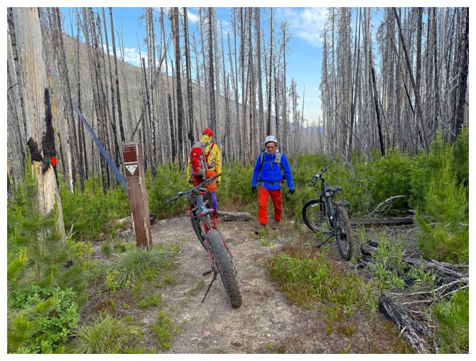
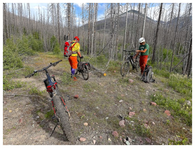
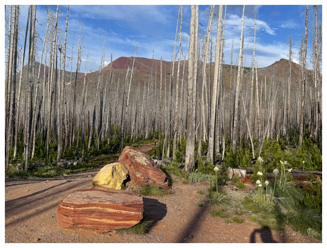
The end of the easy riding. The trail from here to the bottom is not the wide, smooth road we were expecting.
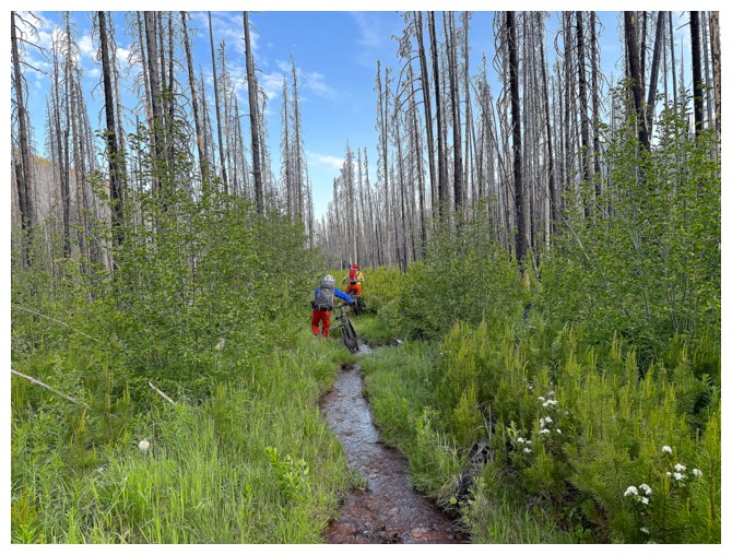
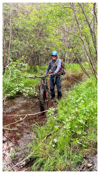
Walking our bikes through one of the stream sections of the trail
Overgrown! (photo by Doug)
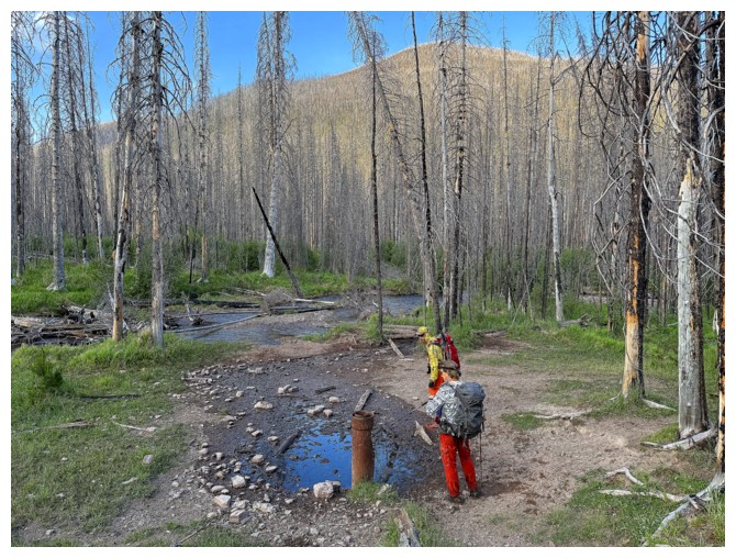
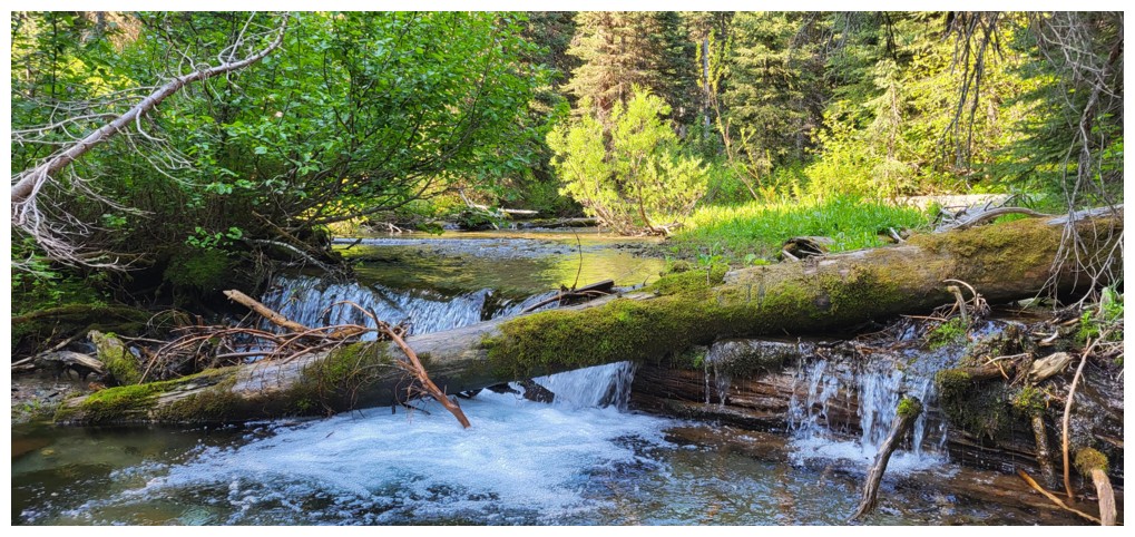
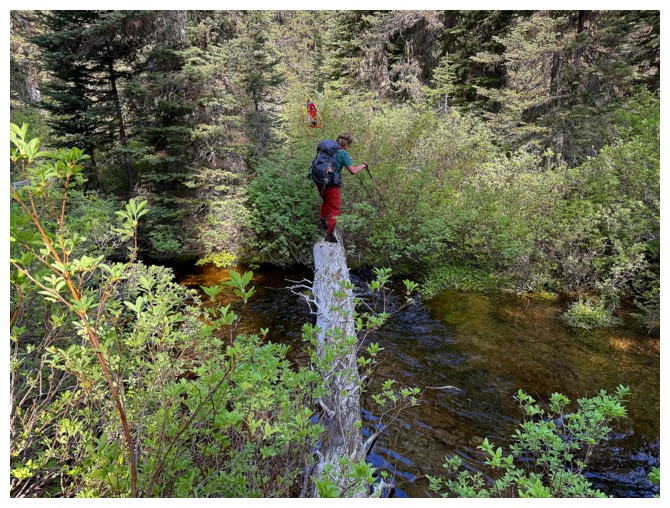
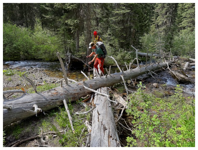
Off the bikes and heading over to cross Akamina Creek
These logs would help to keep our feet dry in the meantime, but all in vain in the long-run (photo by Ephraim)
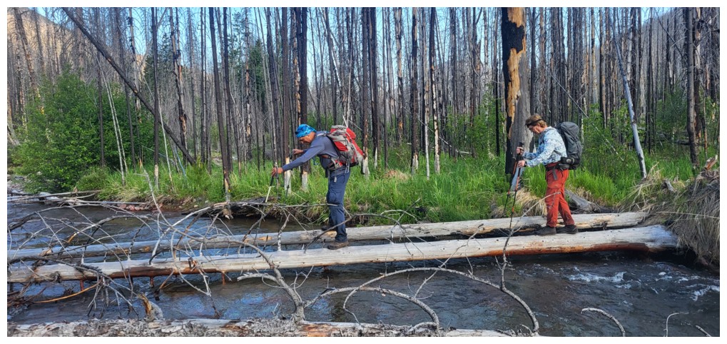
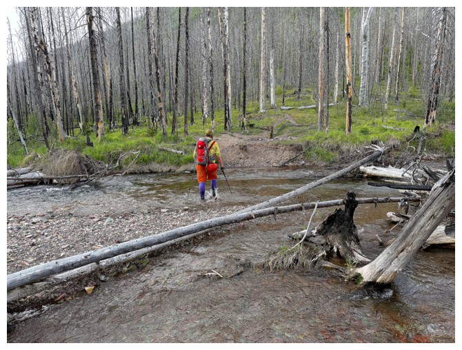
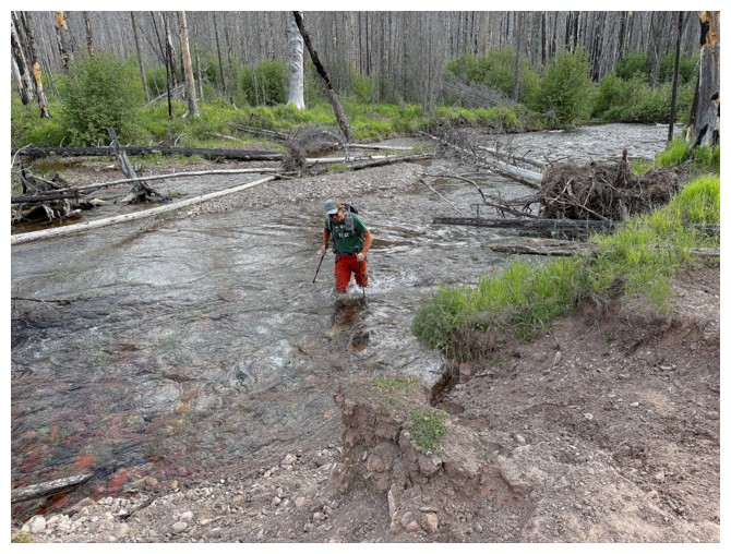
No logs here. We all just walked through this creek and several more en route to See.
The nasty part of the Grizzly Gulch trail (photo by Doug)
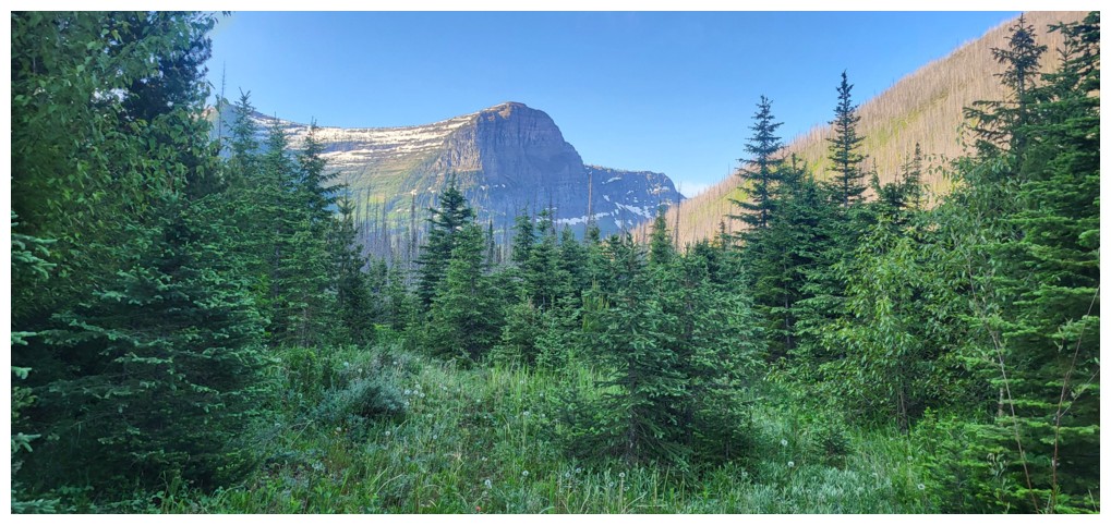
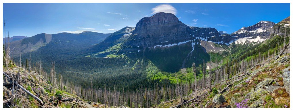
First view of Mount Ashman (photo by Ephraim)
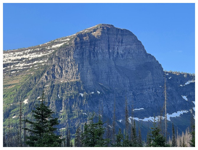
Close-up of Ashman's vertical northwest face
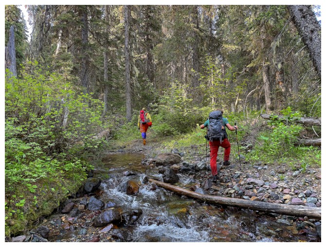
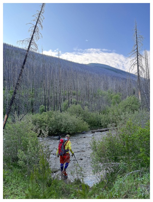
More minor creek crossings. Our boots were completely water-logged at this point anyway.
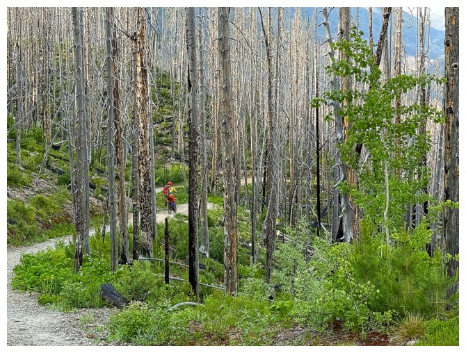
The trail gets overgrown at times, but it's still quite easy to follow (photo by Ephraim)
Ashman towering above us (photo by Ephraim)
Pleasant creek scenery (photo by Ephraim)
Back to using logs to get across creeks, in the hopes of drier feet. Ephraim had changed into dry footwear.
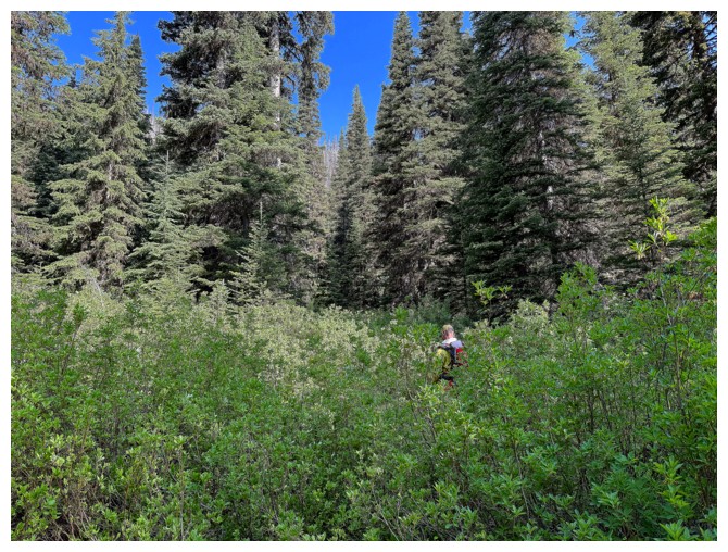
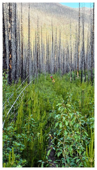
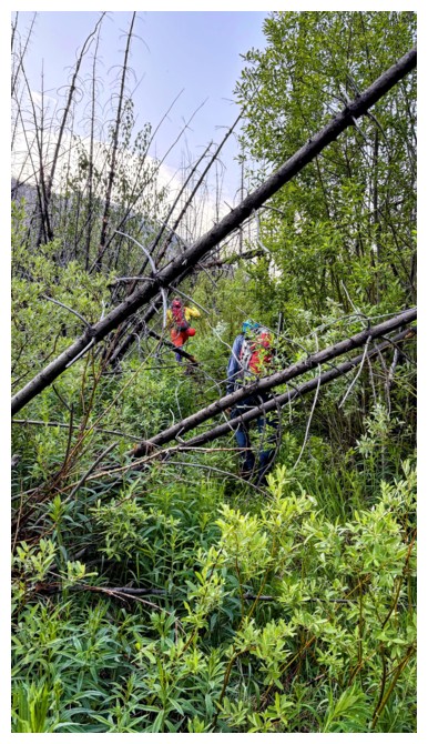
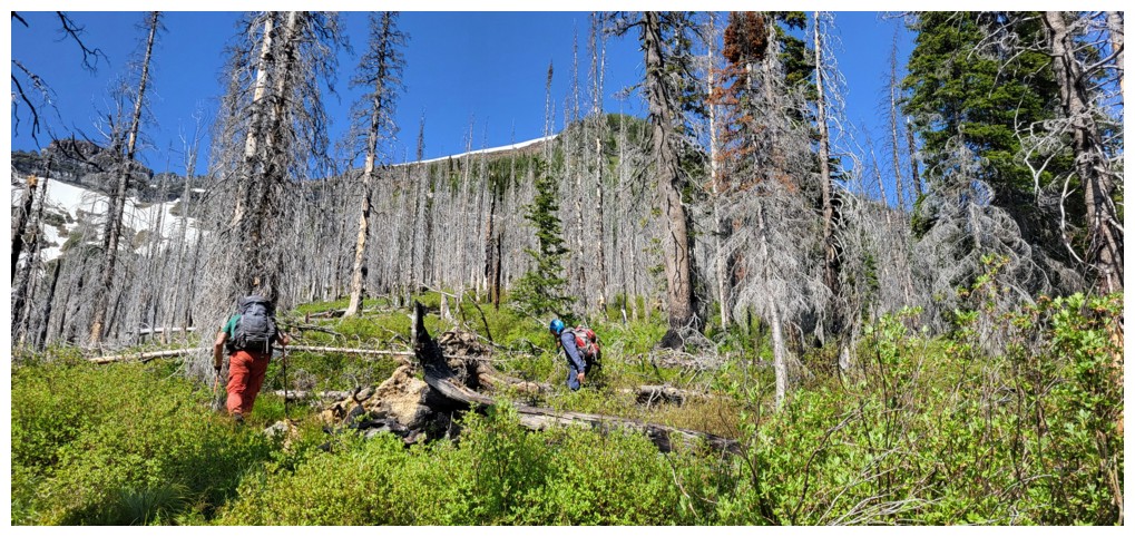
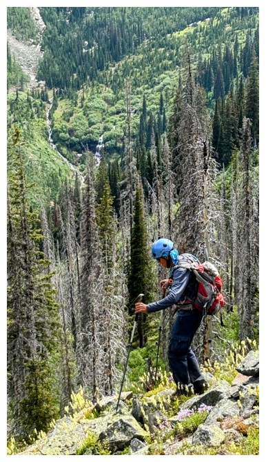
Into the bush
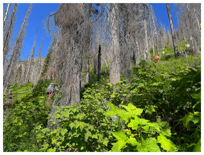
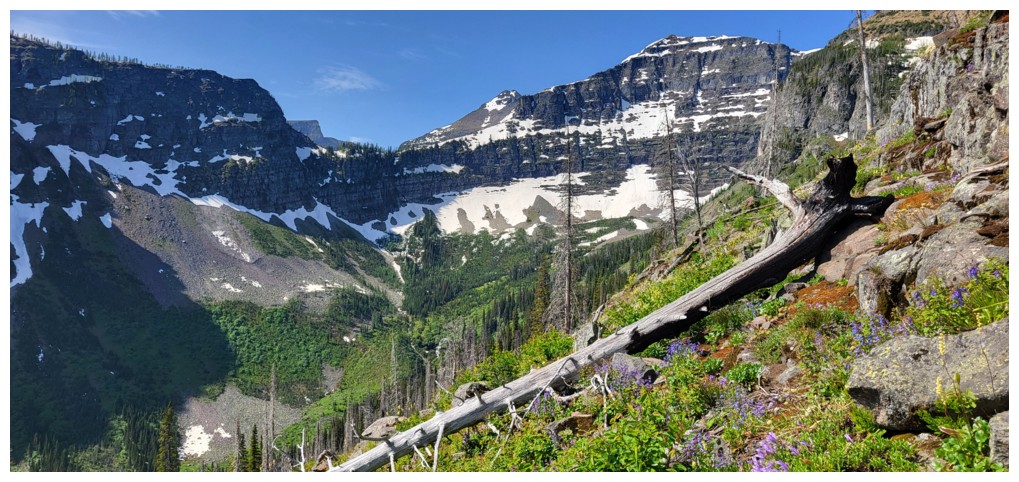
Dense vegetation and deadfall on steep slopes would be the only item on the menu for the next 45-60 minutes
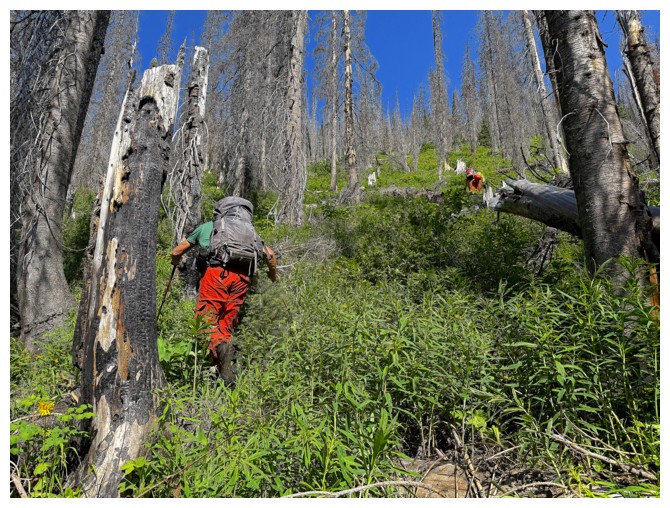
Same as above
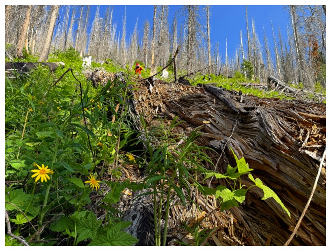
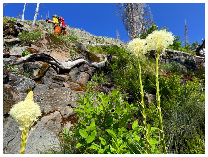
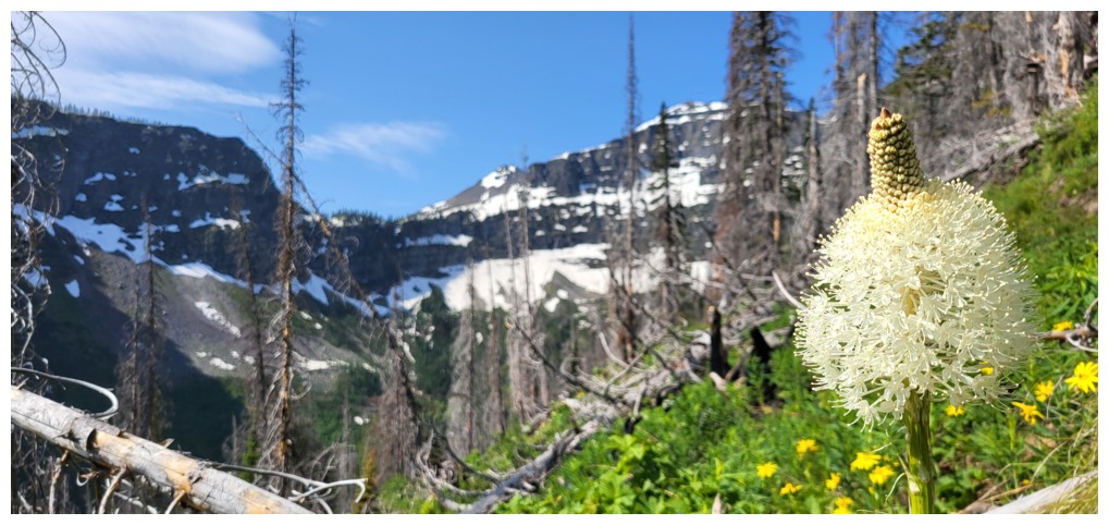
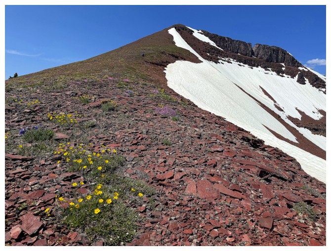
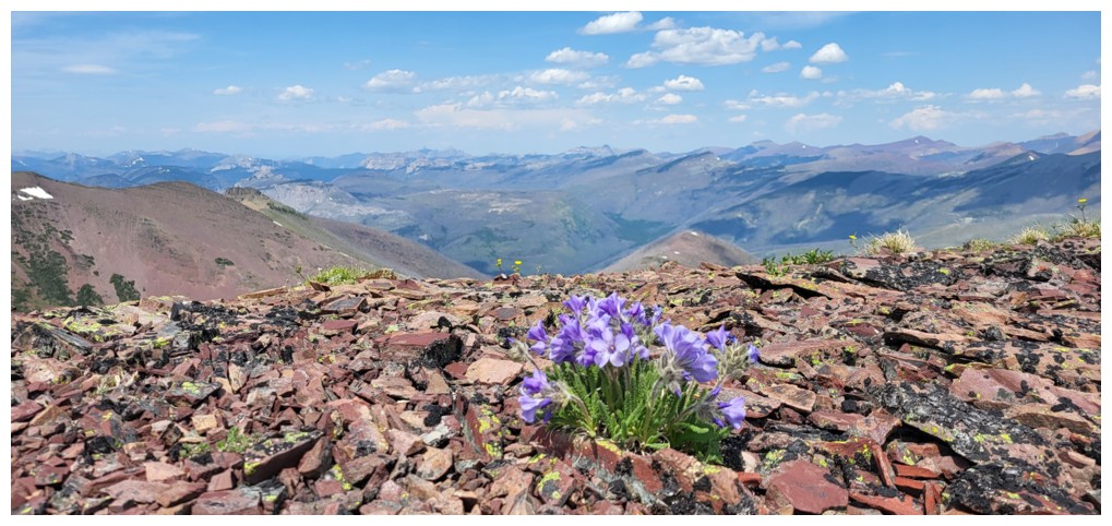
First wildflower of the day
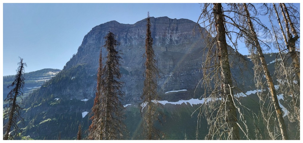
Ashman's impressive face is going to get tons of attention (photo by Ephraim)
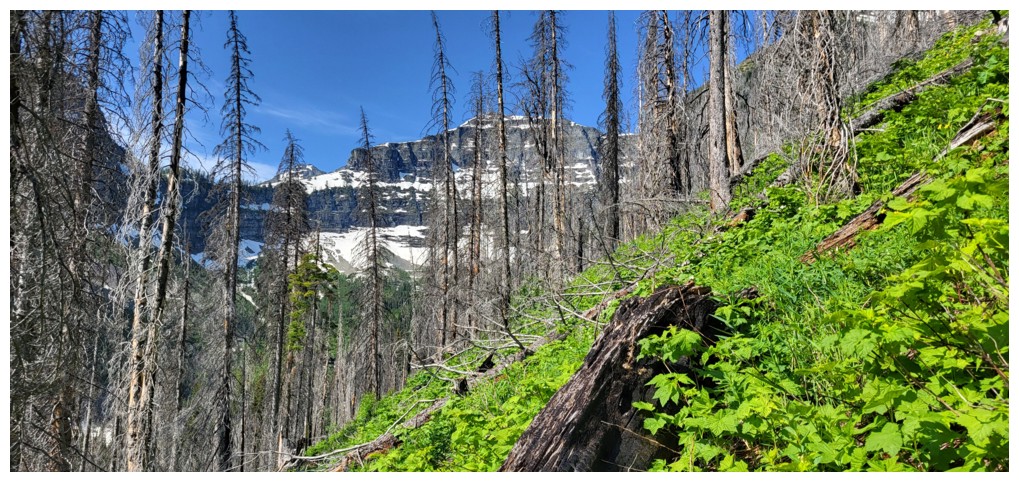
At least the vegetation was a beautiful shade of bright green (photo by Ephraim)
Ashman and the green (photo by Ephraim)
Excellent photography by Ephraim
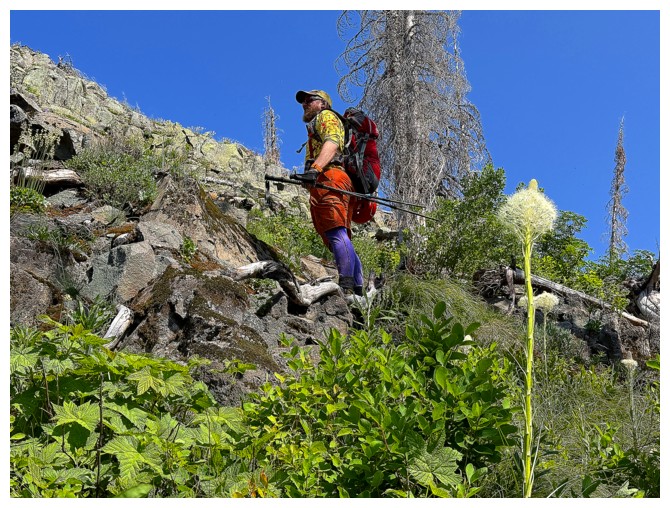
My attempt at photographing bear grass is much less refined. At least Ephraim's colourful attire salvages the effort!
Ashman and those greens again (and my annoying cranium at the lower left) (photo by Ephraim)
More of the same. The colours were amazing and we hadn't even got into the red argillite yet! (photo by Ephraim)
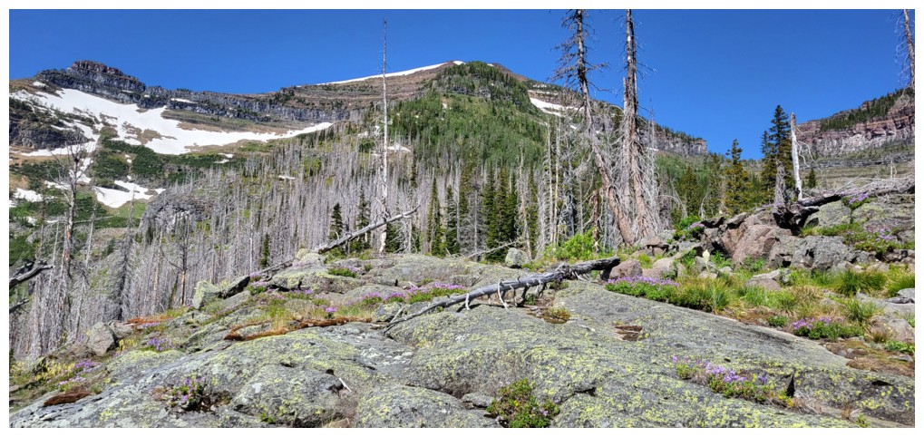
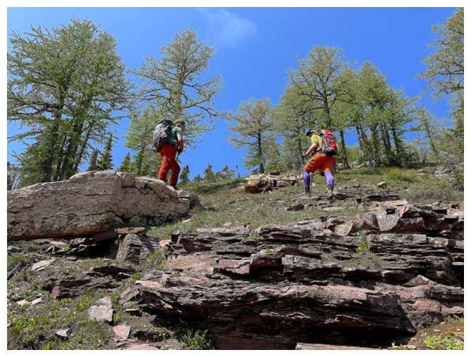
The vegetation gives way to rockier terrain
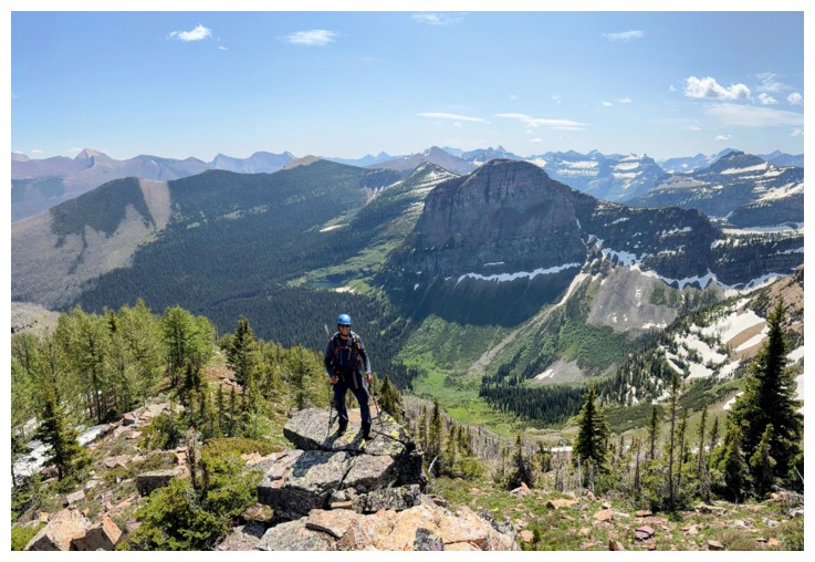
Atop the first and steepest section of the ascent
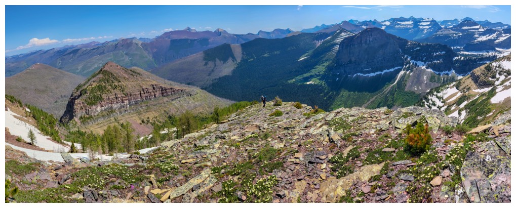
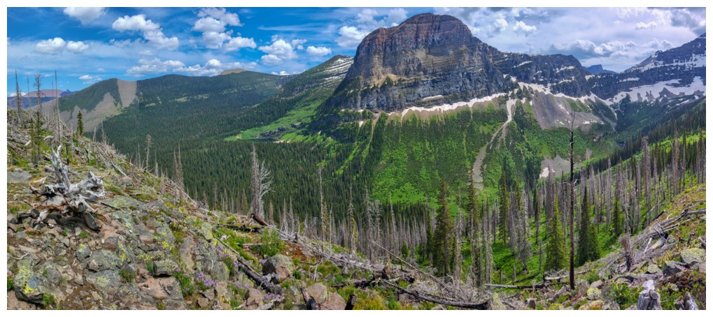
The
route ahead. The treed area in the centre is the key to Ephraim's
route. It gives easy access to the upper slopes (photo by Ephraim).
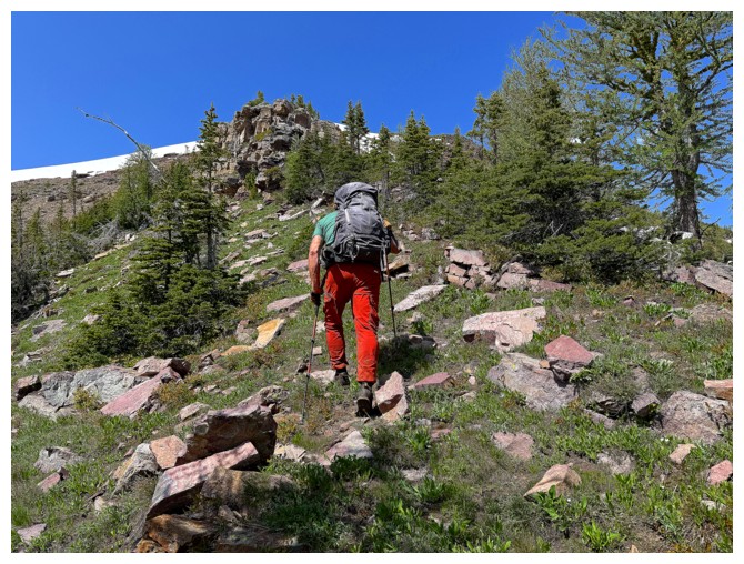
Continuing up through light bush (photo by Ephraim)
Part
of the very cool northeast right of See. Looking at the topo map, this
could have also been a potential line of ascent...more to come (photo
by Ephraim).
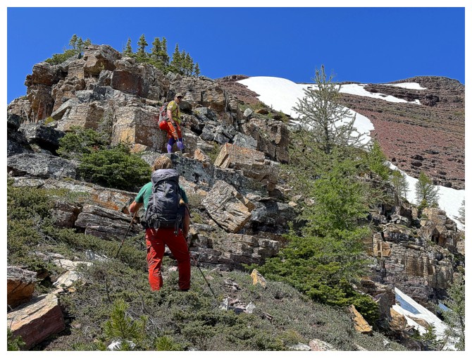
Doug leads the way up the first significant band of red argillite (photo by Ephraim)
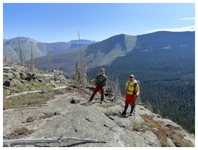
The boys atop the band
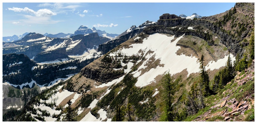
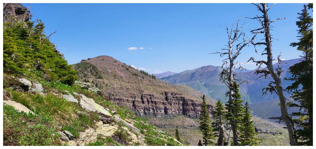
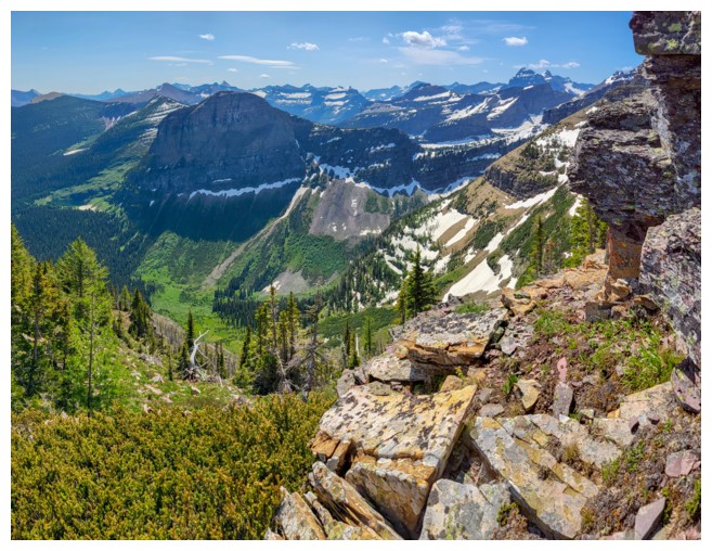
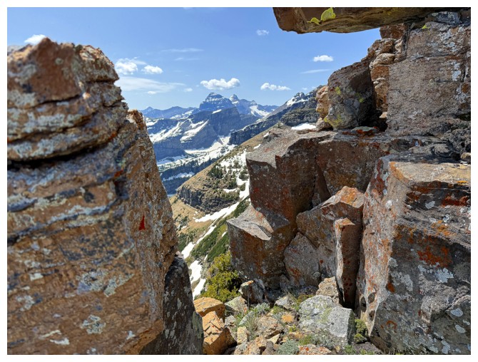
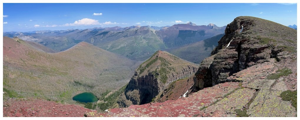
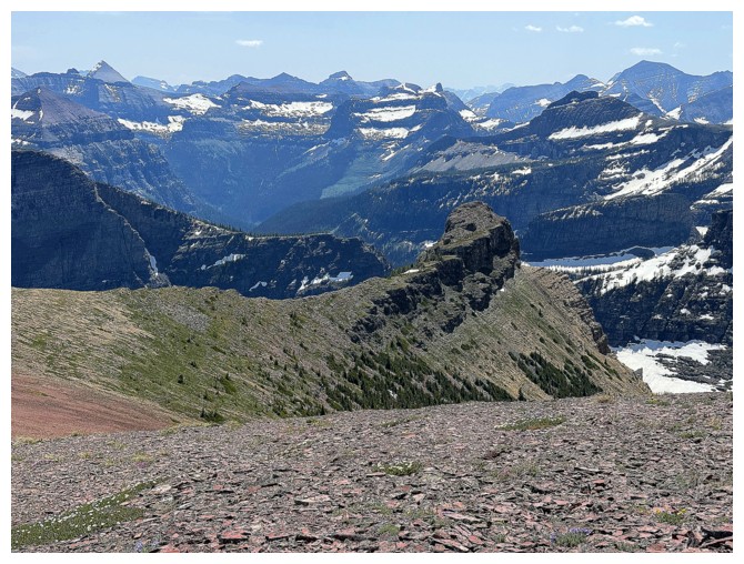
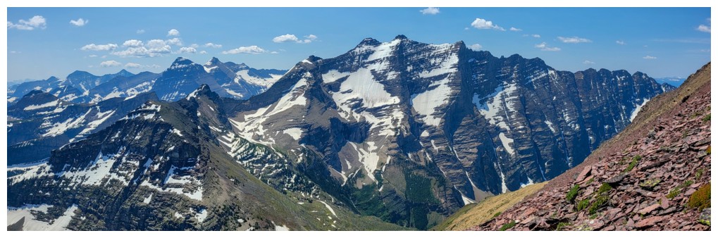
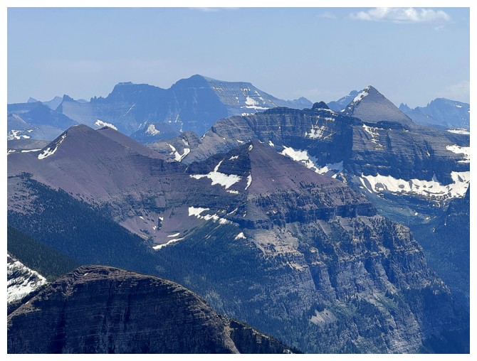
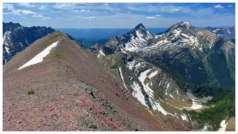
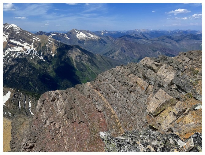
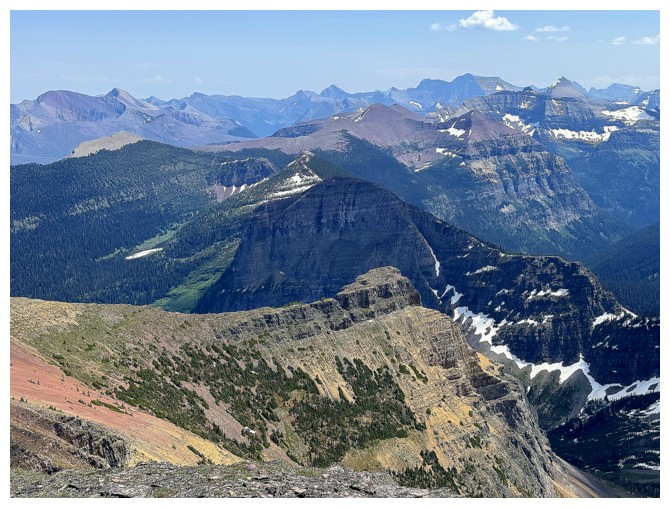
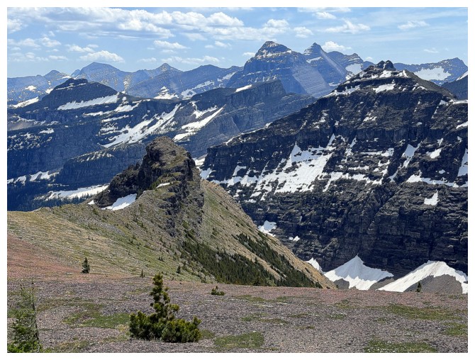
The east face of See and terrific views into Glacier National Park (photo by Doug)
Two of the three prongs of Long Knife Peak make an auspicious appearance
Larches and red rock. The mid slopes were home to numerous mature larches (photo by Ephraim).
Same as above
Ashman won't be denied (photo by Ephraim)
A few scrambling moves ahead, but all easy and on solid, blocky rock
Atop the first step (photo by Doug)
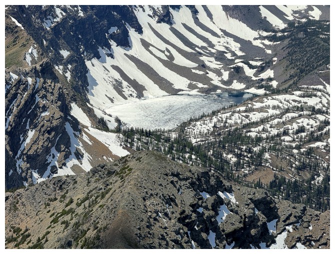
Ashman Lake can be seen behind me (photo by Doug)
More blocky rock and the appropriate red/green Christmas version of Doug
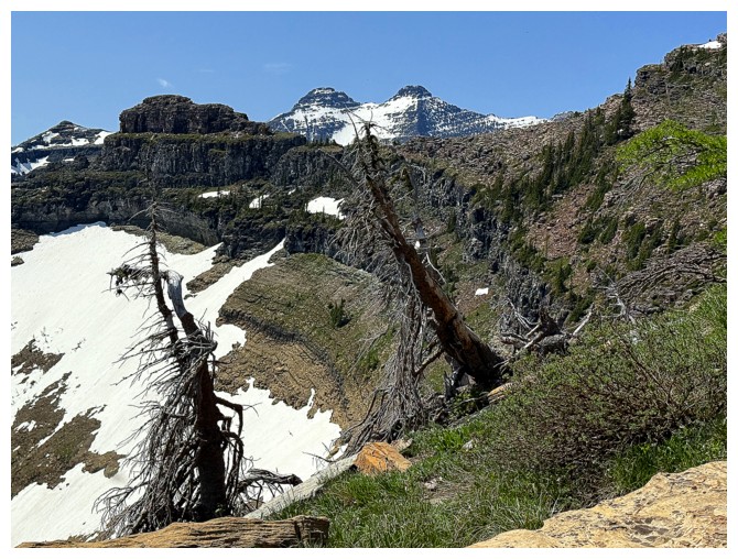
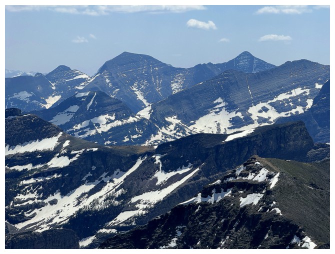
Mounts Kinnerly and Kintla through the gap
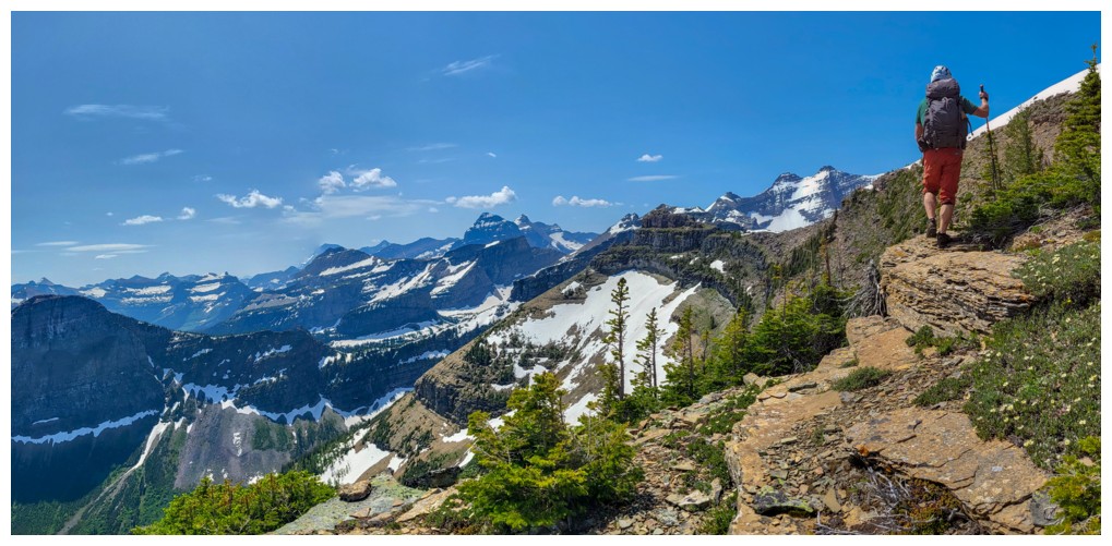
The mountains of GNP are really starting to put on a show (photo by Ephraim)
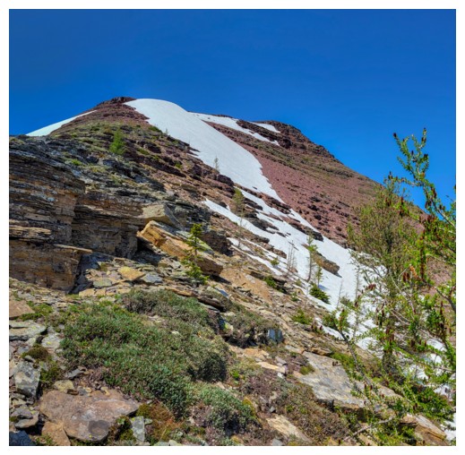
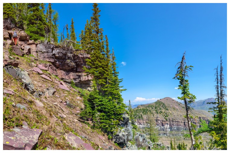
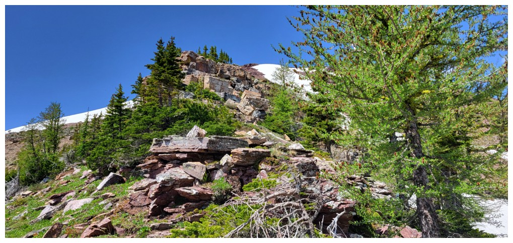
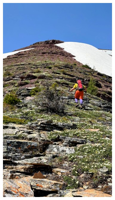
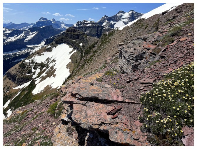
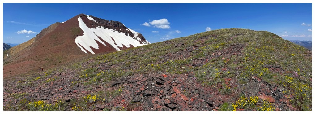
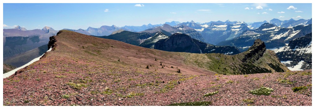
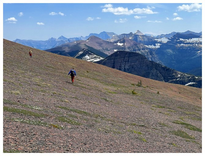
Above treeline and nothing but sweet, argillite ahead (photo by Ephraim)
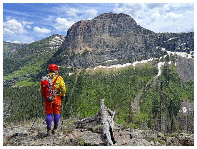
Doug takes in the incredible view (photo by Ephraim)
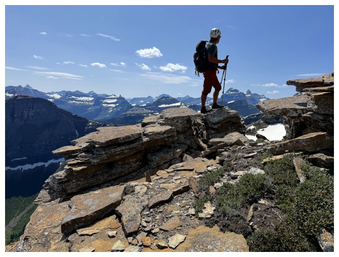
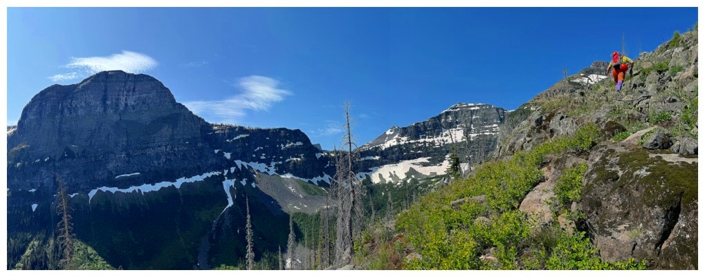
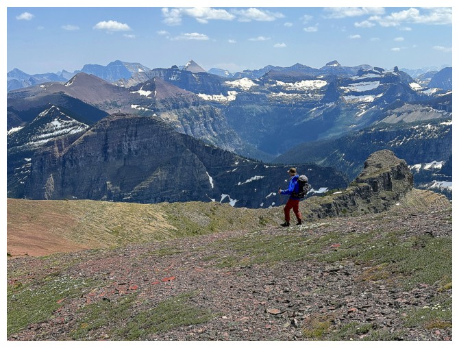
Ephraim leads the way (as he did throughout) and I model my boring blue get-up (photos by Doug)
All the colours on the mountain are starting to emerge (photo by Ephraim)
So are more wildflowers
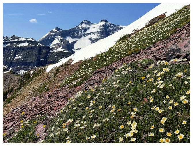
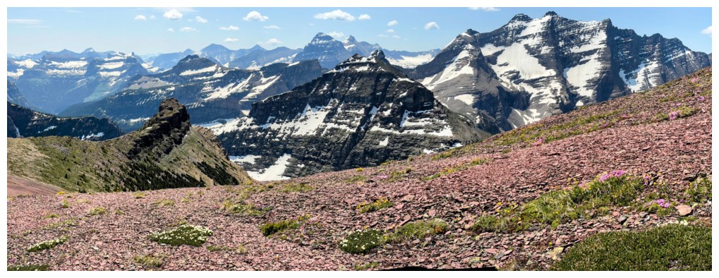
All three prongs of Long Knife and a field of wildflowers

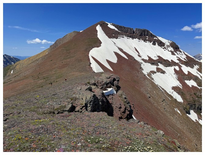
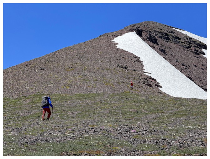
Gentle slopes of red rock lead to the summit block
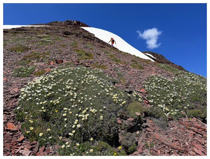
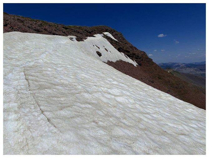
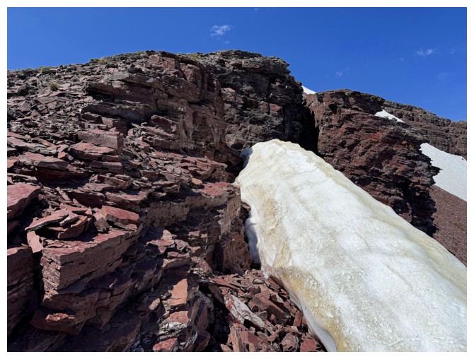
Ephraim out front, skirting the last of the remaining snow on the mountain
Nice shot of the red argillite and the green in the valley, with the stragglers at the lower left (photo by Ephraim)
Ephraim is just about to crest the ridge, where the final push to the summit will finally be visible
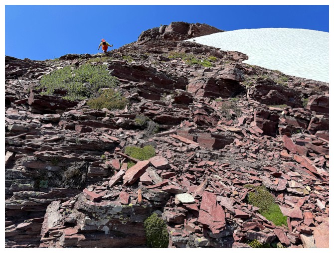
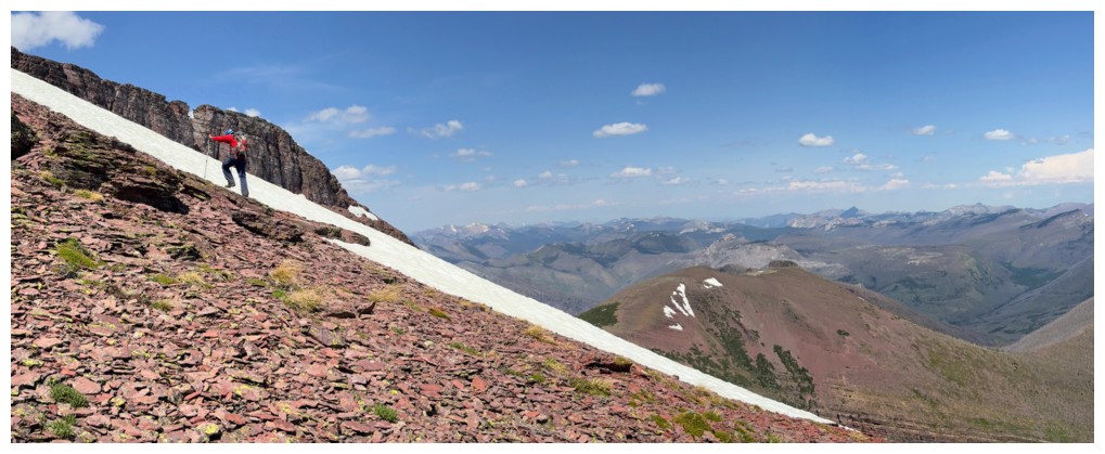
I decided to take the snow route to reach the ridge
Almost there
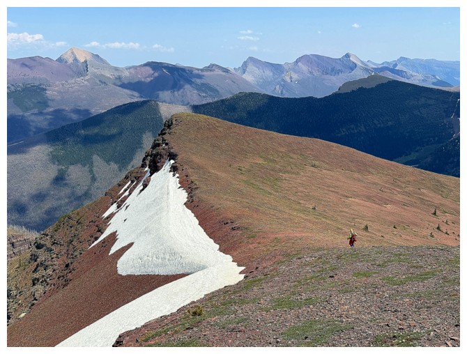
The northeast ridge of See again. Good thing we didn't take that route - the drop-off at the end is severe.
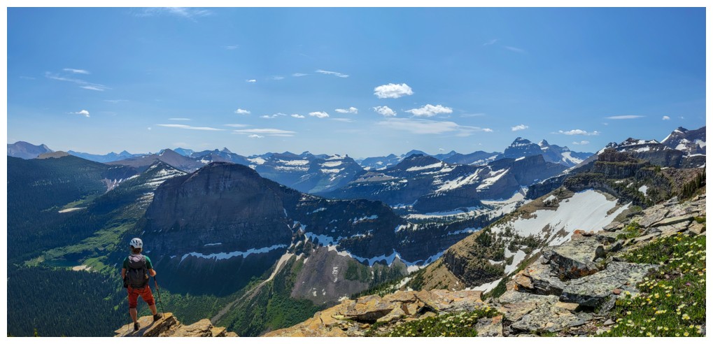
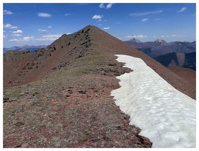
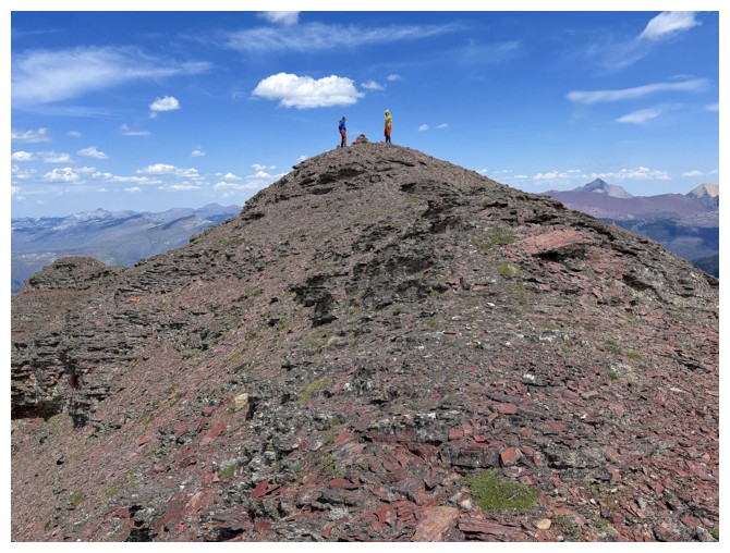
There's the summit, just right of centre
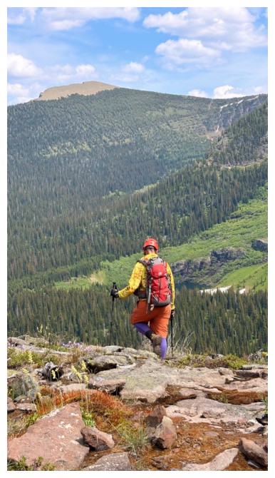
The hike from this point to the summit was one of the most gratifying
experiences I've ever had in the mountains - the colours, the contours,
the views were utterly breath-taking
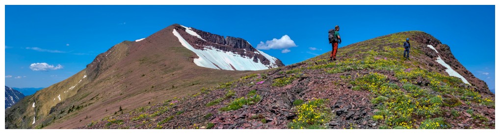
Wildflowers and the summit block
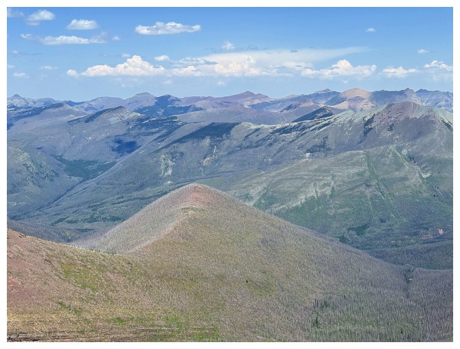
Love this photo by Doug. Lots of unnamed but cool ridges and peaks.
Doug and Ephraim side-sloped over to the ridge, while I went to a nearby hump first
The hump at the right
The summit block from the hump
The view from the hump, includes Thomson Lake in the centre
Close-up of Thomson
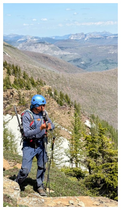
D and E are ready for the final push to the top
E's viewpoint (photo by Ephraim)
D's (photo by Doug)

A's
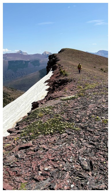
Now on a beautiful red argillite ridge, of course I'm going to go overboard with the photos!
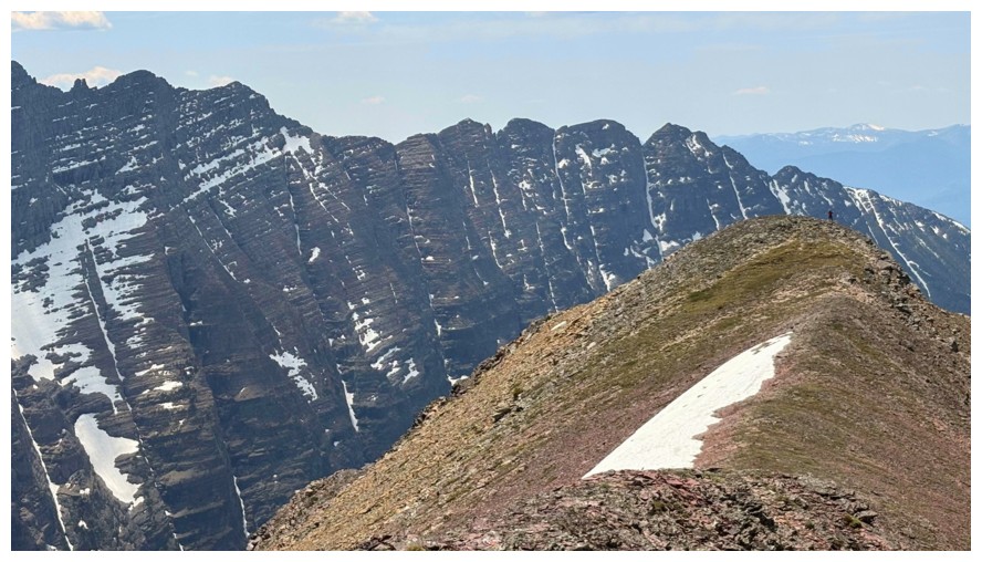
Another terrific photo by Doug. I have been reduced to a little speck on the ridge at the left.
And another, minus the speck (photo by Doug)
D and E are up there somewhere
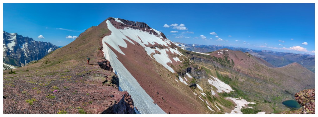
The ridge in front looked extremely tempting, however there's a huge
notch that would probably end progress and given the length of the
trip, neither Doug, nor Ephraim, nor I had the energy
Not far now
My view
Such a satisfying scene. D and A are both specks now (photo by Ephraim).
Slogging my way up (photo by Doug)
Best view of Long Knife Peak (photo by Ephraim)
Ephraim is steps away from the summit
Doug on the ridge
Another tribute to red and green (photo by Ephraim)
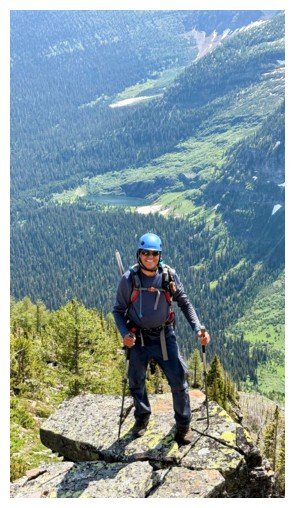
I'm closing in on the summit
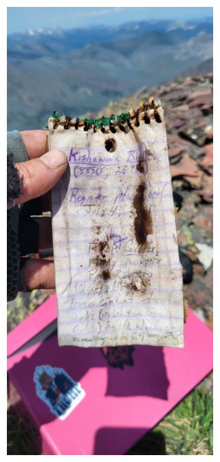
Ephraim is already there and taking out Rick Collier's summit register from 2001 (photo by Ephraim)
Finally caught up to Ephraim
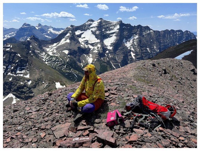
Ephraim has brought one of his summit register containers
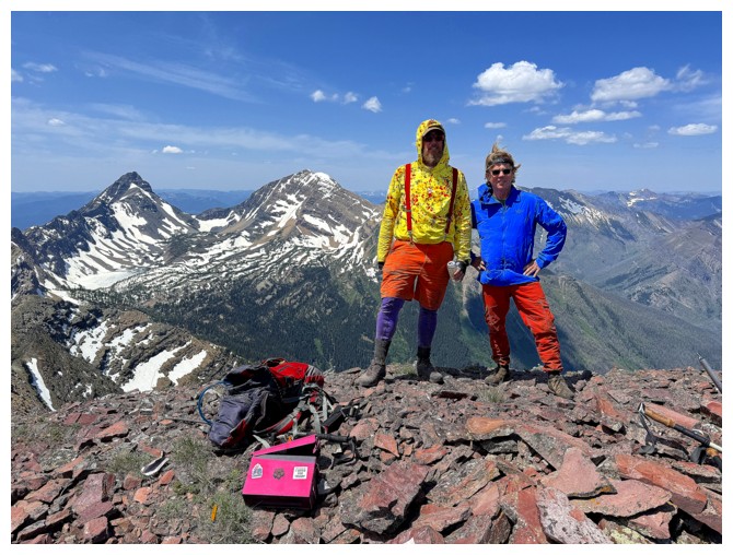
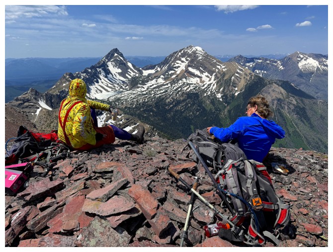
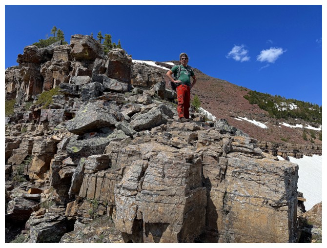
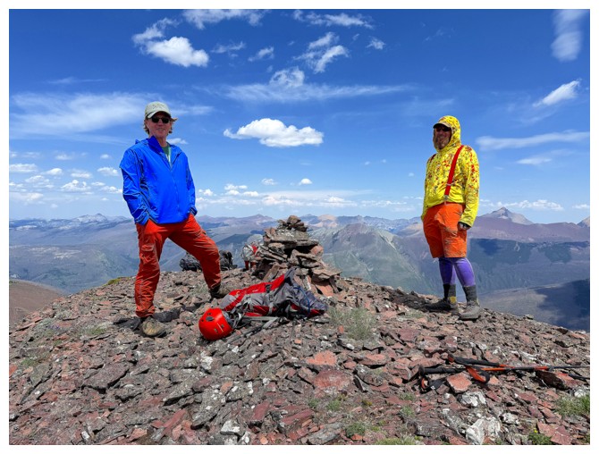
Two-thirds of the elated and very colourful summit team.
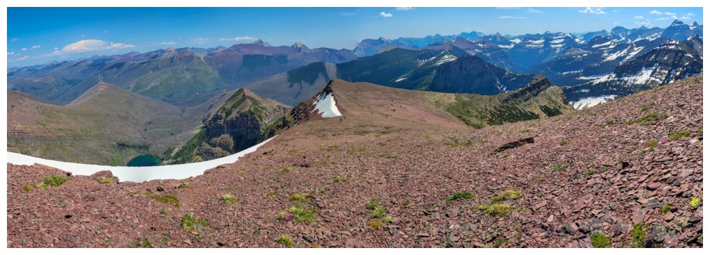
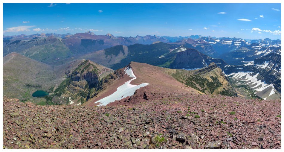
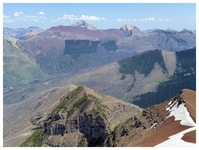
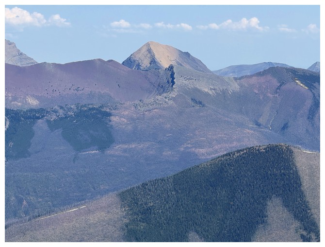
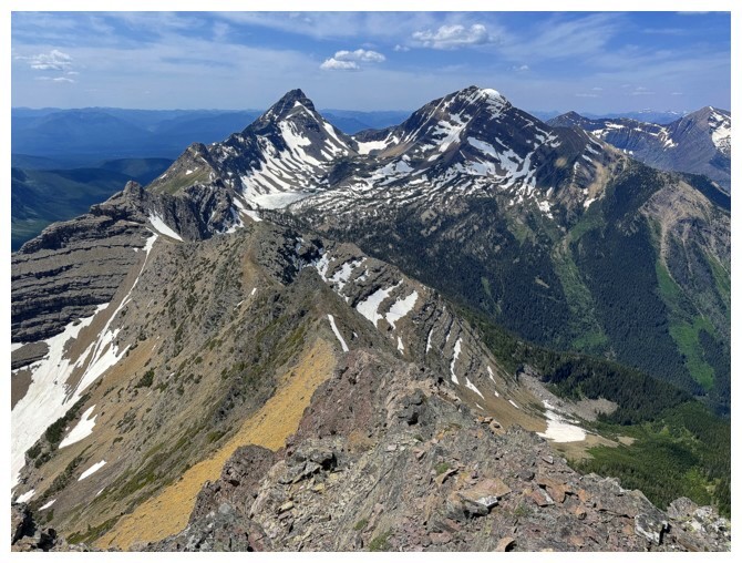
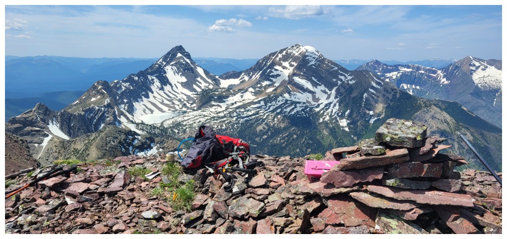
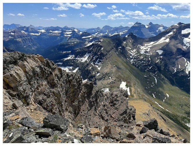
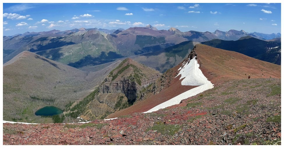
King Edward Peak (left) and Starvation Peak sit at the west end of Kishinena Ridge (photo by Ephraim)

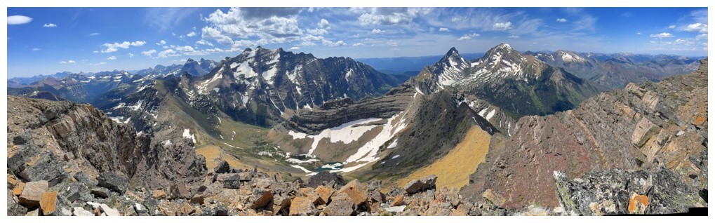
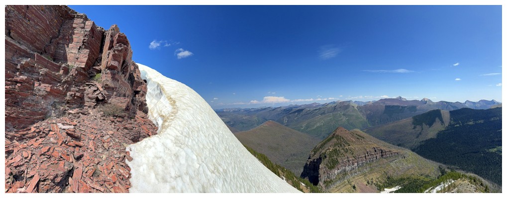
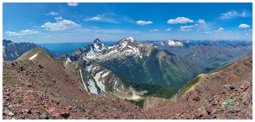
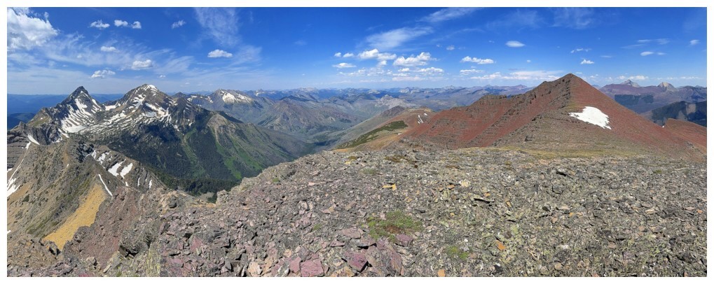
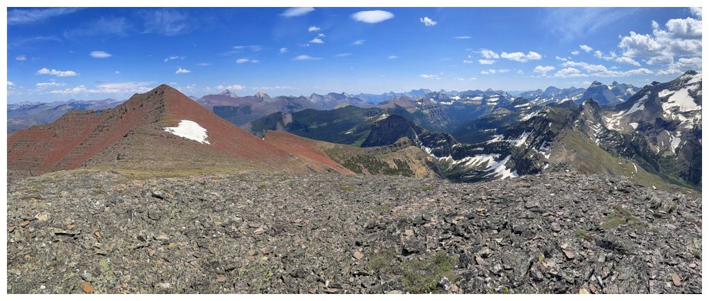
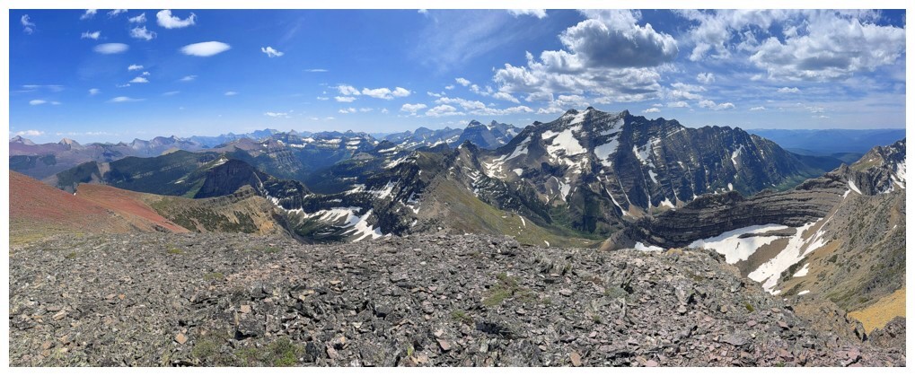
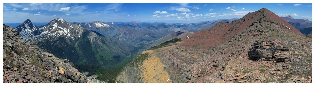
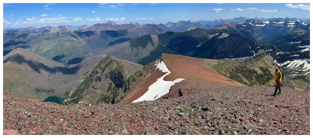
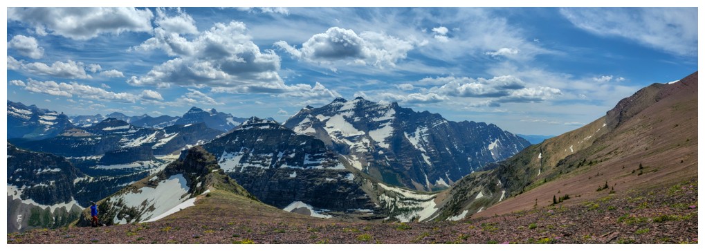
A 360 degree panoramic photo by Ephraim. Click HERE to see a larger version.
View to the east (photo by Ephraim)
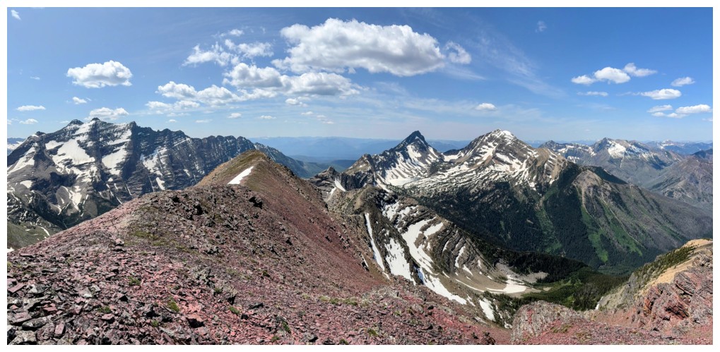
View to the west (photo by Doug)
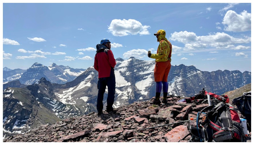
E and A discussing the price of Canola oil (photo by Doug)
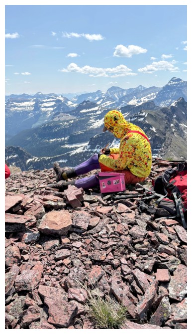
Ephraim
makes a new register to replace the old, soggy one. He was able to dry
out Rick's entry during our summit stay (photo by Doug).
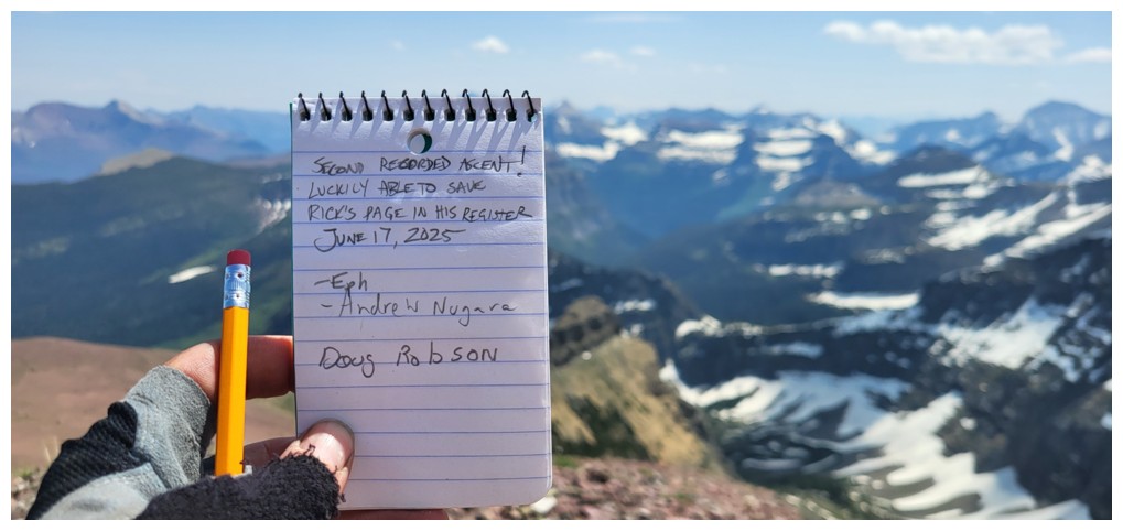
Ephraim's entry (photo by Ephraim)

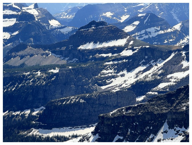
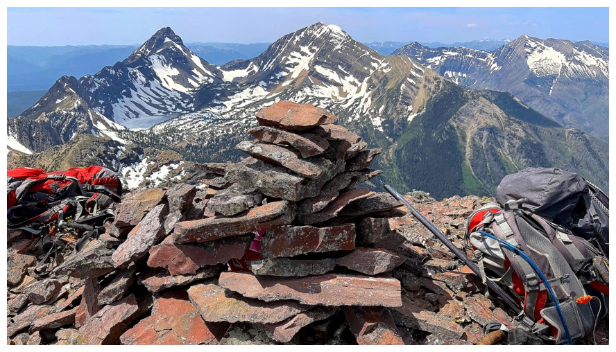
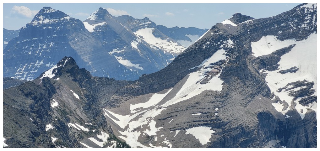
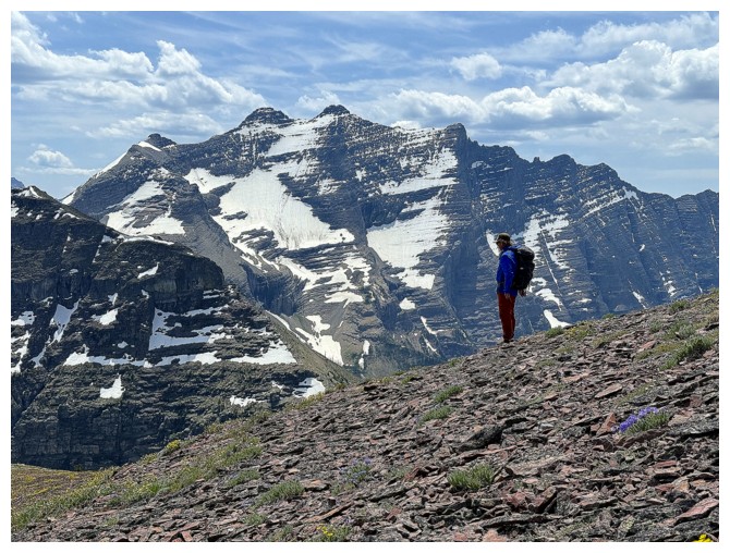
Kinnerly (left) and Kintla
Mount Cleveland in the background. Akamina Ridge at the centre left and Akamina Minor in the centre
Mount Carter (left) and Rainbow Peak (right) - both in GNP
Mounts Blakiston and Lineham
Close-up of Blakiston
Close-up of Lineham, with The Peak of Despair in front
View into The Castle. Most of the usual suspects are visible.
A very famous free standing formation of rock called Nunatak at the bottom. It has been climbed.
Three of my favourite Waterton peaks: Buchanan Ridge, Mount Carthew, and Mount Alderson
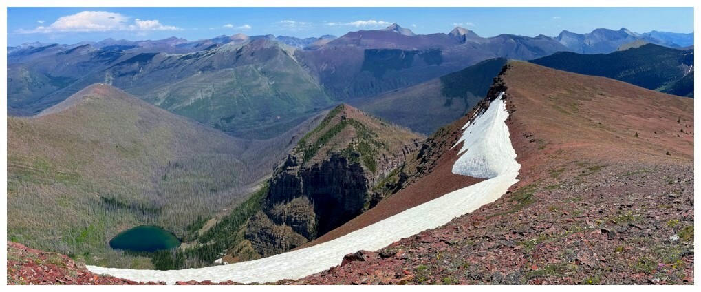
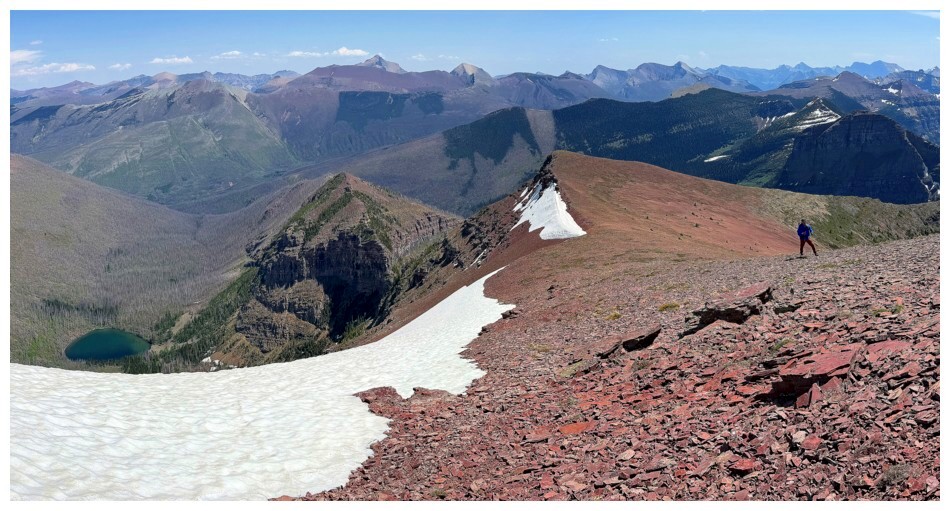
The minor highpoint I'm going over to visit at the left
Looking back to the summit
Back to being a speck at the right, but what a cool capture of Long Knife's imposing
west ridge (photo by Doug)
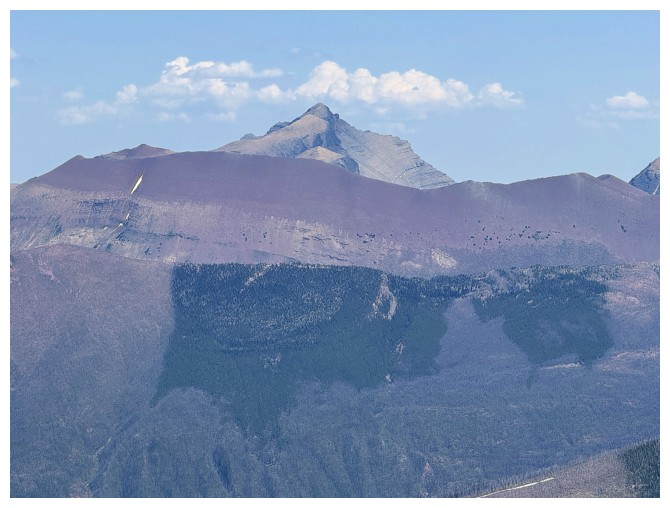
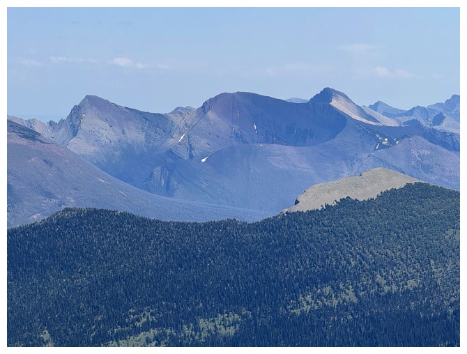
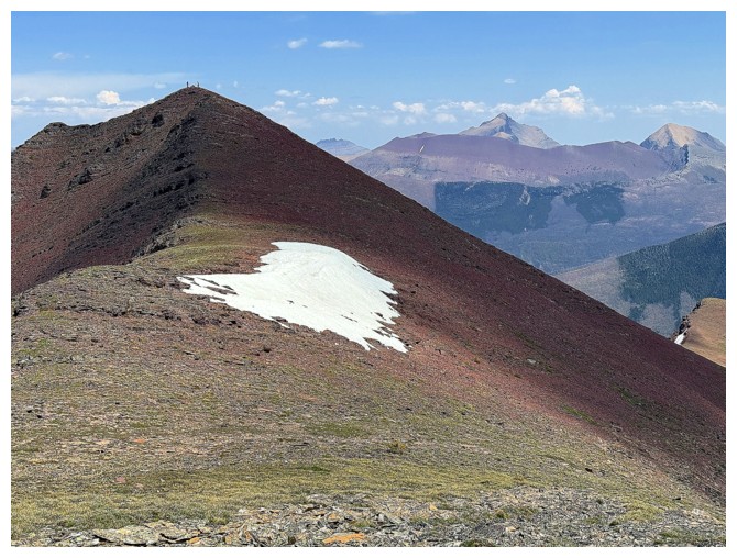
King Edward and Starvation from the highpoint
Same as above, but from the summit, and with the newly construction cairn (photo by Ephraim)
Views from the highpoint

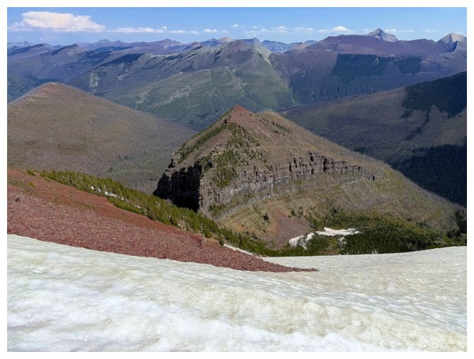
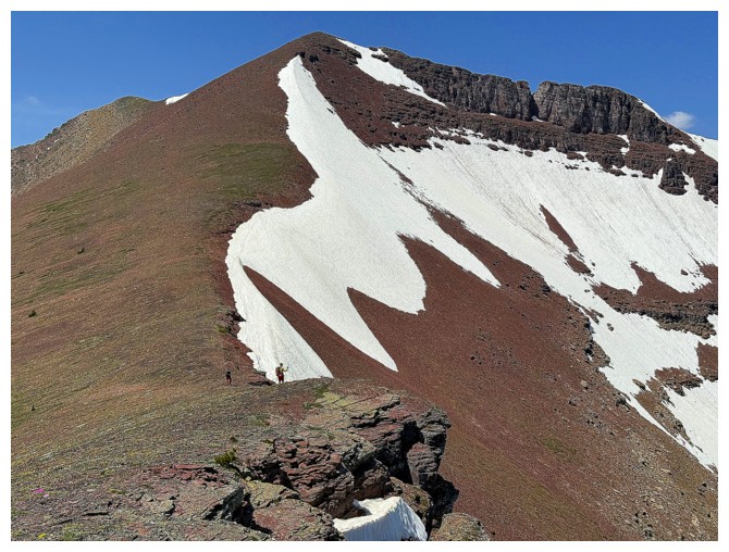
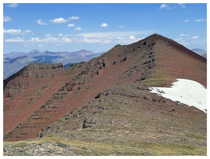
The west ridge of the highpoint. Collier and his party ascended this way, reporting it to have some 5.4 sections.
The other side is equally daunting
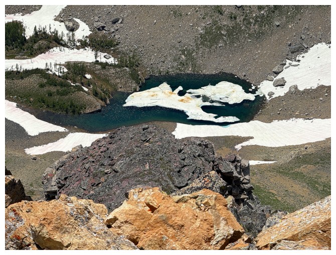
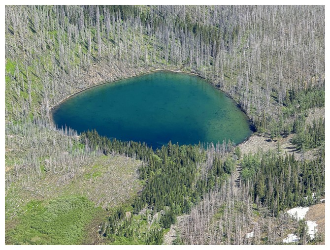
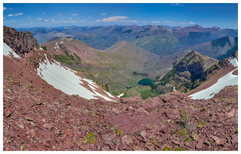
Starvation Lake
A much bigger lake, but unnamed lake below King Edward Peak
The notch along that ridge is visible, and Mount Ashman is looking more foreboding without the Sun
Heading back to reunite with the troops
Same as above
Rock colour explosion!
D and E are waiting patiently - maybe discussing the price of turpentine
Reunited
The new cairn again (photo by Doug)
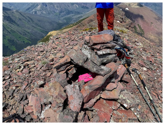
The new register container fits nicely in the sarcophagus-like new cairn
Yet another awesome photo by Ephraim of Kinnerly, Kintla and part of Long Knife
Time to go?
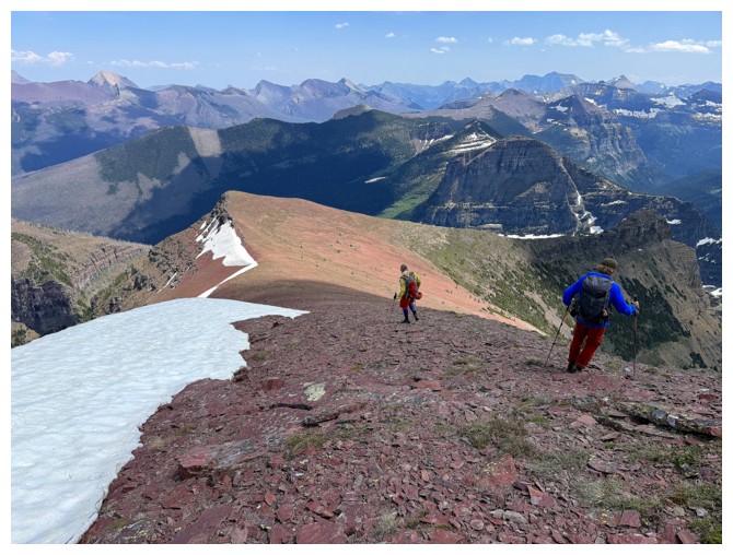
Yep..the first steps of the long return route
The next few
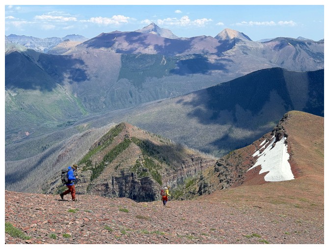
The scenery was equally rewarding on return
Doug and that other ridge
Nothing like a lake to spruce up the view
Wildflowers and The Castle (photo by Ephraim)
Just the other ridge and lots of shapely peaks
All three of us side-sloped this time
Last look at Long Knife (photo by Ephraim)
Same as above with Doug
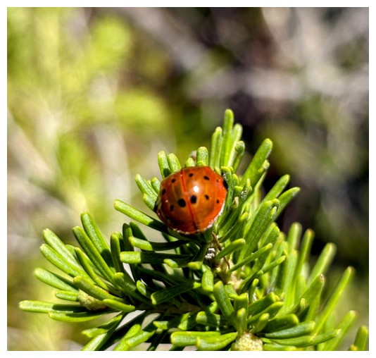
This ladybug was huge! (photo by Doug)
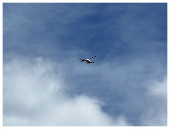
'copter
Another round of awe-inspiring Ashman (photo by Ephraim)
With Ephraim
More descent photos by Doug

We took a slightly different route down but Doug led the way in fine fashion
No point in getting our feet wet just yet
Sometime later recrossing Akamina Creek
Doug does the same. The logs we used to cross about 11 hours earlier are at the upper right.
Ready to be off our aching feet, but not excited to have to gain 300 vertical metres
Stuck in the mud (photo by Doug)
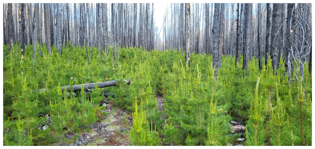
The new growth is beautiful, but it does add challenge to the ride (photo by Ephraim)
Very relieved to be back near Akamina Pass
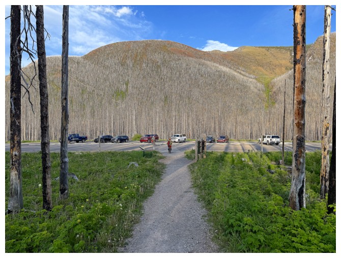
Ephraim coasts the last kilometre of the trip
The last few metres of one of the best trips I've ever done. Thank-you Ephraim and Doug!
The End
LOG