Seward Mountain
September 1, 2024
Mountain height: 2718 m
Total elevation gain: approximately
1860 m
Ascent time: 6:50
Descent time: 5:30
Scrambling with
Mark.
One of the most
scenic and unique trips we’ve ever done.
Seward Mountain
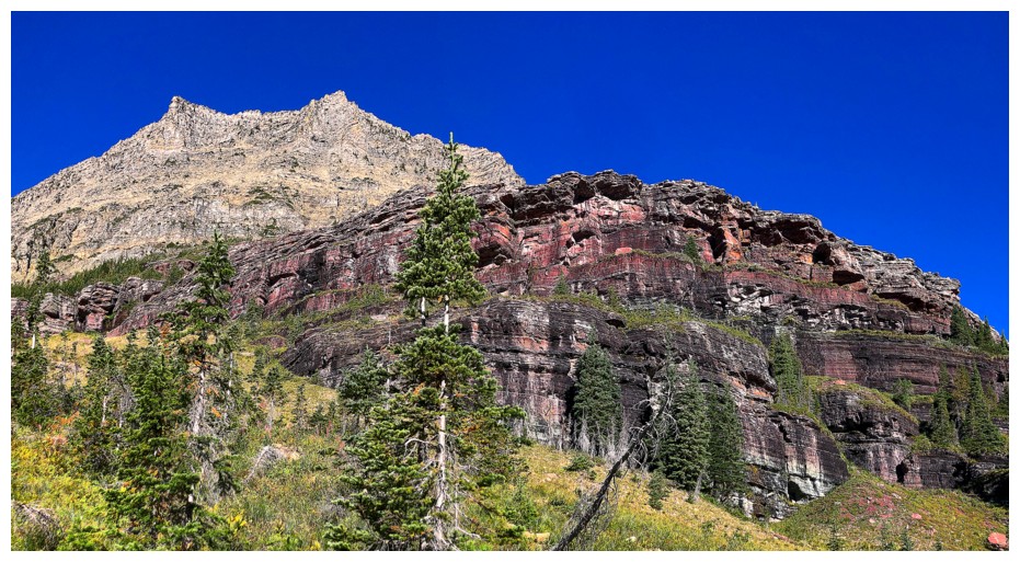
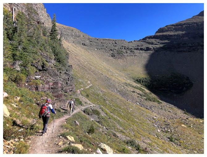
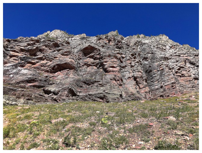
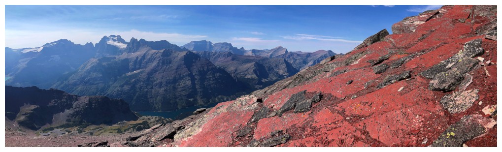
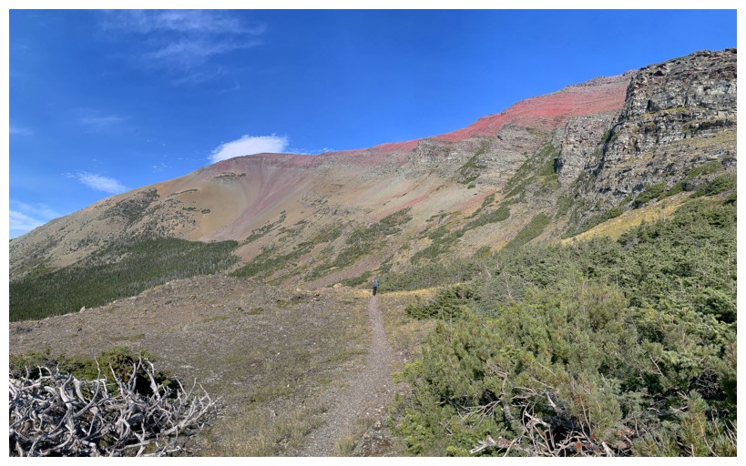
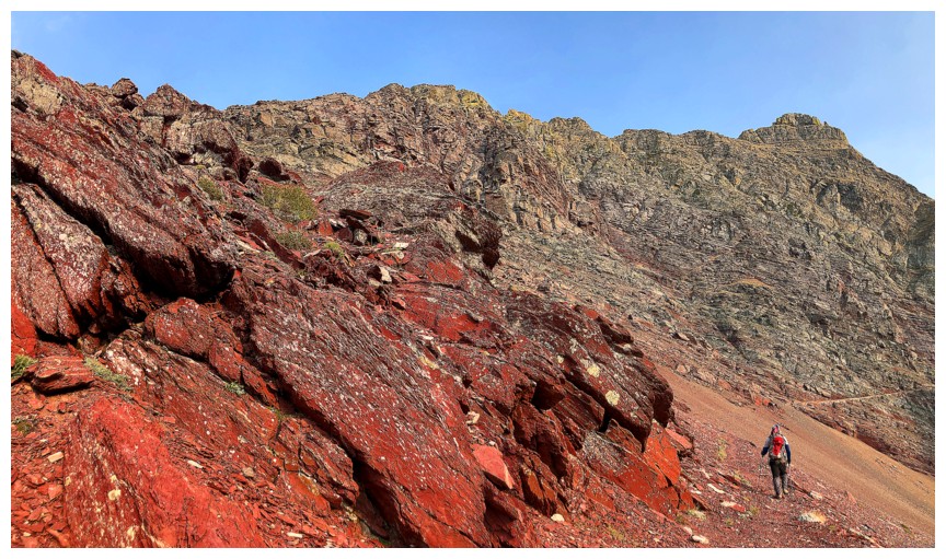
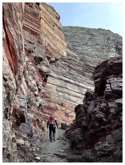
had long been on our “to-do” list. I mean, the mountain is a mass of red
argillite – what other motivation does a man need?!
Given several
warnings about the overall length of the trip via other routes (Poia Lake or
Ptarmigan Trail/Redgap Pass Trail), we chose the shortcut route that bypasses a
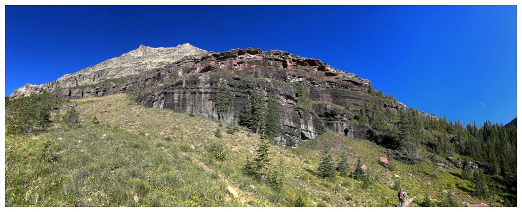
big chunk of the Ptarmigan/Redgap Pass trails. The ascent line goes up and over
a seemingly impossible stretch of terrain, north of Crowfeet Mountain – more to
come.
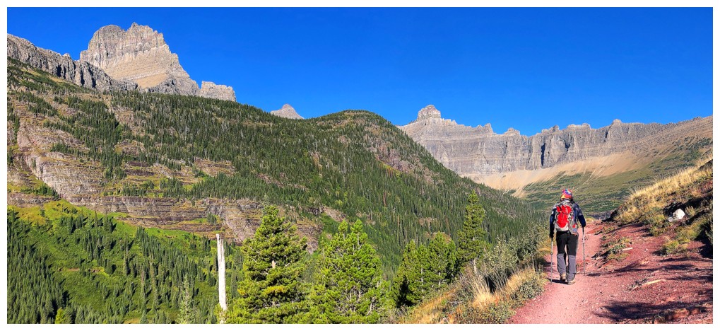
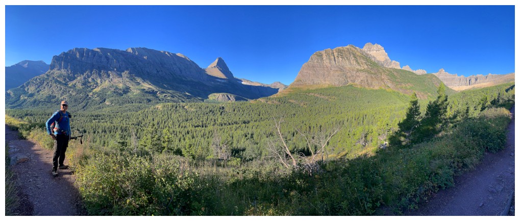
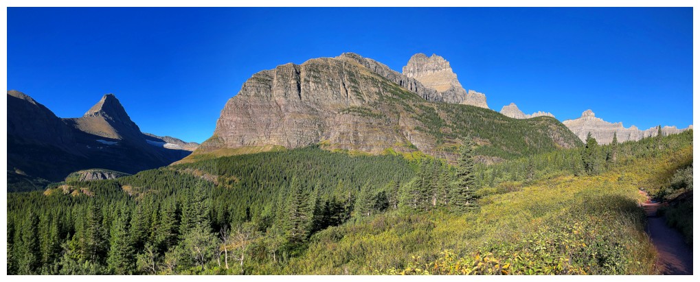
But first
there’s the approach and the famous Ptarmigan Tunnel. 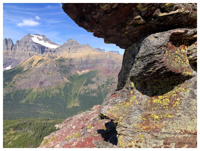 Although I had hiked down
this trail in 2010 after ascents of Henkel and
Crowfeet, I couldn’t
remember a single detail – shocking since Mark and I would agree, on this day,
that the Ptarmigan Trail offers some of the most breath-taking scenery anywhere
in the American or Canadian Rockies. The immense Ptarmigan Wall is truly a
sight to behold, boasting insanely colourful and craggy rock. And then there’s
the tunnel – a manmade passage through a lowpoint in the Ptarmigan Wall that
leads to another dimension!! Perhaps some hyperbole here, but that’s truly what
going through the tunnel feels like – you get a magnificent view from one side
and then a completely different magnificent view on the other side; the two
views have absolutely nothing in common. Like the amazing Grinnell Glacier
Trail, this is an experience that should be on everyone’s “hit-list”.
Although I had hiked down
this trail in 2010 after ascents of Henkel and
Crowfeet, I couldn’t
remember a single detail – shocking since Mark and I would agree, on this day,
that the Ptarmigan Trail offers some of the most breath-taking scenery anywhere
in the American or Canadian Rockies. The immense Ptarmigan Wall is truly a
sight to behold, boasting insanely colourful and craggy rock. And then there’s
the tunnel – a manmade passage through a lowpoint in the Ptarmigan Wall that
leads to another dimension!! Perhaps some hyperbole here, but that’s truly what
going through the tunnel feels like – you get a magnificent view from one side
and then a completely different magnificent view on the other side; the two
views have absolutely nothing in common. Like the amazing Grinnell Glacier
Trail, this is an experience that should be on everyone’s “hit-list”.
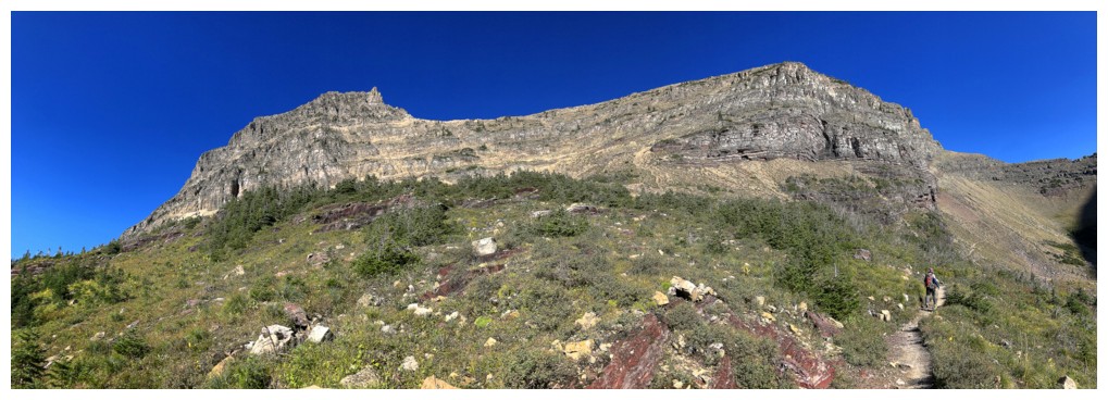
After composing
ourselves from the excitement of the tunnel, we continued on this unreal goat trail,
turned human trail, hugging the near vertical cliffs of 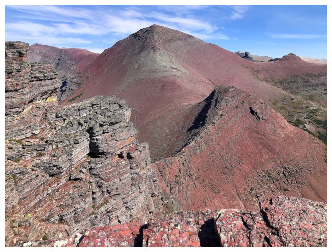 Crowfeet Mountain's
northwest side. This section, too, is a mind-blowing experience. I’m not sure
who to pat on the back more – the goats that initially engineered the trail or
the humans that made it possible for clumsy-footed bipeds to use it – think
I’ll give the nod to the GNP Goats; they are in a league of their own!
Crowfeet Mountain's
northwest side. This section, too, is a mind-blowing experience. I’m not sure
who to pat on the back more – the goats that initially engineered the trail or
the humans that made it possible for clumsy-footed bipeds to use it – think
I’ll give the nod to the GNP Goats; they are in a league of their own!
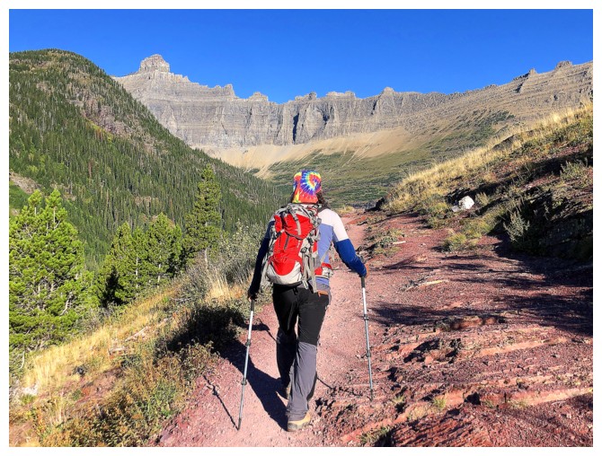
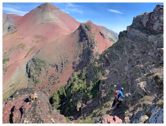
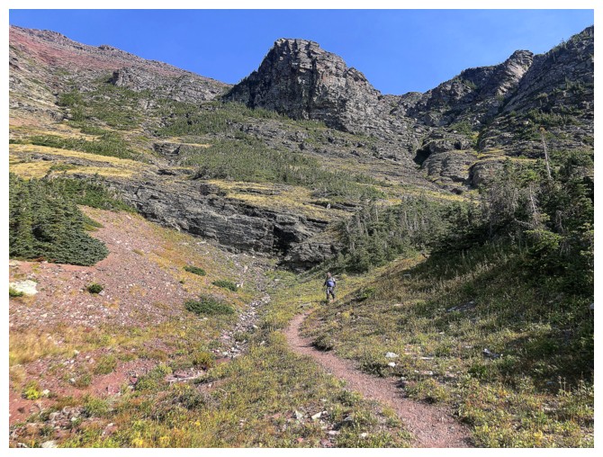
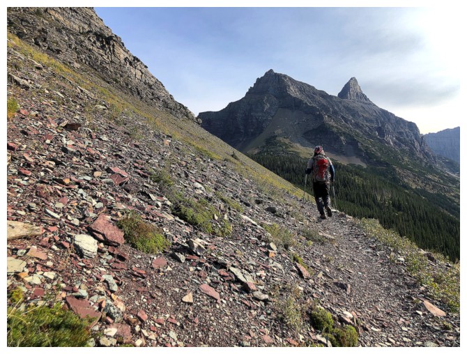
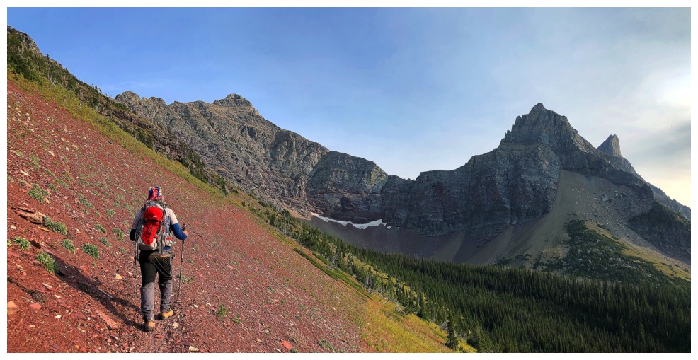
Now for the
excitement! The next section of the trip involving descending the Ptarmigan
Trail for a short distance, then scrambling up to the ridge above, traversing
that ridge, and finally descending an improbable line, again made possible by
the magnificent goats of GNP, over the other side of the ridge to reach Redgap
Pass. We did not end up taking the described line up to the ridge, but managed
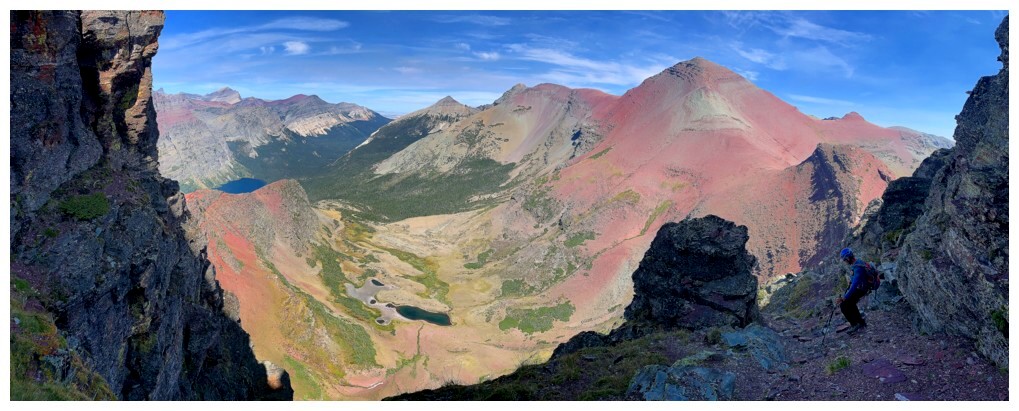
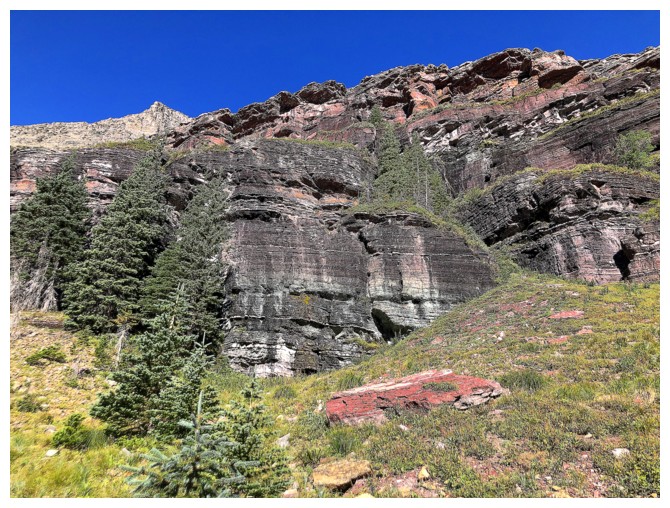
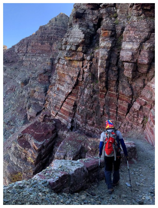
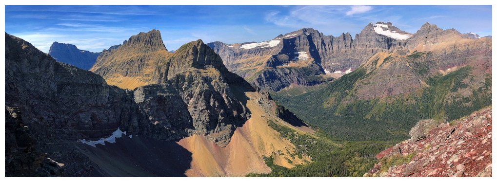
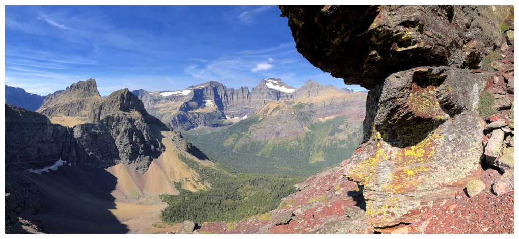
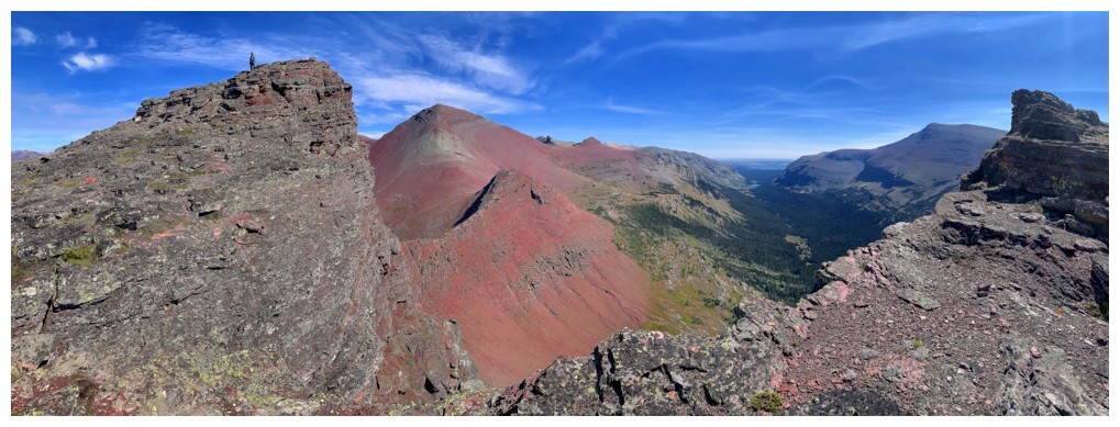
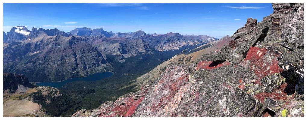
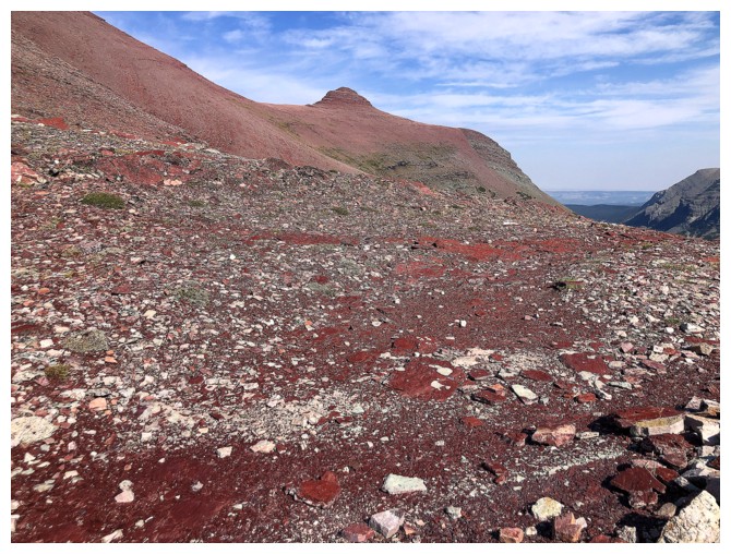
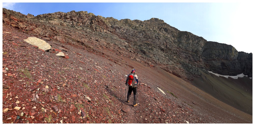
to reach it eventually, getting a good dose of red argillite scenery en route.
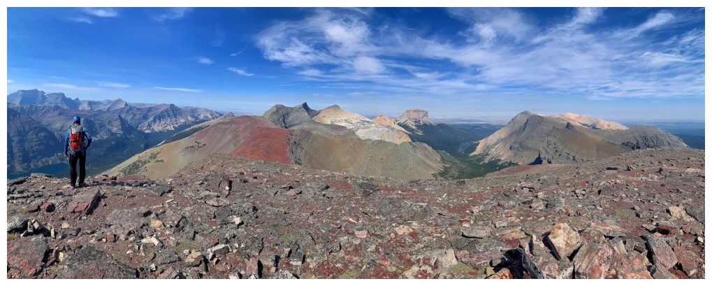
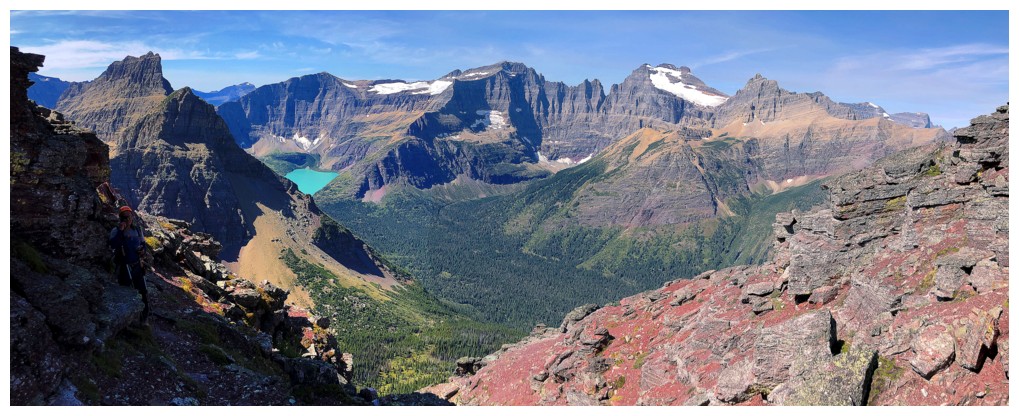
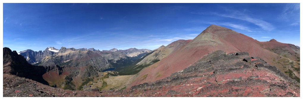
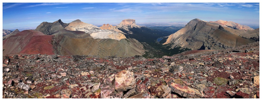
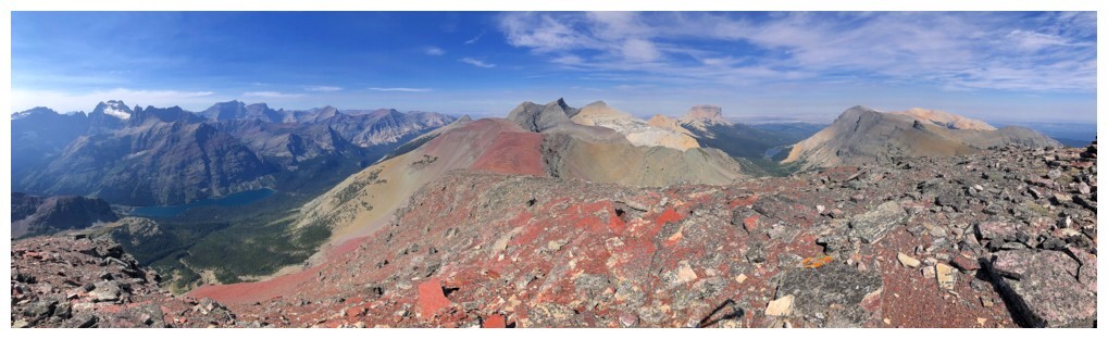
Views towards Mount Merritt and the surrounding peaks were terrific throughout.
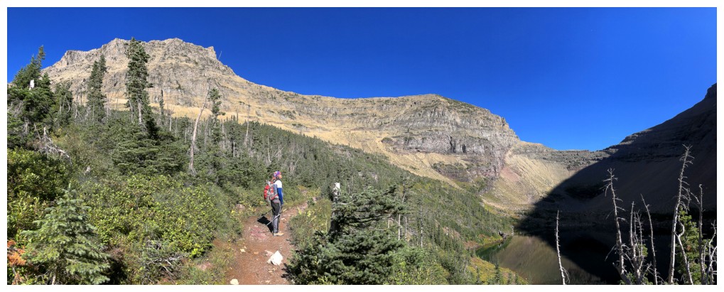
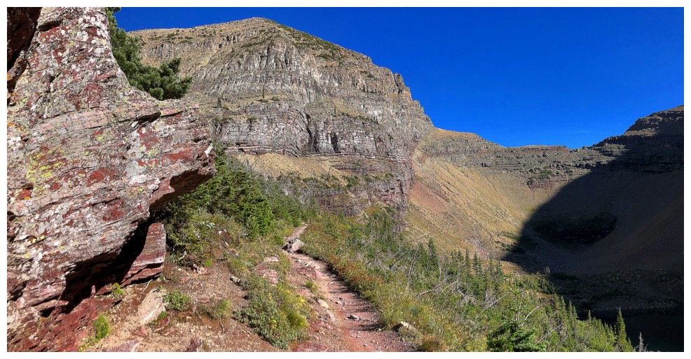
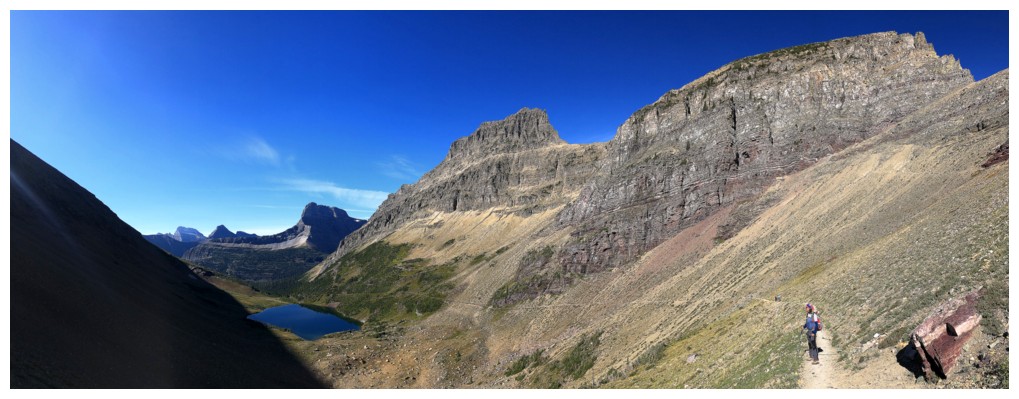
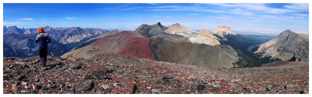
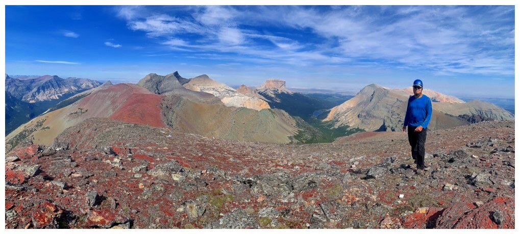
The view from
the ridgetop, however, was spellbinding. In addition to the craggy peaks to the
west, enter the glorious red bulk of Seward – what a sight! We took a
much-needed break here to refuel and bathe in the wonderful vistas.
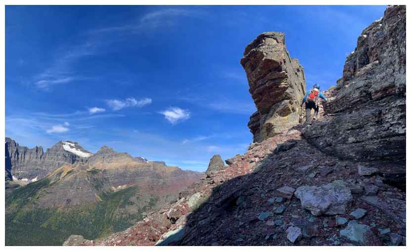
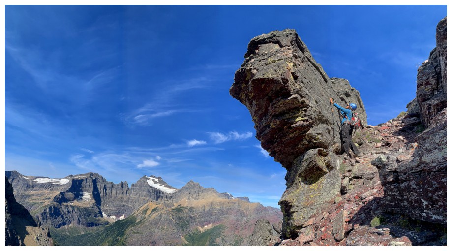
Traversing the
ridge was, likewise, a cool experience. Throughout you are baffled that there’s
a route down the east side that doesn’t involve using a parachute or wingsuit!
It’s straight down. We eventually found the notch and the magical goat trail
that precludes the use of the aforementioned equipment. Gordon Edwards’
description is perfect: “A look down through that notch toward Redgap will
surprise and delight even the most jaded mountaineer”.
Having said
that, descending the goat trail is no trivial matter. There are a few sections
where any slip would send you clean off the mountain and certain death. And
descending it with any snow and ice remaining would be suicide, even with an
axe and crampons. Luckily, we had perfect conditions. 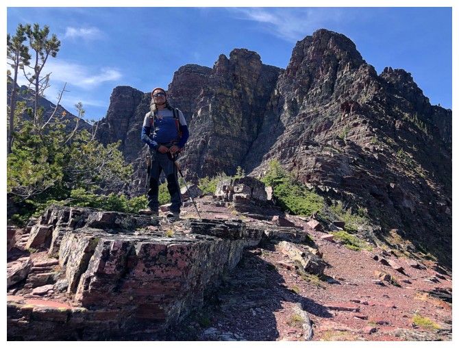 Getting down was a slow
and cautious process.
Getting down was a slow
and cautious process.
Upon
reaching
the plateau below, we erroneously ascended a minor bump west of the
pass, before
backtracking and then making our way to Redgap Pass. Another break was
taken, before the straightforward, hour-long slog to the summit of
Seward Mountain.
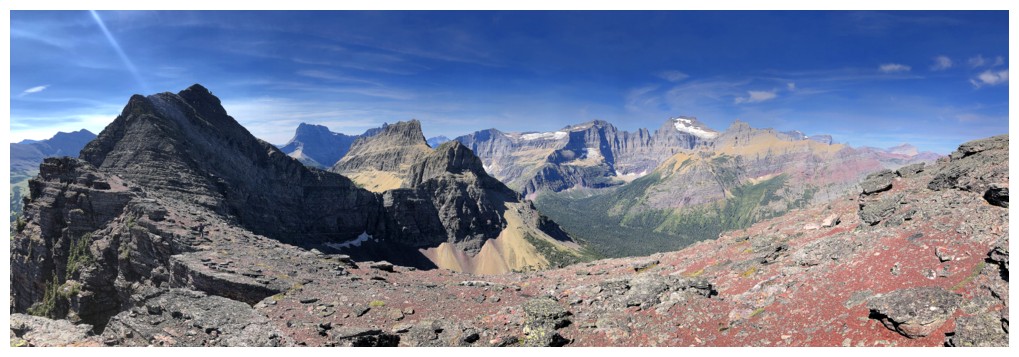
The skies to the west had become a little hazy at this point, but it
was the
view to the northeast, towards Chief, Yellow and Gable that we were
most
interested in. And that view was phenomenal! The colours and contours
of those
three mountains are unlike anything in the park, featuring vibrant
shades of
gold, yellow, red, brown, and gray. Combined with the craggy peaks to
the west we
were treated to a gripping summit panorama!
We were soon
joined by two friendly scramblers coming from Yellow Mountain – well done! 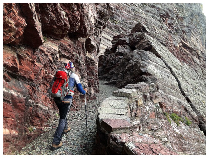 In addition,
two people had already left. Six individuals on this remote peak in a single
day – very unusual for mountains in GNP.
In addition,
two people had already left. Six individuals on this remote peak in a single
day – very unusual for mountains in GNP.
Once
back at pass
we decided on an alternate return route, sticking to the Redgap Pass
and
Ptarmigan trails. This would add about 8 horizontal kilometres and 200
vertical
metres to the return. However, it would all be on good, easy trails,
and would avoid
the exposed and challenging terrain used on ascent. Plus, we would get
to see some new scenery. This route worked exceedingly well. In fact,
using
these trails for both ascent and descent would be perfect for anyone
not
comfortable with the challenges of the shortcut route; and with a good
hiking
pace, could be completed comfortably in a day. The extra elevation gain
back to
the Ptarmigan Tunnel was a little tiresome, however. We were both quite
relieved
to pass through the tunnel, knowing the remaining 2 hours were all
downhill.
Definitely one
of the coolest routes and most scenic trips we’ve ever completed. Chalk another
one up for amazing Glacier National Park, Montana!
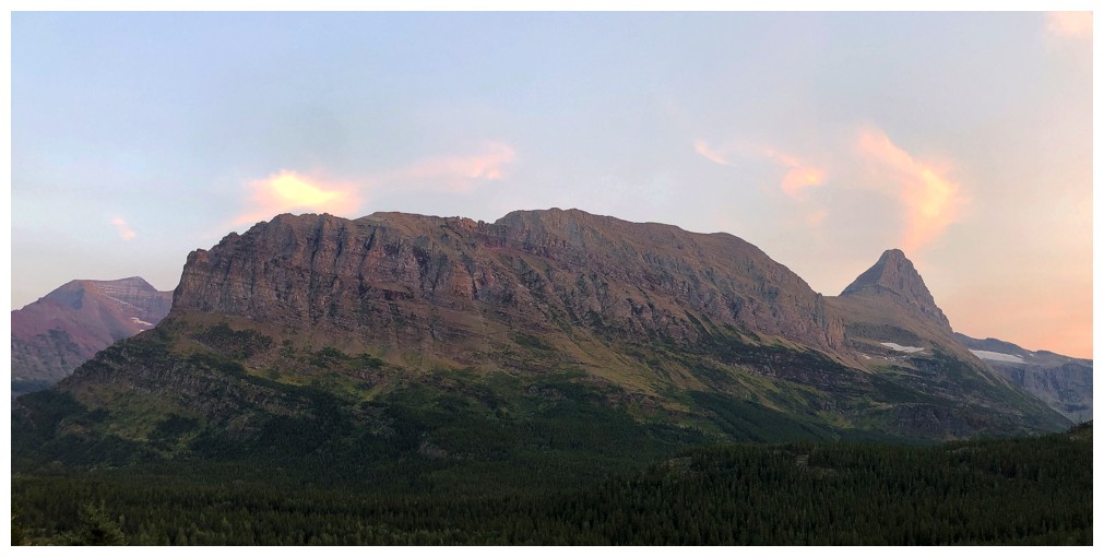
The first of so many amazing views. Left to right: Grinnell Point, Mount Grinnell, Bullhead Point, and Mount Wilbur.
Similar view
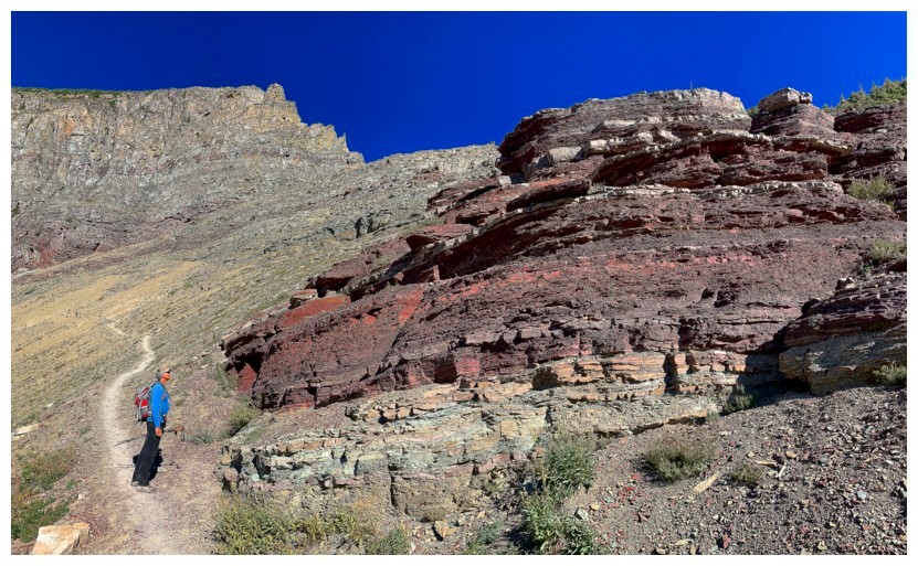
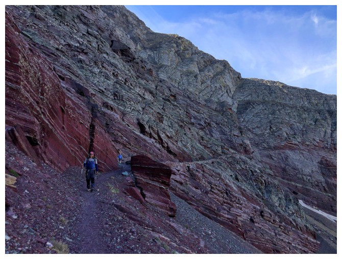
B-7 Pillar and part of the Ptarmigan Wall in the background. A sweet red argillite trail in the foreground! (and Mark)
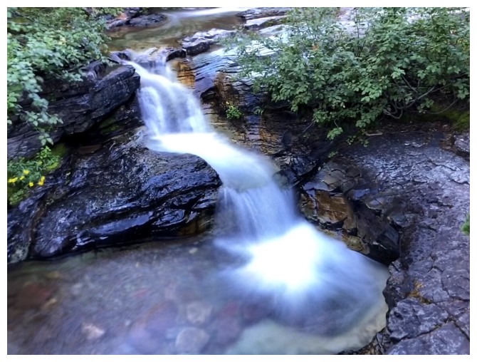
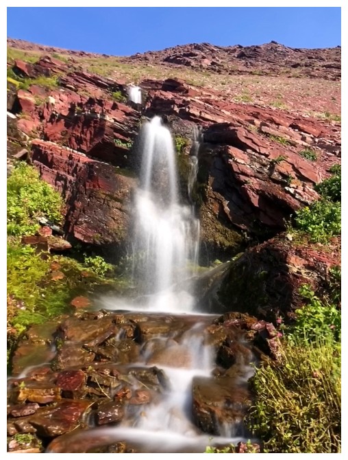
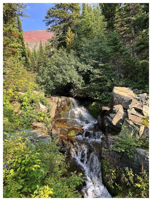
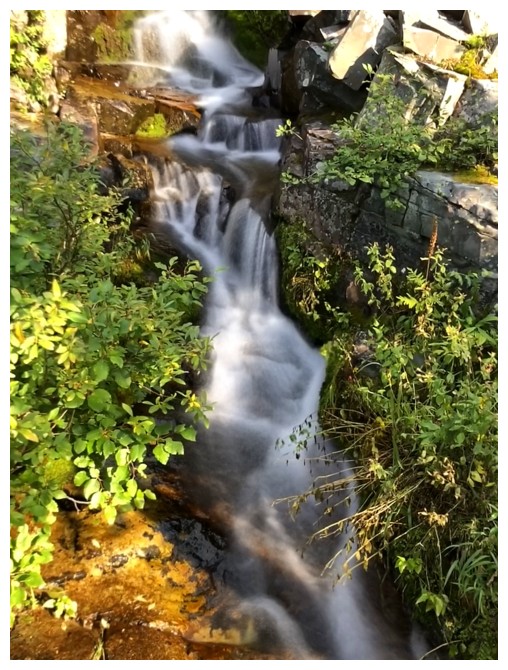
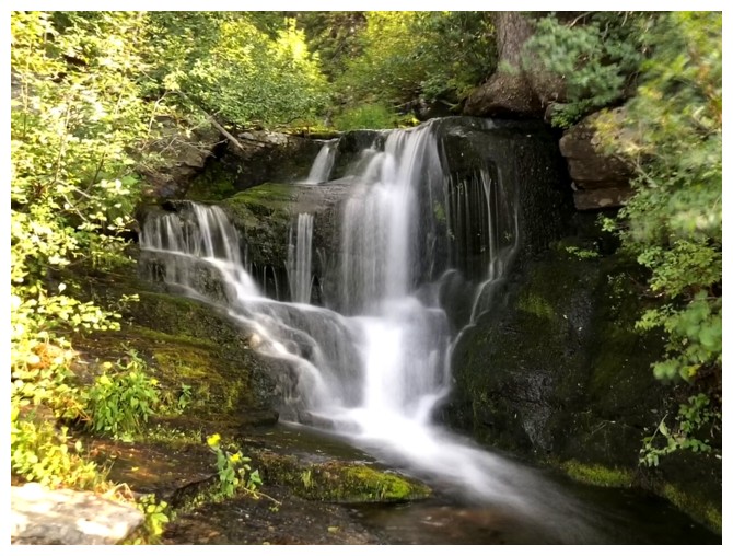
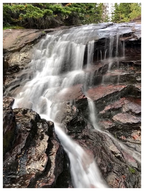
This trip did not feature a ton of flowing water scenery so I took what I could get
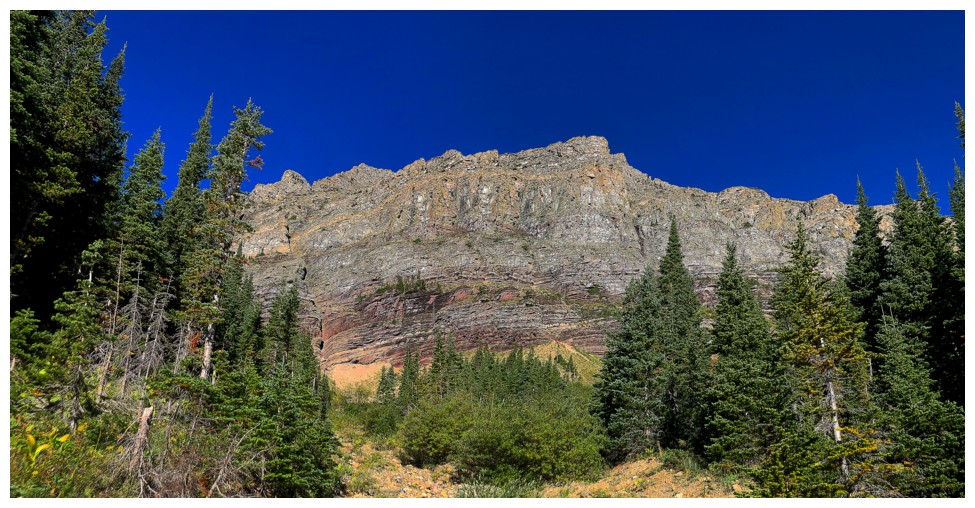
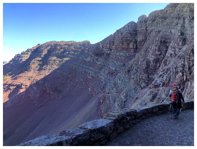
Here comes the colourful section of the Ptarmigan Wall
Someone is mesmerized by the Wall
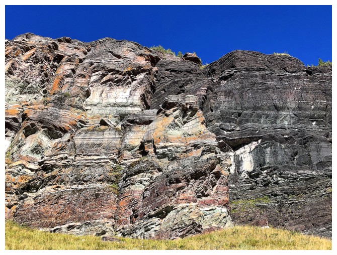
Not hard to see why
Wilbur's north side
Back to the Wall
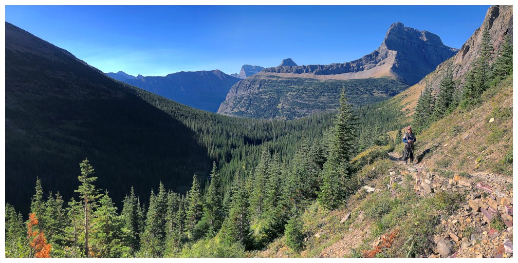
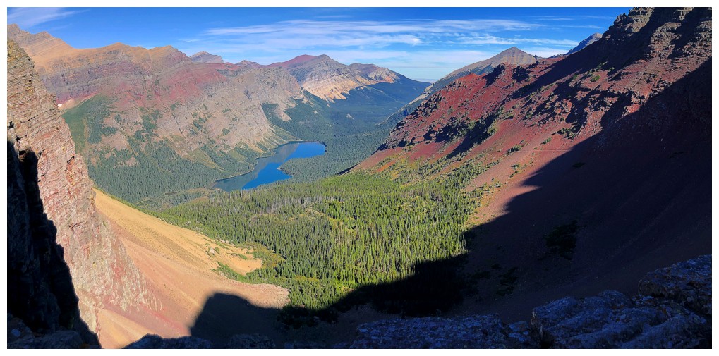
The end of the valley is now visible
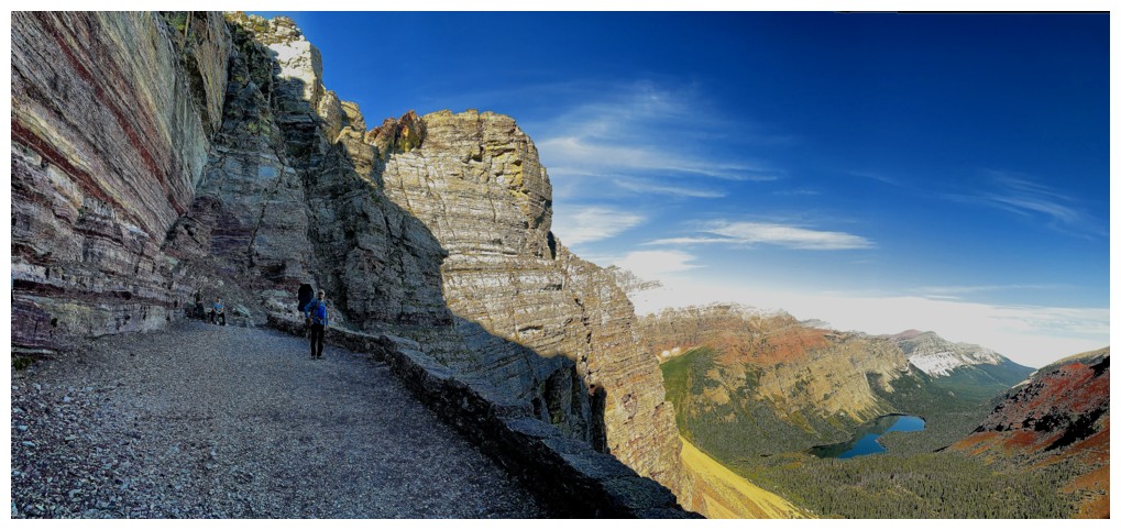
Great trail, great rock
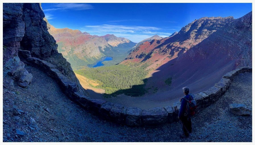
The Ptarmigan Tunnel is up there, somewhere
But for now the Ptarmigan Wall is still keeping us entertained
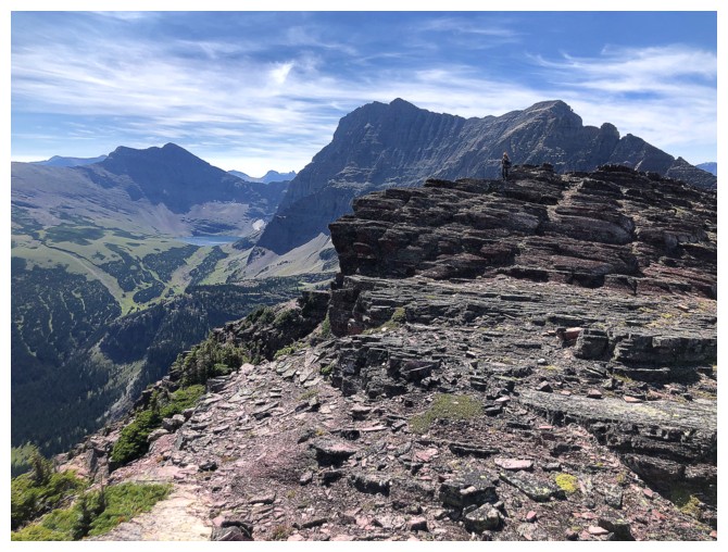
Ptarmigan Lake at the left, Ptarmigan Wall (centre and right), all seen from the Ptarmigan Trail.
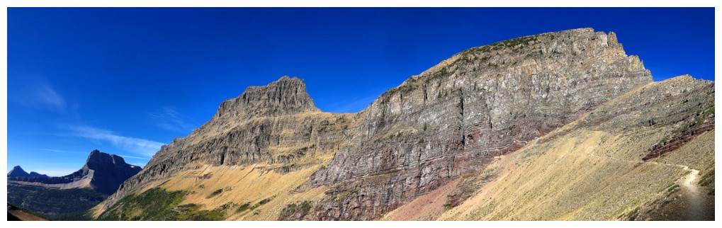
The Wall and note the trail at the right
Three big switchbacks lead to the Tunnel
A glorious band of argillite sweeps down the mountain
One of the coolest views we've ever seen
Hardly surprising that I'm completely enamoured by a big chunk of red rock!
Ptarmigan Lake is a beaut, backdropped by Gould, Grinnell, and Wilbur
...and the Ptarmigan Wall
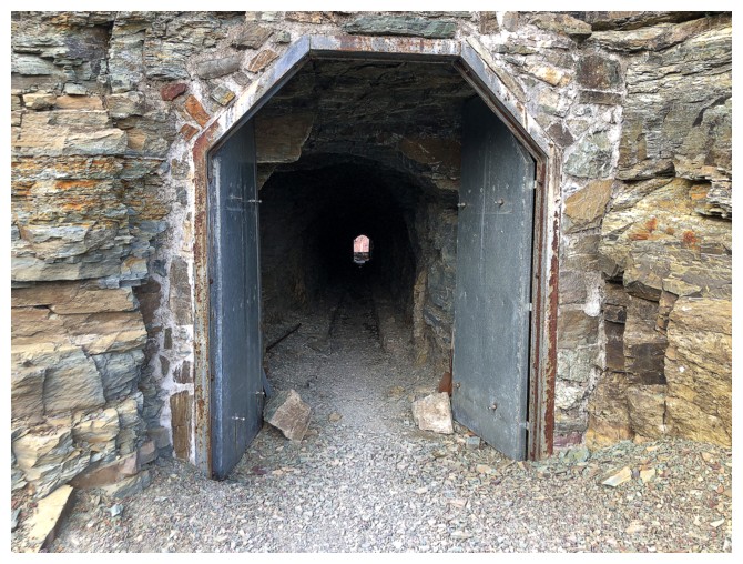
The Tunnel. Click HERE to see Mark's video of the experience.
On the north side of the Tunnel
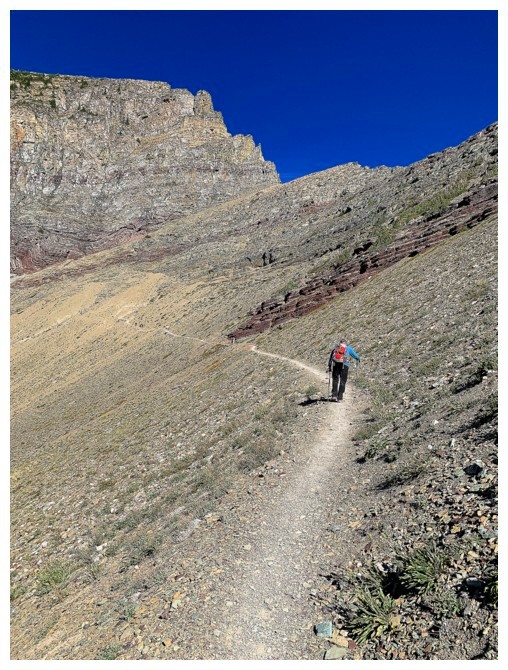
You can see the trail going diagonally down, across the north wing of Crowfeet Mountain
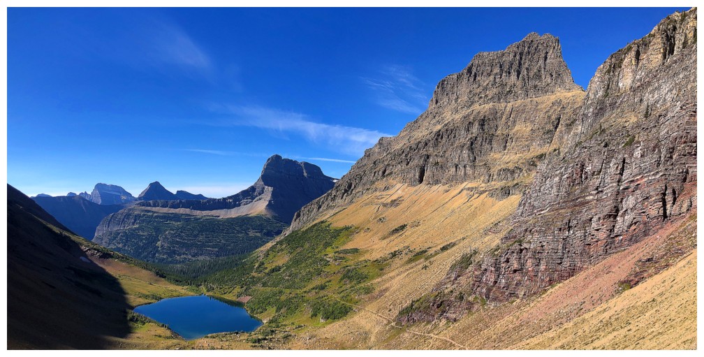
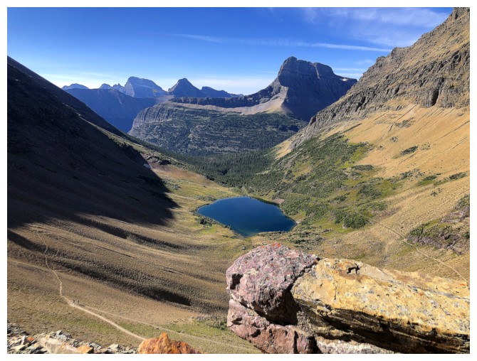
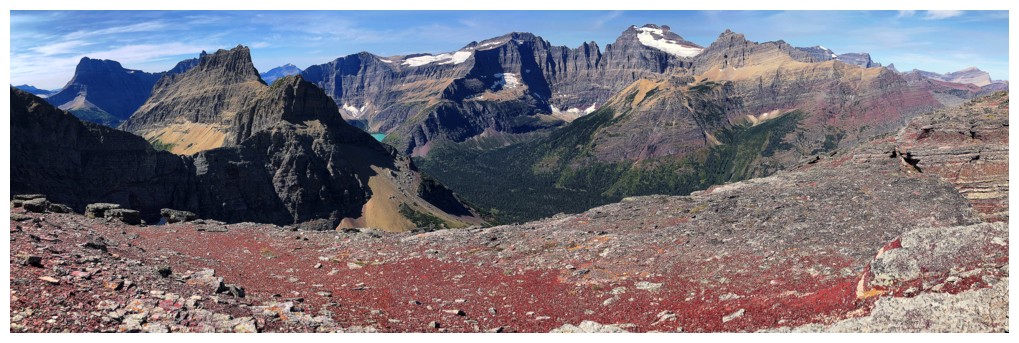
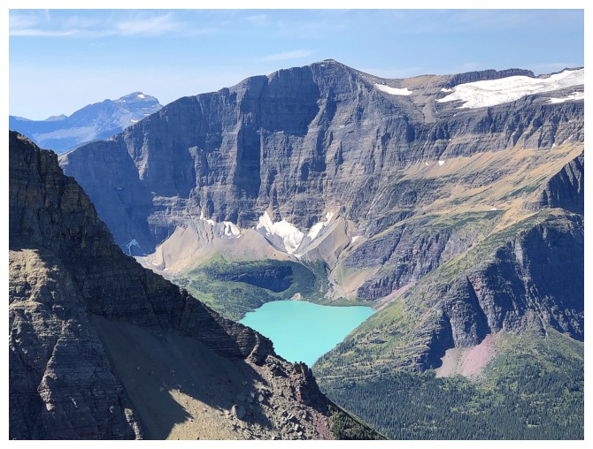
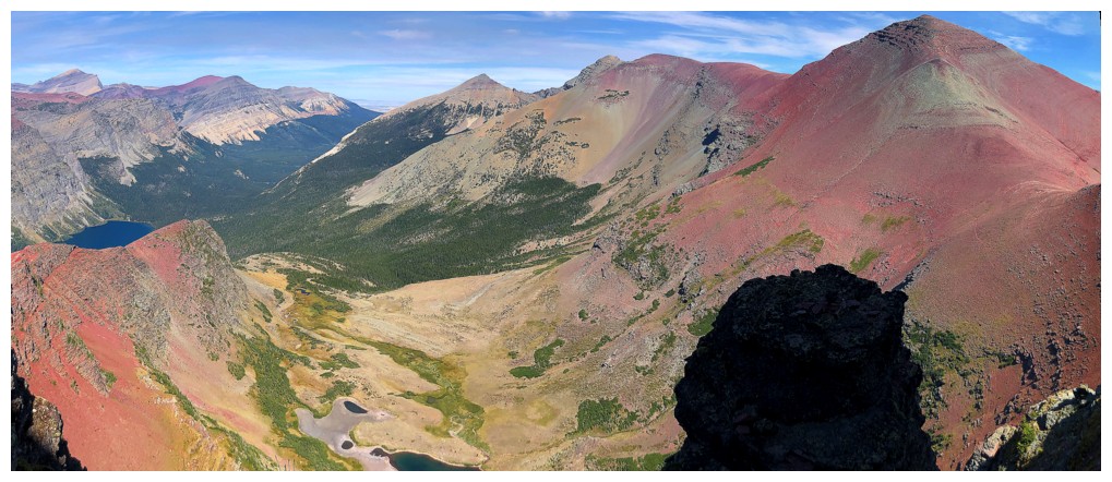
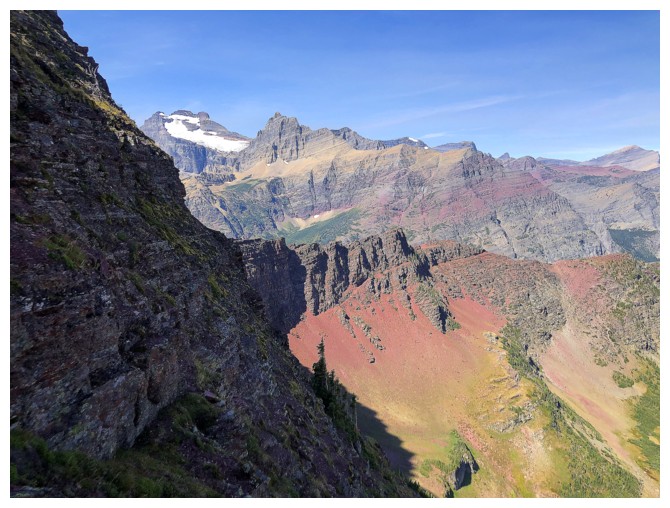
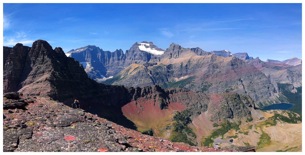
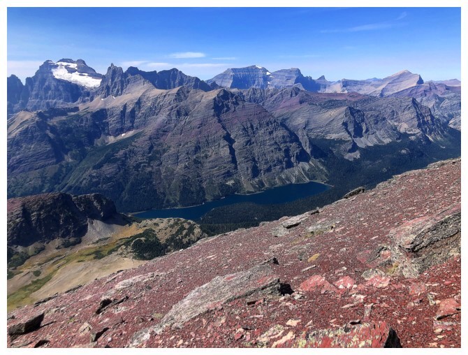
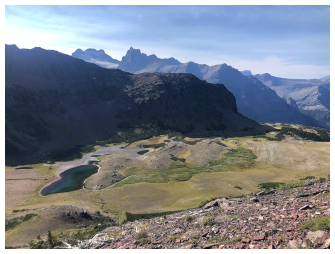
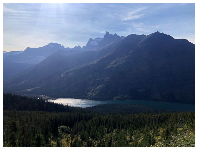
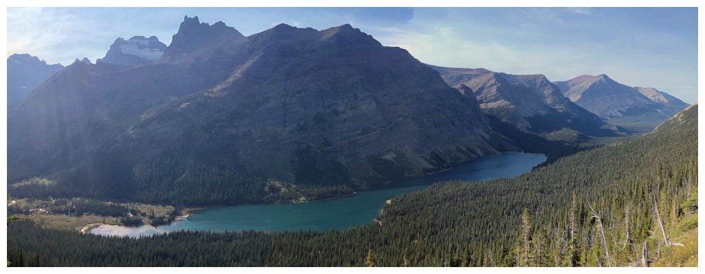
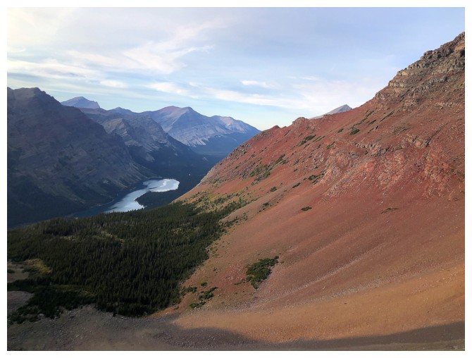
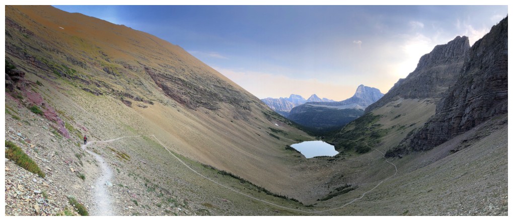
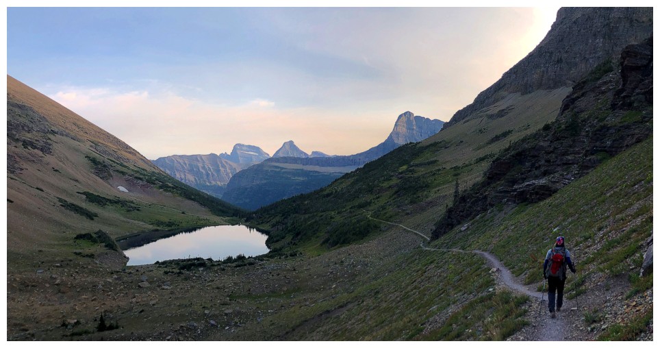
Elizabeth Lake is the source of the Belly River. The Belly runs
northeast and eventually flows into the Oldman River near Lethbridge,
Alberta. The slopes to the left of the lake are part of the northeast
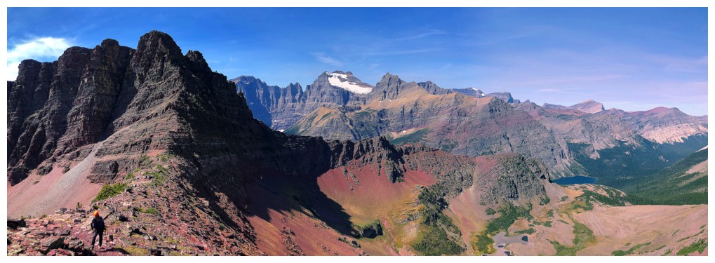
side of Natoas Peak. Bear Mountain in the distant centre.
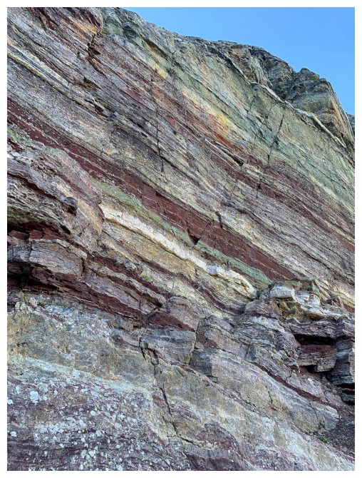
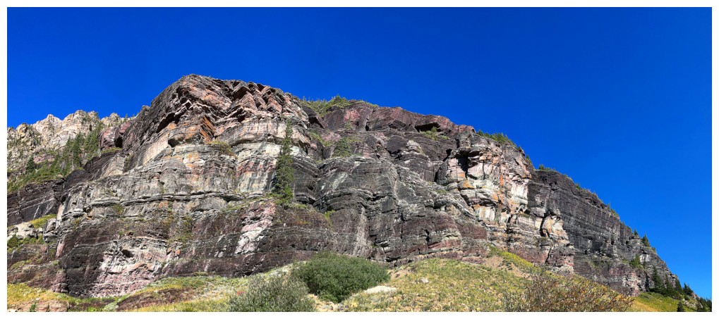
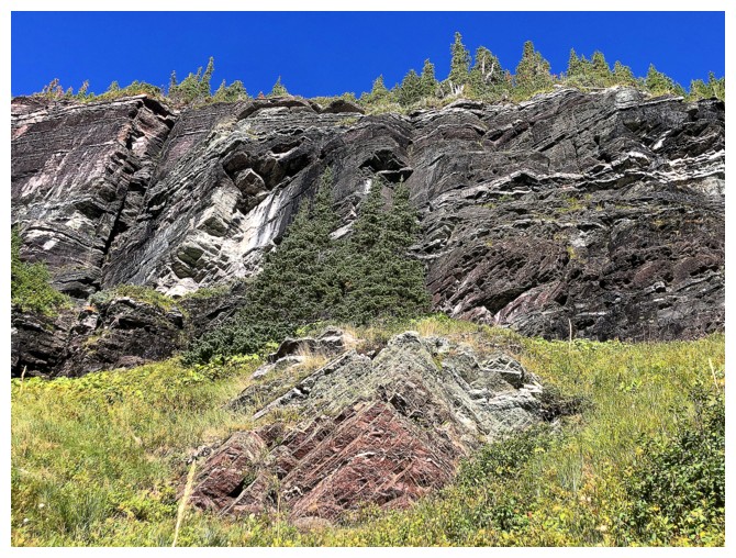
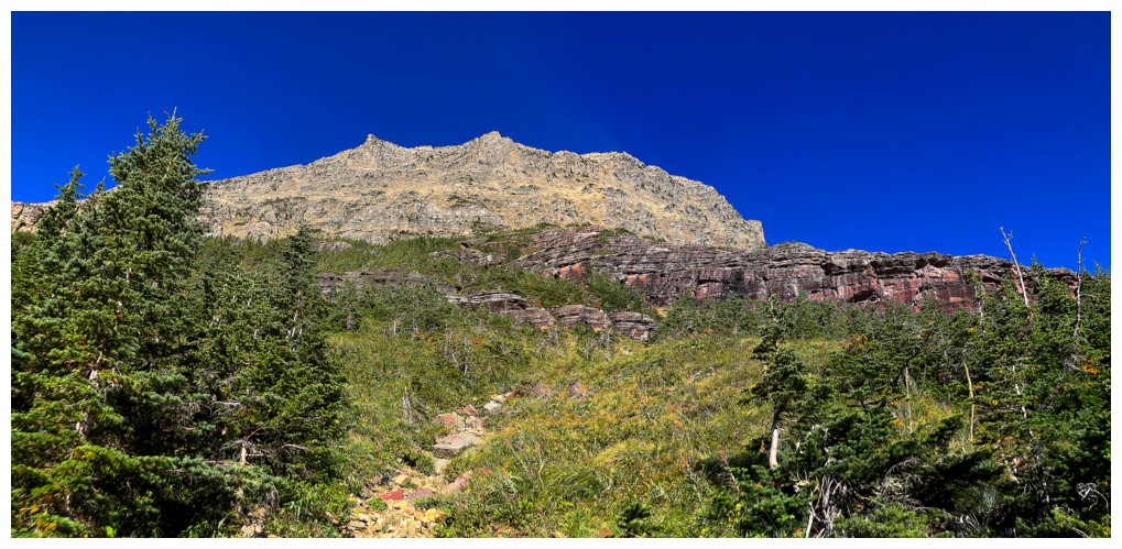
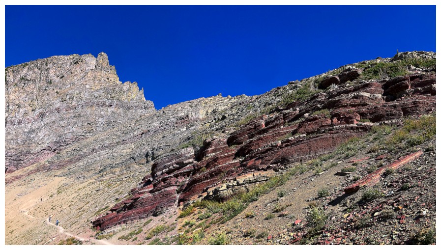
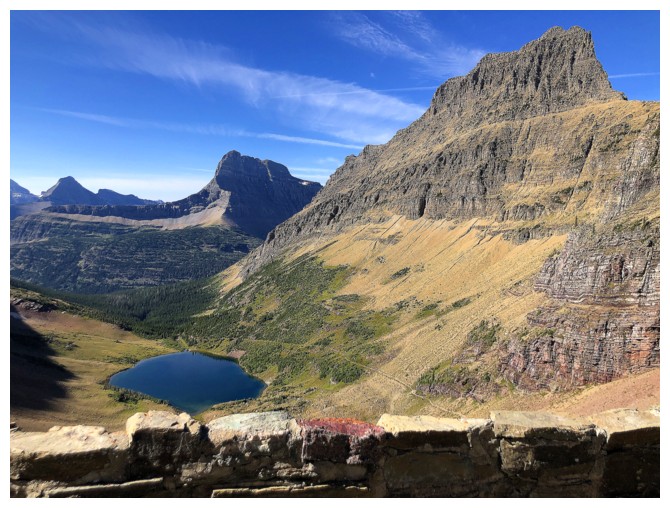
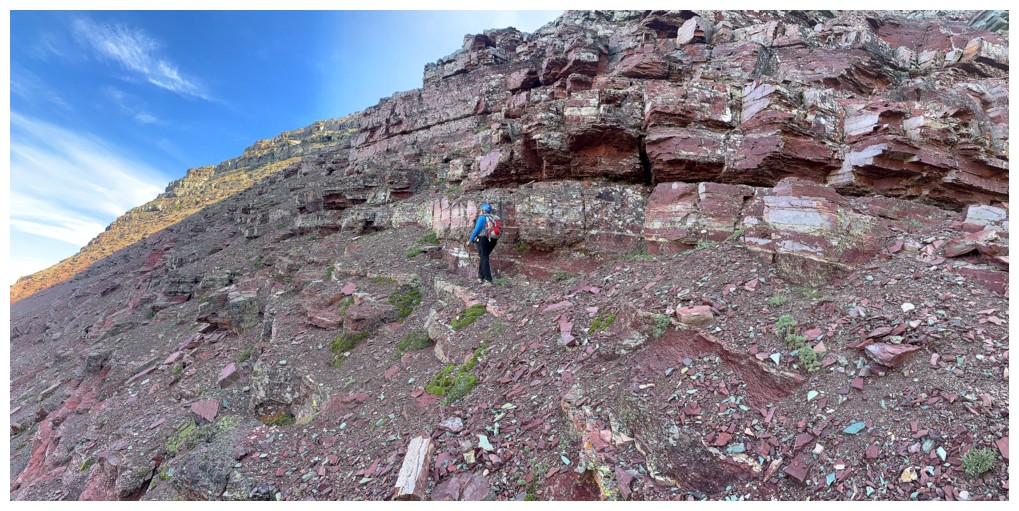
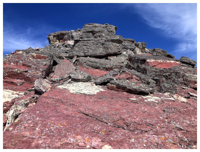
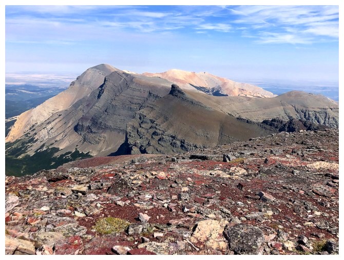
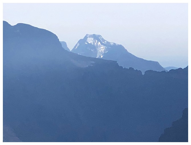
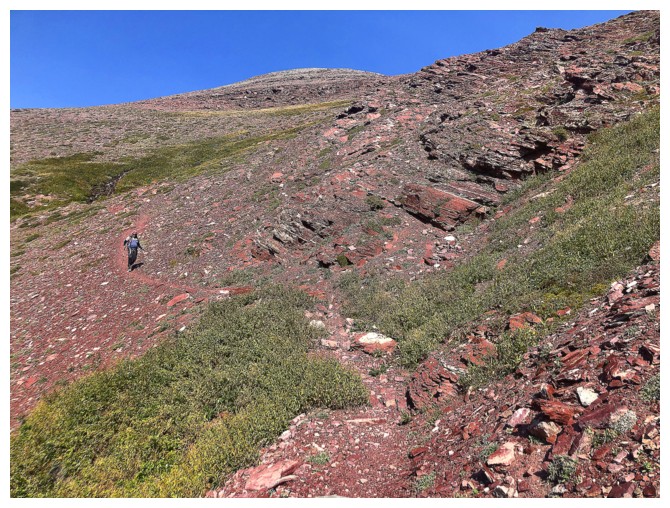
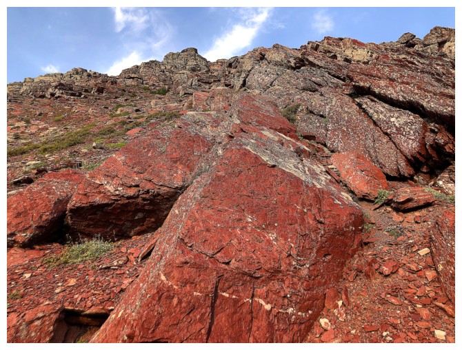
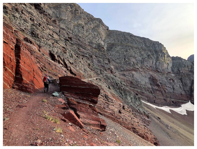
The strata on this side of the mountain are remarkable
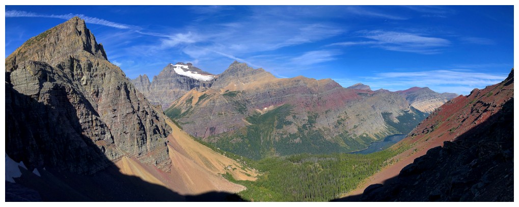
So is the view! Glaciated Mount Merritt is going to be the centre of attention for a while.
A wonderful ride down the trail, but we missed the described turn-off
Heading up red argillite slopes instead. The terrain here is stepper than it looks.
I stand corrected - everything to the west is going to be the centre of attention!
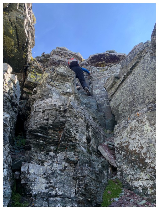
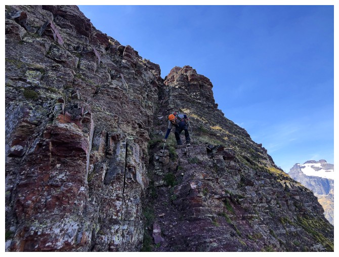
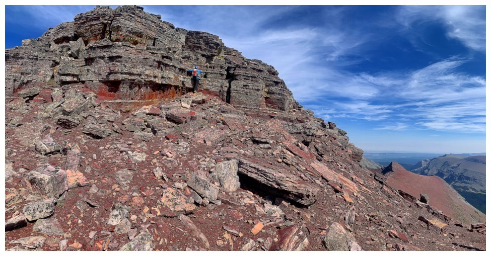
There was some steep scrambling to get to the ridge
Approaching an interesting outcrop
View from the outcrop
Apparently I can be enamoured by other types of rock too!
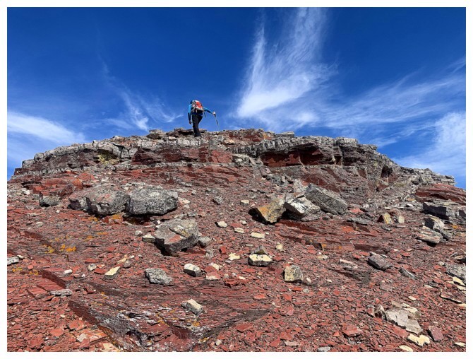
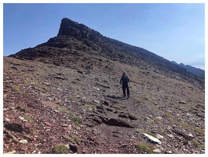
Easier terrain leads to the ridge
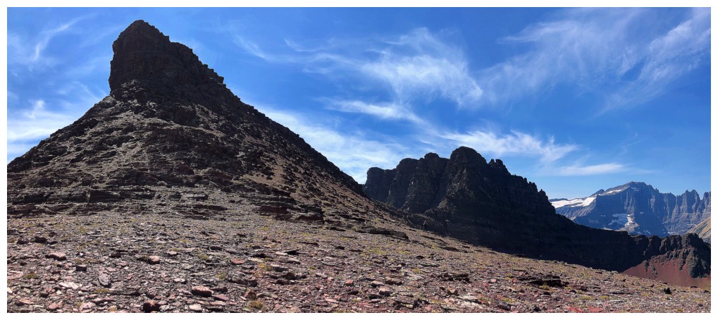
The north highpoint of Crowfeet Mountain behind Mark
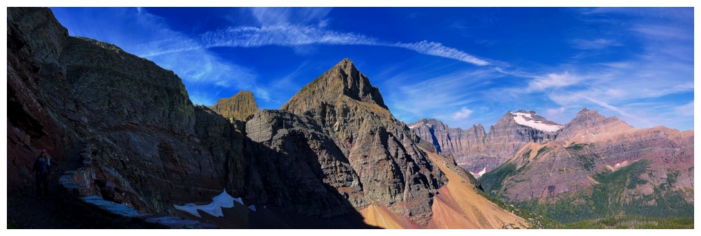
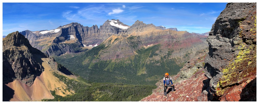
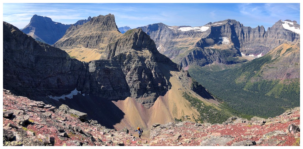
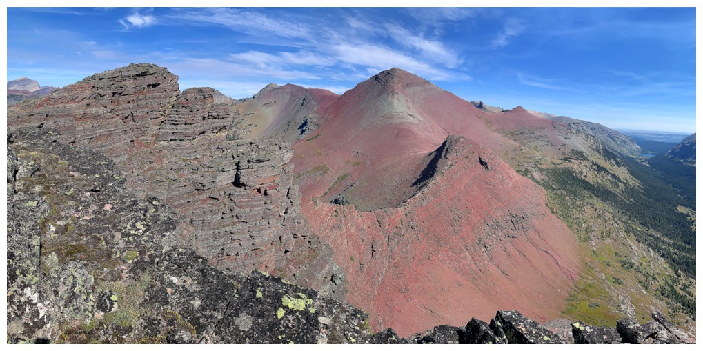
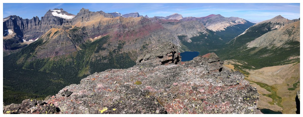
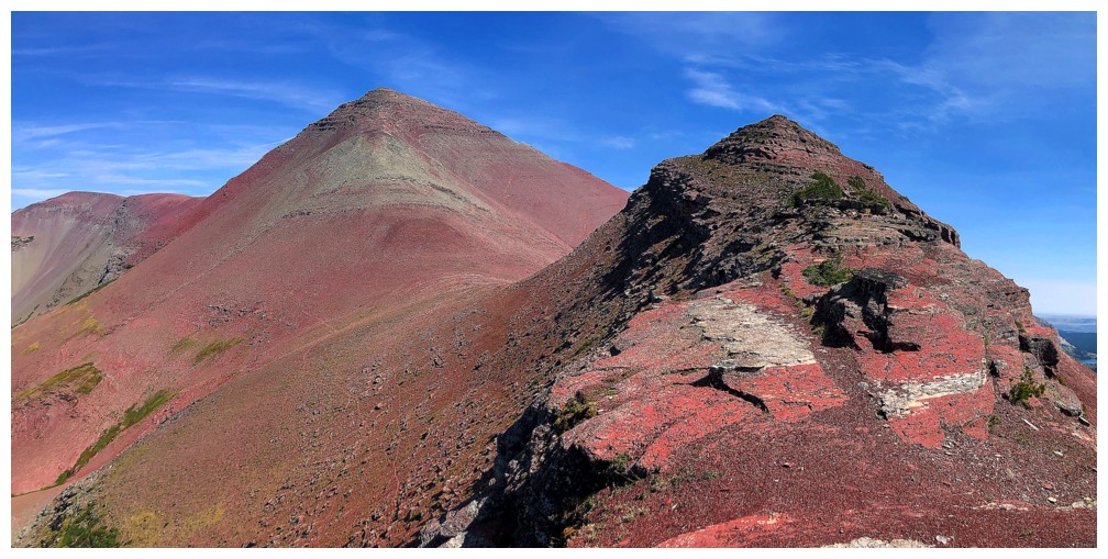
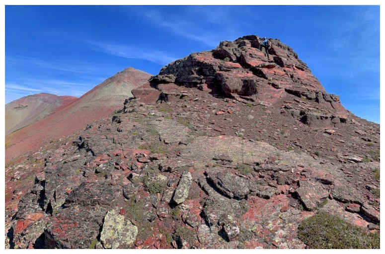
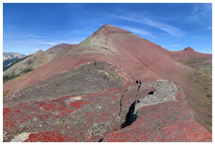
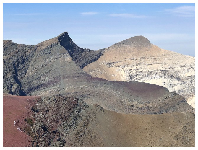
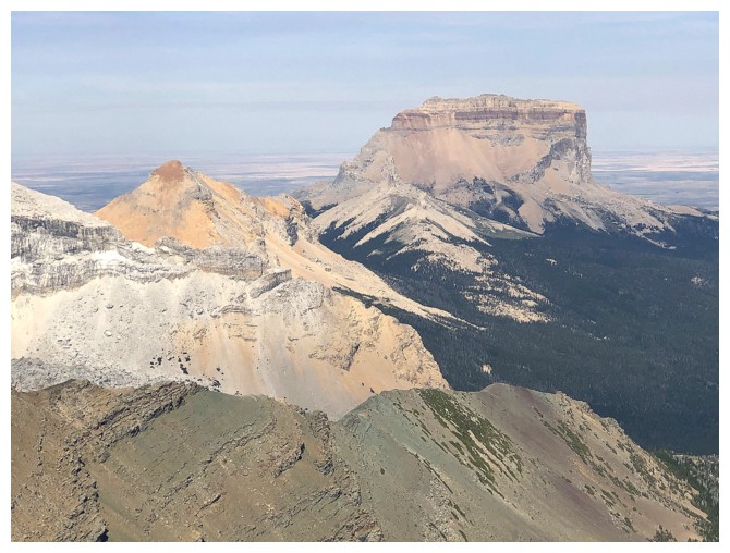
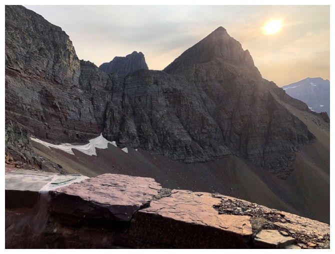
First thing you see upon reaching the ridge - Mount Seward
Mark makes his way to the ridge
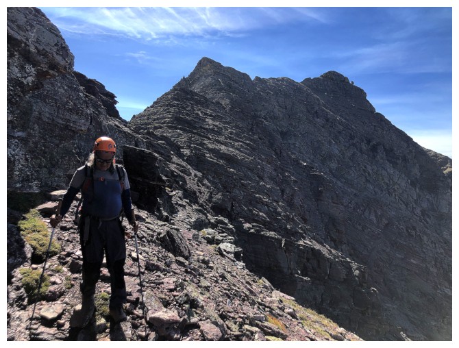
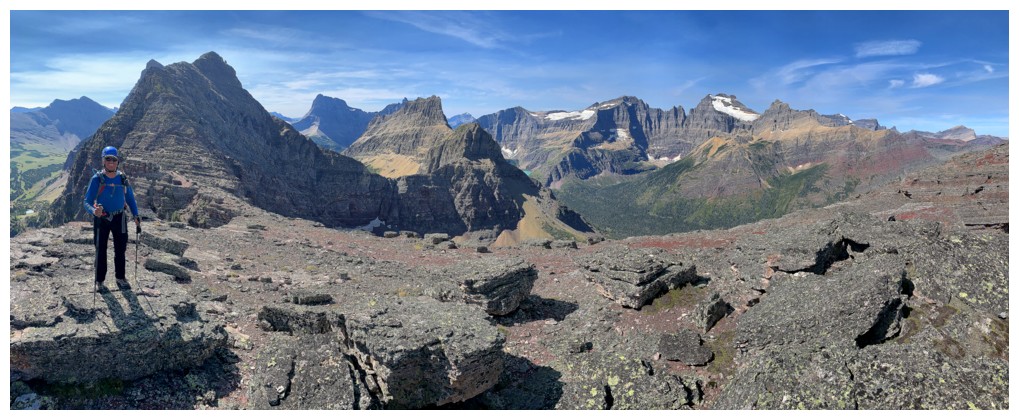
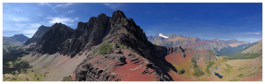
Looking south along the ridge. Apikuni Mountain at the left.
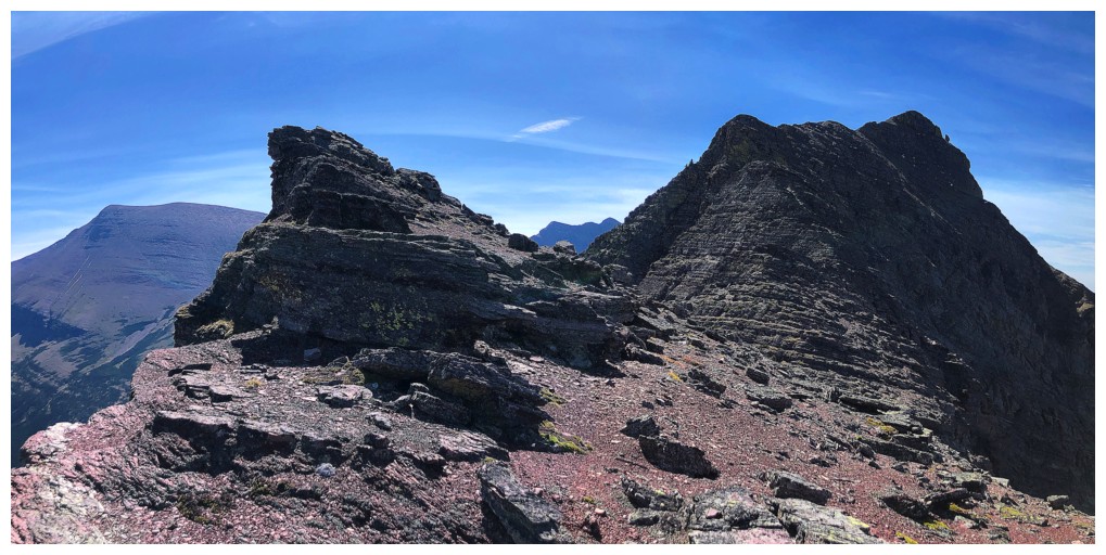
I'm on the first of several highpoints along the ridge
Really couldn't get enough of the view to the west...
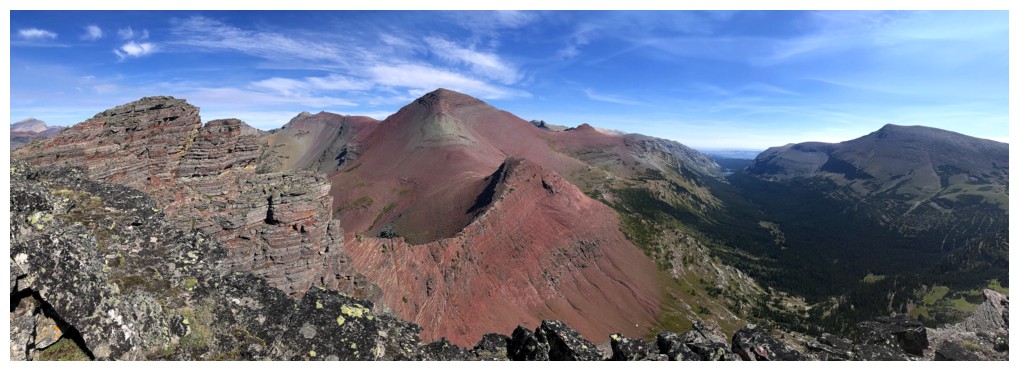
...or the view to the northeast, for that matter!
Zoomed in a little
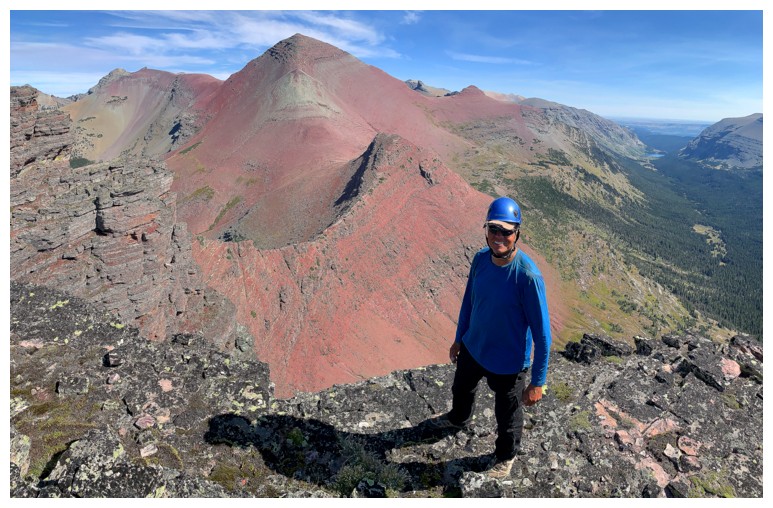
Me and Seward
Me and the view to the west
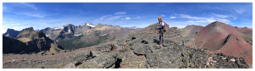
Mark and both views
The view AND a carpet of red argillite!
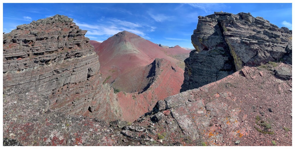
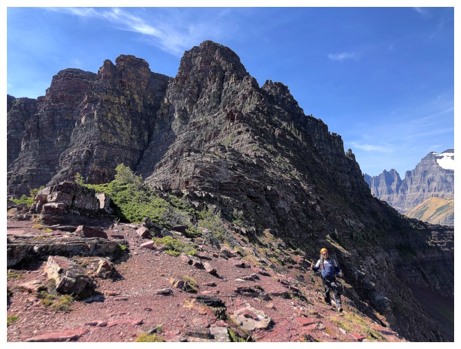
Between two more highpoints along the ridge
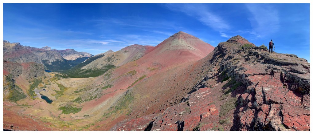
Elizabeth Lake is reappearing
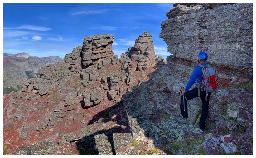
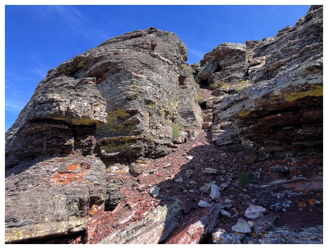
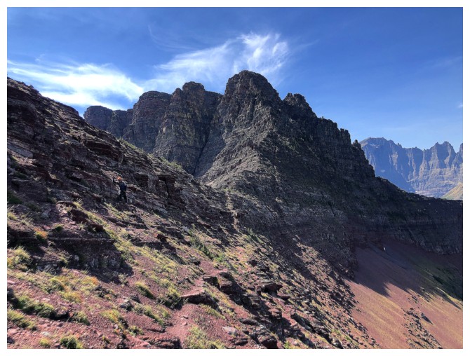
Approaching the key to the continuation of the trip
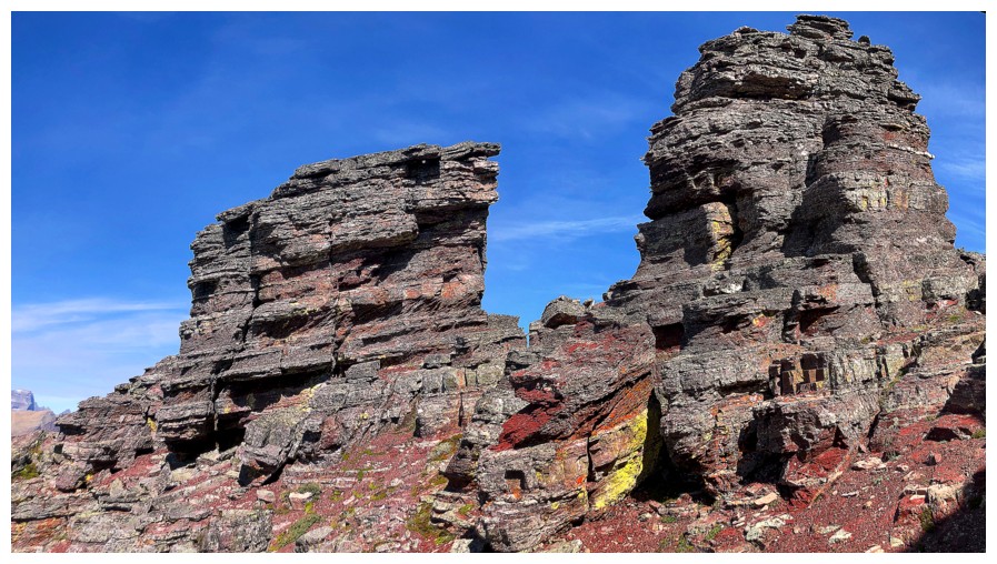
The "towering spires" described on Summitpost
Helen Lake (left) joins in the fun
Ahern Peak above Helen Lake
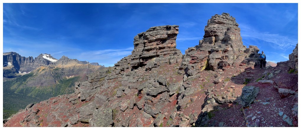
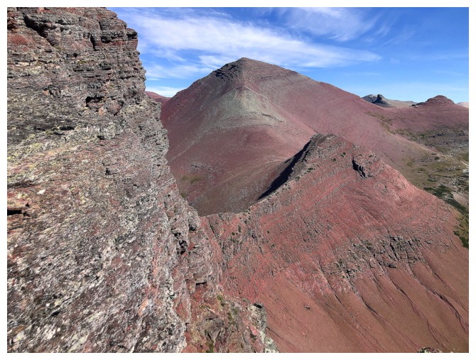
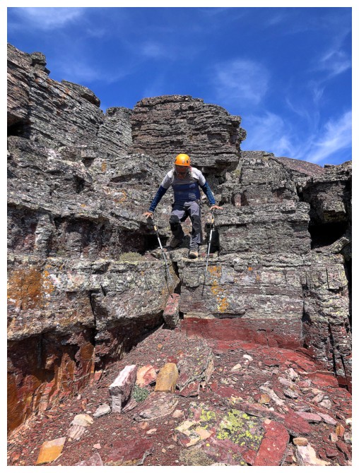
At the famous notch
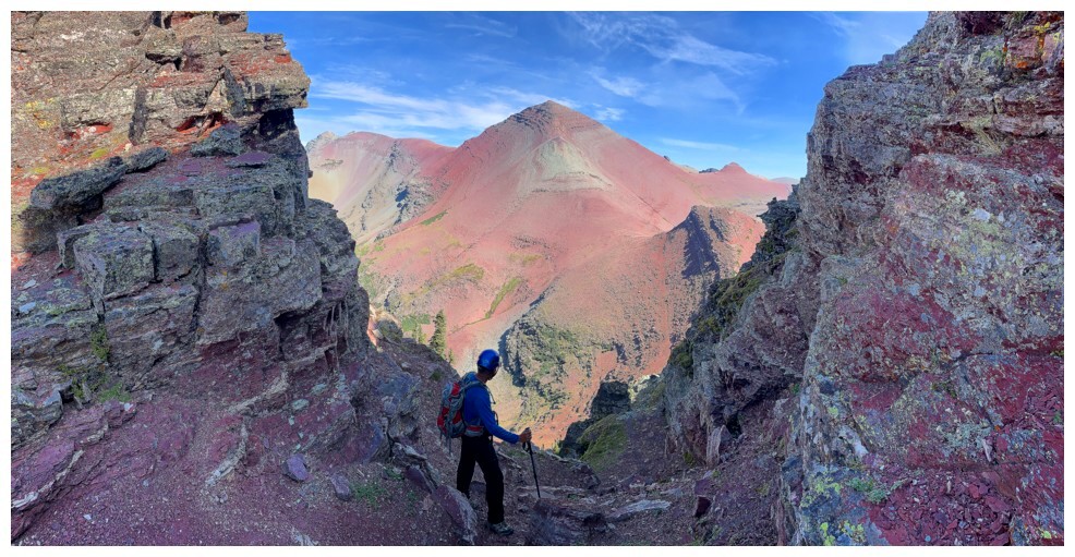
Looking down the famous goat trail from the notch
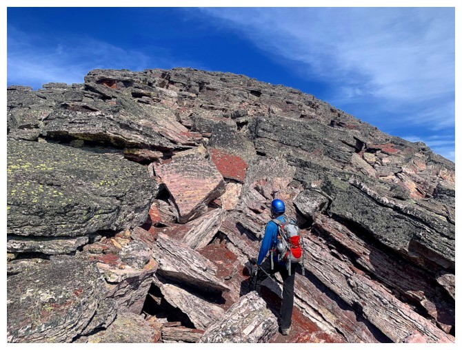
Crazy variety of colours
The goat trail is straightforward at first, but lower down it gets quite serious
Mark on the easy part. We put away the phones at this point to concentrate on not falling off the mountain!
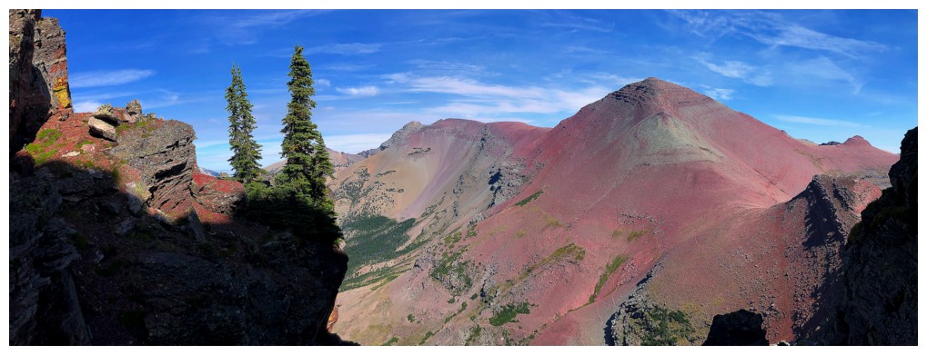
But I took mine out to photograph Merritt and Natoas
We are down
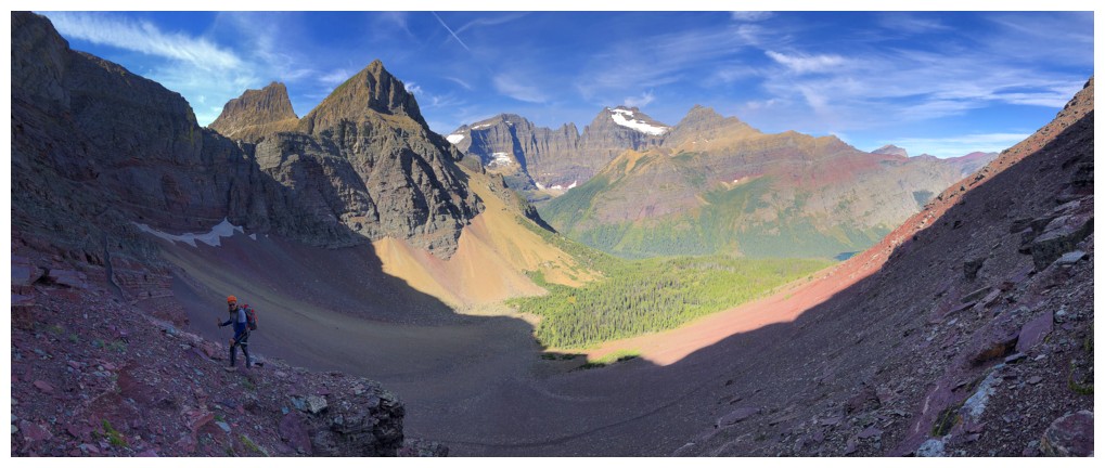
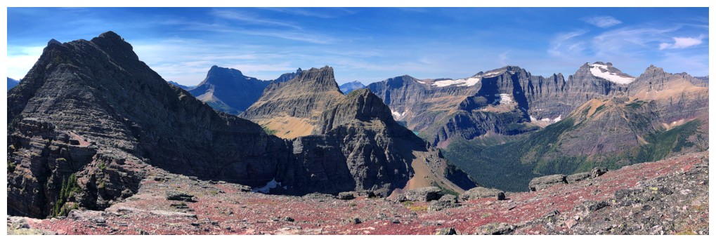
The route ahead. Seward at the left and the highpoint we inadvertently ascended at the right.
Looking back to where we came from. Hard to believe there's an "easy" route down that.
Working our way up the unnecessary, but very cool, highpoint
Almost at the top
The view from the top
Mark completes the ascent
Kennedy Lake is just visible below Mount Henkel at the left
End of the line for the highpoint. It's straight down the other side.
Mark works his way down to a faint trail that goes around the highpoint
Looking good from here
Easy to see why we couldn't descend the highpoint direct (without a few seconds of free fall)
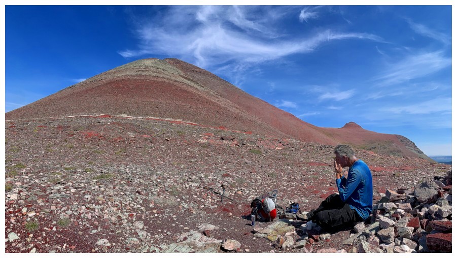
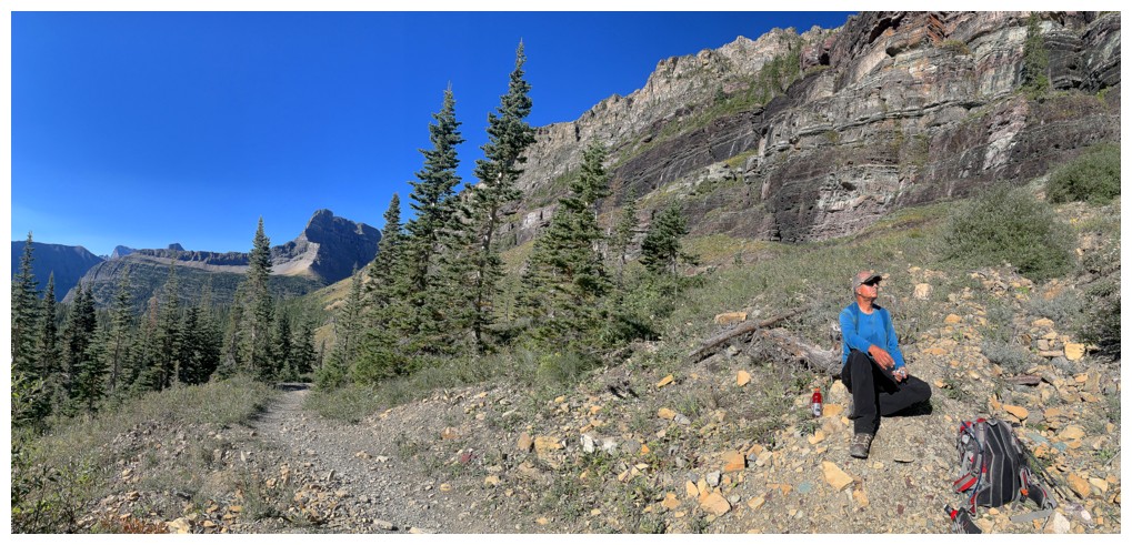
Applying copious amounts of sunscreen at Redgap Pass
Mark leads the ascent
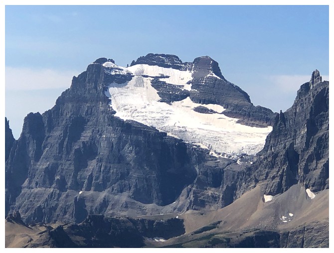
Mount Merritt
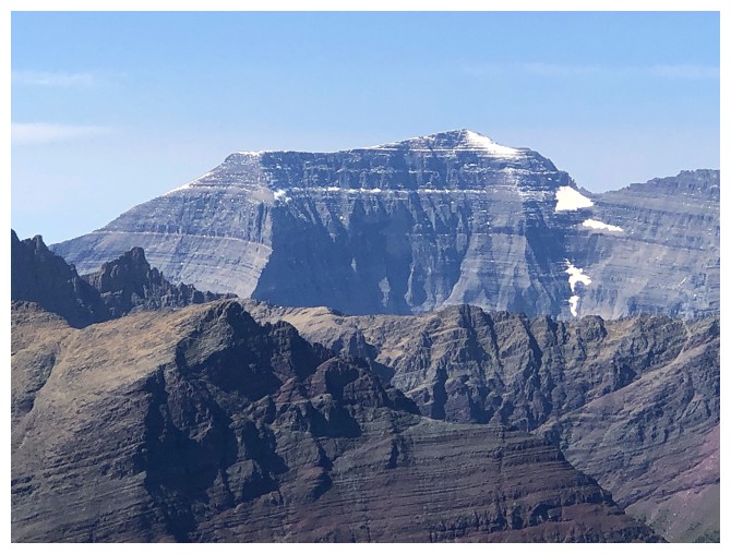
Mount Cleveland
Snow!
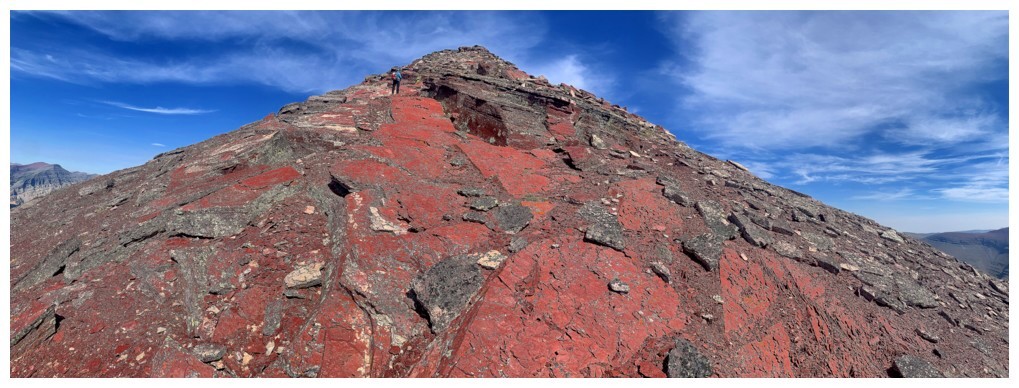
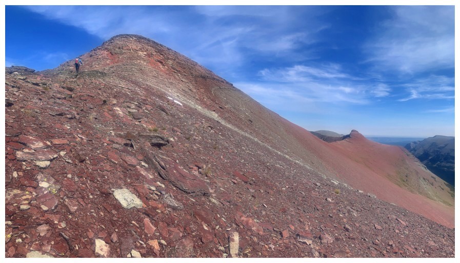
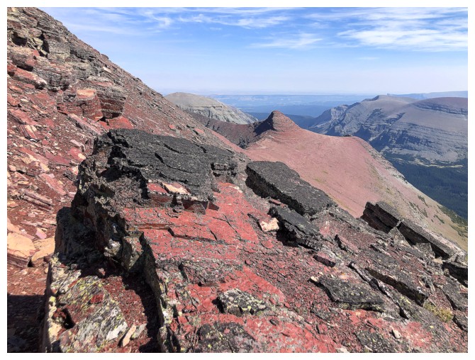
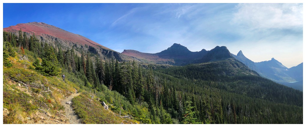
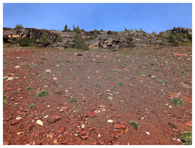
The upper part of the mountain is comprised of bright red argillite
Elizabeth Lake is fully visible again
Interesting section of pink argillite
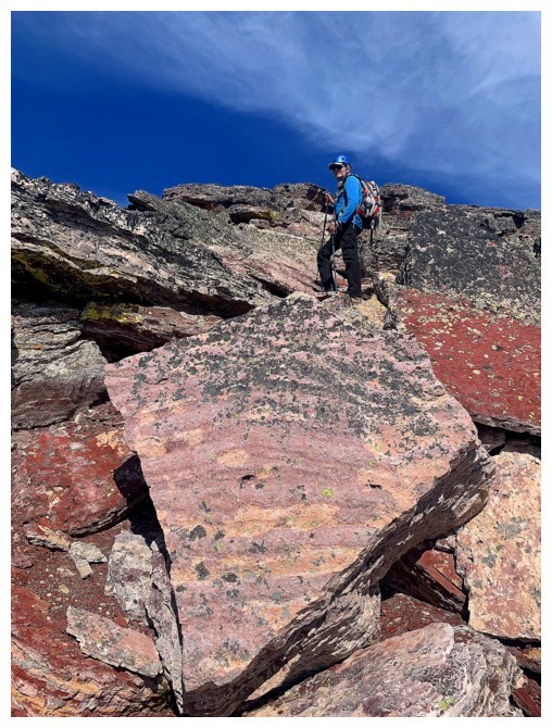
Looks like I'm standing on a giant Laughing Cow cheese triangle!
One of two distinctive highpoints on the connecting ridge to Yellow Mountain
Short section of scrambling before the summit
Final few steps
The surreal view we came to see
Yellow Mountain
Mark and the view
Me and the view
Remembering a wild day on Heavens Peak
Gable Mountain
Chief Mountain
Last look before the long descent
Steppy rock
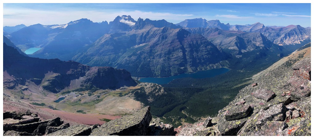
Helen and Elizabeth lakes are both visible
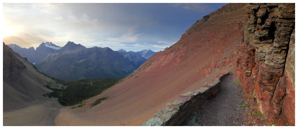
Back to the bright red argillite
Back at Redgap Pass. I wonder why it's called Redgap?!
The start of a long but easy descent (except for the 200 m of elevation gain back to the Ptarmigan Tunnel)
I love red argillite trails!
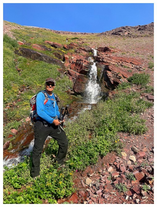
Perfect place to get more water
Unfortunately, the trail does not go by the tarn at the left and neither Mark nor I had the energy to make the detour
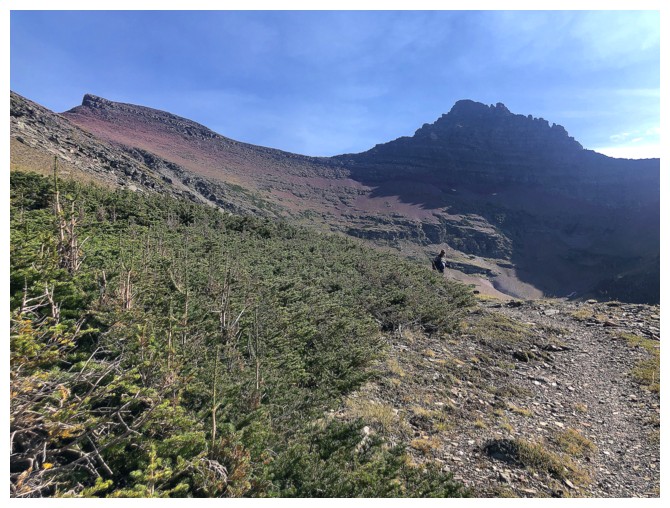
Looking back to the unnecessary highpoint (left) and the north ridge of Crowfeet
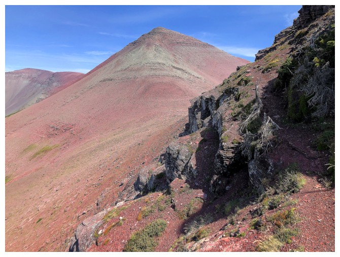
The alternate descent route allows you to see the northwest side of Seward
Same as above
Different view of Elizabeth Lake
The trail is soon going to turn in the opposite direction, go across
the forest to the right side, and then around the other side
A little additional water scenery
Hiking past the long lake
Getting ready to turn the corner
Seeing the red rock is a good sign that we are getting close
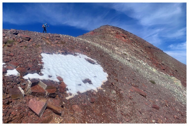
Still a ways to go, but at least we can see approximately where the tunnel is (above the right side of the snow patch)
Almost back to the point where we left the trail, 7.5 hours earlier
The northern highpoint of the Ptarmigan Wall
Approaching the exciting portion of the return
Those strata!
Last look over the north side
And back to the south side
Approaching Ptarmigan Lake where we will get water again
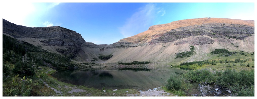
Ptarmigan Lake
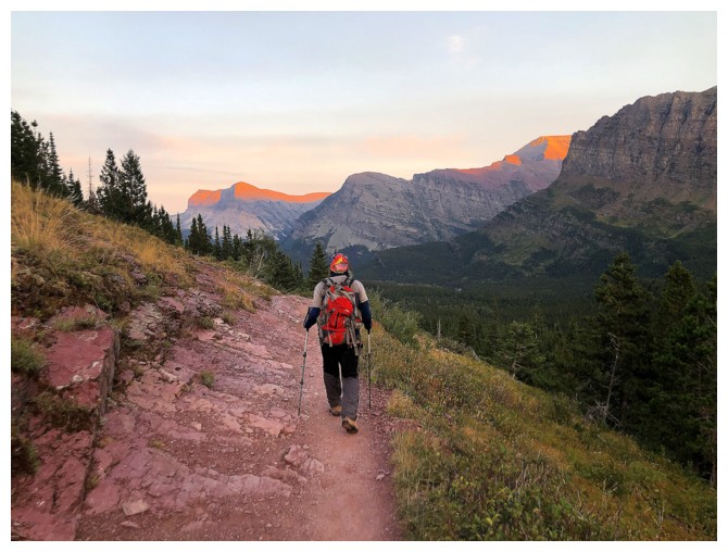
The Sun is setting
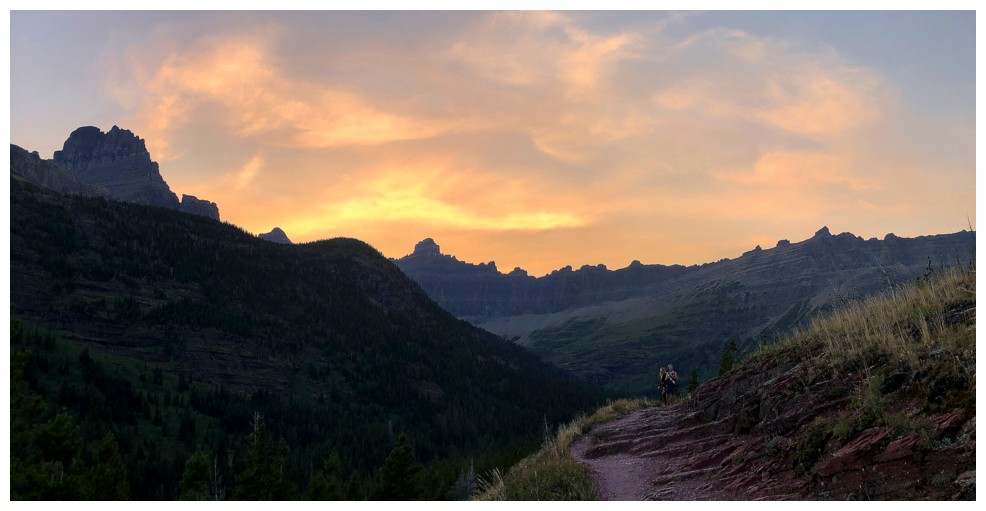
Cool evening clouds and colours over the Wall
Grinnell Point and Mountain. Darkness would fall shortly after, though
we were able to complete this totally awesome trip without headlamps.
The End
LOG