The Turret
August 21, 2015
Mountain height: 2574 m
Elevation gain: 860 m
Ascent time: 3:05
Descent time: 3:30
Solo scramble.
An attempt of The Turret had been on my hit-list ever since Kevin and I
tried to reach The Turret/Foch col while trying to climb the east side of Mount Foch. We made the attempt from Rawson Lake, ascending the northwest side of
the mountain to get to the col. En route we encountered nightmarish
bushwhacking, followed by an equally nightmarish ascent line, bailing on the
attempt when the climbing started to become very sketchy.
 A quick online search revealed that, who else but the venerable Mr. Rick
Collier (and company) had found a much easier line up The Turret from the southeast
side. My plan, therefore, was to follow Mr. Collier’s route.
A quick online search revealed that, who else but the venerable Mr. Rick
Collier (and company) had found a much easier line up The Turret from the southeast
side. My plan, therefore, was to follow Mr. Collier’s route.
After a pleasant and generally easy bike ride along Fox Creek, I turned
onto the Blueberry Hill trail, abandoning my bike about 1 km before the summit
of the hill. A light bushwhack up to the east side of the objective followed.
Once a good amount of elevation was gained, Collier and party took a sharp
left, traversing slopes around to the south side of The Turret. However, upon
arriving at that point, I decided to take a look at the route to the right that
might go more directly to the summit. To my surprise, a pretty decent route up
revealed itself, After traversing a long section of slabby terrain, I ascended steep
rubble, interspersed with short sections of moderate scrambling up a water-worn
gully directly to the summit block.
I suspected the summit block may present some challenges, but I was
wrong - the summit yielded with ease and I took a long break to take in the
terrific views. Those views would have been outstanding on a clear day.
Needless to say, after my summit stay, I had to check out at least the
first part of the daunting ascent of Mount Foch’s east ridge. It was not a long
side-trip! The ridge between the two mountains suddenly became quite narrow and
very exposed for a short section. Getting past the exposed part was certainly
doable, but given the extensive, steep slabs ahead and my solo status, turning
around was an easy decision. Even if I had managed to scramble up the slabs to
the highpoint southeast of the summit of Foch, the connecting ridge to the top did
not in any way resemble a scramble.
The descent turned out to be the trickiest part of the trip. I
mistakenly thought descending Collier’s ascent route would be a figurative "walk in the
park". It was not, requiring lots of route-finding and backtracking when steep
rock bands were encountered. Nevertheless, I arrived back at my bike unscathed and
finished the day with one of the most enjoyable bike rides around. The Fox
Creek trail is gently graded and allows a wonderful coasting return, with
minimal effort and without having to ride your brakes for long sections.
I certainly would have liked clear skies, but still a fantastic day of exploration
on a more than worthwhile objective.
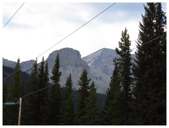
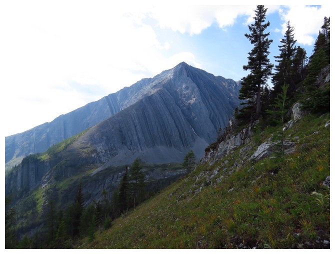
From near the parking lot The Turret looks to be relatively close
After most of the bike approach it doesn't look so close (far right)!
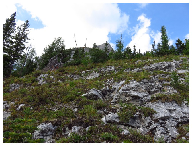
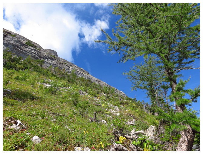
Typical terrain on the lower slopes after the light bushwhack
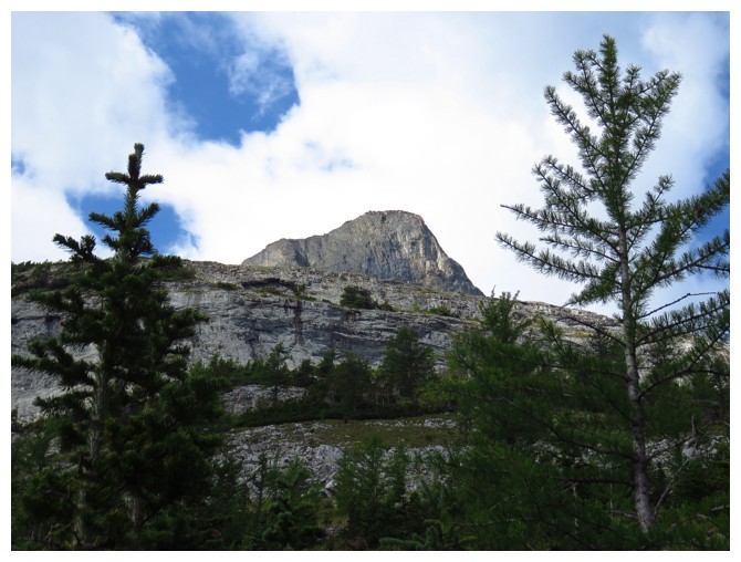
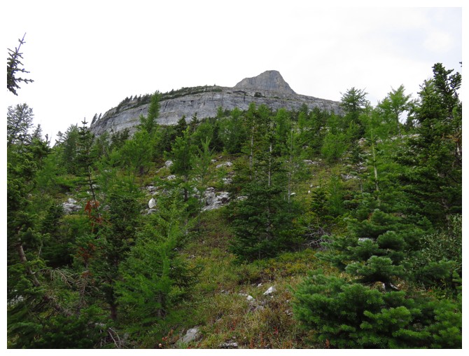
There's the summit block
Mount Fox - unfinished business
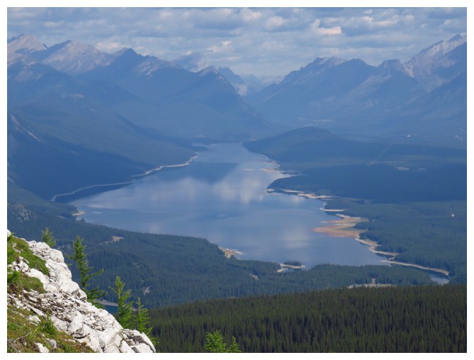
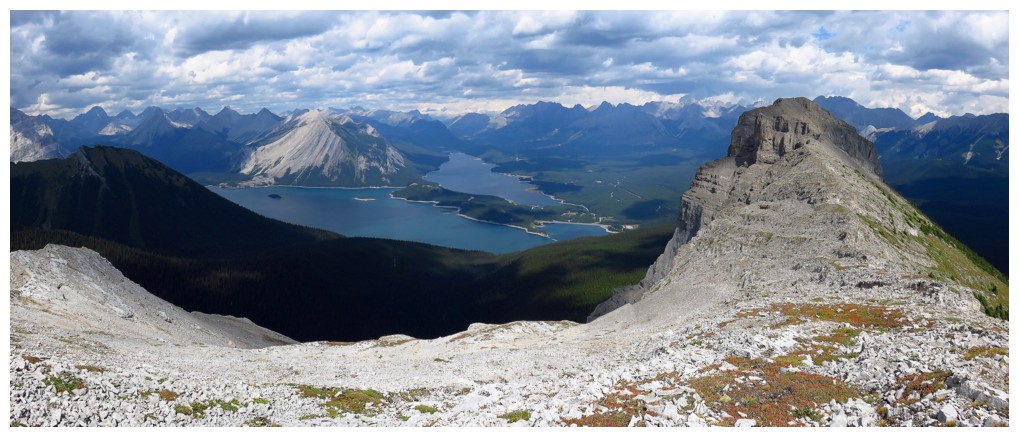
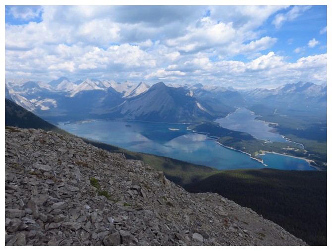
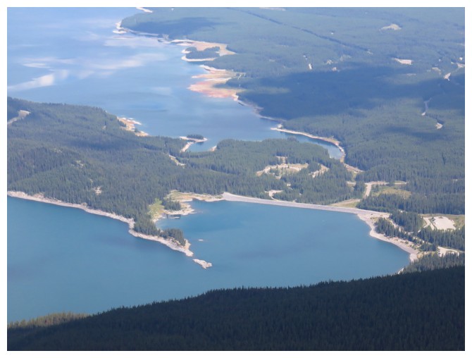
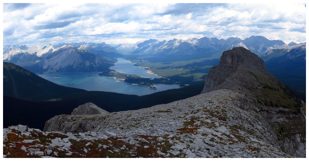
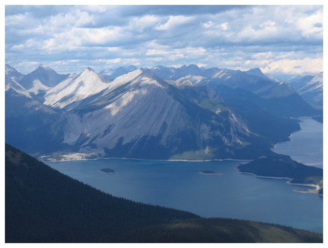
The Lower Kananaskis Lake
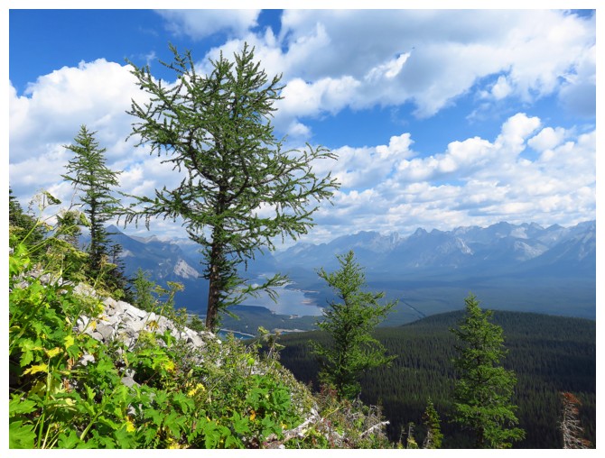
Lots of larches on this side of the mountain
Looking ahead to the route to the right that I took
Looking in the opposite direction to the route Mr. Collier probably took
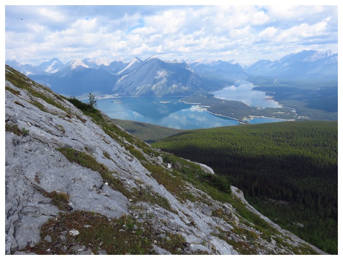
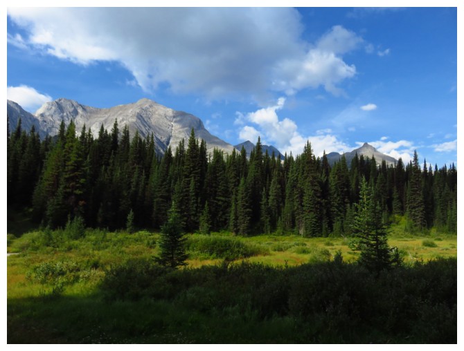
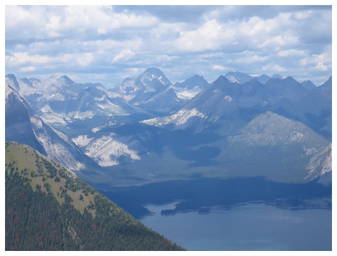
The Kananaskis Lakes are going to the one of the scenic highlights from here on in
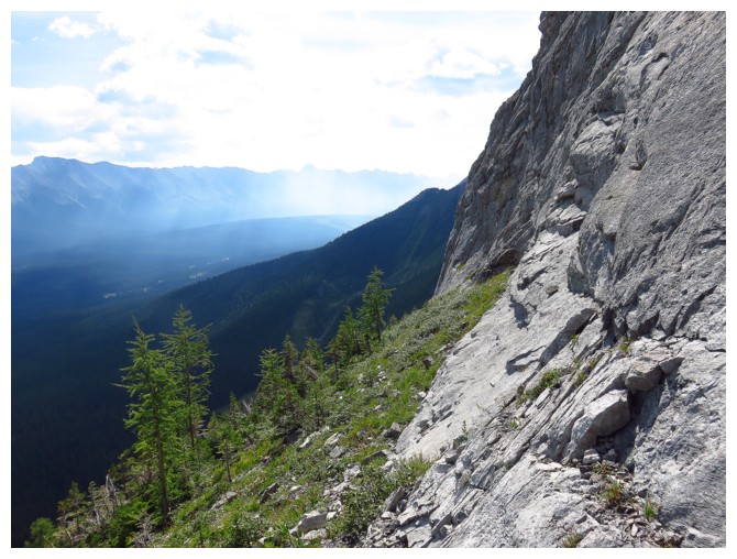
Typical terrain on the traverse around to the northeast side of the mountain
The traverse does feel a little exposed in places
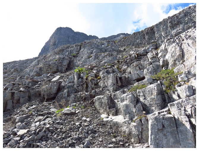
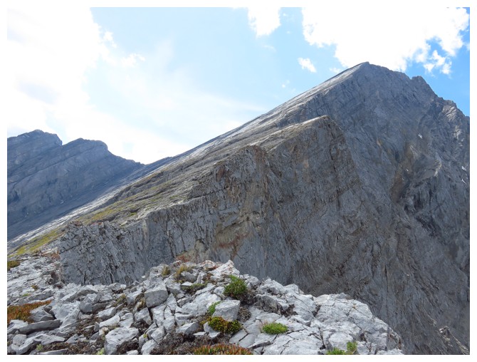
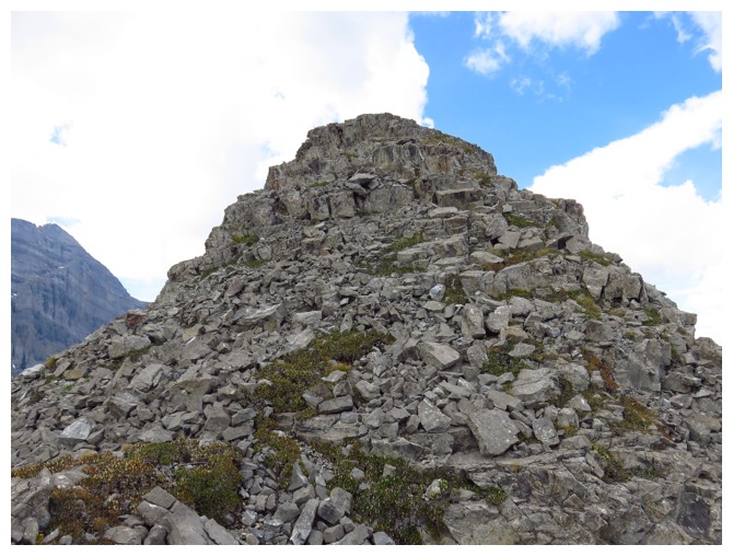
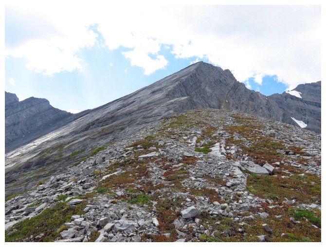
Heading up
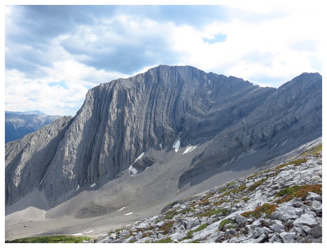
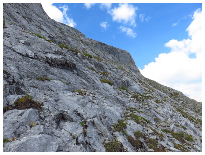
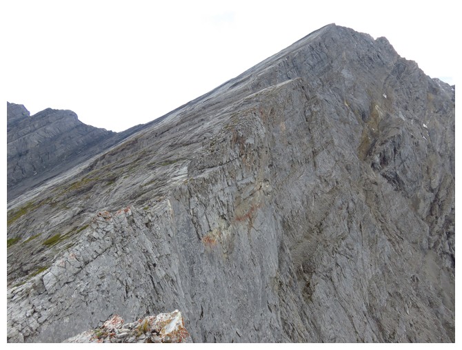
One of several steep walls that guards the summit. There is an obvious weakness through it.
The view to the north gets better
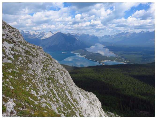
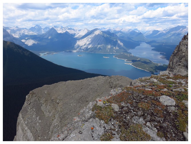
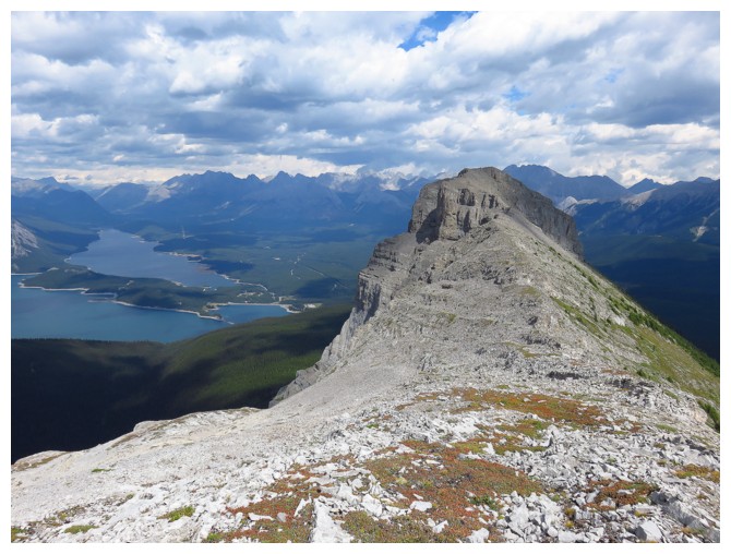
Grassy Rawson Lake Ridge at the lower right - definitely one of the best viewpoints in Kananaskis
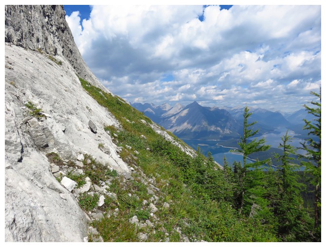
Above the steep rock band, it's an easy hike to the summit
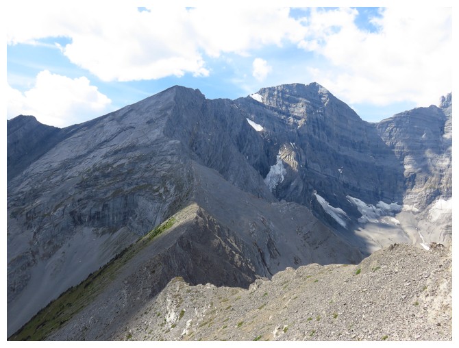
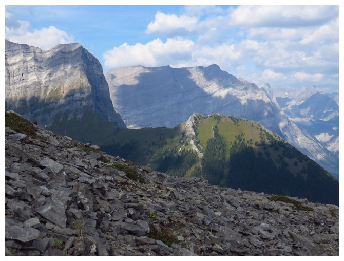
Looking west to Mount Foch and the connecting ridge
Mount Sir Douglas is immediately recognizable to the northwest
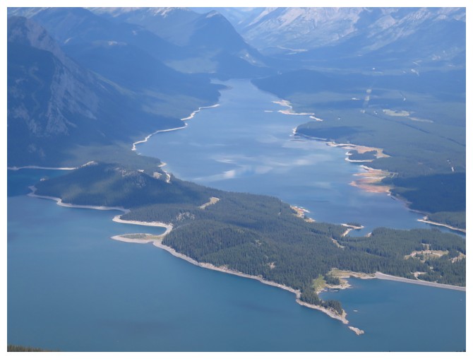
Closer look at some of the Kananaskis Lakes
The peninsula of rock in the lower part of the photo is one of my favourite areas of the Upper Lake
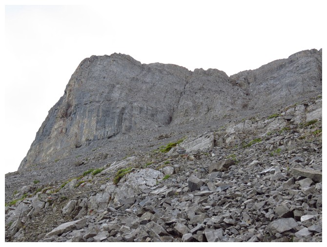
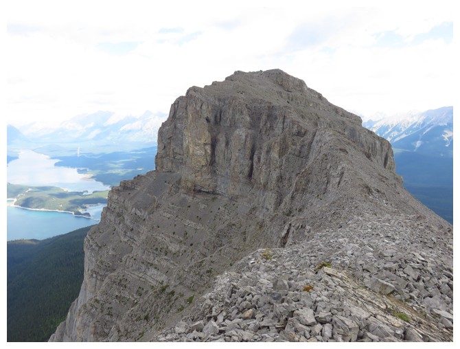
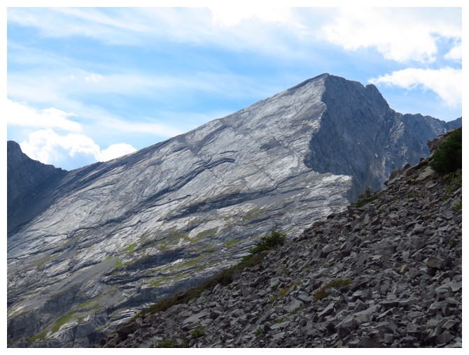
The rock on the north side of The Turret is very steep
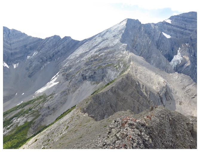
From some angles the ridge to Foch looks quite daunting
On the connecting ridge, looking back to The Turret
And from other angles it looks quite manageable
There is an impressive drop on the north side of the ridge
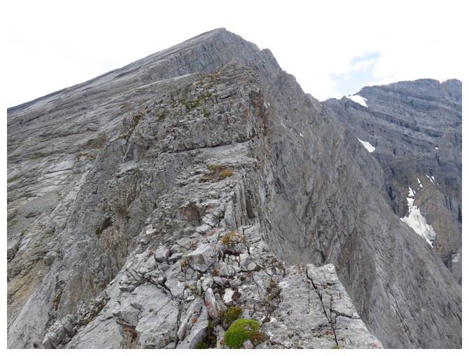
Where the ridge narrows. While certainly not Darrah S2 knife-edged, it does deserve the respect, as a fall down either side would be fatal.
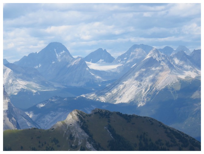
In addition to Sir Douglas, Robertson, French and Jellicoe are also visible to the northwest
Mount Indefatigable across the lake. Hard to believe my Mum and step-dad both made it to the south summit in 2002.
Another look at The Turret now that the Sun is shining on it
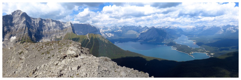
Mount Sarrail at the far left - definitely a Kane scramble I'd like to do someday
From this angle the Foch slabs look mighty steep!
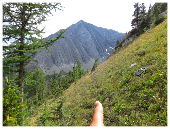
The somewhat archaic method I sometimes use to indicate direction of travel for future use
Heading back into the trees
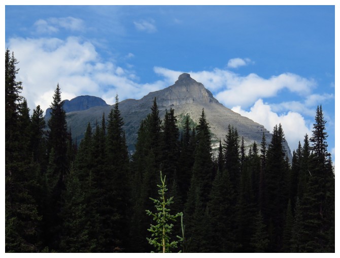
Parting glance at The Turret
The End
LOG