South Flathead Peak
Mount Borsato
August 3, 2020
Mountain heights: 2468 m, 2441 m
Total elevation gain: 2109 m
Round-trip time:
14 hours
Scrambling with Dave.
(Writing the bulk of this trip report three and
a half years after the trip still gives me a bit of the shudders!)
Back to North Kootenay Pass for another round!
But another round of what?
The objective for this third trip to NKP in
only three weeks was to check out the outliers north of the pass. Several of
the unnamed peaks reached impressive heights, surpassing named peaks in the
area, such as Mount Borsato. The real prize would be Centre SE1, but knowing
little about the nature of the terrain, we would be happy to make any summit in
the area, big or small.
We decided to bike as far as possible towards
North Kootenay Pass. That basically brought us to within 1 km of the pass. The 9 km bike ride down was going to be awesome!
From the pass we started
side-sloping around the south side of the southern-most outlier until a
feasible route up appeared. 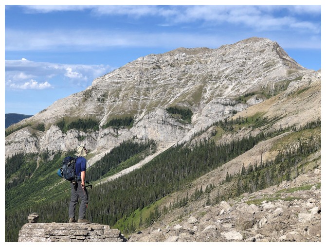 All was going well until the route in front of us
reared up to “non-scrambling angles”. We had no choice but to lose elevation. That
was until Dave spotted a potential route in the form of a long scree ramp. I
wasn’t terribly optimistic about getting over to and then up the ramp, but I
have learned over the years to trust Dave’s remarkable mountain instincts and will
follow him anywhere.
All was going well until the route in front of us
reared up to “non-scrambling angles”. We had no choice but to lose elevation. That
was until Dave spotted a potential route in the form of a long scree ramp. I
wasn’t terribly optimistic about getting over to and then up the ramp, but I
have learned over the years to trust Dave’s remarkable mountain instincts and will
follow him anywhere.
The ramp route worked, and it worked perfectly!
We were able to scramble up some decent rock before gaining the ramp and easy
access to the summit ridge. 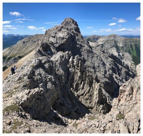 Of course, the rubble in places was the classic
ankle-jarring garbage, characteristic of the Flathead Range, but that’s what
the Flathead is!
Of course, the rubble in places was the classic
ankle-jarring garbage, characteristic of the Flathead Range, but that’s what
the Flathead is!
Given that it’s the southern-most point of the
range, Dave picked the name “South Flathead Peak” for the mountain – a logical
and appropriate unofficial name. A short summit break was taken to enjoy the
fine views, before we turned north. Unfortunately, hopes of continuing on to
Centre SE1 were quickly dashed. Getting down to the col would have been
relatively straightforward, however the terrain on the other side appeared to
be unassailable. We returned to the summit to discuss other options.
Really, there was only option, aside from
calling it a day – “go west, young men!”. And that’s what we did, of course
completely unaware that this decision was going to turn a relatively short day
into a near epic 14-hour one! Distant Mount Borsato was hardly on our minds, at
his point, but the highpoint between South Flathead and Borsato looked to be an
intriguing proposition.
We made it to that highpoint without much ado.
The traverse was easy and scenic. Of course, that put us within striking
distance of Borsato and suddenly the infrequently ascended peak WAS on our
minds. Off we went.
Borsato did not acquiesce without baring its
teeth! Some sections of the ridge were not within the realm of scrambling,
forcing us to lose a fair amount of elevation to circumvent them. Other
sections were fairly exposed. And the actual ascent of Borsato's east face was far from
trivial. Dave expertly guided us up terrain that we both agreed we would rather
not descend. We were not terribly concerned at this point, 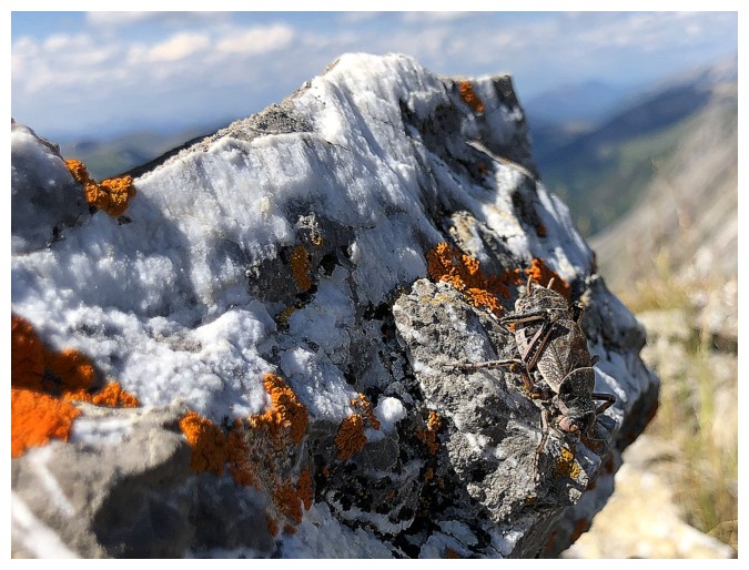 as we had already
decided to descend the southwest ridge instead of retracing our steps down the
east face.
as we had already
decided to descend the southwest ridge instead of retracing our steps down the
east face.
Eventually we arrived at Borsato’s apex, both
quite pleased with ourselves. At the start of the day neither Dave nor I expected
to be standing on this summit. The view was fantastic, featuring many of the peaks
of the Flathead Range to the northeast and the Taylor Range to the northwest. We
took a long, but not too long break, as our vehicles were now a significant distance
away.
The descent started well. We could generally see
the line we wanted to take and didn't expected to encounter any difficulties
- the mountain had other ideas!
Unseen cliff bands on the east side of the ridge
prevented us from taking the line we would have liked, forcing us in every
direction but the correct one. With MUCH ado, we did eventually escape the
terrors of the southeast ridge. Though our descent route so far was not ideal,
we were still optimistic about finding the North Kootenay Pass Trail and
following it with ease back up to the pass. That didn't happen either. The
trail was nowhere to be found. No problem - from up high we had spotted
another, very prominent trail farther south and eventually intercepted that
one. This trail was awesome, probably a former logging or fire road. 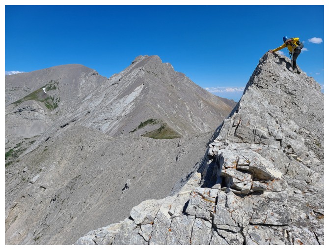 Once
again, optimism was high for an easy trek to NKP. Denied again!! The trail shockingly
came to a screeching halt in the middle of nowhere, as did our progress.
Once
again, optimism was high for an easy trek to NKP. Denied again!! The trail shockingly
came to a screeching halt in the middle of nowhere, as did our progress.
We
were both stumped by this turn of events. There
was no choice but to bushwhack up very steep slopes in the direction of
the
pass. Somewhat dejected and both exhausted we started up, eventually
stumbling onto
the NKP Trail relatively close to the pass. At this point, the
alternate return
route had added more than 500 vertical metres to the trip, and ten
times that number in additional white hairs on top of my head!
What a sheer relief it was to finally be reunited
with our bikes and the thought of a merciful ~10 km downhill coast back to the
start. I've used the ambiguous terms "depressingly comical" or
"comically depressing" in the past and I think either apply to the
next and final hiccup of the day. Not more than 2 minutes into that
exhilarating bike ride, Dave blew a tire. It could have been worse, as the
blowout may have caused Dave to crash. Thankfully, he didn't and unthankfully,
he was going to have to walk his bike for the remainder of the trip. I coasted
alongside my friend ("never leave your wingman"), enjoying his
company and happy my tires were still intact!
What a day of literal and figurative ups and downs!
Not quite an epic, but all the required ingredients were there. Fortunately,
the recipe failed! Super happy to have ascended both peaks for "I
shall not look upon (their) like again (7:55)" (at least from the east side!).
Click HERE to see Dave's riveting report!
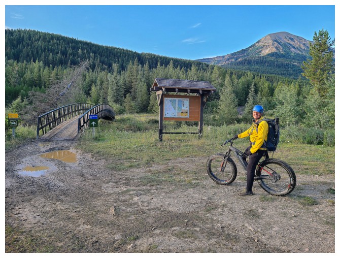
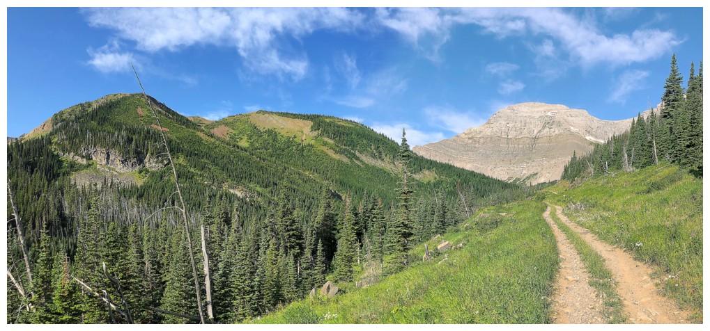
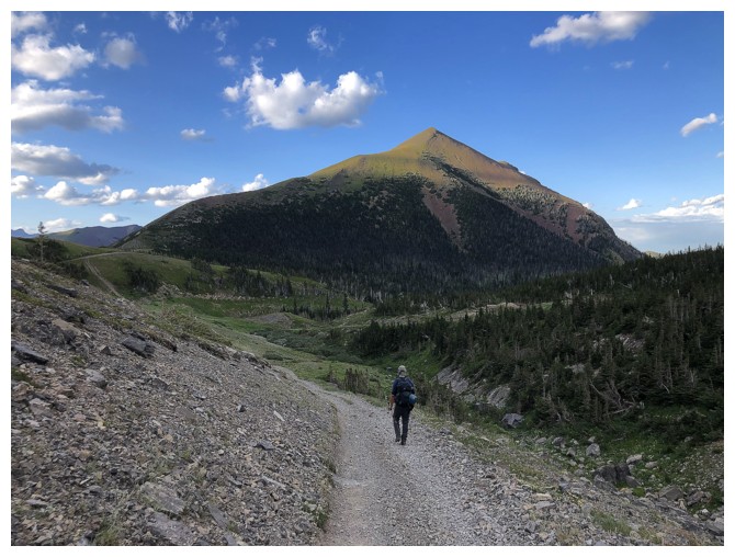
Ready to bike a big portion of the terrific North Kootenay Pass Trail (photo by Dave)
Mount McCarty behind Dave. A peak receiving mixed reviews.
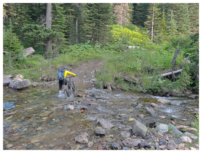
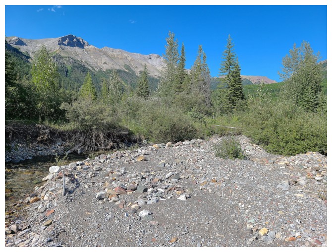
Crossing the Carbondale River (photo by Dave)
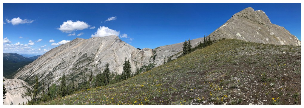
South Flathead Peak right of centre and outliers of Hollebeke Mountain at the left
South Flathead (left) and Centre SE1(photo by Dave)
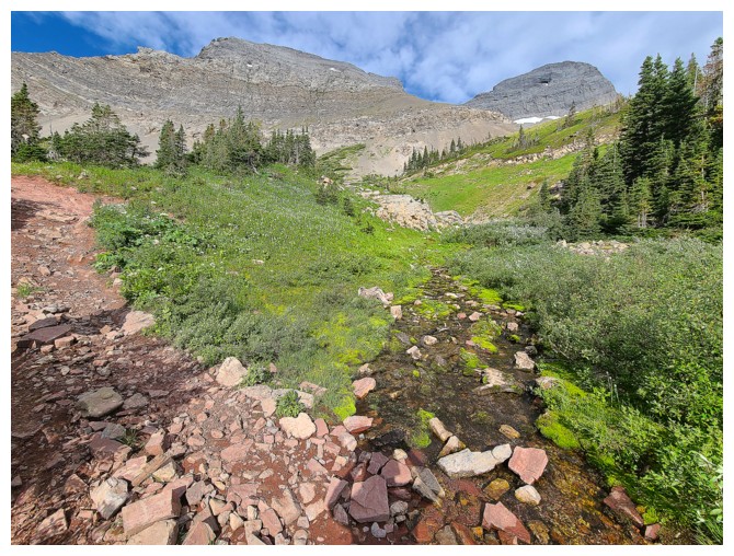
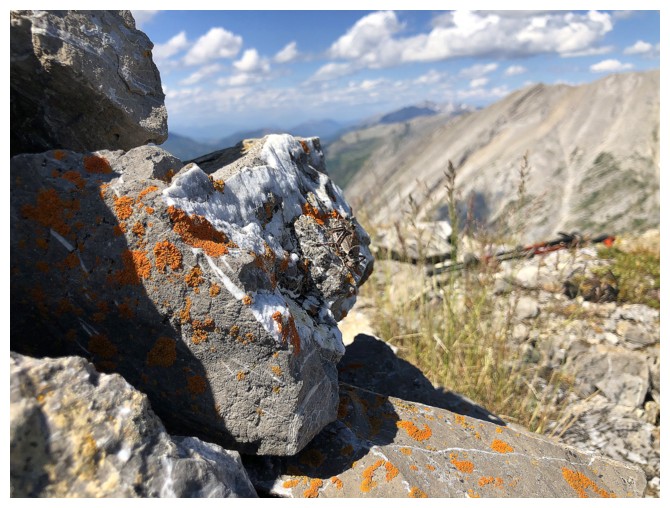
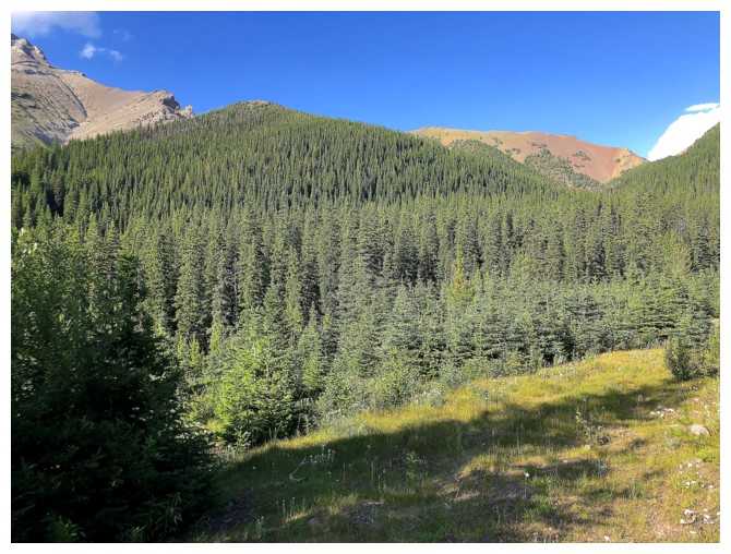
Throw in some red argillite for colour. Everything north of North Kootenay Pass is classic grey limestone.
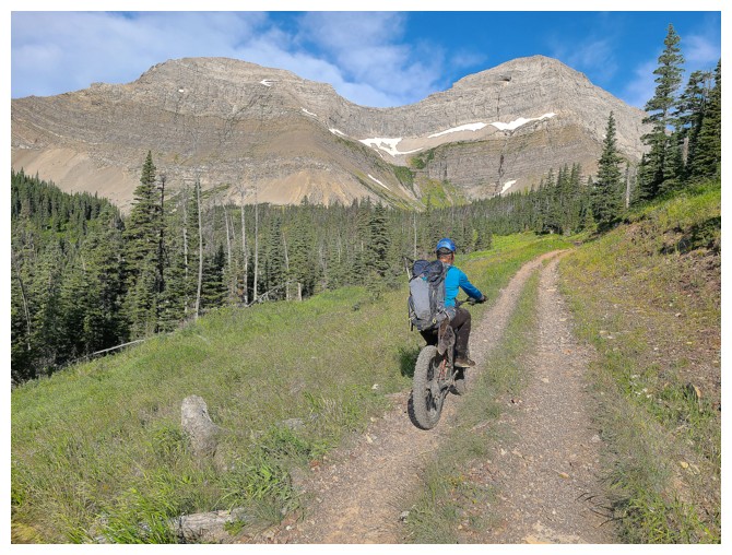
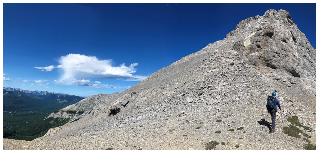
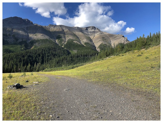
Easy trek to the pass (photo by Dave)
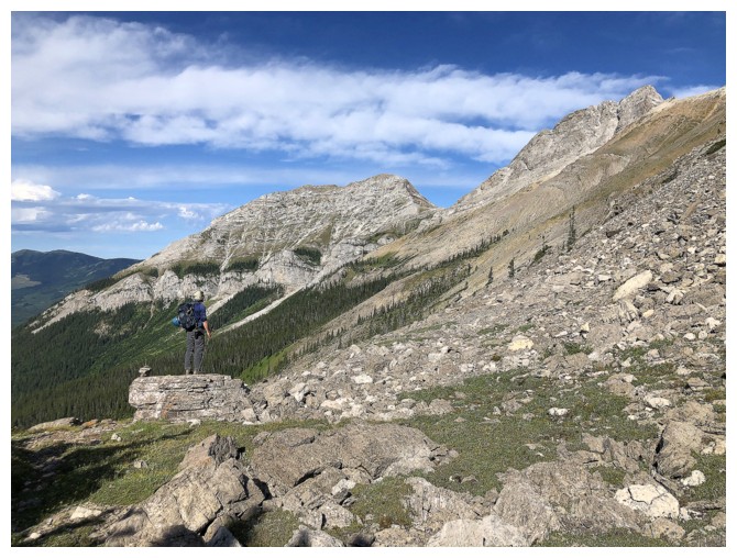
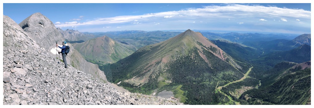
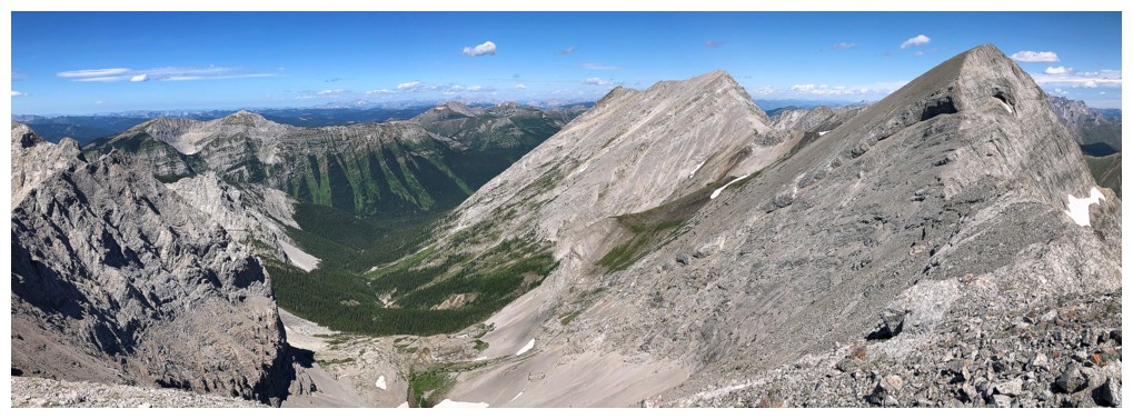
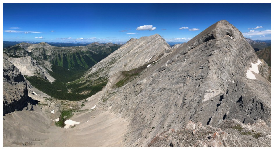
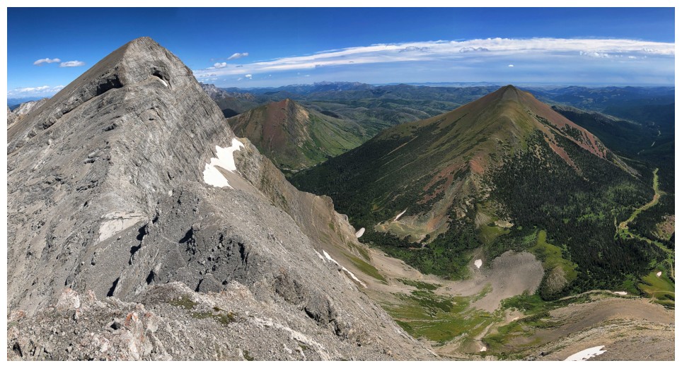
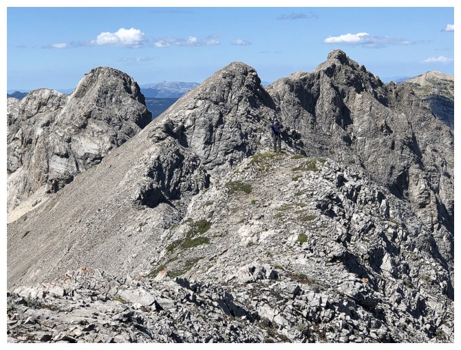
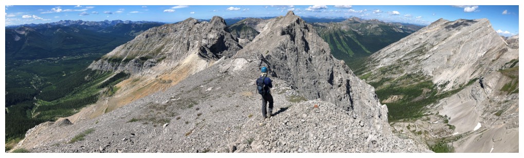
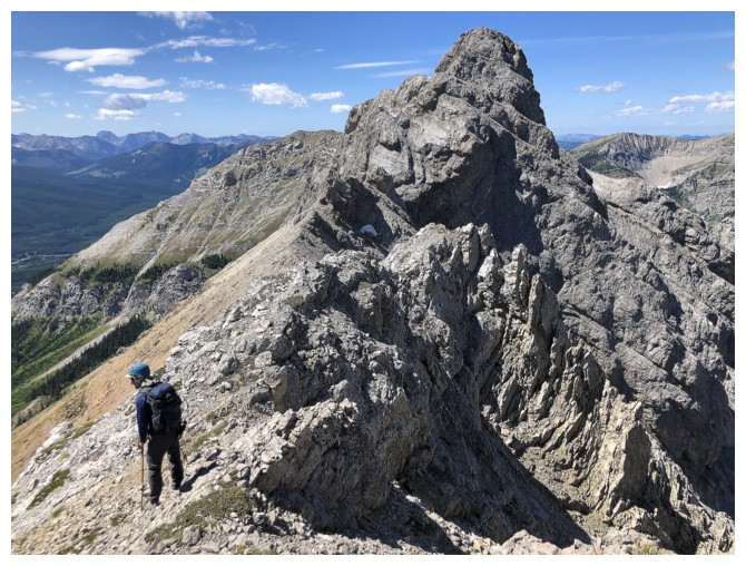
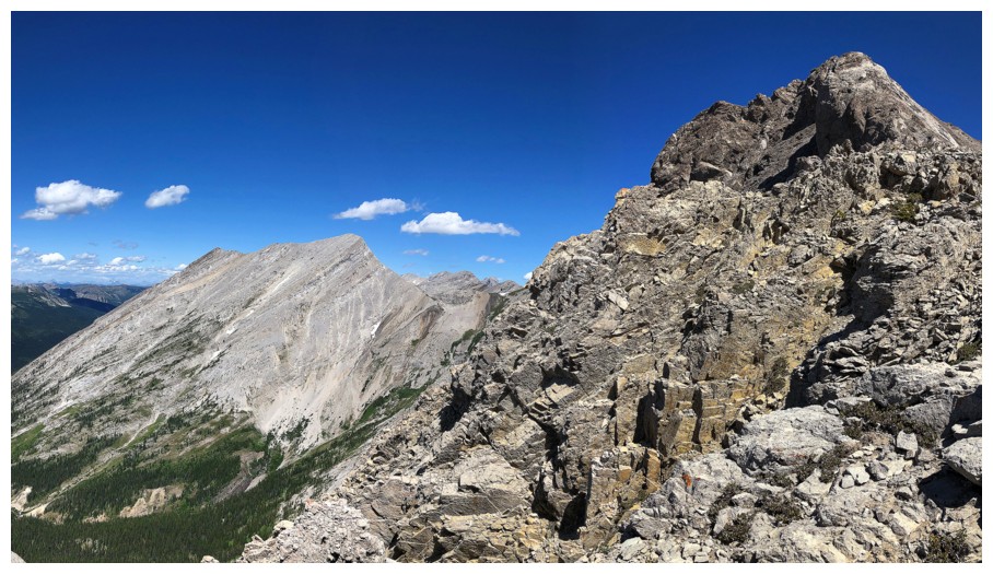
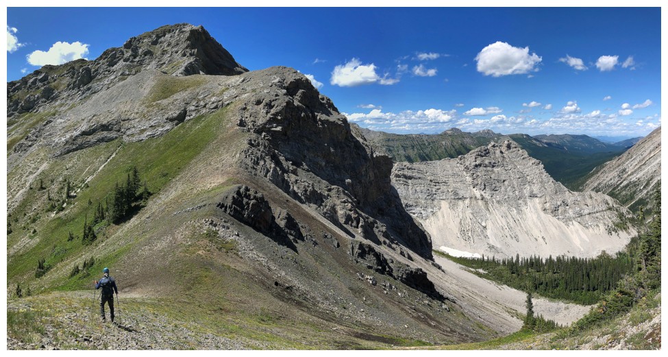
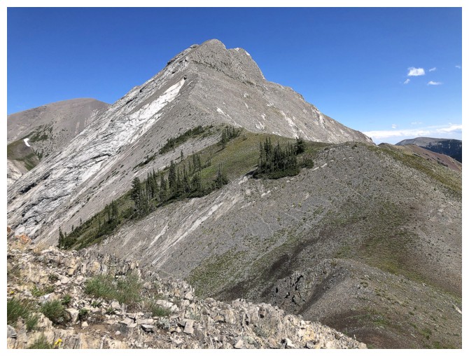
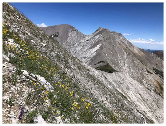
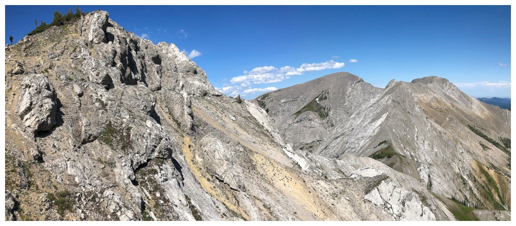
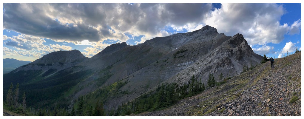
Dave checks out potential ascent routes up South Flathead (to the right
but not visible). Borsato is in the centre and the highpoint between
South Flathead and Borsato is at the right.
Dave and Borsato
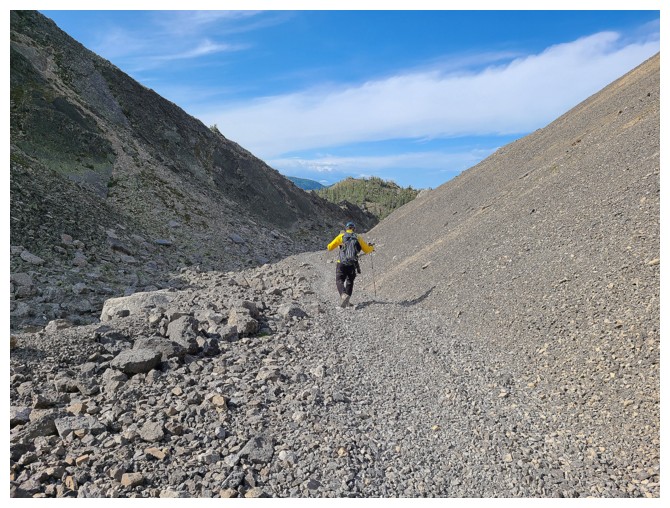
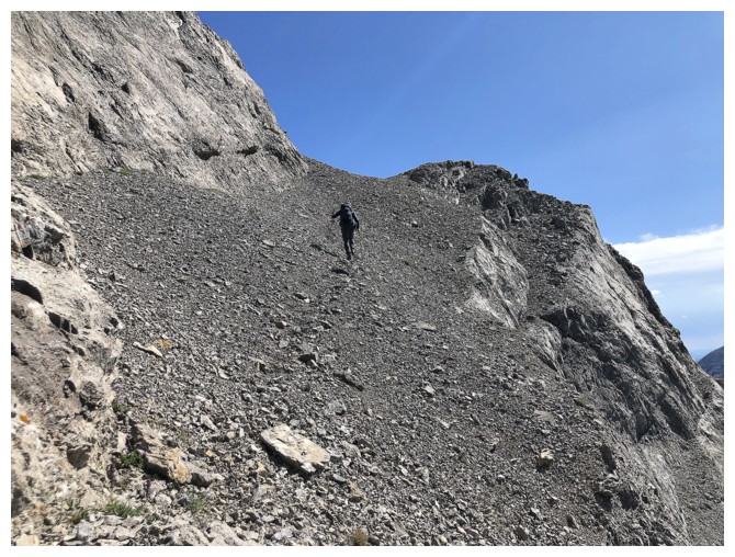
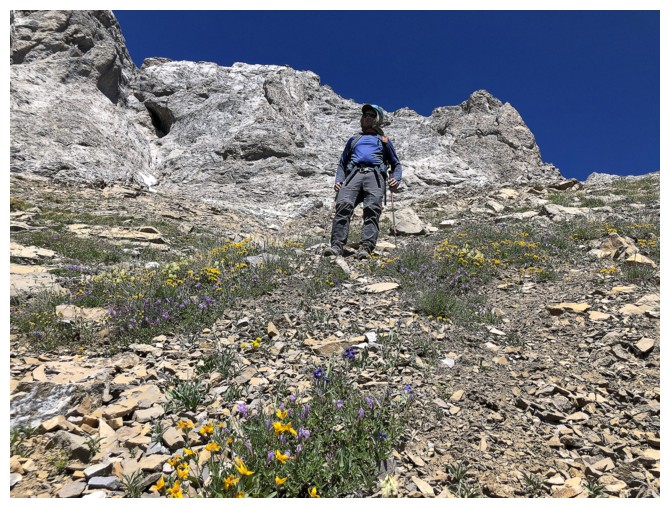
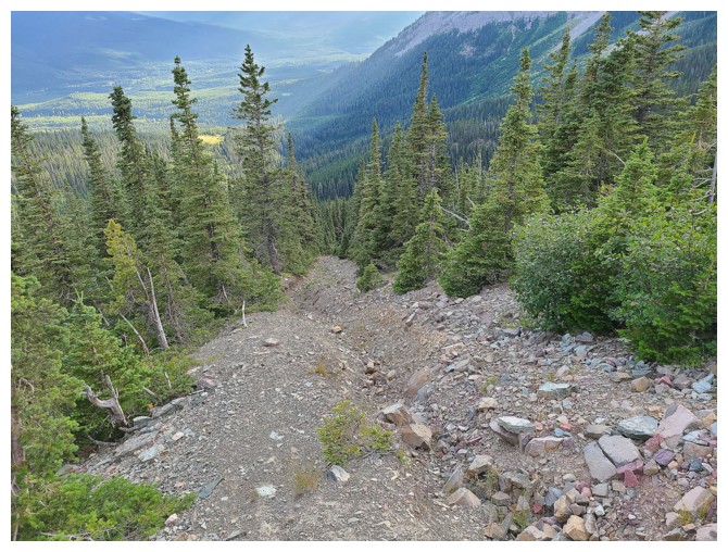
Trudging up a very old drainage. The footing here was slightly better than the annoying rubble on either side (photo by Dave).
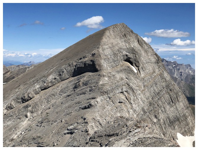
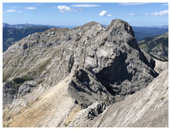
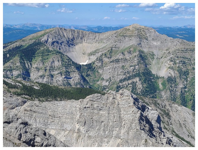
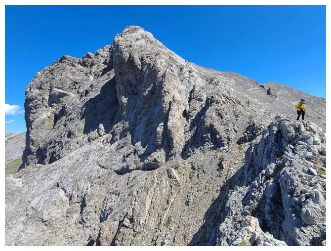
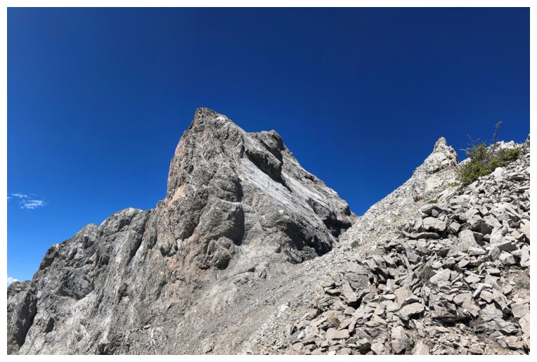
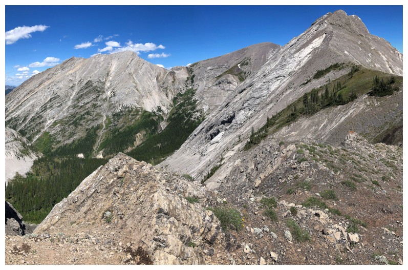
The south side of the peak (right) is very steep and has plenty of impressive rock (photo by Dave)
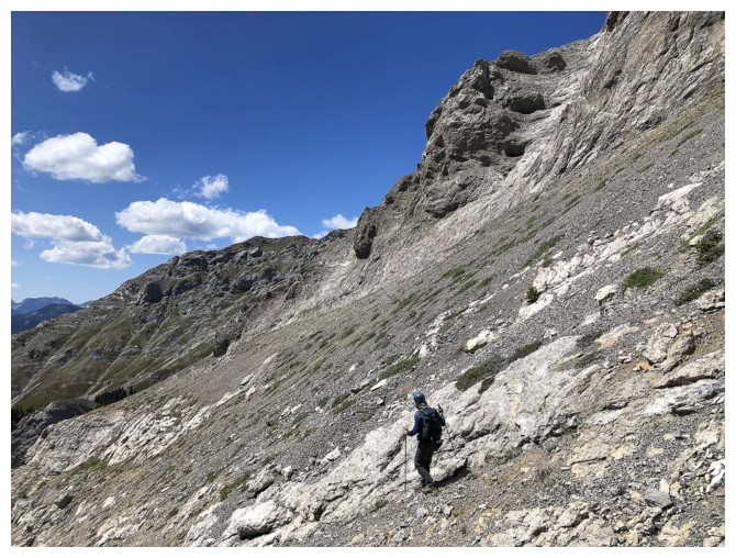
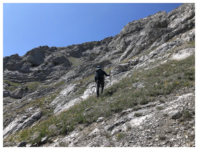
More trudging (photo by Dave)
Dave and Hollebeke - that's one mountain I desperately want to repeat on a completely clear day
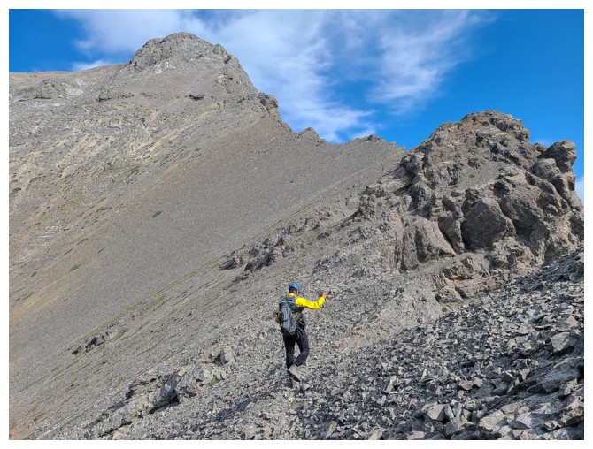
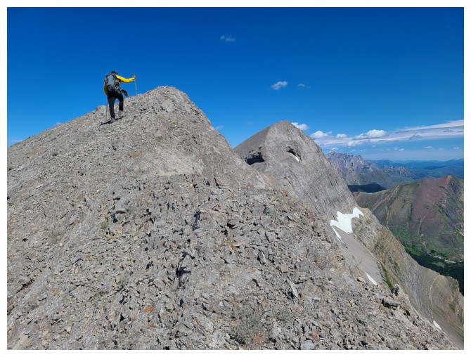
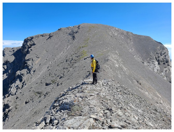
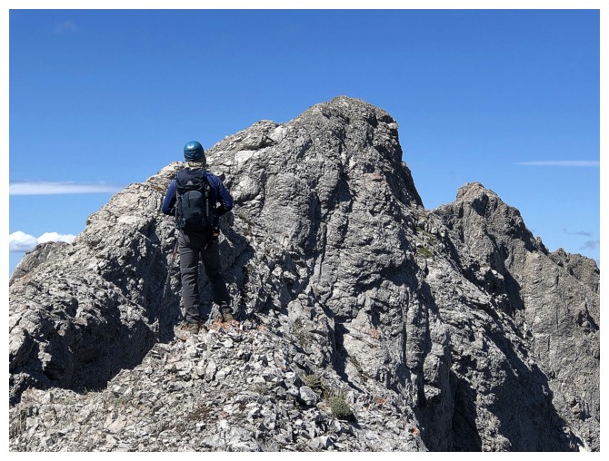
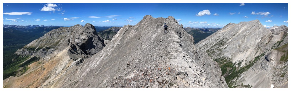
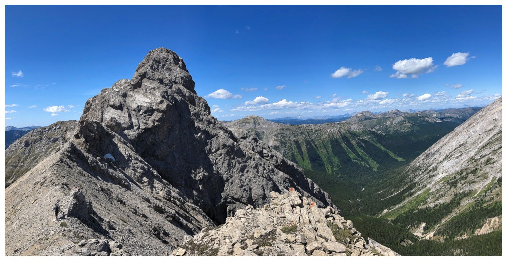
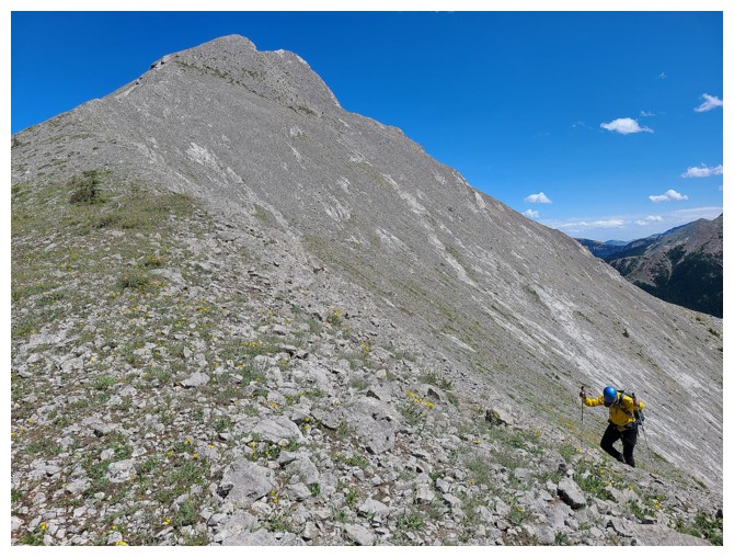
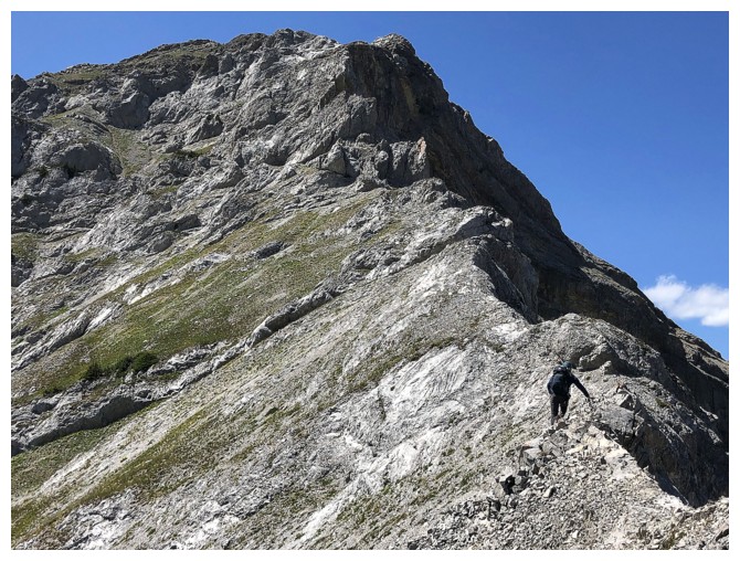
Now heading north towards the summit
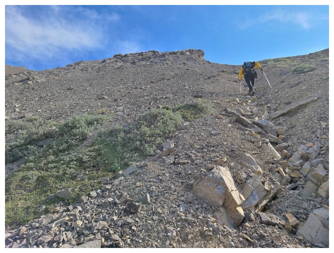
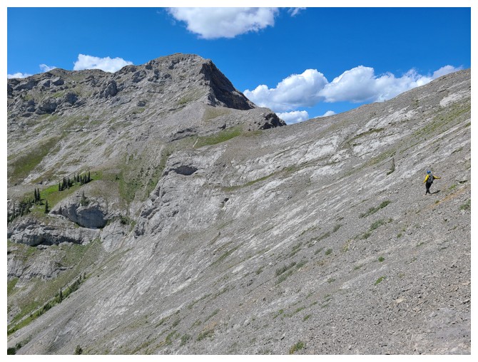
Typical grade of the ascent slope (photo by Dave)
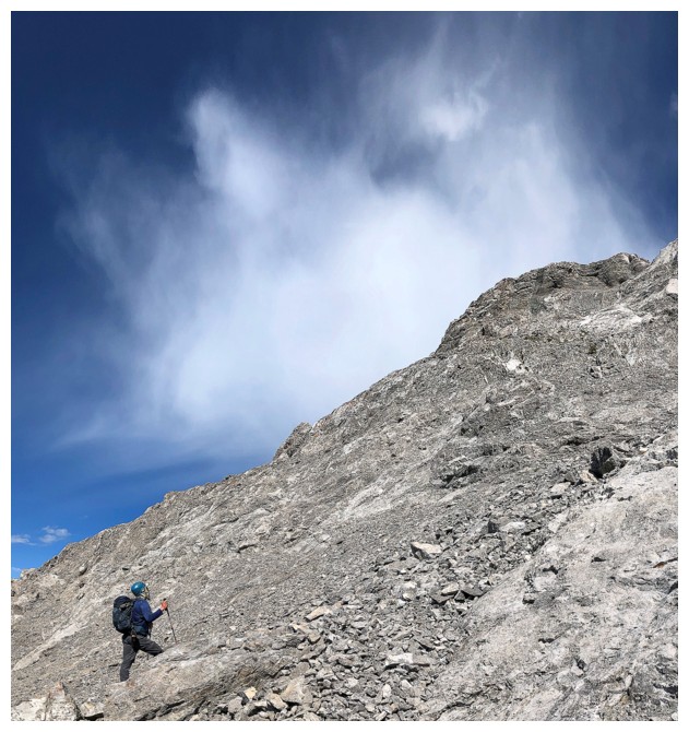
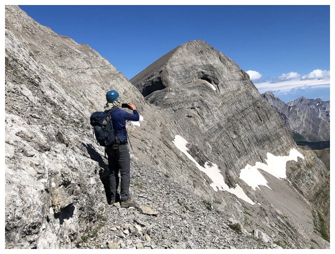
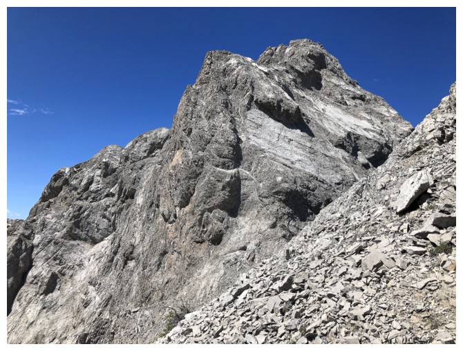
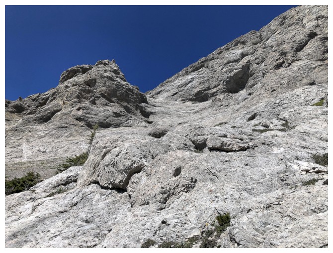
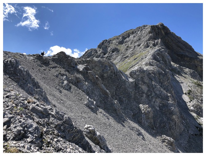
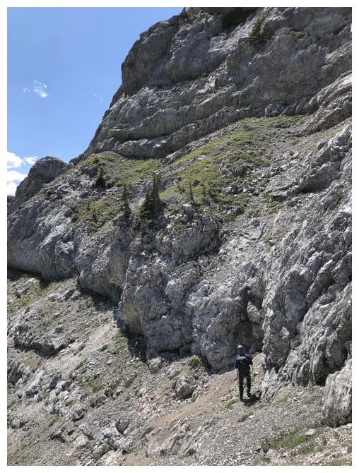
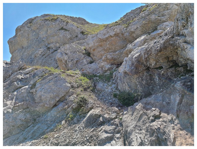
The terrain above looks much steeper
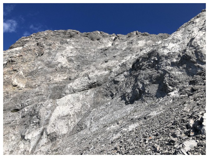
It is not a scramble
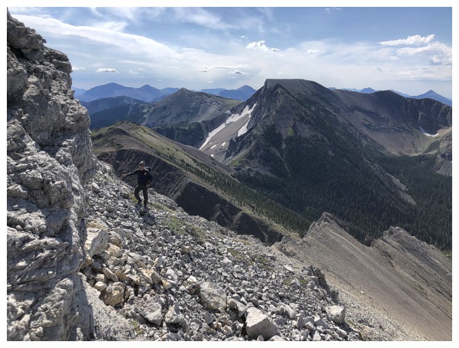
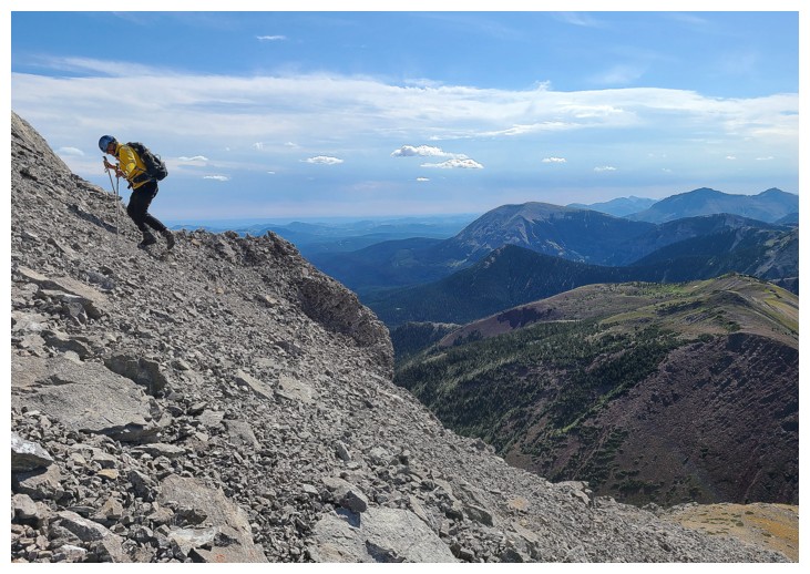
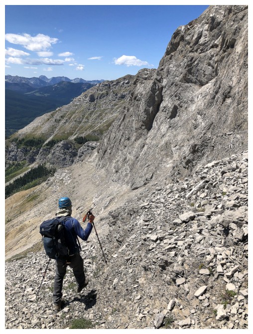
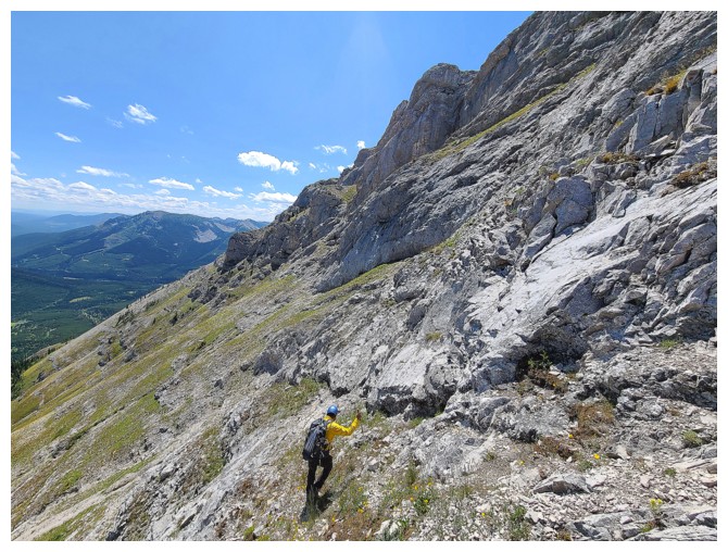
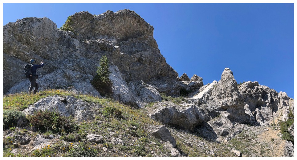
Losing elevation to get around the steep stuff (photo by Dave)
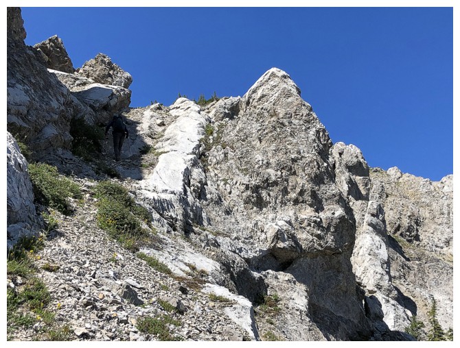
The ramp that Dave spotted - good eyes!
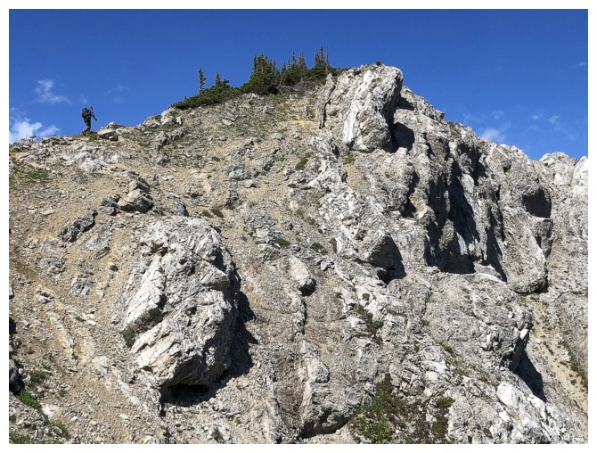
At the top of the ramp and looking for a way back up to the south ridge
Checking out Centre SE1
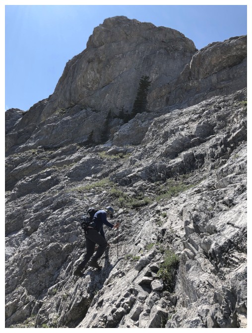
Minutes away from the top (photo by Dave)
Dave takes the final few steps
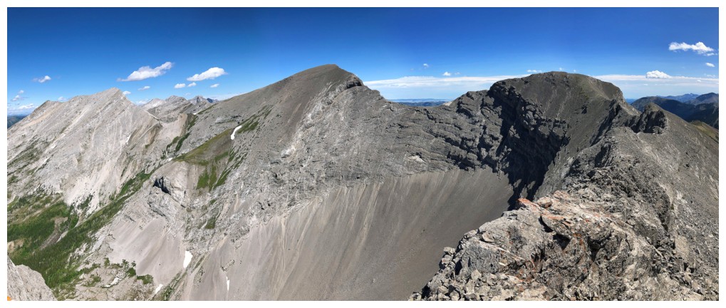
Summit view to the north, featuring Centre SE1 and Centre Mountain
Close-up of Centre SE1. Looks like you'd have to lose a ton of elevation to the left to have any hope of reaching the summit.
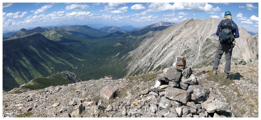
Dave builds a summit cairn. North Kootenay Mountain (Centre E3) to the right.
Summit shot (photo by Dave)
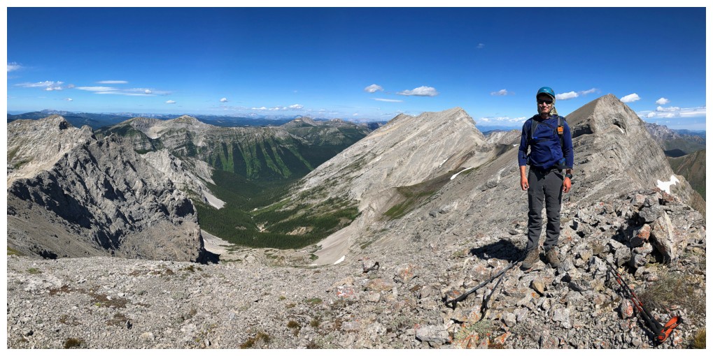
And one for Dave
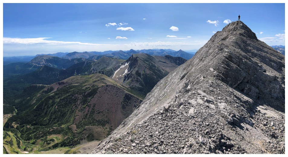
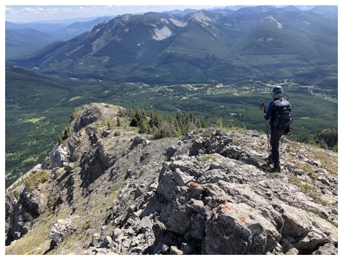
Descended a short distance down the north ridge to see if getting down
to the South Flathead/Centre SE1 was possible. Dave stands at the
summit.
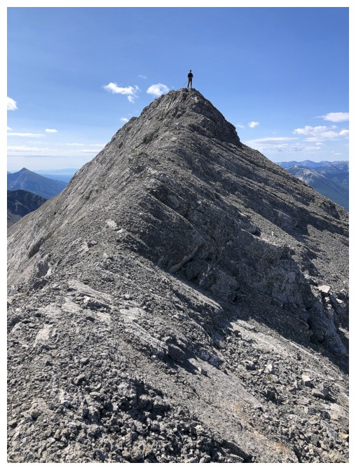
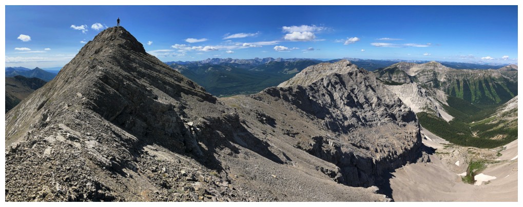
There's The Man
View north from where I stopped
Northeast
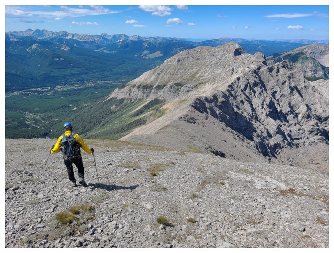
Heading west (photo by Dave)
Admiring the views again
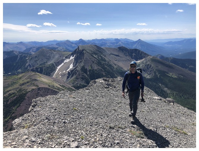
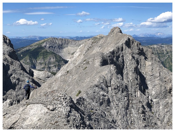
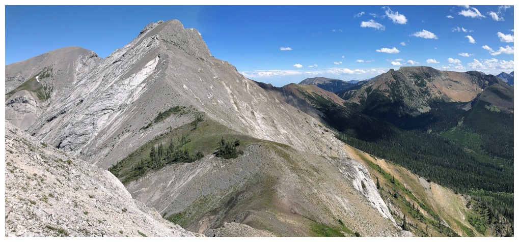
Looking back to South Flathead (photo by Dave)
The terrain ahead looks to be getting more complex
Same as above
Centre SE1 and South Flathead
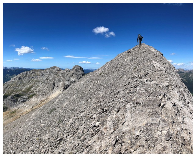
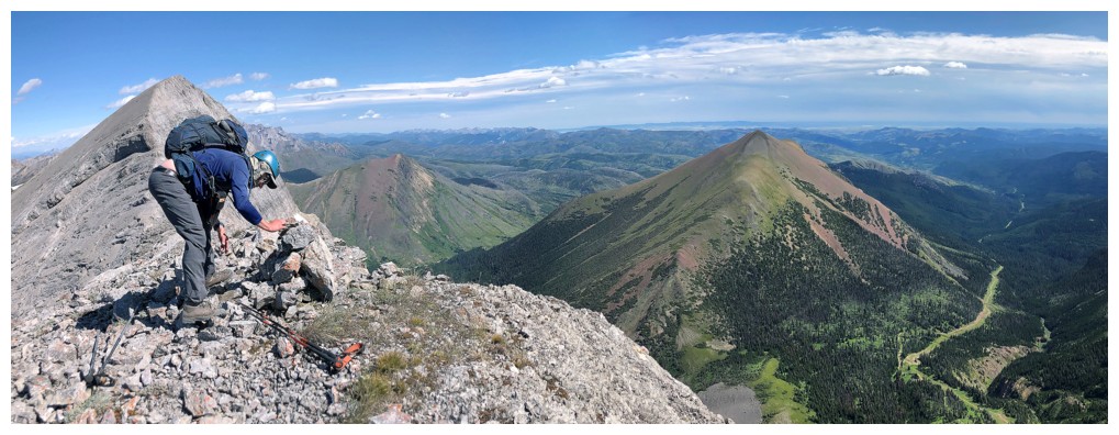
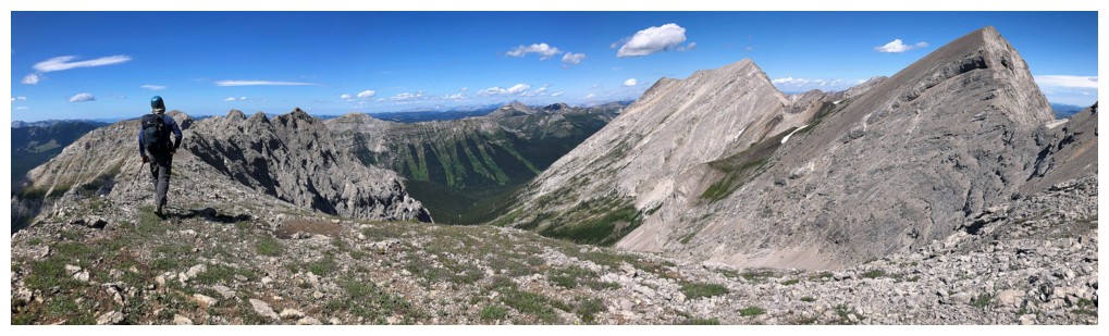
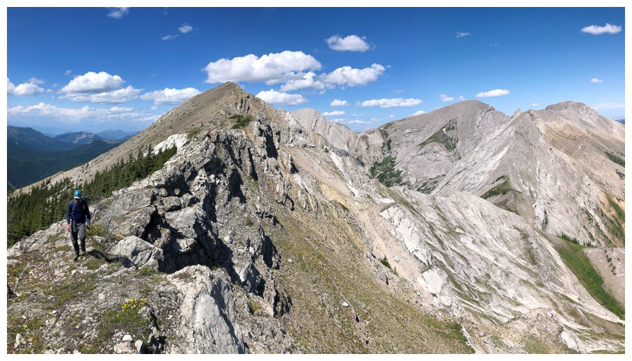
Dave approaches the first highpoint
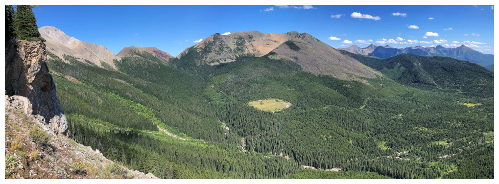
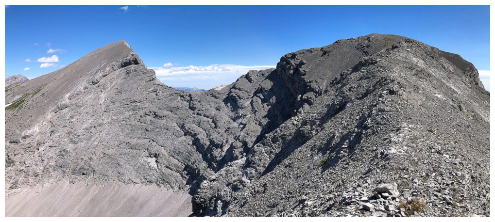
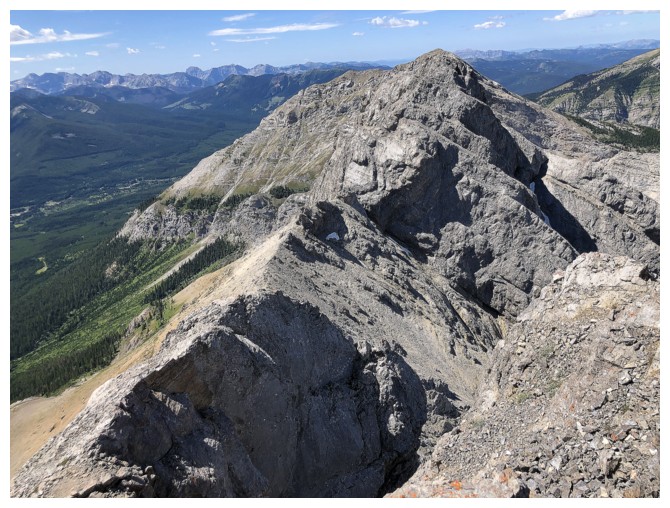
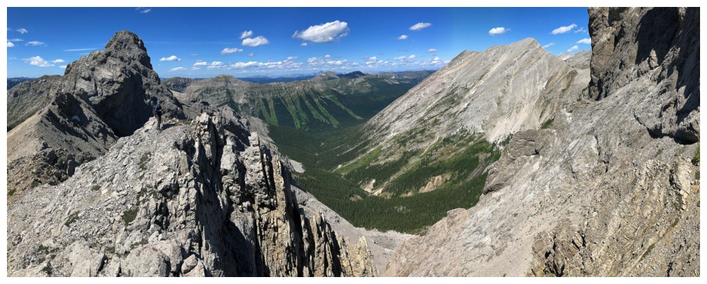
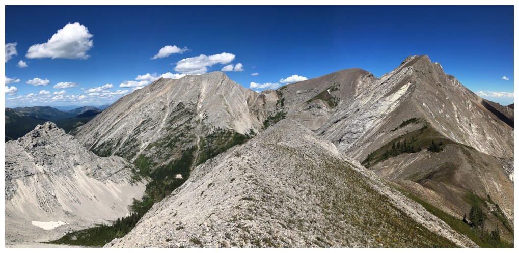
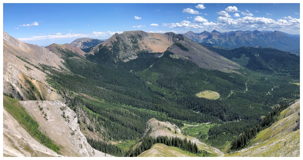
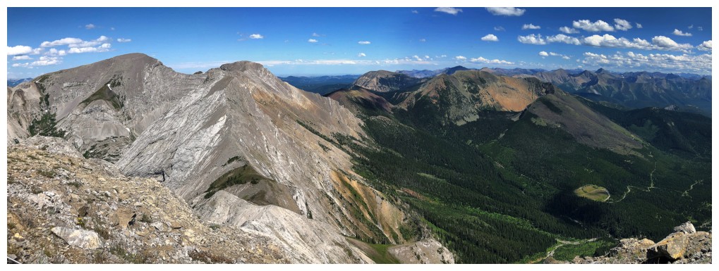
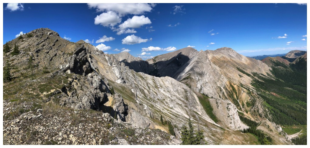
The view to the next highpoint and much more
Lots of interesting terrain ahead
Same as above
Glad to be back on easy terrain

Easy does it here. It's more exposed than it appears to be.
Infrequently ascended Mount Corrigan to the west (photo by Dave)
A touch of colour, courtesy of some orange lichen (photo by Dave)
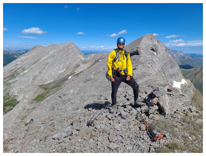
At the point where we decided that an attempt of Borsato was too much to pass on
Still enjoying the view of "where we once were"
Here we go - the start of several hours of route-finding and challenging terrain to the summit of Borsato
Relatively easy at the beginning (photo by Dave)
...and super scenic
Approaching a very scary-looking section
...so I'll ignore it by just looking at what's behind us!
At that scary section and thankful there's a bypass on the left side. Otherwise, we would have turned around.
Dave starts the bypass
There it is again - that gives me a bit of the shudders!
A pleasant run-in with some wildflowers
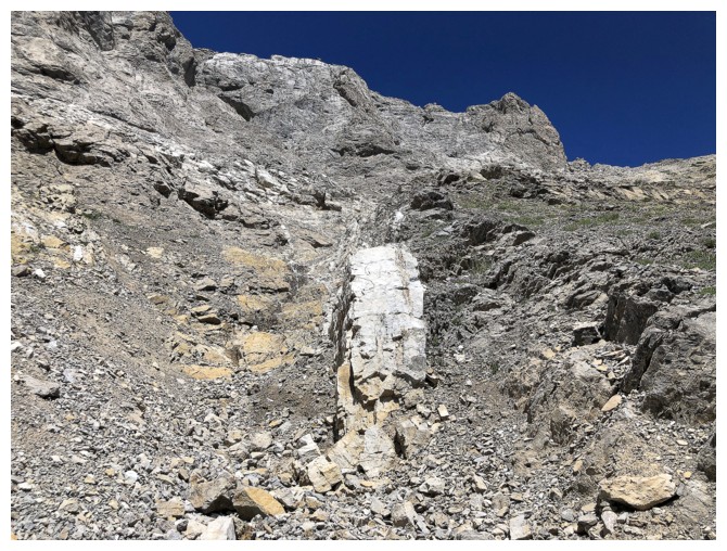
Random slab of white rock
At this point we are far below the ridge and doing lots of traversing and little ascending
Looking back up to the ridge
Big traverse coming up, but at least we will be reunited with the ridge (photo by Dave)
Almost back on the ridge (photo by Dave)
Looking back
Looking forward
There will be lots of "looking back" for a while, as I love the shape
of the highpoint we were once on and the ones on either side
There's 1
There's 2
And 3's a charm!
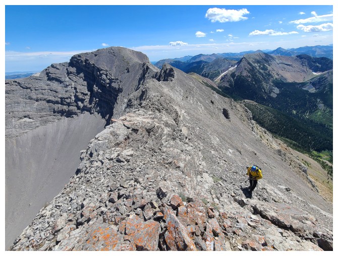
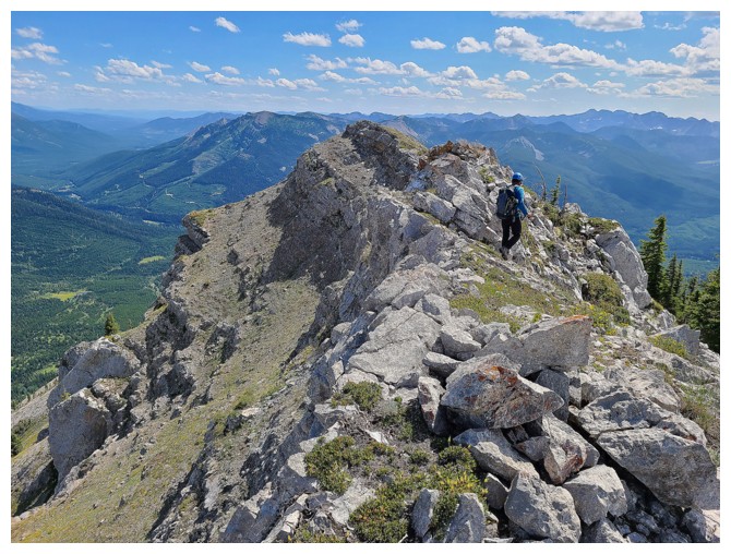
Turning my attention to the route ahead. Dave on the ridge.
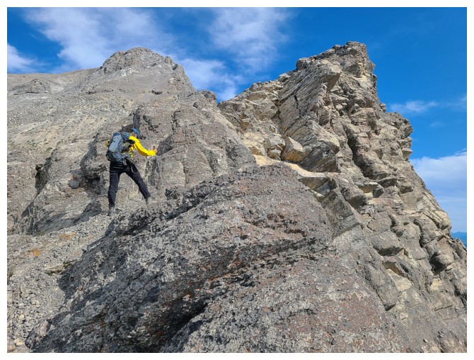
Dave leads us over an exposed section
I follow (photo by Dave)
Forced to traverse left again to find a route up Borsato - staying on the ridge was not possible
More wildflowers
Getting above this band proved to be a challenge
As such, we kept traversing left to find a weakness (photo by Dave)
The view over to Hollebeke Mountain is a fine one
Dave finds a weakness
The challenging terrain continues (photo by Dave)
After some "bobbing and weaving" we were able to find a feasible route to the summit ridge
Heading up the ramp at the left
Dave reaches the summit ridge
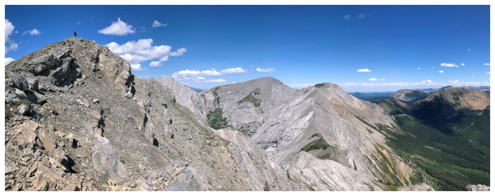
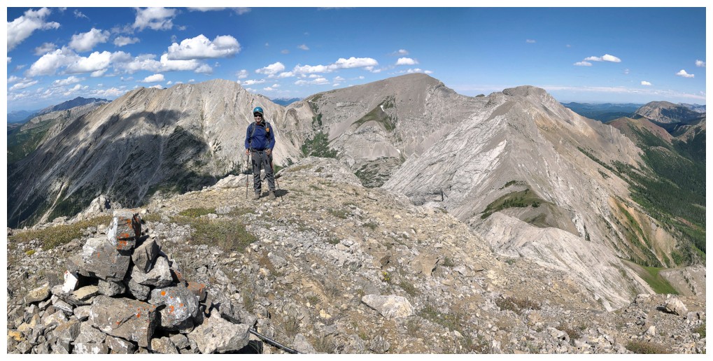
A bigger view, with Dave at the far left
Success!!
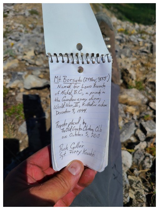
Not surprisingly, the current summit register was placed by the venerable Rick Collier (photo by Dave)
Dave reads the register. There is always something special about seeing
a Rick Collier register, given not only his incomparable and unequaled
achievements in the Canadian Rockies, but the character and class of the man himself.
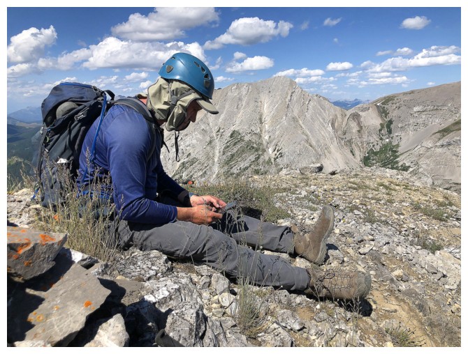
A grasshopper on a cool chunk of rock
Close-up. The grasshopper is well camouflaged.
View to the east
To the north

The view to the southwest includes distant St. Eloi (left), Mount Haig (centre), and Tombstone Mountain (right)
Mount McCarty
Last summit photo before the trip goes south - figuratively and literally!!
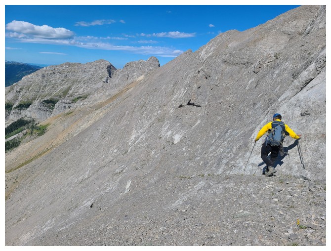
The first few steps of the near epic descent (photo by Dave)
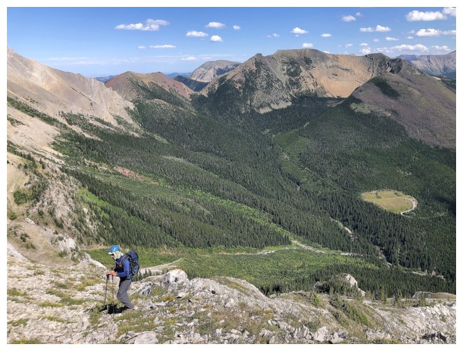
Easy and wonderfully scenic travel down the south ridge
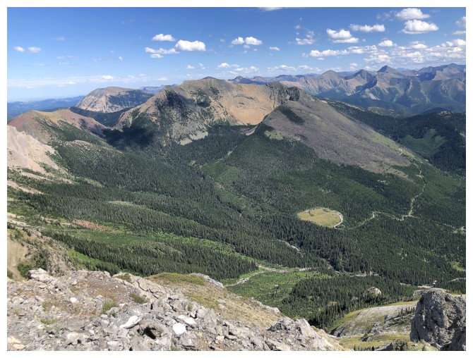
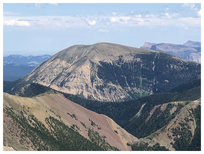
Hollebeke
dominates the view to the east. Note the patch of clear-cutting near
the right. Eventually we would end up there. North Kootenay Pass is
just out of view at the left.
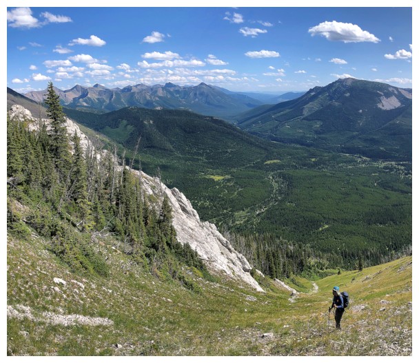
Still easy
...and still scenic
Ran into a cliffband here and had to backtrack
Found this very descendable gully but it was going slightly away from NKP and so we traversed over to the ridge at the left
Dave traversing at the left and lots of unnamed peaks and hills in front
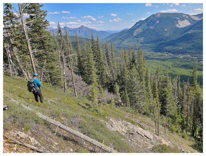
We'll be heading into those trees soon (photo by Dave)
Fortunately, the bushwhacking was easy (photo by Dave)
We lucked out by avoiding any heavy bush, but were still going in a general direction we didn't want to go (photo by Dave)
Relief upon finding Pincher Creek. Older maps depict the North Kootenay
Pass Trail following the creek. Unfortunately, that trail no longer
exists, as is depicted on newer maps (photo by Dave).
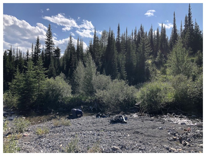
Dave is cooling off in the creek. Note that this is not the same
Pincher Creek originating on the southeast side of Victoria Peak and
running through the town of Pincher Creek.
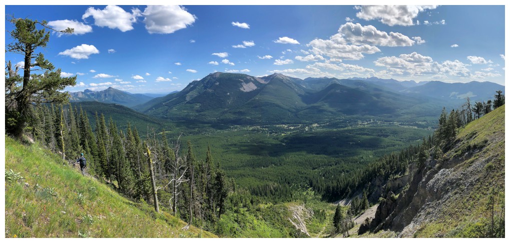
After failing to find the trail (because it didn't exist!), we hiked to this open
area, where a godsend of a trail going in the right direction was found
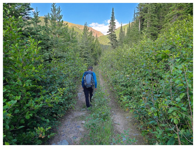
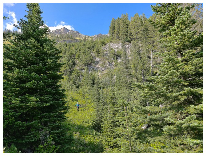
Hiking that little goodie! (photo by Dave)
Shortly after this photo was taken the trail abruptly stopped. We need
to be on that treed highpoint at the left. Apparently, God didn't send
that trail!
Mercifully finding the North Kootenay Pass Trail. It too abruptly stops a short ways down. The two trails do not connect.
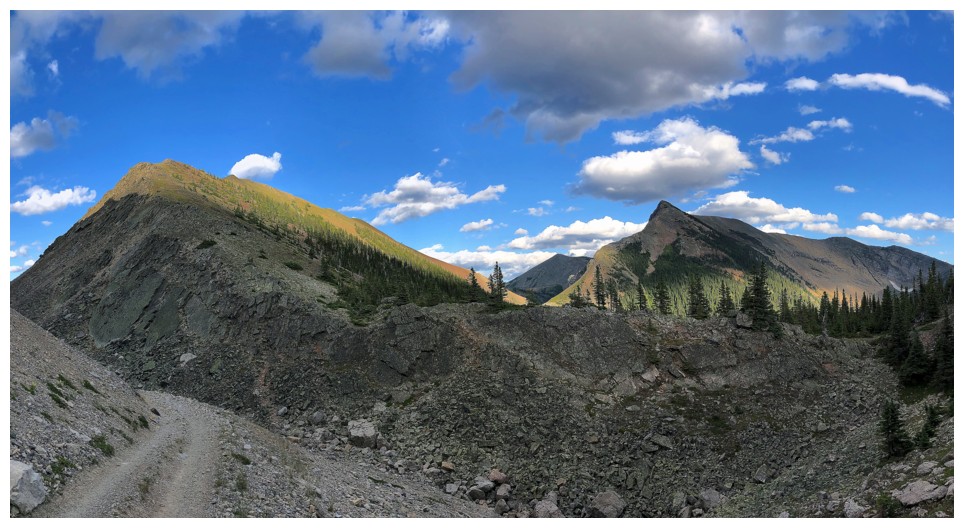
Dave and much of the route we took - South Flathead at the right, Borsato at the left
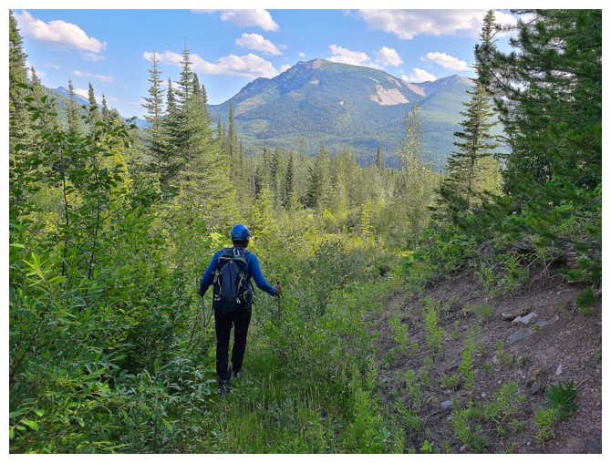
At the pass, with North Kootenay Point at the left and Hollebeke at the right
We were both salivating heavily at this point, with our bikes less than a kilometre away. North Kootenay Mountain ahead.
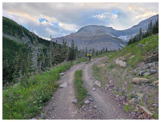
Near the start of a sweet ride down! (photo by Dave)
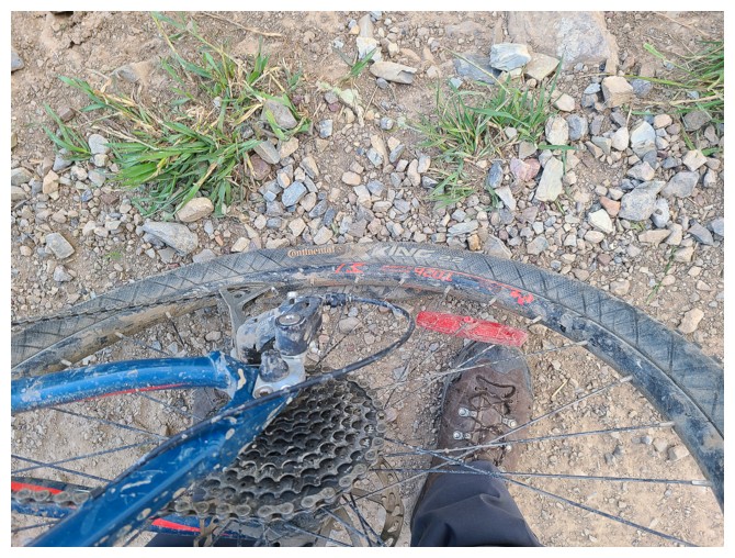
A minute later and the end of the sweet ride down! (photo by Dave)
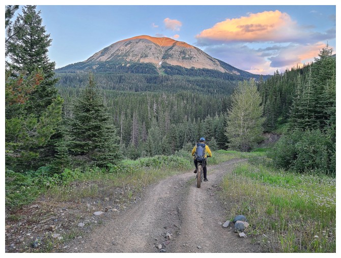
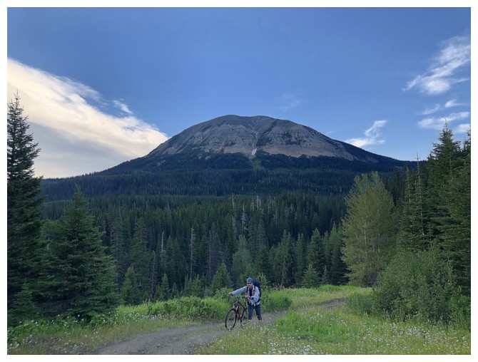
McCarty enjoying it's last few minutes of Sun. I'm just relieved to be
riding my bike, not walking it, as poor Dave had to do for approximately 9 km (photo by Dave.)
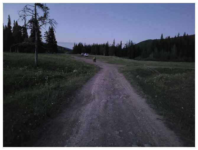
Our vehicles are seconds away. A crazy 14-hour day of "Didn't see that coming!" (photo by Dave)
The End
LOG