Cloudowan Northeast
August 5, 2023
Mountain height: 2585 m
Elevation gain: approximately
1300 m
Round-trip time: 8:45
Solo
scramble.
I had been eyeing up this route for some time. Though
not a particularly adventurous-looking line, I have learned you can never
underestimate the scenic potential of any route in Waterton/The Castle. 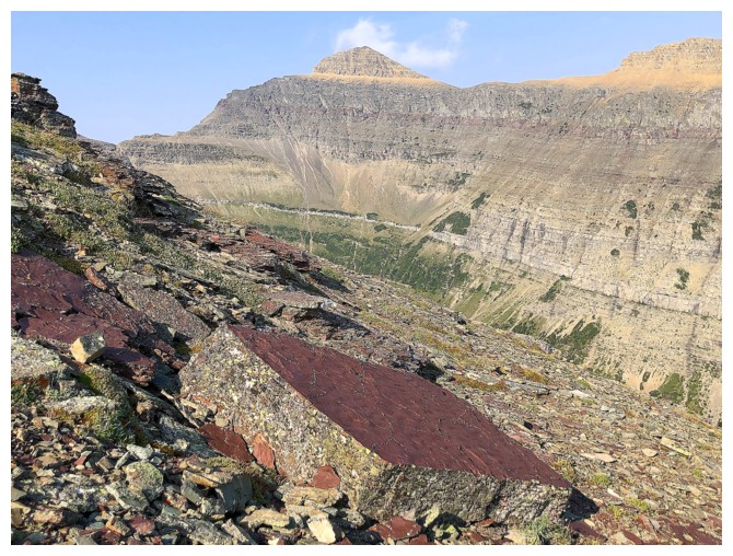 The
objective, the distinctive northeast summit of Cloudowan Peak, could more than
likely be attained easily from Cloudy Ridge, but an attempt from the northeast
via a subsidiary drainage of Yarrow Creek was beckonening – might as well “get 'er
done!”
The
objective, the distinctive northeast summit of Cloudowan Peak, could more than
likely be attained easily from Cloudy Ridge, but an attempt from the northeast
via a subsidiary drainage of Yarrow Creek was beckonening – might as well “get 'er
done!”
The day started with a somewhat tedious bike ride up
and over the cutline down to the Yarrow Creek gas road. For the two-wheel
approach, this trail can vary from decent to downright nasty, due to boggy
sections and terrain chewed up by livestock – I got a mixture of the two. I
then biked easily to a gas well right by the ascent drainage, memories of two bushwhacking
epics on Cloudy Ridge Junior nipping annoyingly at my brain!
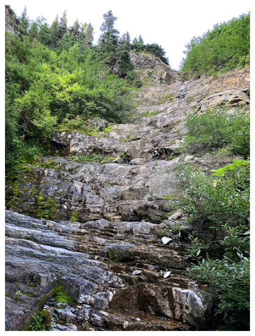
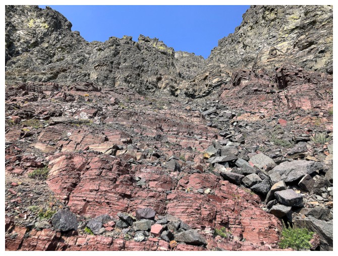
Luckily, the bushwhacking to get into the drainage,
though hideous, was short-lived. The drainage itself started off with some bushy
sections, but soon graduated to an awesome scrambly ramble on step-like rock.
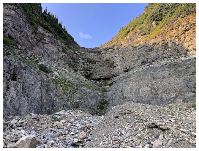
 One section of upclimbing near the beginning was at the high end of my scrambling
ability and I took note to try to find a different route on return.
One section of upclimbing near the beginning was at the high end of my scrambling
ability and I took note to try to find a different route on return.
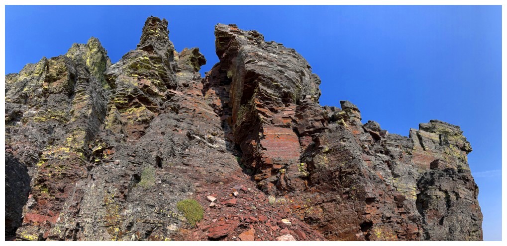
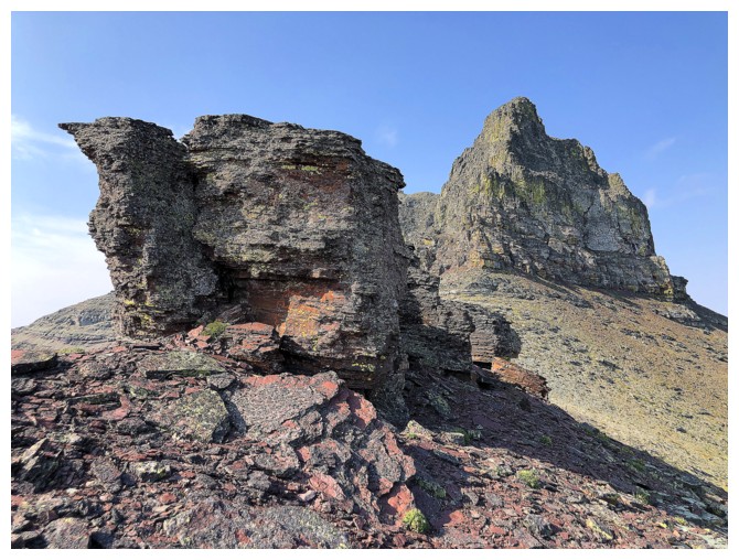
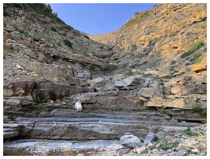
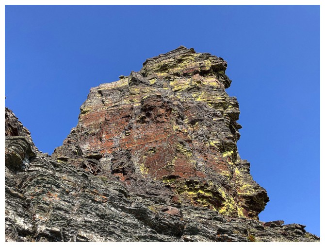
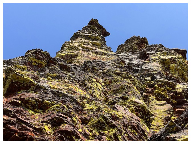
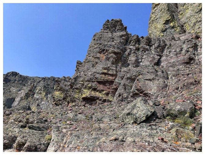
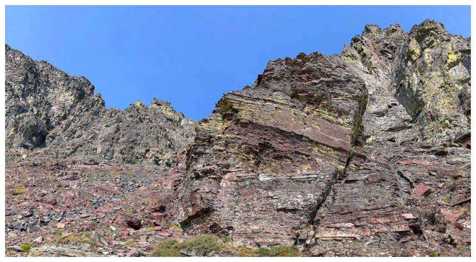
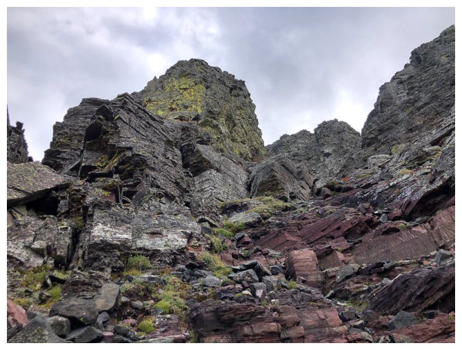
Eventually I reached the base of the summit block and
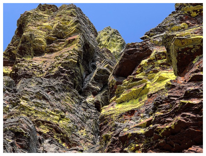
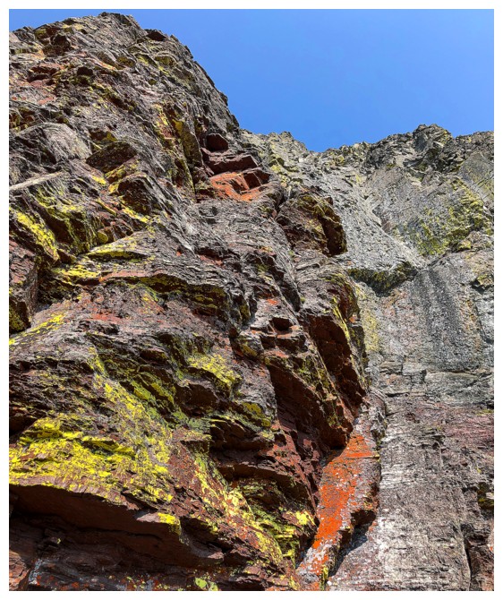
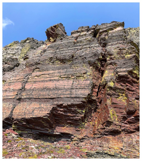
lo and behold the lower half appeared to be comprised mostly of red argillite, covered in yellow
lichen. I have two addictions in life: chocolate is one and the yellow painted
red rock is the other! Though my initial plan was to tackle traverse around the
north side of the block, in hopes of ascending a weakness I spotted from
Glendowan, the south side was unexpectedly bathing in Sun. No way was I going
to be denied at least a good look.
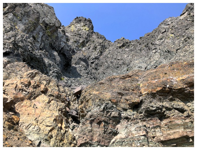
Good choice – it turned out to be a wild ride of
incredible rock scenery. A weakness was also revealed on this side, however,
after scrambling up to the base, I decided against an attempt, unsure if I might
hit an impasse higher up. Decision time again; continue traversing around the
east side to the Cloudy Ridge/Cloudowan NE col and attempt the summit from
there or return and try the west side. I chose the latter and it worked
perfectly. The weakness on that side involved only a few moves of moderate scrambling
and then an easy trek to the summit. Sadly, the predicted weather conditions
took hold at this point – overcast and smoky – yuk!
I descended almost exactly the same way, with the
exception of the aforementioned tricky section in the drainage. I circumvented
that section by going into the forest and enduring possibly the worst stint of
bushwhacking I’ve ever encountered. Getting back into the drainage was sheer
relief. The remainder of the descent went without a hitch, and the last section
of the bike ride was tolerable.
Overall, an excellent day of exploration. Would I ever
repeat this route? Yes, but only with the promise of free chocolate for life!
The east side of some of The Castle. Cloudowan NE is second from the left.
Biking the cutline; Mount Dungarvan (left) and Cloudy Ridge Junior
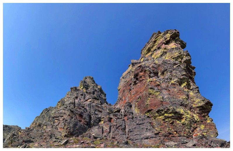
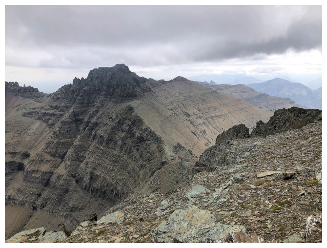
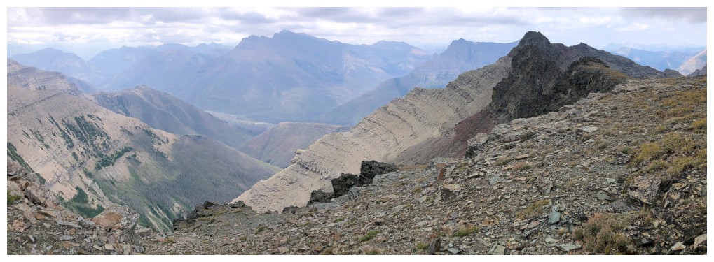
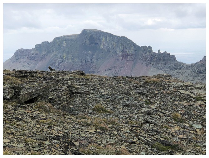
Cloudy Ridge Jr., Cloudowan NE, and Glendowan
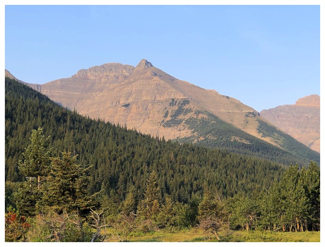
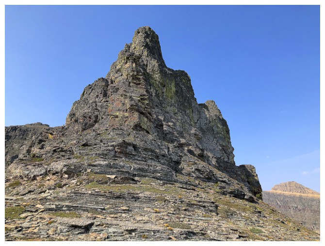
The objective. The ascent line goes between the two ridges.
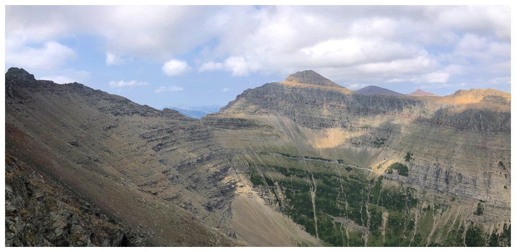
Glendowan
Mount Yarrow
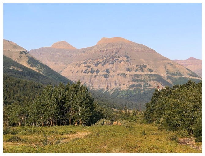
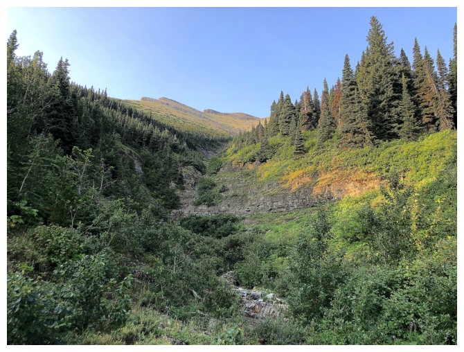
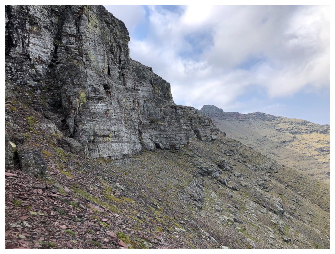
Cloudowan NE from the end of the bike approach. The heinous bushwhacking lies to the right.
Out of the heavy bush and into the lightly bushy drainage
Less bushy
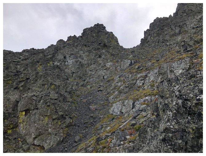
Approaching the crux of the drainage
Easier terrain above the crux
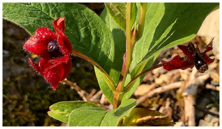
Some sort of berries
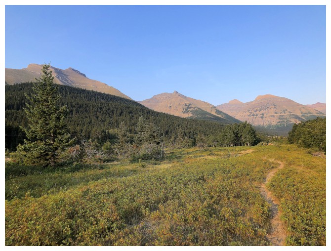
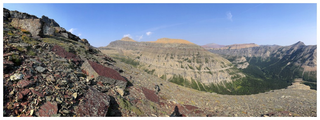
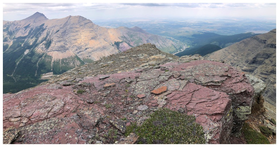
Alittle preview of what's to come upon reaching the upper plateau
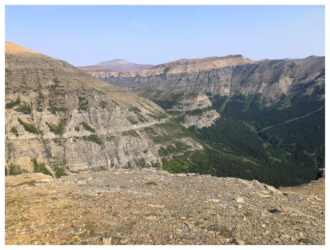
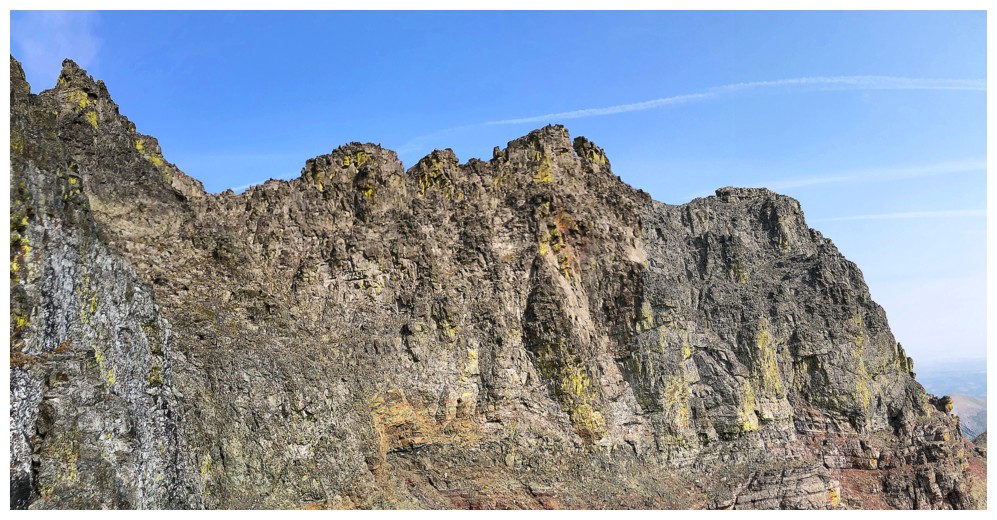
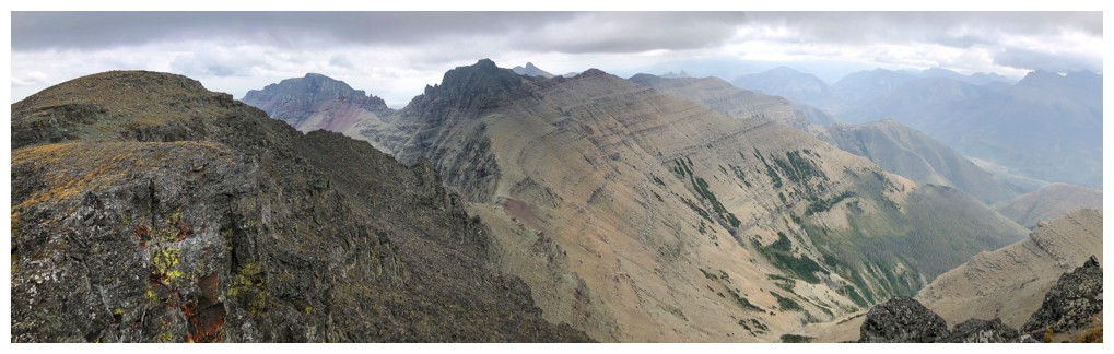
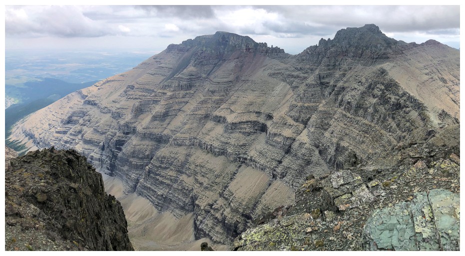
The lengthy and amazing Spionkop Ridge
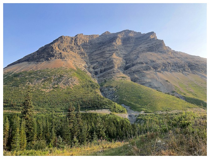
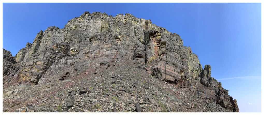
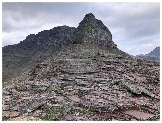
The summit block appears at the left
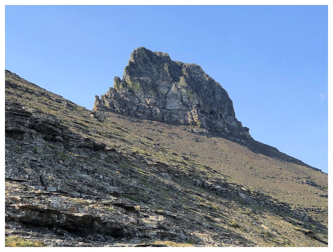
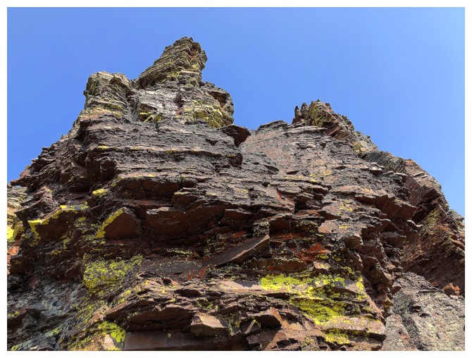
It's impressive even from afar
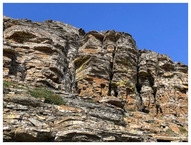
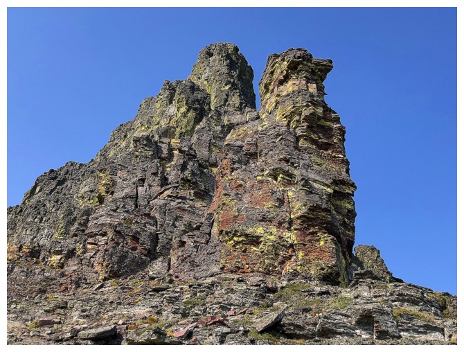
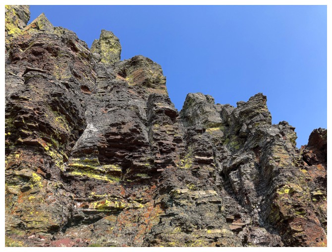
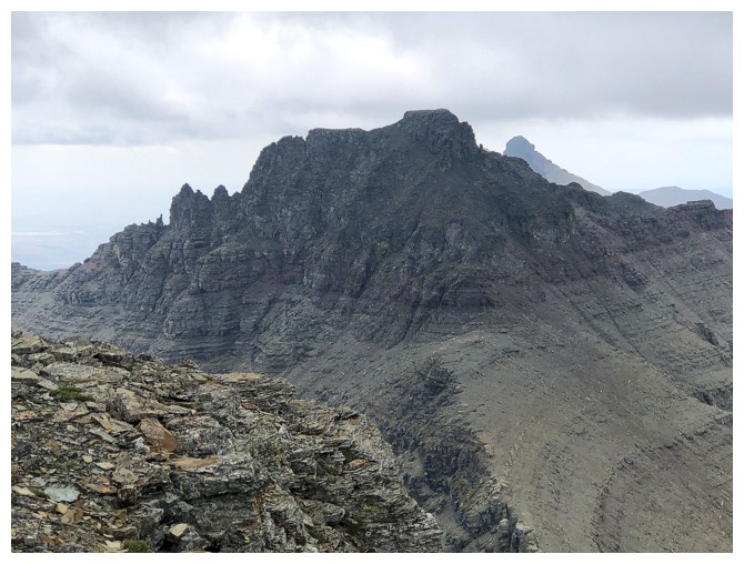
So are the blocks, topped with red argillite
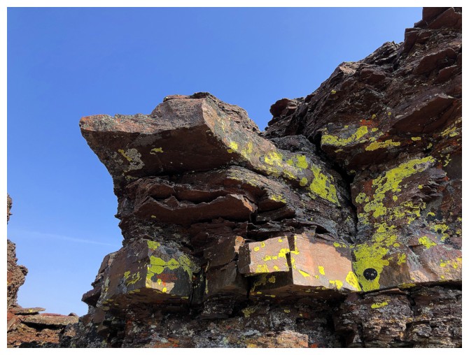
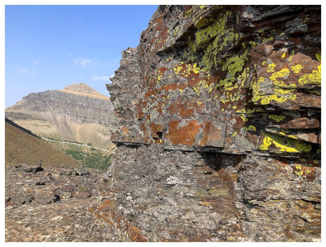
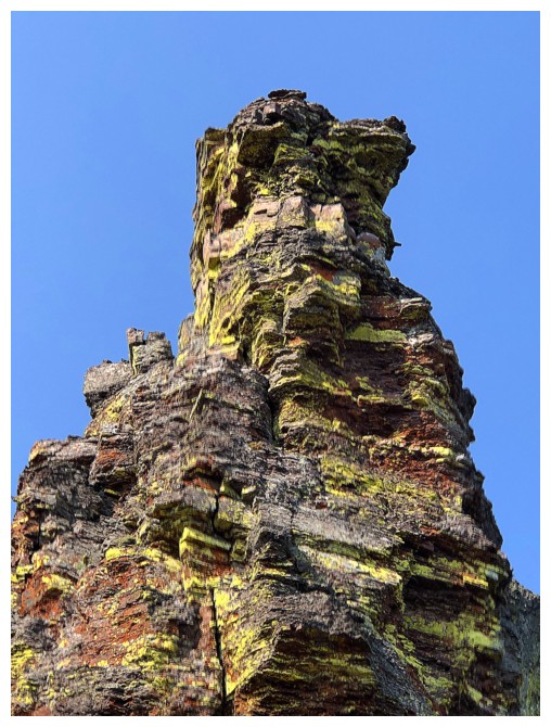
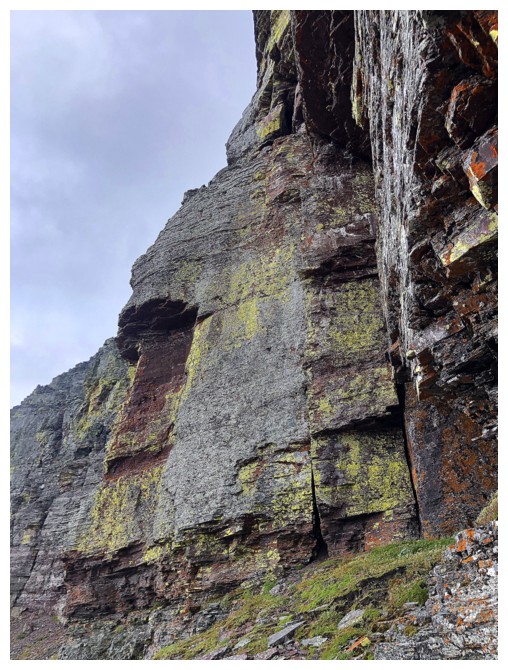
Yellow lichen on red argillite - a sign of things to come
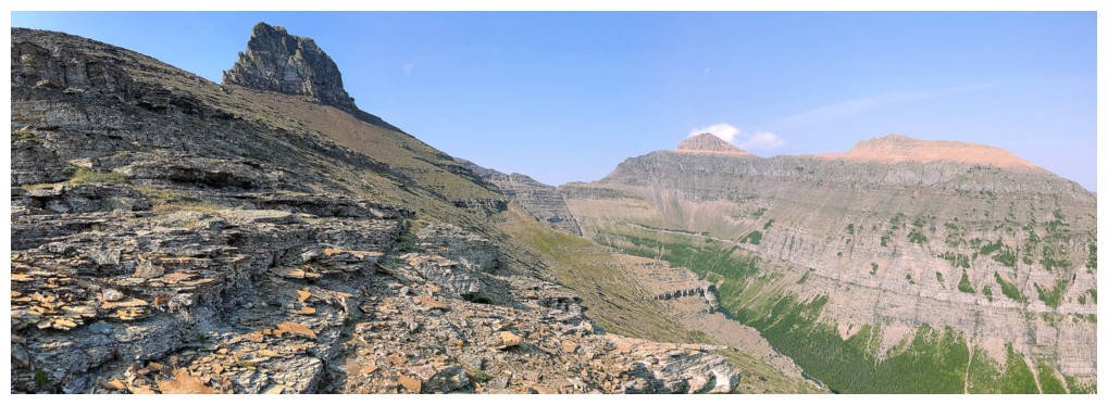
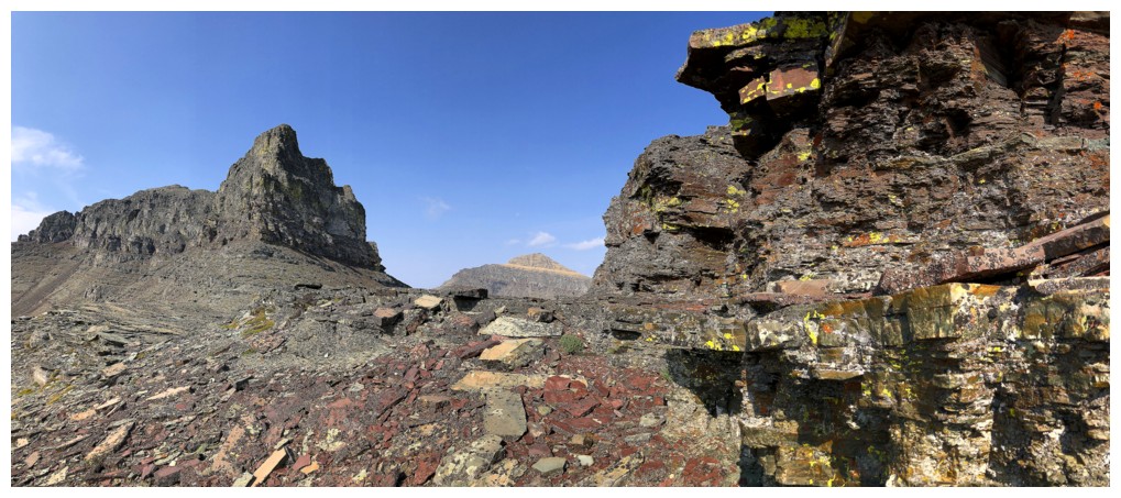
With Glendowan
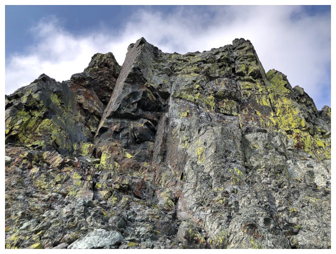
Decision time: right (north side) or left (south side) around the summit block?
The left looks great
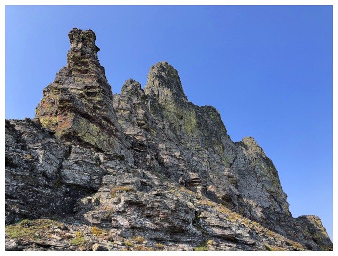
So does the right
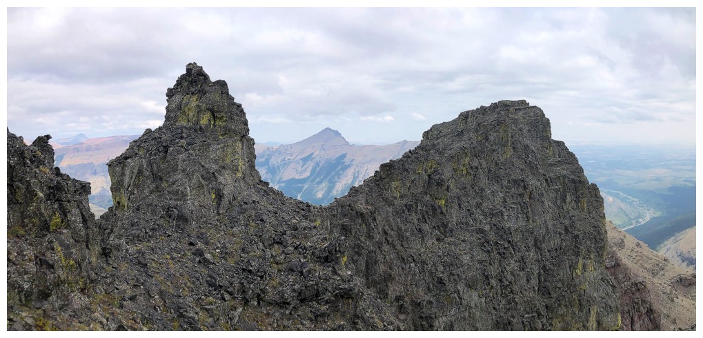
Straight ahead looks impossible!
Heading around the left side
Already this is a great decision
Yellow lichen and red argillite rock scenery on the left side
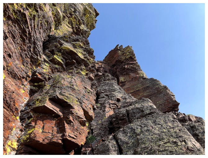
Going straight up at this point is obviously out of the question
So I kept traversing
Looks like a few potential routes up here
Heading up
There was a route up here but I backed down because I couldn't see the
entire route. Later in the trip I would see that the route would have
worked.
Another potential route but this one was severely exposed and very steep
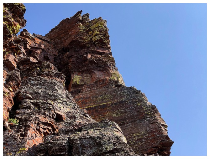
Admiring the rock before I turn around
Same as above
Traversing back to the east end
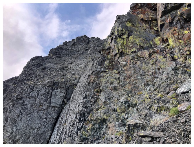
Now on the right (north) side looking up one potential gully
Took the second gully and it provided easy access to the summit ridge
Back to gawping at Glendowan
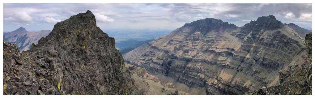
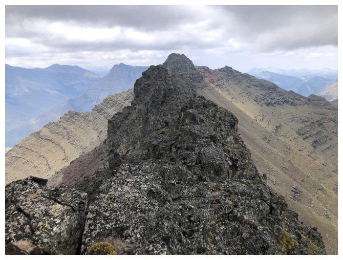
The far east end of Cloudown NE at the left and the two Cloudys at the right
Once I had a dream of attempting Glendowan from the east (seen here), but after a (too) interesting day on Newman Senior in 2022, and some epic bushwhacking on Cloudy Ridge Junior from this valley, I've decided against it!
I did make an attempt to get to the far east end of the ridge but it was quite exposed and not worth the risk
Cloudy Ridge
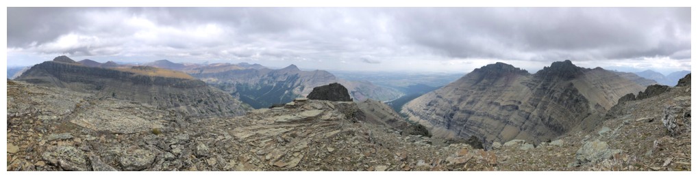
Summit pano
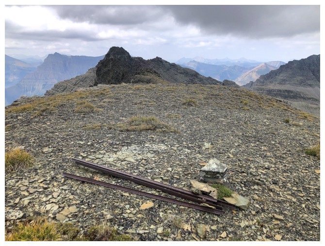
The remains of a park boundary marker
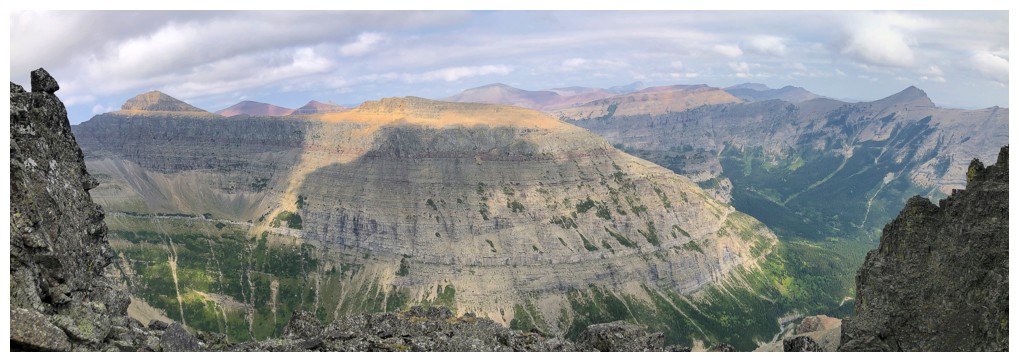
Blakiston in the centre
The ridge to Cloudowan Peak. Had the weather not been breaking down I may have tried to traverse there.
Last summit pano
Cloudy Ridge
Cloudy Ridge Junior
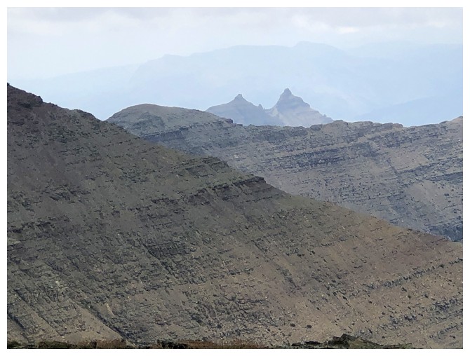
The pointy peaks are Mount Galwey (right) and Galwey North
The Cloudys again
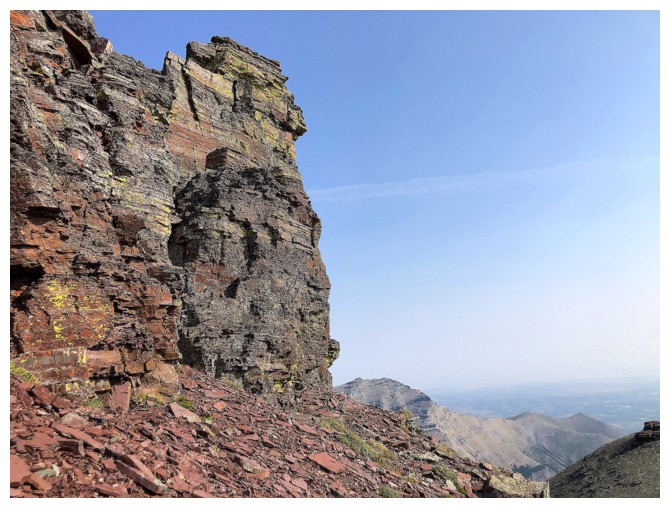
Back down beneath the summit block
Parting look at Mount Roche (left) and Yarrow (right of Roche)
Parting look at the objective
The End
LOG