Pastry Peak IV
July 5, 2022
Mountain height: 2464 m
Elevation gain: 1171 m
Round-trip time: 6:30
Solo scramble.
I set out to attempt the northeast peak
of Cloudowan Peak from the Yarrow Creek side. However, after two straight days
of torrential rain in the area, everything in sight from the trailhead was
drenched or a muddy mess – no thanks!
Since there was no Plan B, I right away
defaulted to something on the south side of Loaf Mountain. That side is a gold
mine of super interesting ascent routes and even after taken multiple lines, I
still have many more to check out.
 Initially, I was thinking about a route
close to the summit, but after completing the bike approach, I opted for a
different one. In May of
2019 Dave and I had reached a plateau east
of Pastry Peak (the middle summit of Loaf) and in April of 2022
Dave, Brad, and I had reached Pastry Peak from a point where I now stood.
Between the plateau and Pastry lie unknown territory for me and that became the
day’s objective.
Initially, I was thinking about a route
close to the summit, but after completing the bike approach, I opted for a
different one. In May of
2019 Dave and I had reached a plateau east
of Pastry Peak (the middle summit of Loaf) and in April of 2022
Dave, Brad, and I had reached Pastry Peak from a point where I now stood.
Between the plateau and Pastry lie unknown territory for me and that became the
day’s objective.
To
reach the plateau, however, I opted
for a new route right up the drainage to the right of the starting
point. And
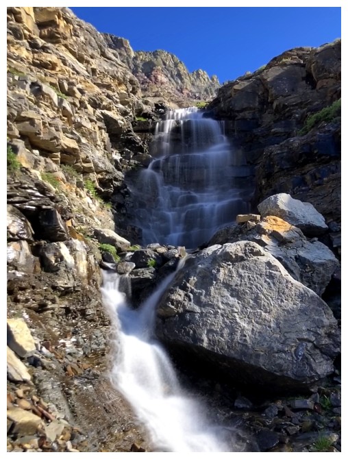
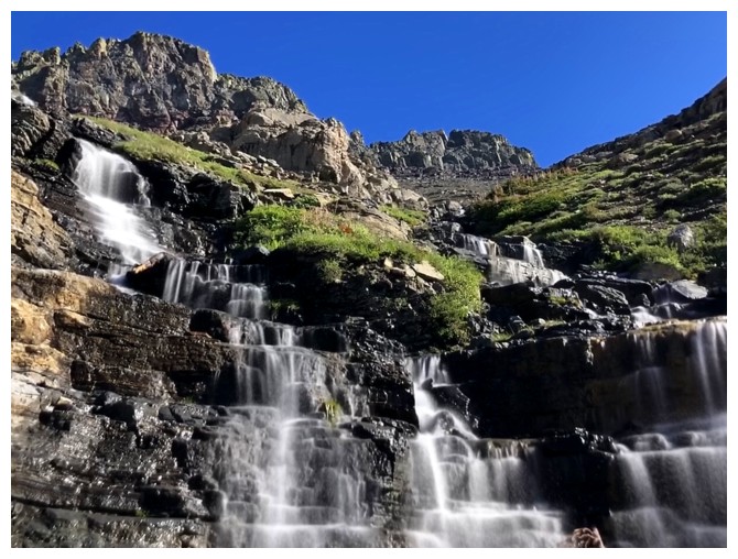
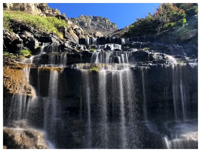
did that decision ever pay off! The drainage was spectacular, with one
small
waterfall after another. The long-exposure feature of my phone camera
got its most intense workout to date! Fortuitously, the drainage also
took me to the base of
the gully that Dave and I had used to reach the plateau.
The goal, at this point, was to see if
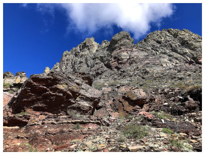
the ridge could be scrambled. From afar it looked to be quite challenging and
very exposed – close up, even more so on both counts! Nevertheless, it was
worth a go. Within a few minutes, I arrived at a very exposed section that I
knew I could scramble up but would be unnerving to downclimb. I couldn’t see
the terrain above. Dave often quotes, “There are old climbers and there are
bold climbers, but there are no old, bold climbers!”. On those wise words, I
backed down.
Circumventing the exposed section
presented no difficulties and soon I was on familiar terrain and close to Pastry.
The scenic hike with a little scrambling to the summit was unfortunately in
deteriorating weather conditions. As such, my summit stay was very short.
For descent, my intention was to follow
the ascent route I completed On April Fool’s Day on 2013, but in reverse.
However, yet again this magnificent mountain invited me to try a new route
down, on the west side of the ridge east of the true summit. The route went
without difficulty but did leave a relatively long hike back to my bike. Of
course, the return bike ride was anything but long, taking about 6 minutes to
cover 4 km of gravel road.
Loaf delivers yet another wonderful
experience of fun and interesting terrain, terrific views, and a few surprises.
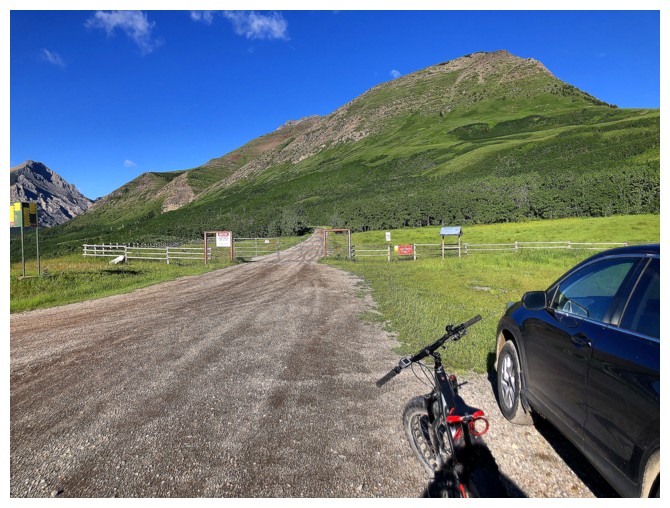
Lost count of the number of times I've been at this trailhead, but I'm sure it's over 20
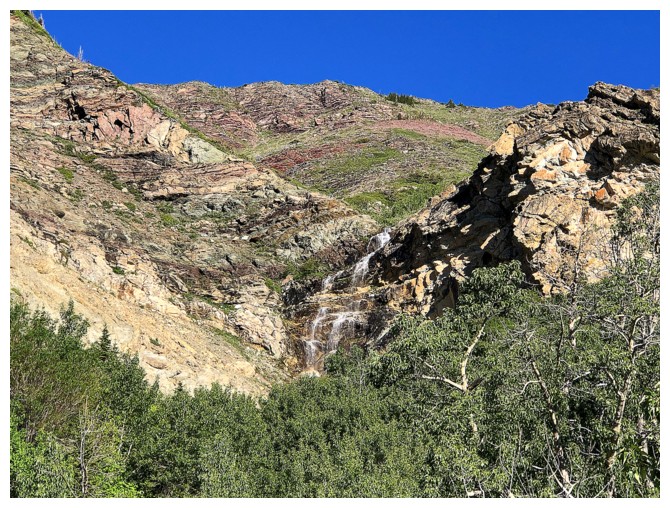
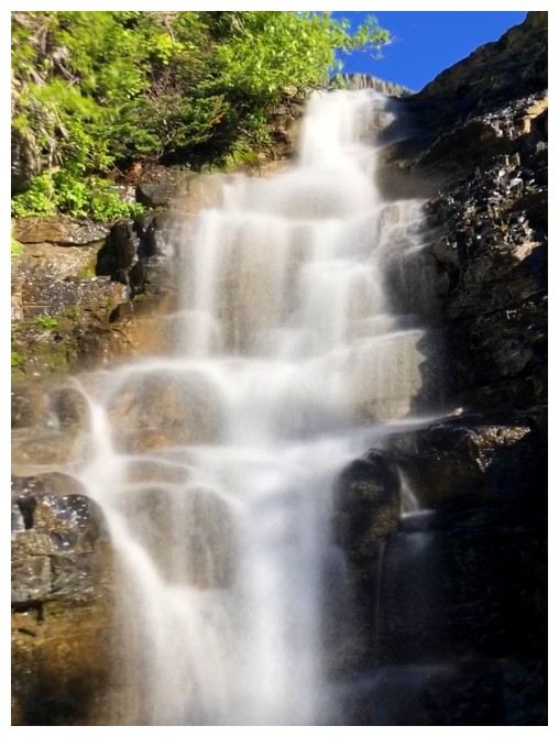
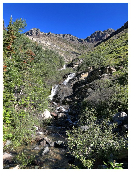
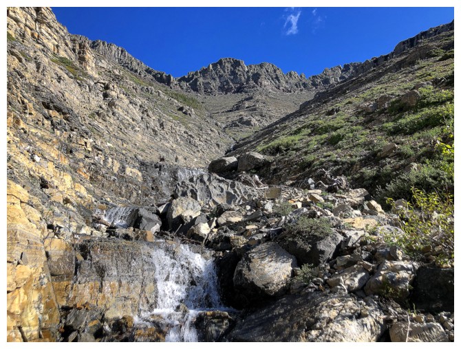
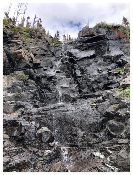
Stopping to photograph the waterfall that becomes this in winter
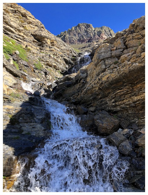
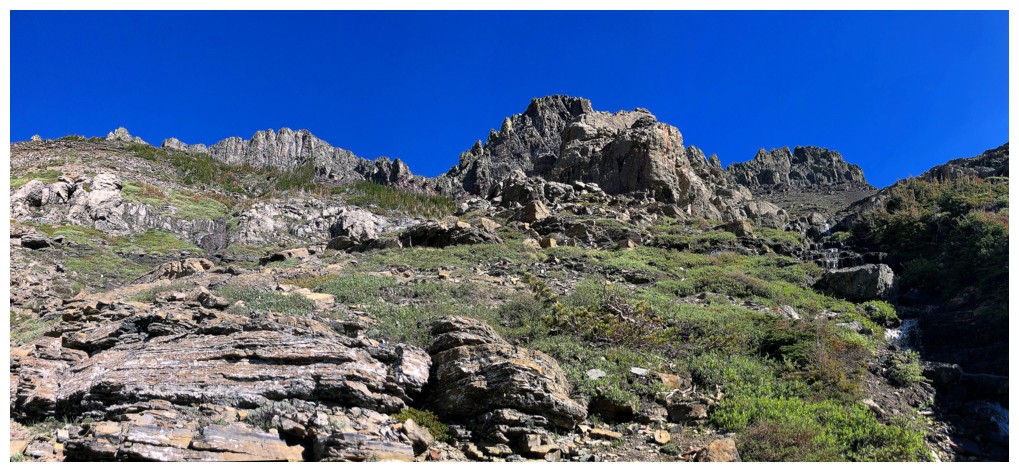
At the start of the route up - doesn't look all that exciting (yet!)
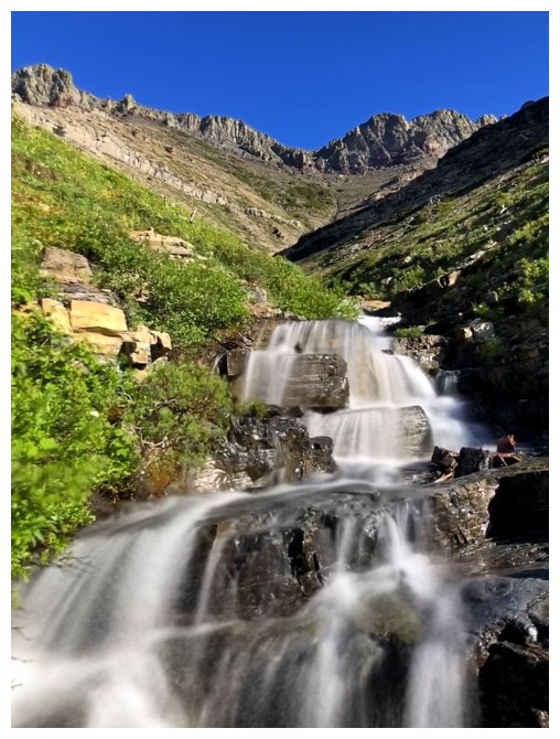
In the drainage that leads almost all the way to the ridge - still doesn't look like much
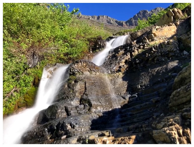
Here we go - the start of endless waterfalls and endless long exposure photos!
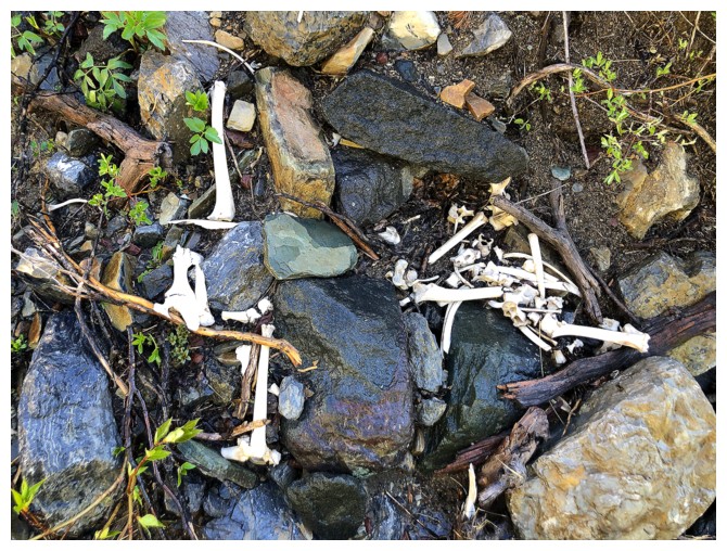 And the odd scene of skeletal remains
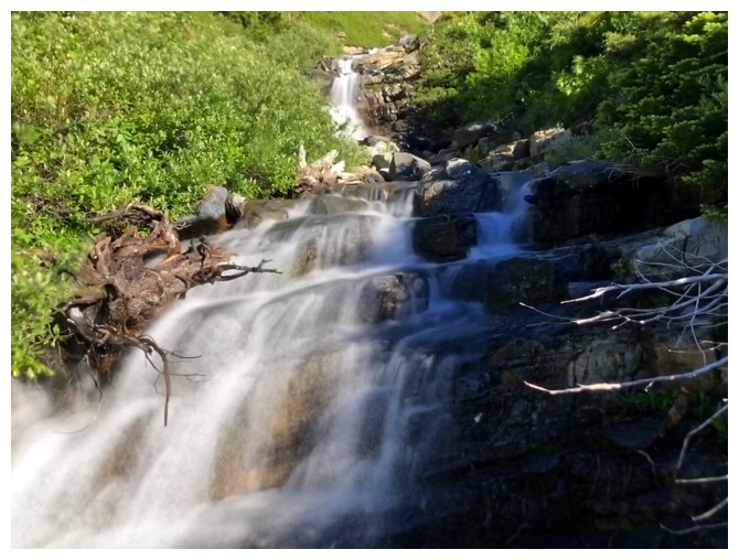
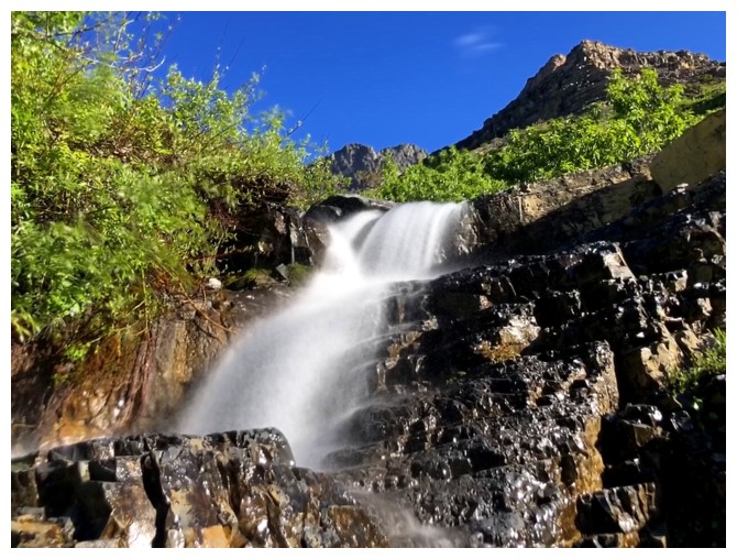
Back to waterfalls
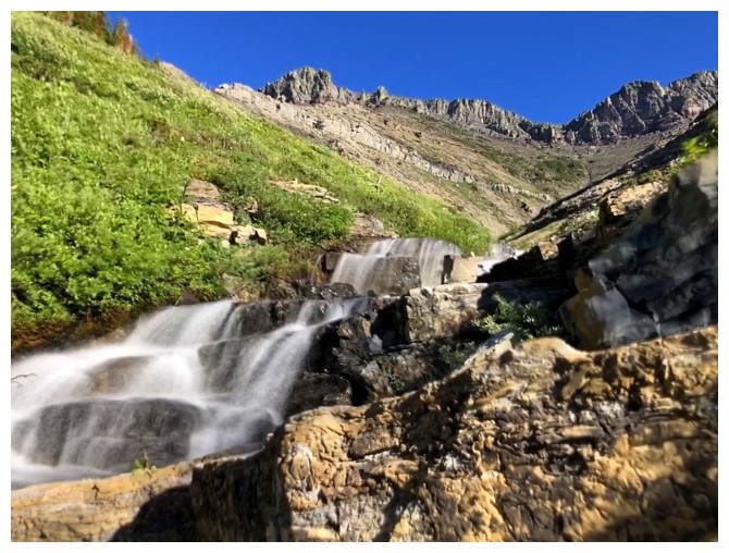
Looks like the end of the waterfall scenery
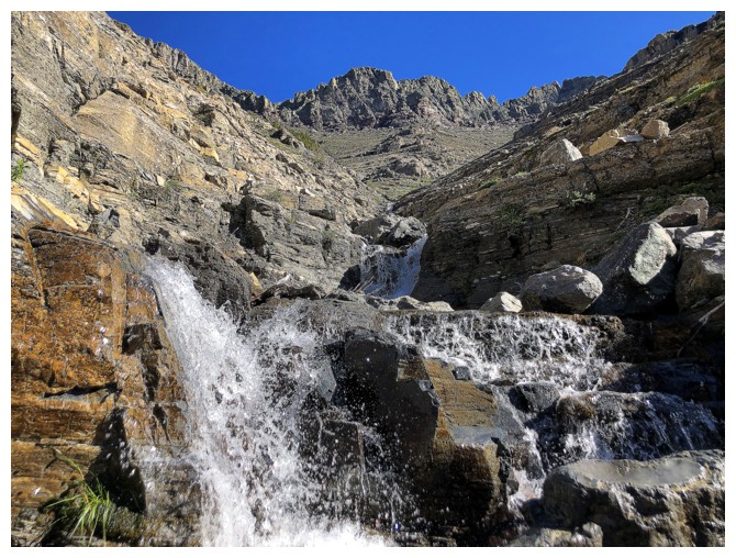
But no!
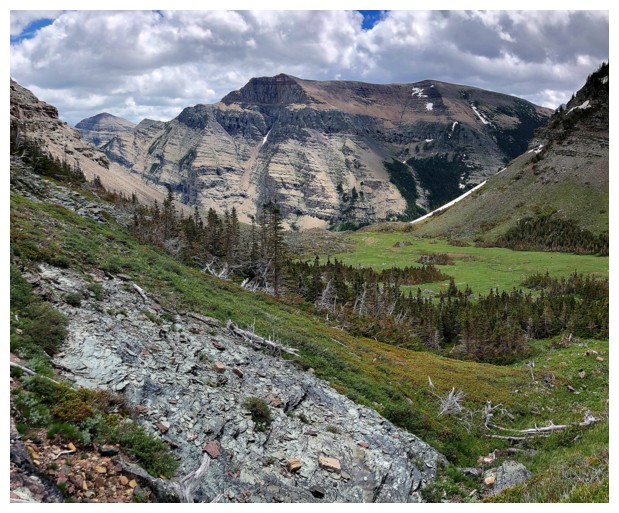
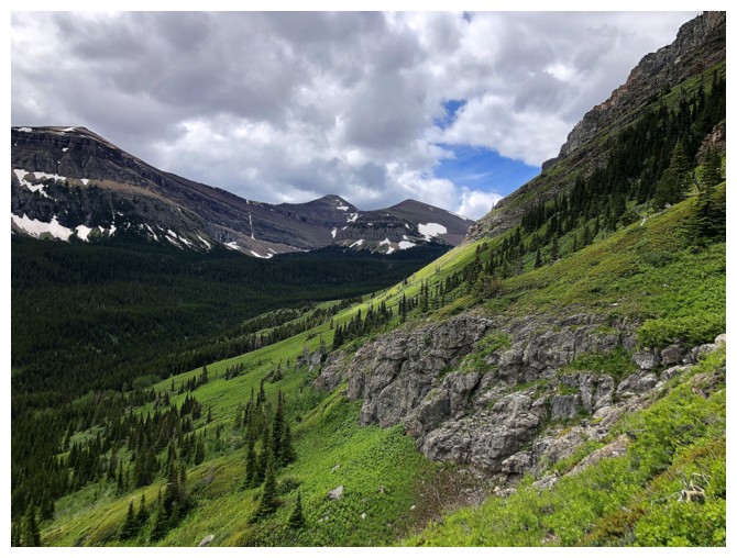
Looking over to Spionkop Ridge
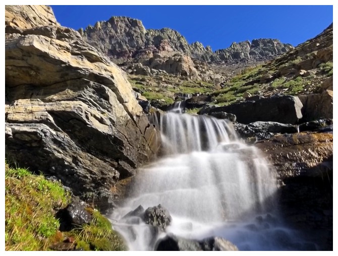
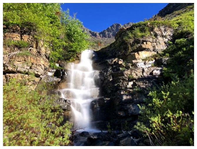
The end?
No
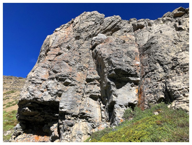
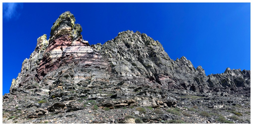
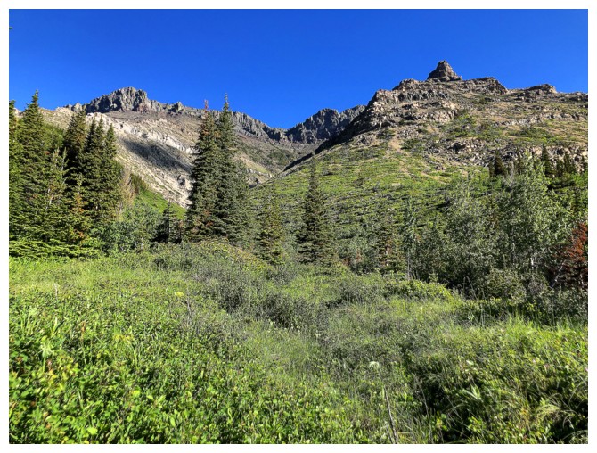
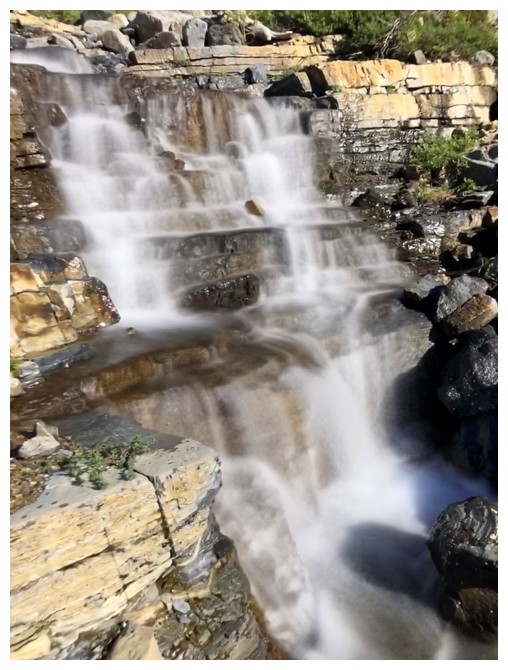
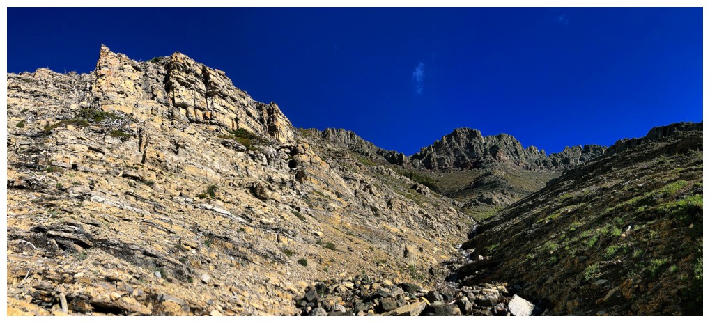
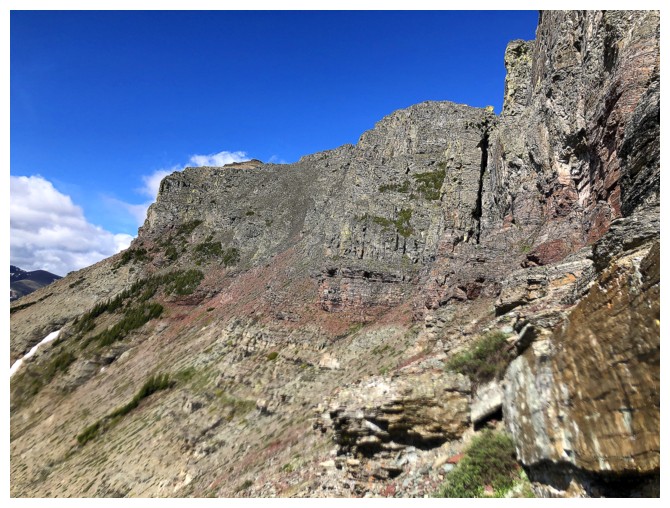
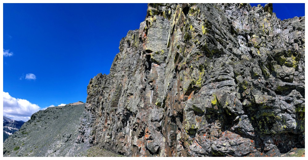
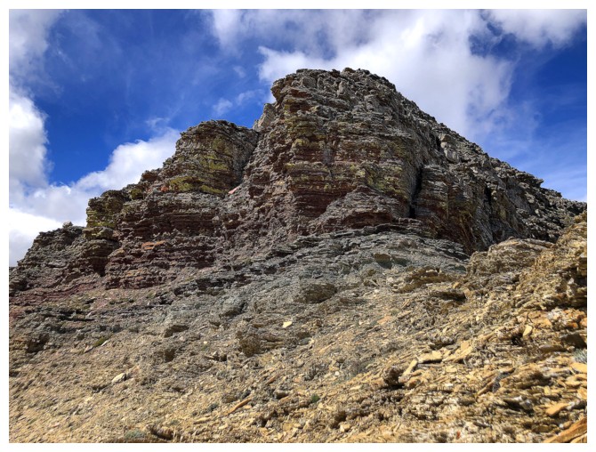
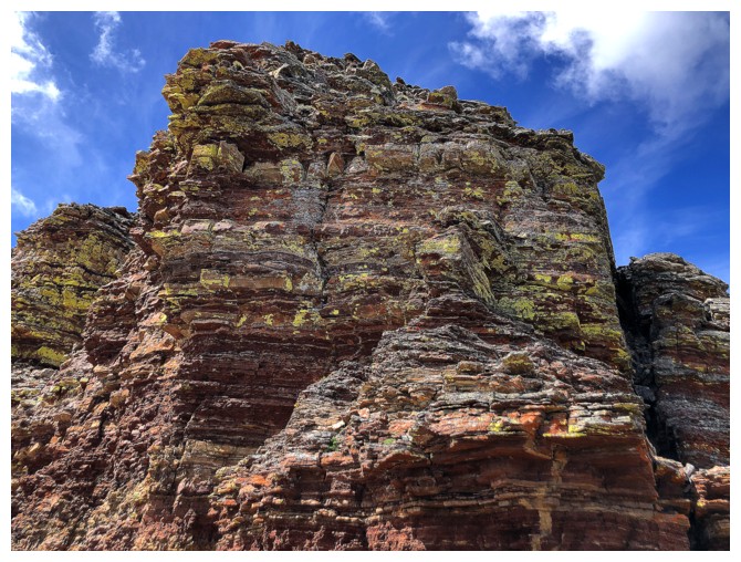
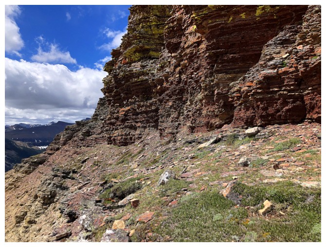
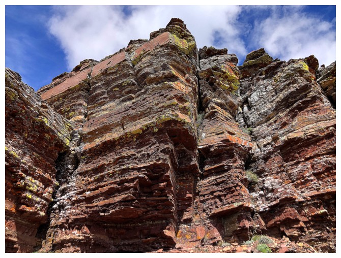
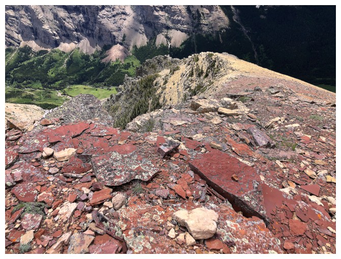
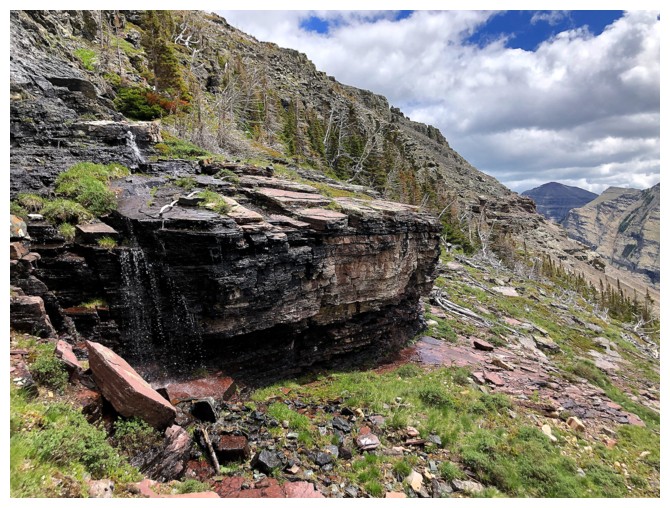
The waterfalls scenery finally ends, but the amazing rock scenery of Loaf takes over
The route goes between the rock bands left and right of centre
Traversing along the base was possible at this point, but that route would have bypassed the terrain I was looking to explore
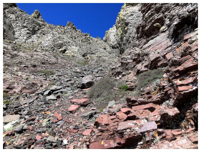
Back in the gully Dave and I used in 2019 to access the ridge
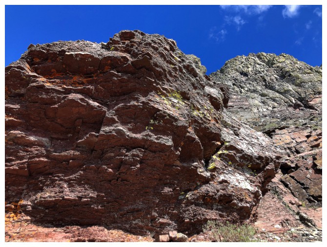
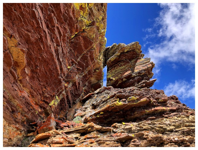
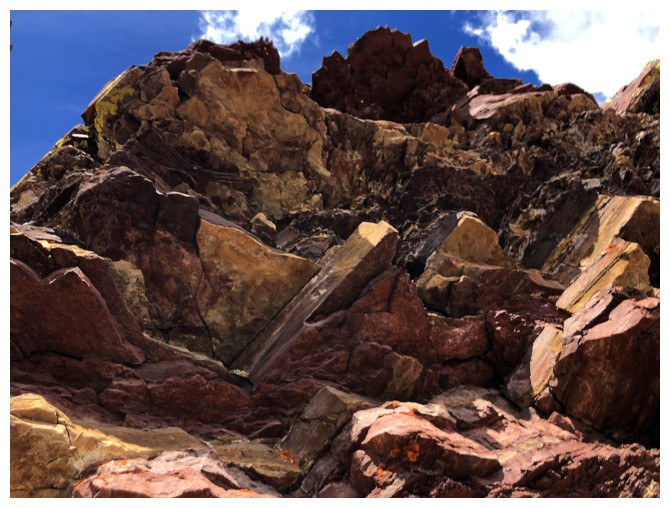
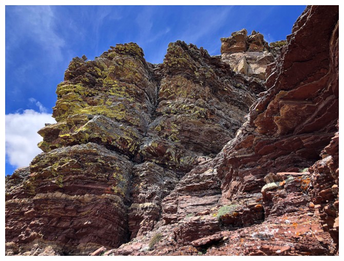
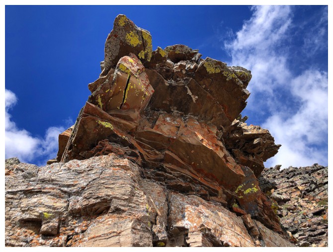
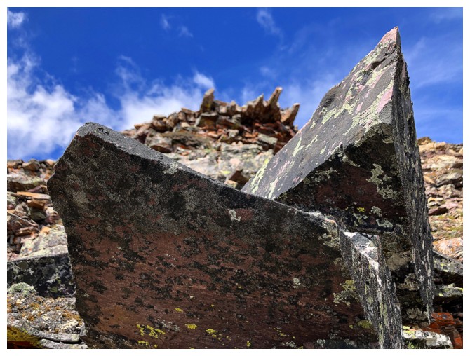
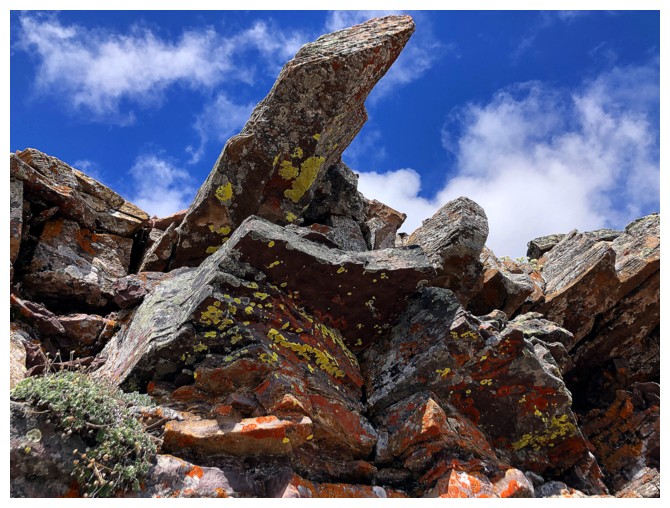
No shortage of cool rock to ogle at while going up the gully
Deja vu - this is where Dave and I eventually arrived on our awesome Bakery Peak trip
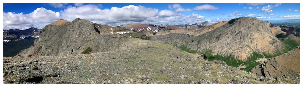
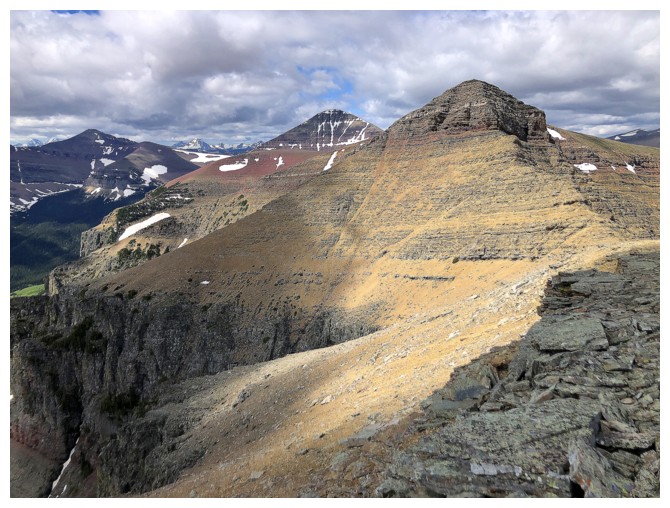
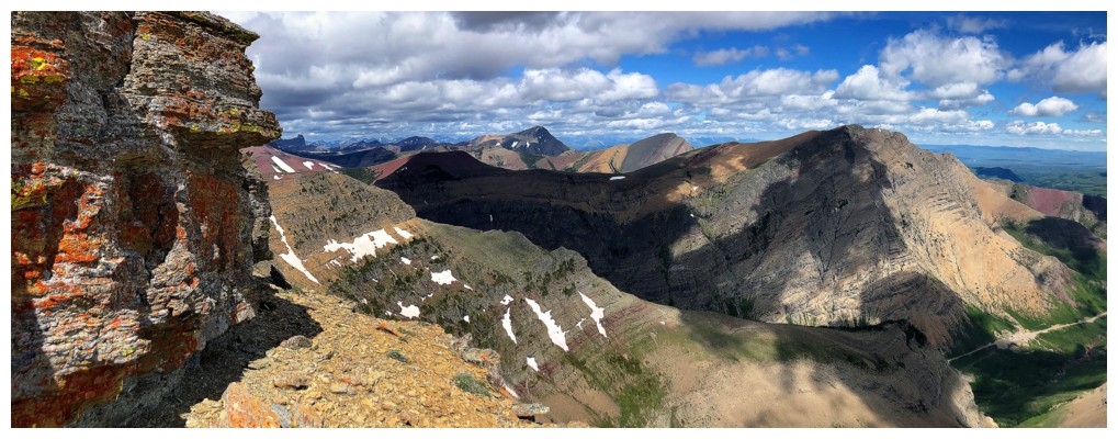
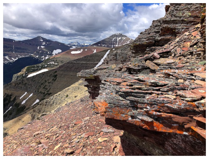
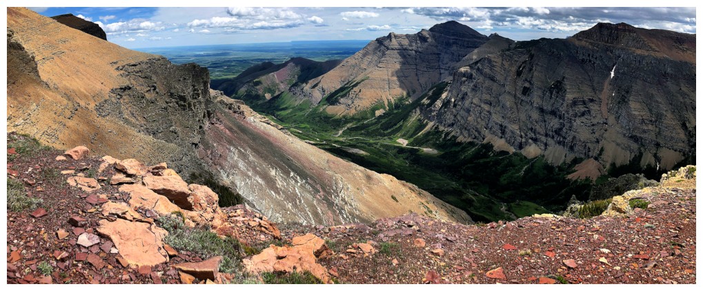
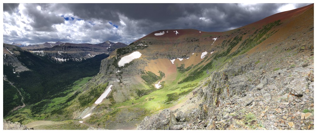
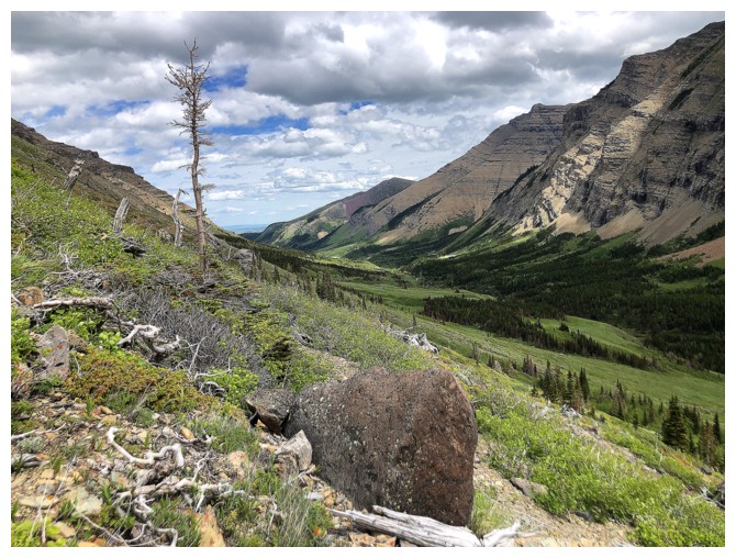
Views from the ridge are excellent and include the distinctive form of Castle Peak to the northwest

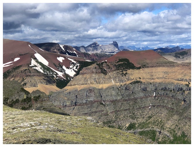
Looking east to the elusive summit at the east end of Loaf
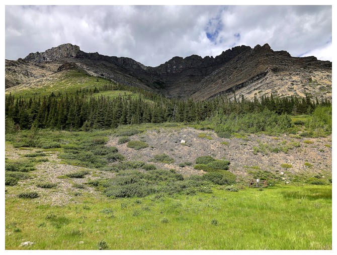
Drywood Mountain immediately north
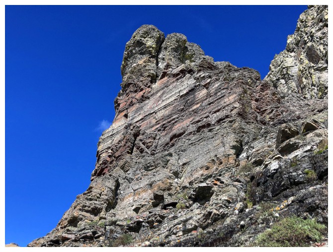
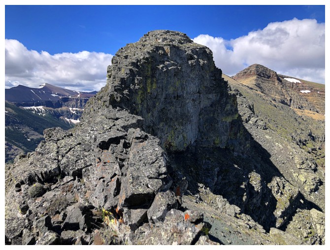
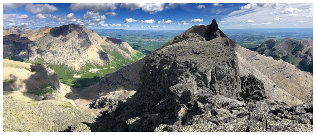
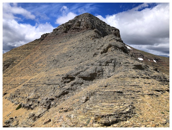
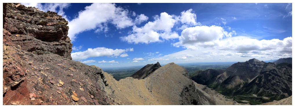
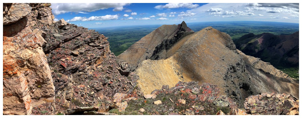
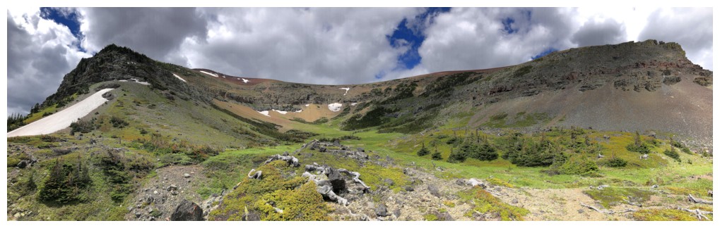
Heading west towards the crux of the trip
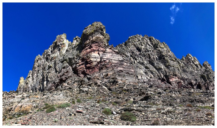
The crux in the centre and the colourful summit of Pastry at the far right
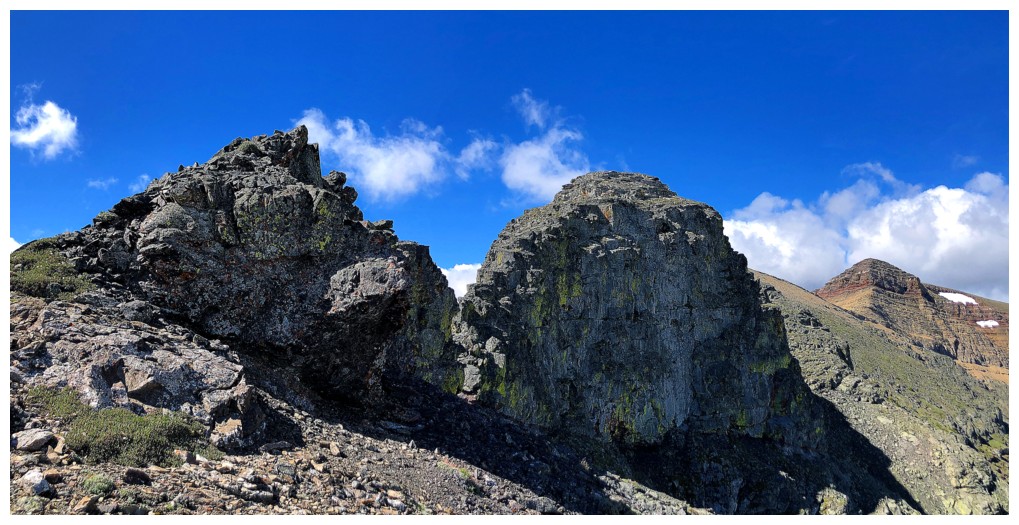
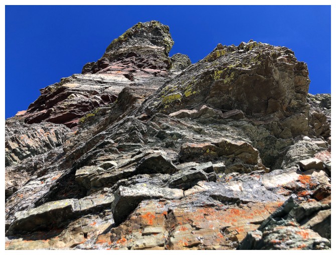
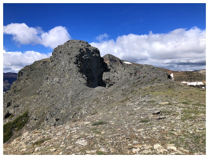
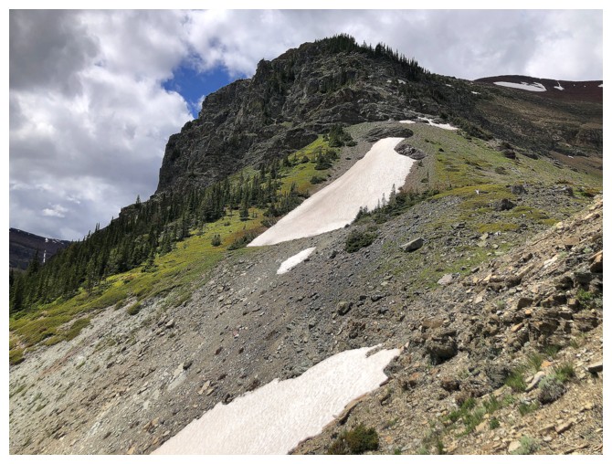
Closing in on the scary part of the trip
Started off okay but got pretty serious, pretty quickly. I backed down shortly after this.
Checking out Drywood again before I backed down
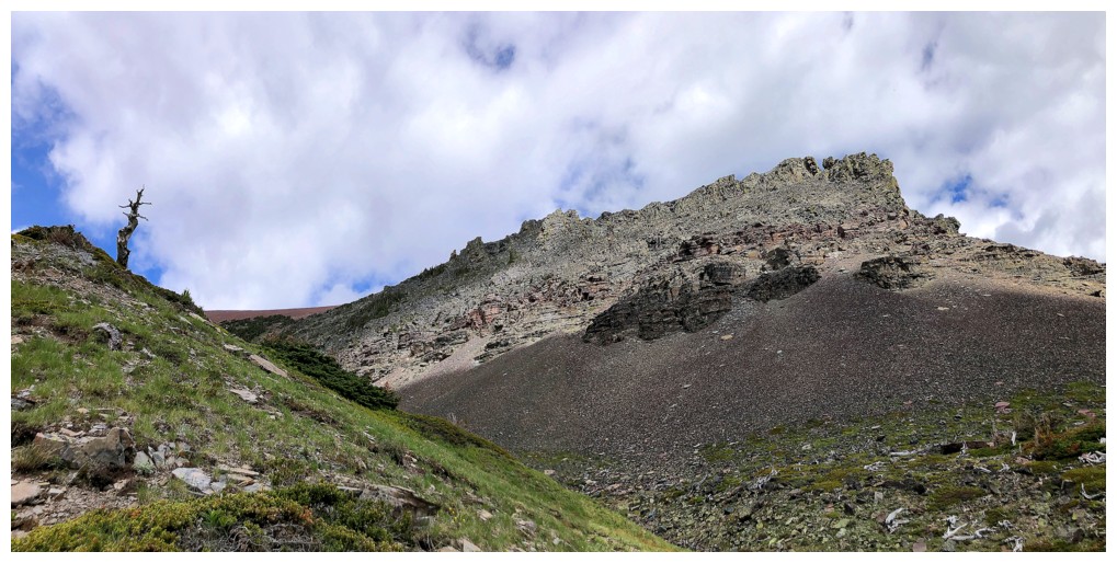
There were bypass routes on both sides of the narrow ridge - I took the left side
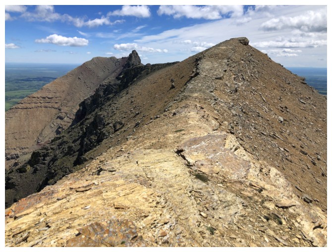
Back on the ridge
I did walk back to check out the crux from above and it appeared to be straightforward
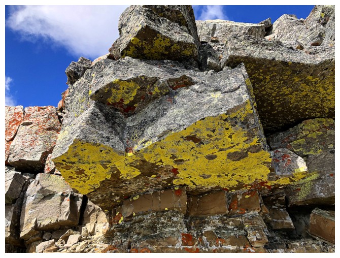
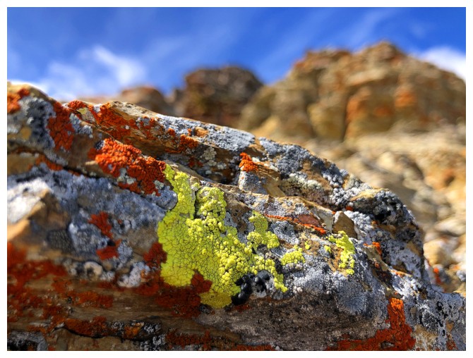
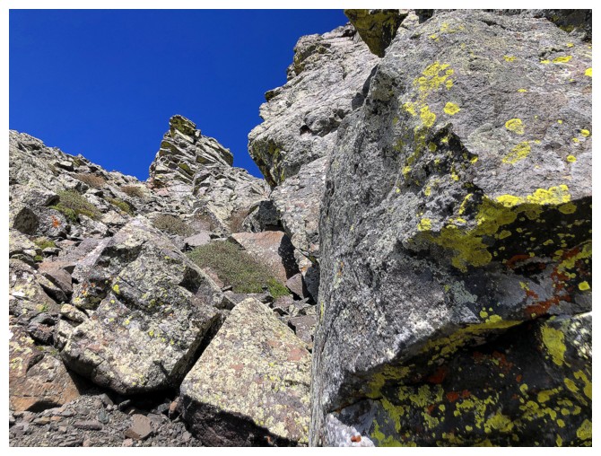
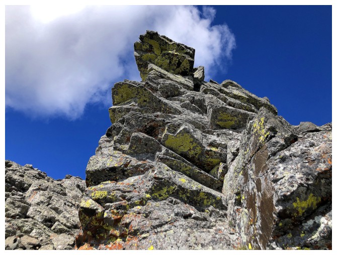
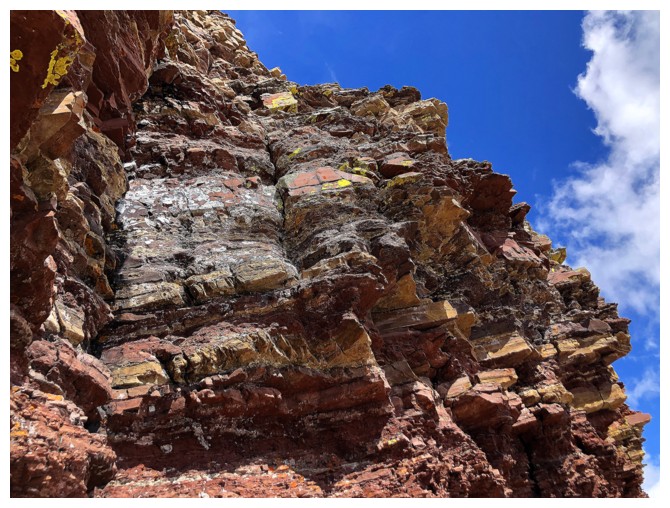
Back to checking out the cool lichen-covered rock
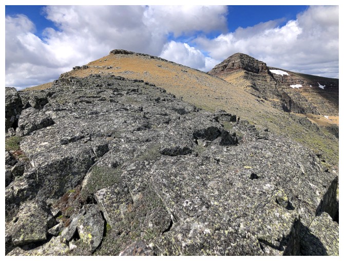
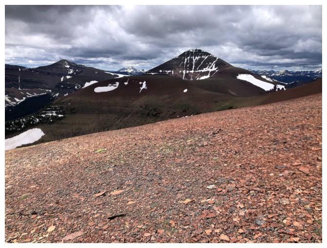
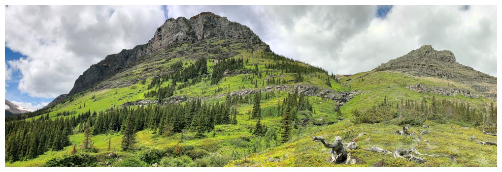
Loaf in the centre and Pastry to the right
On familiar terrain
Pleasant ridgewalking...
...followed by pleasant scrambling
Victoria Peak and Pincher Ridge are now visible to the north
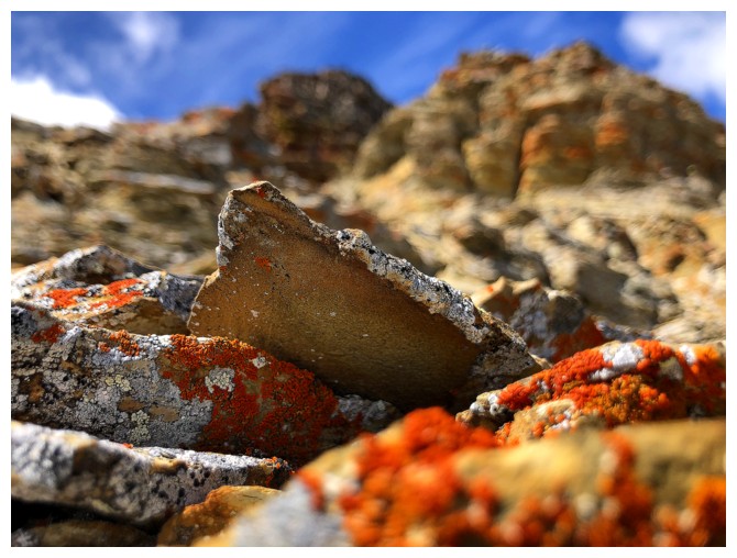
Time for close-ups of rock and lichen
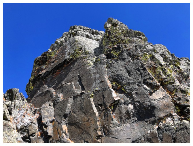
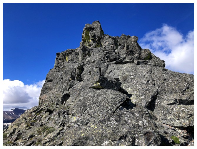
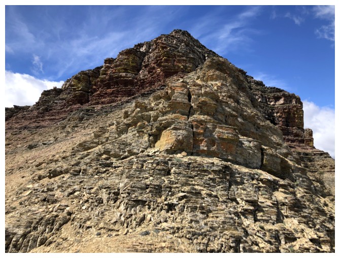
Approaching the east end of the summit block
Heading around the left side of the summit block as Dave, Brad, and I did before
Taking the same photographs as Dave, Brad, and I had before
But who wouldn't want to capture this magic again?!
Looking back to the east
Instead of taking the gully Dave, Brad, and I had ascended to the summit, I continued farther around to see more rock scenery
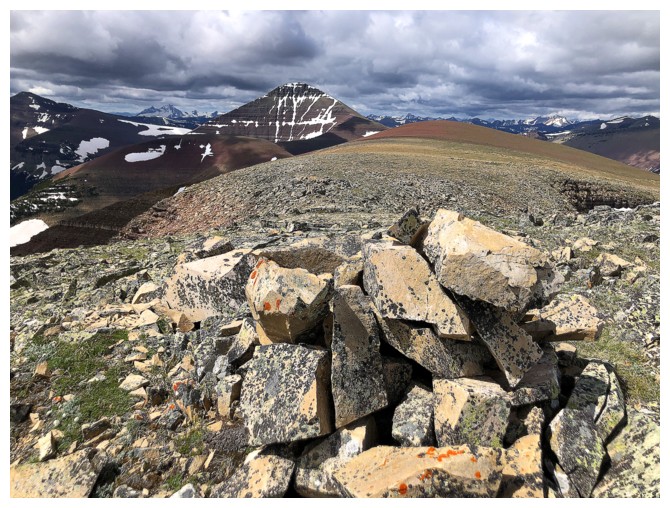
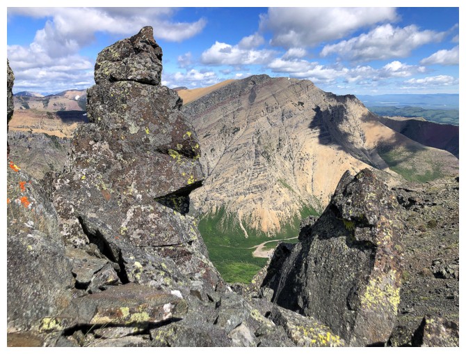
Summit of Pastry
The summit of Loaf is still some distance away and the clouds have moved in - time to call it a day
Heading down one of the south ridges. My intention was to descend to the left, but I ended up going right
The view to the left (southeast)
The view to the right (southwest)
Descending southwest
Lots of interesting terrain on the way down
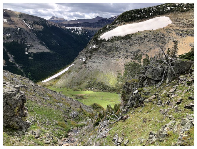
Almost down to the hanging valley
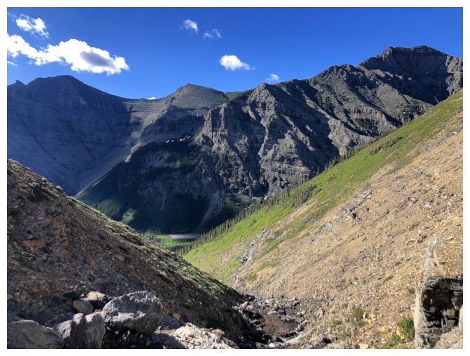
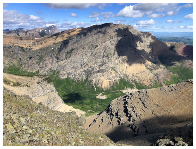
The hanging valley
Easy terrain to get back down to the trail
Still descending to the valley bottom
Looking up the route I just came down
Back at the end of the gas road and ready to coast 4 km back to the start
The End
LOG