Anderson Peak V
May 9, 2024
Mountain height: 2698 m
Elevation gain: 1100 m
Ascent time: 5:50
Descent time: 3:25
Solo scramble.
 With the Red
Rock Parkway opening up for the season, I was very motivated to complete an
ascent somewhere near or at the end of the road. In retrospect, I should have picked a shorter
objective, as a couple of weeks of mountain inactivity had rendered my physical
condition less than peak. Nevertheless, a fifth ascent of Anderson Peak was the
“mountain de jour” and off I went.
With the Red
Rock Parkway opening up for the season, I was very motivated to complete an
ascent somewhere near or at the end of the road. In retrospect, I should have picked a shorter
objective, as a couple of weeks of mountain inactivity had rendered my physical
condition less than peak. Nevertheless, a fifth ascent of Anderson Peak was the
“mountain de jour” and off I went.
I chose the
“slog” route west of the “fantastically awesome” route, primarily because I
wanted to see the waterfall scenery in that drainage. The general safer
nature of the line when snow covers the mountain was also a contributing
factor. 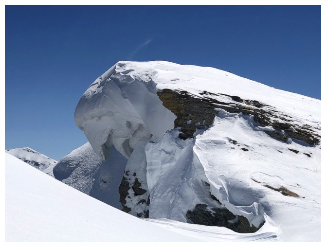 A previous ascent of this line with the wonderful Alston family in July
of 2020, featured terrific scrambling up the drainage but only because it was
almost completely dry. Hopefully I would be able to scramble alongside the
watercourse.
A previous ascent of this line with the wonderful Alston family in July
of 2020, featured terrific scrambling up the drainage but only because it was
almost completely dry. Hopefully I would be able to scramble alongside the
watercourse.
And that’s
exactly what happened. An hour approach along Blakiston Creek Trail, followed
by a very scenic jaunt up the water-filled drainage – mission accomplished. All
that remained was a foreshortened but straightforward steep hike up to the
ridge and then a very easy scramble to the summit of Anderson. At least that’s
what I convinced myself would happen!
What actually
occurred was an arduous, soul-sucking, trail-breaking slog, in seemingly desert
hot conditions, that completely wiped me out. 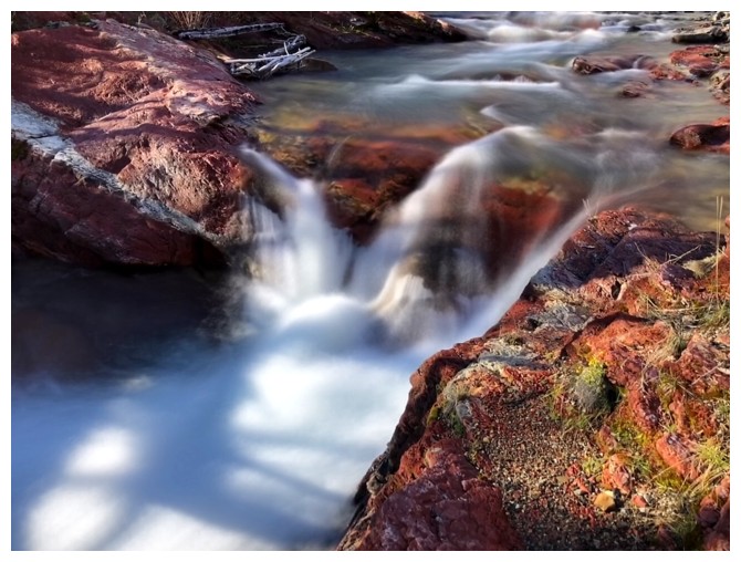 The snow was never deep, but lifting
your feet out of any depth of snow still requires more energy than ascending
the same terrain without snow. It took me almost 3 full hours to get to the ridge from the end of the
waterfalls. And even slathered in sunscreen so thick I looked a clown’s worst
nightmare there was no hiding from the Sun reflecting off the snow.
The snow was never deep, but lifting
your feet out of any depth of snow still requires more energy than ascending
the same terrain without snow. It took me almost 3 full hours to get to the ridge from the end of the
waterfalls. And even slathered in sunscreen so thick I looked a clown’s worst
nightmare there was no hiding from the Sun reflecting off the snow.
Upon reaching
Anderson’s east ridge I opted to side-slope to the southwest ridge connecting
Anderson to Lost Mountain and then tackle the summit from there. Taking a
direct route to the top looked pretty sketchy with all the new snow. A lengthy
summit break ensued, not only to enjoy the amazing snowy panorama, but also to recover from the grueling 6-hour ascent.
As much as I
would have loved to complete another ascent of nearby Lost Mountain (it’s a
mere 50 vertical metres from the Anderson/Lost col), I was in no physical condition
to do so. Returning the same way I came up would have to do. And upon reaching
the parking lot, I’m very glad that decision was made. Utterly depleted would
best describe my state at that point.
Loved the water
scenery, loved the views, loved the clear skies, loved being back at the end of
the Red Rock Parkway, but I’ll likely never repeat this route with those
conditions – much better to wait for snow-free slopes and go up the “fantastically
awesome” route!
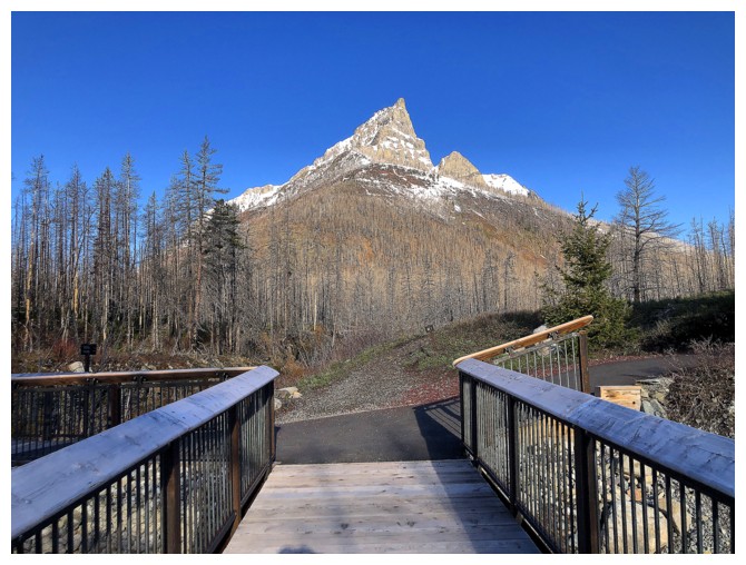
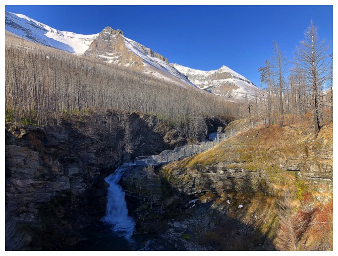
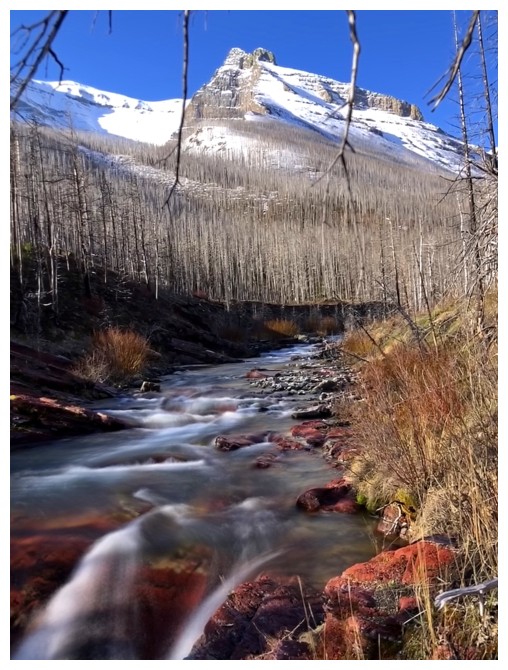
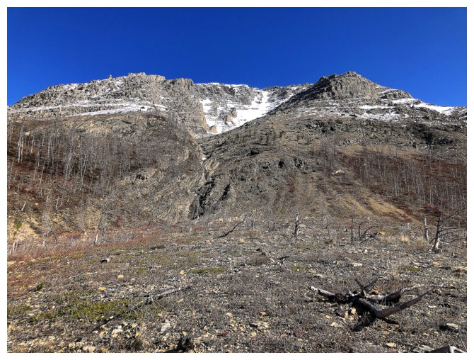
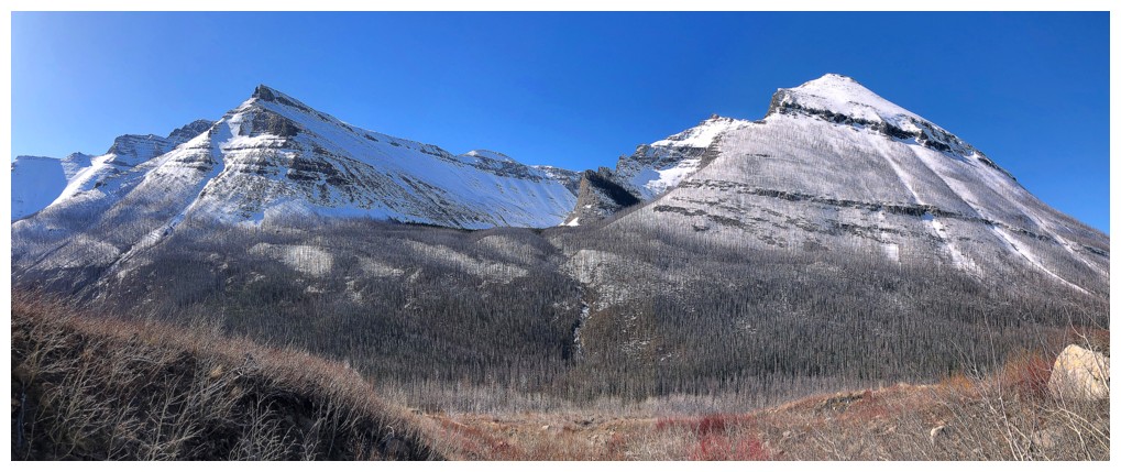
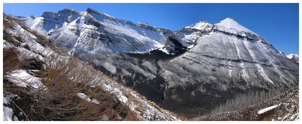
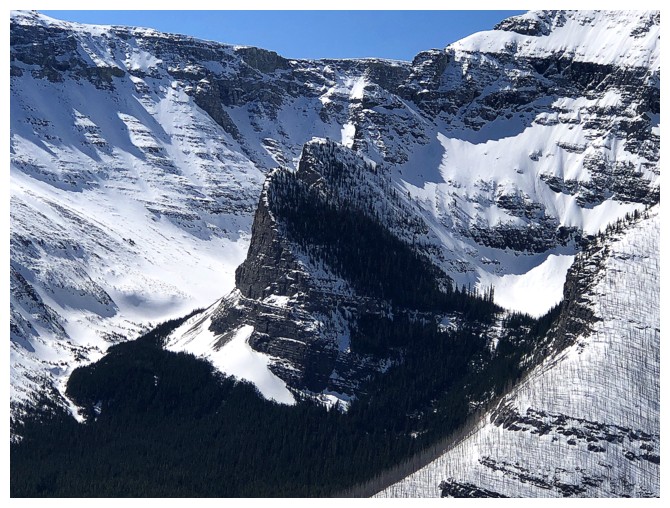
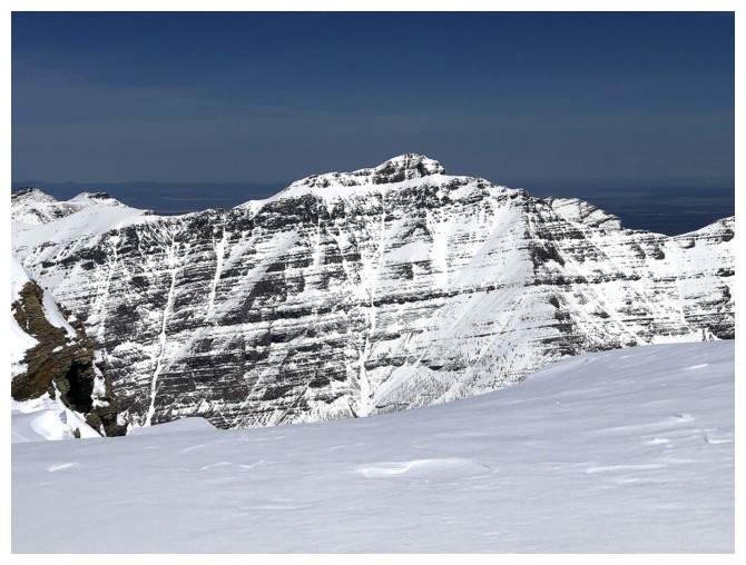
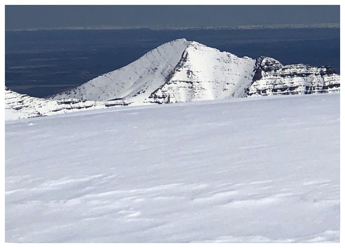
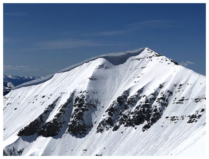
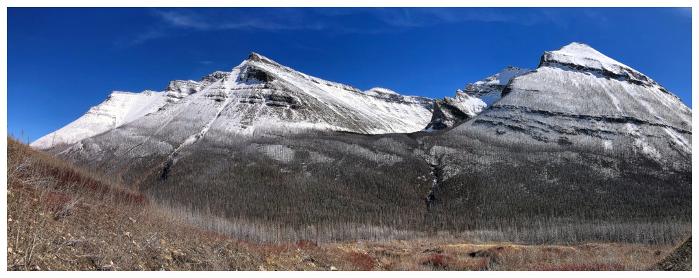
The striking east side of Anderson Peak from near the bridge that crosses Red Rock Canyon
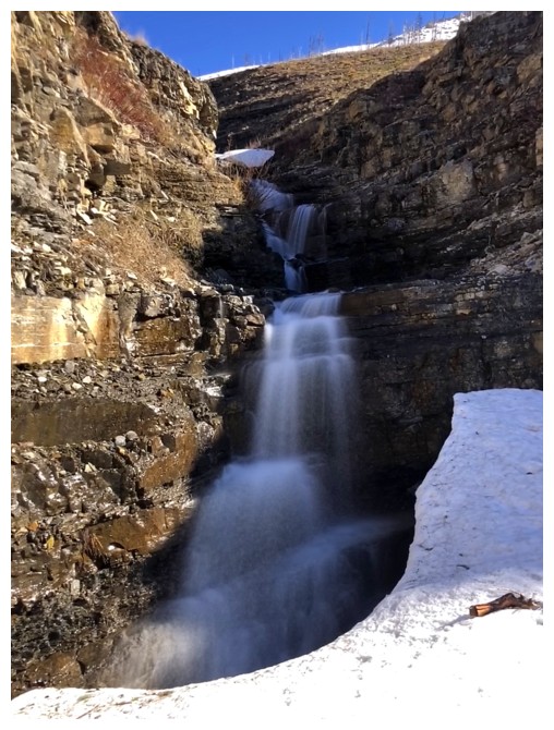
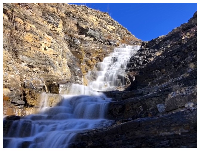
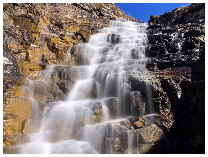
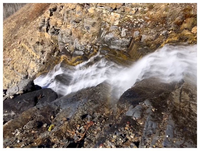
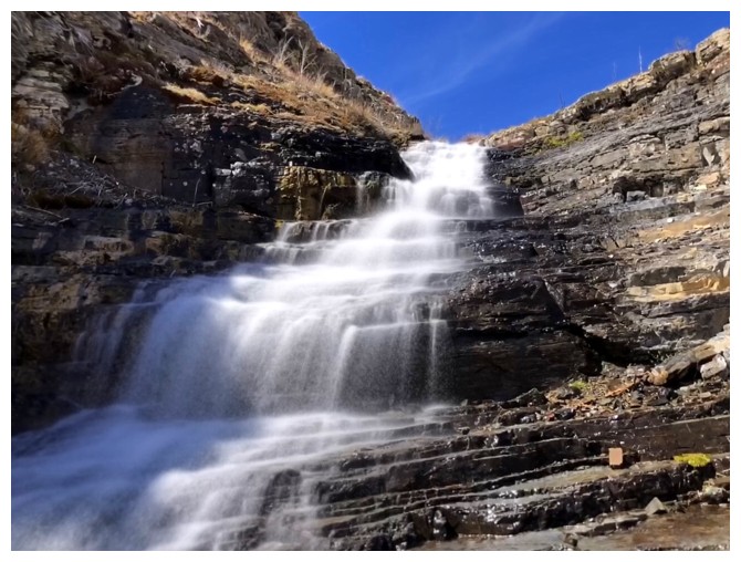
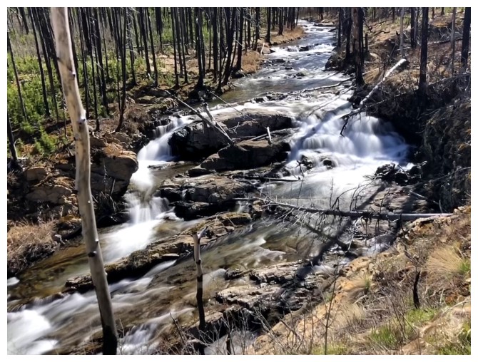
Mandatory stop at Blakiston Falls
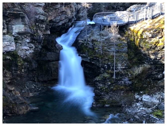
Close-up
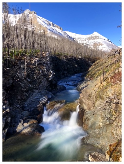
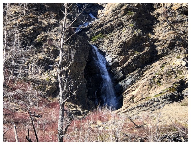
A smaller fall
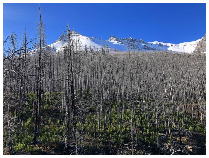
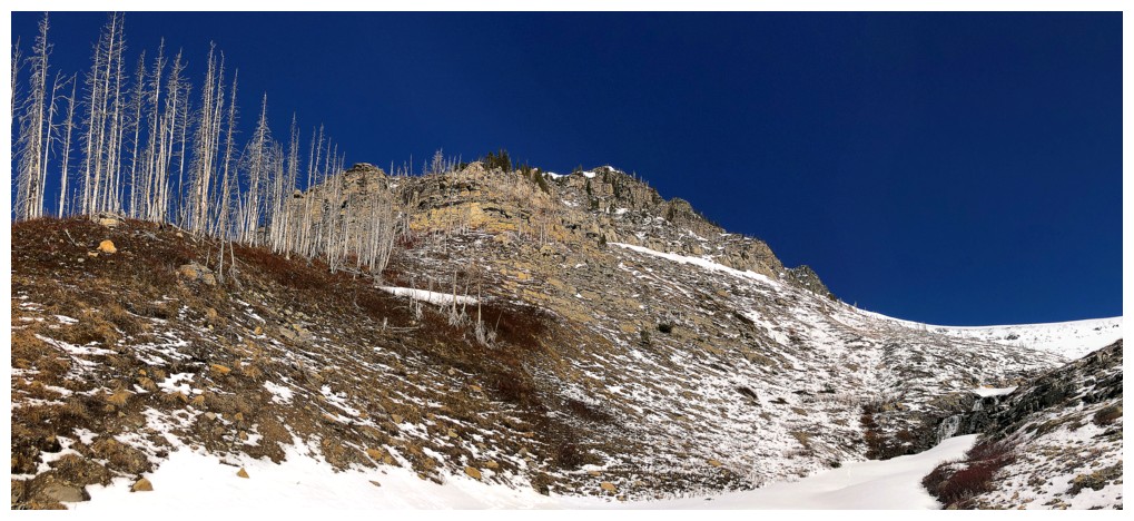
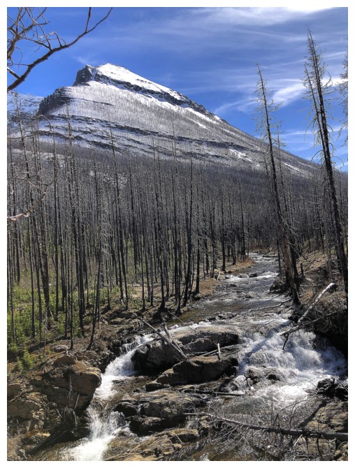
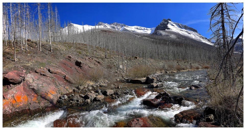
The burnt remains of the 2017 Kenow fire and tons of new growth
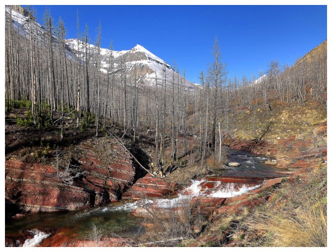
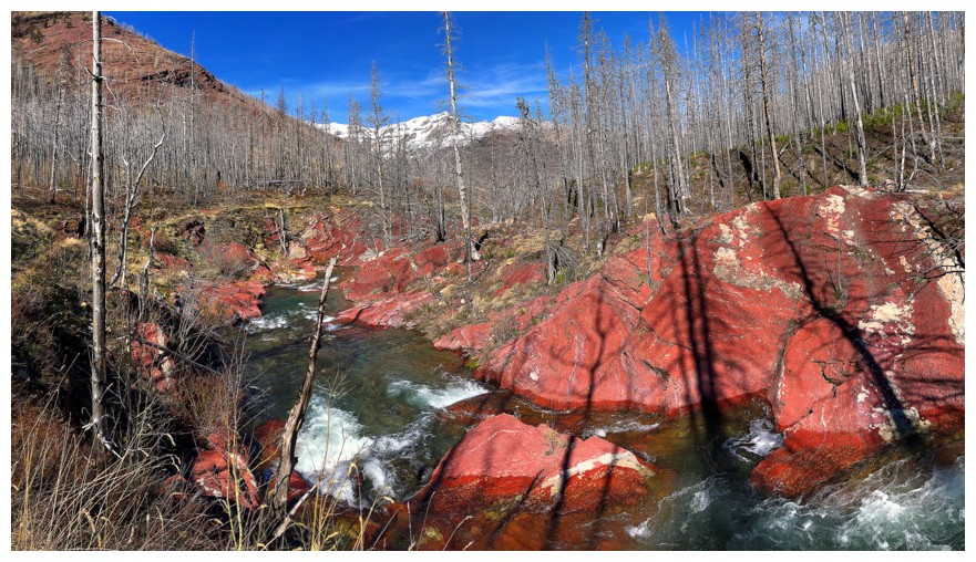
Arriving at the best part of Blakiston Creek Trail - the red argillite section
Love it!
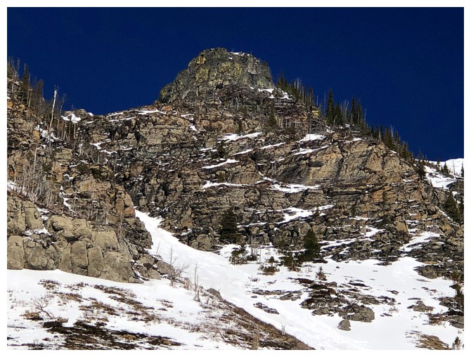
One of the many outliers of the famed Mount Blakiston Horseshoe route
Passing the first route we tried (and failed) up Anderson
Passing the third route we attempted (and succeeded) - this is the fantastically awesome route!
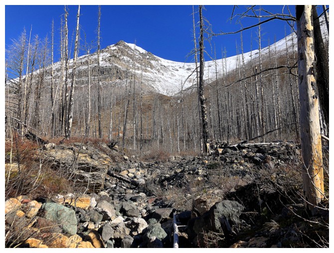
Leaving Blakiston Creek Trail and heading up the drainage between Anderson and Lost - same as route as Anderson Peak IV
Lone Mountain - I'd like another run up that mountain, but with an
approach on bike via the Snowshoe Trail, instead of hiking the long
Blakiston Creek Trail
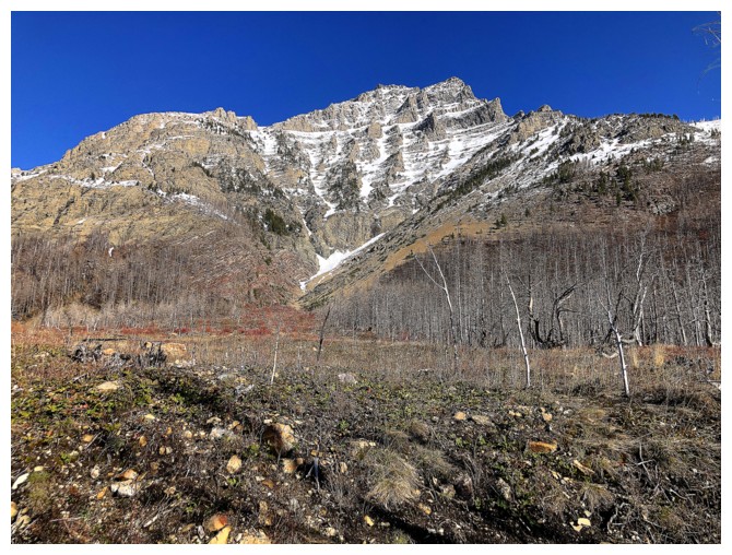
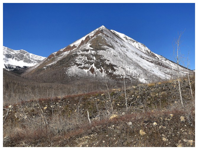
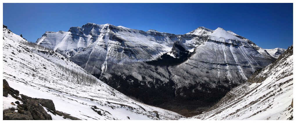
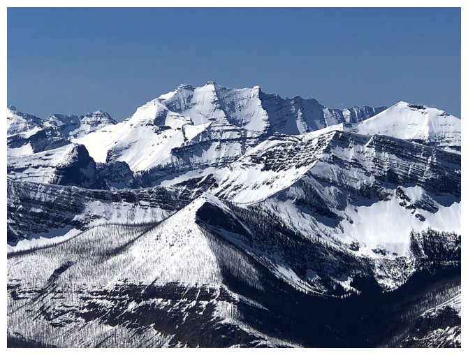
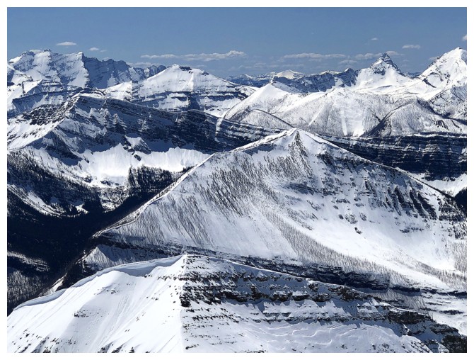
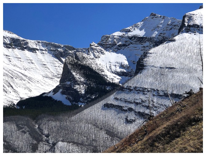
Lost Mountain (left) and the south side of Anderson
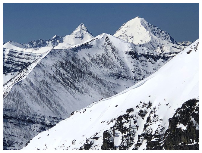
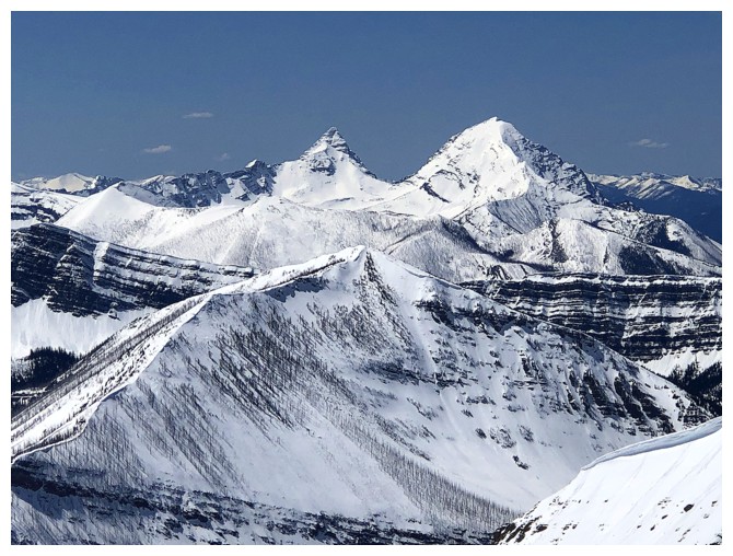
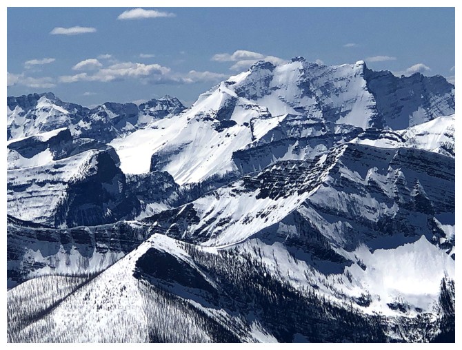
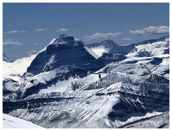
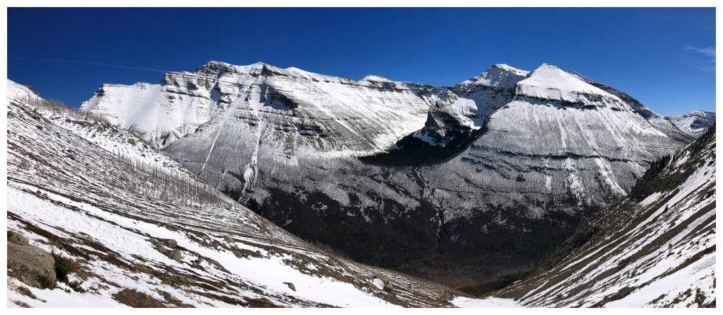
The Blakiston massif to the south is going to get lots of attention
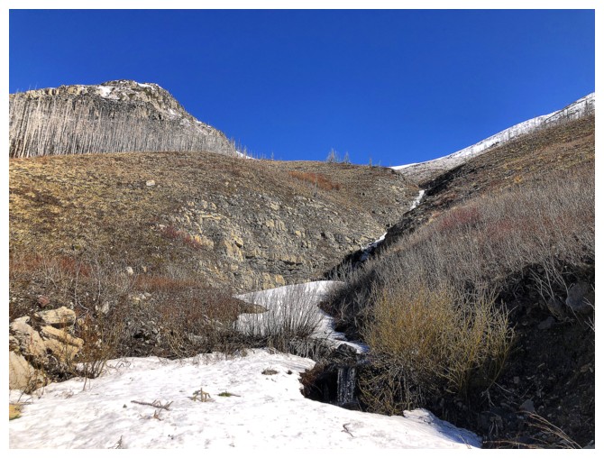
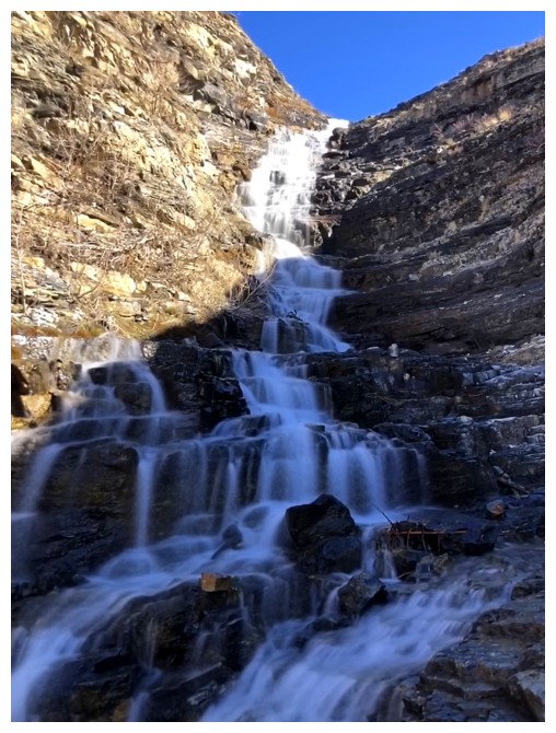
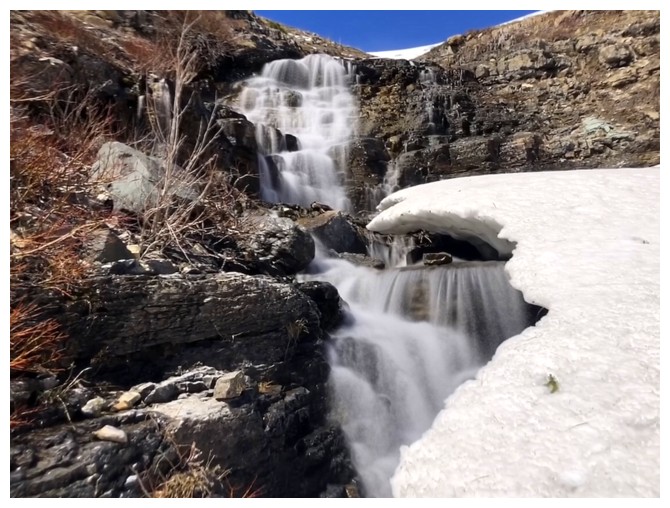
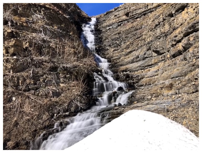
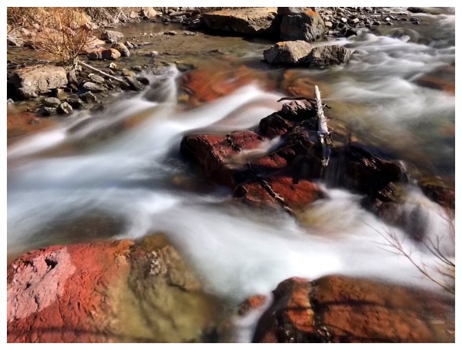
The remaining snow in the drainage made travel easier at times
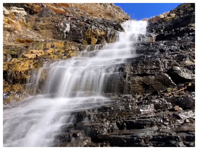
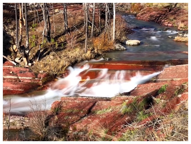
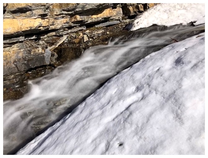
The first of many beautiful cascades
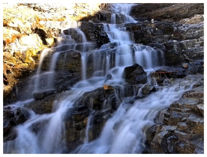
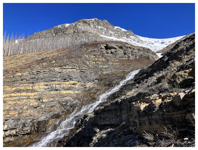
Following the drainage right by the water was not always possible
But there were always routes back to it
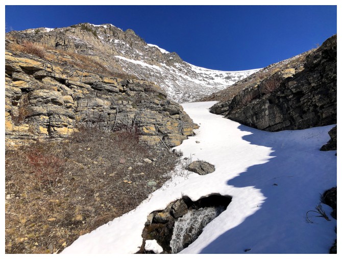
Snow reappears. Doing this ascent in late May/early June would probably provide the most amount of water scenery.
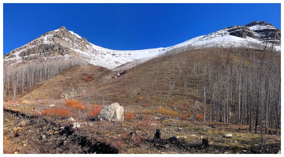
Burned-out forest at the left and stunning blue skies above Lost Mountain
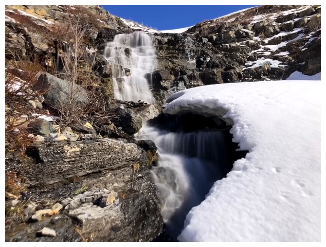
Brief return of the waterfalls
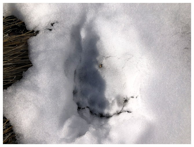
Bear footprint
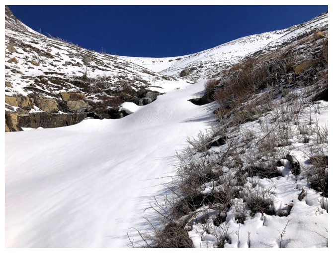
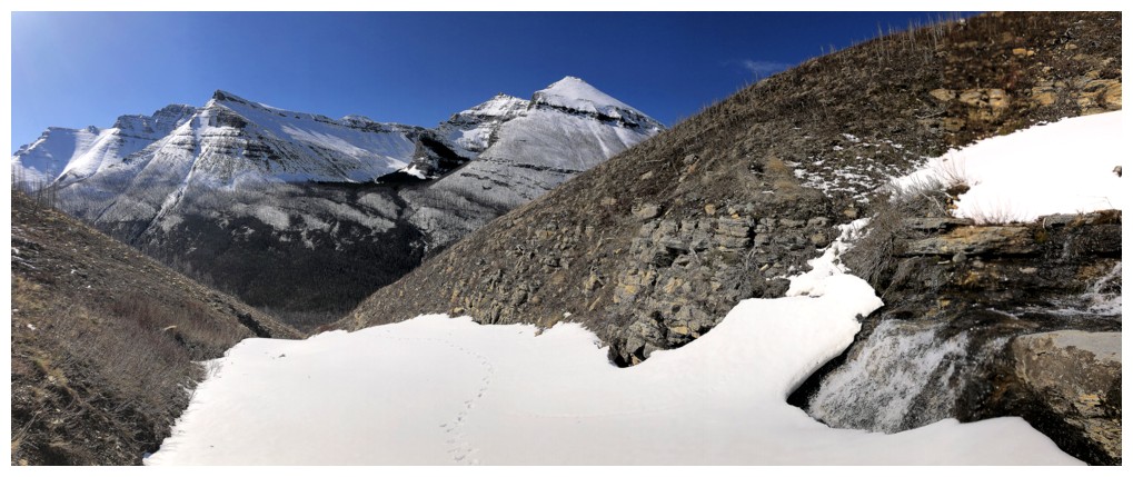
Back to the snow - for the remainder of the ascent this time
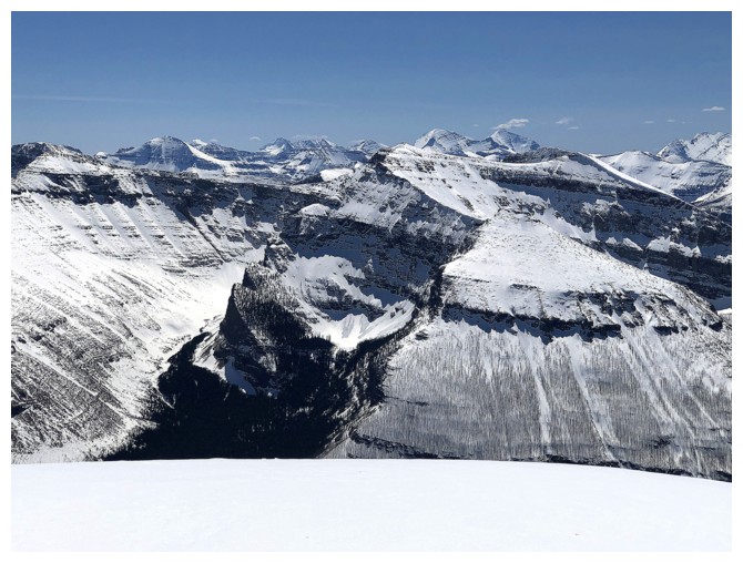
The striking and colourful southeast side of Lost
That Blakiston massif again
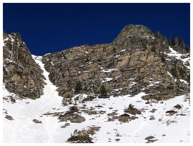
I did (very) briefly consider attempting to ascend the snow couloir at the left, but (very) quickly came to my senses!
The avalanche debris in the adjacent couloir definitely contributed to my apprehension
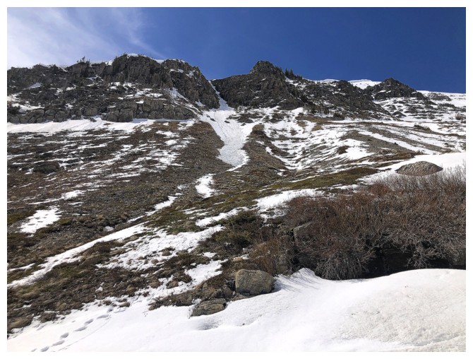
My route up to the ridge looks considerably easier, but it is steeper than it appears and deathly foreshortened!
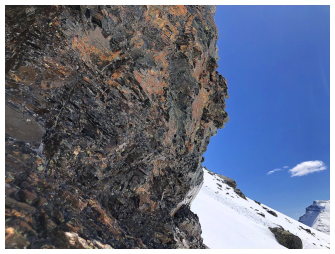
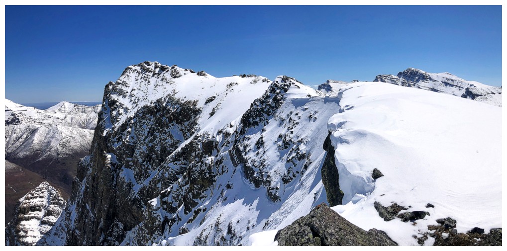
A very interesting fin of rock on the north side of Blakiston
Zoomed-out view with that fin
Lost and that deep blue sky
The view to the southwest opens up significantly once some elevation is gained
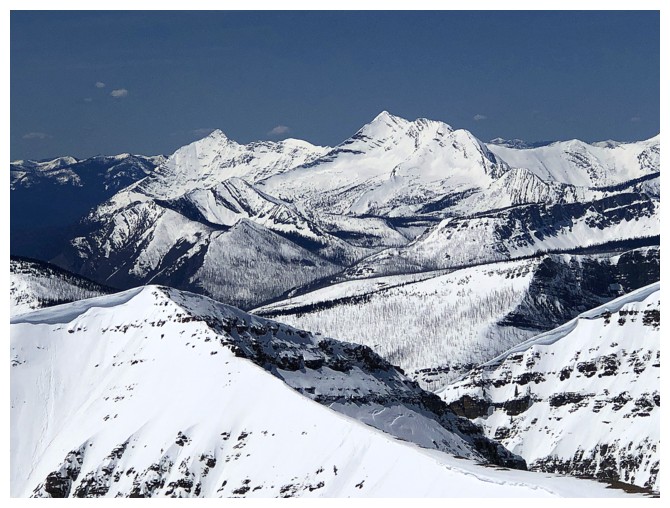
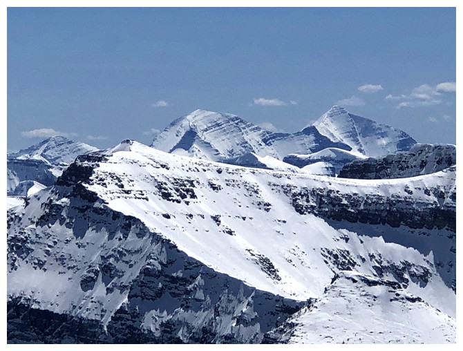
Kind Edward and Starvation peaks always look cool from the northeast side. Lone Mountain in front of them.
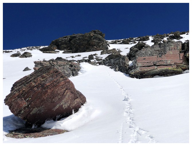
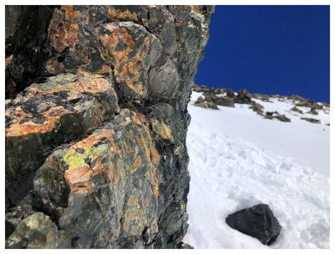
Burgundy argillite encounter - thank the Lord! - I need a breather.
Hiding behind an outcrop of rock before ascending a short but very steep slope behind it
Almost at the ridge
View to the west
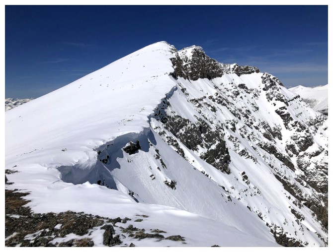
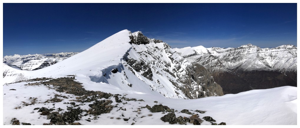
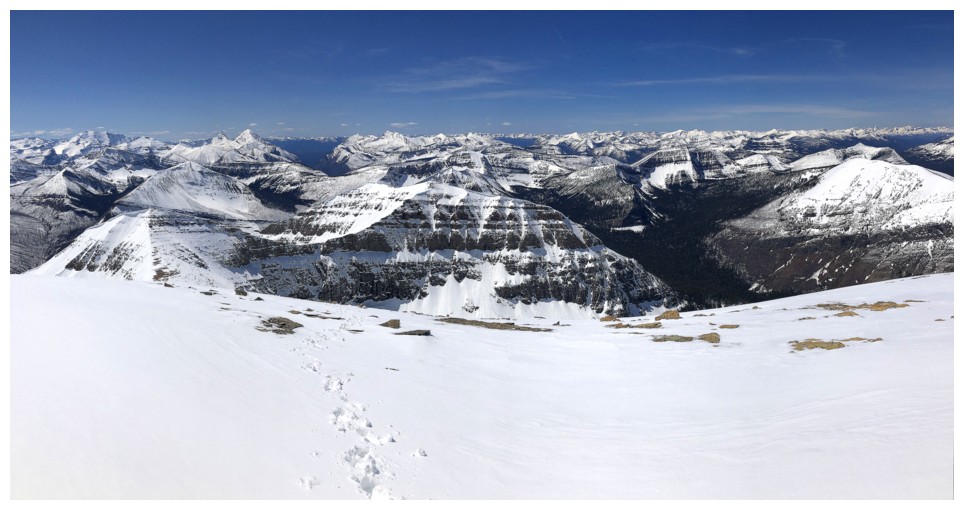
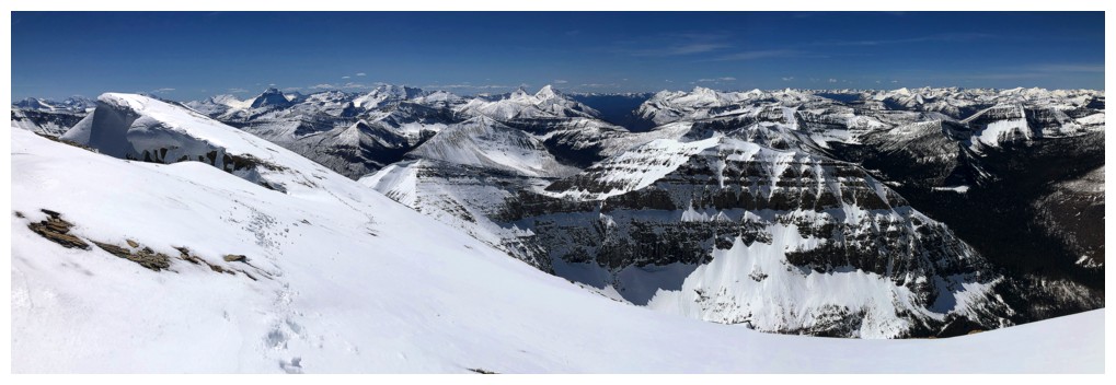
Finally on Anderson's east ridge, after several hours of grueling travel
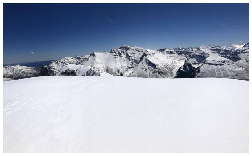
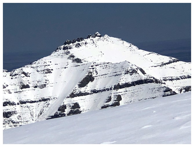
East summit at the right and true summit at the left. The true summit is considerably higher than the east summit.
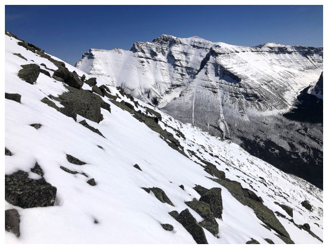
The wildly steep east face of Anderson
King Edward and Starvation again. Lone Mountain looks much smaller now.
I would have loved to have hiked over to the east summit, but my energy levels were already depleted
No Waterton ascent is complete without a photo of Long Knife Peak
Miskwasini and Kenow peaks
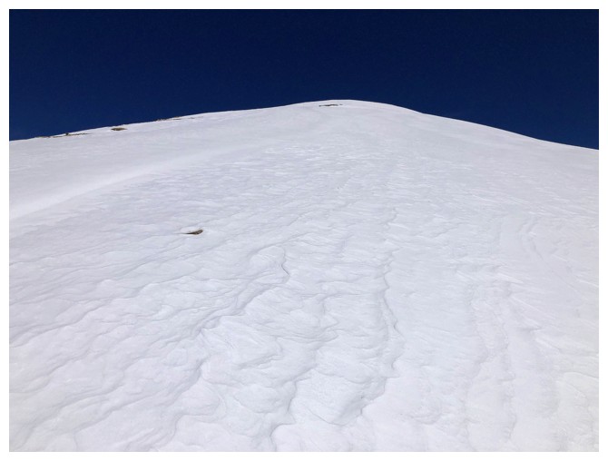
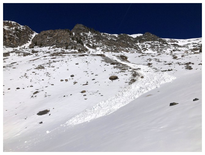
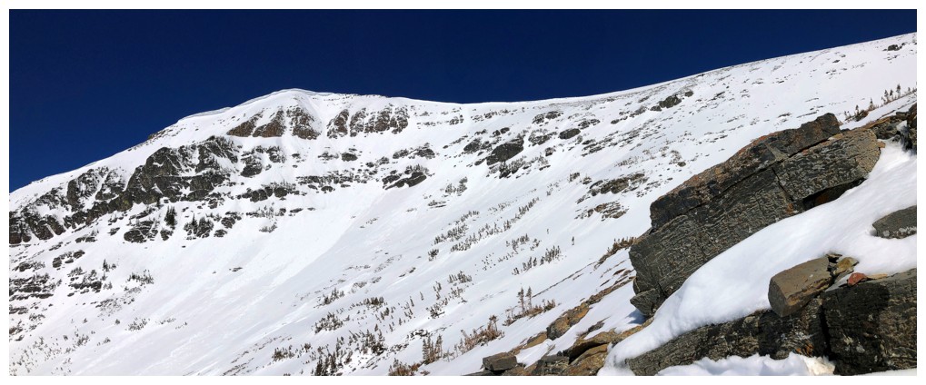
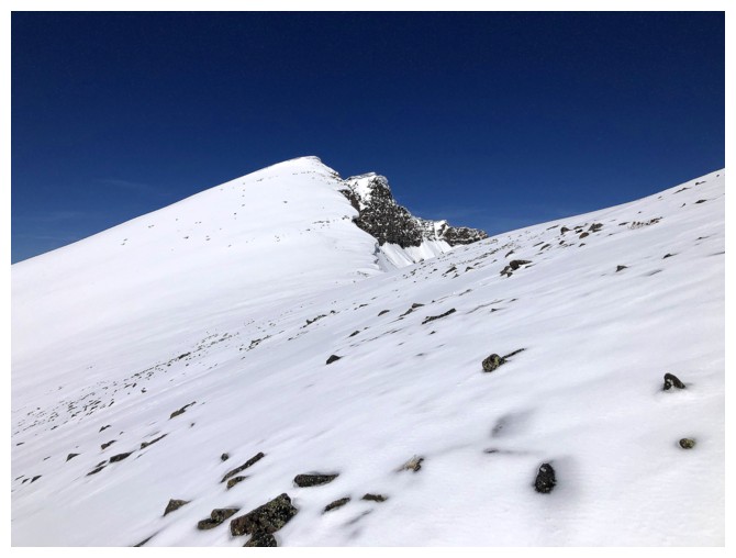
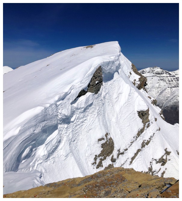
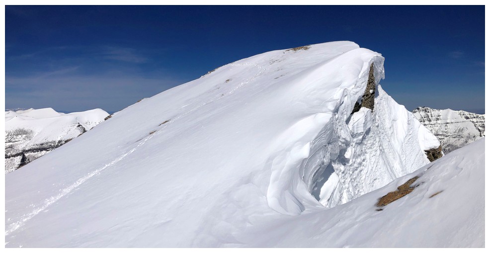
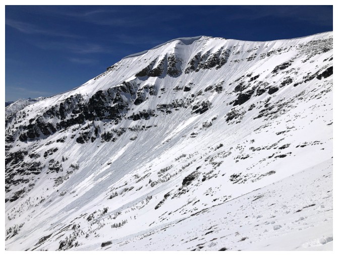
Looking up to the summit. It may look innocuous, but there was a huge
build-up of snow with serious avalanche concerns near the top.
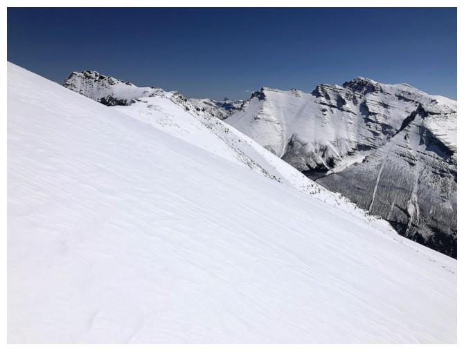
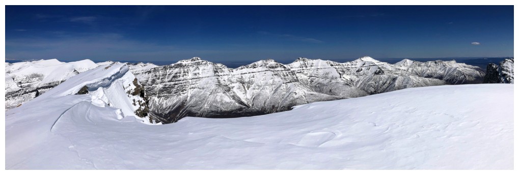
The slope I traversed to get over to the southwest ridge of Anderson
On the southwest ridge, looking southwest
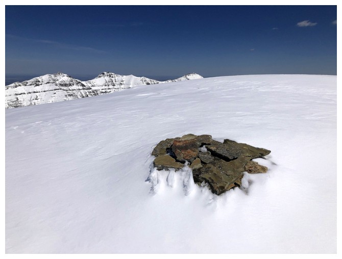
The summit cairn
Mount Glendowan
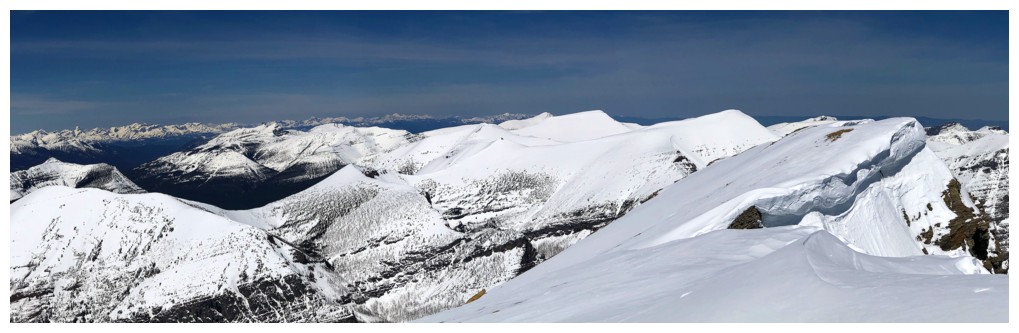
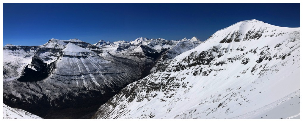
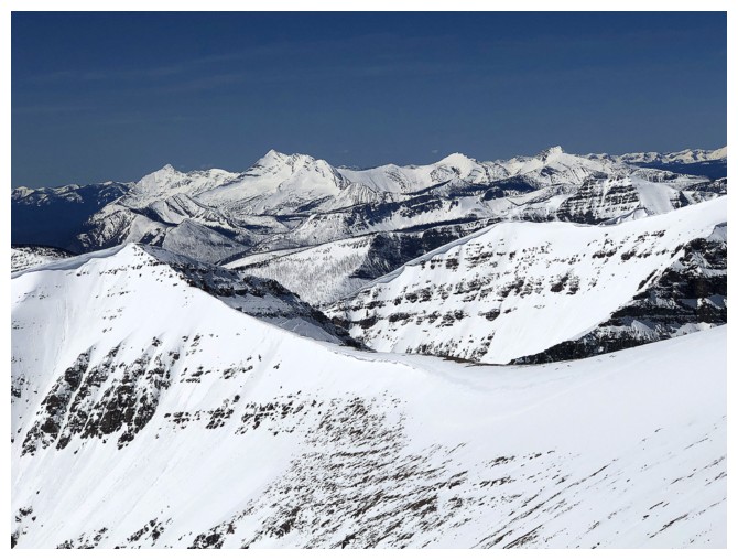
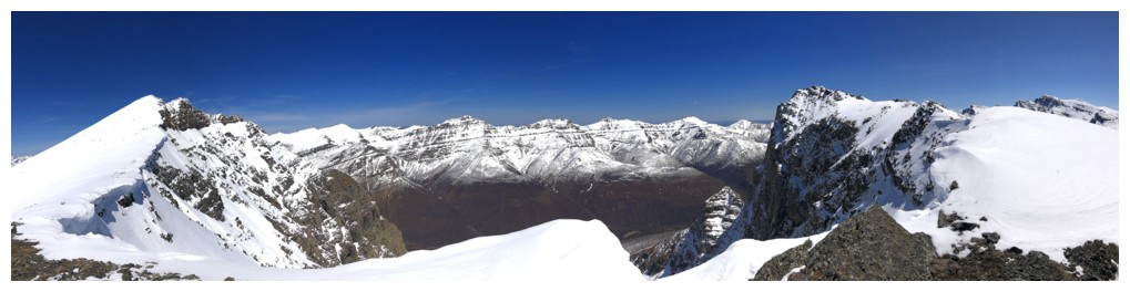
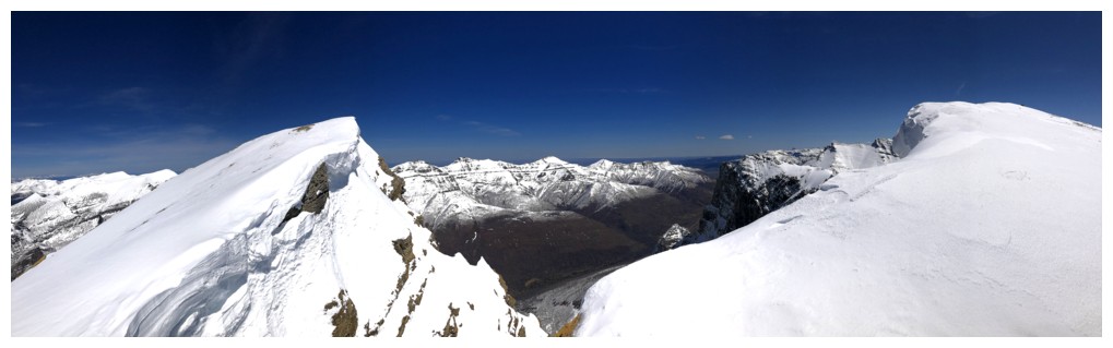
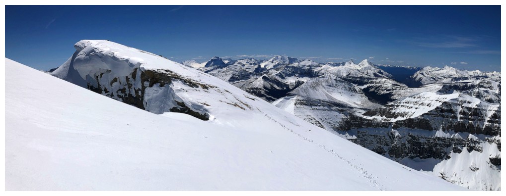
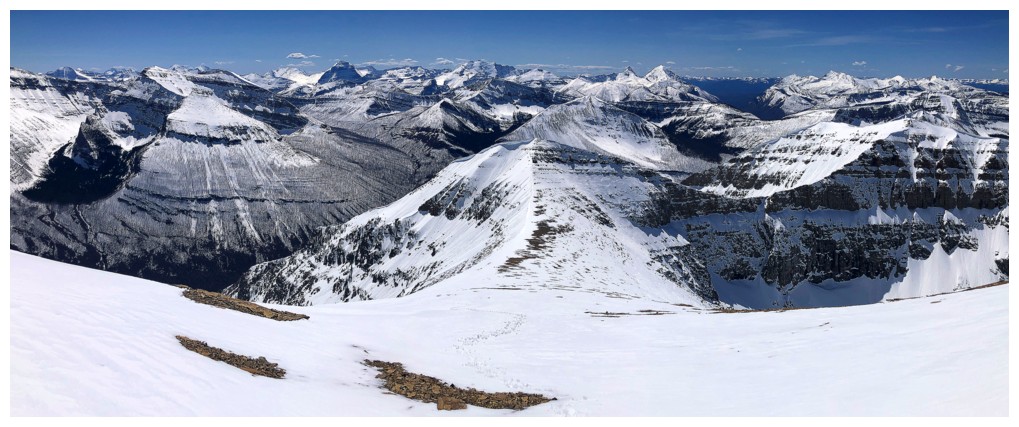
Summit view to the north
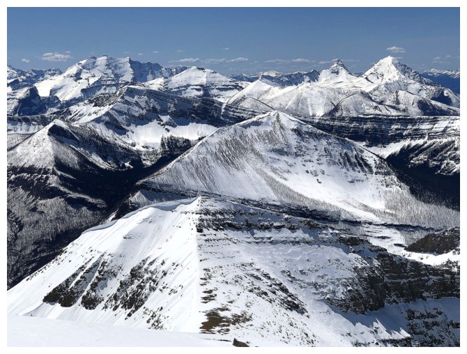
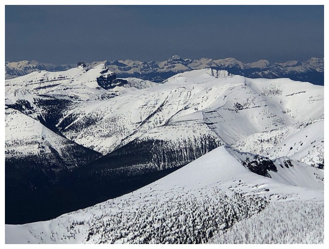
Southwest view
South
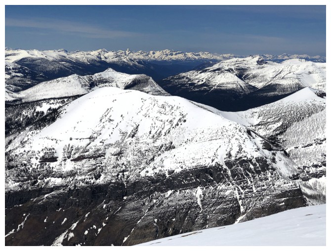
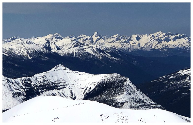
Avion Ridge sits immediately northwest of Anderson
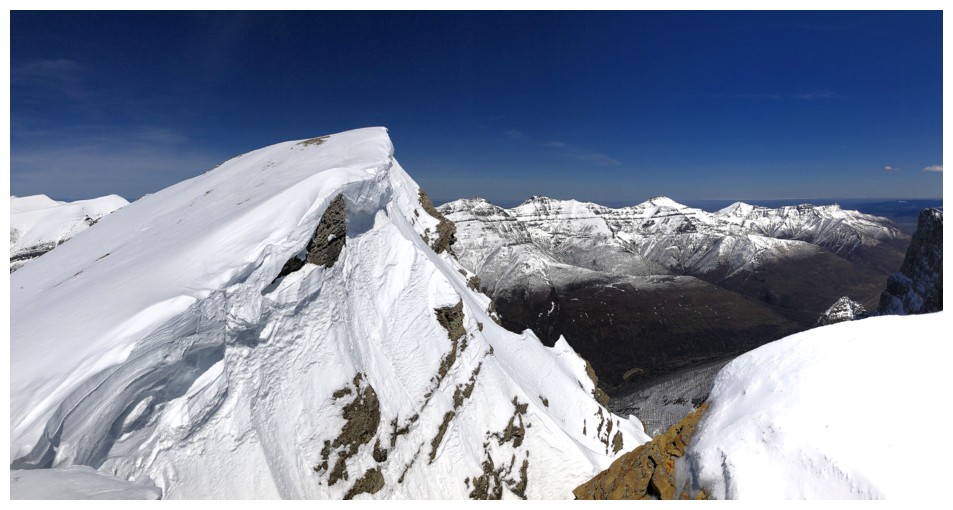
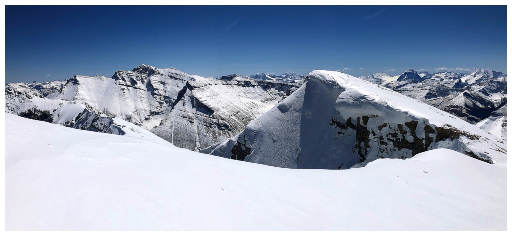
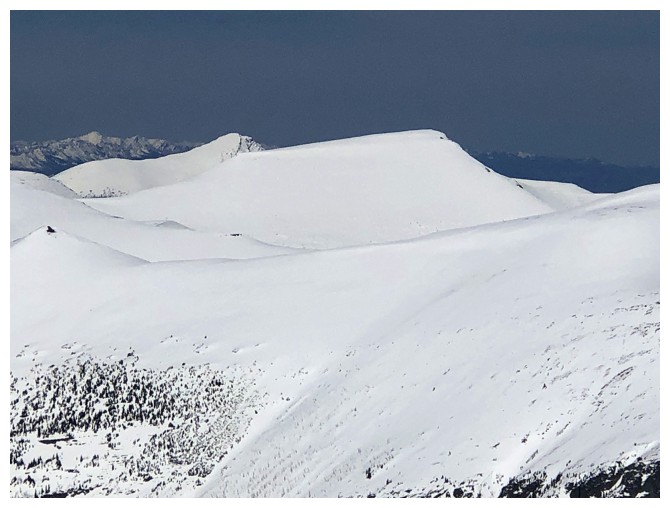
The slightly lower summit to the north
West
North
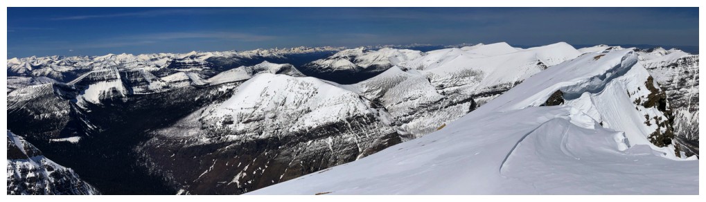
Northwest
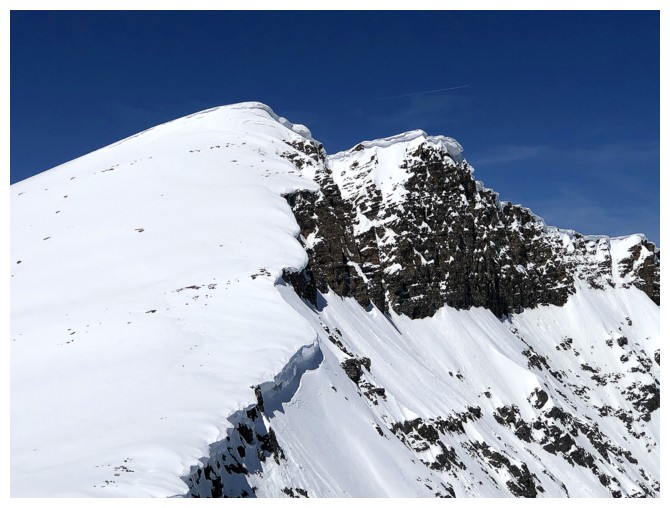
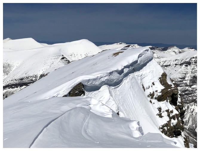
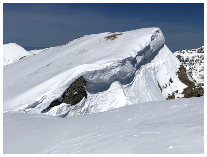
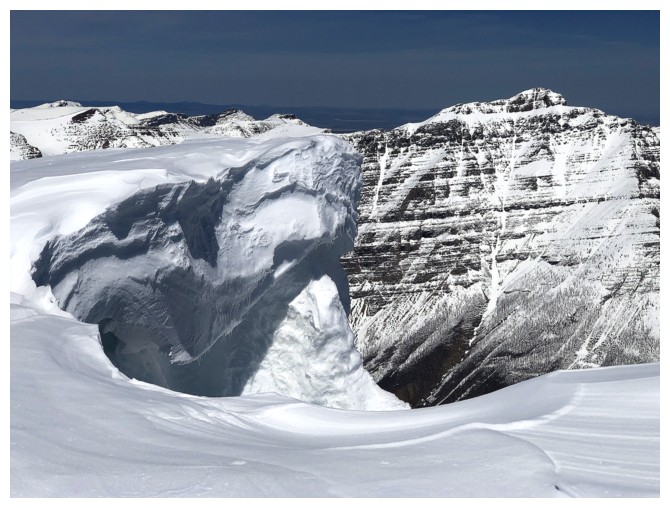
The huge cornice at the summit prevented me from seeing some of the view to the south
Could get enough of the interesting view to the southwest
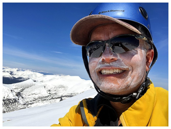
Apparently I was pretty serious about not getting too much sun exposure
A visit to the north summit was irresistible, even though I was exhausted at this point
Both summits
One of the few spots I could get relatively close to the edge
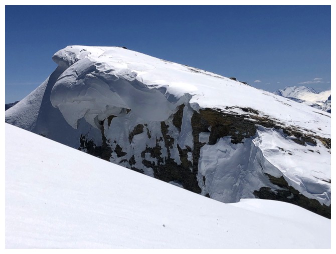
The cornice at the summit
Same as above, with more of the view
As close to the top of the north summit as I could get
So much snow!
Heading back
The almost flat summit of Loaf Mountain
Castle Peak and Windsor Mountain at the left and lots of snowy ridges
Peaks of the Flathead Range, with Mount Darrah in the centre
Loved all ridges and peaks north of Long Knife Peak
Mount Kinnerly in Montana
Looking back to the north summit and my circuitous route to avoid the cornices
Mounts Carter and Rainbow (GNP)
Mount Peabody (GNP)

Chief Mountain
Rogan Peak looks very different from this angle
Dungarvan
Descending
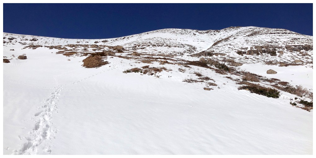
Typical grade of the main ascent slope
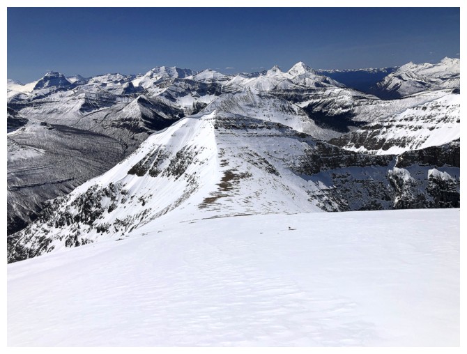
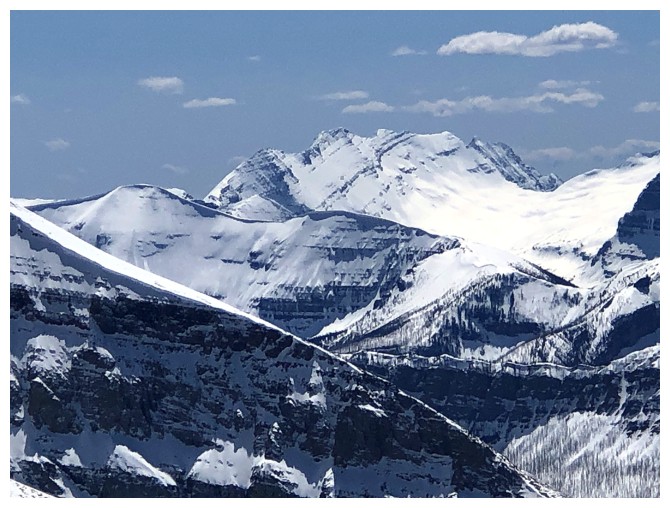
Lost Mountain
Back to that colourful rock to hide behind
The east side of Lost has seen some avalanche activity in the time it took me to go up and down Anderson
A fair amount of snow has melted from the lower slopes during the day
Looking back up my route - again, steep and foreshortened
 Similar photos of the same area to show how much snow melted during the day: left on descent, right on ascent
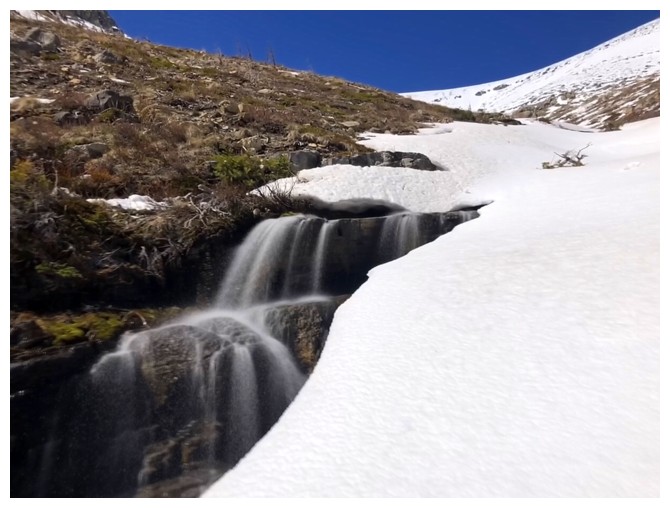
I get another round of cascade/waterfalls views
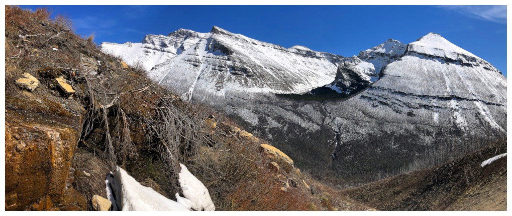
And more great views of the Blakiston massif
That fin again
Almost back to the main trail
Back to Blakiston Creek
The waterfall of the second drainage - it was dry when I went past it in the morning
Red argillite time again
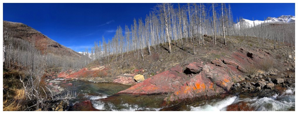
The last of it
The End
LOG