Barnes Peak
July 24, 2020
Mountain height: 2421 m
Elevation gain: 1080
m
Round-trip time: 6:55
Scrambling with Dave.
I’m not sure what my expectations for Barnes
Peak were as we drove to the start of the trip, 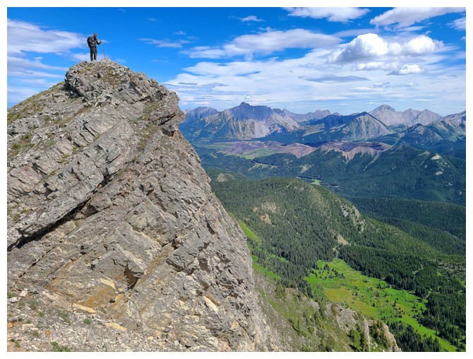 but it’s safe to say I wasn’t
expecting a Crypt Peak- or Molarstone Mountain- or Mount Fisher- or Mount
Murchison- or Mount Wilbur-type experience. And neither Dave nor I got that.
What we did get was 7 hours of incredibly rewarding exploration on a wonderful
peak, with terrific mountain- and lake- views, an awesome ridgewalk, and a
fantastic alternate descent route – perhaps much more like the
aforementioned mountains than I thought!!
but it’s safe to say I wasn’t
expecting a Crypt Peak- or Molarstone Mountain- or Mount Fisher- or Mount
Murchison- or Mount Wilbur-type experience. And neither Dave nor I got that.
What we did get was 7 hours of incredibly rewarding exploration on a wonderful
peak, with terrific mountain- and lake- views, an awesome ridgewalk, and a
fantastic alternate descent route – perhaps much more like the
aforementioned mountains than I thought!!
Dave picked this relatively unknown objective
(the highest point of Limestone Ridge), 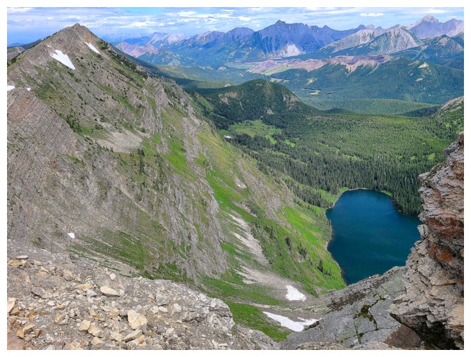 west of Mount Darrah and Centre
Mountain in the Flathead Range. He had also drawn up an excellent potential line
up the mountain, with the possible option of completing a loop route via Barnes
Lake. The route worked like a charm.
west of Mount Darrah and Centre
Mountain in the Flathead Range. He had also drawn up an excellent potential line
up the mountain, with the possible option of completing a loop route via Barnes
Lake. The route worked like a charm.
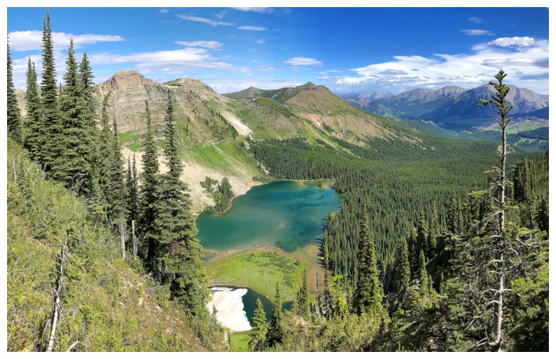
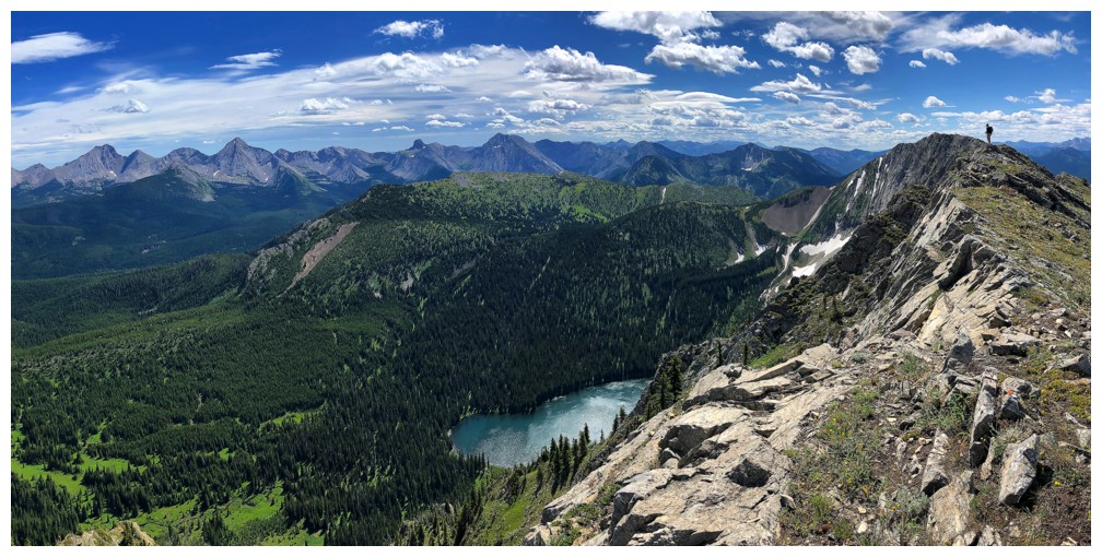
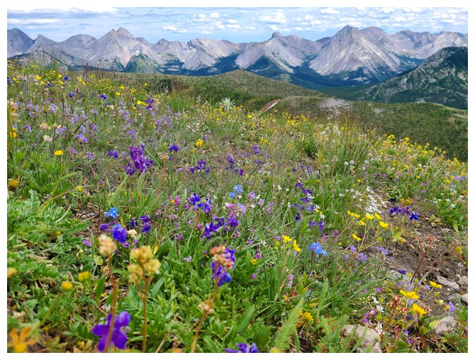
Of the many highlights experienced throughout
the trip, perhaps the best was the proliferation of green in all directions.
Vast grassy slopes and forests, and two beautiful lakes conspired to make green
the theme of the day. Scrambling was minimal, but the terrain was always
interesting. We enjoyed clear skies for the first half of the trip
and more threatening ones for the latter half. However, even the gray skies did
little to dampen our shared enthusiasm and enjoyment of the route. The icing on
the cake was the alternate descent route via the south side of the ridge, that
allowed us to almost circle beautiful Barnes Lake from above.
Awesome day on our terrific mountain. You get a
gold star for this one Dave!
Click HERE to see Dave's fantastic report.
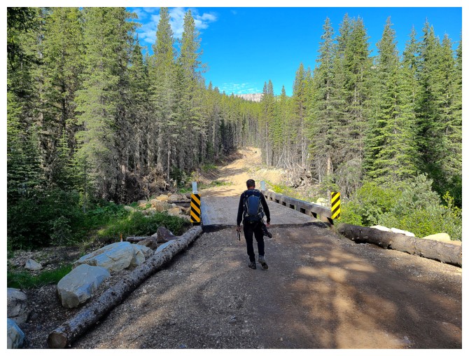
The trip starts with some easy logging road hiking (photo by Dave)
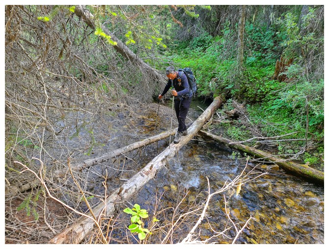
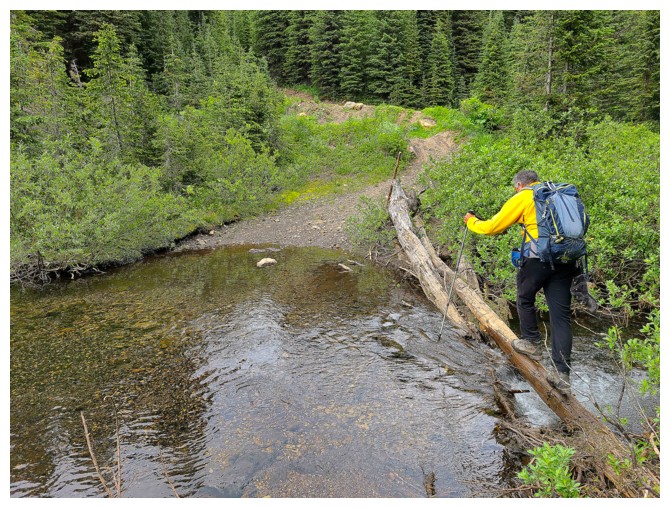
... followed by a not-so-easy log crossing (photo by Dave)
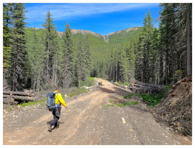
Back to the road. Part of Limestone Ridge that we will eventually traverse in the background (photo by Dave).
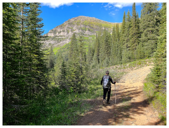
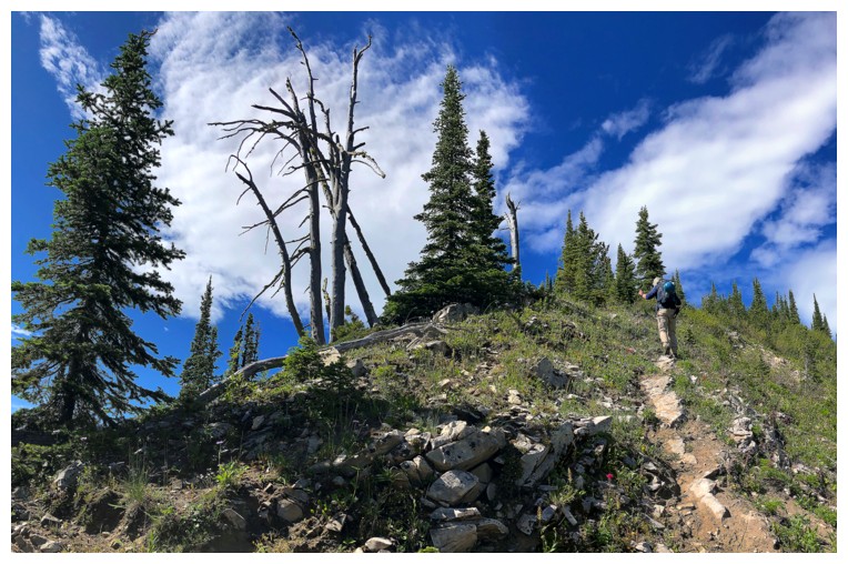
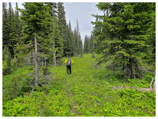
A little bushwhacking to contend with upon leaving the trail
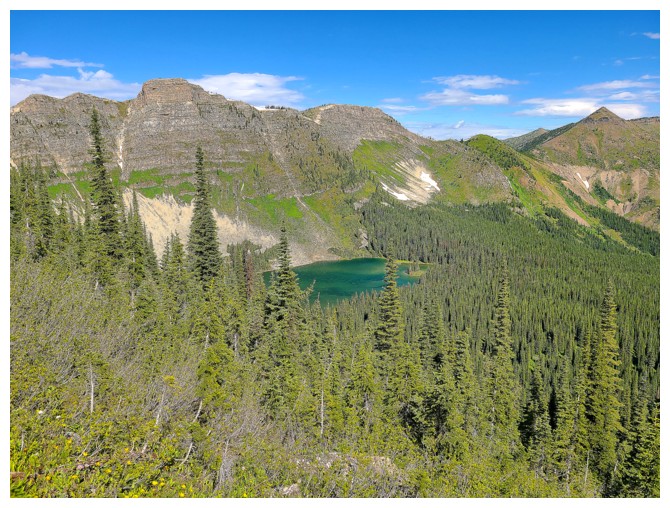
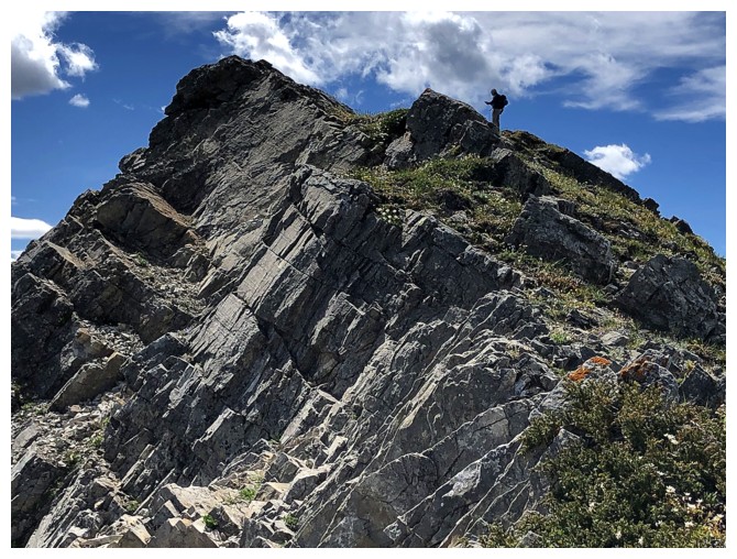
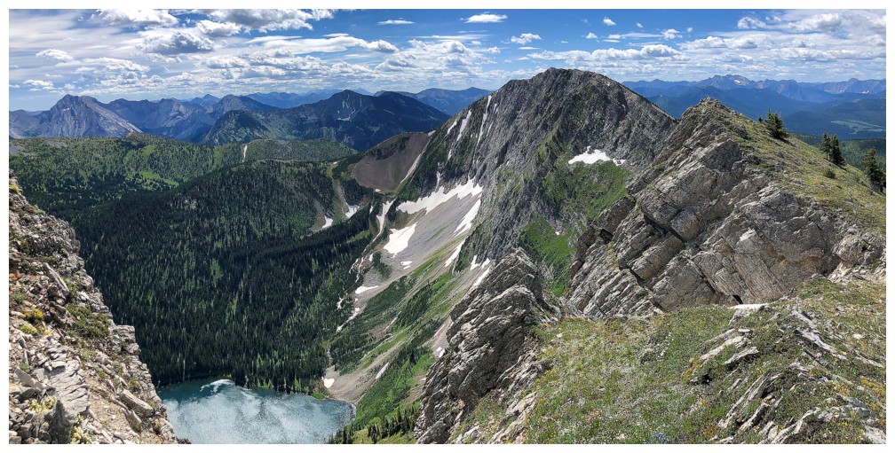
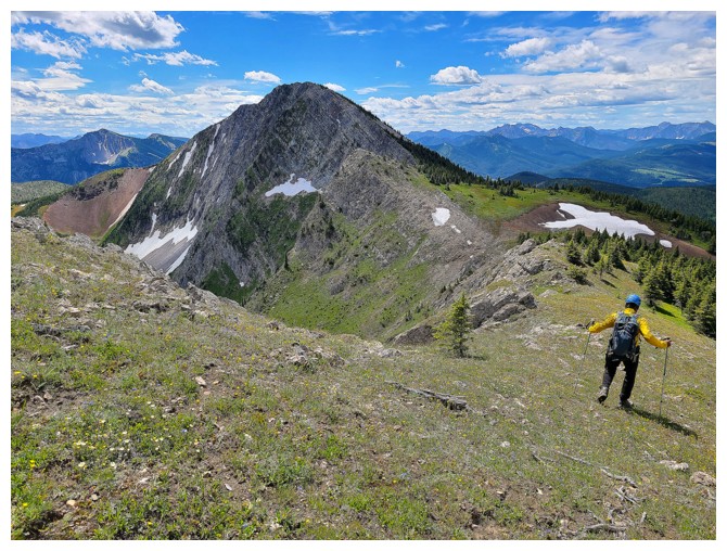
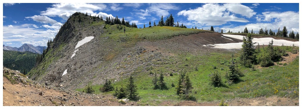
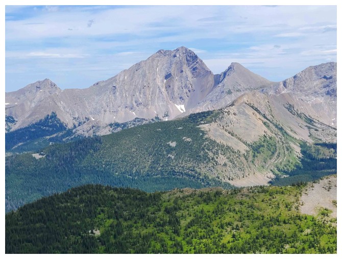
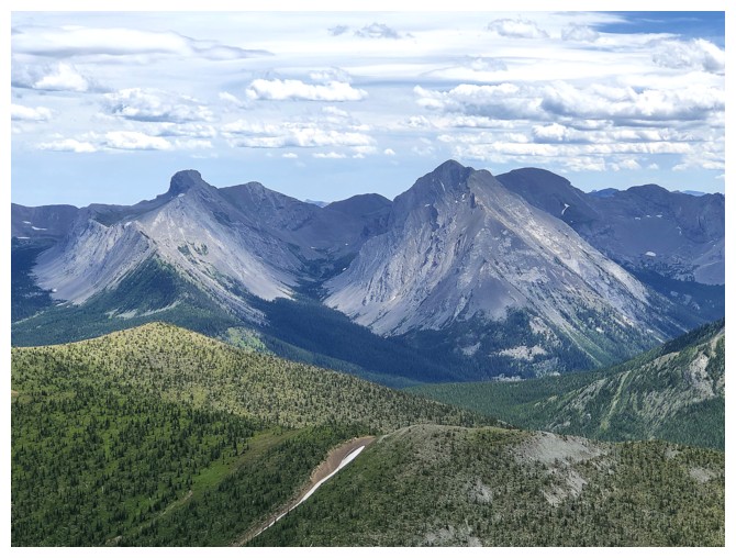
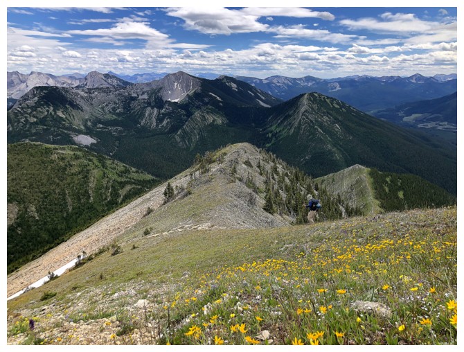
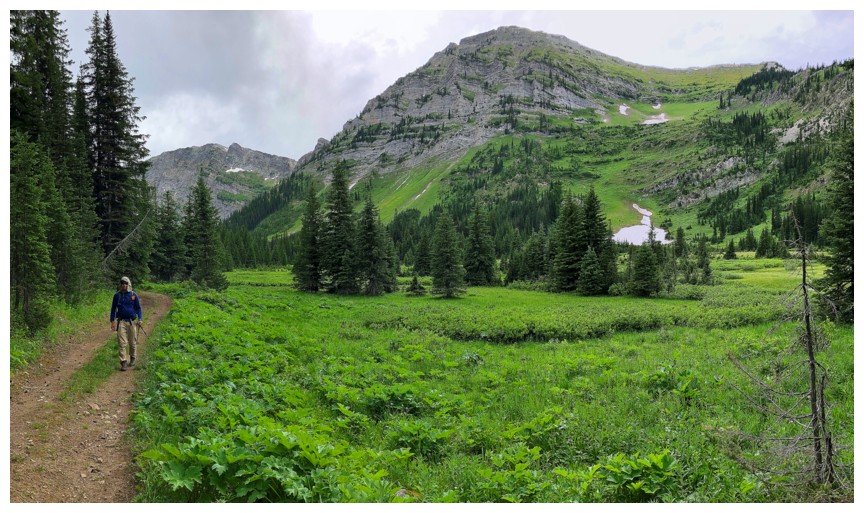
First view of Barnes Peak (just right of centre) and the some of "greenery" that is one of the delightful features of the trip
Onto friendlier terrain (photo by Dave)
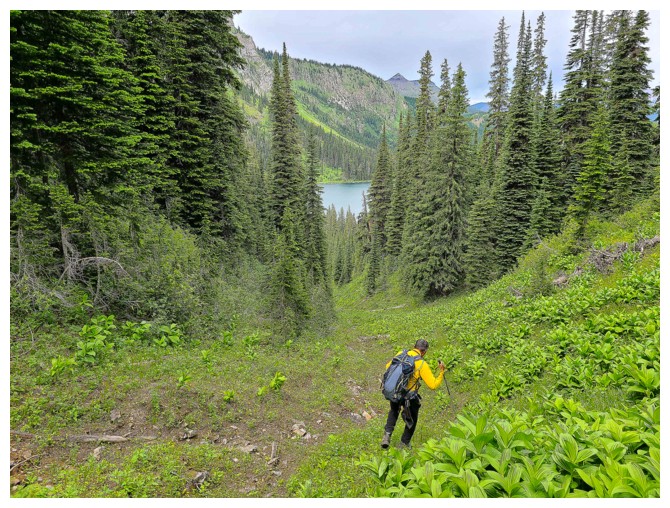
First view of the green unnamed lake to the north (photo by Dave)
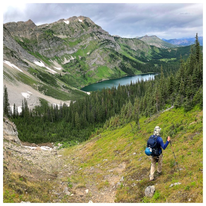
More green and a glimpse of Barnes Lake to the south
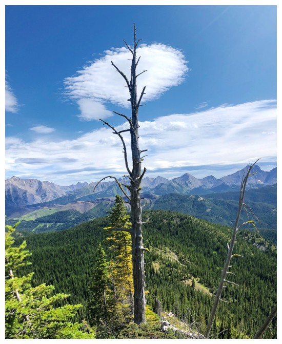
A tree and a cloud
Dave checks out the north lake
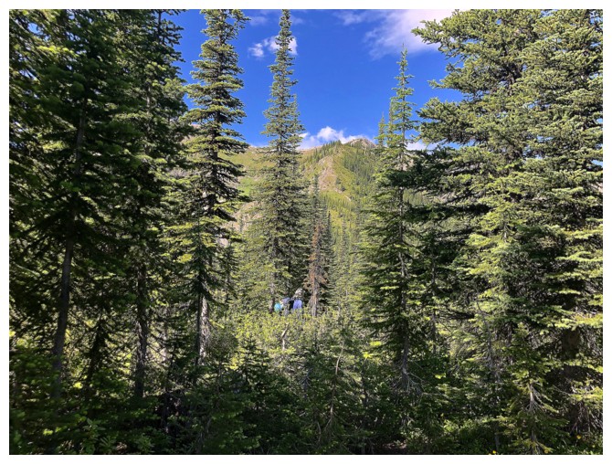
Bit of a trail here
A small plateau is reached before we gain the ridge at the right side
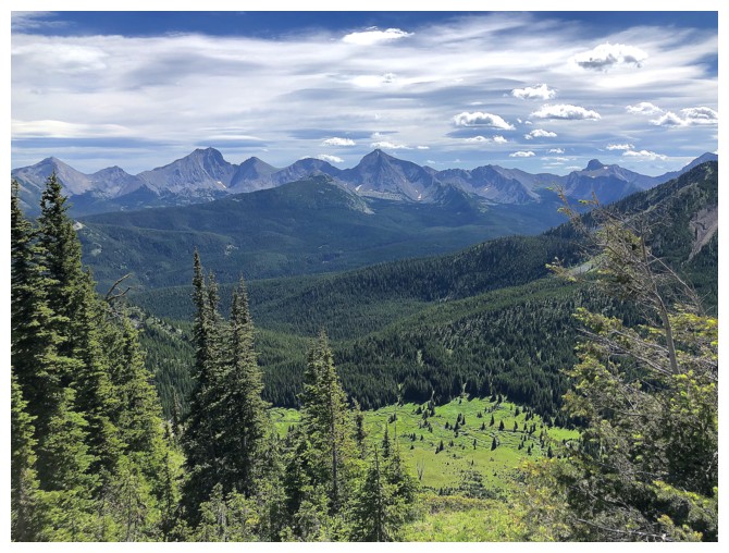
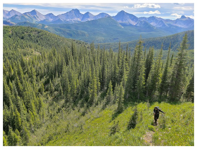
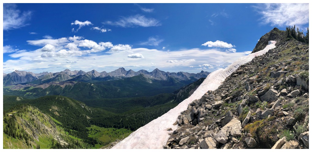
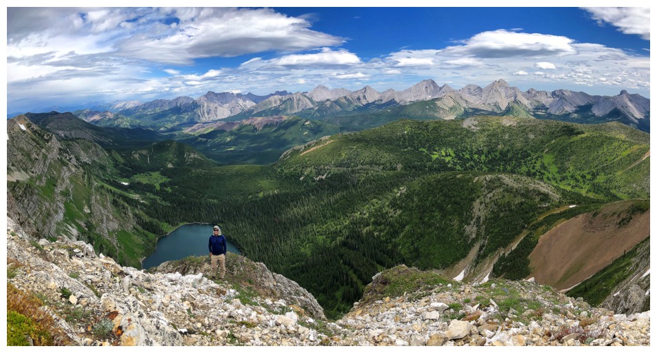
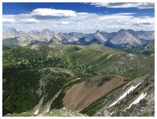
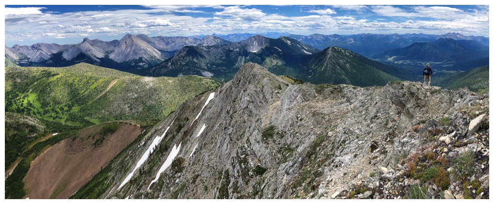
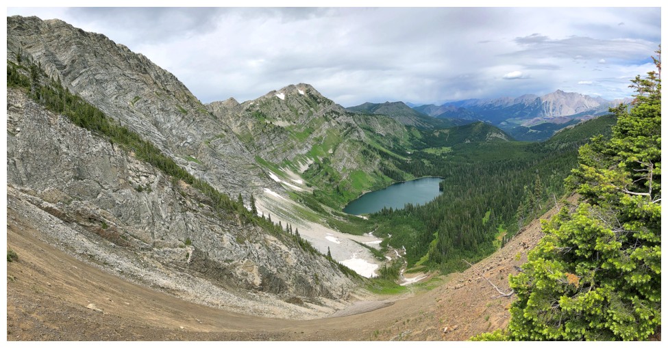
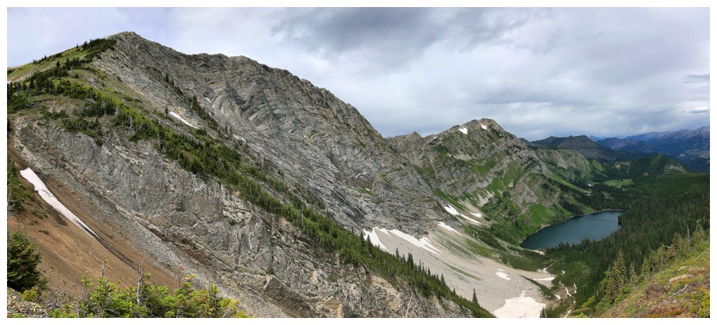
Multiple peaks of the Flathead Range to the east
There's that vibrant green again
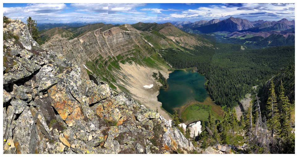
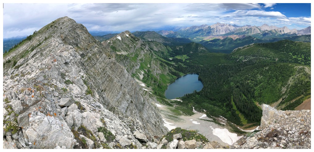
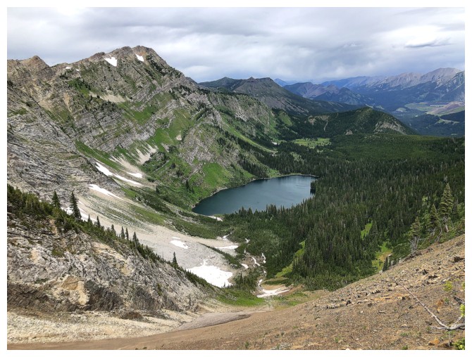
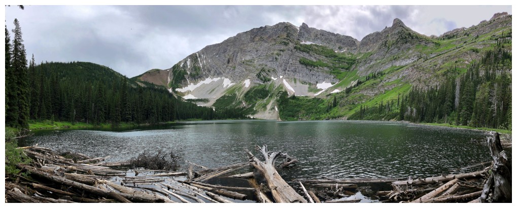
There's that beautiful lake again
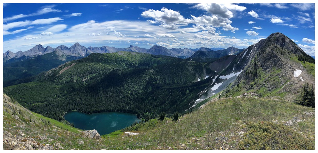
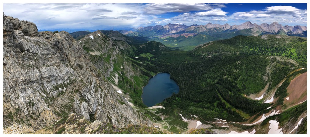
It's actually two lakes (or a lake and a tarn, if you wish)
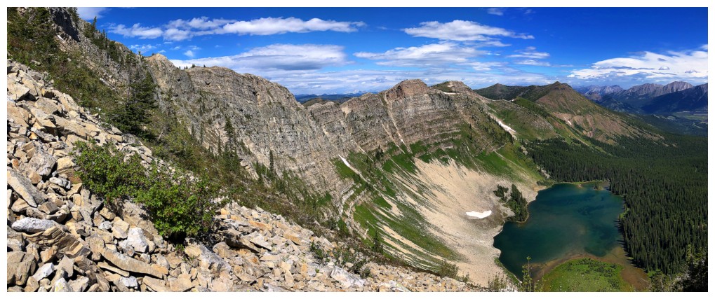
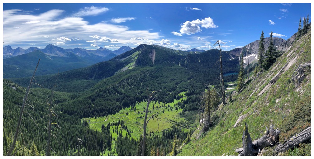
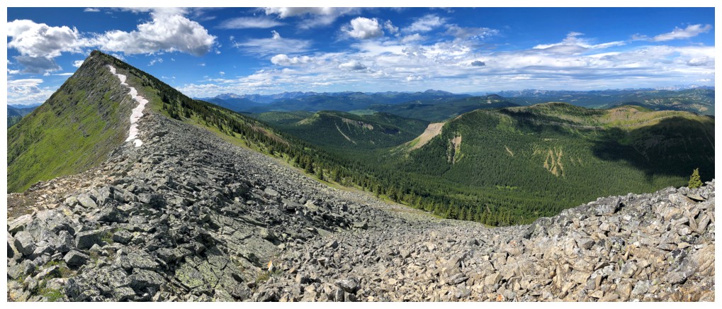
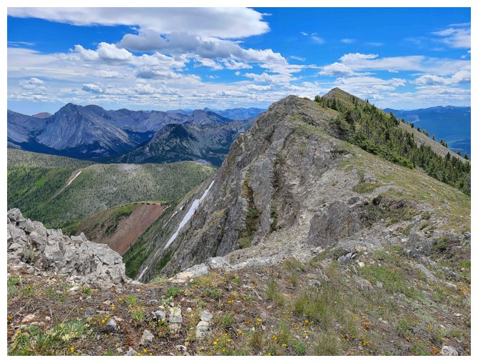
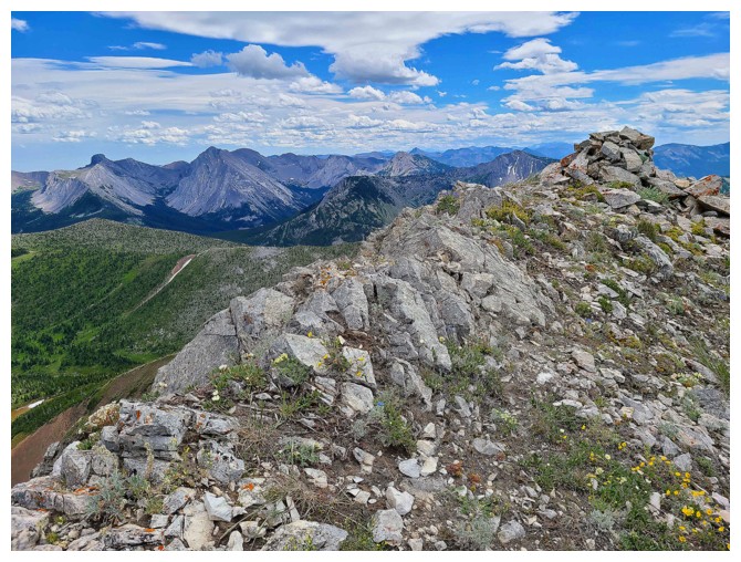
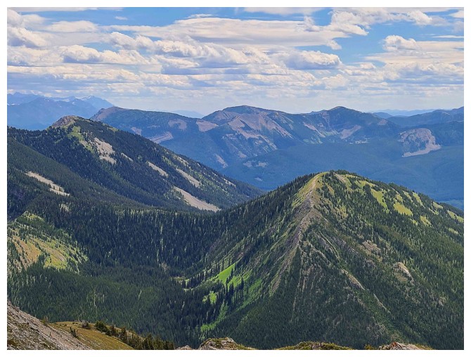
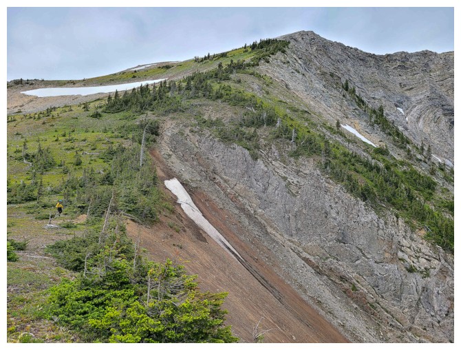
Limestone Ridge extends far to the north
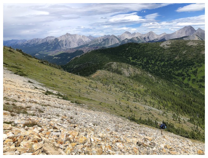
Grinding up a section of rubble (photo by Dave)
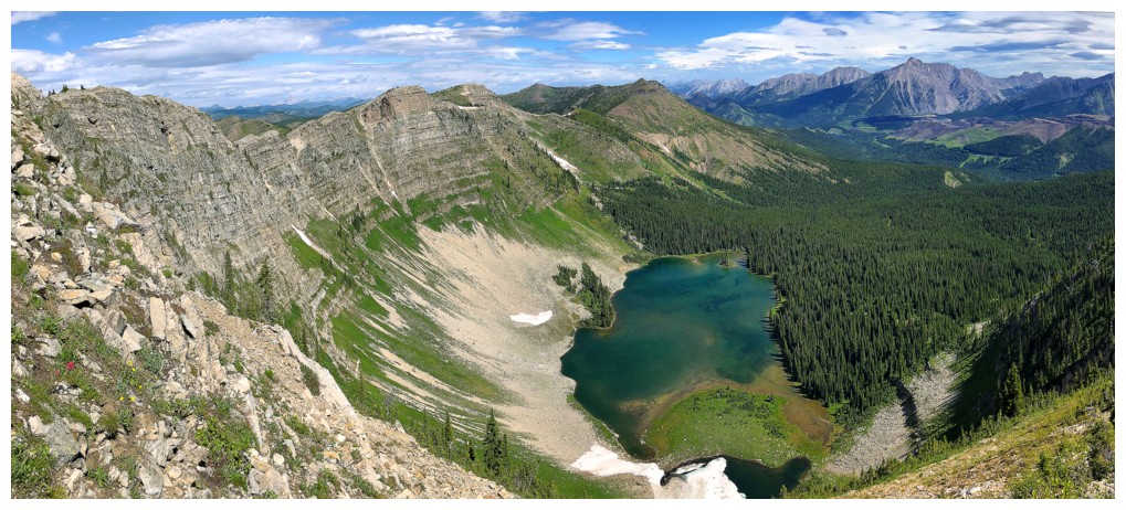
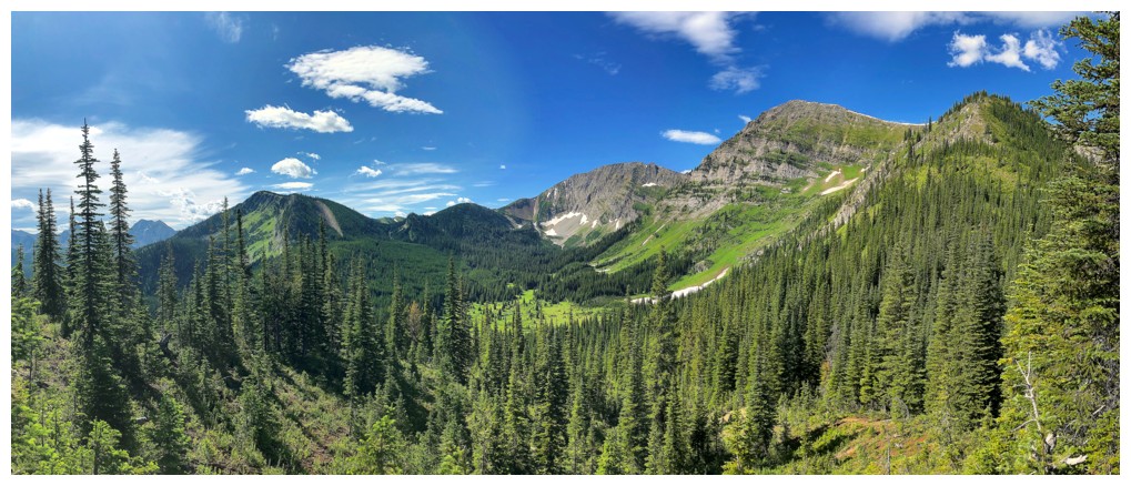
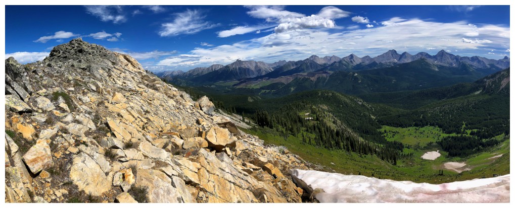
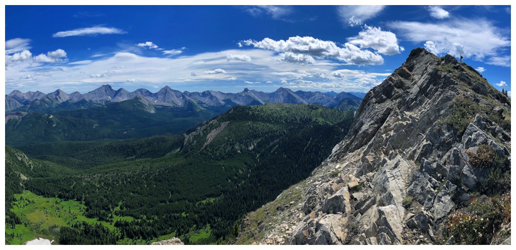
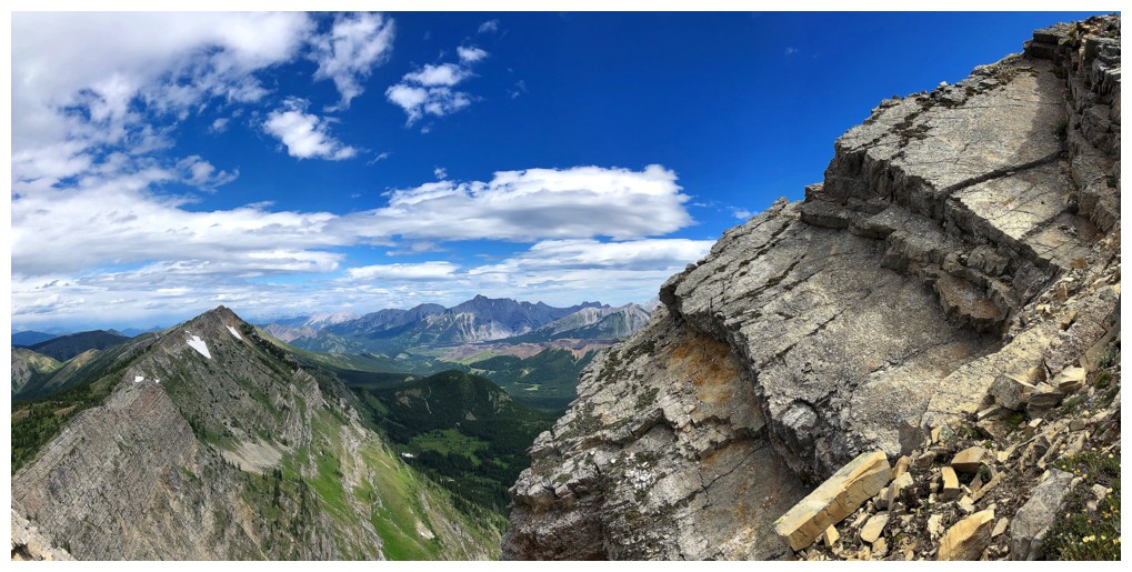
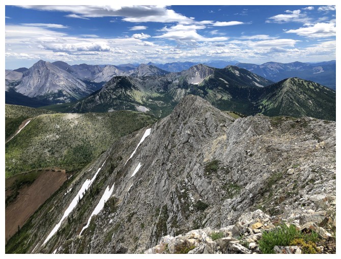
One of the best views of the trip
The ridge we will soon be on (photo by Dave)
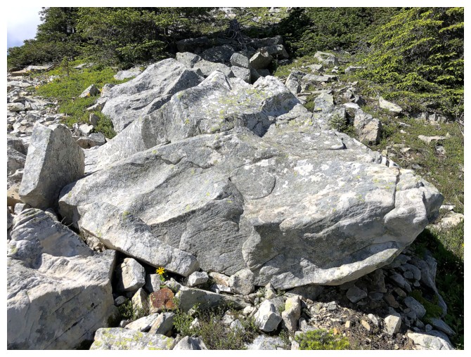
A block of rock
Dave and the view to the north
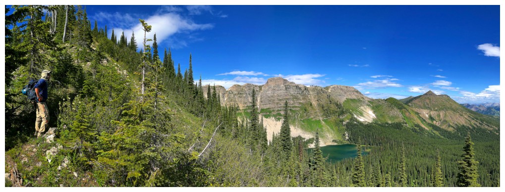
Without Dave
Dave reaches Limestone Ridge
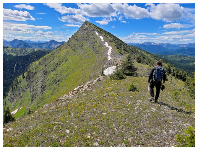
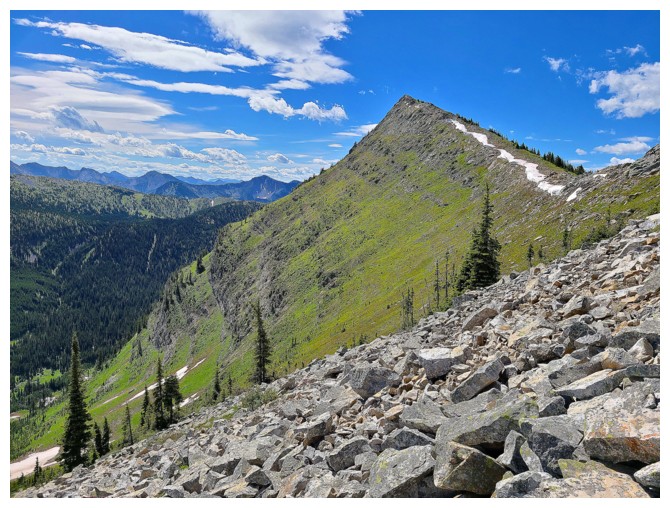
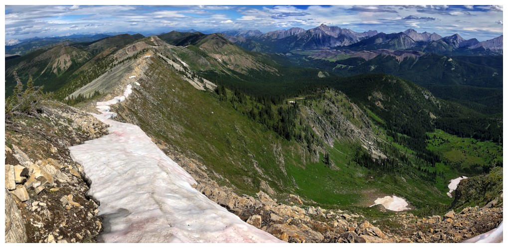
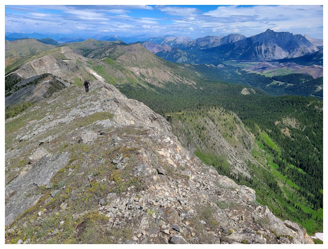
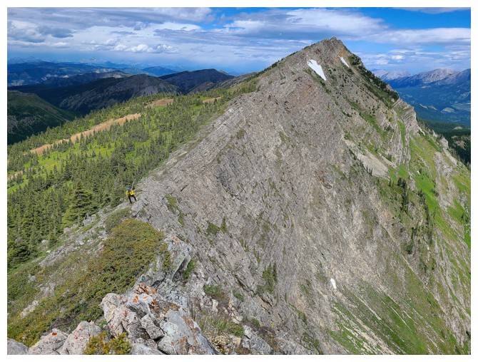
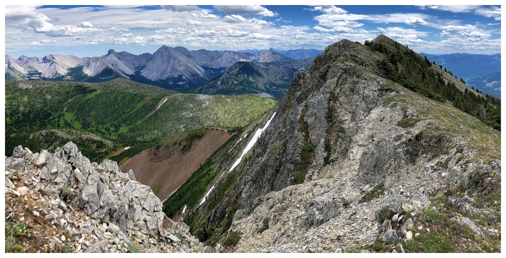
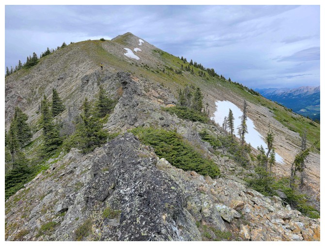
The start of an extremely rewarding traverse of ups and down to the summit (photo by Dave)
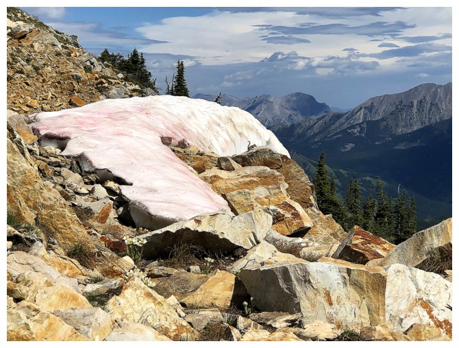
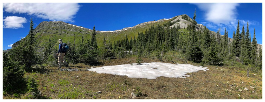
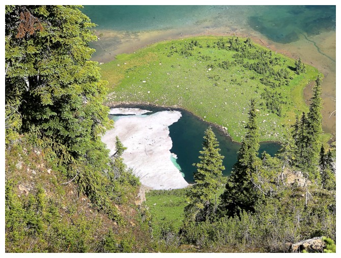
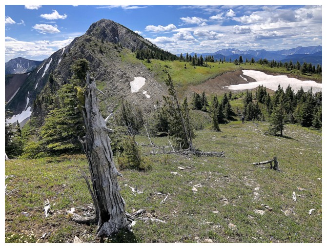
Way to survive the summer heat, Snow!
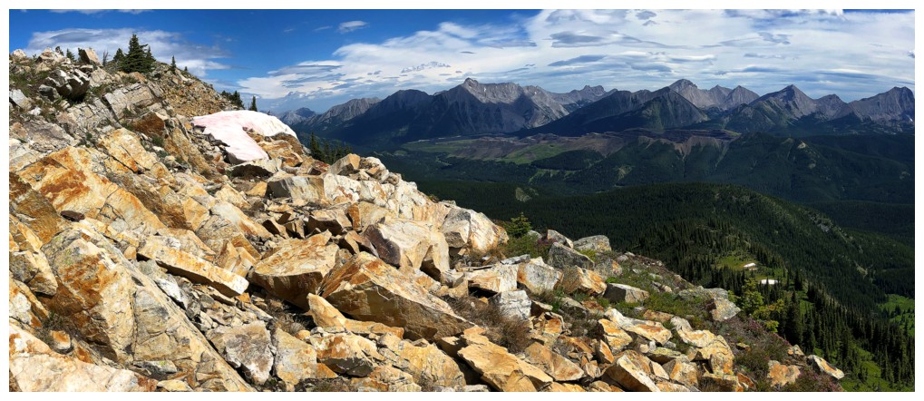
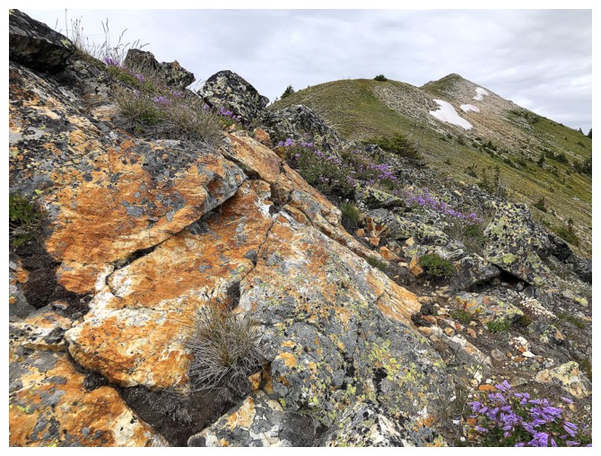
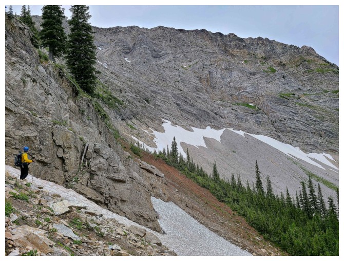
That snow and the colourful rock its resides on
Lots of green on the west side of the ridge too
Onto an easy, grassy section of the ridge (photo by Dave)
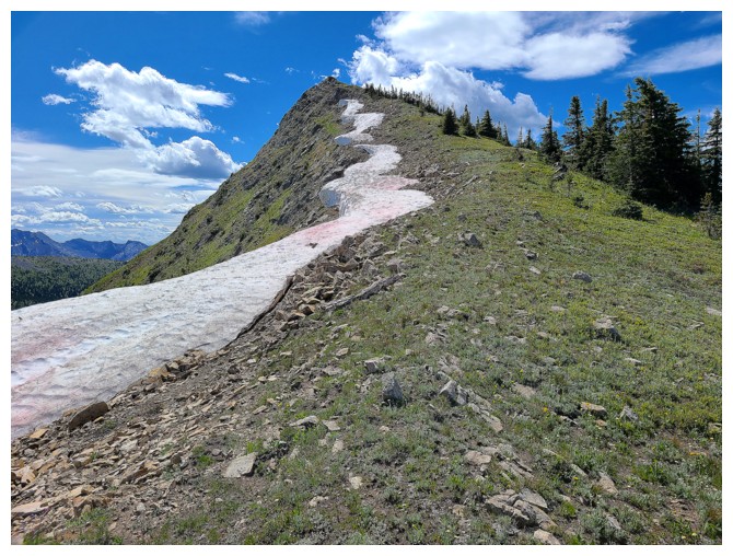
More late July snow!
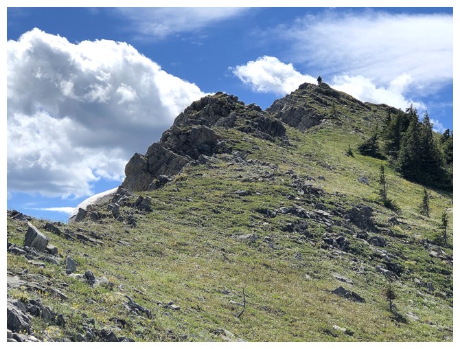
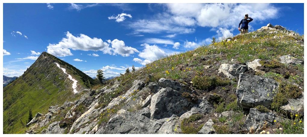
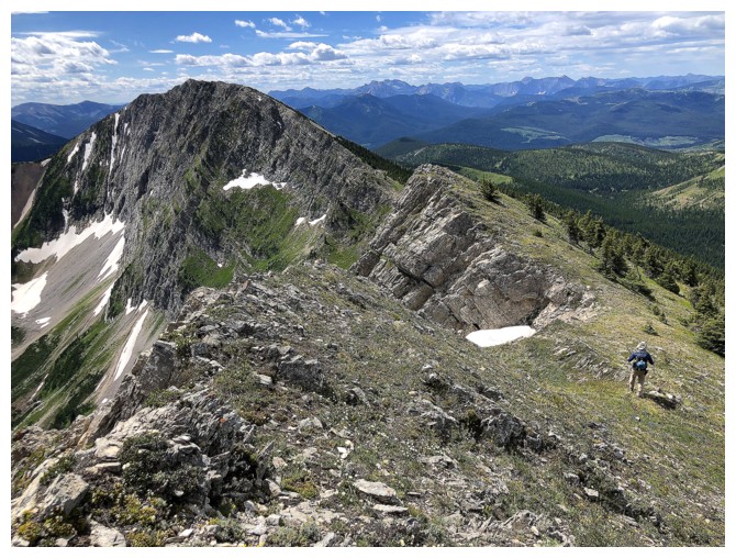
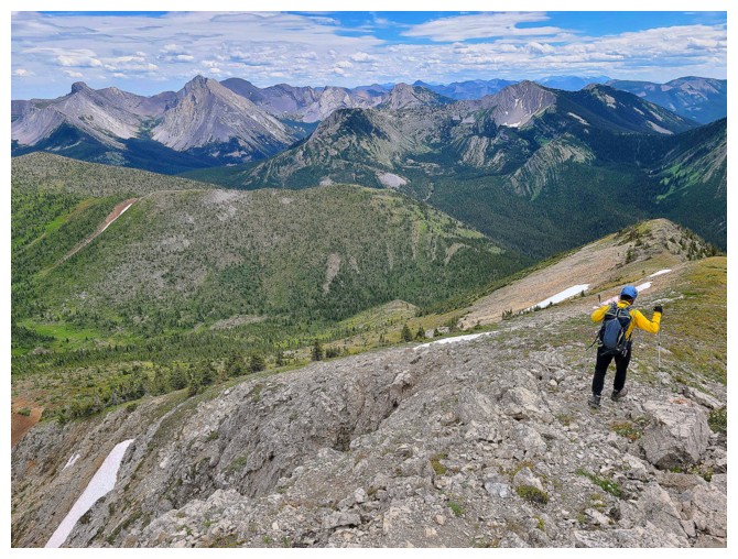
Dave hits one of the many highpoints along the ridge
Dave's
view from the highpoint features the summit of Barnes a significant
distance away and the first good look at Barnes Lake (photo by Dave)
Looks like I've almost caught up to Dave
No I haven't! That was a zoomed-in photo and Dave can just be seen on the ridge, way ahead of me.
Zoomed-in photo by Dave
Catching up...
Falling behind
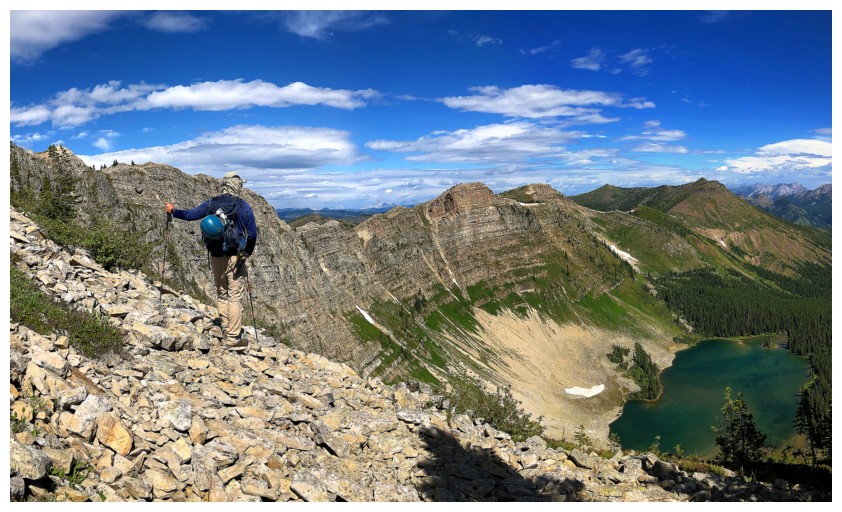
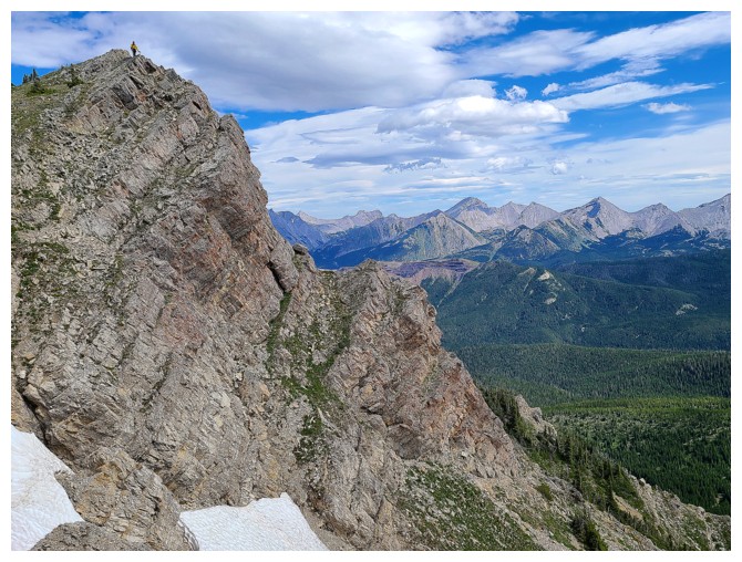
The east face of Limestone Ridge is impressively steep (photo by Dave)
Dave is off again, leading the way
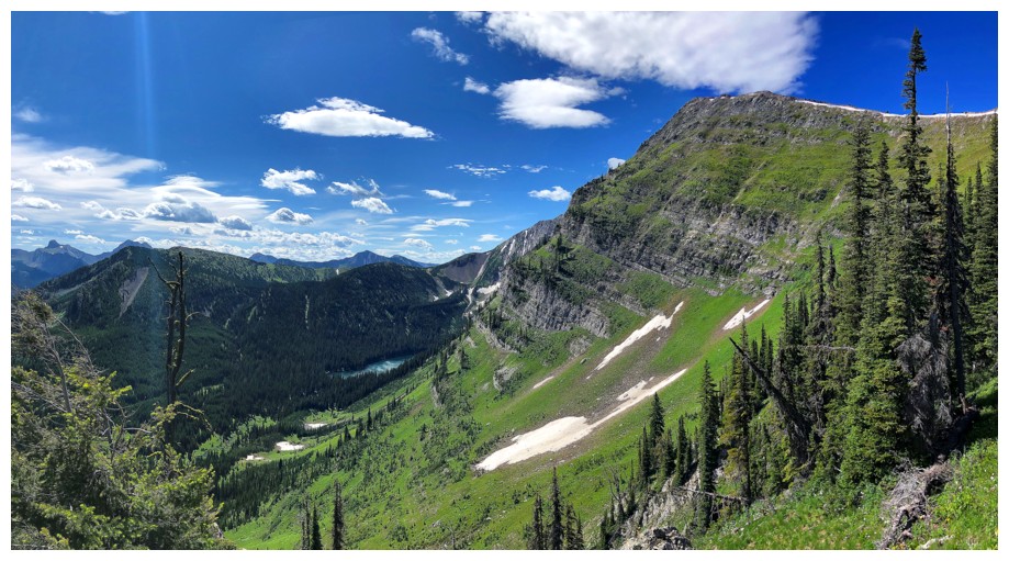
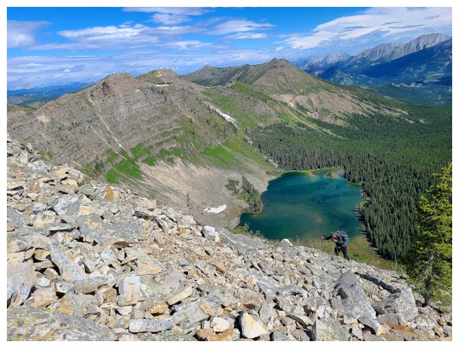
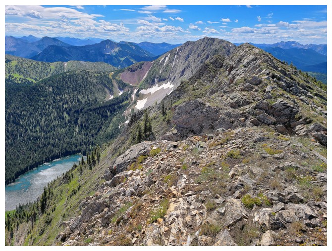
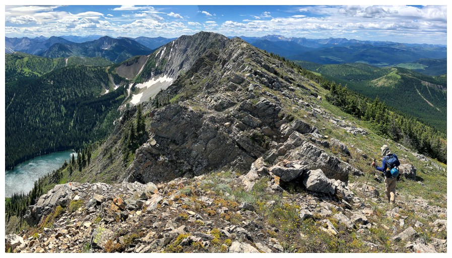
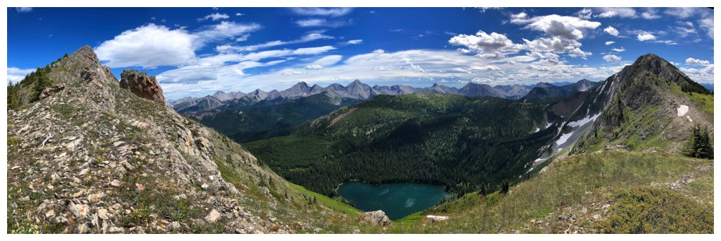
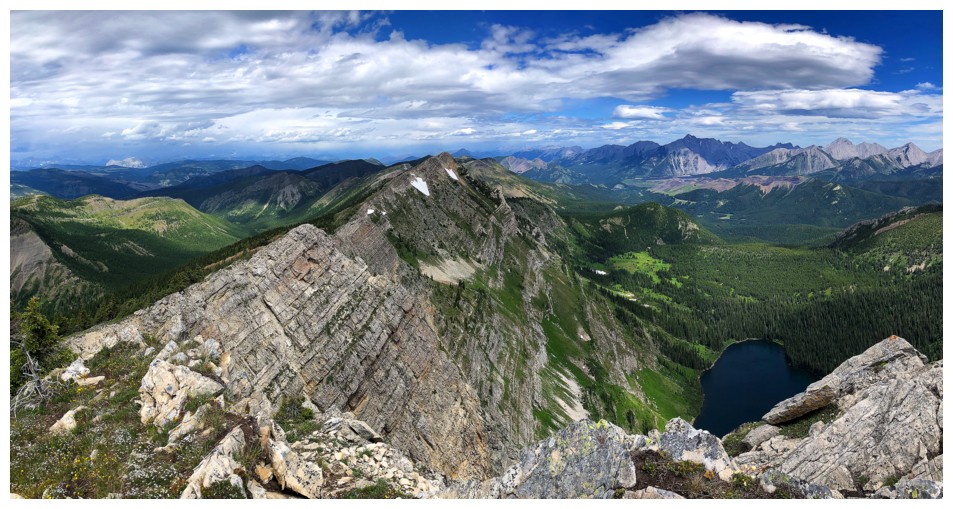
Almost all of Barnes Lake can now be seen
Loved the views from this awesome ridge
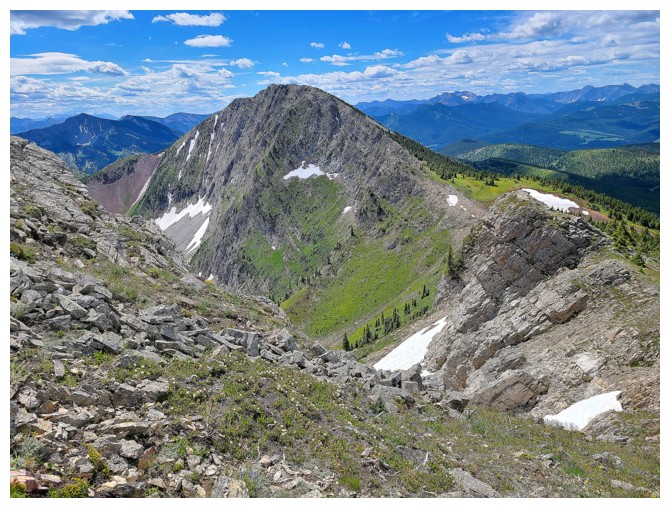
The summit of Barnes looks close from here, but there is still lots of cool ridge to traverse (photo by Dave)
The east face again and I'm way behind again at the top of the highpoint (photo by Dave)
Descending. Dave waited for me (photo by Dave).
I'm ahead but only because Dave had to tie his boot laces! (photo by Dave)
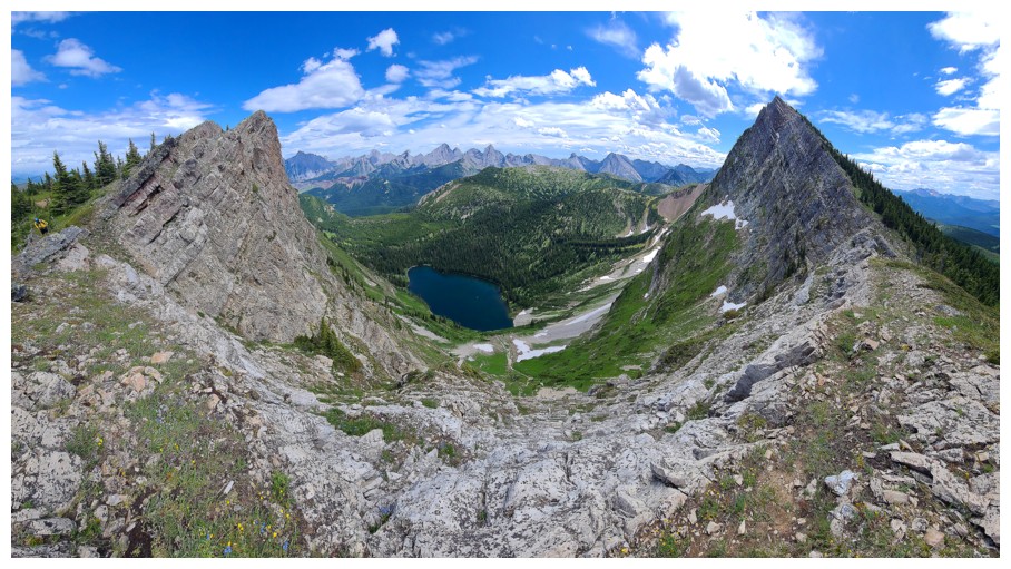
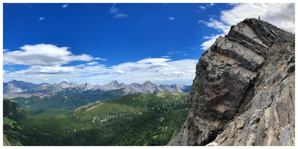
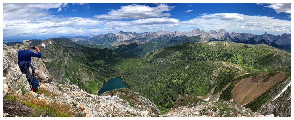
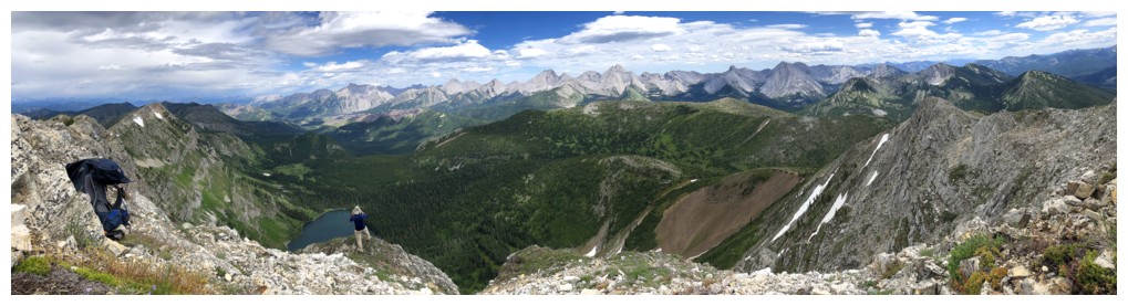
Deceiving pano
Less deceiving
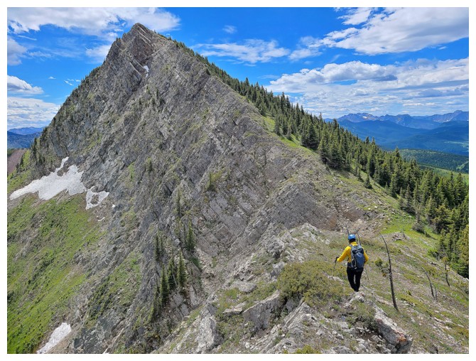
Another grassy section. The variety of terrain along this ridge make it such an enjoyable affair.
Same as above
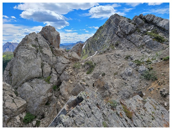
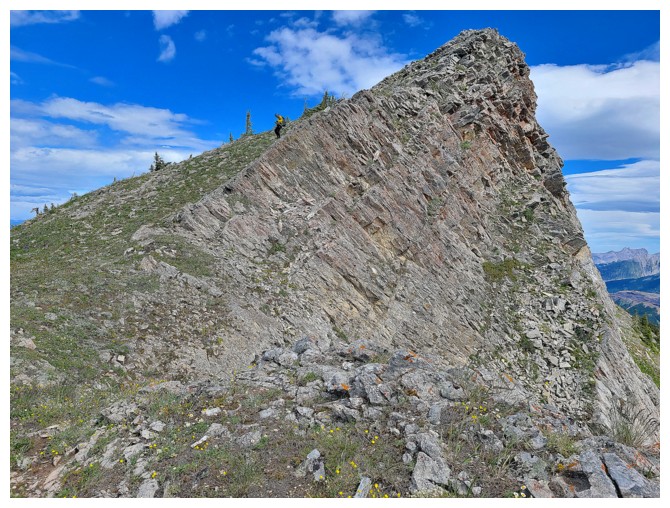
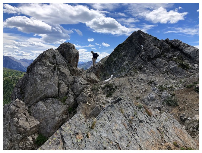
Dave approaches a very interesting section of the ridge (photo by Dave)
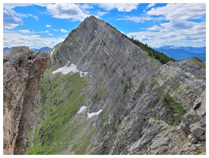
His view to another false summit (photo by Dave)
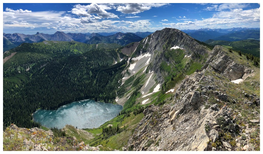
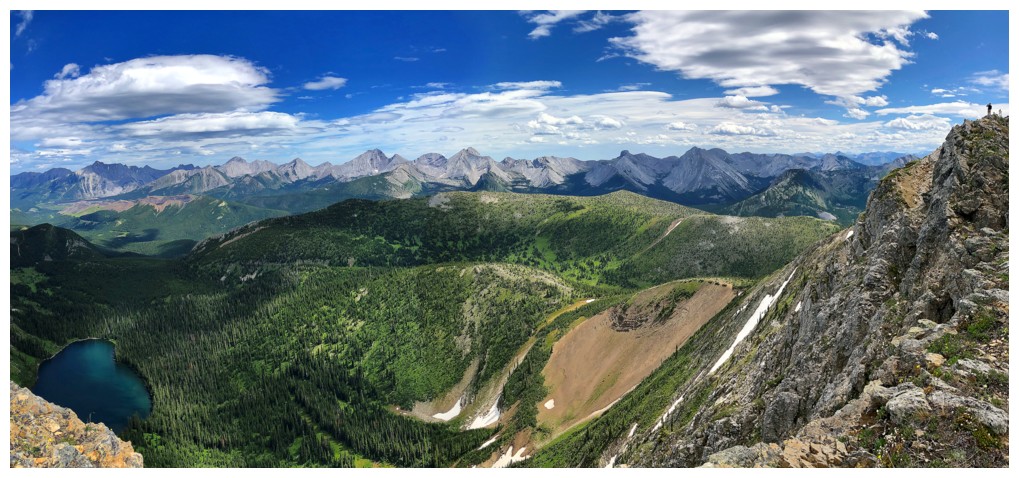
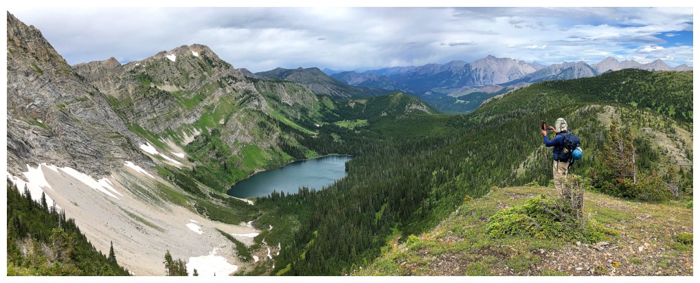
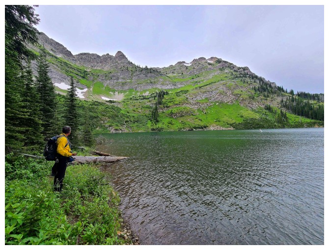
And his view of beautiful Barnes Lake in full (photo by Dave)
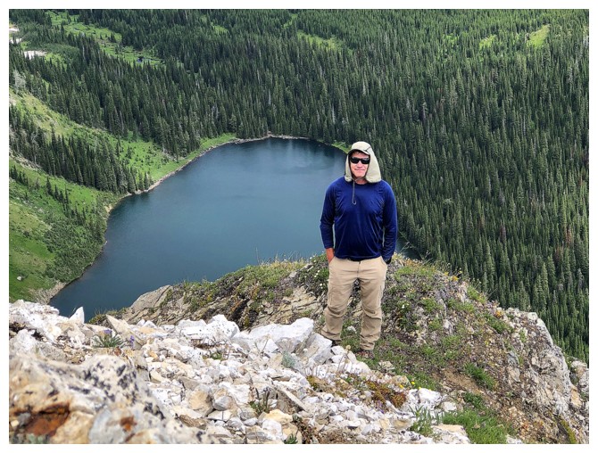
Dave checking out the lake
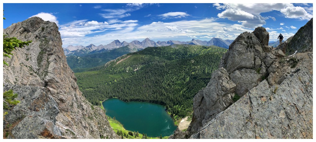
Another deceiving pano, with Dave at the right
The ultimate deception! Summit at the right and the north ridge at the left, but they lie in a straight line (photo by Dave).
Playing leap-frog again. I'm ahead... (photo by Dave)
...I'm behind (photo by Dave)
Summit finally looks close but its not (photo by Dave)
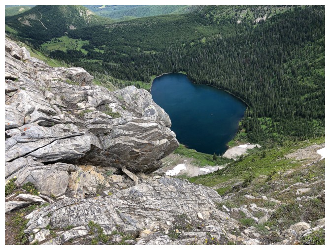
The lake
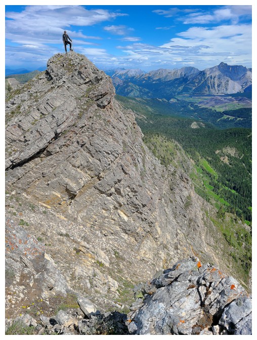
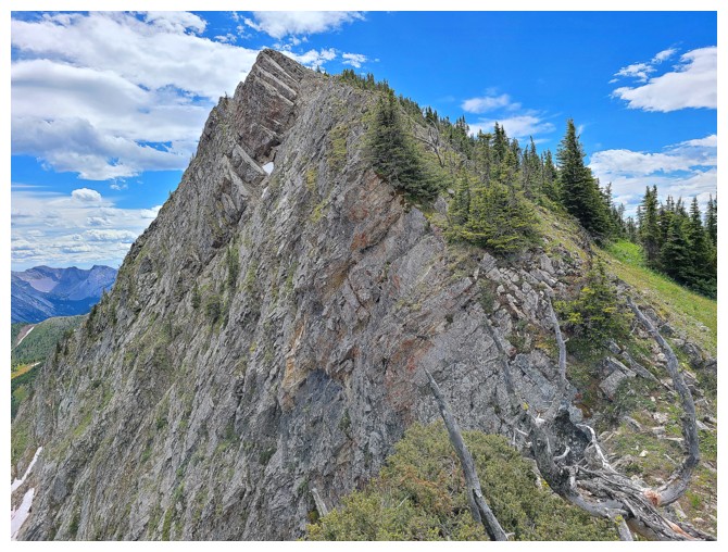
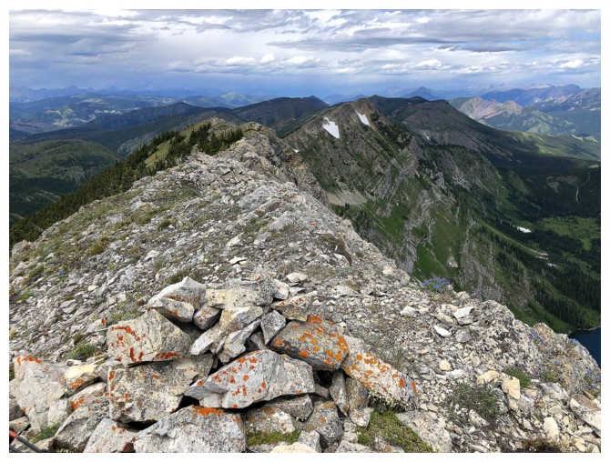
Dave reaches another super cool highpoint, with incredible rock scenery
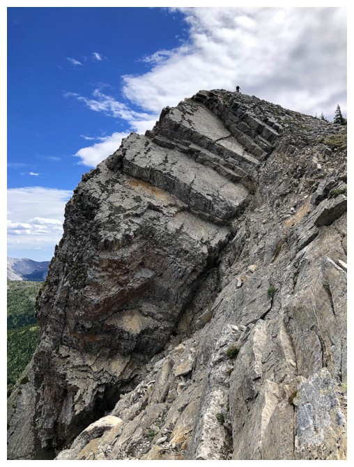
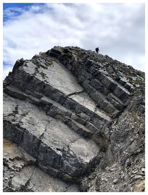 Zoomed-in and zoomed-in more
Nice!
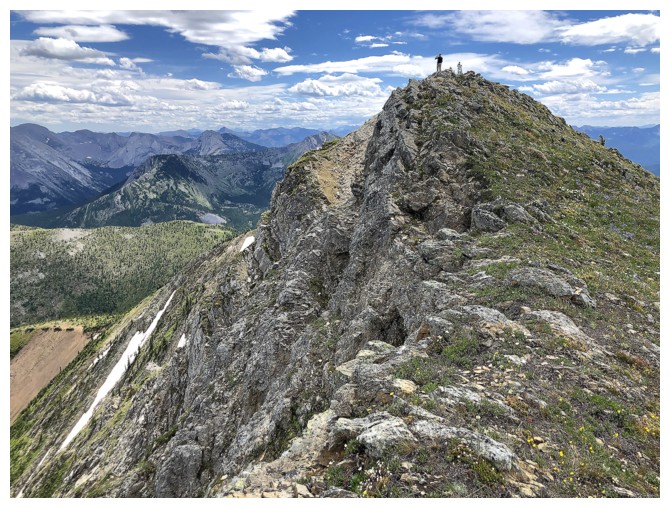
Now the summit looks far, but it's actually close! (photo by Dave)
Looking back along the ridge we just traversed
Dave is steps away from the summit (photo by Dave)
Meanwhile I'm light-years away! Dave is just visible at the top.
(interesting physics/astronomy note: a light year is a measure of distance, not time, as is sometimes thought. On this trip Dave and I covered a distance of 1.98 X 10⁻¹² light-years or 0.00000000000198 light-years - we rock!)
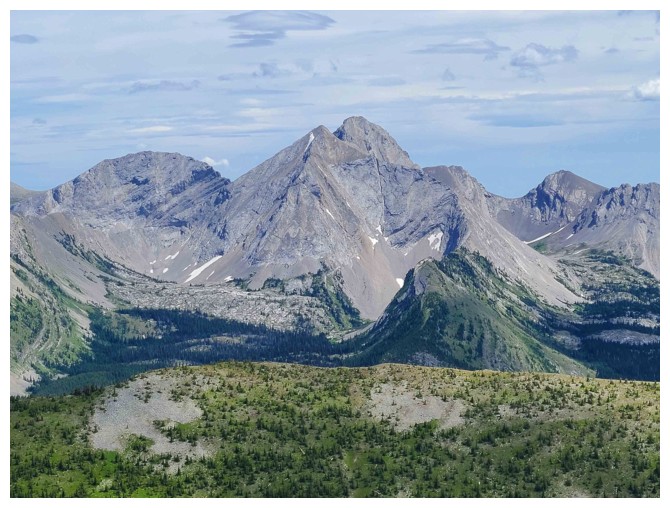
Darrah S2 - didn't make the summit, but had a wonderful day on that one (photo by Dave)
Mount Darrah is the K2 of the area. That is, not the highest, but certainty the hardest to climb (photo by Dave)
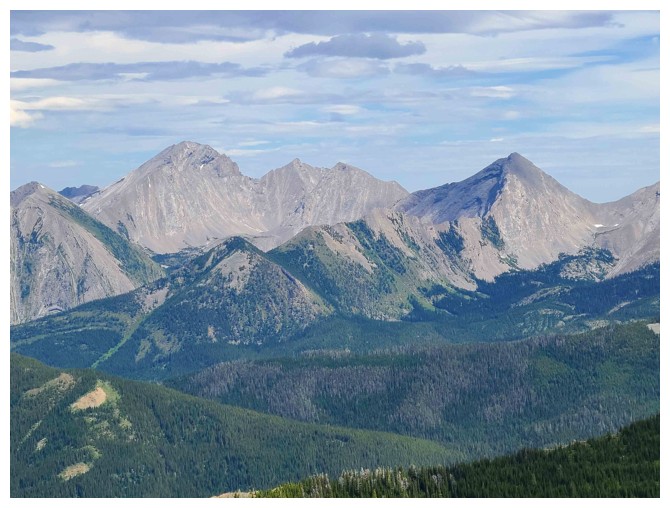
Four peaks and the two lowest ones in the middle are the named peaks - go figure! (photo by Dave)
Dave is getting bigger at the far right and the view is too
Almost there
Success! The weather is breaking down to the north.
The summit register. Sealed tight but a ton of water still managed to get in (photo by Dave).
Dave captures the view to the east, northeast, and north
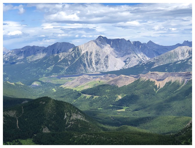
There's the highest one - Mount Ptolemy (photo by Dave)
Centre Mountain (just right of centre) and Centre N1 at the left
Peaks of the MacDonald Range to the southeast (photo by Dave)
Looking down some of the route we will use for descent
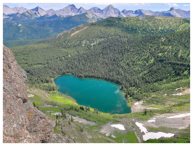
Dave descends to a small bump to get a great view of Barnes Lake
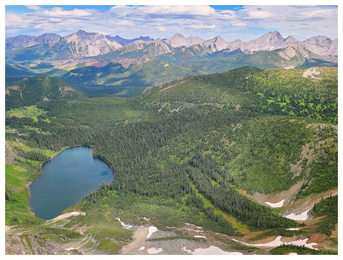
This view! (photo by Dave)
Close-up
Not so close-up
While the clouds looked threatening to the north, the ones to the east had a more friendly appearance
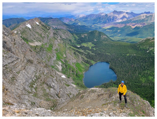
My turn on the bump (photo by Dave)
View from a short distance down the southeast ridge
Dave leads the descent
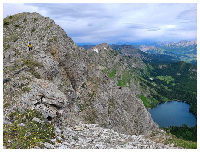
Good thing my yellow jacket sticks out a little, otherwise I'd be almost invisible! (photo by Dave)
The weather continues to deteriorate to the northwest, but the view is still incredible
Generally easy travel down the ridge, again with terrific views (photo by Dave)
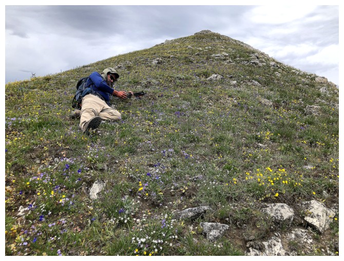
Dave's standard position for....
...taking wildflowers photos
Continuing down
Even the yellow jacket isn't enough here (photo by Dave)
Irresistible section of colourful rock
Here, we had to traverse left to gain the ridge above the lake
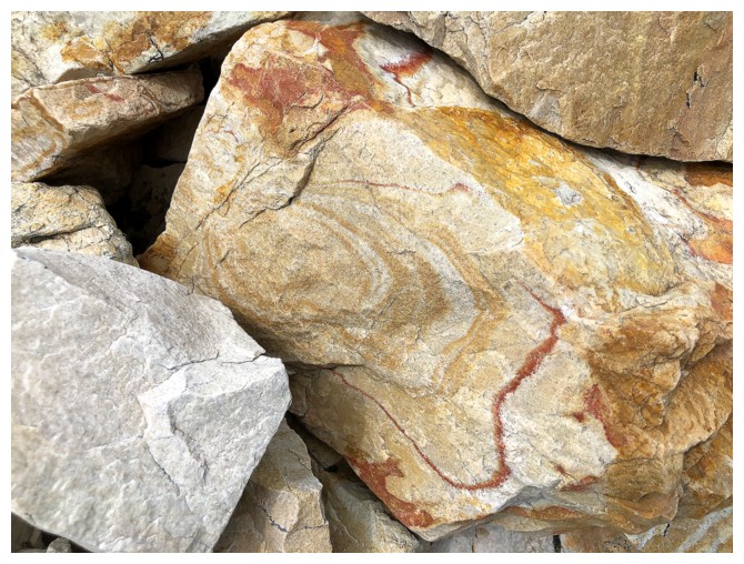
More cool rock
On the ridge (photo by Dave)
Still getting great views of the lake
Same as above
And a view back to the summit, some of Limestone Ridge, and the lake
Dave takes in the view from up high one last time
Heading down
Same as above (photo by Dave)
Found a faint trail on this flat section before finishing the descent to the lake (photo by Dave)
Nice break through the trees give us easy access to the lakeshore (photo by Dave)
At the shores of Barnes Lake (photo by Dave)
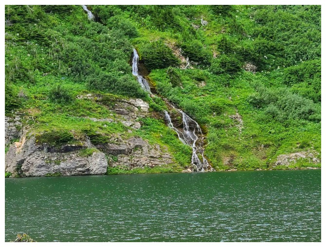
Waterfall on the other side (photo by Dave)
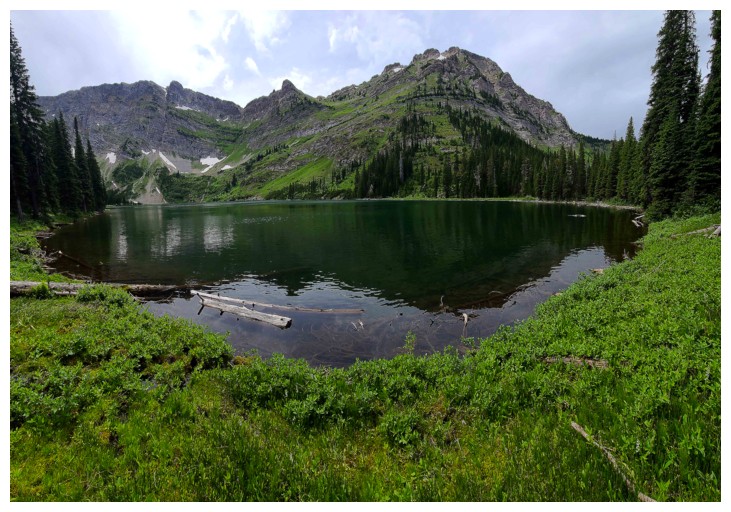
Going around the lake (photo by Dave)
Near the outlet
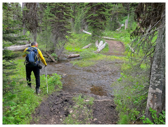
Several streams to cross once on the Barnes Lake Trail (photo by Dave)
Shame about the cloudy skies, but the greenery was wonderful throughout
Well placed log (photo by Dave)
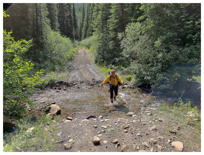
At this point of the day we decided to just walk through the creeks (photo by Dave)
Final stretch of easy hiking to end an awesome day (photo by Dave)
The End
LOG