January 1, 2026
Mountain height: 2116 m
Elevation gain: 775 m
Ascent time: 5:00
Descent time: 2:25
Solo scramble.
What would the
first day of 2026 bring? Well, certainly not a major summit. With cloudy skies
forecast for the day, a familiar objective, probably using a familiar route
would be on tap. 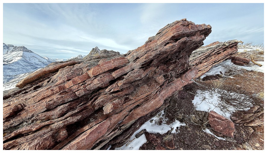 That summit would be Bellevue Hill, via its northeast ridge.
After hiking
the first part of the approach, a potential new route revealed itself. A
prominent drainage splits the east side of the mountain. I had ascended and
descended the drainage and its right side, but suddenly the left side looked
very tempting. The route would definitely get steep for a few sections, but I
wouldn’t know the severity of the grade unless I got right up into it – game
on.
As expected,
the first part of the route was straightforward and easy. However, as elevation
was gained I could see a section above that was much steeper than anticipated.
I attempted to traverse into the drainage to the right, but doing so would have
put me on even more serious snow slopes. Two choices: retreat and go home or continue
up the way I initially intended. I chose the latter, hoping the terrain above
was less serious than it looked.
Turns out that
was generally the case. I say generally because the route up was far from a
pushover, requiring lots of route-finding and a few difficult scrambling moves.
 And after the first challenging step was overcome, several more were waiting.
Getting up to the highpoint took far longer than expected, but once there and
reunited with a familiar cairn on the southeast ridge, I knew the remainder of
the trip would unfold with ease. It did and also served to remind me of the extremely
colourful nature of the Hill in general, and the preference for clear skies.
Although the skies did boast some impressionist painting-like clouds, a
complete absence of clouds would have been far better.
And after the first challenging step was overcome, several more were waiting.
Getting up to the highpoint took far longer than expected, but once there and
reunited with a familiar cairn on the southeast ridge, I knew the remainder of
the trip would unfold with ease. It did and also served to remind me of the extremely
colourful nature of the Hill in general, and the preference for clear skies.
Although the skies did boast some impressionist painting-like clouds, a
complete absence of clouds would have been far better.
At the summit I
ran into Spencer from Lethbridge. We had a wonderful conversation about the mountains
in Southern Alberta. Spencer had only two or three mountains in Waterton to
ascend before completing all the official peaks in the park. Not surprisingly,
Lone Mountain and Mount Festubert sat on that list – the two most remote and
seemingly unremarkable peaks in Waterton. (Having said that, I’m eager to
repeat an ascent of Festubert, via its east face.)
The northeast
ridge of Bellevue was the logical route for descent – direct and
straightforward. Of course, en route I was distracted, detoured, and delayed by
all the colourful rock (yet again), but such is life!
I’m not sure
I’d repeat the ascent route (though it may be more enjoyable without snow), but
completing a half new loop route on the best “Hill” in the southern Rockies
turned out to be a great way to usher in the new year.
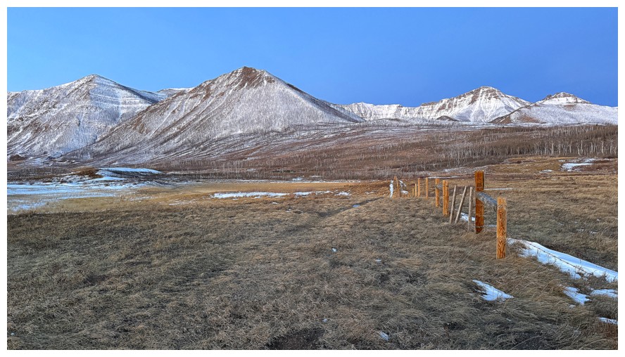
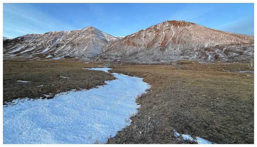
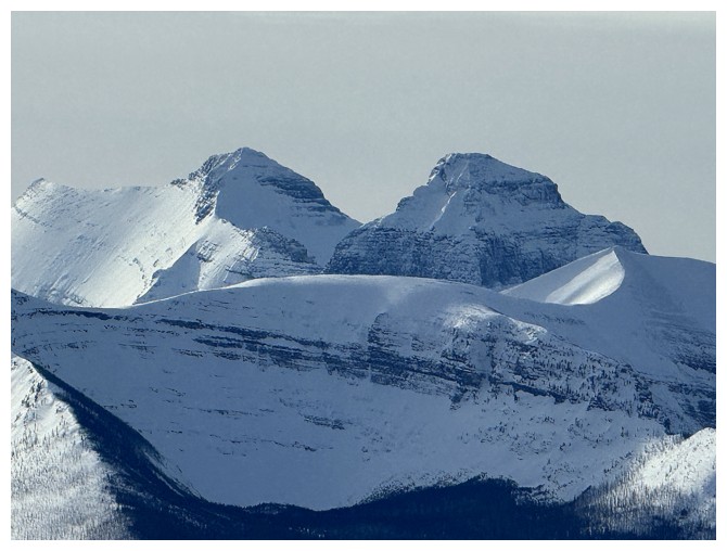
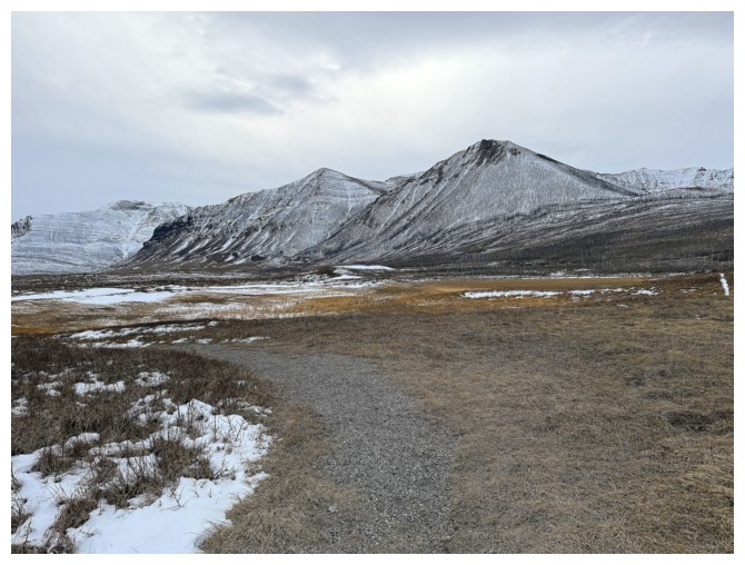
The start of the trip features views of Bellevue Hill (left), Rogan Peak, and Lakeview Ridge
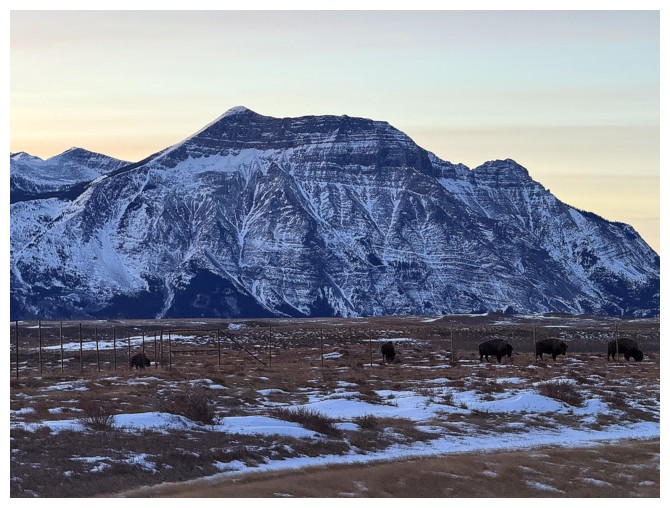
The bison are roaming under the beautiful form of Vimy Peak
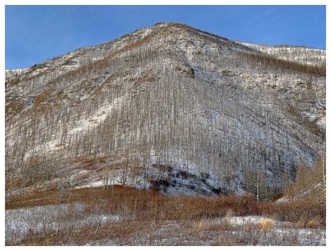
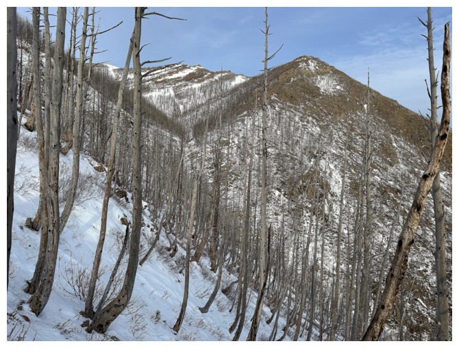
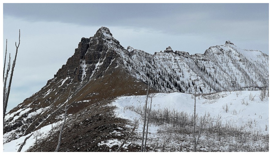
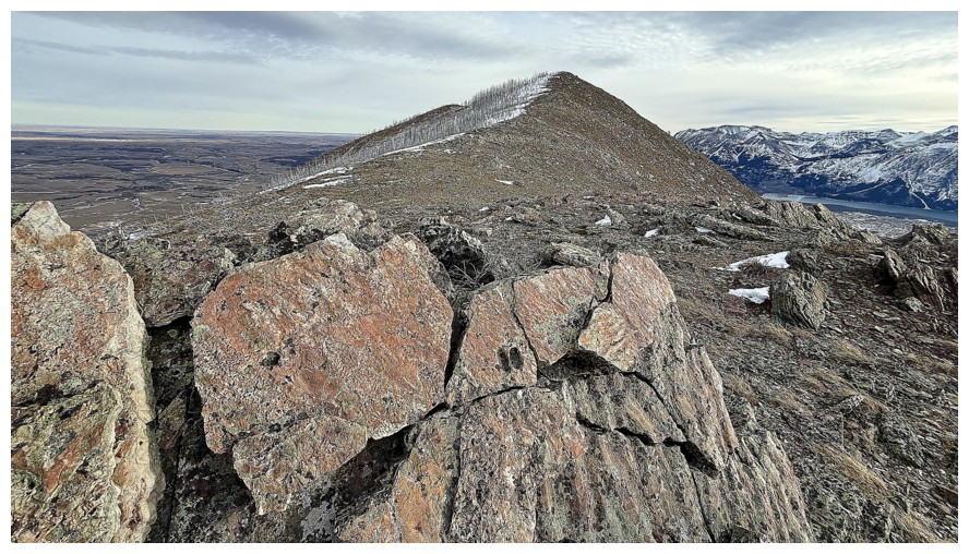
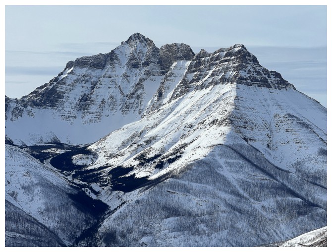
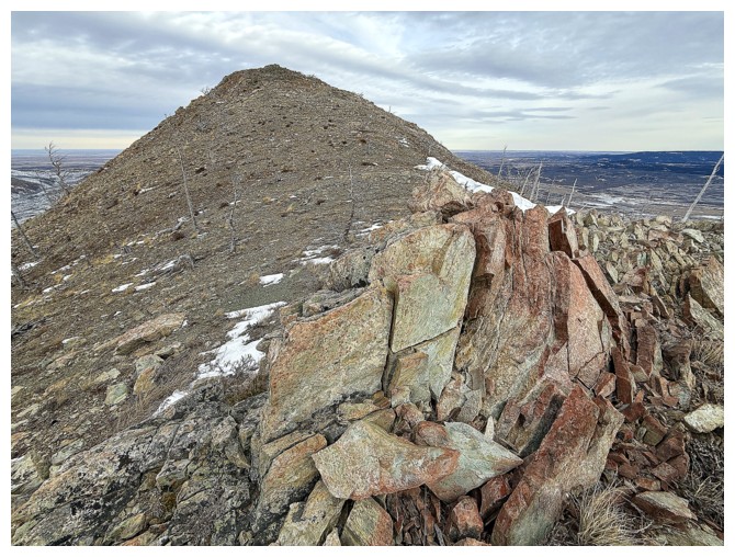
Bellevue's northeast ridge at the right was the original route I intended to do
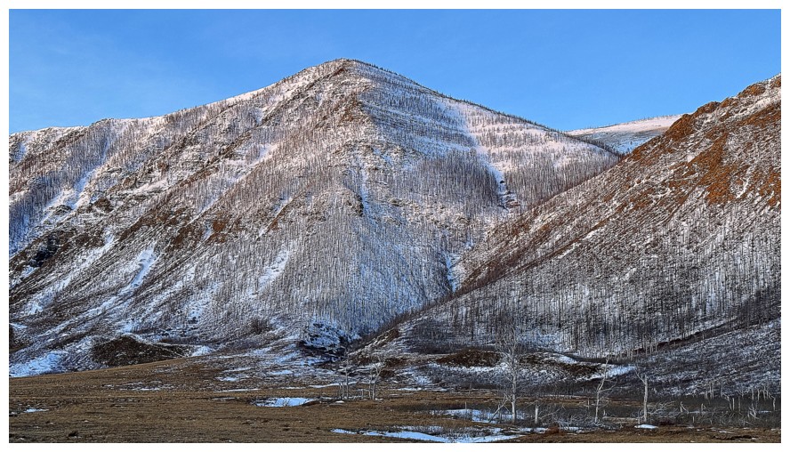
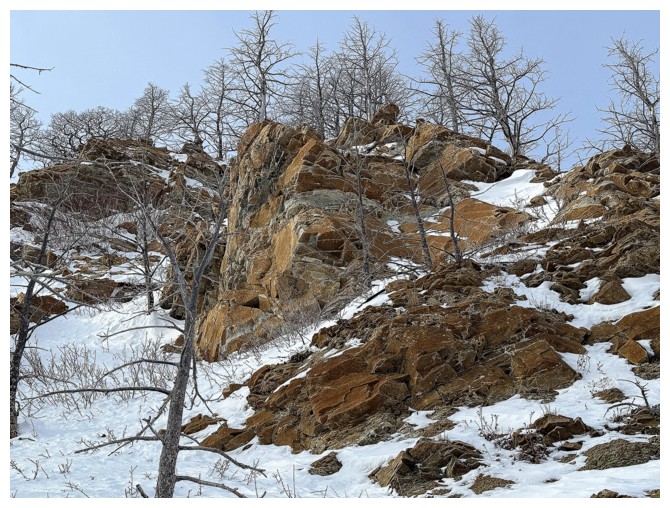
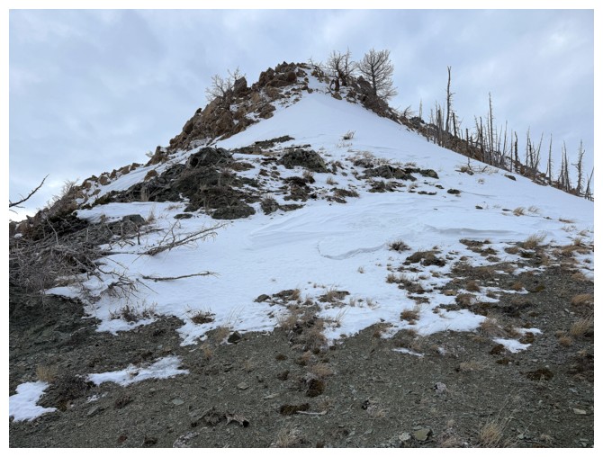
However, a route straight up the centre of this outlier of Bellevue suddenly looked appealing
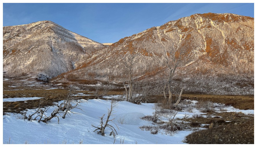
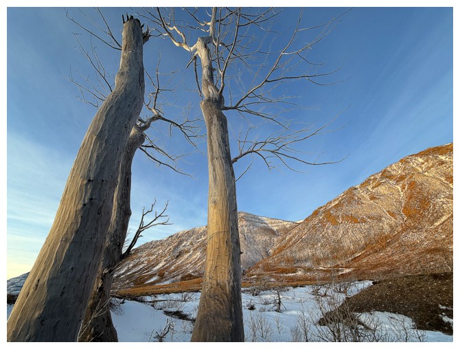
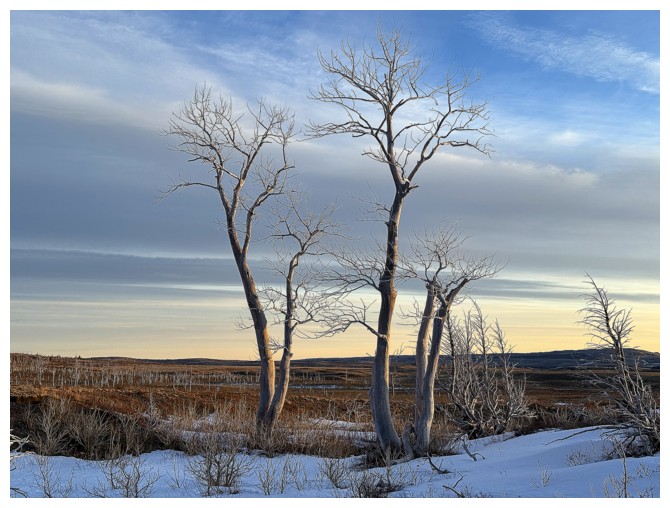
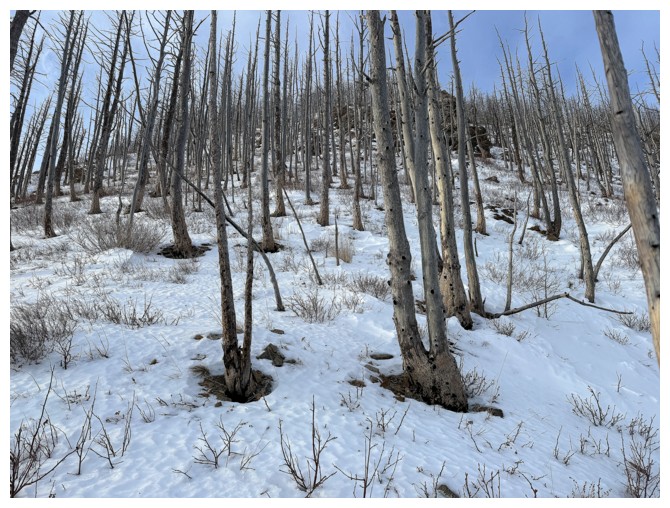
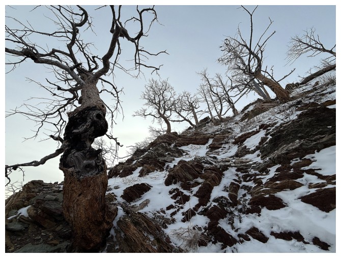
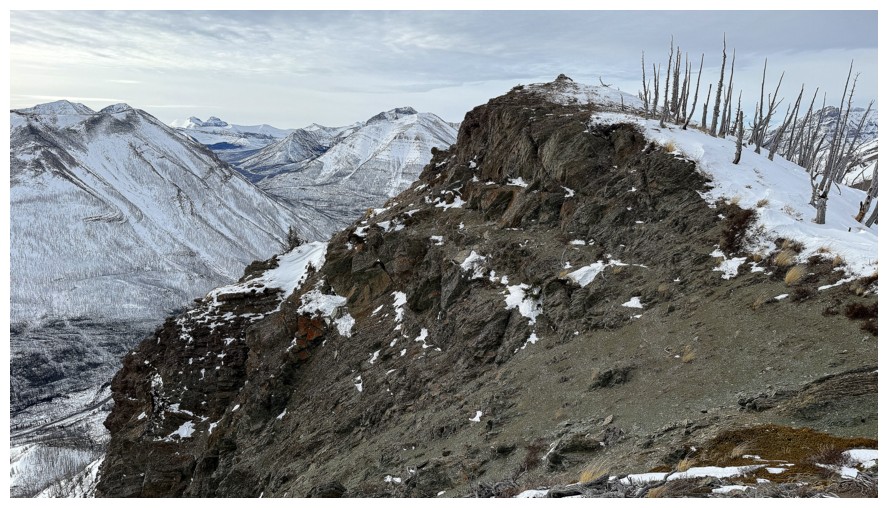
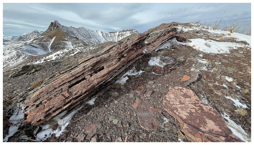
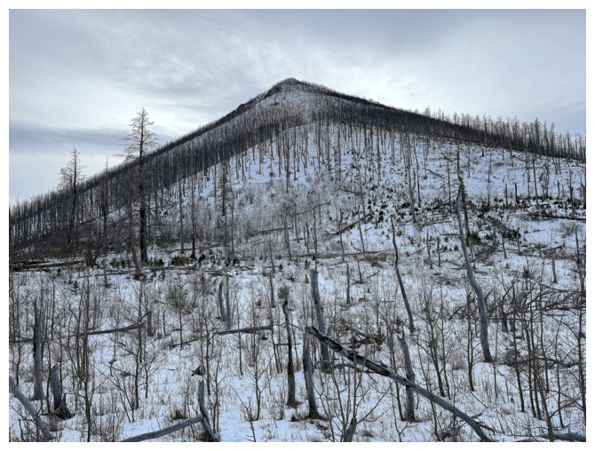
Approaching "The Trees" (a classic from 1978 that is even more lyrically poignant in the year 2026)
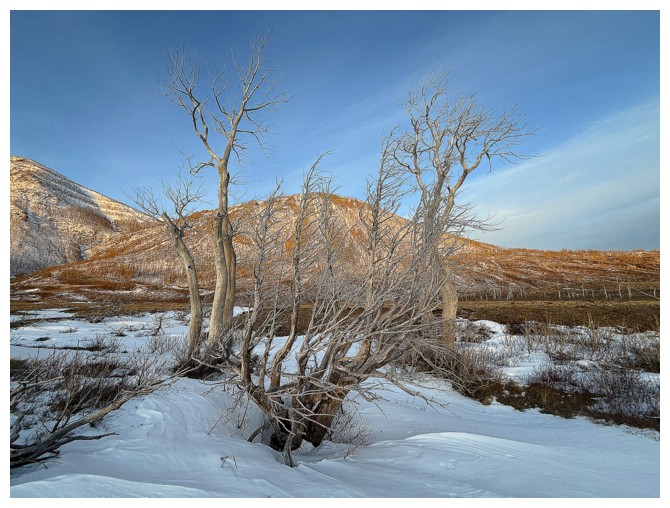
The Trees are a random group of dead trees that stand like sentinels, separating the mountains from the prairies. They are also very photogenic.
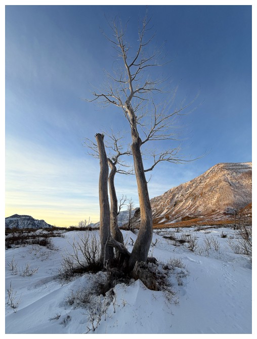
Leaving The Trees
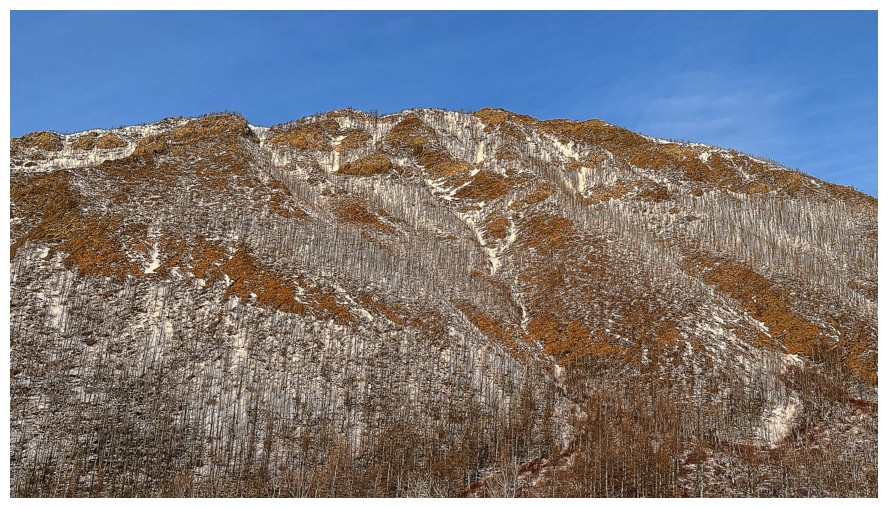
Looks like there could be several interesting lines up the northern outlier
But I'm focused on the southern one
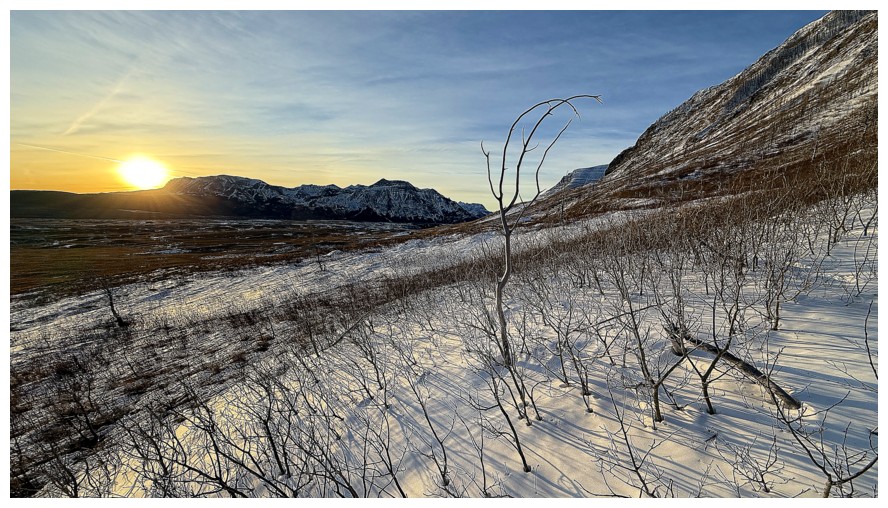
The Sun peaks over Sofa Mountain
Ascending the southern outlier and looking over to the northern one
Typical terrain early on
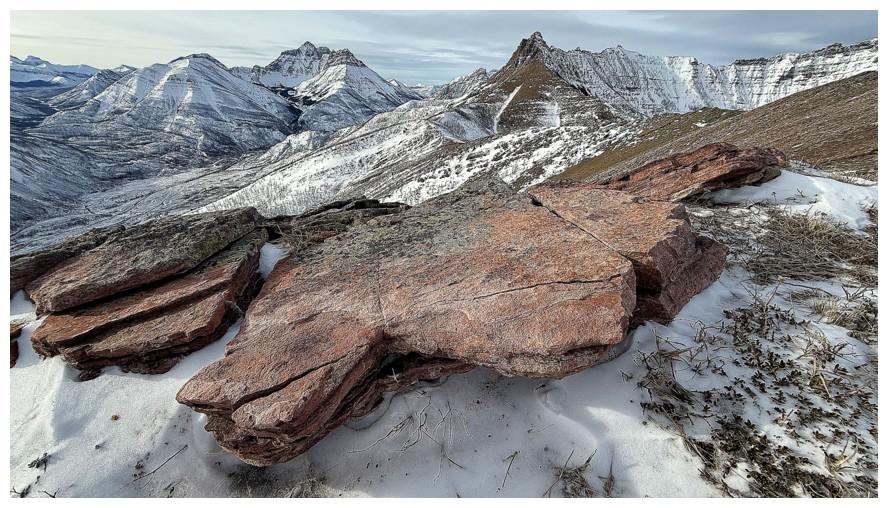
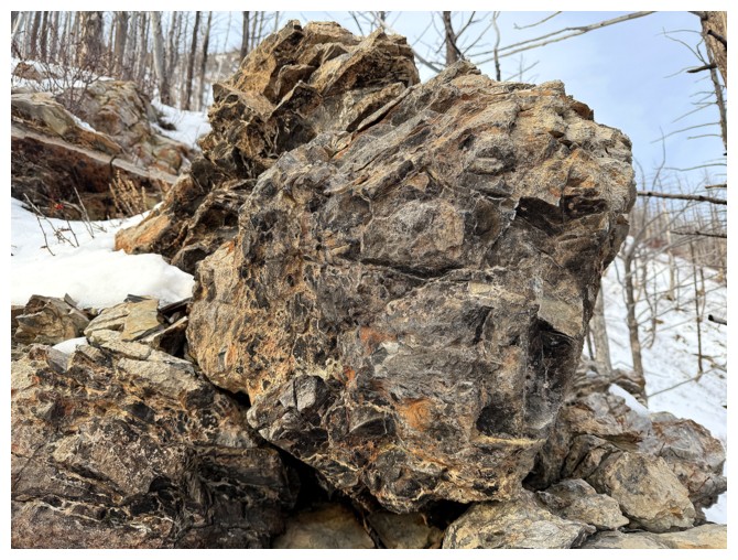
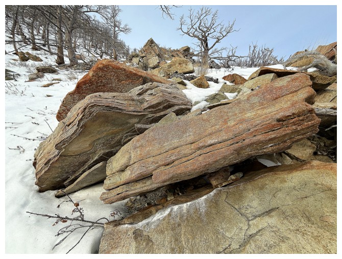
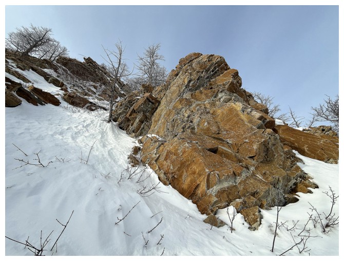
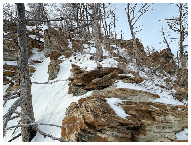
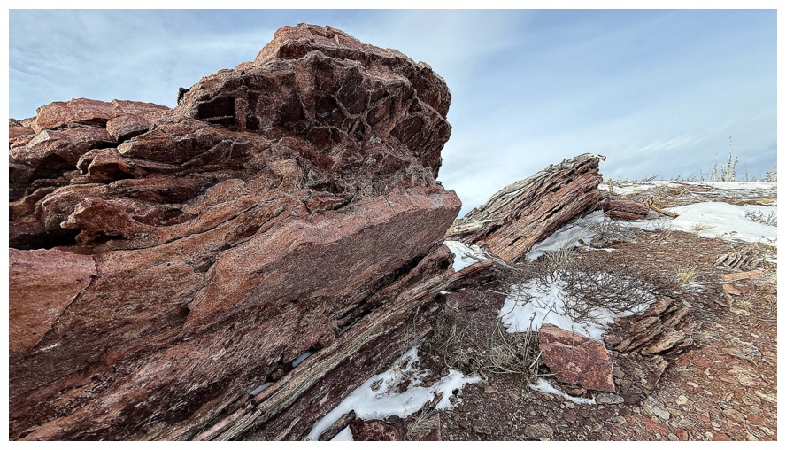
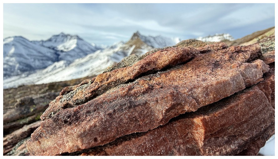
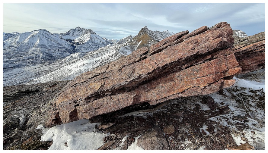
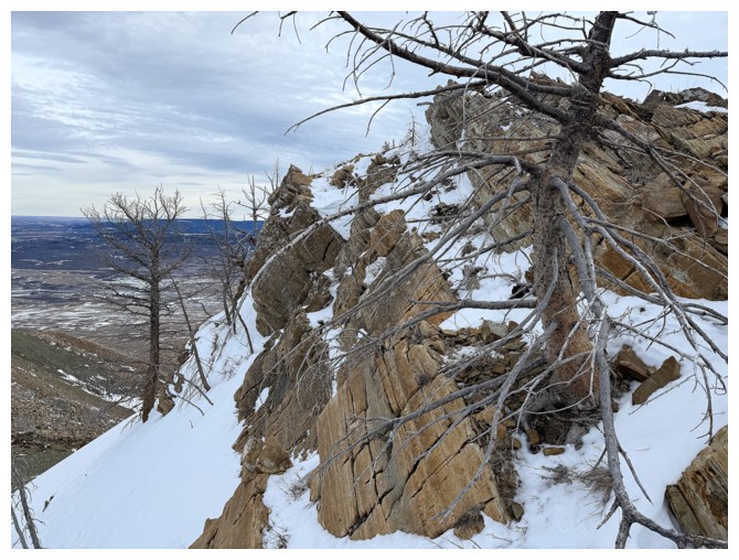
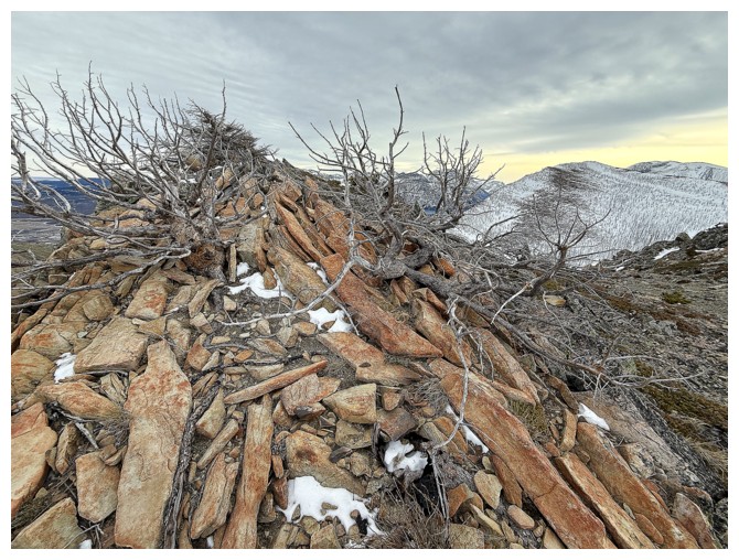
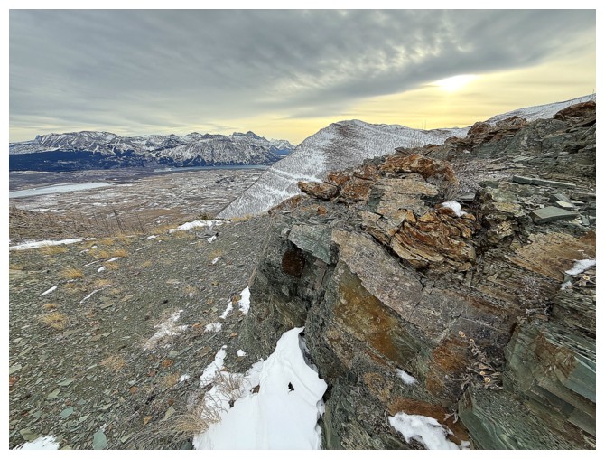
First run-in with cool rock

The second
Many more to come, so I'll stop numbering them!
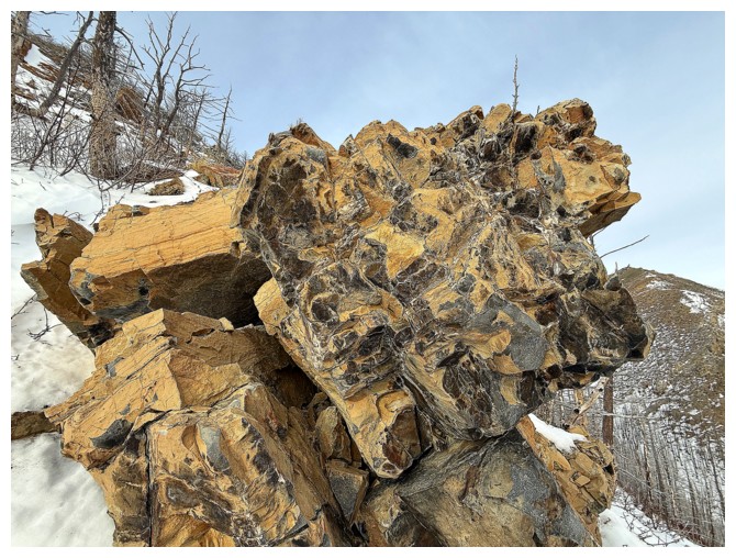

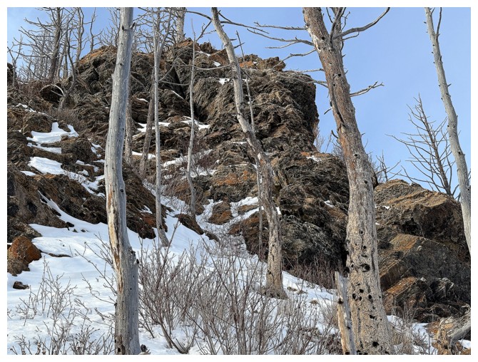
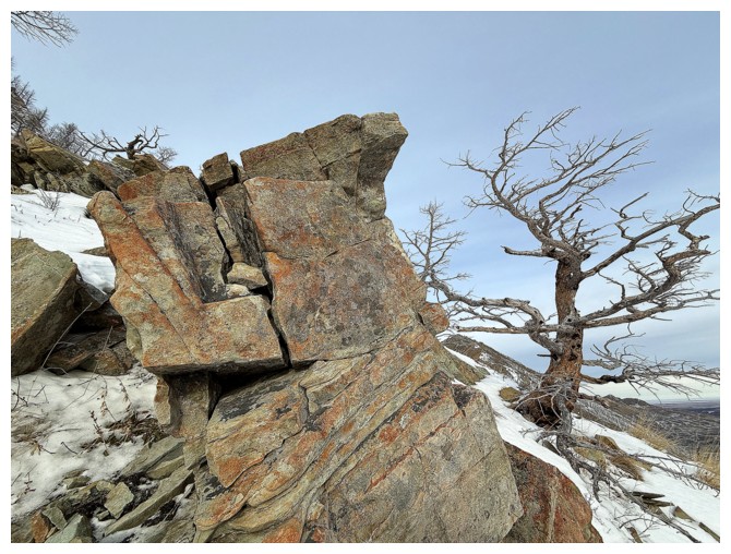
The first tricky section. I had to squeeze up a small crack on the
right side of this very interesting rock - not so easy wearing my bulky,
winter boots and thick mitts.
The very interesting rock and the tree
Onto the next
Needless to say, the trees en route were as stunning as the rocks
Both
The second tricky section. It's steeper than it looks. I went around the left side. An ice axe was needed.
The route around the left side
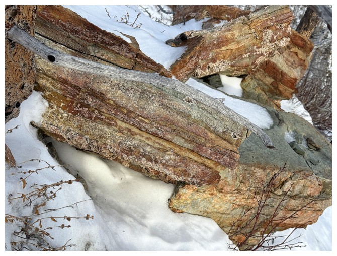
More beautiful rock run-ins
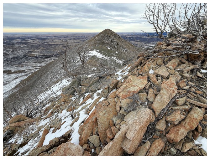
Again, looking over to the northeast ridge
The terrain ahead
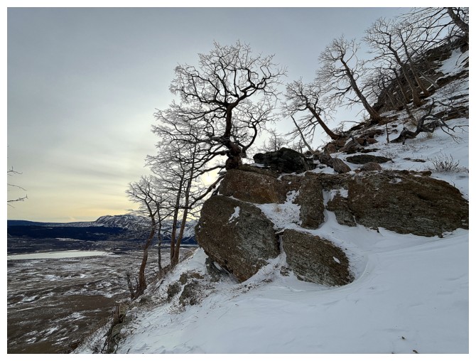
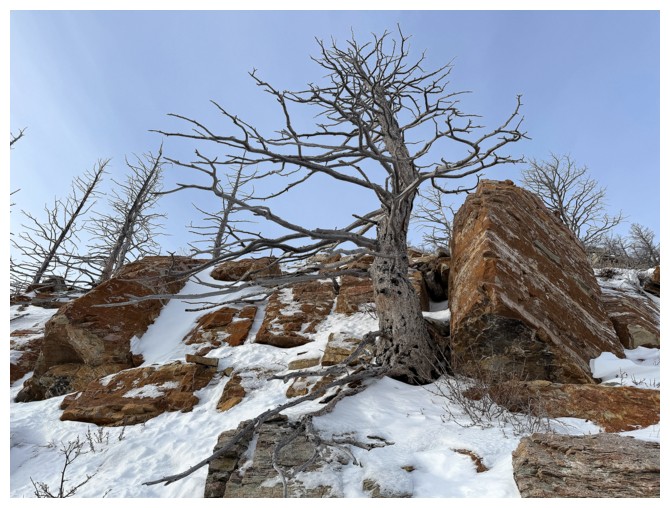
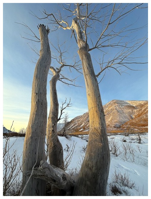
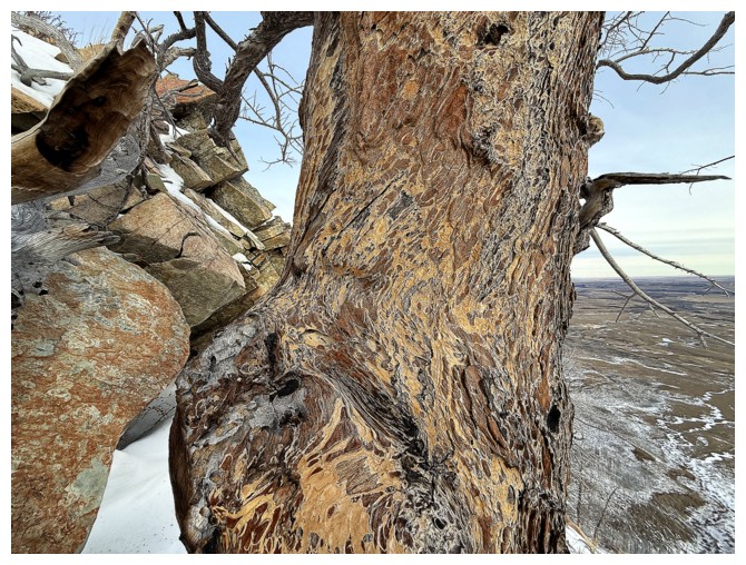
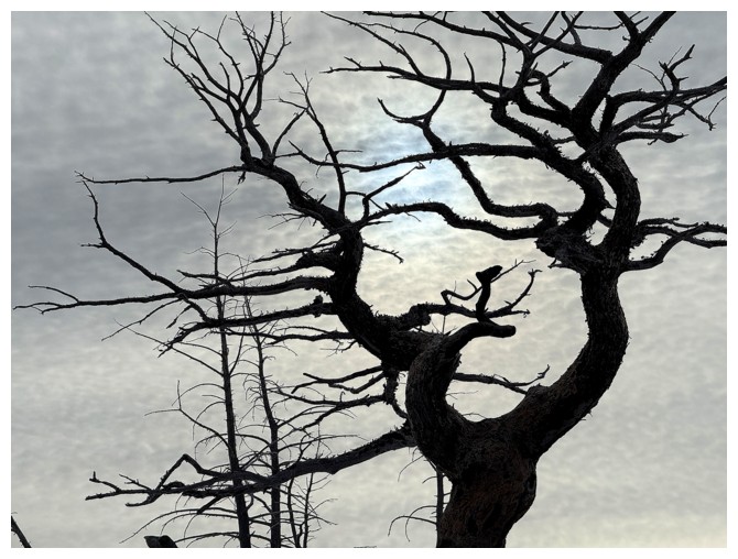
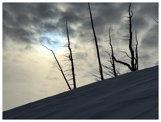
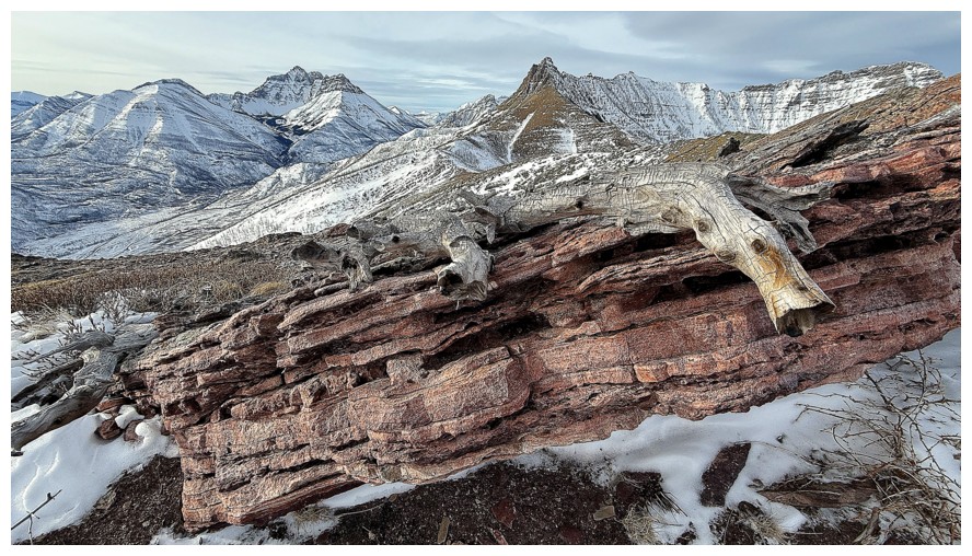
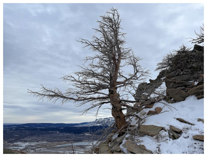
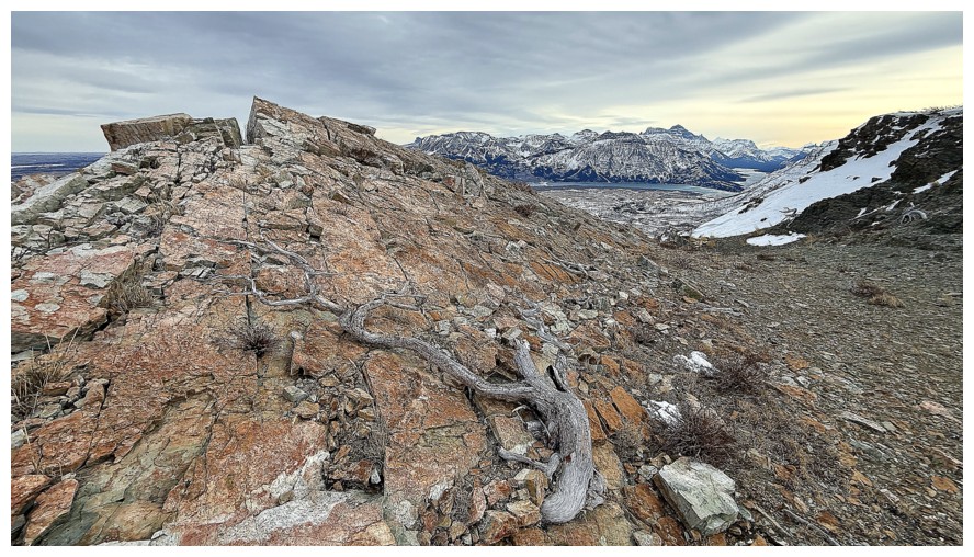
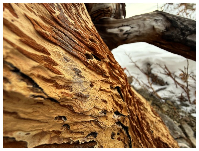
The upper part of the route featured a glut of interesting and sometimes scary dead trees
That's a scary one
Interesting and scary
Definitely scary!
Back to the rock
Wishing I had Sun on the rock and blue skies in the background
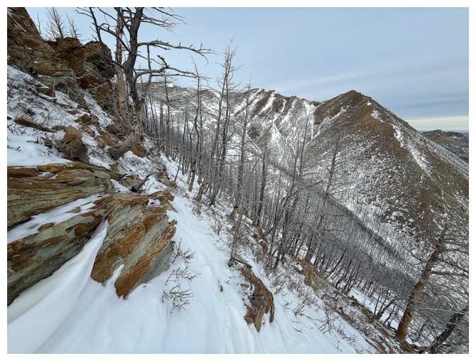
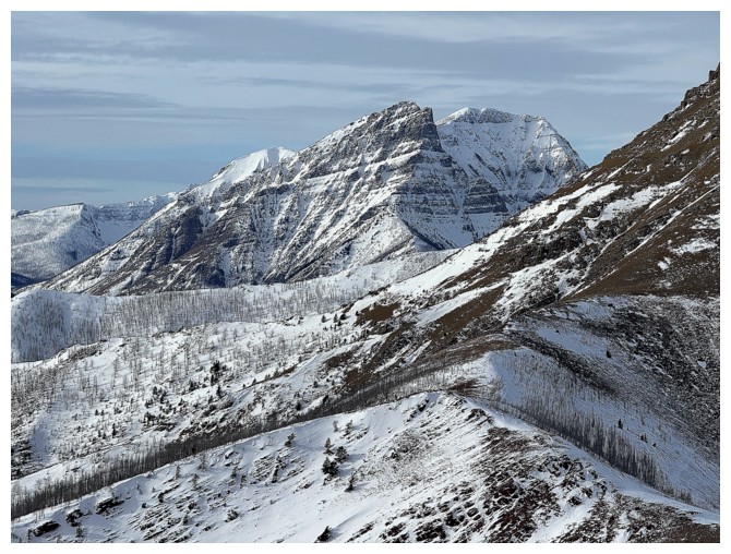
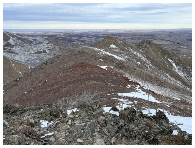
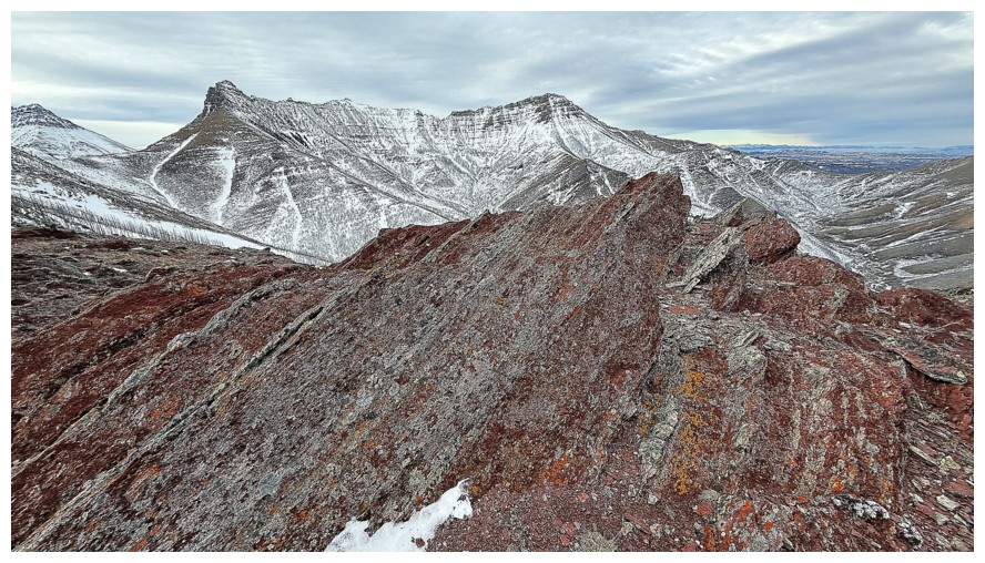
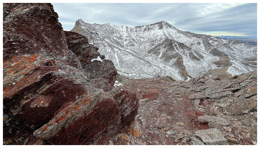
Better view of the northeast ridge
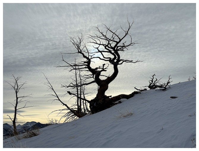
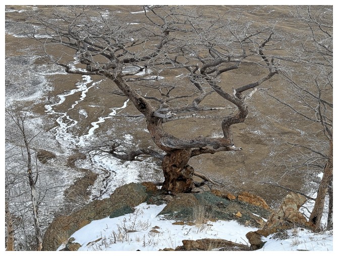
The scariest one!
Close-up , with pale blue clouds behind
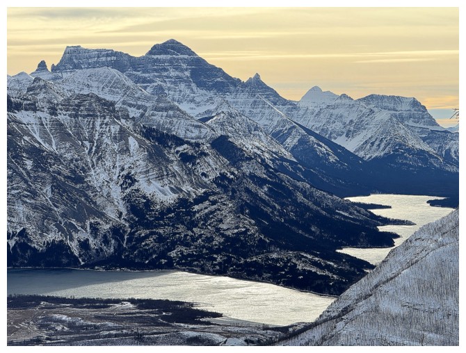
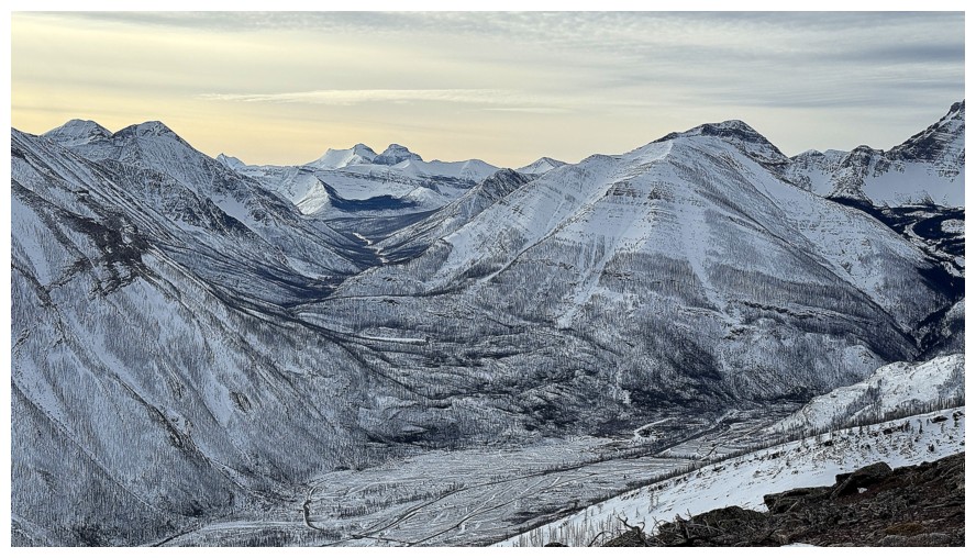
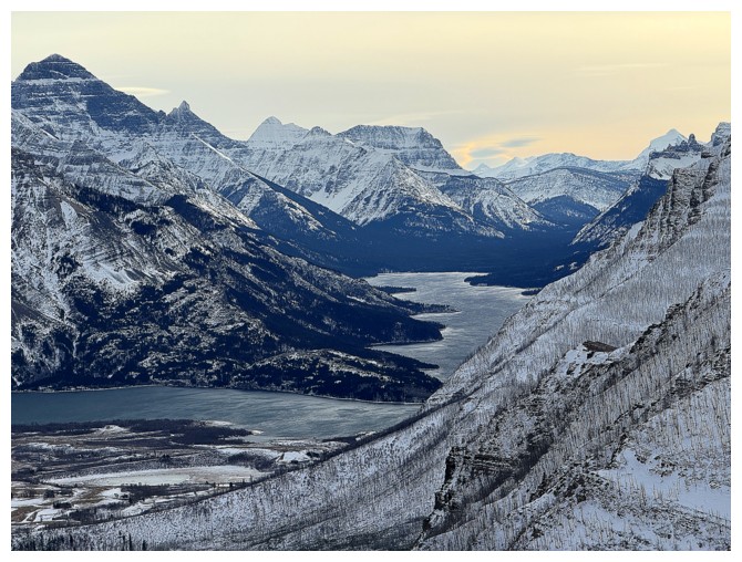
Some of the Waterton Lakes and Mount Cleveland
Zoomed out
If it's going to be cloudy, let's at least have some impressionist-like clouds

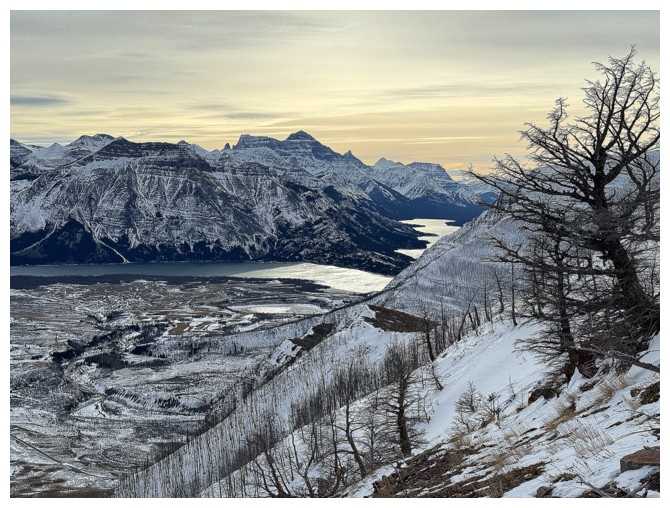
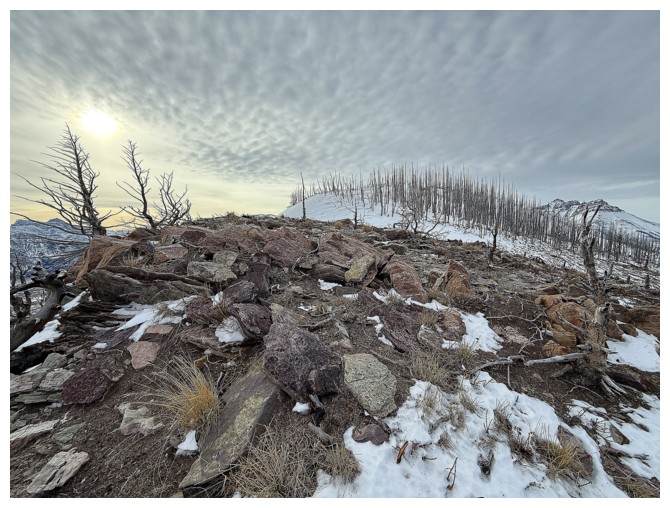
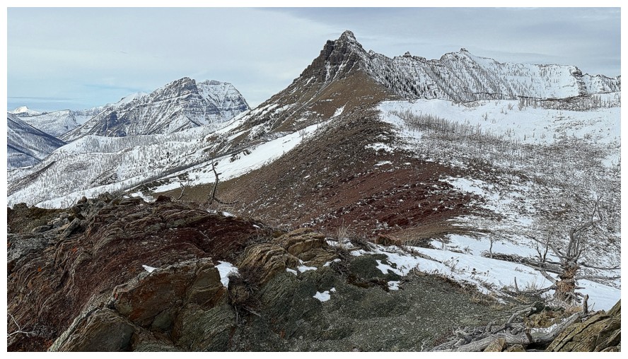
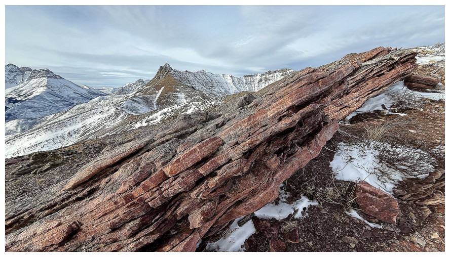
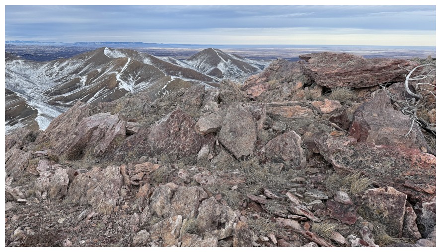
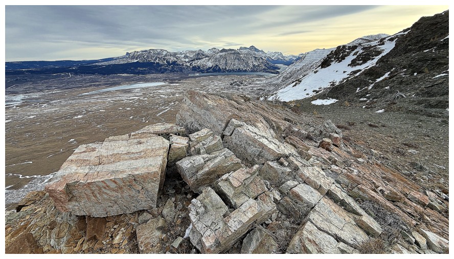
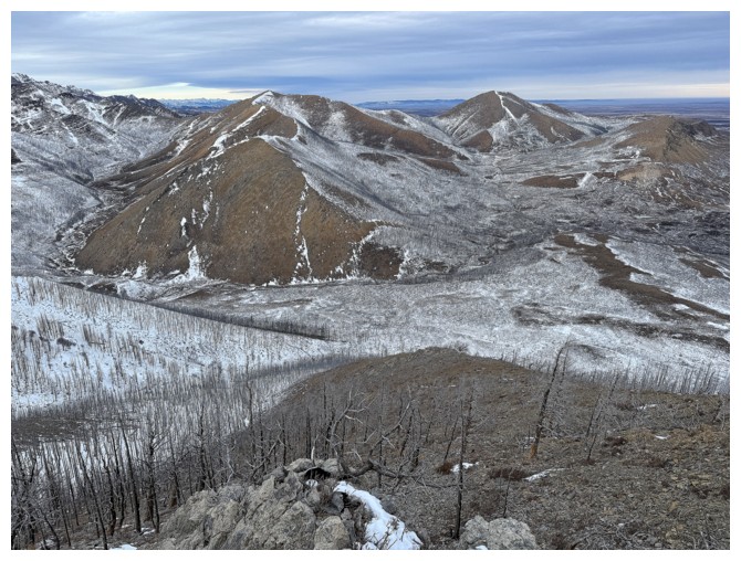
Overall view, approaching the first highpoint
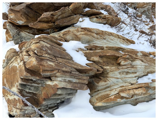
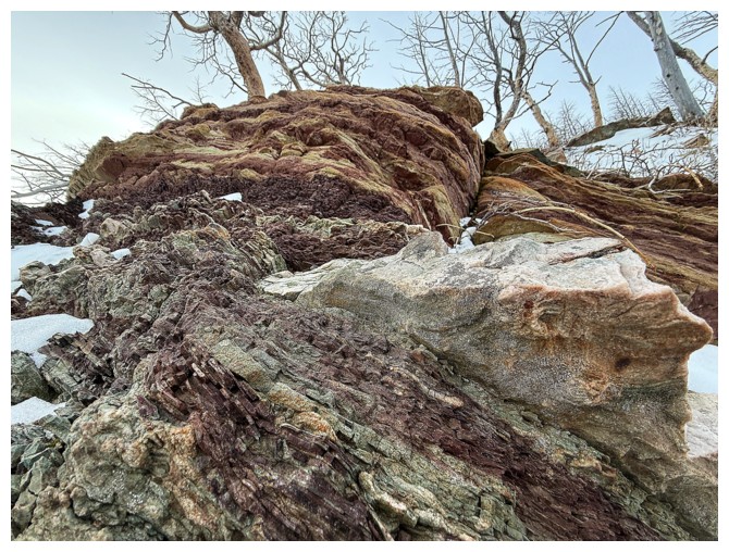
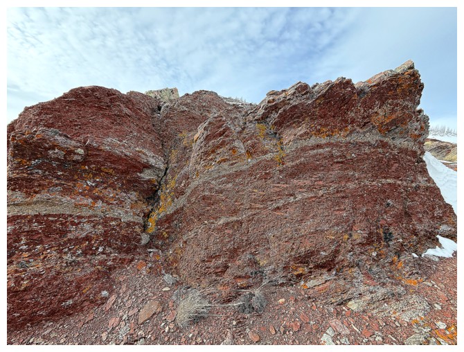
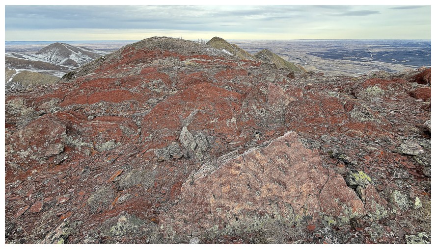
The interesting colour again
And some interesting snow. The snow at the top looked like an ice rink up close.
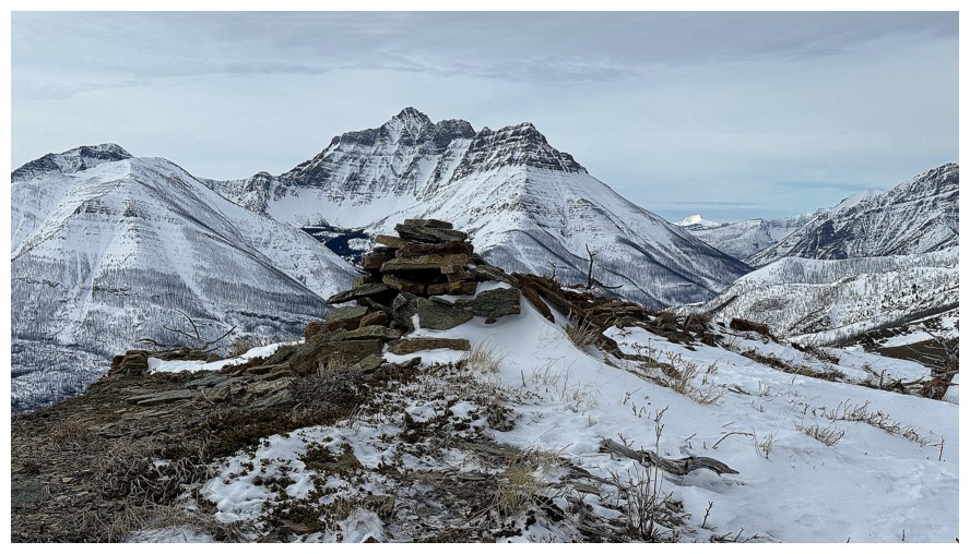
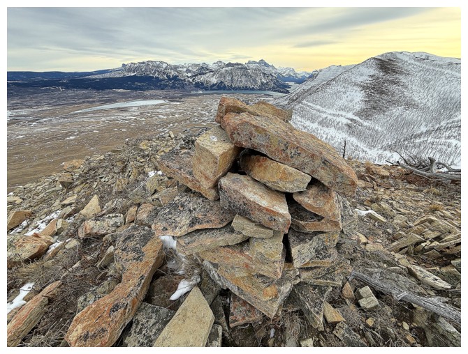
There's a big cairn at that highpoint
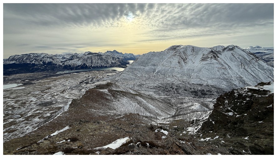
Still enjoying the clouds (as much as possible, when I crave clear skies) and now the north side of Mount Crandell joins the view
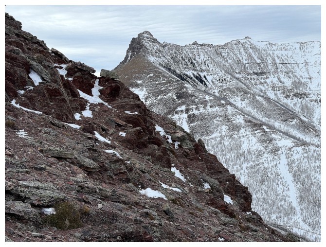
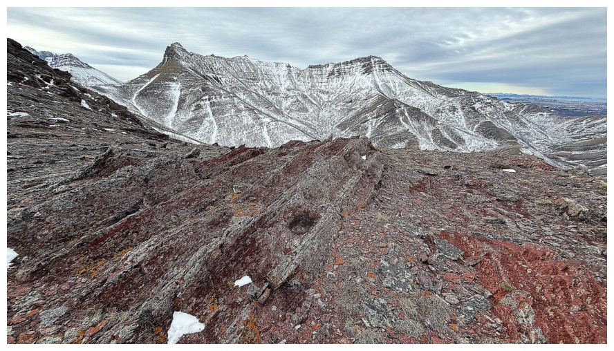
Close-up of Crandell. There are plenty of routes up on the north side but the ones on the northeast side are more feasible.
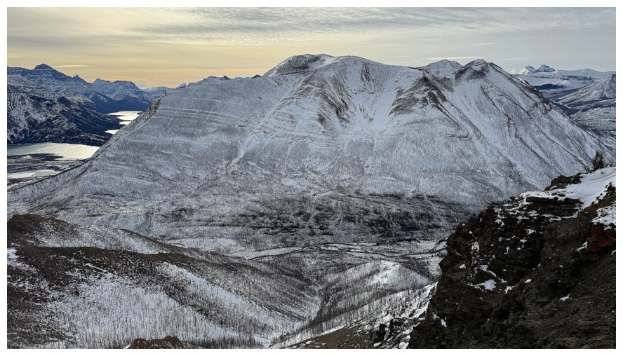
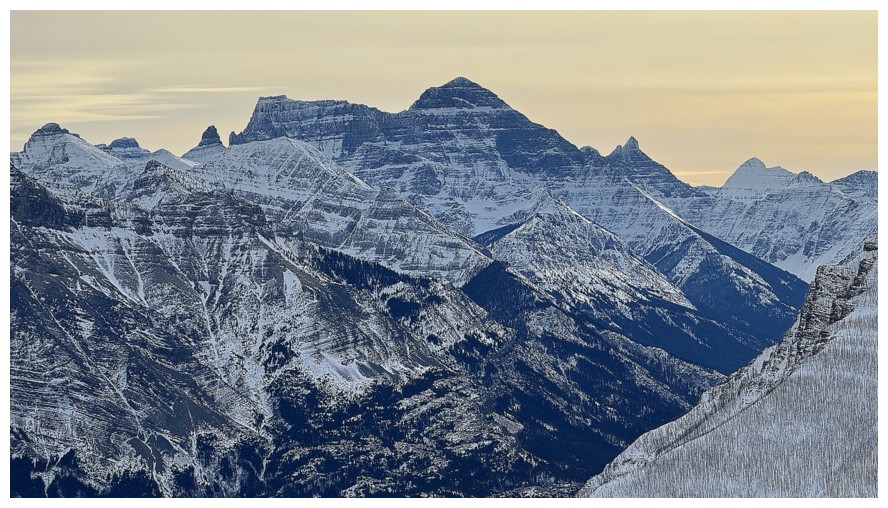
Distant but always beautiful mounts Kintla and Kinnerly in Glacier National Park
Much closer and also always beautiful Mount Galwey
The cairn and Mount Blakiston
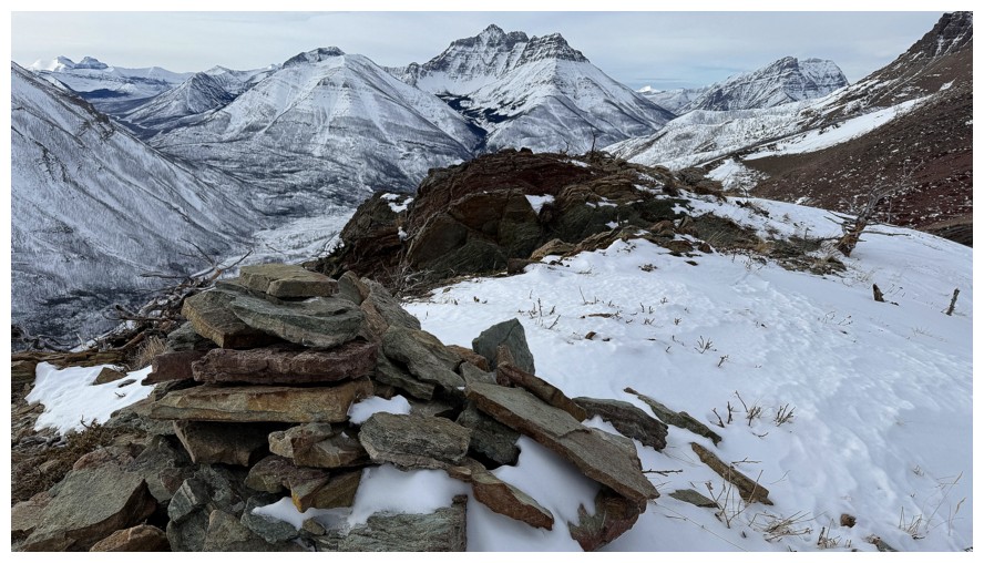
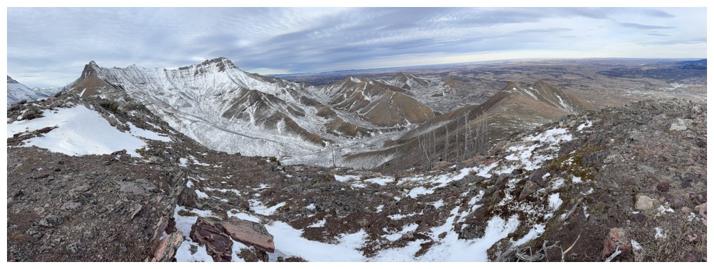
View to the south
Heading for the summit
Close-up of Cleveland
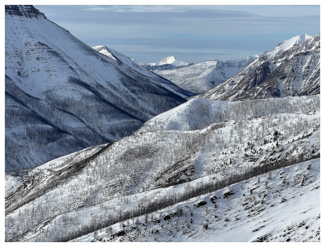
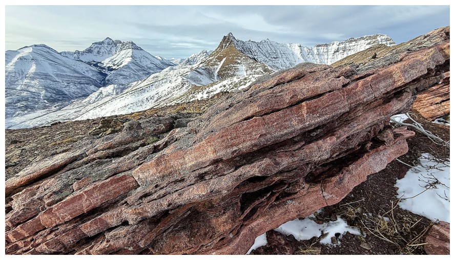
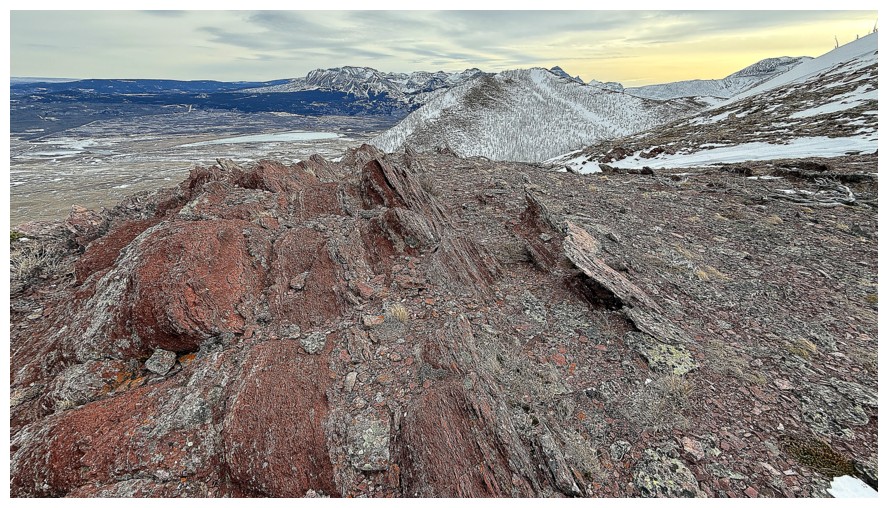
The rock scenery from here to the summit is fantastic, but I'll need to repeat the traverse with clear skies
Looking back to the first highpoint
Close-up of Kintla and Kinnerly
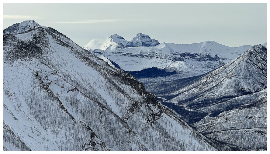
Anderson Peak - another on the list of my favourite scrambles in the Rockies
Kenow Mountain in the very distant centre
Close-up of Blakiston
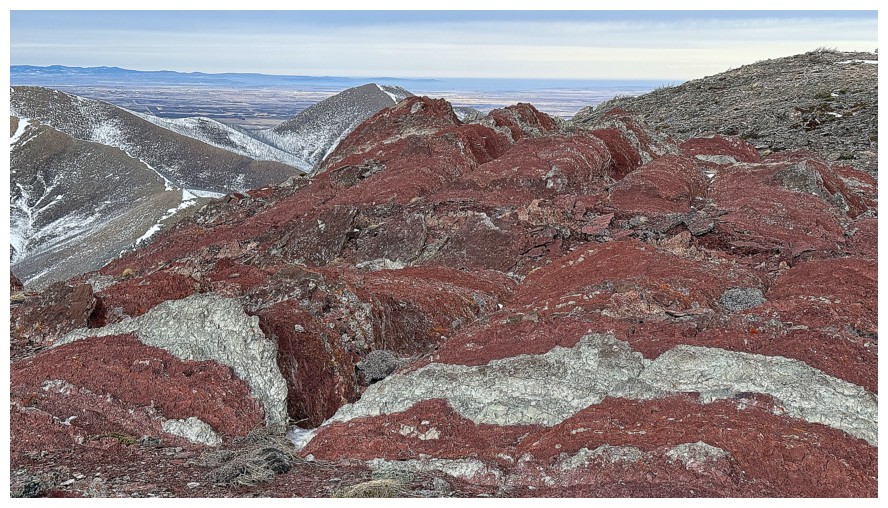
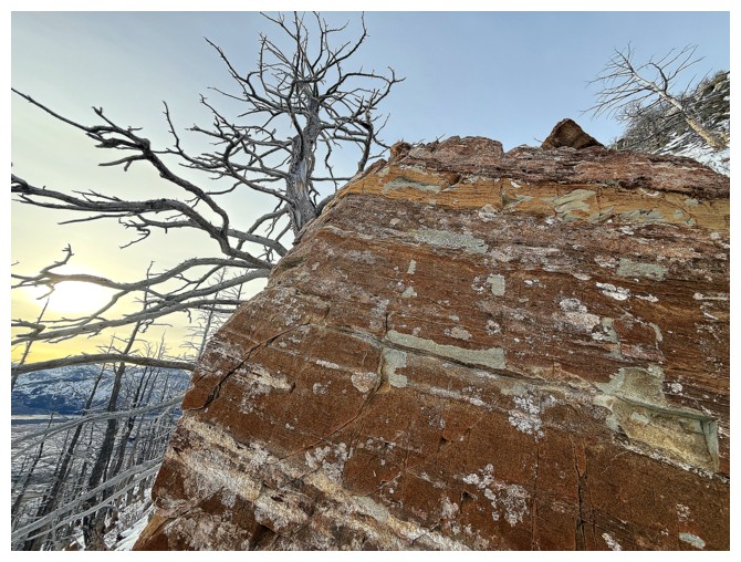
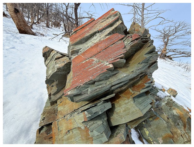
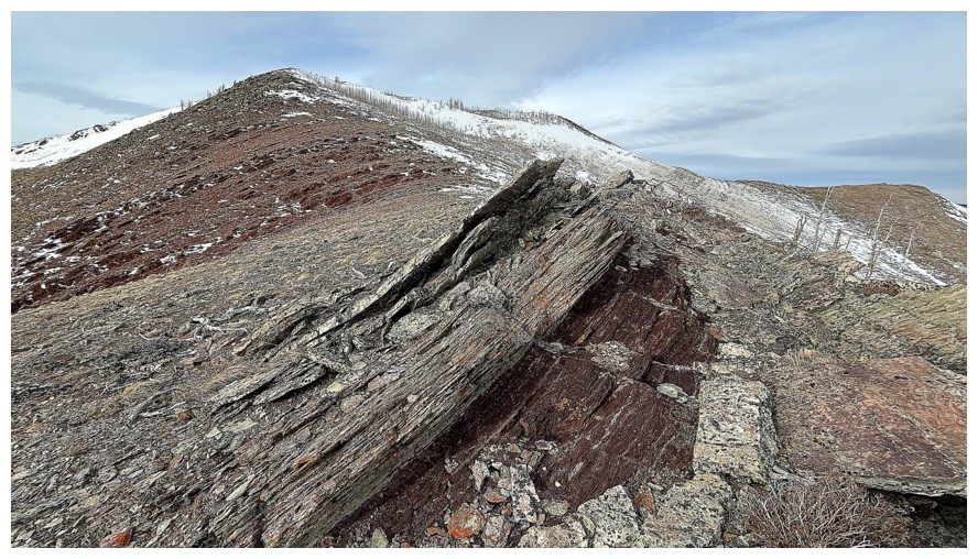
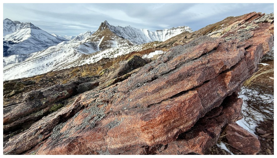
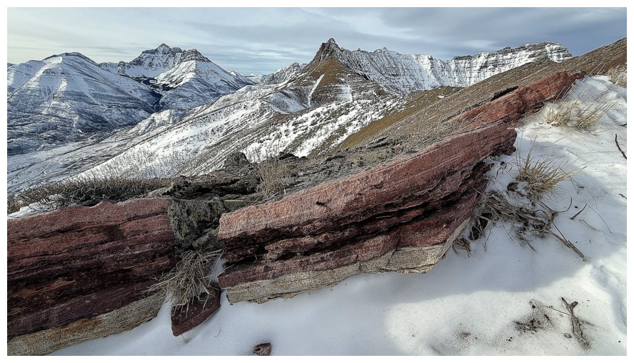
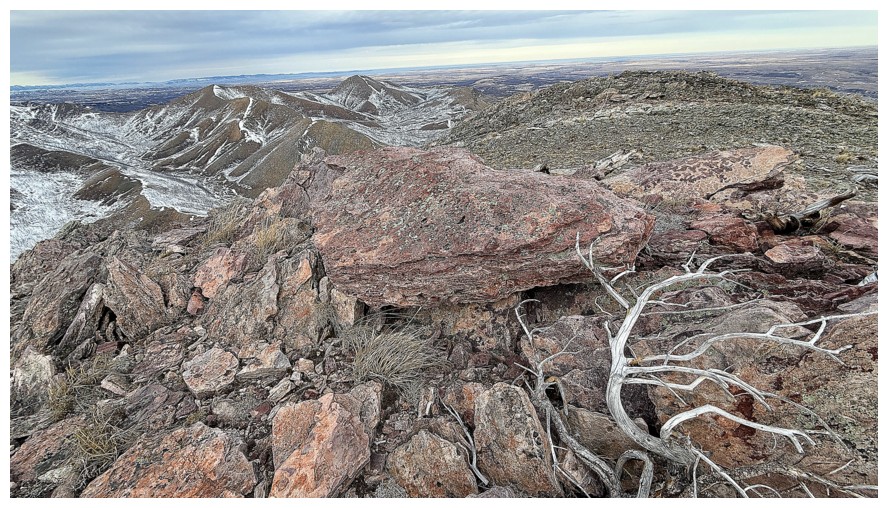
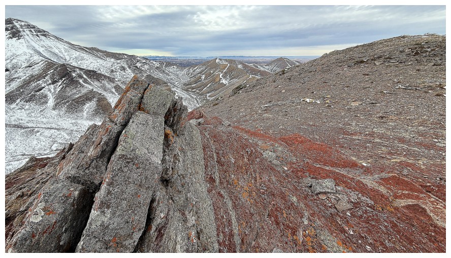
This section of pink/burgundy rock was the coolest of the traverse and demanded a 5 minute stay to enjoy it
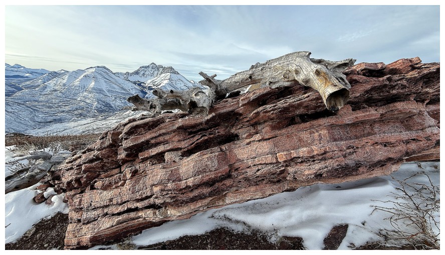
Dead tree draped over the rock
Last one
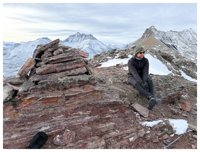
Spencer at the summit
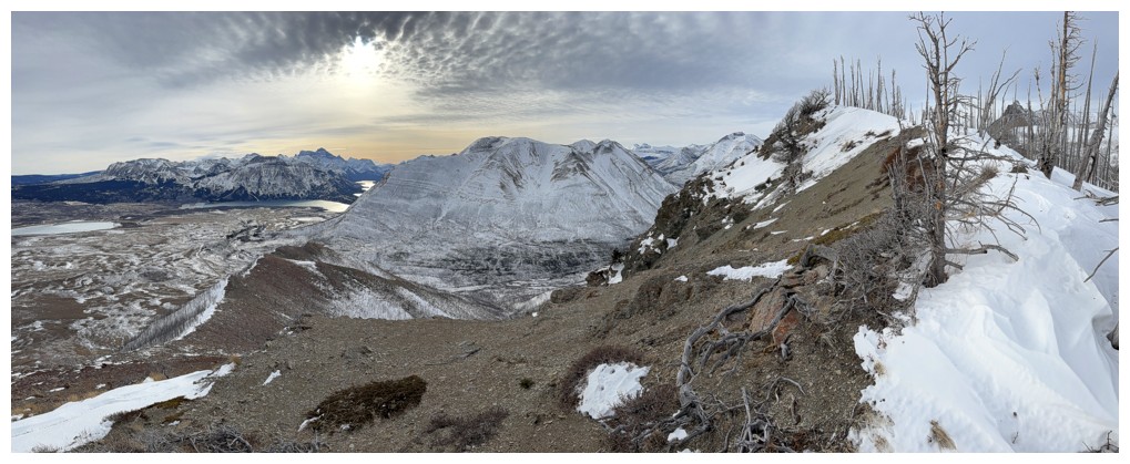
Summit panos
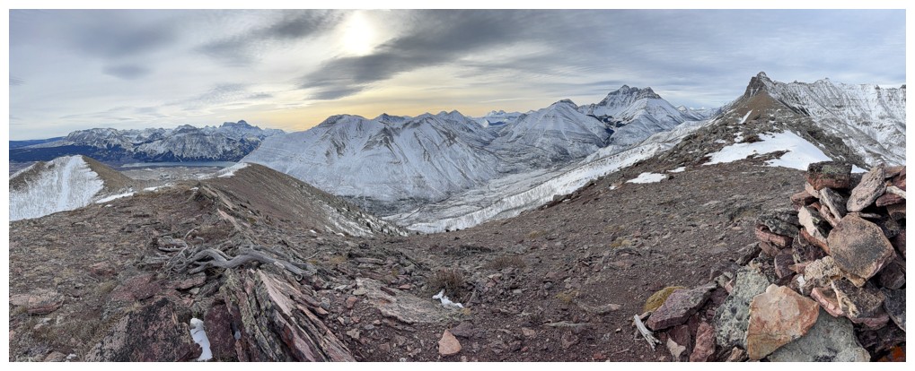
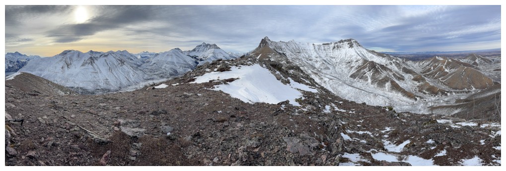
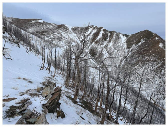
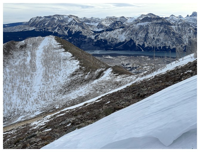
The Lakeview Ridge massif to the northeast - tons of different routes up that one
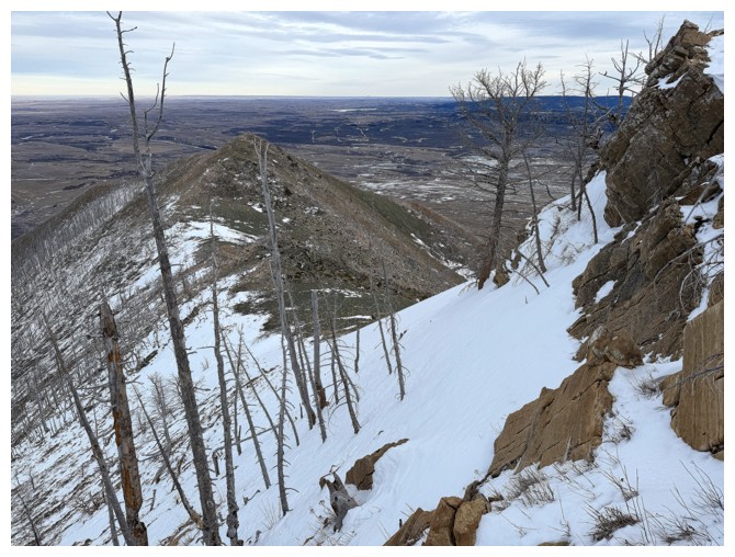
Looking down the northeast descent route
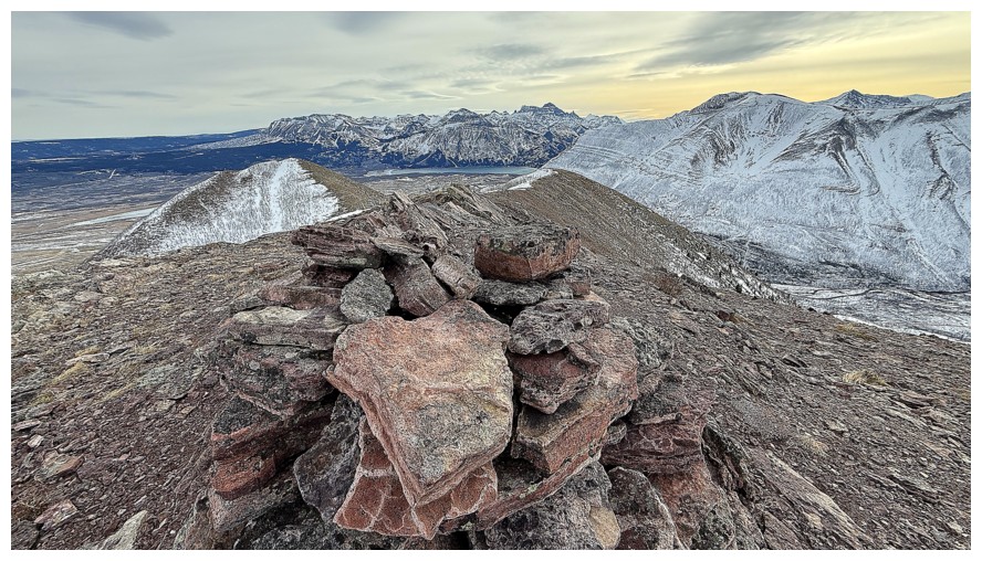
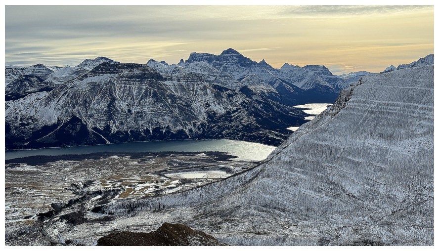
The large summit cairn and view towards the lakes
Last look to the west
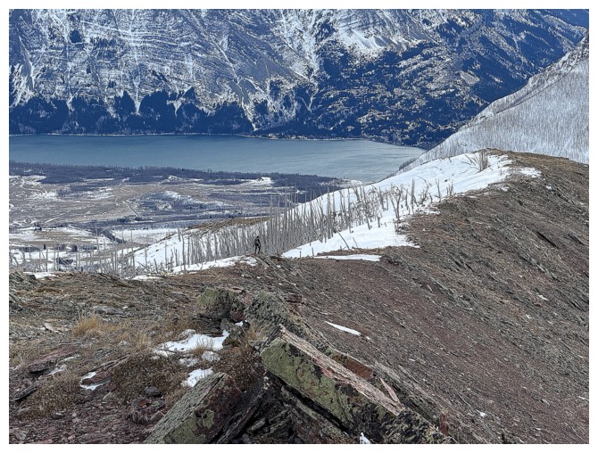
Spencer is heading down the way he came
My turn to leave
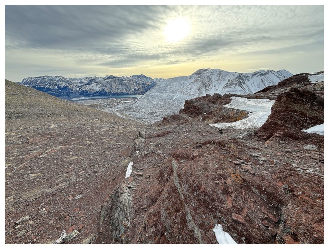
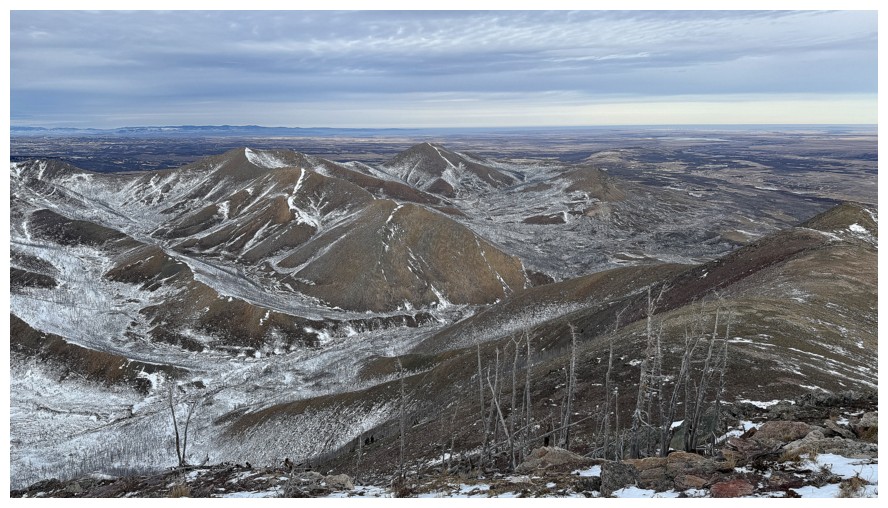
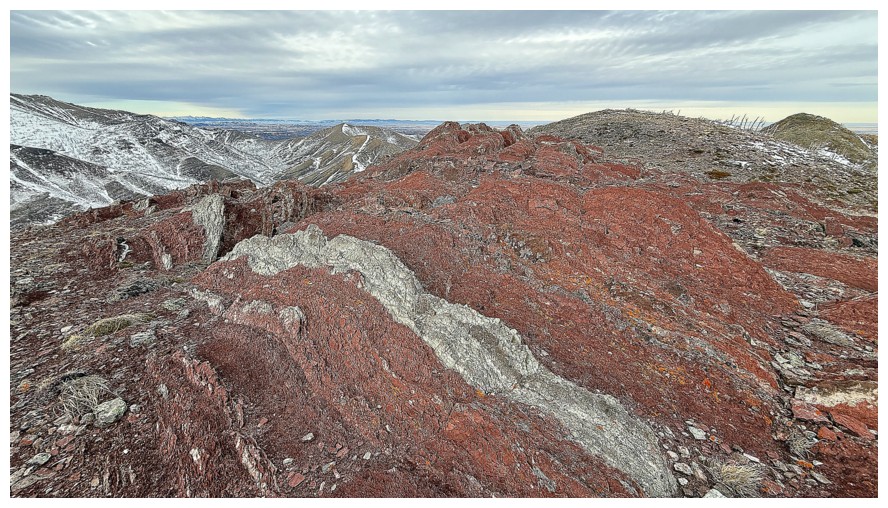
The descent route is also littered with amazing rock
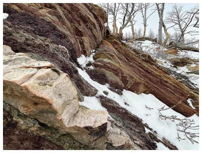
Approaching the red argillite section
Galwey again. I tried but failed to find a scramble route up the steep east ridge, seen here.
Infinite curses on those cloudy skies!
Rogan Peak near the right
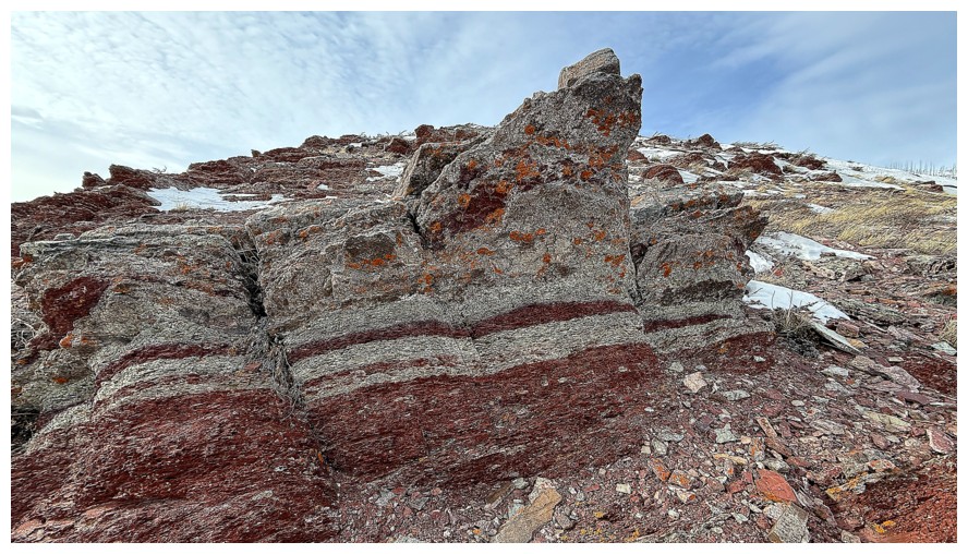
The argillite is replaced with dolostone and limestone
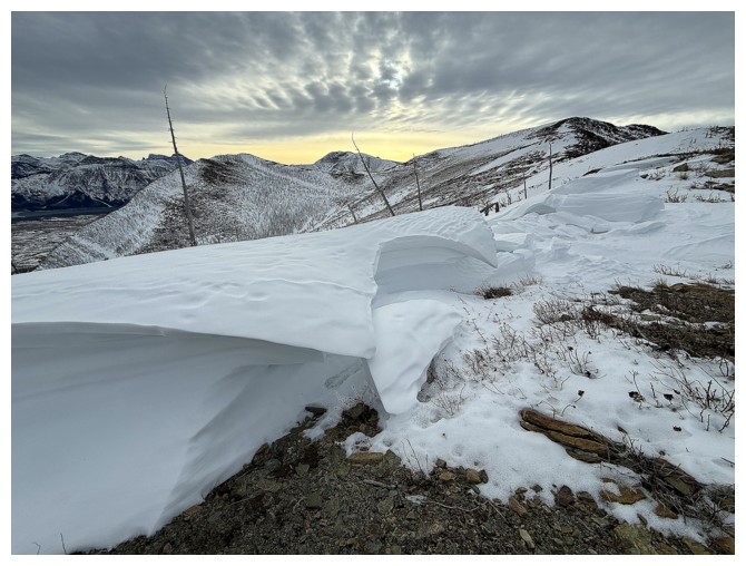
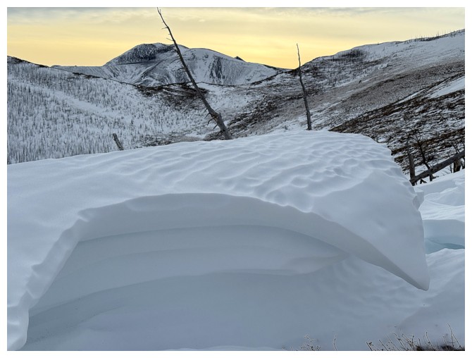
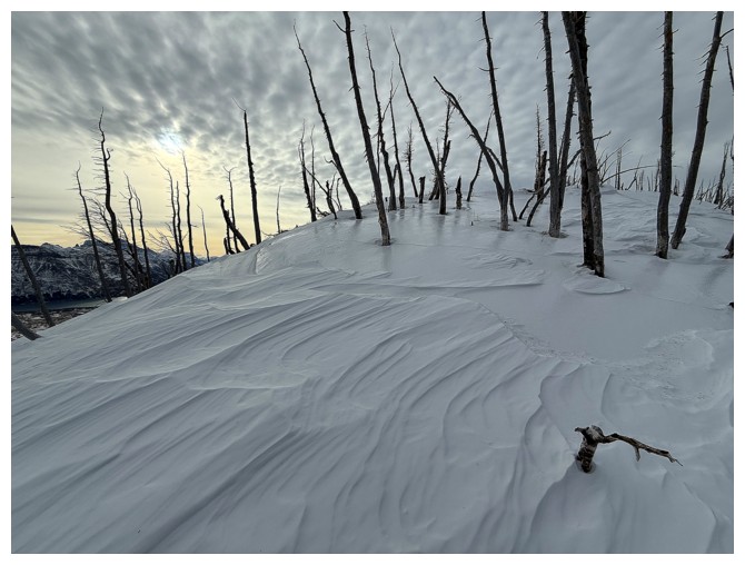
Finally, some interesting cornice-like scenery
The crux of the descent was getting down this snow slope, as the snow was very hard. I took out microspikes and an axe ice.
Looking up that snow slope from safer terrain
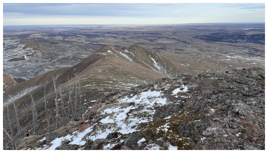
The cool rock continue throughout
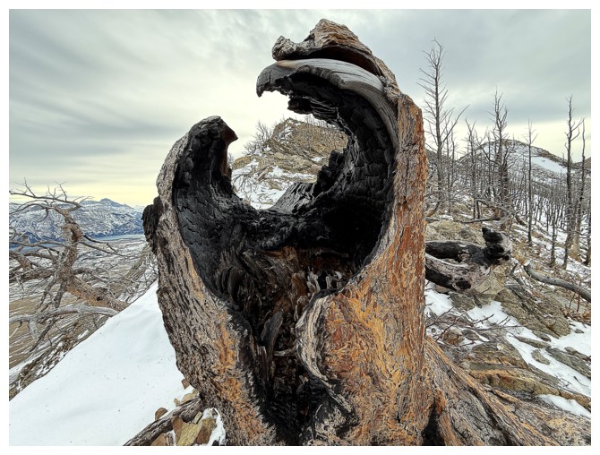
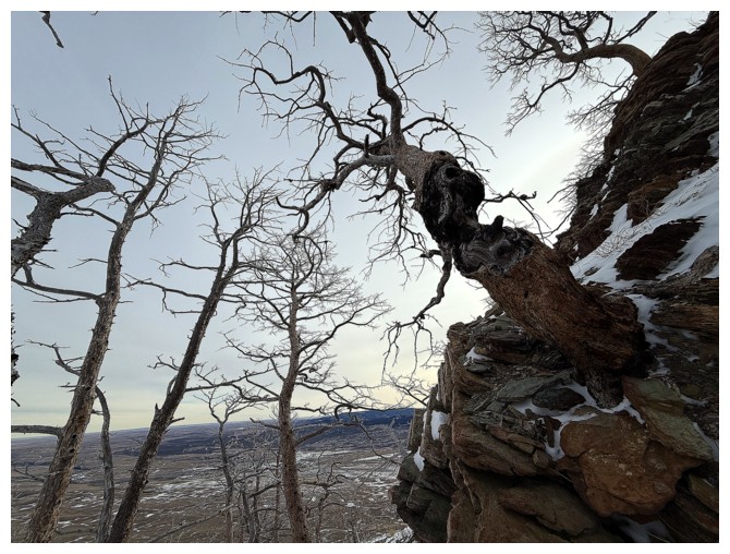
Approaching a very neat dead tree
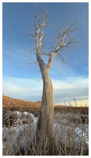
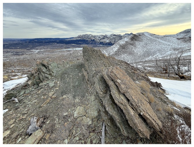
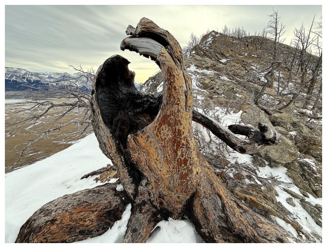
There is is. It looked way cooler on my first ascent on the northeast ridge, covered in frost with the top lit up.
Thought the skies may be starting to clear at this point, but I was wrong
Another big cairn that marks the first highpoint of the northeast ridge
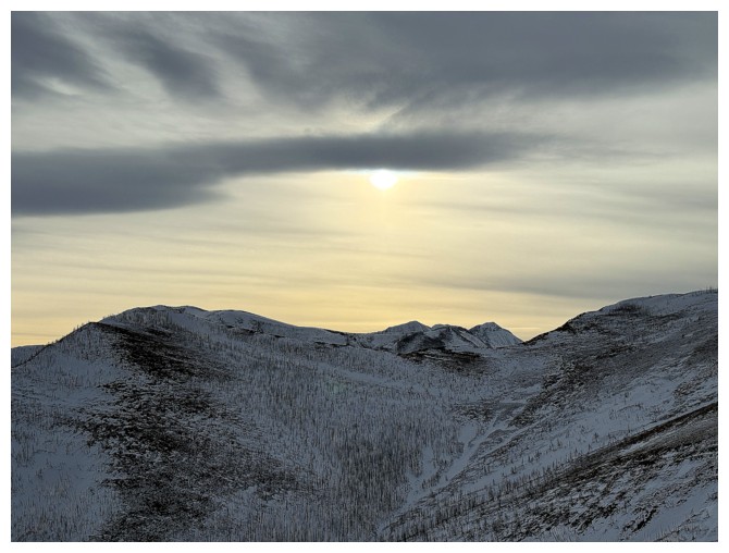
The Sun sinks below one cloud layer into another
I think that's Wahcheechee Mountain in the centre
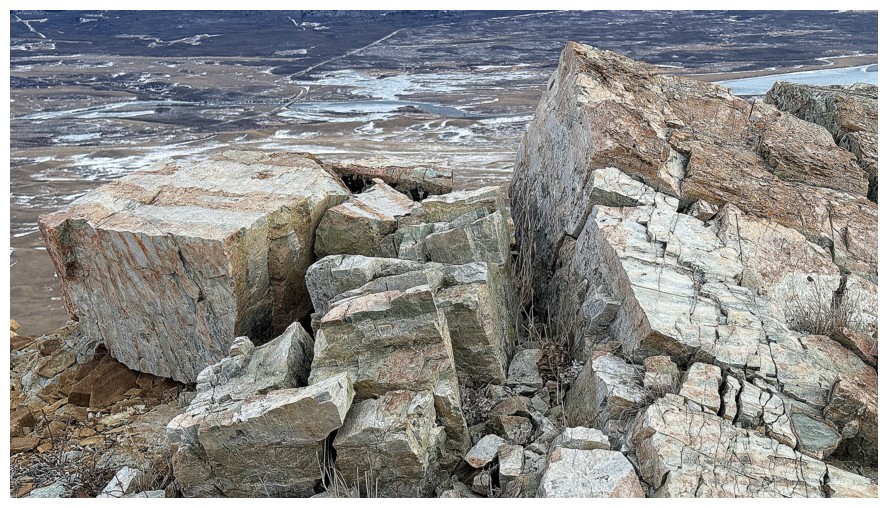
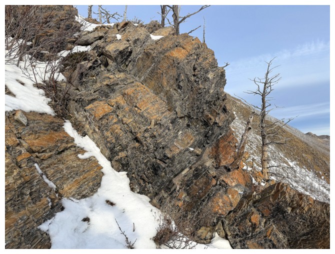
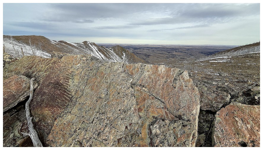
Always interesting to see rocks that have fractured in such geometrically pleasing ways
Tree close-up
Zoomed out
Lakeview Ridge again
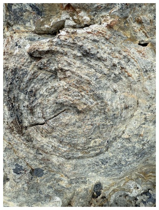
Circles in the rock
At the bottom of the route
And back at the parking lot
The End
LOG