Mount Galwey V
May 1, 2021
Mountain height: 2348 m
Elevation gain: 960
m
Round-trip time: 7:45
Scrambling and a little mountaineering with
Mark.
 Given that most of the trips I do these days
are repeat ascents, many are accompanied with a fair degree of nostalgia. But
perhaps none as much as this one. It had been 17 years since Mark and I had scrambled
up Mount Galwey (Mark’s first Waterton ascent and my fourth) and although I had
visited Galwey’s summit on three separate occasions since 2004, none were with
the old bro’ and none were half as nostalgic as this one.
Given that most of the trips I do these days
are repeat ascents, many are accompanied with a fair degree of nostalgia. But
perhaps none as much as this one. It had been 17 years since Mark and I had scrambled
up Mount Galwey (Mark’s first Waterton ascent and my fourth) and although I had
visited Galwey’s summit on three separate occasions since 2004, none were with
the old bro’ and none were half as nostalgic as this one.
Mark chose Galwey as the day’s objective for
a few reasons:
1. He had just bought an ebike and wanted to
test it out on the Red Rock Canyon road before it opened, usually in mid-May.
2. The decent weather was forecast to
breakdown by midday and so a shorter, front range trip would be preferrable.
3. Simply
for the nostalgia factor.
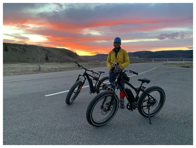
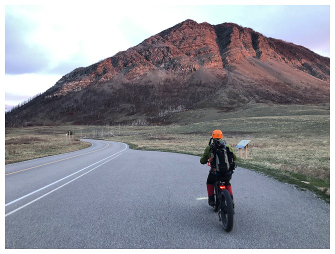
 Arriving at the locked gate near the entrance
to Red Rock Canyon road, we started (e)biking around 6 am and arrived at the
Coppermine Creek parking lot about 20 minutes later – 8 km of super enjoyable
biking, made so much more enjoyable (and easier) by the pedal-assisted power of
the ebikes.
Arriving at the locked gate near the entrance
to Red Rock Canyon road, we started (e)biking around 6 am and arrived at the
Coppermine Creek parking lot about 20 minutes later – 8 km of super enjoyable
biking, made so much more enjoyable (and easier) by the pedal-assisted power of
the ebikes.
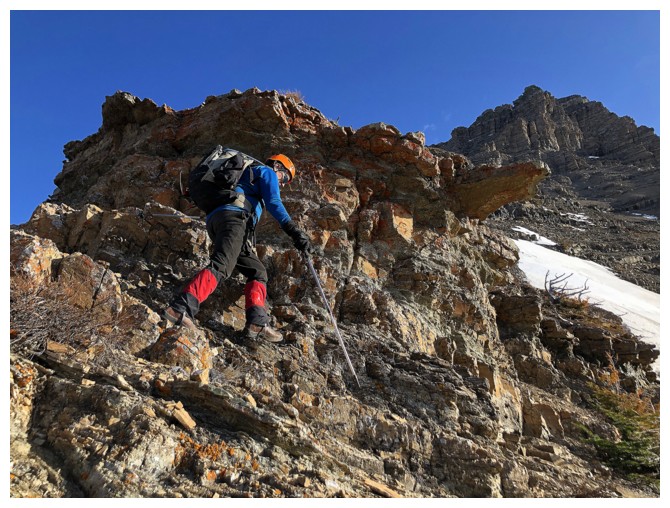
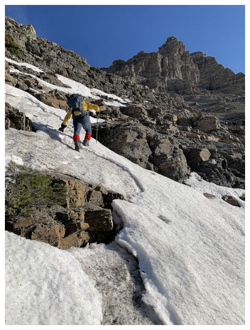
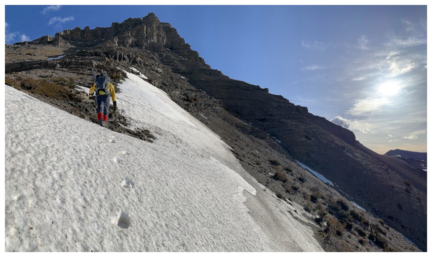
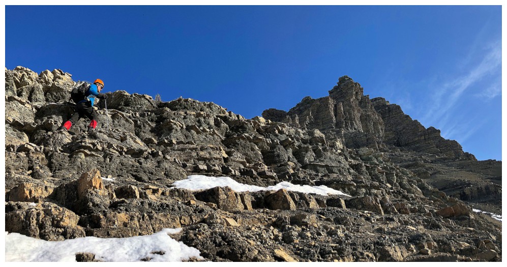
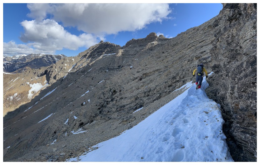
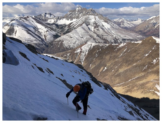
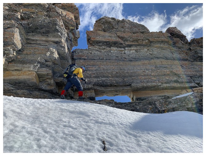
A little concerned about snow on the route upper
section of the mountain, we did bring some mountaineering gear with us,
including ice axes, crampons, a rope and harnesses. The lower section was
completely snow-free, allowing easy travel up the well-worn trail. We did leave
the path at one point, continuing up the ridge when the trail veered off to
the left. I knew from a previous ascent that traversing back to the Alan Kane
ascent route was feasible from this ridge. Gaining elevation, we soon
encountered a little snow, but more importantly a fair amount of verglass on
the southwest side of the mountain, making a few sections more challenging than
usual.
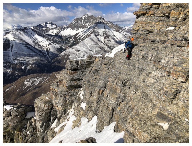
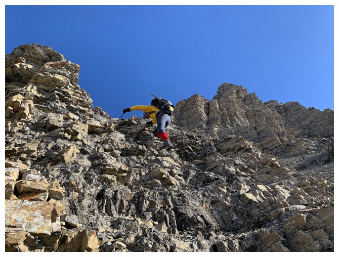
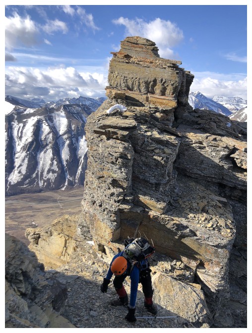
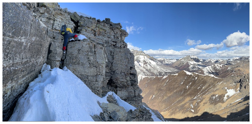
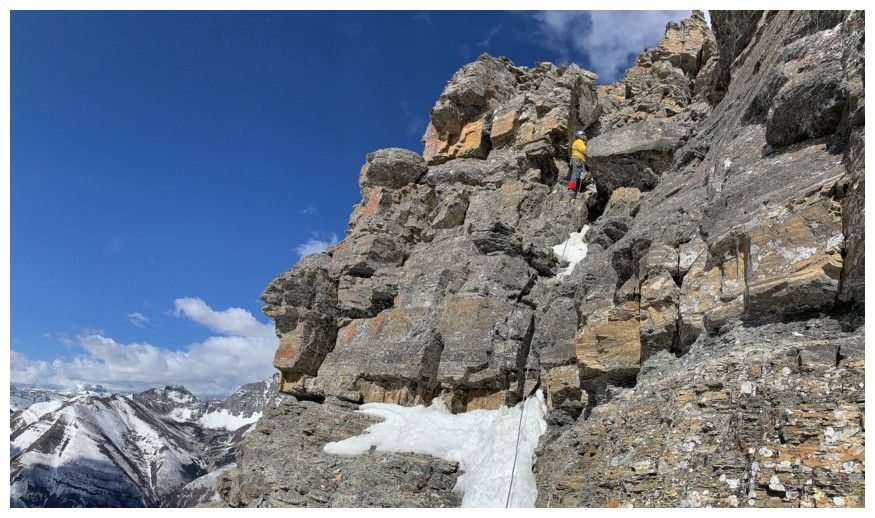
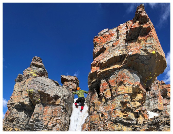
Thankfully, such was not the case for the
crux – a short, but exposed traverse across narrow ledges to a very cool window
in the rock on the other side. After re-enacting a questionably humorous scene
at the window we geared up for the final push to the summit. This short section
was not snow- and ice-free and using all the equipment we had seemed prudent. We
were both certainly glad for the crampons and ice axe up the snow-choked,
shallow chimney feature that leads to the “mushroom” (a distinctive,
mushroom-shaped rock formation) and then easily to the summit. En route,
another nostalgic photo op was re-staged atop the “mushroom”.
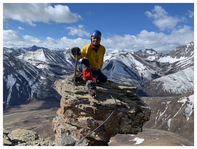
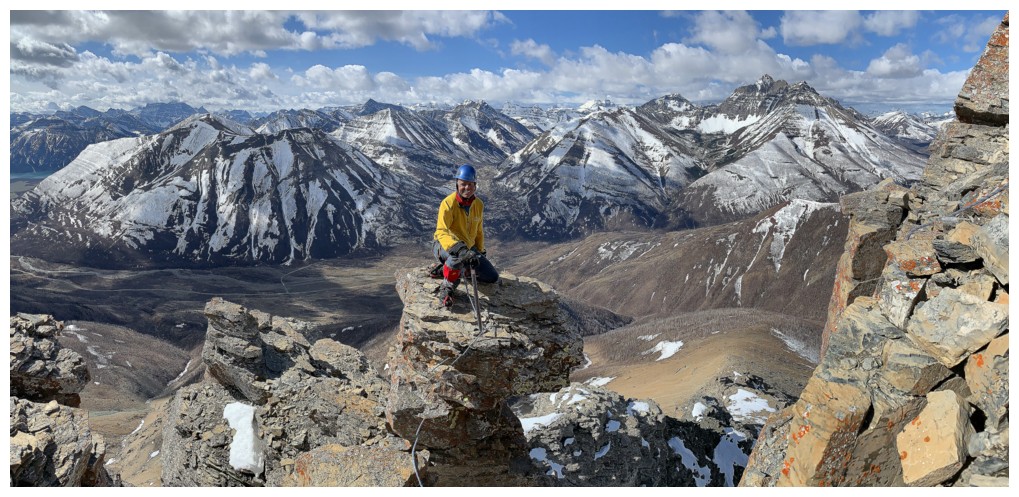
 After taking in the wonderful summit view, we
both had a short Facetime session with friends and family. Strange to think
that on our 2004 trip Mark and I didn’t even own cellphones and Facetiming
someone from the summit of these mountains was a more of a Star Trek fantasy than reality!
After taking in the wonderful summit view, we
both had a short Facetime session with friends and family. Strange to think
that on our 2004 trip Mark and I didn’t even own cellphones and Facetiming
someone from the summit of these mountains was a more of a Star Trek fantasy than reality!
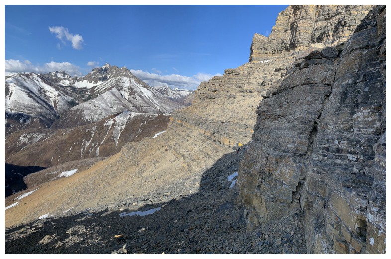
Having already decided to forgo the loop
route we started down, following our uptrack. About halfway down I spotted a
vehicle on the Red Rock road and conjectured it must be park staff. Then
another appeared and another and another. To our utter surprise, we realized
that the road had opened to the public (sometime after 6 am obviously!),
several weeks ahead of the usual May long-weekend opening. Great! Mark was able
to call his family, who could then meet us at Red Rock Canyon. Again,
this was something that we couldn't have even dreamed possible in 2004.
Back then, we were incommunicado (cheesy video, but awesome Marilion song!) from the the time we left our respective houses in Calgary until the time we walked back through their doors.
Back at our bikes, we cycled the remaining 8
km of the 16 km road, met up with the family, and checked out Red Rock Canyon
for a few minutes.
 Getting back to the start was a blast. Mark
gave his bike to his son Rogan (now 10 years old), and he and I hit the road,
while the remainder of the family rode in their vehicle. And you didn’t need an
ebike to make the return trip easier. 16 km of exhilarating downhill on a
smooth road – heaven!! Rogan performed magnificently, keeping up with (and
threatening to pass) me throughout. It took exactly 24 minutes to complete the
16 km, an average speed of 40 km/h. What an awesome end to an awesome day!
Getting back to the start was a blast. Mark
gave his bike to his son Rogan (now 10 years old), and he and I hit the road,
while the remainder of the family rode in their vehicle. And you didn’t need an
ebike to make the return trip easier. 16 km of exhilarating downhill on a
smooth road – heaven!! Rogan performed magnificently, keeping up with (and
threatening to pass) me throughout. It took exactly 24 minutes to complete the
16 km, an average speed of 40 km/h. What an awesome end to an awesome day!
So, what had changed in the 17 years between
our ascents of this Waterton gem?
1. Firstly, and obviously, we were 17 years
older and therefore 17 years slower (whatever that means!)
2. Technology: we now both had phones that
were able to take excellent photos, pinpoint our exact location on a topo map
displayed on the phone (even without a cell phone signal), and allow Facetime
conservations from the summit. In 2004, I had a push-button landline and no
cell phone of any kind. And of course, the dramatically improved technology of electric
bikes!
3. Perception: In 2004, I wrote, " The crux was not at all what we were expecting and was easily
traversed on relatively large ledges”. In 2021, it would read more like, “Make sure your
last will and testament is in order before you traverse these tiny ledges that would put of fear of God into a slender hamster.”
4. The small picture: In 2004,
big views and big scenery were the focus of most trips. They still are, but in
2021, we both have a far greater appreciation for the small stuff – rocks,
flowers, the tiny details of ice and snow, etc.
We’ve already planned a return
trip for 2038, though we'll probably need jetpacks instead of backpacks for that
ascent!
And speaking of nostalgia and being incommunicado:
Sometimes it seems like I've been here before
When I hear opportunity kicking in my door
Call it synchronicity call it deja vu
I just put my faith in destiny - it's the way that I choose
(excerpt from Incommunicado by Marilion, lyrics by Fish, 1987)
Pretty excited to ebike the Red Rock Canyon road
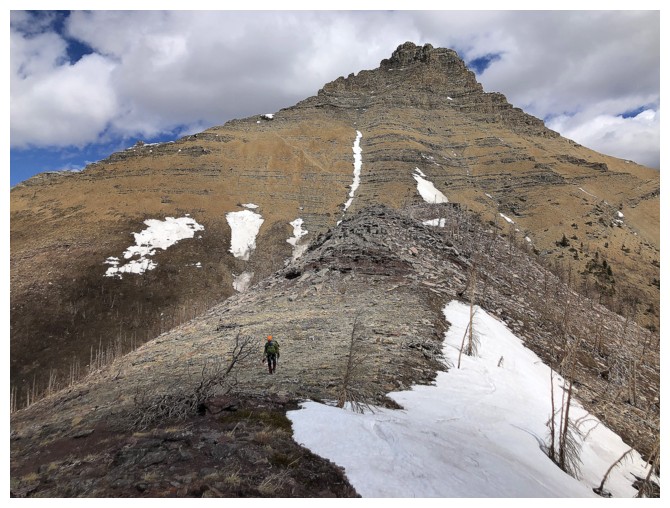
Approaching Bellevue Hill. Many memorable ascents of the Hill including the most recent, up the smaller, dark gully near the right side.
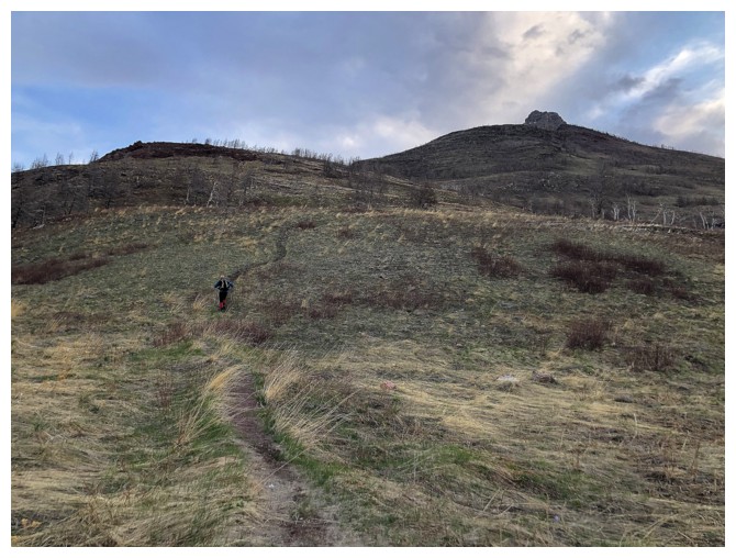
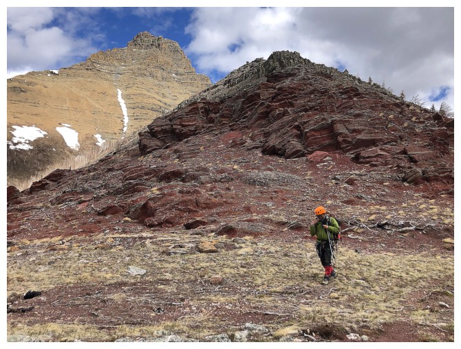
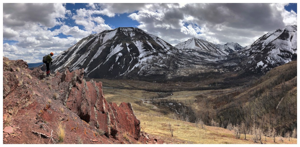
The beginning of the Galwey trail
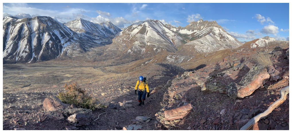
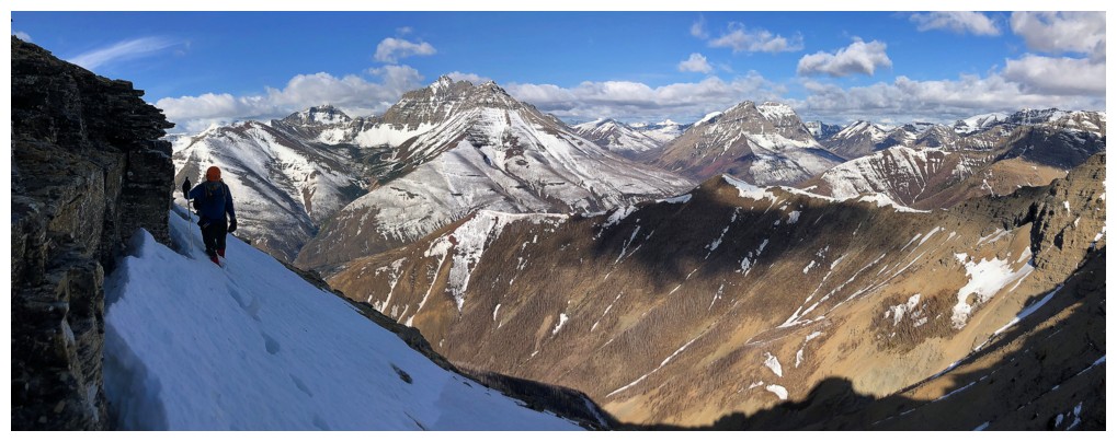
Great views of Mount Blakiston and Ruby Ridge are going to dominate the day
Red argillite will also dominate, but not until the Sun is shinning upon the rock.....
.....didn't have to wait too long for that!
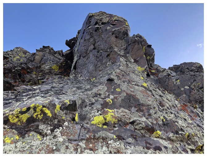
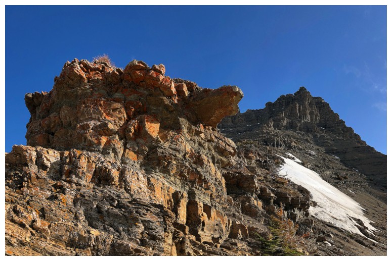
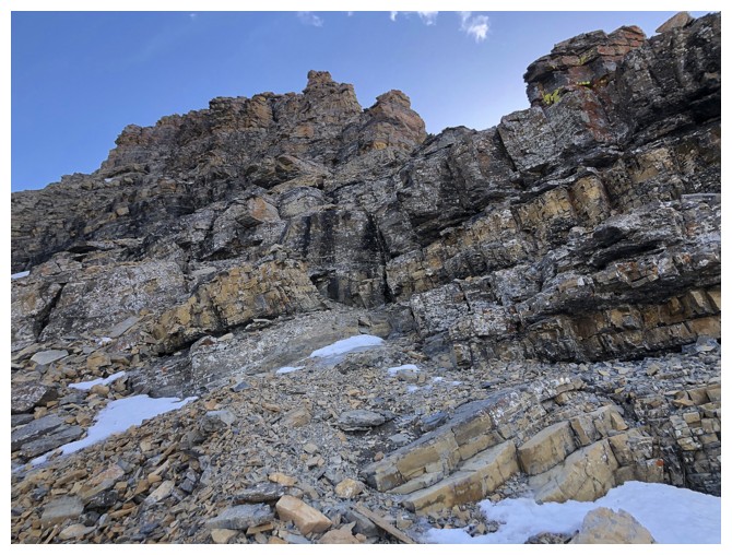
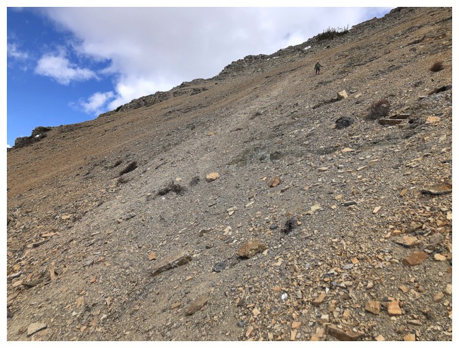
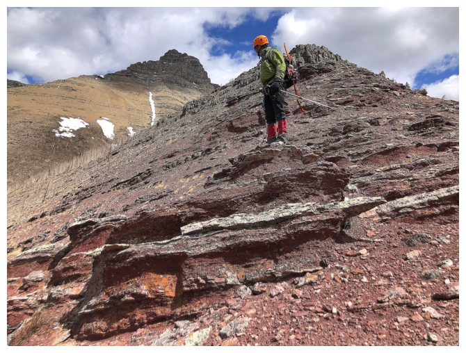
Lots of other types of rock besides argillite
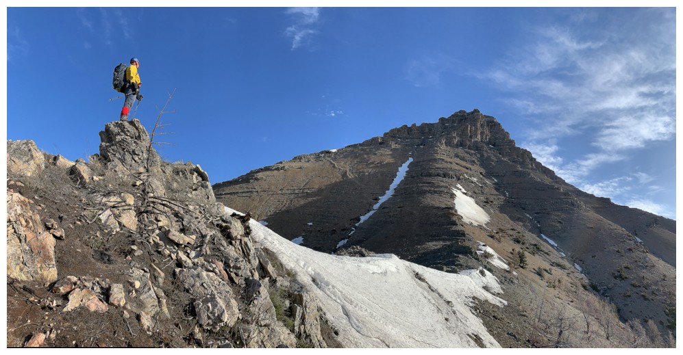
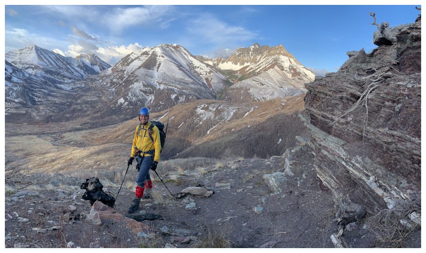
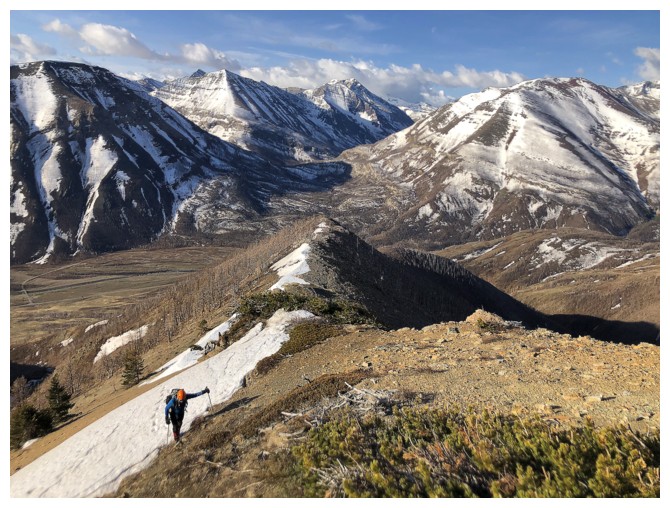
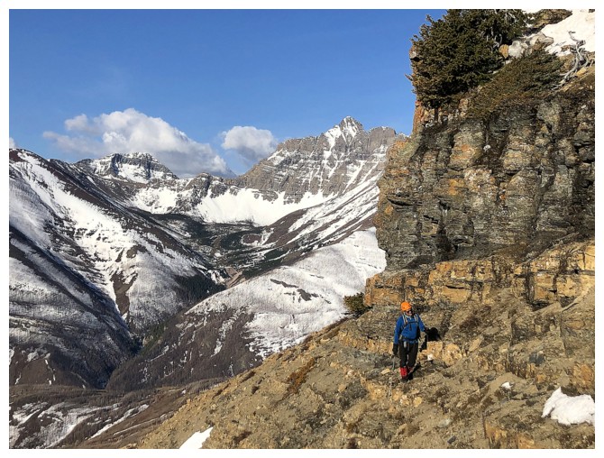
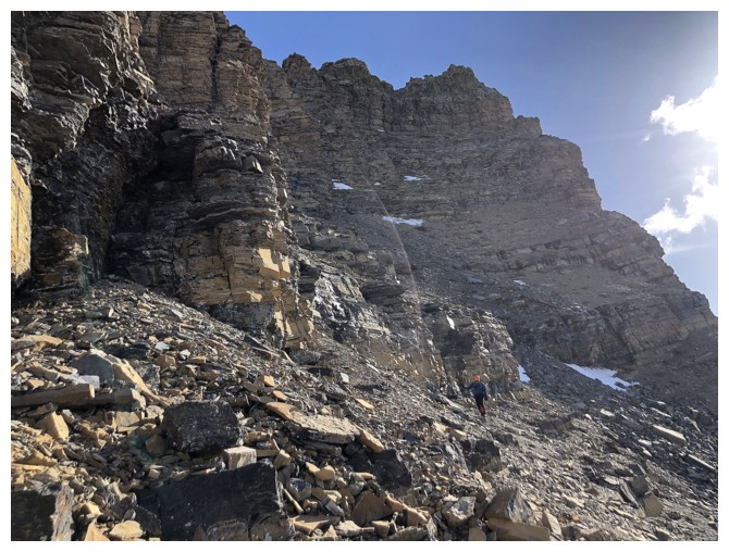
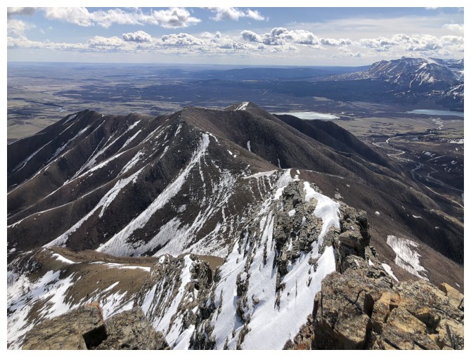
Easy and rewarding travel up Galwey's south ridge
And improving views behind
Still enjoying the easy ridgewalking. Note the trail in the scree that veers off to the left - that's the "normal" route up
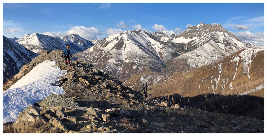
And still enjoying the views behind
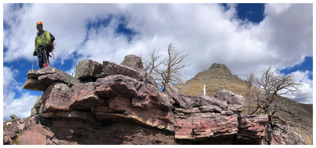
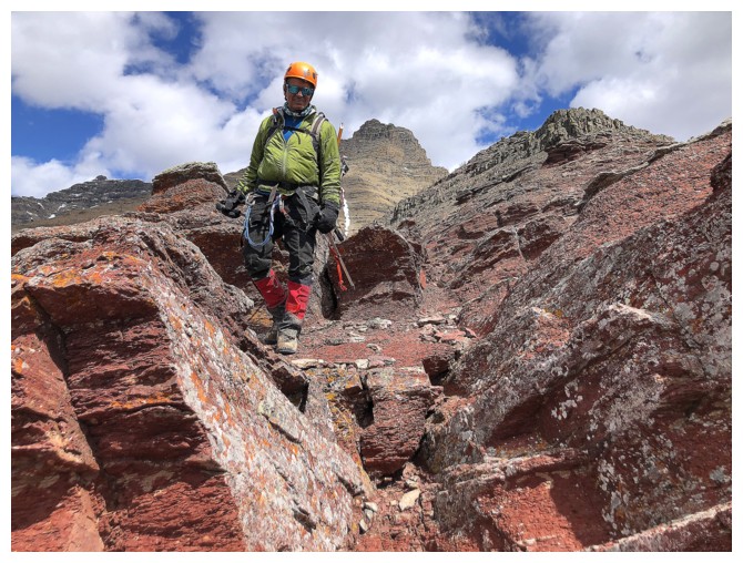
The advantage of staying on the ridge is a proliferation of terrific rock scenery
The ridge is interrupted by several rock bands that must be circumvented
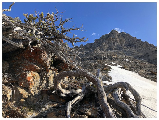
And some twisted dead trees
The snow on this side of the mountain didn't require an ice axe
Looking back at the gentle ridge
Resting at a rock band to enjoy the view (and catch our breath)
Another steep rock band that we circumvented on the right side
Heading back up to the ridge
Sometimes it seems like I've been here before
When I hear opportunity kicking in my door
Call it synchronicity call it deja vu
I just put my faith in destiny - it's the way that I choose
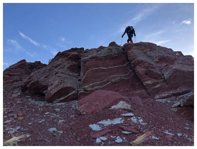
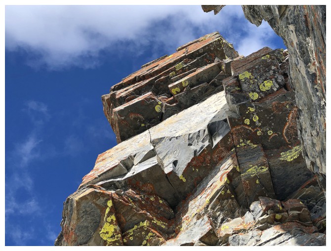
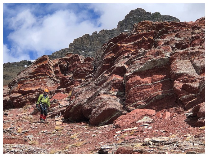
A few super interesting examples of rock bending in the foreground
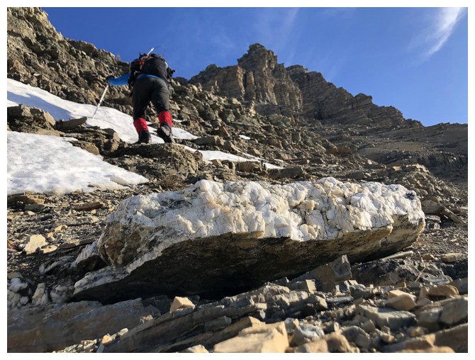
And also a big chunk of white marble
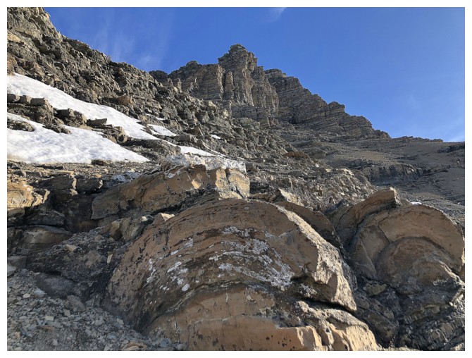
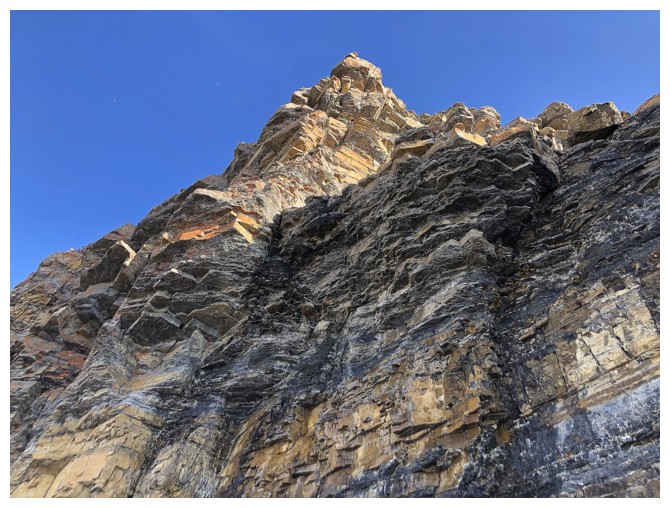
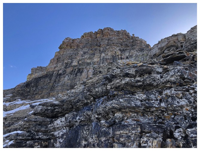
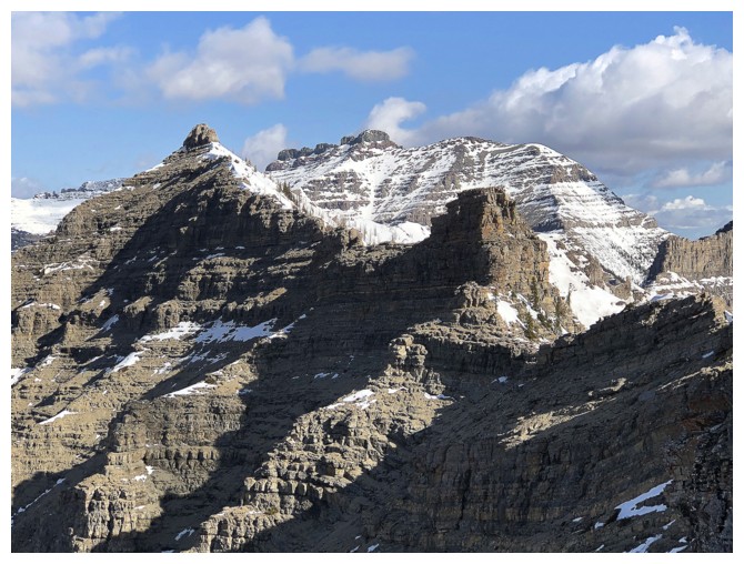
The staircase-like layering of southern Alberta rock is always a redeeming feature of the entire area
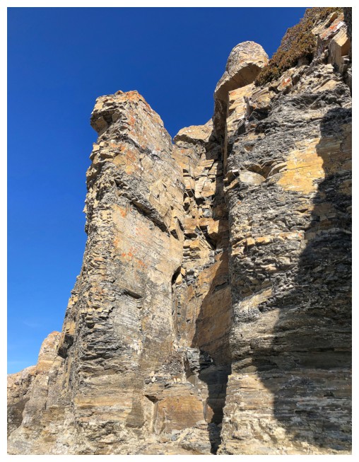
Another impressive rock feature
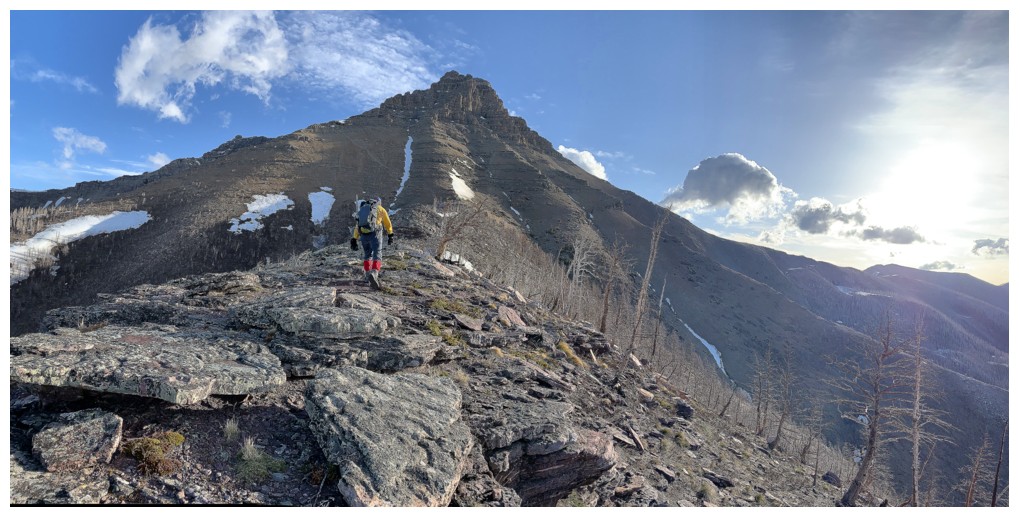
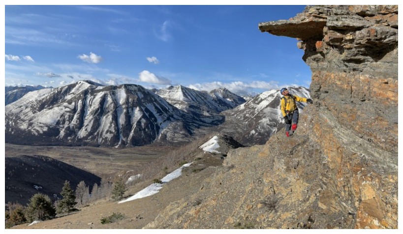
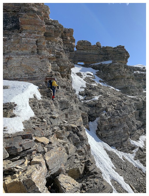
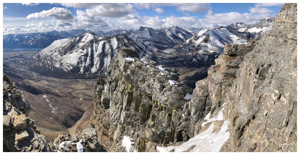
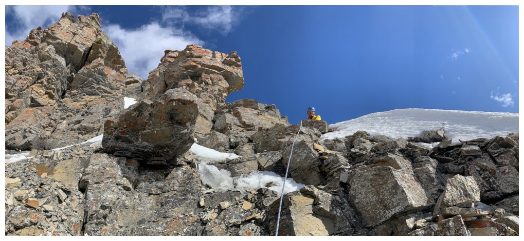
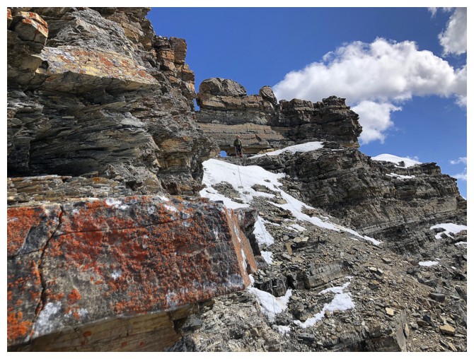
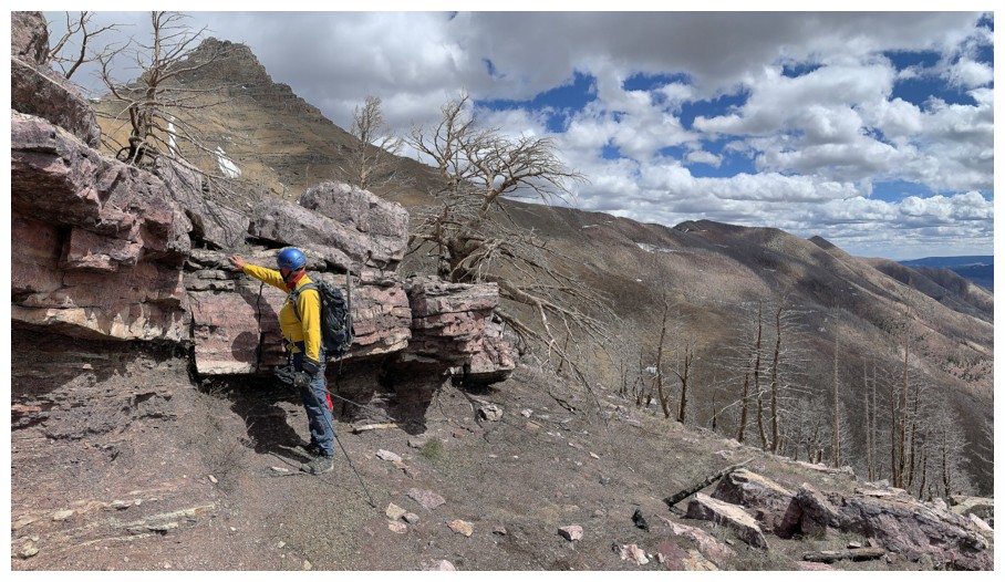
Almost at the start of the traverse back to the Kane route
Traversing
Mark follows
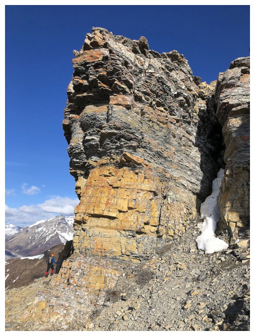
The reason why ascents directly up the south ridge of Galwey present a significant climbing challenge
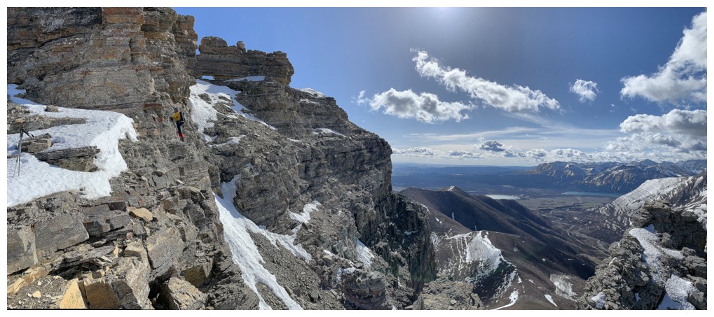
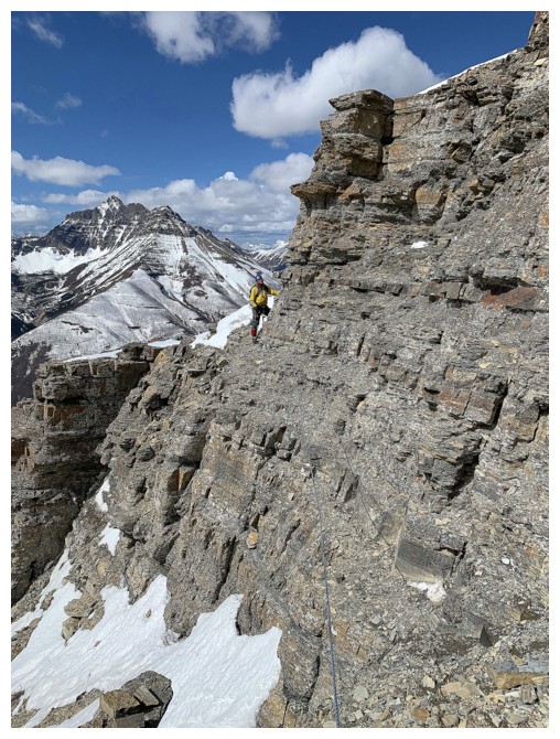
Almost around to the southwest side of the mountain
Mark rounds the corner
The southwest side, where the Kane route goes up
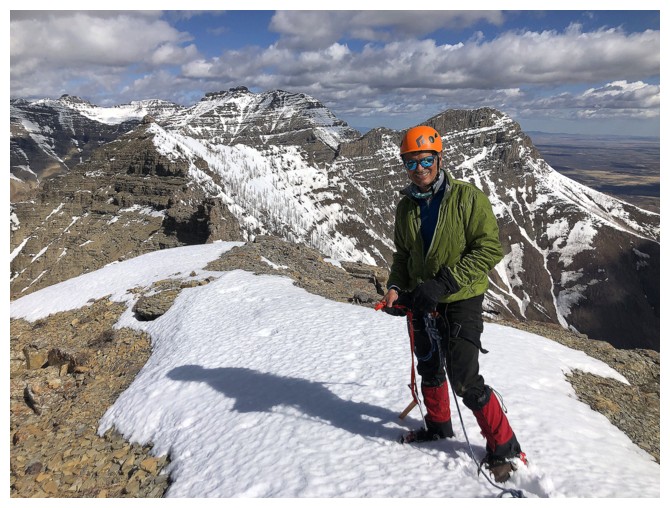
More inconsequential snow
Passing another distinctive feature of the route
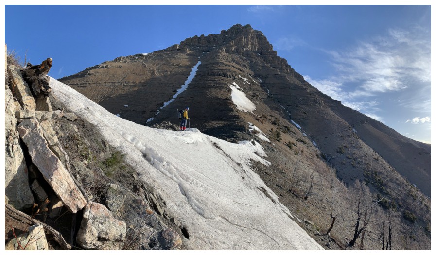
Aim for the "mushroom" - the small rock feature near the right
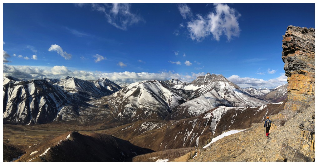
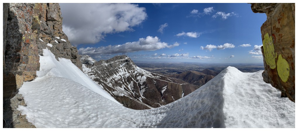
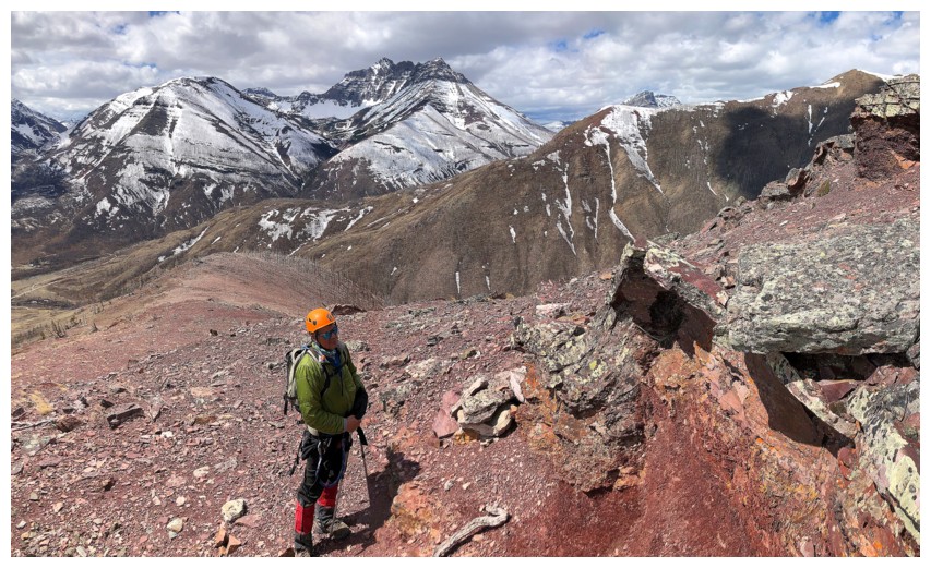
Now on the southwest side, views to the west and northwest improve dramatically
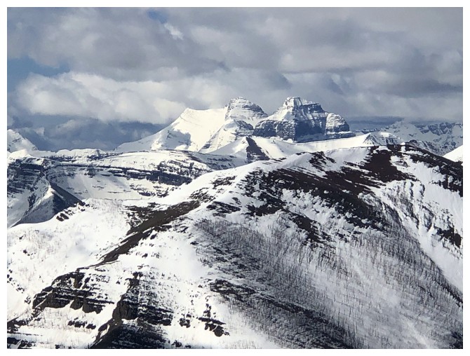
But Blakiston still dominates the horizon
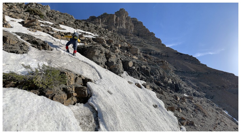
The "normal" route was covered in verglass so we took a slightly different route
Looking over to the connecting ridge and Mount Dungarvan behind
Verglass - looks nice but makes for treacherous travel
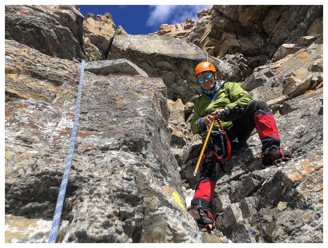
Preparing to negotiate the crux
Halfway across
Mark on the other side of the traverse
He's getting ready.....
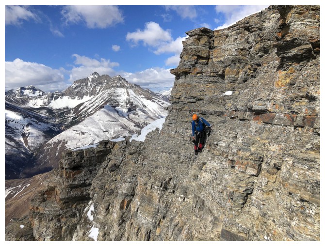
And off he goes. Clearly a slip here would be very bad!
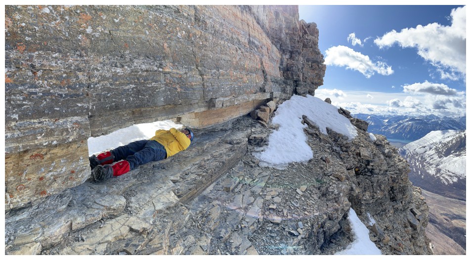
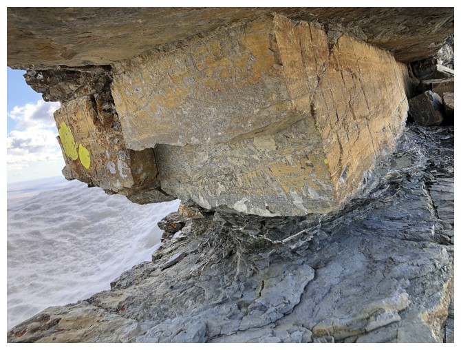
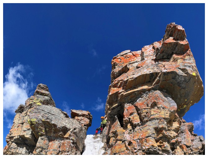
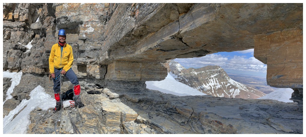
Arriving at The Window
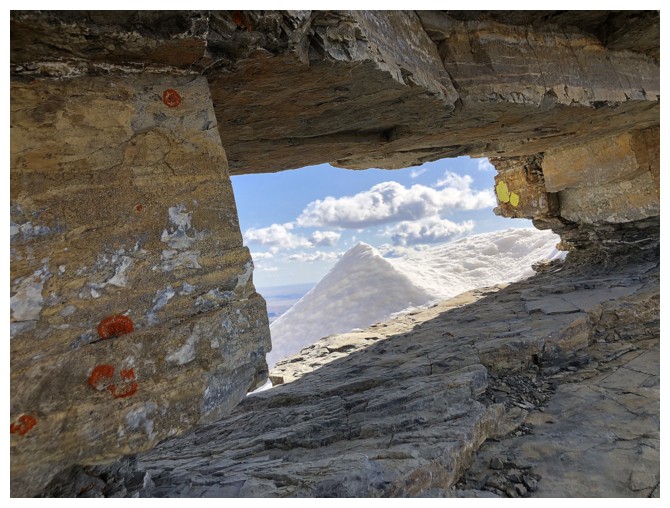
Looking through the cool feature
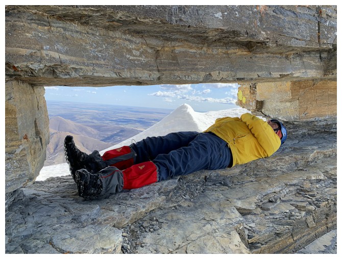
Re-enactment #1 - The Cadaver.
Somebody bulked up in all the wrong ways in 17 years!!!
One of the views, while decomposing in The Window
View over the other side
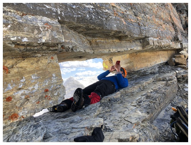
Mark's turn. In 2021, you can text your family from inside The Window.
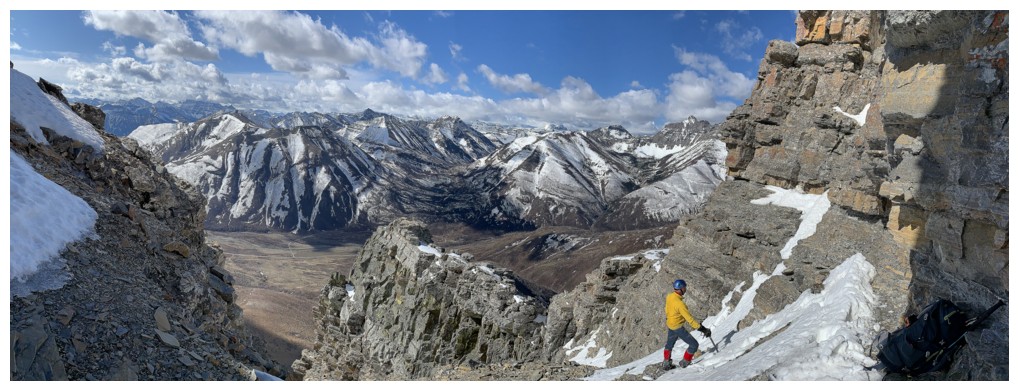
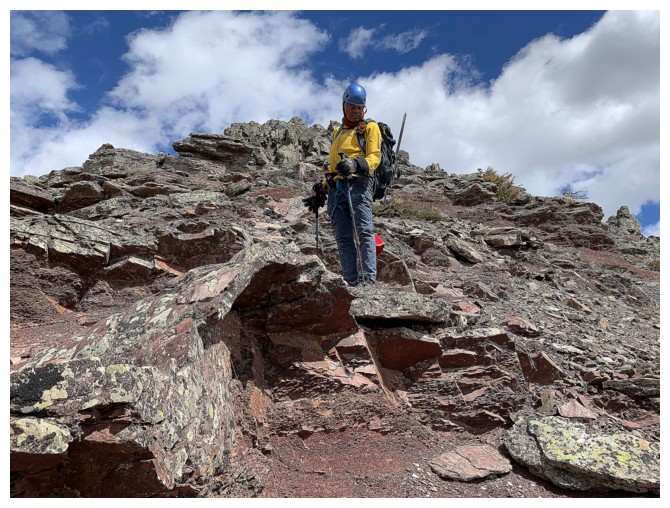
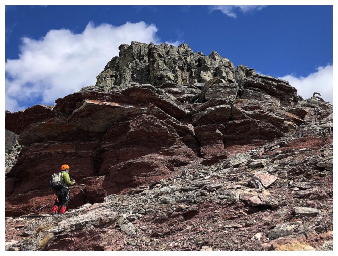
Checking out the remainder of the ascent
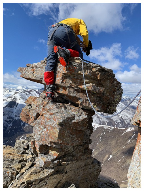
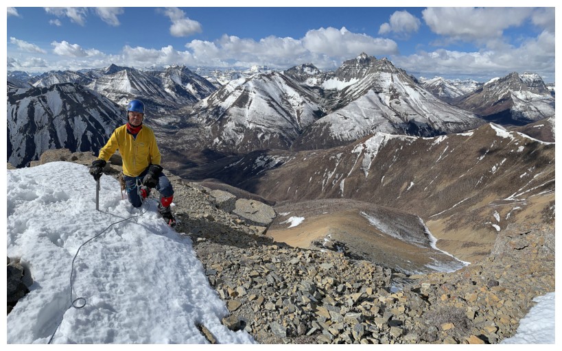
All geared up and heading for the summit. We left our packs at The Window.
The rope was unnecessary, but is there such a thing as "unnecessary ropework"??
Mark leads the final push to the summit
But not before re-enactment #2, atop The Mushroom
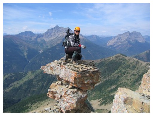
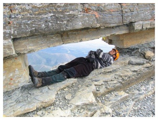
Definitely managed to get a cooler pose (right photo) when I was young!
Carefully downclimbing The Mushroom
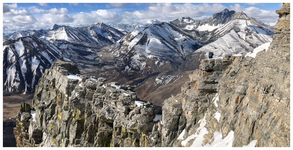
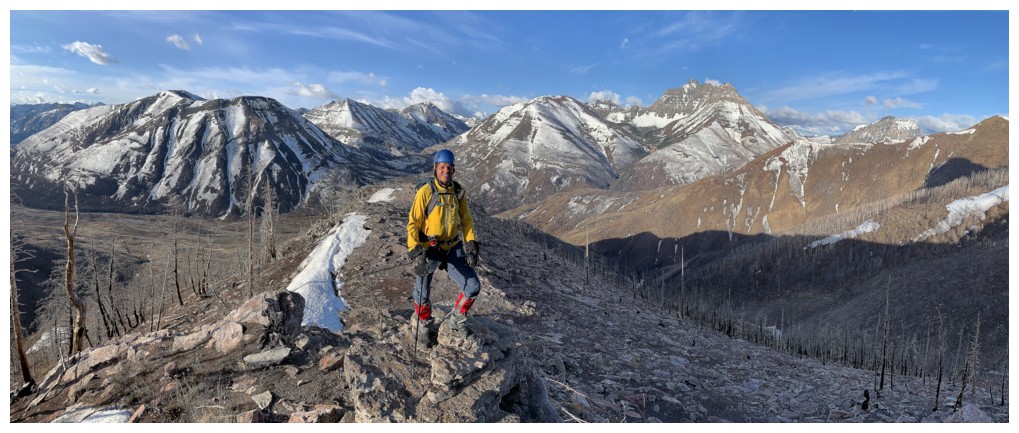
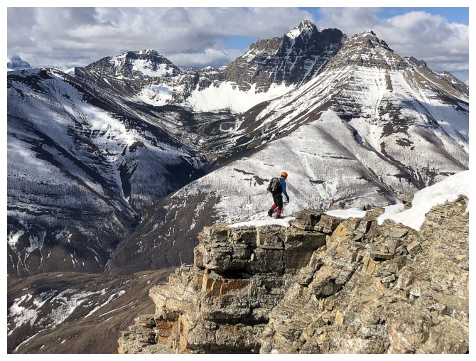
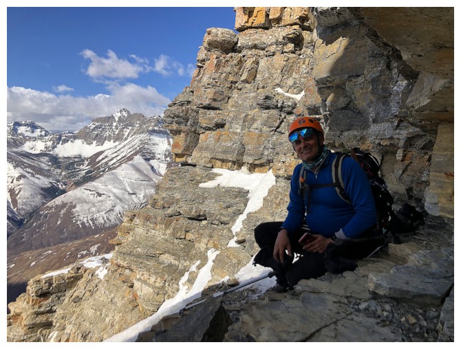
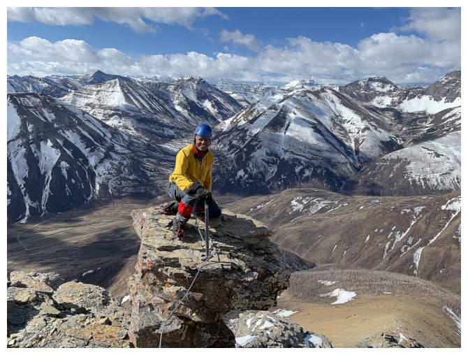
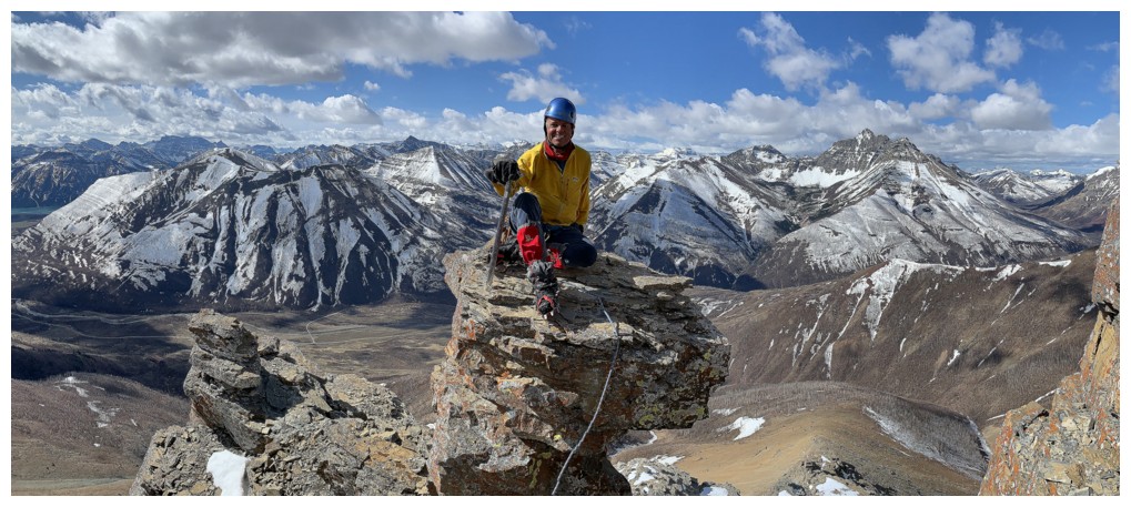
Summit photos
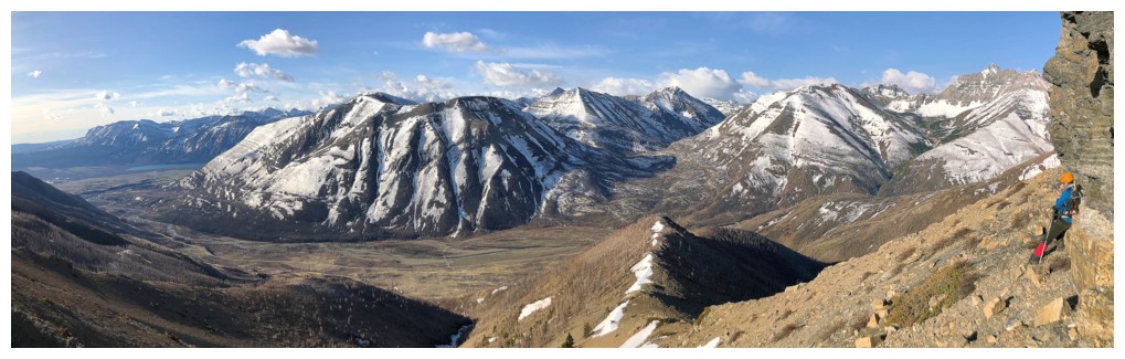
Looking south to Bellevue Hill and Sofa Mountain at the far right
Too many peaks to the west to mention
But Kintla and Kinnerly, in Glacier National Park, always get some attention
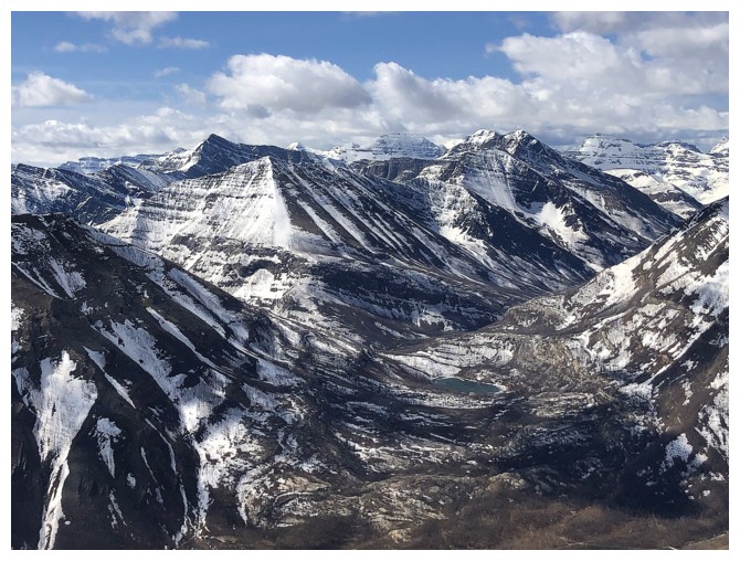
Five awesome peaks beyond Crandell Lake, that have all experienced my now heavier footprints in the last 10 months: Alderson, Buchanan Northeast, Buchanan The Middle Child, Buchanan Ridge, and Carthew
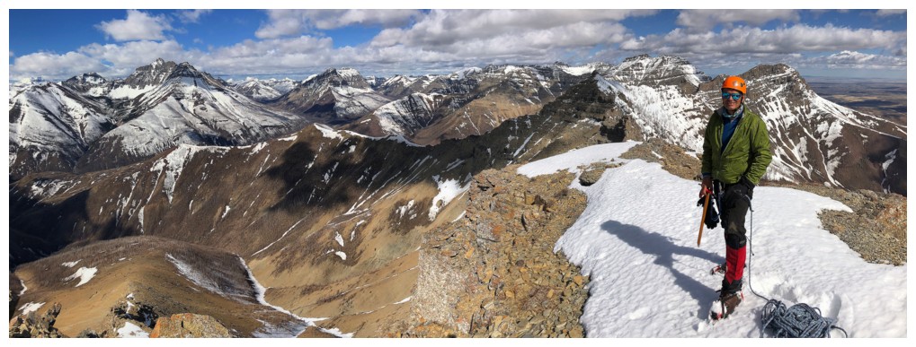
Another summit shot of Mark and some of the gems north, northwest, and west of Galwey, including Rogan, Dungarvan, Dundy, Cloudy, Cloudy Junior, Glendowan, and Anderson.
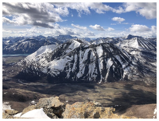
Mount Crandell has received a decent amount of attention from us in recent years
Back near The Mushroom (I'm getting hungry!)
Resting in the chimney section
One last nostalgic visit to The Window
Looking up at the fantastic rock around the summit block
Mark waits at The Window, while I complete the traverse back to saner terrain
Going back across the ledge is slightly easier
We stuck to the scree trail on return
Back to awesome ridgewalking, on easy terrain, with awesome rock
Some of the awesome rock
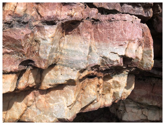
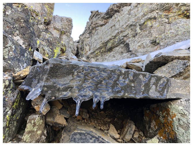
Close-up
My usual intimate moment with rock
We are both going to be mesmerized by the red argillite for the next section
Last of the argillite and the vehicle-littered road is in sight
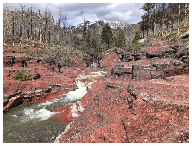
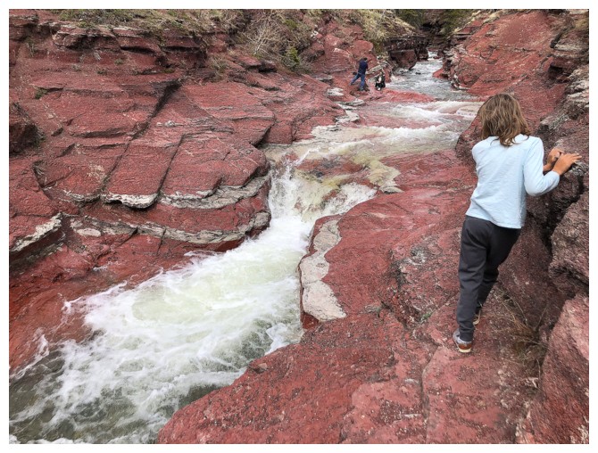
Red Rock Canyon
Rogan in the canyon
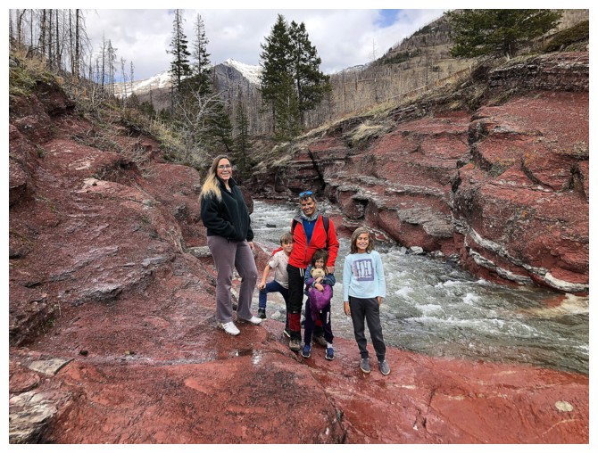
The whole Nugara gang at Red Rock
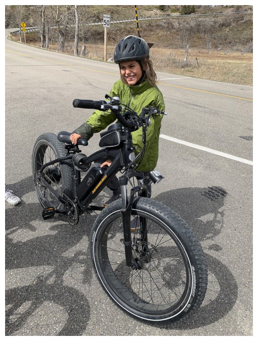
The namesake of "Rogan Peak" at the end of our awesome 16 km bike ride back to the start
The End
LOG