Bell Ridge
July 7, 2024
Mountain height: 2731 m
Total elevation gain: approximately
1300 m
Ascent time: 6:00
Descent time: 5:45
Solo scramble
with some mountaineering.
I picked
this outlier of Mount Bell as an objective because I thought it would be short,
scenic, and sweet! Scenic and sweet it was, but short it was not. Following the
directions for the east ridge described by both authors, I hiked the Boom Lake Trail for
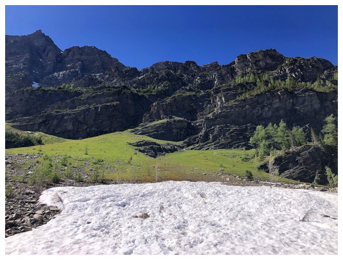
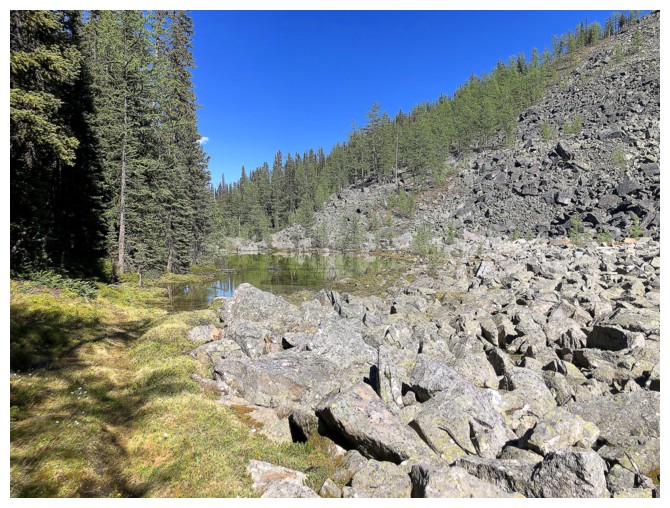
a few kilometres and then took the turn-off towards O’Brien Lake. From a plateau,
a short and easy bushwhack brought me to the start of the scramble. Jones
mentions the larches in this area, and he is on-point – definitely a mountain to
return to during larch season.
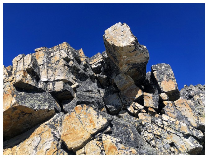
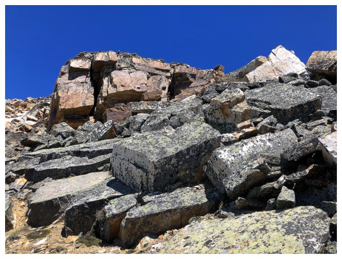
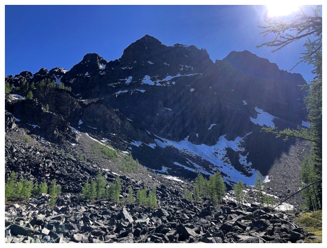
The other
element of the terrain that quickly announced its presence was the quartzite
rock. And that rock was to become one of the main highlights of the trip. I’ve
seen quartzite in a few different colours, but the east ridge of Bell is next
level. In addition to the standard beige, outcrops of white, grey, and an
amazing shade of purple were prevalent throughout. Throw in a little snow
scenery and a perfectly blue sky and I had a recipe for a repeat of Bertha
Minor II, where it took me 3 hours to ascend a slope that could easily be
completed in an hour, because of the fantastic rock scenery. There were several
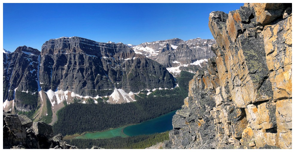
detours made on either side of the ridge. The right side soon boasted a
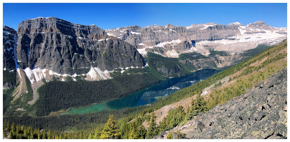
wonderful view of Boom Lake – the third highlight of the trip (or perhaps that
was the tenth!).
After
a few ups
and downs and lots of cautious scrambling up huge quartzite boulders I
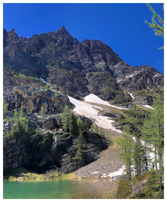
reached the summit. The bulk of Mount Bell blocked some of the view
to the northwest, but otherwise the panorama was outstanding. My summit
stay was not
long, however. A decision needed to be made regarding the next step.
Options
were:
1.
Call it a day
and descend to Boom Lake and out via the well-established trail. Given the trip
was already more than 6 hours long, this option had great appeal.
2.
Descend to the
next col and head up to the summit of Mount Bell. Having ascended Mount Bell
with Bob Spirko in 2005 and questioning my stamina to handle the extra 400
metres of elevation gain, this option was accompanied with some level of
trepidation.
3.
Complete the
loop route via O’Brien Lake as suggested by Mr. Potter. This option had the
most appeal, however, getting down to the valley below was filled with
uncertainty because of the large amount of snow still residing on the north
side of the mountain. Undoubtedly, crampons and an ice axe would be mandatory;
I had both.
Logically, the
best course of action would be to check out the snow conditions for option 3
and if they weren’t acceptable turn to option 1. Option 2 was mysteriously
sucked into a black hole before I even left the summit!
Getting down to
the Bell Ridge/Mount Bell was easy and much shorter than expected. I decided to
give the loop route a go but back down (actually back up) if I didn’t feel
comfortable descending the snowy slopes. To my delight those slopes were
perfect for a straightforward kick-stepping descent into the valley. The
crampons and ice axe were essential for making that happen – there’s no way I
would have done it without both.
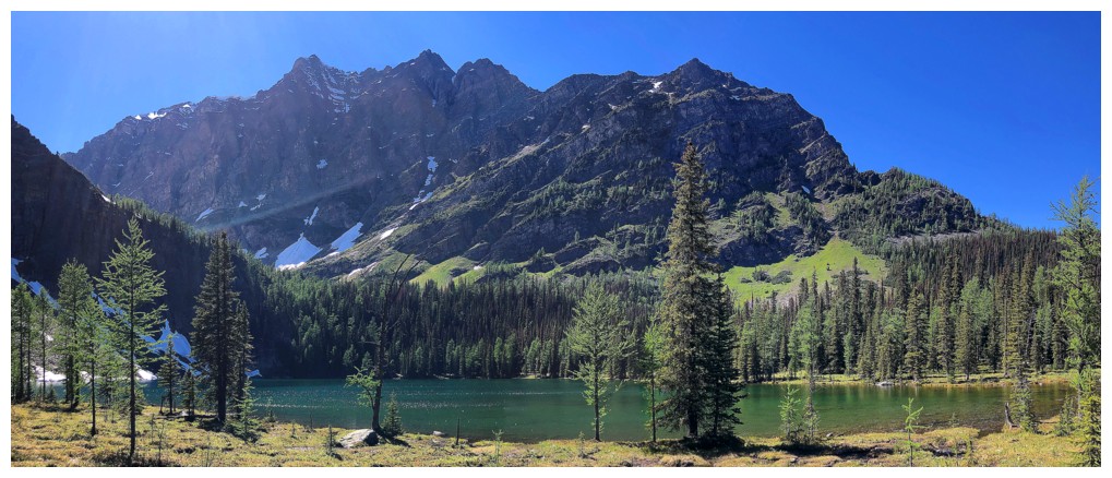
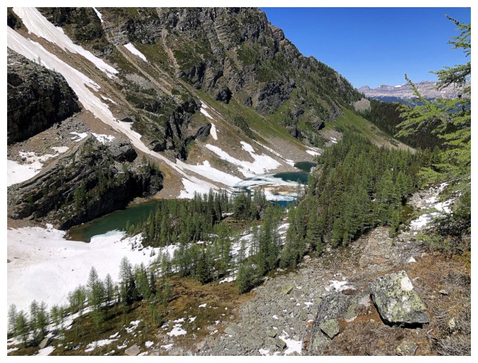
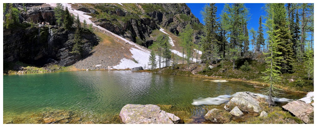
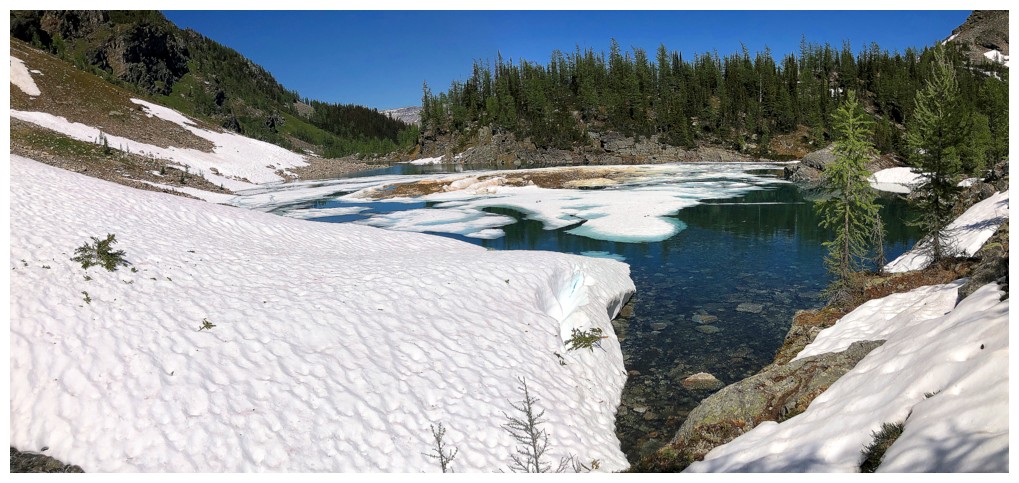
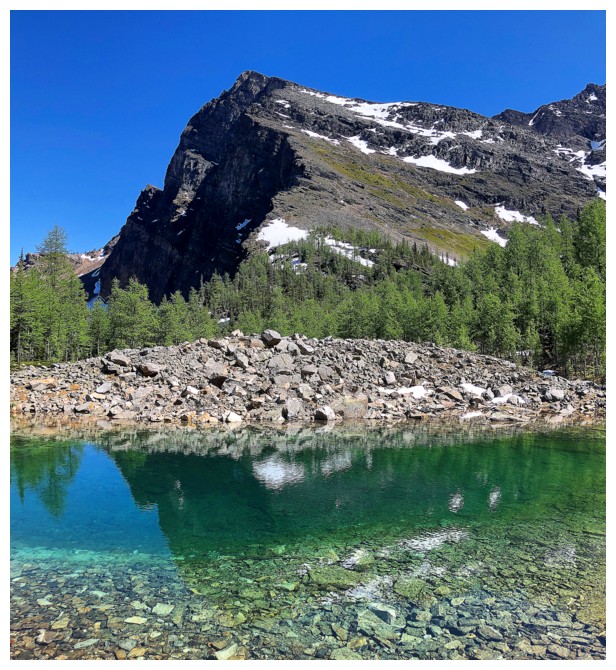
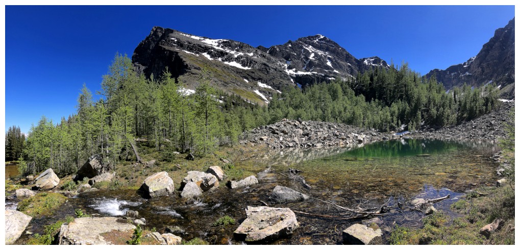
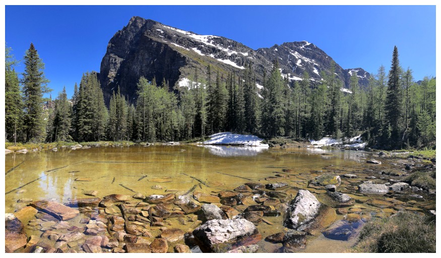
The valley
itself was stunning – four beautiful unnamed tarns, backdropped by the
steep walls of Mount Bell, and mature larches everywhere – I will be back here
during larch season for sure! O’Brien Lake did not disappoint
either though I did prefer the tarns.
And to end a
perfect day I now just needed to find and follow the O’Brien Lake trail back to
the Bell plateau. Easier said than done! In its present snowy and marshy
condition, I lost the trail leaving the lake and missed the key intersection. I
was heading in the right direction but through increasingly challenging terrain
– dense forest on steep slopes and deadfall everywhere. In a minor state of
panic, I turned upslope heading towards the base of the mountain and
fortuitously stumbled onto the trail within 10 minutes. Whew! This is not an
area where you want to be off-trail.
Following the
unmaintained trail went with relative ease, though there are sections where the
route is not obvious. Plus, there is about 200 metres of elevation that must be
regained en route. I was quite relieved to reach the plateau, knowing the
remainder of the day was all downhill.
An
immensely rewarding day! Along with Vista
Peak and Pincher Ridge V perhaps the surprise trip of the year so far. Once again, shout-outs to Mr. Potter and Mr. Jones for
their descriptions and inspiration.
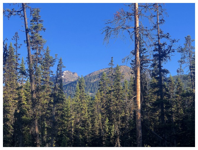
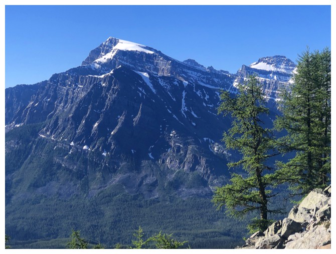
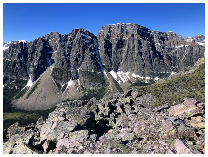
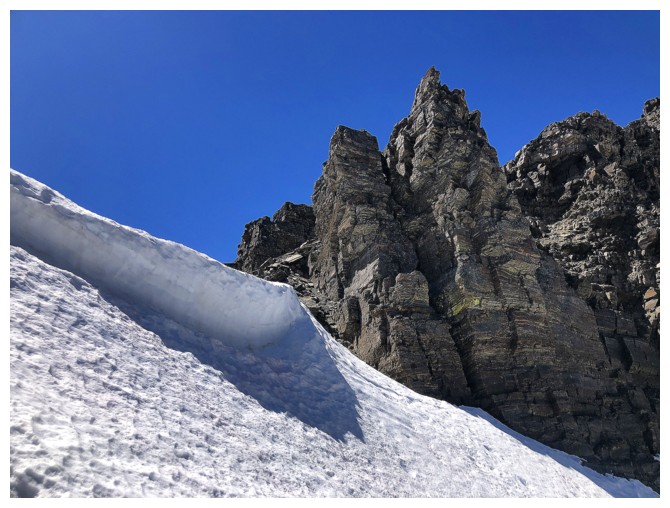
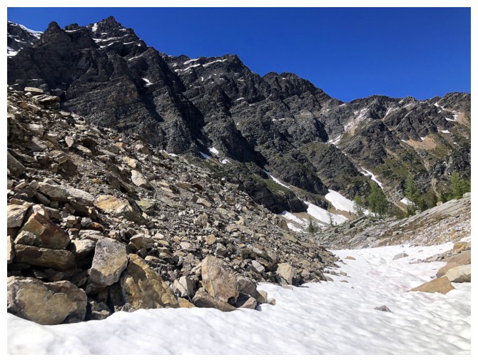
First view of some of Bell Ridge
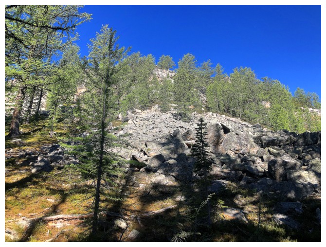
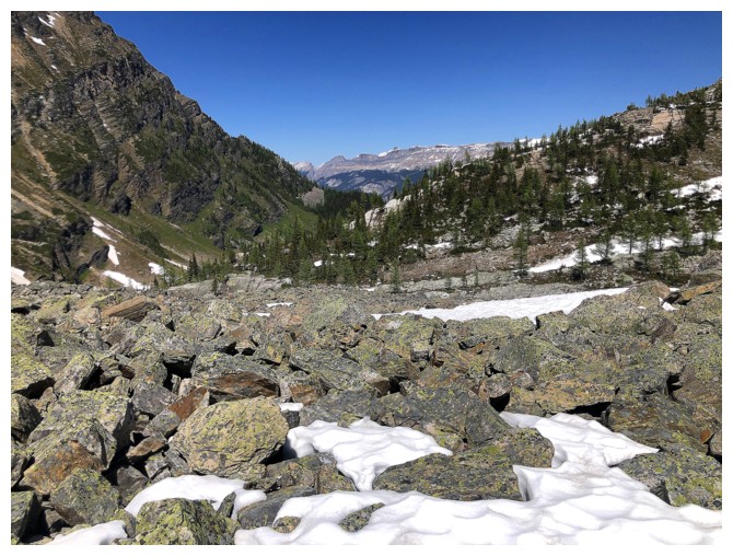
Approaching the boulder field that marks the start of the scrambling
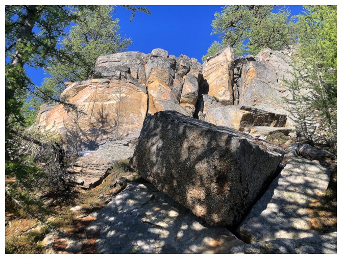
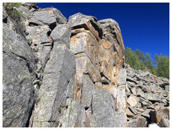
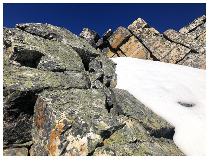
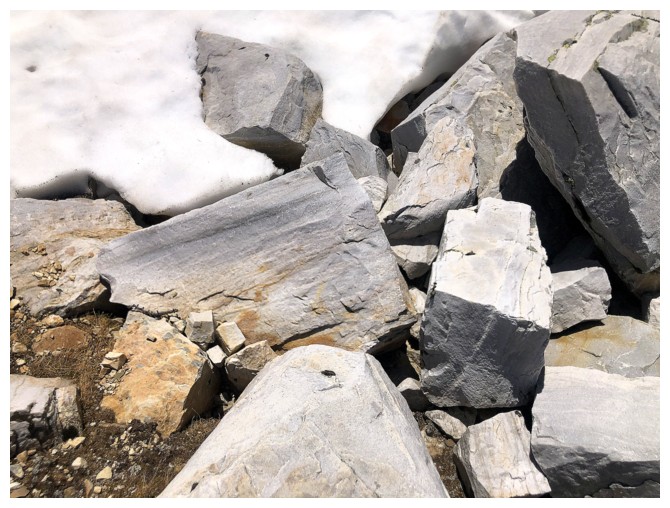
Almost immediately, cool quartzite blocks of rock are encountered
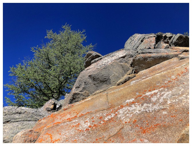
Almost every tree in the area is a larch
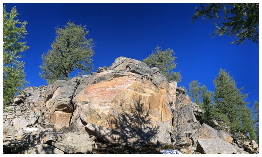
No substitute for blue sky above beautiful quartzite
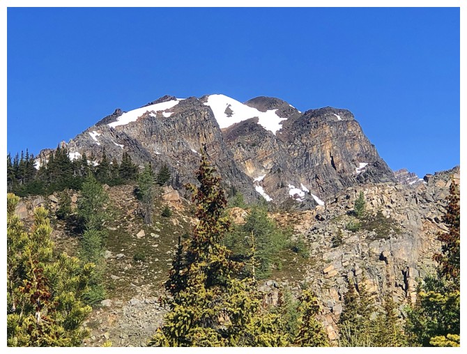
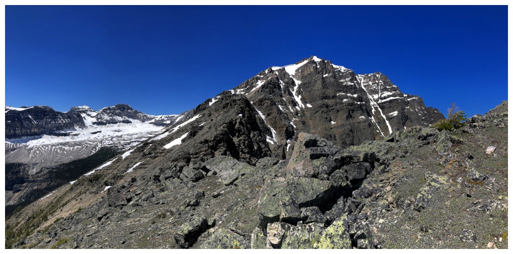
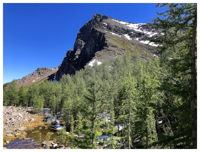
Storm Mountain
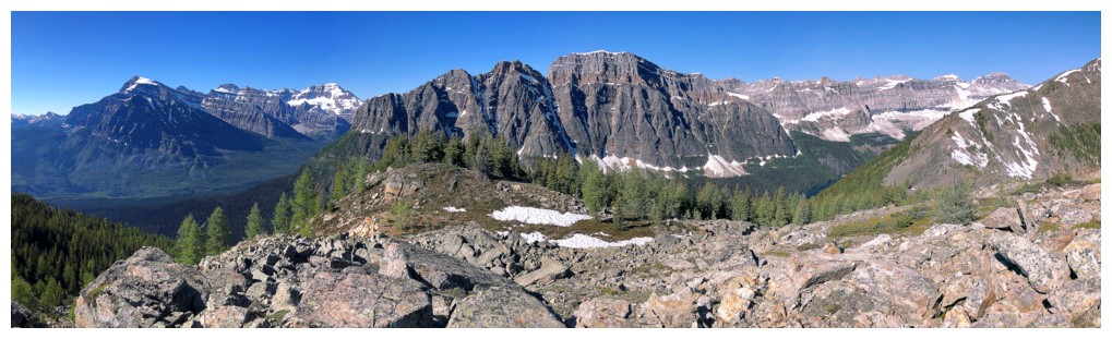
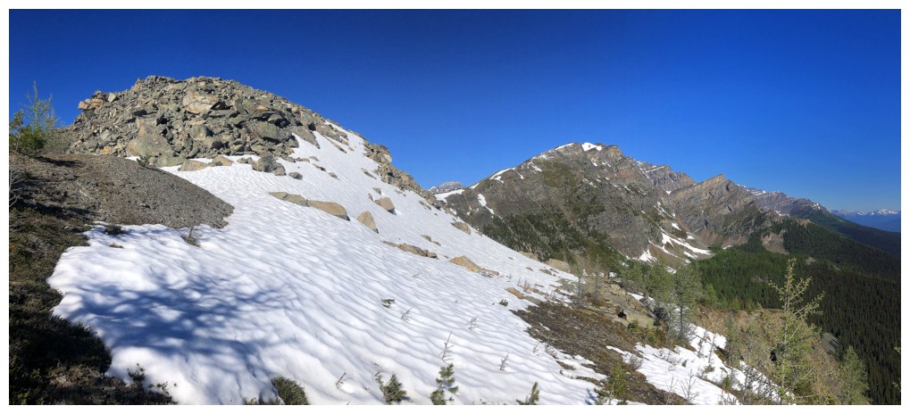
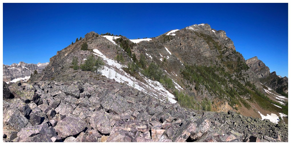
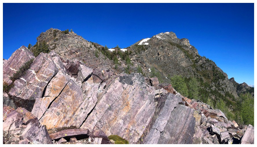
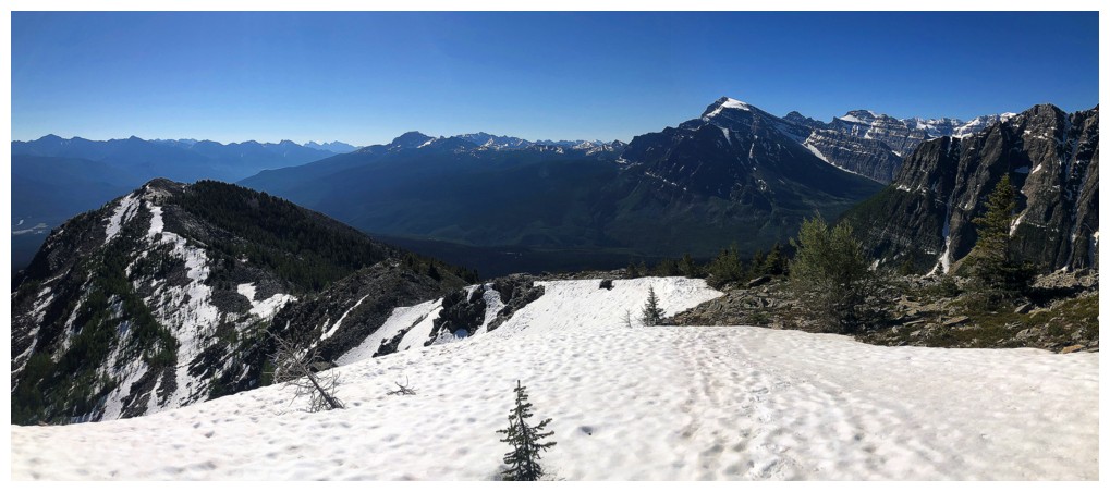
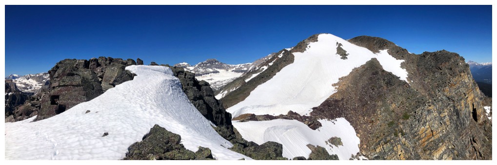
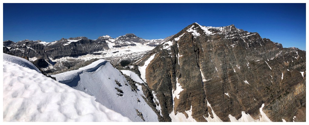
On the ridge, looking at some of the bumps of Bell Ridge
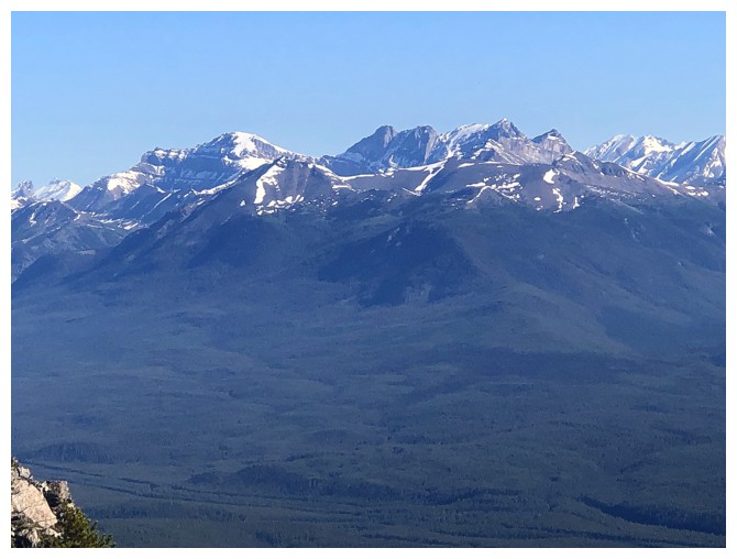
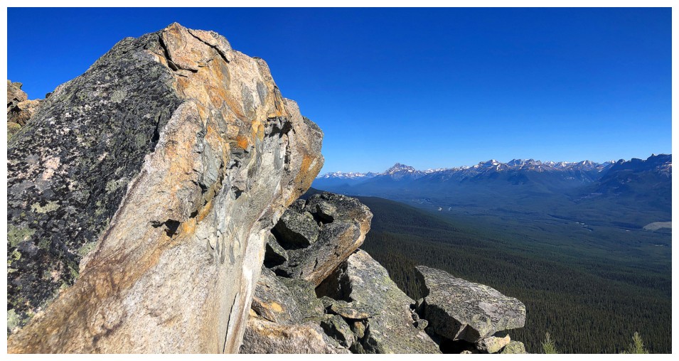
Some of the Skoki peaks: Richardson, Pika, Ptarmigan, and Redoubt
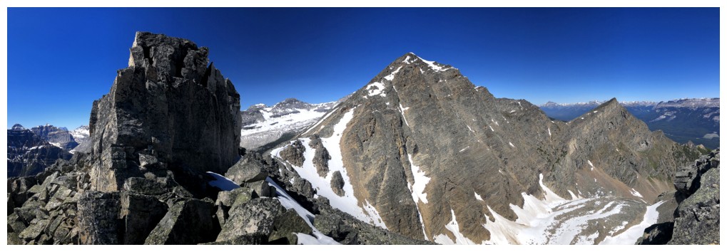
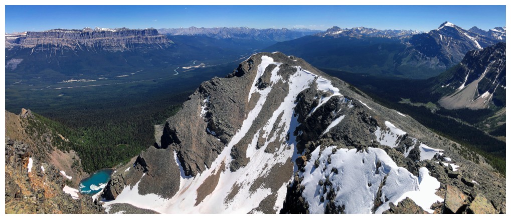
The summit of Bell Ridge at the right
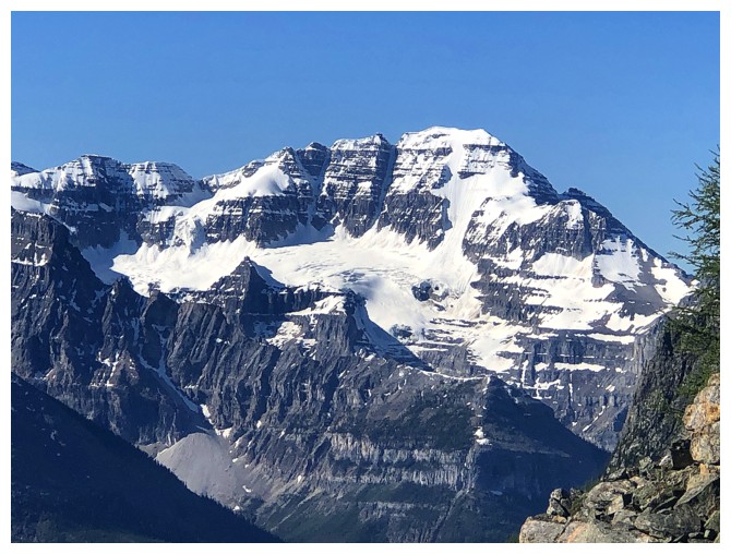
Stanley Peak
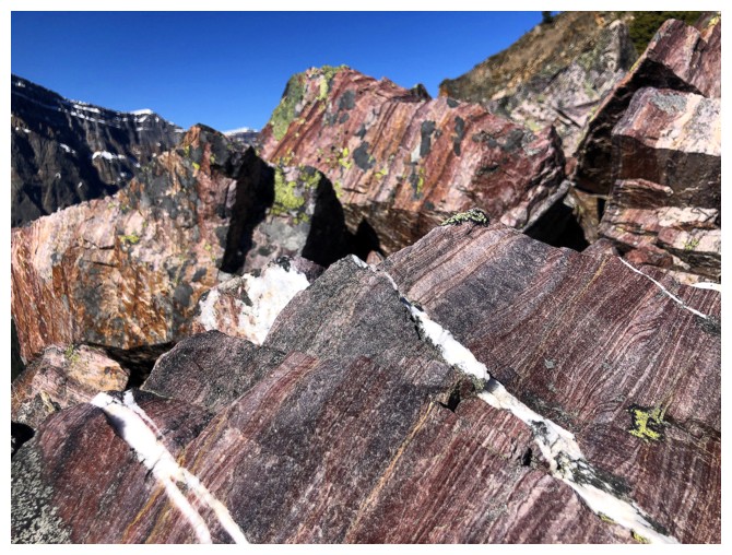
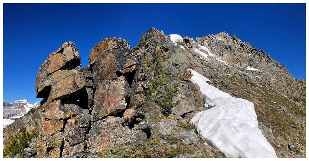
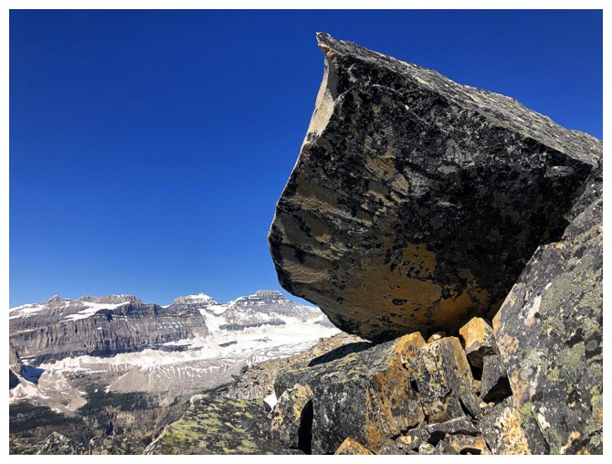
Back to gawking at super cool rocks
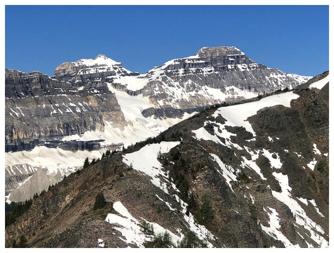
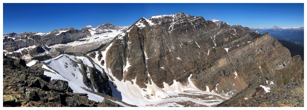
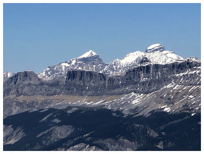
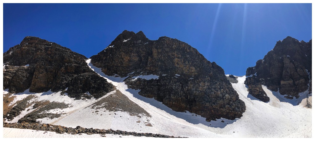
Chimney Peak (left) and Chimney N1
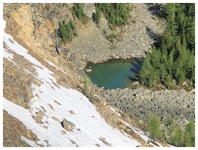
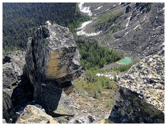
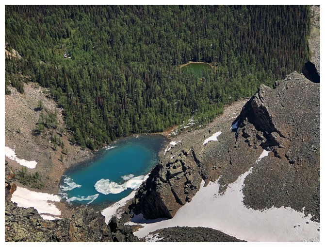
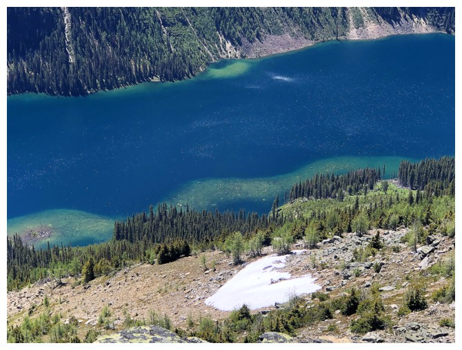
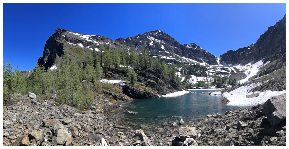
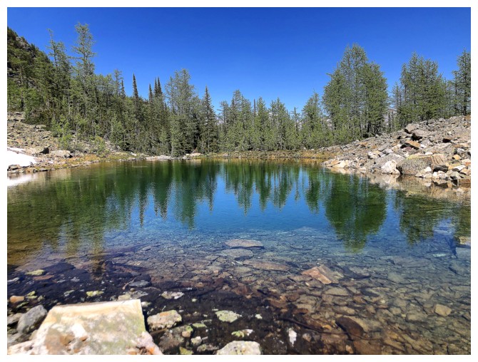
Close-up of a small tarn in the valley to the east

Zoomed out, the tarn is barely visible
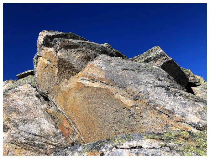
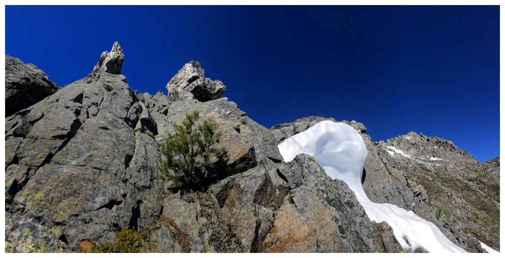
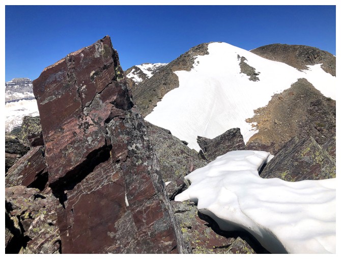
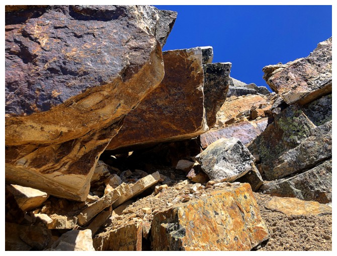
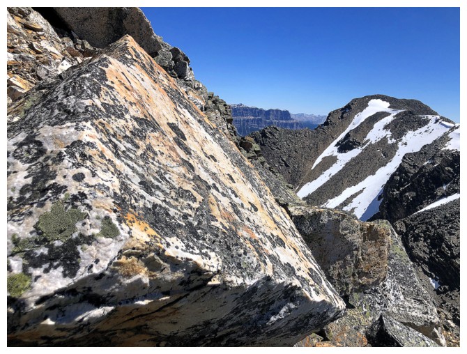
First run-in with purple quartzite
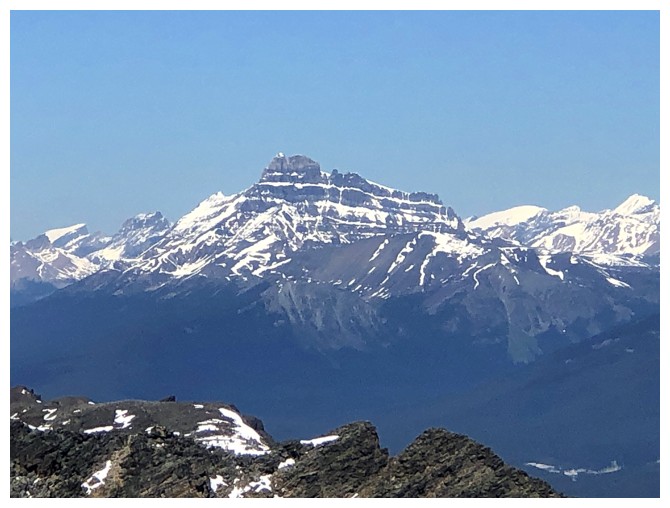
Boom Mountain
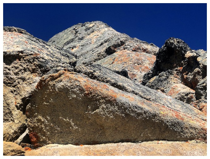
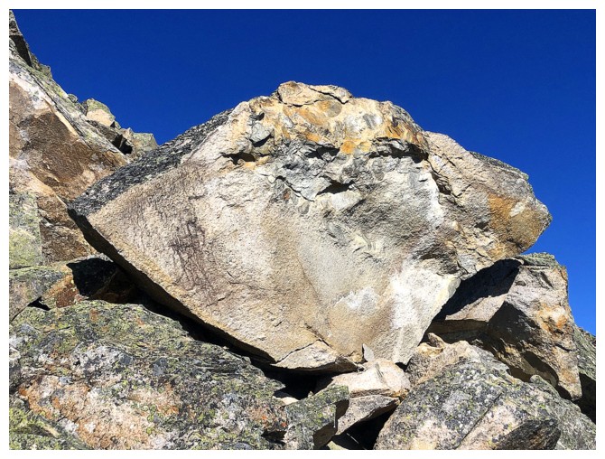
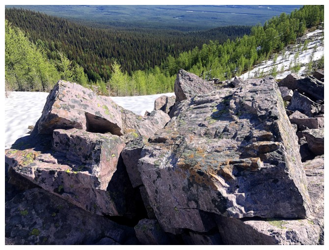
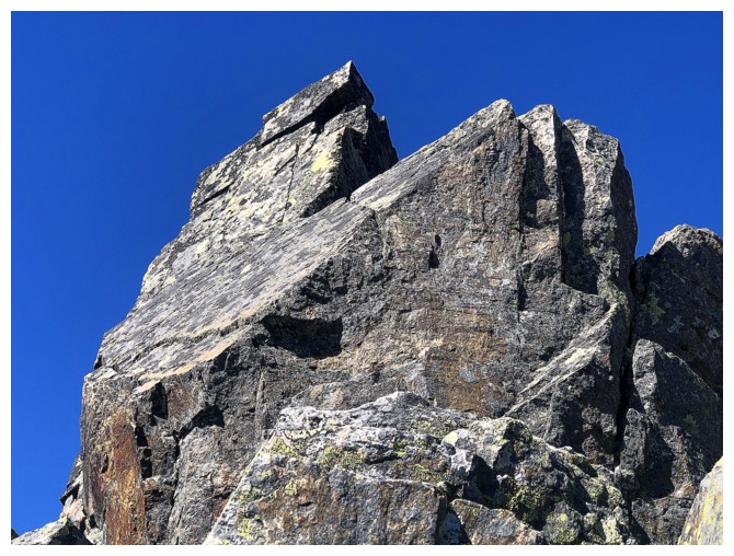
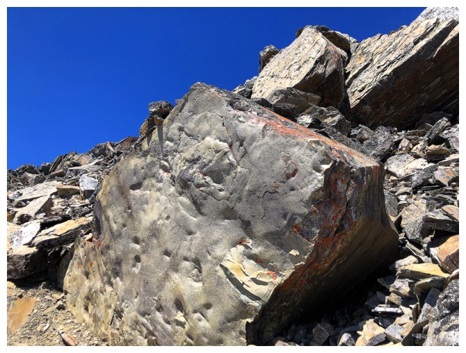
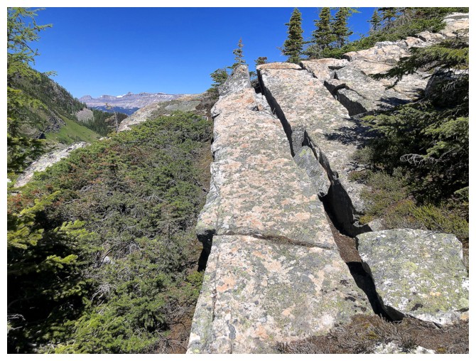
Some of the coolest quartzite I've ever seen
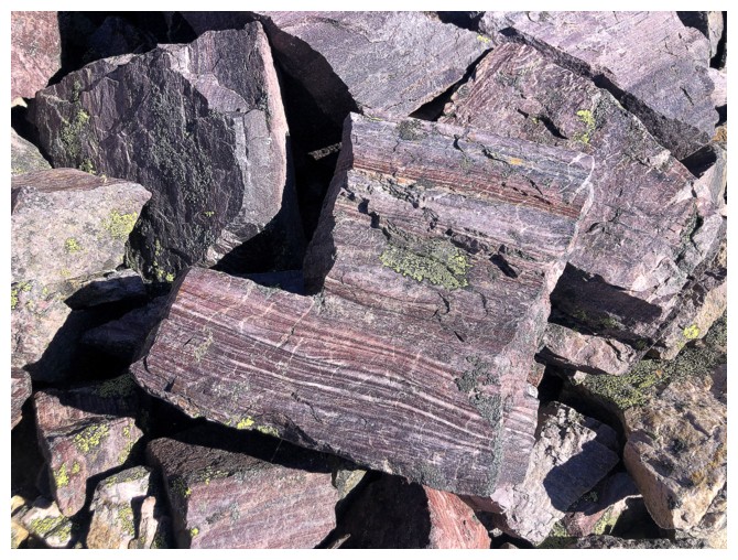
Close-up
Ouch!
Larches vs. pines
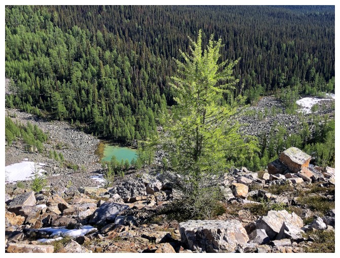
The tarn and a larch
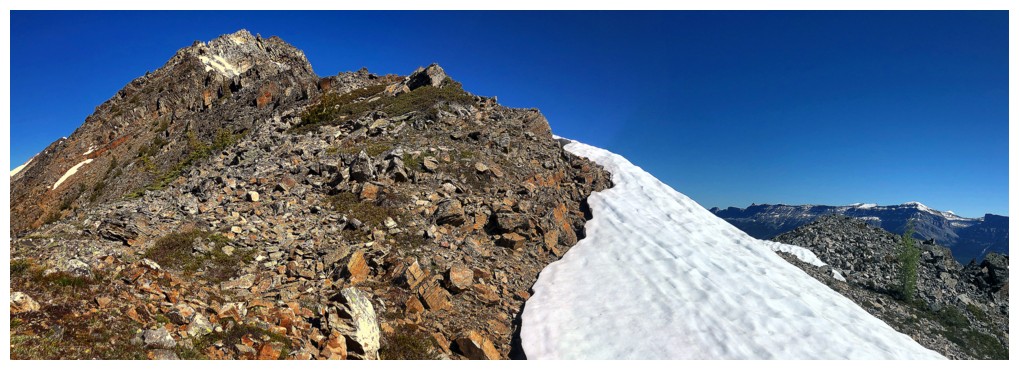
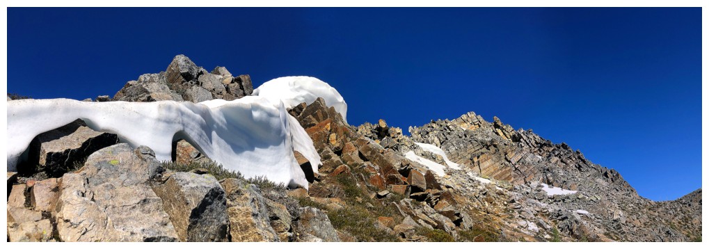
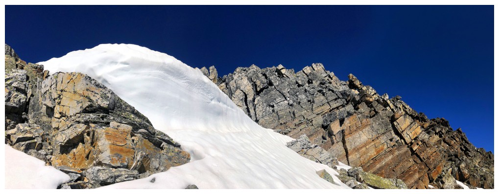
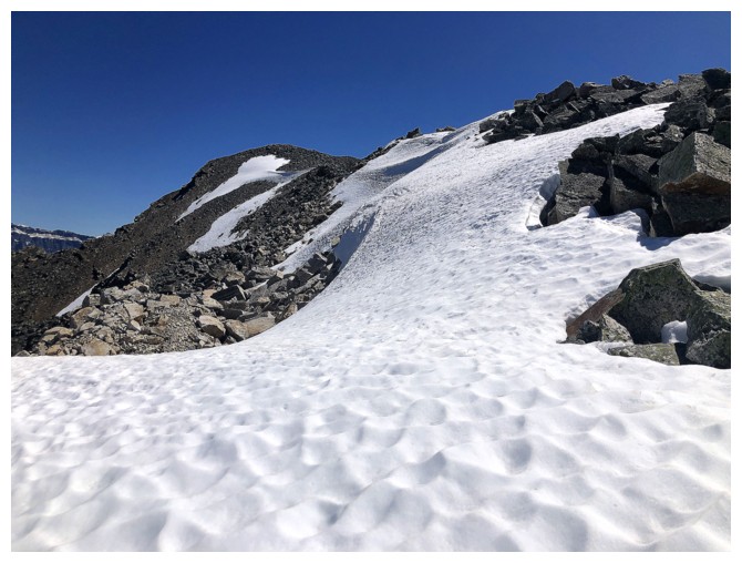
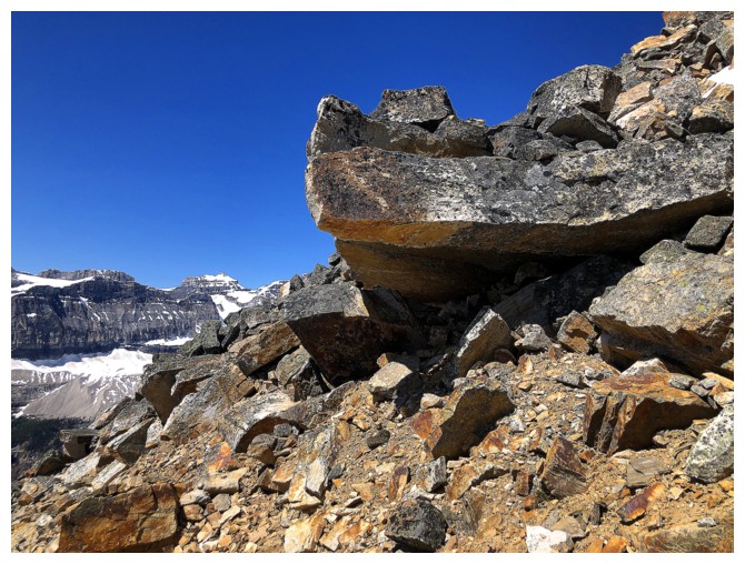
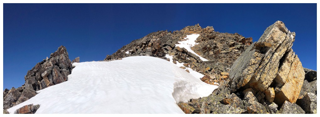
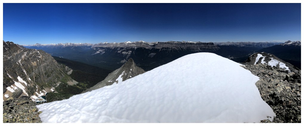
The remaining snow on the peak was a welcome scenic addition
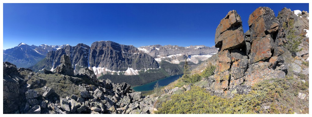
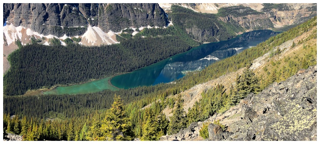
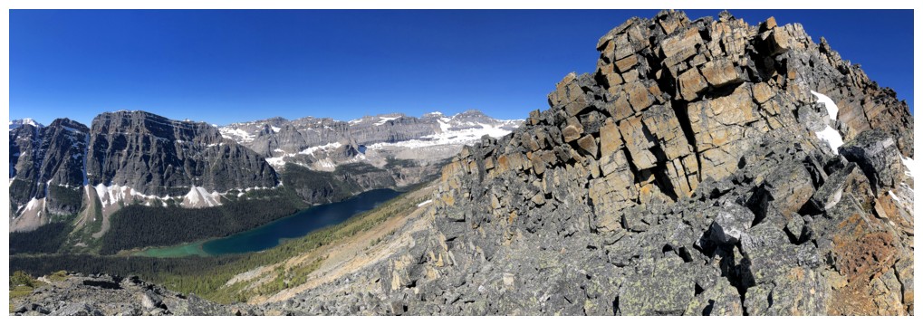
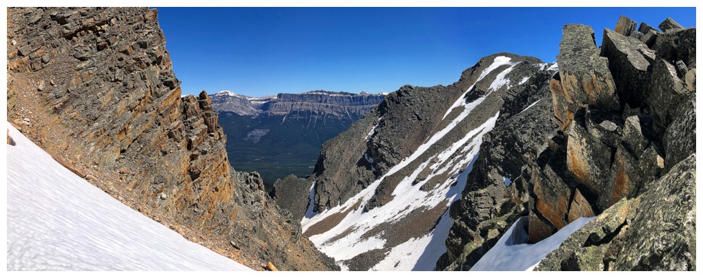
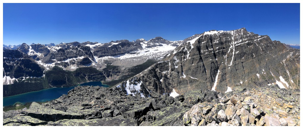
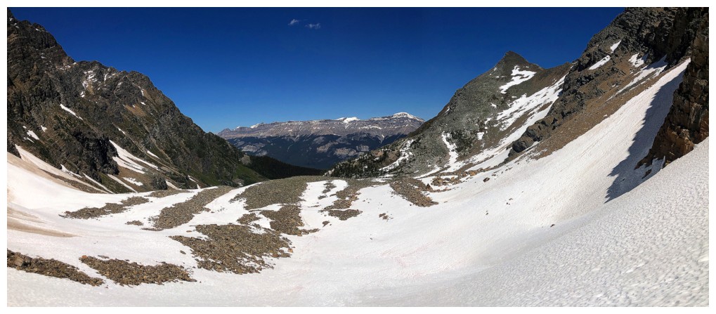
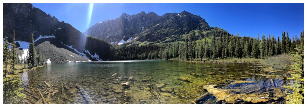
First of many amazing views of Boom Lake and its surrounding mountains
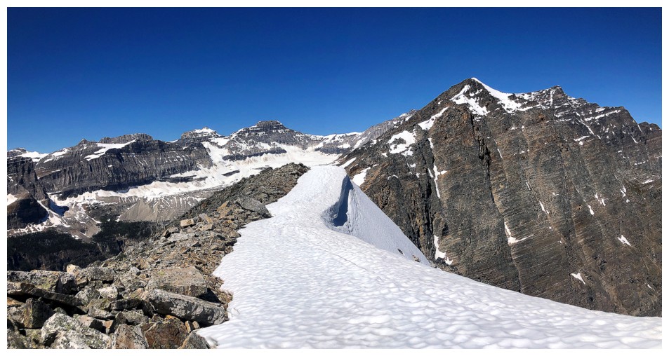
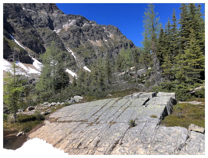
Easy travel for a while
With more great rock scenery
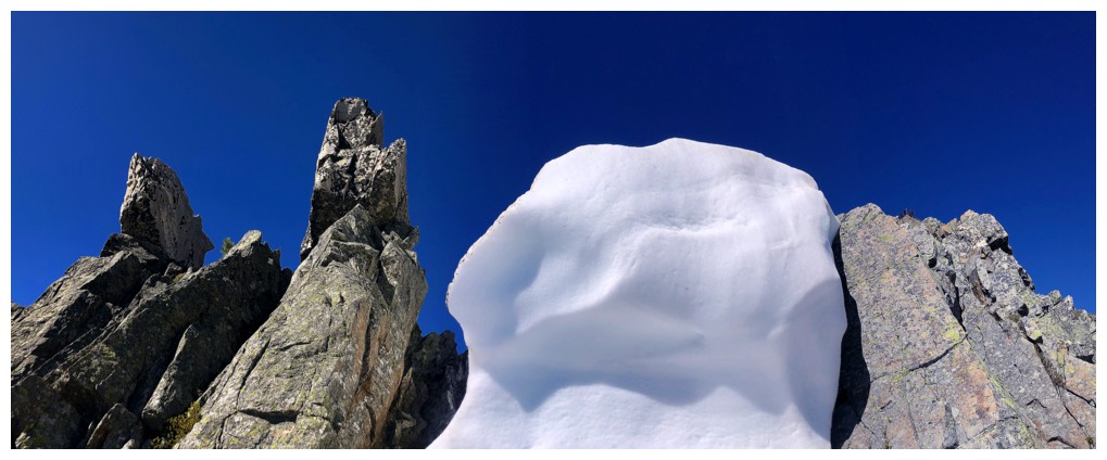
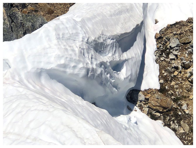
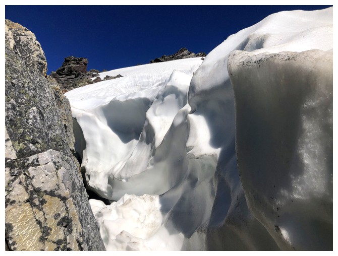
One of the really cool snow features
Another and two interesting rocks
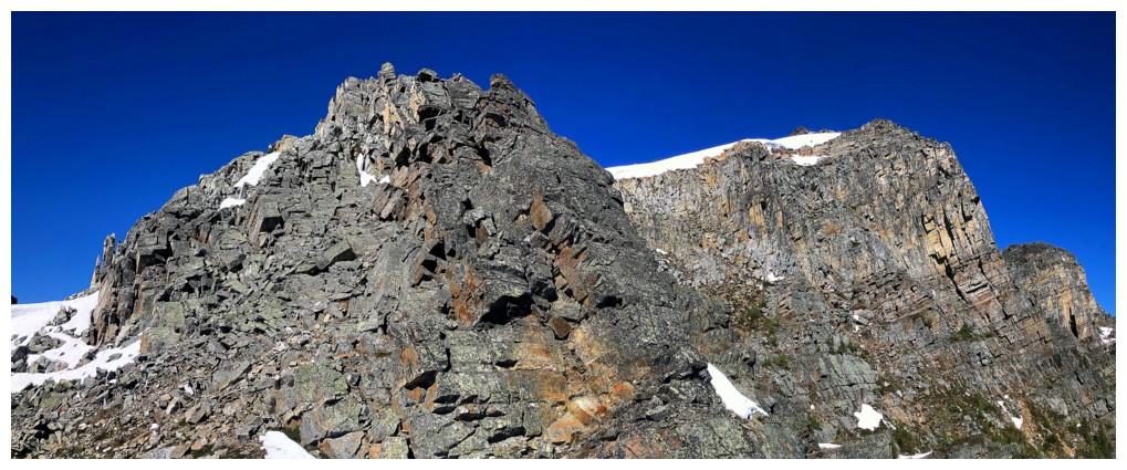
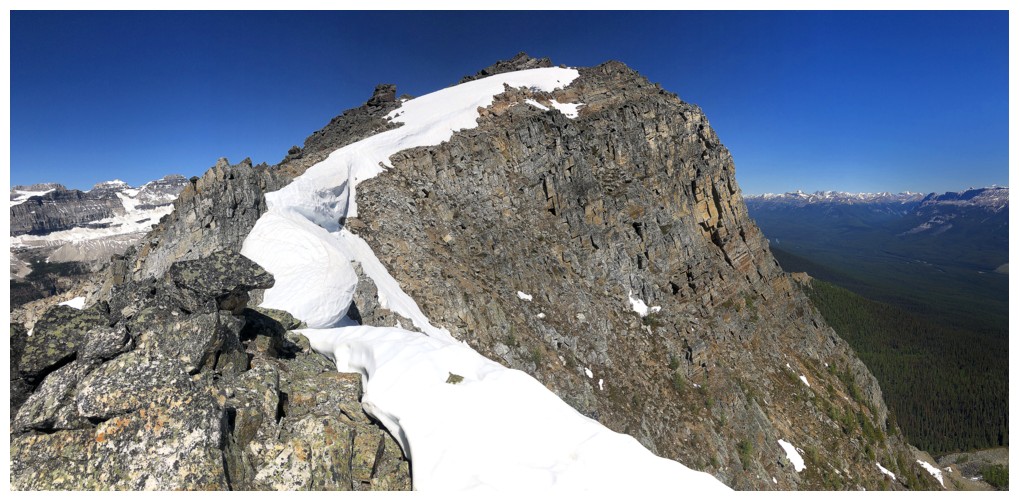
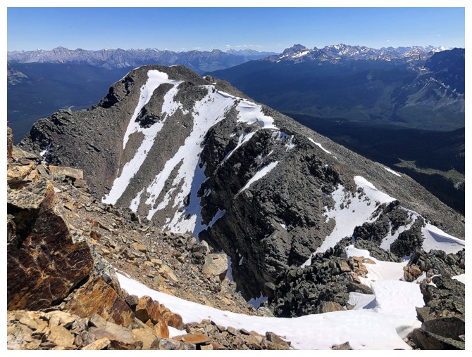
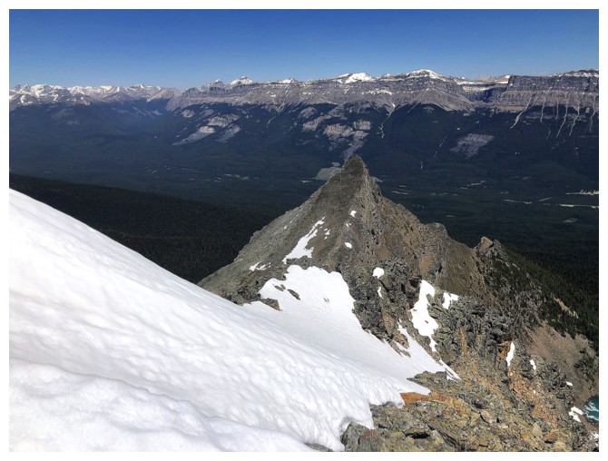
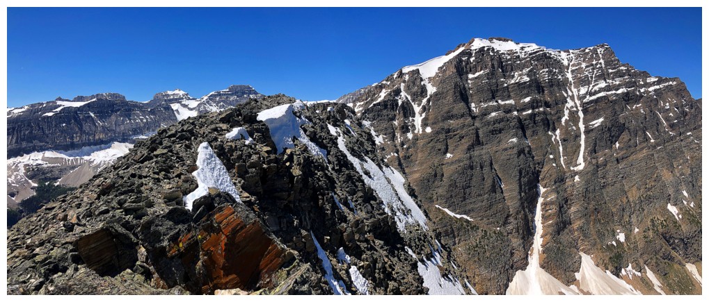
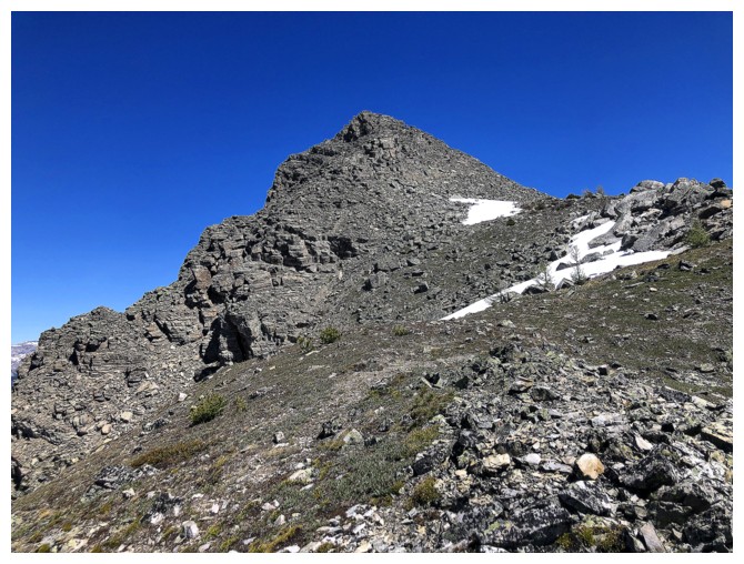
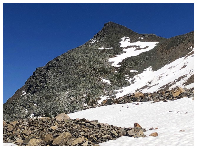
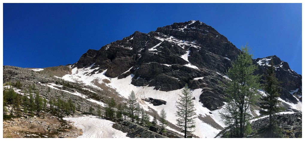
This ridge is surprisingly long. That's not the summit near the right.
However, the "awesomeness" of the rock distracts from the length and the many ups and downs of the ridge
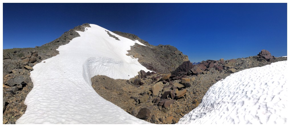
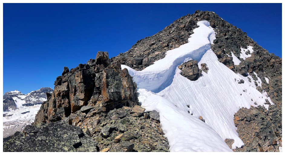
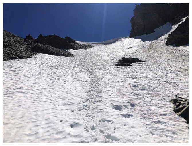
The first major summit is finally within reach, but it's guarded by that menacing face in the snow
Now past the tarn
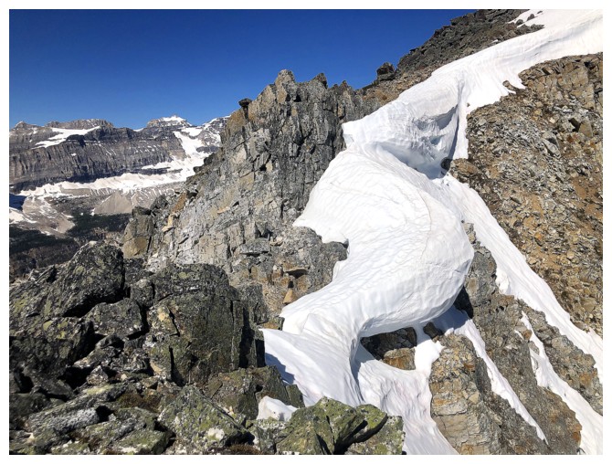
Approaching the face
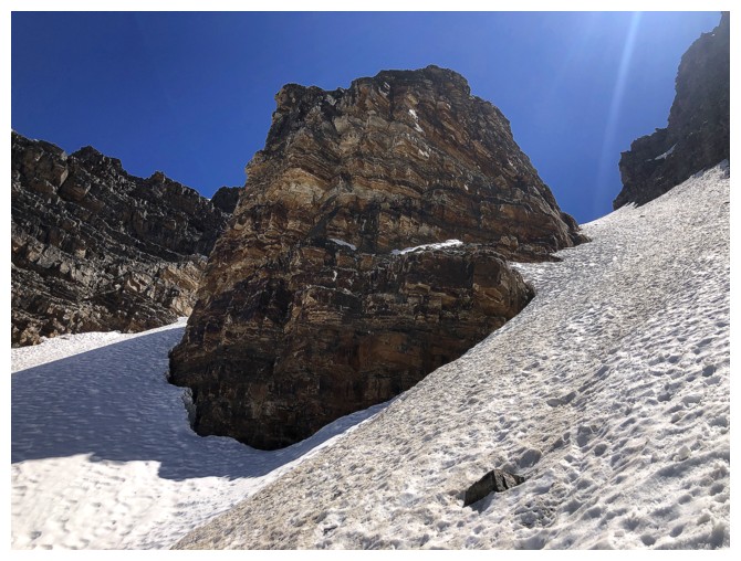
Maybe not so menacing
Another terrific snow feature

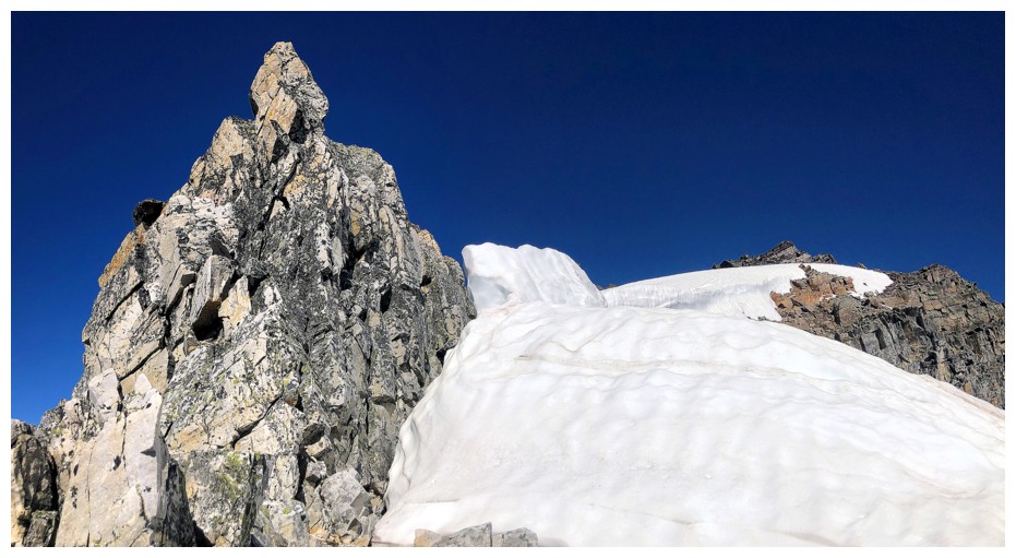
Was able to sneak between the gap in the rock and the snow
This gap
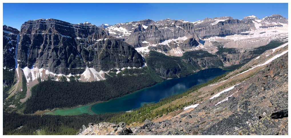
Can't forget about Boom Lake
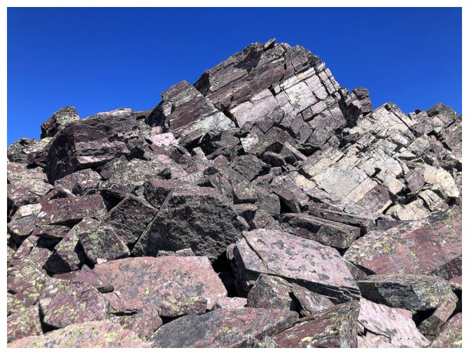
Another welcome run-in with purple quartzite
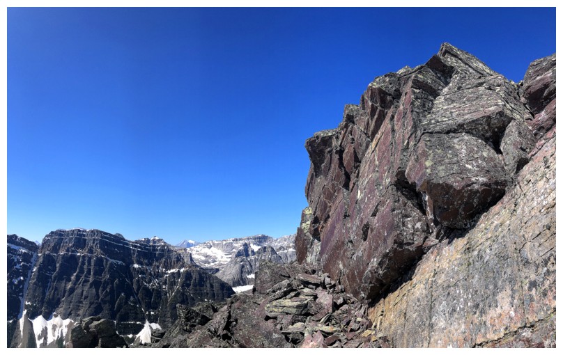
More ups and downs
With purple rock
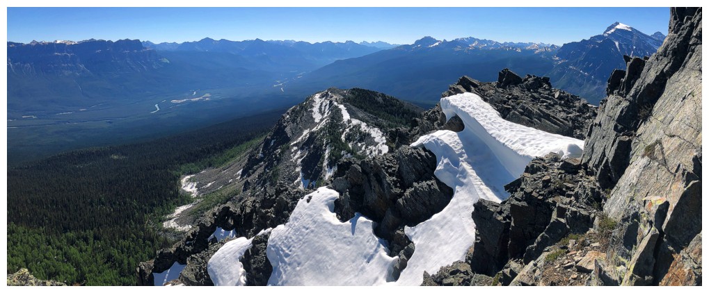
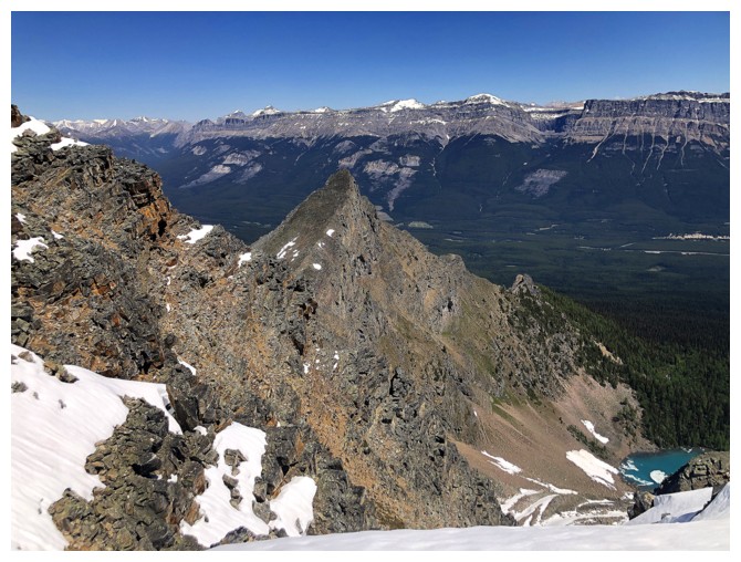
The summit of Bell Ridge is the point just left of centre and the peak to its right is Mount Bell
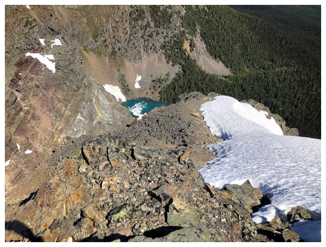
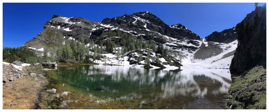
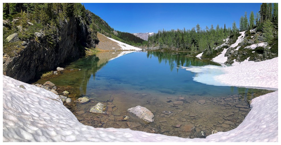
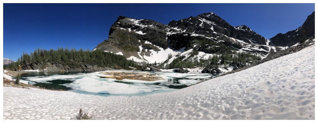
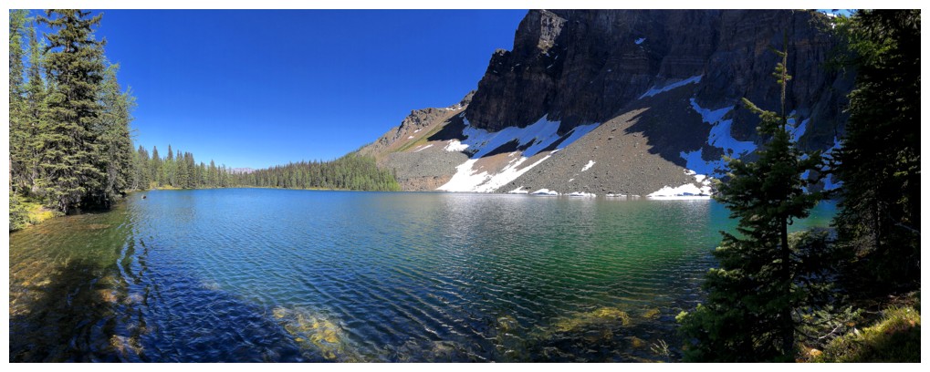
Another lake!
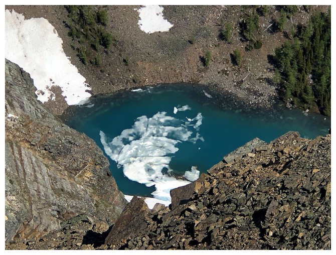
And this one is a stunning colour and holding onto some of its winter ice
The route to the summit is finally revealed
The summit of Bell Ridge now looks very distinctive
A significant outlier of Bell Ridge to the northeast. I would later
find out this is the sorta' famous Ivory Tower, described in David
Jones' book also.
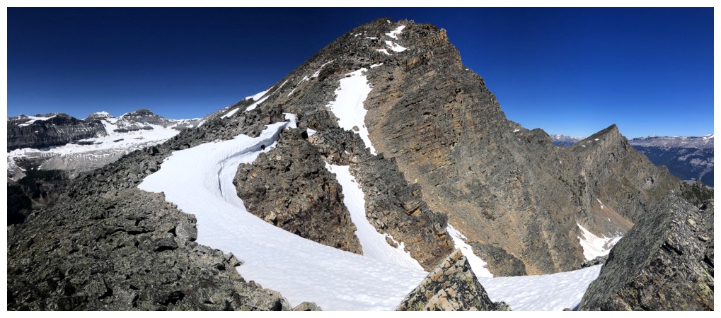
Down at the col before the final ascent to the top
Peaking at Television Peak (left of centre) through the gap
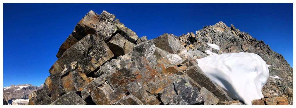
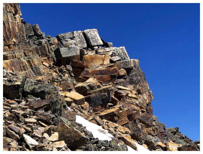
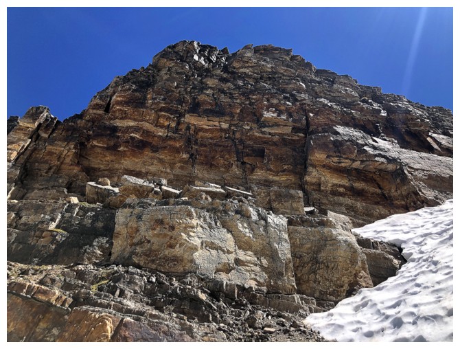
The slope to the summit is all colourful quartzite boulders, but many are not stable
Slow and cautious travel through this section
Looking back to the last highpoint
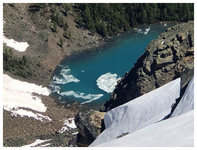
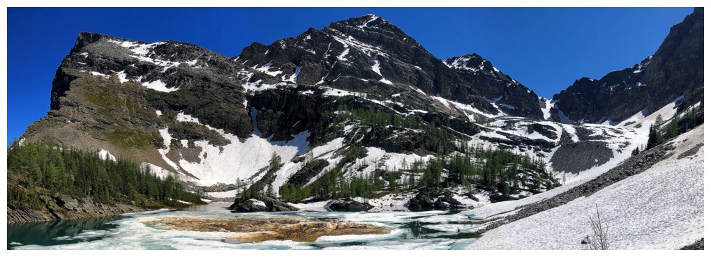
That lake again
Ivory Tower and the lake
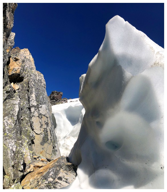
One last snow feature
Very interesting rock
Looking back again. I was sucking wind at this point, so I had lots of time to stop and take photos!
There's another lake east of the stunning one!
And more lakes on the other side
Contrary to appearances, getting over to the Ivory Tower is not
possible from the summit of Bell Ridge without some serious rappelling
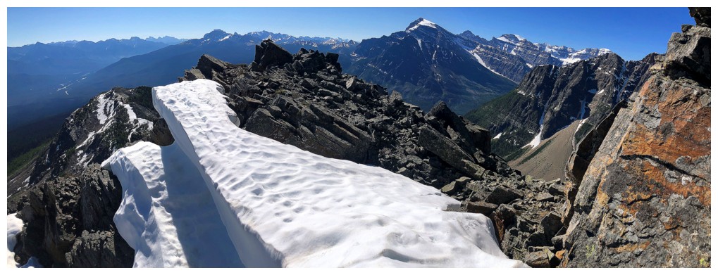
Eureka! The summit is achieved.
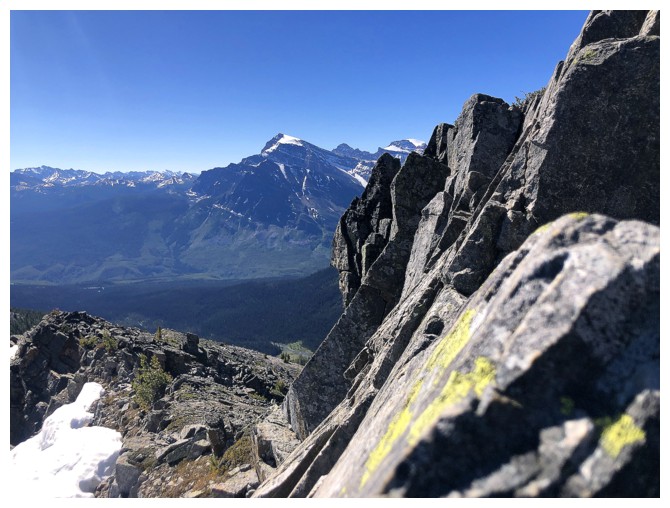
View to the east
Mount Douglas and St. Bride
Mount Hector - never quite got to the top of that one, but another attempt is very low on the priority list
Mount Bell looks close but you have to lose a significant amount of elevation before trudging up its south ridge
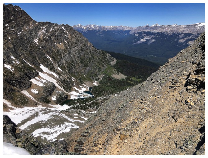
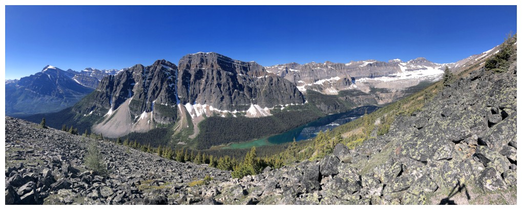
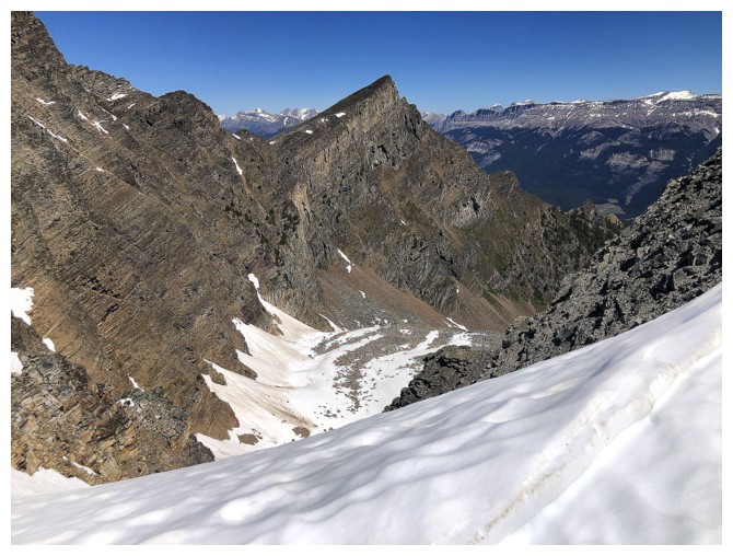
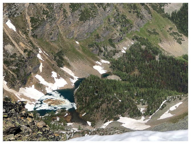
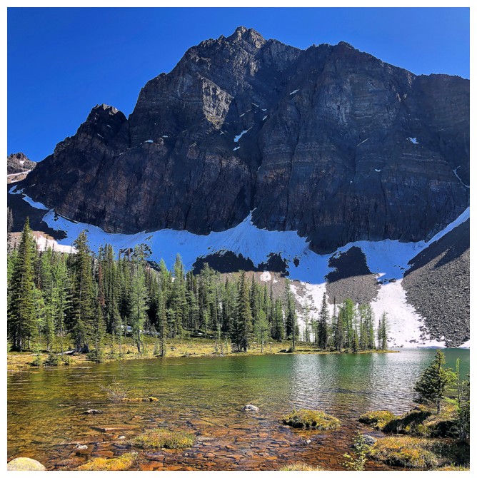
Looking down into the tarn-filled valley that Potter (and Alan Kane) describe
Close-up of the interesting colours of Boom Lake
Fantasy Island?!
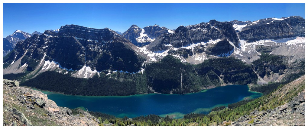
Last look at Boom Lake
Heading down to the Bell Ridge/Mount Bell col
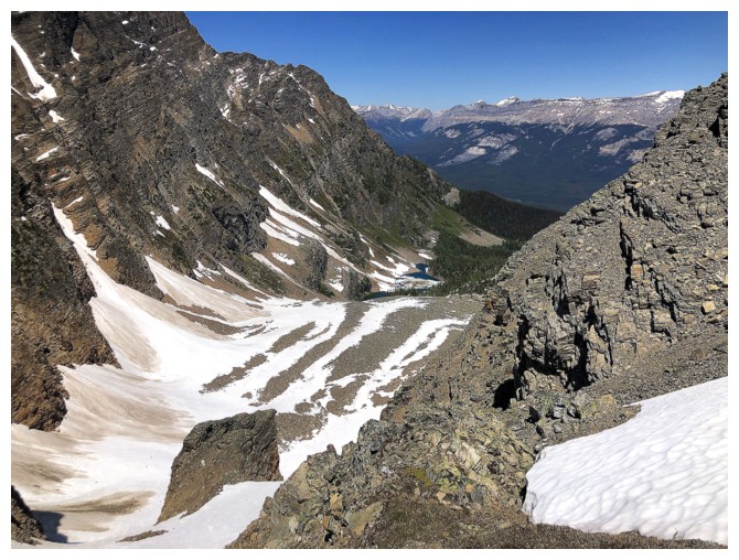
The valley I'm going to try to get down to
Looking back to the summit before plunging down the other side of the ridge
Heading down steep snow slopes
Looking back up. These slopes are quite steep and I was glad to have crampons and an ice axe.
Still no shortage of great rock
The angle of the snow is better represented here
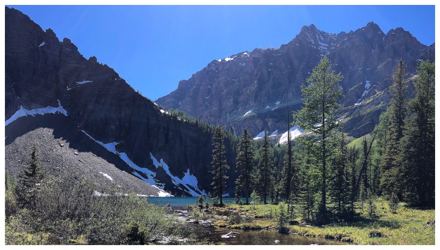
In the upper valley
The easy route up Ivory Tower that hopefully I can attempt during larch season
Looking back to the descent route at the right. The snow gully on the left may have worked too.
Descending the valley. Eventually the snow gave way to boulders.
But more snow was found on the south side of the valley
Yet another cool colour of rock
Nice change over to slabs
The north side of Bell Ridge
More slabs
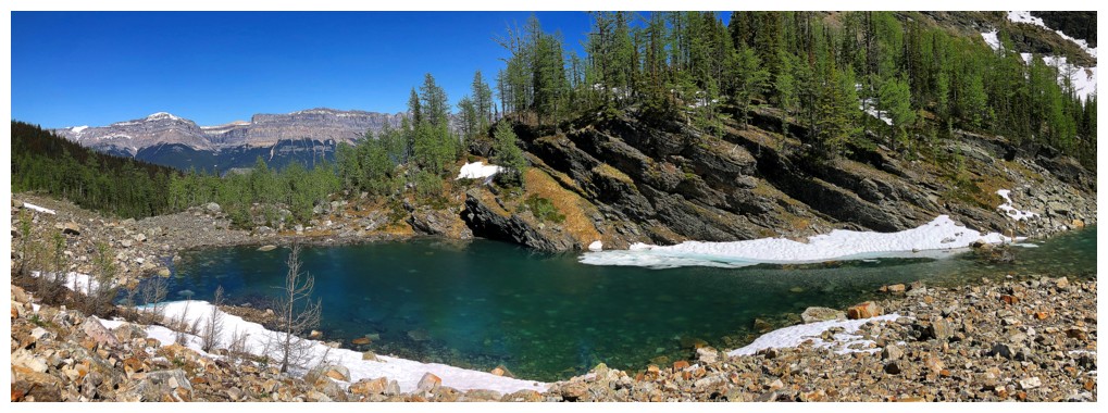
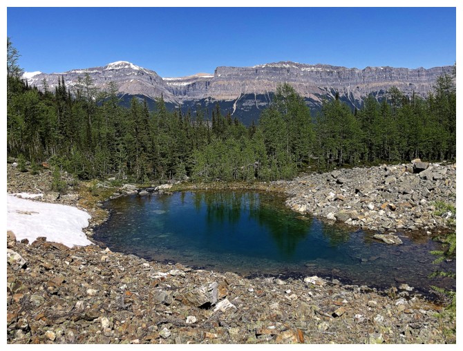
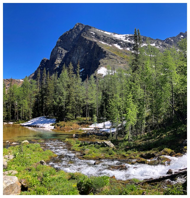
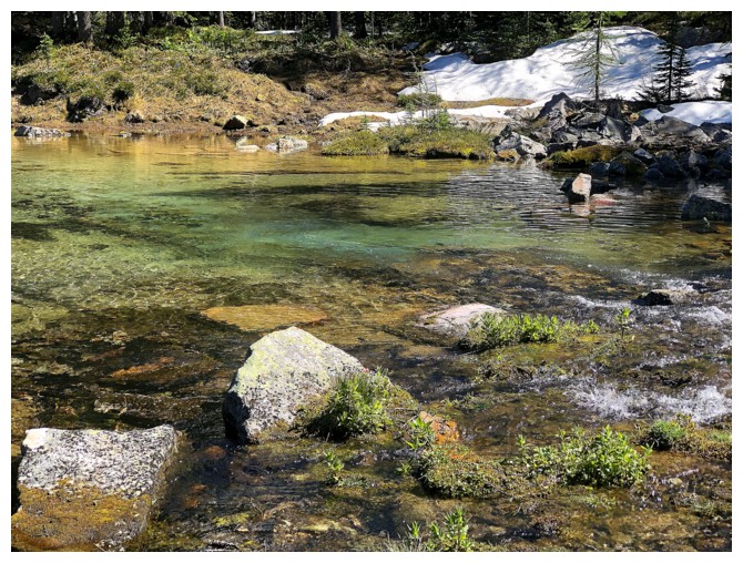
Approaching the first tarn
Larches above the tarn
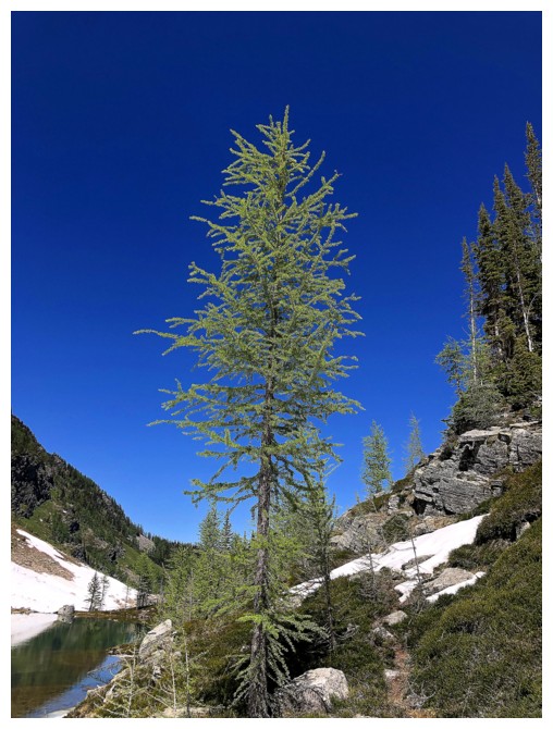
A lone larch that will look amazing during larch season
Going around the south side
The slope above all the tarns were awesome to look at: steep rock and lots of greenery
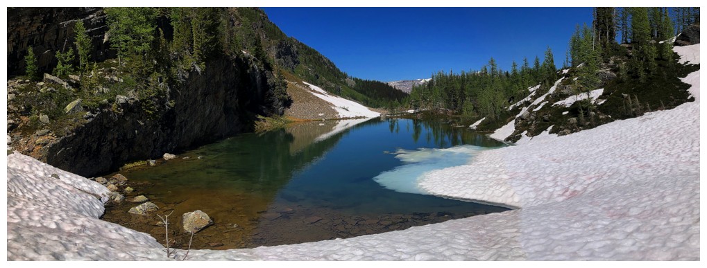
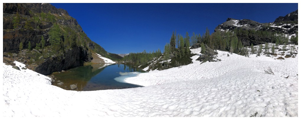
The last of the ice floating on the tarn
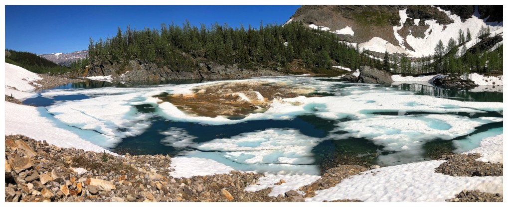
Going down to the second tarn
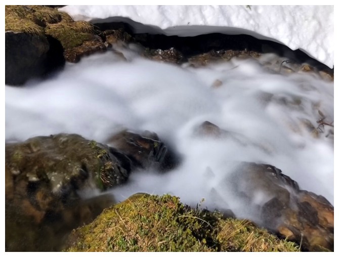
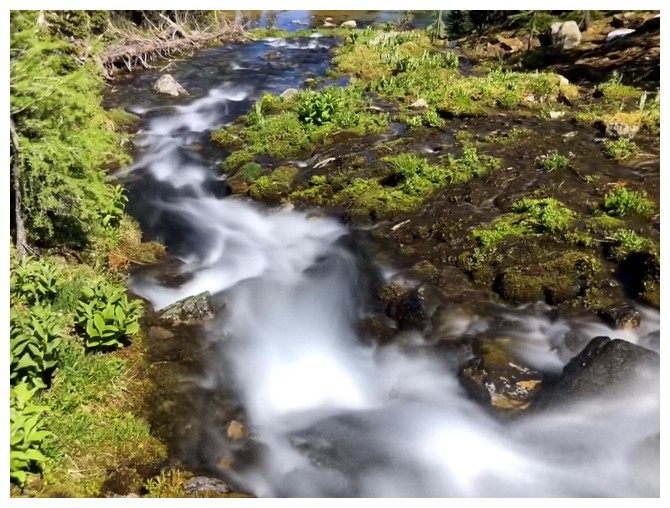
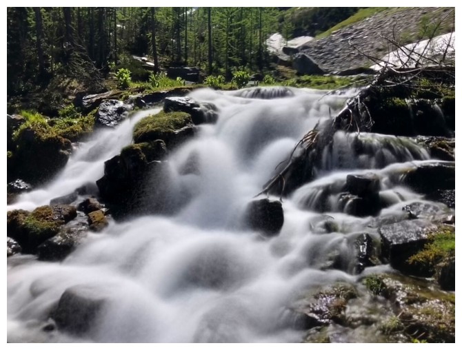
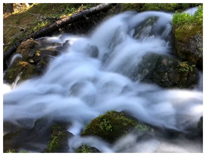
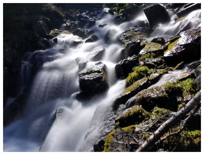
Finally, an opportunity for some long-exposure photos!
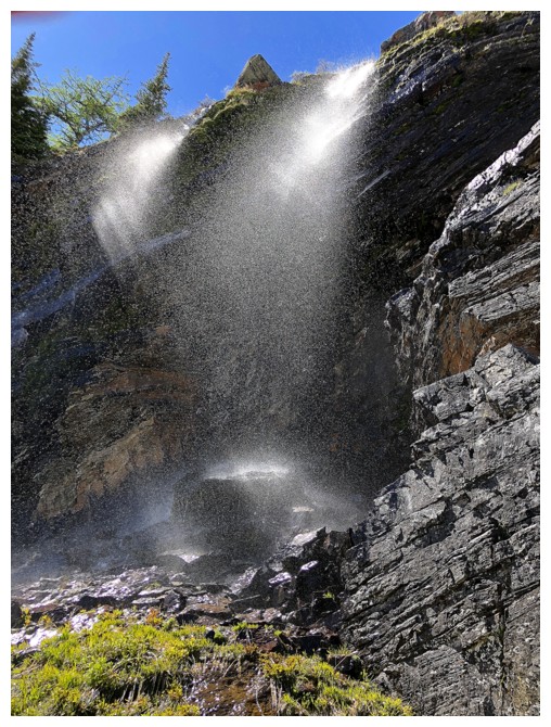
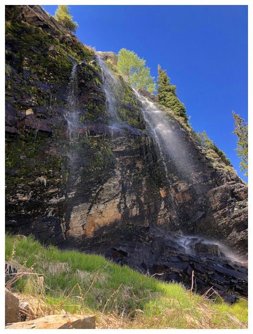
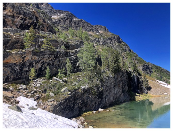
Quick detour back to some waterfalls on the north side of the first tarn
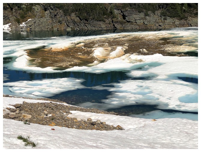
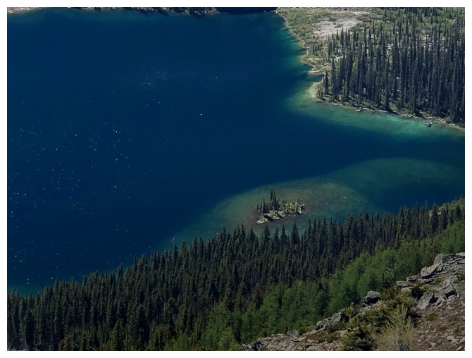
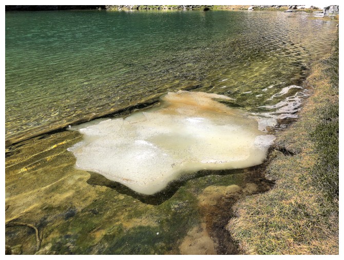
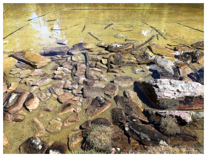
Not sure if this is an island in the second tarn or debris that has avalanched into the tarn
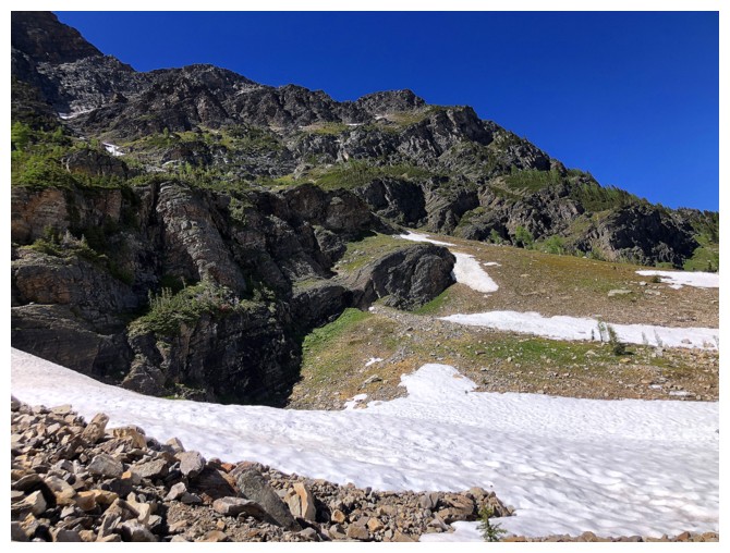
Those steep, green slopes again
The mystery in the middle of the tarn
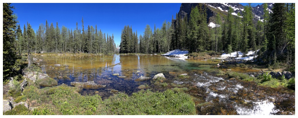
Went around the north side of the second tarn
Ivory Tower (far left), Bell Ridge, and the tarn
East end of the tarn
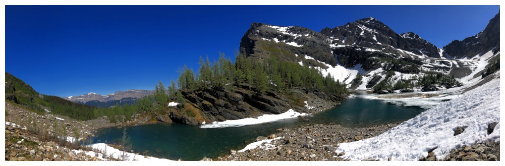
All of the above. This area was yet another of the innumerable highlights of the trip.
Regrettably leaving the second tarn
The third is more of a big puddle, but nicely backdropped with Castle Mountain
Larches and Ivory
The Puddle
The Green
The Puddle was a magnificent shade of Green
Leaving The Green Puddle
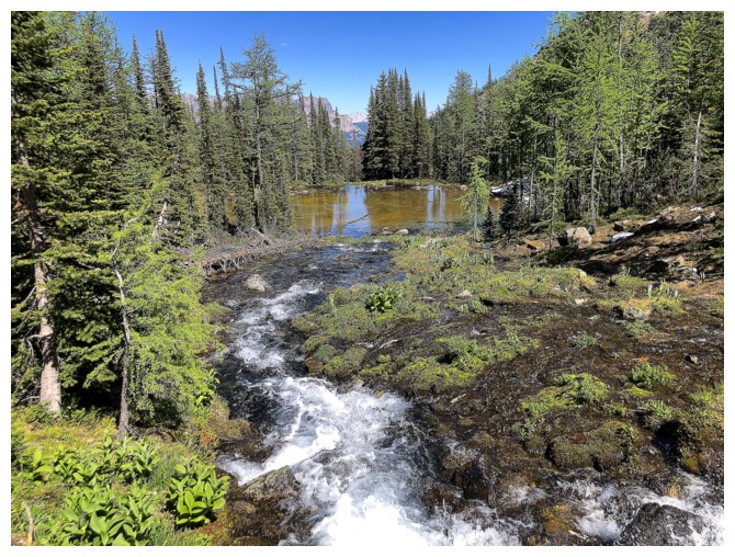
Nice connecting stream between The Puddle and the fourth tarn
Scenery overload: the stream, the tarn, the larches, and Ivory
The fourth tarn was quite unique
Nice colours
The unique part
The unique part, Ivory, and Bell
Another stream that connects the fourth tarn to O'Brien Lake
At the west end of O'Brien Lake - it's a big lake
There's a 5.8 climbing route up the Ivory Tower up the left side
Leaving O'Brien Lake. Mount Bell above the lake.
False alarm - crossed the lake outlet, then went around to the northeast side of the lake
An hour later, after losing the O'Brien Lake trail, and some intense searching to find it, I'm back on track
Passing below Bell Ridge on its east side. Just a longish hike back to the parking lot from here.
The End
LOG