Bridle Peak III
Cinch Hill III
November 27, 2021
Mountain heights: 2180 m and 2079 m
Elevation gain: 350 m
Round-trip time: 5 hours
Solo scramble.
Experiencing a typical bout of
indecisiveness, I decided to start hiking the Drywood Falls trail without an
objective in mind. 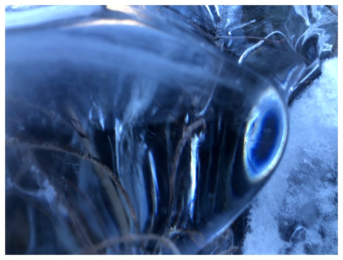 Hopefully an appealing and also feasible route would reveal
itself along the trail. Within 30 minutes, several had: a couple of new routes
up the north side of Drywood Mountain and three routes up gullies on the south
side of Pincher Ridge. I chose Pincher because at least I would eventually
ascend into the Sun-soaked slopes. The Drywood routes would be in shade
throughout. There was also the issue of the wind, which promised to be vicious
all day.
Hopefully an appealing and also feasible route would reveal
itself along the trail. Within 30 minutes, several had: a couple of new routes
up the north side of Drywood Mountain and three routes up gullies on the south
side of Pincher Ridge. I chose Pincher because at least I would eventually
ascend into the Sun-soaked slopes. The Drywood routes would be in shade
throughout. There was also the issue of the wind, which promised to be vicious
all day.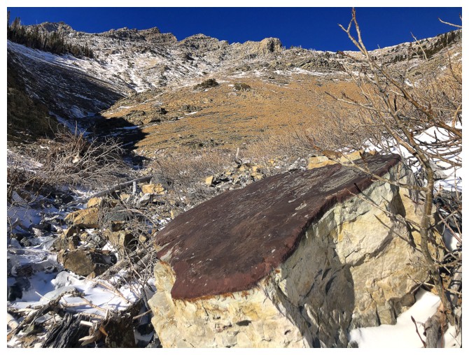 Going up a south facing gully would probably be the best way to stay
somewhat sheltered.
Going up a south facing gully would probably be the best way to stay
somewhat sheltered.
Of
the three gullies, the middle one looked
to be the most interesting (simply because there was some visible red
argillite!) and the least likely to lead me onto precarious terrain.
Disappointingly, I arrived at the argillite section long before the Sun
would
light up the colourful rock. However, the route up to that point had
been
excellent, courtesy of the frozen water in the drainage. With
surprisingly
clear skies ahead, it looked like things would get even better.
And they did.
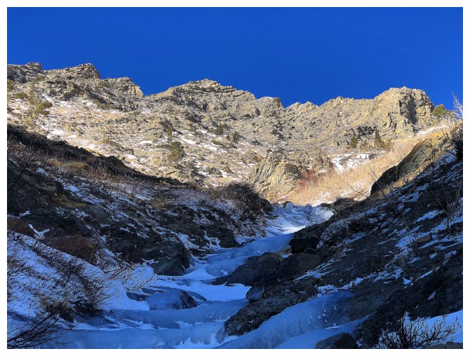
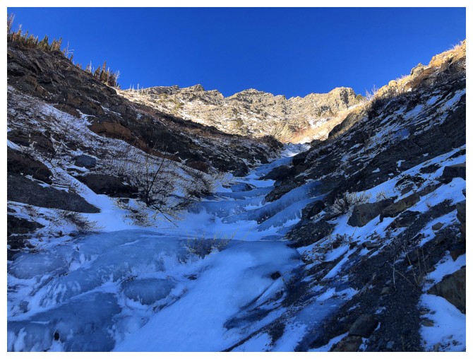
The ascent gully provided tons of interesting
scenery – rock and frozen water – enhanced dramatically by the blue sky above. Higher
up, I was able to traverse over to the east ridge of Pincher, west of Bridle.
Both Bridle and Cinch were easily reached from that point. The loop was
completed via an easy route down the southeast side of Cinch.
A very rewarding half day out.
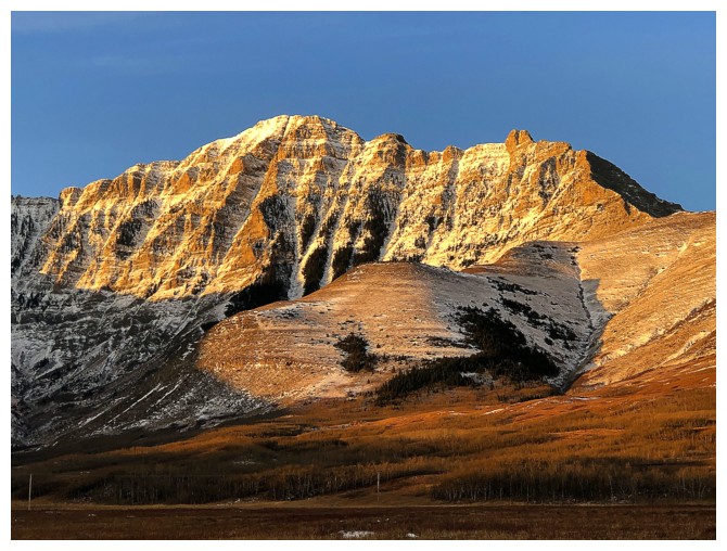
Early morning light on Mount Roche (Spread Eagle Mountain)
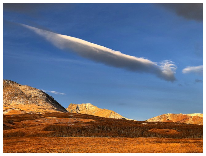
Interesting cloud
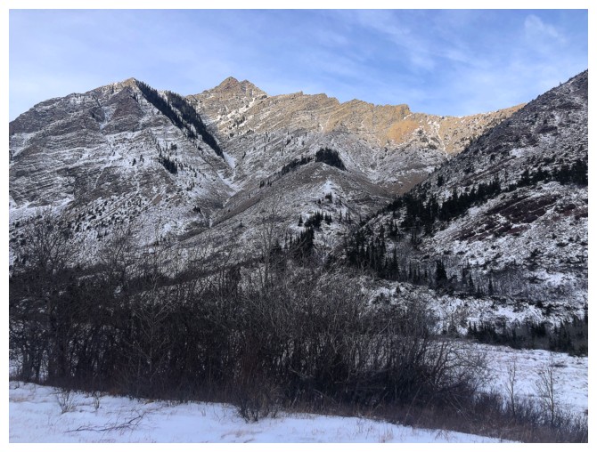
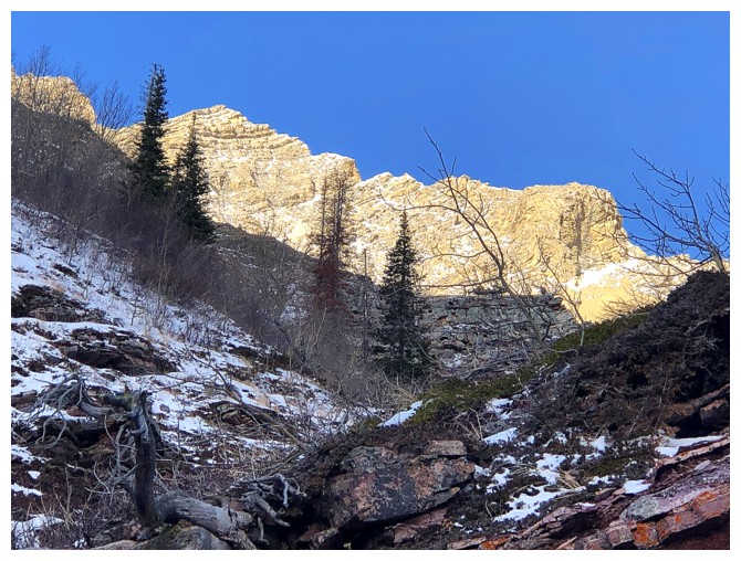
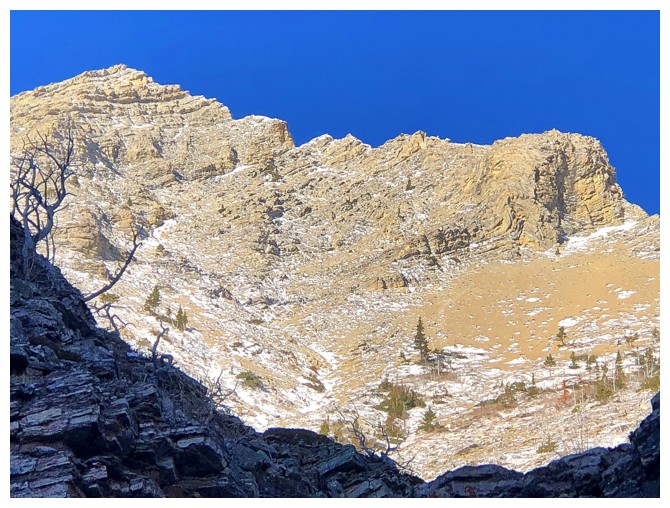
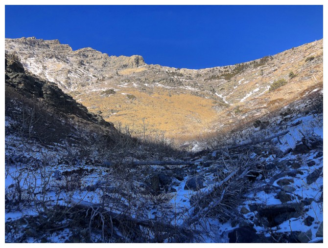
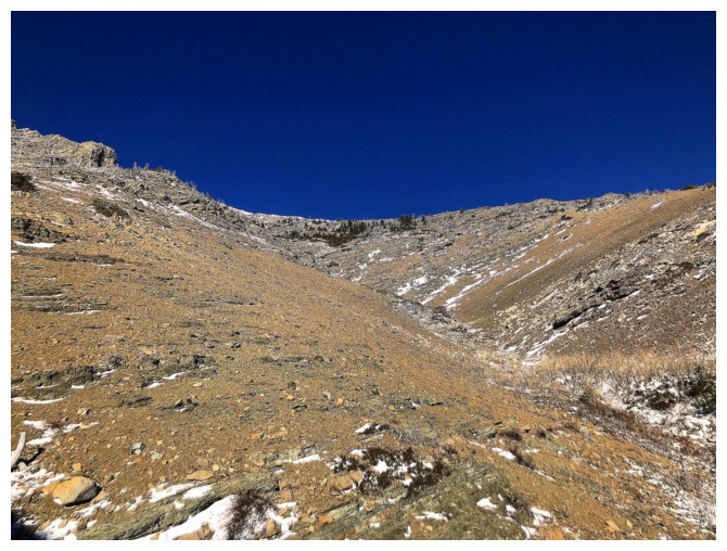
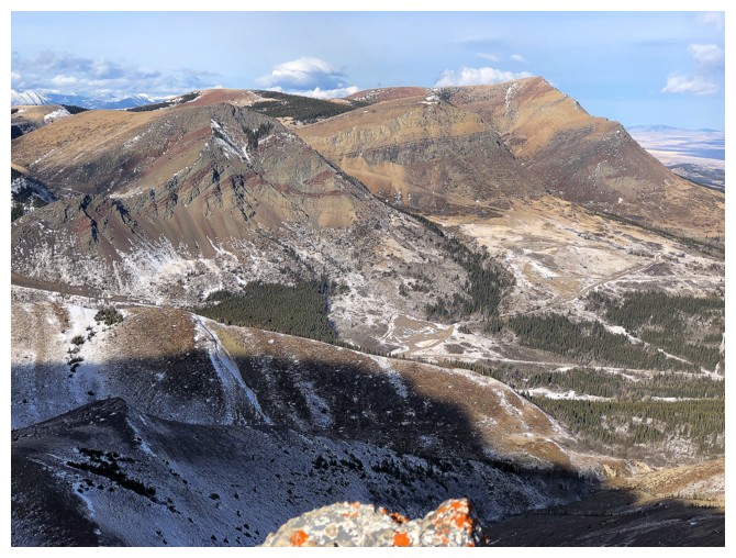
Pincher Ridge and two of potential ascent gullies. I took the one on the left.
Across the valley, the Drywood Falls ice climb is forming nicely
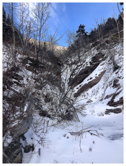
Entering the drainage
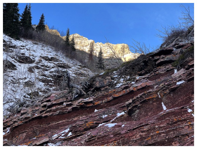
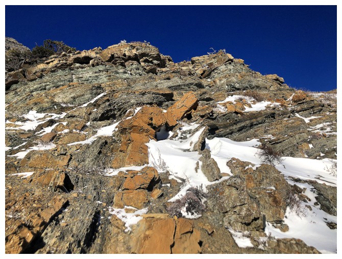
First red argillite encounter of the day
...but the Sun's rays are only hitting the mountain tops
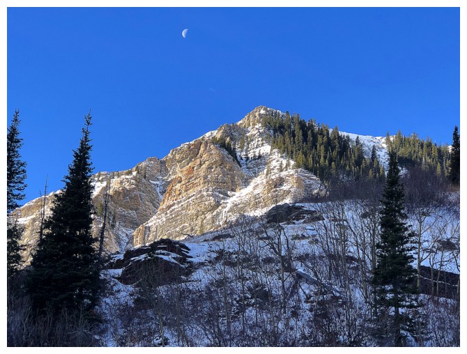
...and the Moon
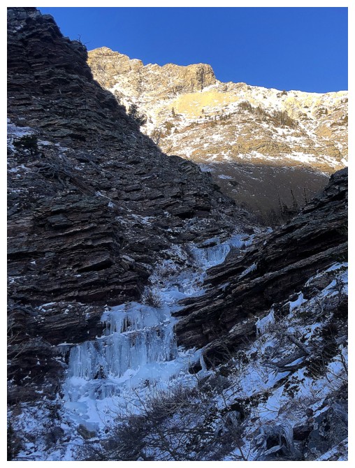
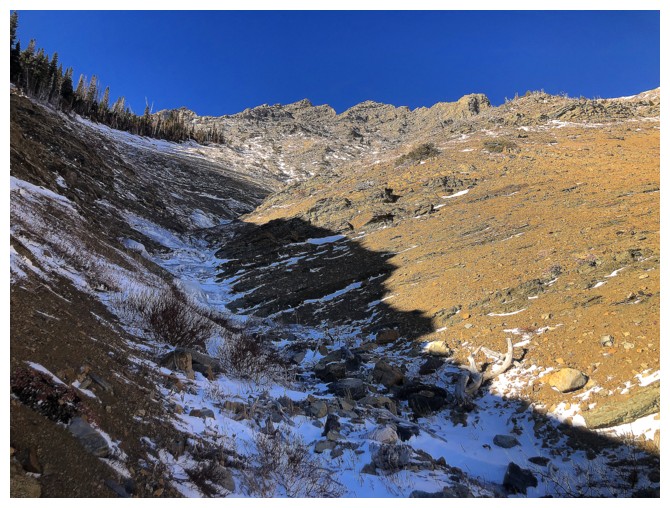
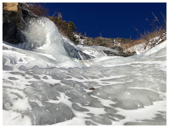
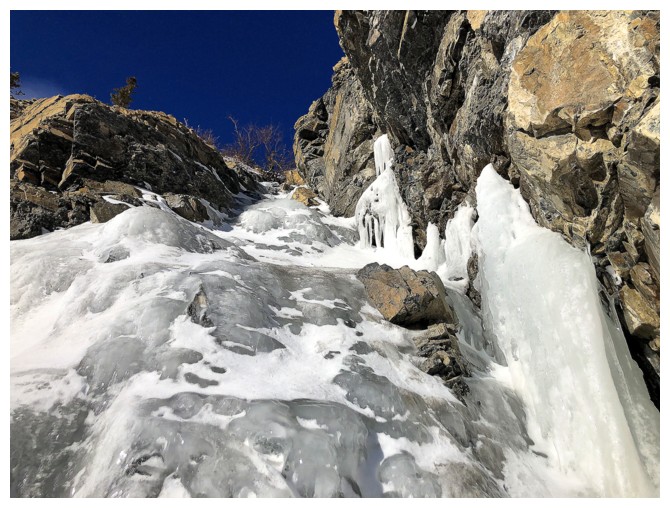
The start of a string of ice encounters
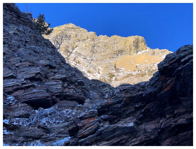
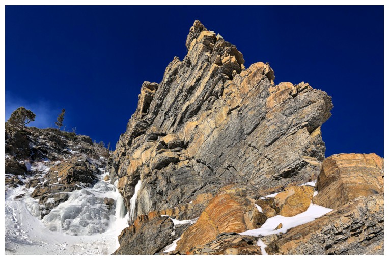
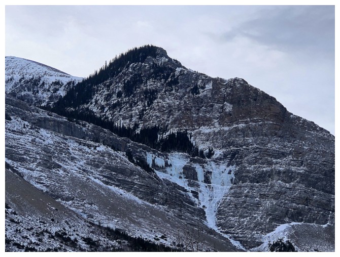
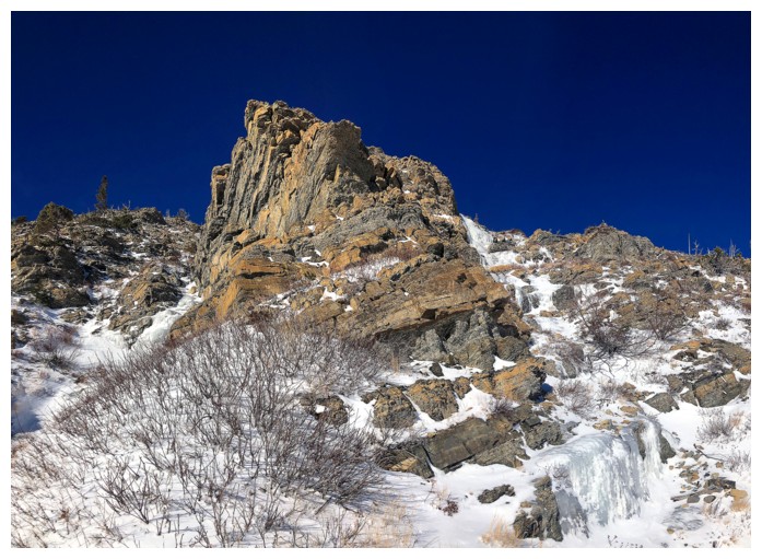
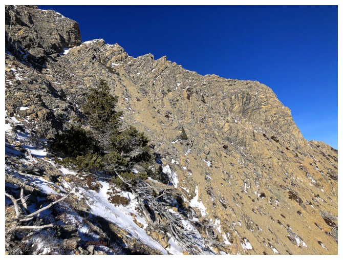
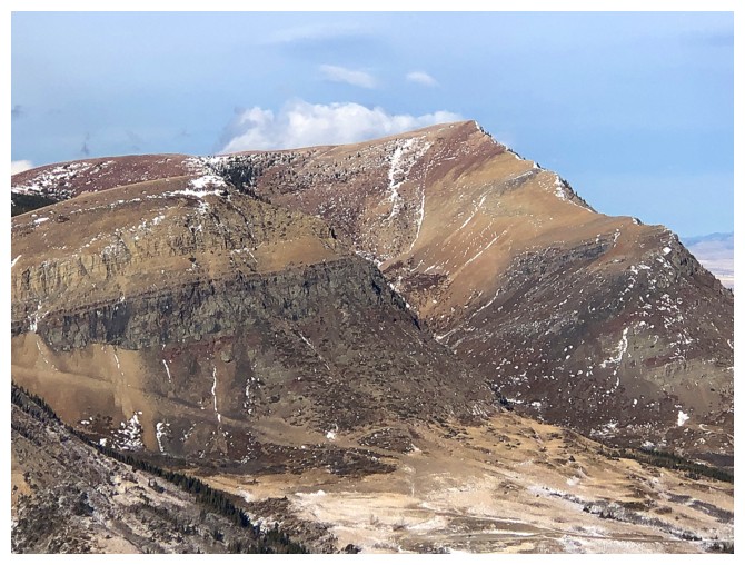
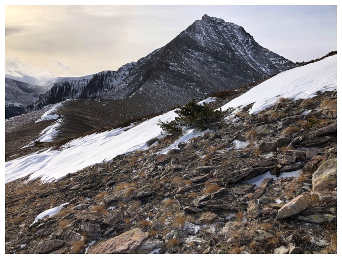
Pincher's fierce east ridge
Close-up
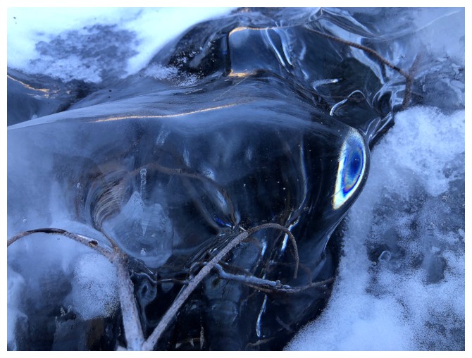
Light does cool things when it hits smooth ice
Same as above
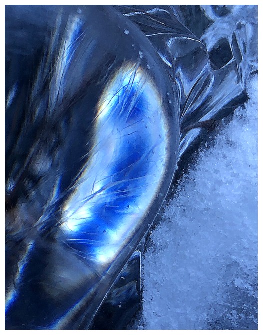
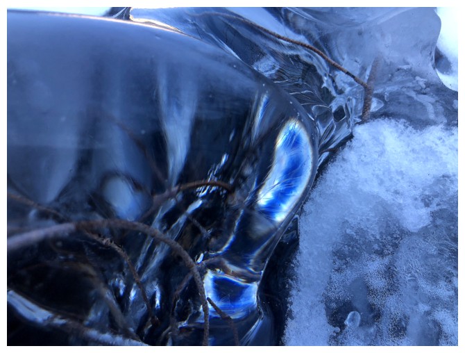
Close-up
About to escape the shadow of the mountain
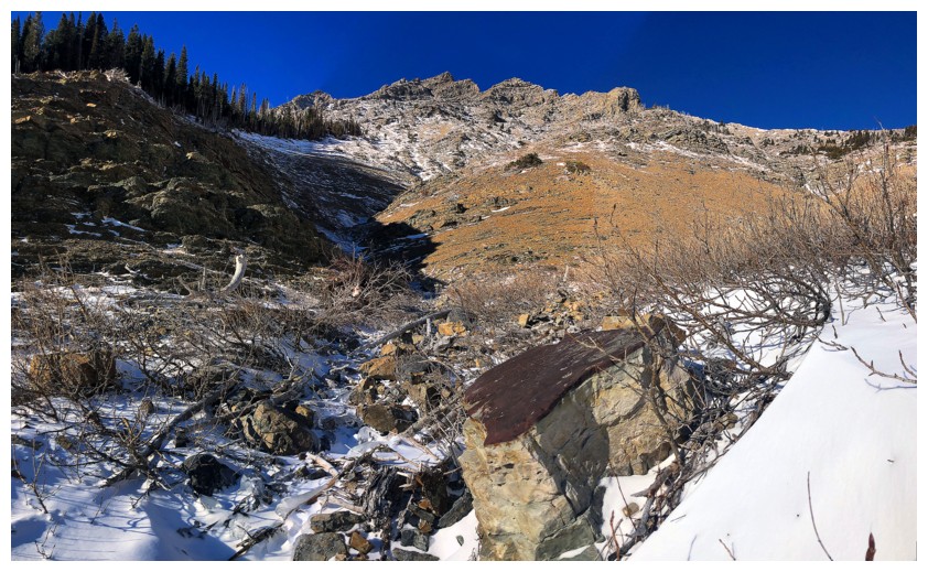
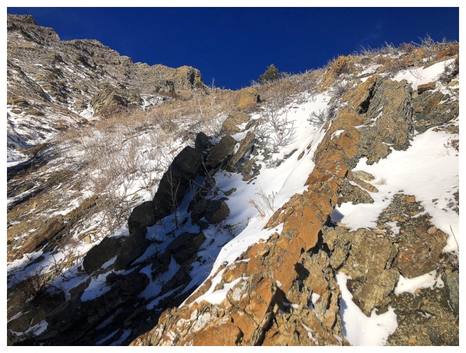
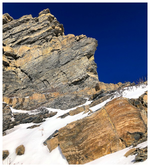
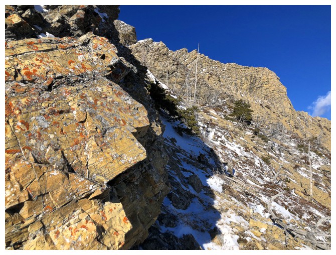
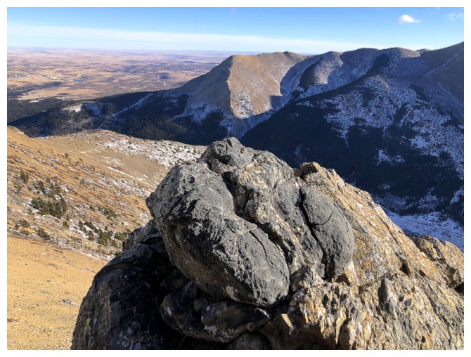
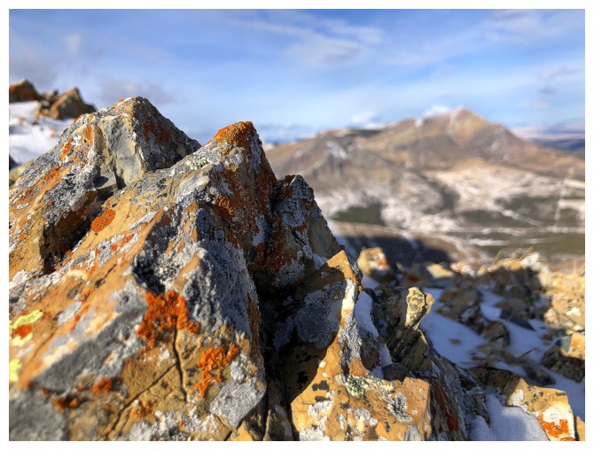
Out into the open, and greeted by a beautiful, red argillite-topped boulder
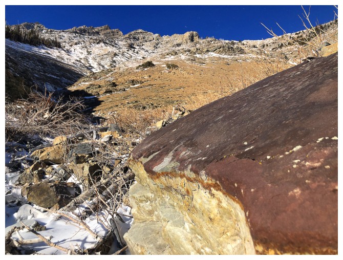
Close-up of the rock
The route ahead looks fairly uninspiring
So I went left into another drainage
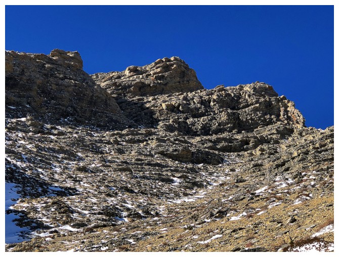
Great rock and wickedly blue sky are going to be the highlights of this part of the ascent
Looking over to the northeast ridge of Drywood Mountain
Distracted by something different
Back in the shadows, but here comes Round 2 of "Cool, Ice Encounters"
Same as above
Back to the rock
Back to the ice
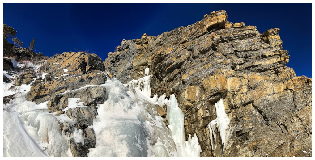
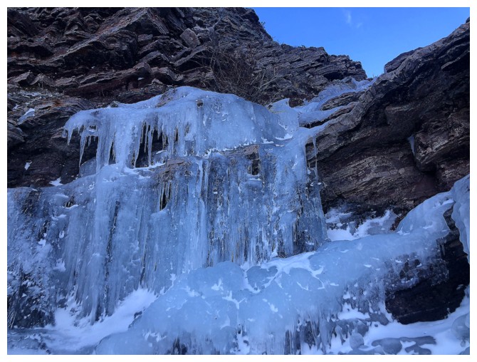
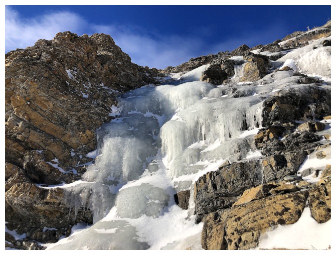
Approaching the scenic highlight of the day
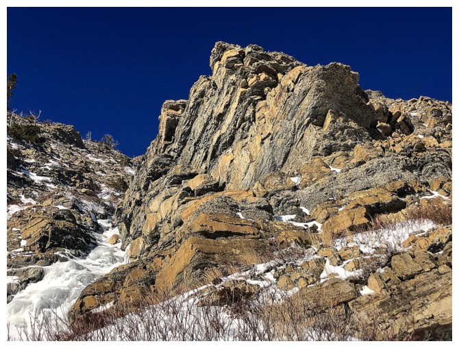
The rock was amazing
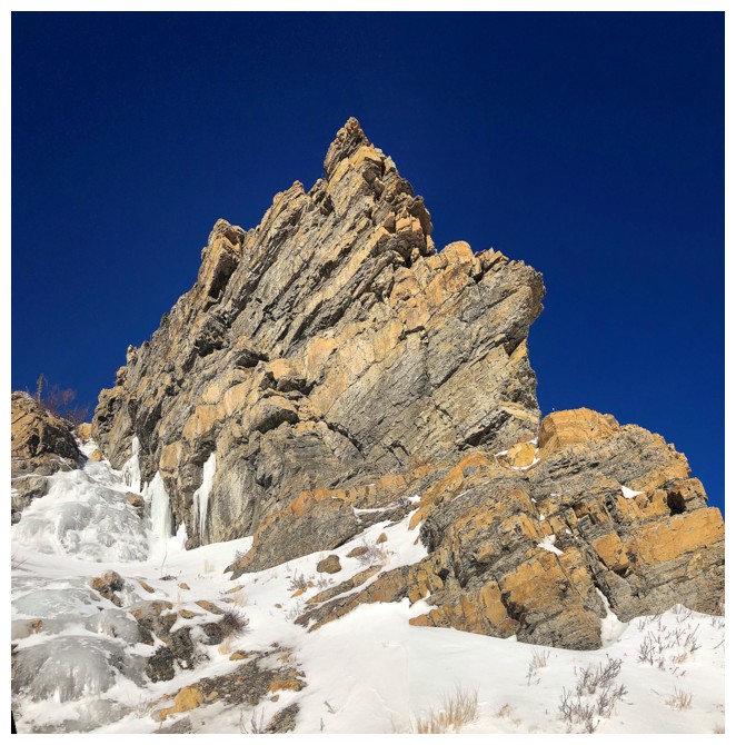
...but the ice on the left side made it "next level"
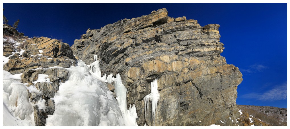
Love it!
More ice above the ice
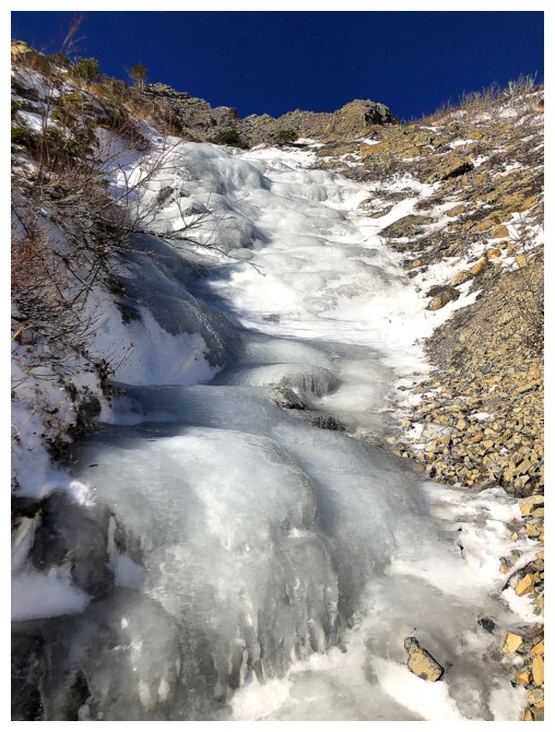
And again
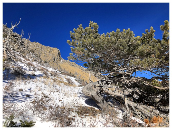
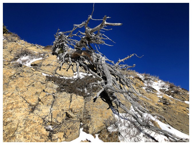
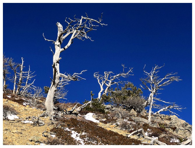
The ice scenery is done, so now it's "Tree Time"
I was tempted to intercept the east ridge route up Pincher, but that one is a great summer route - not late November!
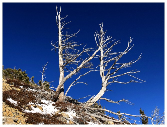
So back to the trees
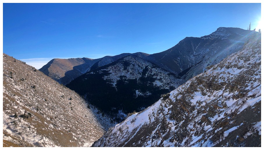
Getting over to the ridge between Pincher and Bridle required a lengthy traverse
Another tempting route up
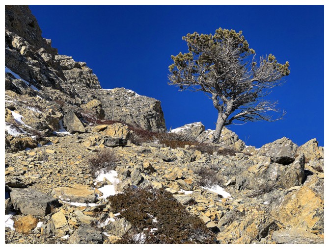
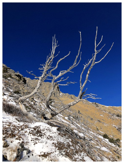
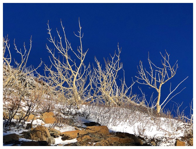
Still traversing and still enjoying the views and dead tree scenery
Same as above
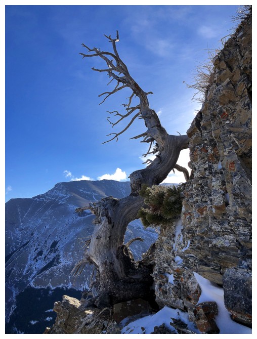
Same as above
The ridge is at the left, but as usual I'm distracted by a rock in front
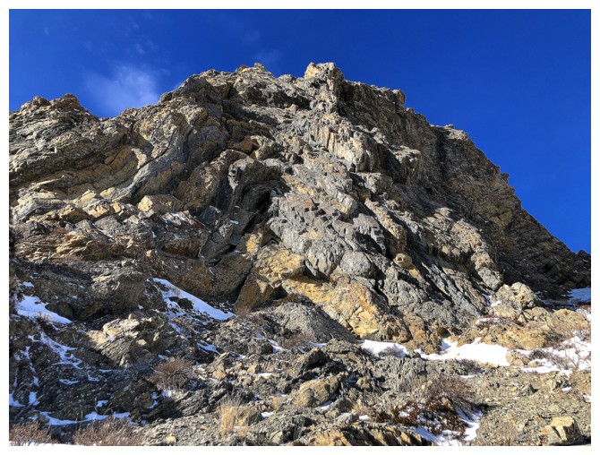
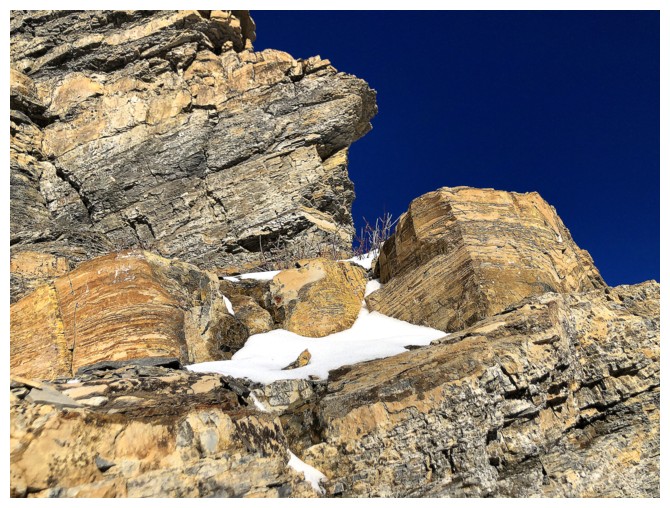
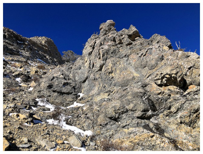
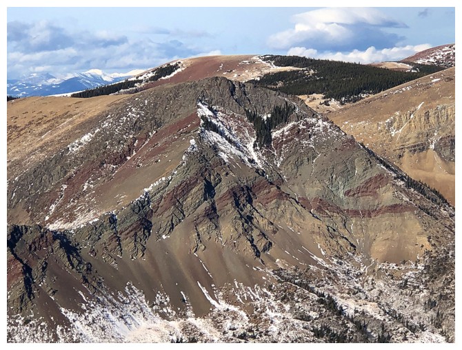
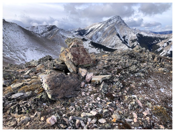
The rock folding on this side of Pincher is insane
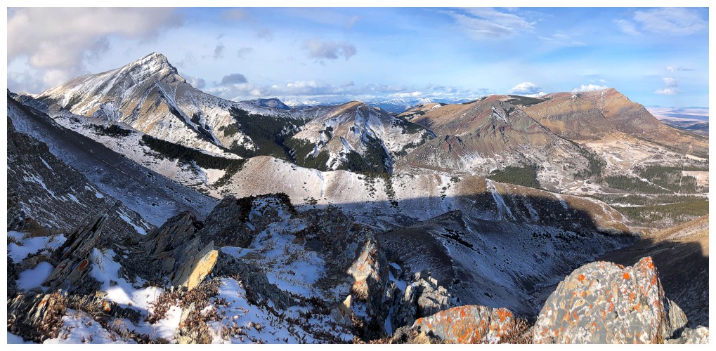
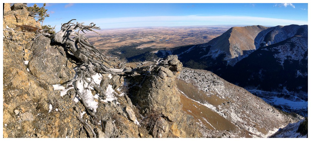
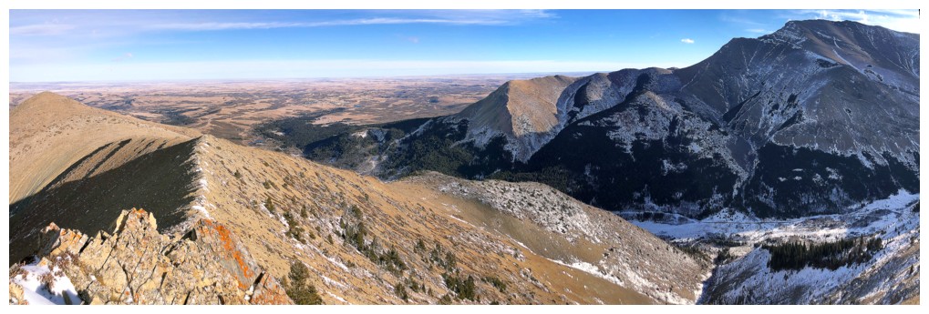
View to the north from Pincher's east ridge
Prairie Fire, Sky, and Bluff
Fire and Bluff
Sky
Victoria Peak
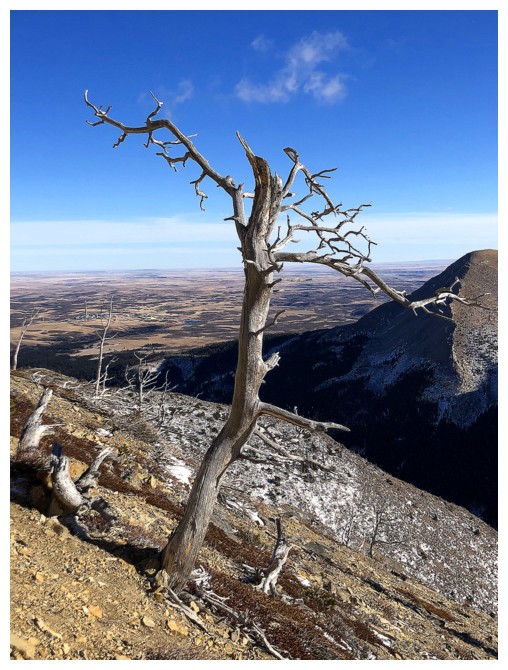
Heading down to Bridle Peak
A little lichen
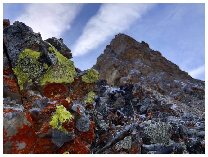
A little more
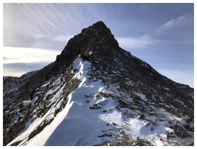
Looking back up Pincher's east ridge
Same as above, but from farther down the ridge
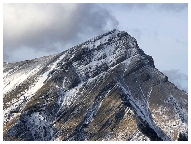
Summit of Bridle
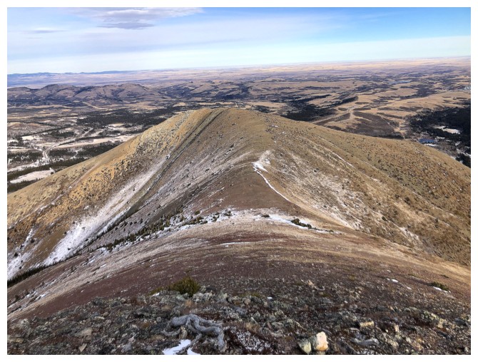
Descending to Cinch Hill and back to the start
The End
LOG