Otokomi West
October 6, 2023
Mountain height: 2580 m
Elevation gain:
1200
m
Ascent time: 5
hours
Traverse and descent
time: 3:20
Solo scramble.
This one can
join the ranks of Crypt Peak, O Peak, Corona Extra, Bakery Peak, Sage Senior and
many others – that is, unnamed, unofficial, and relatively unknown peaks that easily
make it onto the list of my Top 20 favourite trips of all time. In fact, Otokomi
West quite easily slides into the Top 10.
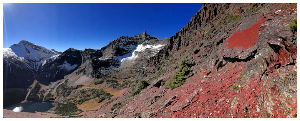
I spotted this innocuous-looking
mountain, above Otokomi Lake, during a recent ascent of Goat Mountain. It probably
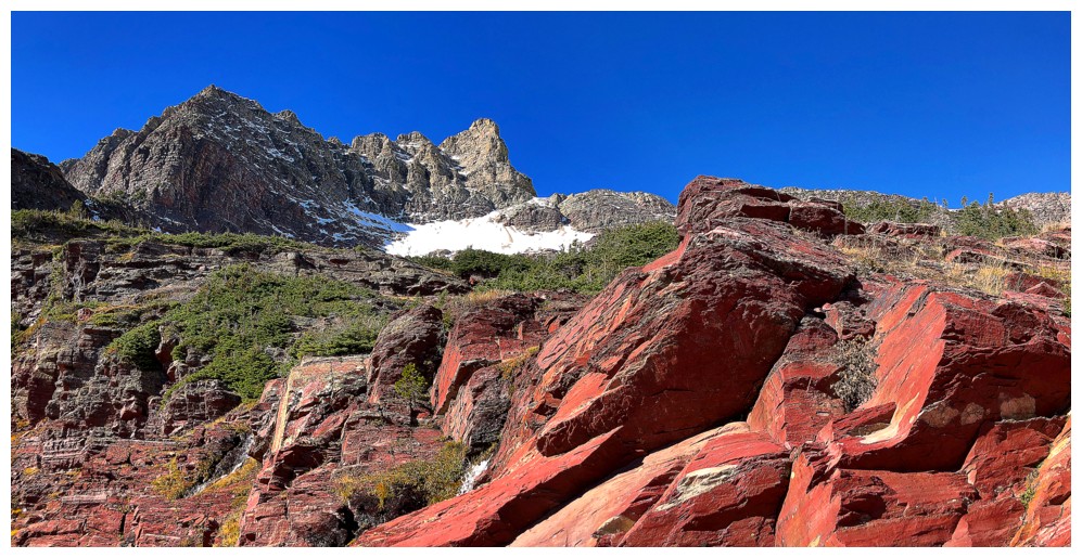
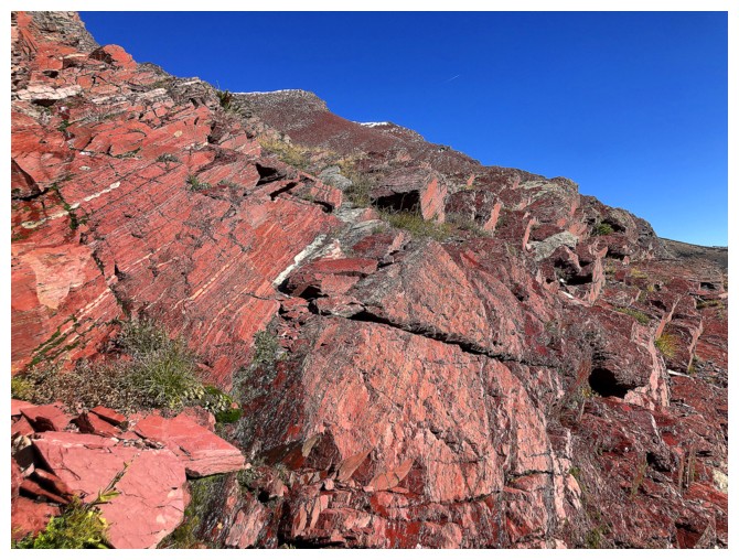
 goes without saying that the swaths of red argillite rock that make up the peak
provided all the motivation I needed for a closer look.
goes without saying that the swaths of red argillite rock that make up the peak
provided all the motivation I needed for a closer look.
The
trip began
with an 8.6 km hike to Otokomi Lake. 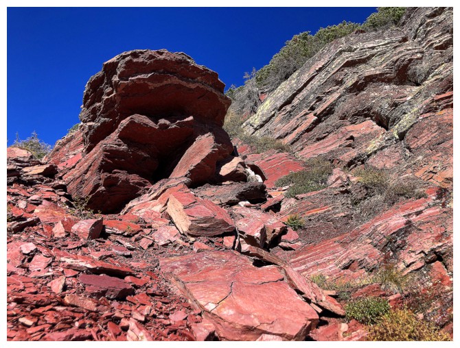 There were a few good views along
the way,
but generally the hike stayed in forested areas, becoming more
utilitarian in
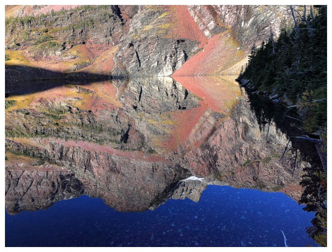
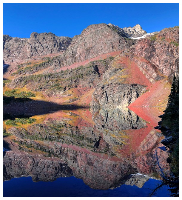
nature. ! Views at the lake were
stunning, especially the red rock reflected in the calm waters. I did
regret not going around the south side of the lake to fully experience
those reflections,
but I had a relatively big trip planned for the following day, and
therefore
had to be selective about doing too many side-trips.
There were a few good views along
the way,
but generally the hike stayed in forested areas, becoming more
utilitarian in
nature. ! Views at the lake were
stunning, especially the red rock reflected in the calm waters. I did
regret not going around the south side of the lake to fully experience
those reflections,
but I had a relatively big trip planned for the following day, and
therefore
had to be selective about doing too many side-trips.
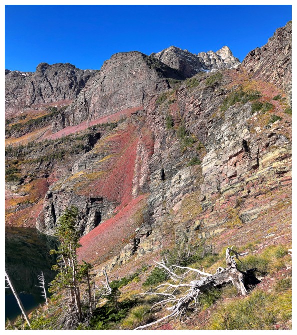
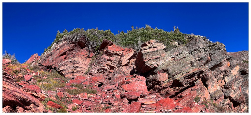
Getting around
the north side of the lake required a little bushwhacking, but eventually led
to a promising ascent route up a steep scree slope towards the west ridge of
the objective. Not only did the “promising” part come to fruition, but the
route also boasted a ton of the outstanding red argillite scenery I had come to
see. The trip had already met my delusionally high expectations, 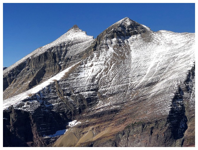 and I hadn’t
even reached the ridge!
and I hadn’t
even reached the ridge!
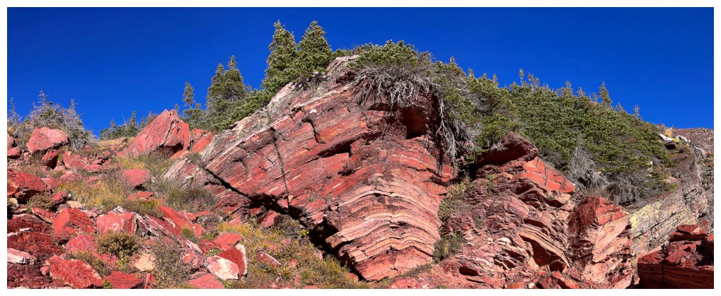
Atop the gully, the
ridge and the summit sat to right, but I went left. I had already denied myself
a trip around the lake and was not going to repeat that error. The terrain here
had me running around in circles, trying to take in as much as possible, but
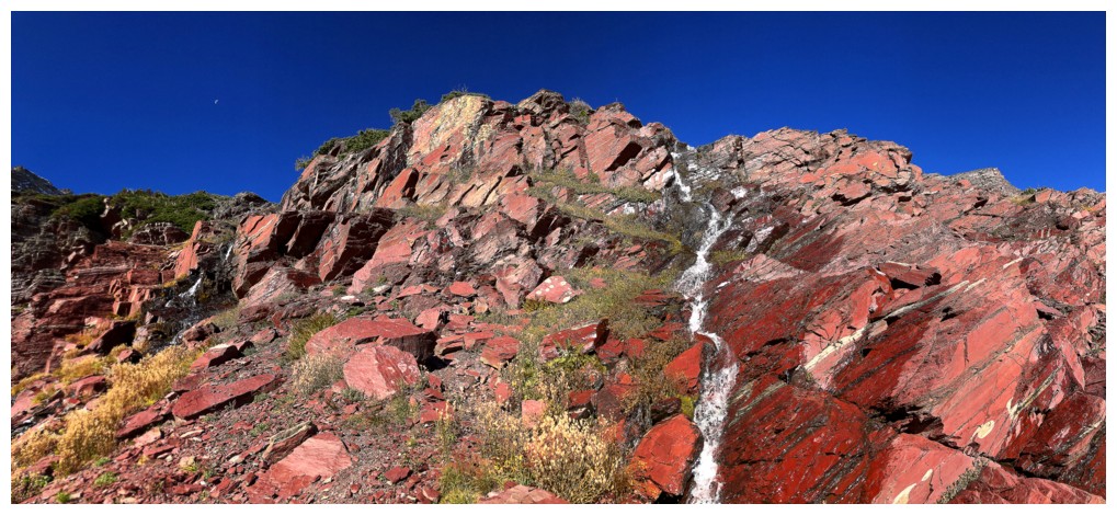
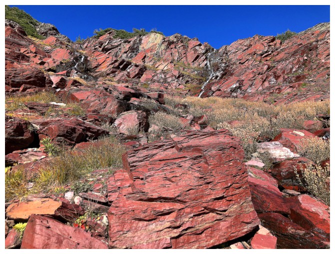
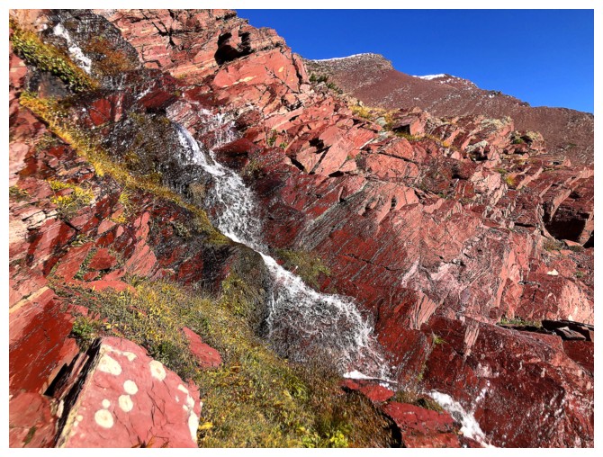
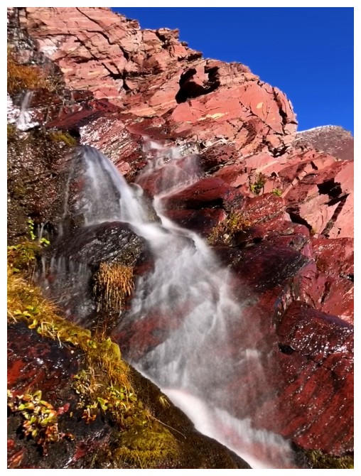
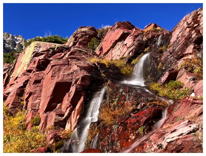
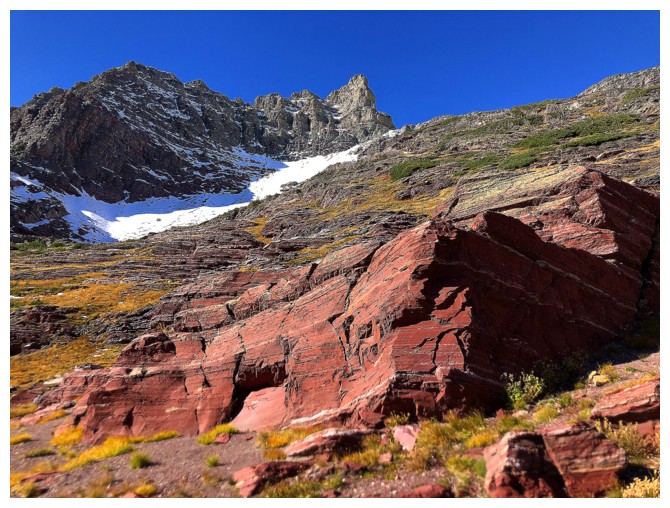
knowing there was a limit to any exploration I could do. Two small streams
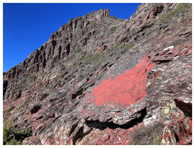
running down a wall of insanely bright red argillite were magnificent, making me wish I
had the time to locate their source.
Nevertheless,
time is depressingly finite for us all, and I was going to get to the top
before mine came to an end! At this point I made a long, foreshortened, upward
traverse towards the ridge. Gaining it directly appeared to lead to a drop-off
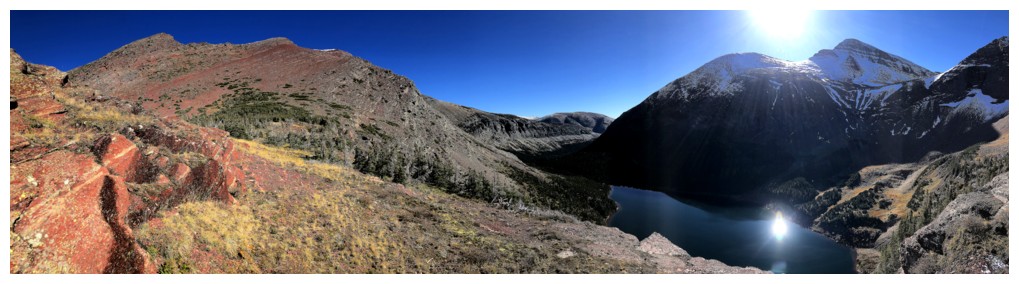
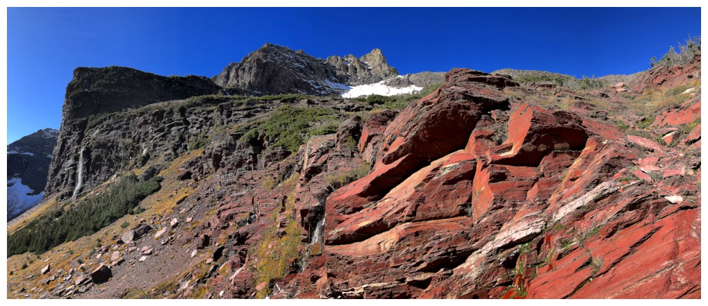
that might end a summit bid. Views of the surrounding area improved dramatically
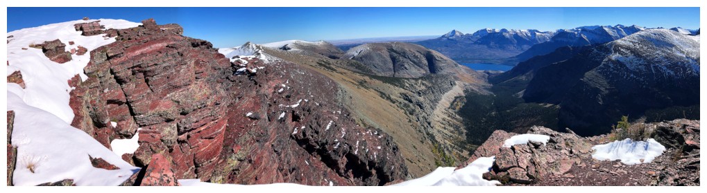
with each metre gained and exponentially once the ridge was gained. Here, views
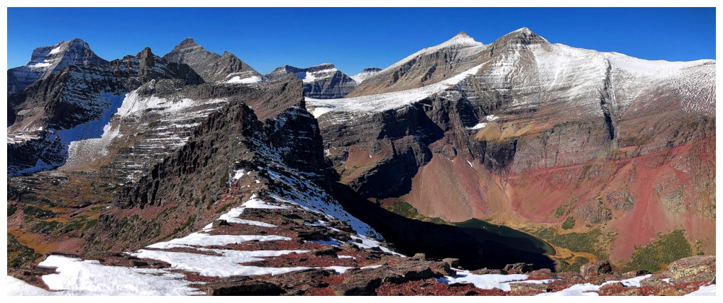
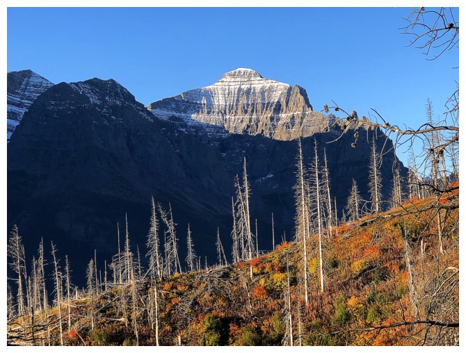
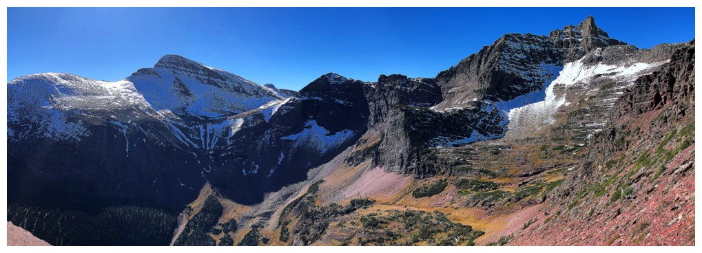
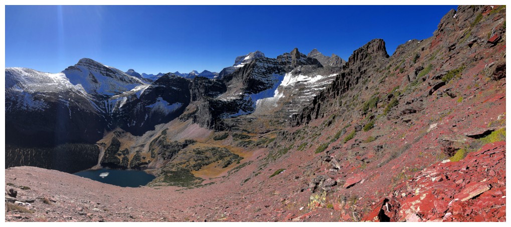
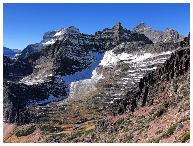
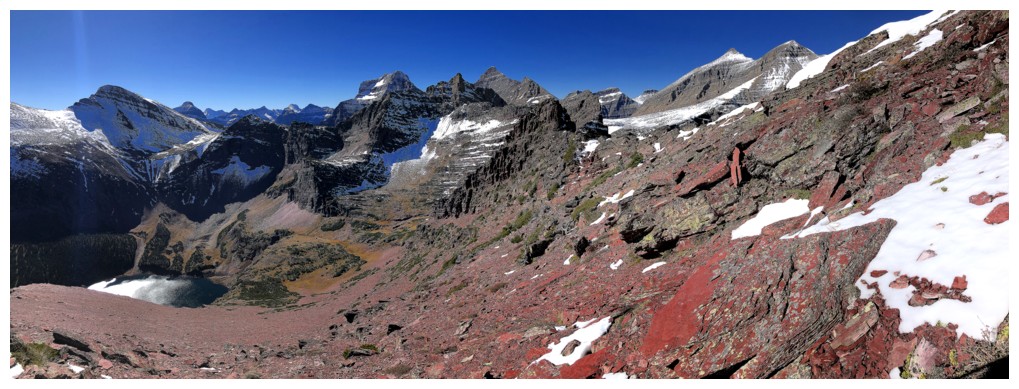
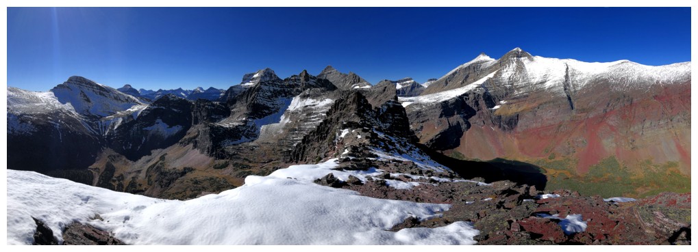
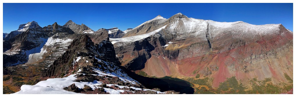
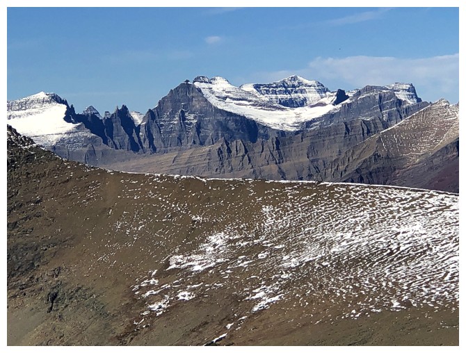
of snow-covered Mount Siyeh, Cracker Peak, and Mount Wynn were phenomenal.
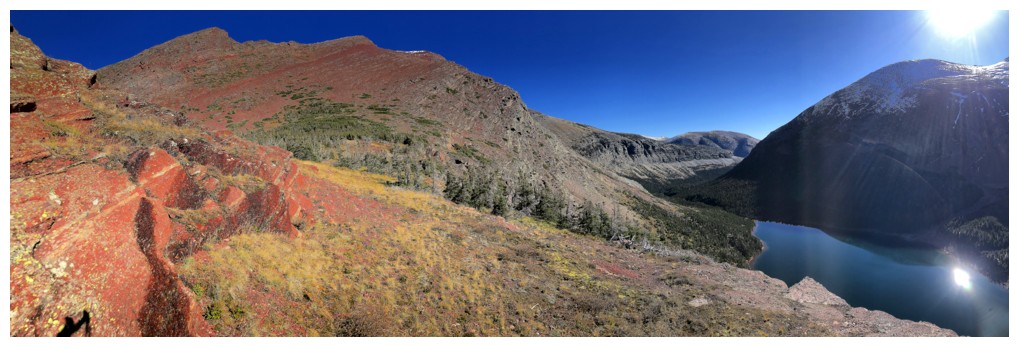
An easy and
most gratifying ridgewalk to the summit ensued, where I took a short break.
Short, because a summit of approximately the same height sat to the east and I
wanted to visit that one before descending. I had already scoped out an
alternate descent route down to the Otokomi Lake Trail between the two summits,
so I had to go in that direction anyway.
The
other summit
turned out to be a few metres lower but was still worth the easy trek
over. It provided another fantastic view and also a good look at a
potential route over to Otokomi Mountain. Again, with
more time I might have given it a go. Instead, I went back a short
distance
towards the true summit, then started another long traverse, this time
descending to an obvious scree slope that would grant me an easy access
to the trail below. Once back on the trail, the hike out went quite
quickly, the
fall colours on full display near the end.
Not only one of
the most enjoyable trips of the year, but one of my best ever! Guaranteed I’ll
be back someday to do some more exploration of this wonderful area (and without restrictions!).
The south side of Otokomi Mountain
The exciting east ridge of Goat Mountain
Little Chief Mountain - on the "to-do" list at some point
One of the few spots you get to see Rose Creek
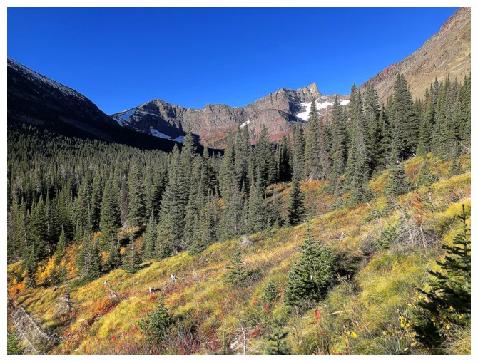
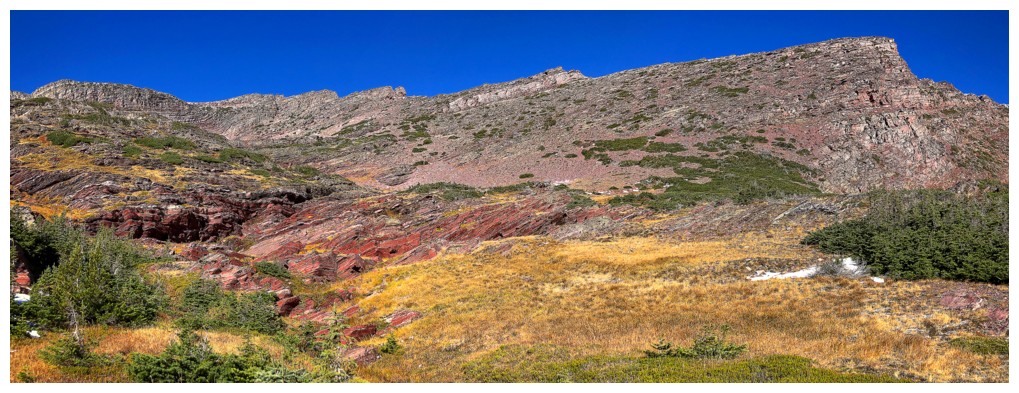
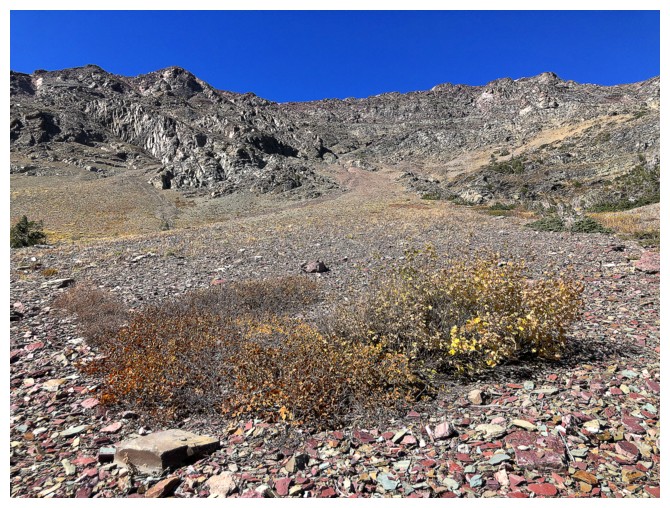
Finally, some open terrain
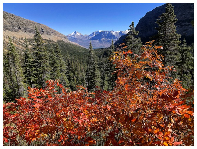
The autumn colours in Glacier are spectacular
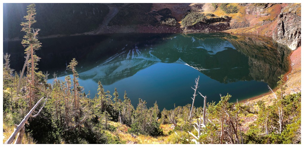
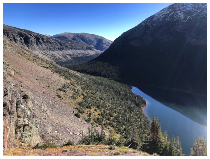
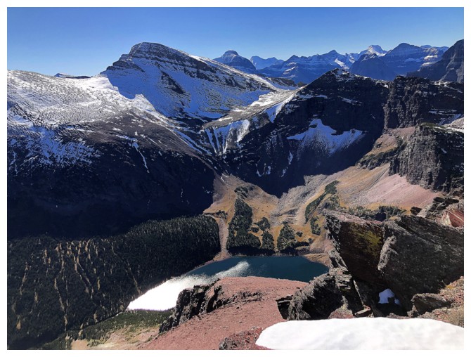
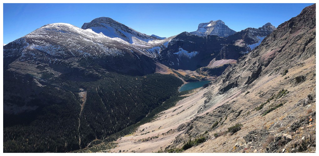
Otokomi Lake is close, but you don't see it until it's right in front of you
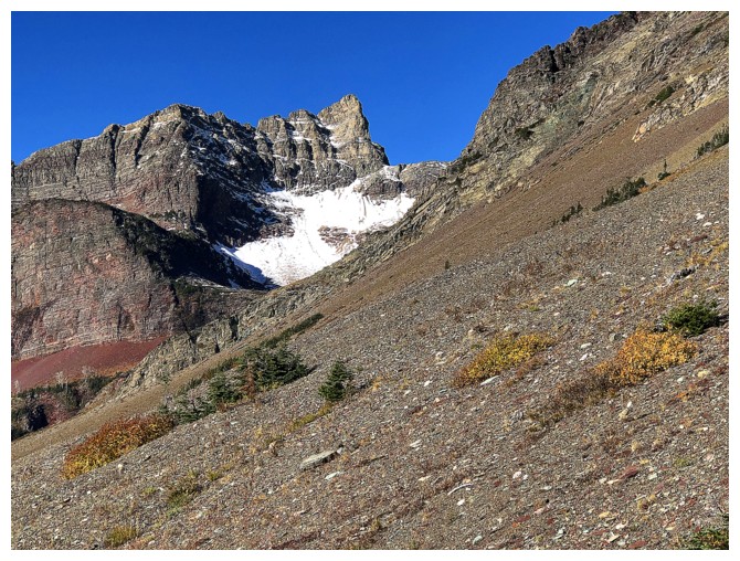
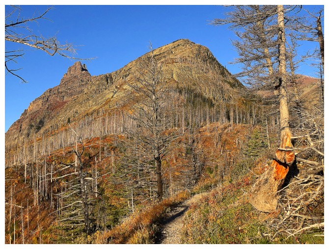
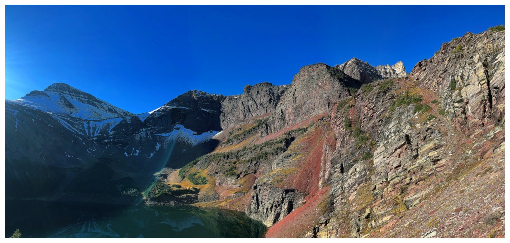
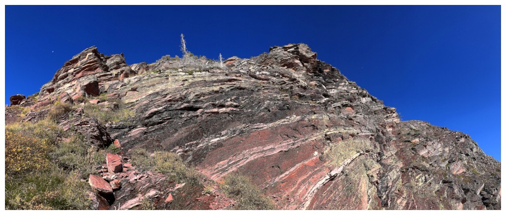
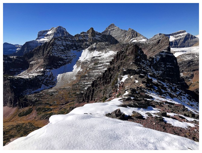
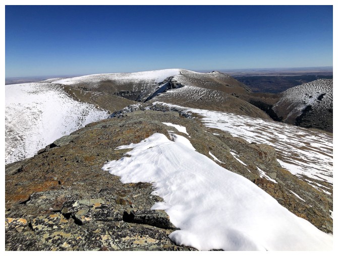
A very striking unnamed peak
Part of Otokomi West
Same as above
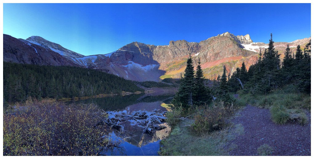
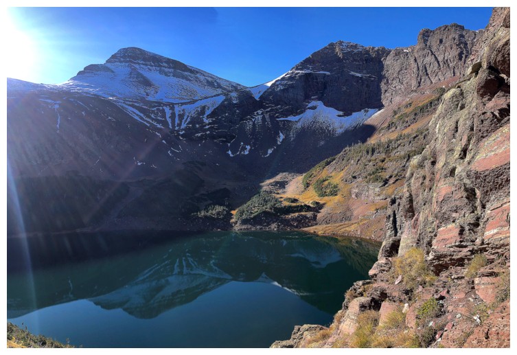
At the lake
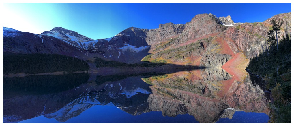
The reflections in the lake were perfect. I should have gone around to the south (left) side.
Same as above
Looking for a route up to the hanging valley above. I eventually went up the far right side.
Still enjoying the reflections...
...and the fantastic scenery above the lake
The beginning of the route up to the valley above
Last look at the lake for a while
The sweet rock above is going to command my attention instead
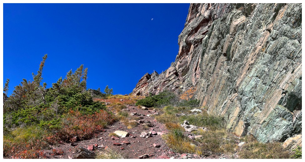
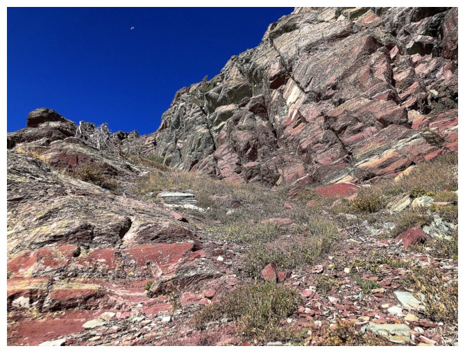
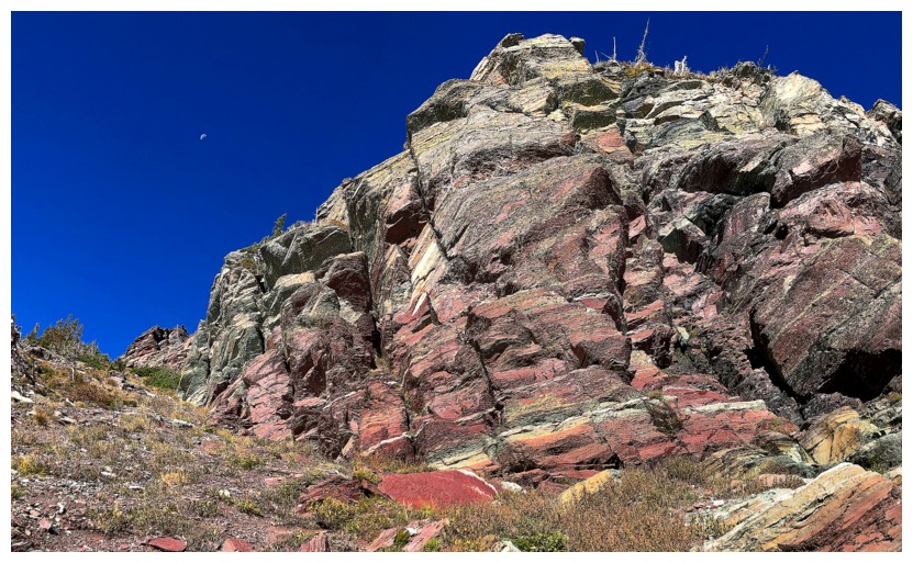
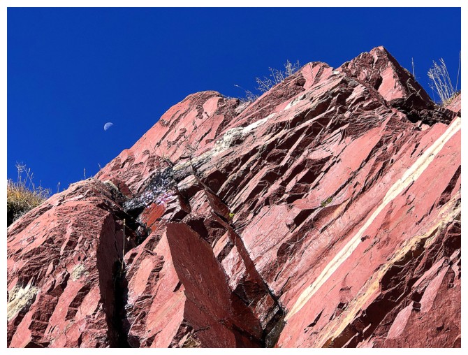
The faint moon was also a constant companion
Back to the lake
Back to the rock
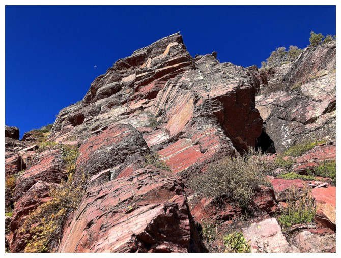
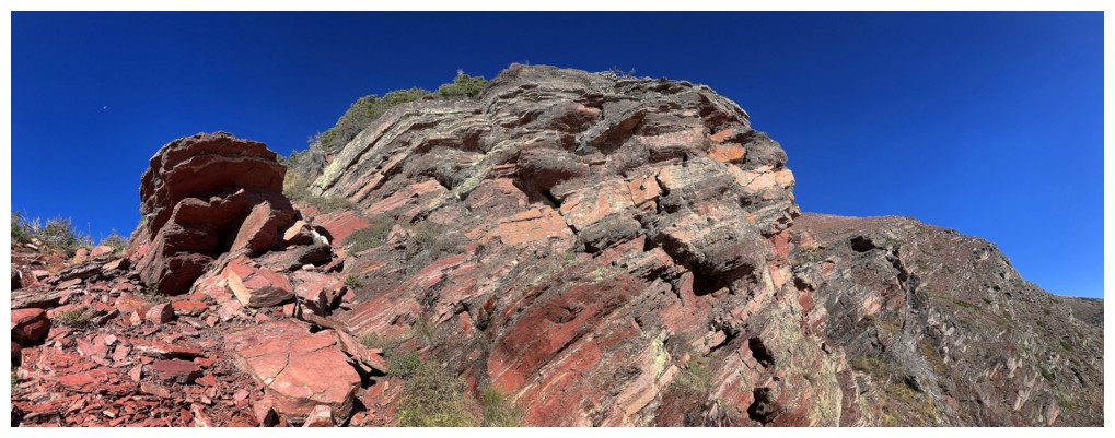
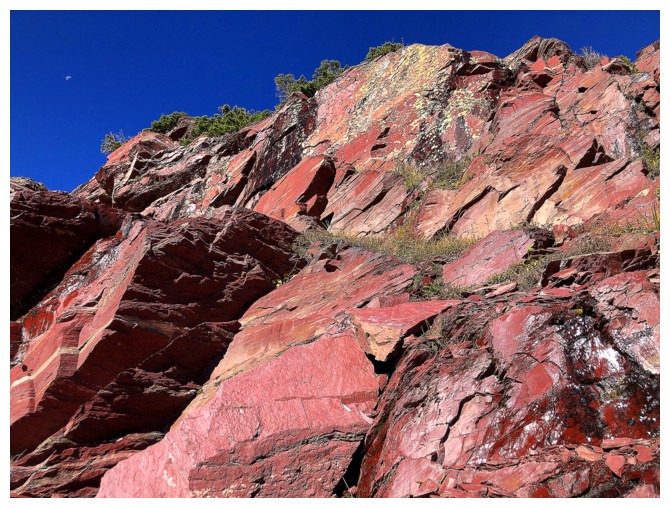
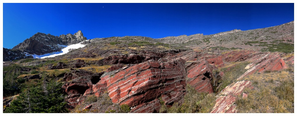
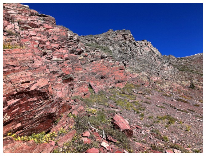
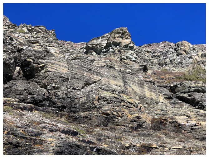
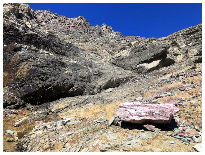
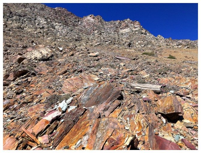
The next section had some of the brightest red argillite I've ever seen
The summit ridge of the objective is now visible at the left and Goat Mountain at the right
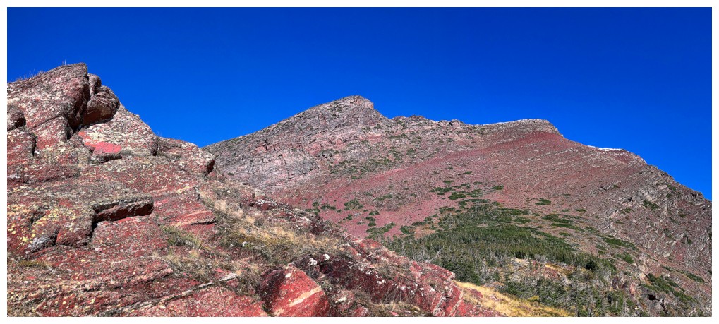
The summit is way over to the right where a little snow can be seen
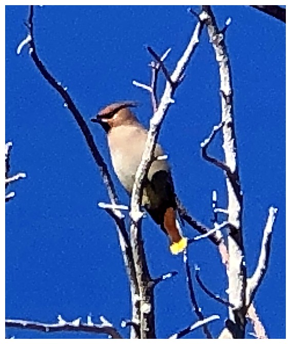
A pretty bird!
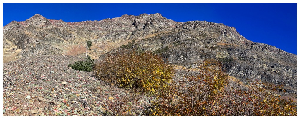
A couple of interesting peaks to the west
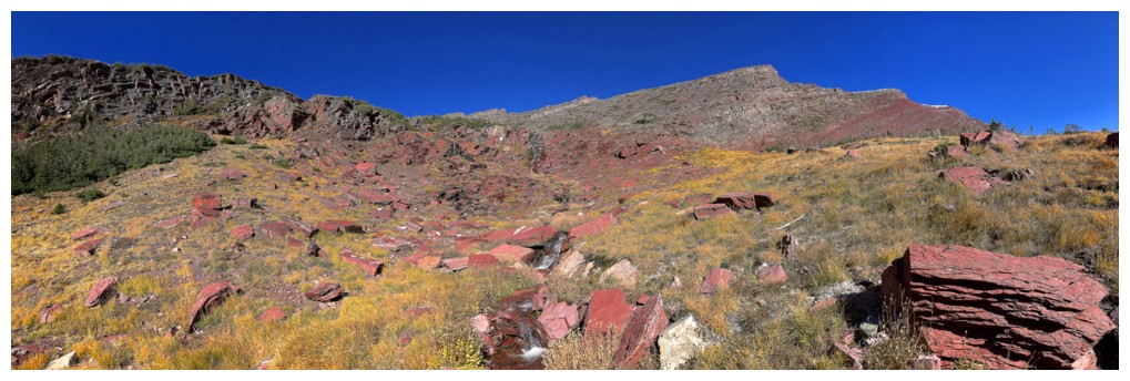
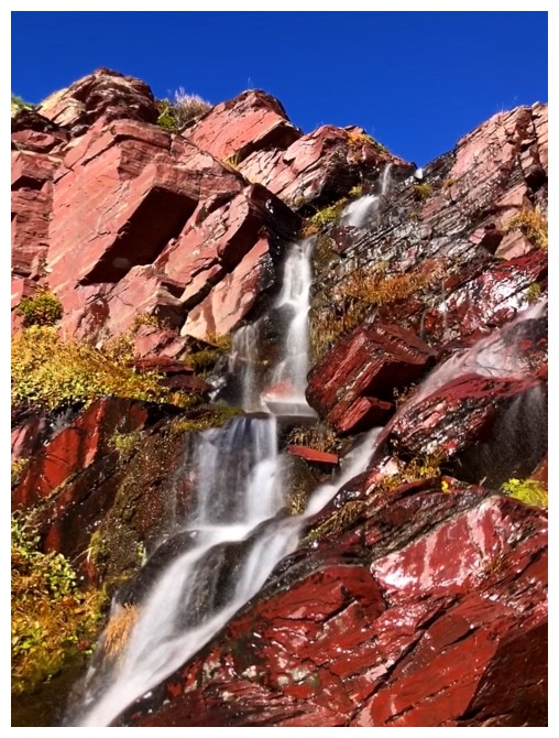
Heading towards a couple of small streams coming down the argillite
There they are
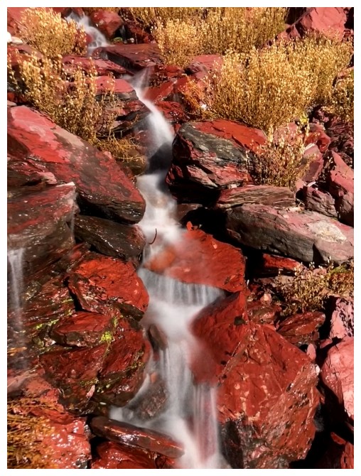
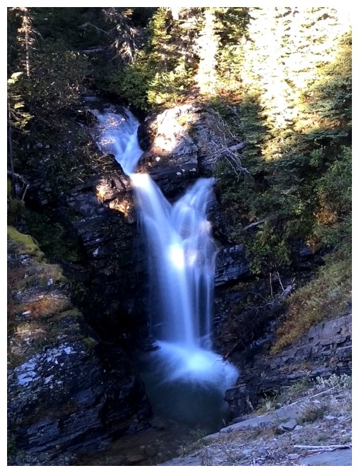
Long exposure photos with red argillite?? I must have won the lottery!!
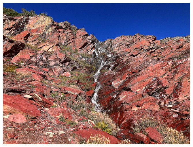
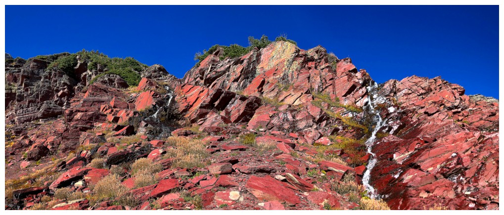
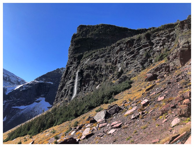
A big waterfall coming off one of the outliers
But who cares when scenery like this is right in front of you!
Time to leave and head towards Otokomi West (not seen here)
But there will be lots of turning around while doing that. I should practice hiking backwards!
Yes I should
Gaining
the ridge at the left was possible, but I suspected it might lead to a
tricky or impossible downclimb. Instead I went up and to the right.
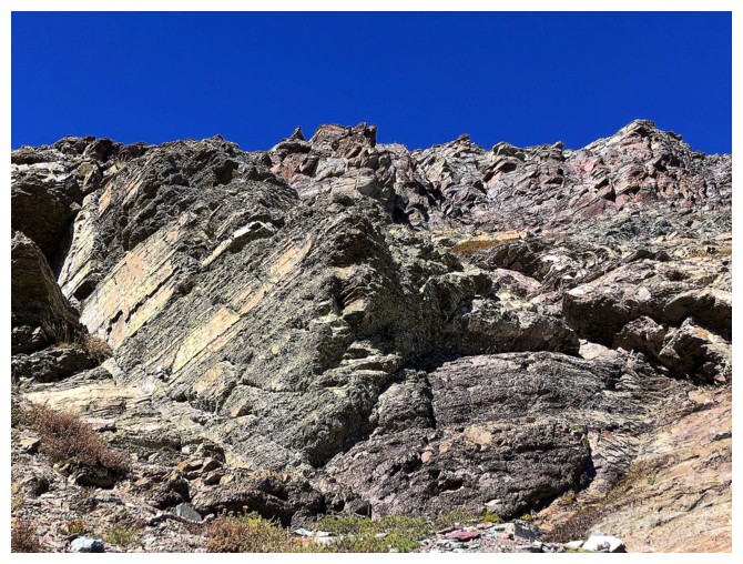
Hugging the rock band was best
That's why!
Ditto
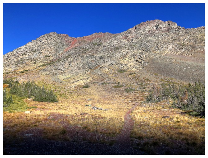
Goat Mountain is also accessible from Otokomi Lake, as opposed to the Baring Creek route
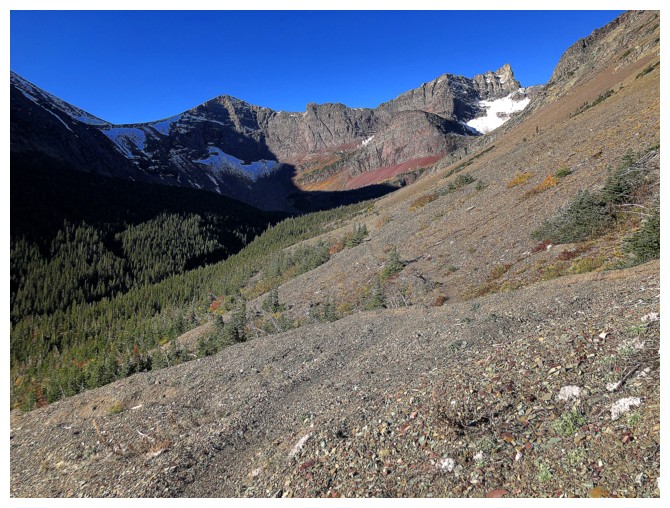
The view really starts to open up while grinding my way up the foreshortened slope
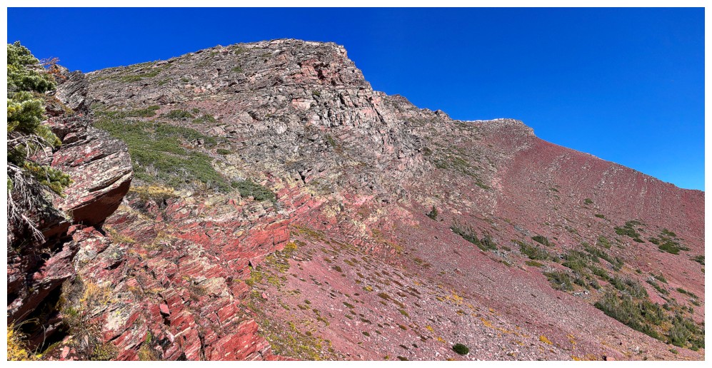
Crazy red argillite! The cliffband at the centre top is the one I would
have reached had I gained the ridge earlier. There did appear to be a
potential route down.
Ouch!
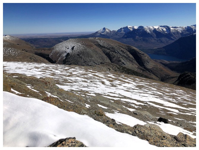
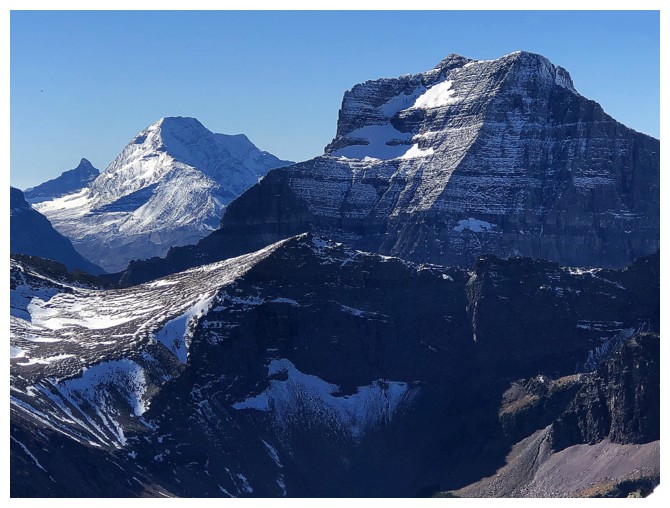
Going-To-The-Sun Mountain (left) and Matahpi Peak (right) are now visible. The peak between them is unnamed.
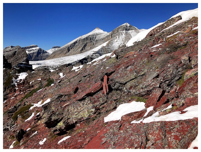
First sighting of Siyeh (left) and Cracker (right)
Ouch again!
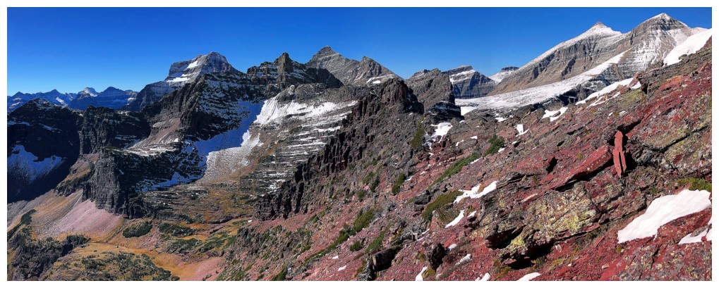
And again!! Simply one of the coolest views I've ever seen - and from a
lowly, unnamed peak that probably sees less than one ascent per year,
on average.
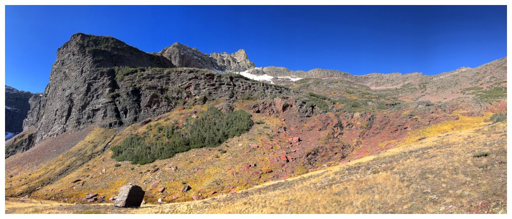
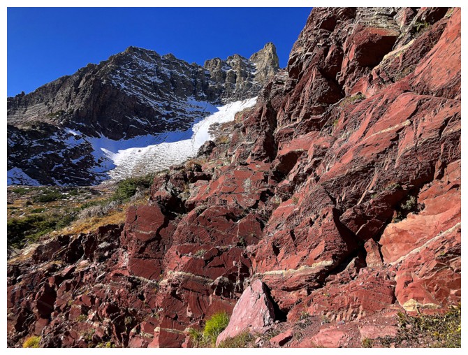
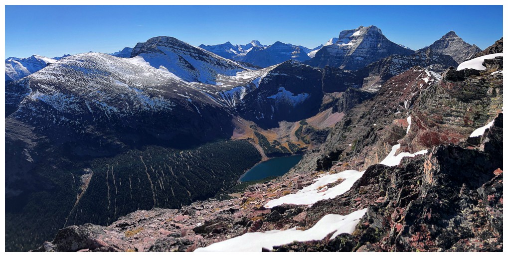
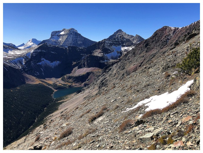
Siyeh and Cracker look better now that the colourful south side of the massif and the lake are visible
Of course red argillite makes everything look good!
Taking a break from the red rock
But not for long! I definitely went a little (a lot) crazy here photographing the same view - but it was so darn good!
The last one didn't have the lake in it!
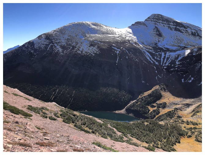
The lake is bigger here!
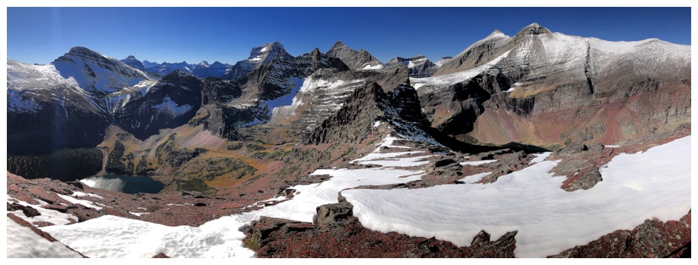
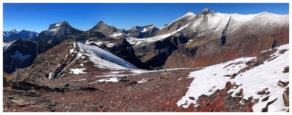
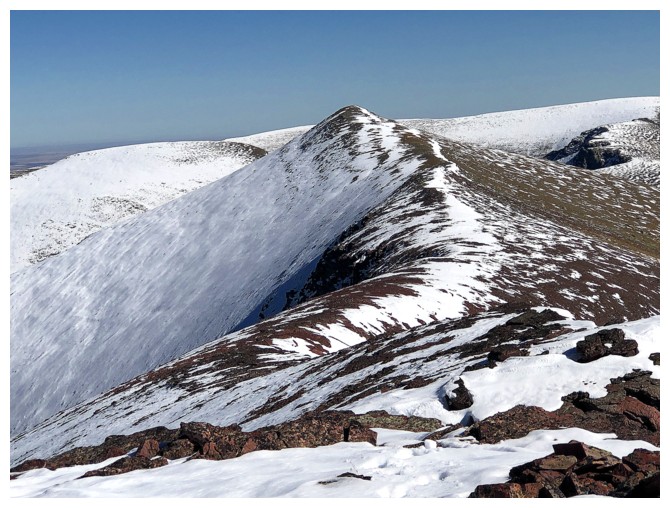
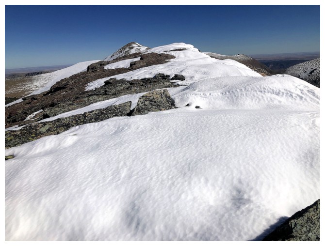
The summit is finally in sight
St. Mary Lake joins the view
After a few bumps along the ridge, the summit is within striking distance
Looking at part of the descent route I would later take
Looking back yet again
The summit is steps away at the left

Summit cairn
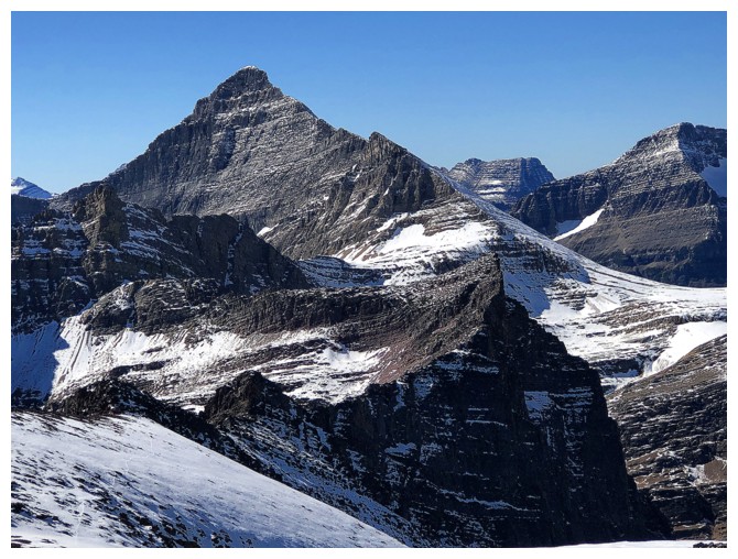
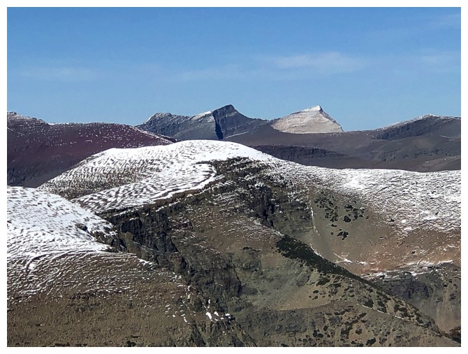
Matahpi Peak
Yellow Mountain in the background
Looking east to the next summit
Snow! Getting excited about the upcoming winter (the snow only, not the bone-chilling temperatures!)
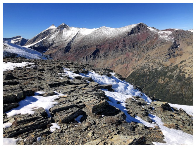
GTTS Mountain still dominates the view west
Still experiencing great views around and above Otokomi Lake
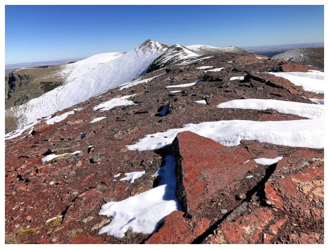
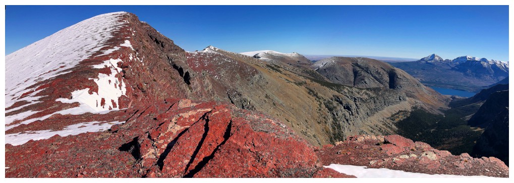
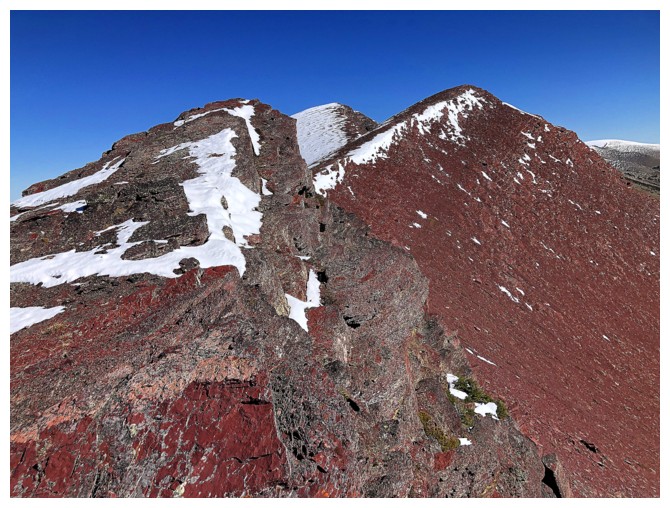
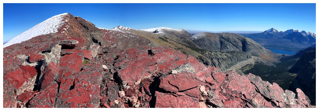
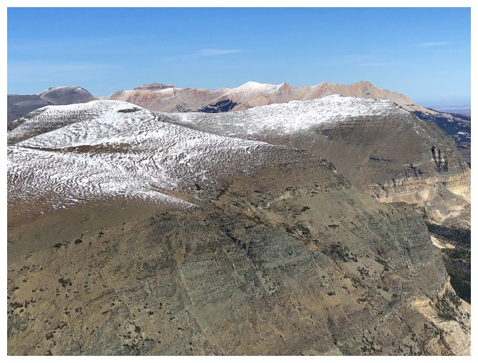
No shortage of red argillite on the summit ridge
But it soon gives way to green argillite and snow
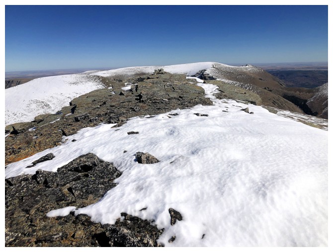
There's a small cairn on this summit too
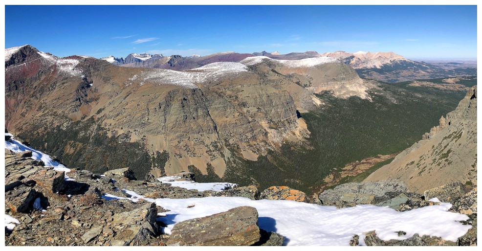
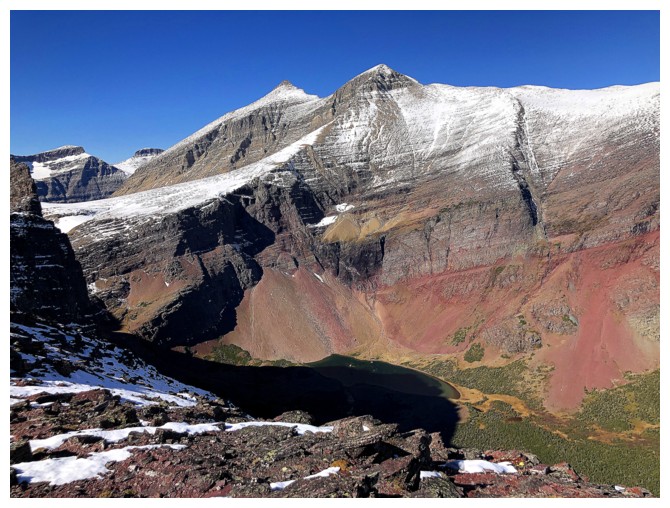
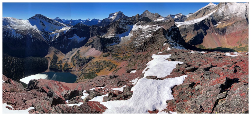
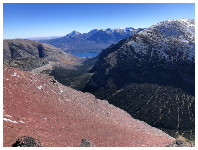
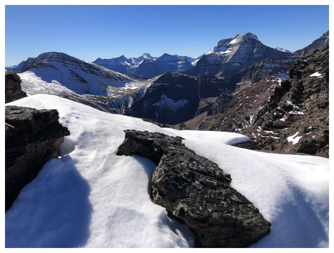
View to the north and northeast from the summit
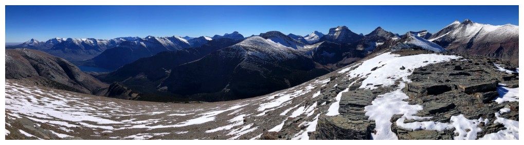
South and southwest
Merrit and Cleveland
The double summits of Gable
Chief pokes over Yellow
Better view of Yellow
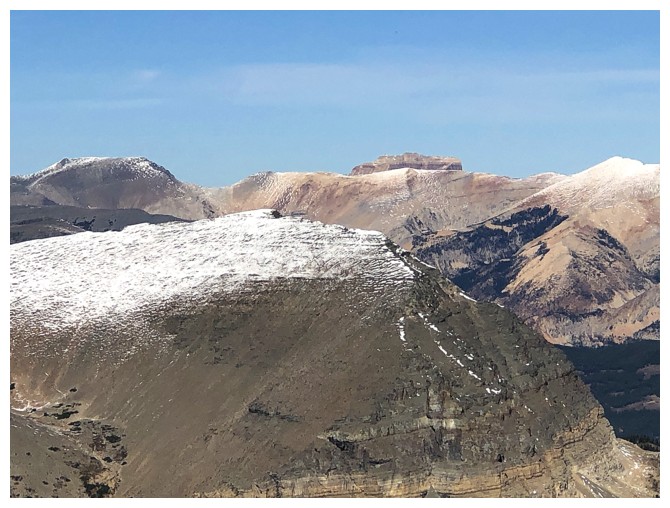
The view to the east features East Flattop Mountain
Otokomi Mountain remains as one of the best surprises I've had in the mountains
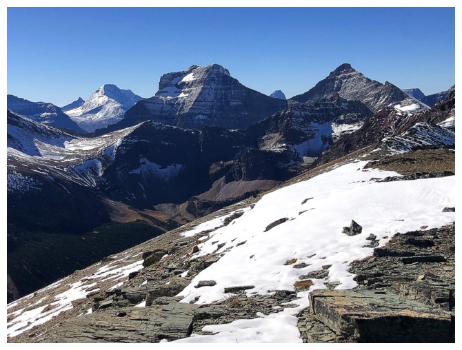
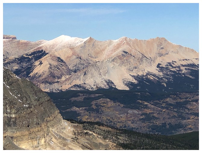
Mount Jackson (left) has now joined the view
The long ridge that includes Siyeh, Cracker, and Wynn
can be traversed, but makes for a very long day. From Wynn, I made it
to the highpoint near the right (GR088024) but no further.
Close-up of GTTS Mountain and awesome Mount Jackson to the left
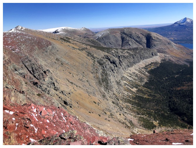
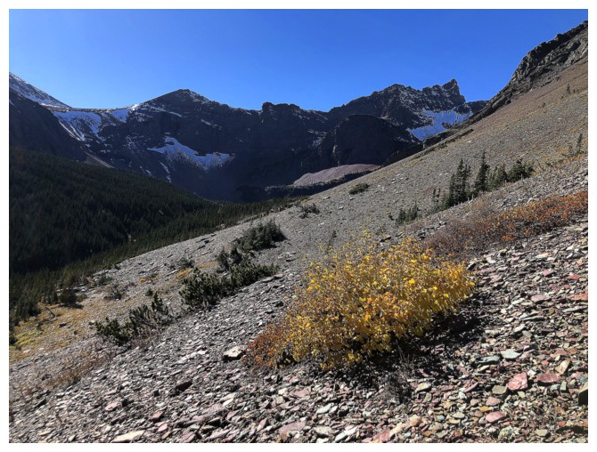
Heading home. A long, descending traverse back towards Otokomi Lake was required.
But it was replete with great rock scenery
...and great views
Almost back to the trail
Looking back up to the ridge. There are some potential routes straight
up from here, but you would miss the outstanding scenery around the
lake.
Have to remind myself to return here in a year, when the autumn colours are on full display
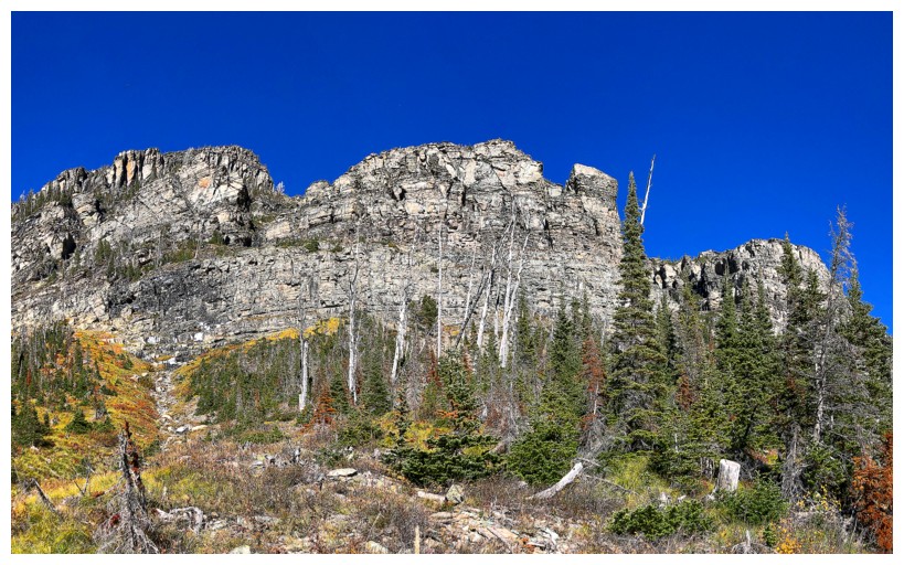
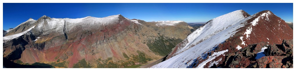
The south face of Otokomi West ridge is steep and impressive
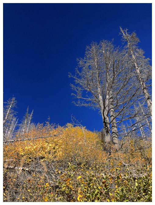
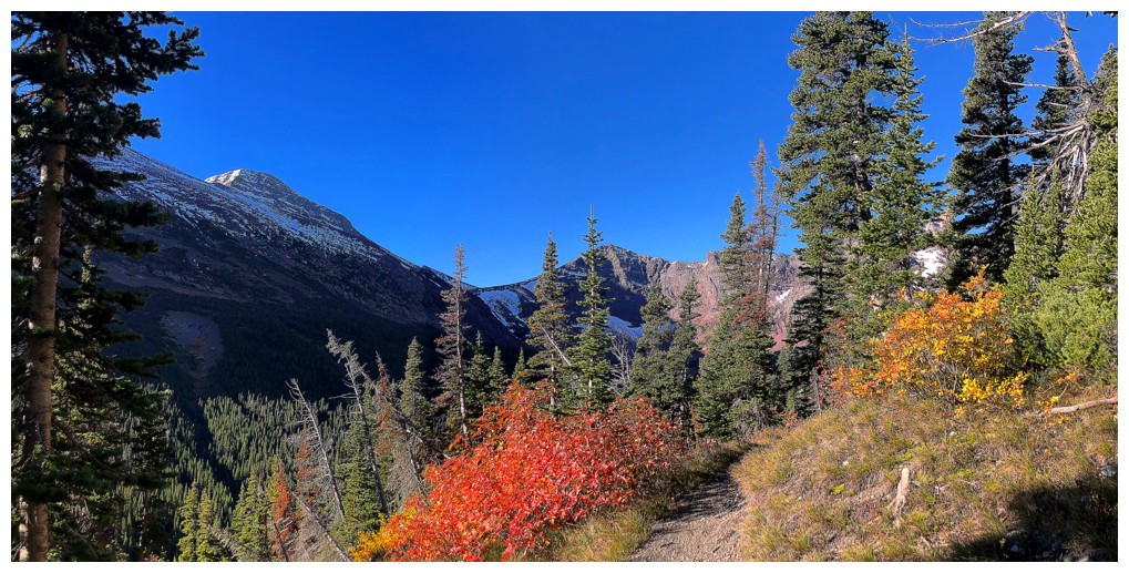
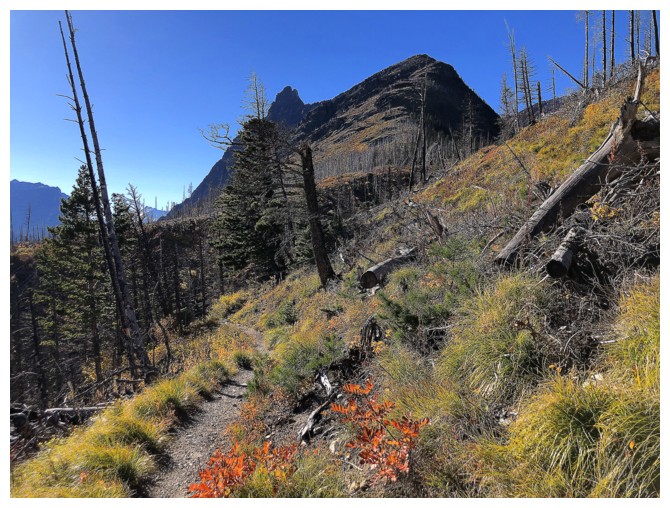
More autumn colours
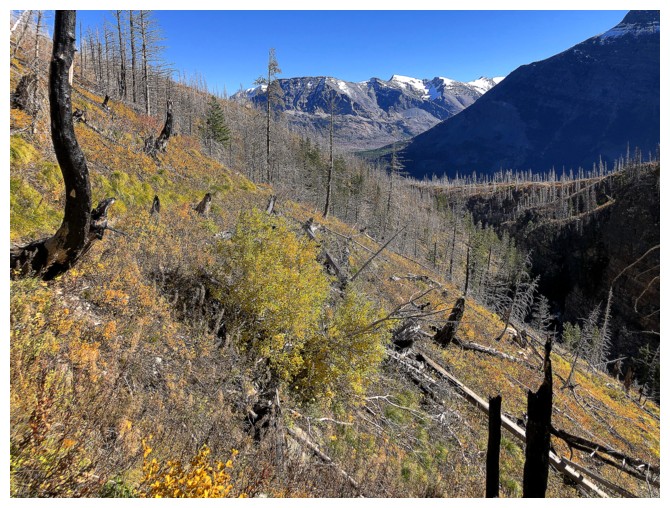
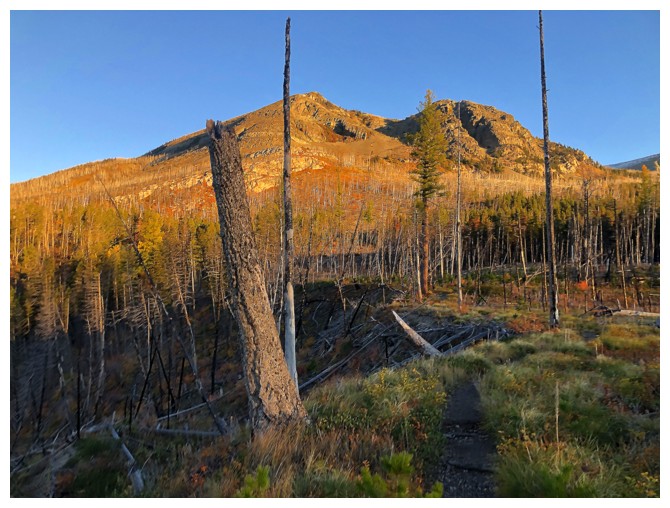
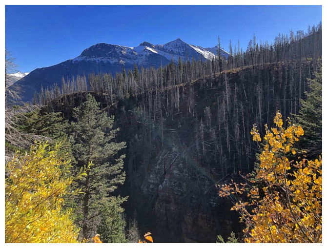
The area has seen a major fire relatively recently
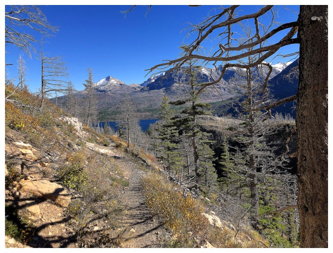
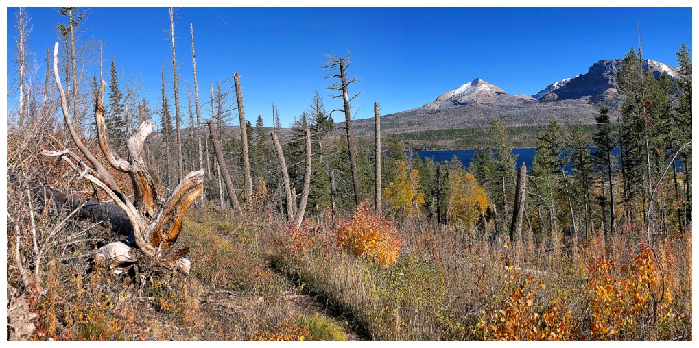
When Divide Mountain and St. Mary Lake are visible, the trip is coming to an end
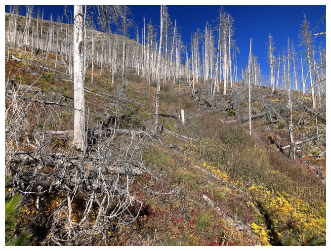
More signs of the fire
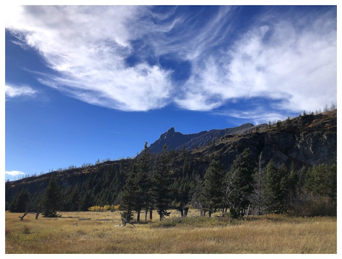
Goat Mountain again
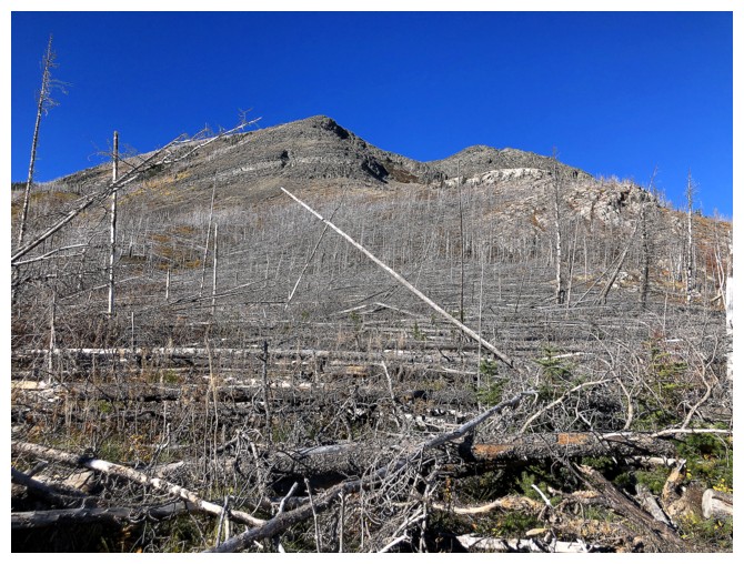
Picking your way up Otokomi Mountain from this point would be an excruciating exercise in futility
Even near the end, the trip has rewarding views
The only clouds of the day materialized right at the end
The End
LOG