Windsor Mountain II
July 5, 2023
Mountain height: 2544 m
Elevation gain: 1400
m
Round-trip time: 7:55
Solo scramble.
A second ascent
of Windsor Mountain wasn’t at all on my radar until I saw ascents by Cornelius,
and Vern that make a nice loop, taking in a close-up view of spectacular Castle
Peak in the process. They both credit Dave McMurray with much of the route up Windsor. Charge up the ebike and game on!
Thanks to Cornelius’
and Vern’s GPS tracks, after 9 km of biking, I had no problem finding the trail
that grants easy access to the Windsor’s southwest face. I also had no problem attracting
every drop of moisture that fell overnight on the vegetation overgrowing the
trail and I was drenched from the waist down within 10 minutes!
The route to
the summit of Windsor route unfolded exactly as Cornelius and Vern’s described.
I found it very odd though, that I couldn’t figure out where Mark and I had ascended.
It was only several hours later, checking my trip report from 2009 that revealed
we were far south of this route.
A brief but nostalgic
summit stay was followed by a breath-taking traverse over to the base of Castle
Peak. Superb and fascinating rock scenery greeted me at every turn and the
views down the awesome, vertical face of the massif were exactly as described:
breath-taking!
A little fearful
of having to bike back to the car in a thunderstorm or heavy rain, I didn’t explore the area
around Castle Peak as much as I would have liked. Instead, I continued along
the ridge to the next striking conglomeration of rocks and then started down
the mountain. Though initially very easy, the route eventually intercepted a
significant rock band lining the face. Traversing hard left for a considerable
disatnce would probably have led to an easy route down the band, but I was able
to squirm my way down a weakness and then to the creek below. The remainder of
the descent went well, and thankfully the storms and rain didn’t materialize.
Awesome day and
a fantastic traverse between two cool peaks.
Stopping to reminisce about a great day with Dave and Jollin on Lys Ridge. The ascent route we took goes right up the boulder field in the centre.
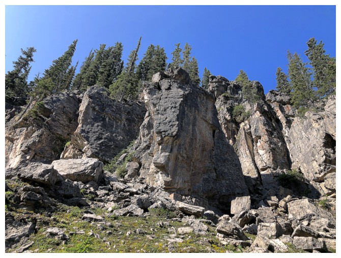
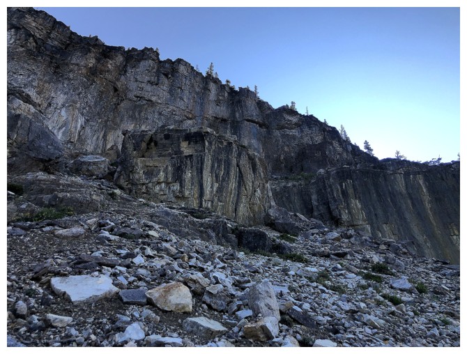
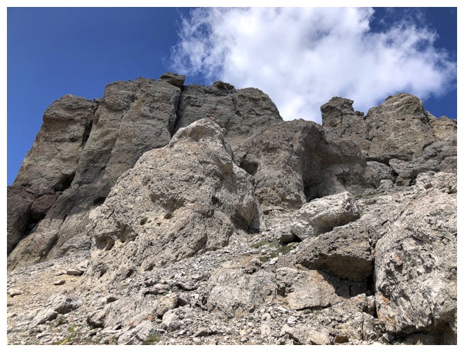
Round 1 of amazing rock
Same as above
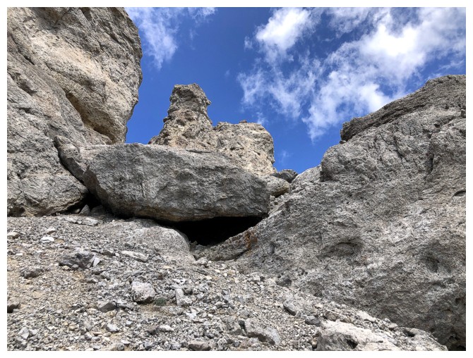
Heading up to a weakness on the right side
View to the southwest. Mount Matkin near the left.
The summit of Lys Ridge in the centre
Round 2
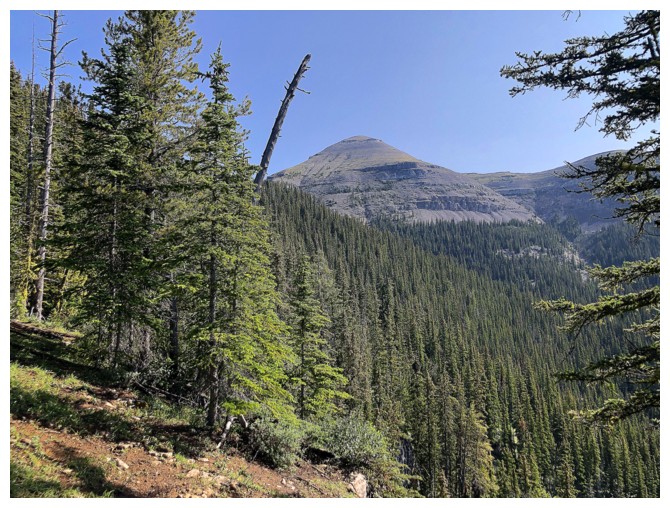
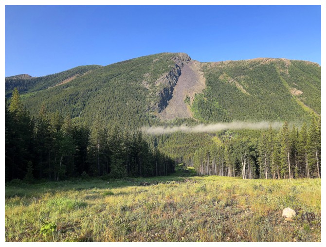
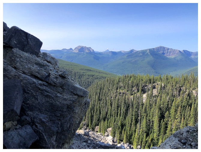
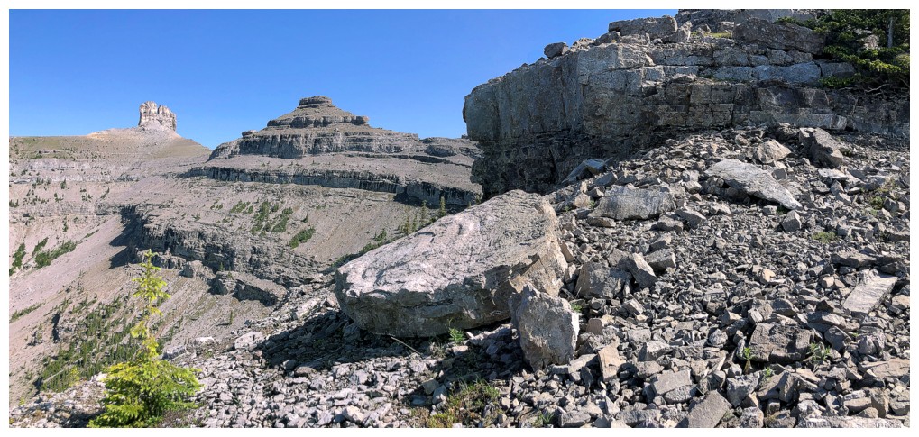
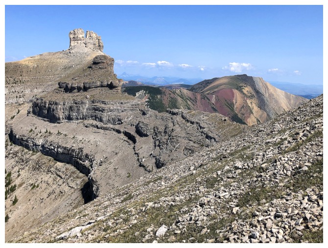
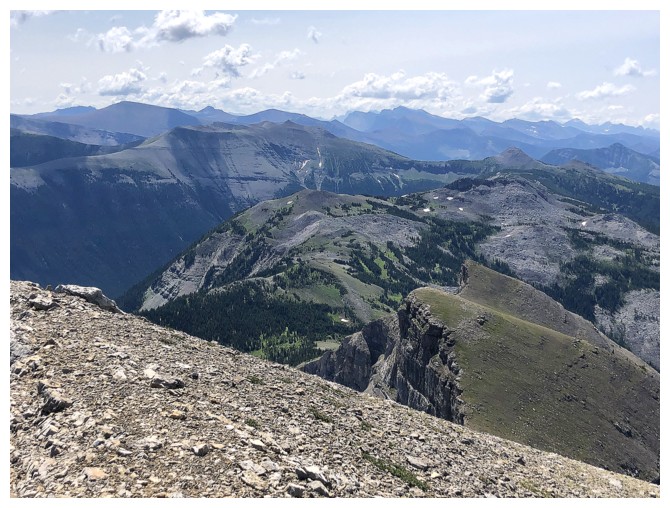
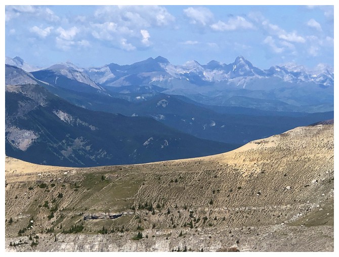
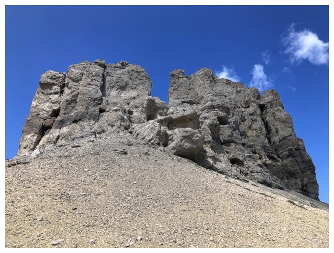
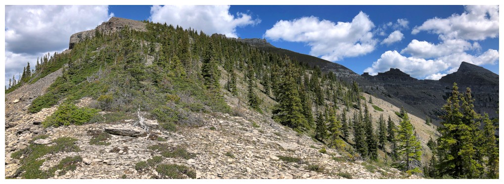
First glimpse of Windsor Mountain
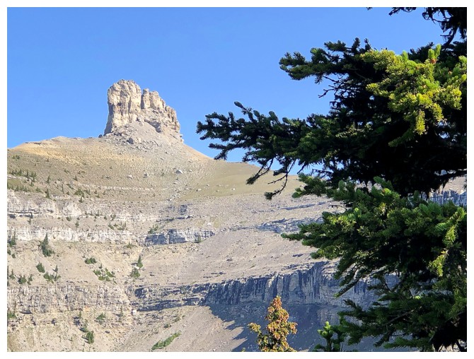
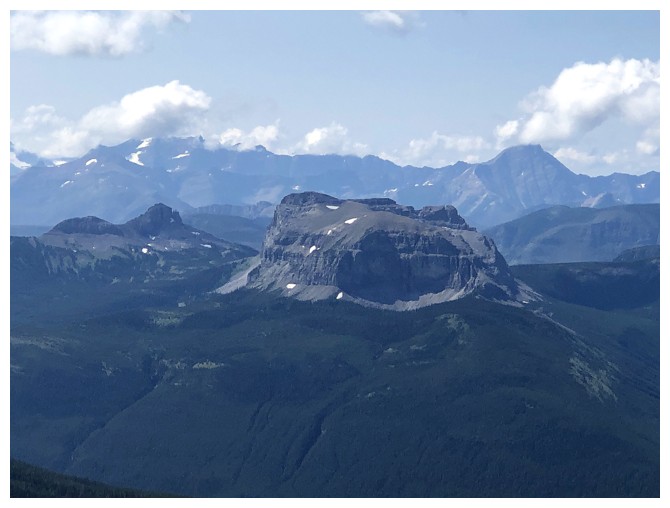
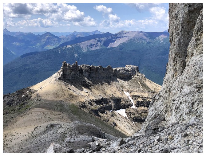
First glimpse of Castle Peak
A section of light forest before the real work begins
Round 3?
No, this is Round 3!
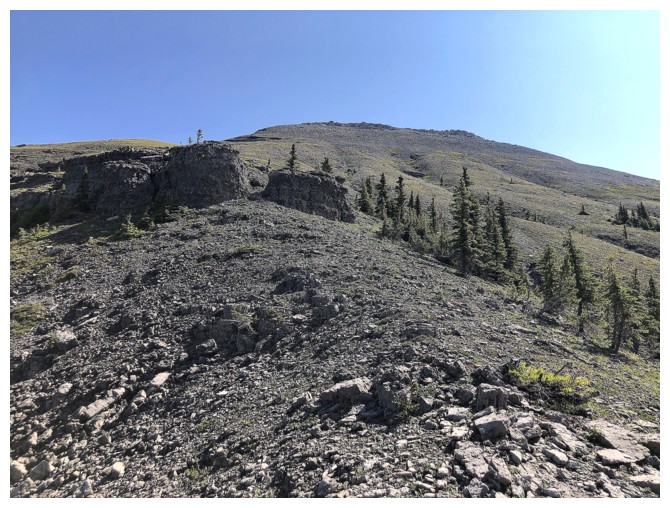
The ascent slope is easy but surprisingly foreshortened
The view over to parts of the traverse keep your mind off the tedium
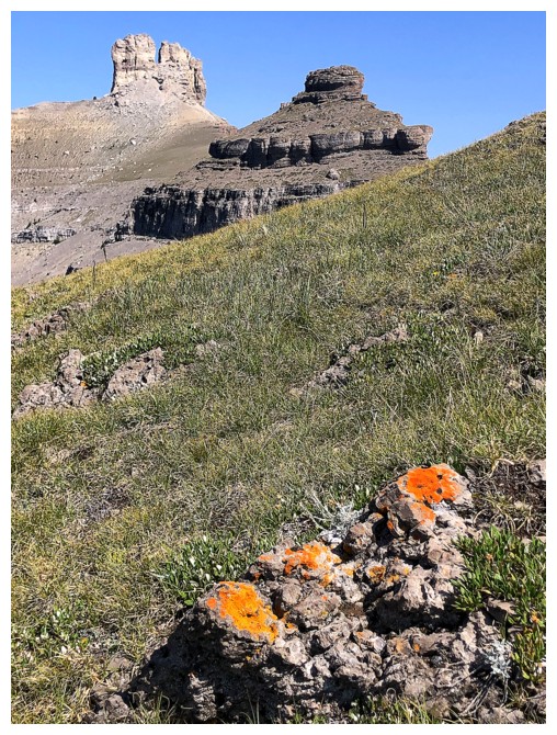
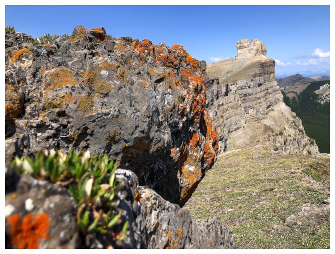
Nothing better than a splash of lichen to brighten your day!
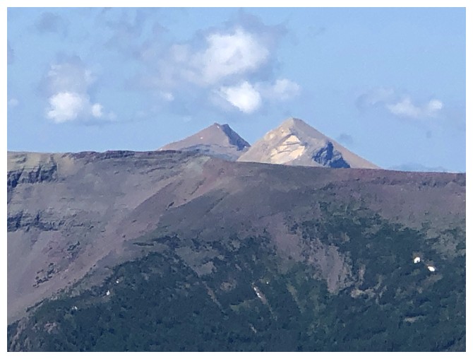
Throw in Mount Gladstone for good measure
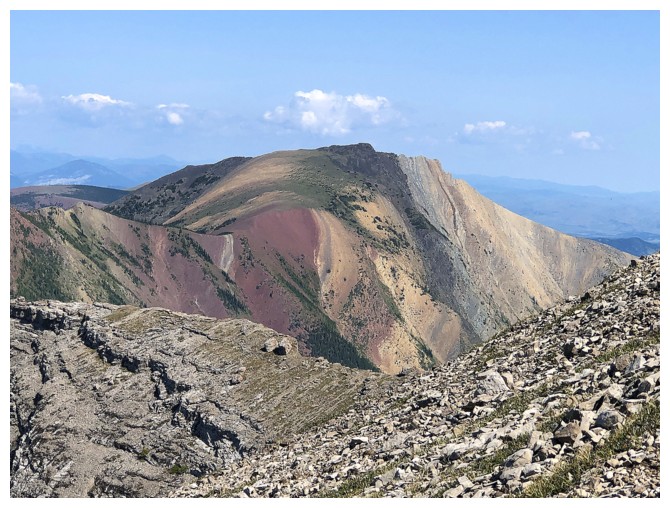
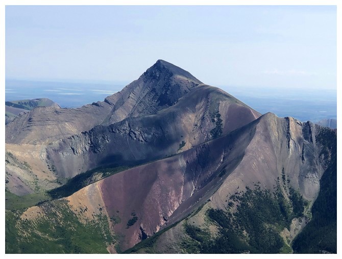
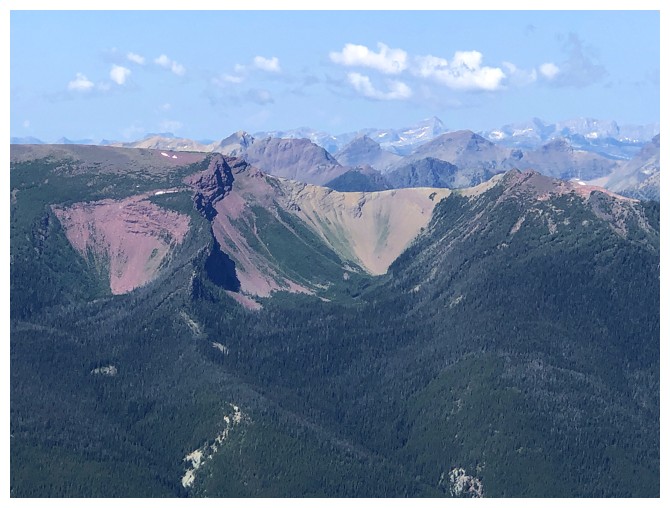
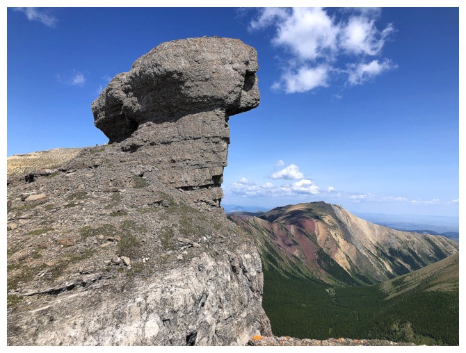
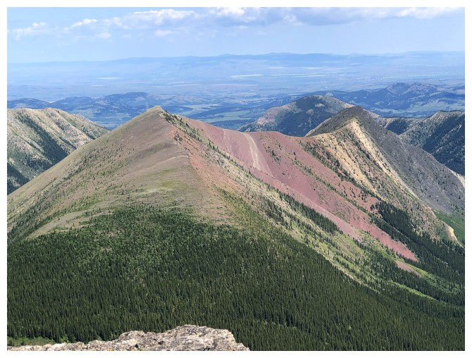
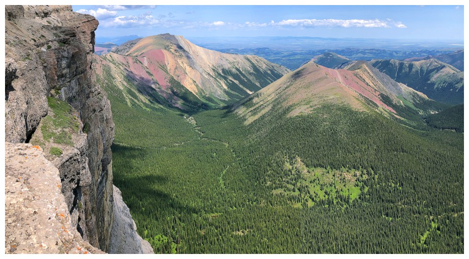
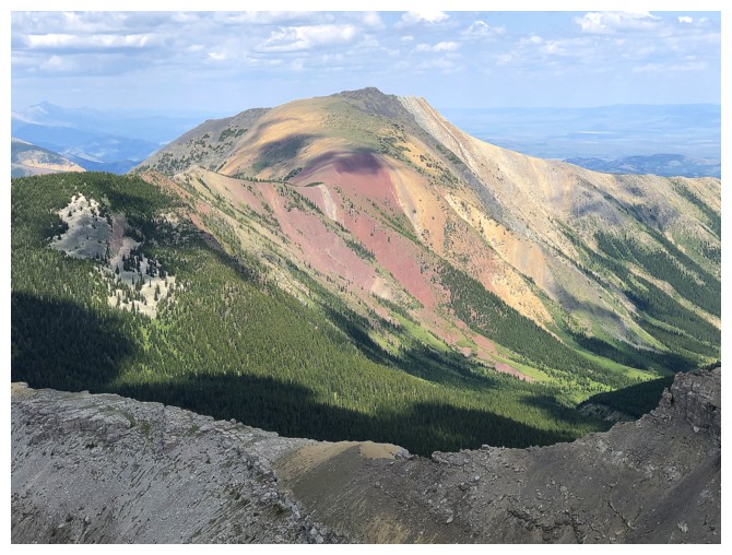
Close-up of the colourful peak. The scree run down the red argillite is one of the best in the Rockies.
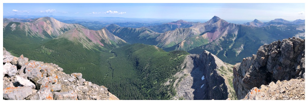
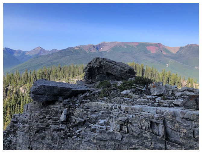
Summit view to the east includes Gladstone, Mill Creek Peak and Mountain, Prairie Bluff, Mount Victoria, Pincher Ridge, and Drywood Mountain
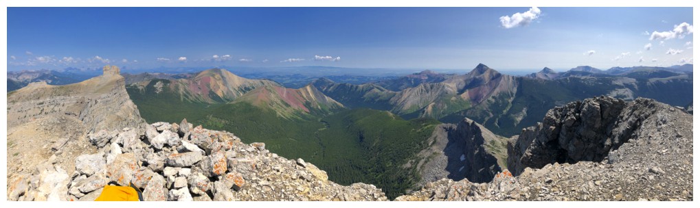
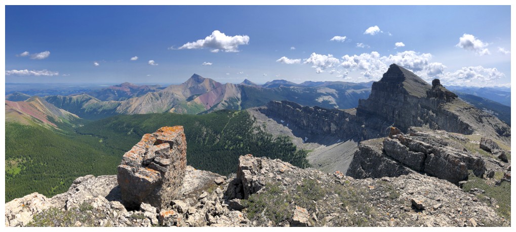
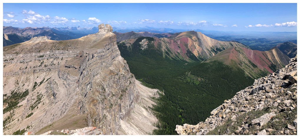
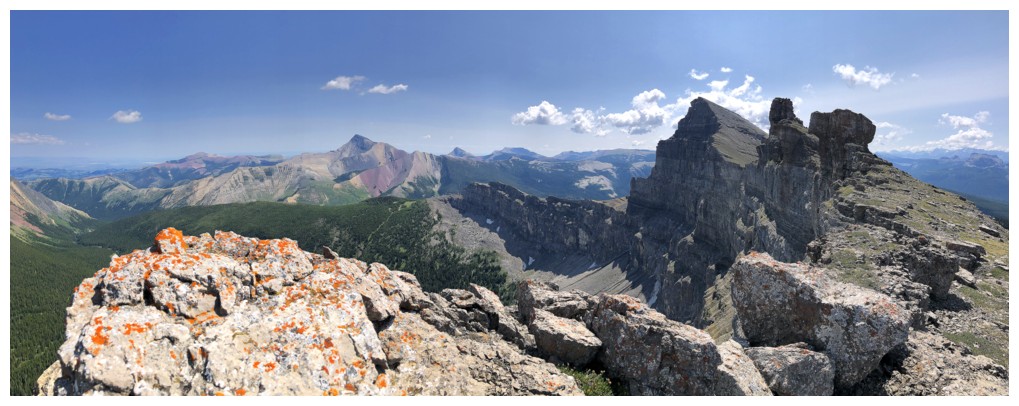
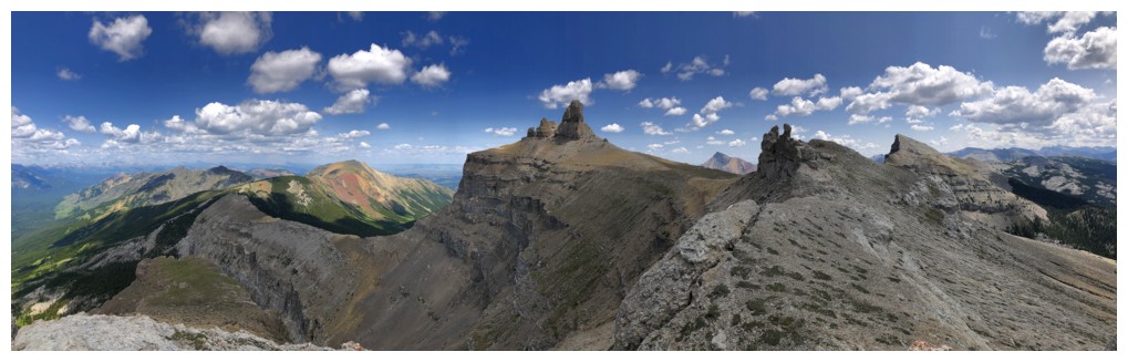
Big pano
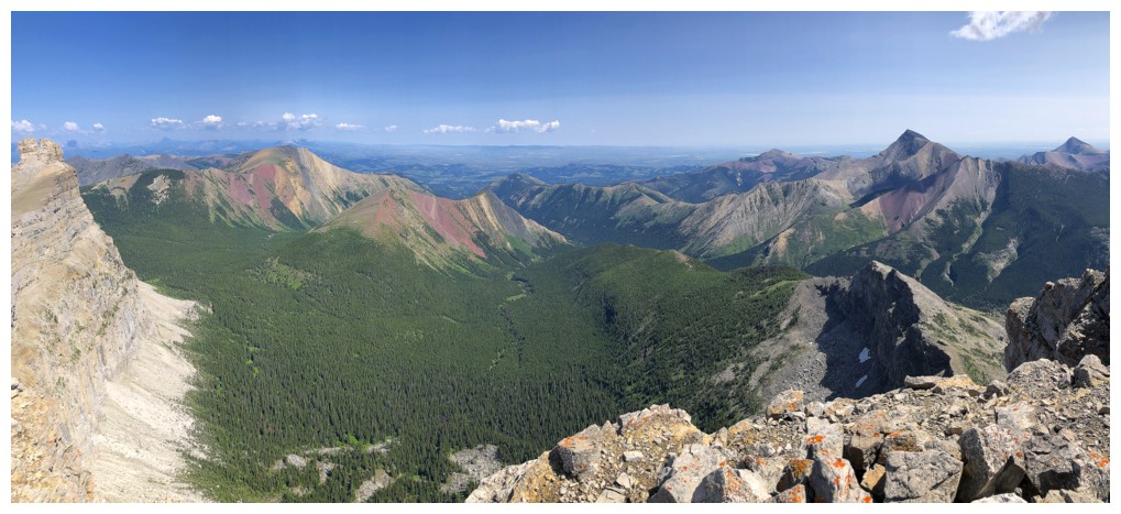
Smaller one
Close-up of Victoria Peak
Close-up of Prairie Bluff
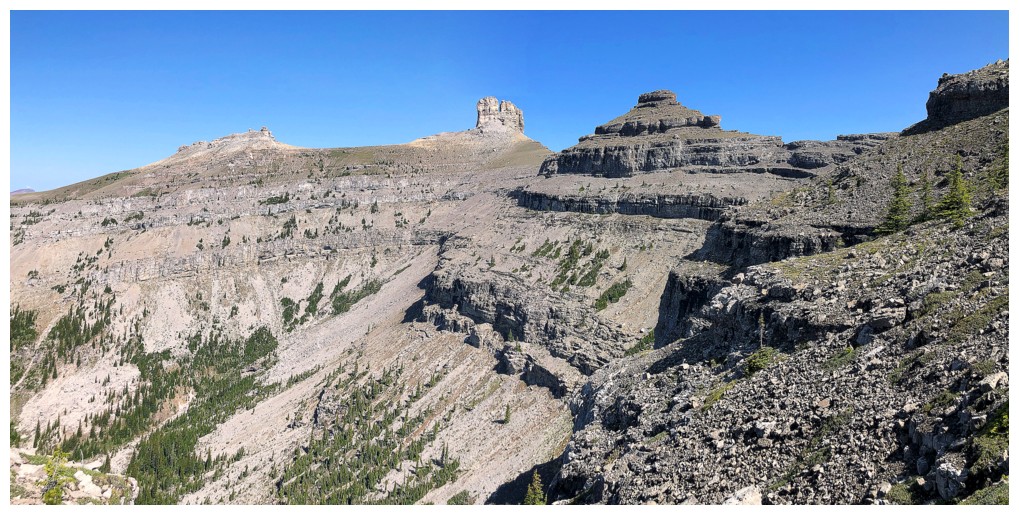
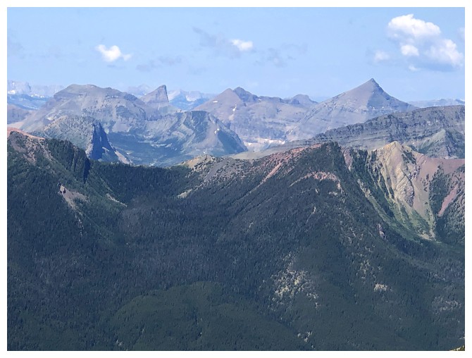
Looking south to the continuation of the ridge
Scarpe Mountain and Jake Smith Peak
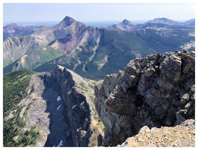
A section of Lys Ridge between the true summit and the West Castle summit
Some familiar favourites to the west: Middle Kootenay Mountain, Tombstone Mountain, Boot Hill, and Mount Haig
Distant peaks of the Flathead Range, including Mount Darrah, just right of centre
Matkin
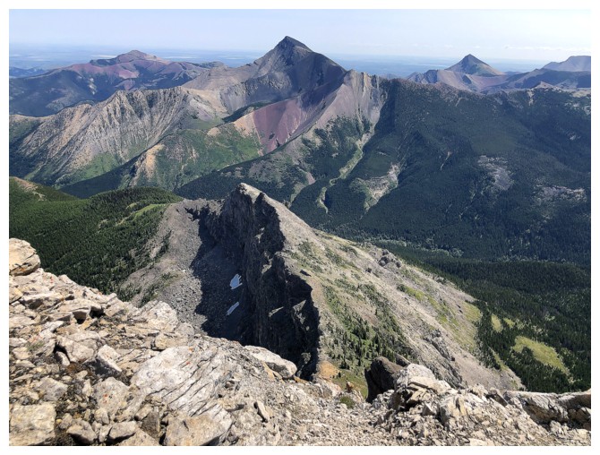
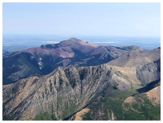
That ridge in front in significantly lower but would probably grant an awesome view of Windsor, Castle, and Victoria
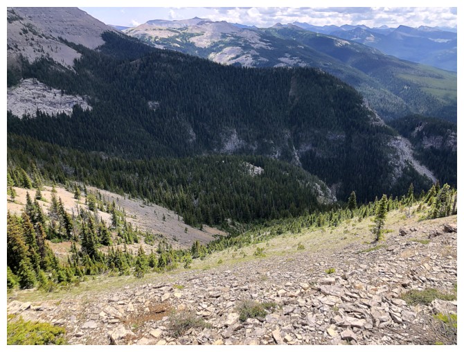
Nice view that is pretty constant throughout the traverse to Castle
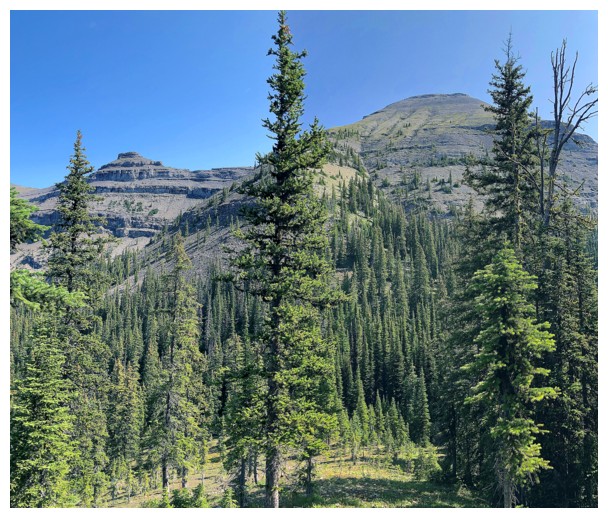
Looking back at Windsor
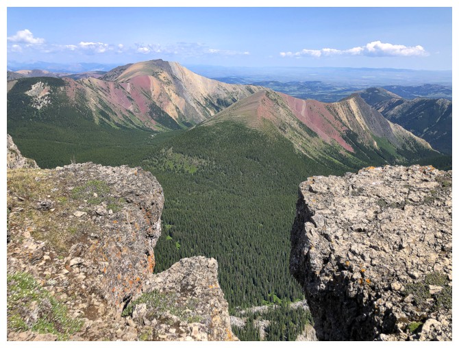
Gladstone and the Mills
Trying to capture too many things in one photo!
Looking back up
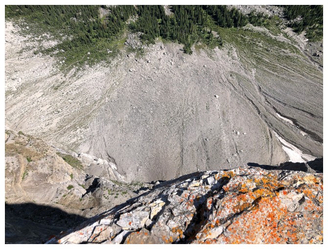
Looking down
Looking forward
Looking forward and around
There's certainly enough lichen covered rock on this peak to keep me from whining!
Looking back again. The angle is quite gentle, contrary to appearance.
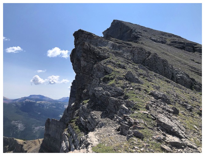
Approaching the only real obstacle of the ridge, and it's easily circumvented on the left side.
The right side would be a really bad life decision and straight up is for Alex Honnold only
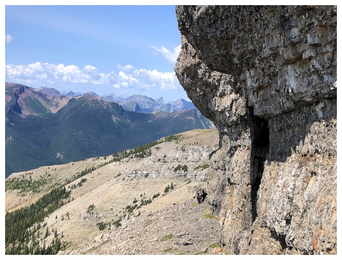
Going left - good life decision!
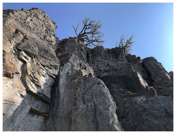
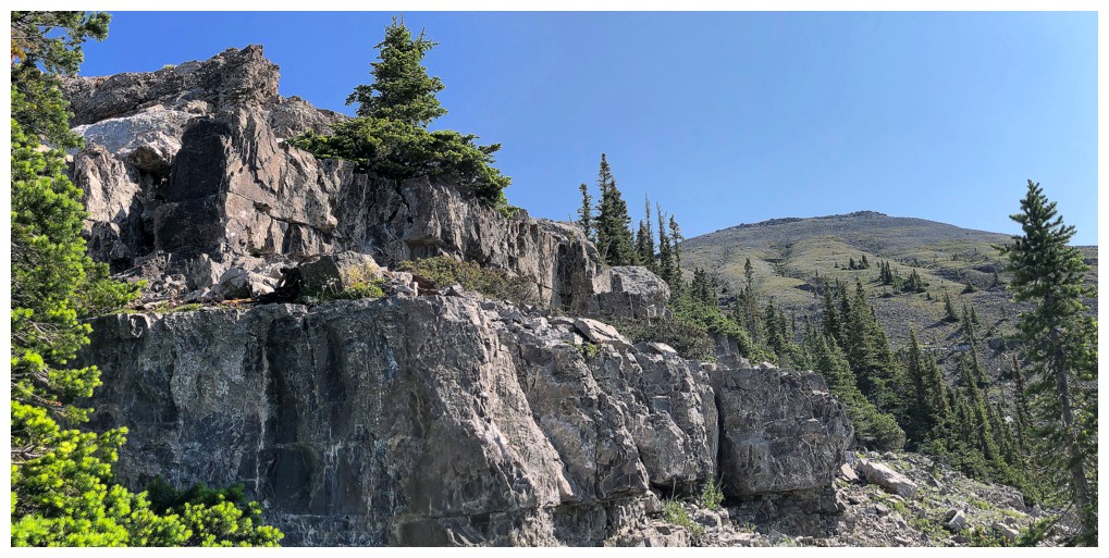
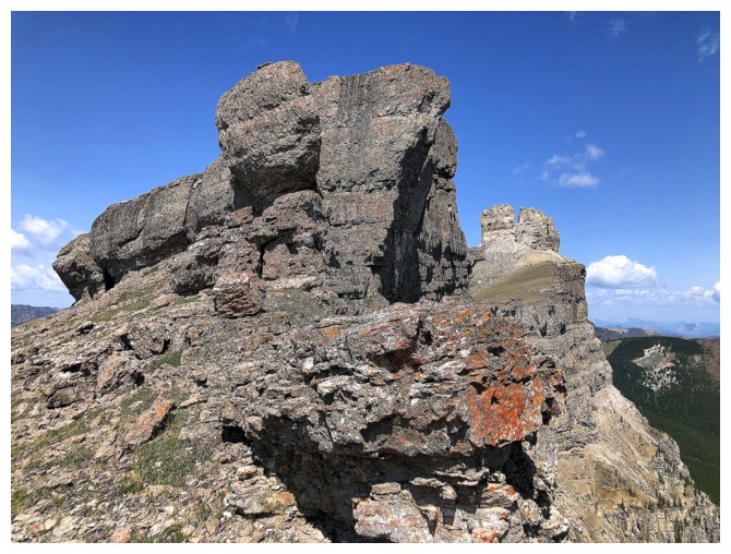
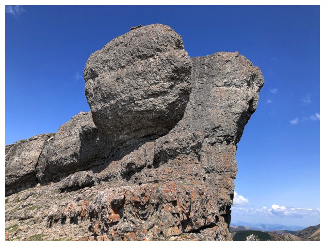
More entertaining rock scenery
The same one with Gladstone
Mill Creek Mountain (left) and Mill Creek Peak (right). They definitely deserve another run up, but in summer conditions.
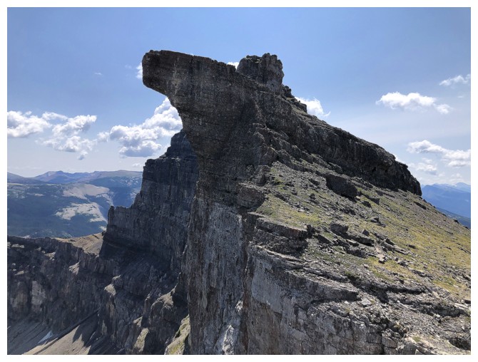
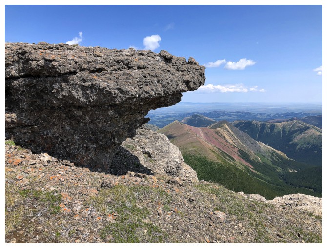
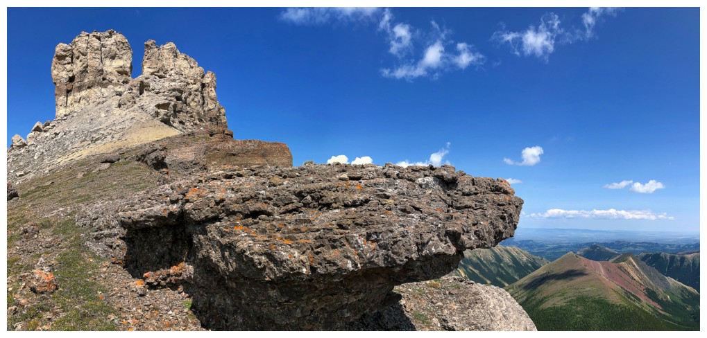
Passing that cool feature
It and the feature before
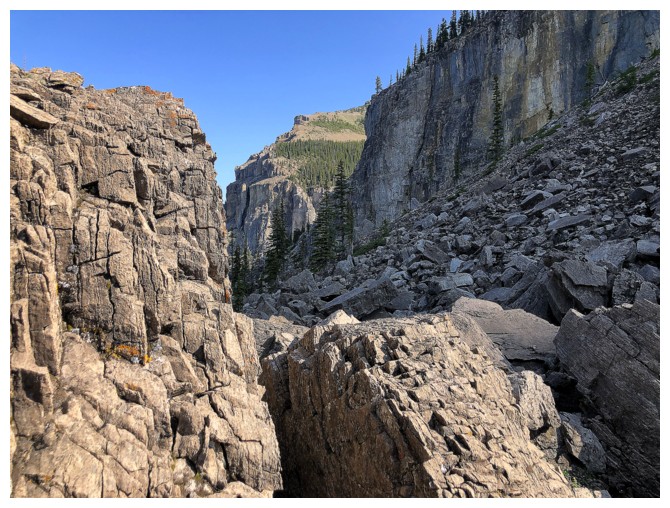
Traversing under another prominent rock band
Looks like a great base-jumping location (unless the hit the ledge near the bottom!)
The overall view continues to impress (in a big way)
As do the random outcrops of cool rock
That great view again
And the other great one again
Gladstone and the Mills yet again - very photogenic mountains
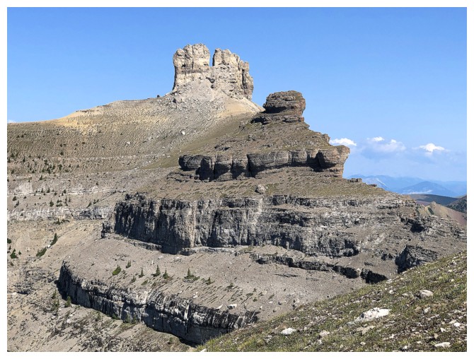
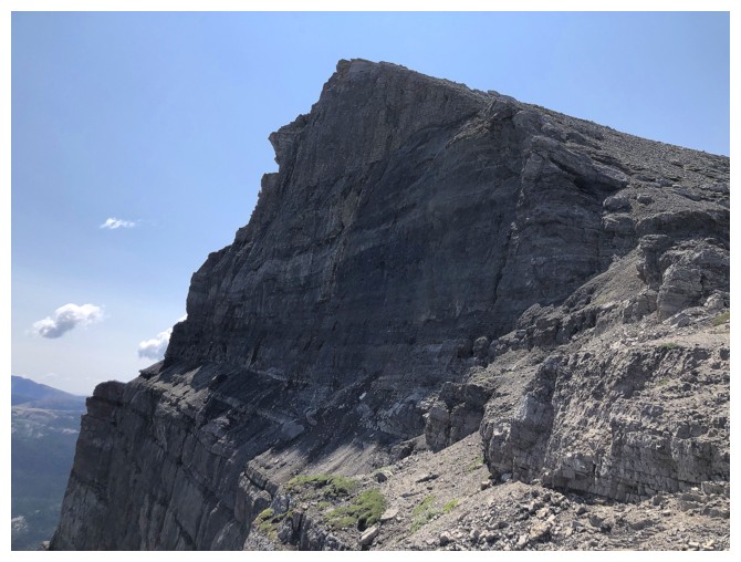
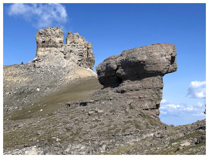
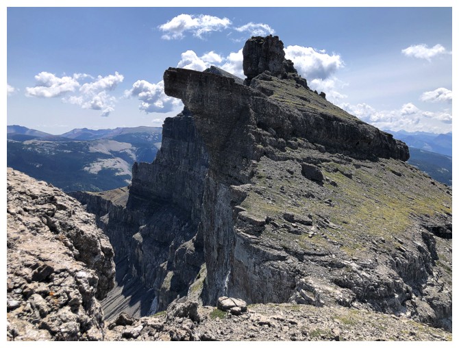
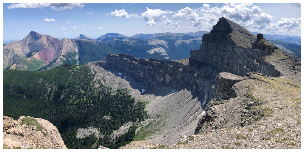
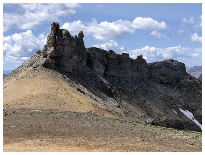
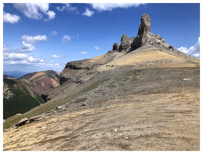
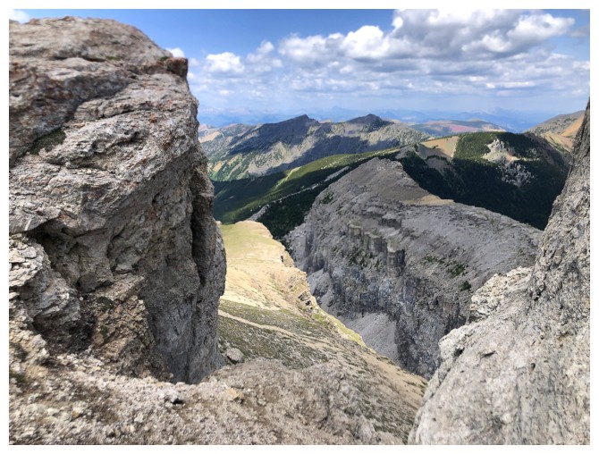
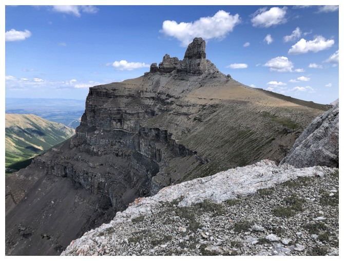
Approaching the base of awe-inspiring Castle Peak
Lots of room to explore here but I was concerned about the weather breaking down
Same as above
Looking over to the next destination
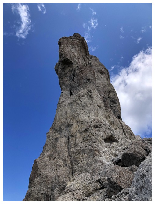
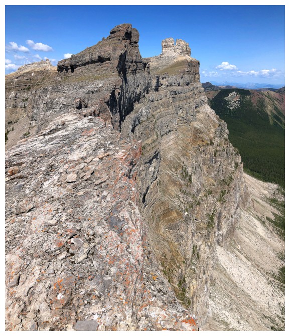
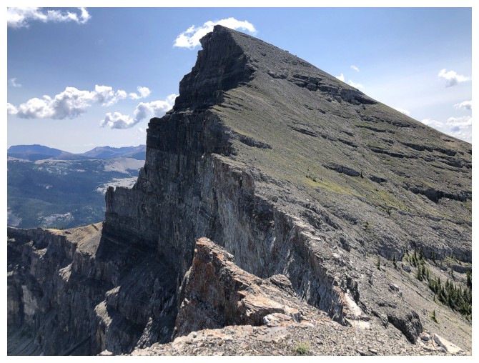
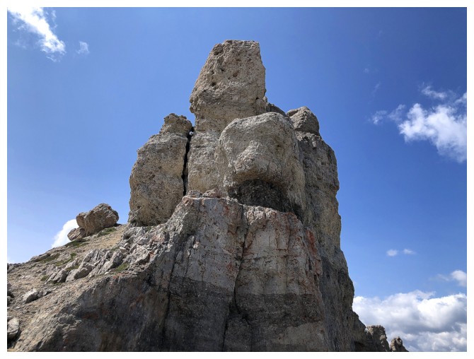
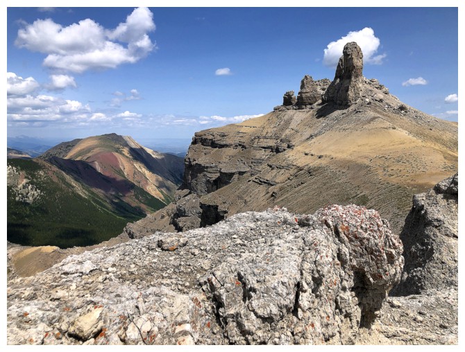
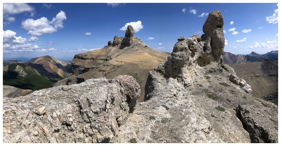
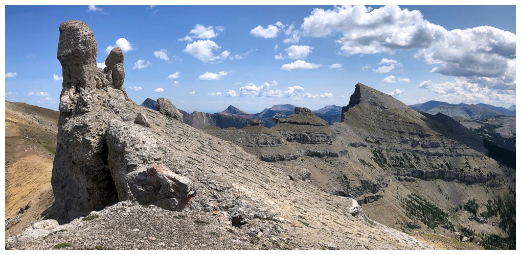
The profile of Castle Peak from its west end is quite striking
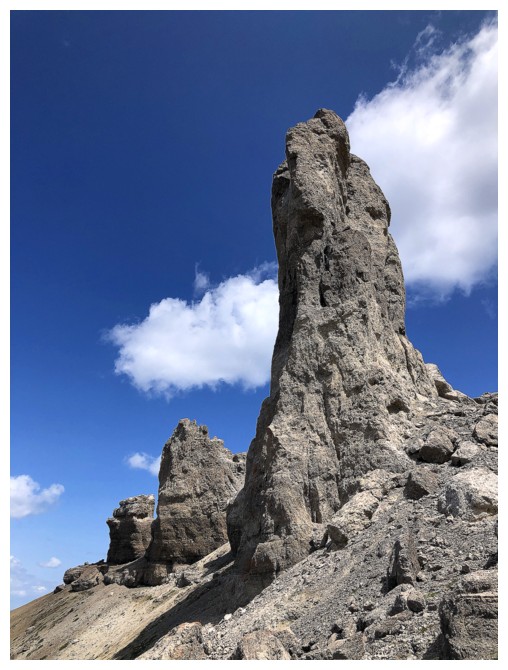
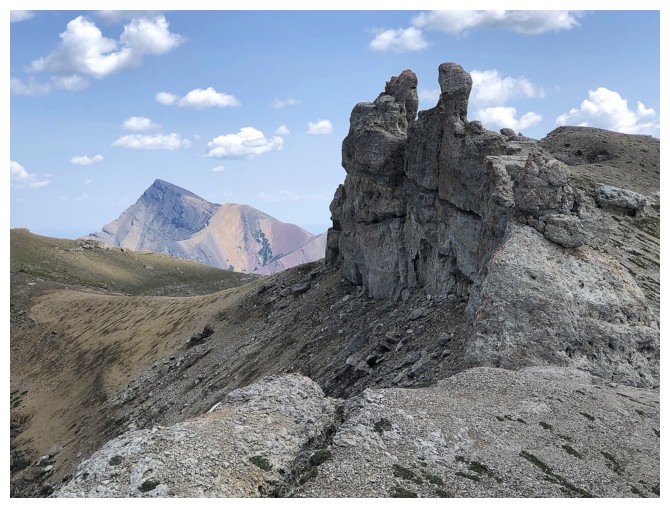
...as are the other pinnacles
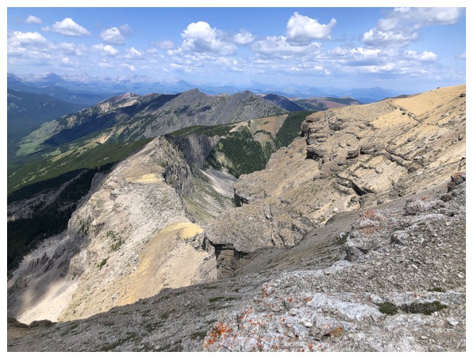
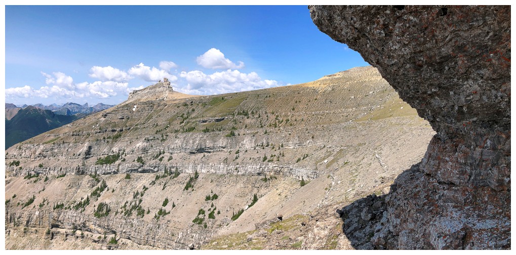
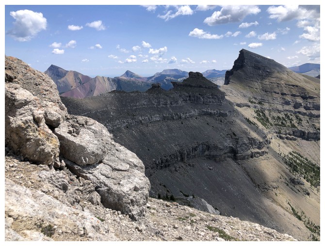
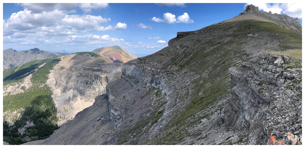
The northwest leg of the Windsor/Castle massif looks quite interesting
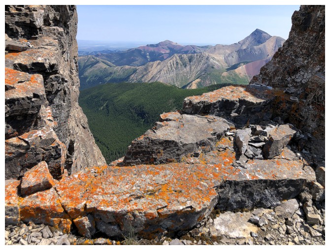
Approaching the last stop of the day before descending
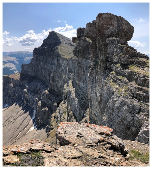
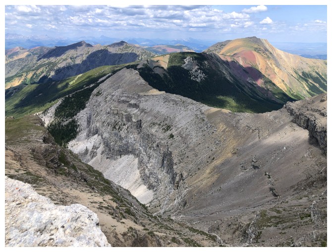
Looking back to Castle
Some steep terrain ahead but it too is easily circumvented on the left
Windsor at the far right
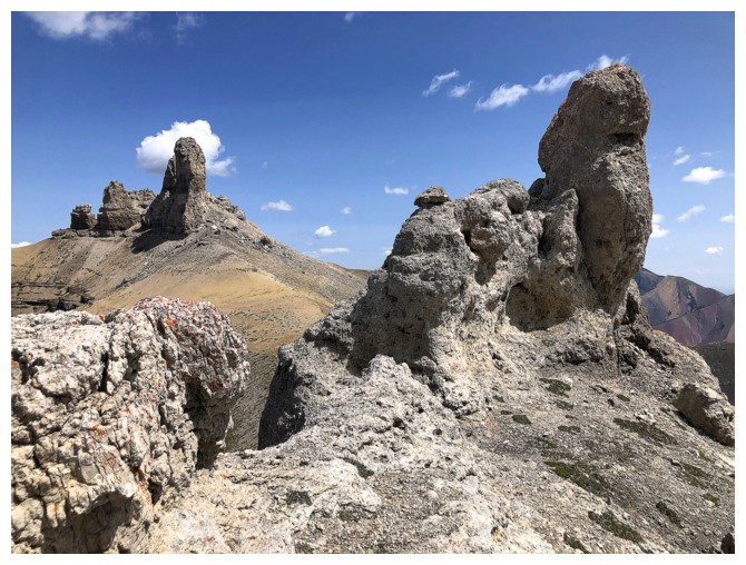
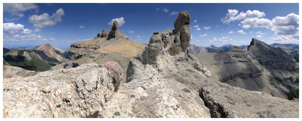
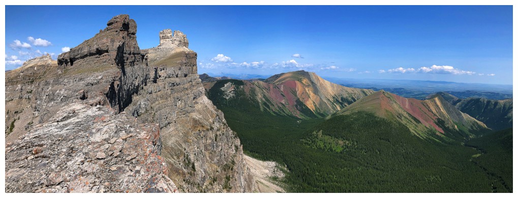
With the added rock formations nearby, the view back to Castle is going to get out-of-hand!
Without the nearby pinnacles
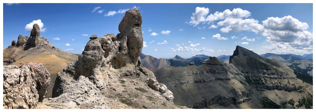
With them and all the way over to Windsor
A compromise
Farther down the ridge
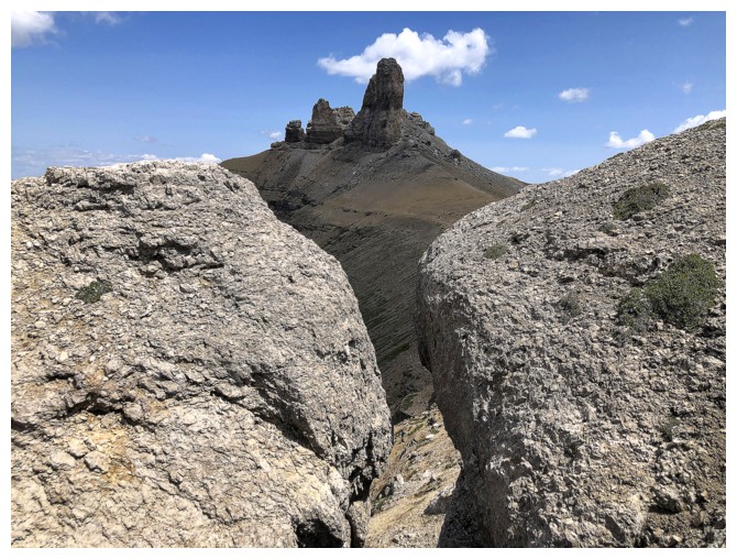
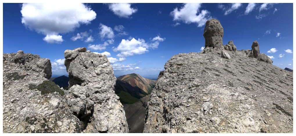
"Mind the gap"
That northwest leg again
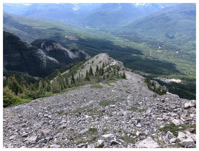
Looking down some of the descent route. I followed the ridge down for quite a distance before cutting back to the left.
Apparently, I have a thing for the northwest leg! However, looking at the topo
lines, it would be viciously steep, if not impossible, from all sides.
Last comprehensive look at the wonders of this ridge
Victoria is omnipresent
If you haven't seen Gladstone enough already, here it is again
Castle Peak
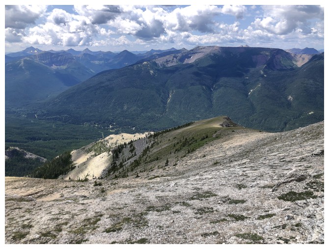
Now a fair distance down the ridge, looking back up
The route ahead is easy, but if you go too far you will get cliffed out (unless you are Alex Honnold)
Finally heading down easy scree slopes, but the route is going to trend far left
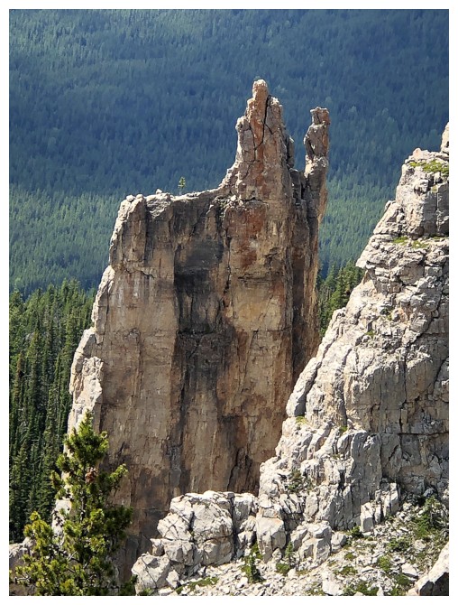
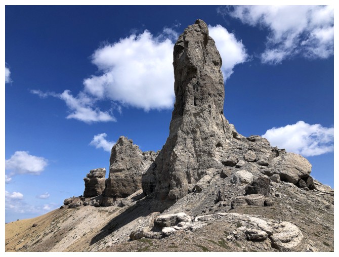
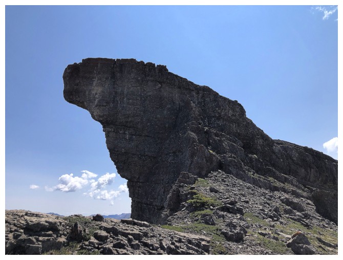
A super cool pinnacle, seen before entering forested terrain
The End
LOG