Prairie Bluff XIV
Pincher Ridge North Outlier
II
April 17, 2021
Mountain heights: 2258 m, 2180 m
Elevation gains: 558 m, 620 m
Round-trip times: 5:15,
4:40
Solo snowshoe and scramble.
The “future” trip, as alluded to in Prairie Bluff
exploration, came much sooner than expected. A week earlier I had seen some
rock bands that begged for a close-up look, thinking that a late May/early June
trip would provide optimum results. 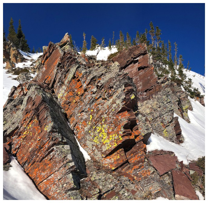 However, checking the SunCalc app on my phone (love
this app!), I optimistically conjectured that the Sun would, more or less,
shine upon that rock in mid-April. Game on!
However, checking the SunCalc app on my phone (love
this app!), I optimistically conjectured that the Sun would, more or less,
shine upon that rock in mid-April. Game on!
Enjoying the wonderfully short and easy
approach, I quickly reached a point where the rock was in visual range. No Sun
yet. No problem – that gave me ample time to explore other areas of the east
face of this ridge (one of two fantastic ridges on the north side of the
mountain). I had seen some of the rock a year earlier, but there was plenty more to
explore.
Eventually the Sun did rise enough to hit the
rock I had came to see and spectacular it was! A meandering exploration
followed and then I ascended the drainage between the two ridges up to the
summit ridge of Prairie Bluff. 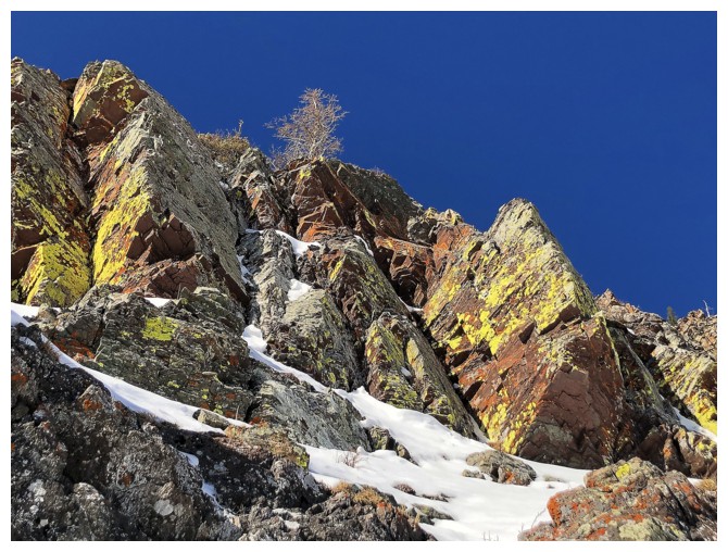 With perfect weather at hand, running up to the
summit was pretty much mandatory. Surprisingly, I ran into a couple on their
way down from the summit. Fourteen or so trips on Prairie Bluff and its
outliers and this was the first time I had encountered other human beings.
With perfect weather at hand, running up to the
summit was pretty much mandatory. Surprisingly, I ran into a couple on their
way down from the summit. Fourteen or so trips on Prairie Bluff and its
outliers and this was the first time I had encountered other human beings.
A quick descent followed a short summit break,
and I was back to my car by 12:45 pm. With daylight in abundance, I decided to
check out the new Victoria Ridge/Peak approach. The usual route had recently been
closed permanently to the public because of private property, but apparently
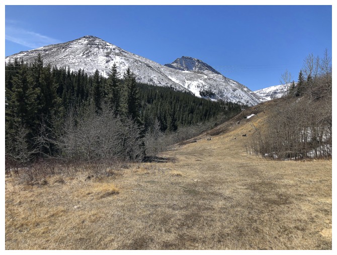
the area was accessible from the south via a cutline.
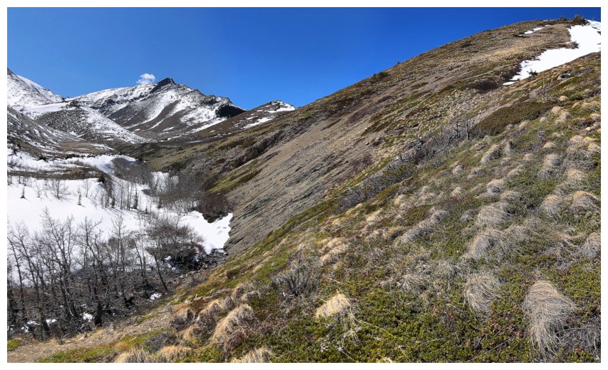
The route first gains a prominent ridge on
the north side of Pincher Ridge and then descends to Pincher Creek, before
joining up with the gas road. I had ascended that ridge back in 2008 and didn’t
exactly have warm and fuzzy feelings about it back then!
Nevertheless, much has changed since then, my
exponentially increased appreciation of and fascination with the colourful rock
of Southern Alberta being at the forefront of those changes. As soon as I
gained the ridge, checking out the new approach was out the window. I wanted
another shot at this ridge, if for no other reason than to see if the passage
of 13 years had changed my perception of the trip.
In short, it did and it didn’t, though the
“didn’t” was more a result of my waning energy levels as I made my way up the
ridge. I was exhausted by the time I reached the summit – perhaps doing this
trip after an ascent of Prairie Bluff was not the smartest decision I’d ever
made! Nevertheless, in between long bouts of heavy breathing (i.e. trying
to catch my breath), I did enjoy the route far more than on my previous trip. And
though a little cloudy by this time, the summit view was pretty sweet.
For descent, I considered trying to go
directly down to the gas road, but already quite depleted from the day’s
ascents, the familiarity of returning the same way I came up seemed prudent.
I'm pretty sure that I’m now done with this route up
the Pincher Ridge Outlier, but there were several intriguing lines up Pincher
Ridge from this valley, so I may yet return to the general area. In regards to
Prairie Bluff, its likely that only death will permanently keep me away from that one!
Prairie Bluff XIV
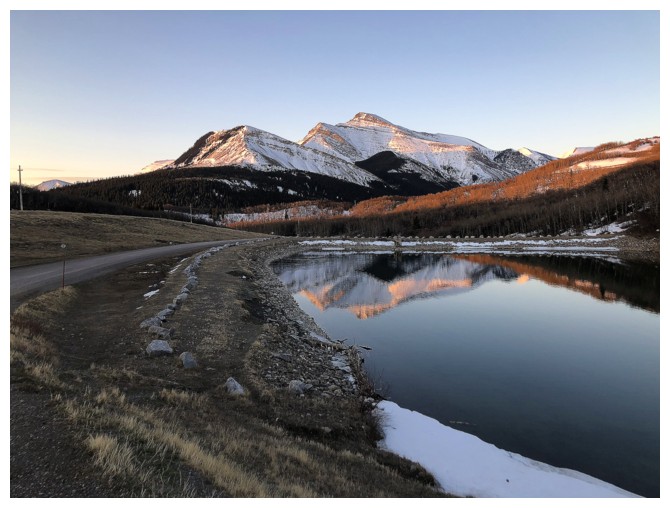
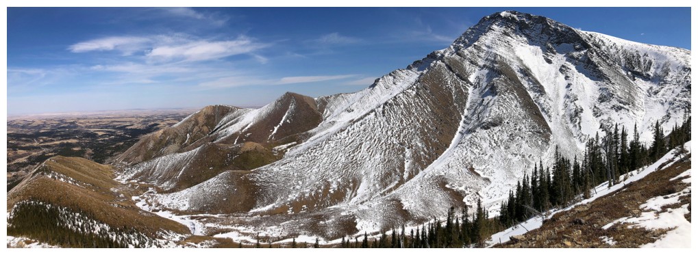
The mandatory stop at Butcher Lake, with Drywood Mountain
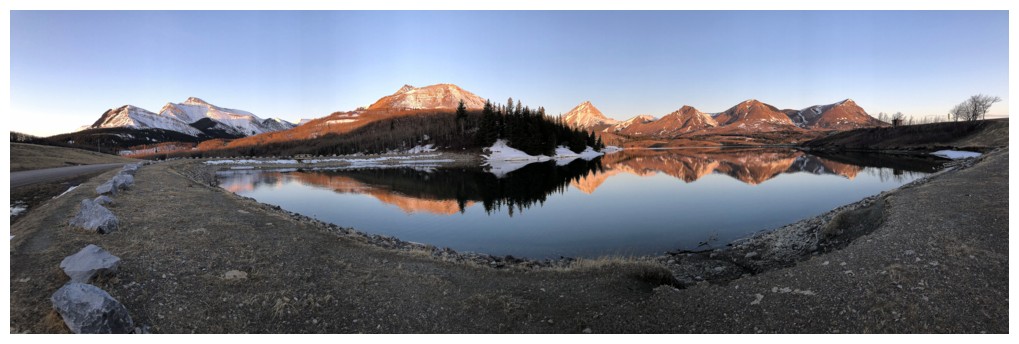
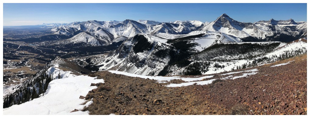
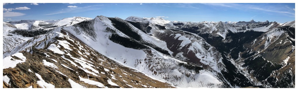
Left to right: Drywood, Pincher, Victoria, Prairie Storm, Prairie Sky, Prairie Fire, and Prairie Bluff
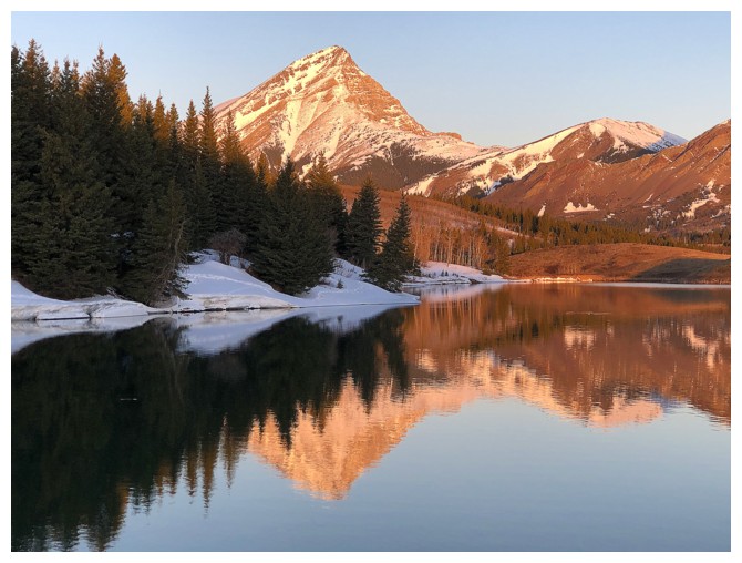
Victoria Peak - a Castle favourite because it was the first mountain I ascended in The Castle area and has one of the best ridgewalks in the Rockies
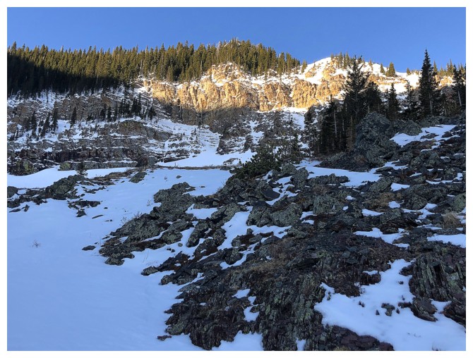
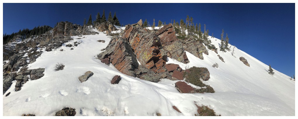
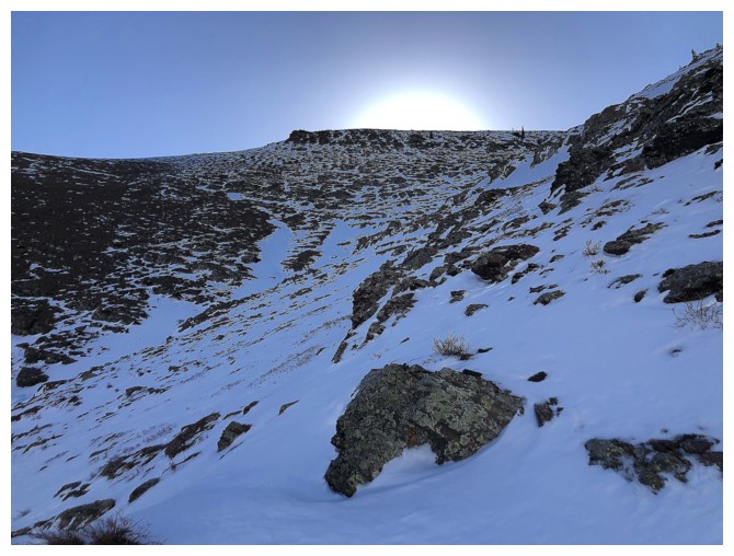
Arriving in the area of the rock I want to check out but the Sun is still too low in the sky
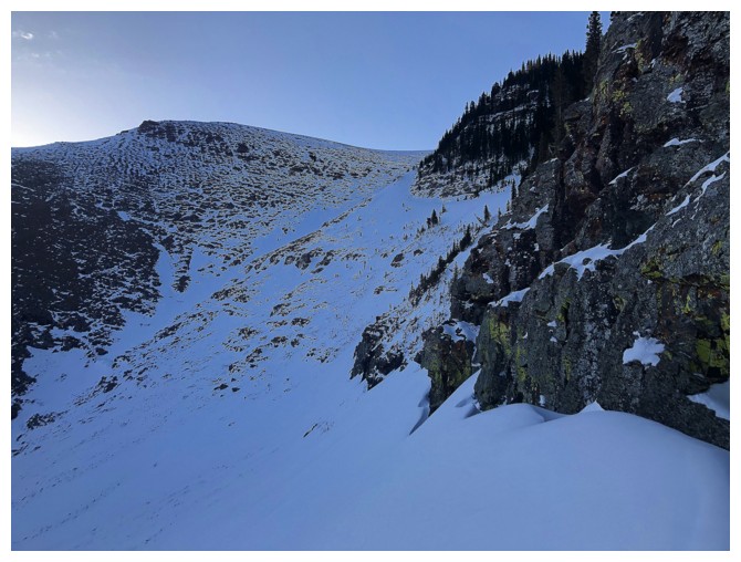
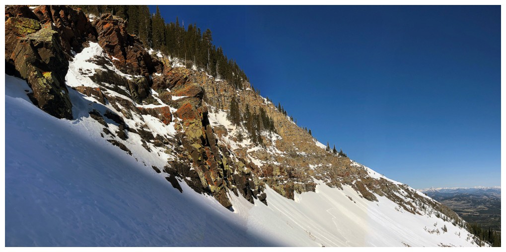
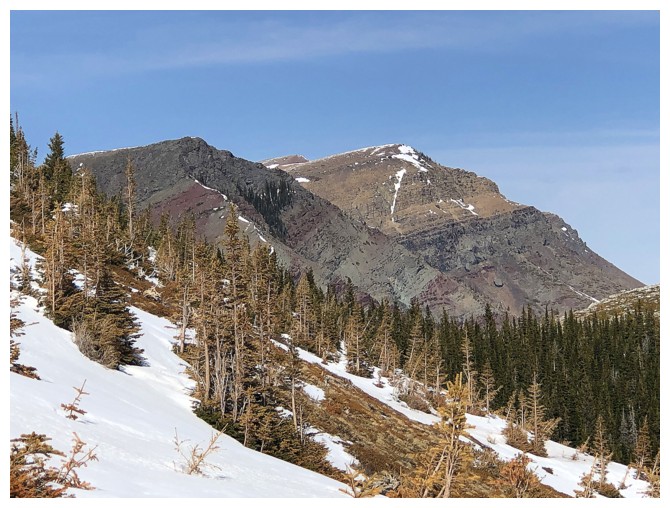
The ridge I ascended a week earlier at the left (one of favourite
routes in the Rockies), and the shaded rock I came to see at the right
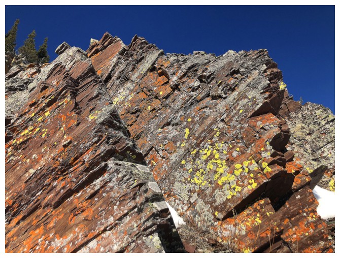
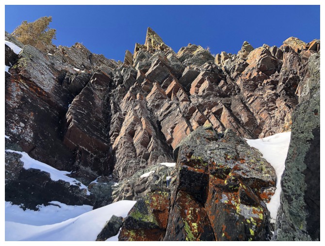
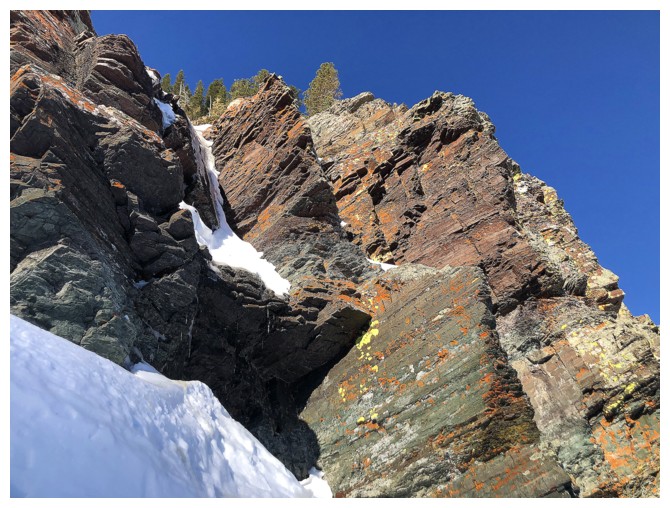
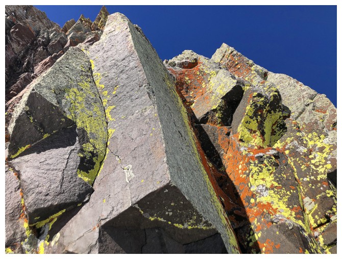
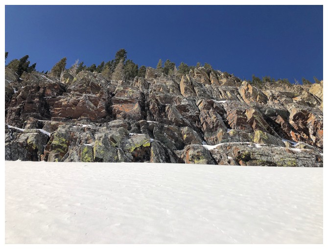
Here we go - if you don't enjoy looking at endless photos of colourful, lichen-covered rock then go no further!
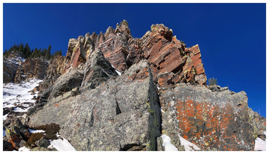
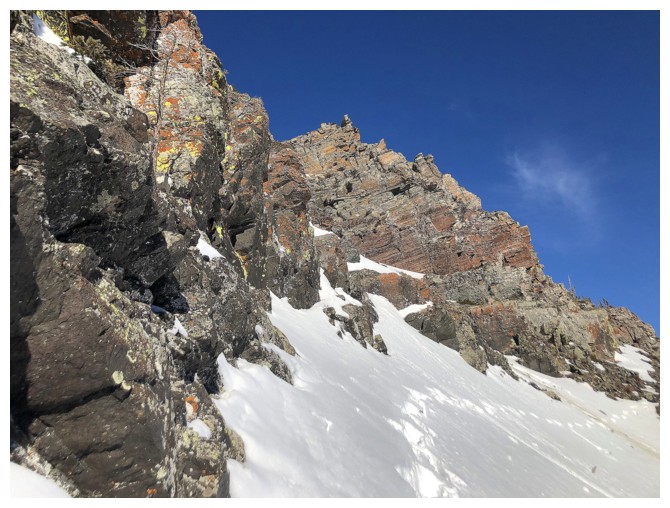
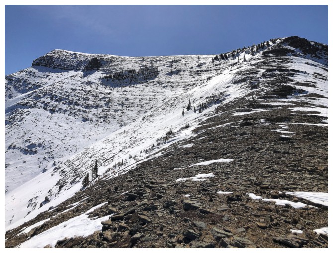
Many potential routes up through the rock bands
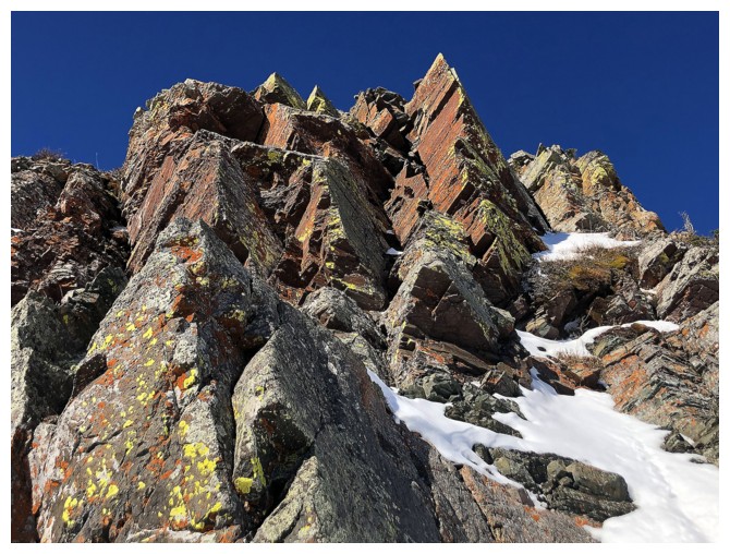
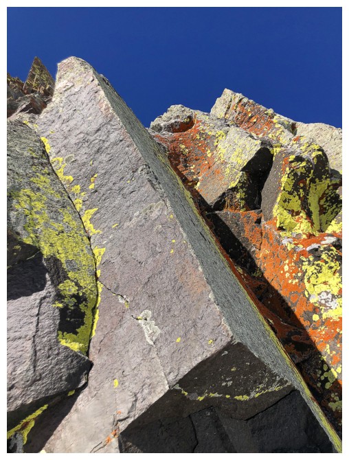
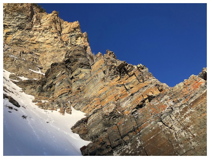
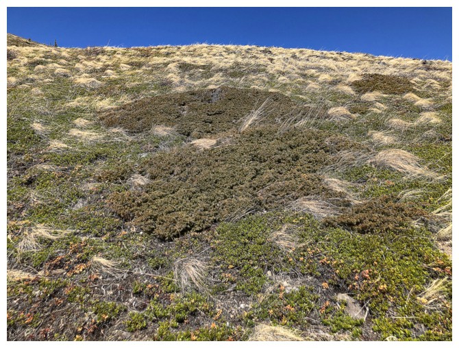
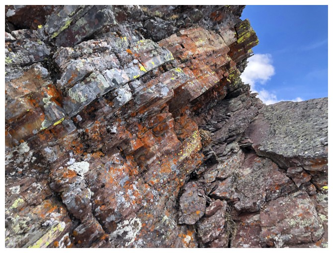
Yellow lichen on red argillite is still my favourite
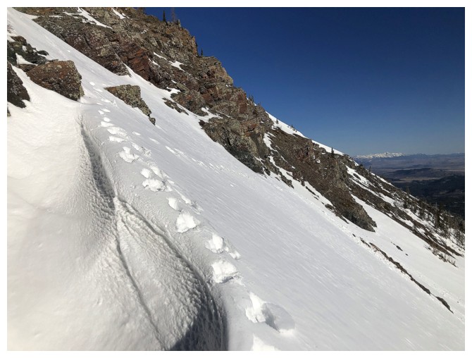
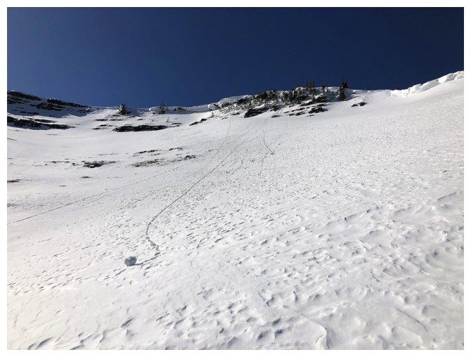
Looking back at my tracks. The slope is fairly steep here and I did
slip at one point, but managed to self-arrest before going down any
significant distance.
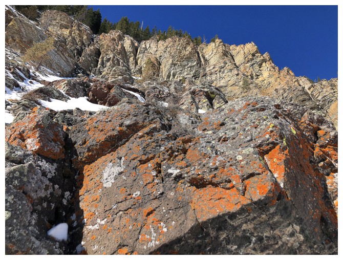
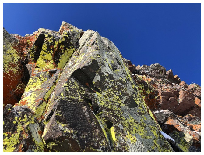
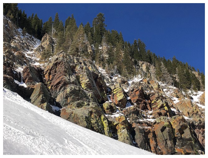
Back to the lichen-splashed rock
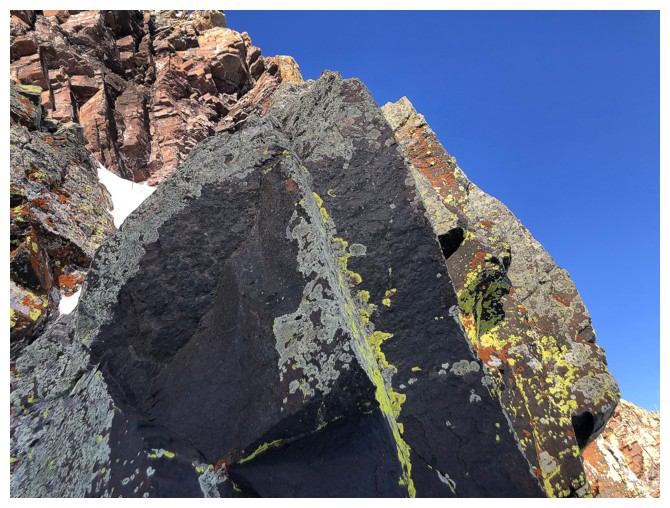
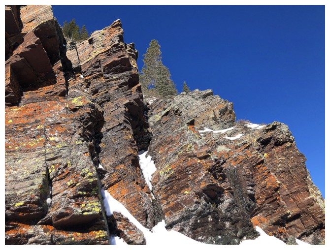

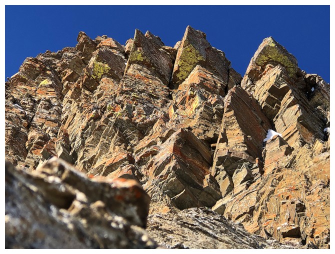
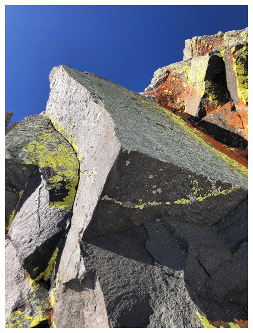
This chunk of beautiful, clean-cut rock was the highlight of the first part of the trip
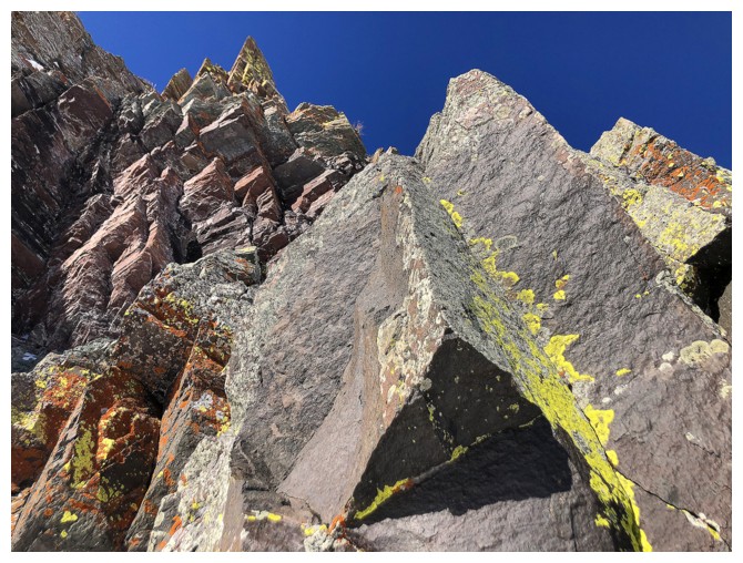
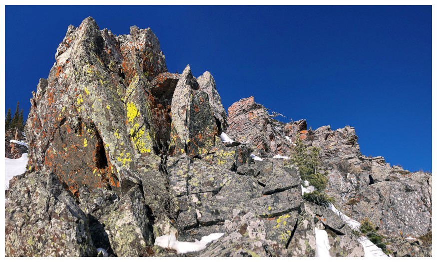
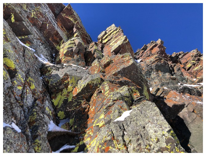
Ogling at more potential scrambling routes up the amazing rock (colour, not quality!)
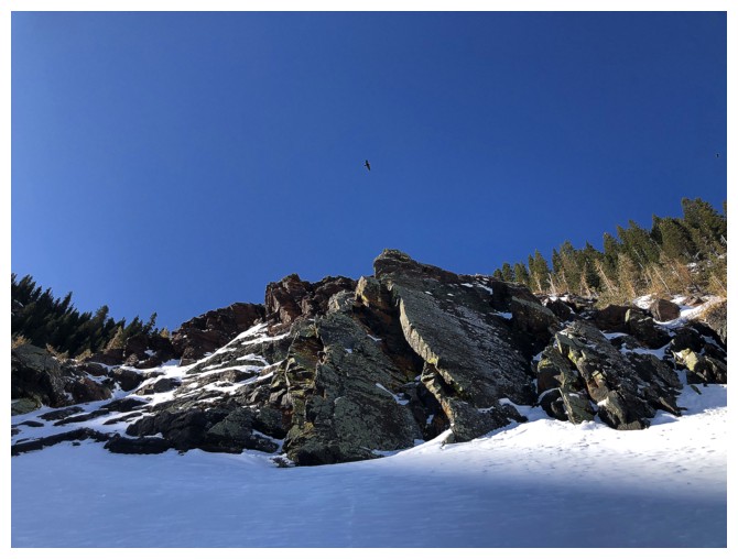
The bird in the upper middle also appreciates the rock
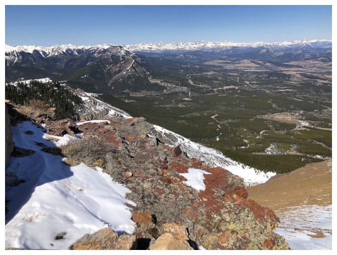
Looking back to the area of exploration, but it's time to move on
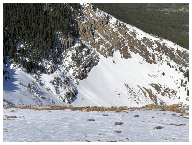
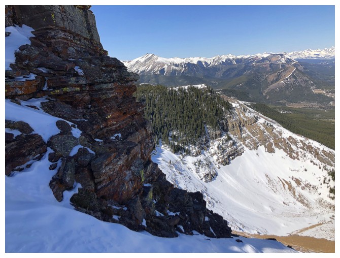
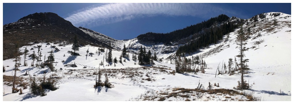
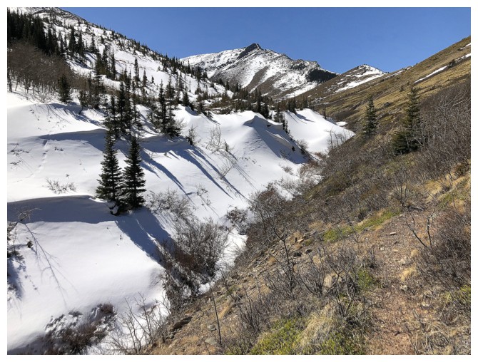
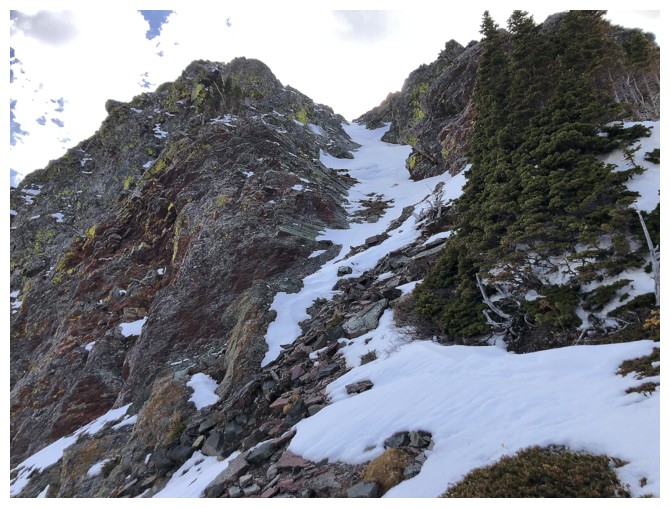
Traversing into the drainage between the two ridges
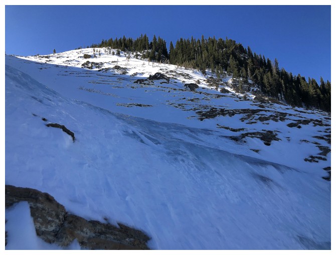
The drainage is very steep in places and does have a couple of small frozen waterfalls
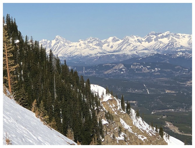
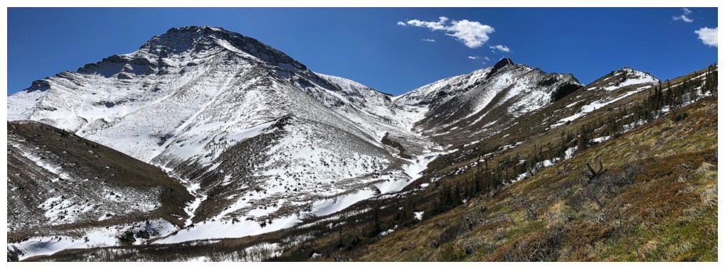
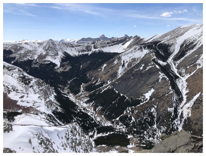
The always impressive view of the Flathead Range to the northwest
Easier terrain above the small falls
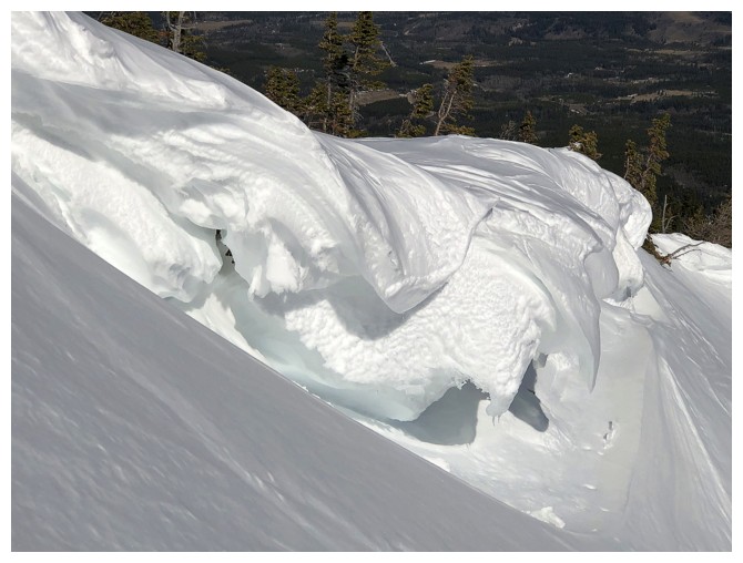
Heading to the right to check out the cornices
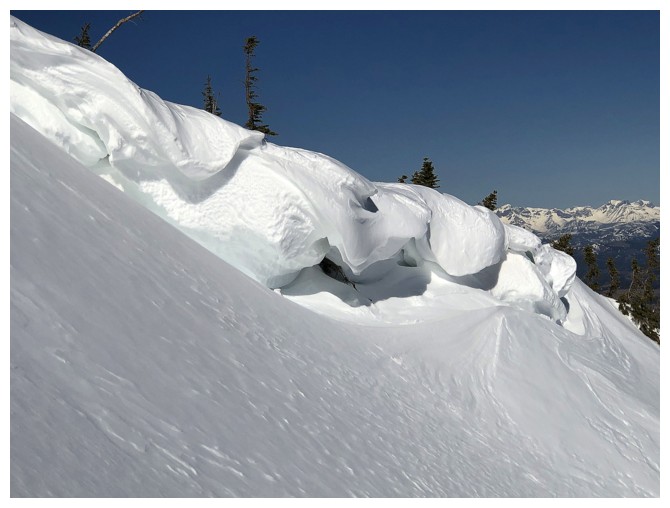
Cornices are the winter equivalent of yellow lichen on red argillite! Pretty awesome to experience both on the same trip.
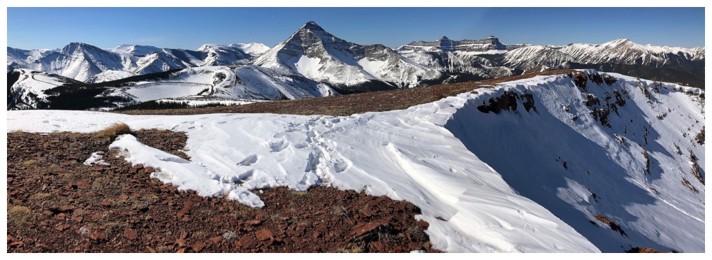
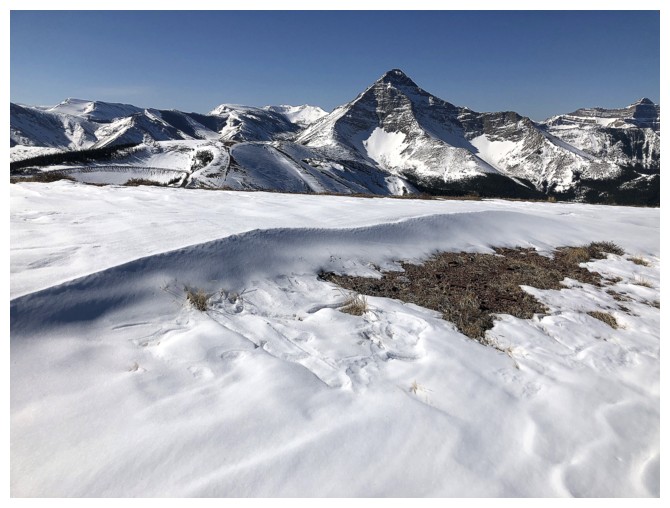
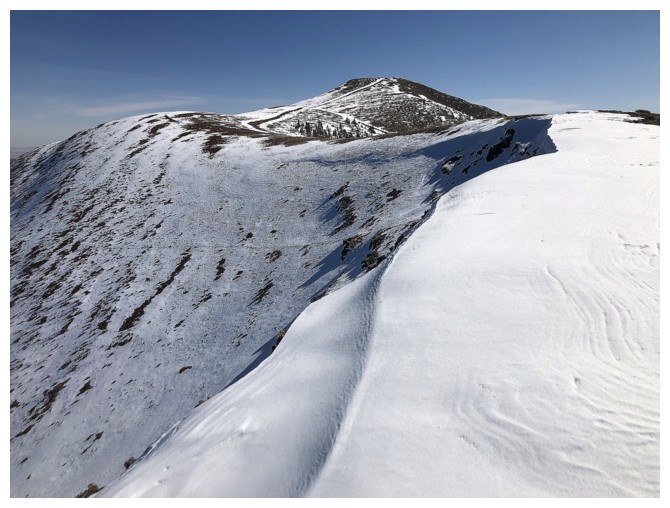
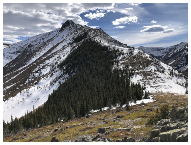
On the ridge with the summit of Prairie Bluff at the left
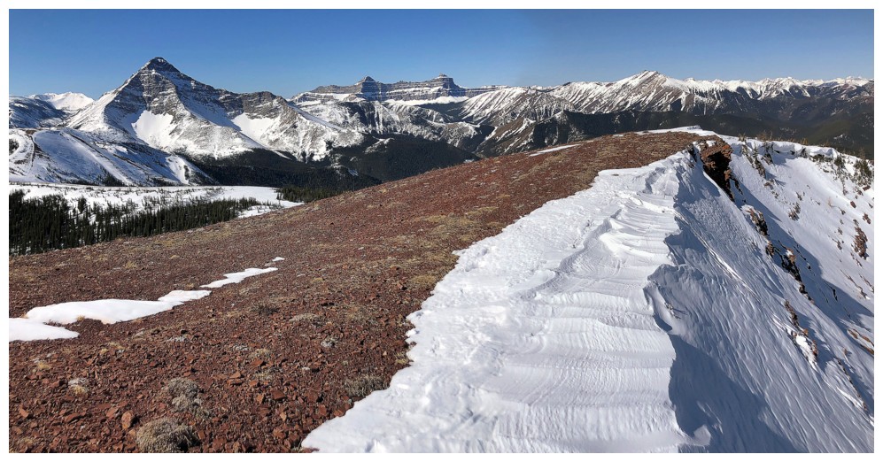
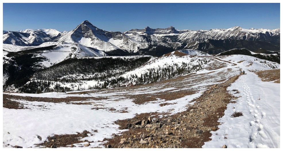
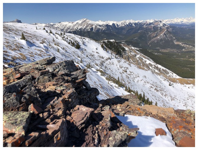
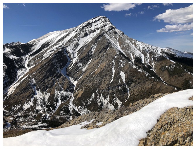
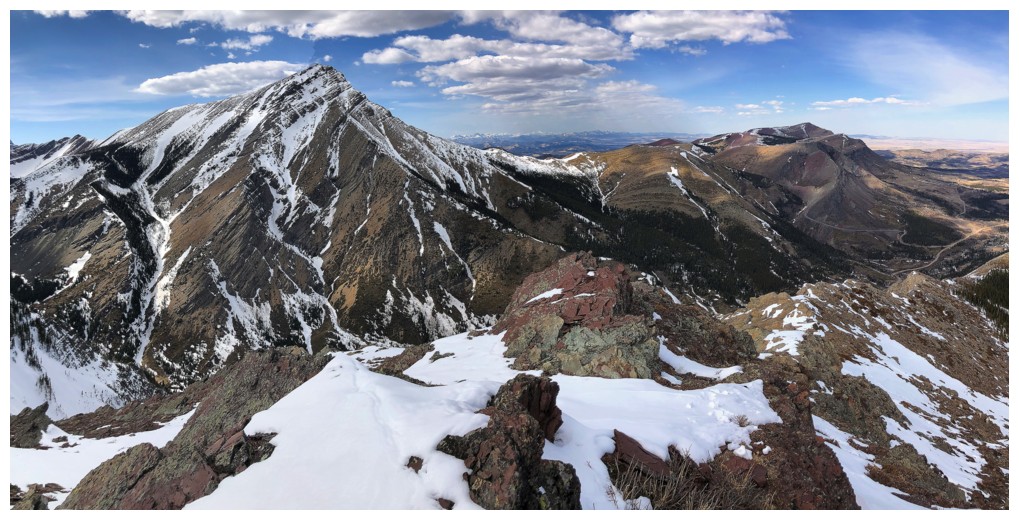
The classic view of Victoria Peak that never gets tired
Seeing interesting curves of snow never gets tired either
Victoria and the curves
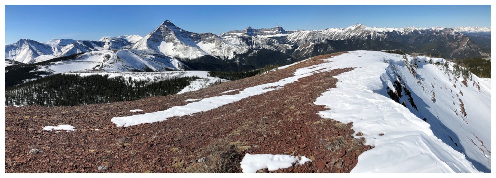
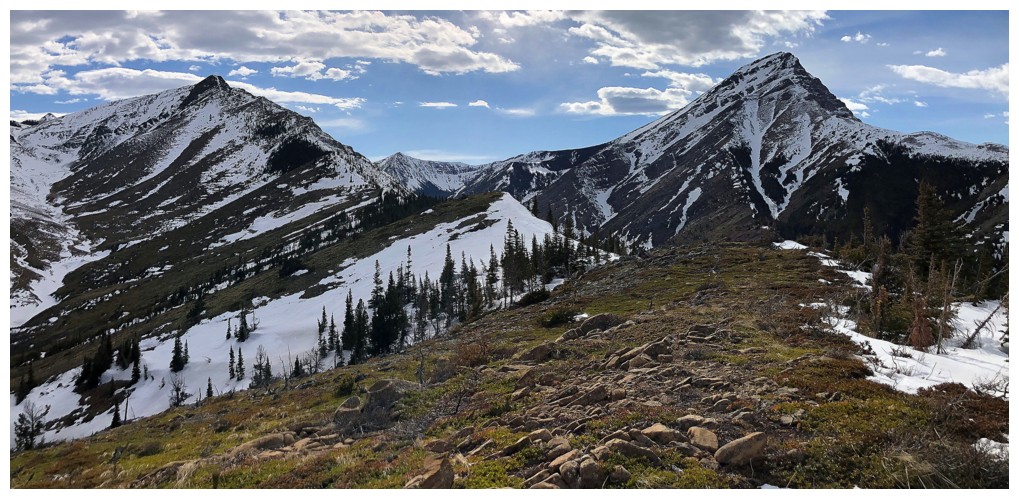
The southwest peak of Pincher Ridge in the centre and the summit of Victoria Ridge to the right
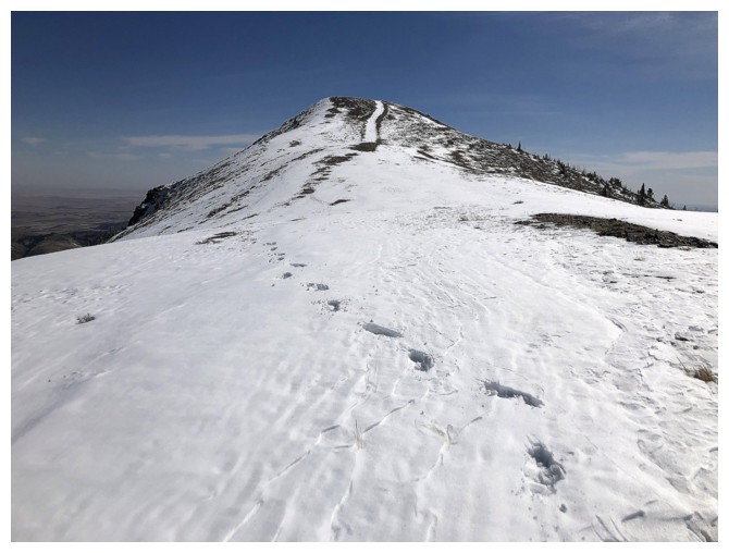
About as easy as it gets from here to the summit
And replete with great views
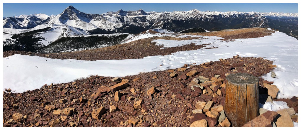
At the summit of Prairie Bluff - definitely my most frequently visited summit in the mountains
Summit view to the south
The northeast side of the peak will probably see me at some point
Descent
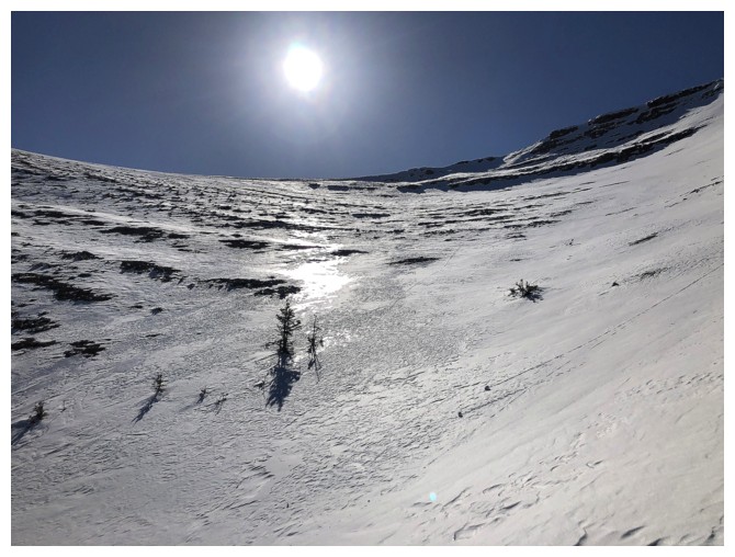
Looking down at the area I explored earlier
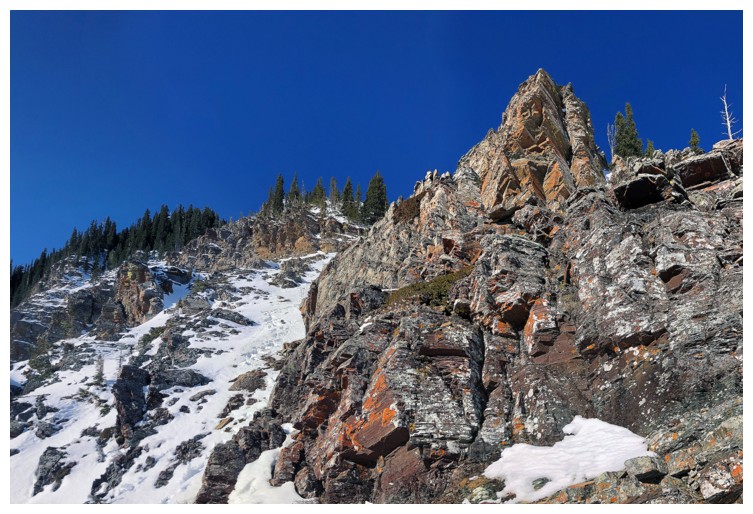
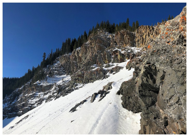
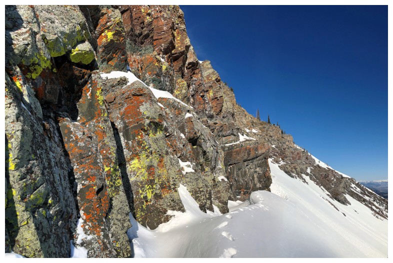
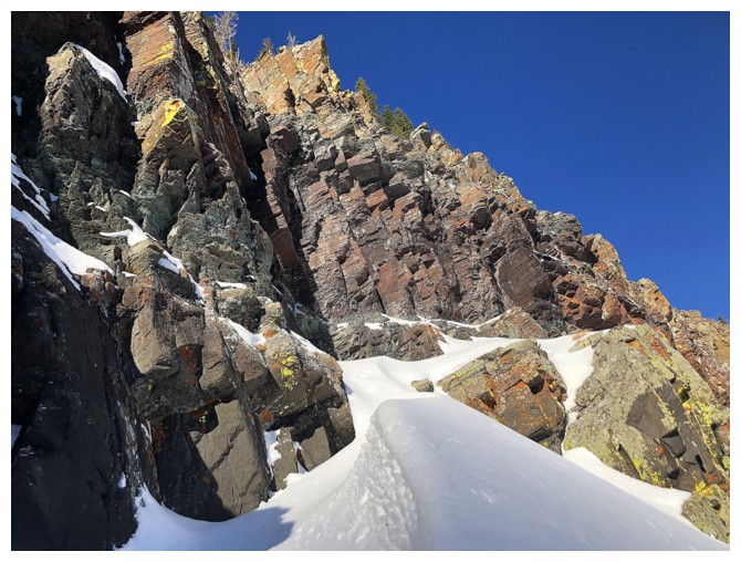
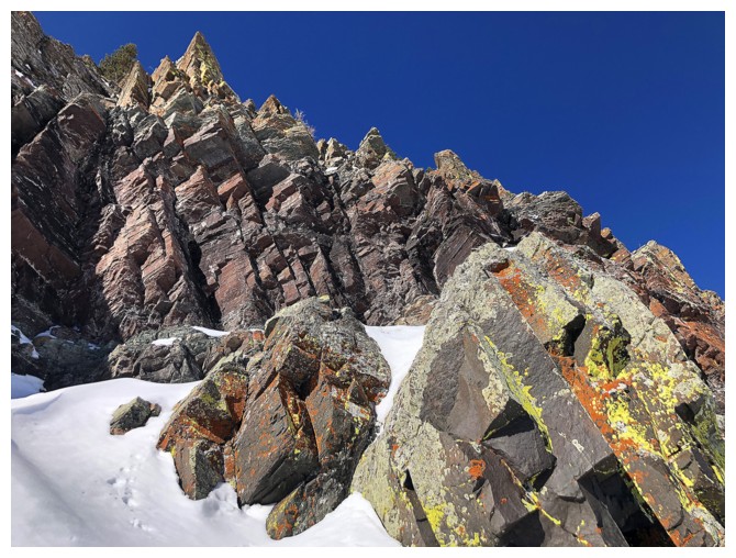
At the top of one of the coolest red argillite rock bands in the area
Wrong time of the day though - this rock band should be seen late in the day, when the Sun is in the western skies
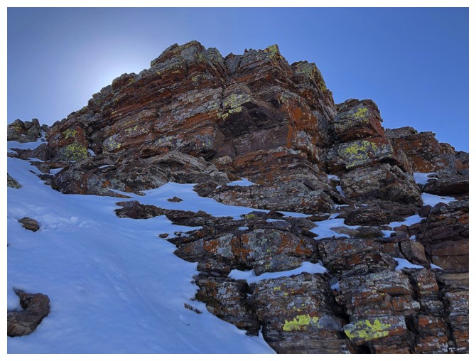
Easy to tell it would look amazing with the Sun shining on it
Looking back to the summit
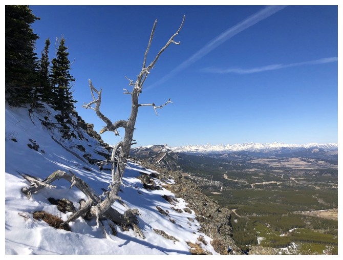
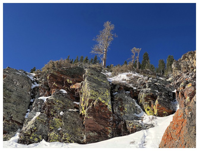
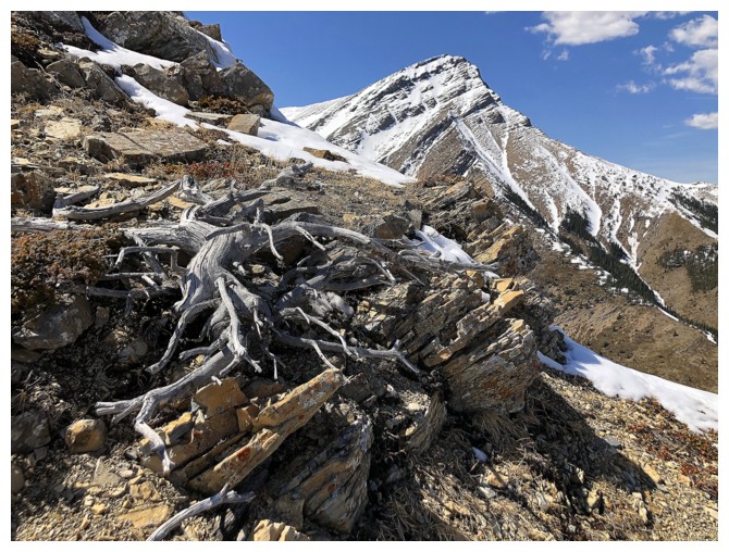
No Castle trip is complete without a dead tree photo
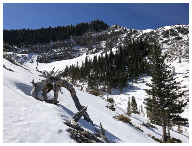
.....or two!
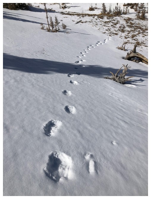
I have some company
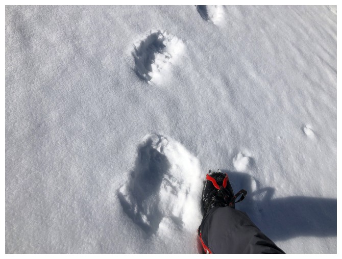
Thankfully the bear was gone, but he/she obviously passed through when
I was on the mountain, as the tracks were not there in the morning
Parting look at one of my favourite areas in the Rockies
Pincher Ridge North Outlier
II
The new start of the Victoria Peak/Ridge trip. "Bridle Peak" (left) and Pincher Ridge in front.
Cinch Hill joins the others
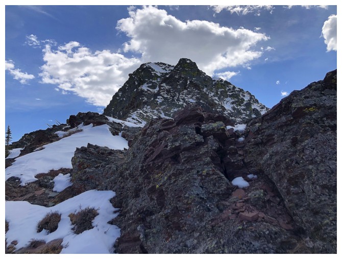
First view of the objective - the North Outlier
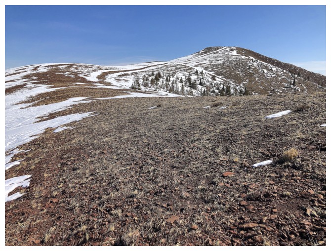
Surprisingly green slopes for mid-April
I did consider following the valley bottom, but eventually opted for the ridge
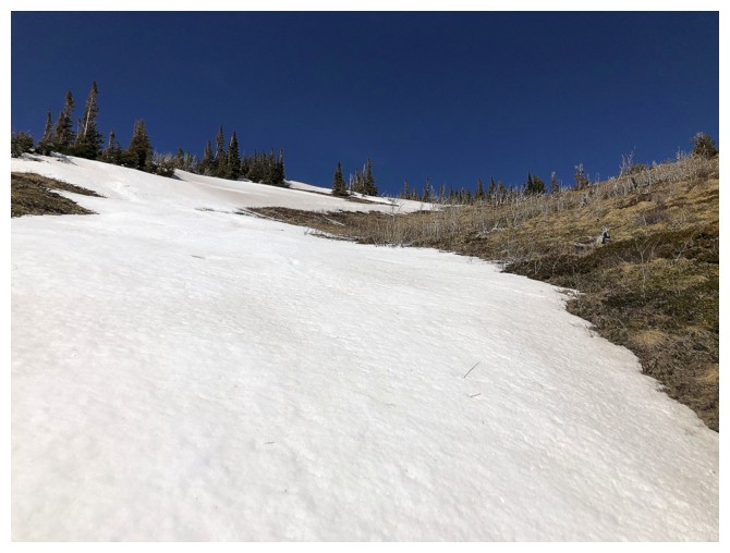
Heading up to the ridge and taking advantage of easy travel up snow slopes
Mark and I attempted to reach the summit of Pincher Ridge from this side many
years ago on what continues to be one of our more epic days
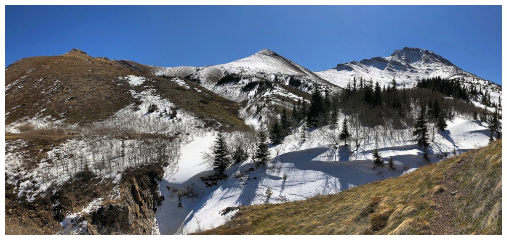
Prairie Sky (left) and Prairie Fire
Looking back down the route
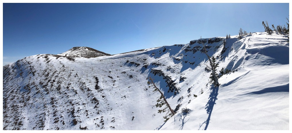
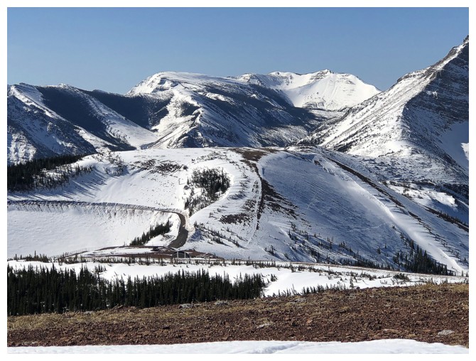
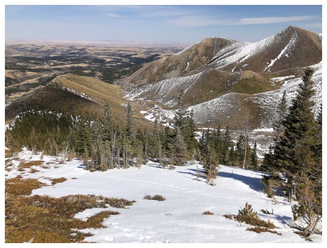
The many peaks of Prairie Bluff and the Victoria Ridge gas road
Victoria Peak is going to be the center of attention from here on in
Yes, she is!
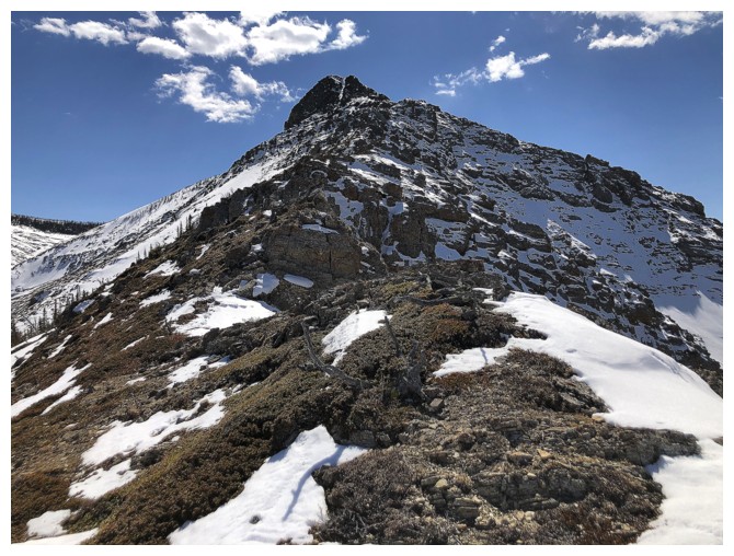
Summit in sight
Cinch Hill, Bridle Peak, and Pincher Ridge
Closing in
This "easy" gully leads to the top
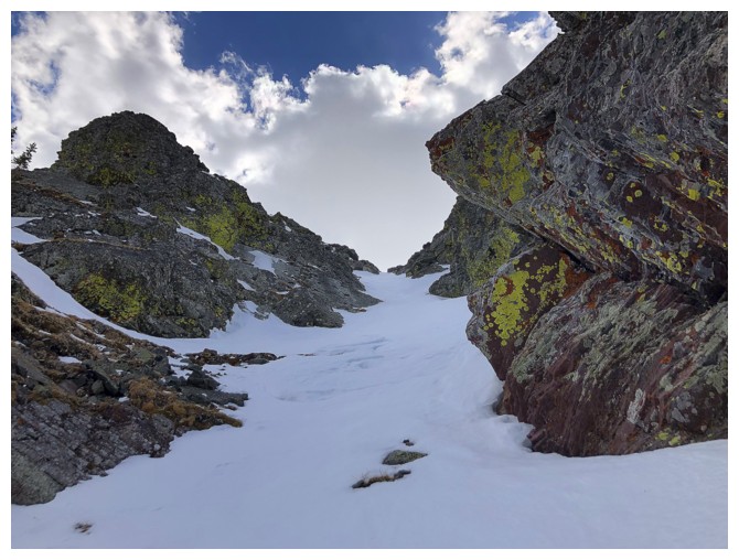
However, it's deceivingly steep and with the deep snow, I put on crampons and used an ice axe
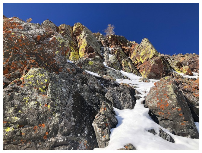
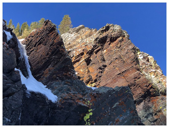
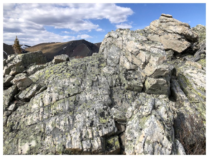
Not surprisingly, there's a lot of colourful rock along the way
At the summit. The view to the west features distant Castle Peak and Windsor Mountain.
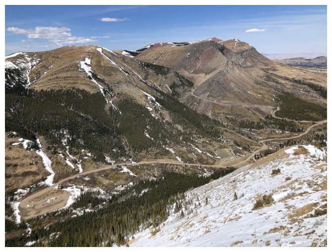
The view to the southwest features much of Pincher Ridge and Victoria Ridge - great route, but now that the trailhead to Victoria has changed, perhaps a less practical one.
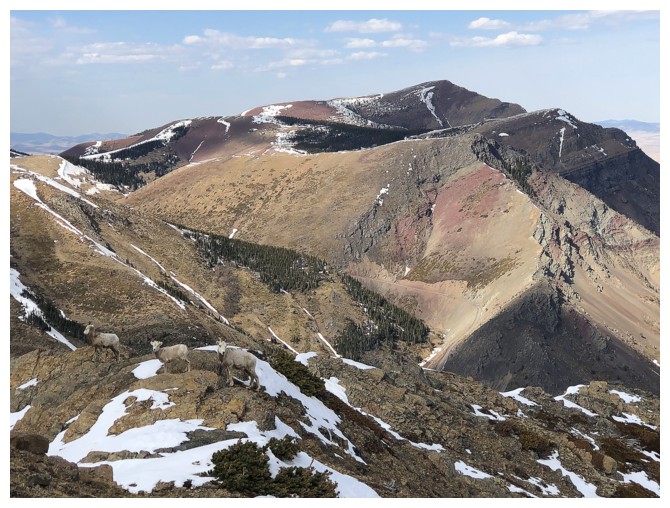
Victoria Peak and Prairie Bluff
4 out of the 5 summits of Prairie Bluff. Prairie Storm is just out of the photo to the left.
Nice section of cool rock on descent
Looking back to the summit
Last look at the outlier (left) and Victoria Peak
The End
LOG