OX Peak
July 1, 2023
Mountain height: 2935 m
Elevation gain: approximately
1200 m
Round-trip time: 9:05
Repeat ascents are no stranger to me. I’m into
double digits for a few mountains and that list is likely to get bigger as I
age and become more conservative in choosing objectives (a process that is already
well under way!).
And then there’s the, “Glad
I did it, but NEVER again” list. OX Peak, an unofficial outlier of unofficial
OXO Peak has made that list, and will never see a repeat ascent from me (in
this lifetime!). 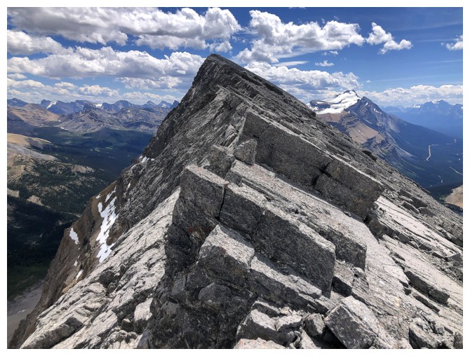 This is not to say OX doesn’t have any redeeming features: the
approach is stunning, the ridgewalk to the top, very enjoyable, and the summit
view is fantastic. Unfortunately, between the stunning approach and the
enjoyable ridgewalk lies a “Whole Lotta’ Ugliness!”
This is not to say OX doesn’t have any redeeming features: the
approach is stunning, the ridgewalk to the top, very enjoyable, and the summit
view is fantastic. Unfortunately, between the stunning approach and the
enjoyable ridgewalk lies a “Whole Lotta’ Ugliness!”
An attempt of OX was inevitable, having already
reached the summits of higher OXO and lower O – all unofficial summits of the
massif east of Dolomite Peak. 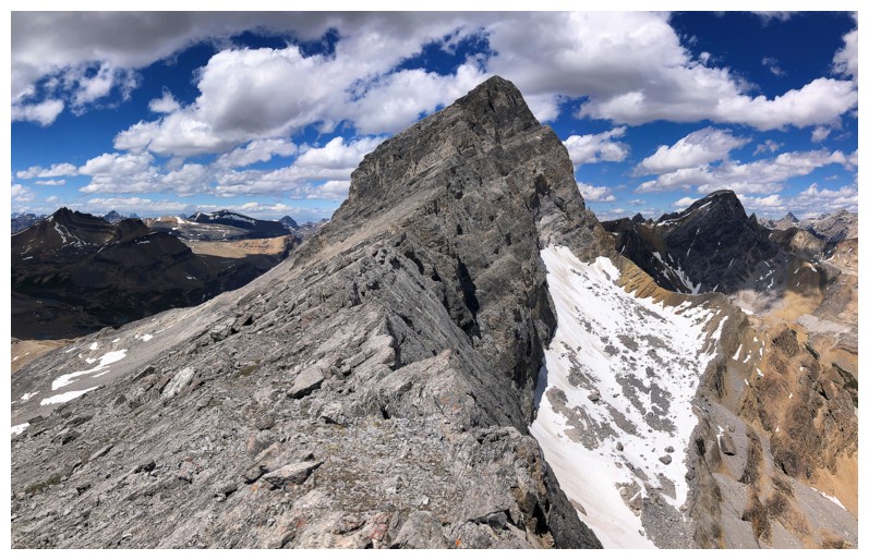 The easiest ascent route appeared to be a
circuitous scree slog starting from near the pass west of OXO. However, I was
hoping a more direct scrambling route would be revealed as I made my way up the
valley. Unfortunately, all potential routes appeared to be blocked by vertical
rock bands. I did eventually pick a promising looking gully and it did, in fact
provide access to the upper slopes of OX, but a thing of beauty it was not,
reminiscent of the challenging terrain on OXO. Steep, slick, hardened dirt
inbetween the sections of solid rock took all the fun out of the scrambling here.
I was definitely not coming down this route.
The easiest ascent route appeared to be a
circuitous scree slog starting from near the pass west of OXO. However, I was
hoping a more direct scrambling route would be revealed as I made my way up the
valley. Unfortunately, all potential routes appeared to be blocked by vertical
rock bands. I did eventually pick a promising looking gully and it did, in fact
provide access to the upper slopes of OX, but a thing of beauty it was not,
reminiscent of the challenging terrain on OXO. Steep, slick, hardened dirt
inbetween the sections of solid rock took all the fun out of the scrambling here.
I was definitely not coming down this route.
At this point of the day I was a little
disillusioned, not only by the unaesthetic nature of the route but also by the
unexpectedly less-than-perfect weather. All forecasts and satellite images had
pointed to Canada Day of 2023 to be cloud-free in this neck of the woods, but a
mix and Sun and cloud was all nature could muster up. Nevertheless, I wasn’t
about to abandon ship yet.
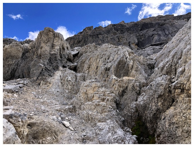
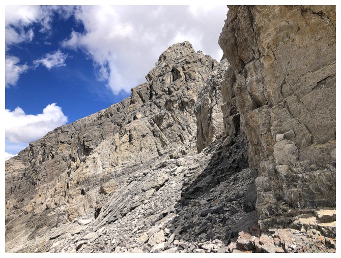
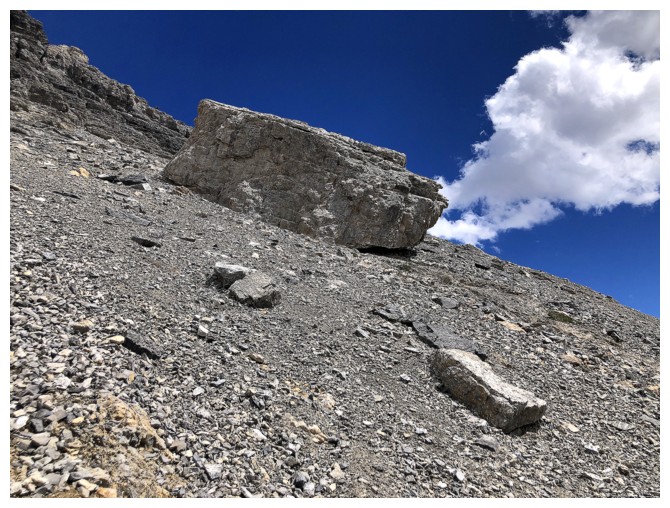
Above the gully, the solid rock was replaced
with tedious scree and rubble, still interspersed with the dirt - hardly an
improvement. I eventually reached the
ridge and started south, towards the summit. Not surprisingly, the summit
wasn’t about to acquiesce easily. A slick downclimb that I dare not attempt
forced me to backtrack, lose elevation and then side-slope across loose rubble
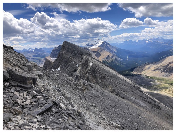
back to the ridge. From that point to the summit was veritable bliss compared
to what preceded it - a pleasant ridge walk, mostly on solid friction slabs
with precipitous views down the east side. The summit view did not disappoint
either, though obviously inferior to that from OXO.
After a very brief summit stay, I did attempt to
see if there was a potential route down the south ridge, but that was
short-lived. I couldn’t even make it to the end of the ridge due to several deep
fissures. The only option was to return the same way. To avoid the steeper
terrain encountered on ascent, I traversed far to the north, ending up on the
lower portions of the OXO ascent route. Besides my waning energy levels, the
remainder of the descent went with relative ease.
Three of the four sections of this trip were
fantastic. Unfortunately, the hideousness of the third one will assure I never
return to OX, as least by that route. But thanks for the memories!
First view of the some of OXO massif. OX Peak at the far and O Peak is the second from the right.
O is the only one I would repeat (in fact I already have!)
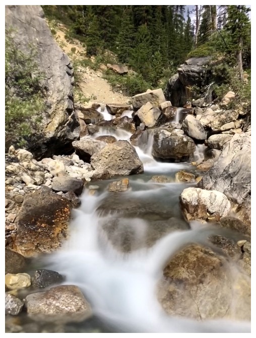
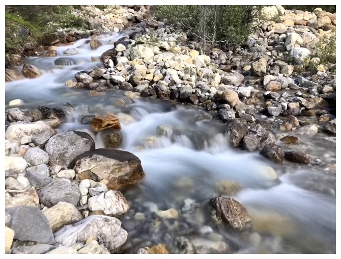
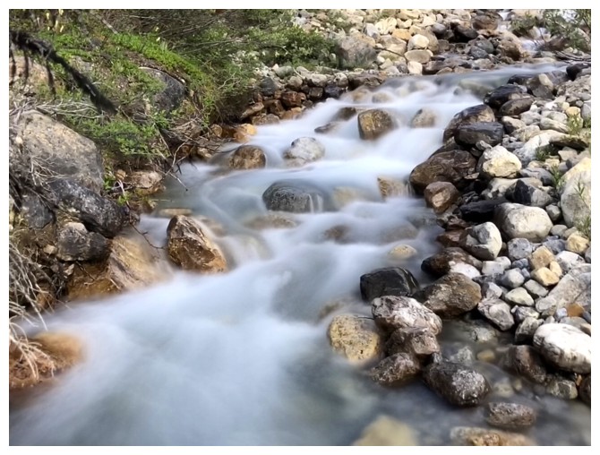
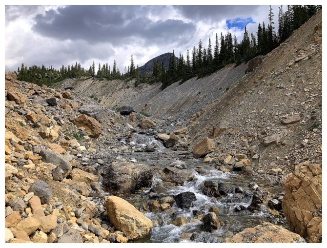
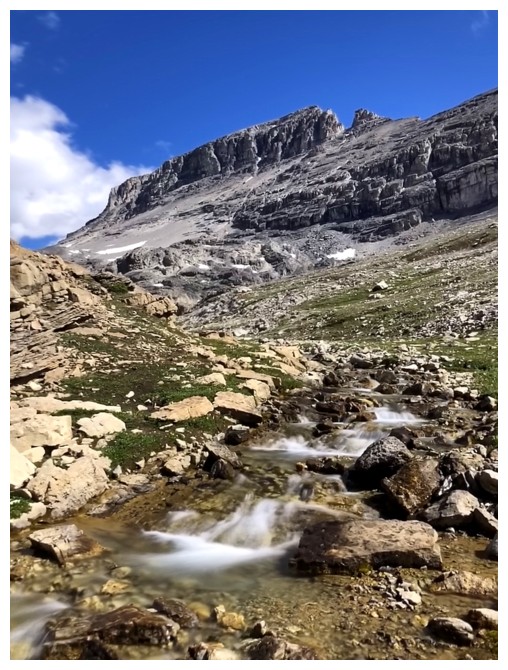
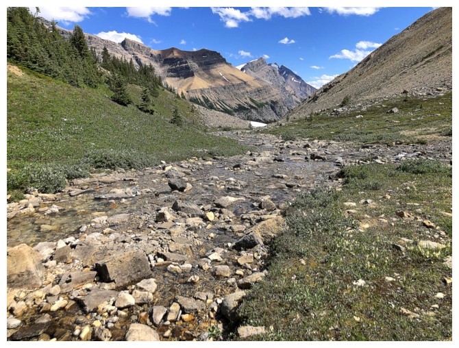
Another exhausting round of long exposure photos of the creek that goes to the OXO valley
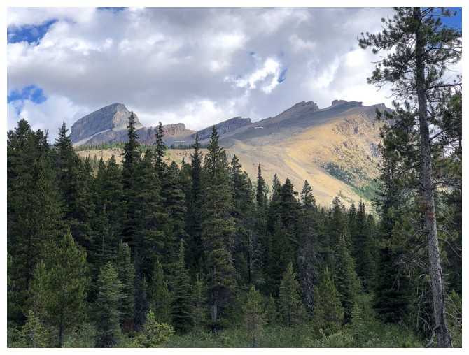
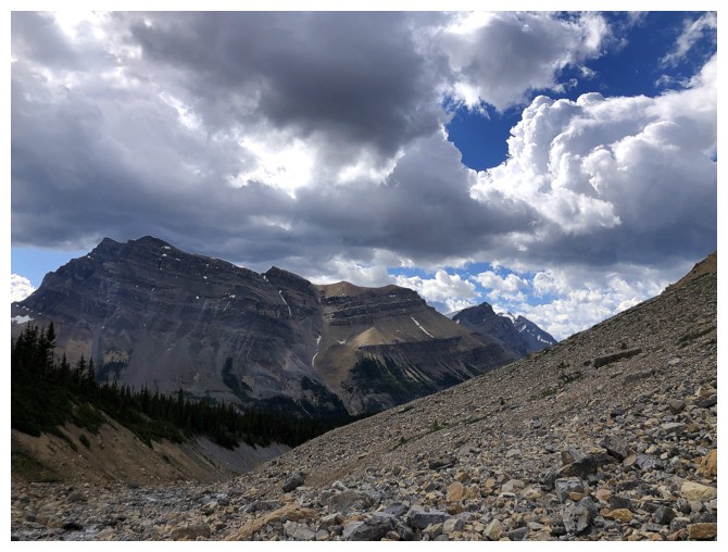
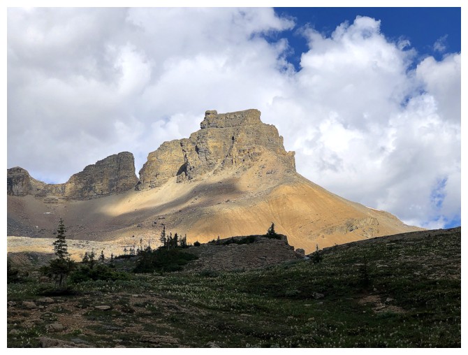
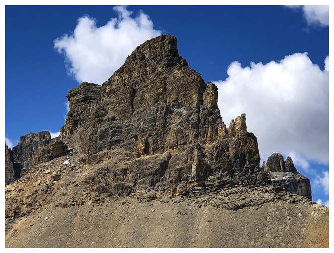
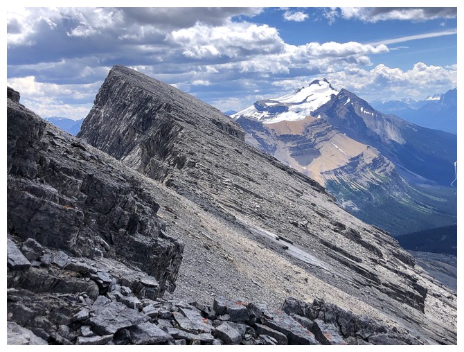
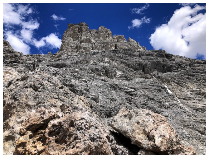
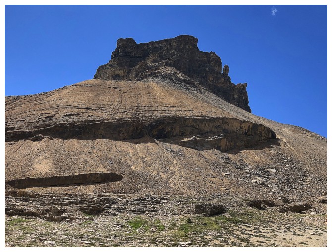
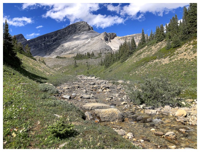
First view of OX
Looking back to Noseeum Peak
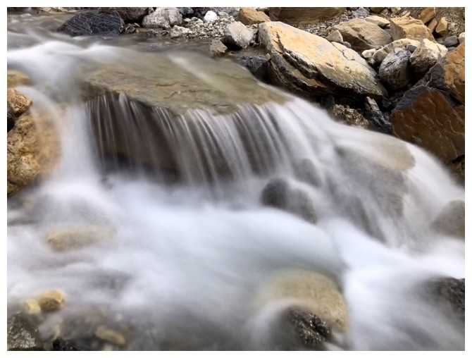
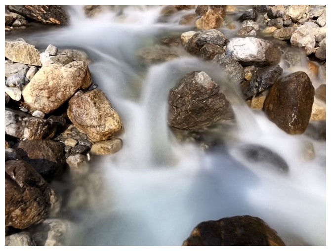
Not yet done with the long exposures!
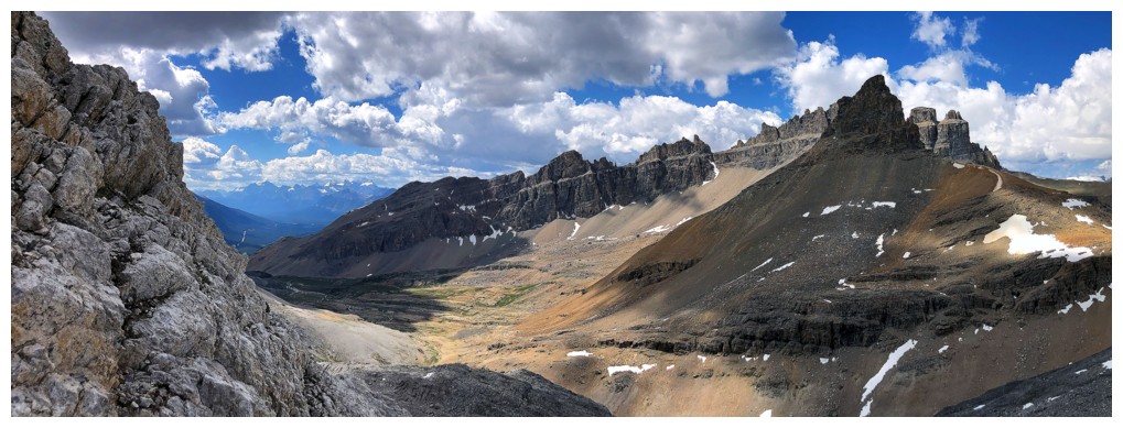
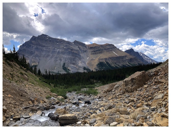
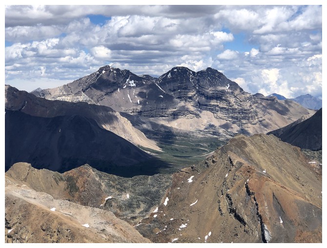
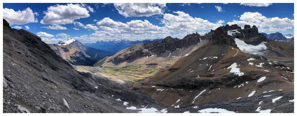
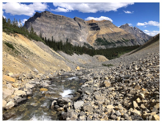
Up and into the OXO valley. Left to right: an impressive outlier of Dolomite Peak, OXO, OX
Scowling at the cloud cover, but at least the one near the right looked cool
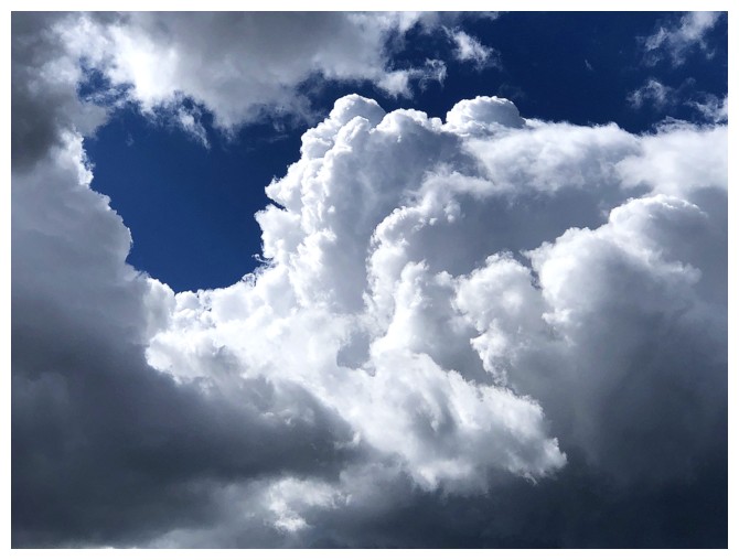
Close-up of the cool one
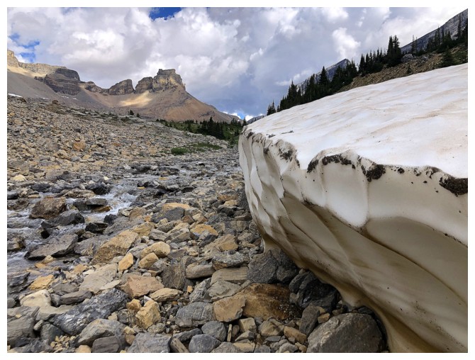
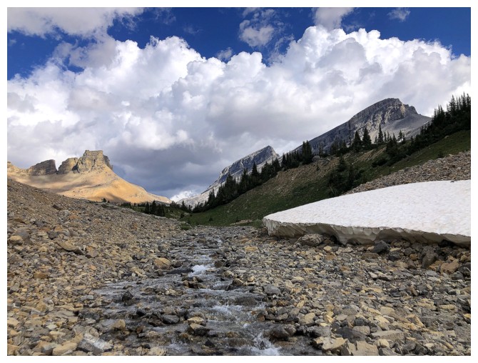
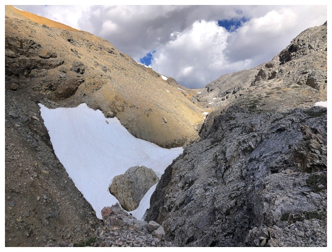
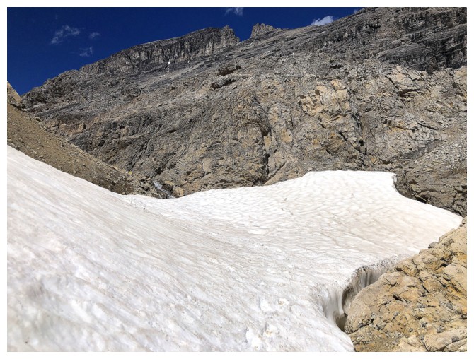
A very tenacious slab of snow hanging onto life and doing a great job of it!
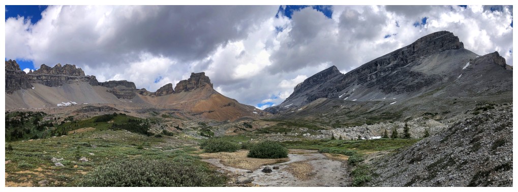
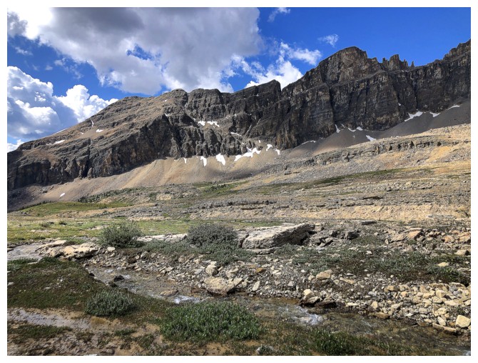
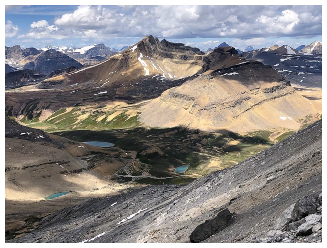
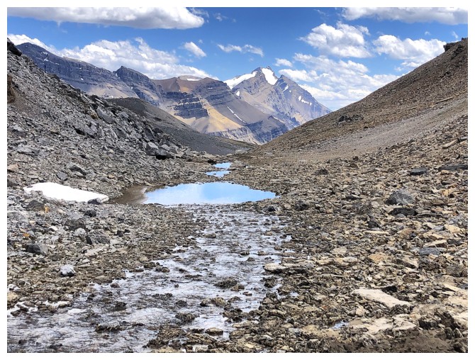
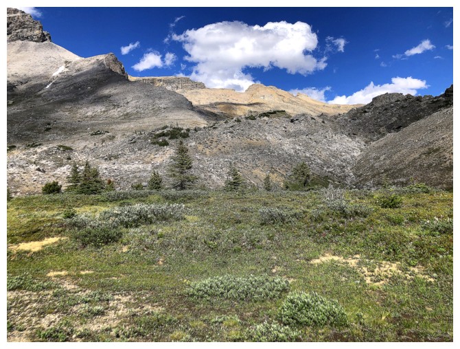
Getting into the heart of this remarkable valley
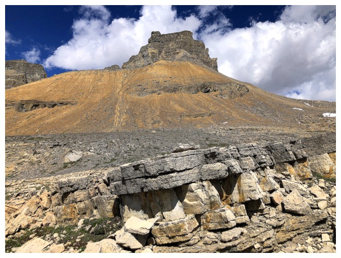
The striking northeast outlier of Dolomite is going to get more photo
attention than anything else on this trip. Let's call it "Dolly"!
The southeast shoulder of Dolomite Peak is a fantastic trip, described in Mike Potter's Ridgewalks in the Canadian Rockies. You can see the point where Mark and I stopped earlier this year - the steep drop-off, just right of centre.
Close-up of the drop
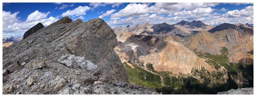
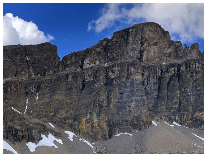
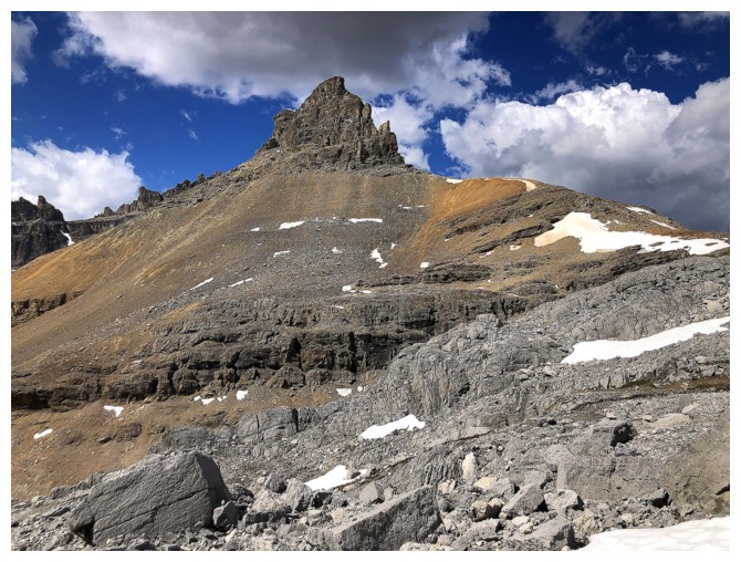
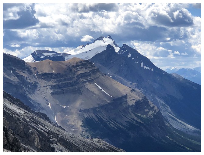
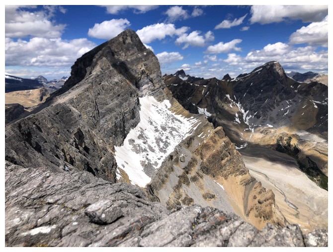
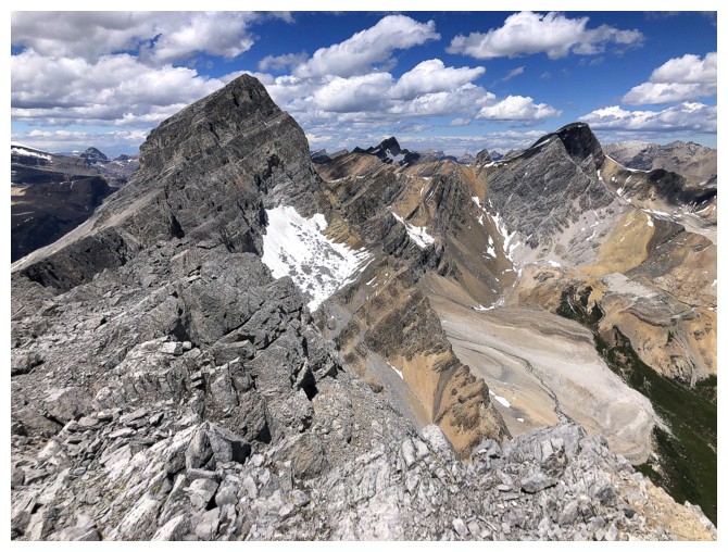
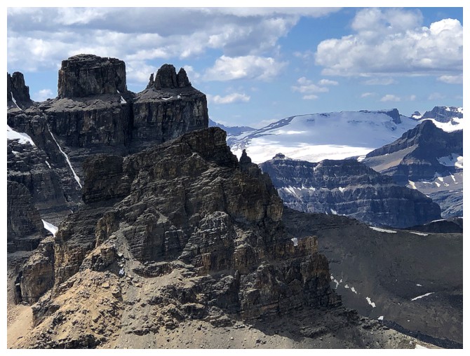
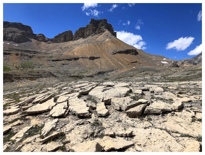
OXO at the left and OX at the right
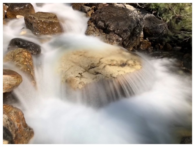
Last opportunity for a long exposure photo! My ascent route would go
between the summit of OXO and the wall of rock to the right.
Dolly
Another tenacious snowpatch in the main drainage
Dolly looking very aesthetic
If it wasn't a lowly outlier, I'm sure Dolly would receive some attention
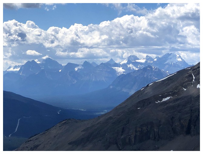
View to the south includes Temple, Lefroy, and Victoria
Mount Hector
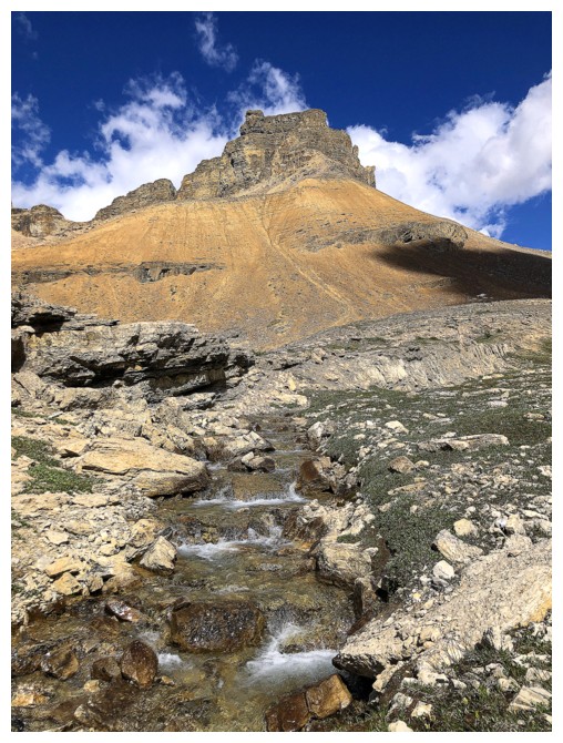
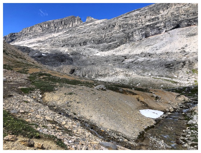
This looked like a good route
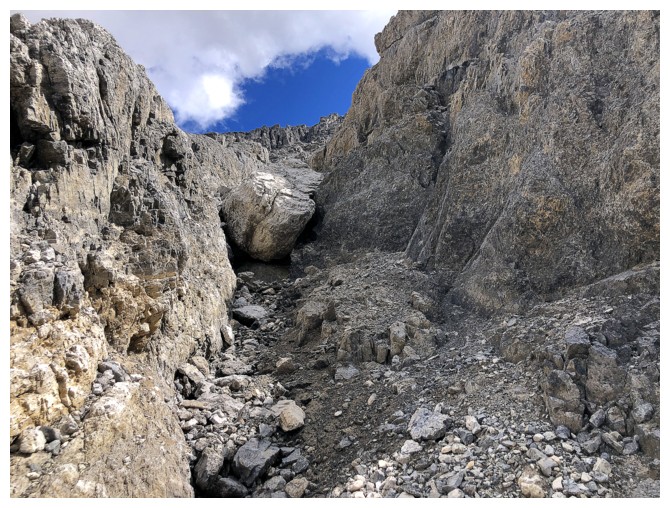
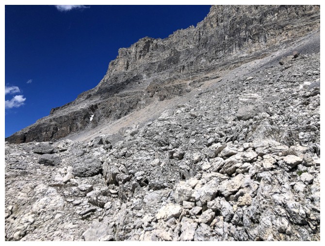
Unfortunately, the ugly moraine-like terrain negated the fun scrambling on solid rock
First glimpse of Cirque Peak
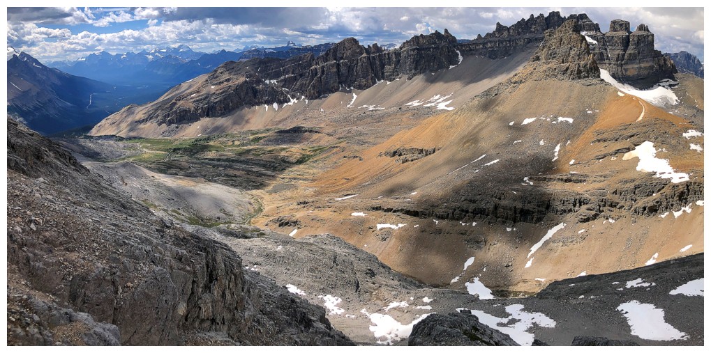
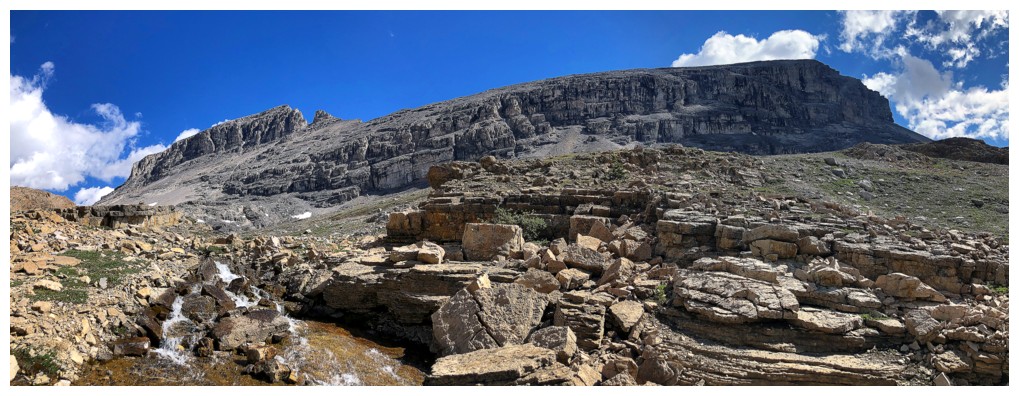
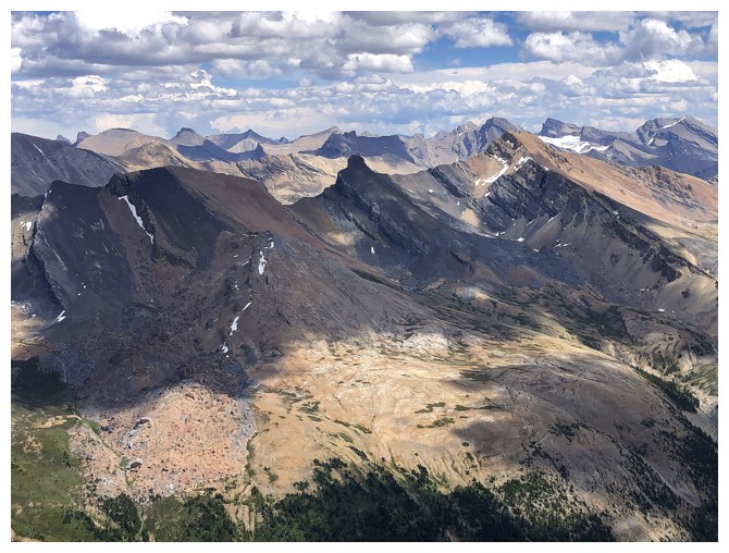
Looking over to the entire east side of Dolomite Peak
Onto even worse terrain. This slope is steeper than it appears and has zero redeeming features.
At least Cirque Peak still looks good
The summit of OXO and the wall of rock. At this point of the ascent I
was only about 100 horizontal metres from the summit of OXO, but over a
kilometres away from OX.
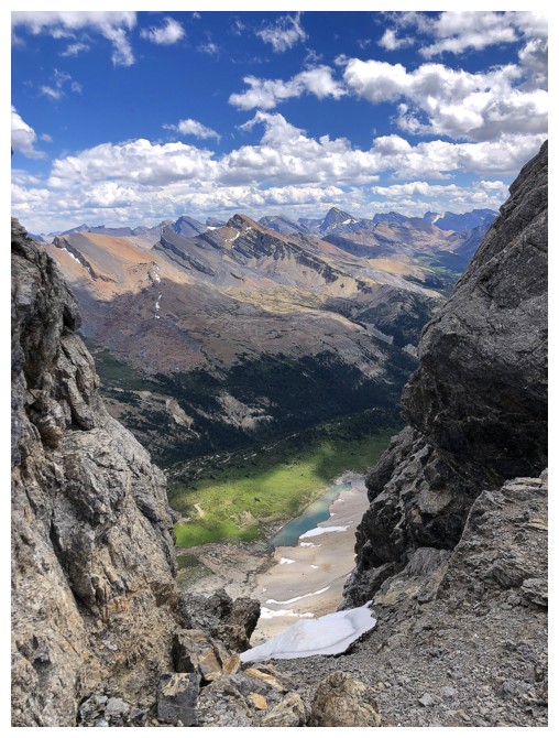
There's OX, but unseen is a tricky downclimb that prevented me from taking a direct route
View to the southeast
Southwest
West
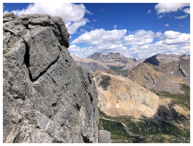
Ready to side-slope to the col
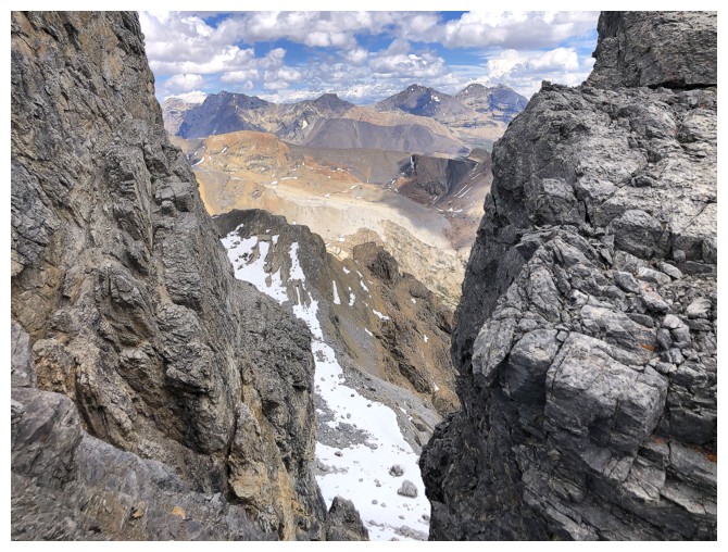
Looking through a gap along the ridge
The east side of the massif is very steep
Another gap, and an unnamed tarn
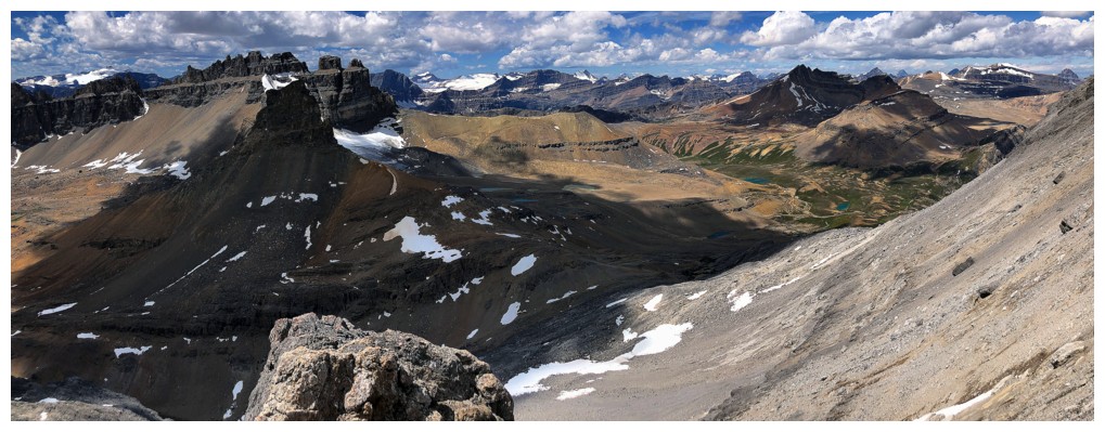
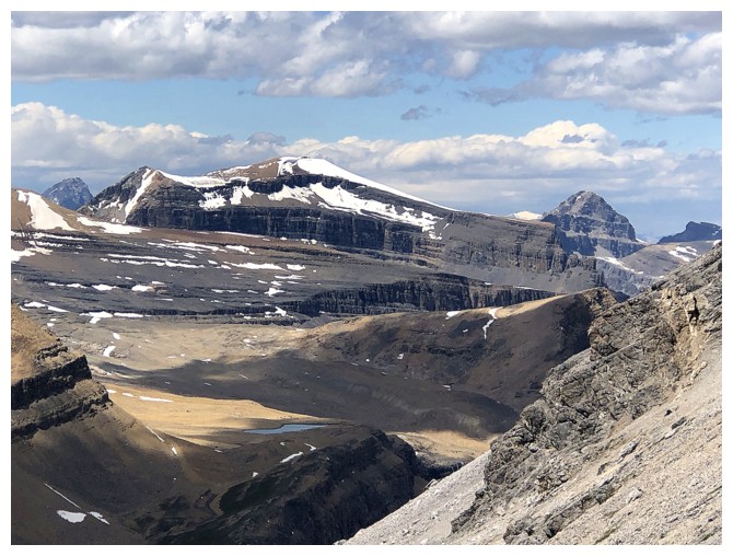
Looking back to OXO. Clearly there used to be a glacier on the east side of the mountain.
Same as above, with more of the view
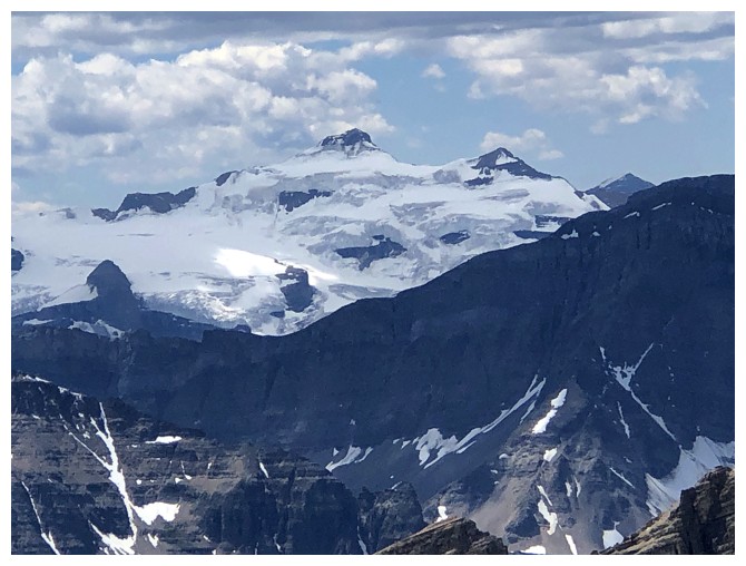
Mount Balfour
Mount Daly (left) and Vaux (distant right) still have glaciers
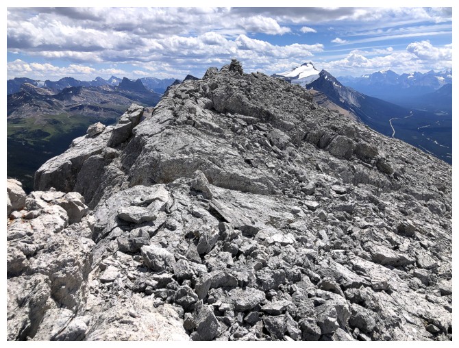
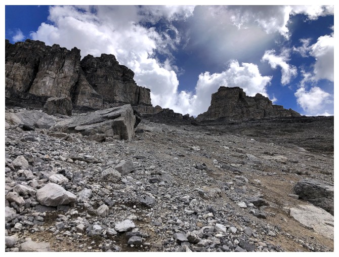
The summit cairn is close
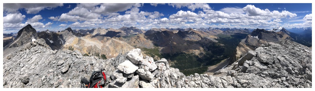
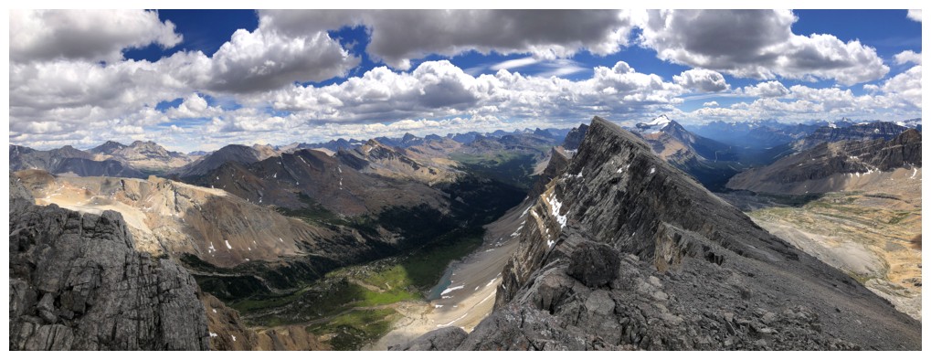
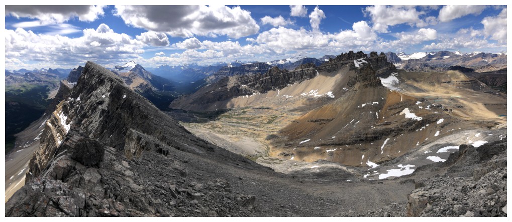
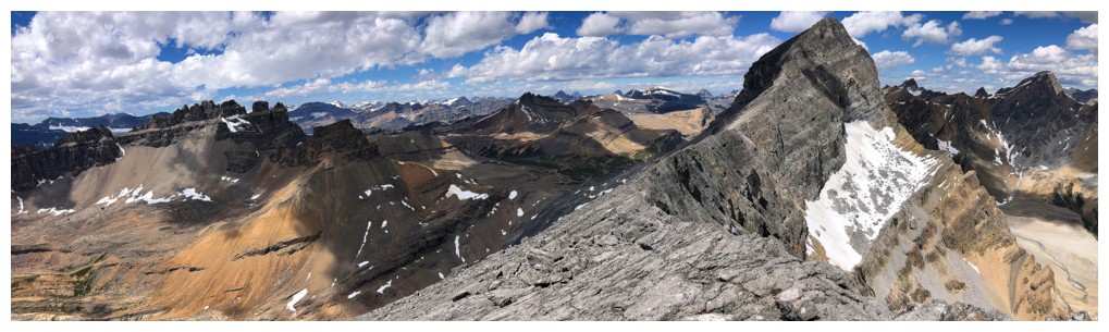
Summit view from north to south
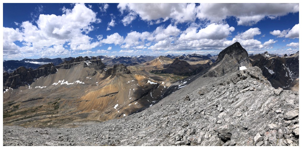
Summit view from southwest to north
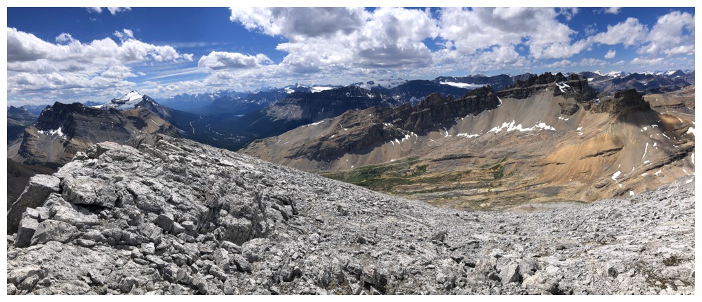
South to west
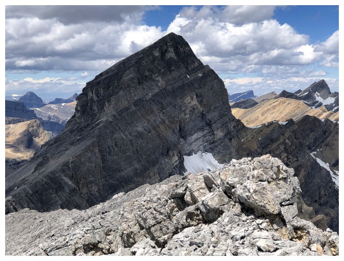
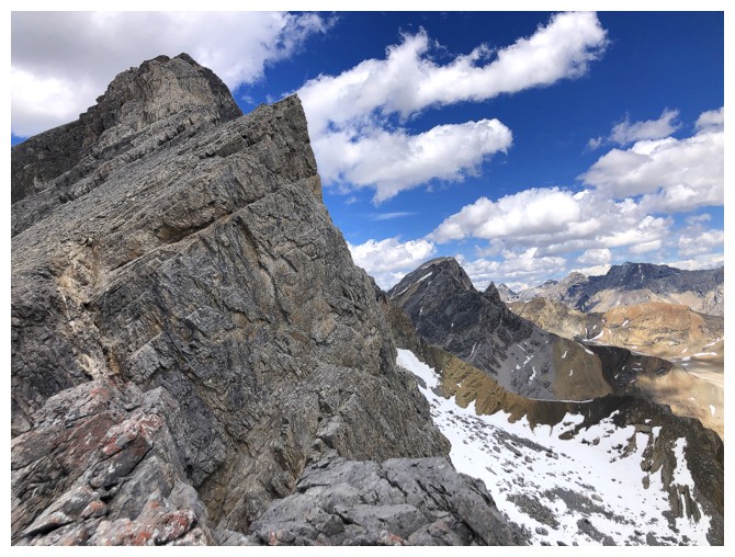
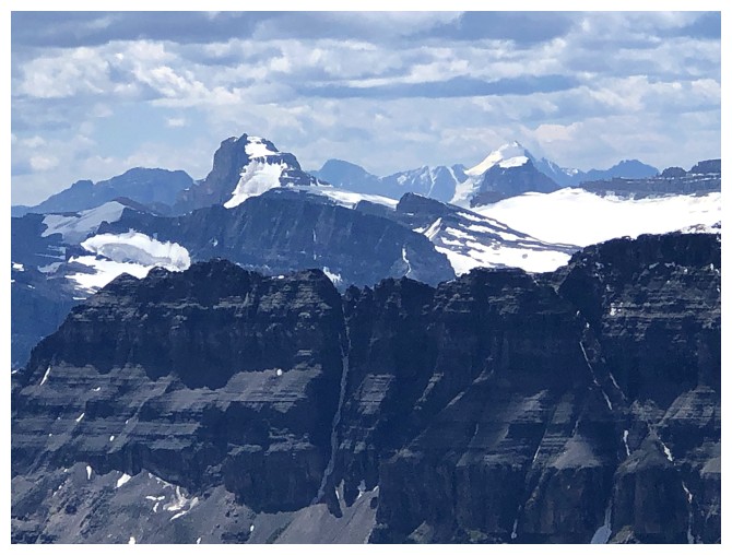
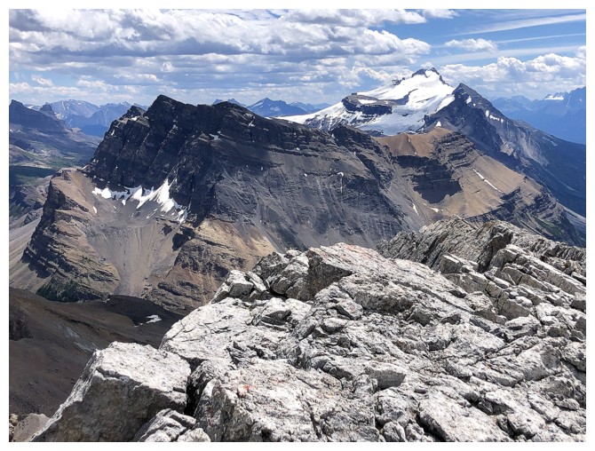
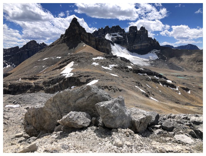
OXO looks menacing, just like it's ascent route!
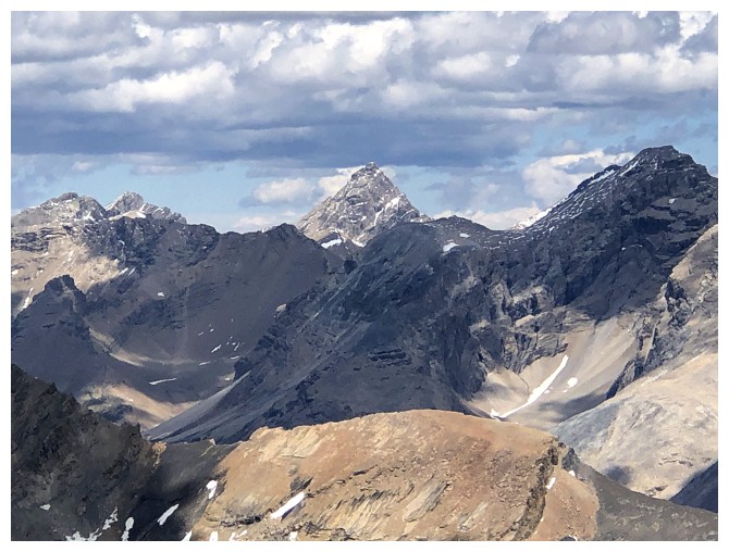
I think that's Recondite in the distant northeast
The Willingdons
Quartzite, Ramp and Mosquito. Still haven't been up Q or R!
Molarstone Mountain in the foreground and Cataract Peak in the distant centre
Noseeum and Hector
Still obsessing with OXO
The Willingdons again
Observation Peak and Mount Weed
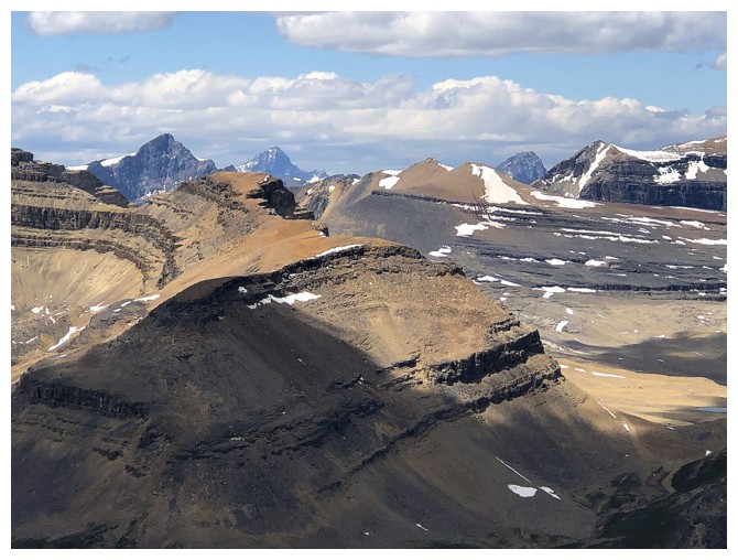
Observation Subpeak in the centre, Patterson at the left and Forbes to the right of Patterson.
The north end of Dolomite and a small portion of the Wapta Icefield
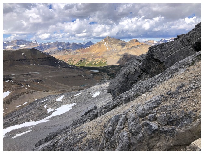
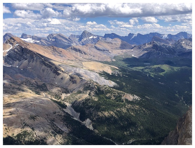
Scenes on descent
Same as above
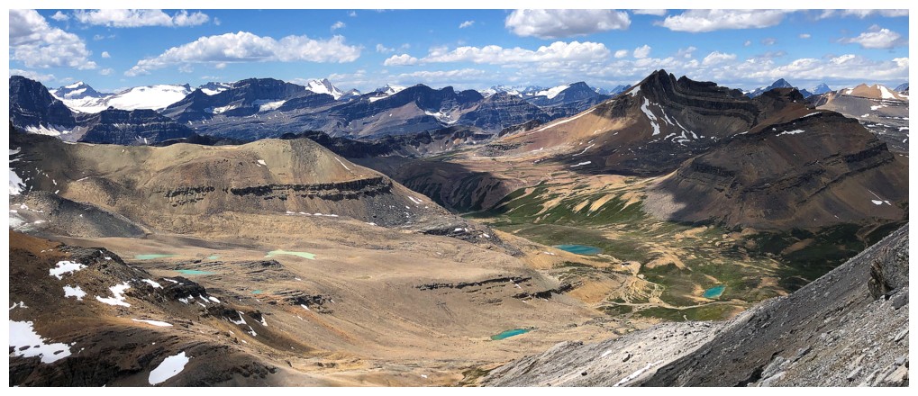
There are several colourful tarns in the valley southeast of Cirque
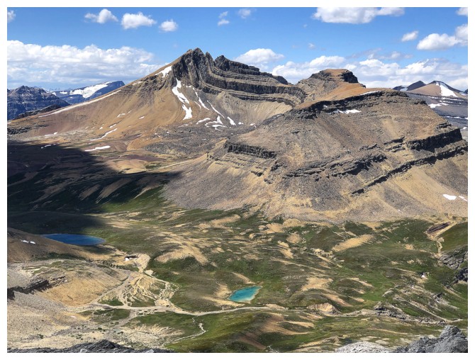
Cirque and two of the tarns
Back to the Dolly fixation
Looking up the start of the ascent route for OXO
Below the col and heading back
That snow bank in the drainage I saw earlier
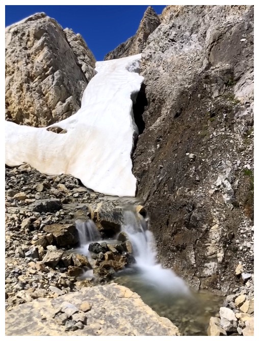
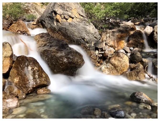
Last long exposure photo
Last look at the unpleasant ascent route
At least Dolly is giving me some joy
Yes she is!
Glance over to O Peak
Pleasant hike out
Last look at OX
And Noseeum once again
The End
LOG