The Amoeba II
The Amoebet
Barnaby Ridge II
May 3, 2025
Mountain heights: 2465
m, 2380 m, 2474 m
Total elevation gain: approximately 1300 m
Ascent time to
The Amoeba: 4:40
Traverse time
to The Amoebet: 0:55
Traverse time
to Barnaby Ridge: 1:30
Descent time:
1:50
Solo scramble.
The Amoeba II
Ever since our
first ascent in 2008, Barnaby Ridge has held a certain fascination for me –
it’s like a Transformer; that is, “More than meets the eye”!
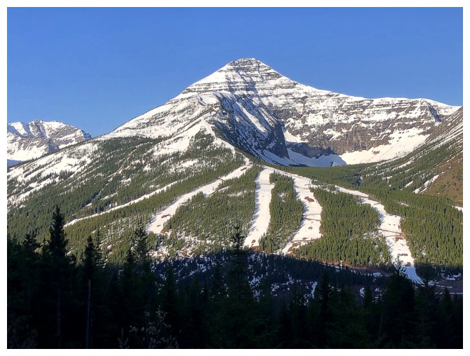
Though fairly
pedestrian-looking from the Castle Mountain Ski Resort, Barnaby’s west
side is
home to many interesting rock features, as we found out in what seems
like another lifetime! In addition to the highest point, the Barnaby
massif is also home to a summit of similar height that locals call "The
Amoeba". Given The Amoeba is essentially a giant blob of red argillite
rock, it held as much interest to me as the true summit.
I didn’t have a
specific route in mind until I arrived at the Castle Mountain Ski Resort –
straight up from there would be the plan. Hopefully this would take me to a
point just north of The Amoeba. 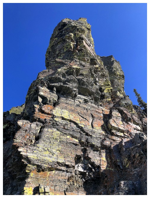 I would then ascend the “big red blob”,
traverse over to the highpoint of Barnaby Ridge, and return the same way I came
up. That was the plan, and it did, more or less, come to fruition.
I would then ascend the “big red blob”,
traverse over to the highpoint of Barnaby Ridge, and return the same way I came
up. That was the plan, and it did, more or less, come to fruition.
Not without a
stroke of good fortune, however. The big question mark for the route would be
the negotiability of the forest between the trailhead and the open slopes
above. If resistance was encountered, I would have to back down and find
another route. Resistance, in the form of endless deadfall was initially
encountered, but I very soon and very fortuitously ran into a terrific trail
that some brave soul(s) had chainsawed their way through the mess. The trail
eventually veered off in a direction I didn’t want to go, but by then the
forest was essentially below me.
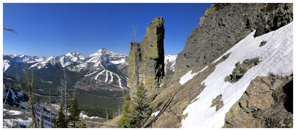
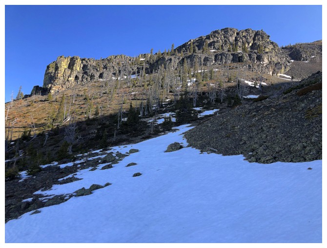
Above treeline,
the trip evolved into a wild ride of outrageously cool scenery in almost every
form (unfortunately, lake views or visits were absent).  The first part turned
out to be remarkably similar to our 2008 trip, in that we started in a drainage
but were lured by pinnacles of lichen-covered rock onto a super interesting
ridge. I was lured again by similar pinnacles, did a little exploration, then gained a west-east
ridge above and followed it up to the north-south ridge of Barnaby. I ended up
hitting the ridge relatively close to the summit of Southfork Mountain but
opted to skip running over there. A long day with more potential detours was
already in the making.
The first part turned
out to be remarkably similar to our 2008 trip, in that we started in a drainage
but were lured by pinnacles of lichen-covered rock onto a super interesting
ridge. I was lured again by similar pinnacles, did a little exploration, then gained a west-east
ridge above and followed it up to the north-south ridge of Barnaby. I ended up
hitting the ridge relatively close to the summit of Southfork Mountain but
opted to skip running over there. A long day with more potential detours was
already in the making.
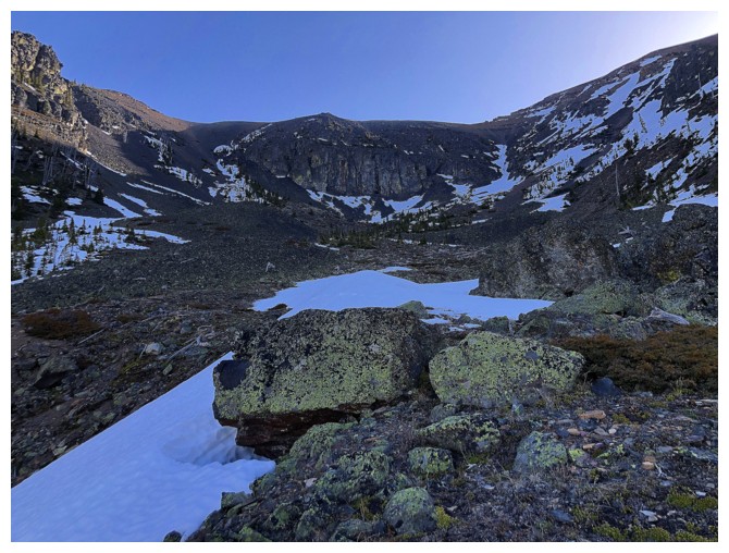
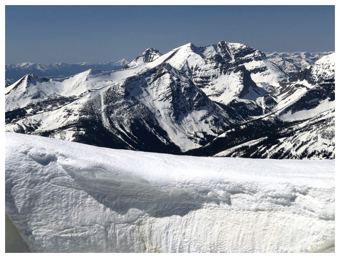
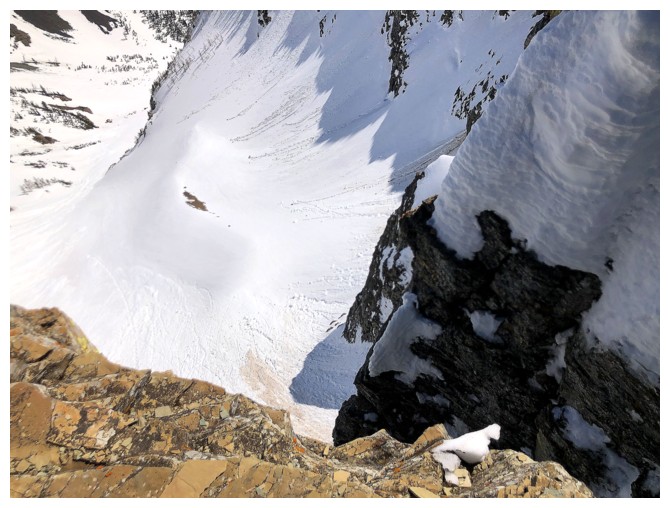
The second
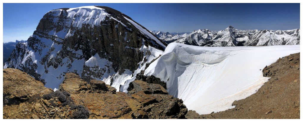
detour occurred immediately. Upon arriving at the col north of the Amoeba, it
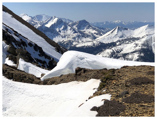
became apparent that the east side of the mountain was still adorned with impressive
cornices. Ascending the ridge to the north provided great views of several
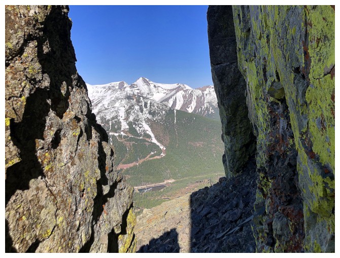
shapely snow formations, defying gravity to their bitter end. I then turned
south towards the summit of The Amoeba, again enjoying snowy and vertiginous
views down the east side and the usual array of colourful rock.
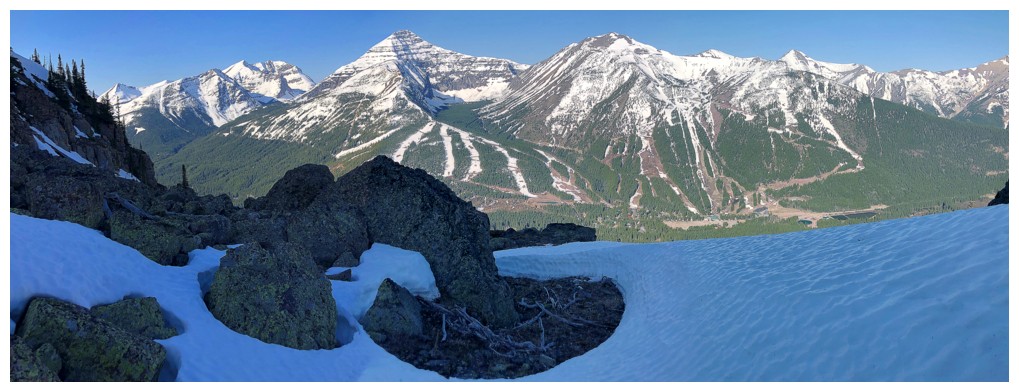
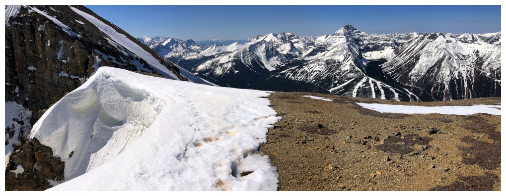
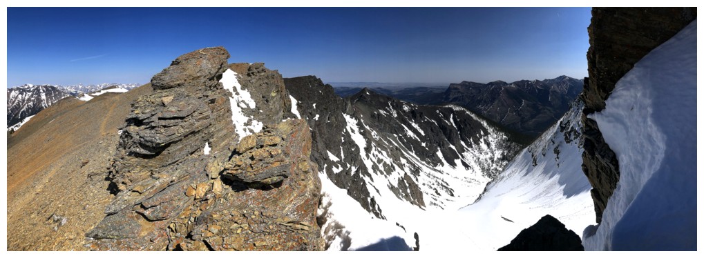
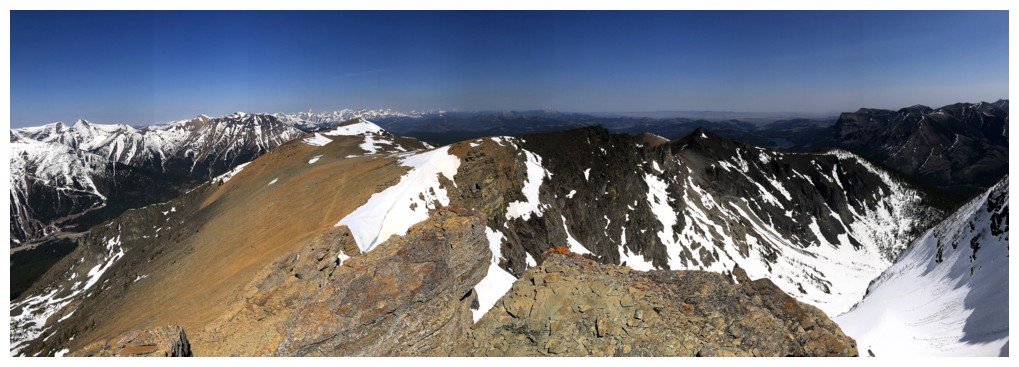
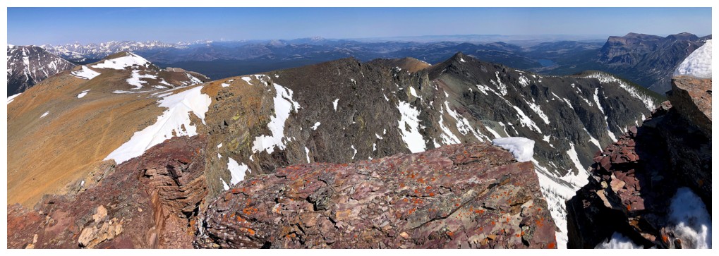
An expectedly
magnificent panorama under clear, blue skies awaited at the top. I didn’t stay
long, however, as the detours had already added over an hour to the trip. On to
Barnaby... (to be continued)
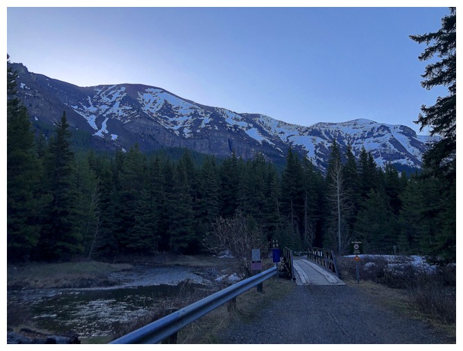
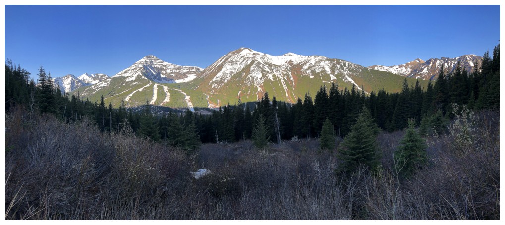
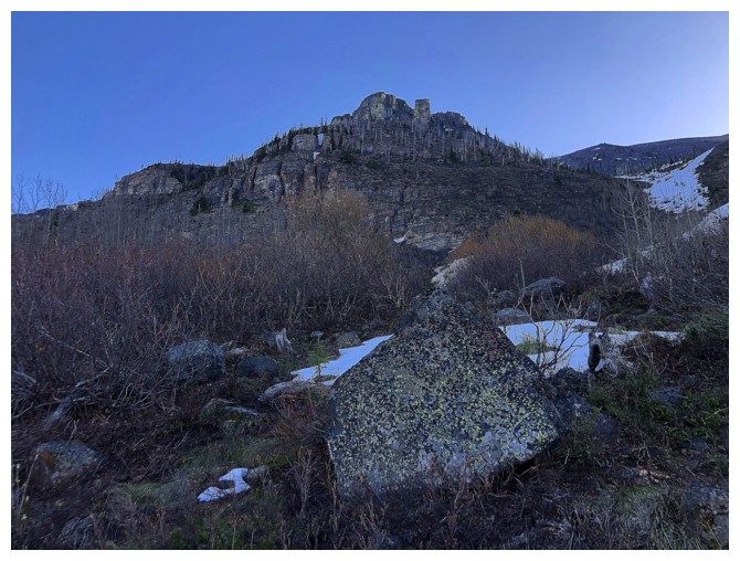
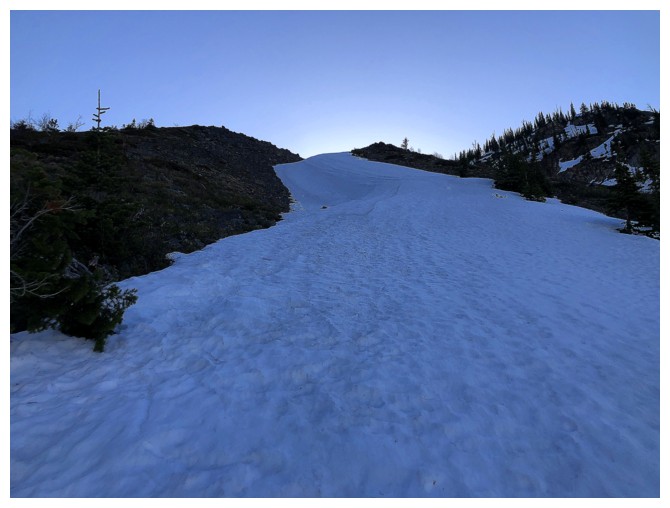
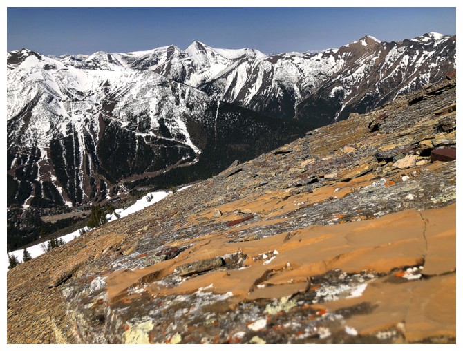
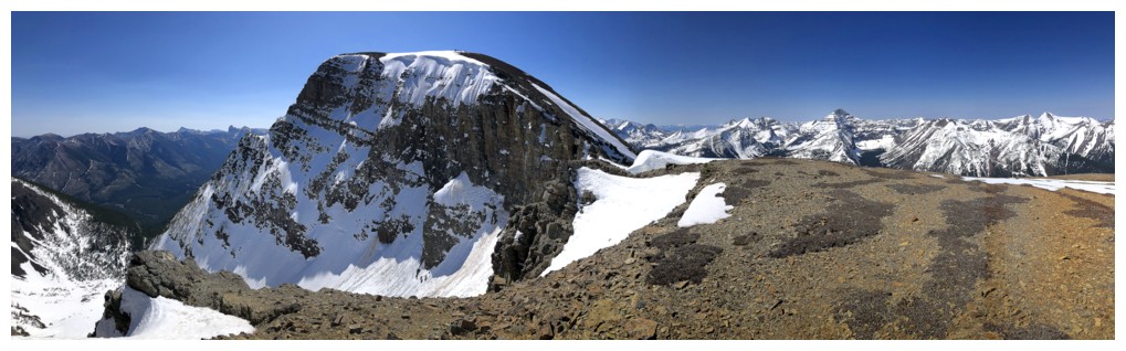
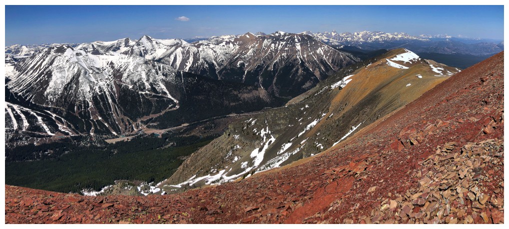
At the trailhead. The route goes into the forest and then up the left
side. The Amoeba is at the left and the true summit of Barnaby at the
right.
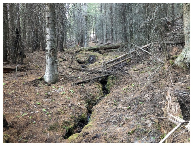
On a faint trail through the forest
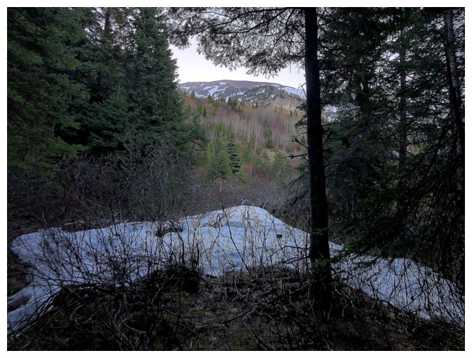
Emerging from the forest
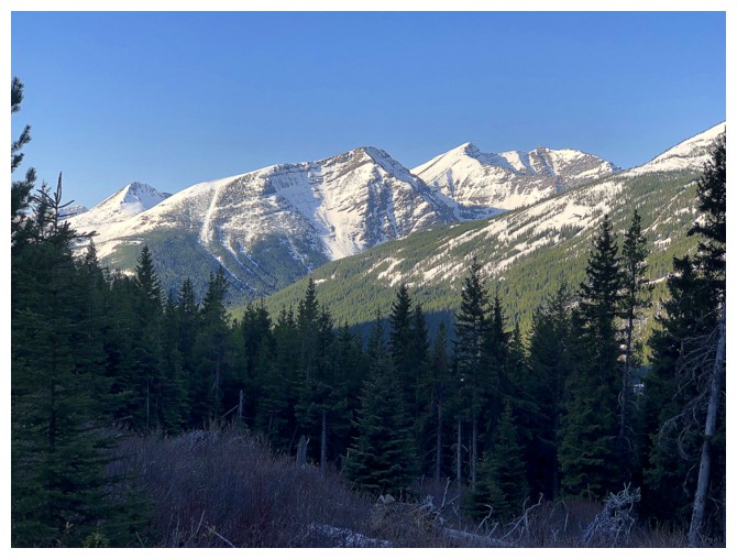
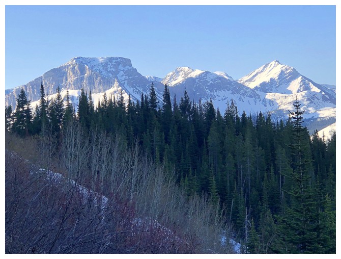
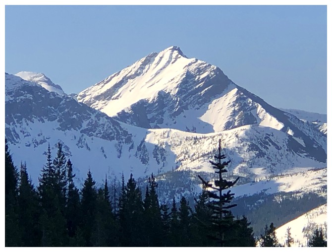
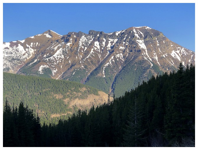
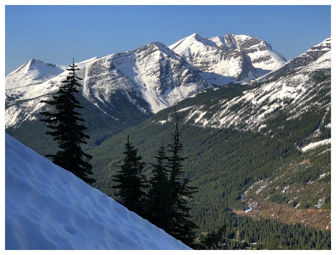
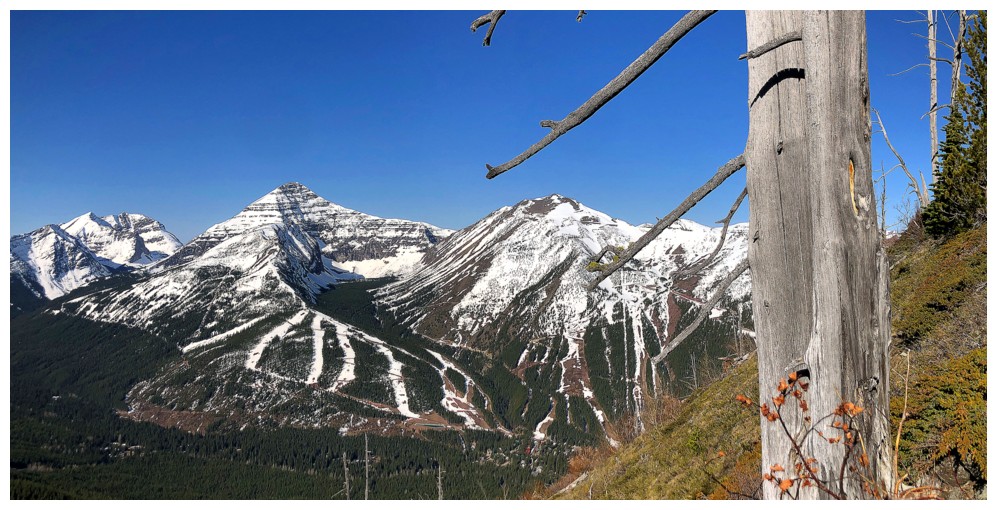
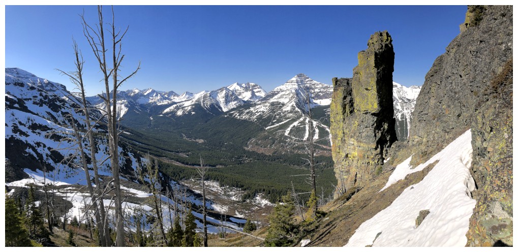
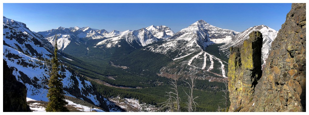
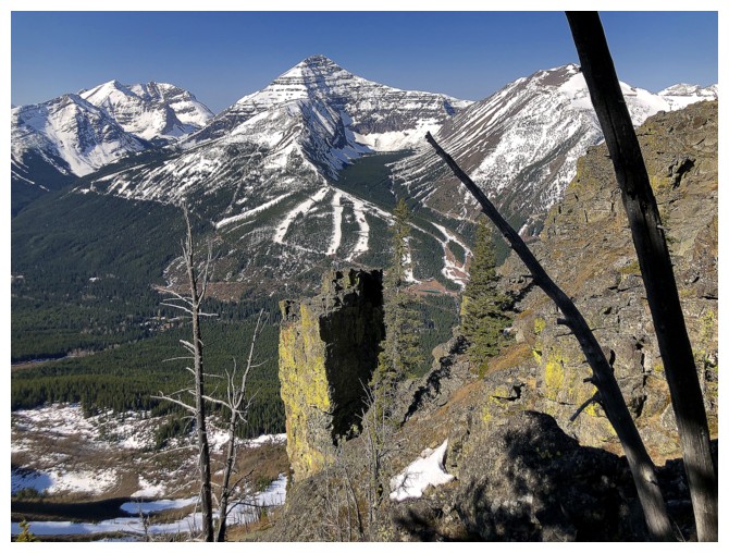
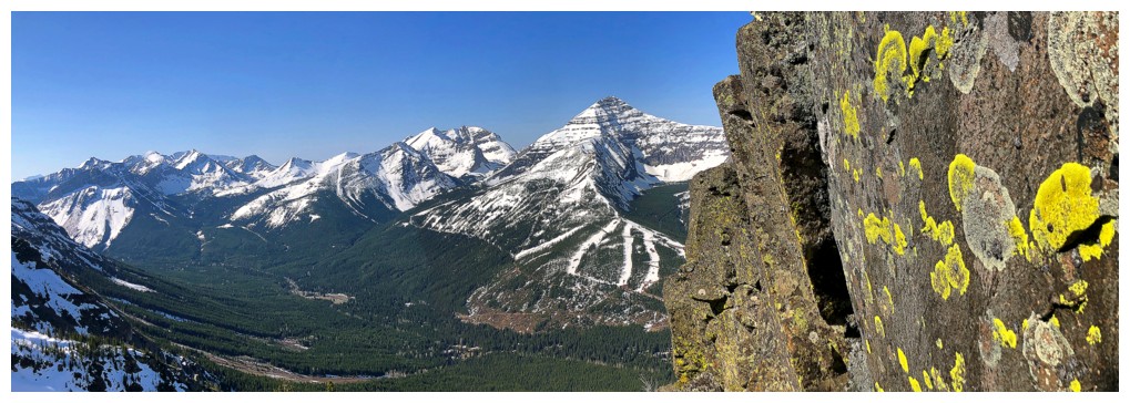
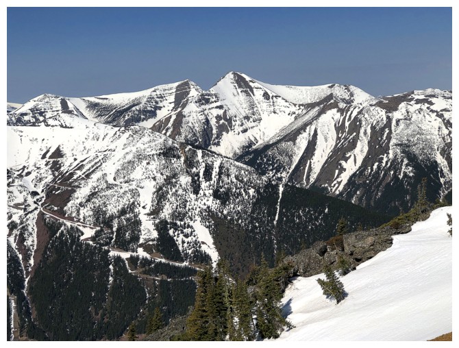
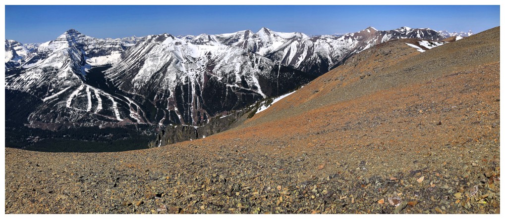
Little Middle Kootenay Peak (centre) and Middle Kootenay Mountain (right) are immediately recognizable
More of the view to the west is revealed. Mount Haig near the left and Gravenstafel Ridge in the centre.
Magnificent Mount Haig
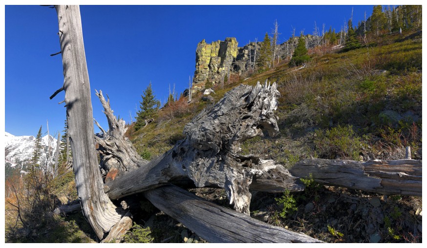
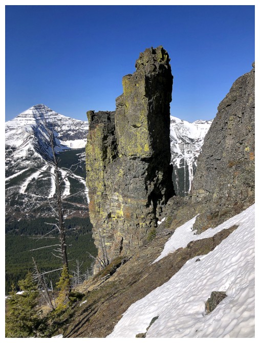
Heading up a drainage between ridges. An interesting rock band makes an appearance high above.
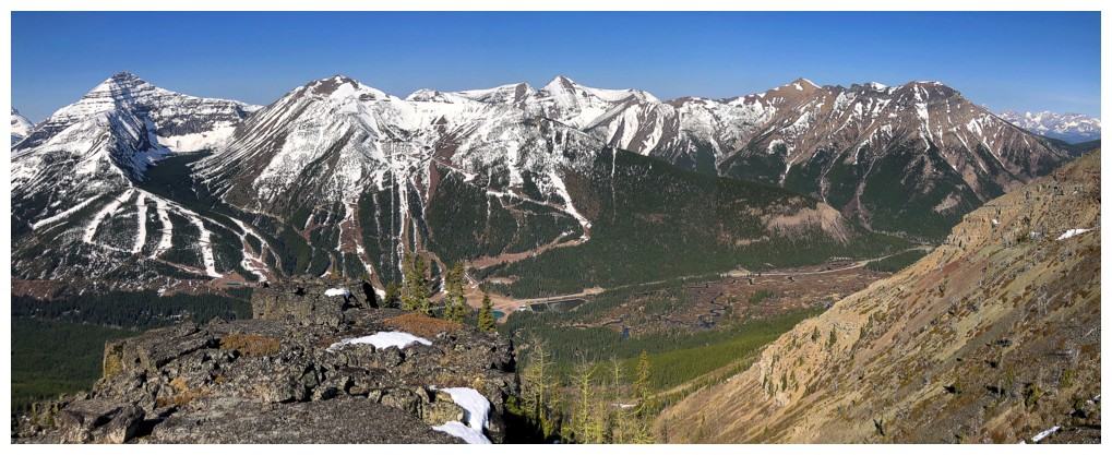
Rainy Ridge (North Outlier), Rainy Ridge, and Three Lakes Ridge
Three Lakes Ridge has an awesome ascent route up cool slabs
The North Outlier was cool but I'm unlikely to repeat the route
Middle Kootenay Mountain - still a winter favourite
Haig and a scary tree
Getting closer to that rock band
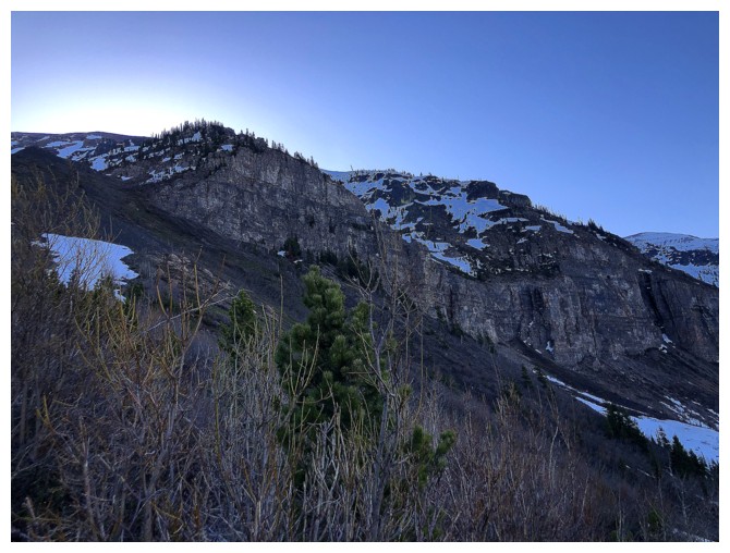
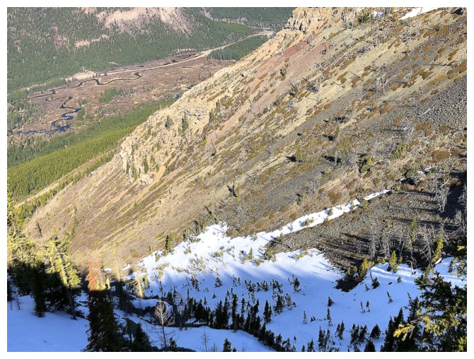
The rock band on the other side of the drainage also had lots of
potential for exploration, but it would be in the shade for most of the
day
The route ahead up the drainage. Initially, the plan was to go straight
up but the closer I got to the rock band on the left, the more I was
lured by it's lichen wiles!
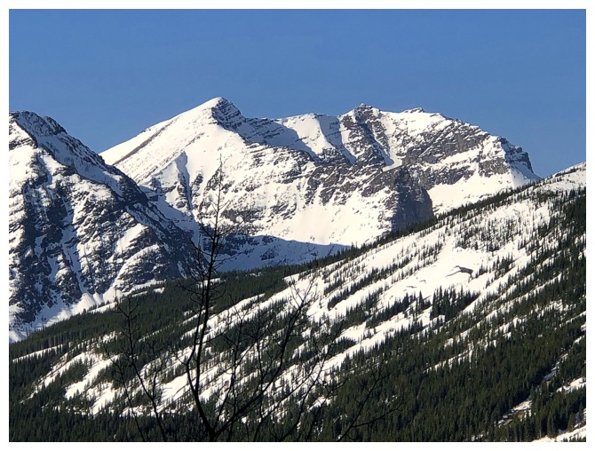
Two of the three summits of Mount Syncline
Ascending the firm snow made travel easier here
Still enjoying views of Little and Middle Kootenay
And the whole area, for that matter
The Sun is starting to shine on that rock band and its lure will be too great
The route straight up looks relatively easy and would make a good descent route
One more of that sweet view to the west
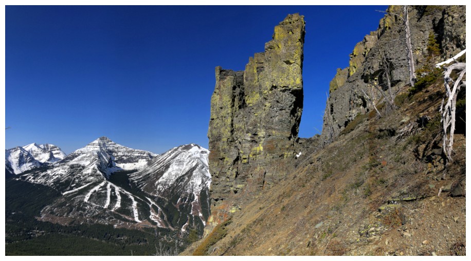
Leaving the intended route for the left side of the lichen-covered rock bands
Zoomed in photo of "the lure"
Travel to the pinnacles was generally easy and interrupted several times by other cool features

Same as above
And again
Ditto
Easy to see, at this point, why I left the original ascent route
Even easier
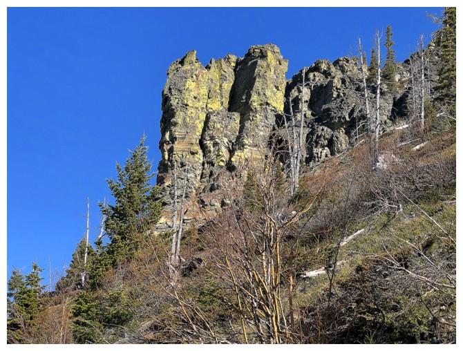
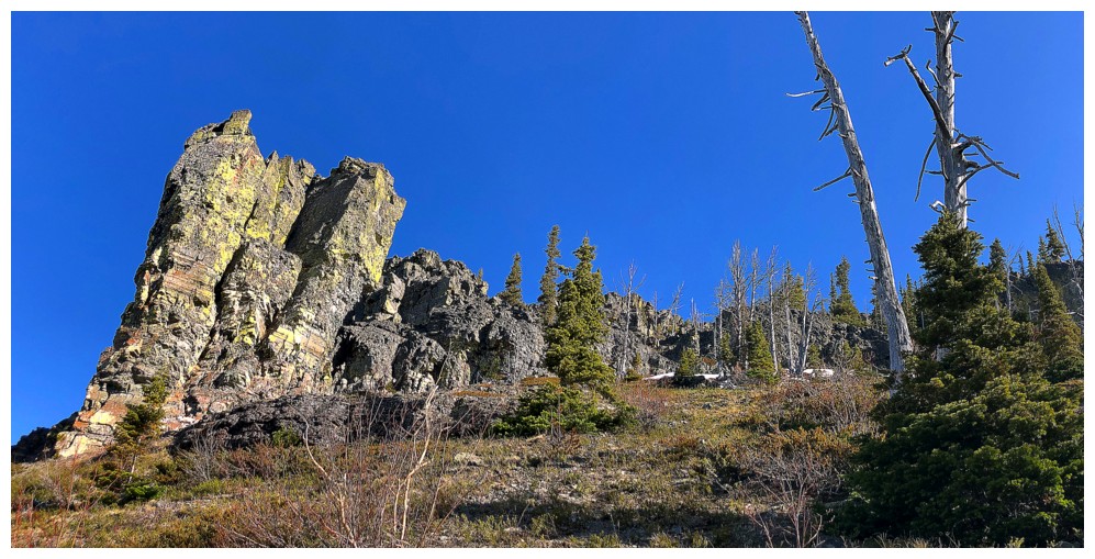
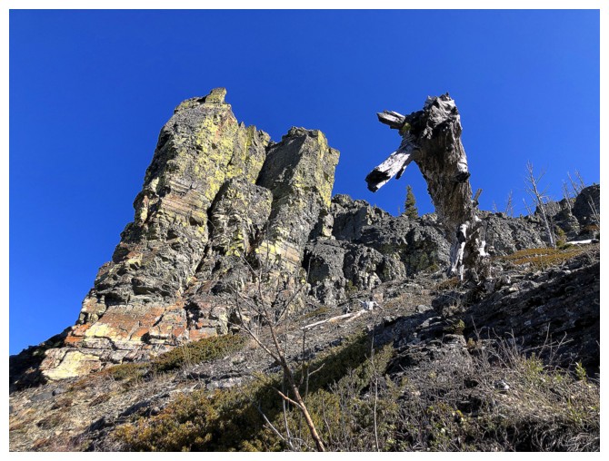
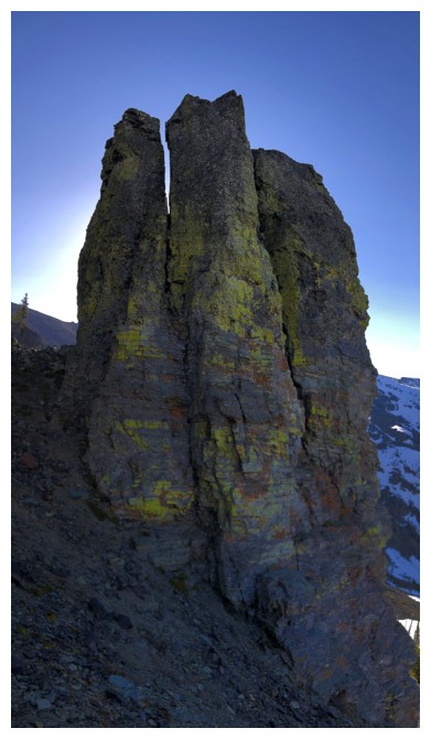
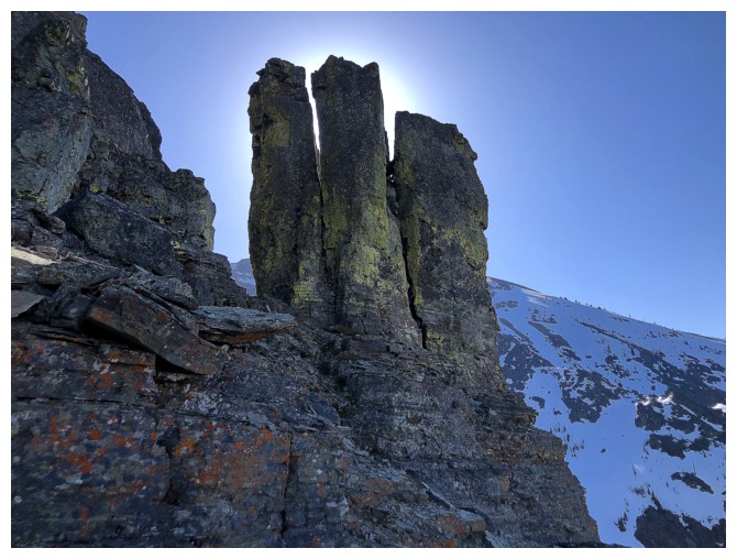
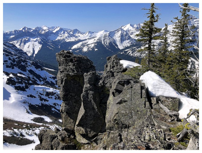
Beneath one of the coolest pinnacles I've ever seen
Decided to explore around the left (north) side before continuing up
The northwest side of the pinnacles
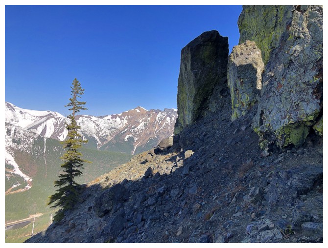
Continuing around to see another
Looking back at the first

The rock wall and the view west
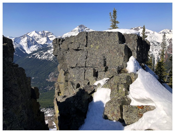
Beautiful, lichen-covered, vertical walls of rock
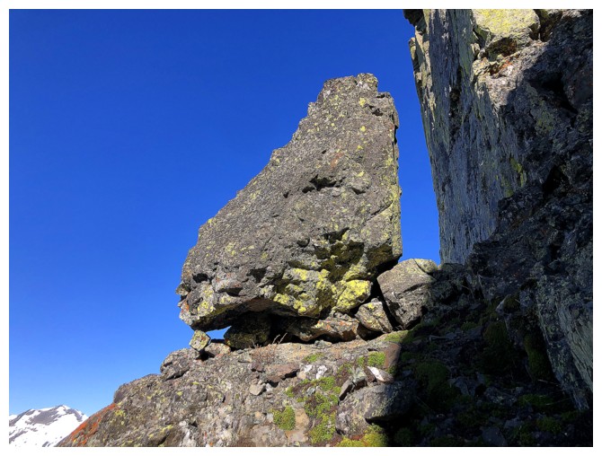
The third is more of a "balancing rock"
St. Eloi Mountain through the gap
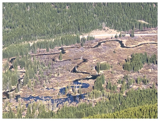
The meandering West Castle River
End of the line for the first detour. The summit of Southfork Mountain
is somewhere up there. Going to that summit from here would have been
possible, but I was more interested in the Sun-bathed rock on the other
side.
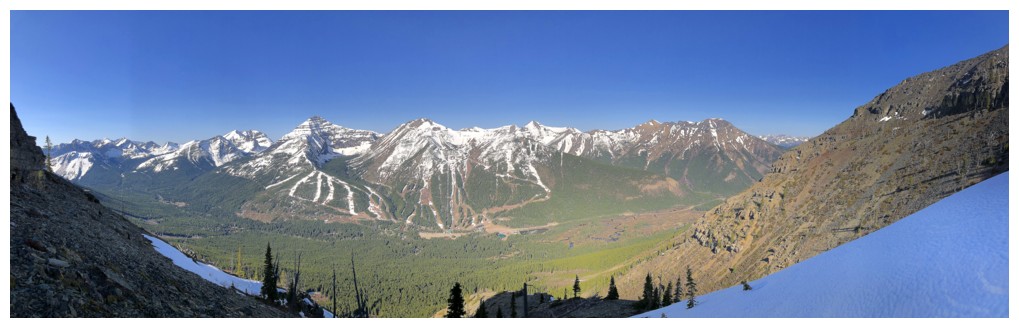
All of the view west
Heading back
The Sun behind the first set of pinnacles
Back on the Sunny side of the pinnacles
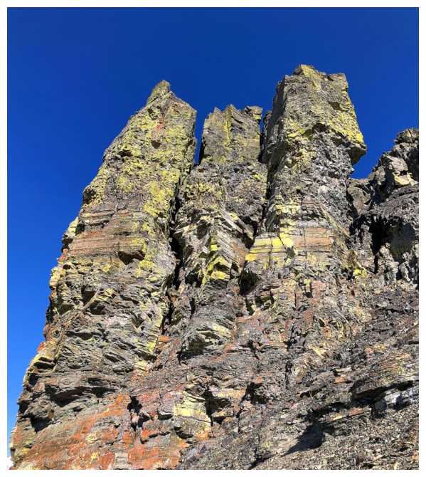
The next section is going to features that set of pinnacles ad nauseam. They were spectacular and well worth the vomiting!
Last one for now
Heading for the ridge above the pinnacles
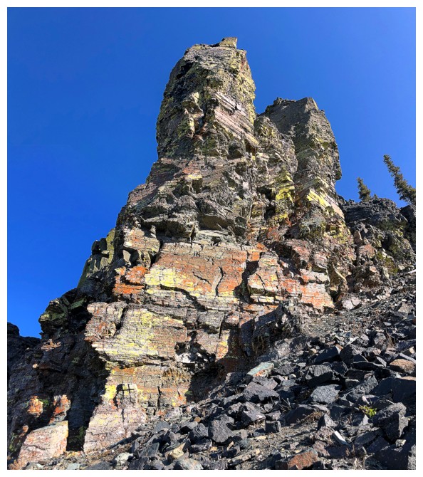
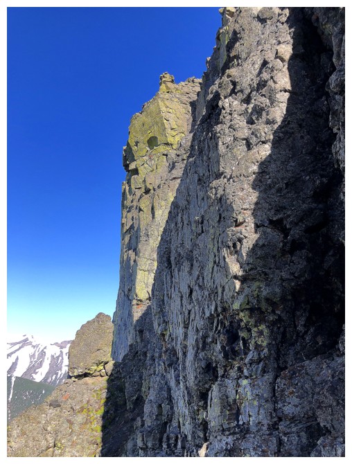
Not surprisingly, the rock of the ridge is terrific to look at also
A few close-ups are clearly warranted
A close-up with a far-away!
Just far-away
Looking down the descent route Mark and I used after going to Southfork Mountain
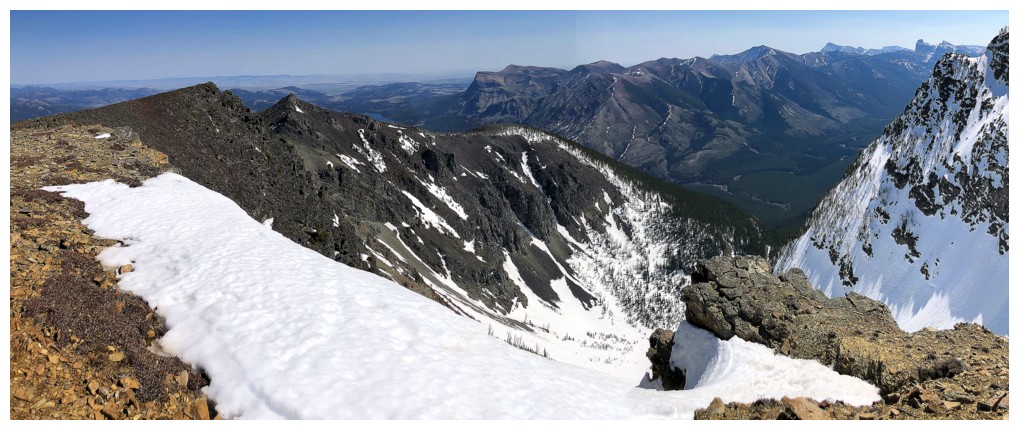
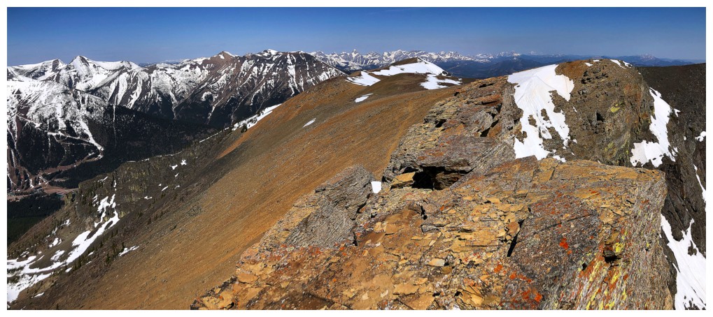
On the east-west ridge, hoping to gain the north-south ridge
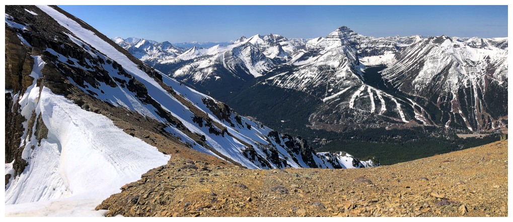
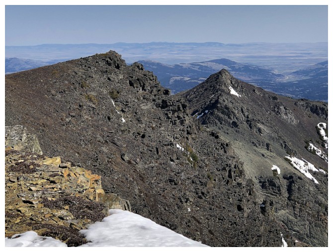
The summit of Barnaby Ridge (centre) is quite distant at this point

The summit of The Amoeba is much closer
The ridge had few exposed sections, but nothing that would faze Mount French!
Looking down to where I was
Looking up to where I'm going
Easy does it here. The exposure on the left was daunting.

Cool little plateau in front and great view behind
Another section where care was needed

Easy from here to the ridge
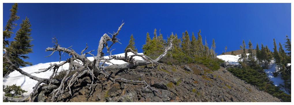
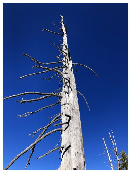
Another scary tree
St. Eloi in the centre - a fantastic trip with Linda in 2006; Sapper Peak and St. Eloi SW1 to the left - a fantastic trip with Dave in 2023
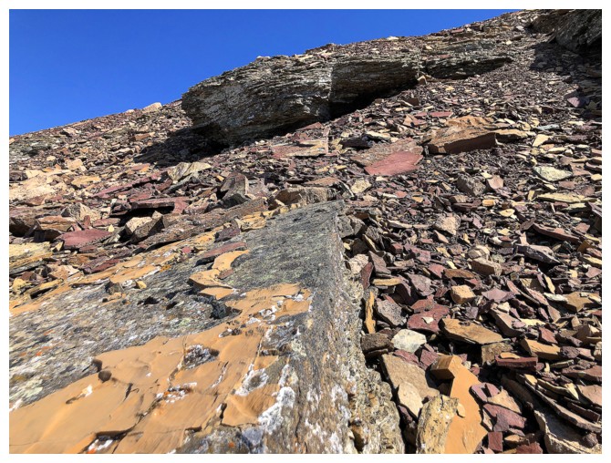
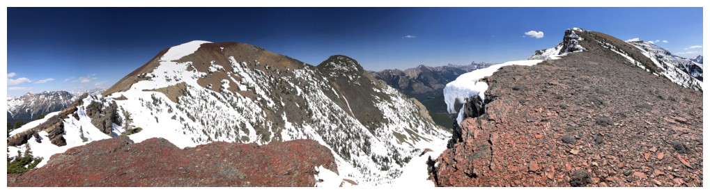
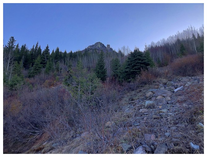
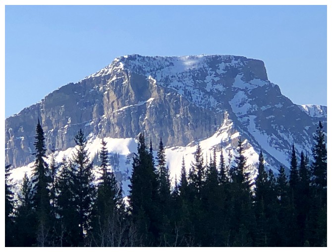
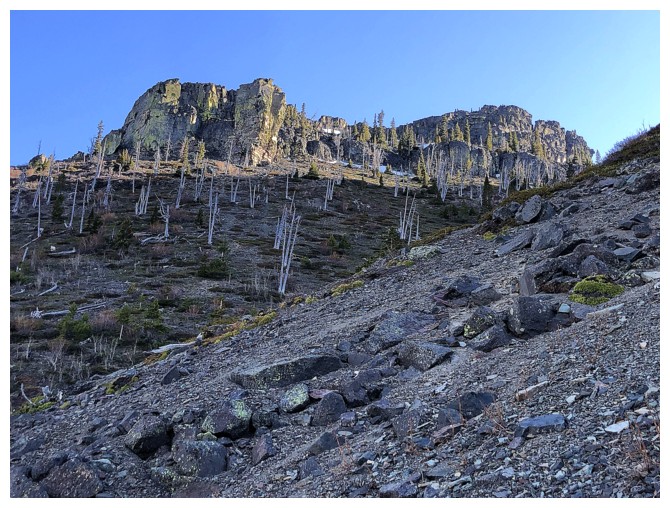
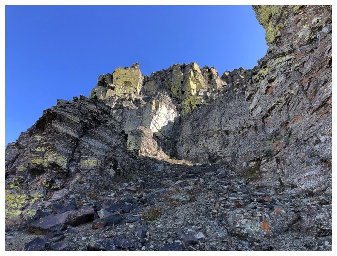
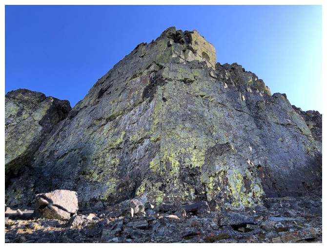
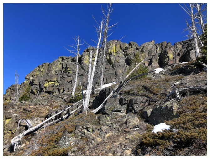
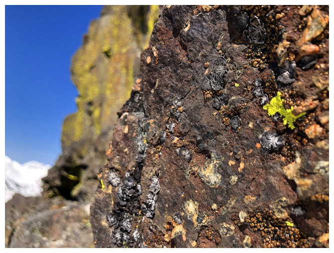
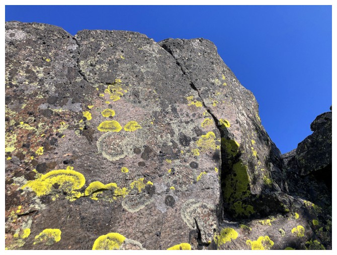
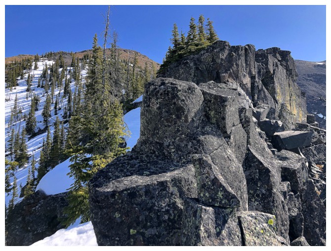
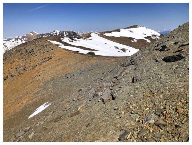
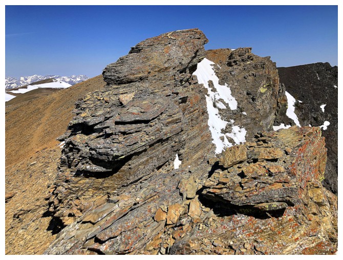
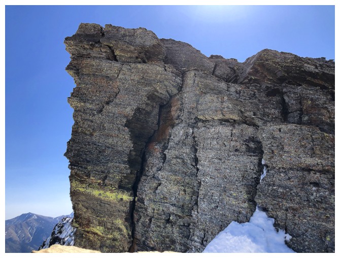
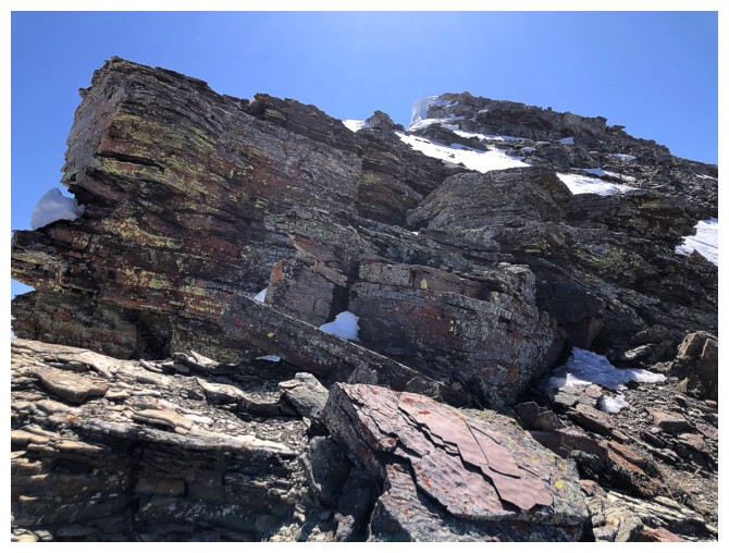
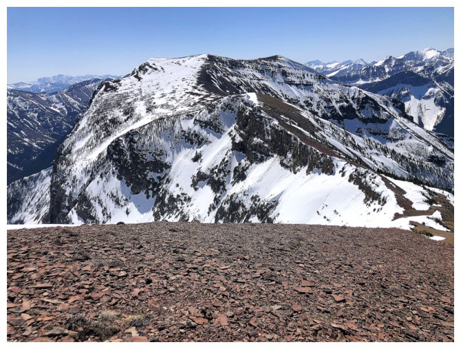
The rock suddenly changes to argillite, dolostone, and shale
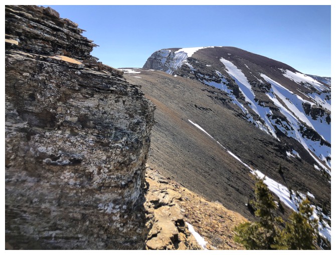
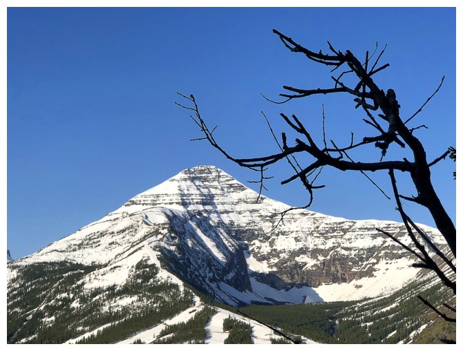
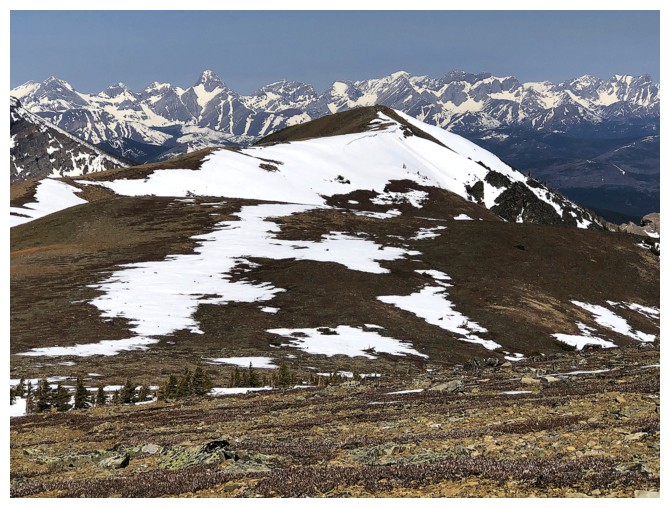
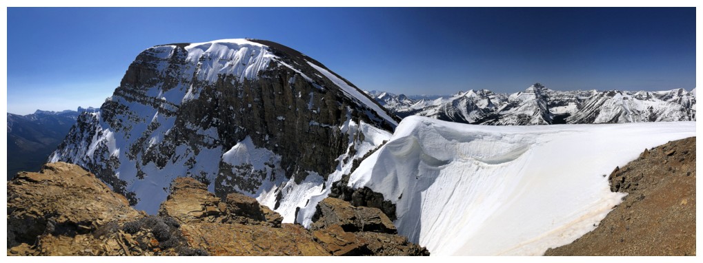
The Amoeba
More of that colourful rock
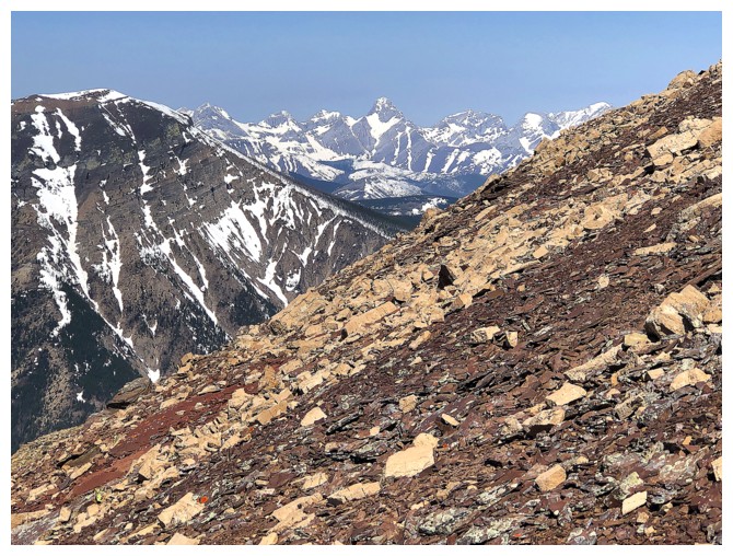
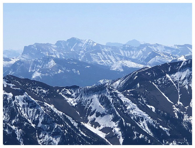
Mount Darrah makes a proud appearance in the distance
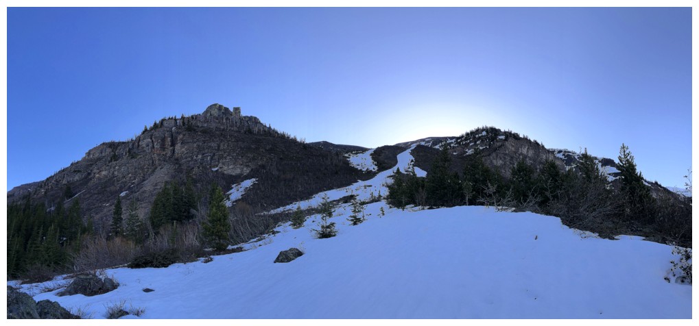
On the ridge and heading towards TA (The Amoeba)
Bizarre group of rocks
The trail bypasses the hump on the left by going around the right side and that's where I went
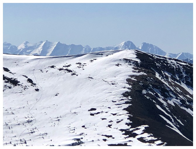
The summit of Southfork Mountain is only about 700 metres away, but I
decided (wisely, in retrospect) not to make the trip over there
Wonderful shades of rock
Nostalgic glance over to Southfork East
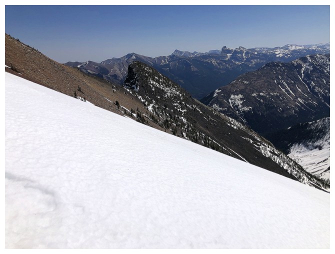
Approaching the lowpoint before an ascent of TA. However, I quickly
realized that bypassing that hump denied me some potentially good views.
One of the views I missed!
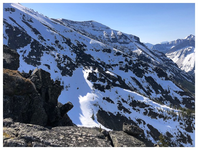
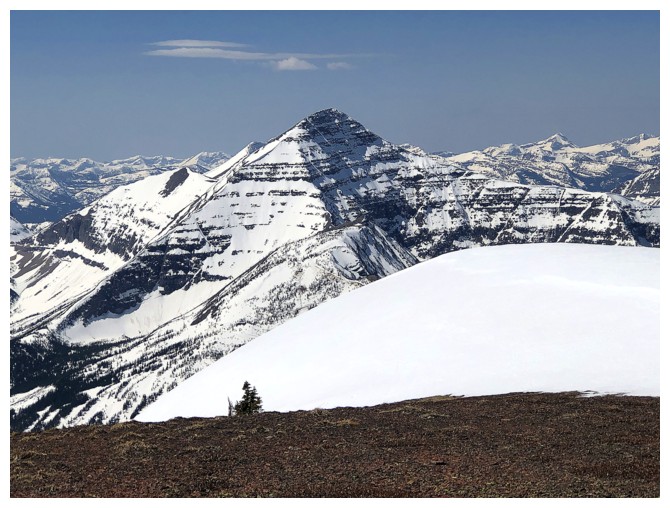
The hump offers great views of some of the wickedly steep east side of the Barnaby massif
Better view of Southfork Mountain and the Flathead Range
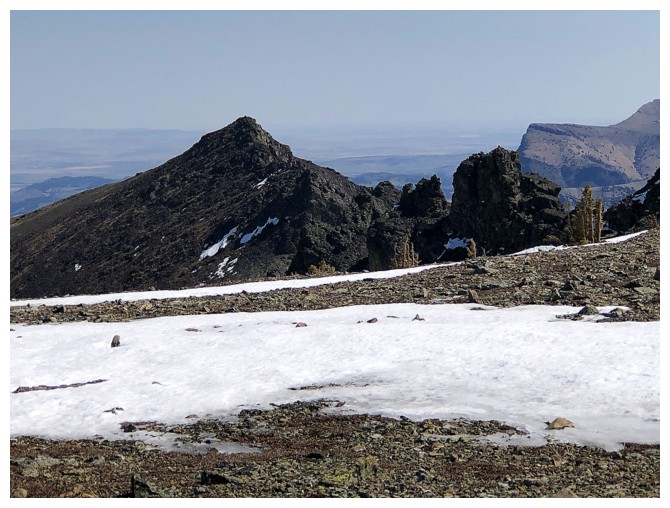
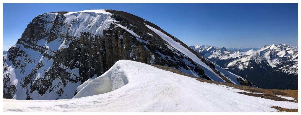
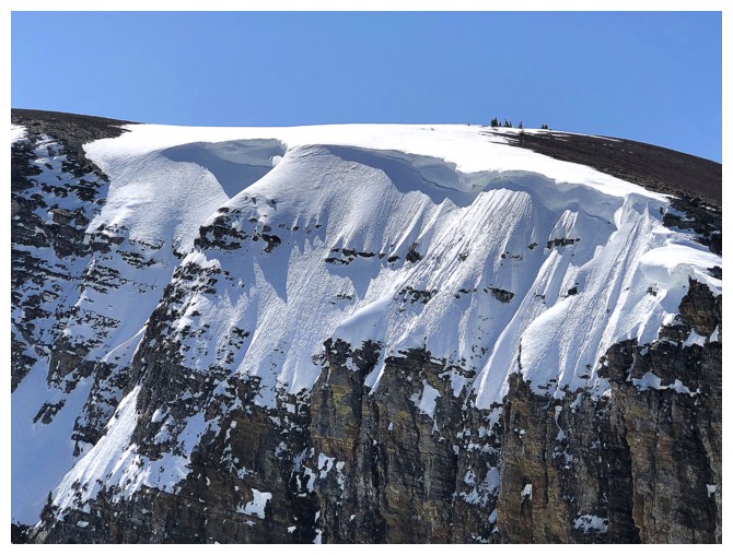
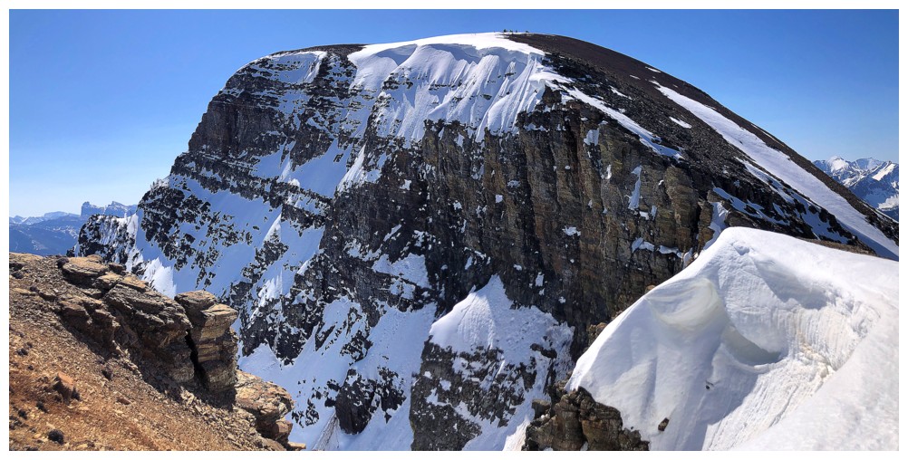
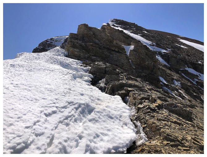
The wickedly steep east face of TA
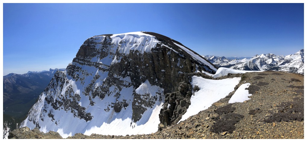
Close-up
Close-up of Southfork East
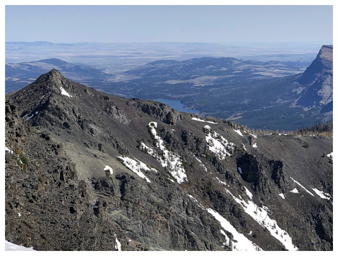
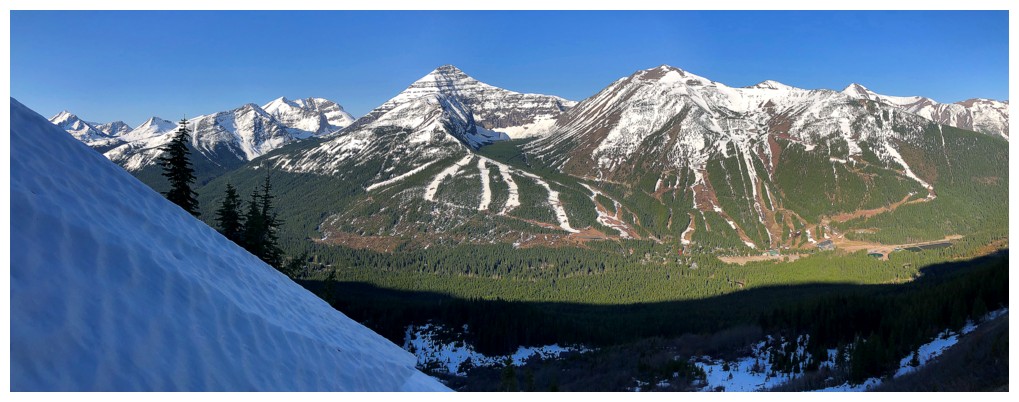
Beaver Mines Lake is partially visible

A sort of dreary view of usually vibrant Table Mountain
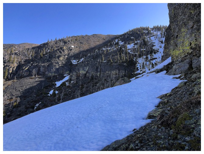
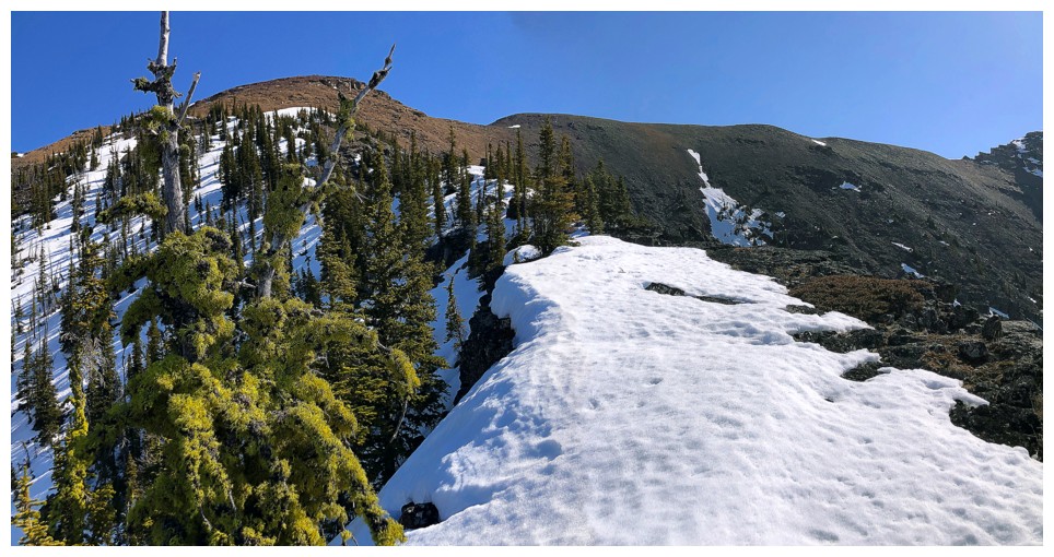
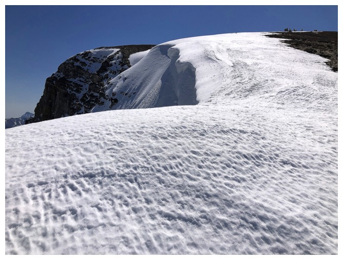
Might be in for some cool snow scenery
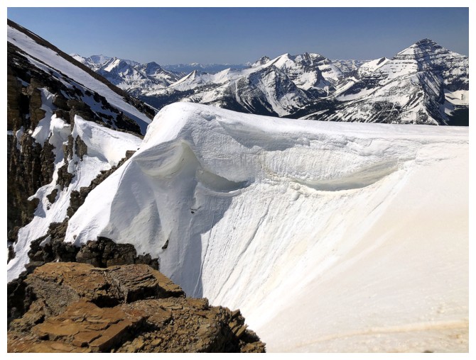
All cornices are dangerous, but some are more dangerous than others!
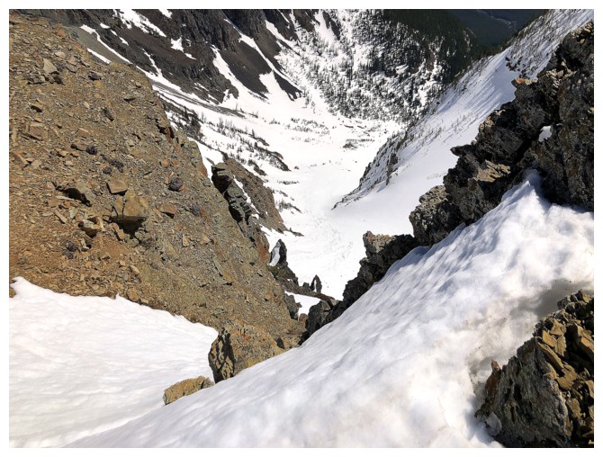
Looking down to the valley far below
Cool snow scenery
The reason why you should never bypass a hump!
Middle Kootenay and top of that incredible cornice
I'm missing winter already! (but not the cold)
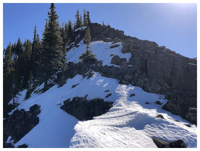
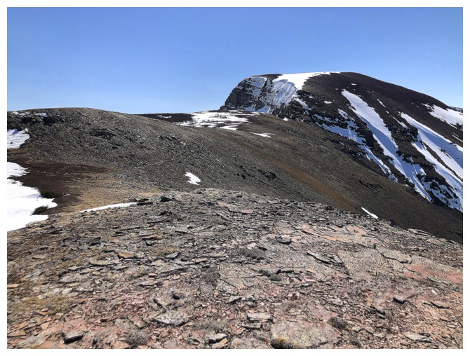
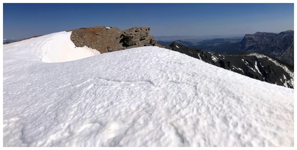
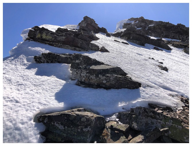
Finally ready to ascend TA
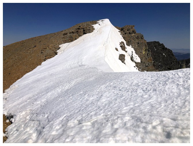
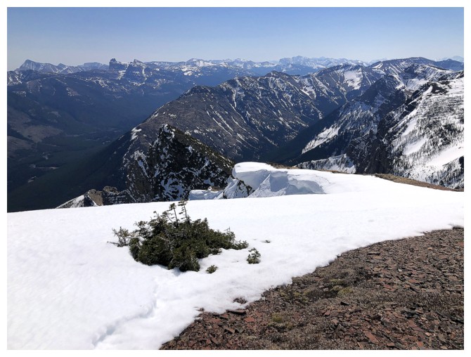
The cornice at the lowpoint
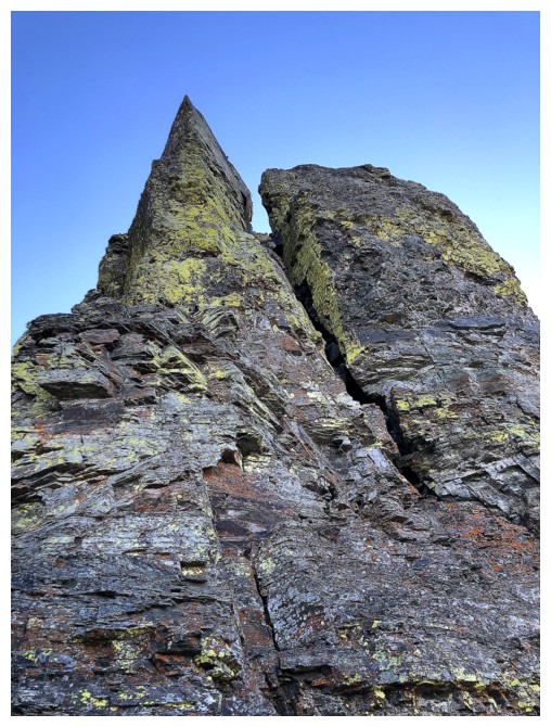
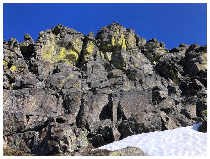
The ridge of TA features beautiful, lichen-covered rock if you stay near the edge
Same as above
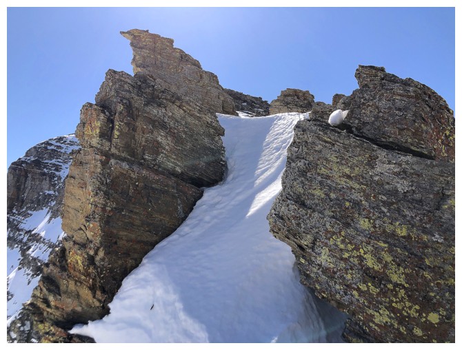
Cool feature, but stepping onto that snow would be suicidal
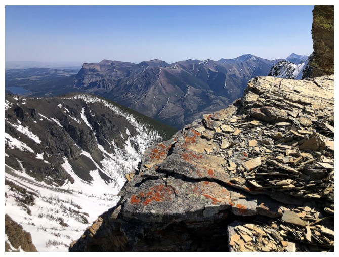
Table still doesn't look like Table, because of the position of the Sun
Looking back to Southfork and the hump (at the right). The bypass trail is clearly visible.
Easy and fun scrambling
It's a huge drop down the east face
More snow higher up
Now starting to see why I describe TA as "a big red blob"
The "more dangerous than others" part of the ascent
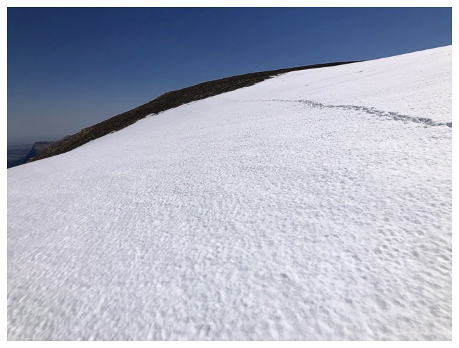
Animal tracks leading to the summit
Another set of animal tracks, but the nasty biped kind!
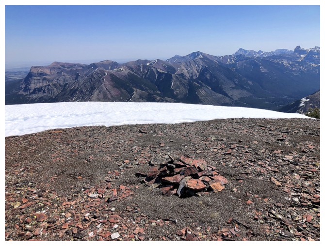
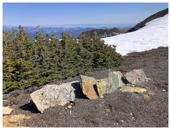
The summit cairn is not going to win any COTY awards! (Cairn Of The Year)
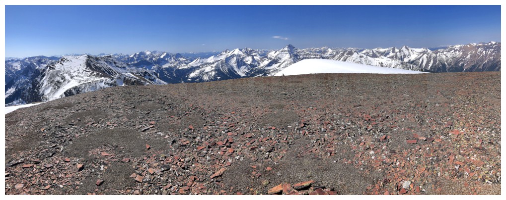
Southeast view
The summit itself is not comprised of a significant layer of red argillite
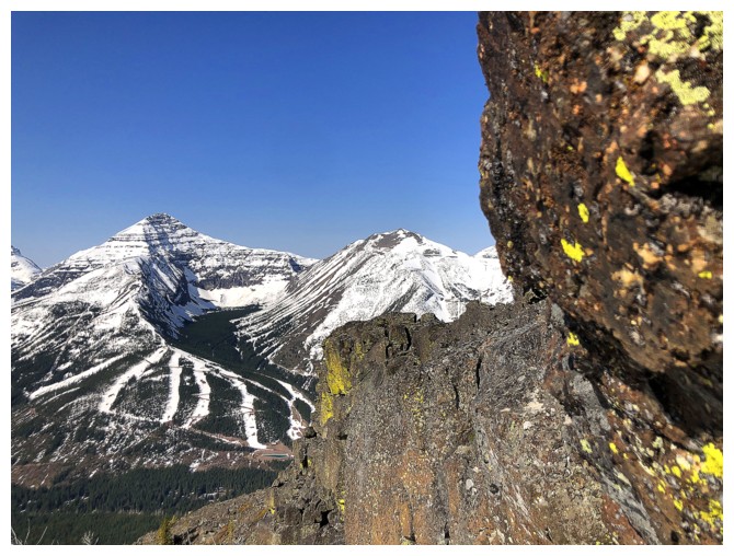
Castle Peak and Windsor Mountain
The giants of Waterton and Glacier National Park: Mount Blakiston (just
left of centre) and Mount Cleveland (just right of centre)
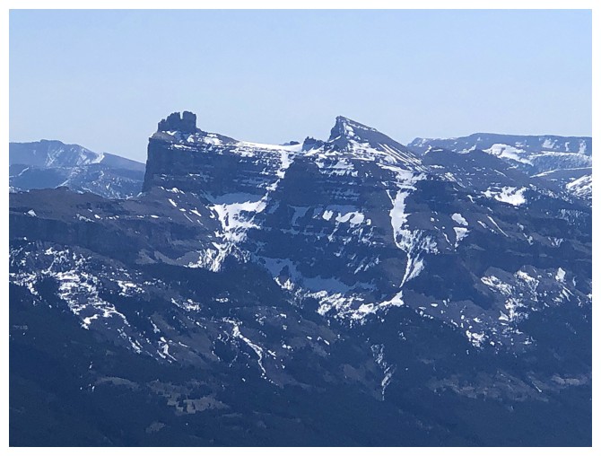
Close-up of the summit of Barnaby. Note the animal tracks near the
left, the three-pronged ridge of Long Knife Peak (also at the left),
and the fact that the summit cairn of Barnaby is actually just visible
from this distance (definitely some COTY potential!)
Haig was clearly the winner of the much coveted and sought-after
MPMFAAOBR Award (Most Photographed Mountain From Any Ascent Of Barnaby
Ridge)
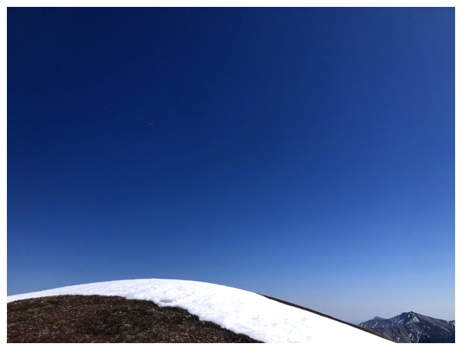
Spot the bird. He/she was circling me for several minutes. Probably
hoping I would expire from the strenuous ascent, so he/she would get a marginally tasty, nasty biped meal.
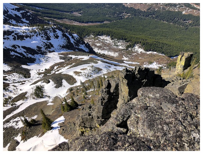
As soon as you start descending, the red argillite makes a grand
appearance (no way am I expiring while the scenery is this good!)
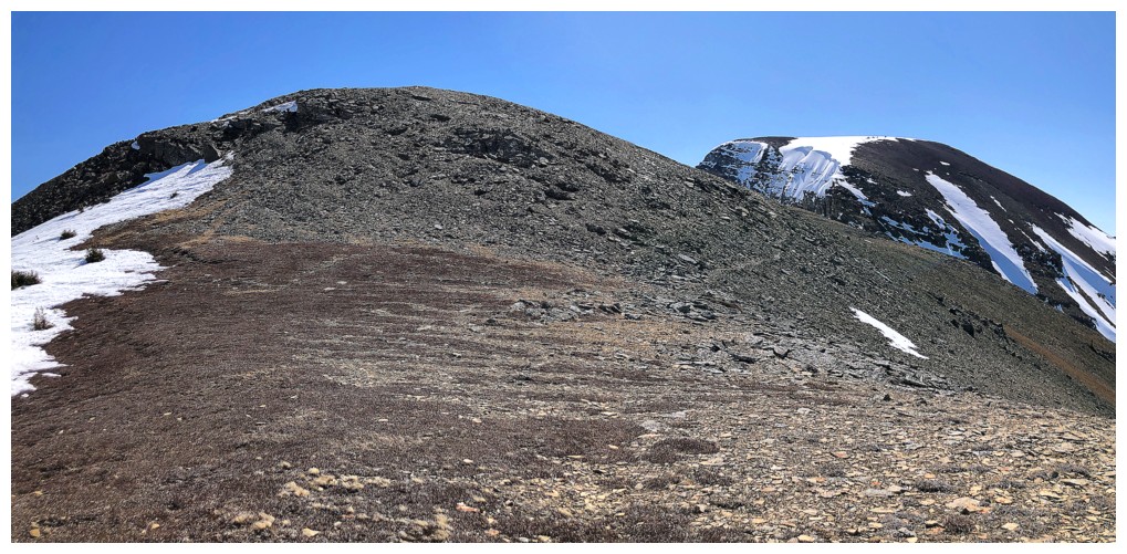
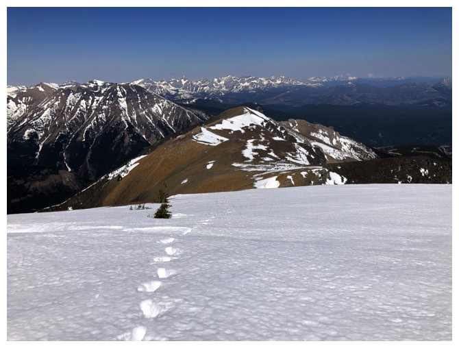
Next destination - the summit of Barnaby Ridge
What's that to the east? Barnaby may have to wait!
Click HERE to continue the trip…
LOG