Highwood Peak South
July 31, 2025
Mountain height: 2790 m
Elevation gain: approximately
1200 m
Ascent time: 3:55
Descent time: 2:20
Scrambling with
Raff.
With Picklewood
Peak now done, it was time to get finally make a stab at Highwood Peak South.
This would also be a chance for Raff and I to redeem ourselves after bailing on
the route on a dreary November day in 2024.
Of the two
routes described in David Jones’ guidebook, both going to the Picklejar Lakes
first, we chose neither. I had done that hike twice in the previous three weeks
and was craving different terrain and views. 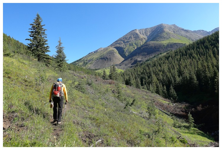 Instead, we planned to hike the
Picklejar Creek trail (the Picklejar Lakes trail actually follows Lantern Creek)
and tackle the mountain from its west side, but north of the route Jones had
completed.
Instead, we planned to hike the
Picklejar Creek trail (the Picklejar Lakes trail actually follows Lantern Creek)
and tackle the mountain from its west side, but north of the route Jones had
completed.
Turns out the
route was not as obvious as I had envisioned. Nevertheless, after some “bobbing
and weaving” (and good route-finding!) we found ourselves at the bottom of a slope
leading to a ridge, that appeared to lead easily to the summit. Though quite
steep, the footing on this face was awesome and we made good progress to a
point where the face became a ridge. Eventually we could see that the ridge
dropped off quite a bit up ahead but hoped for a feasible route down.
There wasn’t
one. After a brief search down the north side of the drop-off, we traversed
over to the south side to find even scarier terrain. 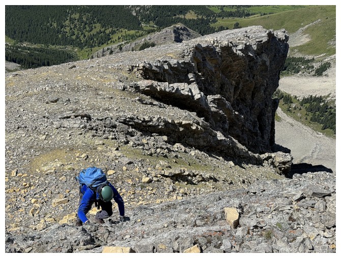 In a last ditch effort we
went all the way back to the north and with a more thorough search found a
feasible route. It required a bit of elevation loss but was otherwise
straightforward and easy. Back on track, our luck with the good foot-friendly terrain
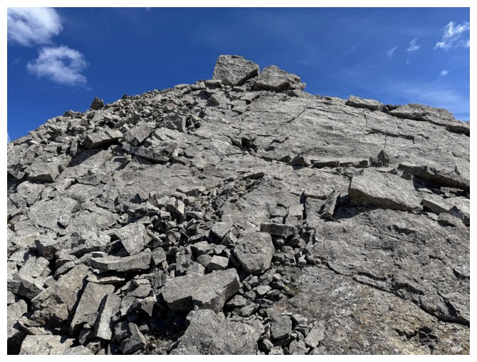
continued almost all the way to the top. Of course, it devolved into hideous
rubble for the upper part of the mountain, but if it didn’t, it wouldn’t be the
Canadian Rockies!
In a last ditch effort we
went all the way back to the north and with a more thorough search found a
feasible route. It required a bit of elevation loss but was otherwise
straightforward and easy. Back on track, our luck with the good foot-friendly terrain
continued almost all the way to the top. Of course, it devolved into hideous
rubble for the upper part of the mountain, but if it didn’t, it wouldn’t be the
Canadian Rockies!
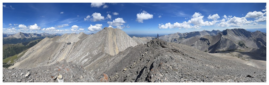
Both Raff and I
were pleasantly surprised with the terrific summit views in every direction. As
a lower outlier of Highwood Peak we weren’t expecting much, the bigger mountain
blocking most of the view. However, as is sometimes the case, a larger,
close-by peak can provide eye-catching views of its own. Such was the case for Highwood
South.
For descent, we
toyed with the idea of going straight down the obvious drainage to the south of
our ascent route and actually started down that path. A short distance down,
however, our conservative sides (not political!) won over our adventurous sides
and we traversed back to our ascent route. In retrospect, it was a good
decision. The remainder of the return went with ease.
Overall, an
unexpectedly awesome route on a terrific peak.
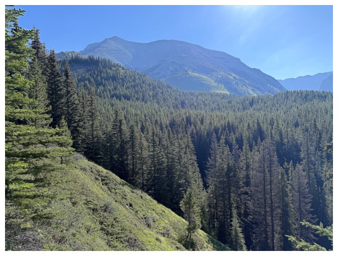
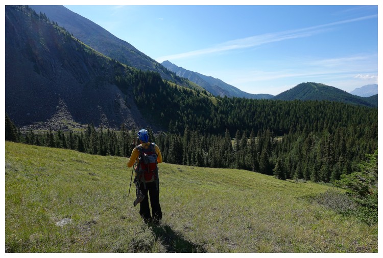
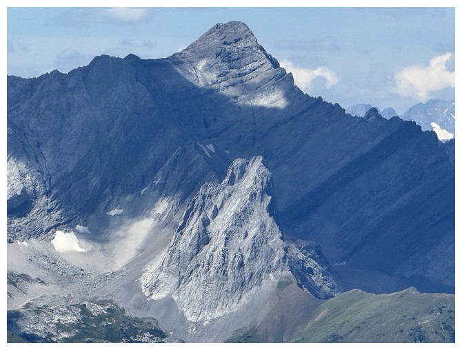
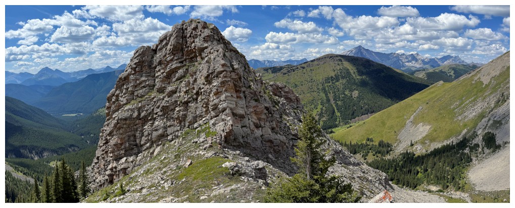
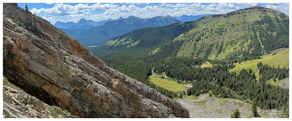
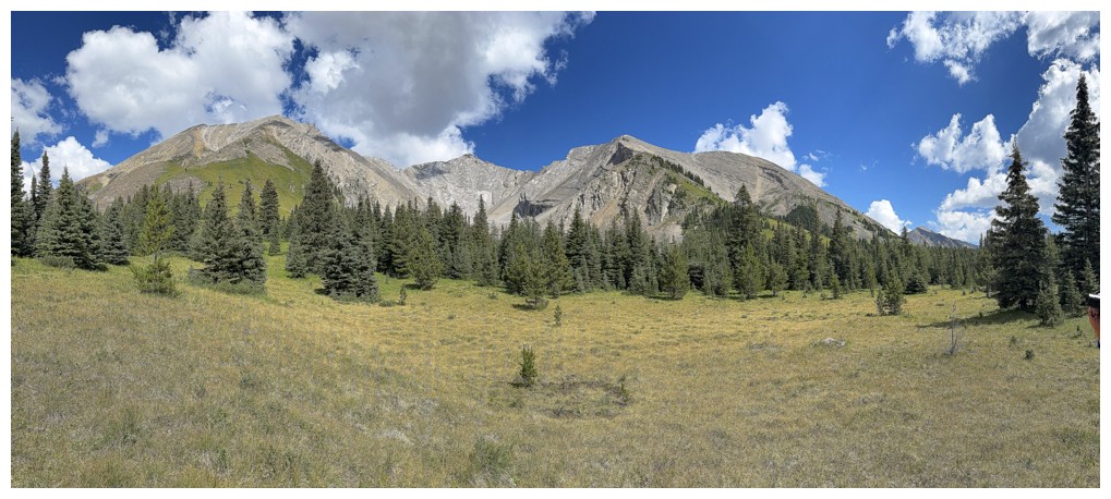
Early view of Highwood Peak South
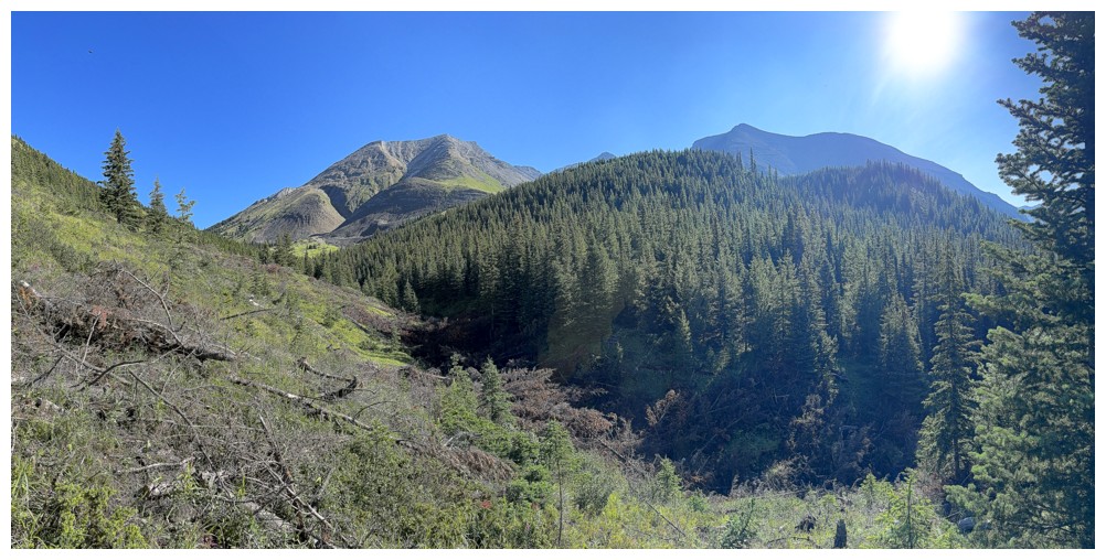
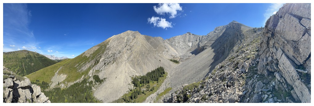
The west outlier of Highwood Peak (left) joins the show
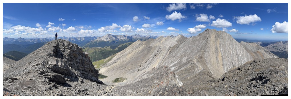
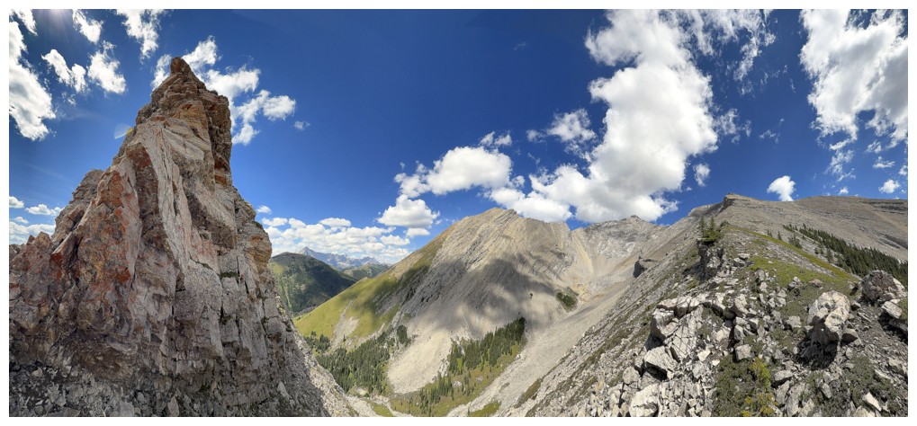
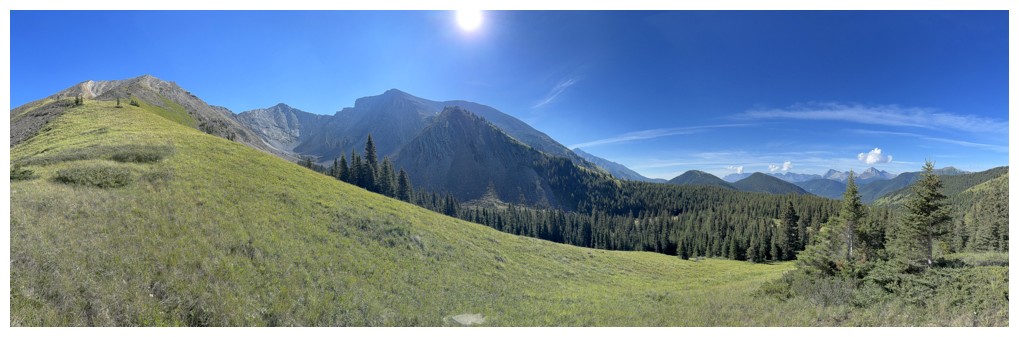
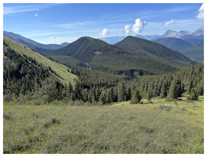
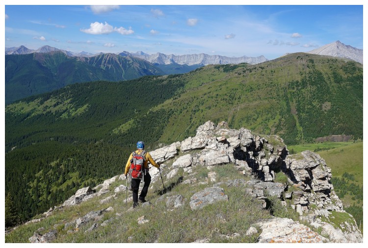
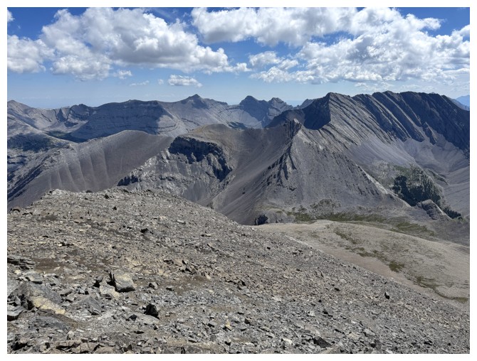
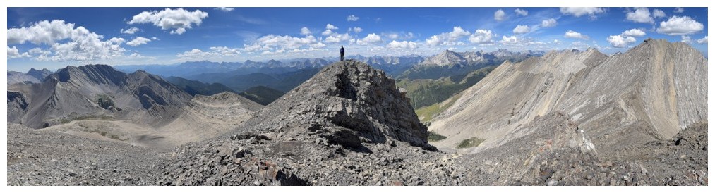
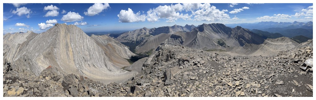
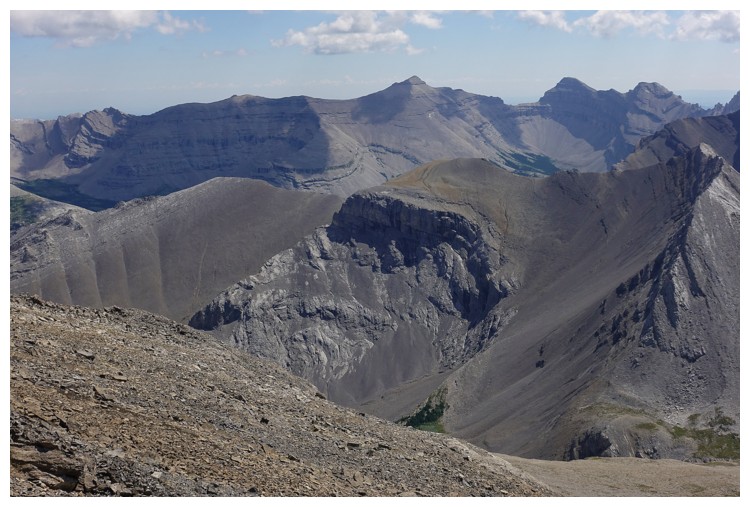
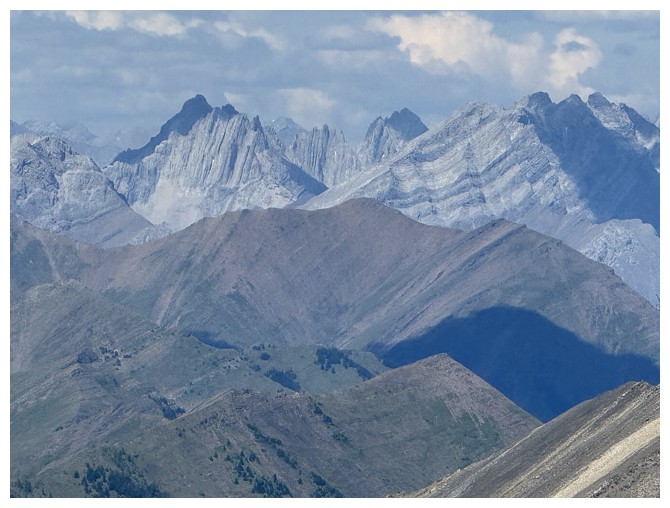
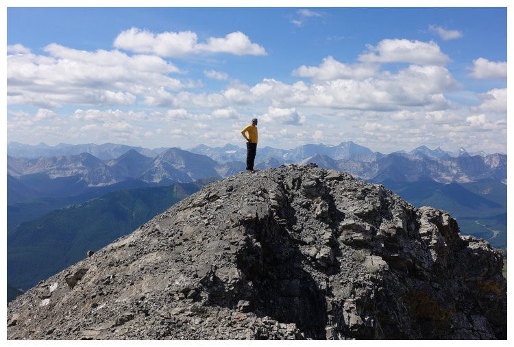
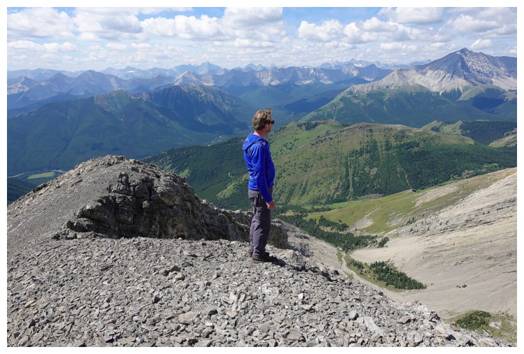
South Mist Hills - best summit views ever!
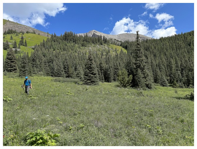
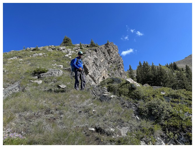
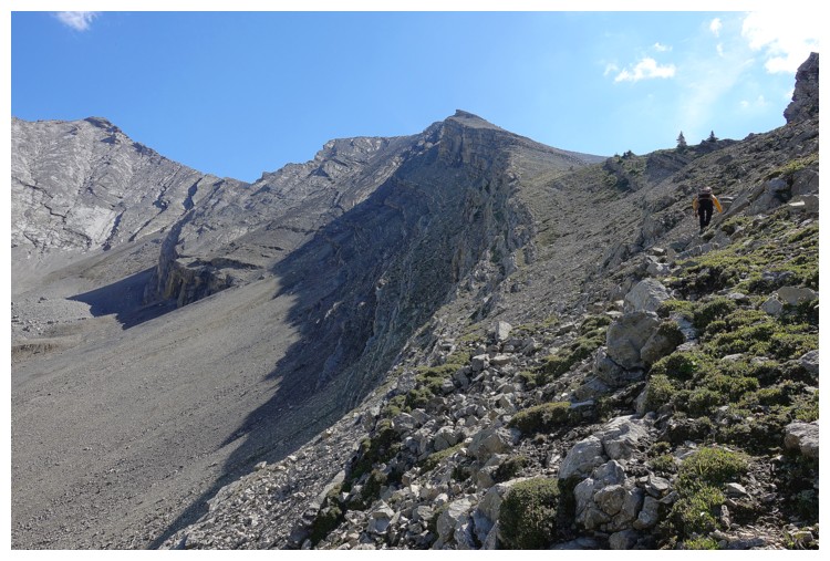
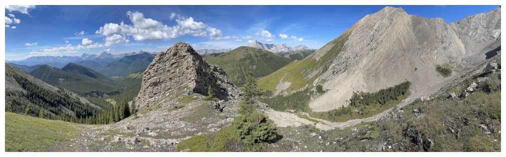
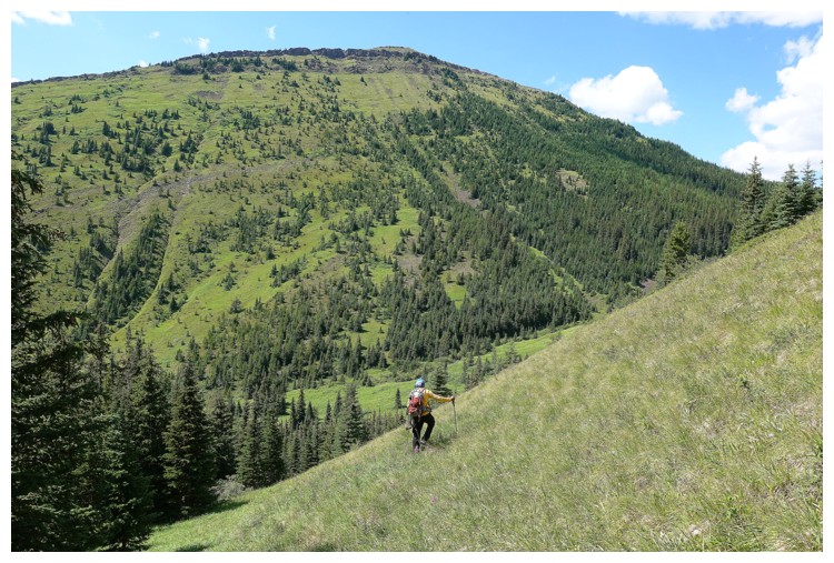
Time to leave the trail and head towards the objective (just left of centre)
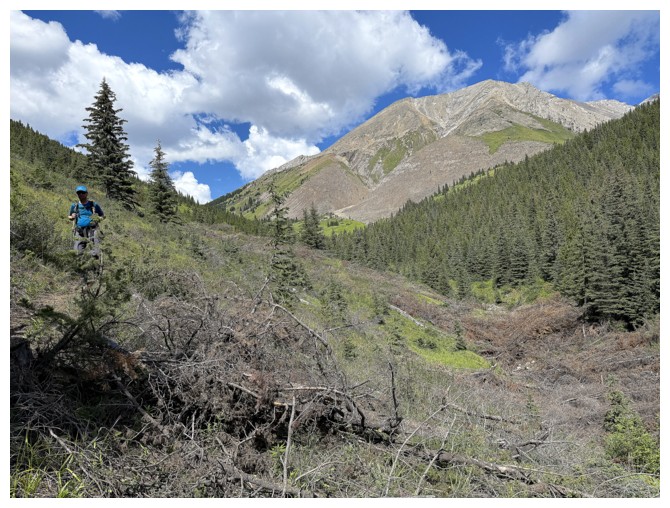
A little elevation loss was required, but the ridge we want to be on in is now directly in front (photo by Raff)
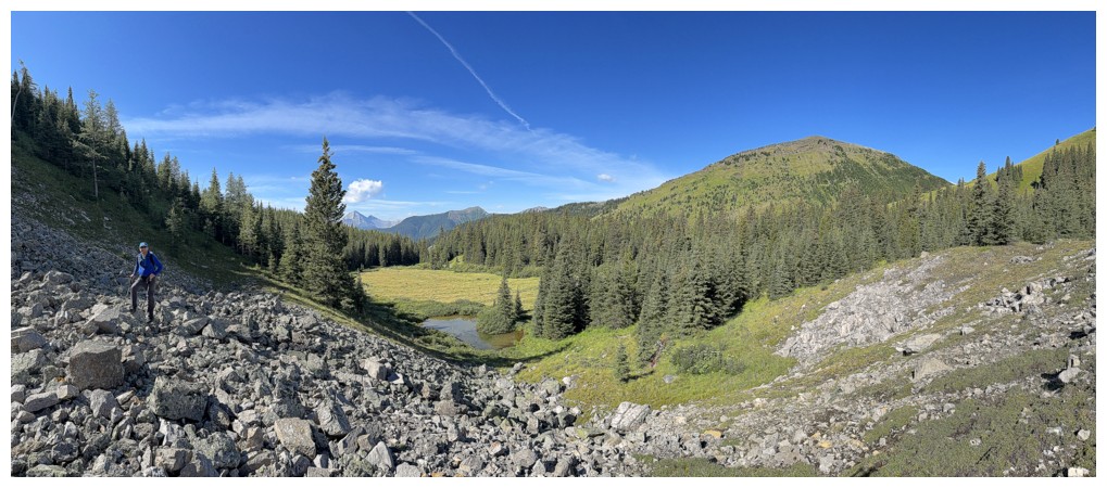
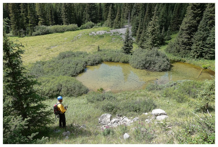
A little boulder field and a little tarn
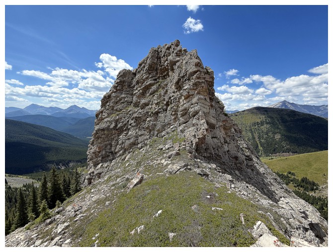
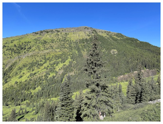
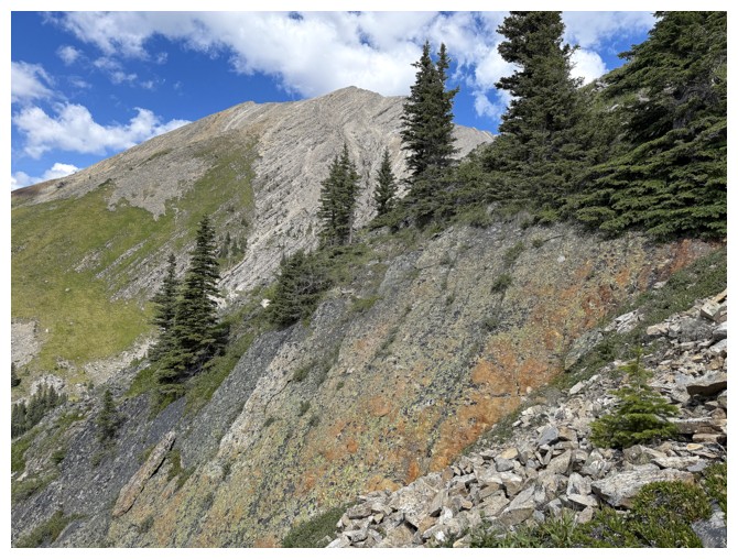
The west outlier of Highwood Peak is a terrific destination in itself
On the grassy ridge. Summit at the far left.
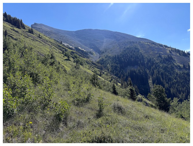
Picklejar Hill and its outlier - not sure if either are worthy ascents due to being heavily treed
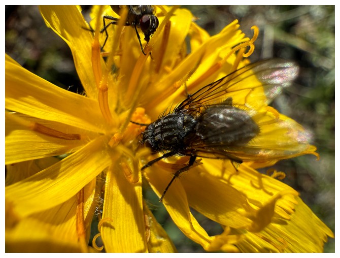
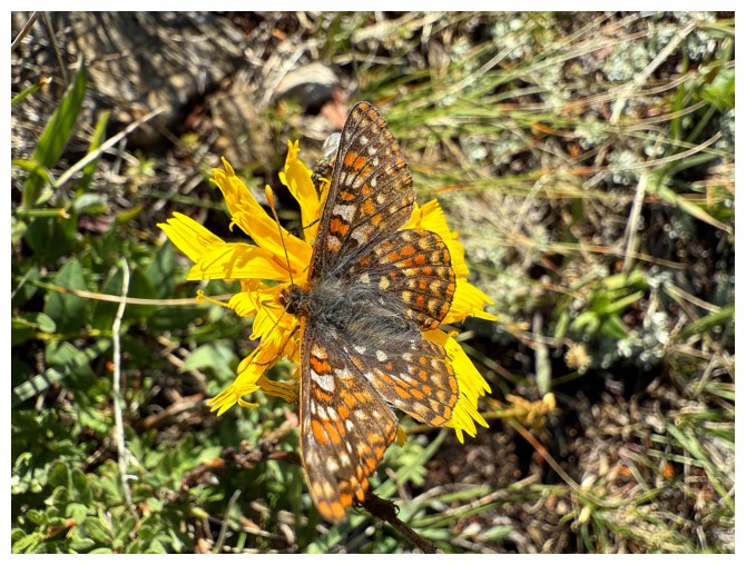
Bees and butterflies are the most photogenic pollinators, but I guess we have to give flies their due at some point!
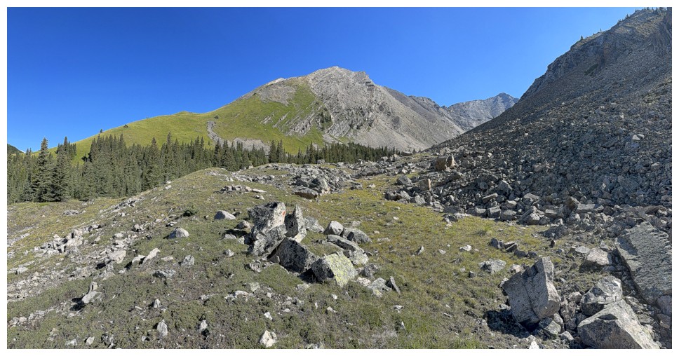
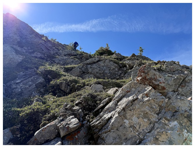
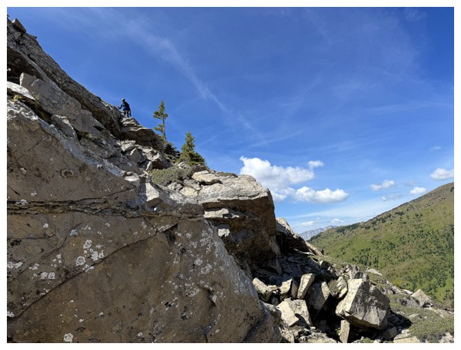
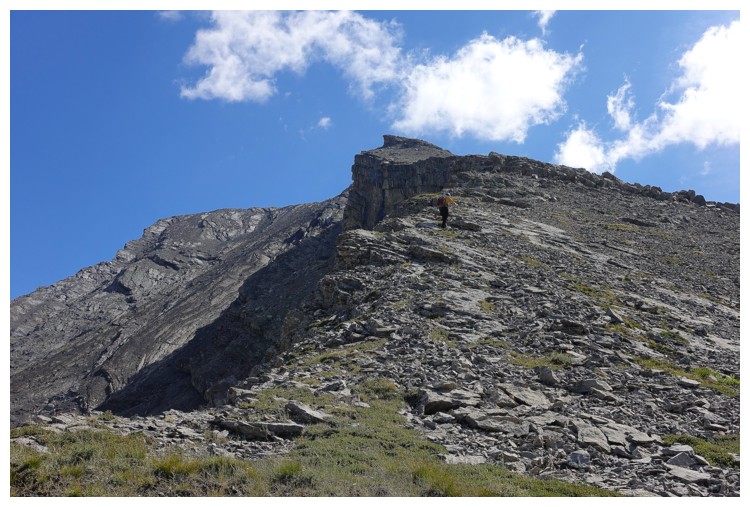
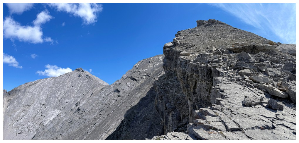
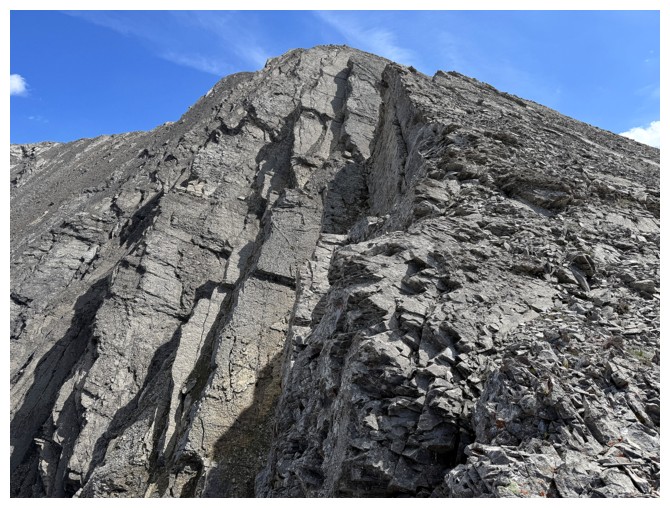
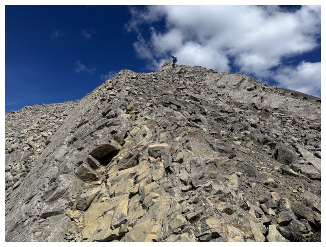
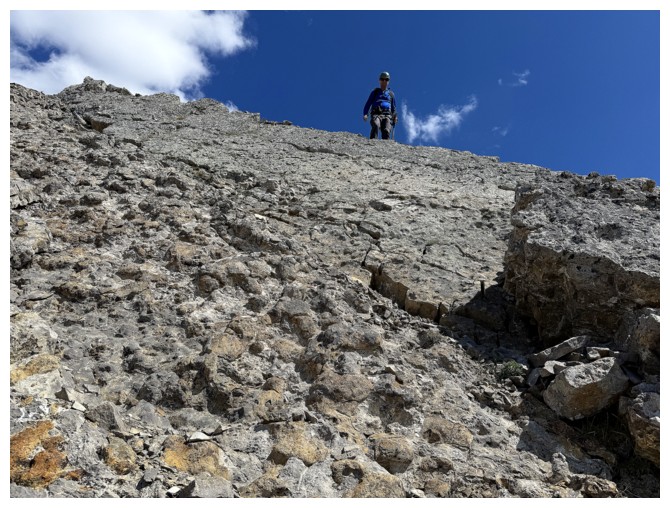
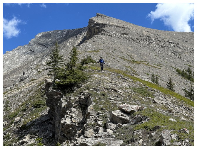
Making good progress up the ridge, but there's a drop-off ahead
Nearing the drop-off
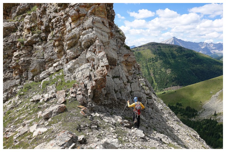
And turning around to find a route to circumvent the drop-off (photo by Raff)
Trying to find a route on the north side of the ridge
Possibly?
Traversing over to the south side
The south side is more severe. No thanks!
Back over to the north side
Losing elevation on the north side (photo by Raff)
Raff follows
Easy route found and now heading back up (photo by Raff)
Raff follows

Almost back to the ridge
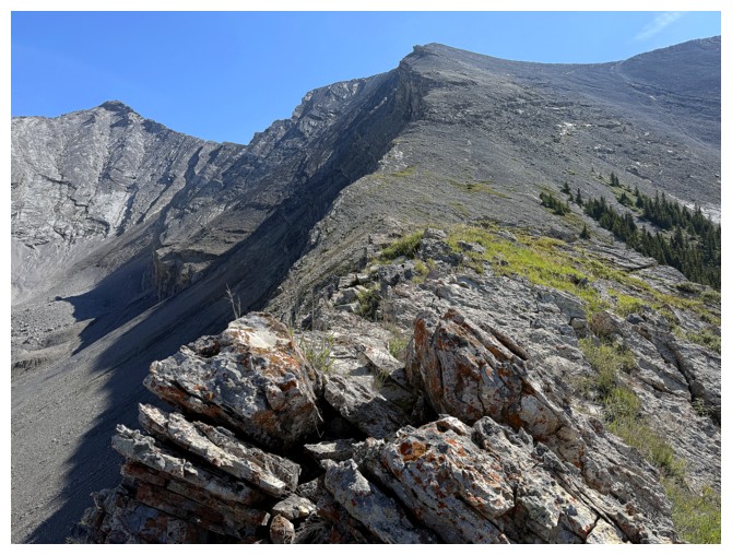
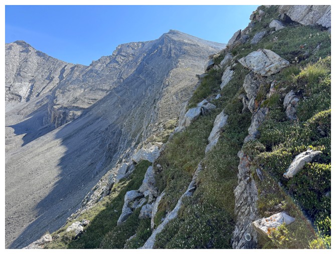
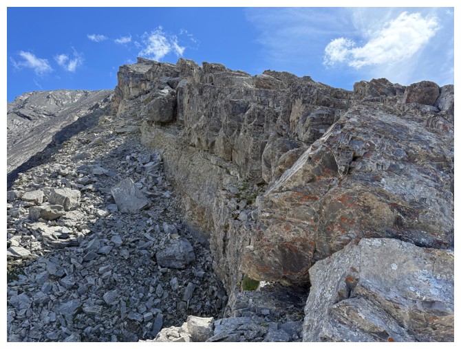
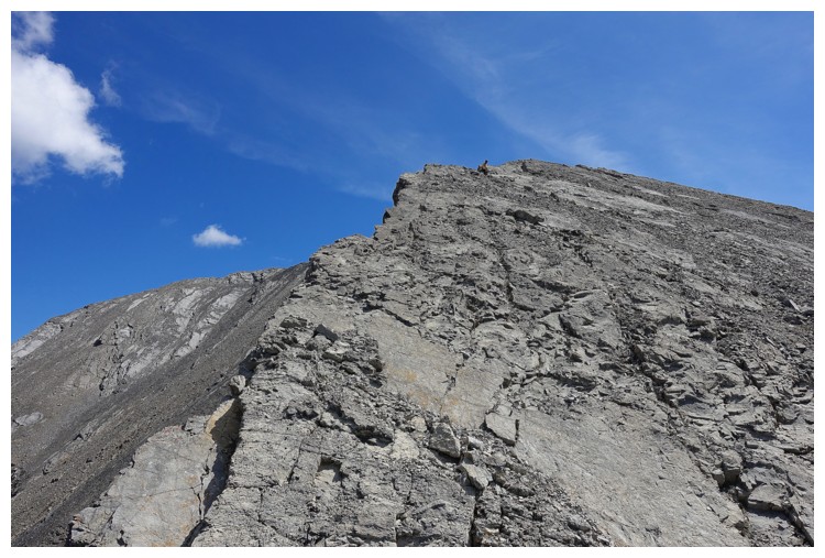
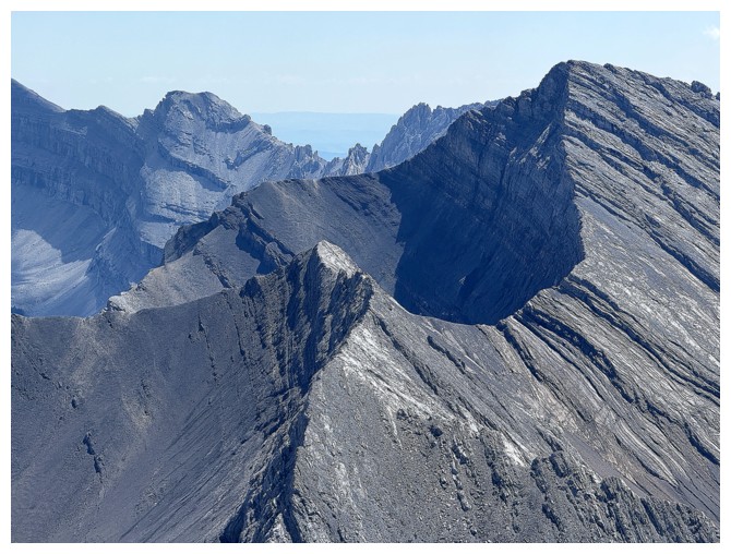
The drop-off from the other side
Same as above
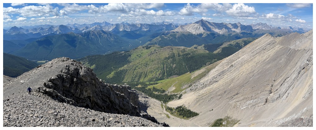
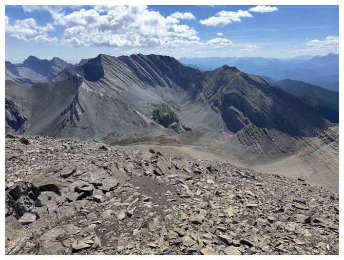
Bigger view
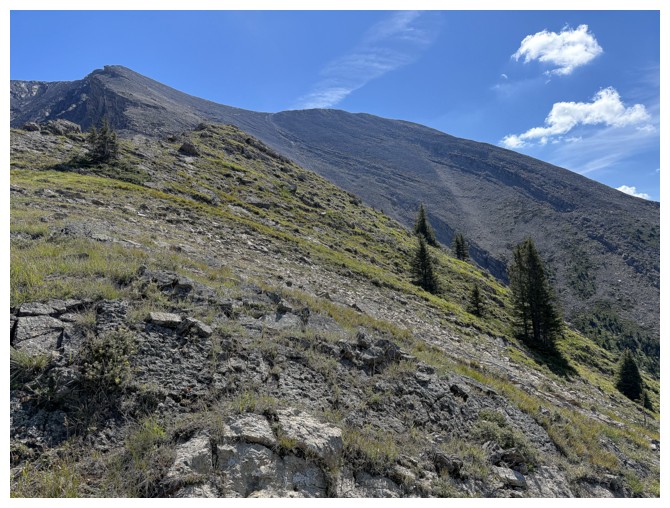
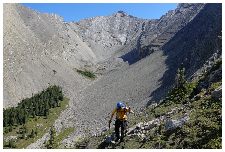
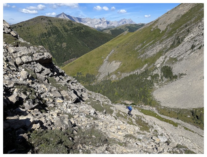
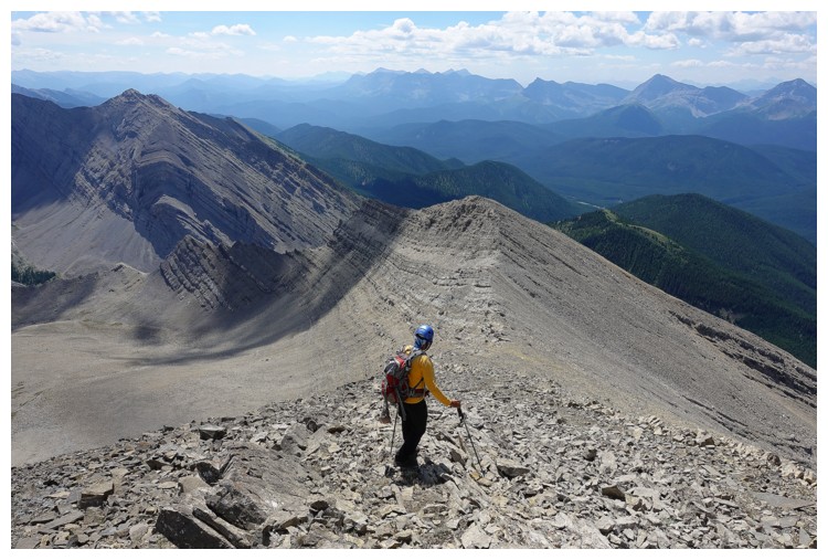
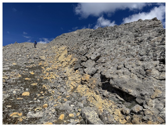
Much easier terrain to the summit from here, but it's still a long way off (photo by Raff)
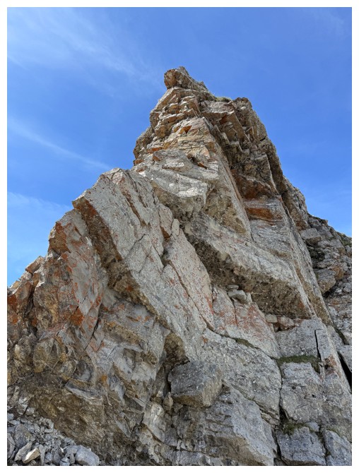
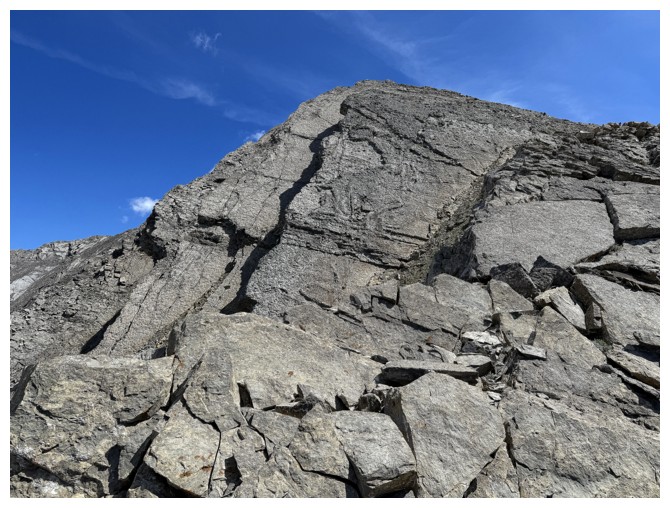
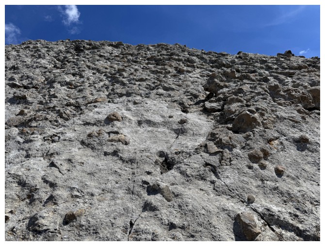
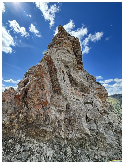
The upper ridge has enough interesting rock to keep my interest
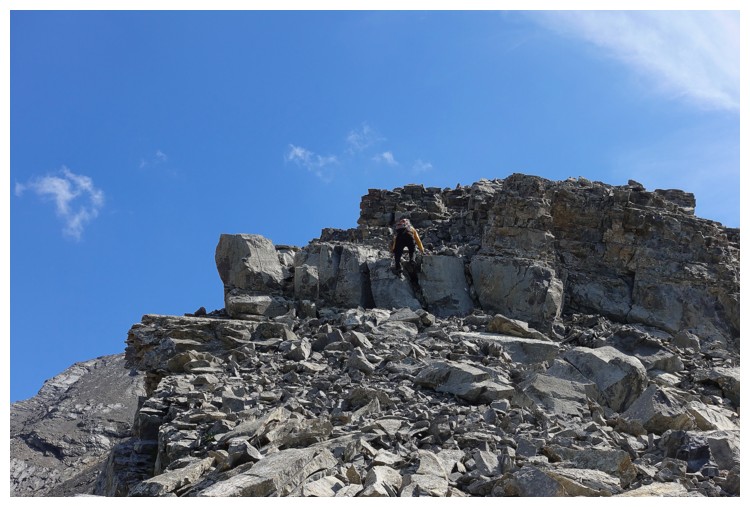
Some enjoyable and easy scrambling (photo by Raff)
The north side of the ridge is also quite severe in places
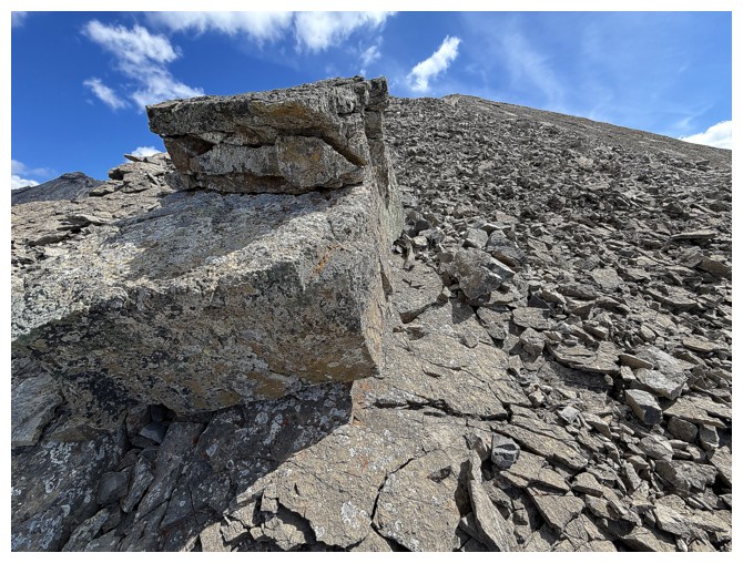
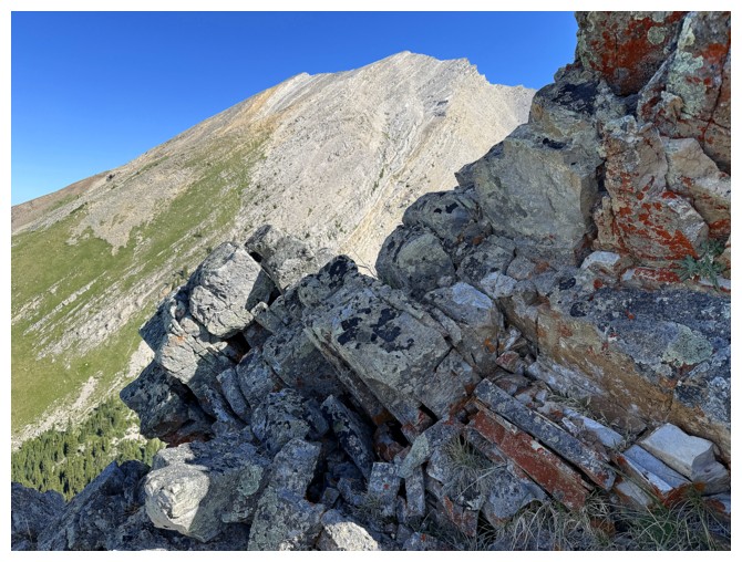
Big rock on the ridge
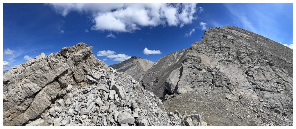
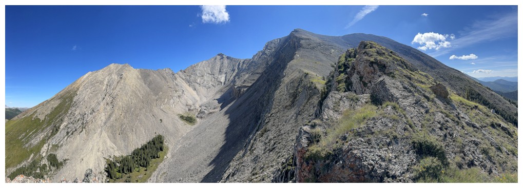
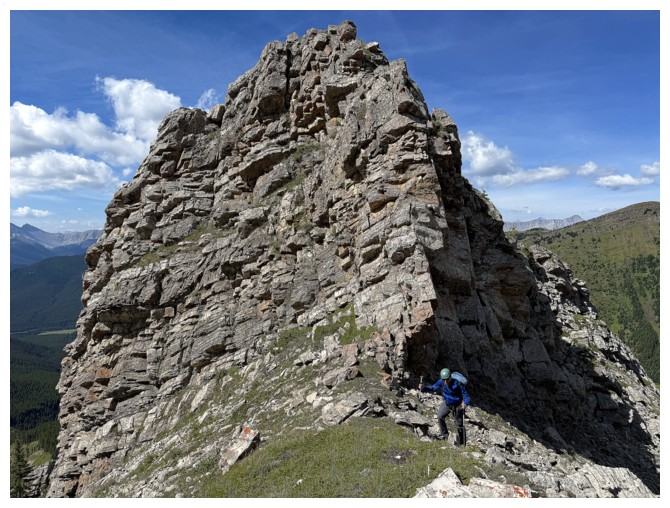
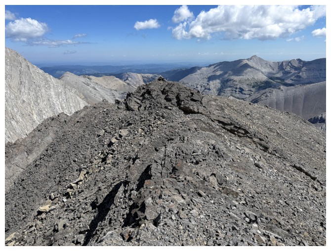
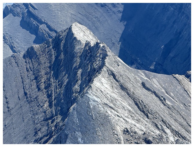
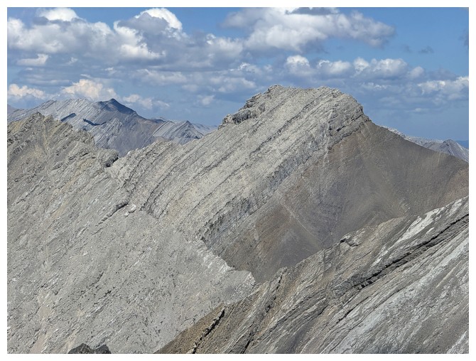
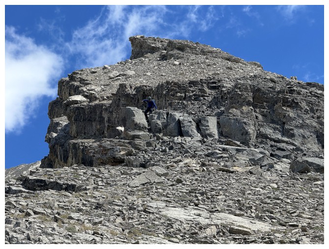
The upper ridge - summit at the right
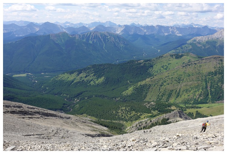
Raff at the lower left, Mist Mountain at the upper right
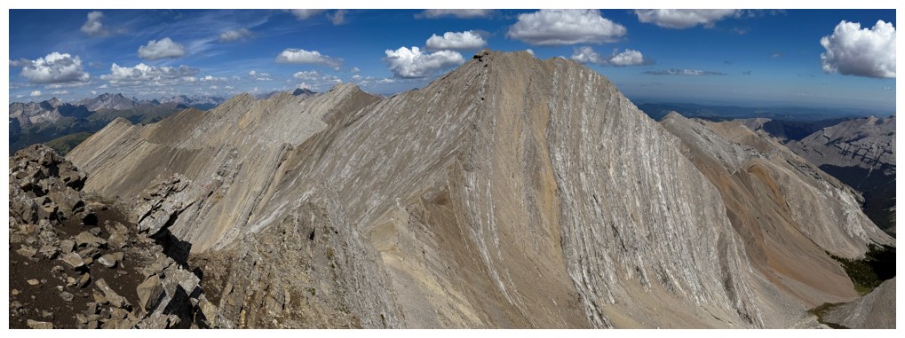
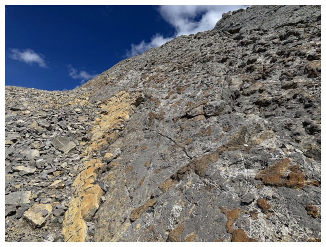
More interesting rock
I'm up there somewhere... (photo by Raff)
...looking at these cool slabs
Shadow on the connecting ridge I failed to traverse between Highwood and its west outlier
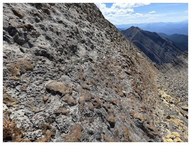
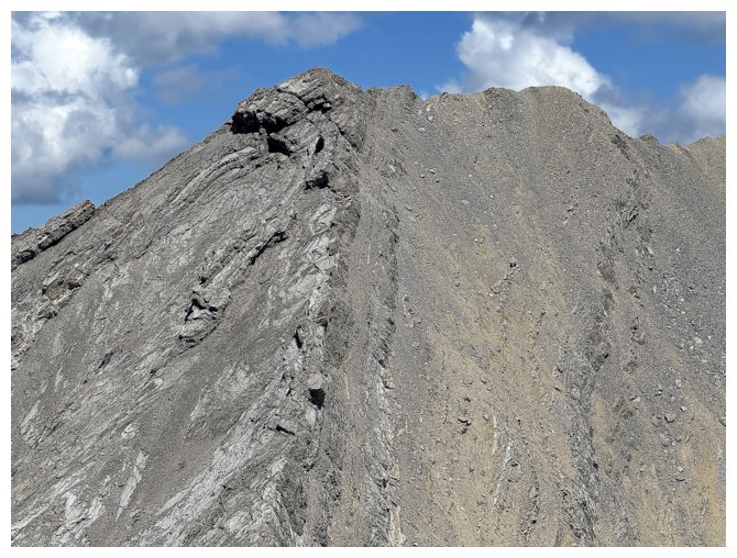
Nice textured rock
Same as above - makes for fun scrambling
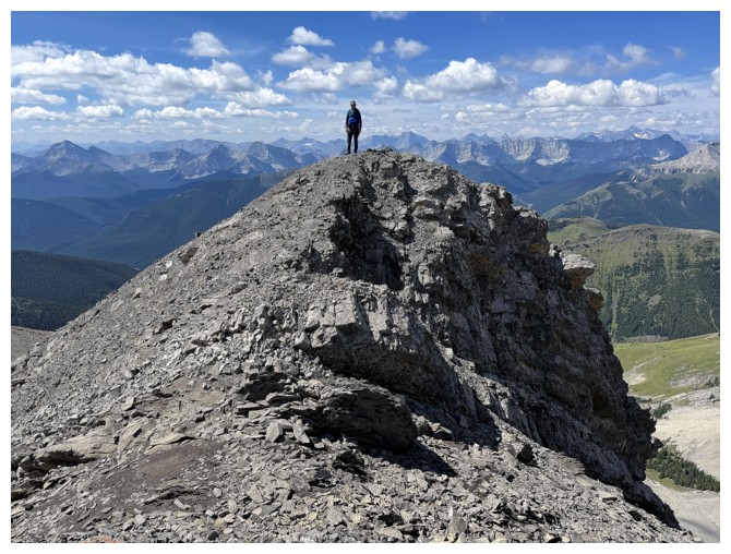
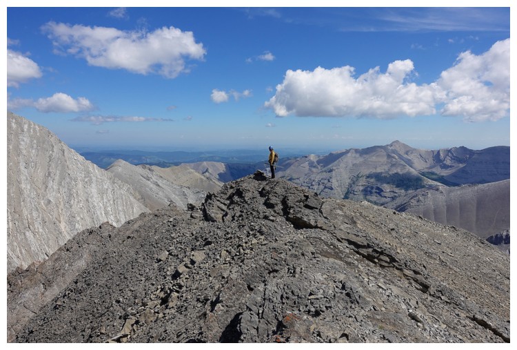
The summit is close
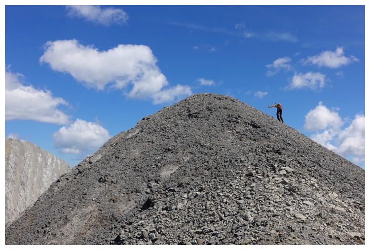
Final few metres (photo by Raff)
Success!
Here comes Raff
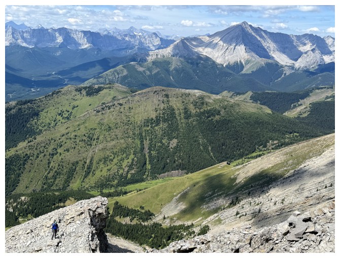
View to the south
Raff on the summit
Same as above
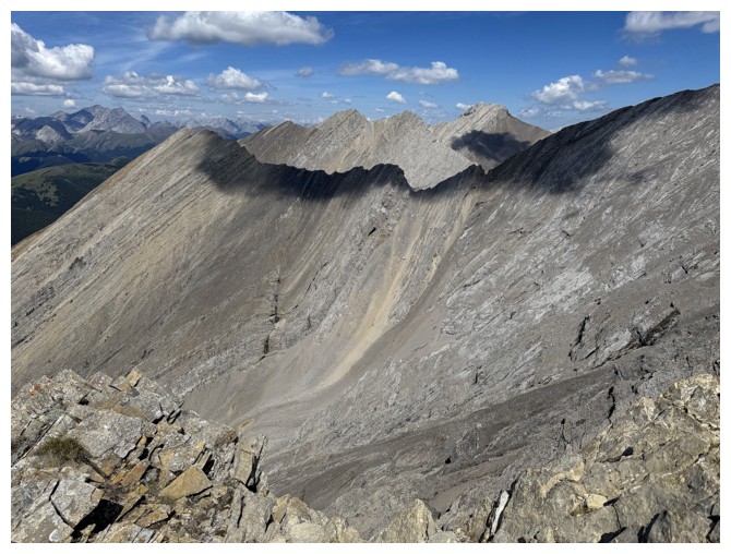
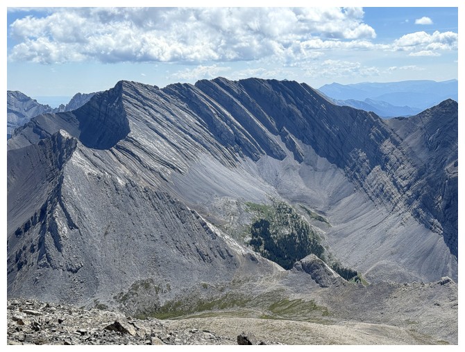
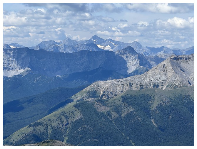
Lineham Ridge, Picklejar Peak, and Picklewood Peak. The Picklejar Lakes are down there but not visible.
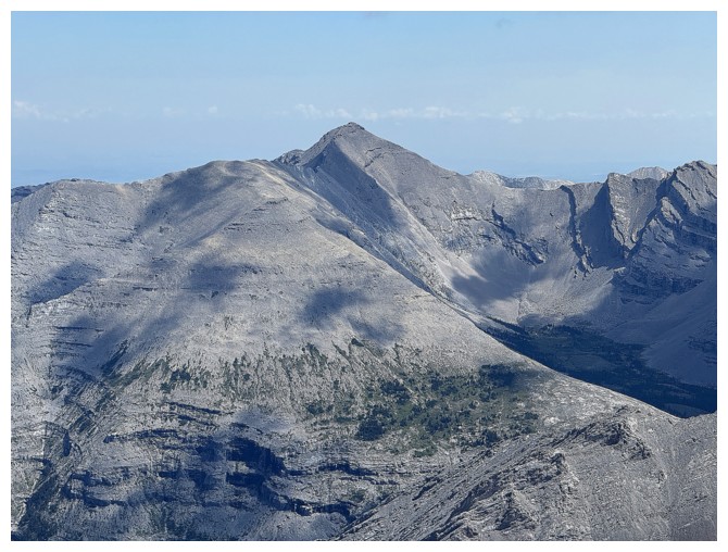
Highwood Peak
I'm on a slightly lower highpoint to the east (photo by Raff)
View from that highpoint
Junction Mountain
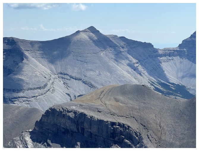
Pyriform Mountain
Picklejar Peak
A comical look at the alternate descent route I used for Picklewood
Picklewood Peak in the foreground
Mount Joffre in the distant centre
Even Mount Harrison is visible in the distance
Storm Mountain
Peaks of the Opal Range, including Elpoca (left) and Tombstone North (far right)
Close-up of Picklewood and its complex west ridge
We've traded summits
I'm back at the true summit (photo by Raff)
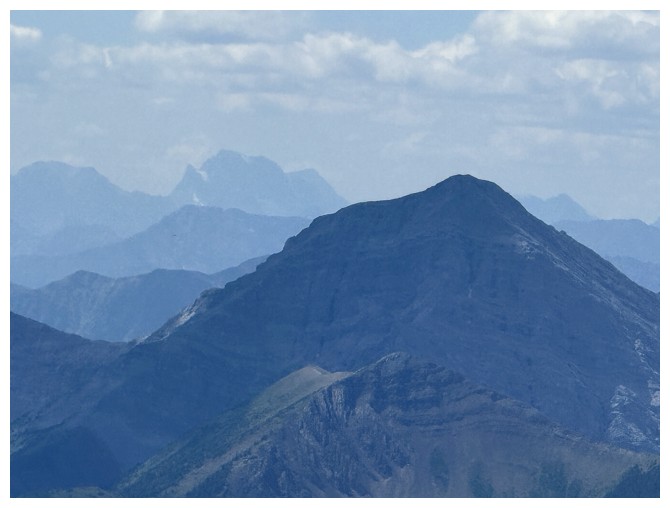
Crumble Peak - that one does not bring back a flood of warm memories!
Neither does an attempt of the challenging south ridge of Highwood Peak
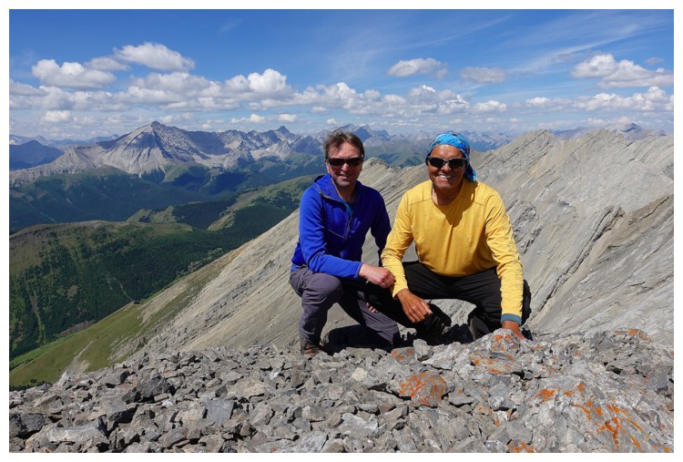
Always a pleasure to summit a mountain with The Raffinator (photo by Raff)
Raff checks out Mist Mountain
Descending the first part of the south ridge
Same as above (photo by Raff)
That wonderful textured rock again
Raff deciding to downclimb here or not
He's down
Traversing back to our ascent route, having decided against trying to follow the unknown drainage down (photo by Raff)
Raff scrambles down a short step
Back at the drop-off
It still looks scary!
Raff approaches the drop-off
Back the way we came (photo by Raff)
We actually went lower down than expected and had to traverse back to the ridge at the left
Nice colours
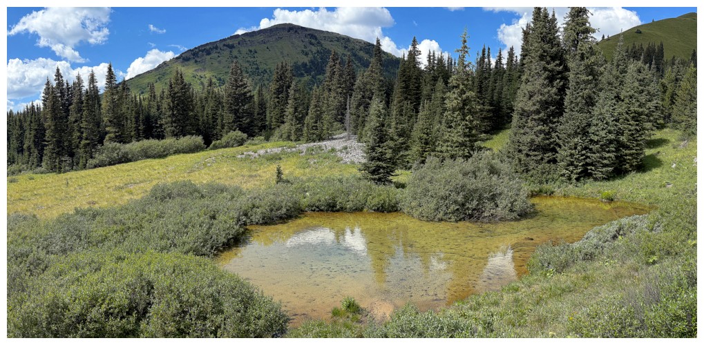
The aforementioned tarn (photo by Raff)
Without me ruining the view
 Looking back to the outlier (left), Highwood (just left of centre), and Highwood South
We managed to find a route back to the trail with minimal elevation gain (photo by Raff)
Raff and the outlier. And that's a wrap!
The End
LOG