Pastry Peak III
April 2, 2022
Mountain height: 2464 m
Elevation gain: 1171
m
Round-trip
time: 8:05
Scrambling/mountaineering
with Dave and Brad.
The south side
of Loaf Mountain is the best thing since sliced bread!
Trying to plan a
long overdue trip with Dave and Brad, when they suggested unofficial “Pastry
Peak” (the middle summit of Loaf Mountain), I was all in. My two previous
ascents were spectacular, and I was more than happy than to repeat either of
those routes. As it turns out, we would end up on a completely different route
and more enjoyable it could not have been.
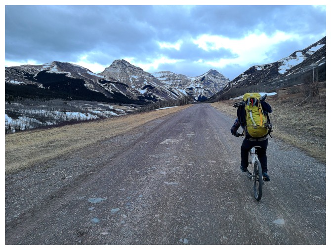
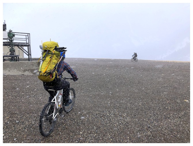
 Brad and Dave
biked the 4 km approach, while I e-biked it – and yes, there is a huge
difference. You don’t realize how much of a difference until you are going
uphill and riding alongside someone without the assistance of a motor! Arriving
at end of the road we had a decision to make: follow one of the established
routes or go for something totally different. I was delighted when Brad and
Dave suggested we attempt to go straight up the face to the ridge from where we
stood. This would be a new route for me and nothing I have ever done on the
south side of Loaf has failed to knock my shoes off!
Brad and Dave
biked the 4 km approach, while I e-biked it – and yes, there is a huge
difference. You don’t realize how much of a difference until you are going
uphill and riding alongside someone without the assistance of a motor! Arriving
at end of the road we had a decision to make: follow one of the established
routes or go for something totally different. I was delighted when Brad and
Dave suggested we attempt to go straight up the face to the ridge from where we
stood. This would be a new route for me and nothing I have ever done on the
south side of Loaf has failed to knock my shoes off!
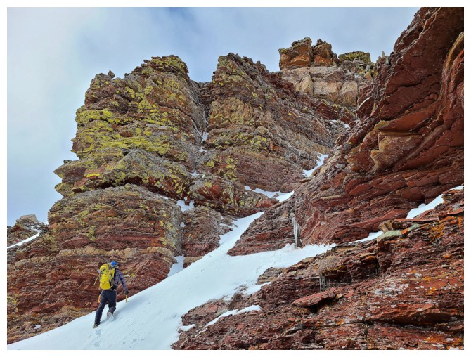
The route
started off well and just got better and better. Very quickly, we arrived at
the bottom of a long snow slope that was perfect for crampons and an ice axe. This
allowed us to gain a fair bit of elevation in a short amount of time. As an
added bonus, the weather was much better than expected, big breaks in the cloud
cover allowing the Sun to light up the amazing surroundings.
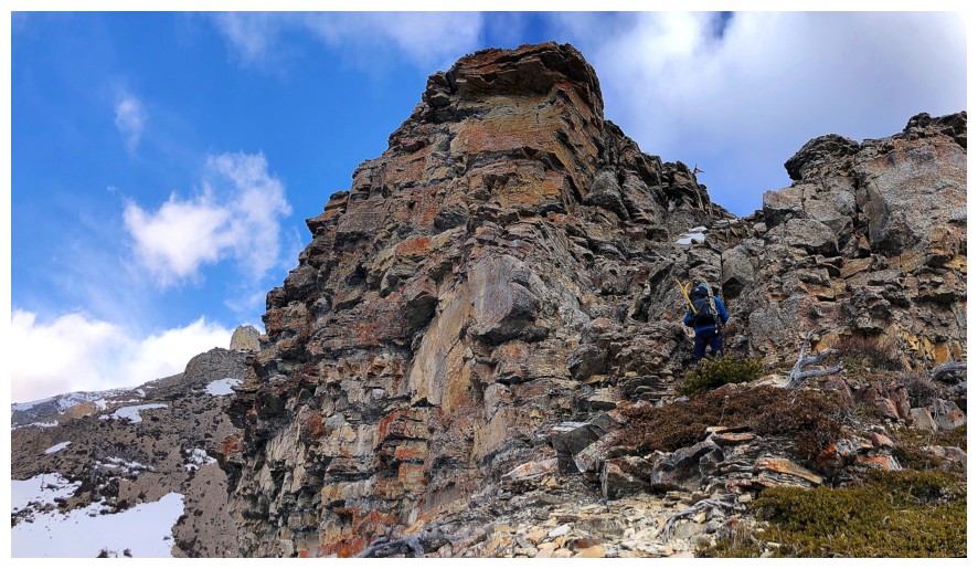
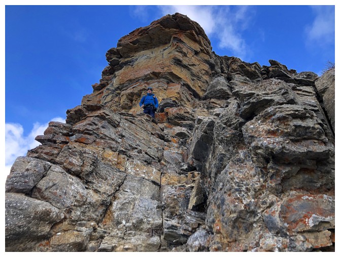
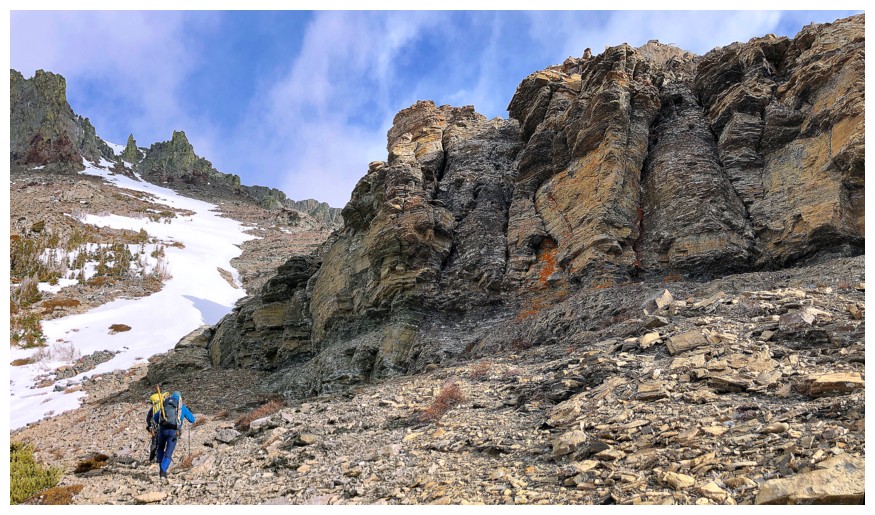
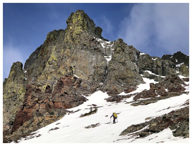
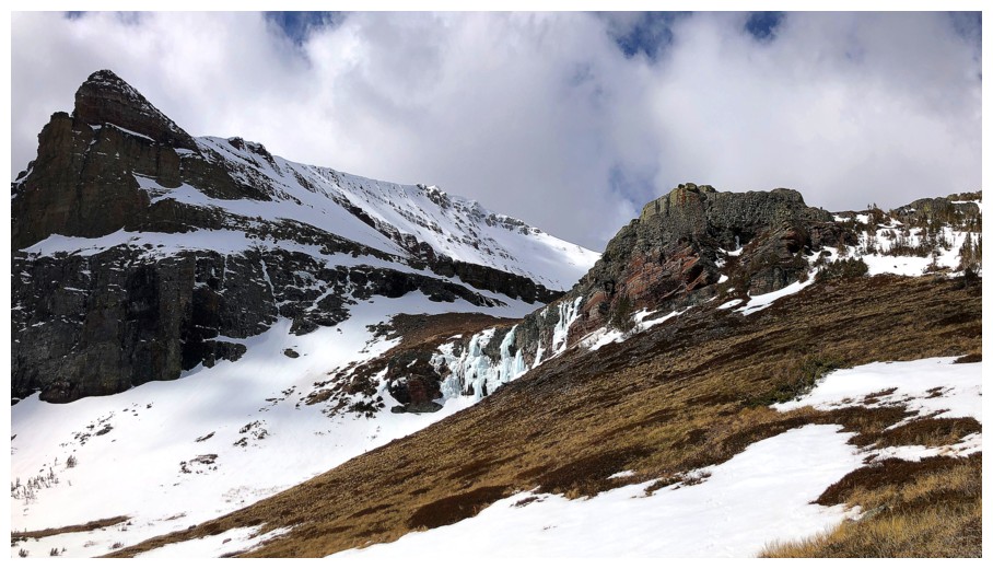
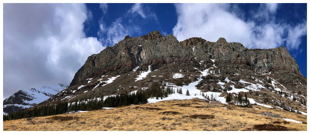
The first major
obstacle sat obstinately above the snow slopes – that steep and pesky limestone
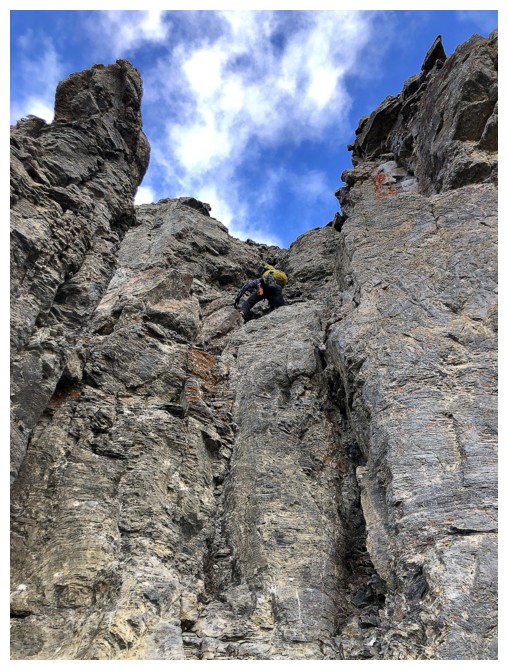
rock band lining most of the peaks in the area. Brad attempted to tackle the
band head-on but quickly reached a near vertical step, looking far from
trivial. Meanwhile Dave had found a minor weakness in the band just off to the
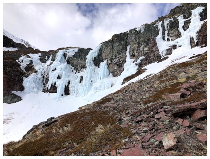
left and had expertly worked his way up. Searching for an even easier route, I continued
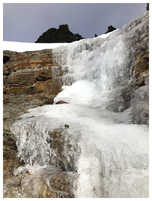
following the base of the rock band along to a very nice frozen waterfall.
Unfortunately, no easy route appeared, and I returned to ascend Dave’s route.
While very steep and a little exposed. the rock was solid with good holds - good route-finding Dave!
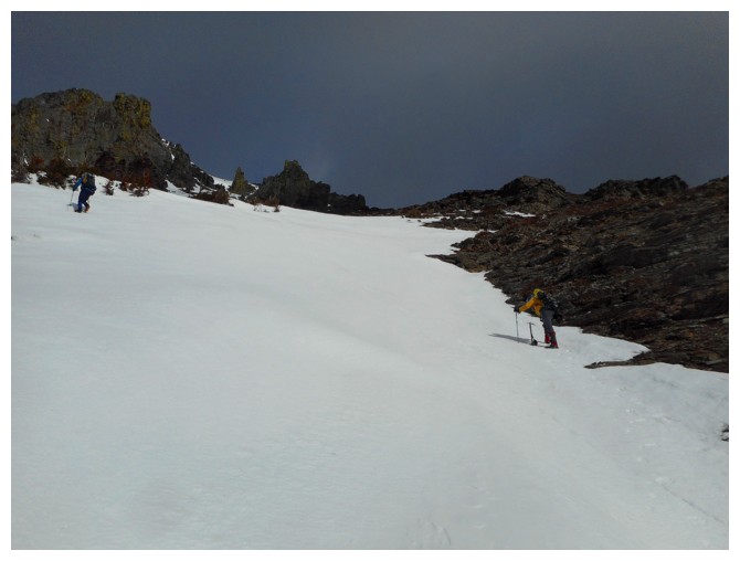
A section of
easier terrain then led to the highlight of the ascent, in the form of another
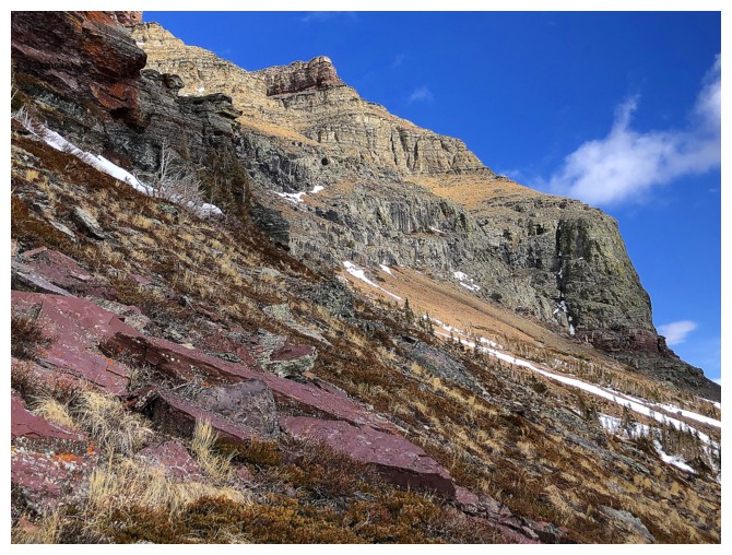
steep snow slope weaving its way through the stunning rock of the upper mountain.
All my favourites were out in full force: red argillite, yellow lichen on the
dark igneous rock band, and super impressive rock formations everywhere. Brad
and Dave led the way while I lagged behind, partly because I had to take a
million photos of the spectacle and partly to catch my breath!
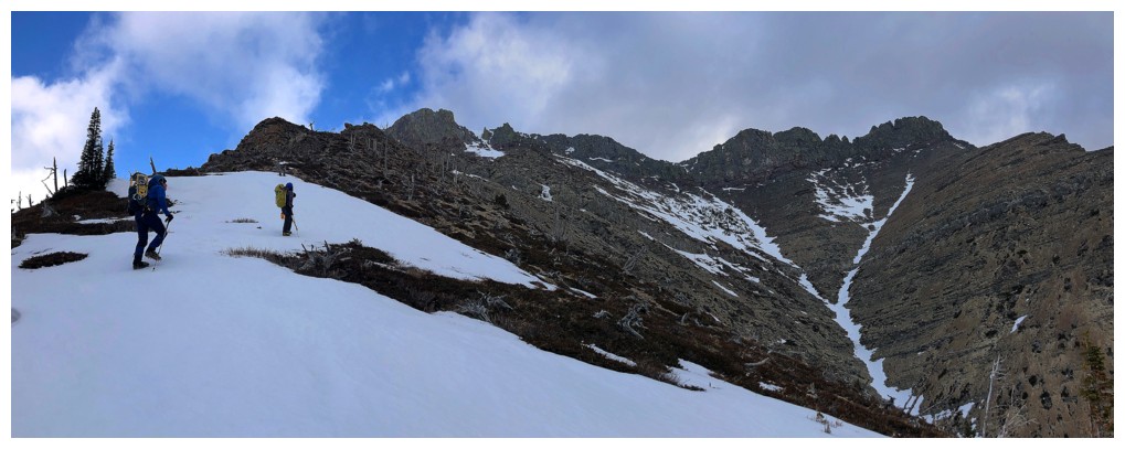
Eventually we
reached the ridge, where a short ridgewalk brought us to another wickedly
beautiful rock band, composed mostly of bright red argillite. We skirted the
base of this band for a few metres and then ascended yet another steep,
snow-filled couloir that ended up right at the summit. What a great route
throughout!
Initially, we
planned to descend the same way Mark and I did in 2020, however, the steep,
snow-plastered slopes looked pretty dicey. Instead, we hiked west towards the
summit and then descended almost completely snow-free scree slopes just east of
the summit block. An enjoyable hike in one of the Castle’s premier
valleys followed. Our timing turned out to be pretty good, as a weather system
suddenly moved in from the west. Thankfully the system was no match for the
gravity-propelled bike ride back to the start. Even the non-motorized cyclists
had an easy time of it!
An amazing day out, on an amazing route, with
amazing friends.
Click HERE to see Dave's report.
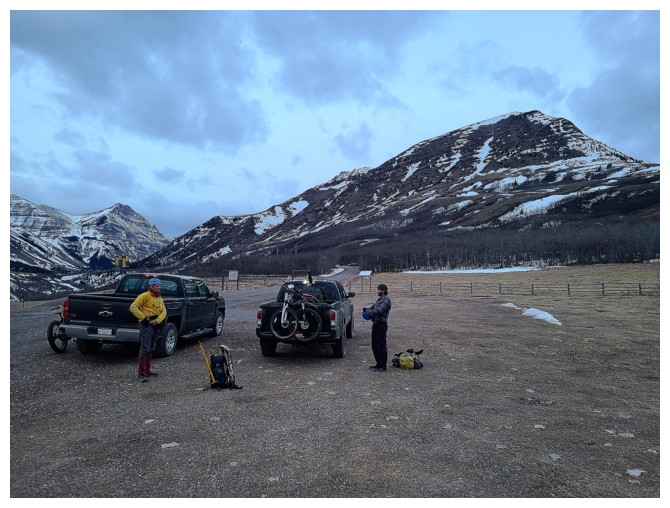
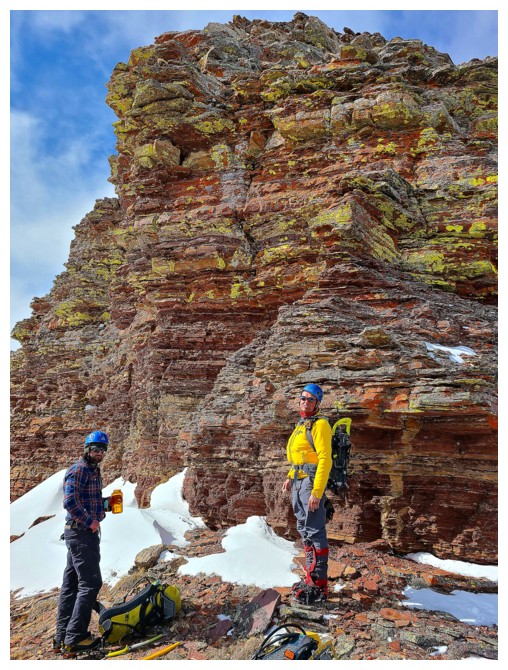
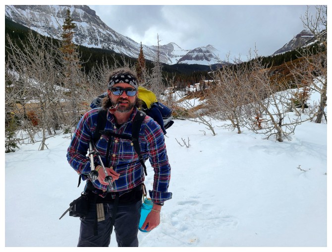
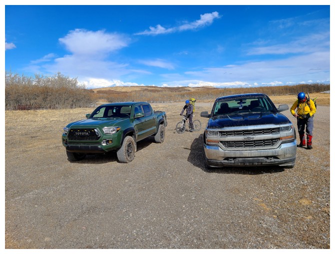
Gearing up at the trailhead (photo by Dave)
Brad leads the way (photo by Dave)
The major advantage of an e-bike - anything that is uphill! (photo by Dave)
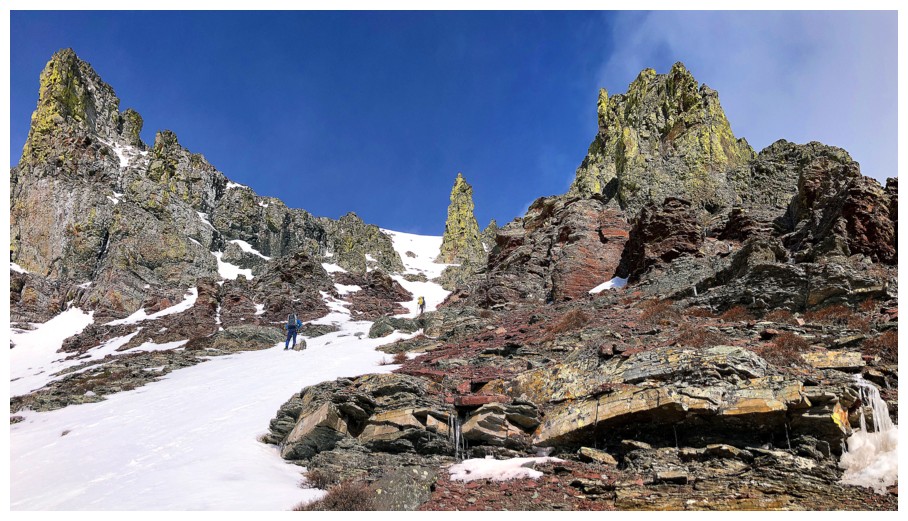
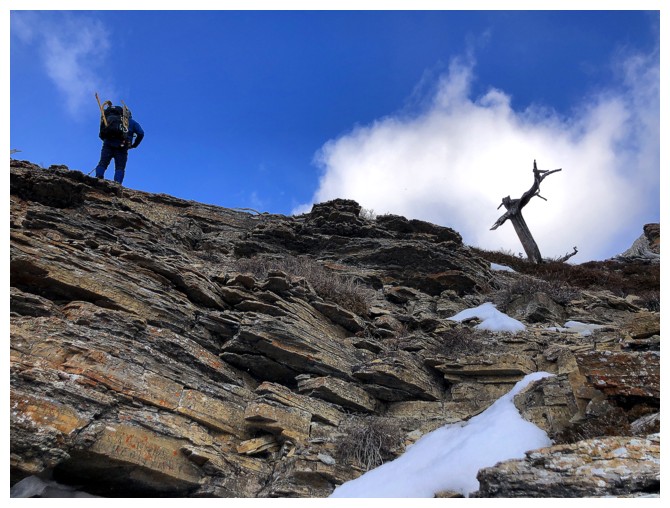
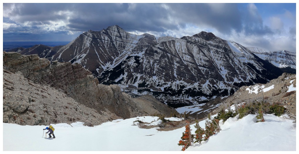
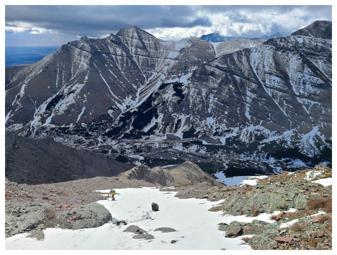
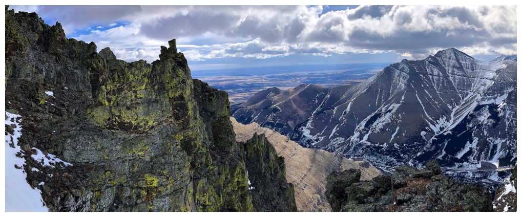
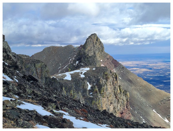
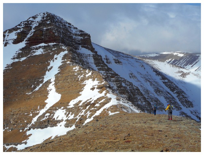
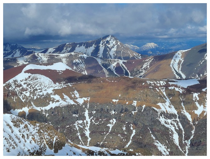
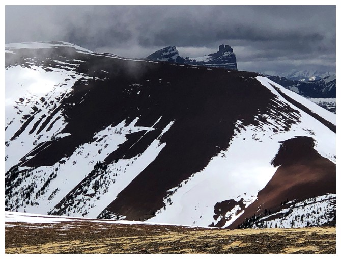
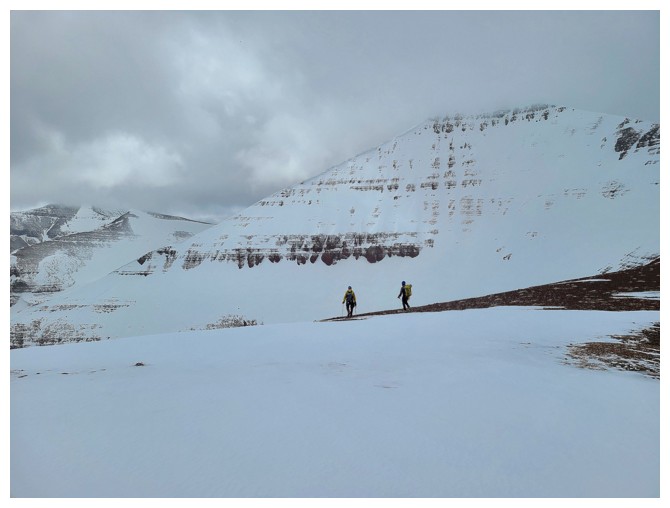
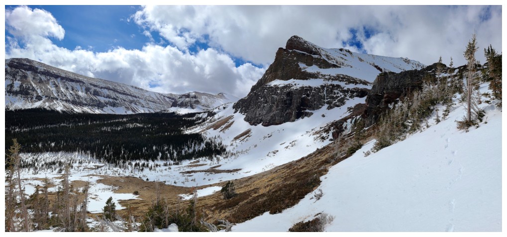
Pointing out some potential routes. Mark and I went up to the bump in the centre, in 2020, and another ascent
went up through the snowy gap at the far left. Dave, Brad, and I would
eventually decide on going straight up from this point (photo by Dave)
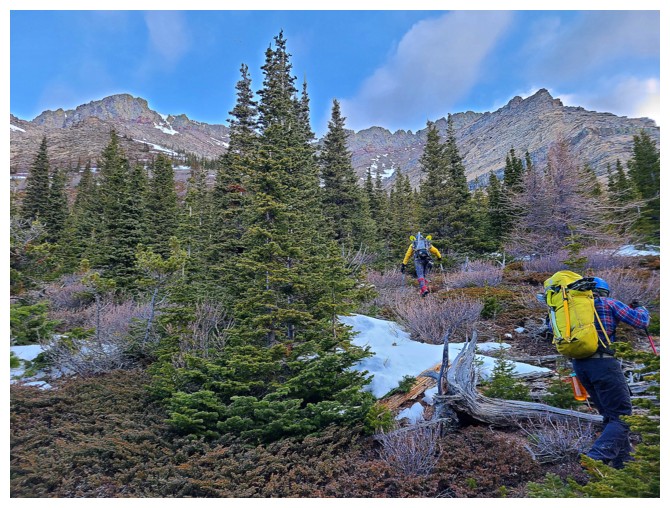
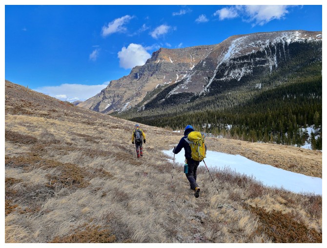
A little light bush to contend with initially (photo by Dave)
Then onto snow slopes - perfect for crampons and an ice axe
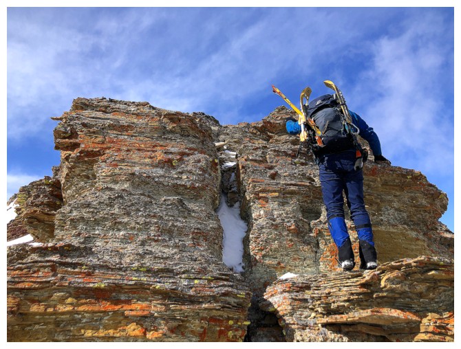
Dave approaches the first of many cool rock features
...and finds a neat route up
Atop the first rock band
Approaching another
Dave finds another step of rock to scramble up
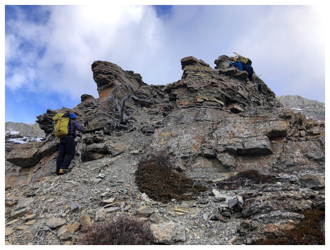
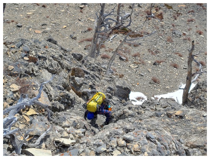
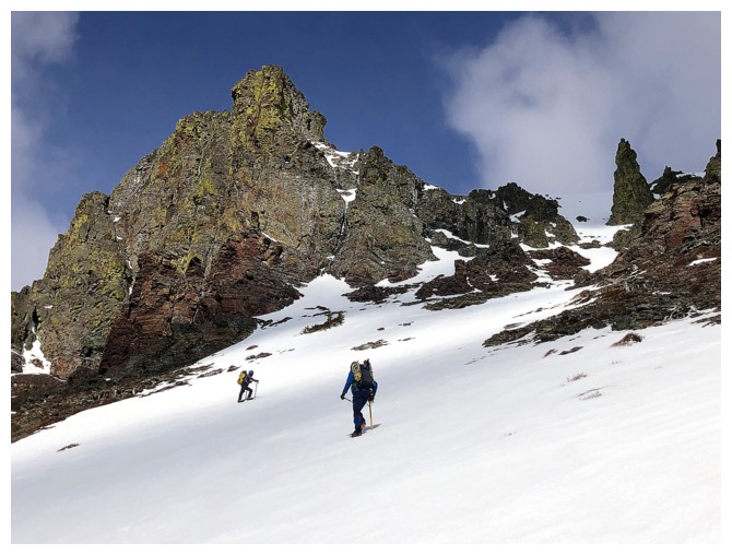
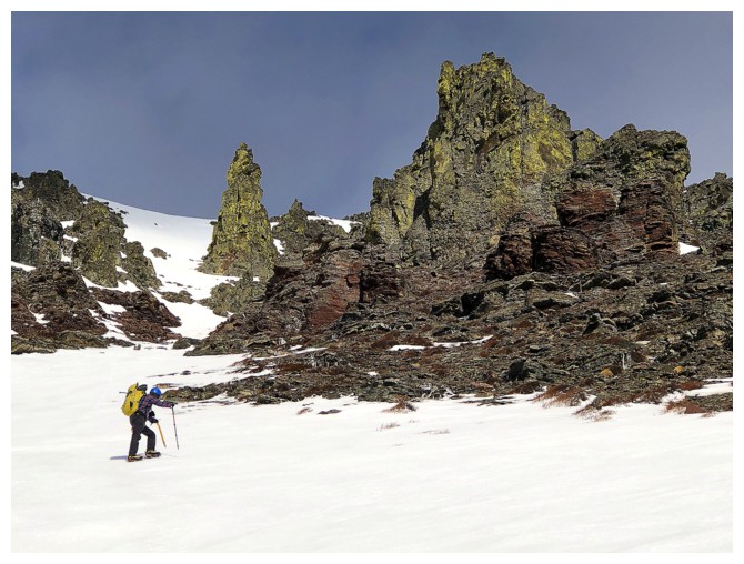
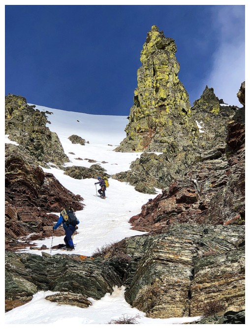
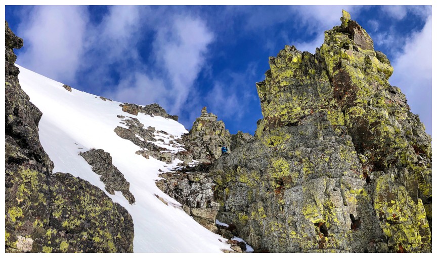
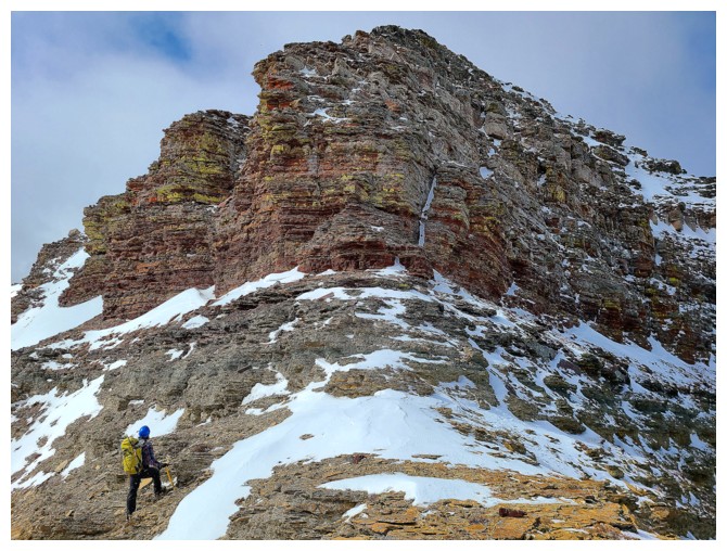
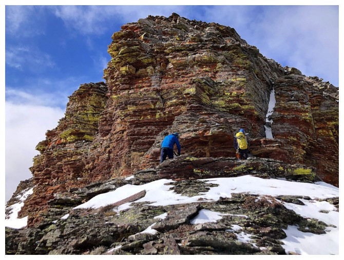
Now approaching the first crux of the trip - the infamous limestone rock band
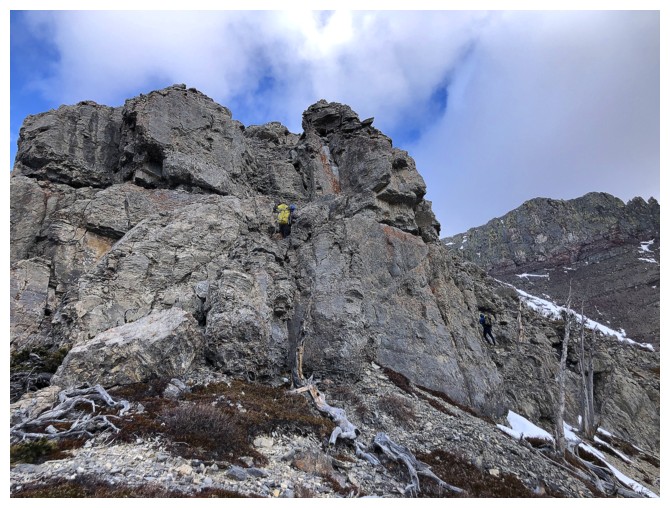
Brad heads straight up the rock band, while Dave can just be seen to the right. Dave's route would turn out to be the best one.
Still, Brad made it quite high up
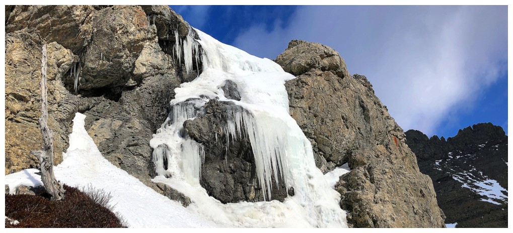
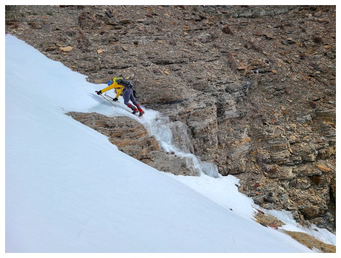
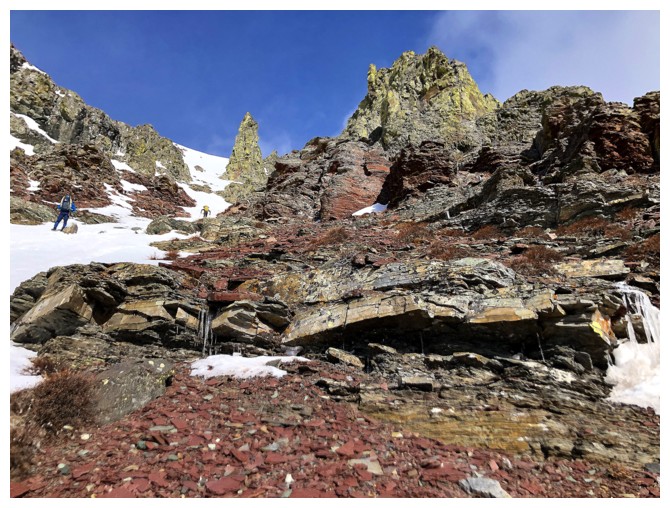
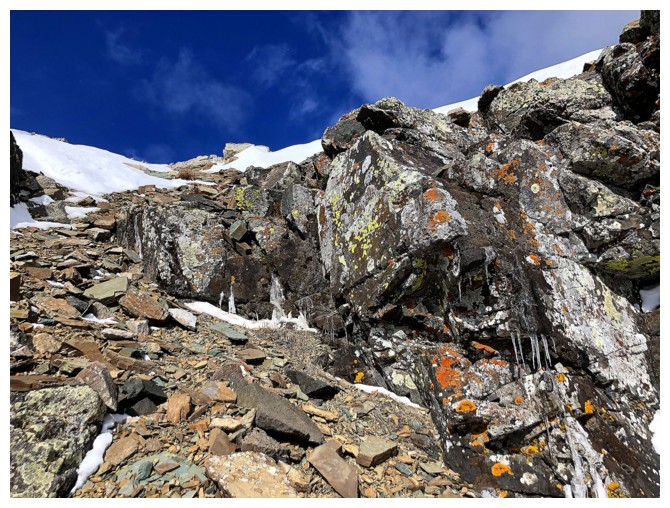
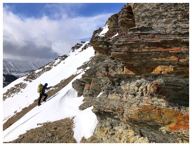
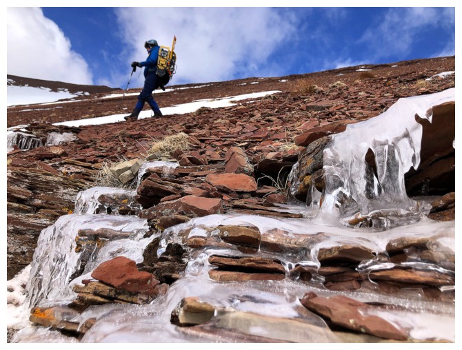
Looking for an easy route, I came across this frozen waterfall
Dave is already atop the rock band
Brad on the last few steps (photo by Dave)
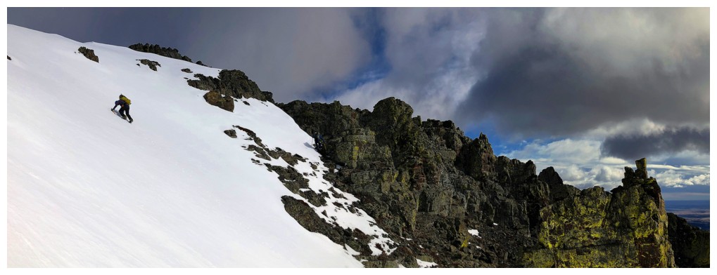
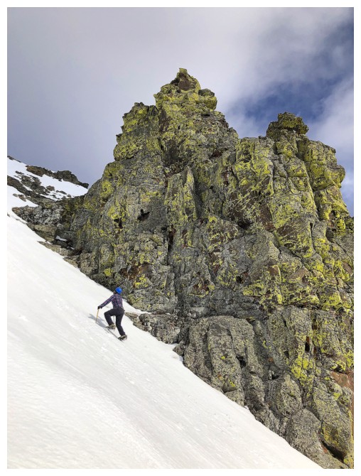
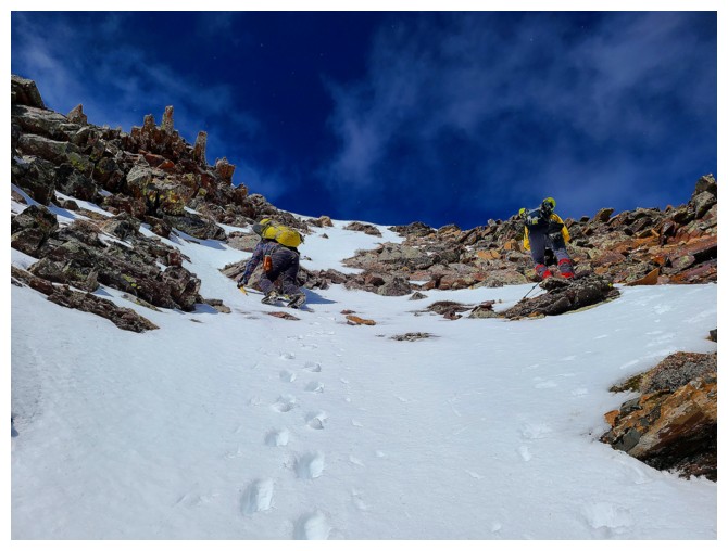
The Boys make their way over to the next snow gully. This one was probably the highlight of the trip.
Dave takes the lead (photo by Brad)
A small but intriguing ice feature along the way
Climbing
the small step of ice with one ice axe, one hiking pole and crampons
dulled to the point where they are more like giant microspikes was
perhaps not the smartest move in the world. At least it was barely
30 degrees in angle! (photo by Dave)
Dave on the lower part of the snow gully
Dave
looks down to Brad and across to Mount Roche (Spread Eagle Mountain)
and the first part of the awesome Spionkop traverse (photo by Dave)
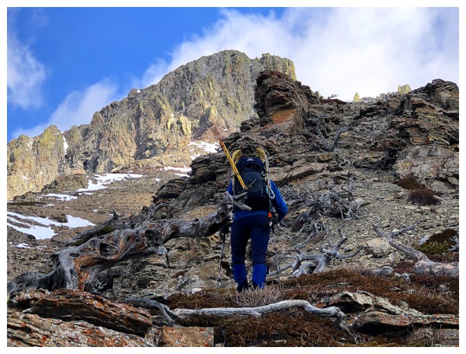
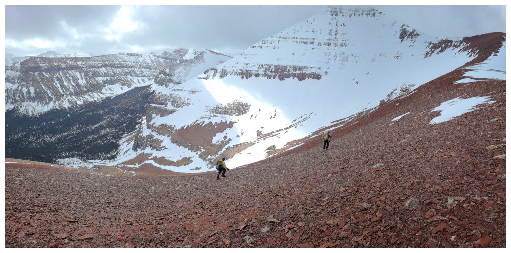
 The route up is obvious
Brad closes in on the awesome rock of the upper mountain
Same as above
I had to take a quick detour over to the right side of the gully, that naturally features a band of burgundy argillite rock
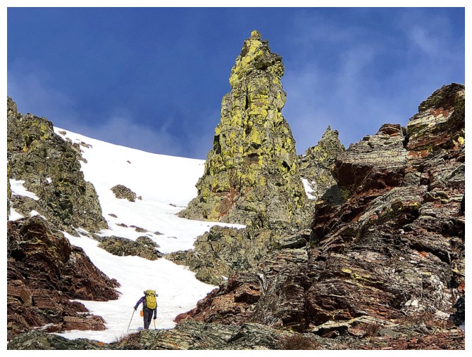
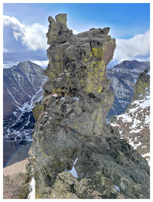
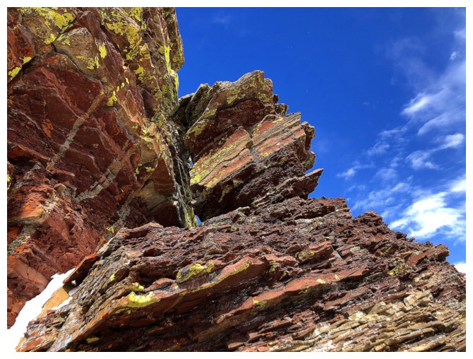
Brad is dwarfed by a striking pinnacle
I'm lagging way behind as usual (photo by Dave)
...partly because I'm mesmerized by the beautiful scenery, but more because I'm just old and out of breath!
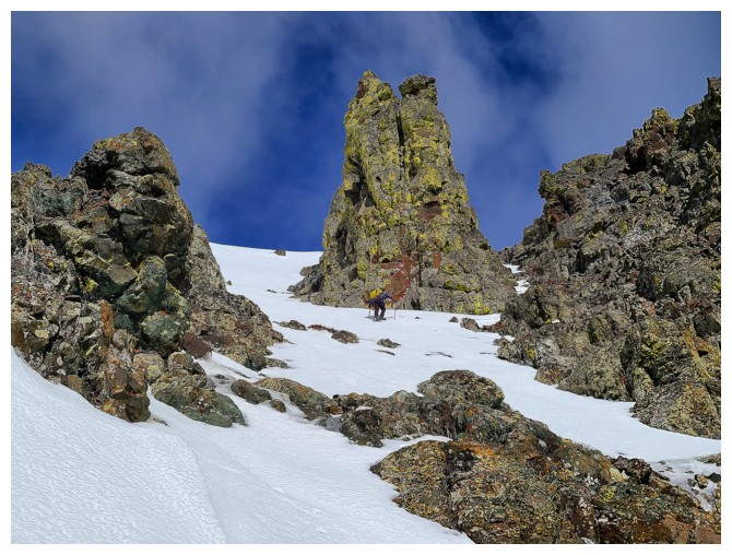
Clearly Brad is also drawn to the pinnacle also (photo by Dave)
 Brad's view of me and Dave ascending the gully (photo by Brad)
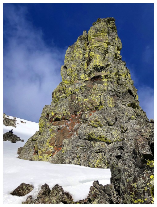
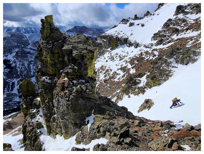
The Pinnacle - so impressive it gets capitalized!
I took a route over to the left, alongside this equally stunning rock
Dave checks out the apex of The Pinnacle - very tempting! (photo by Dave)
My view of Dave as he checks out the apex
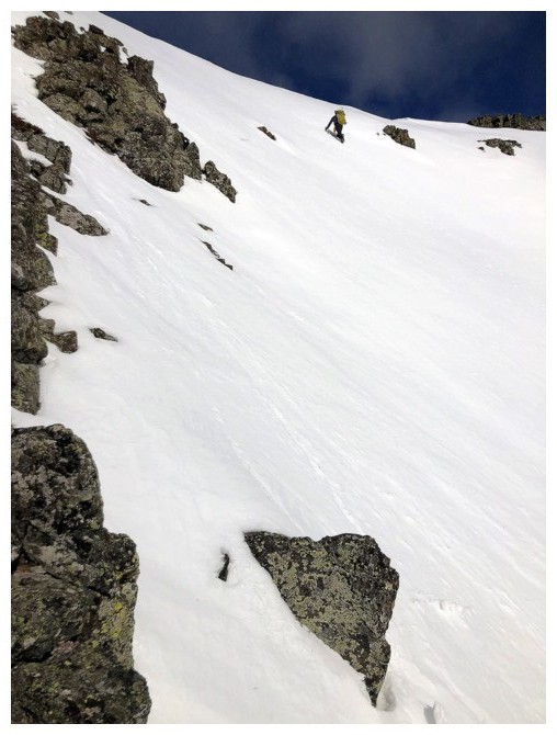
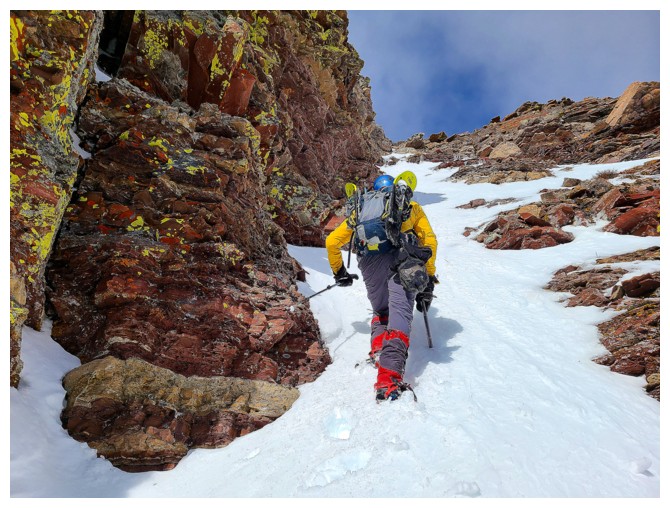
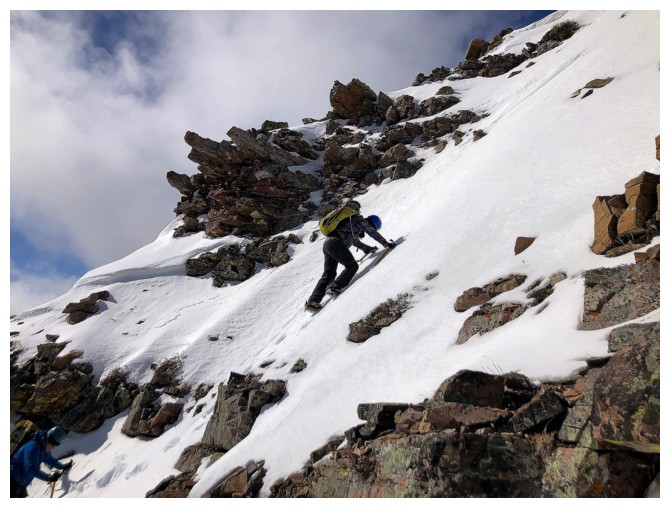
Brad has decided to go directly up the very steep upper section of the
snow gully and has wisely brought out an ice tool to go along with his
ice axe
Up he goes (photo by Dave)
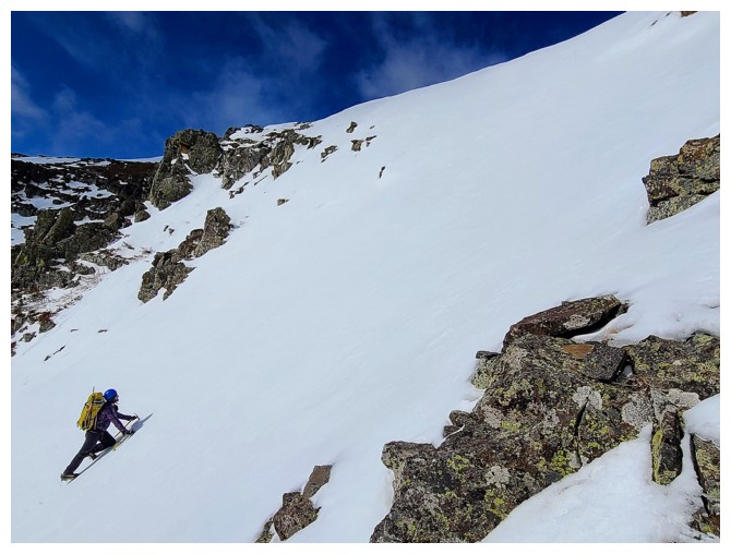
Getting steeper (photo by Dave)
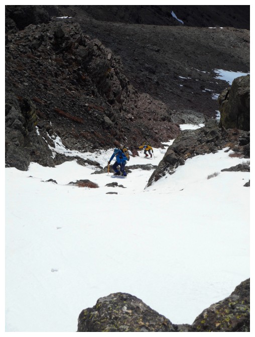
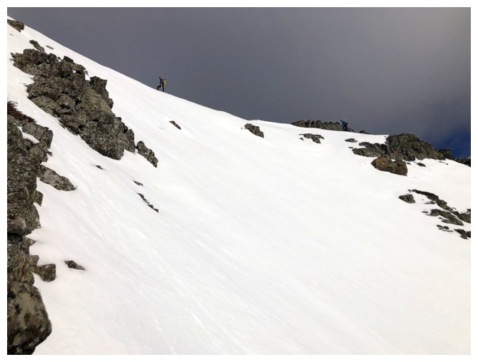
Still enjoying great views and better than expected weather
Brad is making good progress and Dave can be seen on the snow patch, right of Brad
Definitely two axe terrain, especially given how hard the snow was
Brad and Dave reach the ridge
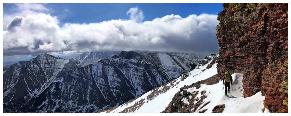
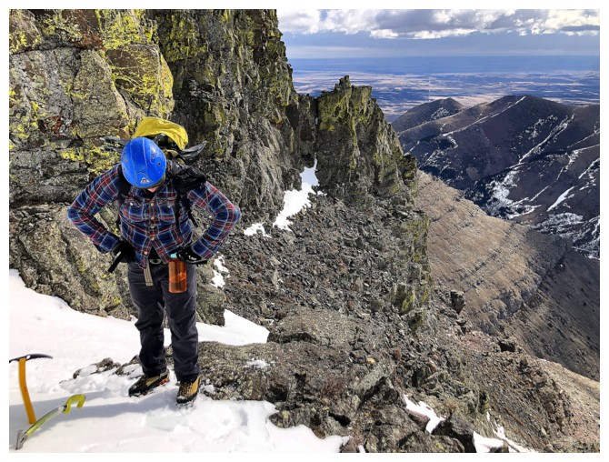
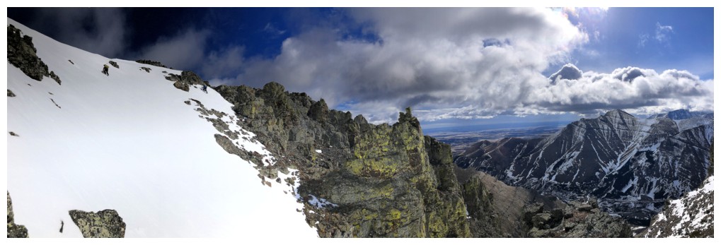
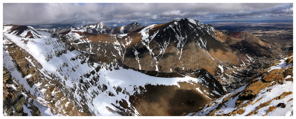
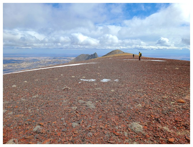
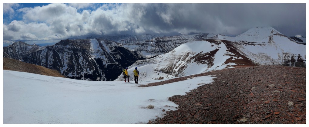
Looking
over to the highest point on the east end of mountain. That summit
requires technical climbing, but getting close to it via the Bakery
Peak route is one of the best scrambles in the area (photo by Dave).
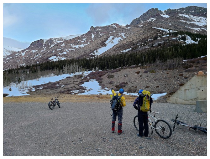
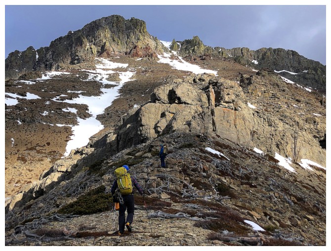
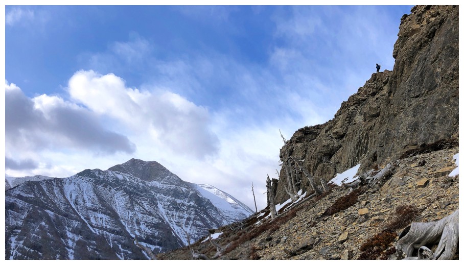
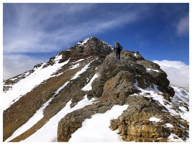
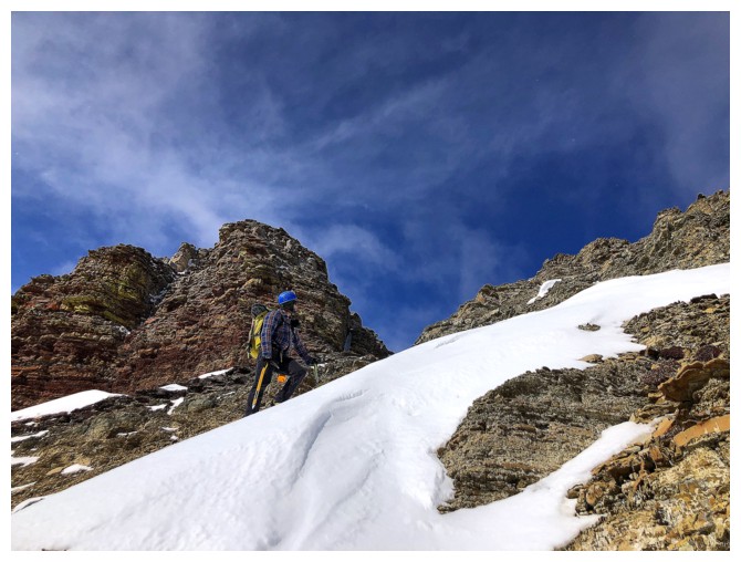
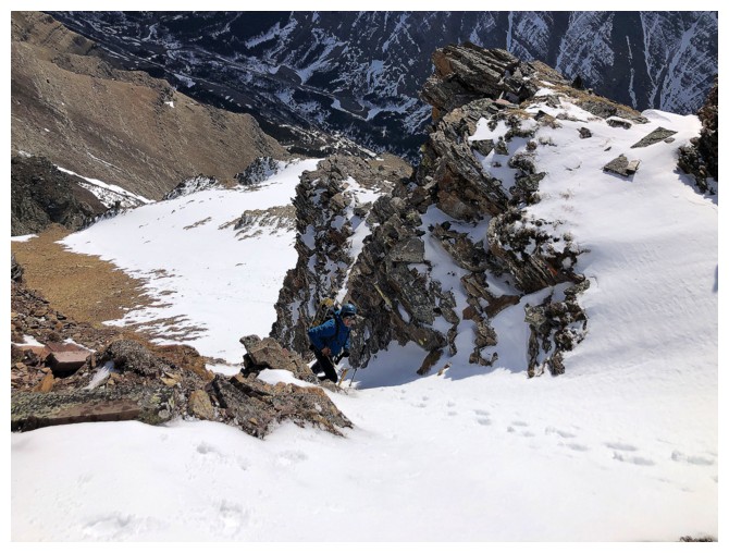
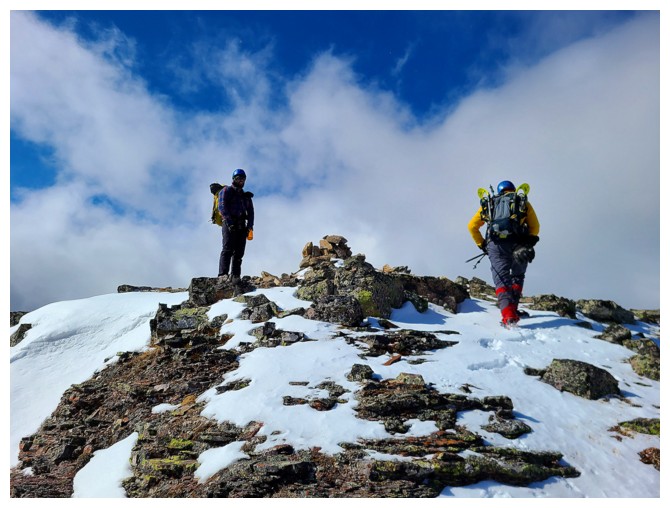
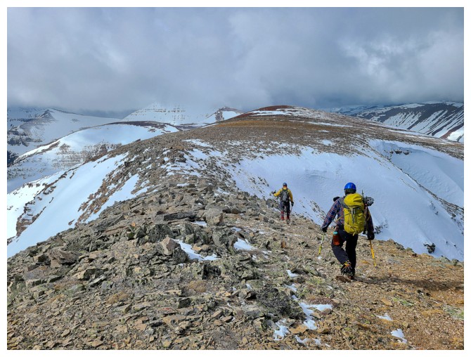
Heading up to the ridge to meet Dave and Brad
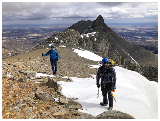
There they are
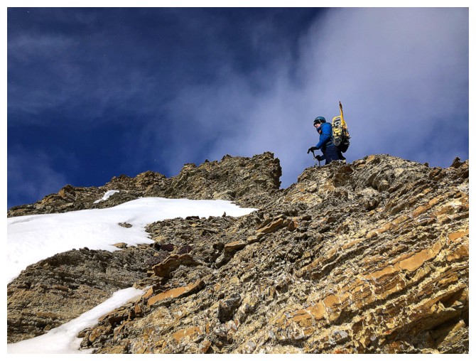
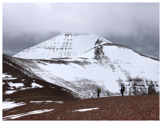
Dave looks to the summit of Pastry
The summit block looks quite intimidating from the east (photo by Brad)
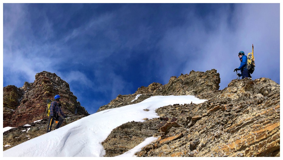
Dave leads the way
We follow (photo by Dave)
Dave tackles another small rock step
Brad loves the slop.....I mean the snow. Reminds me of this great Seinfeld scene.
("His mother was a mudder, his father was a mudder" - classic!)
Strangers in the Night
...or more accurately mid-day
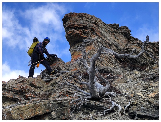
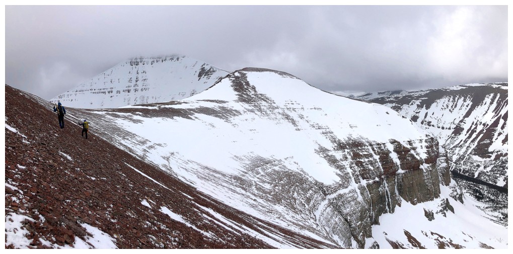
Brad sizes up the rock band ahead (photo by Dave)
Definitely more than scrambling (photo by Dave)
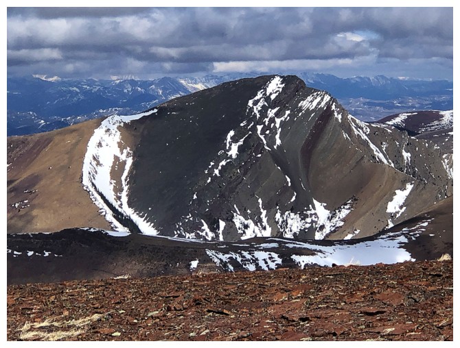
Looking northeast to the summit of Drywood Mountain
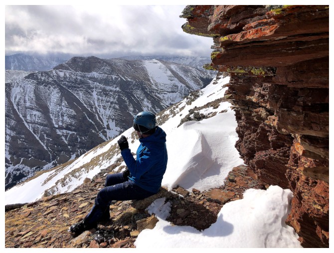
Short food break before we finish the ascent
Taking a break beneath a rock band of yellow lichen-covered, red argillite is never a bad thing! (photo by Dave)
Neither is looking up that band
Same as above
Going around the base to look for a weakness (photo by Dave)
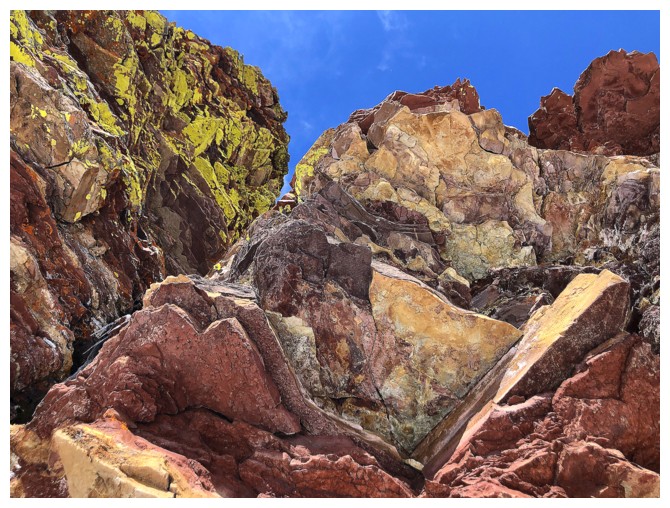
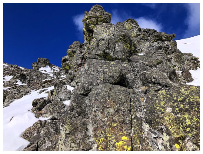
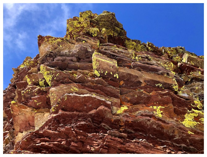
More sweet rock and lichen
Brad finds a promising snow gully to ascend (photo by Dave)
My turn to lead (photo by Dave)
Dave brings up the rear
Brad stuck to the snow as the grade increased. Dave and I went to the right, onto the rock (photo by Dave)
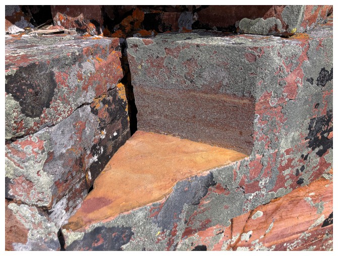
Slice of argillite pizza, anyone?
Two axes needed again
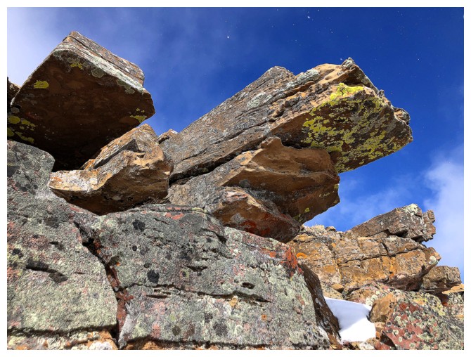
Last of the lichen
Atop the gully it's only a few steps to the summit (photo by Dave)
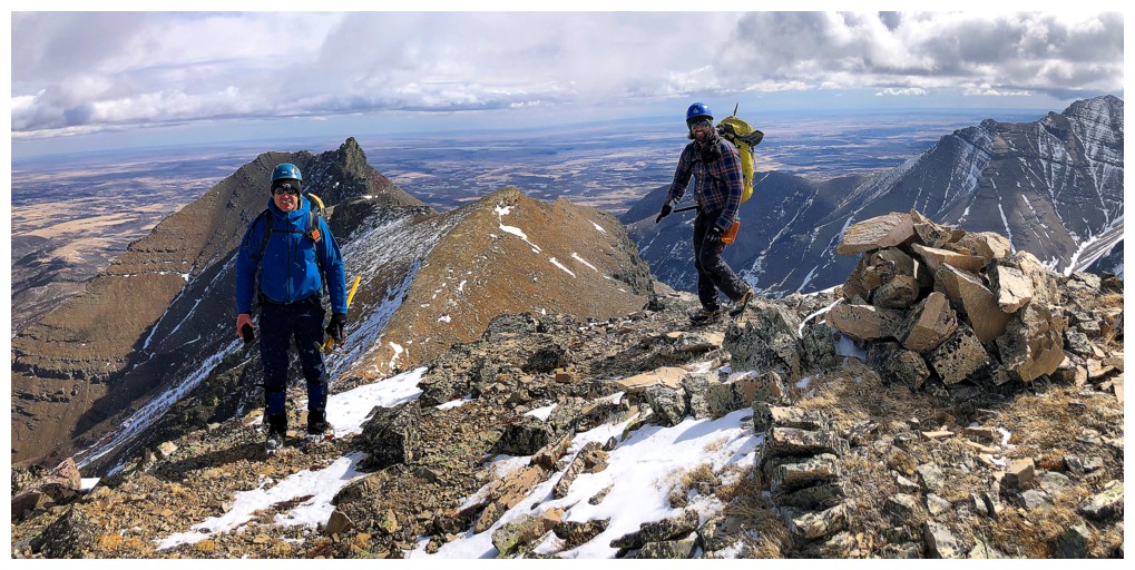
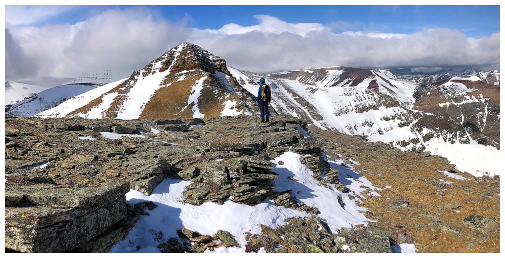
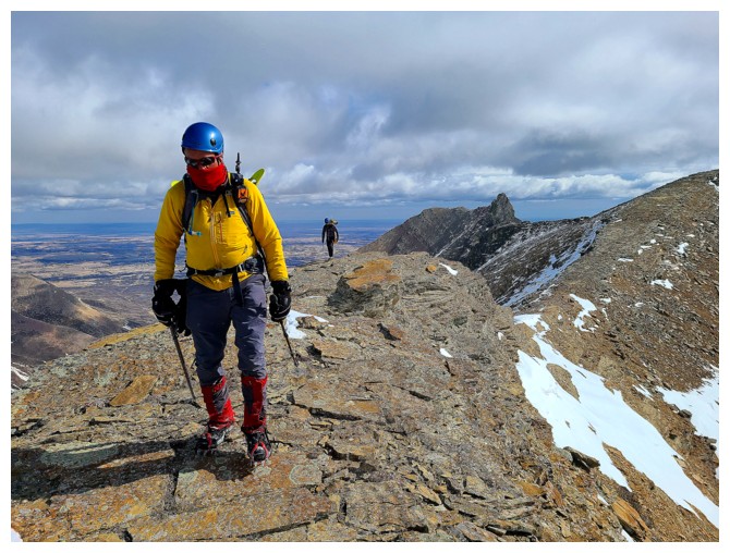
The Boys at the top and still sunny where we are
Dave and I at the windy and therefore very chilly summit. Not so sunny to the west (photo by Brad).
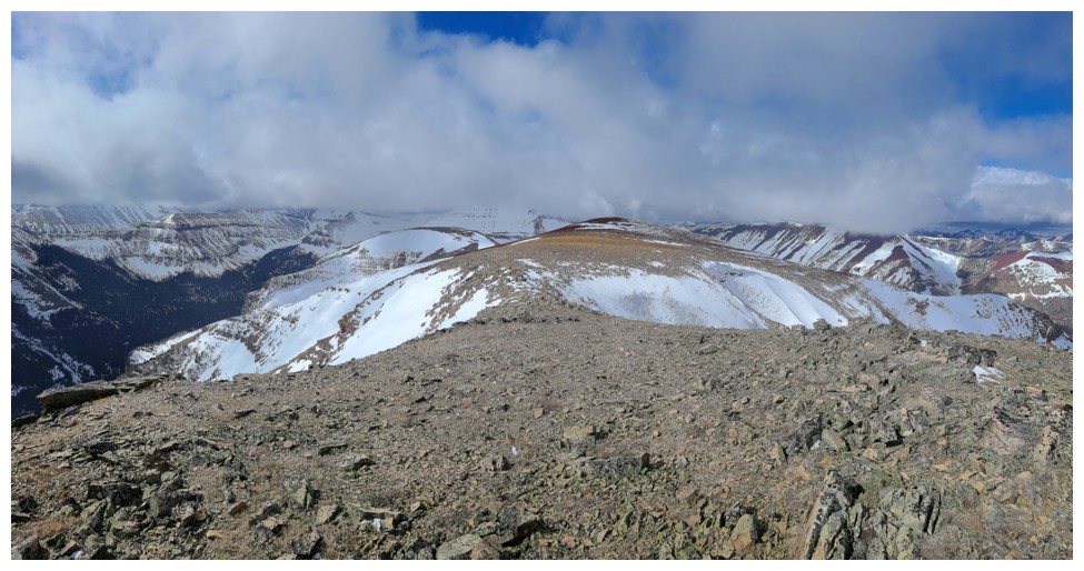
The view to the west usually includes the loaf-shaped summit block of Loaf Mountain, but not today (photo by Dave)
The ridges of Drywood and Pincher in the foreground and Victoria Peak in the centre (photo by Dave)
Descent time (photo by Dave)
The expansive, red ridge of Loaf (photo by Dave)
Pincher Ridge - many great memories on that one
Windsor Mountain and Castle Peak
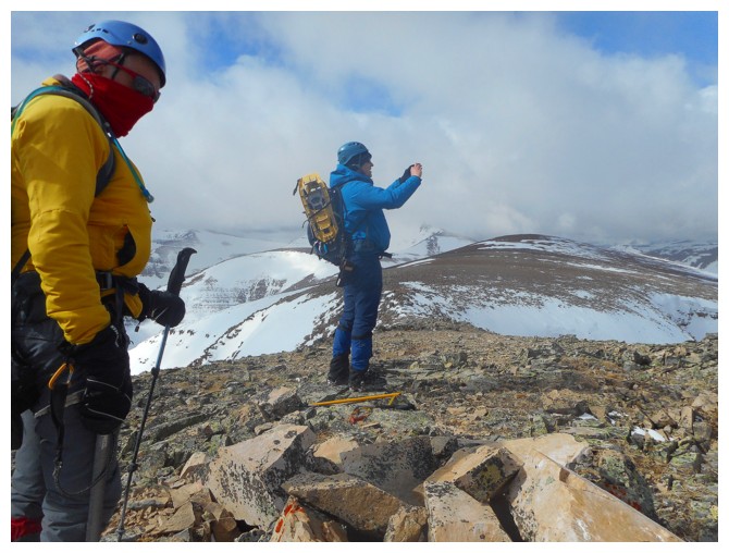
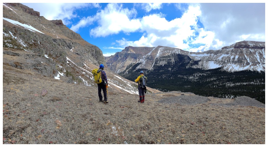
Brad and I discuss which descent route to take (photo by Dave)
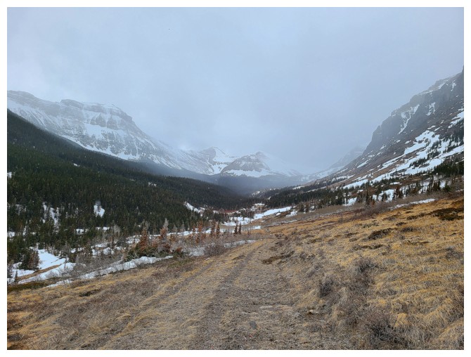
We decided to hike to the summit block and then descend. The summit of Loaf is now visible.
This traverse took far longer than we anticipated
At the point of descent (photo by Dave)
Shockingly snow-free slopes (photo by Dave)
Still a few tasty treats of ice-covered rock
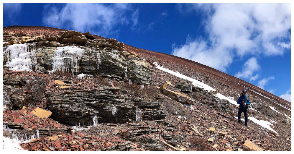
Same as above
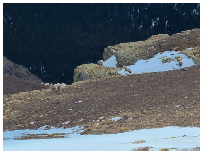
A herd of sheep, also enjoying the delights of Loaf Mountain (photo by Dave)
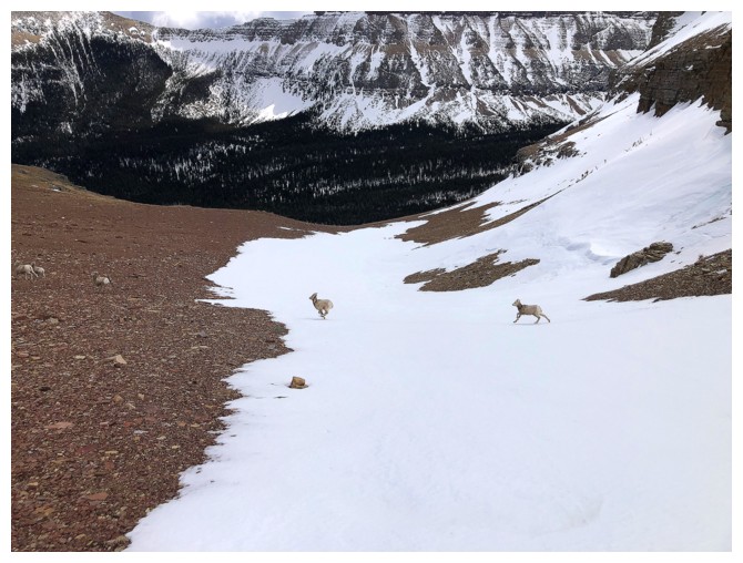
They all bounded past us to get over to the left side of our descent route
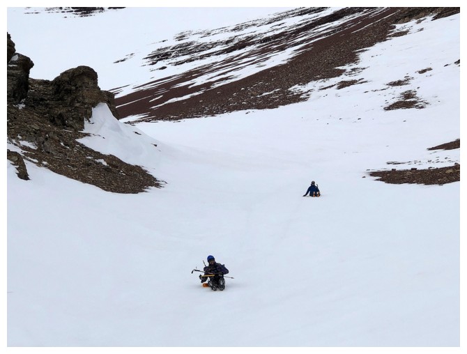
Though very short-lived we did manage to glissade a short section
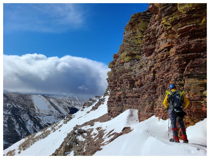
Planning a descent route down to the valley. There is a waterfall, but it can be circumvented on either side (photo by Dave).
Descending, east of the still frozen waterfall (photo by Dave)
Of course, I had to get a closer look
 Looking up to another area of Loaf's south side that I would love to explore someday
Regrettably leaving this amazing area, as the Sun actually makes it onto Loaf's summit. That would not last however.
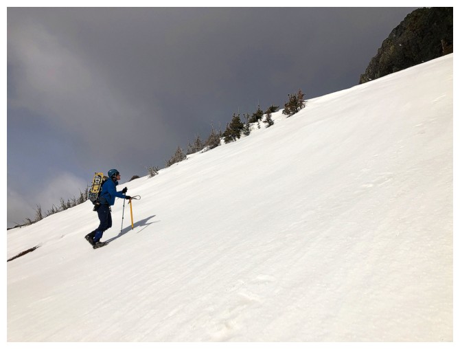
Easy and scenic hike out (photo by Dave)
This wall doesn't appear to have any weaknesses through it
Inevitability (photo by Dave)
The pipe comes out (photo by Dave)
Rapidly deteriorating weather to the west
Trying to beat the bad weather (photo by Dave)
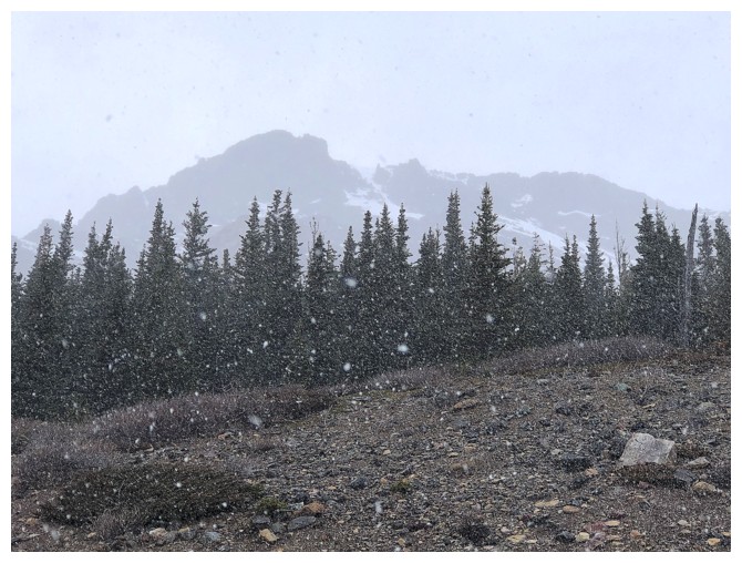
Yep, it's snowing
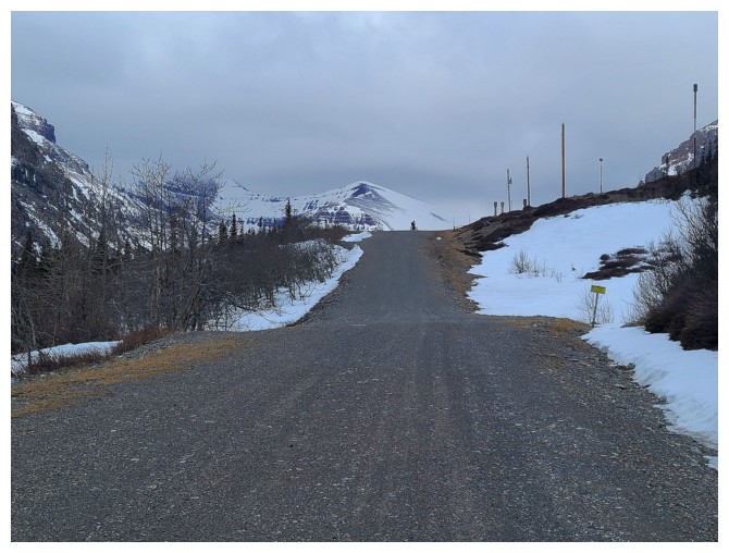
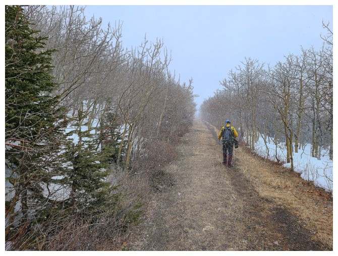
The start of a wonderfully easy bike ride back to the trailhead
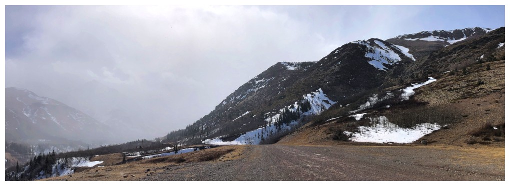
The Muffin and The Croissant are still under blue skies, but I wouldn't want to be farther west
Clear skies back at the trailhead (photo by Dave)
The End
LOG