Pincher Ridge Centre III,
Southwest II,
Victoria Ridge V
 July 30, 2020
Mountain heights: 2350 m, 2450 m, 2530 m
Elevation gain:
approximately 1500 m
Round-trip time: 8:50
Solo scramble.
Inspired by two of Dave McMurray’s trips (Pincher
Ridge I and Pincher
Ridge 2),
I set off to combine his routes, ascending the north side of Pincher
and then traversing all the way to Victoria Ridge. I would
be leaving out
an ascent of the true summit of Pincher Ridge – that summit has seen me
four
times and although five is inevitable, this was going to be a
relatively long
trip already. I had also visited the trailhead several days before and
to my
delight the “No Trespassing” signs present in the latter part of 2019 were gone, therefore
allowing a bike approach.
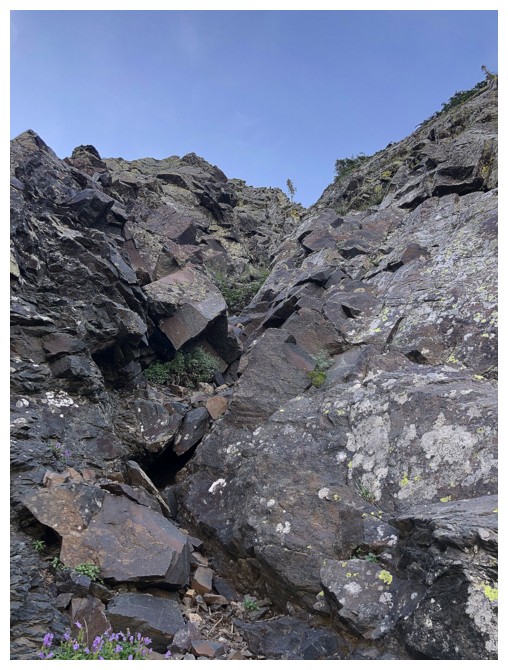
Dave’s route up the north side of Pincher Ridge
was fantastic! Tons of hands-on scrambling up a colourful water-worn gully –
couldn’t have asked for more. Nearing the ridge, I decided to take a steeper
line up a gully of solid igneous rock. All was going very well until I hit a
short but vertical step, at the high end of scrambling. I probably could have
squirmed my way up the step but not more than 10 minutes earlier I had been
thinking to myself that I never want to be one of those individuals that “died
doing want he/she loved”. I’d much rather grow old until I am no longer able to
do what I love doing and then die! As such, I very slowly downclimbed what I’d
already ascended and took the easy route up that I probably should have taken
in the first place.
 Now on the ridge, all that awaited was a long
but easy and beautifully scenic hike to the Centre and Southwest peaks and
beyond. Two previous, and very unique, trips to the Centre and one to the
Southwest did little to detract from this part of the trip. And as well as
finding phenomenal views in every direction I looked, I also found a pair of
sunglasses in my travels. Dave had mentioned he had lost a pair on the
mountain, about a month and half earlier – could these be his? I put them in my
backpack just in case.
Now on the ridge, all that awaited was a long
but easy and beautifully scenic hike to the Centre and Southwest peaks and
beyond. Two previous, and very unique, trips to the Centre and one to the
Southwest did little to detract from this part of the trip. And as well as
finding phenomenal views in every direction I looked, I also found a pair of
sunglasses in my travels. Dave had mentioned he had lost a pair on the
mountain, about a month and half earlier – could these be his? I put them in my
backpack just in case.
From the spacious Southwest summit getting over
to the summit of Victoria Ridge involved nothing more than steep hiking and an
unfortunate but necessary elevation gain of about 200 m. The
summit view was expectedly awesome.
Not much to say about the descent except, all
mercifully downhill and wonderfully scenic. And thank goodness a bike (in fact
an ebike!) was waiting for me at the end of the gas road – my legs were at the
“enough is enough, we’re not taking another step!” stage by the time I reached the bike.
A pretty amazing loop route and big shout-out
to Dave for his great route up the north side of Pincher Ridge. And yes, those were his sunglasses:)
Always a treat to pass by the outlier that started an enduring and meaningful relationship with Prairie Bluff!
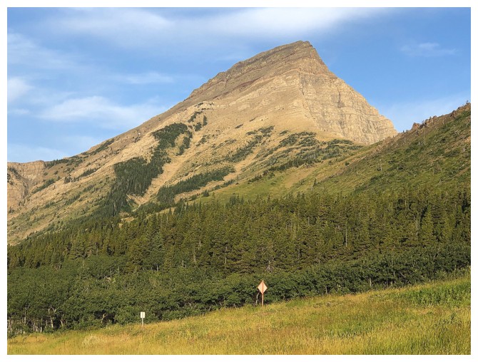
An outlier of Prairie Sky that begs some exploration
Another sentimental favourite. Victoria Peak was the first mountain I scrambled in The Castle, thanks to Linda Breton and her adventurous spirit.
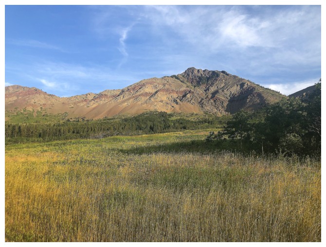
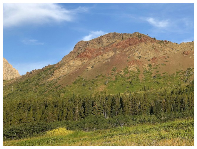
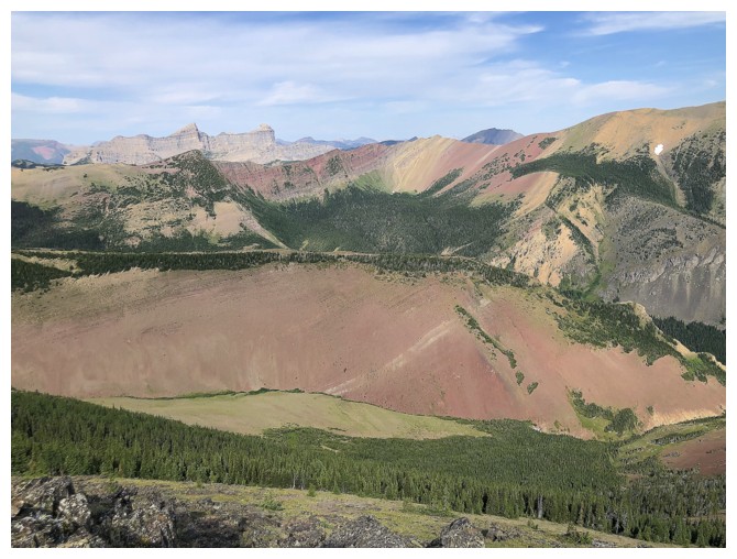
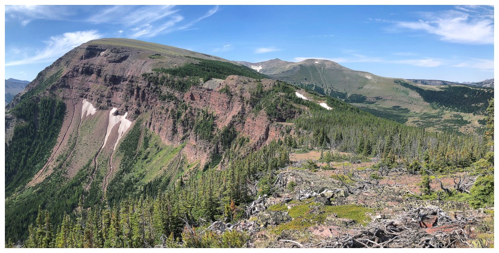
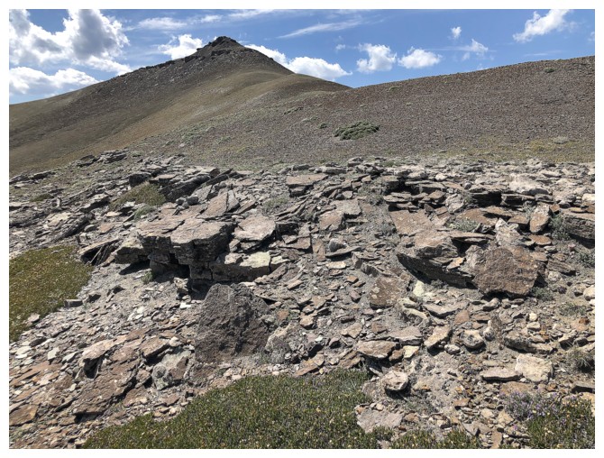
Not such fond memories of this northern outlier of Pincher Ridge
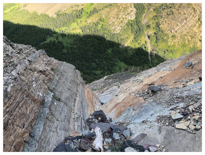
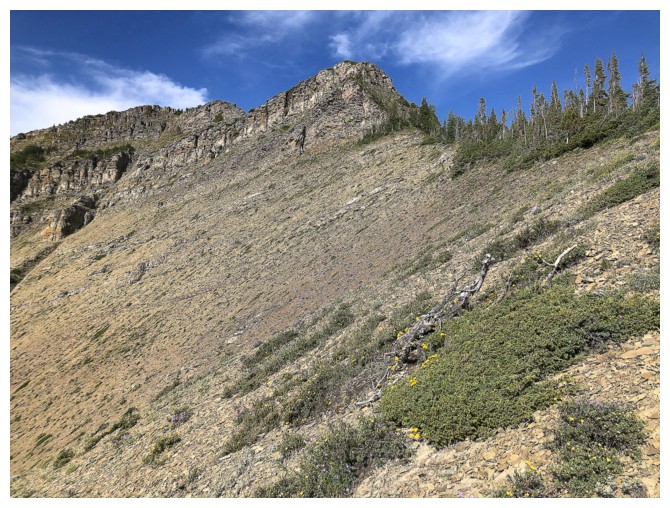
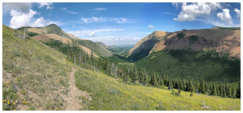
Looking up the ascent route from the point I left the trail
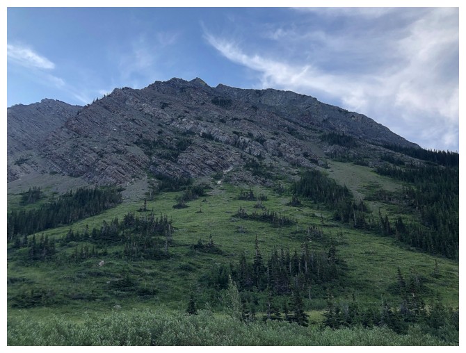
Typical terrain on ascent - fun, easy scrambling
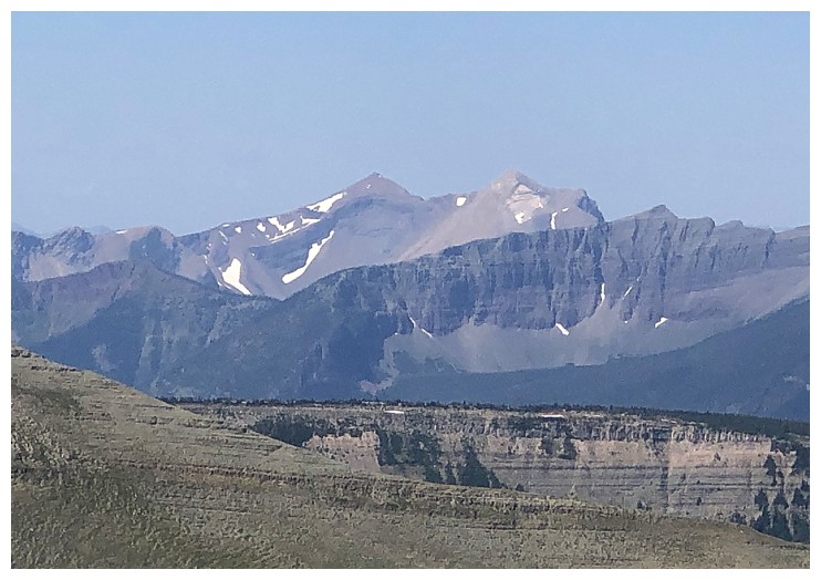
Unfortunately the Sun would not be reaching the rock on the north side of Pincher (right), but was happy to oblige on the south side of Victoria
Victoria again. Three magnificent trips on that one.
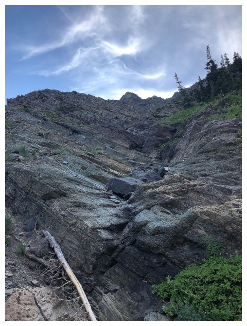
Looking down the colourful route I came up
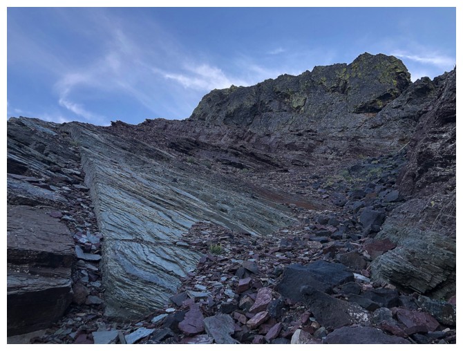
Same thing, looking up
The gully I started ascending and then backed down
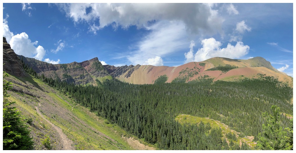
On the ridge, with a great view of Victoria once again
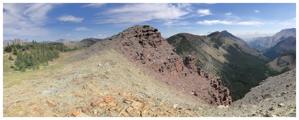
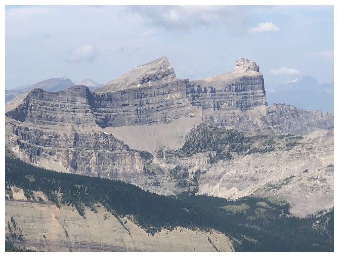
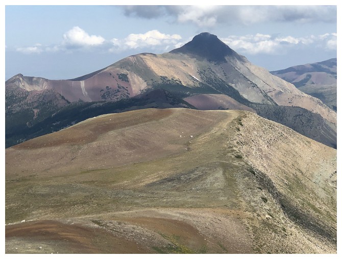
The east summit of Pincher Ridge - surprisingly not the highest point of the whole ridge - that honour goes to the southwest summit
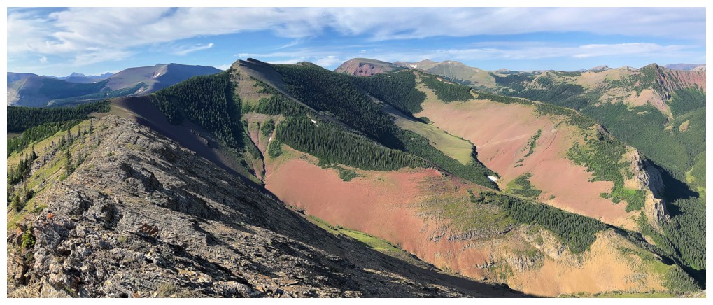
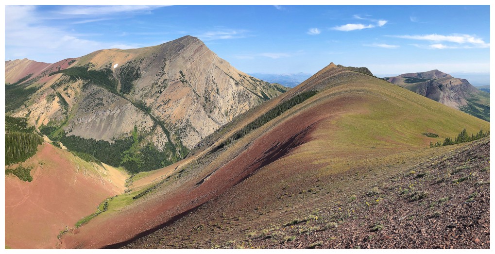
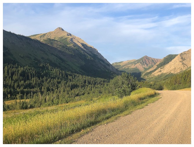
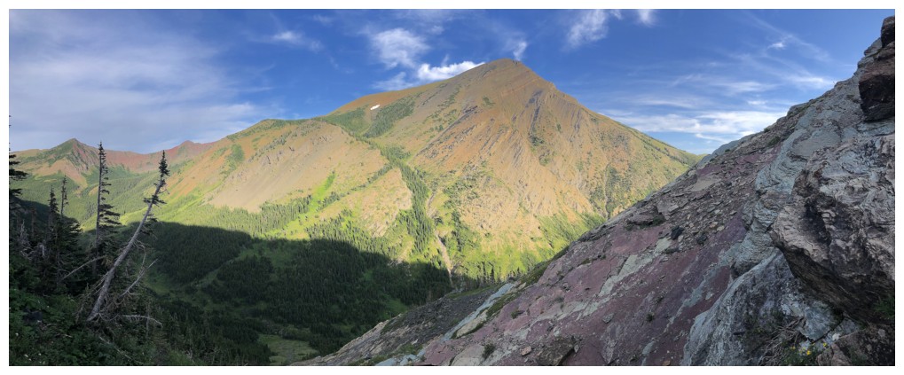
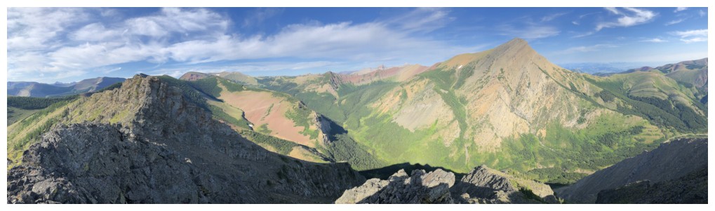
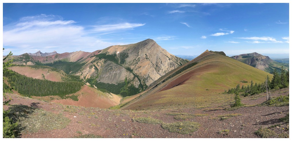
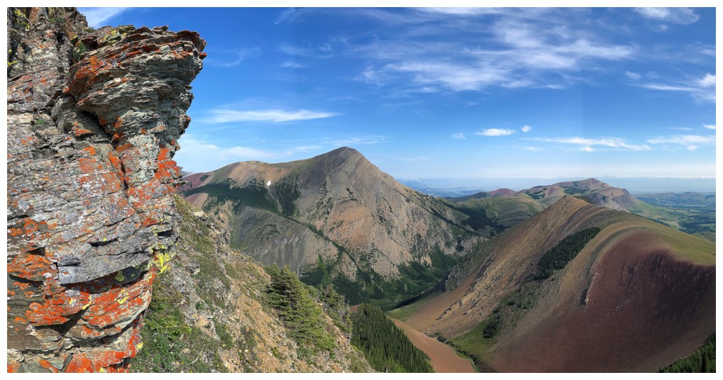
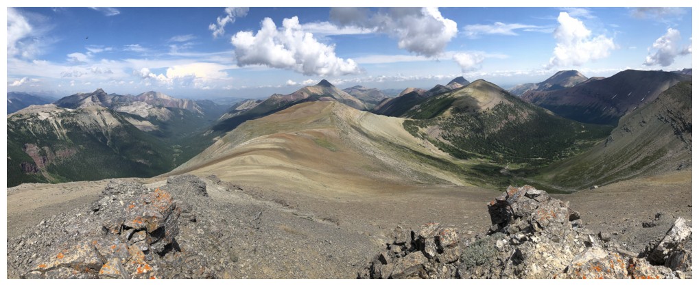
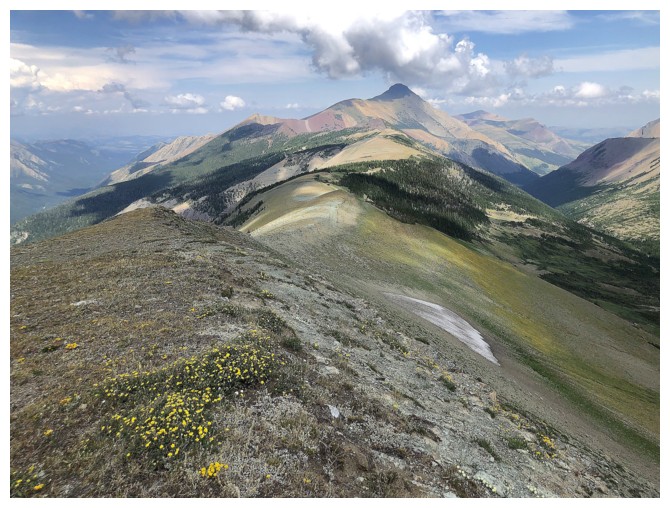
View to the west with all three objectives in visual range
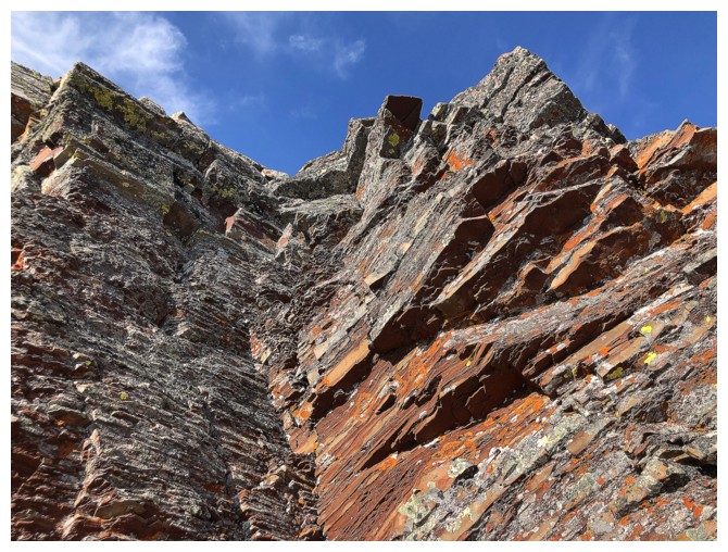
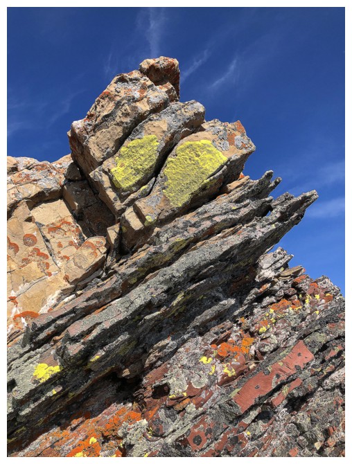
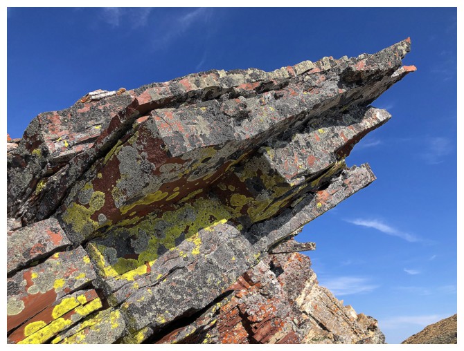
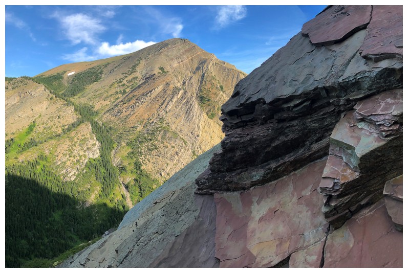
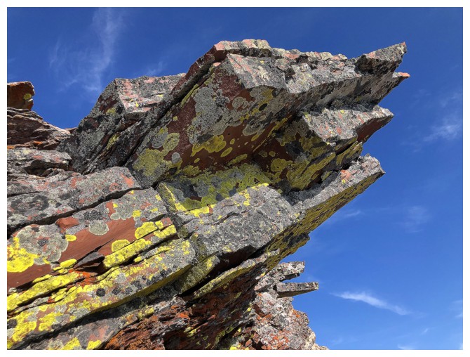
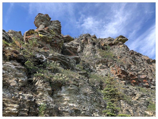
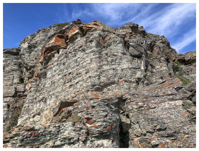
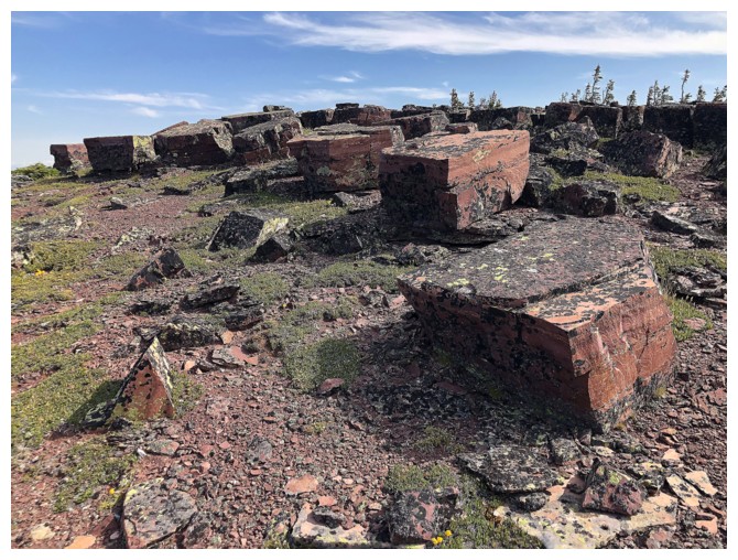
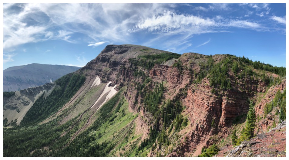
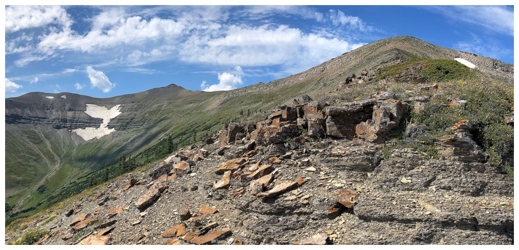
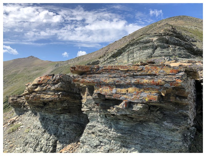
But first, there's a super cool rock band to explore on the ridge, close to where I topped out
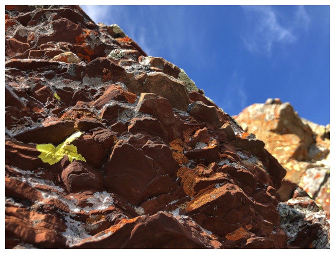
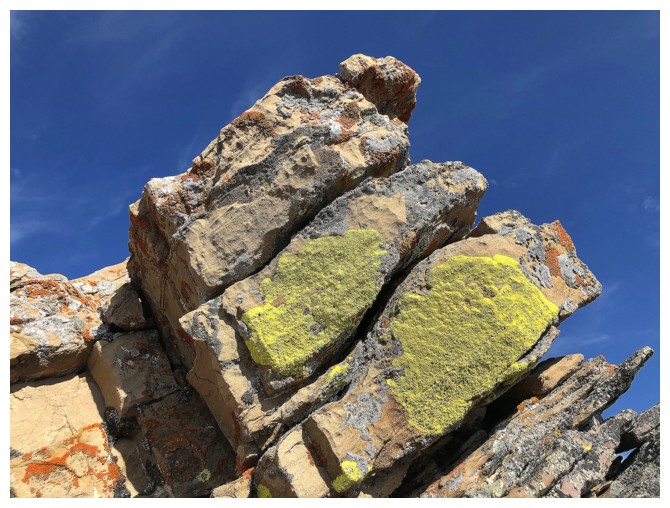
As usual, I gravitate towards yellow lichen on red argillite!
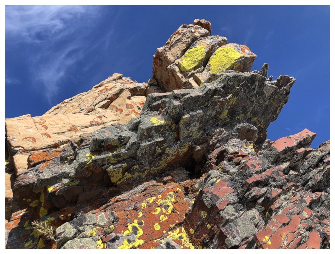
Superb rock and colours
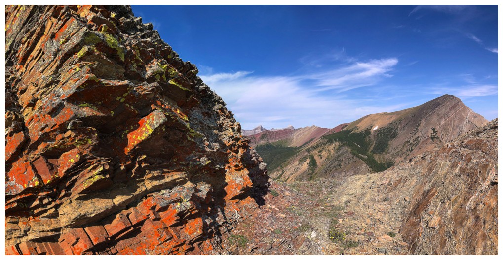
Leaving the colourful rock for the first objective
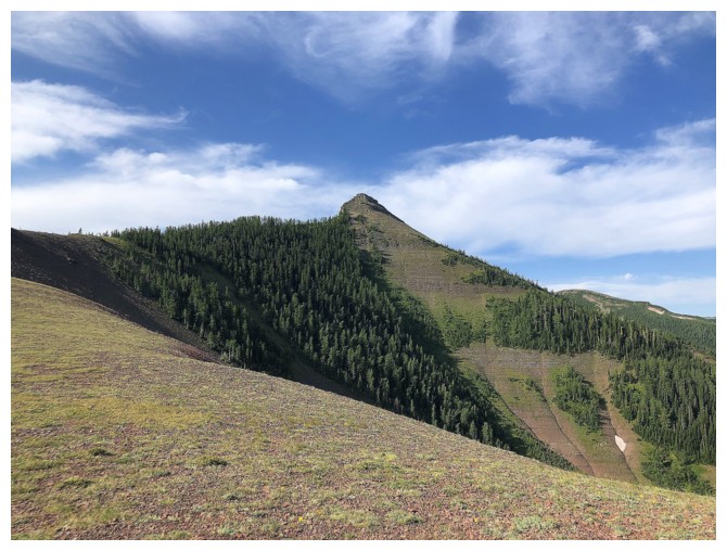
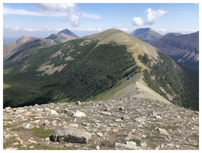
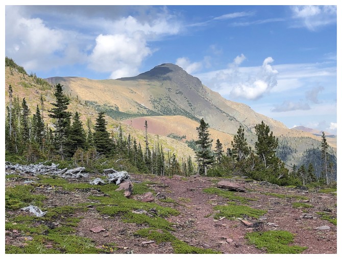
The Centre Peak is an easy hike/scramble away
But it sometimes takes longer than expected because the views behind are surreal and hard to ignore
Approaching the only section of scrambling on the Centre Peak
Up we go
Some steep terrain, but the horizontal orientation of the rock provides great foot- and hand-holds
Distracted by more lichen and increasingly stupendous views
The view atop the scrambling section is a stunner!
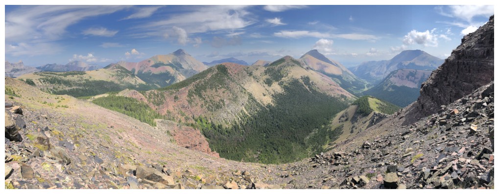
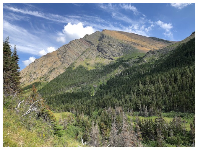
The colours of Pincher and Victoria, with Castle Peak and Windsor Mountain at the distant left
Looking back to Pincher east
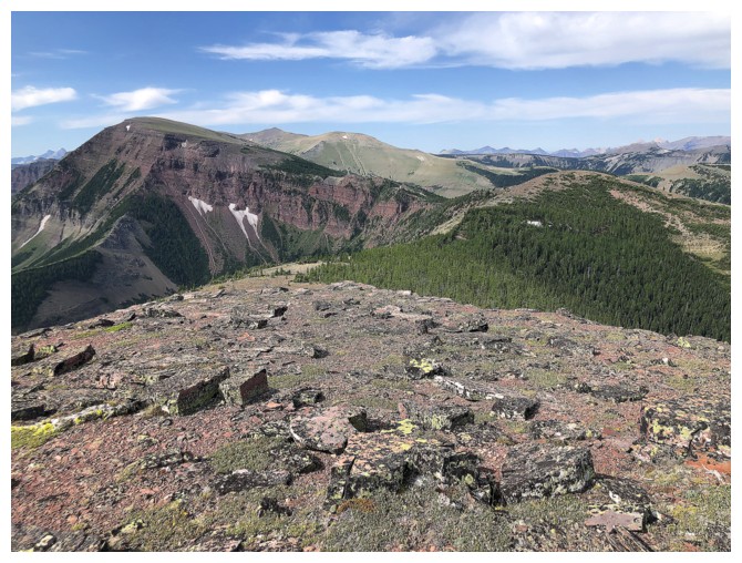
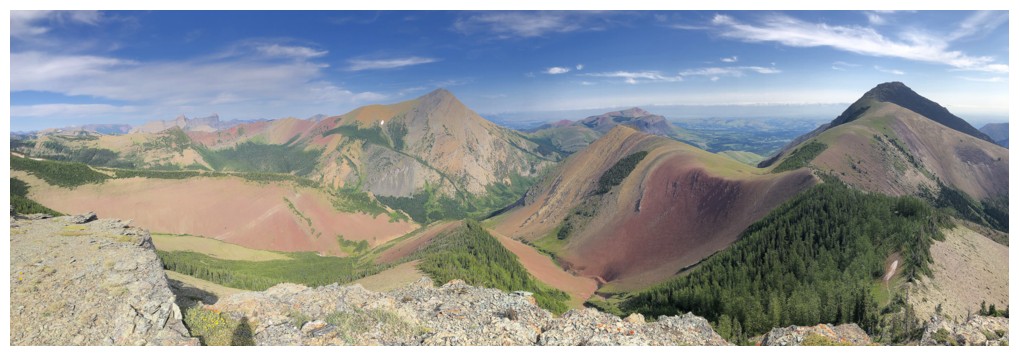
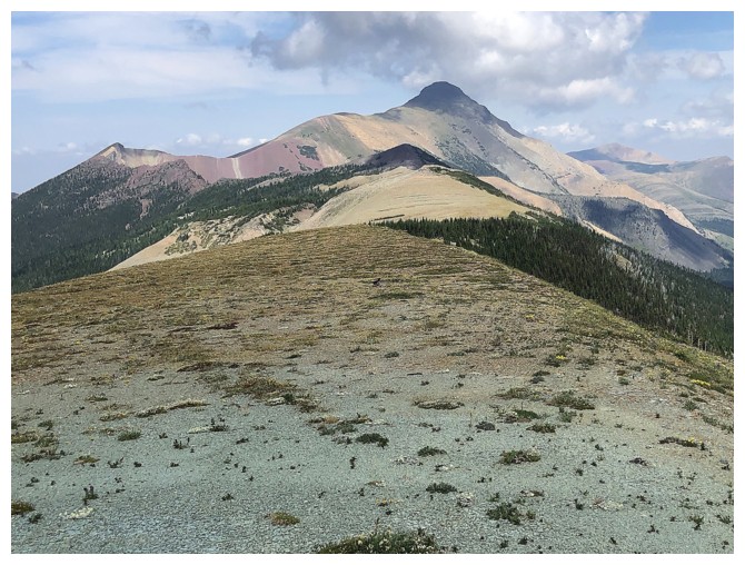
At the summit of Centre, with the Southwest Peak at the far left and Victoria Ridge to the right of Southwest
Chairs for bears near the summit
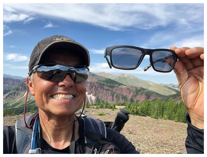
These days I only take selfies when I find a buddy's sunglasses
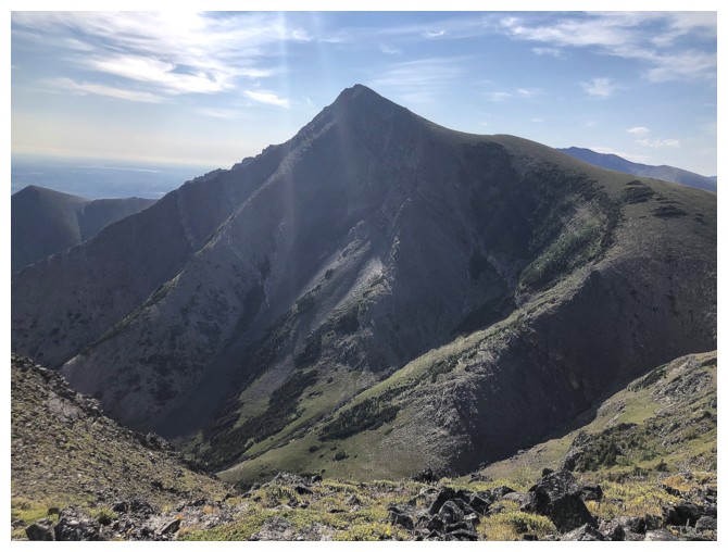
The east face of the Southwest Peak is very impressive
Looking back every so often is imperative on this trip
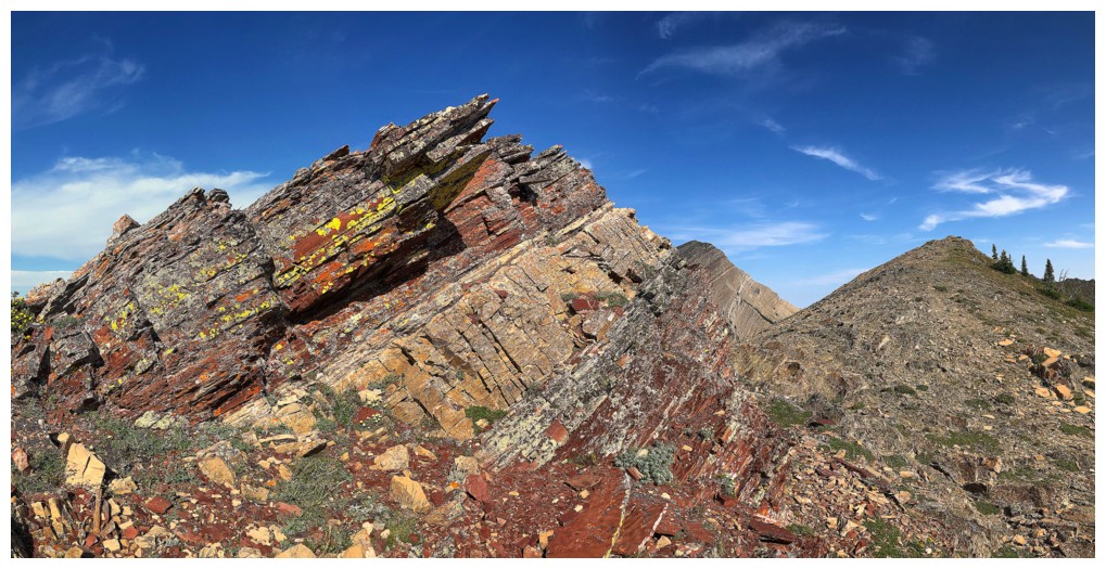
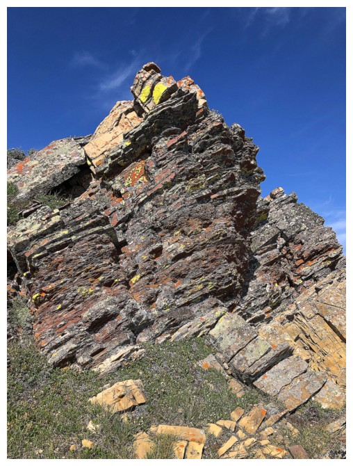
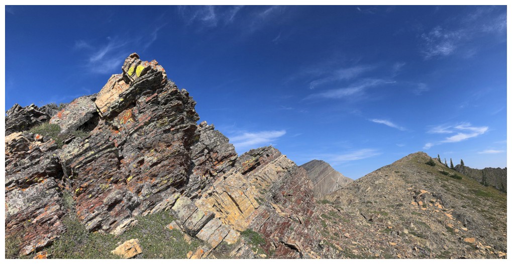
No shortage of red argillite here
Drywood Mountain (far right) joins the excellent view
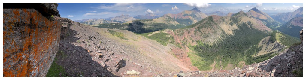
Scarpe Mountain (left) and Jake Smith Peak - that was quite a day!
Windsor and Castle again
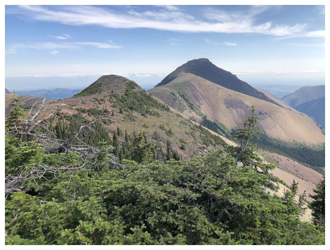
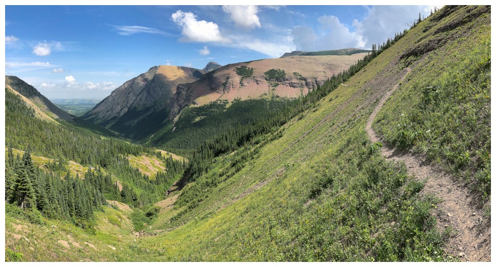
From the summit of the Southwest Peak, the summit of Victoria Ridge (far left) is an easy trek
Near the lowpoint and ready to gain elevation to Victoria Ridge
Luckily there was some nice rock to check out, because exhaustion was starting to set in
Another rest break to look back at the Southwest Peak
The summit is close
Victoria Ridge summit view
Victoria Peak
The multiple summits of Pincher Ridge
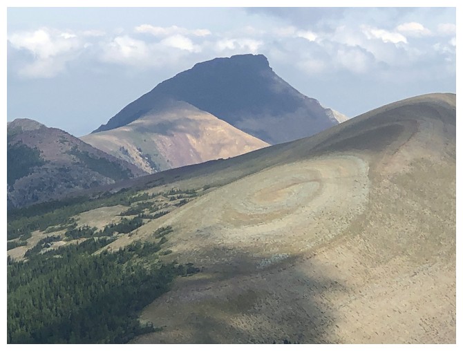
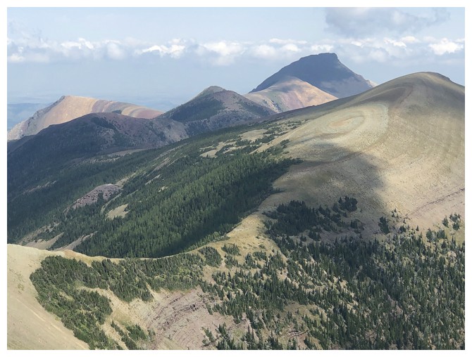
The "bullseye" on the Southwest Peak is a pretty cool feature
Mount Gladstone - looking forward to a third run at that mountain someday
Starting down
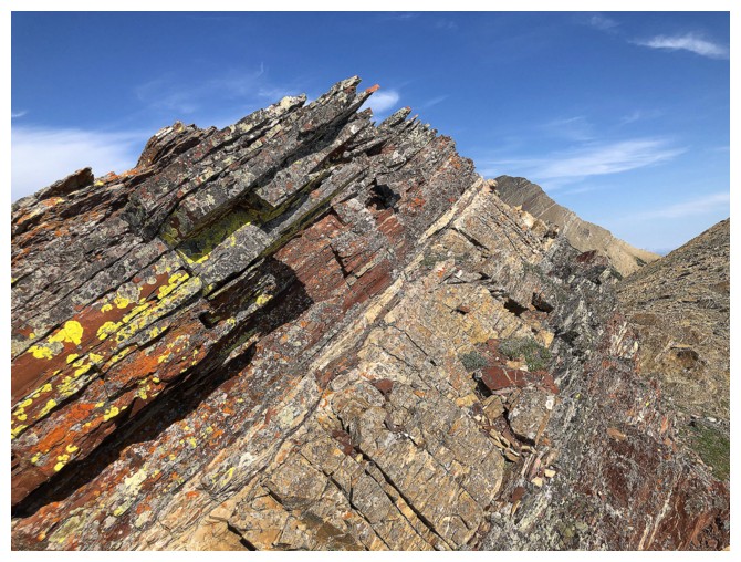
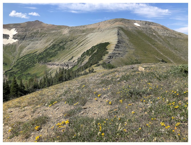
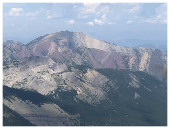
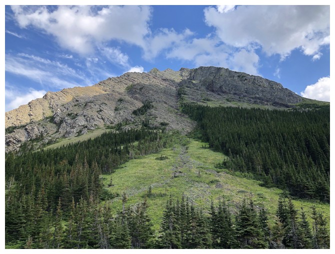
The ridge connecting Victoria Ridge to Peak is a wild ride of fascinating rock layers
At this point, a real man would have continued all the way to the summit of Victoria Peak!
I seem to be losing elevation instead
Realizing I'm not a real man, I'll just enjoy the scenic treat of descending the magnificent Victoria Ridge trail
The stunning connecting ridge, where a real man would be
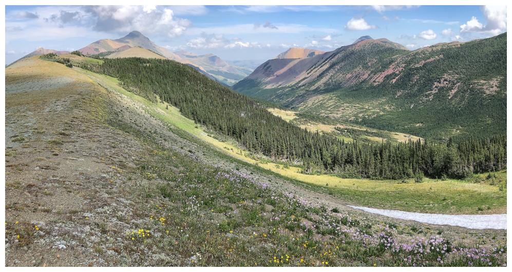
This part is probably my favourite section of any trail anywhere
Good view of the ascent route
Back at the point where I left the trail on ascent. The ebike is not too far away now!
The End
LOG