Prairie Sky V
March 7, 2025
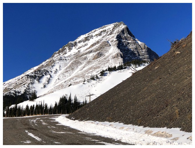
Mountain height: 2050 m
Total elevation gain: approximately
600 m
Ascent time: 4:25
Descent time: 1:55
Solo
scramble.
Lakeview Ridge has some serious competition!
This day
started with an unusually long rendition of “The Drive of Indecisiveness”. I
pretty much stopped at every trailhead along the eastern front of The Castle
before eventually returning to the new Victoria Ridge trailhead to attempt
something…anything!
With forecast
high winds, two routes came to mind: an exploratory trip up the north side of
Pincher Ridge or a repeat of an unexpected trip up an outlier of Prairie Sky. 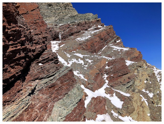 I
had completed this shockingly scenic route up Prairie Sky during the smoky summer of 2021.
Also forecast for the day were clear skies, and therefore I chose the latter.
The Pincher Ridge route would stay in the shade of the mountain most of the day,
whereas the outlier route would be Sun-flooded throughout, and terrific rock
scenery was guaranteed.
I
had completed this shockingly scenic route up Prairie Sky during the smoky summer of 2021.
Also forecast for the day were clear skies, and therefore I chose the latter.
The Pincher Ridge route would stay in the shade of the mountain most of the day,
whereas the outlier route would be Sun-flooded throughout, and terrific rock
scenery was guaranteed.
Even that
decision was met with more indecision. Atop the first hill of the approach, I
was suddenly crossing over to the Pincher Ridge side. 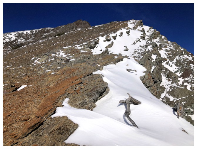 The deep, unsupportive
snow on that side, however, quickly put me back on track for Prairie.
The deep, unsupportive
snow on that side, however, quickly put me back on track for Prairie.
Although the
route I took up to the western outlier of Prairie Sky in 2021 was a good one,
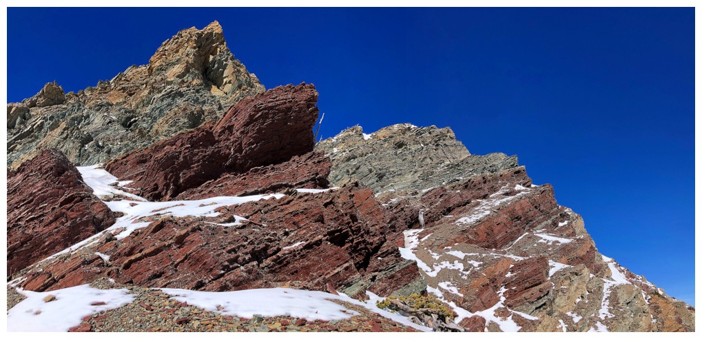
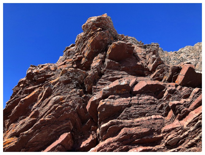
the themes for the day would be variation and exploration. The southeast face
of the Sky and the outlier are lined with some of the most colourful layers of
argillite, dolostone, shale, and limestone in the Canadian Rockies and I wanted
to see as much as possible. This would entail a strict adherence to the rule of
staying below those layers, even when tempting routes to gain the ridge were
encountered.
I managed to do
quite well sticking the lower terrain, where views of the rock layers were phenomenal.
Lots of ups and down, but always worth the effort – this route was definitively
challenging Lakeview Ridge for “Outstanding Rock Scenery” supremacy!
Eventually I
had to make a decision: stay low and try to gain the ridge near the summit of Prairie
Sky or go immediately to the ridge, summit the outlier, then follow the ridge
to Sky. I chose a combination of the two: summit the outlier, descend back down
below the rock layers, and try to reach the summit of Sky by whatever route
presented itself. Of course, this meant more unnecessary ups and downs, but I
had the time and energy (for now!).

The plan played
out perfectly. Once back at a lower level, the alternating layers of red and
green argillite were cause for a haphazard but extremely rewarding exploration
of the face. Passing by a stunning snow-filled couloir, I couldn’t help thinking
Brad and Dave would have attacked this feature like rabid dogs! Later than sooner,
I did have to concede gaining the ridge and finishing the ascent. Luckily, and
purely by accident, I stumbled onto a perfect route up. Even the
remainder of the ascent, now on familiar terrain, felt quite new due to some snow
on the east side and perfect weather conditions.
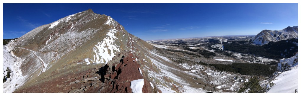
I stayed at the
top for just enough time to take four panoramic photos and make one quick movie,
before contemplating the descent route. There really wasn’t much contemplation
as there’s only one logical (and super scenic) route down – follow the southeast
ridge. Again, this route, was not new to me, but provided another round of amazing rock and dead trees.
A thoroughly engaging
day of breath-taking scenery. With still more terrain to explore, this peak could
very well become one of my “go-to” routes.

First look at the objectives

Prairie Fire

Prairie Bluff

One of the three braids of Pincher Creek - each are very easy to cross at this time of the year

On the gas road and admiring Victoria Peak and the Prairie Sky outlier (right)

A branch of the gas road goes all the way up to (and past) the outlier

Pincher Ridge North Outlier

The southwest side of Prairie Sky is simply magnificent and became the focus of the trip

Close-up of a rock feature that I'll have to see close-up

And there's a slope of brilliant red argillite providing access to the rock - it was meant to be!
Round 1 of Fantastic Rock and Other Scenery


The Other


The second red argillite run-in


Pincher Ridge at the left with the other potential route for the day. Mark and I had tried north side many years ago, on one of our more harrowing days in the mountains.

Back to the sweet rock and lichen


Going up here was very tempting


The reason for staying low on the mountain


The bulk of Prairie Sky is now visible

Innumerable thin layers of rock

Same as above

At this point I did try to get up to the ridge and then the summit of the outlier

Backed down here, in fear of reaching an impasse

More traversing

A route appears that should get me to the Sky/outlier col

And there's lots of red rock en route, so that's a win!

Win

Glad I didn't end up on that snowy terrain at the right

A preview of Prairie Sky's magnificent southeast face. The col sits to the left.

At the col, looking up to Sky

Going the opposite direction to the summit of the outlier

Turning around to check out Sky is irresistible

Outlier summit at the left
Summit views


Looking back to the outlier, Pincher Ridge, and Pincher Ridge North Outlier

Looking forward to Sky

Back near the col and ready to lose a bunch of elevation
The alternating bands of red and green argillite are on full display on this side of the mountain


The snow gully Brad and Dave would have loved. I could have crossed it here, but I was too lazy to put crampons on.

Instead, I lost more elevation than regained it here

The rock, the snow, and the sky - definitely one of the highlights of the trip


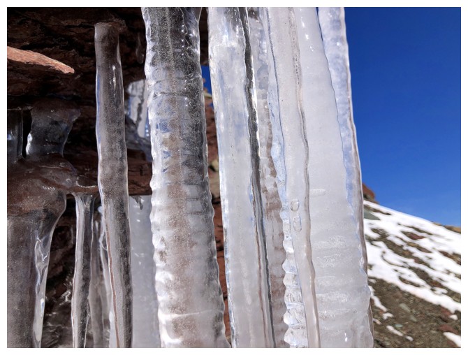
This group of icicles were cause for a diversion

Very nice, but too bad this wasn't similar to an ascent of Otokomi Mountain in Montana, 6 years earlier


Close-ups of ice are usually very cool

Continuing a slightly upward exploration of the face. The upsloping terrain makes travel easier.

Goodbye snow gully


The positive slope of the rock wouldn't help here if you went further east!

Gaining elevation

The summit of the outlier is still surprisingly close

Would have loved to have had the energy to explore this section, but the reserves were getting low - another time

Fortuitously found an easy path up to the ridge at the left

There it is

Snuck up to the ridge via the snow at the right

Same as above, but a much bigger view

Ascents so far this season have been depressingly devoid of amazing cornice scenery


On the ridge again, and ready to tackle Prairie Sky

Again, I was surprised to see the outlier in such close proximity

Easy travel to begin with

Mount Gladstone

The anaconda of dead trees!

The ridge is easy but not devoid of scenic interest


Had I stayed low on the face, I would have had to ascend these snow slopes

The cool scenery on the ridge continues


The impressive summit block of Sky and other interesting things


Some route-finding and scrambling are required here

Went around the left side of this beaut

Easier terrain to finish the ascent

Sweet igneous rock
Summit views from Prairie Sky


The outlier doesn't look like much from up high

Descending via the terrific southeast ridge

Very steep terrain near the top of the face

Some of the Flathead Range


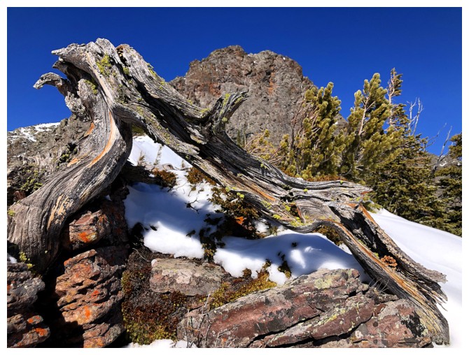
These dead trees were a highlight of the descent route


Prairie Fire is accessible from many sides

Looking back up some of the descent route

This rock band was definitely the single highlight of the descent and perhaps the day

Same as above

Same as above

Same as above

Same as above

Same as above

Last one

Pronounced rock folding

Approaching the bottom of the route

Looking back at the wonderful southeast face of Sky

Cinch Hill, Bridle Peak, Pincher Ridge, and the
Pincher Ridge North Outlier

Pincher Ridge North Outlier ("The Horn") is getting blasted by high
winds, reminiscent of a relatively recent visit to the summit with Dave, Doug, and Scott.

Back across Pincher Creek

Parting view of this amazing area of the Rockies
The End
LOG