Prairie Sky IV
 August 15, 2021
Mountain height: 2050 m
Elevation gain: 400
m
Ascent time: 2:50
Descent time: 1:25
Solo scramble.
Another nasty day in the nasty, smoky summer
of 2021!
Initially, I didn’t plan on going out at all
due to the thick smoke. However, around midday I decided this would be a good opportunity
to hike the new approach to Victoria Peak/Ridge.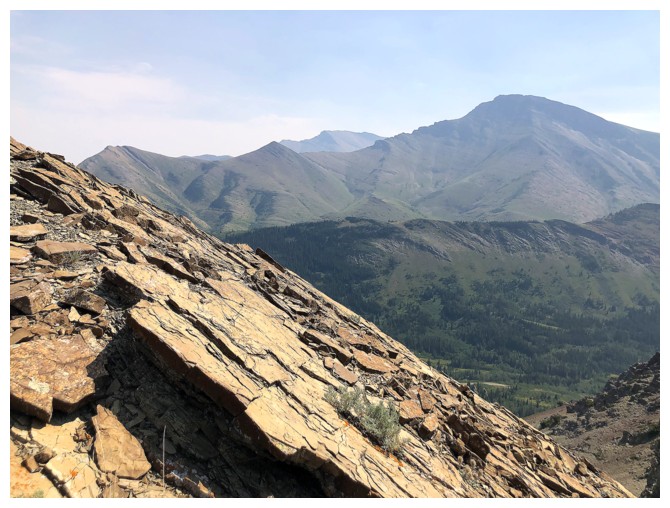 Unfortunately, the standard route
via the gas road is now off-limits for the first kilometre, necessitating a more circuitous and complex
approach.
Unfortunately, the standard route
via the gas road is now off-limits for the first kilometre, necessitating a more circuitous and complex
approach.
The route turned out to be easier than
expected and within 20 minutes, I had crossed Pincher Creek and was on the gas
road, past the off-limits section of the road. And more good news in an unexpected
thinning of the fire smoke. Of course, at this point, I couldn’t resist getting
up something! But what?
How about my favourite – an outlier of an
outlier of an official peak?! A minor bump on the west ridge of unofficial
Prairie Sky, which is an outlier of official Prairie Bluff, would be the
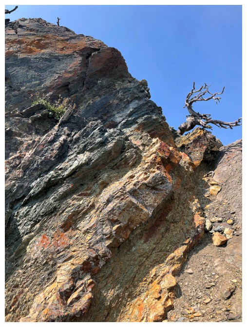
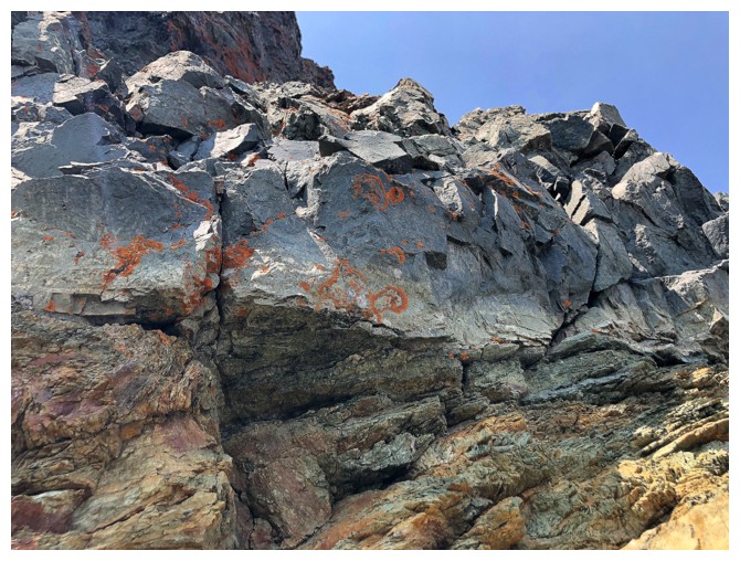
objective. 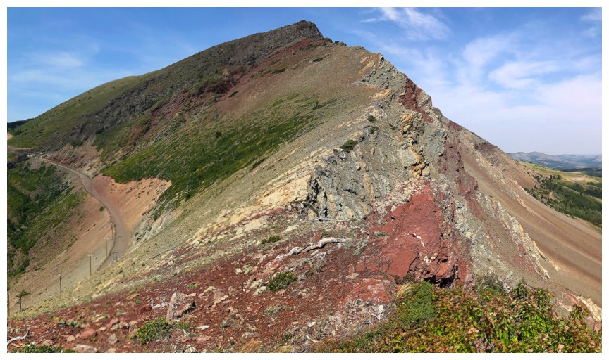 There appeared to be some colourful rock on the bump (i.e. red argillite), and as some
know, that’s my Achilles Heel - nice to always be motivated by a few chunks of oxidized, hardened mud!
There appeared to be some colourful rock on the bump (i.e. red argillite), and as some
know, that’s my Achilles Heel - nice to always be motivated by a few chunks of oxidized, hardened mud!
The ascent did not disappoint in the
least, even with the hazy skies – marvelous bands of striking rock at every
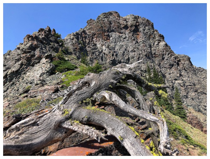
turn, several gnarly, dead trees, and better than expected views. After much
exploration of the wonderful rock face, I reached the highpoint of the bump and
considered options: return the same way or follow the ridge northeast to the
summit of Prairie Sky.
I chose the latter. That too provided a
terrific experience, with more amazing rock and stunning scenery. It was also
especially nostalgic, looking down the route Mark and I had ascended 13 years
earlier on our first trip up Prairie Bluff. And to top off an already unexpectedly
great trip, I was able to more thoroughly explore the southeast ridge descent
route off Sky. Dave and I had a little taste of that wonderful area in 2020,
but I wanted the full meal – when all was said and done it felt more like two
full meals!
Awesome day out on a day when I wasn’t
supposed to get out!
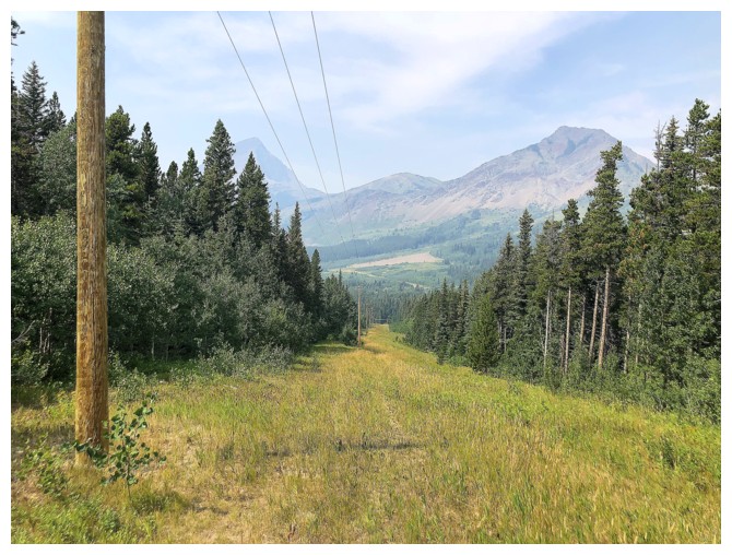
Part of the new approach. Hiking down this cutline is very easy and
then you have to cross Pincher Creek to get to the gas road. At this
time of the year the creek is usually quite low and very easy to cross.
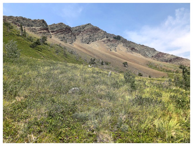
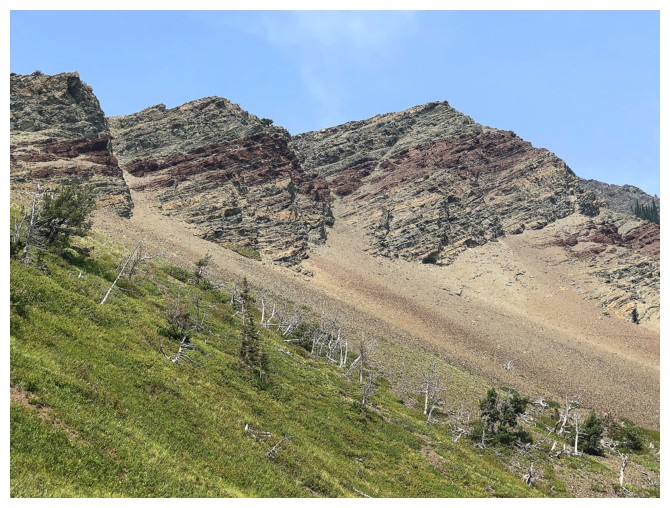
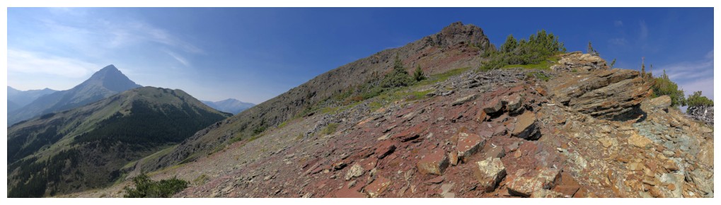
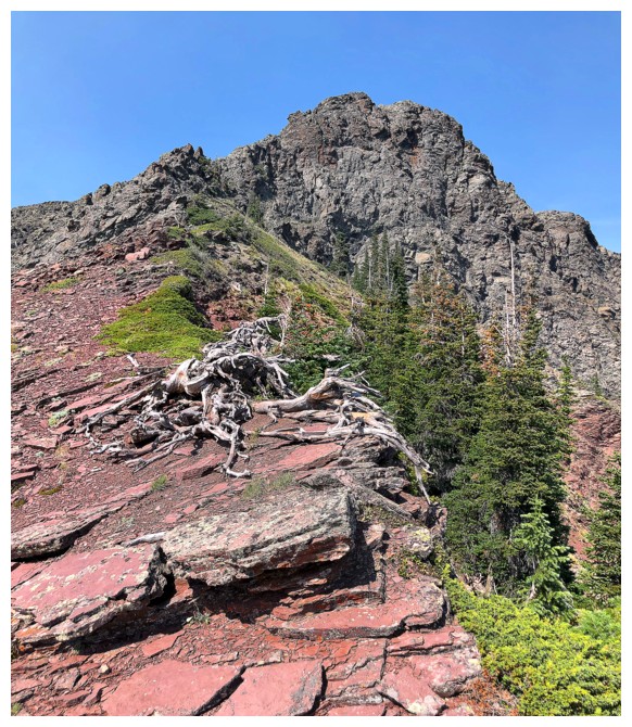
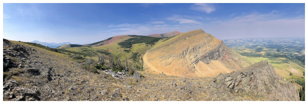
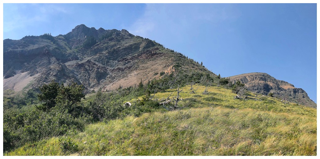
Looking up to the summit of Prairie Sky
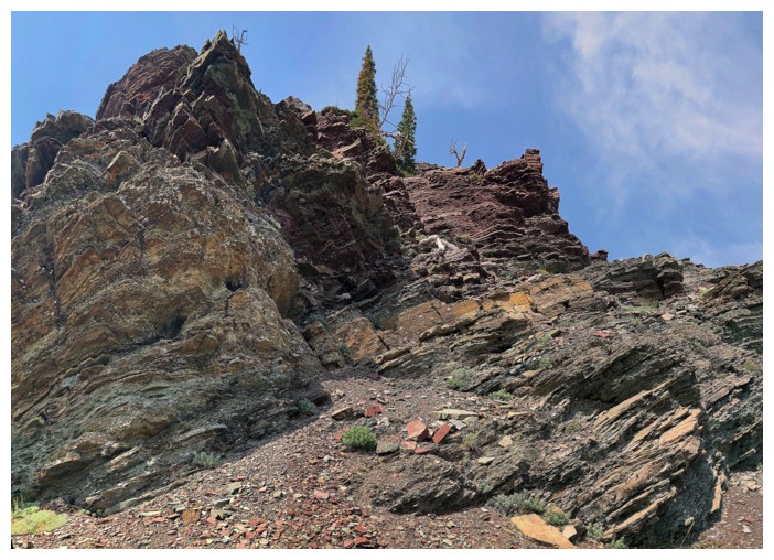
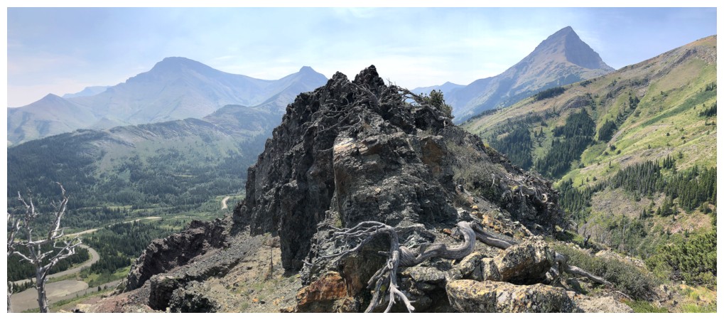
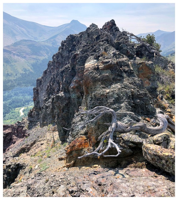
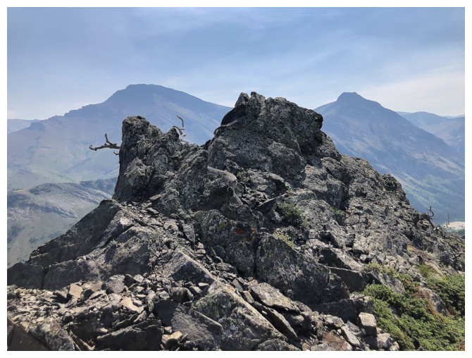
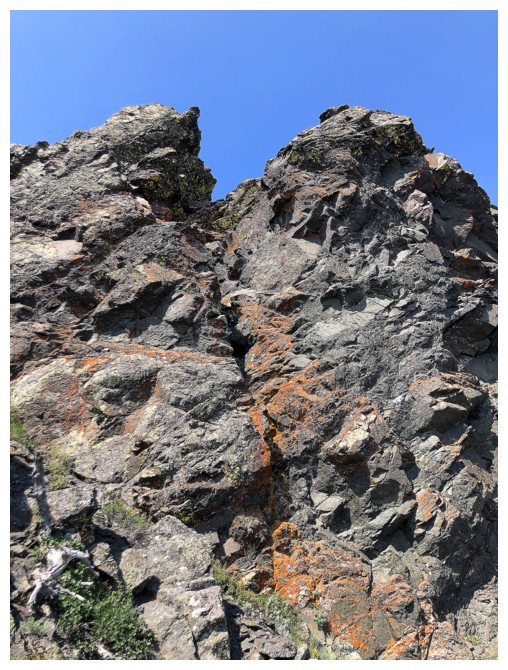
The outlier I'm headed for. Doesn't look like much from below but up close it's pretty cool.
Traversing in that direction was quite tempting
Same as above
But I went straight up instead
And this is why I picked this route!
Getting much steeper near the top
Looking back at the approach. The obvious cutline provides the new approach to ascents of Victoria Ridge, Victoria Peak, Pincher Ridge, and Prairie Bluff.
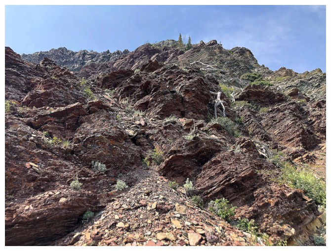
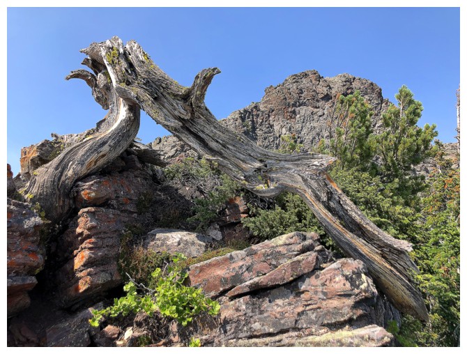
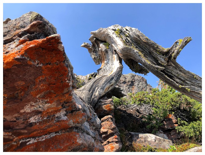
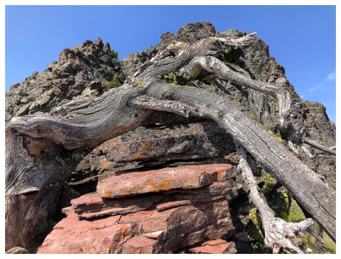
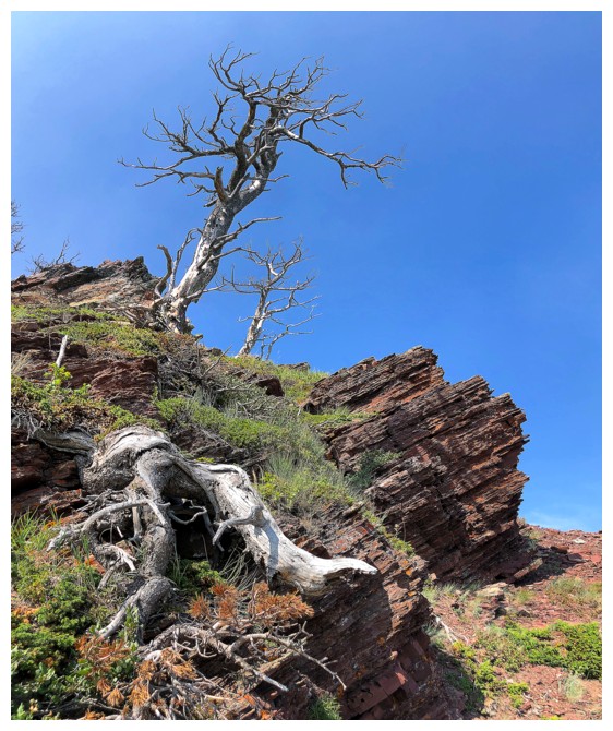
Smitten
Close-up of smitten!
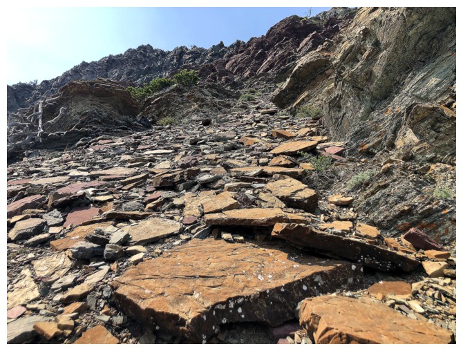
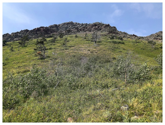
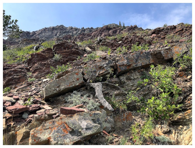
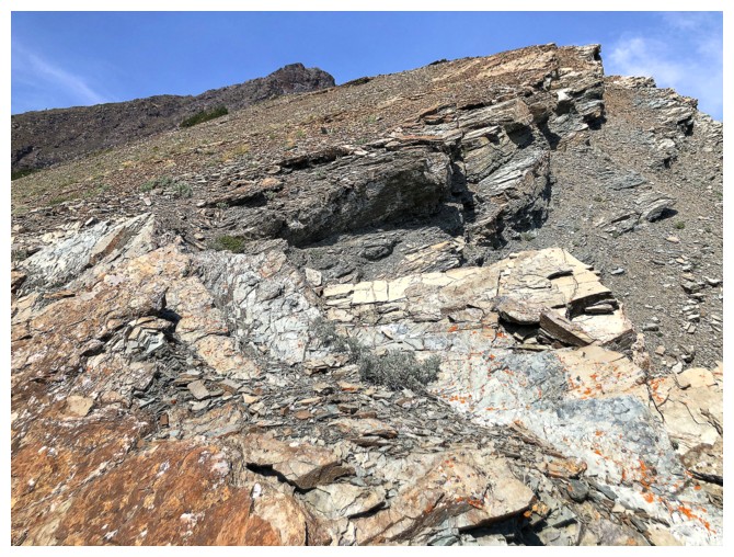
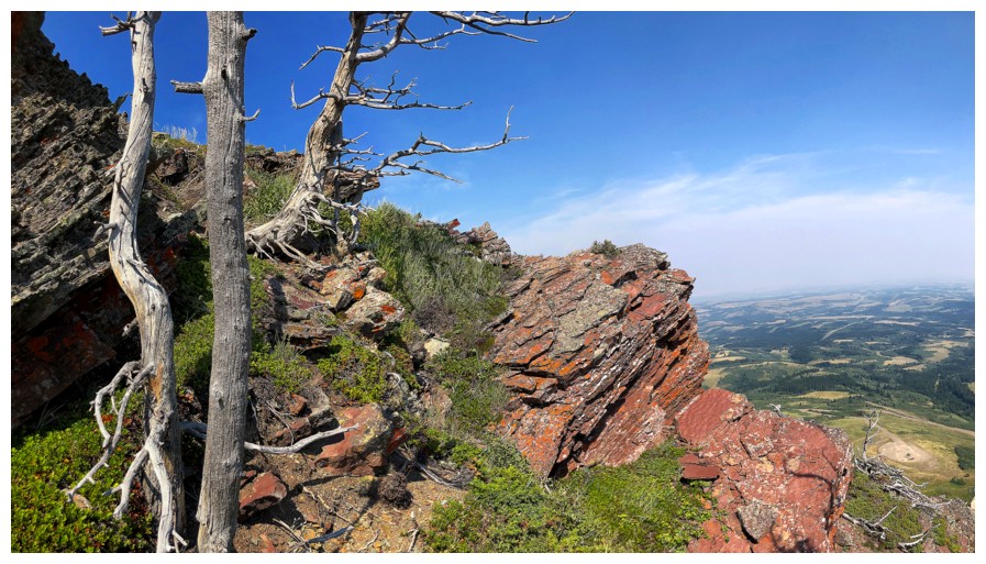
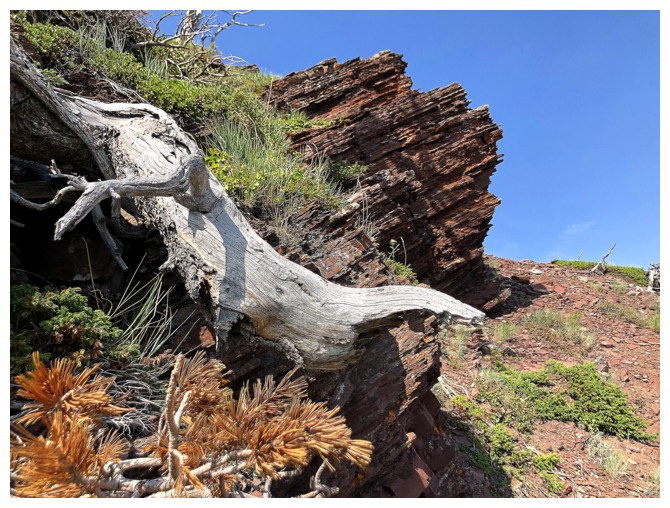
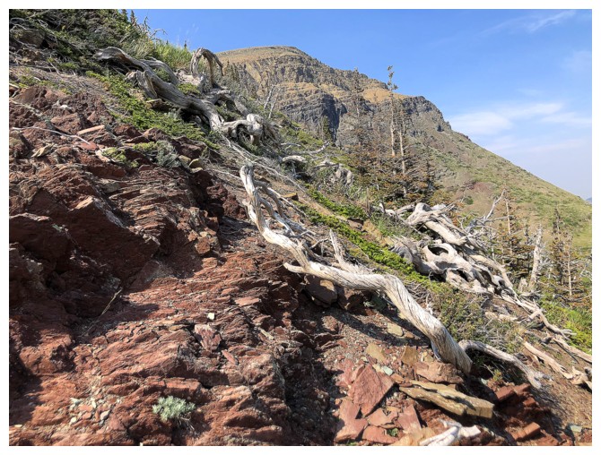
A path to the ridge. Looks like ankle-breaking rubble, but it's actually quite pleasant to ascend.
Part of the reason that Southern Alberta rubble and scree is so foot-friendly compared
to more northerly Alberta rubble and scree is the way the rock breaks. Southern rock
breaks into thin plates that settle to make a more a more stable surface are easy to walk on top of, while Northern
rock breaks into more rounded boulders that give your ankles a real
workout and often move when stepped on.
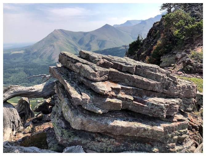
Soon to be thin plates
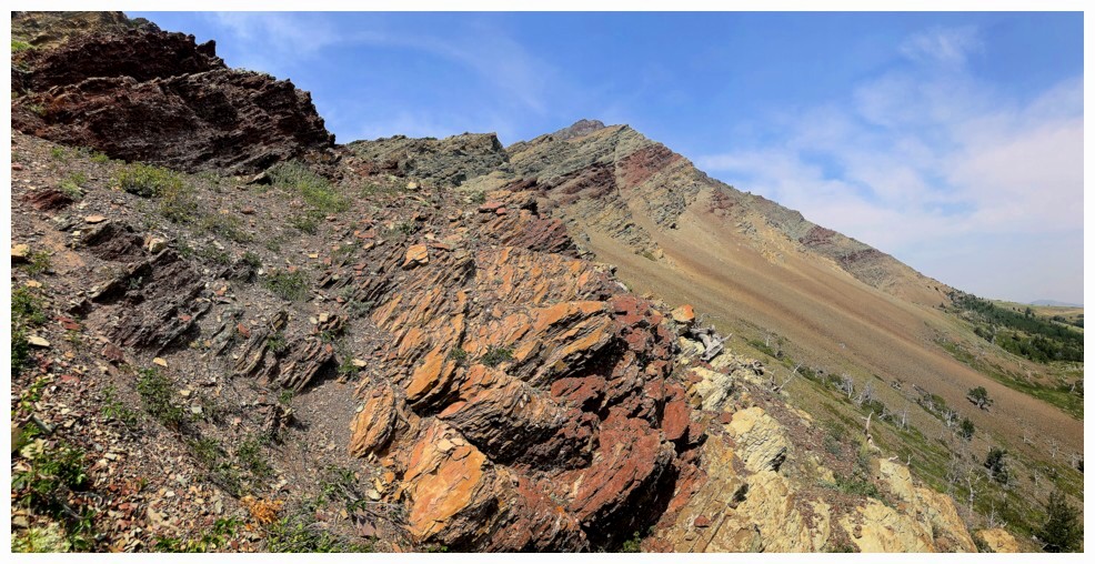
Also much of the rock in the south has a positive slope, which generally makes scrambling easier and more fun
Getting close to the ridge, but I'm definitely going to explore before gaining it
Here's some of that exploration
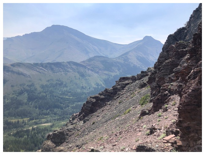
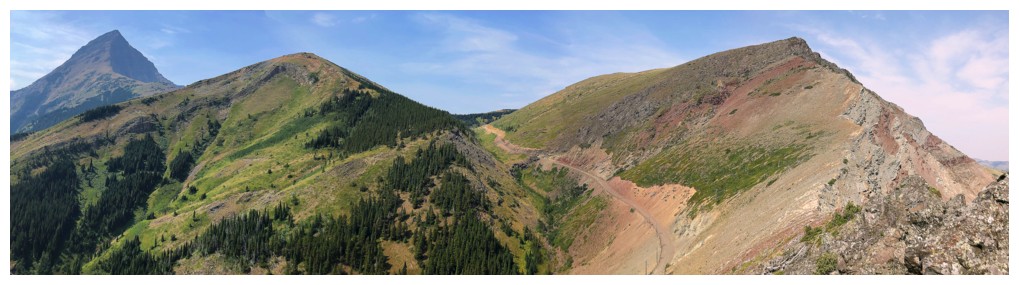
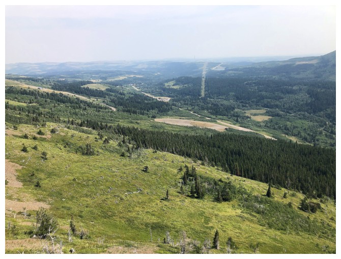
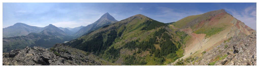
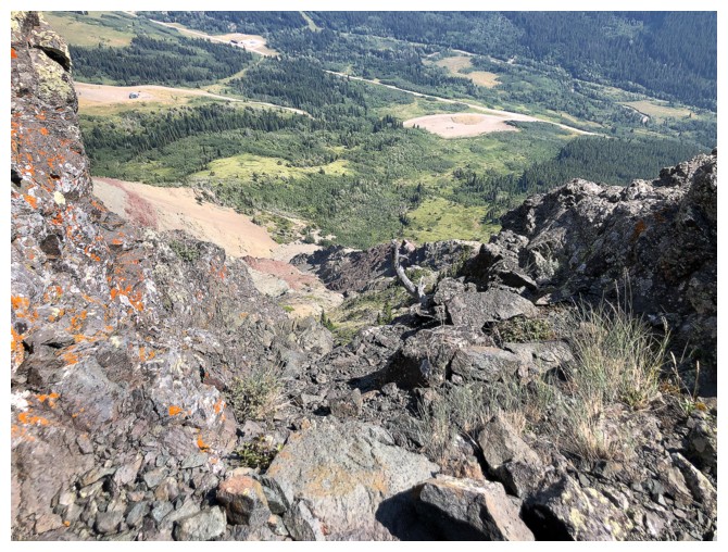
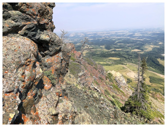
Hazy view of Pincher Ridge (left) and the north outlier of Pincher
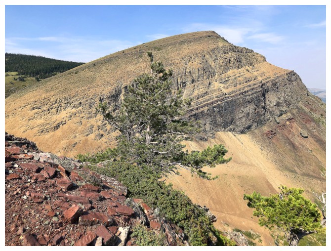
Prairie Sky is destined to be ascended today
Checking out other stuff first
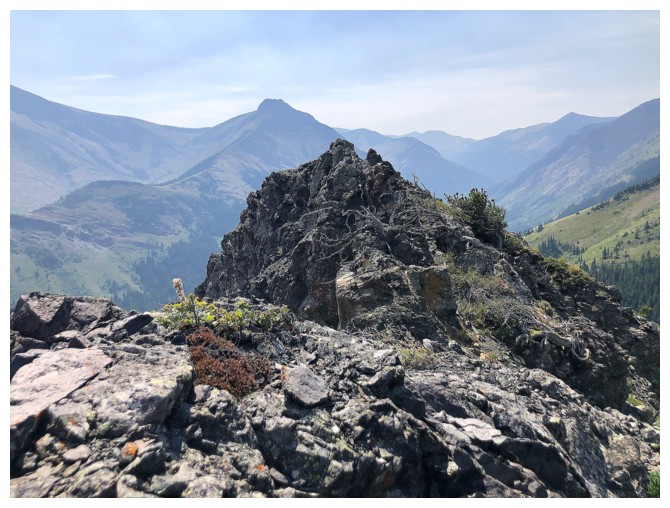
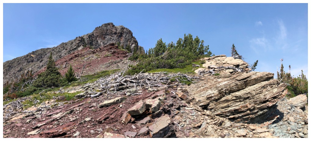
Finally on the ridge, with the highpoint close by
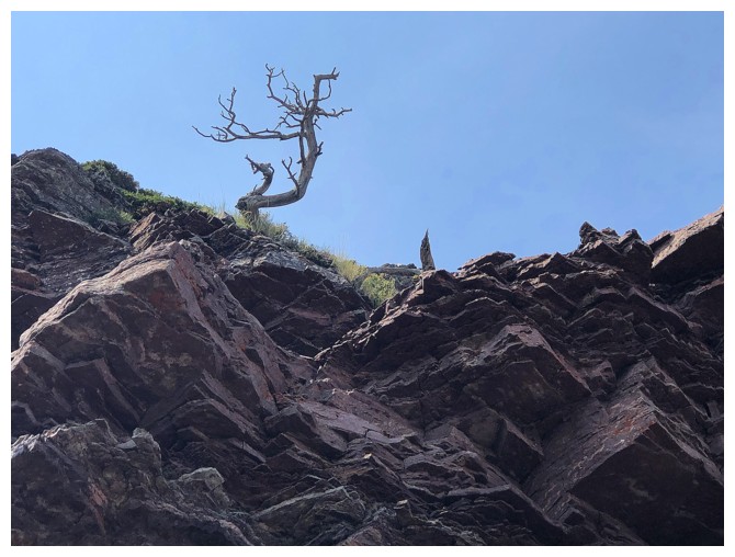
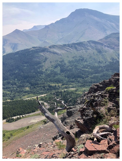
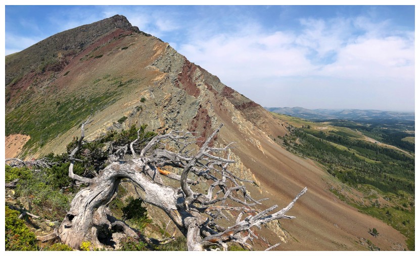
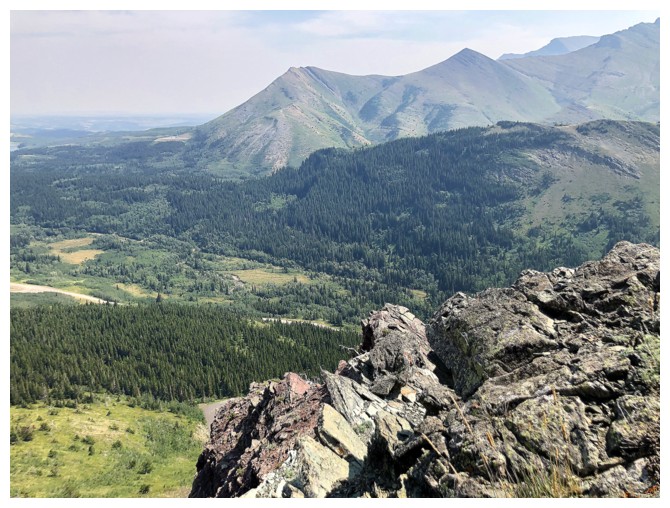
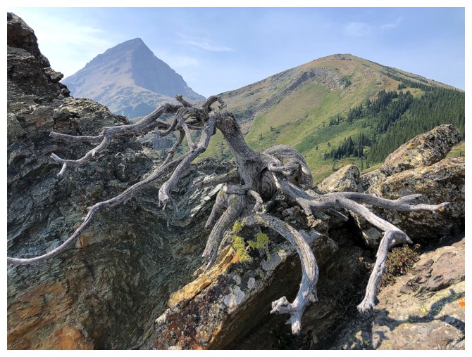
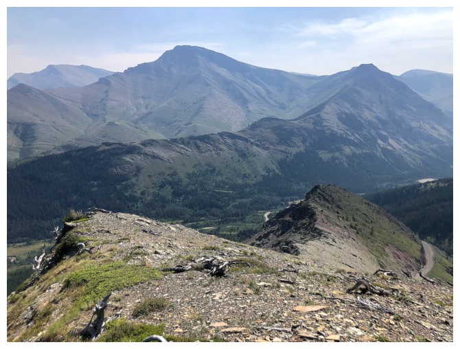
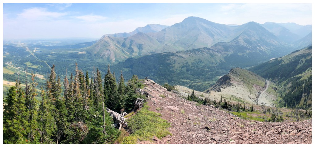
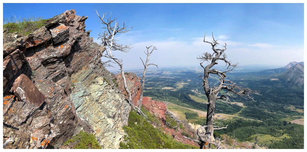
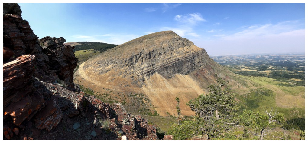
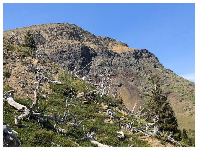
Rocks, dead trees, and Victoria Peak
Victoria and Prairie Storm
All of the above
Steps away from the highpoint
But no! Another detour.
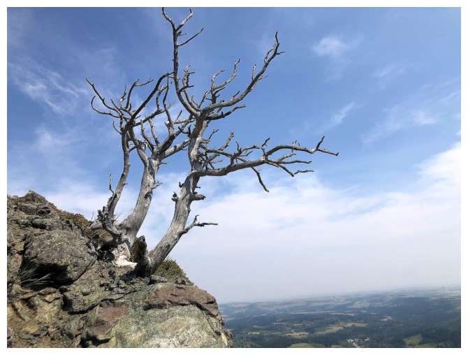
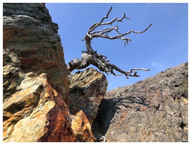
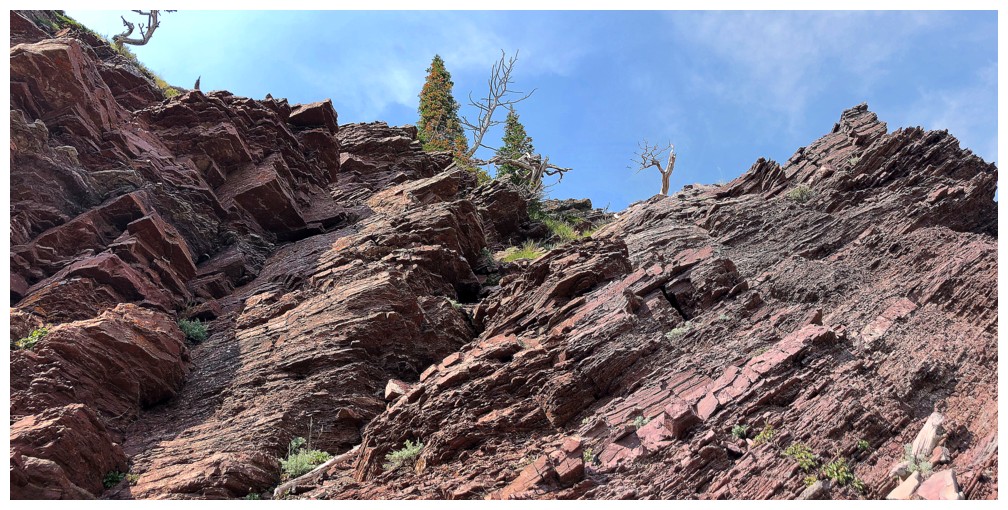
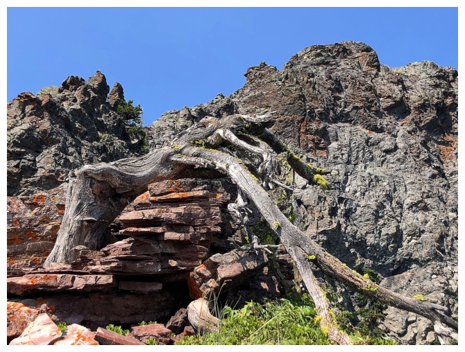
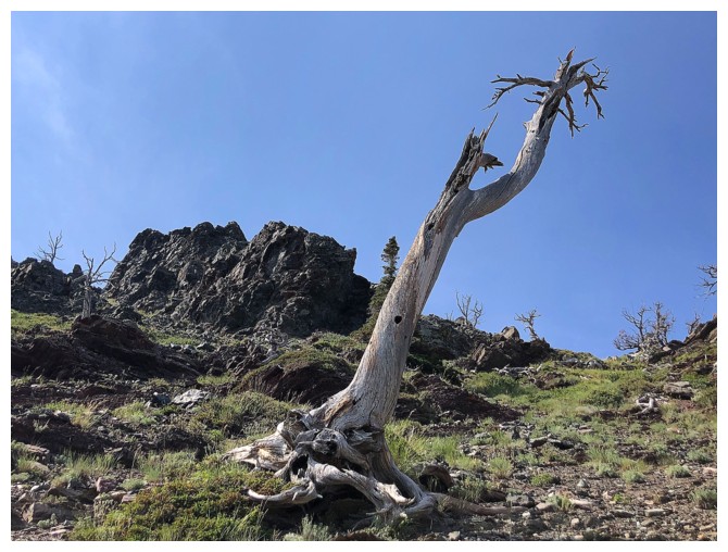
So many twisted, dead trees and so little time
Cinch Hill and Bridle Peak are the eastern outliers of Pincher Ridge and have become off- and on- season favourites
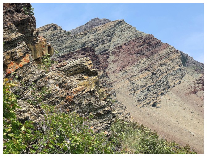
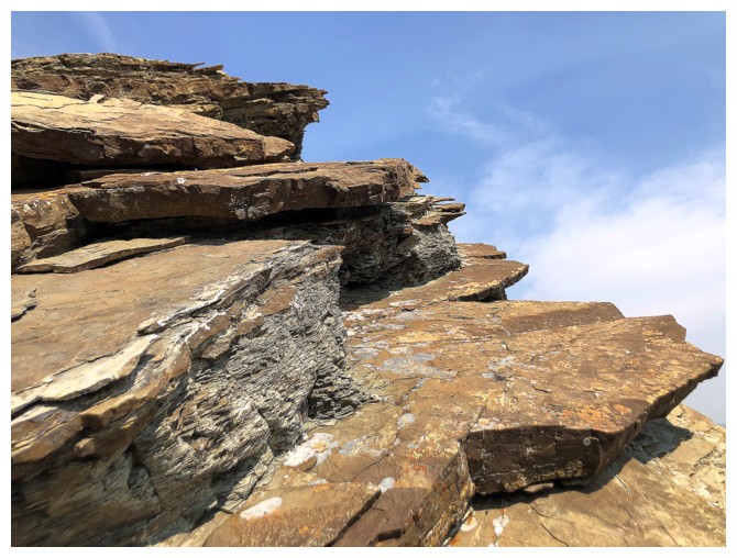
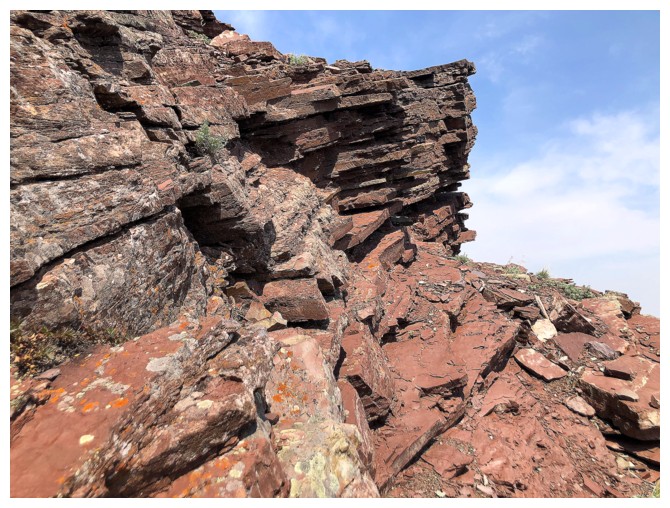
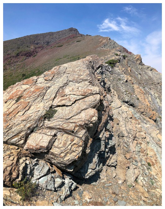
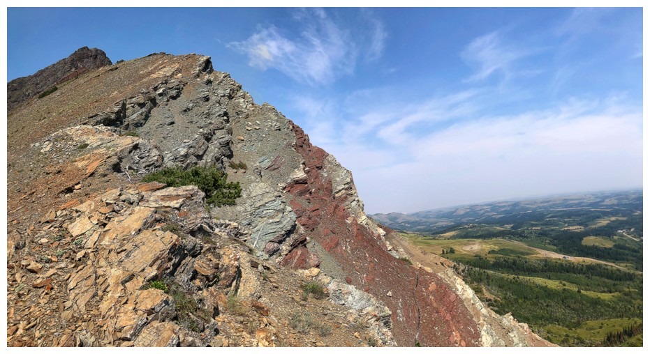
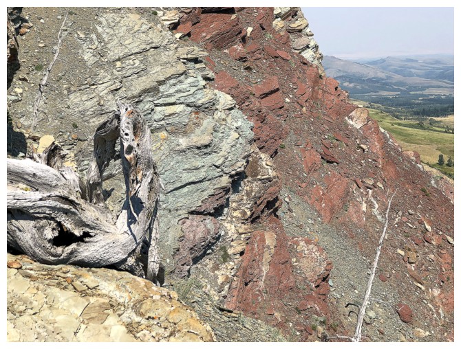
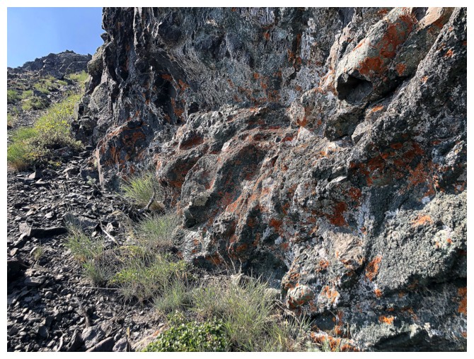
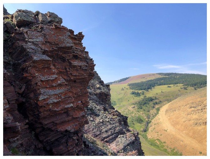
Insane variety of rock in this area
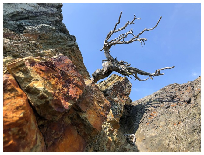
Minor obsession with this guy
Back on track to hit the highpoint
Steps away - for real this time
Summit view

The view to Prairie Sky is a sweet one and the forest fire smoke has cleared a little in that direction
Therefore I'm heading in that direction
It's going to be photo op galore from here to the top
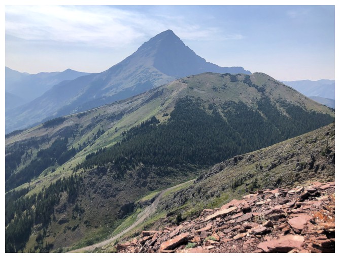
Drywood Mountain joins the view at the far left
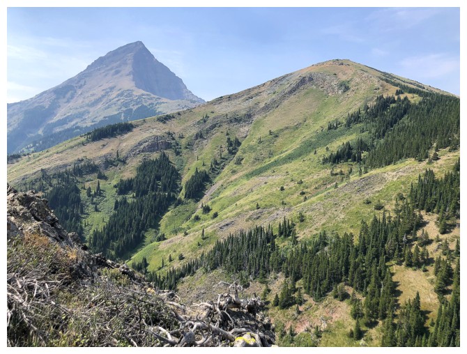
Closing in on the summit block of Sky
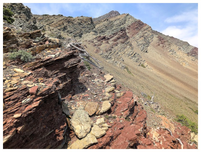
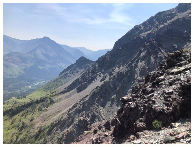
Victoria Peak, Prairie Storm, and Prairie Sky
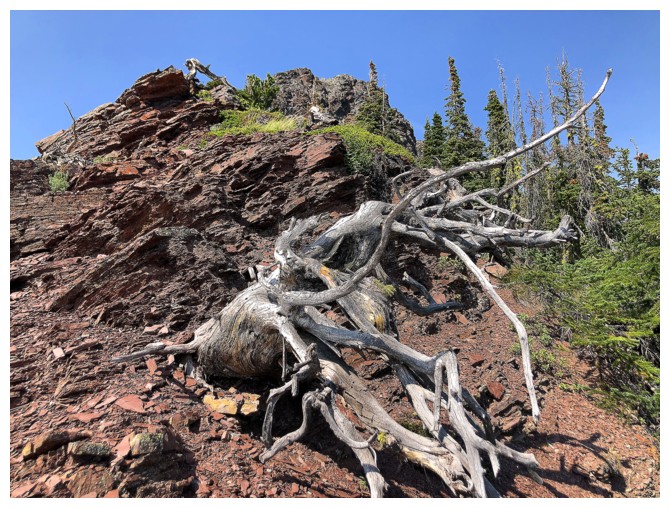
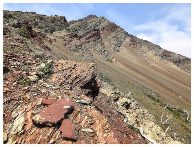
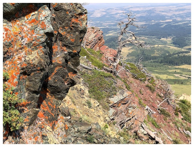
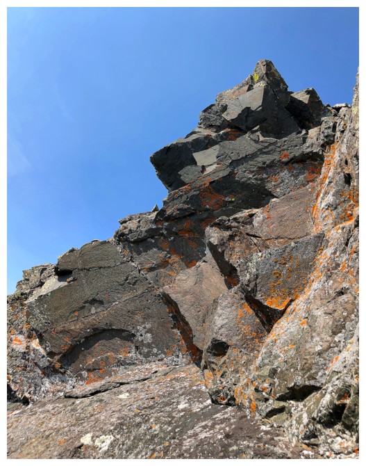
The next section features several cool dead trees, lots of red argillite, and a little lichen
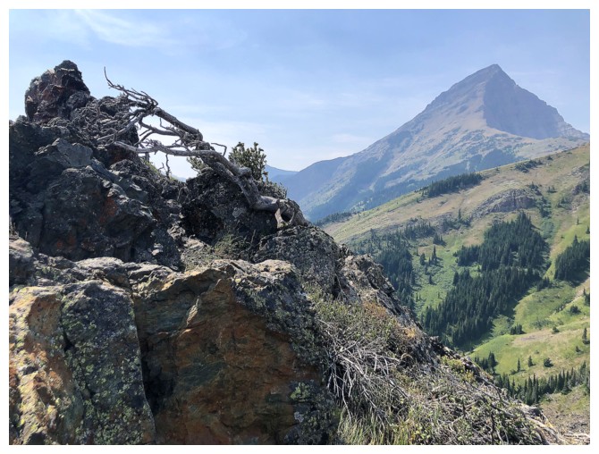
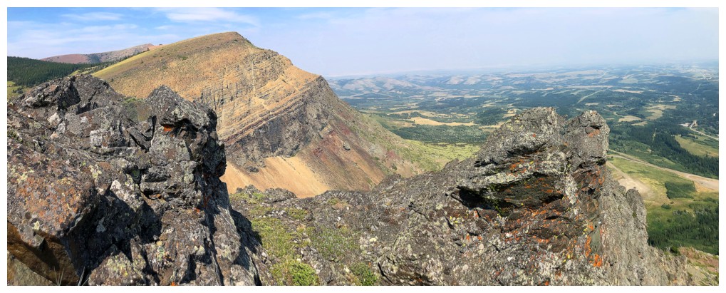
Back to ogling Victoria Peak
This would be such a great view without the haze
A nostalgic look down the route Mark and I ascended in 2008
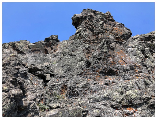
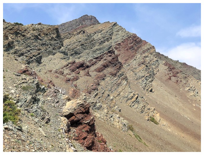
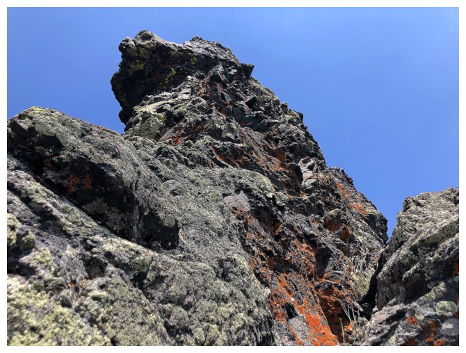
The final section of the ascent features lichen on dark igneous rock
Again with the haze
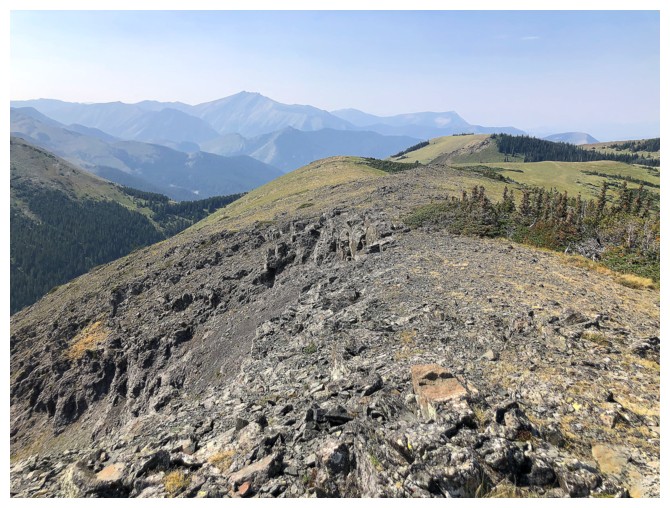
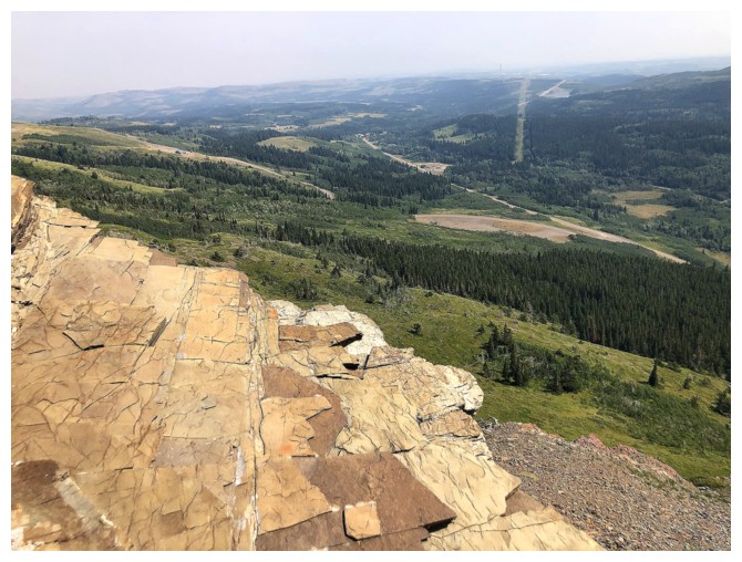
The summit of Sky is more of a plateau than a singular highpoint
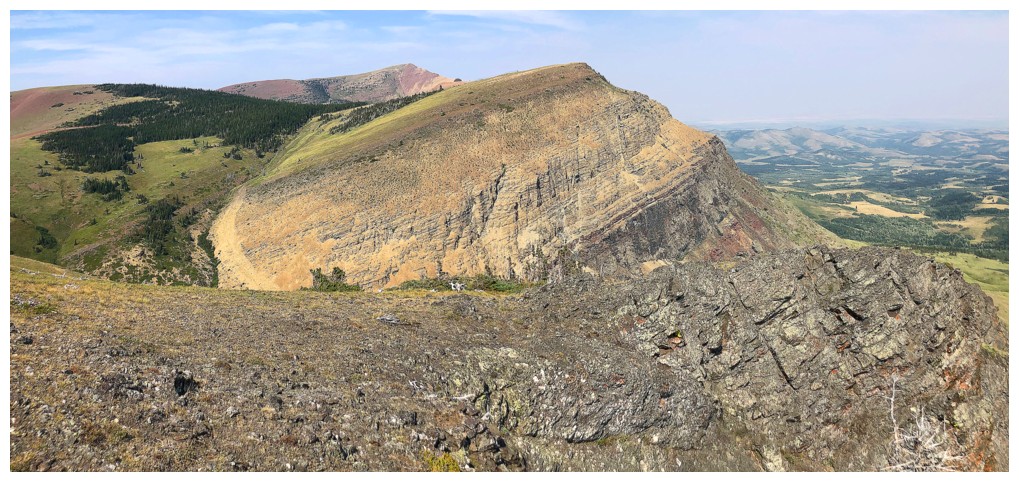
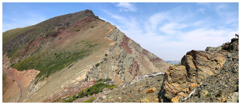
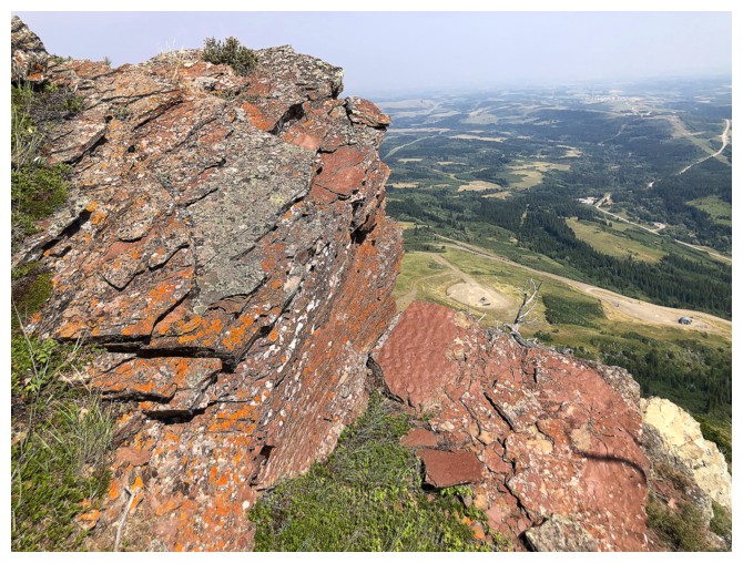
Summit view towards Prairie Fire (centre) and Prairie Bluff (just left of centre)
Summit of Prairie Bluff and one of gas extraction sites near the right
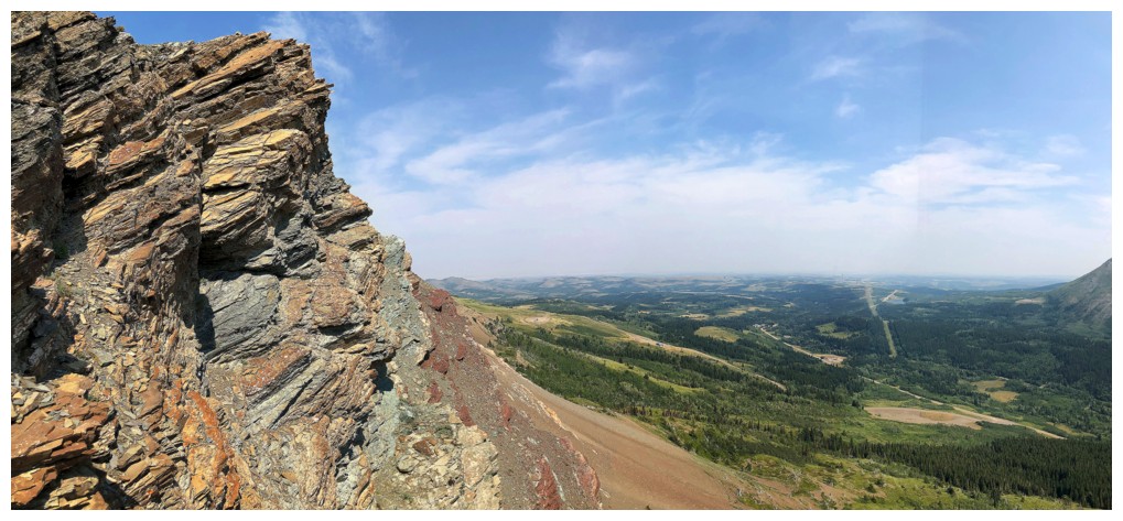
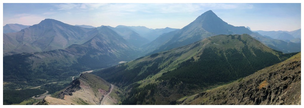
Summit pano
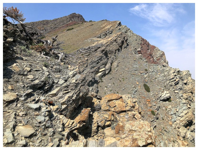
Starting down the northeast ridge
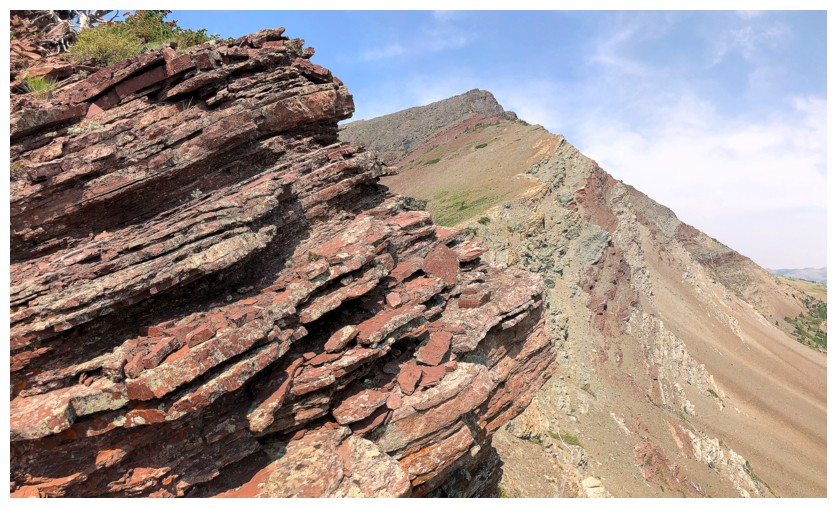
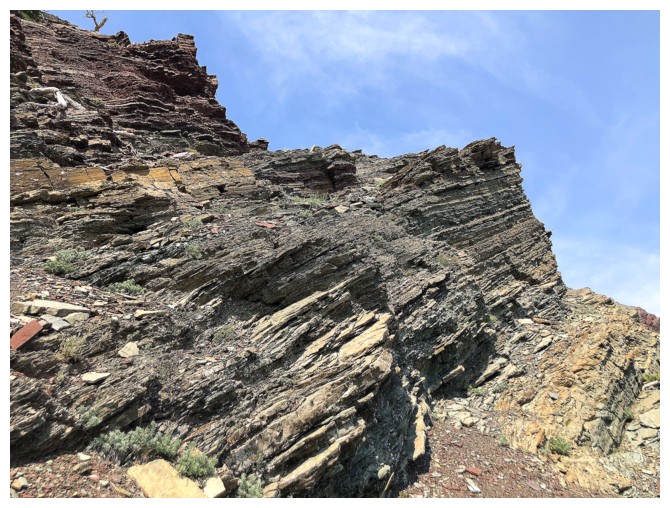
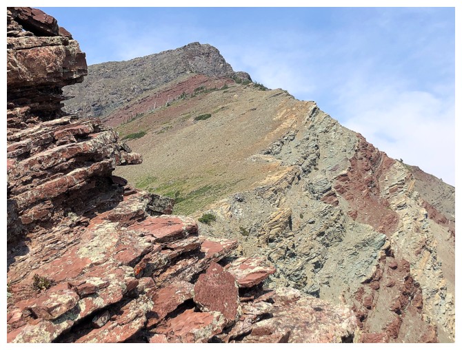
Like the southeast side, the northeast is replete with amazing rock
Throughout the descent I tried to explore the face of the peak and the ridge
Descending the face
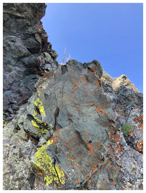
Traversing back towards the ridge because I see some red argillite
Same as above
And arrived
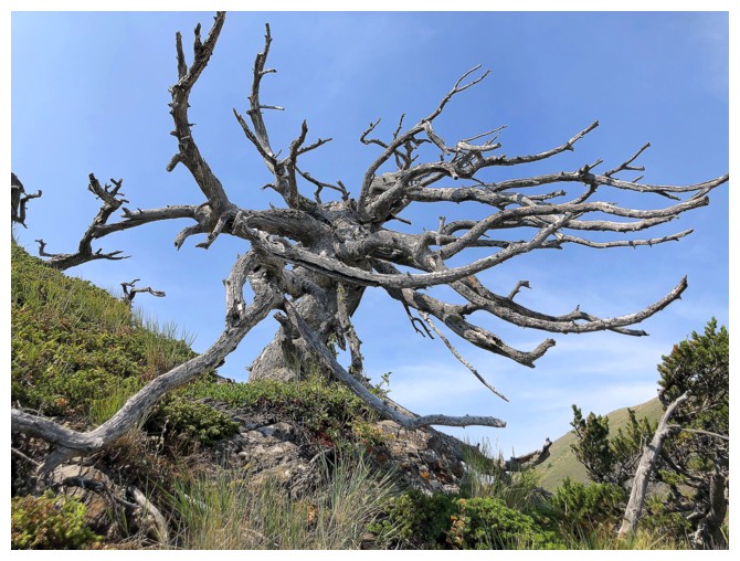
Sweet but creepy tree
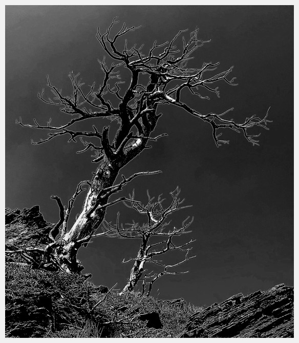
The REALLY creepy version of that tree!
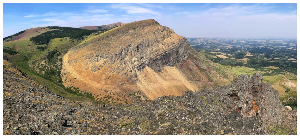
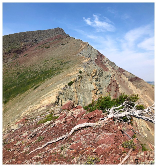
The south side of Prairie Fire offers a straightforward but circuitous route to the top around the southwest side
Although there appears to be a road going up Prairie Fire, it's an
illusion. There is a single track animal trail there, however.
Argillite and that road that doesn't exist

Lots of creepy trees lower down
And less creepy ones

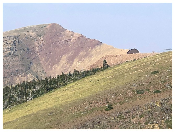
Aiming for the gas well in the centre
Looking across the face of Sky
All the colours and items I love about this area
The far more exciting route up Prairie Fire goes up and through the weakness just right of centre
Sky (left) and Fire. I descended the right skyline of Sky.
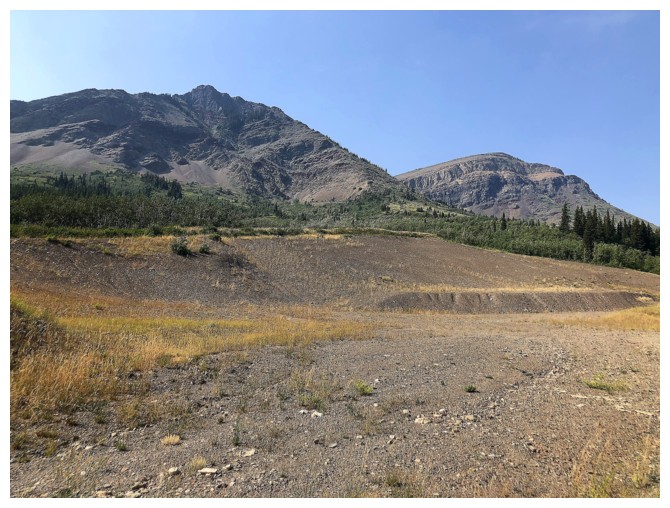
Same as above from the gas road
The End
LOG