Rowe East II
December 30, 2023
Mountain height: 2330 m
Elevation gain:
680
m
Ascent time: 2:00
Minor diversion
time: 1:05
Descent time: 1:20
Solo scramble.
Definitive proof
I need to revisit some mountains or peaks that at one time I thought to be “not
worthy”!
I ran up this
minor outlier of Mount Rowe after ascending Rowe and another outlier to the
northwest, 17 years earlier in 2006. 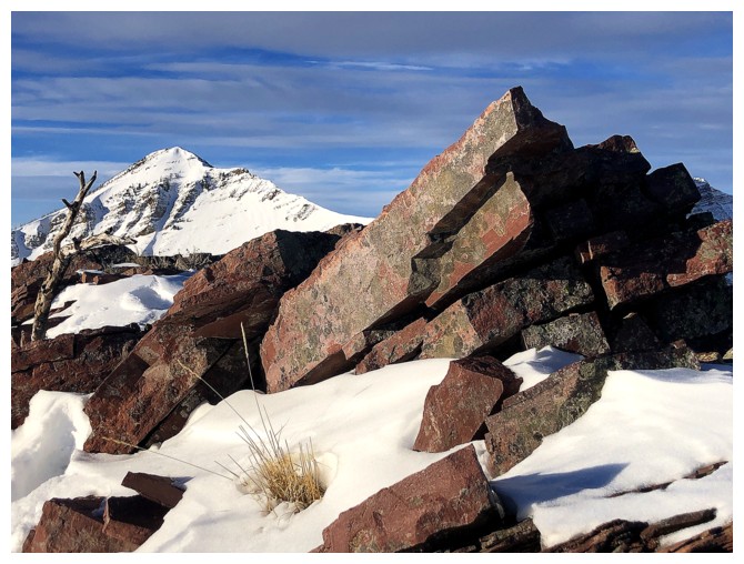 My assessment of the east outlier amounted
to, “It really wasn’t that good of an extension.” However, a recent ascent of
Rowe reignited my interest in the peak, especially as a potential winter trip.
My assessment of the east outlier amounted
to, “It really wasn’t that good of an extension.” However, a recent ascent of
Rowe reignited my interest in the peak, especially as a potential winter trip.
Initially, the
intention was to follow the route Mark and I had used in 2006, but head
straight to the Rowe/Rowe East col and then make the easy trek to the summit
from that point. However, after gaining some elevation, a new route via the
ridge right of the drainage revealed itself and that’s the direction I went. Good
(i.e. lucky) decision! The ridge was fantastic, offering much better views than
that drainage, the usual fare of amazing Waterton rock, and easy travel.
The summit view
did not disappoint either and was certainly superior to expectations, given my lacklustre
2006 review. 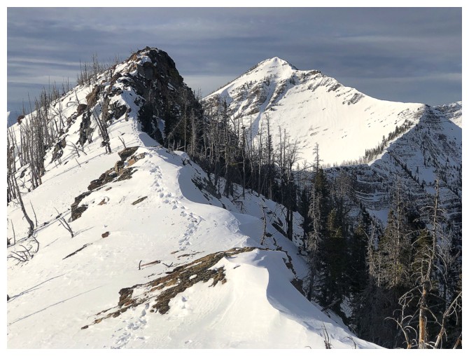 Following the ridge to the east seemed like a good idea at this
point. The weather was in the process of breaking down, however, I had been
fortunate enough to enjoy clear, blue skies on ascent. Crampons and an ice axe
were required to get around a couple of rock bands, but otherwise the traverse
was straightforward and also very rewarding. When the ridge dropped off, I
turned around and went back to the summit.
Following the ridge to the east seemed like a good idea at this
point. The weather was in the process of breaking down, however, I had been
fortunate enough to enjoy clear, blue skies on ascent. Crampons and an ice axe
were required to get around a couple of rock bands, but otherwise the traverse
was straightforward and also very rewarding. When the ridge dropped off, I
turned around and went back to the summit.
For descent, I
had already decided to head towards the Rowe/Rowe East col and then descend
snow slopes into the drainage. This worked perfectly, even granting me a decent
section of fun glissading.
An excellent
day out and also a reflection of my changing perceptions of the mountains. The new
review for Rowe East is, “A superb and very worthwhile extension of Mount Rowe or a great
stand-alone off-season trip. Outstanding!”.
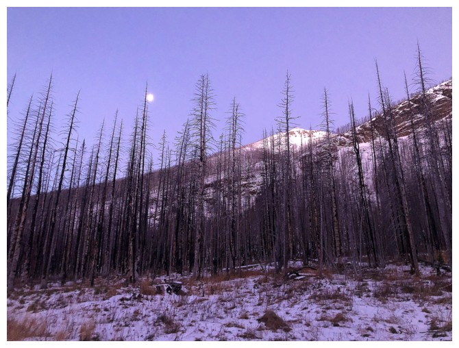
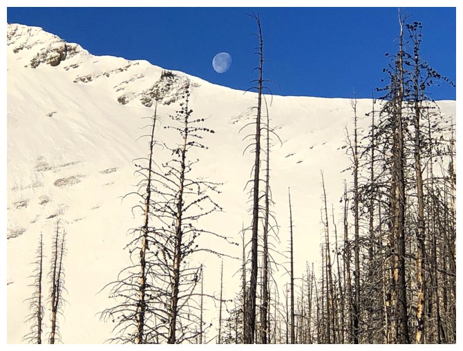
From nearing the parking lot, Mount Rowe and the Moon are visible
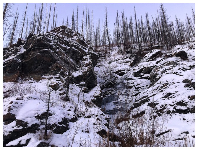
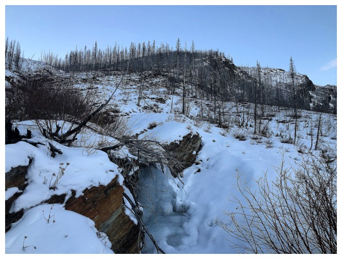
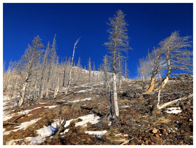
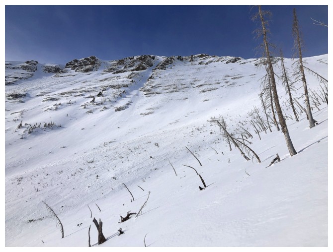
The ascent drainage steepens, but is generally easy to ascend on the right side
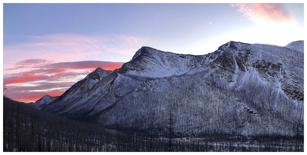
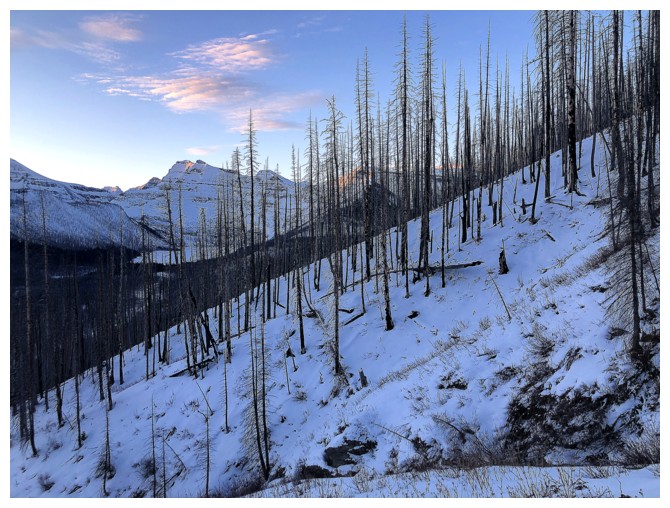
Morning light and colours over Mount Crandell, Senator Peak, Buchanan Ridge, and Mount Carthew
First colourful rock encounter of the day, though the Sun's rays are conspicuously absent
The grade mellows after that one steep section
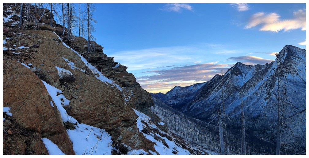
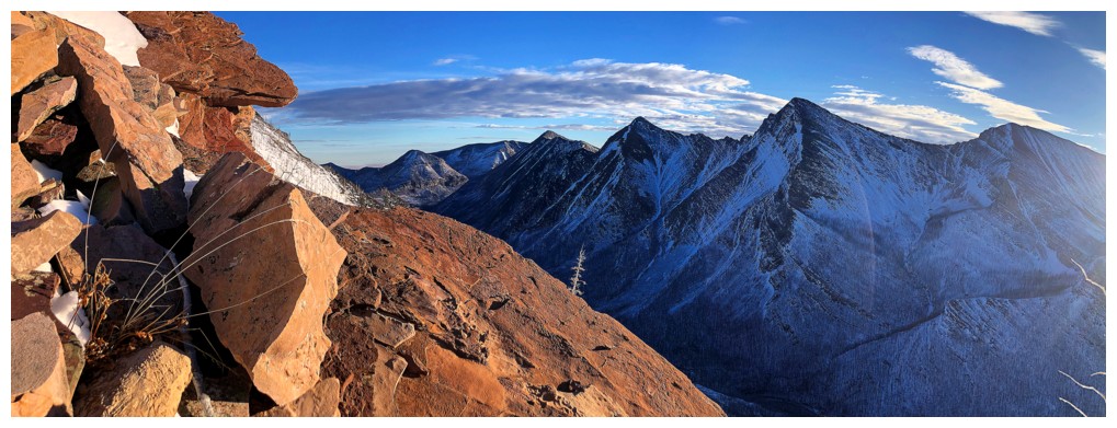
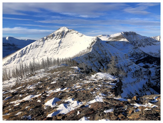
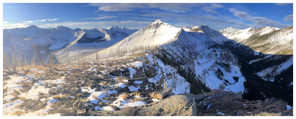
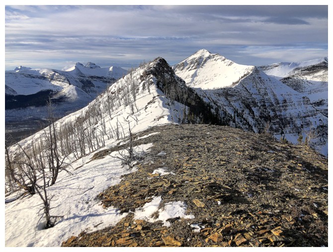
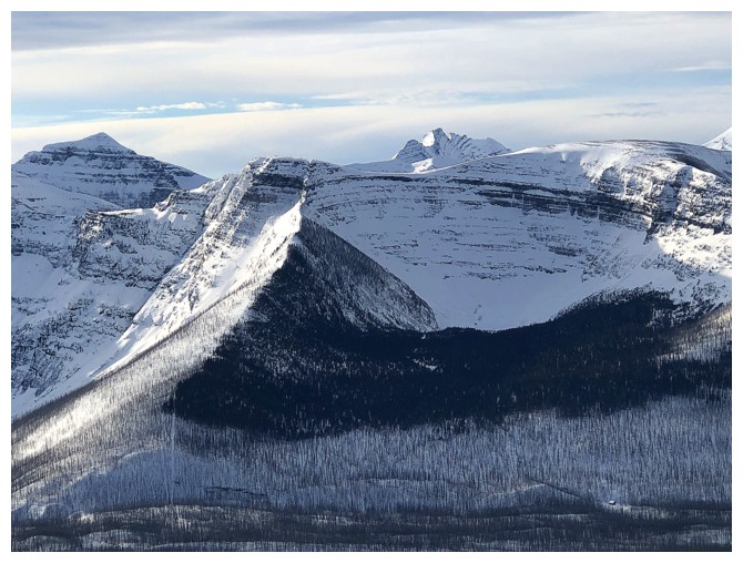
Looking right to the ridge I eventually ended up on
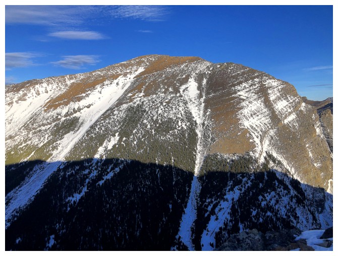
Mount Custer is getting some Sun
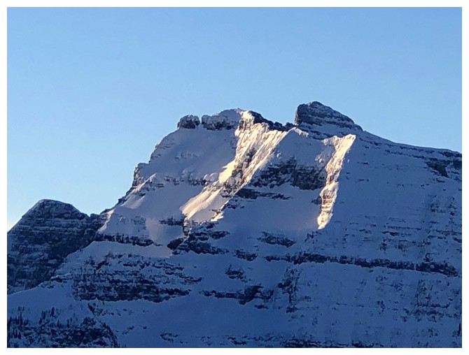
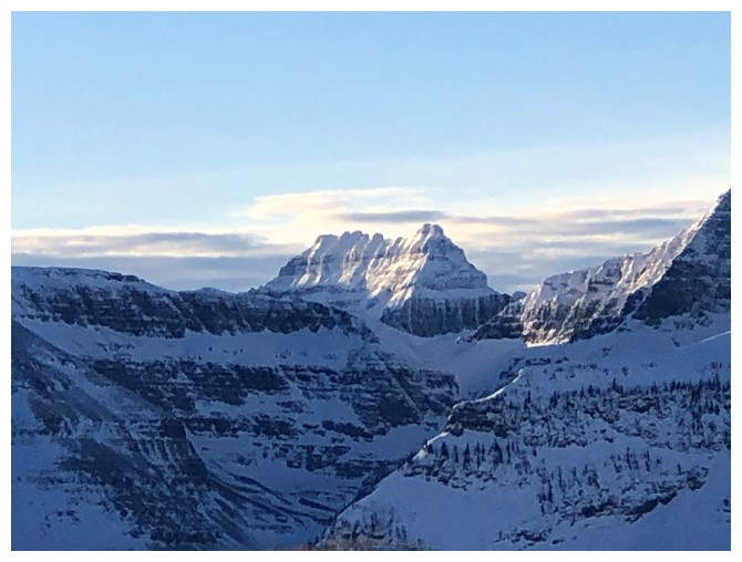
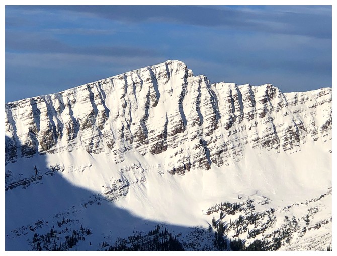
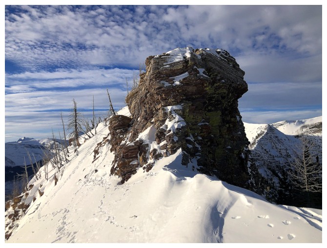
The summit block of Rowe
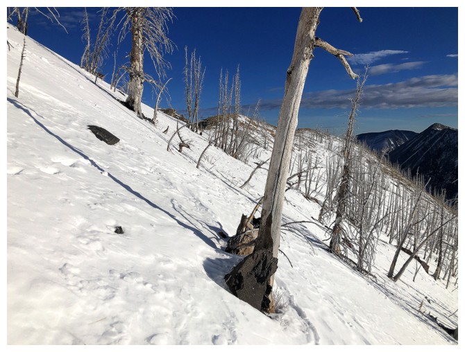
Heading right to gain the ridge. Looks boring but that was soon to change.
The change
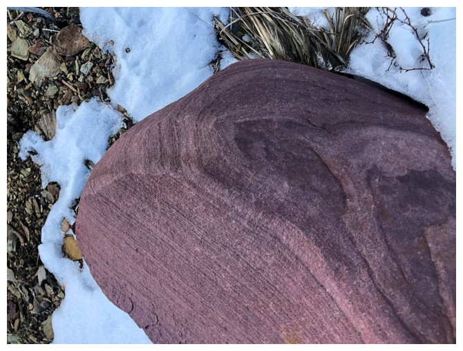
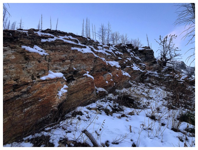
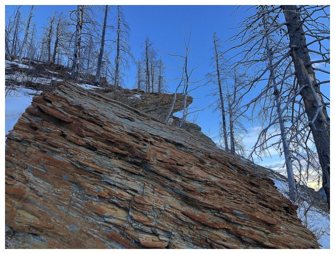
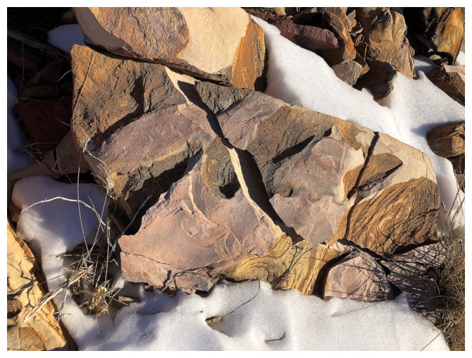
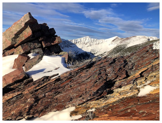
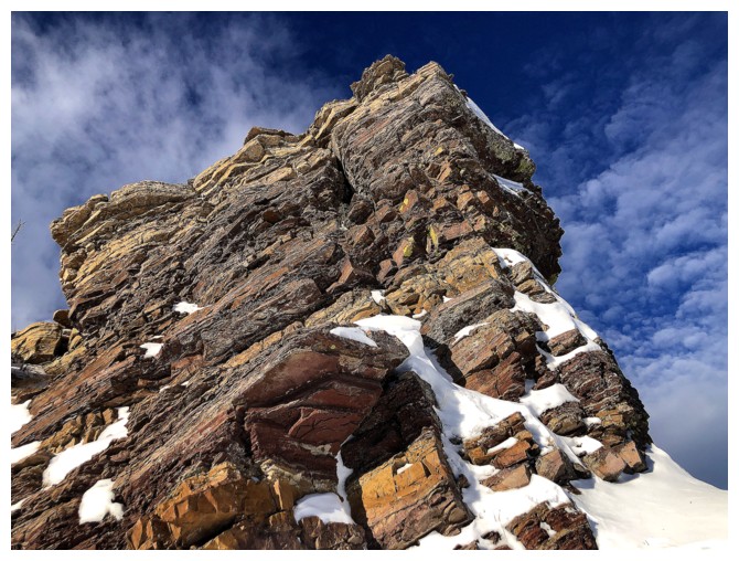
Smooth chunk of burgundy argillite
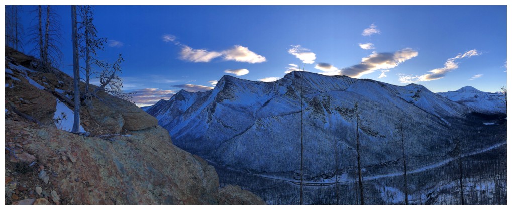
The view on the other side of the valley is front and centre for the entire ascent
Random chunk of burgundy argillite
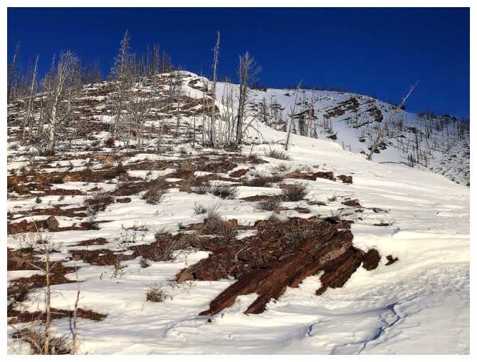
Other types of colourful rock
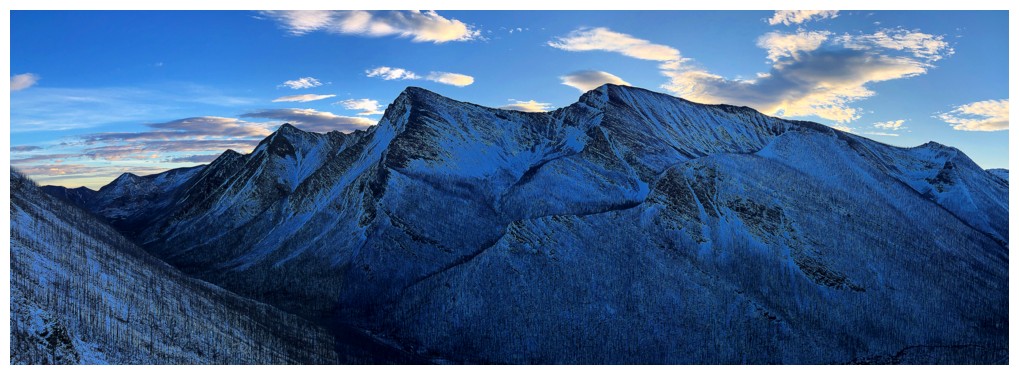
That view again, but of course it will be in shade for most of the day at this time of the year
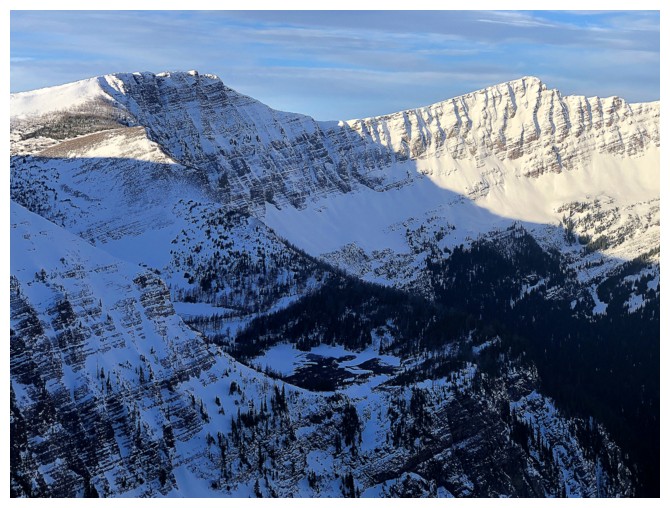
Mount Custer's east face does get some Sun
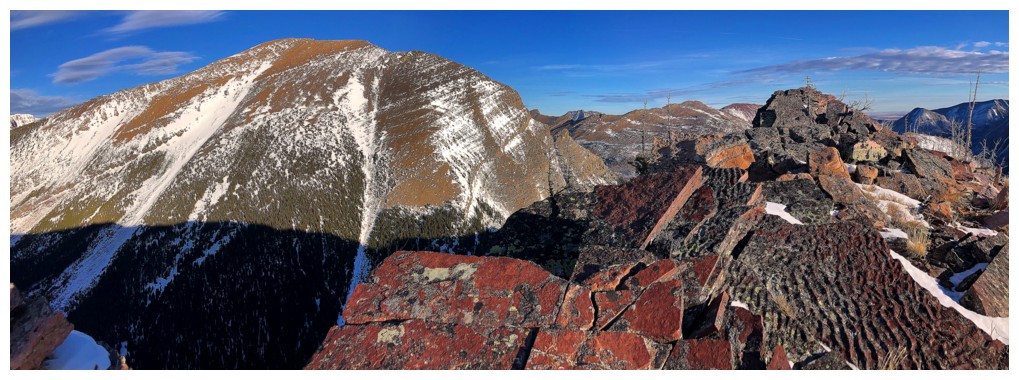
The lower eastern summit of Akamina Ridge up high and "Little Akamina" down low
Forum Peak
All of the above and more
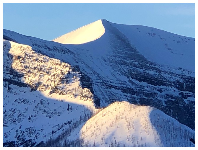
As the Sun rises, it's Mount Rowe's turn to get some attention
Rowe has become one of my favourite snowshoe ascents in the Rockies
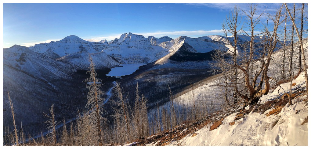
Cameron Lake and Mount Custer
Rowe and a silhouetted tree
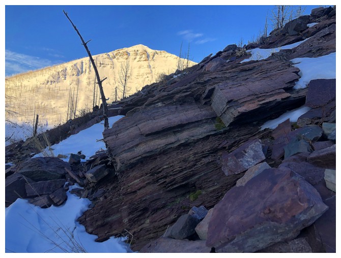
Rowe and red argillite (but no Sun on the red rock - boo!)
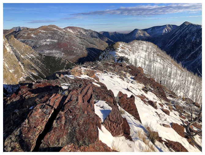
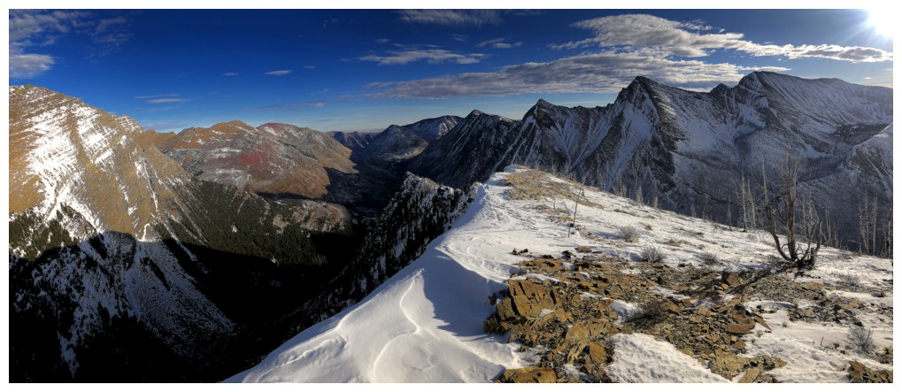
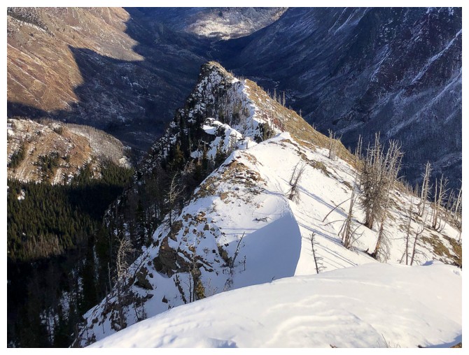
Looking down the ridge
I think that's Thunderbird Mountain in Glacier National Park - very cool looking peak
Summit of Rowe
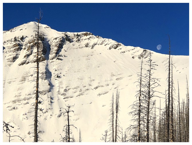
The Moon above the Rowe/Rowe East connecting ridge
Both of the above
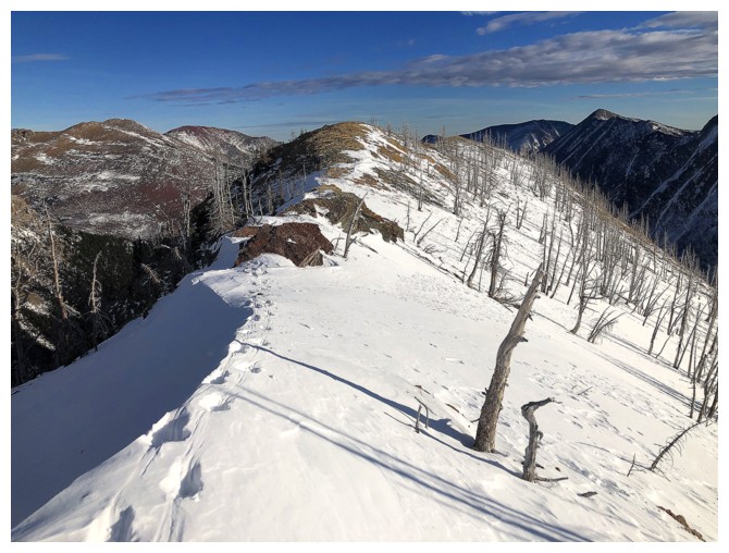
Back to the easy and scenic terrain on and near the ridge
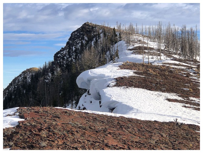
Closer to the edge of the ridge, but don't get too close when it's corniced
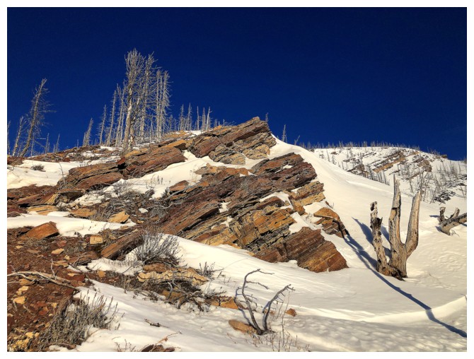
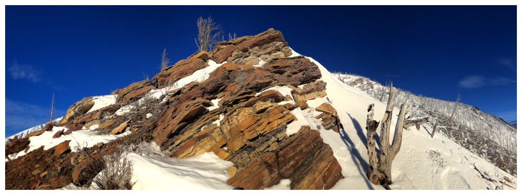
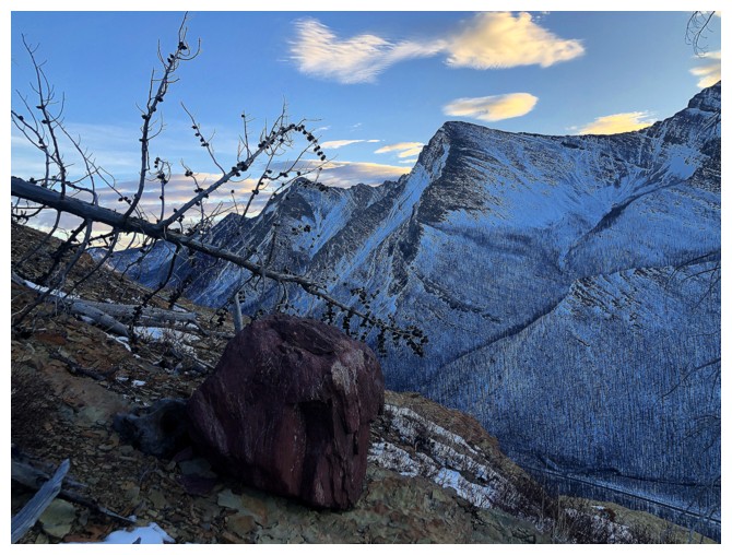
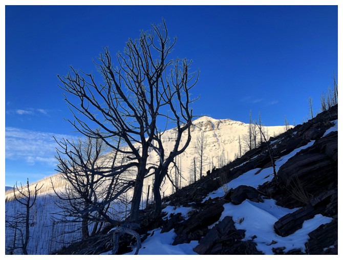
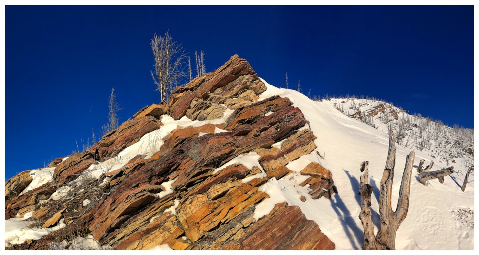
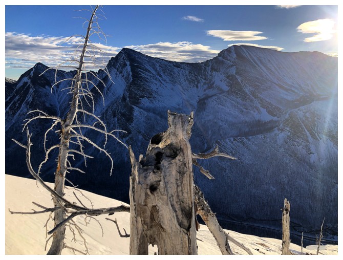
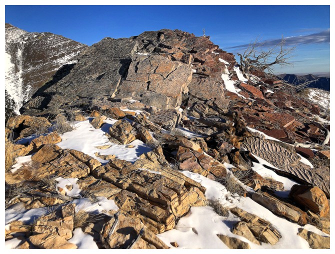
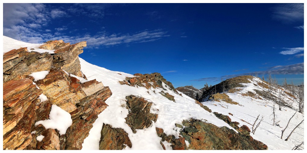
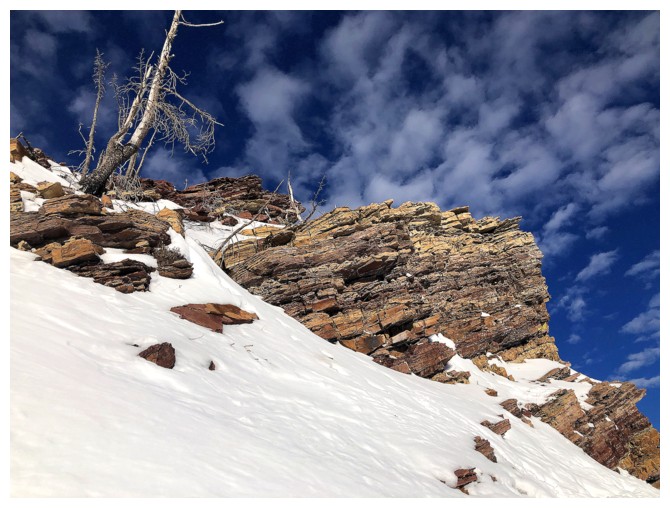
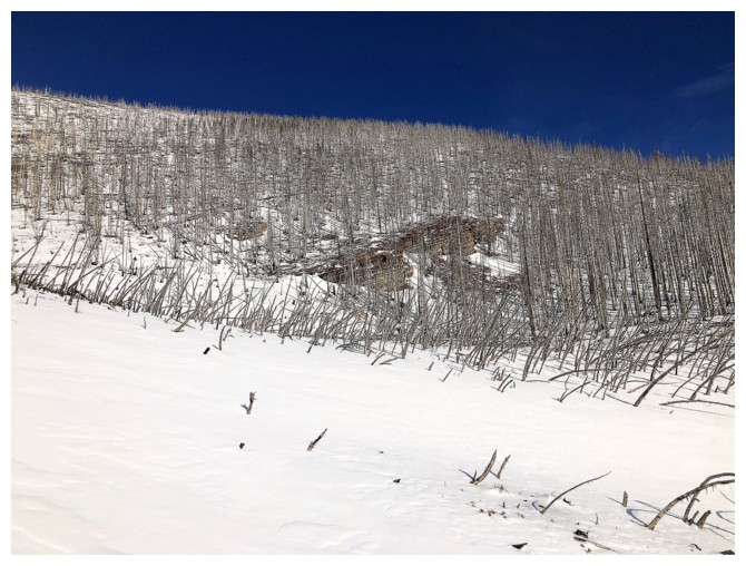
The coolest part of the ascent was this colourful rock band and the dead fork-like tree to the right
Distracted by the view around Cameron Lake
Happy to see this before it gets covered in snow
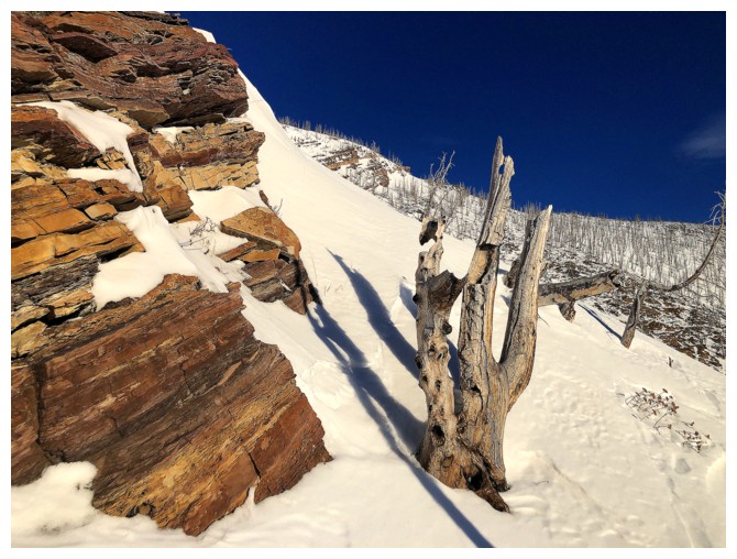
The Fork
Resuming travel up the colourful ridge
May have serendipitously picked a great time to do the trip, when snow
adds to the scenery but doesn't cover all the amazing rock
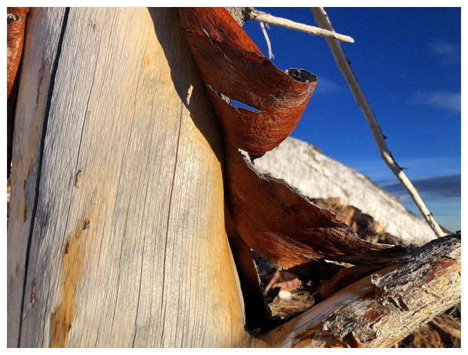
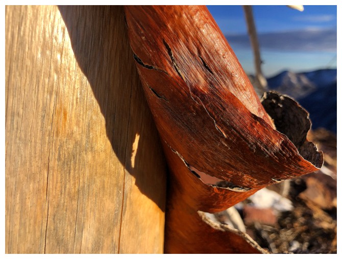
Even the tree bark is red on this ridge!
Enjoying the clear blue sky before it is no longer so
And enjoying the terrific views
Both west and east
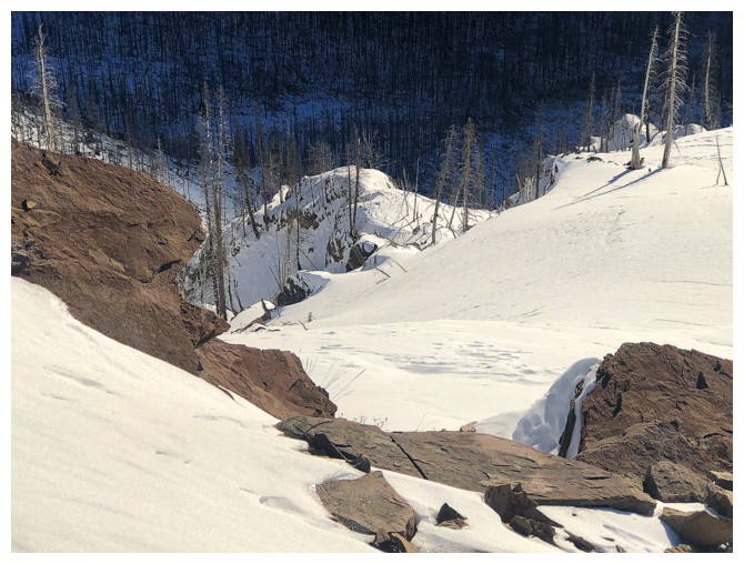
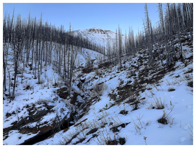
Another interesting section of terrain below
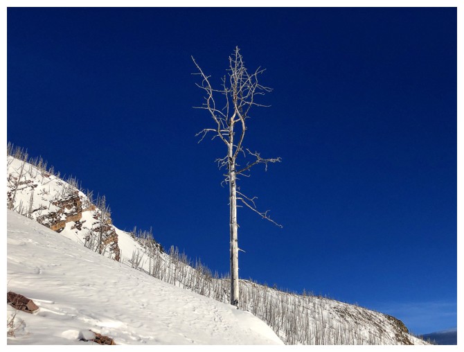
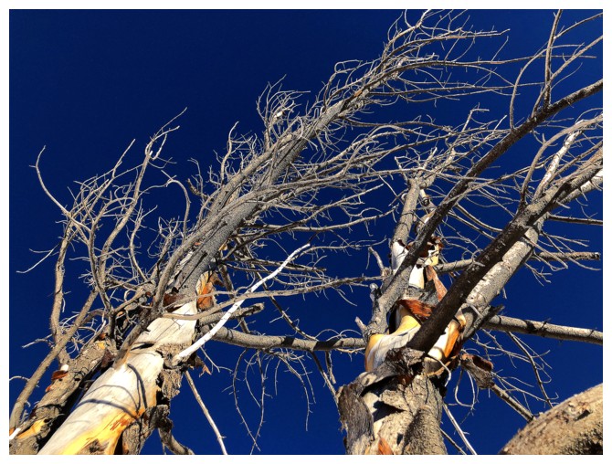
Lone, dead-straight tree
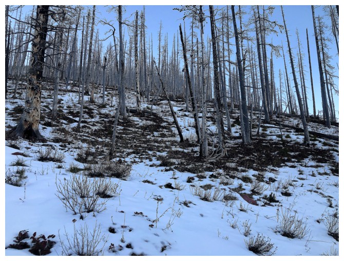
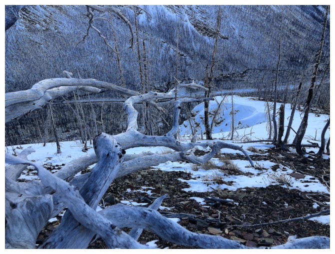
Other remains of trees
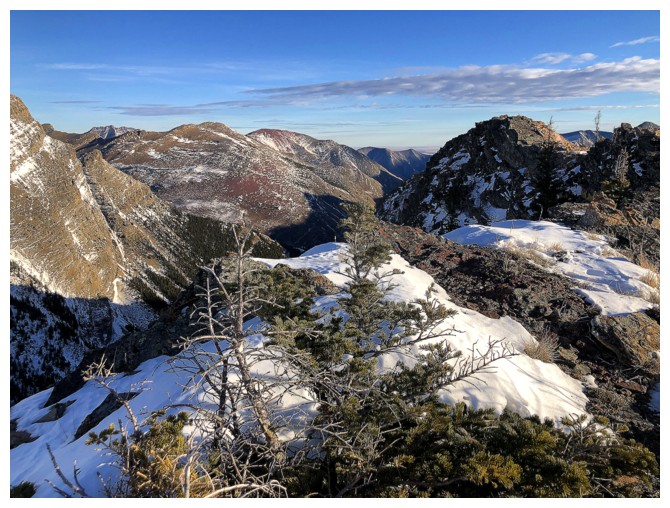
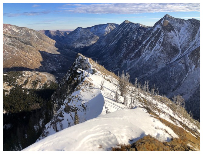
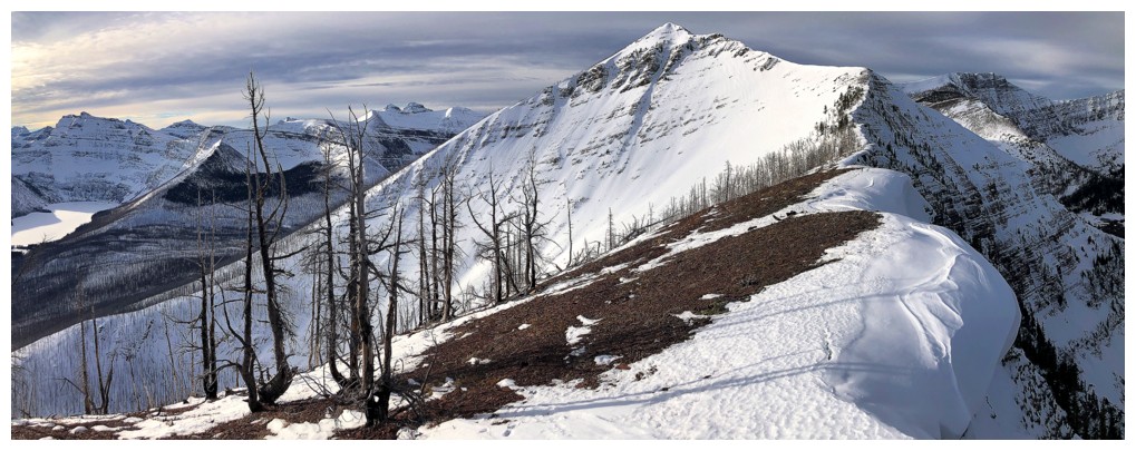
On the ridge between Rowe and Rowe East
Mount Lineham
The summit is only a few minutes away at the right
All of the above
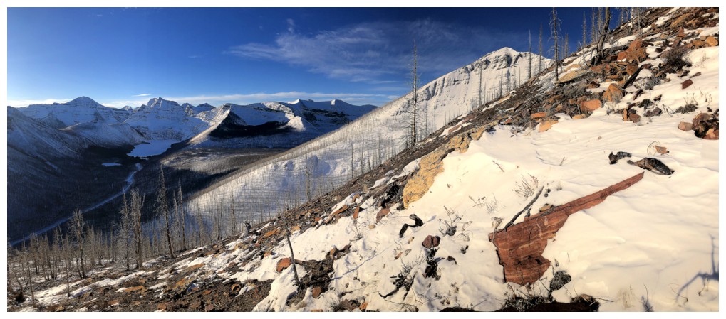
The view to the west is pretty killer
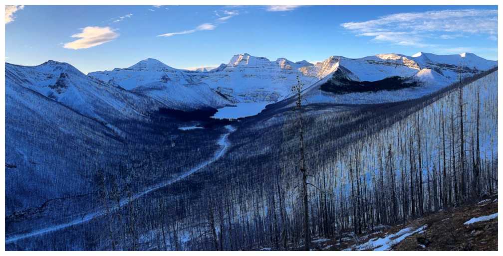
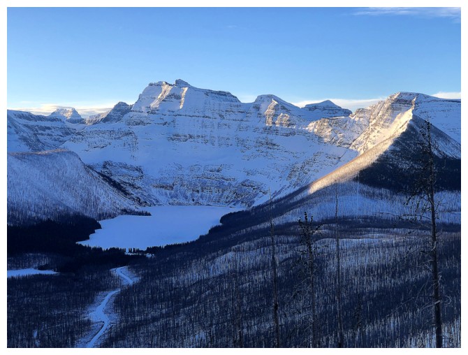
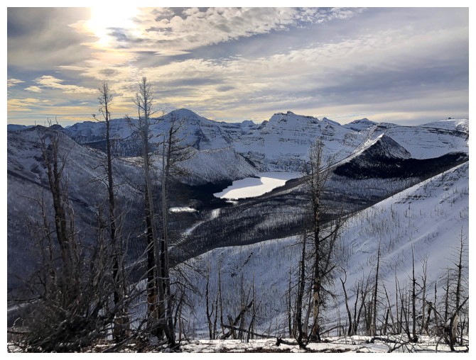
Looking down on snow-covered Lower Rowe Lake
The lower Upper Rowe Lake is hardly a lake at all at this time of the year and only the corner of the upper one is visible
But "The Peak Of Despair" is clearly visible!
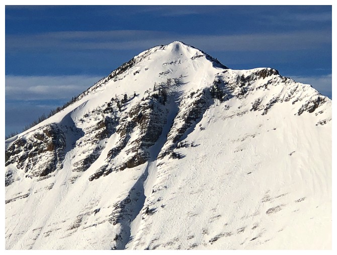
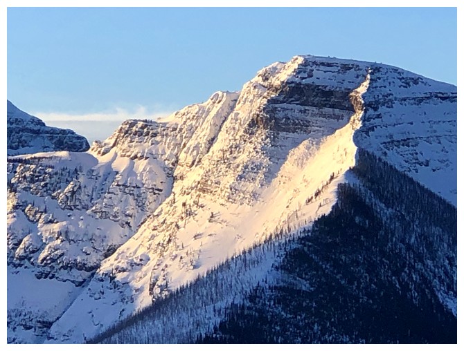
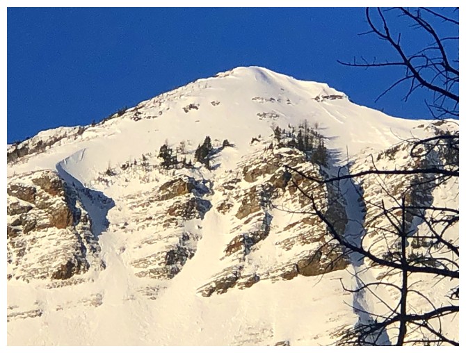
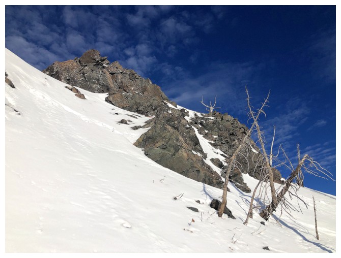
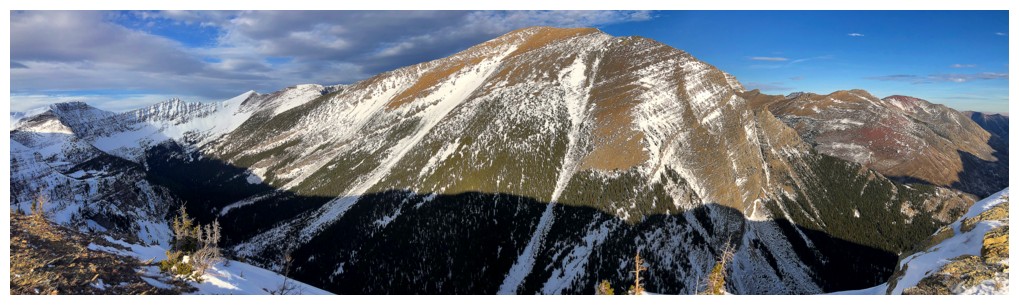
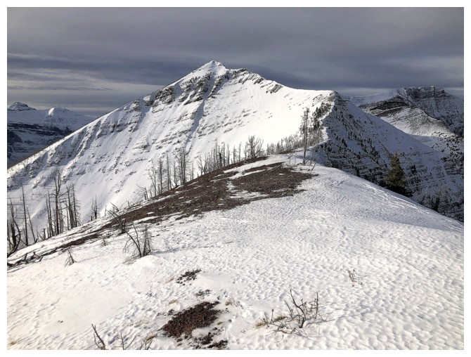
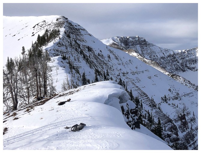
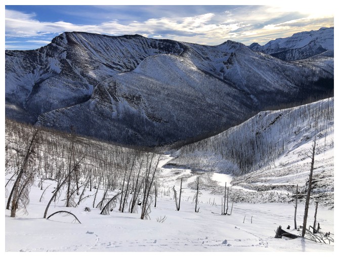
Rowe again. It's east ridge is a short but fun scramble.
Oh, the wonderful distraction of red argillite!
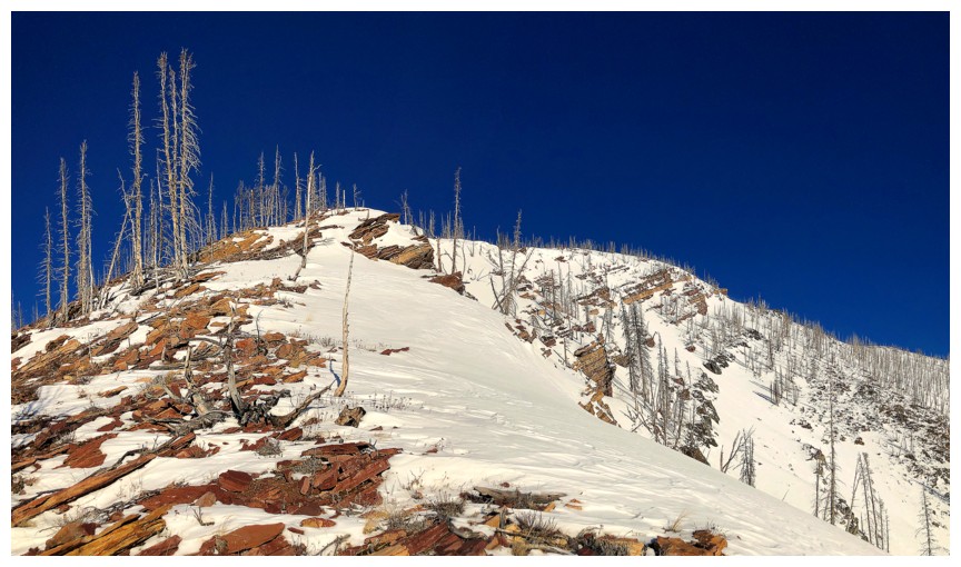
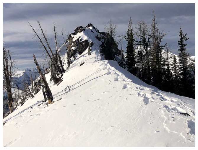
There's the summit
Distracted again, but that's hardly a surprise
Summit of Rowe East
Didn't stay long because the east ridge begged exploration
Easy travel to begin with
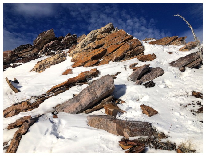
More rocky distractions
Couldn't downclimb this, so had to go around
The route around the rock band at the left. It was quite steep and crampons and an ice axe were necessary.
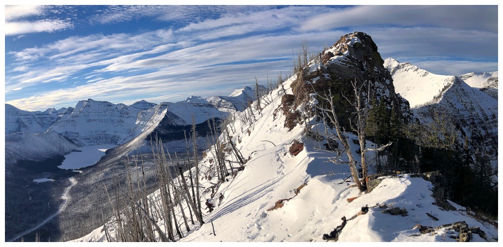
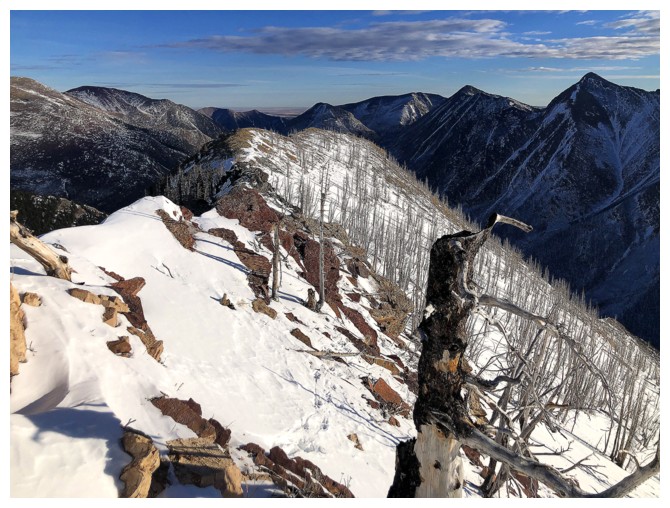
Looking back along the summit ridge
Igneous rock ahead!
Traversing below the ridge to get around the solidified magma
Back on the ridge to find footprints - or more accurately hoofprints
The colourful rock never ends
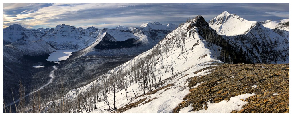
Lineham and others
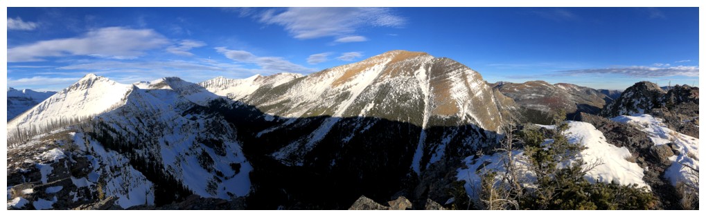
Looking back again to the beautiful contours of the ridge and Mount Rowe
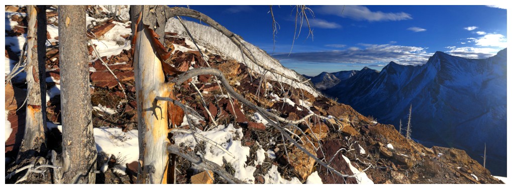
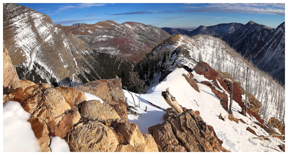
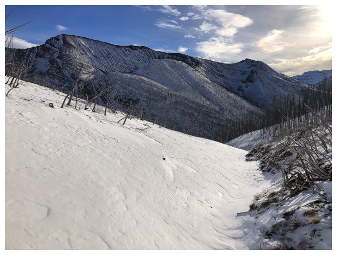
View from the highest point of the ridge
I continued on for a short distance beyond the highpoint
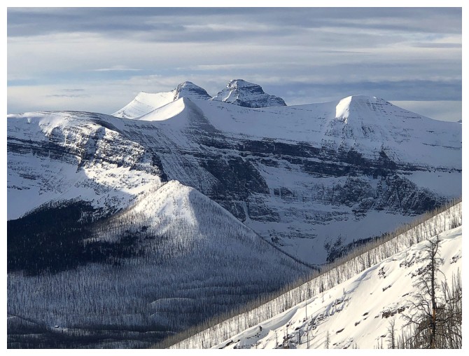
Kintla and Kinnerly in GNP
Forum Peak in Waterton and shapely Mount Peabody, just right of centre, in GNP
The ridge drops off here. The end of the line for me.
Heading back. The clouds are coming in now but I'm already fully satiated.
The contours again
The hoofprints go around the deathly exposed north side of the igneous band - I went for the south side!
Going south around the other rock band
Still clear, sunny, and colourful to the east
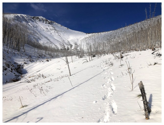
Approaching the col
Even though there is a depressing lack of snow for late December, some decent sized cornices have developed
Passing a few
Cameron Lake and company still look good, even with the clouds
Another cornice
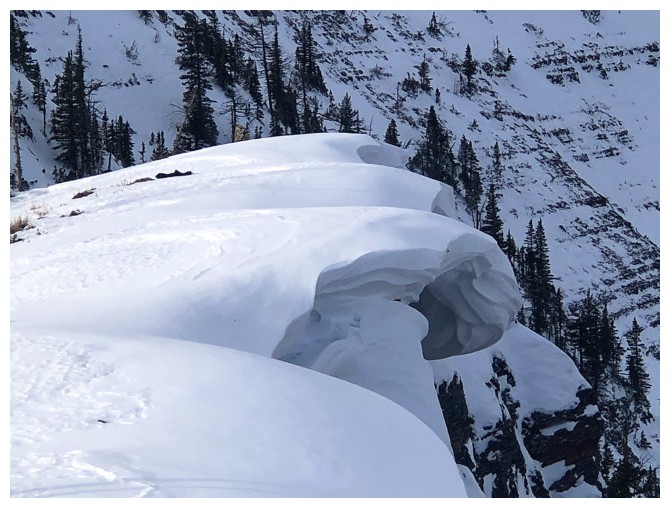
Close-up
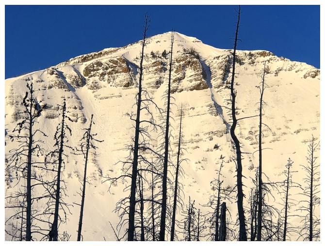
I started descending before reaching the col. Looking up at Rowe's east ridge.
Upper part of the descent route
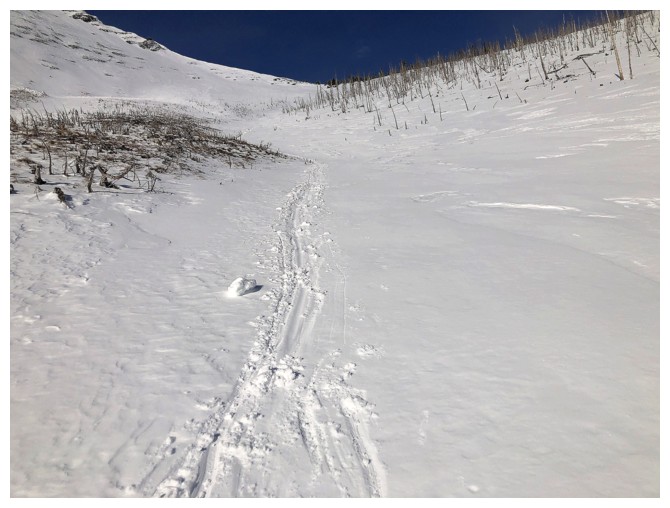
Glissade track
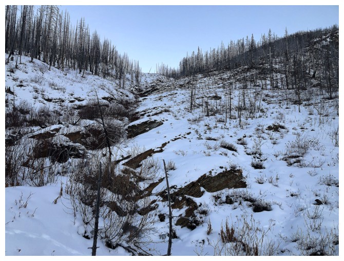
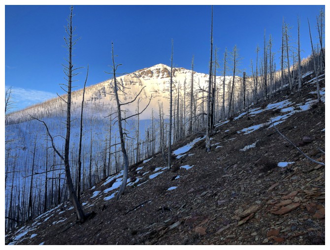
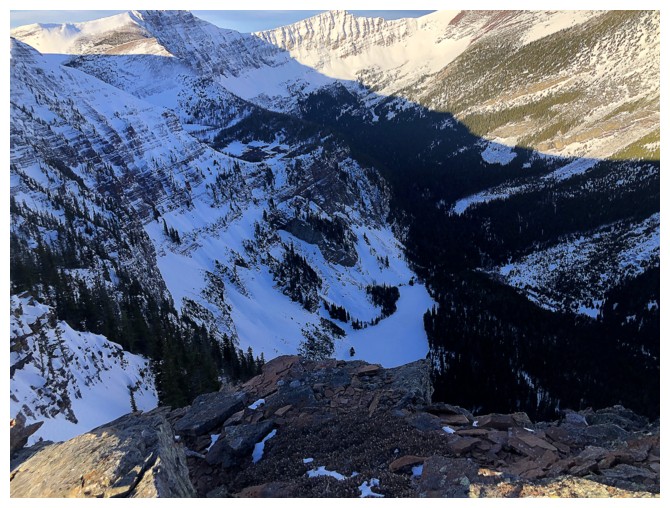
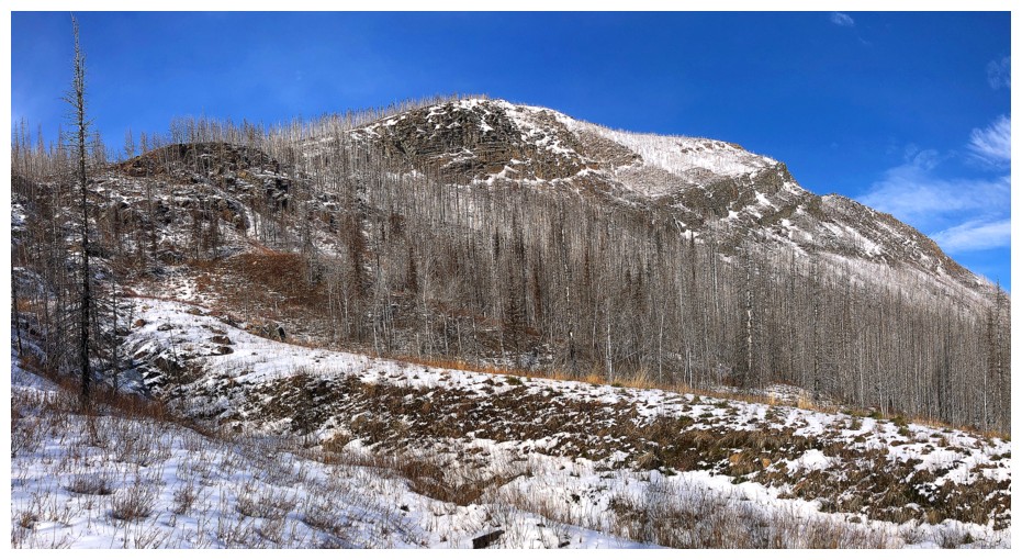
The proliferation of bent trees point to the avalanche prone nature of the drainage
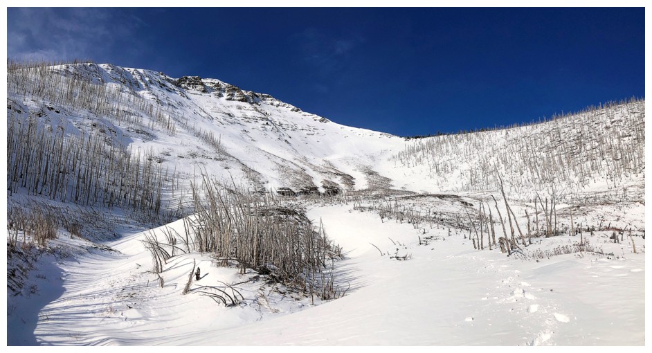
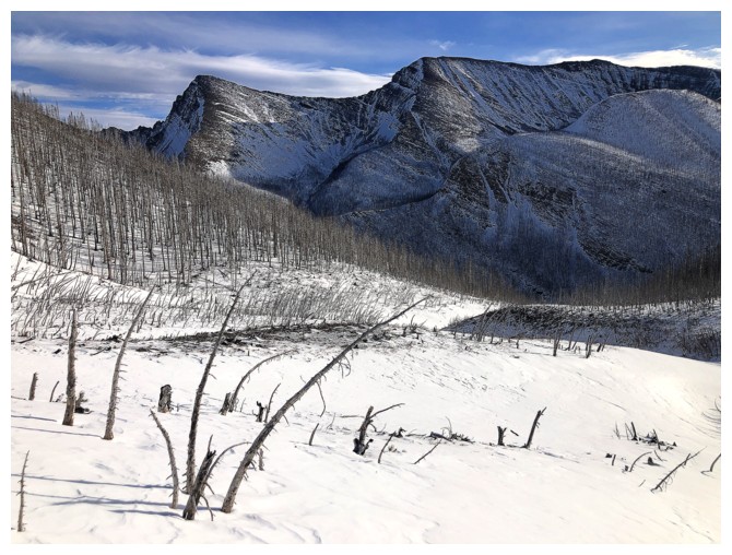
Looking back. I'd stay in the trees at the right in times of avalanche concerns
Those ones. Descending the same route I ascended would be the safest way down (and up).
Carthew, Carthew Minor-Minor, and Carthew Minor. I love The Carthews!
Blue sky holds on for dear life to the north

There's the ridge I ascended. I predict this route to become as popular for me as the winter Mount Rowe route.
Last look at Rowe East. Two thumbs up!
The End
LOG