Avion Ridge exploration
(Goat Lake Peak attempt)
September 9, 2022
Highpoint: 2390 m
Total elevation gain: approximately 1000 m
Round-trip time: 5:50
Solo scramble.
Hazy skies from
forest fire smoke usually dictates an experimental trip, where far-reaching
views are not the focus. As such, I decided to bike/hike to Goat Lake and check
out a potential route to a minor peak above the lake (I'll unofficially call it "Goat Lake Peak").
I had noticed a distinctive gully between rock buttresses that I thought might
grant access to the ridge and peak above.
An
easy bike and
easy hike preceded my almost comical reaction upon seeing the gully - not sure
how my brain had decided this route might go as a scramble, but unless
I was conveniently bitten by a radioactive spider, no way was I going
up this way! Instead, I chose to try a route
just north of the gully. It had potential but also appeared to be quite
steep
near the top and would require a potentially exposed traverse to reach the ridge.
The route
started well, however, as expected increased in severity higher up. I was soon ascending
terrain that could be problematic on descent. 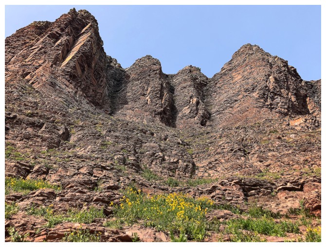 Eventually, I reached a point
where a long traverse across dangerously steep slopes above cliffbands would
have been required. Already concerned about getting down, I bailed here and
took a slightly different route towards the valley bottom. This line required
some very careful and exposed downclimbing but was easier than the route I
ascended.
Eventually, I reached a point
where a long traverse across dangerously steep slopes above cliffbands would
have been required. Already concerned about getting down, I bailed here and
took a slightly different route towards the valley bottom. This line required
some very careful and exposed downclimbing but was easier than the route I
ascended.
What next? I
wasn’t done with Avion yet. Even with the hazy skies, I had already been
treated to plenty of colourful autumn scenery. Returning to the parking lot
seemed premature. 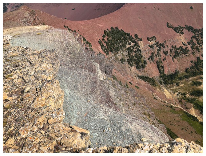 How about another route to get to that ridge?
Once onto easier
terrain, I side-sloped the east face of the ridge until I could get above the
cliffbands. Eventually I was able to side-slope back in the opposite direction above
all the dangerous cliffs to reach the ridge I had originally set out to gain.
Looking at my GPS track was as comical I as the earlier gully experience – looking like a really bad EKG!
Getting to the
summit of the peak above the lake had long been written off. My crazy,
circuitous route to the ridge had wiped me out both physically and mentally. I
settled for a brief rest, before ascending to the highpoint of the ridge
between Newman Peak and the true summit of Avion Ridge and then the long but
easy hike back to the lake and out. Again, the fall colours were impressive and
provided plenty of motivation for a return trip on a non-hazy day.
Overall, an
exhilarating and exhausting day in a stunning area of Waterton. More than
likely, I will return some day to further explore this ridge and peak.
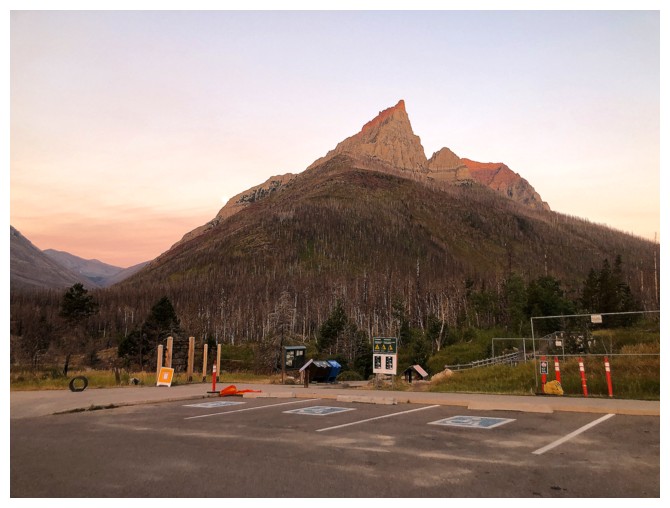
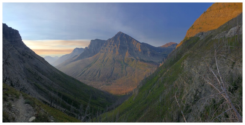
The classic shot of Anderson Peak towering over the Red Rock Canyon parking lot
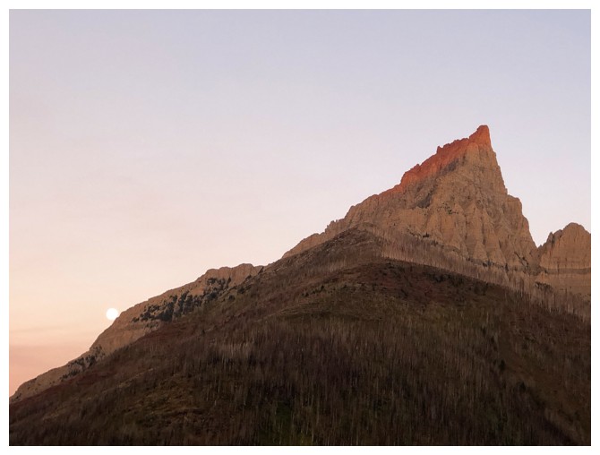
Last look at the moon before it disappears behind Anderson
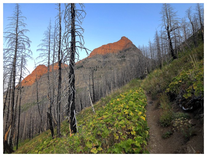
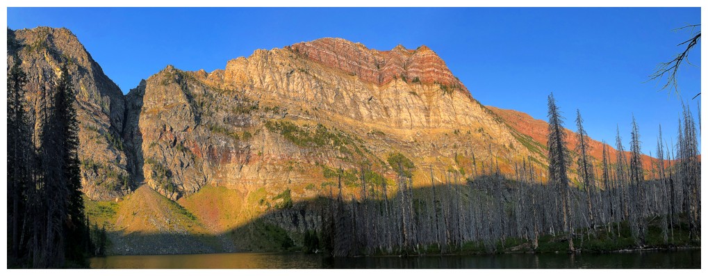
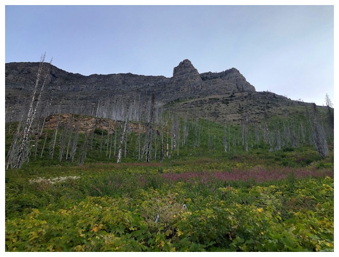
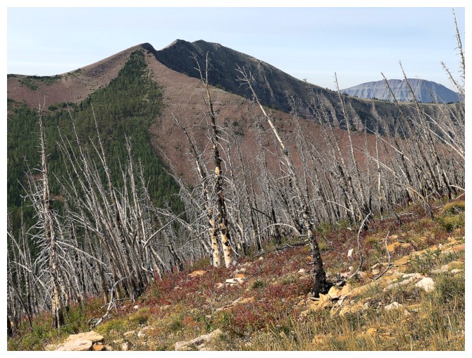
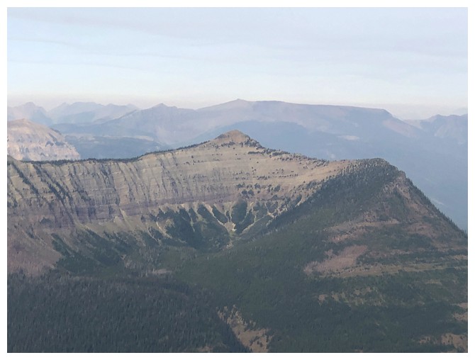
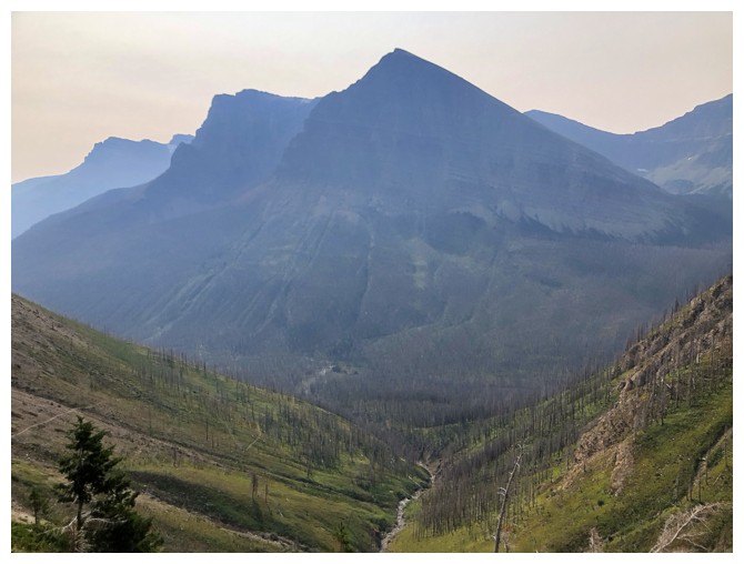
Hiking the enjoyable Goat Lake trail. Goat Lake Peak is dead ahead.
The north side of Anderson
Goat again
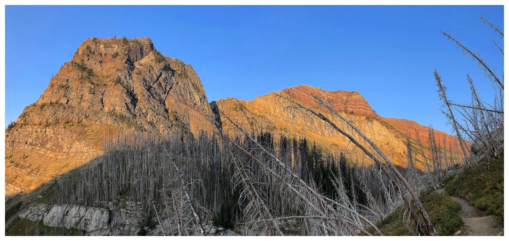
The far southeast end of Newman Peak (and Newman Senior). There's an interesting and challenging scramble route to Newman up this way, but the route has never gained popularity.
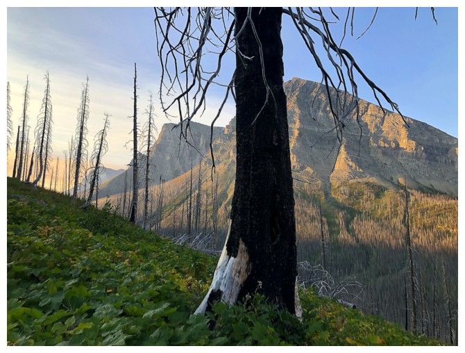
A tree blocks some of the view of Anderson

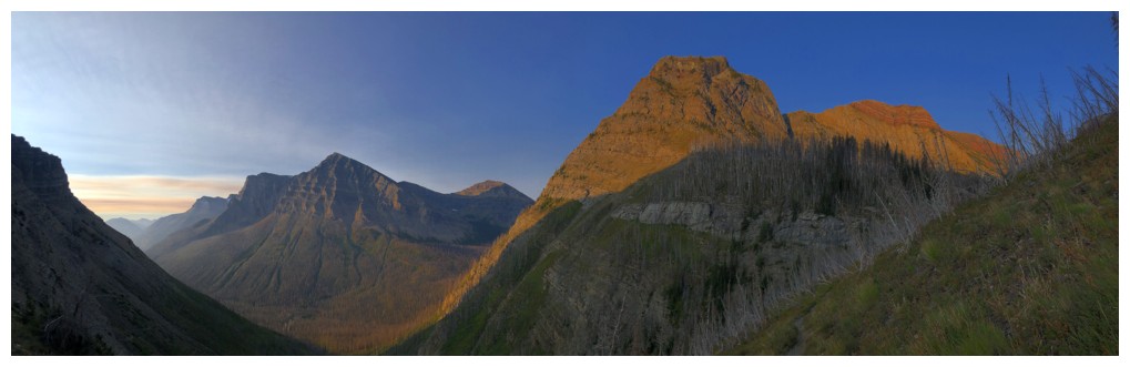
Unofficial Kootenai Brown Peak and official Mount Bauerman to the right of Anderson
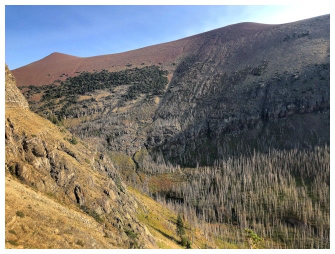
Goat Peak looks quite prominent on approach, but not so much once you are looking down on it from Avion Ridge
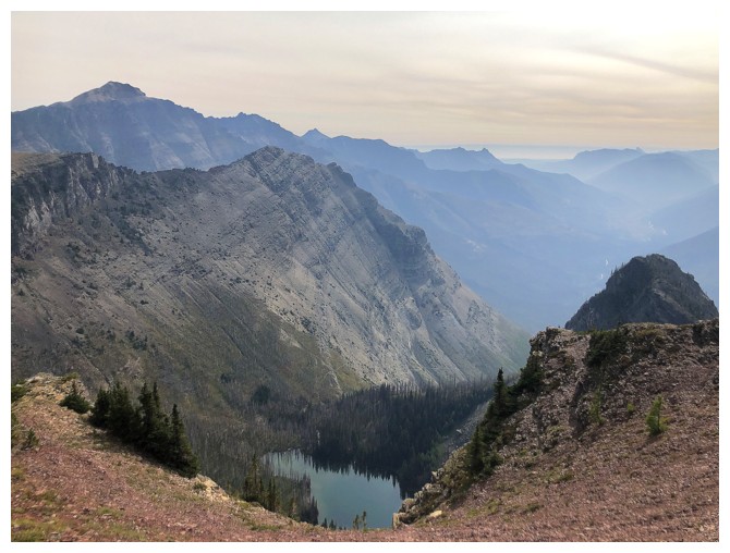
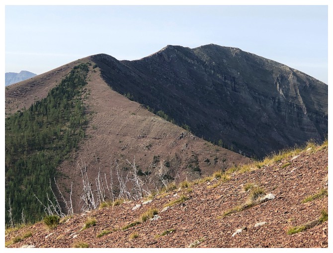
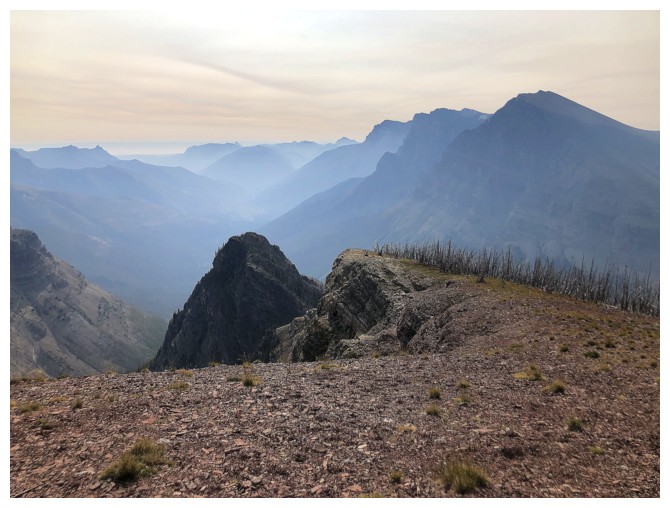
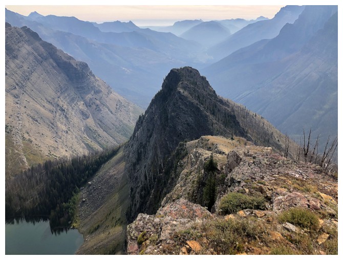
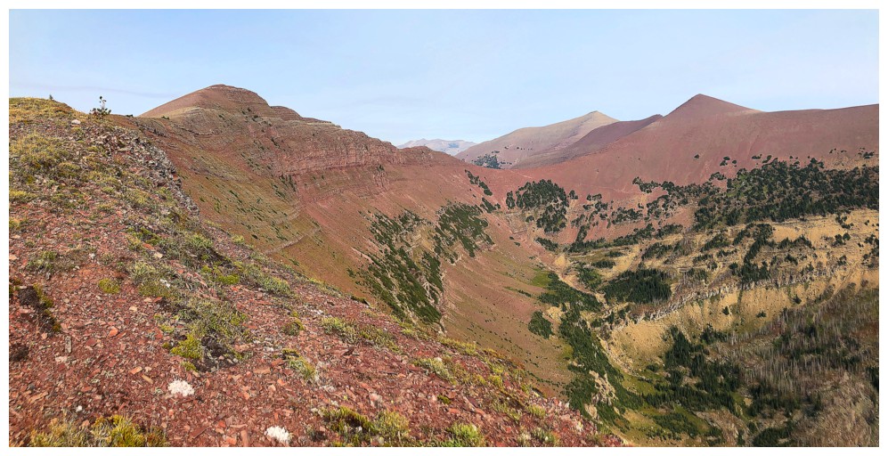
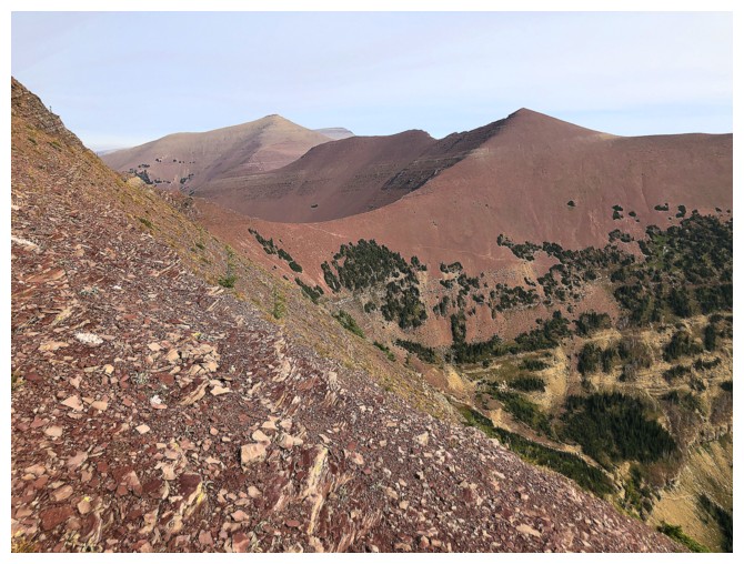
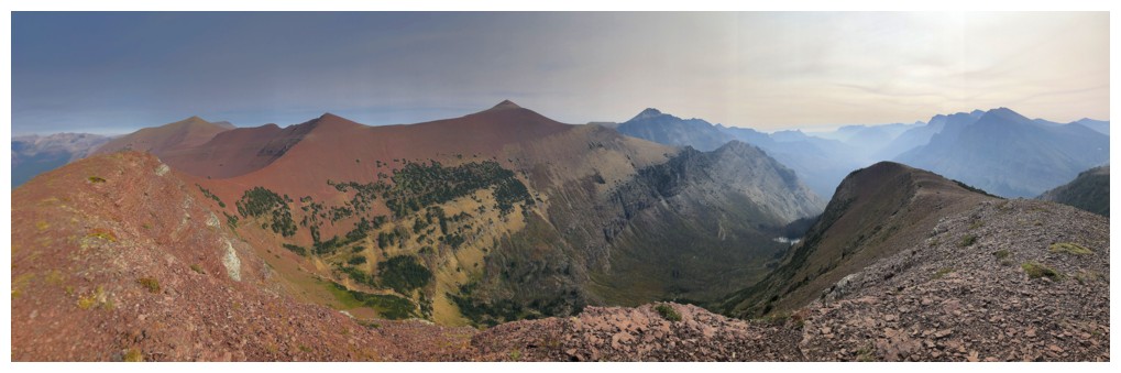
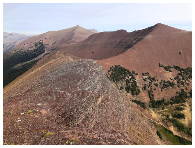
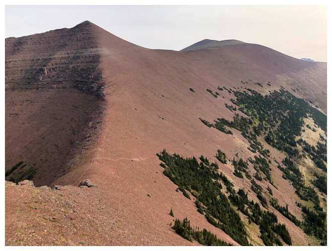
The significant highpoint between Newman Peak and the true summit of Avion Ridge - stunning and always worth a visit
Anderson gets framed by Newman and Goat
All of the above
Goat and the Avion outlier
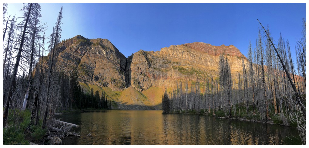
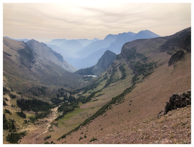
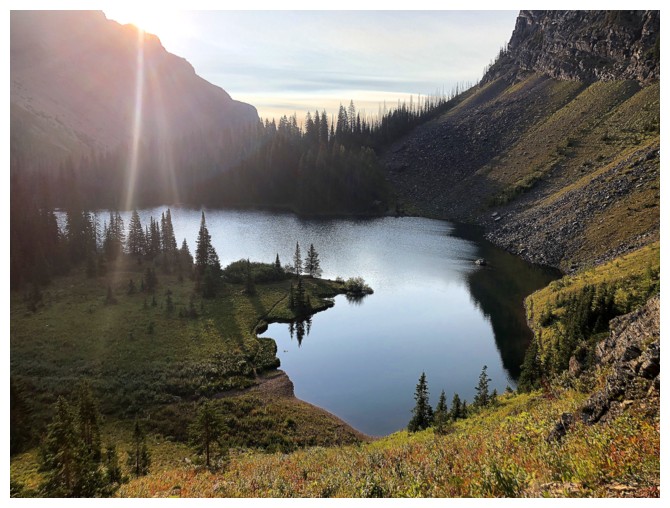
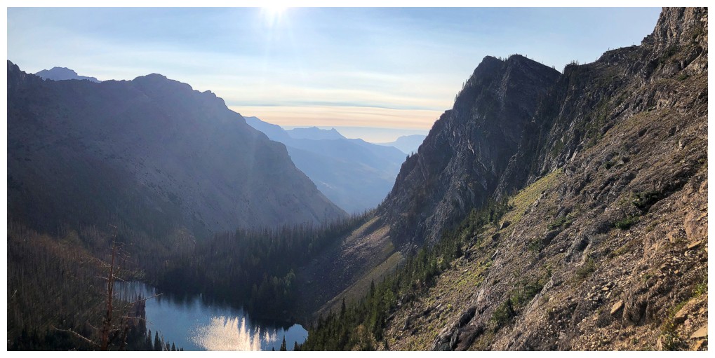
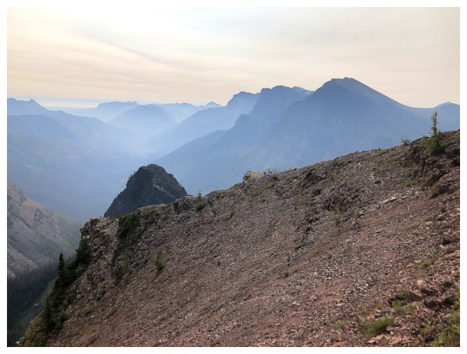
Goat Lake and the objective (left)
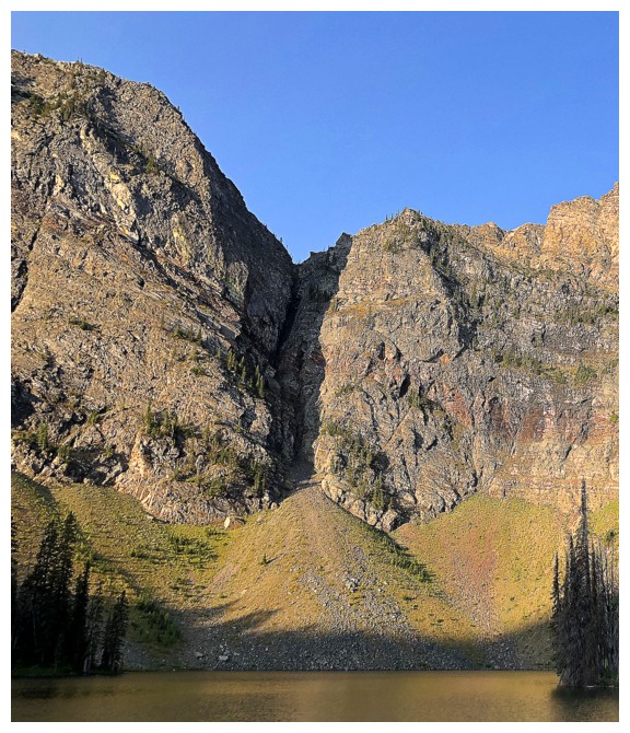
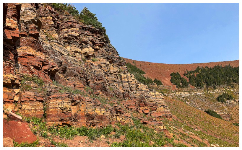
There's the gully I initially intended to ascend - talk about wishful thinking!
The gully does look more manageable from a different angle. That's possibly the angle I was looking at on the previous trip.
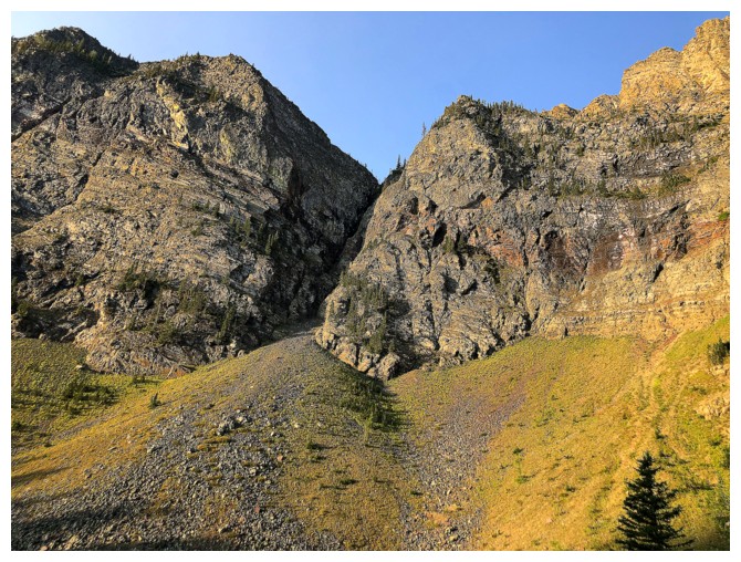
Looking for other routes up to the ridge
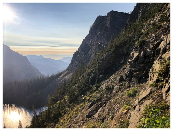
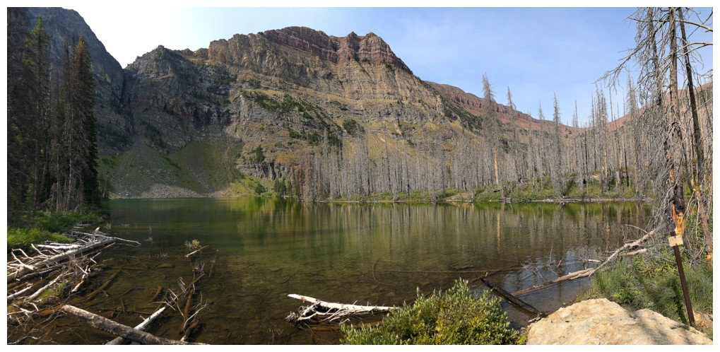
Hiking around Goat Lake is always a treat
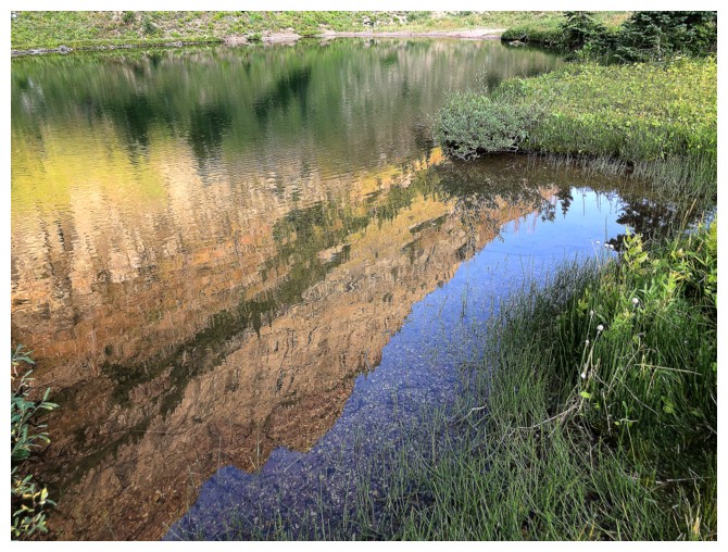
Lake reflection
Heading up. The intended route is up to the right to gain a bunch of elevation, then follow the trees going to the left.
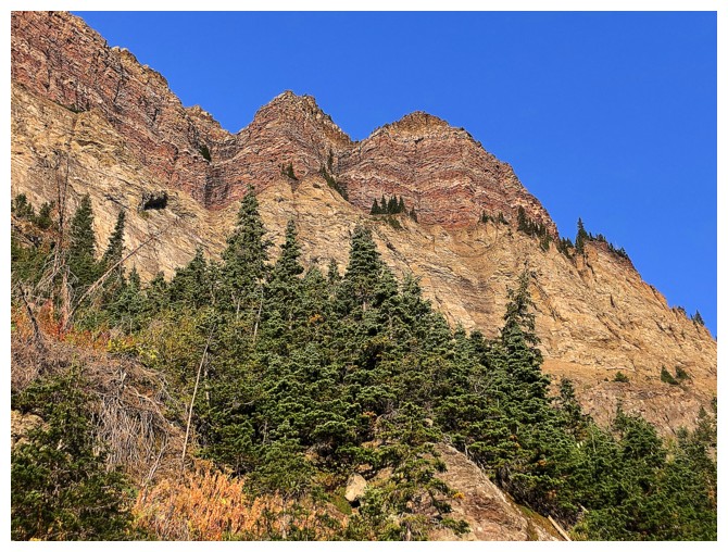
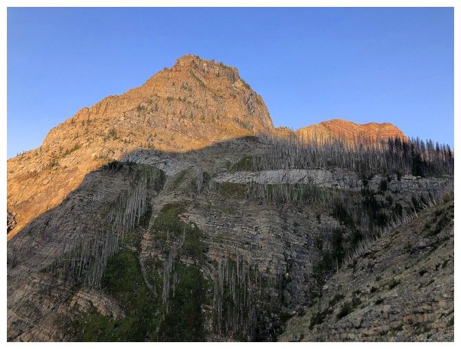
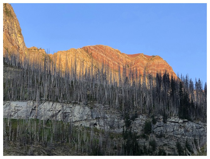
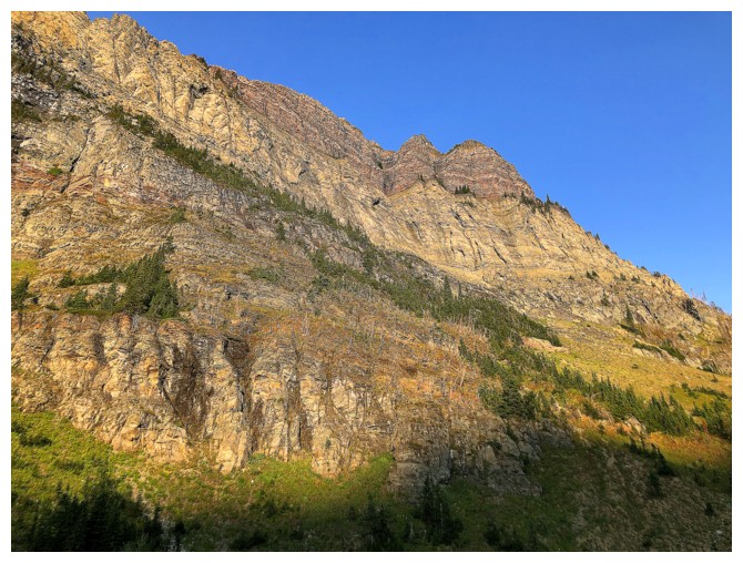
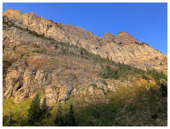
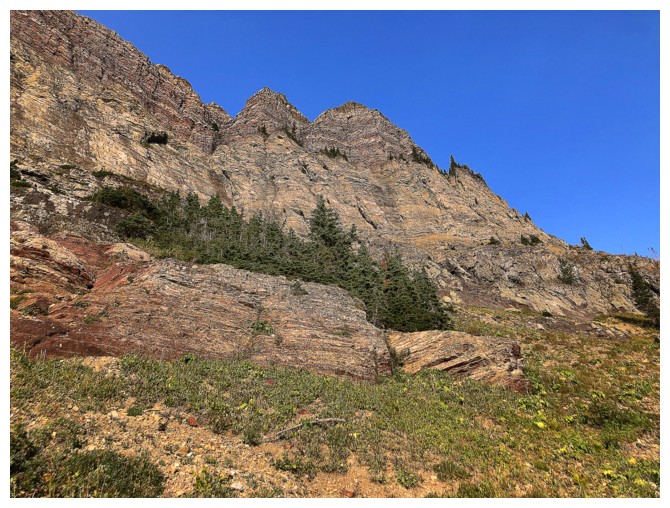
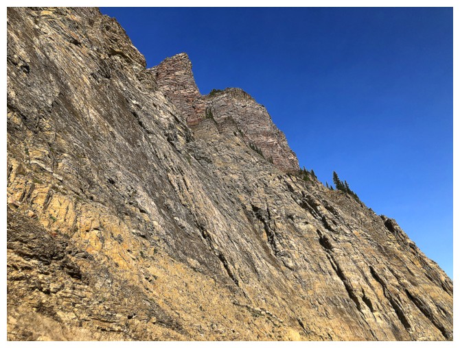
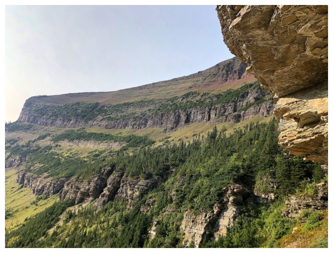
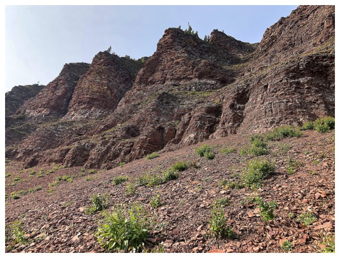
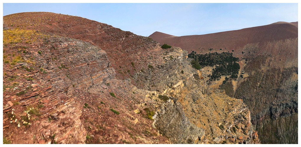
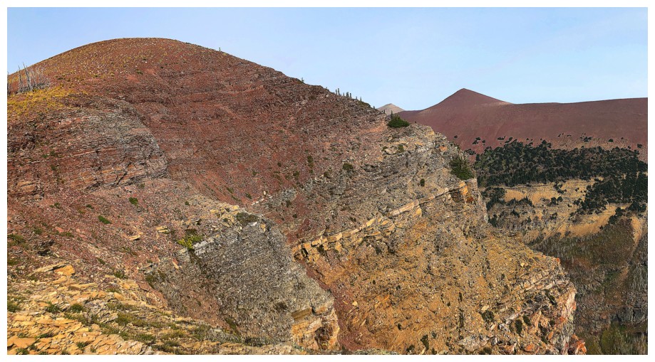
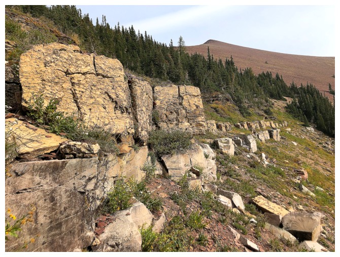
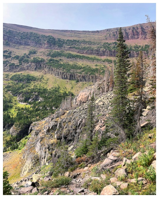
The top rock layers of the ridge are magnificent and get lots of photo attention
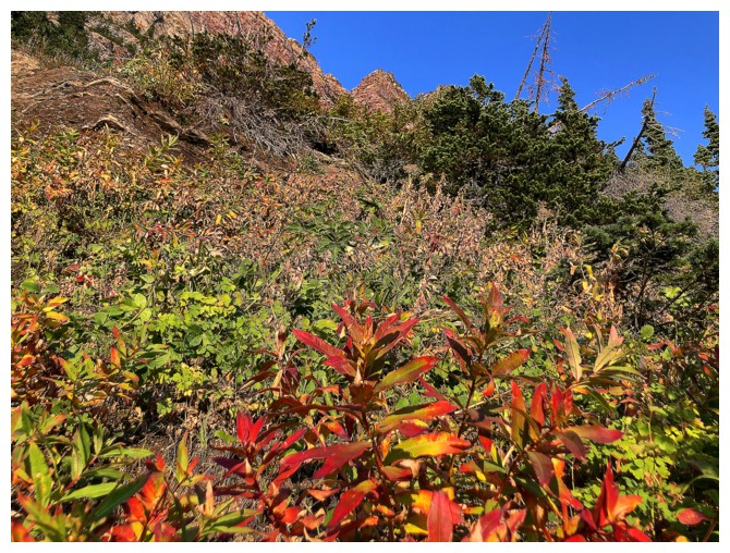
...as do the colours of autumn
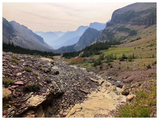
Goat Lake is soon to get alot smaller
Making good progress towards of upper rock bands
The goal is to get to the col near the left
It's getting more colourful but also steeper
Looking over to Newman Peak
This view was cause for concern, as I need to be near the upper right to continue the route
Super cool, but obviously not going that way
Newman Senior near the right
End of the line. The thought of traversing this slope made me shudder in ways humans should not shudder!
Trying to find an easier route down than the one I came up
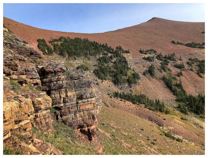
Onto easier terrain. I probably should have descended all the way to the valley bottom, but decided to side-slope here.
Sometime later in a drainage far away
Looking over to where I will eventually be
Following the drainage until I find a place to start traversing left

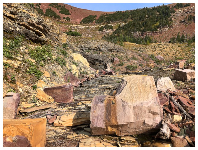
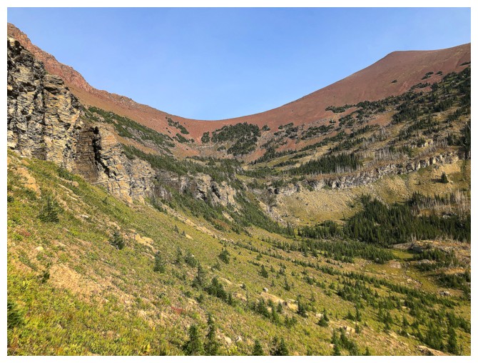
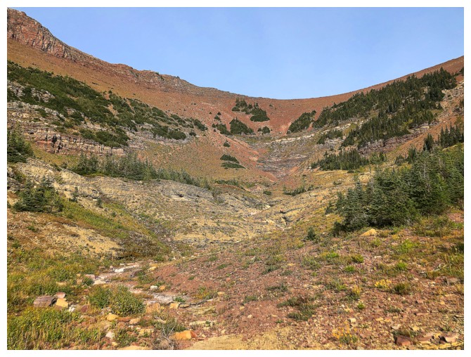
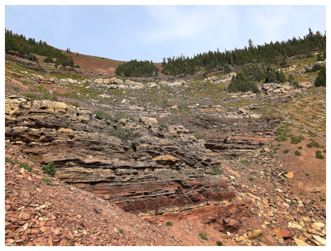
The end of this valley is filled with amazing rock
The goal here is to get to the base of the upper rock band and traverse below it
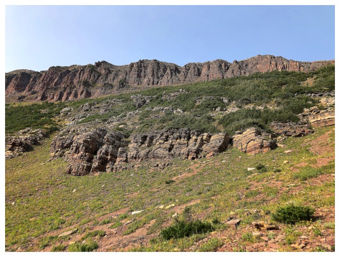
Again, lots of great rock to keep me entertained
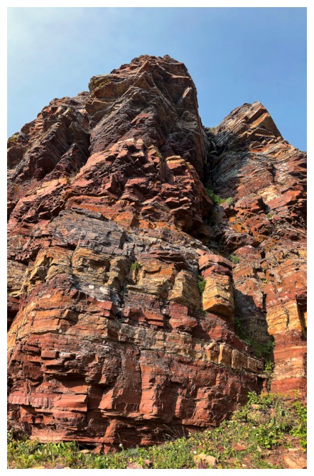
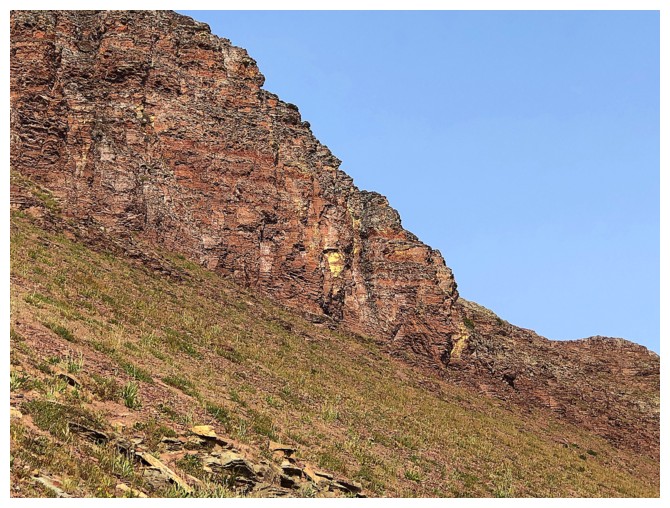
The upper rock band
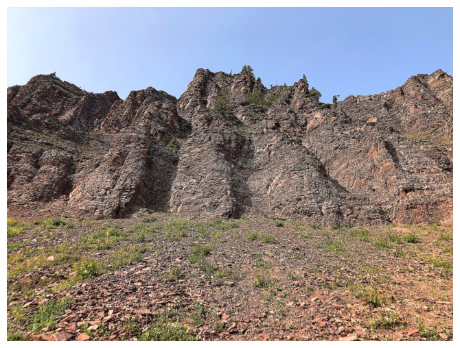
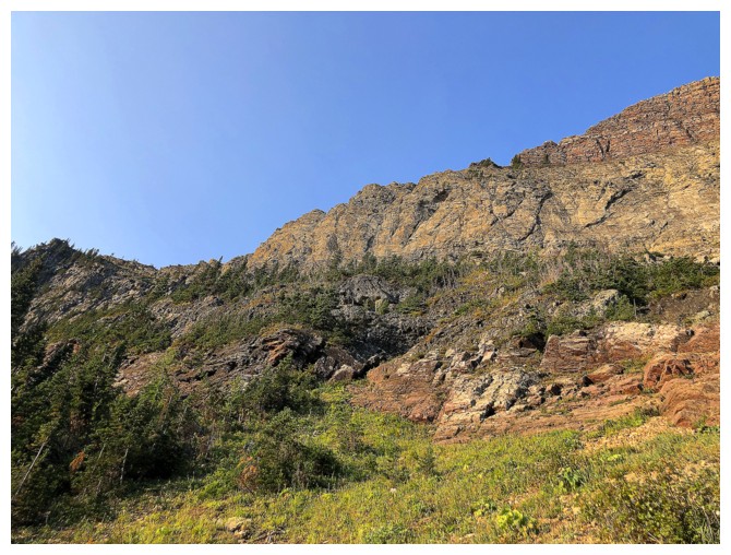
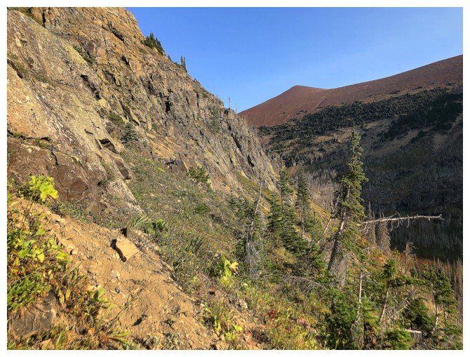
There were a few gullies that could have been used to gain the ridge,
but after the failed route, I was intent on not gaining elevation
unnecessarily
A long side-sloping traverse ahead
Newman Peak keeps me company
Another section where I could have gained the ridge
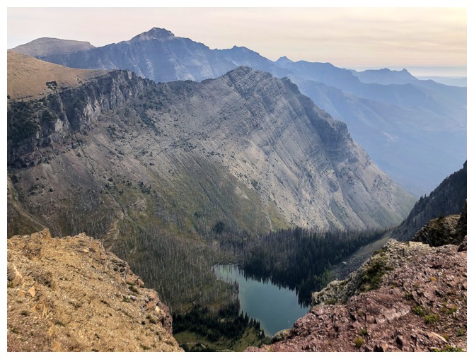
Goat Lake returns to the view
Seconds away from reaching the ridge
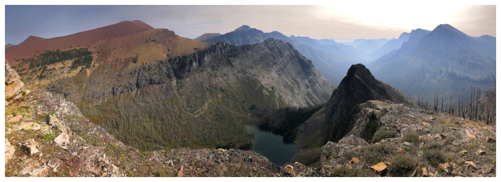
Arrived. The ridge to the true summit of Avion at the right, King Edward and Starvation peaks at the left.
The summit of Avion Ridge
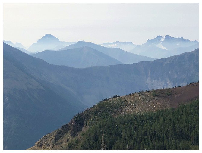
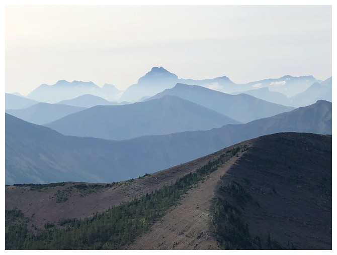
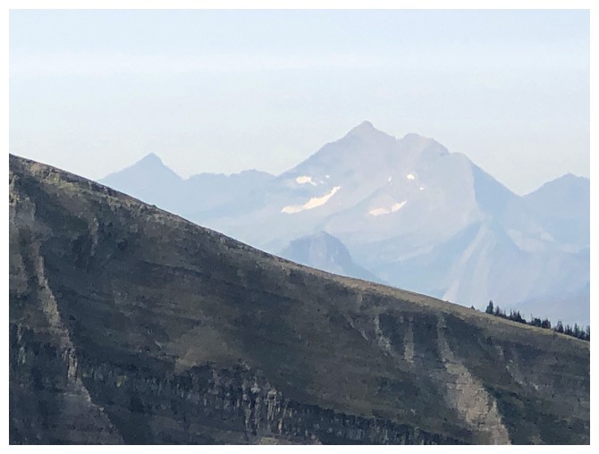
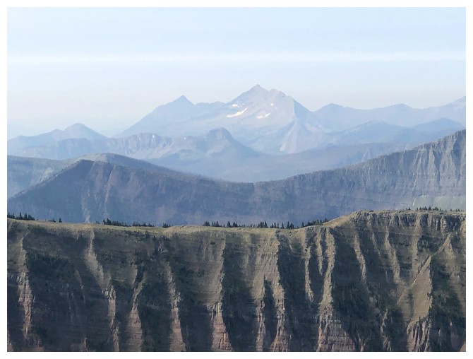
Hazy view into Montana. Kinnerly Peak to the left and Long Knife Peak to the right.
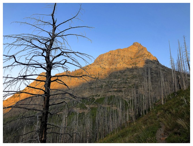
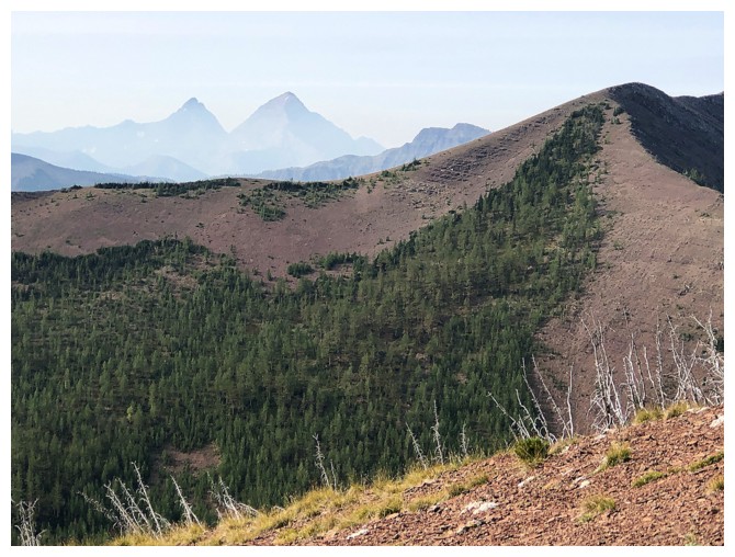
There's Goat Lake Peak
The aforementioned unpopular route up Newman looks insanely steep from this angle (but it's not)
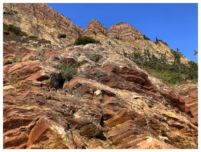
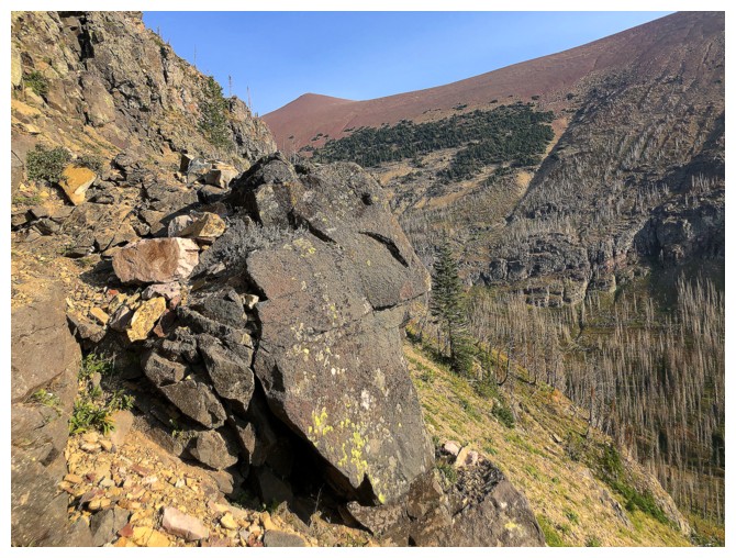
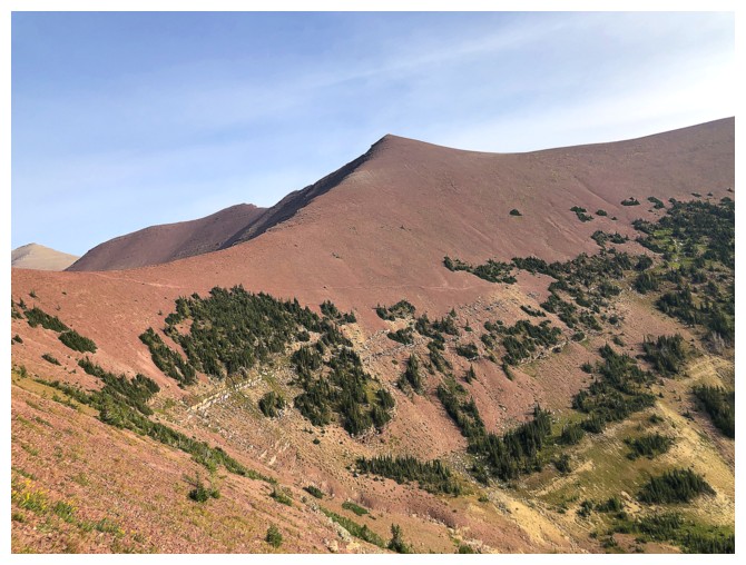
All the red argillite helps to alleviate my exhaustion, at this point!
Descended to this point to get a good look at Goat Lake Peak, but had no delusions about making it to the summit
Sage Senior peaks over Avion Ridge at the right
View to the north from where I stopped
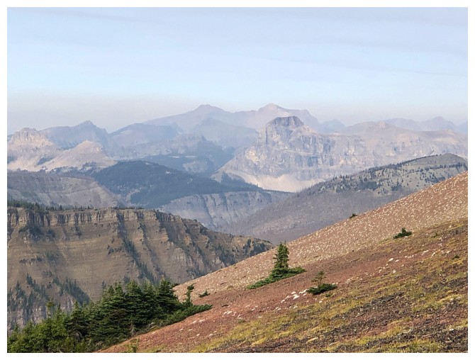
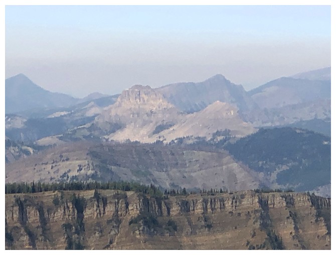
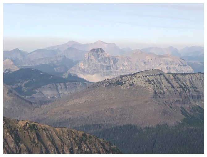
Clearly defined layer of smoke over Scarpe Mountain (just left of centre) and Jake Smith Peak (just right of centre)
Font Mountain can be done as a day trip from Waterton (but it's not a short one!)
Kenow and Miskwasini always get a look when in northwest Waterton
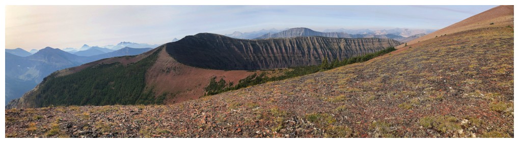
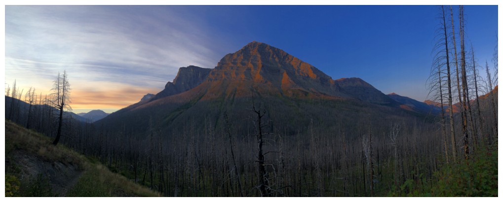
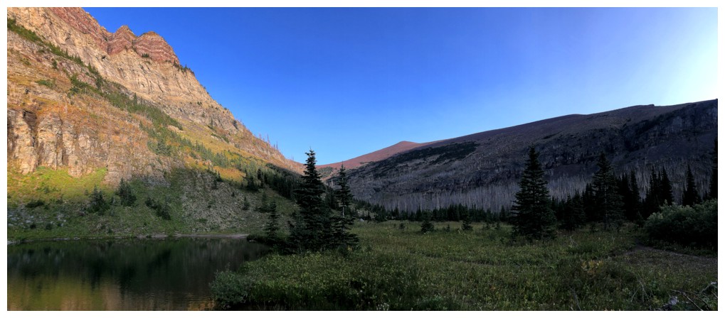
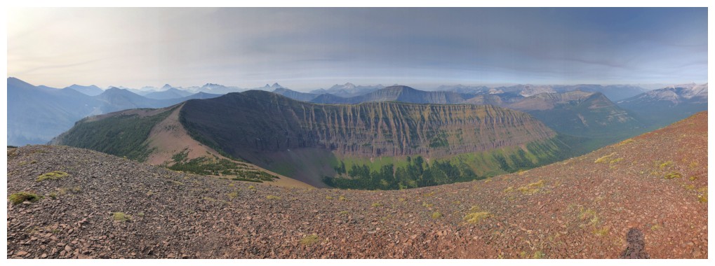
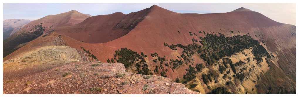
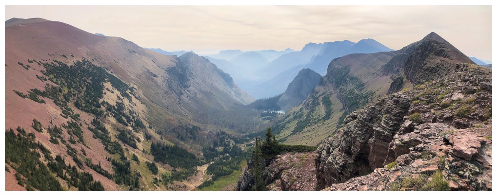
Pano from my endpoint, featuring Avion Ridge
The highpoint of Spionkop Ridge just left of centre - and speaking of forest fire smoke!
Even though I was very tired, it was impossible to resist an ascent of
the highpoint between Avion and Newman. The view from the highpoint is
fantastic, perhaps better than the view from the true summit.
View to the west
A better view of Kenow and Miskwasini

Castle Peak, Windsor Mountain, and Victoria Ridge to the north
Mount Matkin in the foreground
Sage Mountain in the foreground

Newman Senior and Mount Glendowan - yes, you can traverse from one to the other
Heading down
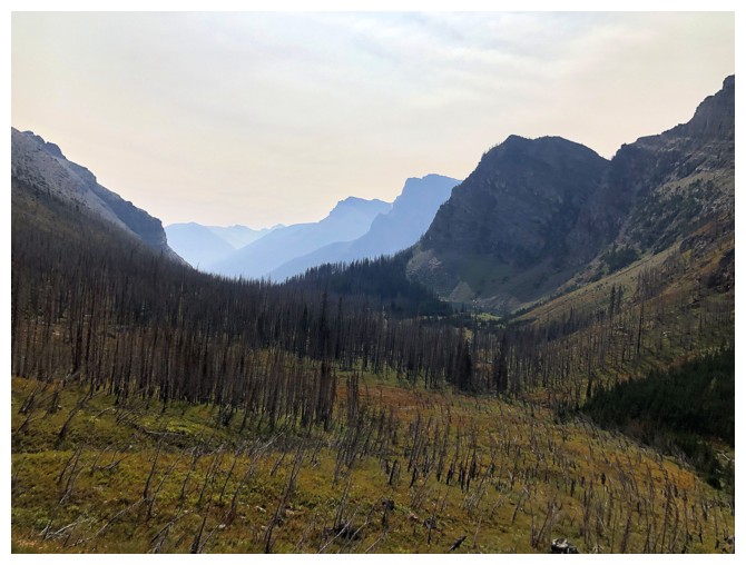
What a wonderful view this would be on a clear, haze-free day
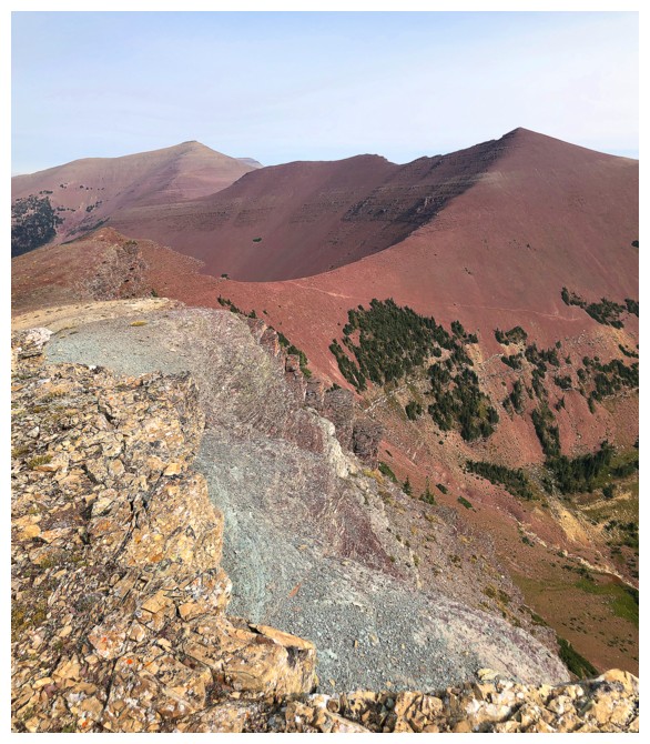
Some green/grey argillite to go with your red
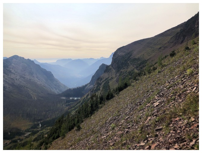
View down the Goat Lake valley
The trail from the col going down into the valley is obvious...
...but going directly down from the col is more scenic
Same as above
And again
Looking over to part of my ascent route
Easy hike down the valley
Back at Goat Lake, looking somewhat drab compared to the morning view
Same for the north side of Anderson - a combination of the smoke and the position of the Sun
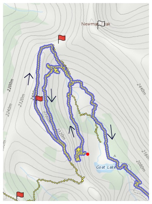
The chaotic GPS track I recorded. I started recording about halfway up
the slope (the red dot), northwest of Goat Lake. The track at the lower left was
recorded three weeks later on another failed, but unbelievably scenic attempt.
The End
LOG