Rummel Ridge IV
(and a little beyond)
April 13, 2025
Mountain heights: 2459 m
(Rummel), 2647 m (extension)
Total elevation gain: approximately 1000 m
Ascent to
Rummel: 3:45
Extension time: 2:00
Descent time off
Rummel: 1:05
Snowshoeing
with Mark.
With a ton of
new snow falling the previous night, prompting avalanche concerns (and
trail-breaking challenges, for that matter) picking an objective became the crux of this
day. Given those criteria and the fact that Mark had never been up Rummel
Ridge, that objective seemed to be a good choice. The route is well-used, and
we were hoping the base would be supportive even with all the new snow atop.
Our wishes were
granted! 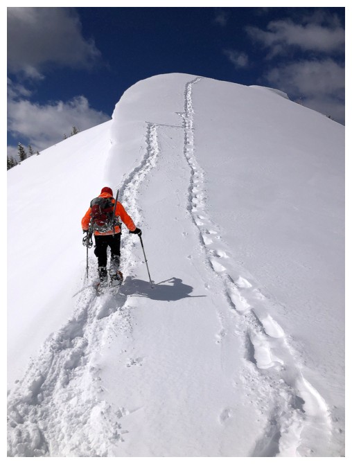 Initially, there was no sign of a broken trail, but clearly one
existed below the new layer. We were making good progress until I decided to
follow an old GPS track, obviously made long before the route up Rummel gained
significant popularity. Within 10 minutes we were up to our waists in snow. We
turned around and resumed travel up the more obvious route.
Initially, there was no sign of a broken trail, but clearly one
existed below the new layer. We were making good progress until I decided to
follow an old GPS track, obviously made long before the route up Rummel gained
significant popularity. Within 10 minutes we were up to our waists in snow. We
turned around and resumed travel up the more obvious route.
Thankfully,
that was an isolated error and although the new snow continued to cover old
tracks, we did eventually find a good snowshoe track that was easy to follow –
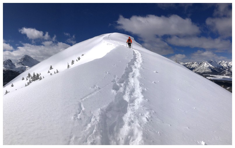
not short, mind you! A good hour of
winding travel through the trees led to open views, with the summit a short
distance away. 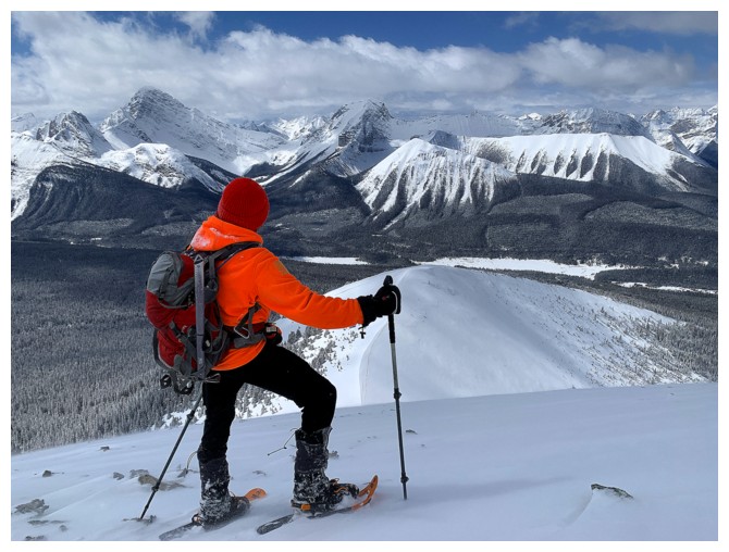 We didn’t get perfectly clear skies, but enough sunny breaks to grant
some outstanding views.
We didn’t get perfectly clear skies, but enough sunny breaks to grant
some outstanding views.
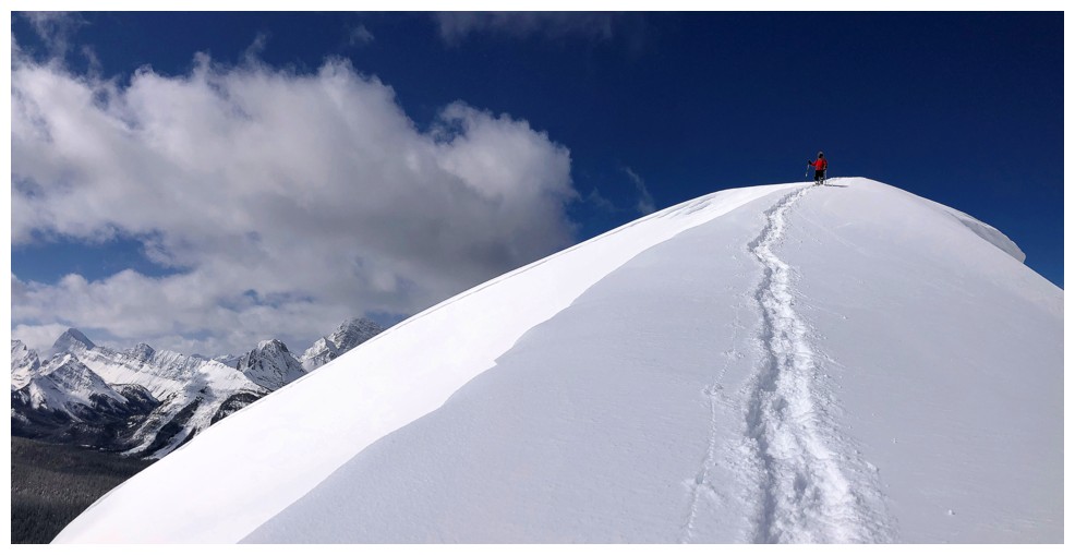
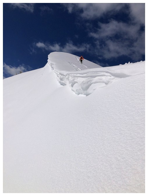
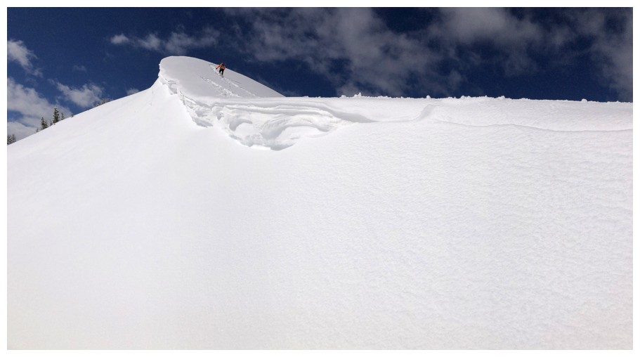
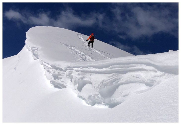
After a short
summit break, we decided to descend to the col between Rummel Ridge and The
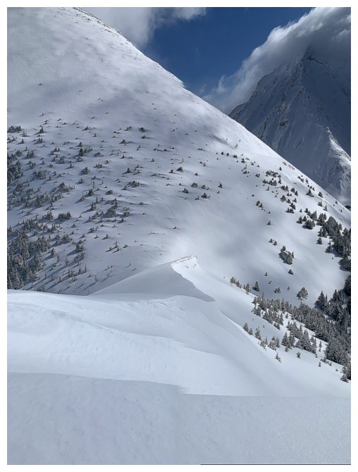
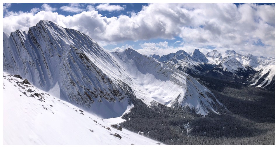
Tower. This little side-trip yielded the best scenery of the day – not
far-reaching views of spectacular mountains, but in the simple form of one snow
slope, with a small but curvy cornice, beautiful Sunshine and a blue sky.
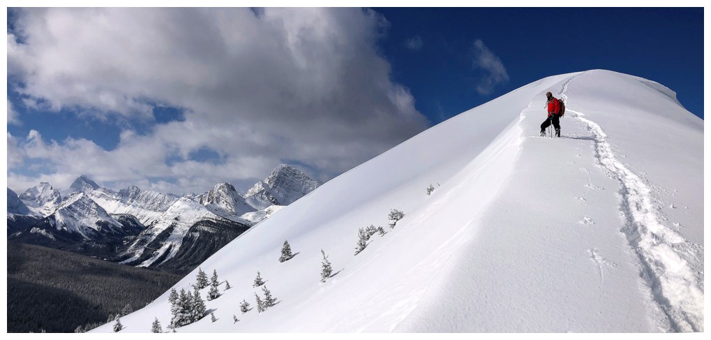
No point
stopping there - we decided to continue up the other side for a while. Reaching
the summit of The Tower is not feasible from this ridge, but we were thoroughly
enjoying the trip and extending it agreed with us both. The snow slope on the
other side of the col ranged from mostly steep to very steep in a couple of
short sections. Fortunately, the snow was excellent, and we were able to gain a
couple of hundred metres of elevation wearing only snowshoes.
We eventually
reached the ridge and continued following it for a while. However, weather
conditions up high were considerably more challenging than those lower down. High
winds causing blowing snow and severely cold temperatures forced us to retreat
at 2647 m. The descent was very easy, taking a fraction of the time of the
ascent.
Even with the
less than perfect weather conditions, a superb day on a little peak that always
delivers.
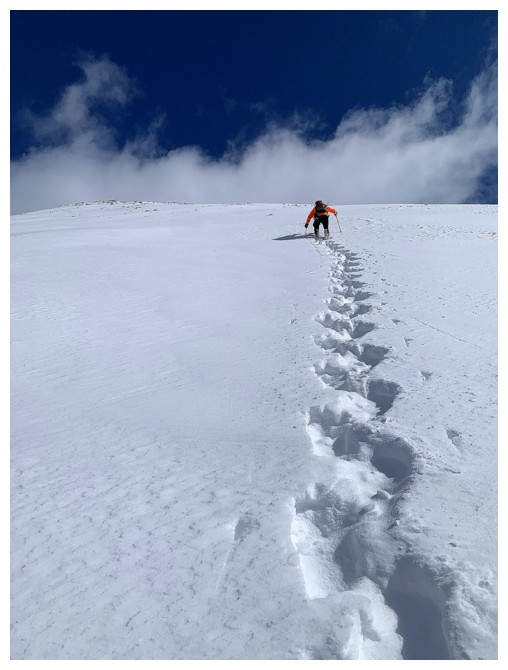
Following a packed down trail underneath the new snow. Without it, we would be up to our waists, even with snowshoes.
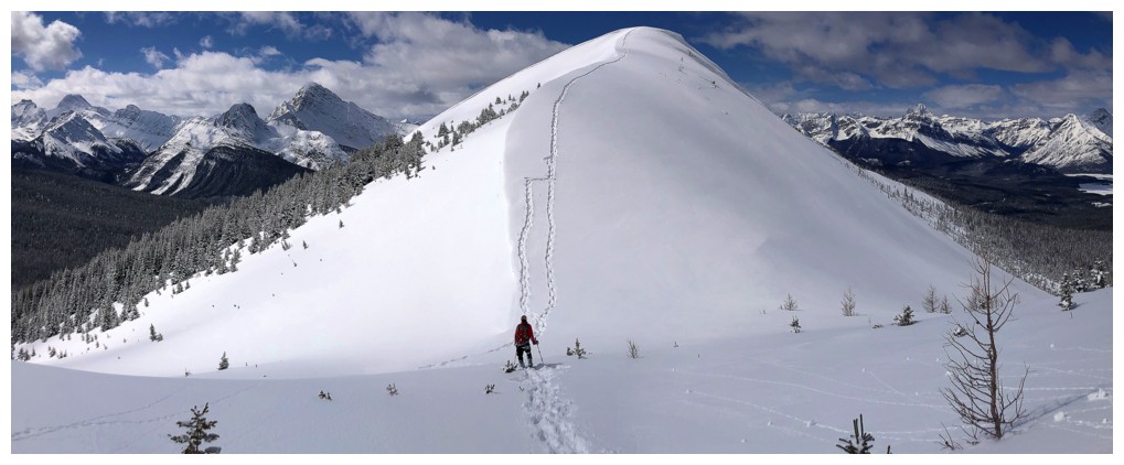
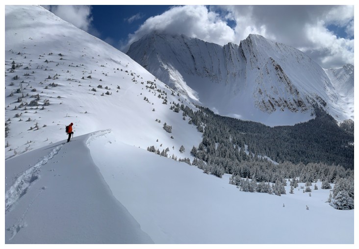
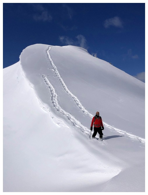
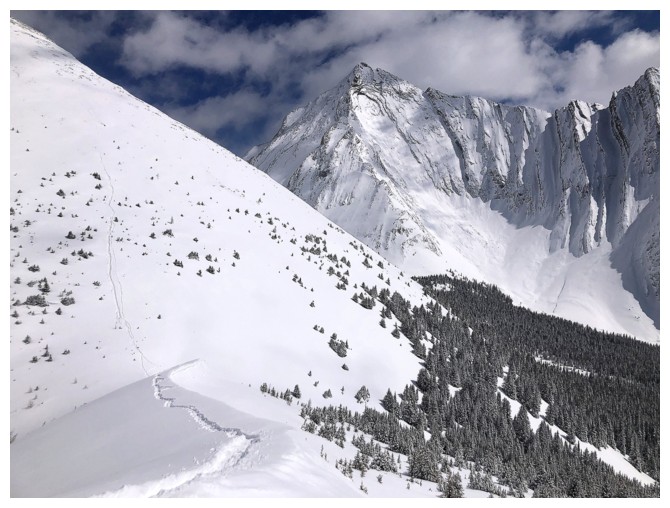
Where the trail veers off towards Rummel Ridge at the right
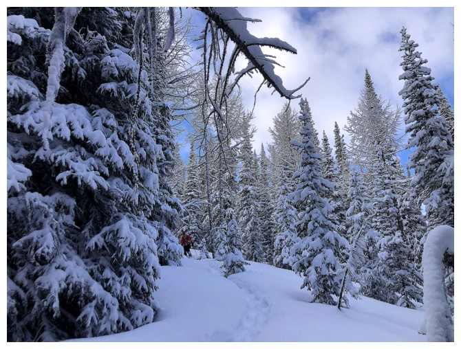
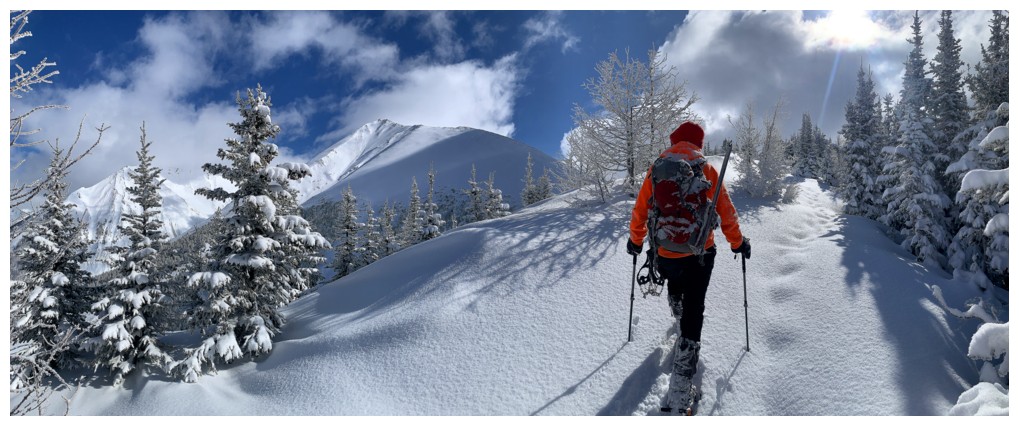
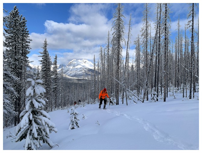
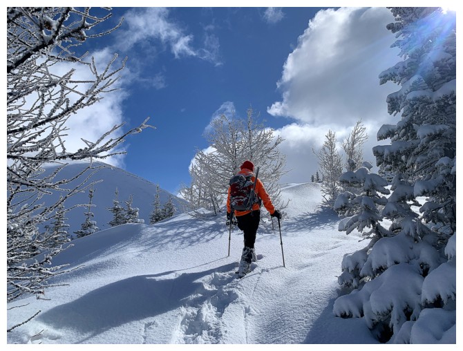
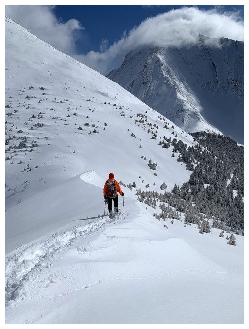
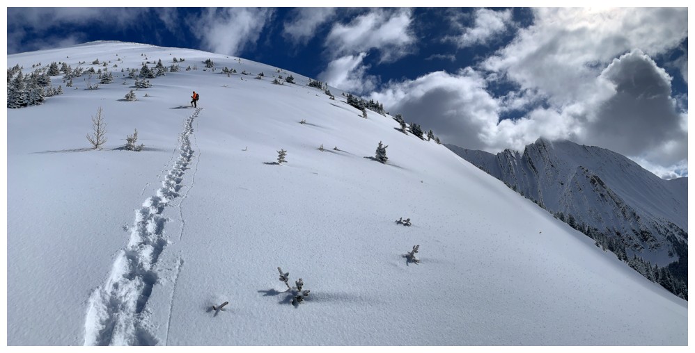
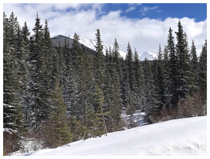
Typical travel through the trees for the next hour or so
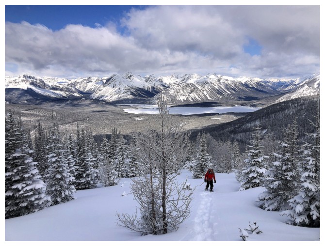
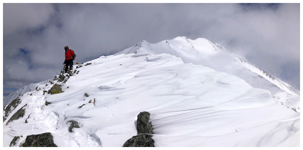
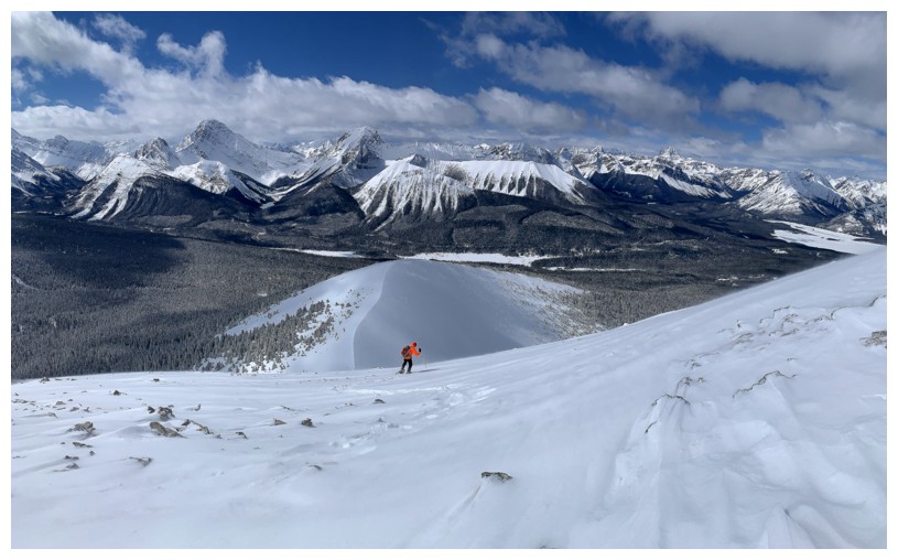
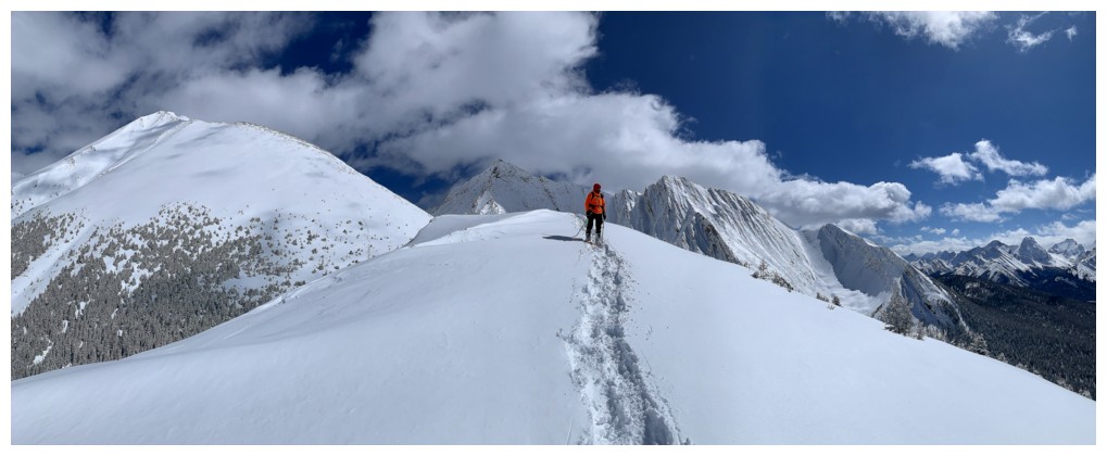
Finally out into the open
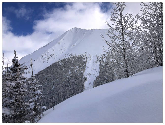
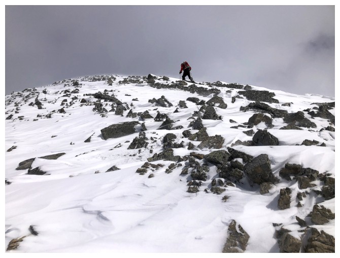
One of the highpoints of The Tower
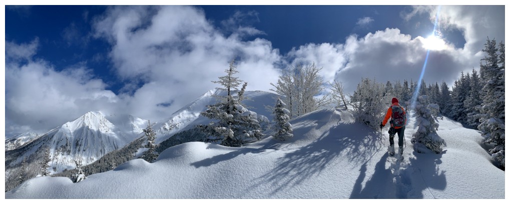
Flirting with Sunshine and clouds throughout
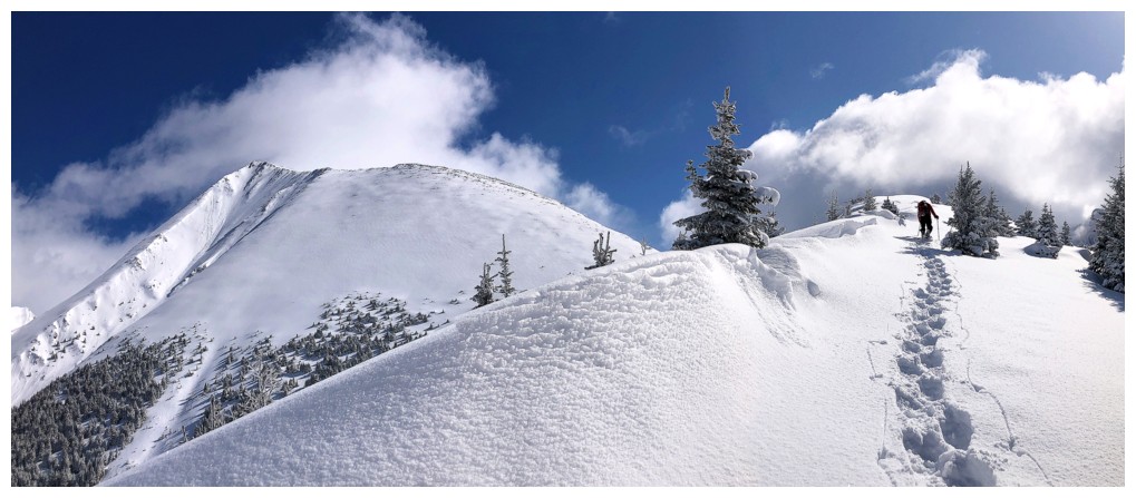
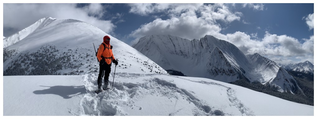
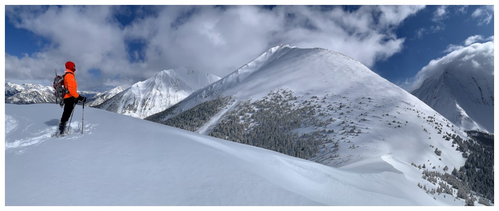
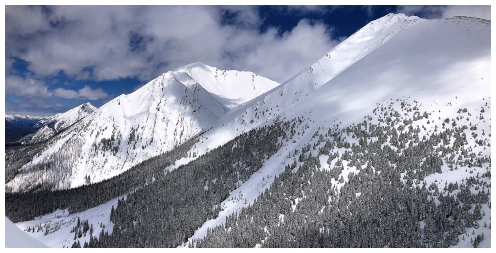
The ridge we will eventually ascend appears at the left
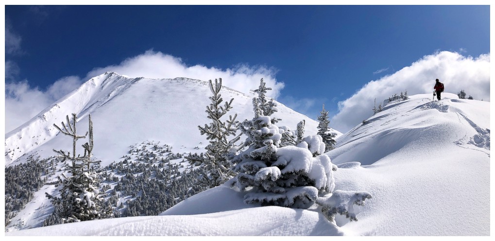
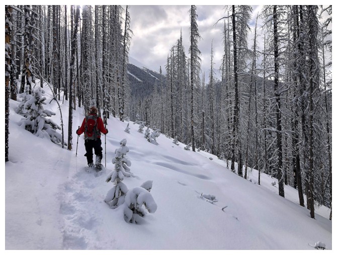
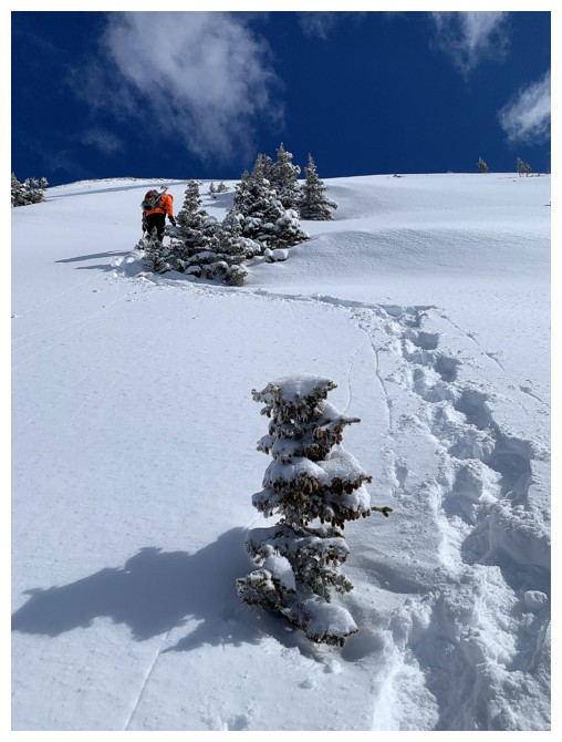
Loved the snow and the reamining trees here
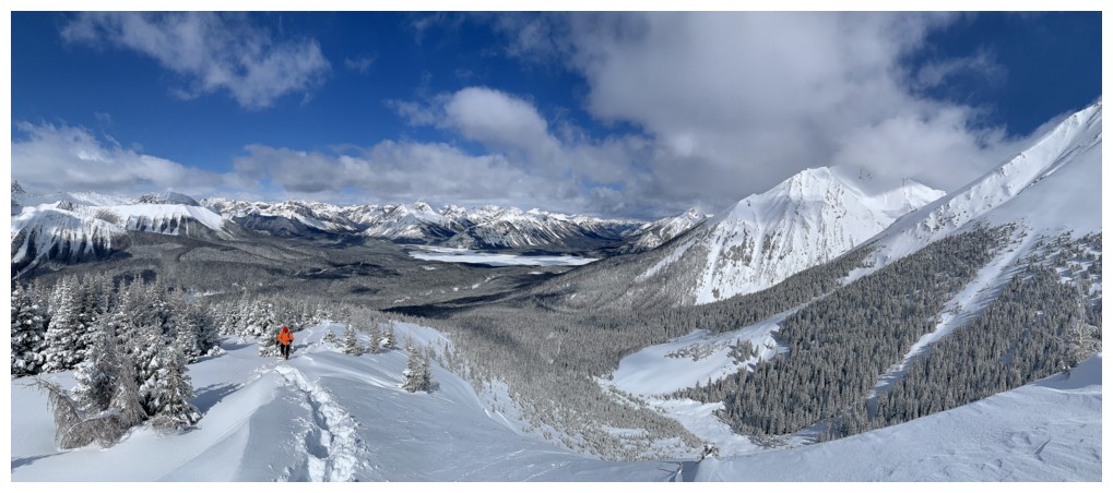
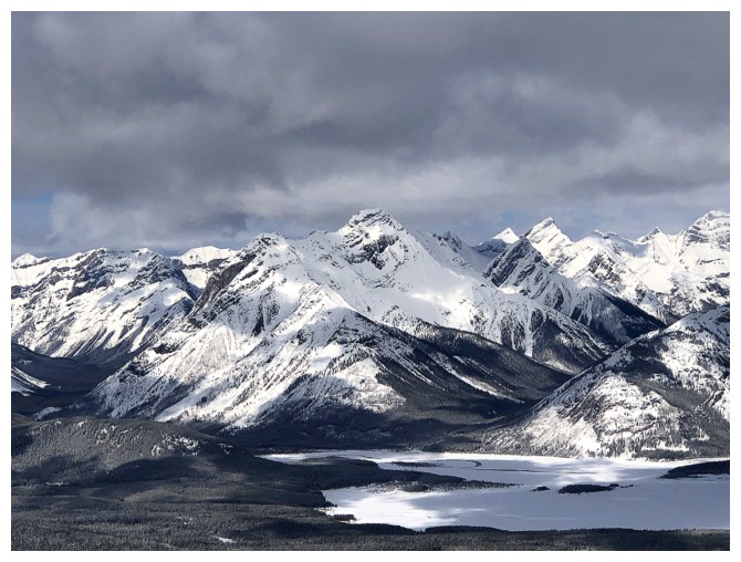
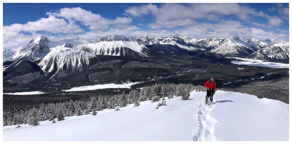
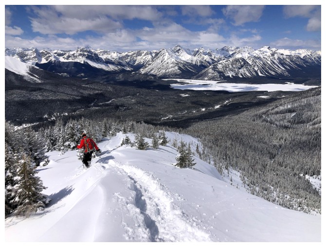
The view behind towards the Spray Lake area is always a rewarding one
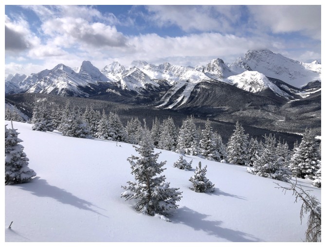
Likewise for the view to the southwest
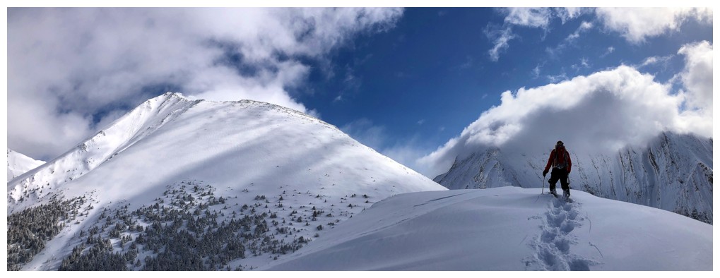
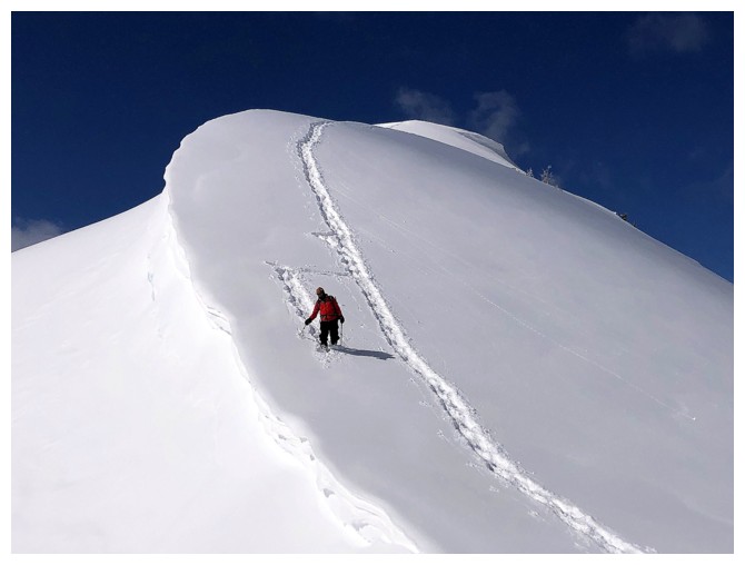
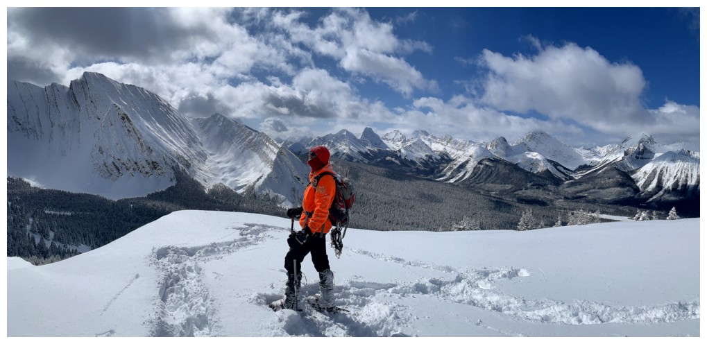
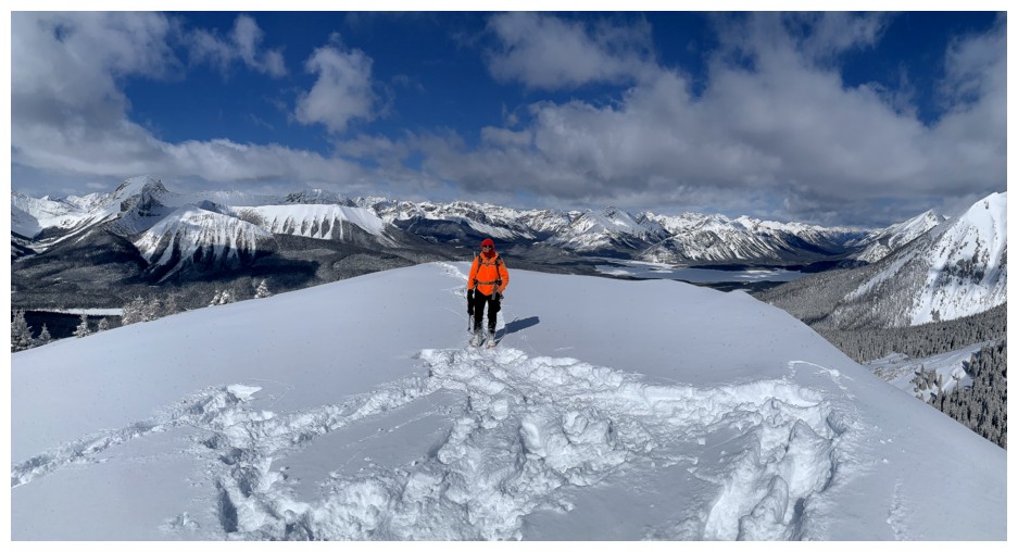
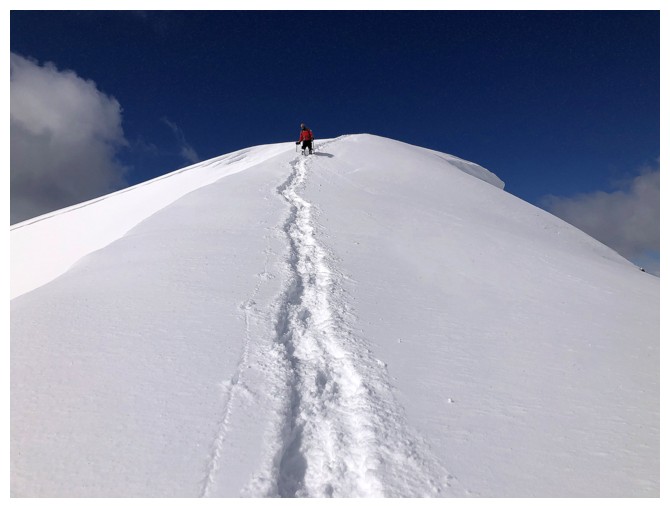
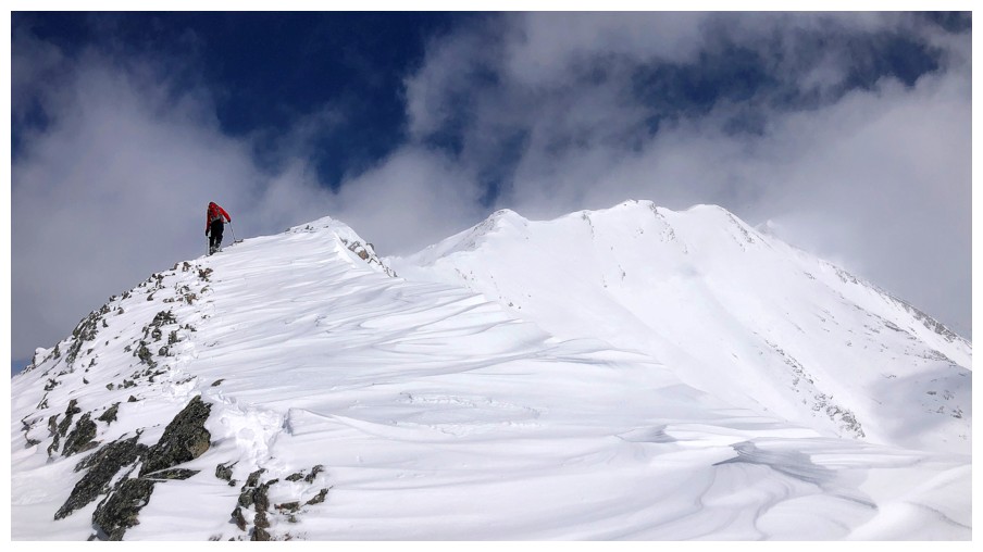
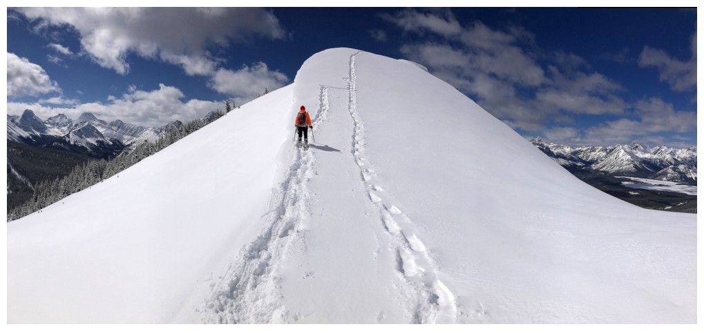
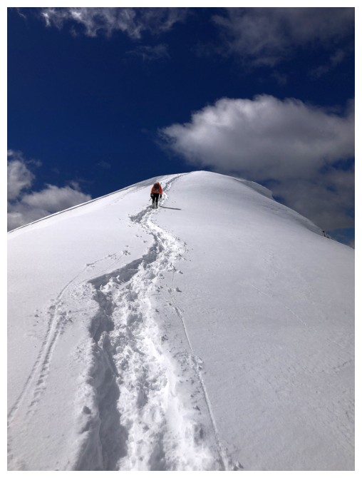
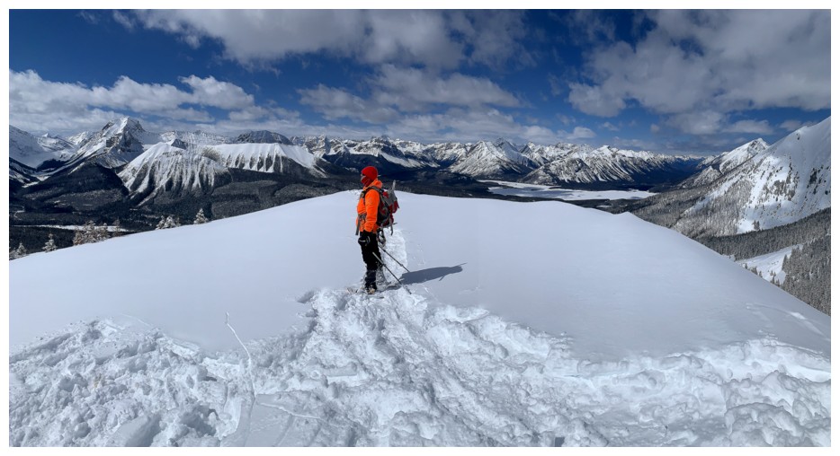
Mark takes the last few steps to the summit
Summit view to the east
Looking down the cool terrain we will soon descend
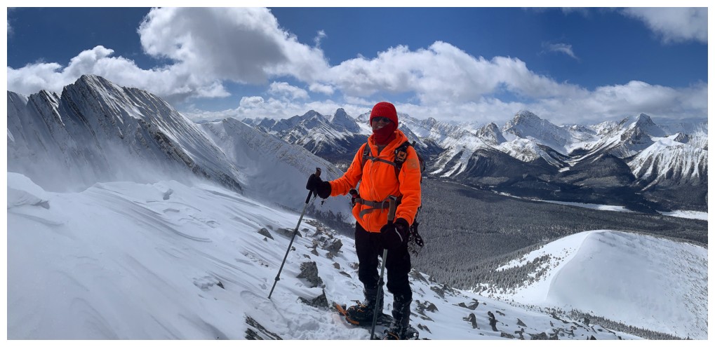
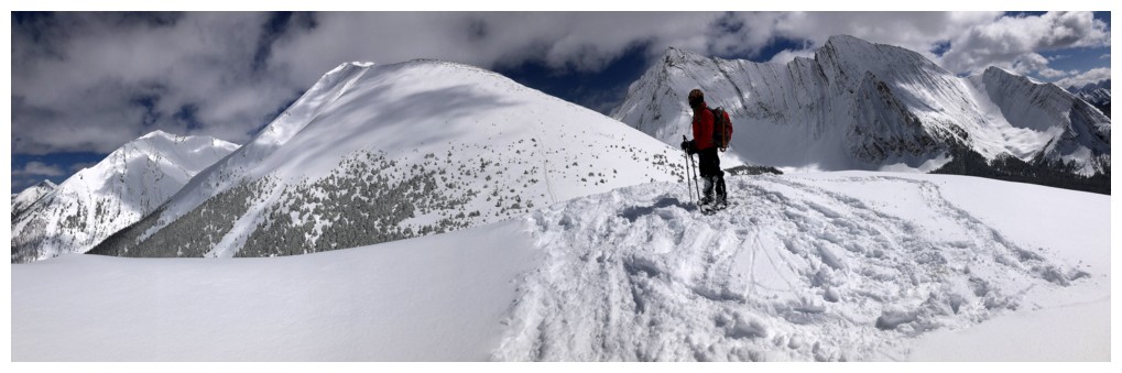
Summit panos
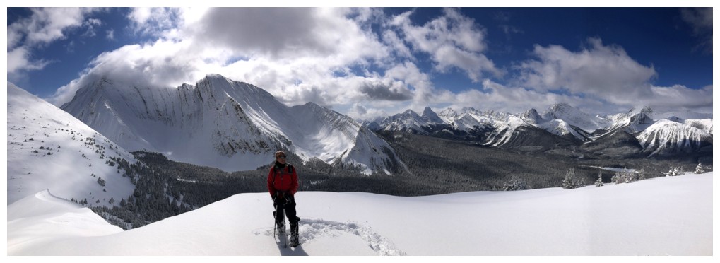
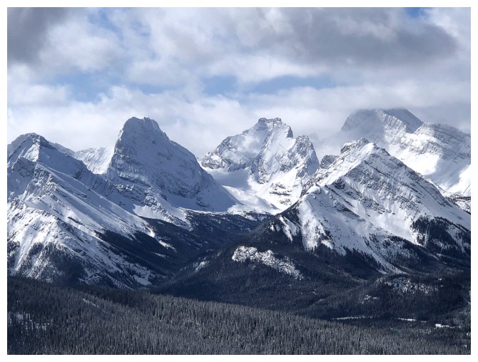
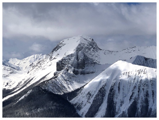
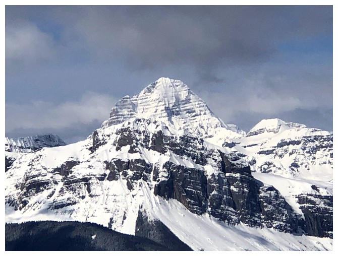
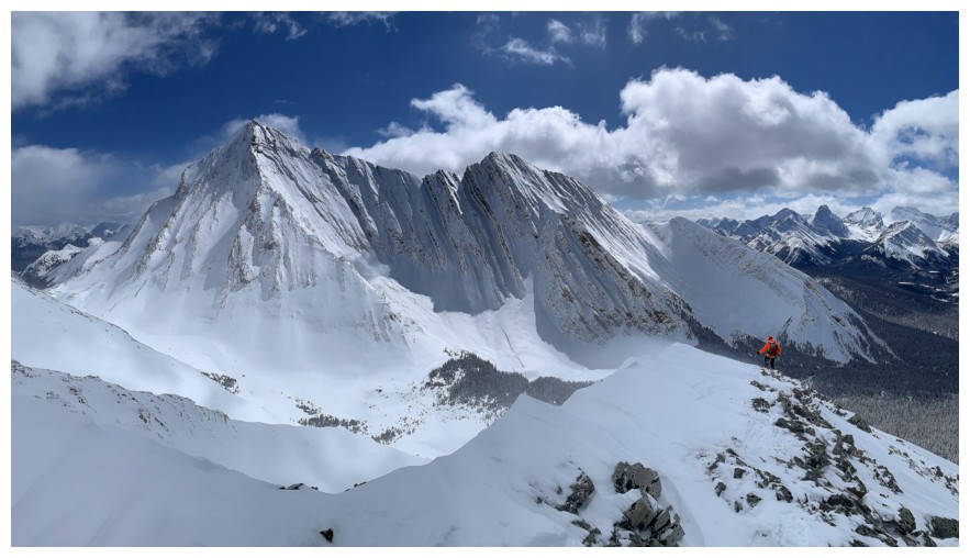
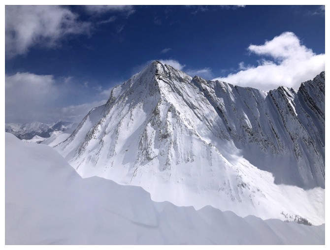
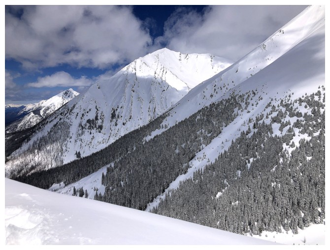
Some of the strikingly beautiful British Military Group
Commonwealth Ridge, Commonwealth Peak, Pig's Tail, Pig's Back, and Mount Birdwood
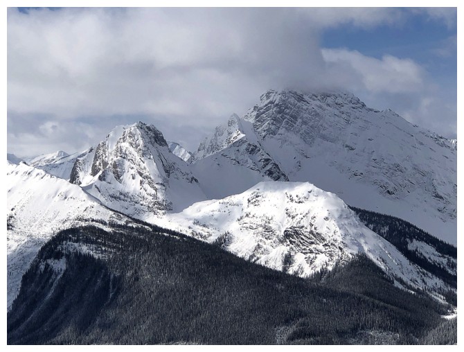
Tent Ridge (foreground right), The Fist (blending into Mount Smuts), and Mount Smuts
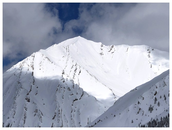
Cone Mountain in the centre - eat your Wheaties before attempting that beast!
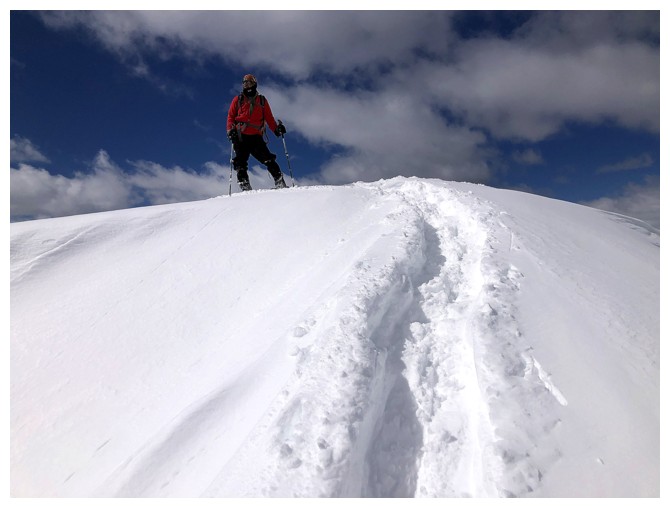
We did a bit of wandering around!
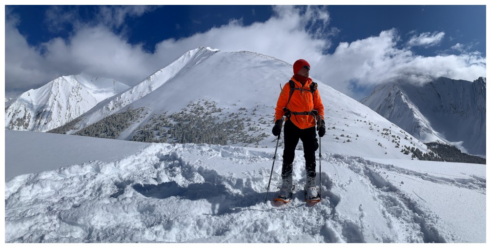
Poser!
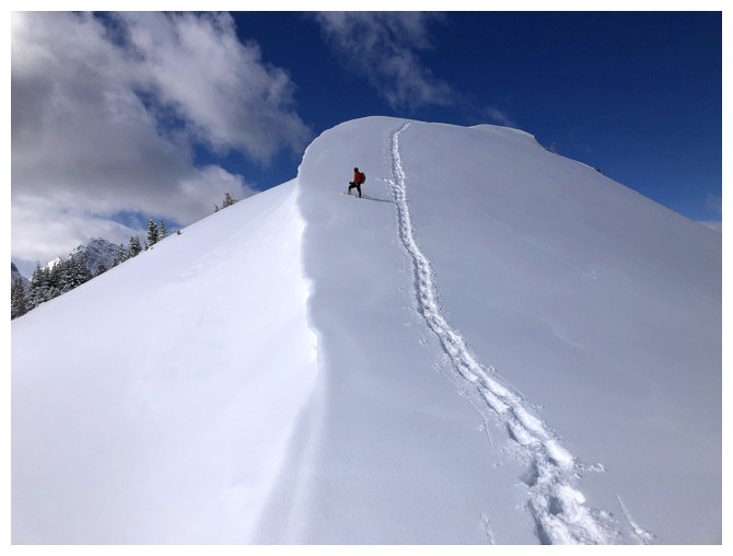
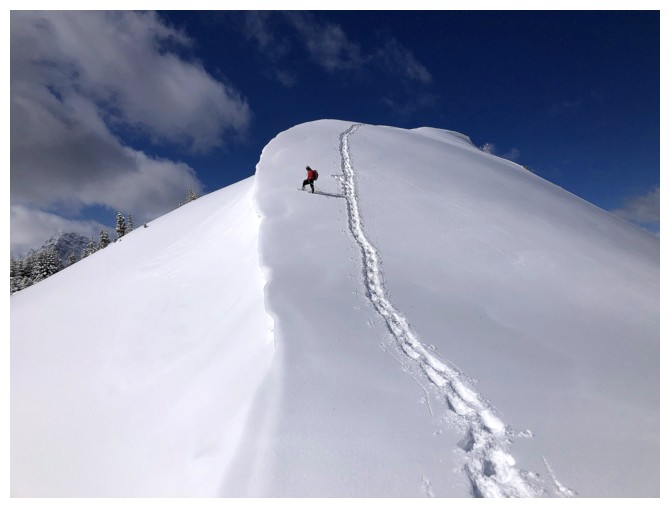
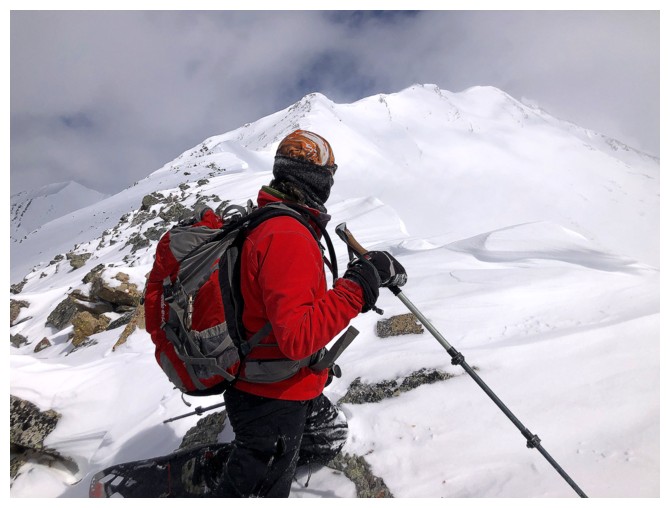
Descending to the Rummel/Tower col
The short distance from the summit to the col provided our favourite scenery of the day
Here we go!
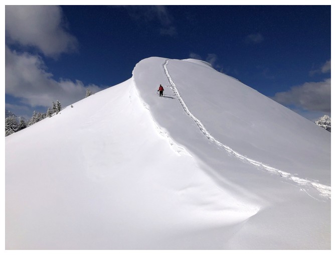
The lighting was changing slightly throughout
Like here
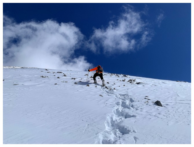
Starting up the other side. This slope is quite steep and should be treated with caution when snowy.
The clouds clear around Mount Assiniboine

Looking back to Rummel
A couple of the steeper sections
Less steep terrain nearing the ridge
Galatea West at the left and Little Galatea in the centre
On the ridge
Battling the winds and cold, and staying off the cornice
At our highpoint of the day

Rummel Ridge is suddenly looking very low
Further travel was possible, but not in the conditions we were experiencing
Retreat
The summit of Galatea (left) is now clear of clouds
Apparentlythere's a 5.4 route up this side of Galatea, but most will take the Kane route, on the other side of the peak
Approaching the steep stuff
Heading back up to the summit of Rummel and Round 2 of the cool ridge
Back on Rummel's summit
Best view of Engadine during the trip
Close-up
Looking back at our tracks
Another round of summit photos for good measure
Time to go home
Back at the start. Rummel Ridge at the right.
The End
LOG