Kent Ridge North II
April 14, 2025
Mountain height: 2914 m
Elevation gain: approximately
1200 m
Ascent time: 4:35
Descent time: 2:25
Solo snowshoe,
with a little mountaineering.
20 years and 4
months after ascending this wonderful peak with Mark and Kevin, I was back for
Round 2.
It was not my
original objective, however. 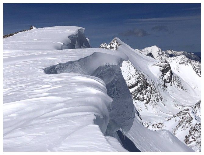 I drove down Highway 93 South hoping to do find
something in the Haffner Creek area; maybe a second ascent of Haffner Senior. Unfortunately,
slightly hazy skies prevailed in that area of the Rockies, and I had just come
from completely clear conditions farther east. I turned around and drove all the way back to Highway 40,
looking for something to do. That something turned into the outlier west of
Kent Ridge North, with the faint hope of reaching the higher summit, if time
and energy levels permitted. And so after leaving Calgary at 6 am, I started
this trip at the depressingly late time of 10:25 am!
I drove down Highway 93 South hoping to do find
something in the Haffner Creek area; maybe a second ascent of Haffner Senior. Unfortunately,
slightly hazy skies prevailed in that area of the Rockies, and I had just come
from completely clear conditions farther east. I turned around and drove all the way back to Highway 40,
looking for something to do. That something turned into the outlier west of
Kent Ridge North, with the faint hope of reaching the higher summit, if time
and energy levels permitted. And so after leaving Calgary at 6 am, I started
this trip at the depressingly late time of 10:25 am!
Working in my
favour was a well-trodden trail in the snow. I put snowshoes on right away and made
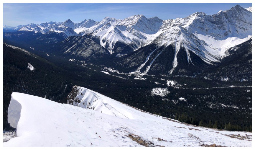
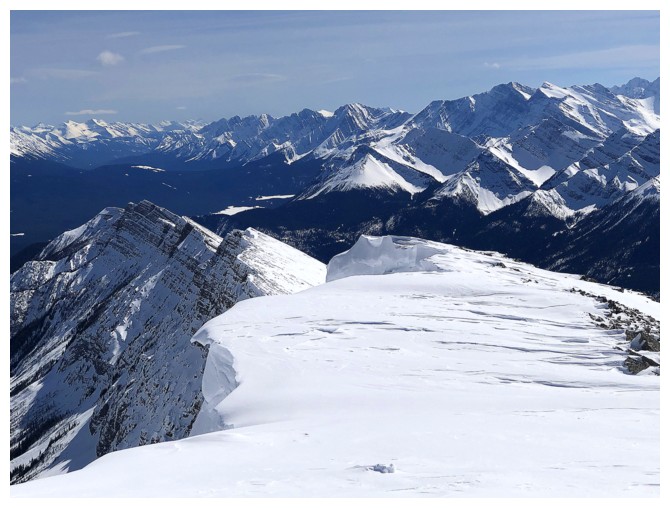
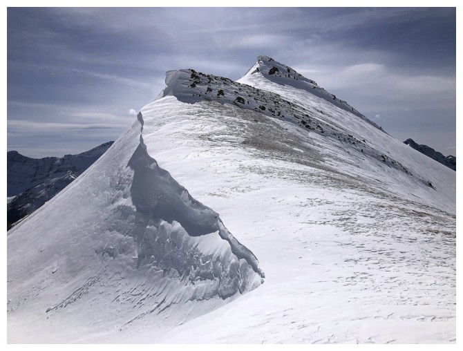
my way up to treeline within an hour. 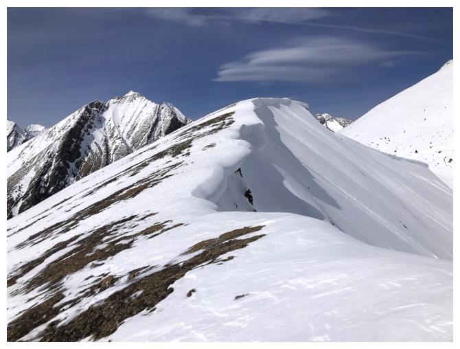 What followed was a tour de force of
jaw-dropping cornice scenery and exponentially improving views. I shouldn’t
have been surprised, having seen this ridge several times in winter but I was!
What followed was a tour de force of
jaw-dropping cornice scenery and exponentially improving views. I shouldn’t
have been surprised, having seen this ridge several times in winter but I was!
I didn’t stop
at the summit of the outlier, already super inspired to continue on to try Kent
North. Although getting down the col was the technical crux of the day,
requiring crampons and an ice axe, the slog up to the summit turned out to be
the mental and physical crux. The foreshortened slog, with about 450 m of elevation gain,
exacted every ounce of energy I could muster up and over 1.5 hours of my life!
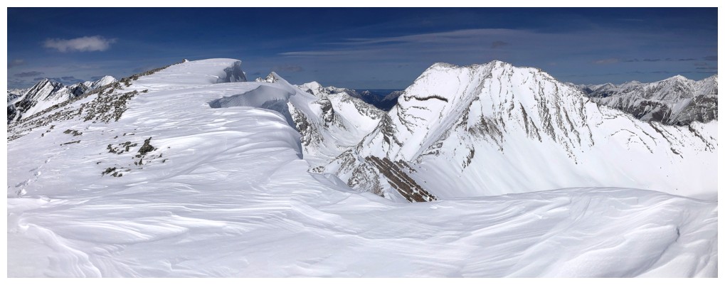
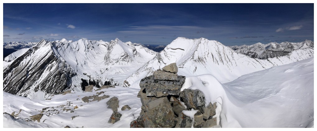
However, the effort was so worth it. At a substantial height of 2914 m, the
highest point of the Kent massif offers an outstanding 360-degree panorama.
Especially eye-catching was the view to Mount Inflexible and the huge cornice
overhanging the east face.
I couldn’t have
asked for a more mercifully easy descent, perhaps matching that of the previous
day on Rummel Ridge: summit to the col – 30 minutes compared to 90 on ascent;
summit of the outlier to the parking lot – 75 minutes compared to 145 on
ascent.
A strenuous but
absolutely magical return to an outstanding mountain.
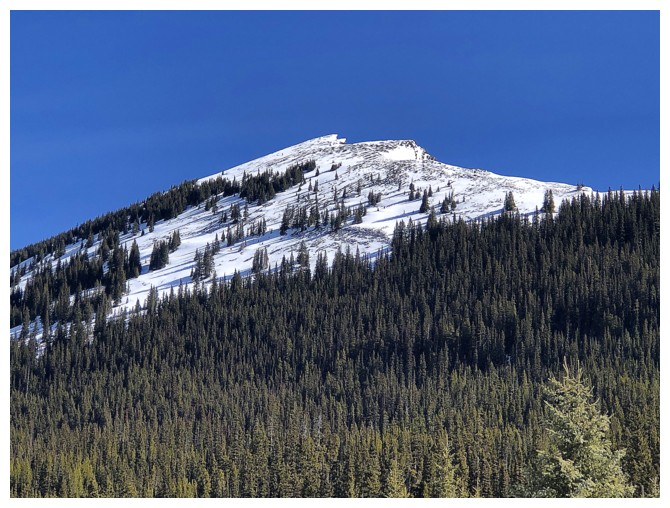
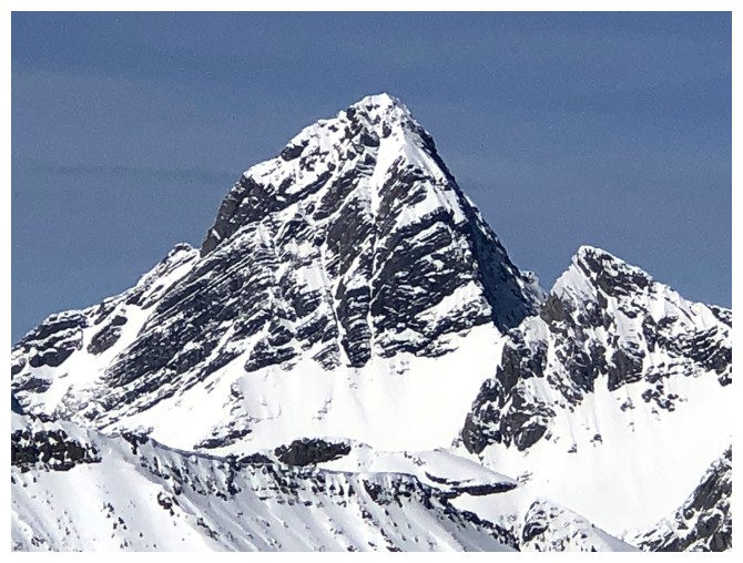
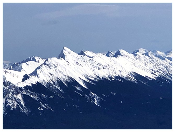
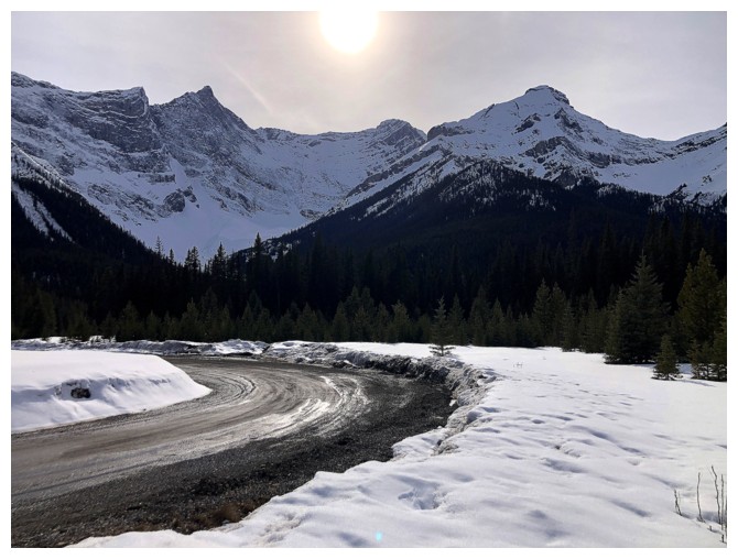
Close-up of the outlier from the parking lot
Looking over to distinctive Mount Smith-Dorrien
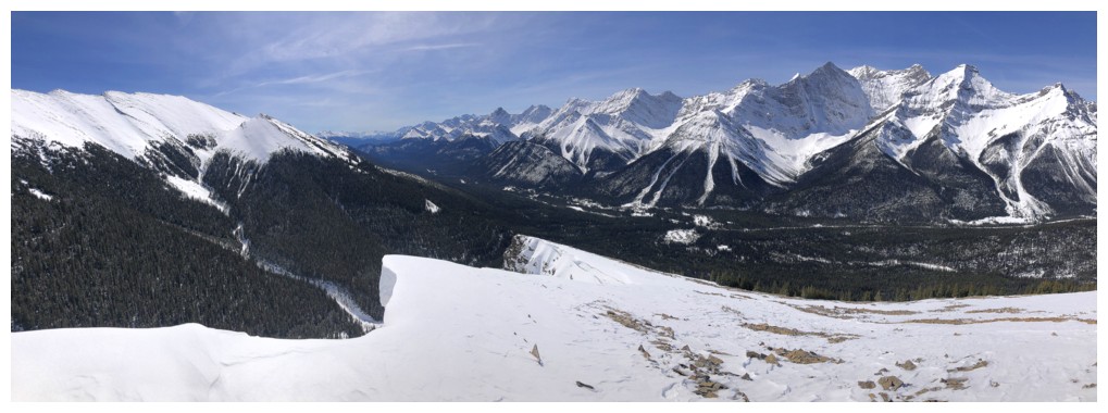
55 minutes later the views finally start to emerge
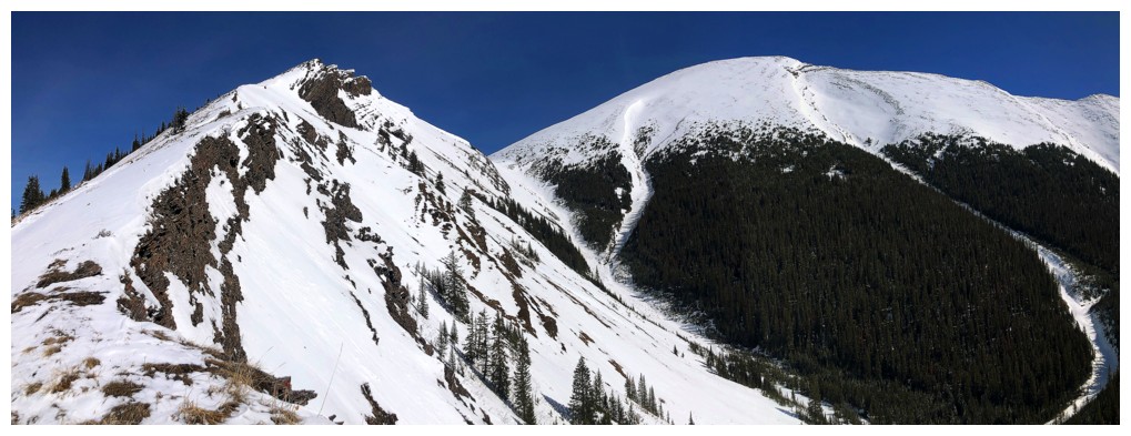
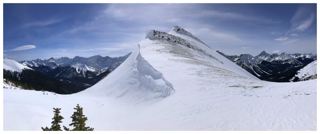
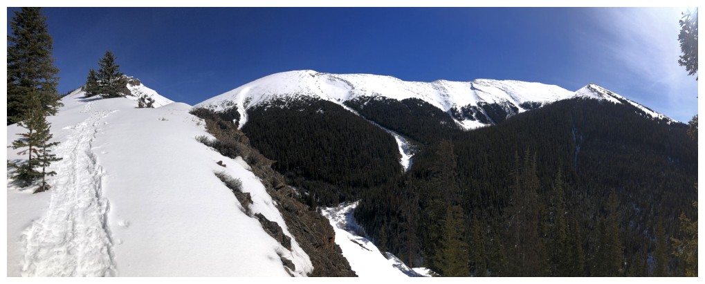
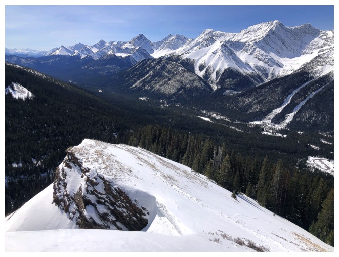
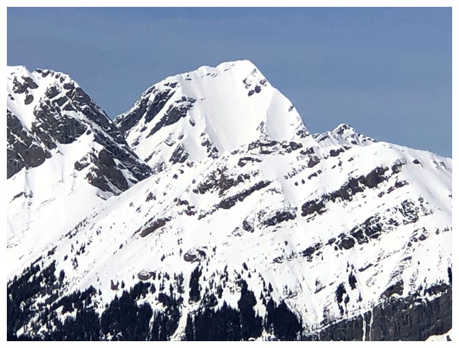
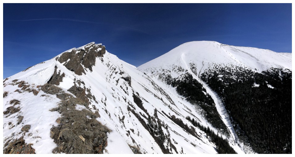
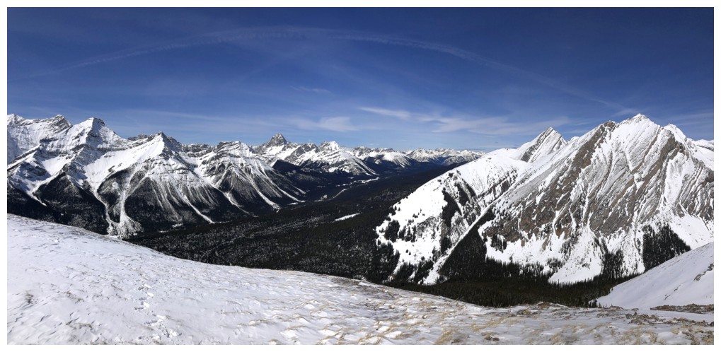
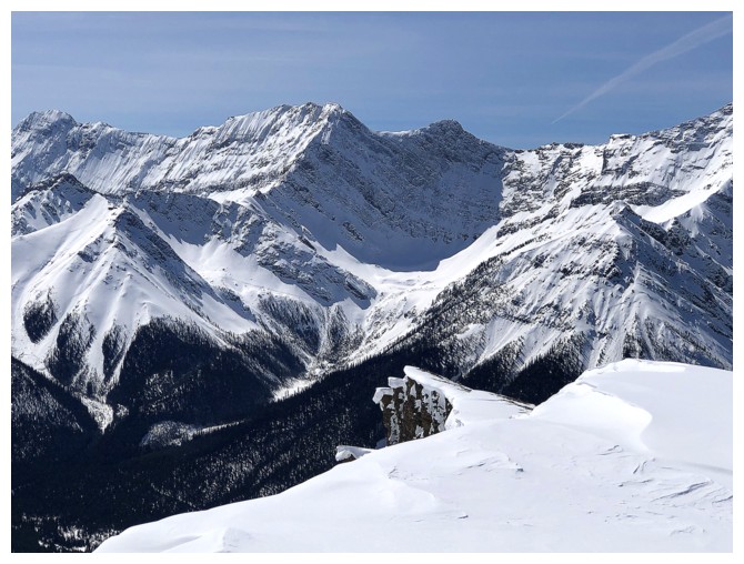
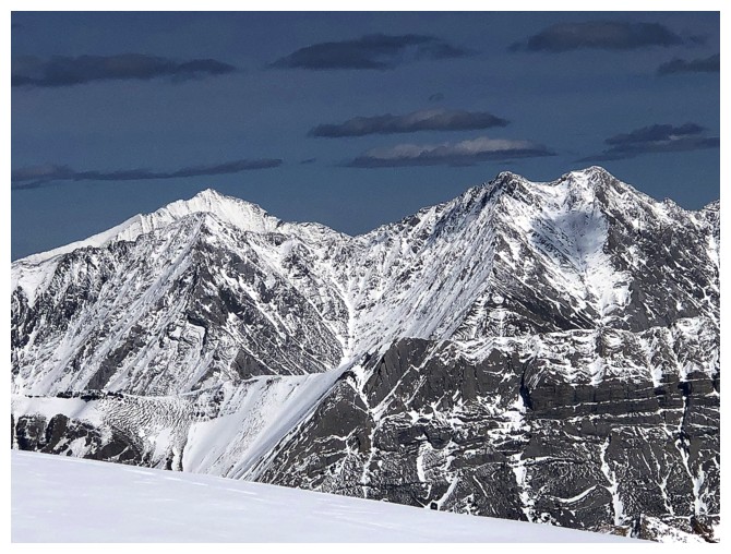
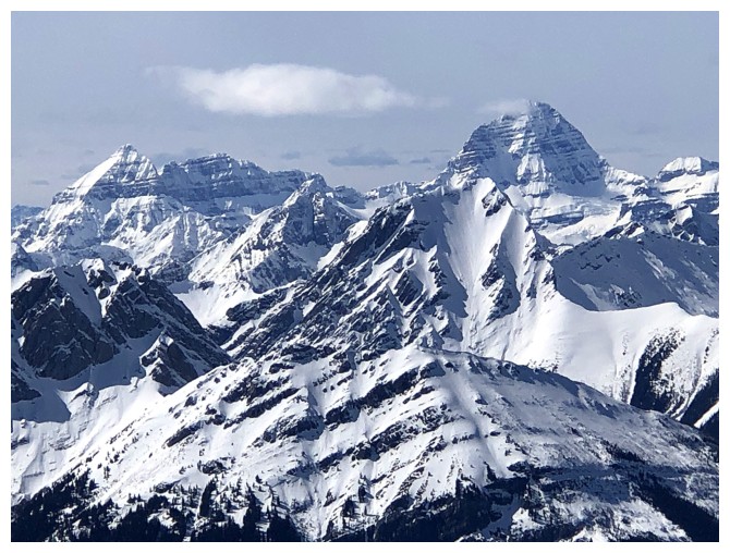
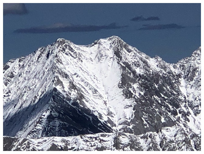
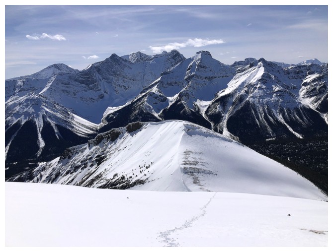
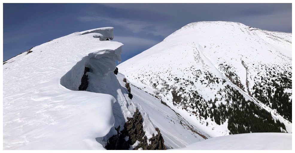
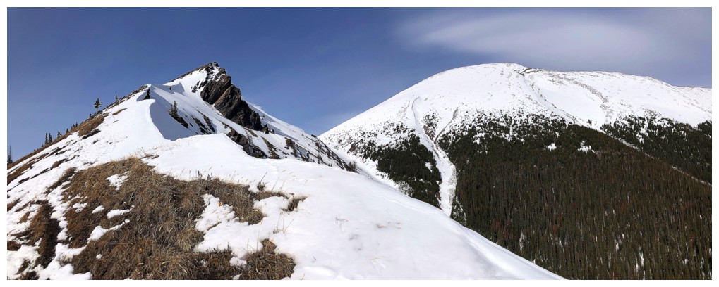
The outlier at the left and Kent Ridge North just right of centre
Mount Murray, CEFNS, Birdwood, Commonwealth, and Smuts are featured throughout the ascent
Small cornices on the lower section of the outlier's east side
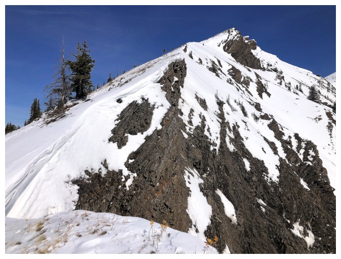
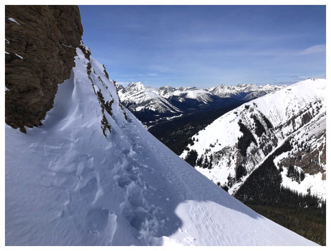
There's a decent trail left of the ridge, but staying near the edge provides the best views
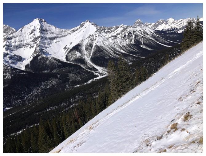
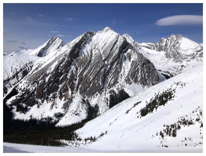
Mounts Black Prince and Warspite lie to the southwest
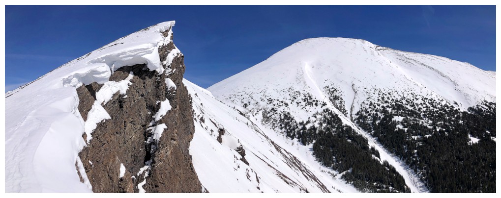
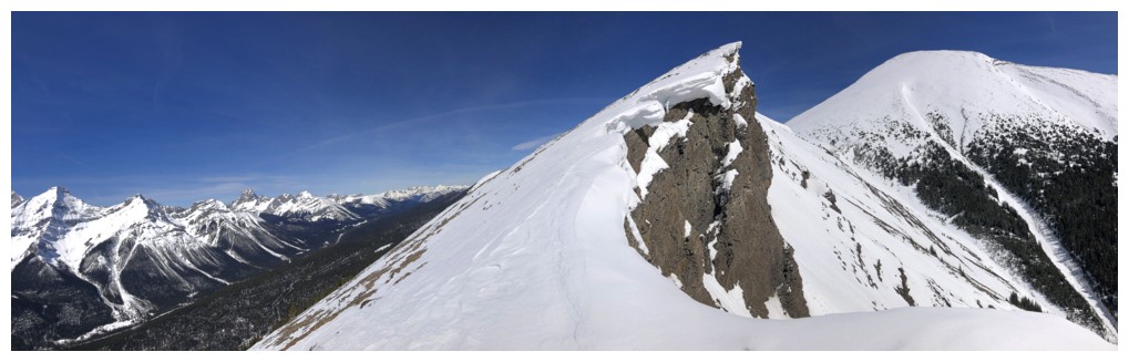
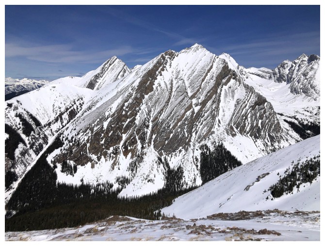
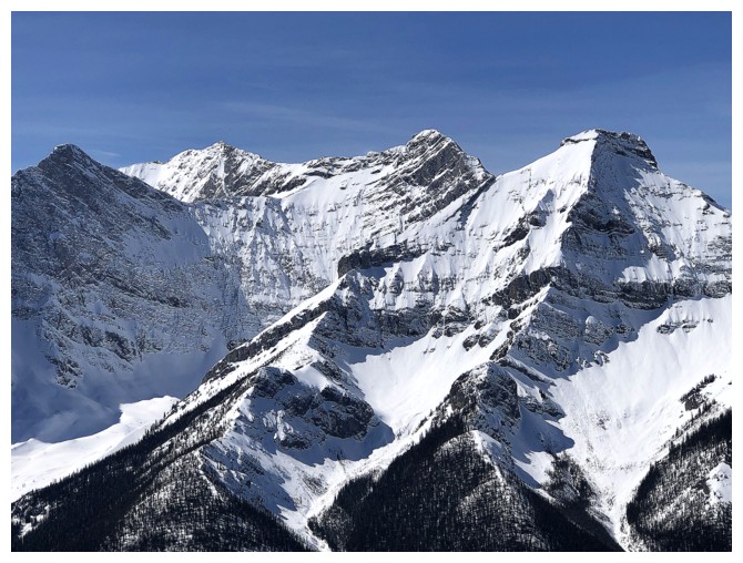
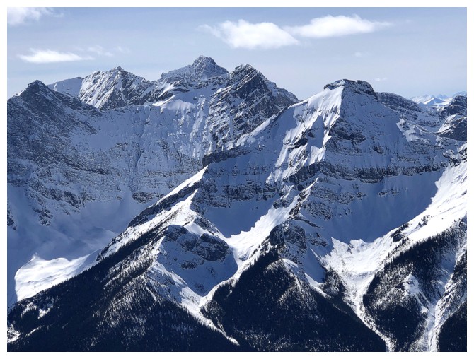
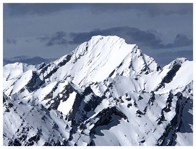
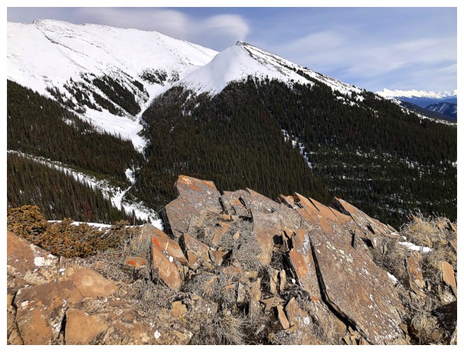
Kent North at the left with some of the massive length of Kent Ridge running south. The official summit lies near the south end and is significantly lower than Kent North, but is an awesome scramble.
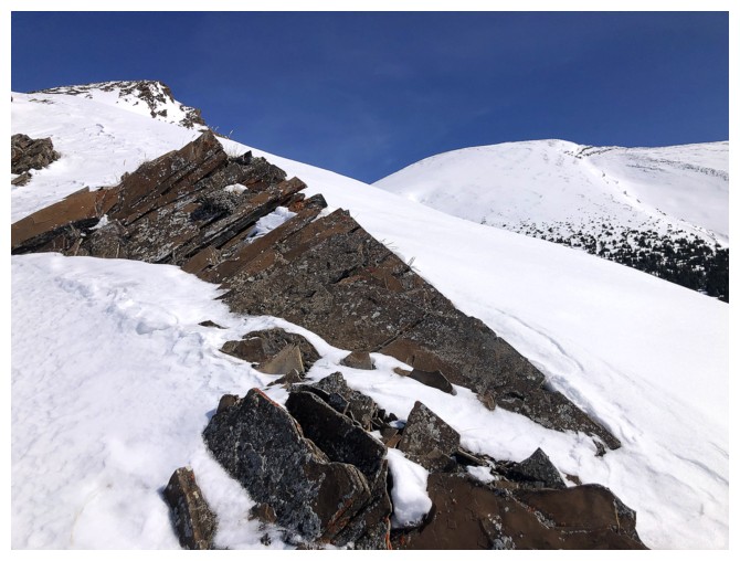
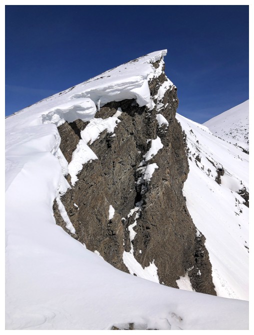
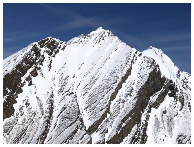
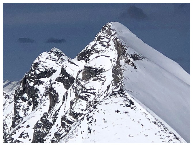
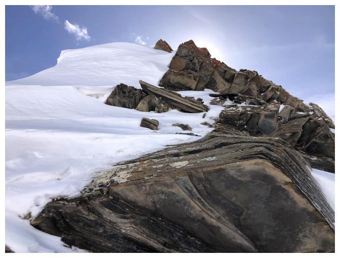
Cool exposed rocks and the two summits
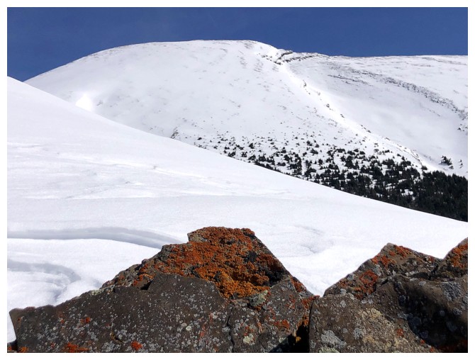
With some lichen
Same as above
Mount Smuts
Mount Birdwood and Pig's Tail (Shark's Tooth)
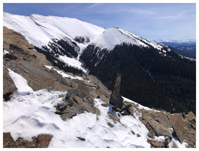
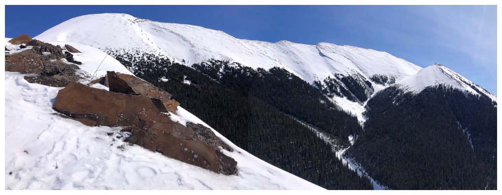
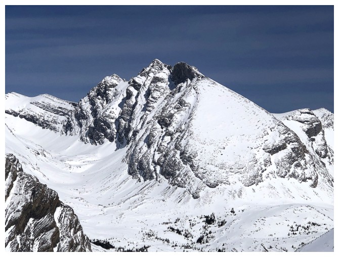
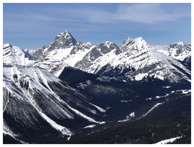
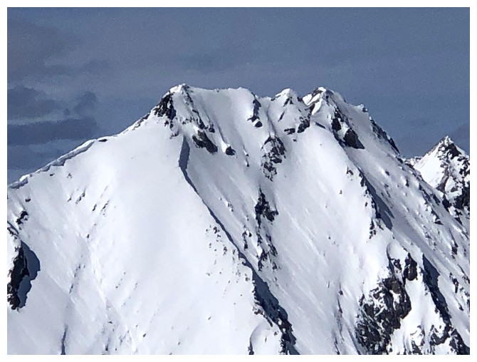
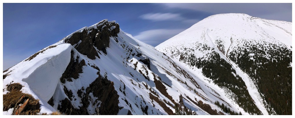
The outlier just right of centre looks like it could be a good
objective and may lead to another significant highpoint along Kent Ridge
Back to the obsession with the outlier and Kent North
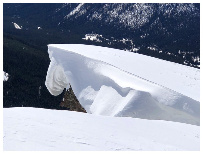
Cornice size is increasing
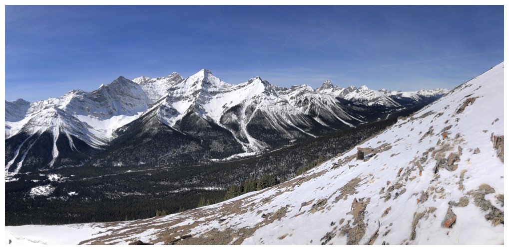
As are the views to the west
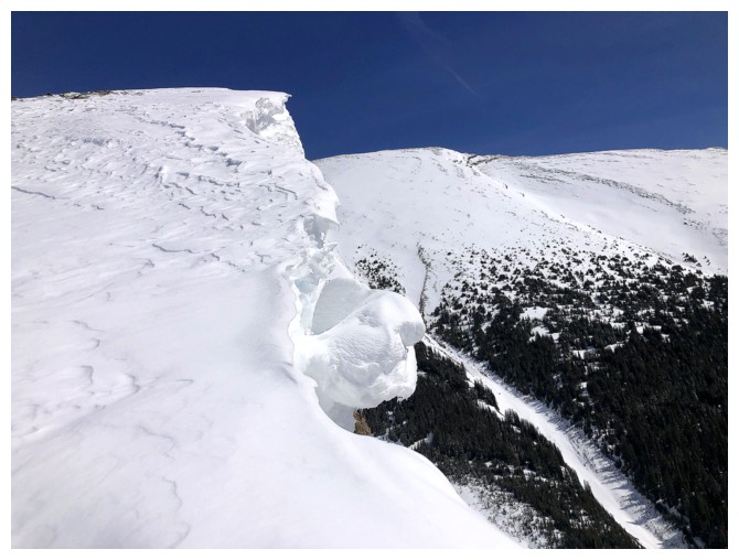
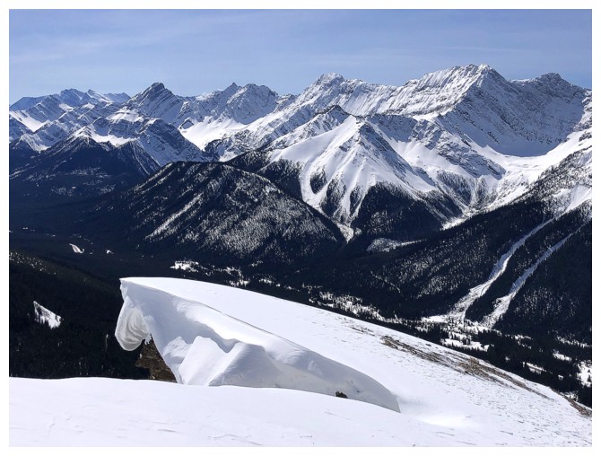
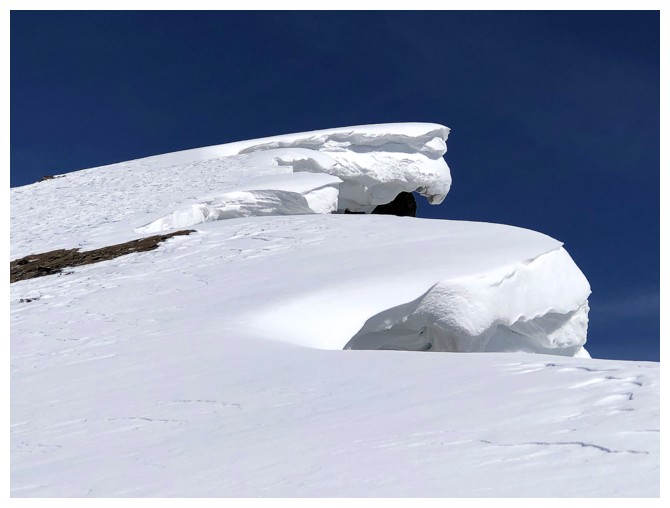
Big chunk of snow that looks like it's ready to fall
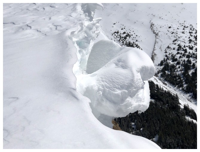
Close-up
Yikes! It did, during the 20 seconds I was moving away from it to get a better angle.
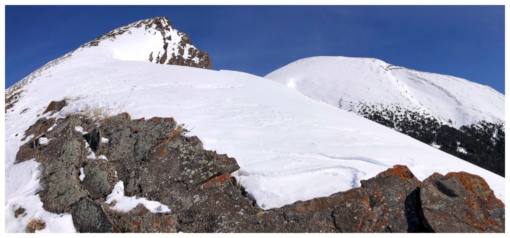
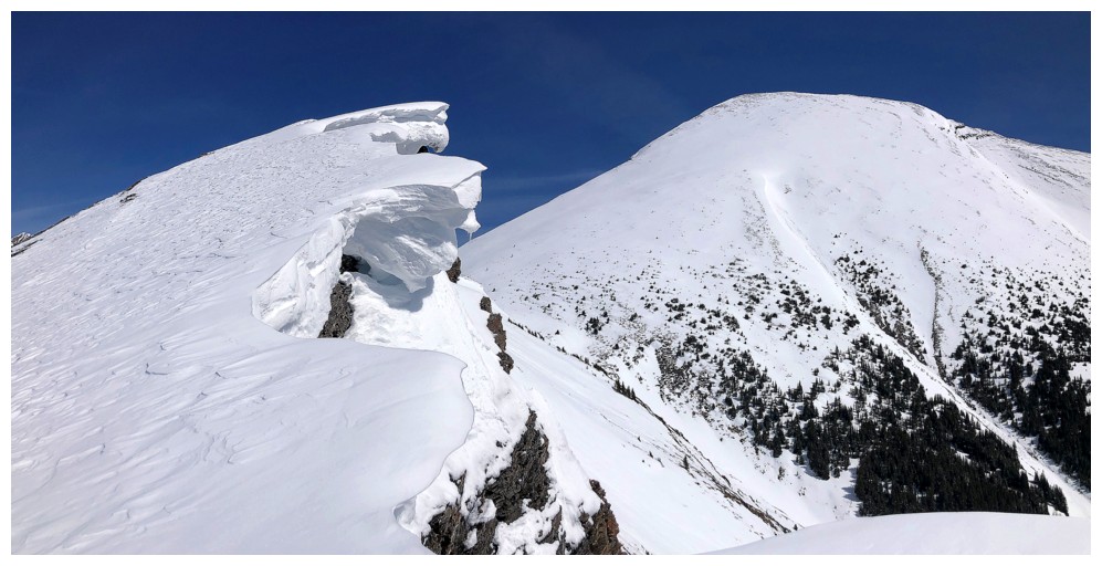
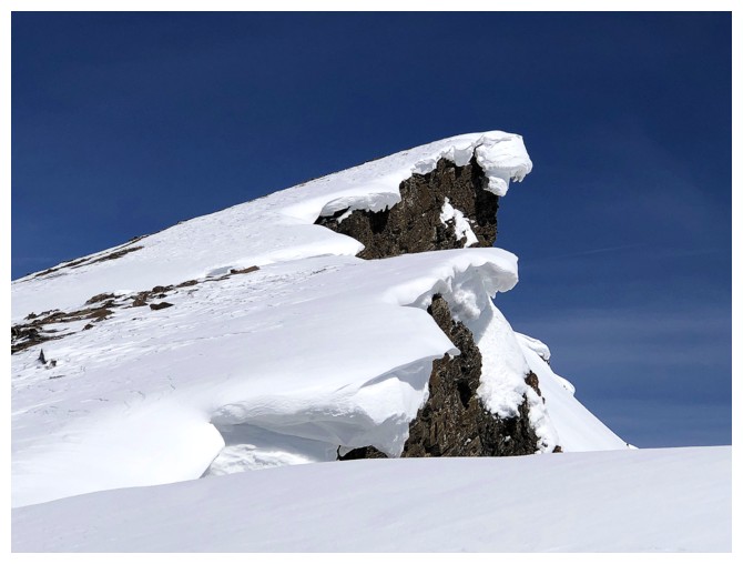
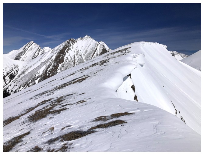
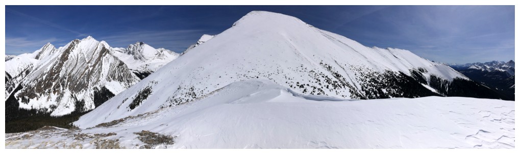
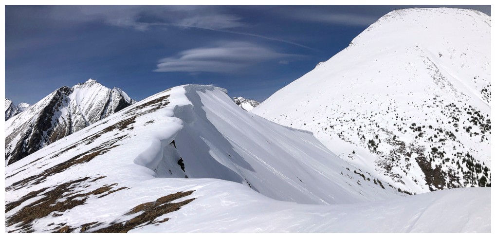
The cornices get even more impressive from here
So does the view looking back
Same as above
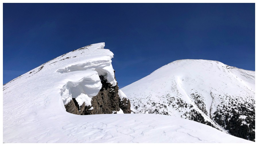
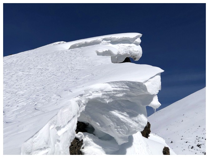
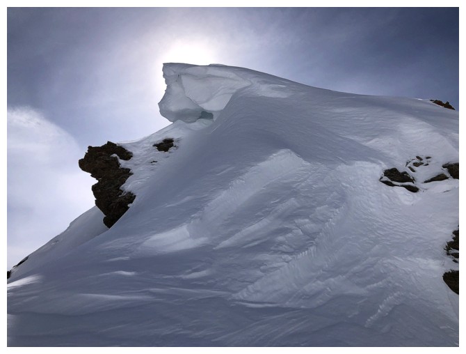
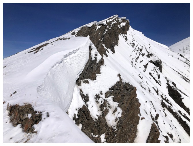
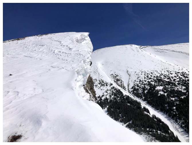
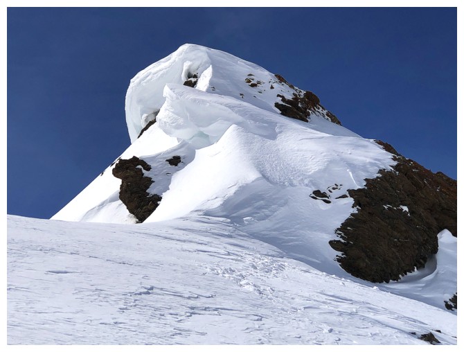
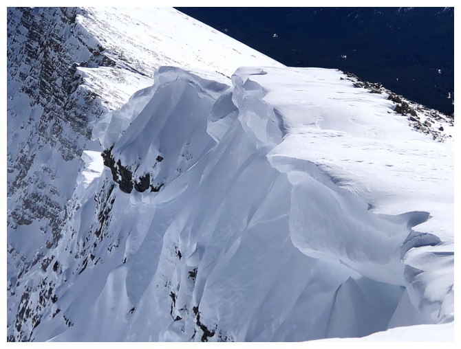
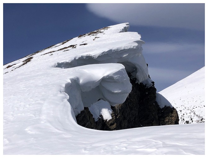
The best cornice on the outlier
Close-up
The next best one
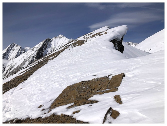
More cornice scenery and other stuff

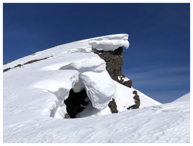
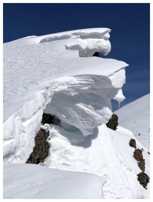
Correction - this was the best cornice on the outlier!
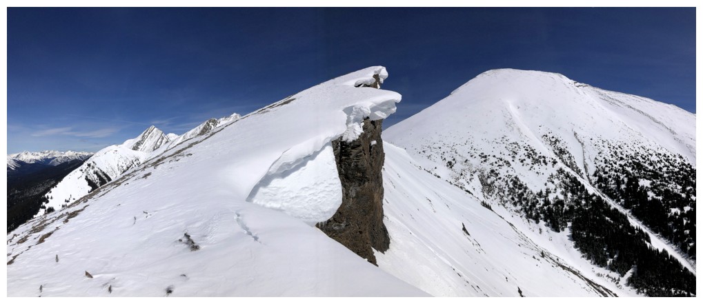

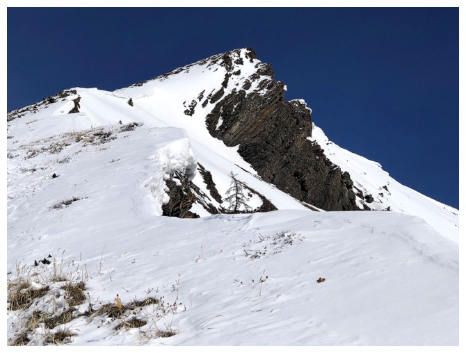
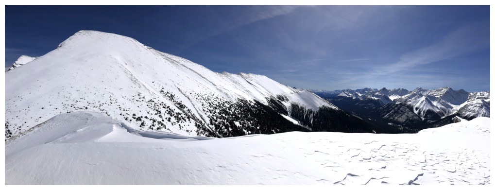
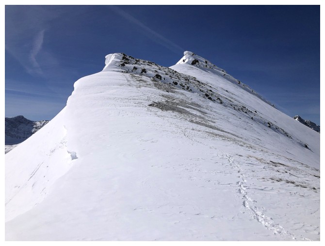
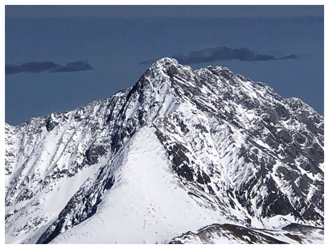
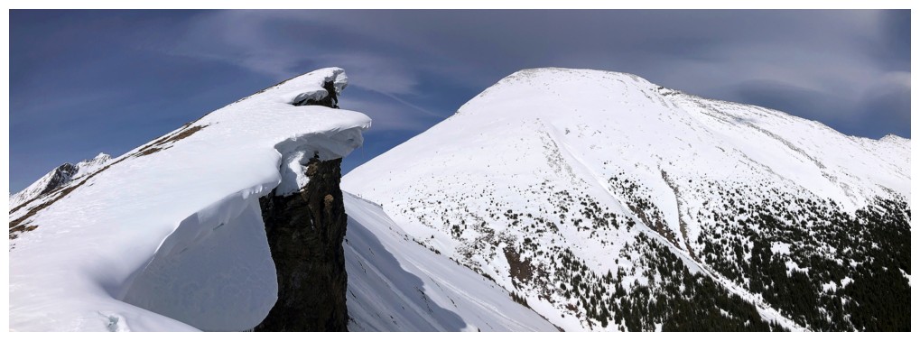
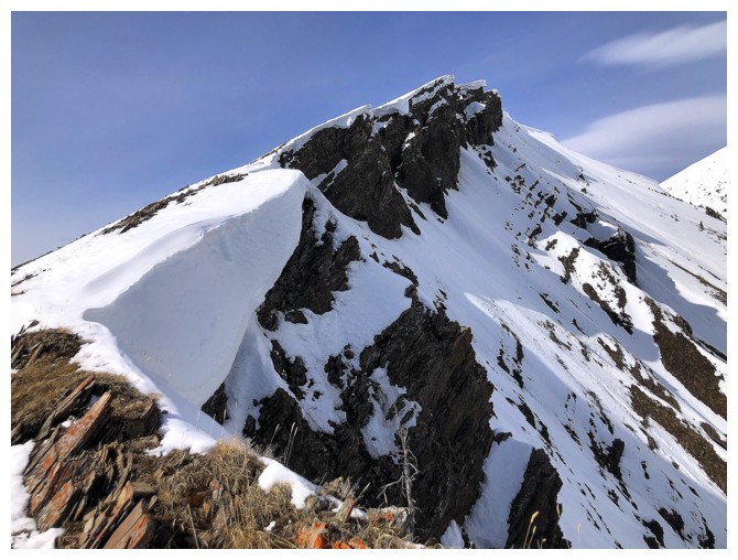
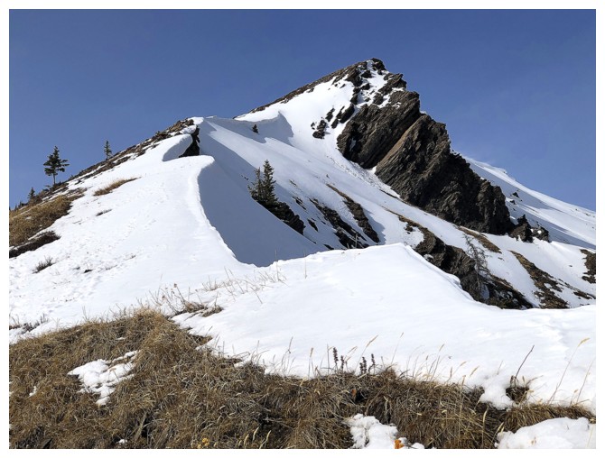
The summit of the outlier is finally close
Same as above
Panos from the summit of the outlier
To the north sit Mount Chesmill, the South Peak of Headwall, and Mount Chester to the left
Mount James Walker
Close-up of the South Peak of Headwall (centre) and Chesmill (the bump on the left). Headwall Peak at the right.
Black Prince
French, Prairie Lookout, and Murray
Birdwood and company again. Commonwealth Ridge near the right.
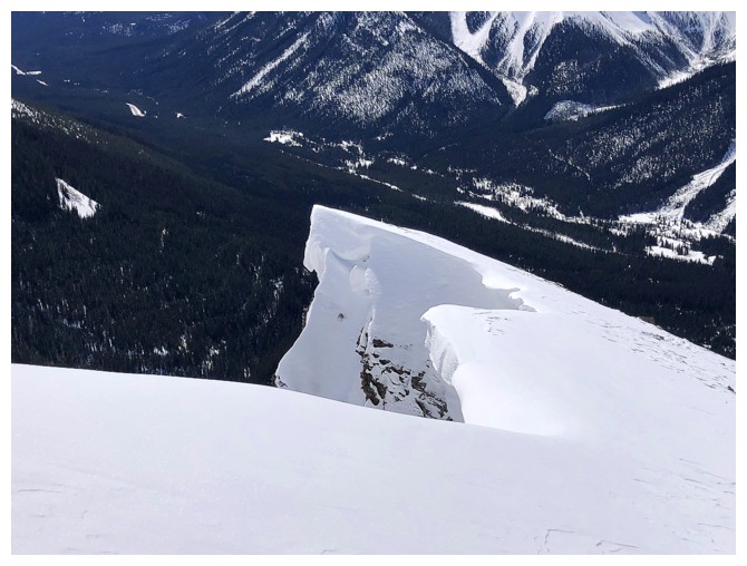
First part of the descent to the col
Looking back at the path I took. It's more serious than appearances
dictate and I wouldn't have descended this part without crampons and an
ice axe.

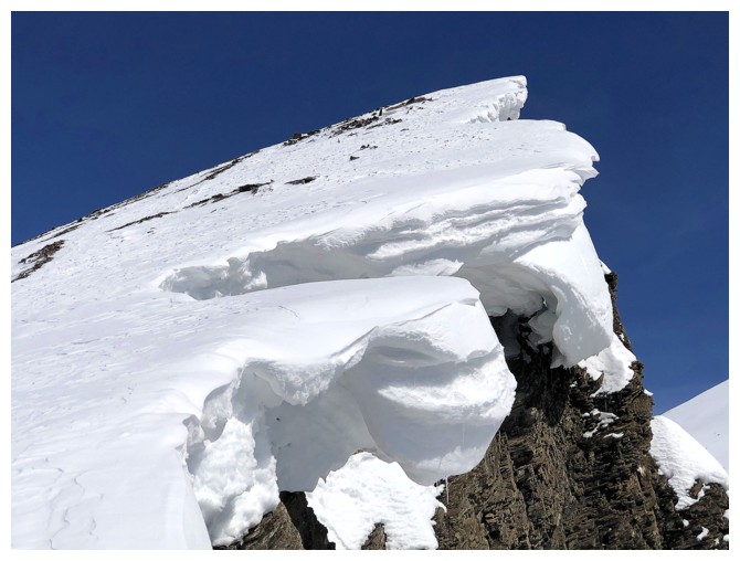
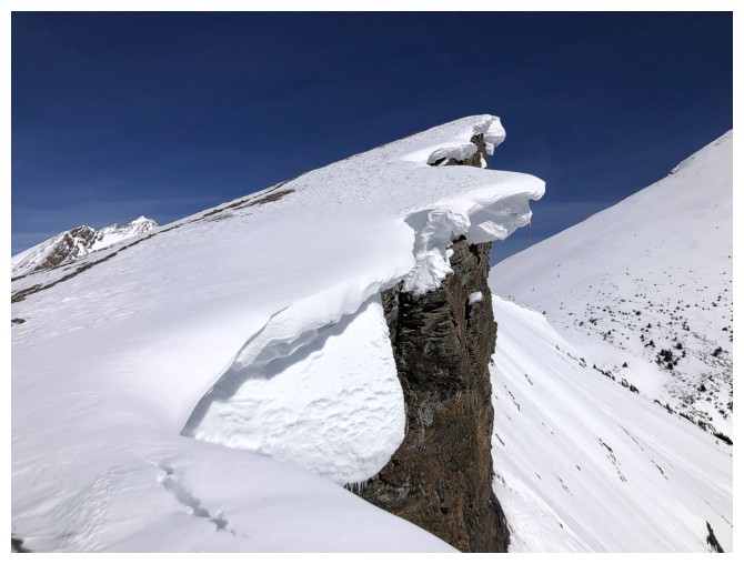
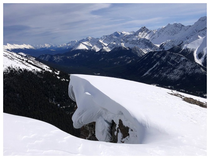
The cornice at the summit of the outlier is always a beaut
Same as above
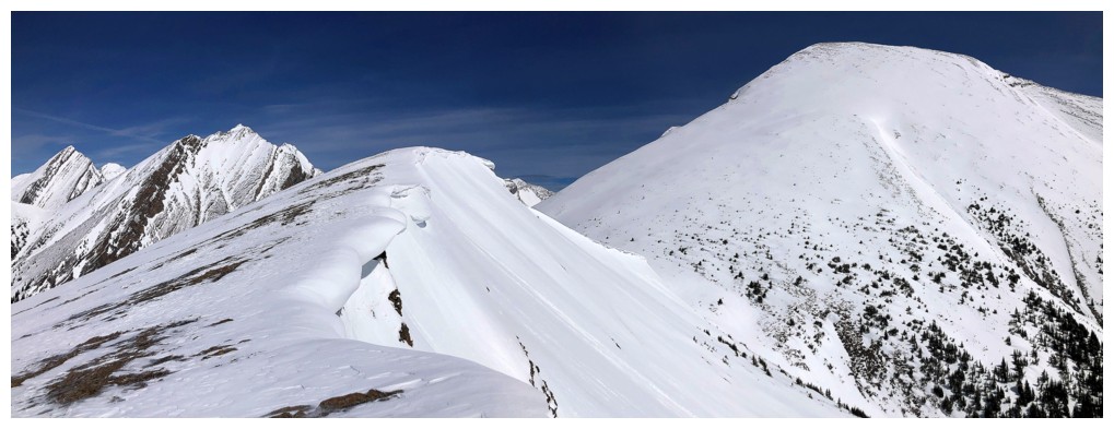
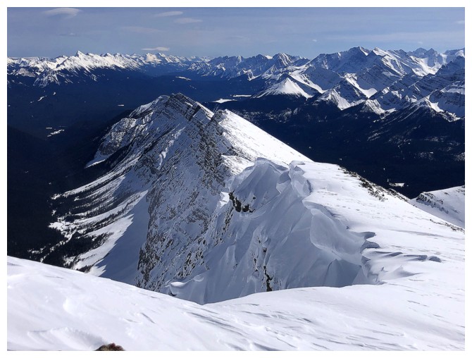
At the col, looking back to the outlier
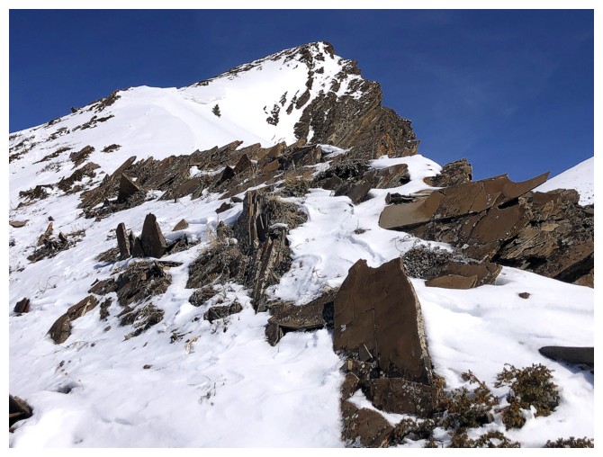
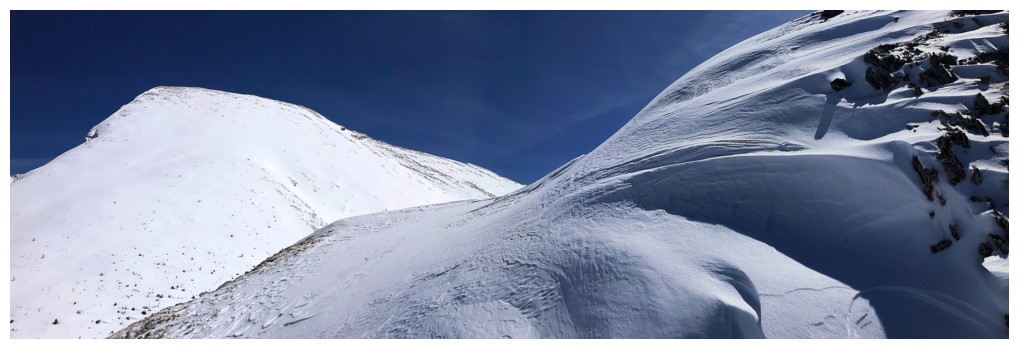
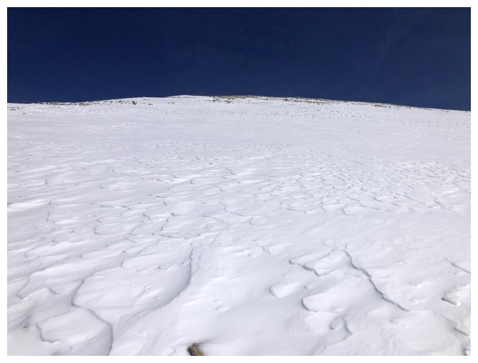
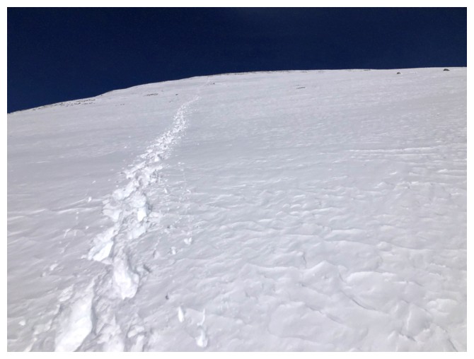
The slope up to Kent North, looking super easy and not very long - wrong on both counts!
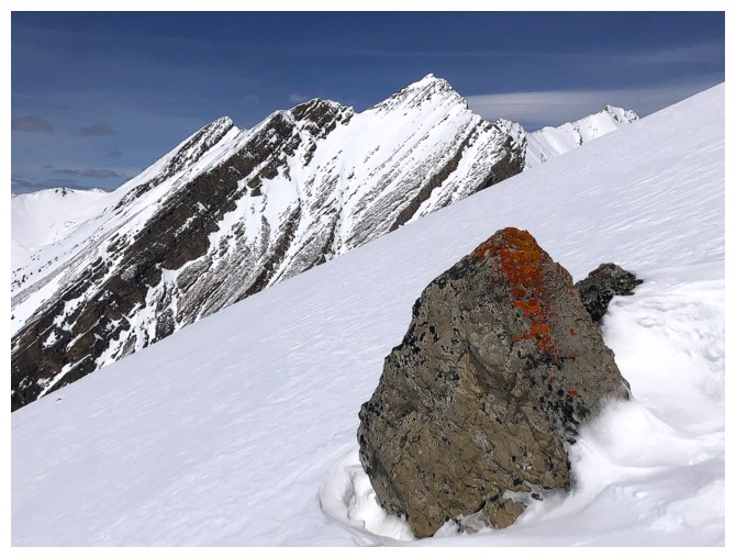
Taking a breather to admire some orange lichen on a rock
45 minutes up and the summit seems no closer
Mount Joffre
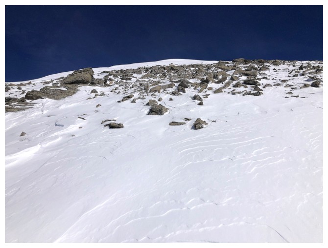
70 minutes up
Finally hit the summit around the 90 minute mark
The James Walker Lake valley
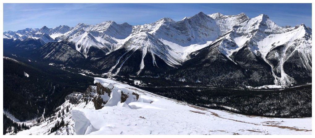
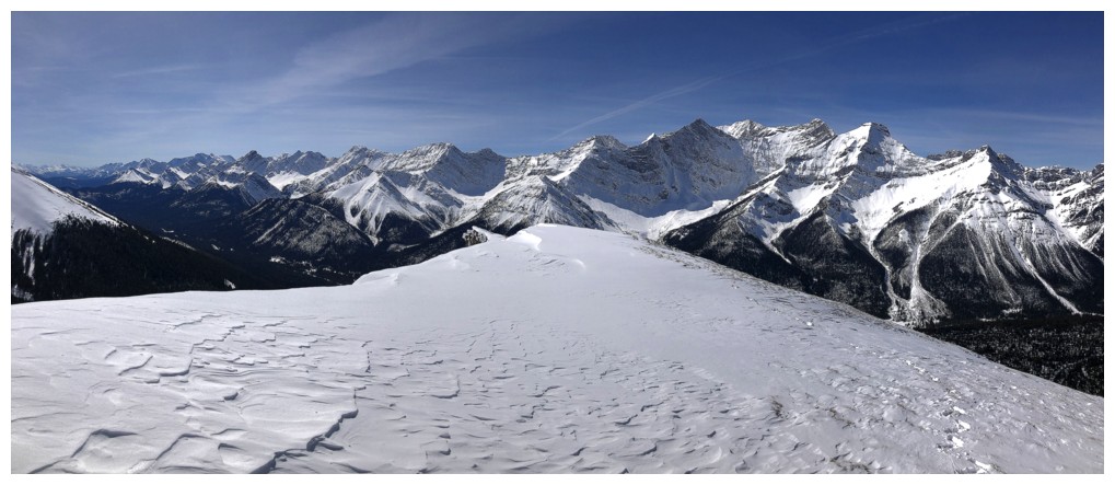
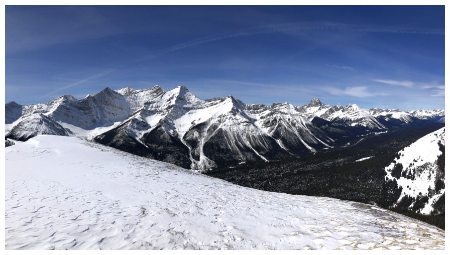
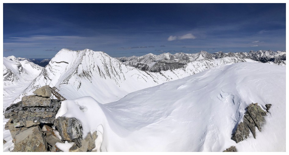
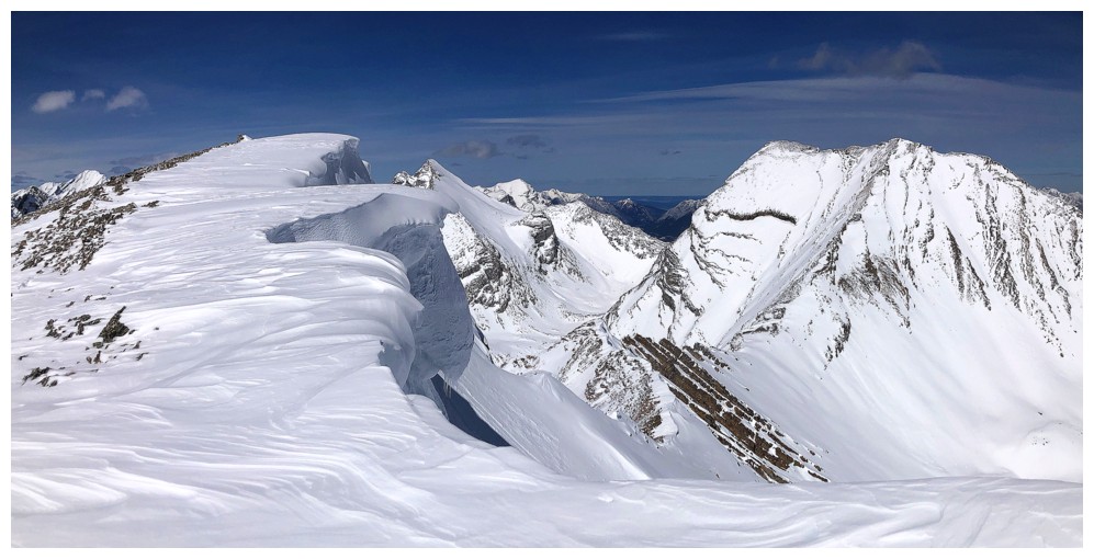
Summit panos

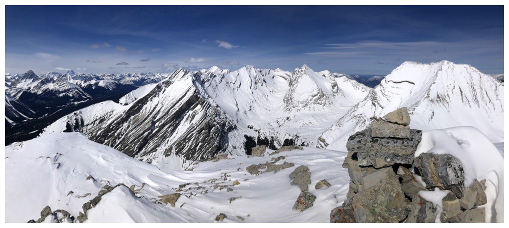
The long ridge of Kent is now visible to the south

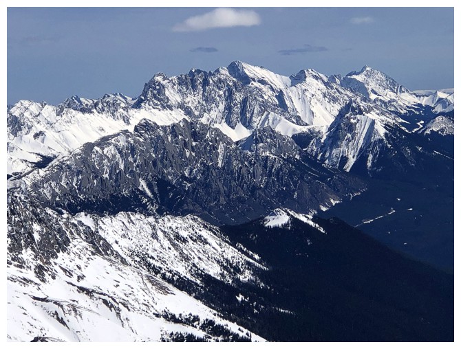
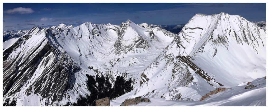
The magnificent Opal Range to the east
Wintour in the foreground (left), Elpoca in the distant centre, and Rae at the right
Mount Denny (right), Rocky Peak (foreground left), and Fisher Peak behind Rocky
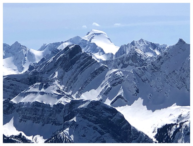
Mount Sir Douglas peaks over Prairie Lookout
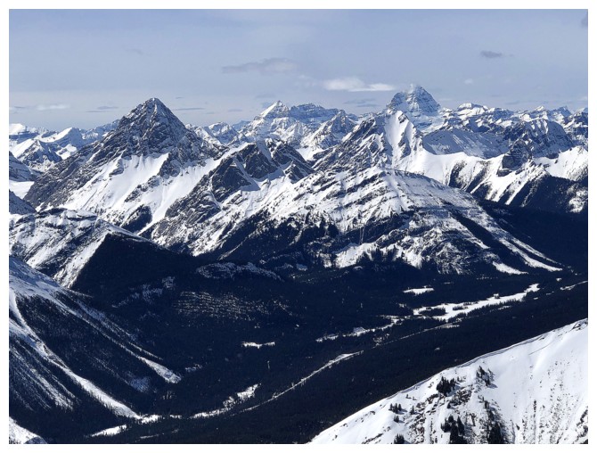
Assiniboine and company join the Birdwood group
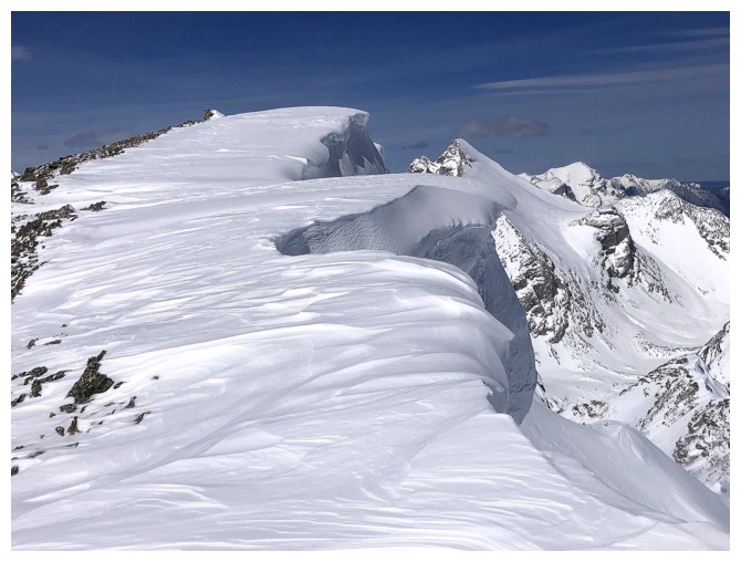
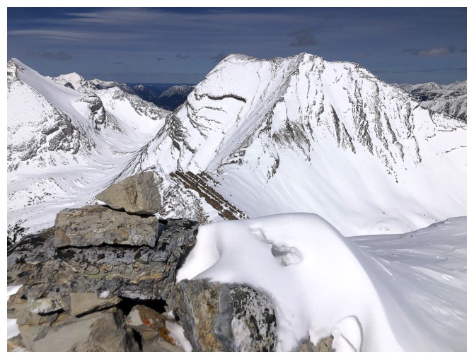
The incredible cornice overhanging the east side
Another look south, specifically at the nearby cornice
Close-up
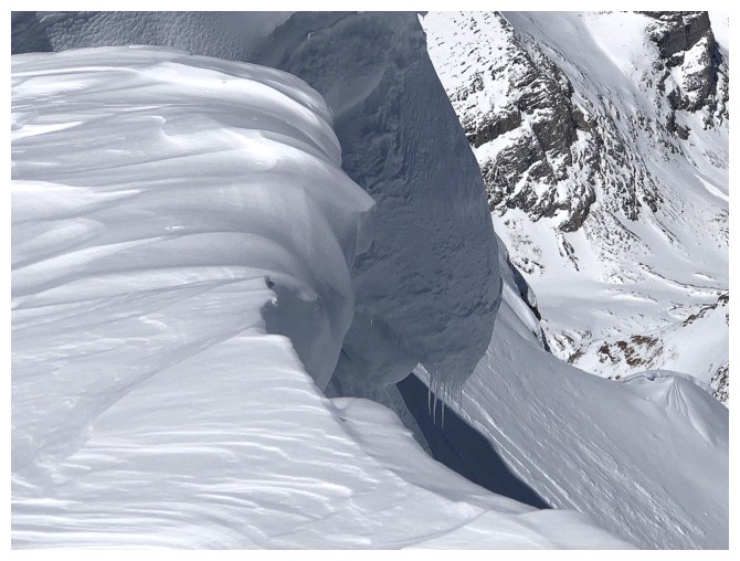
Close-up in the other direction
Not so close-up
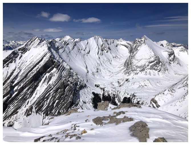
Same as above, with Inflexible at the right and some of the challenging terrain between Kent North and Inflexible
Everything to the north and northeast
Better look at Assiniboine, with Eon Mountain at the left
Mount Galatea
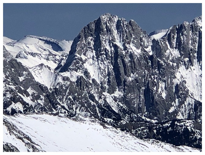
Headwall Peak
The narrow summit ridge of Mount James Walker

Mary Barclay's Mountain (left) manages to hold onto some snow
Back to the Opal Range - close-up of Denny
Mount Evan-Thomas
Mount Packenham
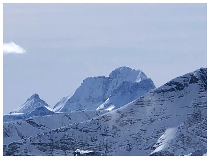
Mount King George
Pocaterra, Tyrwhitt, and other peaks of the Elk Range
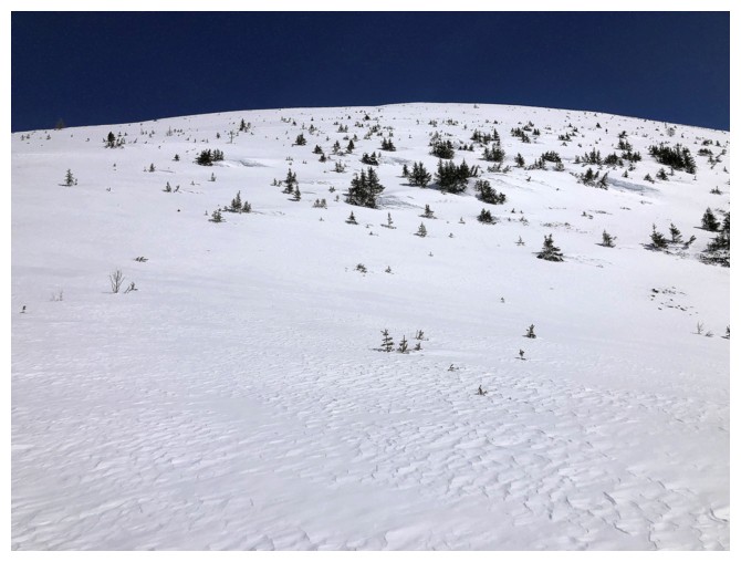
Heading down
Let gravity do the work!
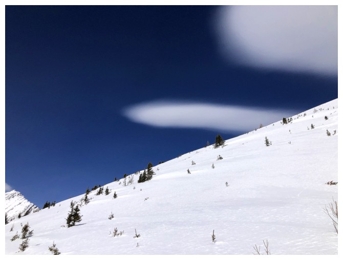
A few interesting clouds form
Back at the col
Rocky sections were few and far between
The South Peak of Headwall was eye-catching throughout
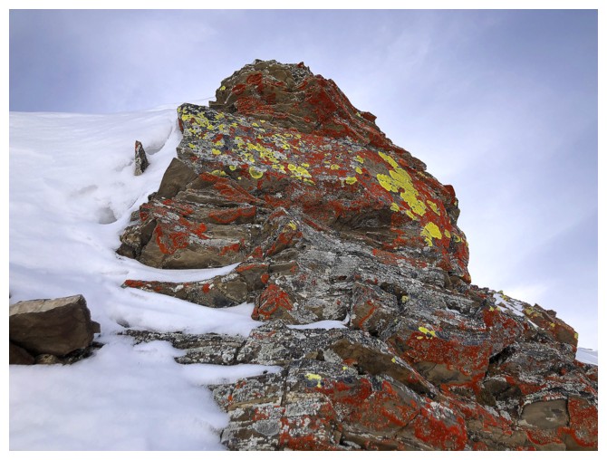
Nice to see some yellow lichen
Glancing back to the summit of the outlier
Had to photo the same cornices on descent too!
A little more exposed rock, due to melting during the day
Last look before descending into the forest
Back at the parking lot, after the wonderful trip
The End
LOG