Arras Peak III
Petit Vimy
June 22, 2024
Mountain heights: 2430 m, 2219 m
Elevation gain: 1473 m
Ascent time to
Arras: 4:35
Traverse time
to Petit: 0:30
Descent time: 3:35
Scrambling with
E. Bikeless and C.U. Faroutinfront.
Firstly, please
read Dave’s excellent report before this one. The events of Vimy Ridge are a history every Canadian should be familiar with,
and Dave’s documents them briefly, but exceedingly well.
Onto my report…
Receiving an
invitation from Dave and Brad to ascend Arras Peak (Maisstooinastáko or Crow Chief
Mountain) was music to my ears, even though I had already visited the summit on
two separate trips. 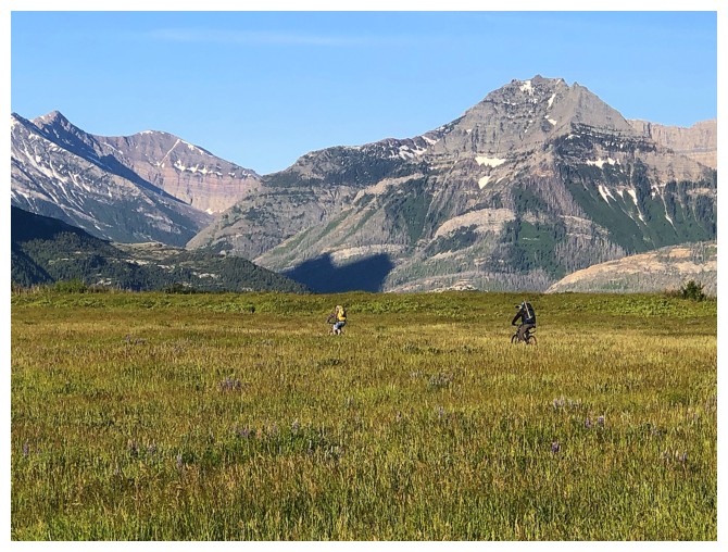 The Vimy Ridge massif is magnificent and worthy of multiple
excursions. We also had a minor outlier of Arras in mind for a potential ascent,
the striking roadside view of the little peak providing plenty of motivation.
The Vimy Ridge massif is magnificent and worthy of multiple
excursions. We also had a minor outlier of Arras in mind for a potential ascent,
the striking roadside view of the little peak providing plenty of motivation.
The 7 km bike
approach went very well, under beautifully clear skies, and featuring a
surprisingly low Sofa Creek for mid-June. Even for E. Bikeless and C.U.
Faroutinfront the ride, which has very little elevation gain, was a joy to
cycle. 4.8 kilometres of hiking later we found ourselves in the basin below
Vimy Peak. When hiking this trail, you always have to keep in mind that even
though the signpost says “4.8 km to Vimy Peak”, that distance leads you only to
the basin and includes almost 800 m of elevation gain. It’s another 300 vertical
metres to the summit of Vimy Peak from there.
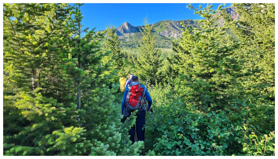
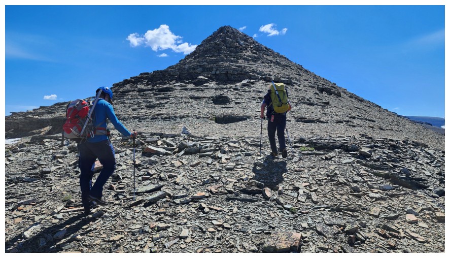
However, for
Bikeman, Bikeless, and Faroutinfront, Vimy Peak was not on the agenda, and we
therefore took the most direct route from the basin towards the ridge between
Vimy and Arras. Once on that ridge we would not be repeating the mistake Mark and I made
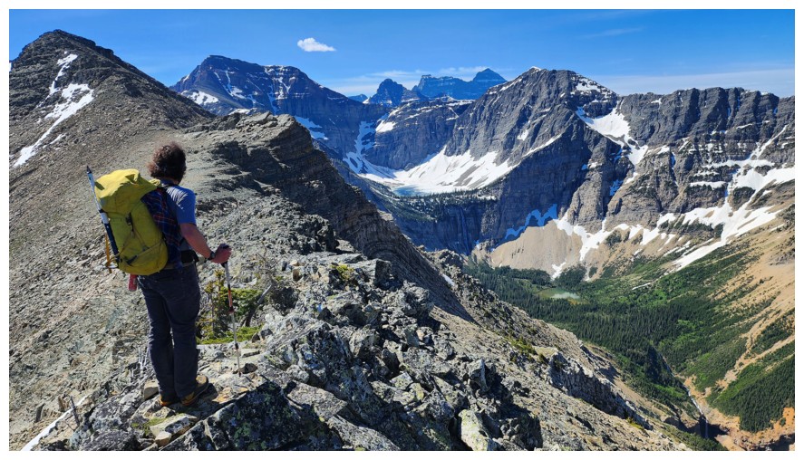
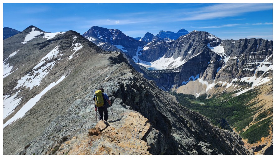
by trying to side-slope the east side of the ridge. A thoroughly enjoyable ridgewalk/scramble
over Vimy Ridge ensued, with interesting terrain and remarkable views
throughout. This traverse is also longer than you might expect and quite
physically taxing. By the time we reached the summit of Arras, I was saying to
myself, “Thank *the deity of your choice* we are not tagging the highest point
on the ridge, further southeast!” Dave, fighting a cold and far from 100%,
probably agreed.
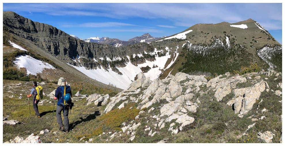
We took a
much-needed food break and then set our sights on the lower outlier of Arras to
the northeast. 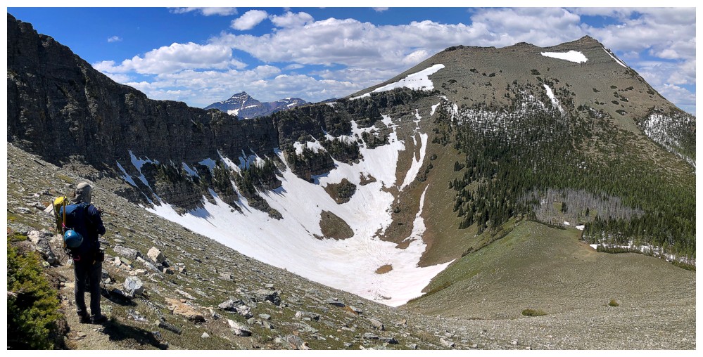 Personally, I wasn’t expecting much in terms of interest for
this part of the day, but shame on me for even entertaining such a foolish idea
when in Waterton! The traverse down and then slightly up to the summit sported
all kinds of interest, stunning views down the precipitous east side, a partial
look at massive Sullivan Falls, and wonderful views in general.
Personally, I wasn’t expecting much in terms of interest for
this part of the day, but shame on me for even entertaining such a foolish idea
when in Waterton! The traverse down and then slightly up to the summit sported
all kinds of interest, stunning views down the precipitous east side, a partial
look at massive Sullivan Falls, and wonderful views in general.
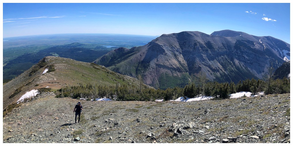
Retracing our
exact route back made little sense, and so after reascending some of the
terrain back towards Arras Peak, we embarked on a long side-sloping traverse to
minimize the elevation gain. Unlike my previous trip with Mark, this round of
side-sloping worked remarkably well and was interesting to boot. Arriving back
at the point above the basin, all that remained was a long but easy downhill
hike back to the bikes, and then the pleasant ride out. And that’s exactly how
it transpired, all three us a little tired but riding a high from the day’s
events and ascents.
An incredibly
rewarding day out with two guys I would happily describe as “the cream of the
Southern Alberta crop” (even if they don’t have e-bikes!).
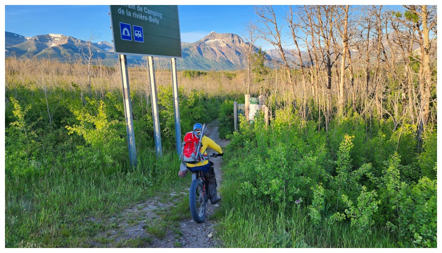
The bike ride begins (photo by Dave)
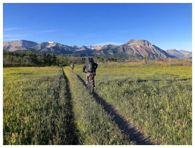
Easy, flat riding here, with terrific views from Sofa Mountain to Vimy Peak
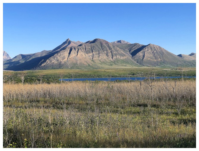
Bellevue Hill (foreground) and Mount Galwey (left) are also on display
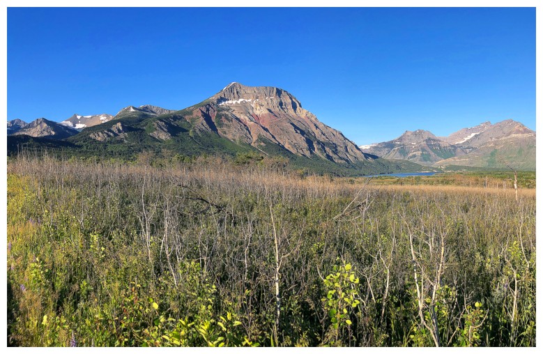
Vimy Peak. Our first ascent went up the red argillite then over to the left.
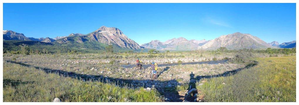
At the Sofa Creek crossing (photo by Dave)
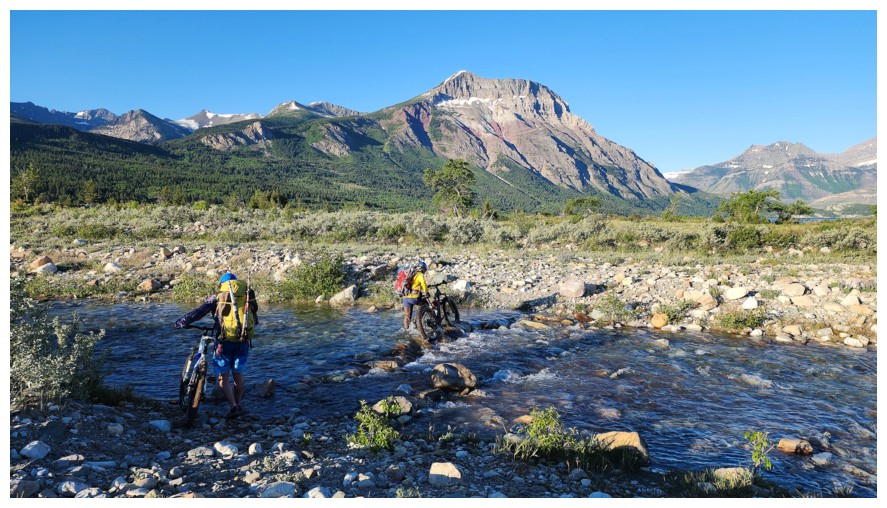
Brad and I push our bikes across the creek. The hip-waders may have been overkill here, but we were all
expecting the creek to be much higher (photo by Dave).
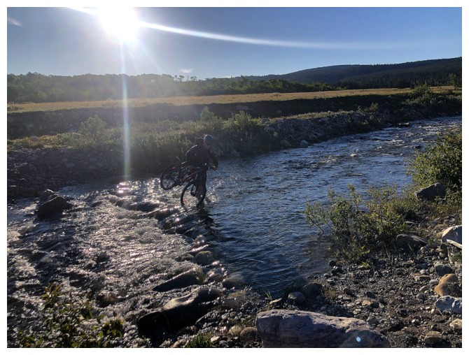
Manly Dave carries his bike across
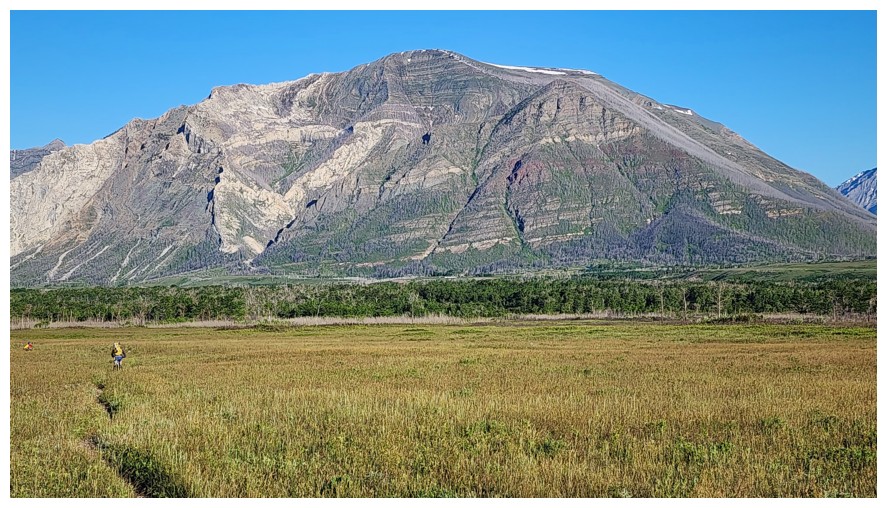
Crandell Mountain - the number of routes up this peak is only limited by your imagination! (photo by Dave)
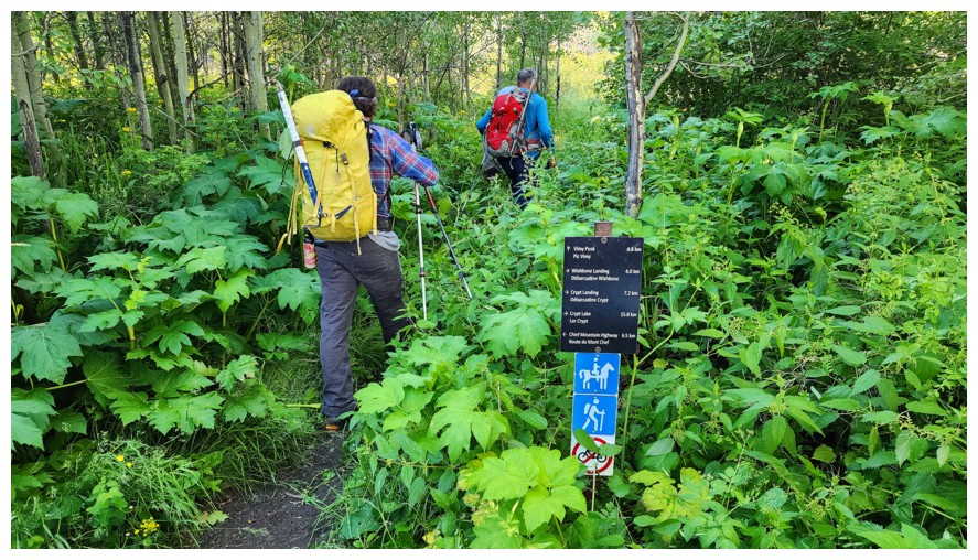
Off the bikes and onto our feet for the deceivingly long 4.8 kilometre hike up to the basin (photo by Dave)
First view of Lion's Head - an official peak on the northeast ridge of Vimy Peak. It's on the to-do list for me, but Dave and Brad have already done it (photo by Dave).
Sweet view of Vimy Peak (photo by Dave)
Lion's Head (centre) and the summit of Vimy Peak (photo by Dave)
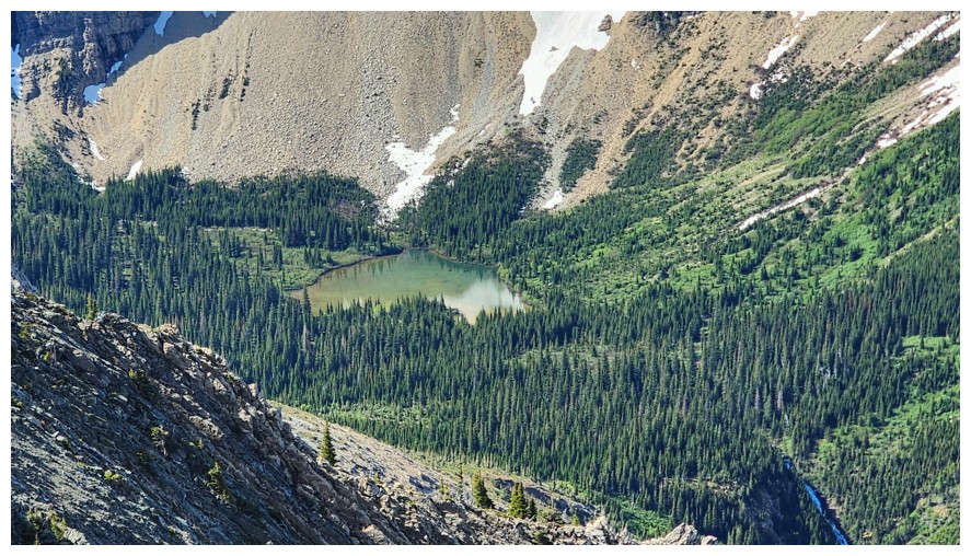
Beautiful greens everywhere (photo by Dave)
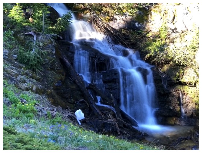
The first of two water features
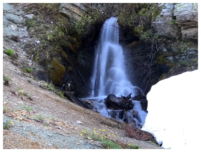
The second
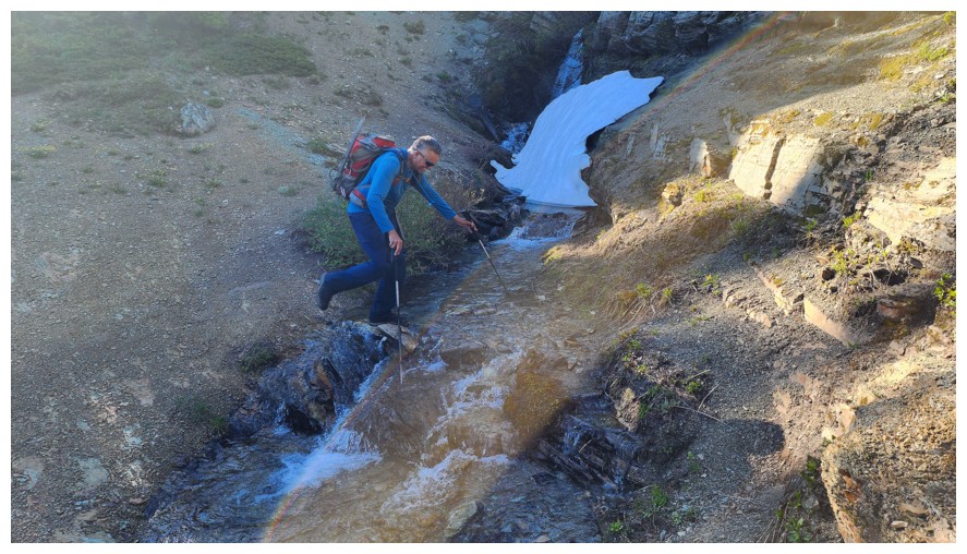
Crossing a creek (photo by Dave)
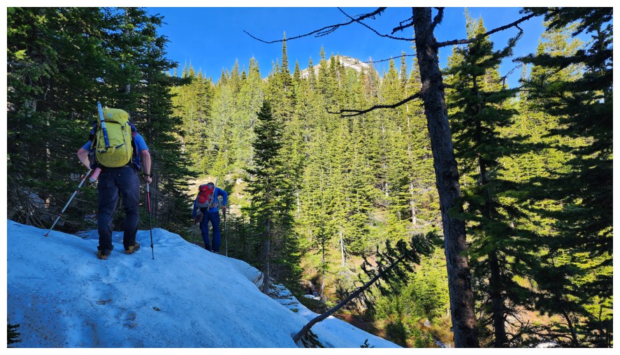
Still plenty of snow in the shaded areas of the trail (photo by Dave)
Shaded now, but obviously not throughout most of the day (photo by Dave)
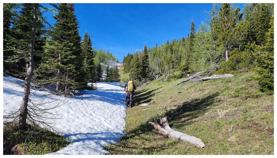
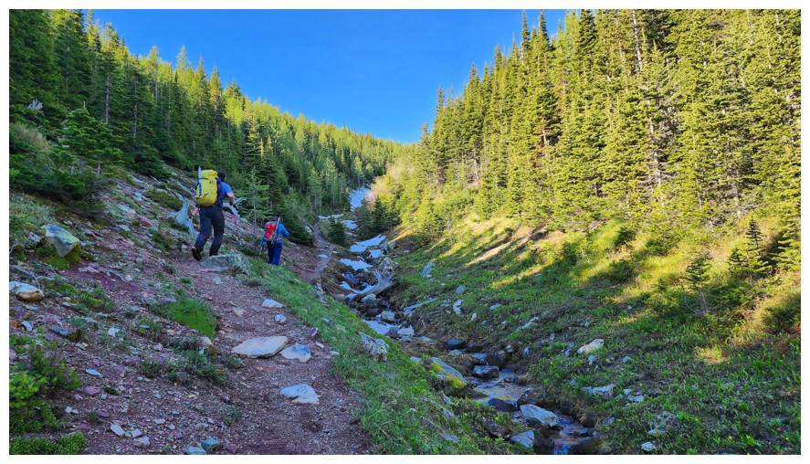
Very obvious which side of the shallow gully here gets the most Sun (photo by Dave)
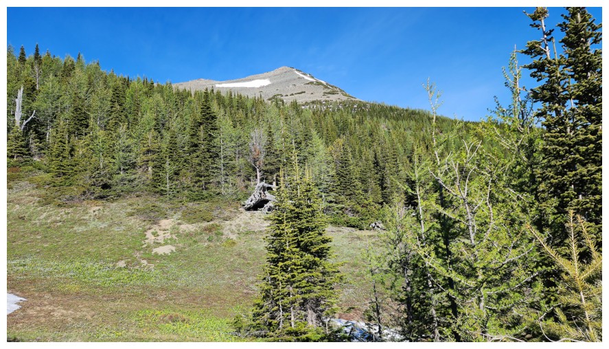
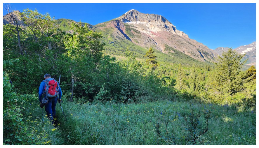
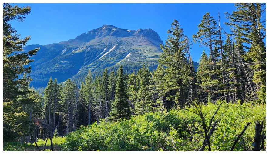
A break in the trees reveals a good view of Vimy Peak (photo by Dave)
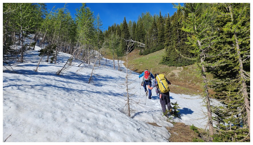
The snow here was perfect for walking up (photo by Dave)
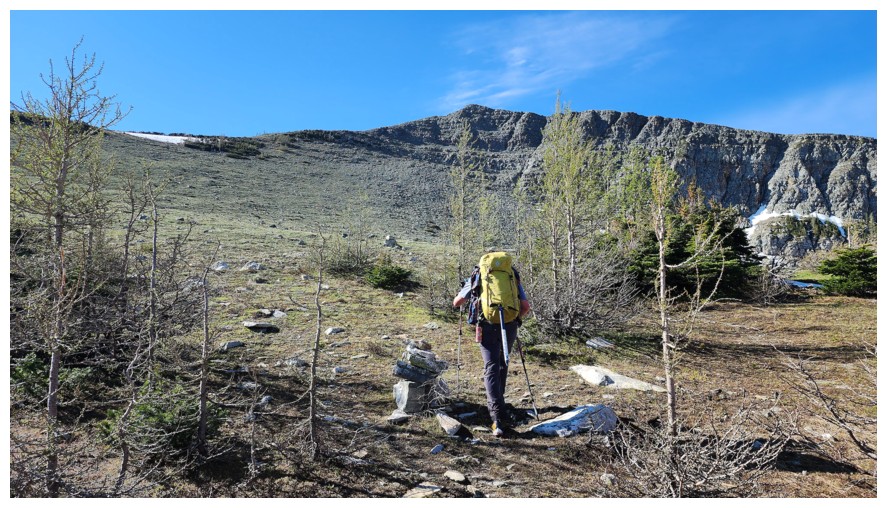
Having left the Vimy Peak trail, now out in the open, looking at the ascent route to the ridge (photo by Dave)
Dave and Brad check out some of the fascinating connecting ridge southeast of Vimy Peak
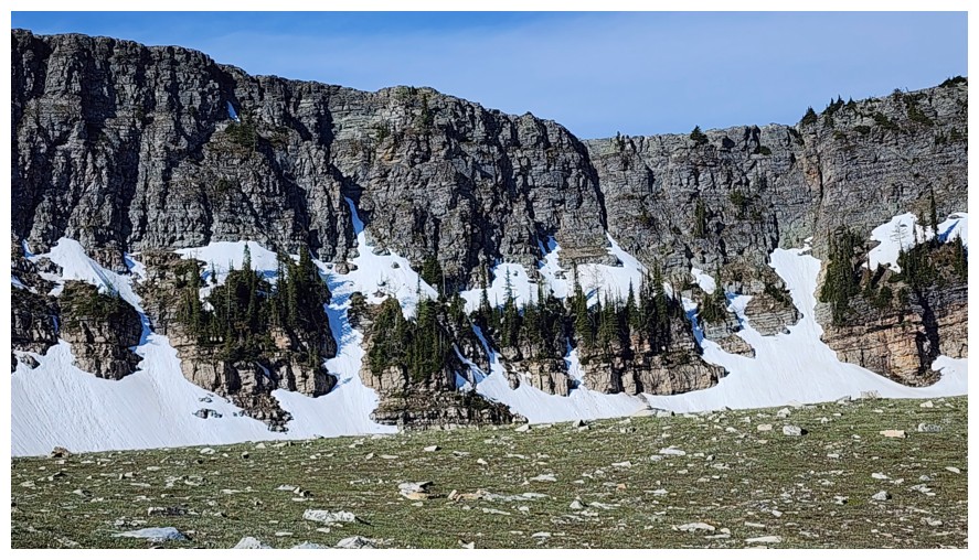
What Dave is checking out (photo by Dave)
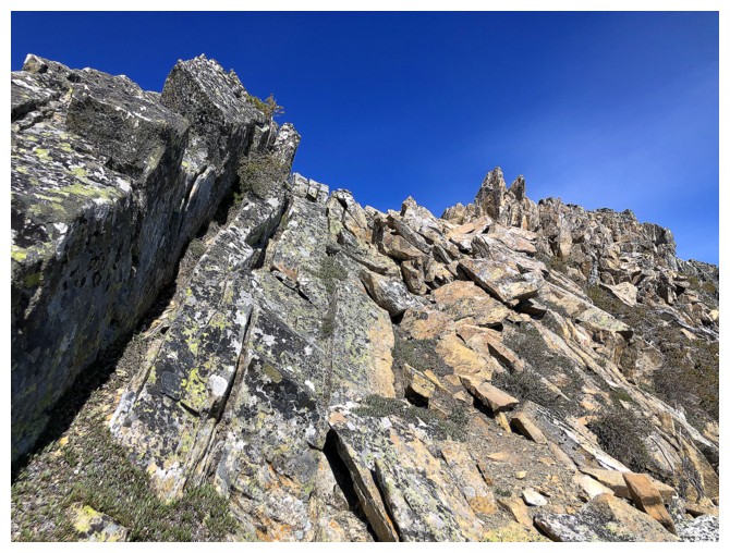
Heading for the ridge above (photo by Dave)
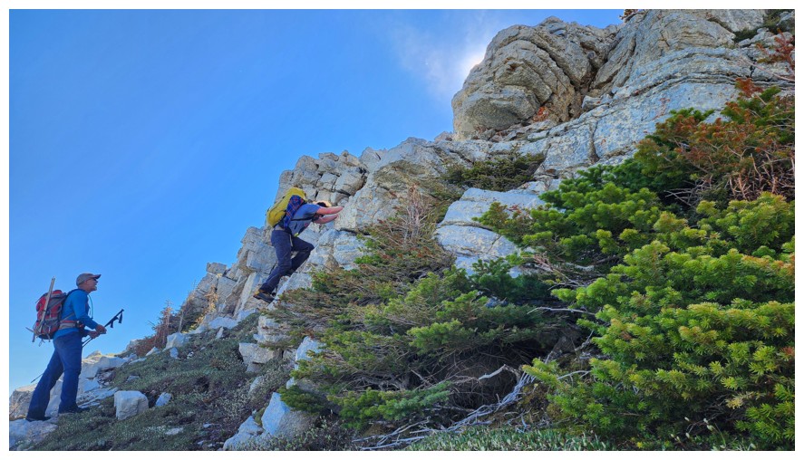
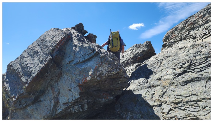
Brad tackles a fun rock band (photo by Dave)
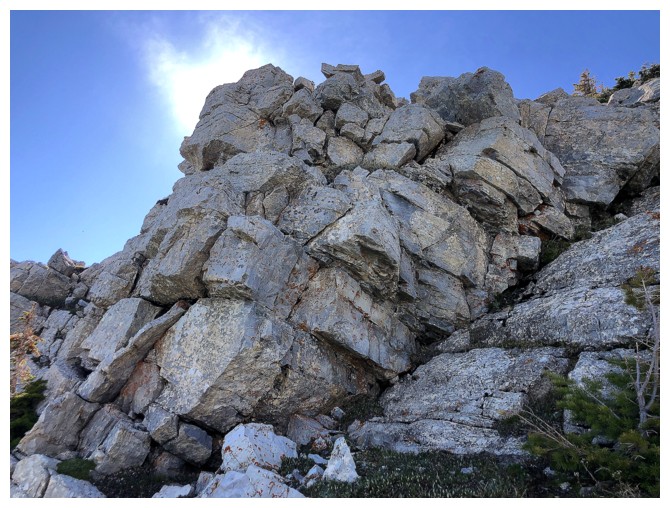
Solid and beautiful rock
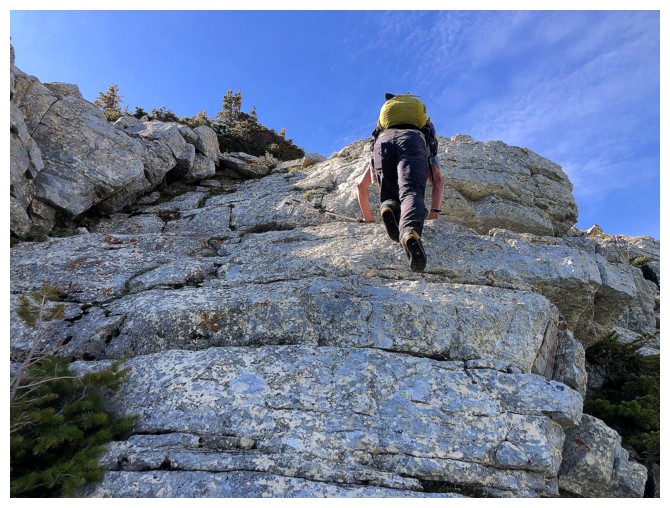
Up he goes
Looking down to Lion's Head (photo by Dave)
The view opens up towards the Lower Waterton Lake
On the ridge
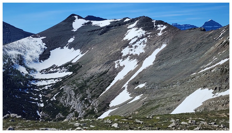
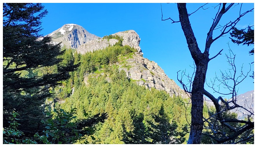
Zoomed in shot of Arras Peak (left). This is where Mark and I side-sloped to make a more direct ascent of Arras. In the end the route was self-defeating (photo by Dave).
Instead we are taking the sensible route via the ridge (photo by Dave)
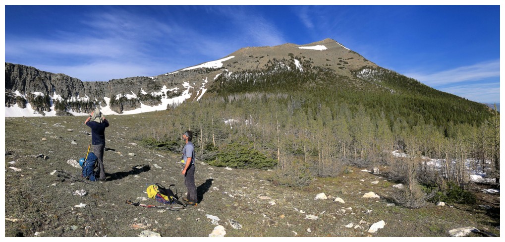
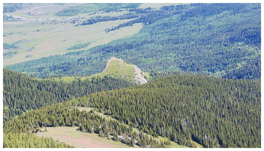
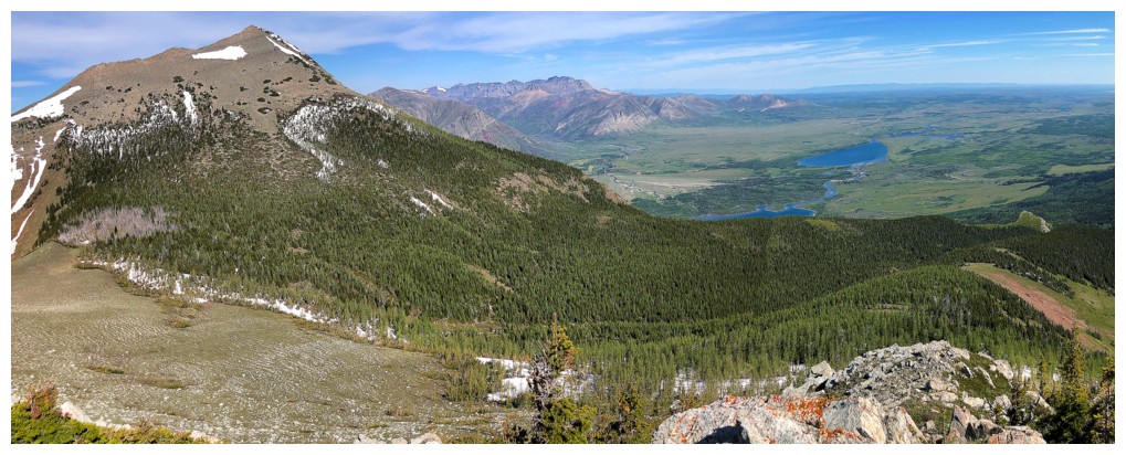
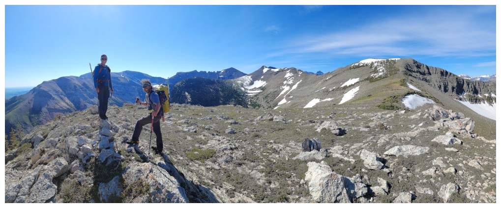
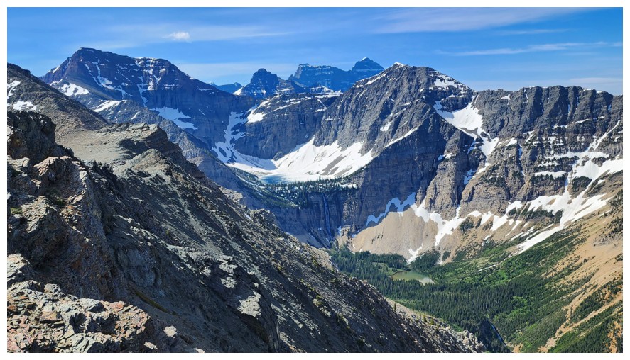
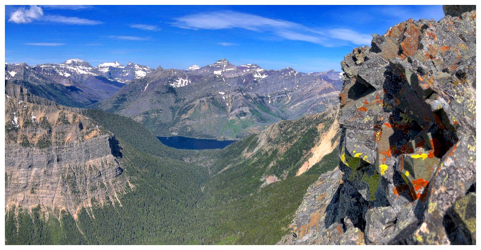
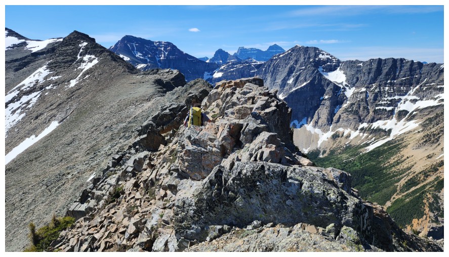
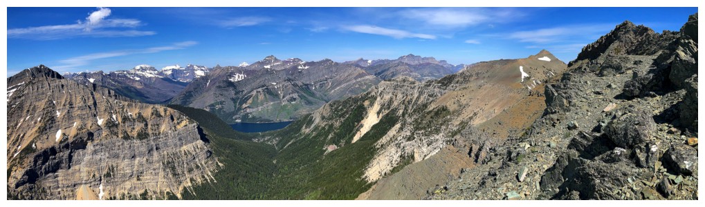
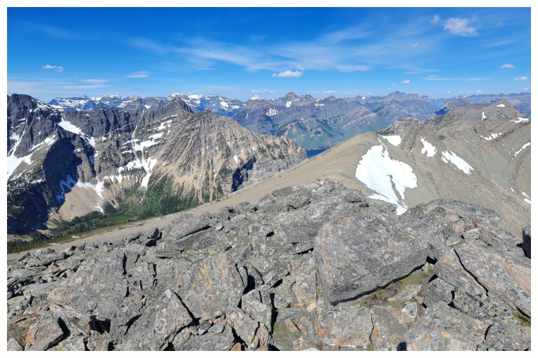
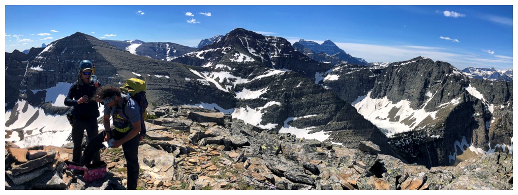
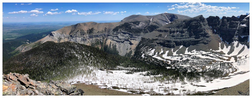
Pano of the area. Petit Vimy is the dark peak in the foreground.
Mount Alderson appears in the distant centre
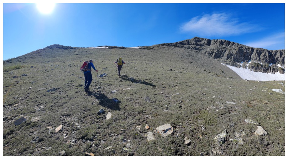
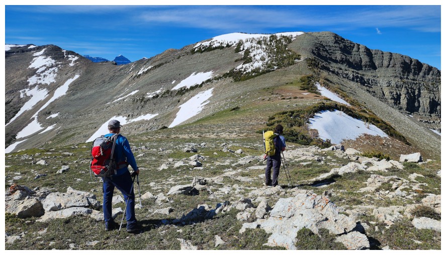
Easy hike to the first highpoint along the connecting ridge between Vimy and Arras (photo by Dave)
Dave to the left and bulky Sofa Mountain to the right
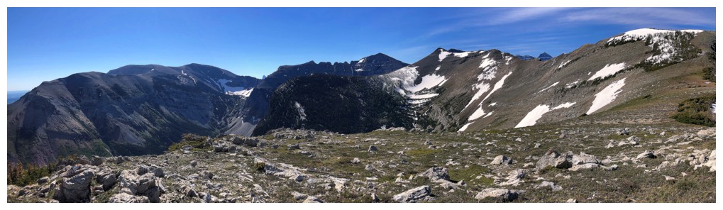
View from the first highpoint
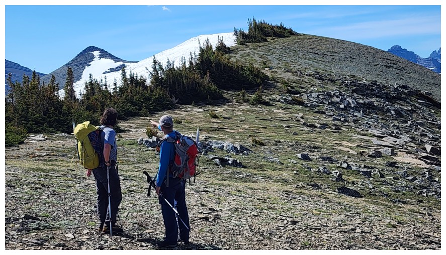
Pointing out Arras at the left (photo by Dave)
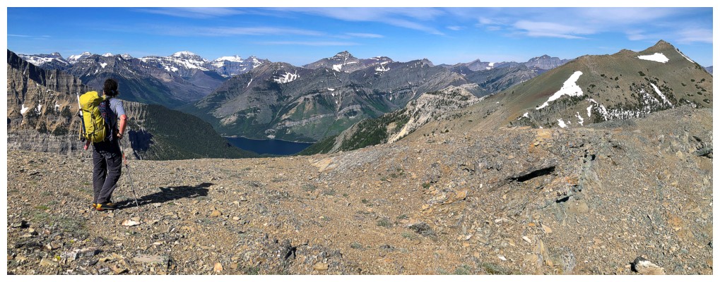
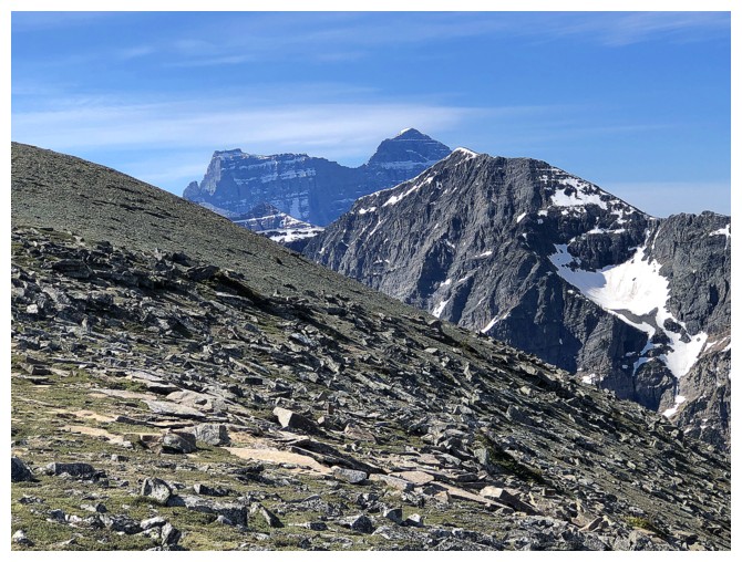
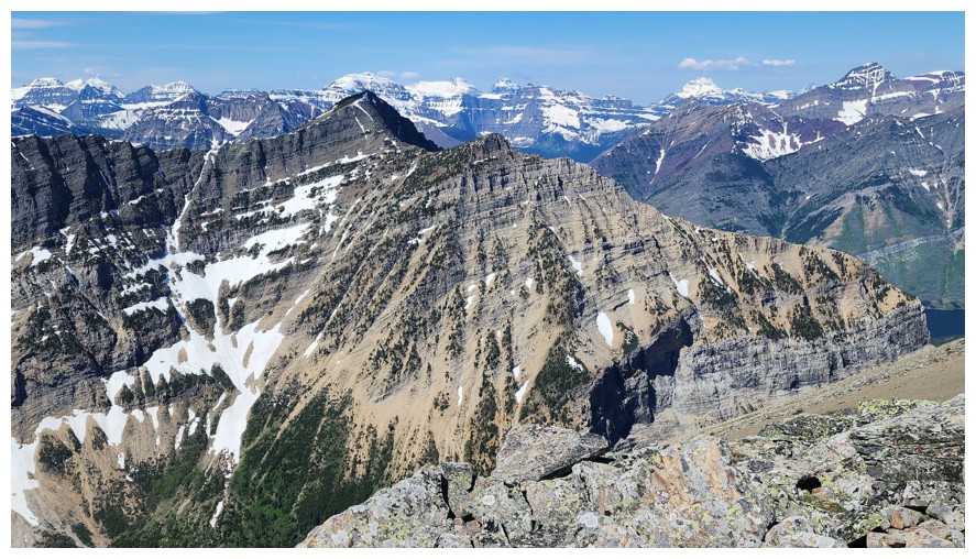
The view to the west includes Chapman, Kintla, Kinnerly (all in Glacier National Park), as well as Richards, Alderson, Carthew, and a slither of the Upper Waterton Lake (all in Waterton) (photo by Dave)
Mount Cleveland
Mount Boswell sits proudly on the other side of the Crypt Lake Lake. I'm aching to repeat Boswell on a clear day (photo by Dave).
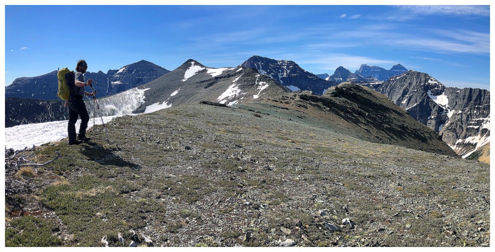
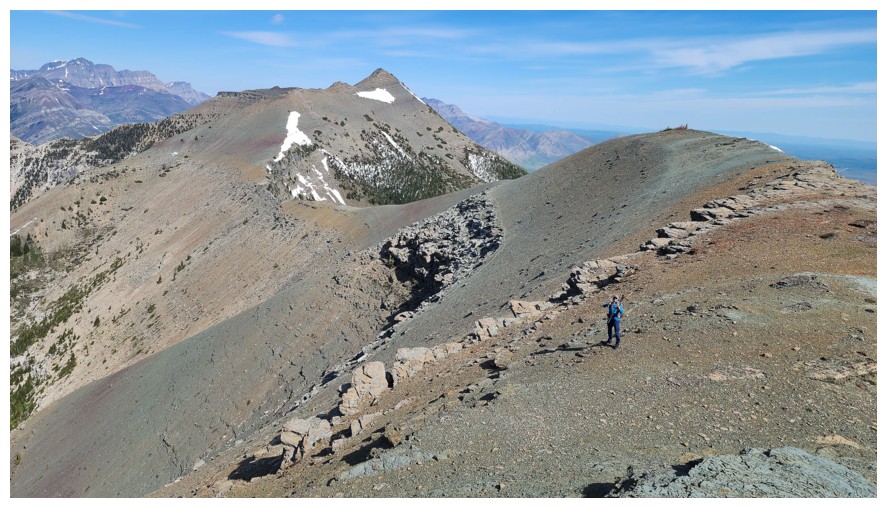
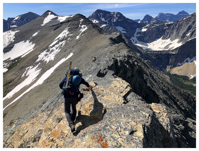
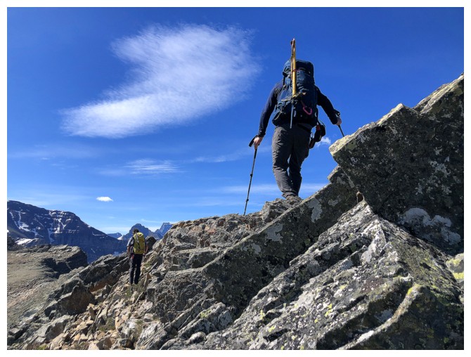
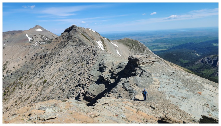
The ridgewalk begins
Same as above (photo by Dave)
Sofa and Petit Vimy (photo by Dave)
There are many small rock steps along the way (photo by Dave)
Dave brings up the rear to get some photos of me and Brad
Another step (photo by Dave)
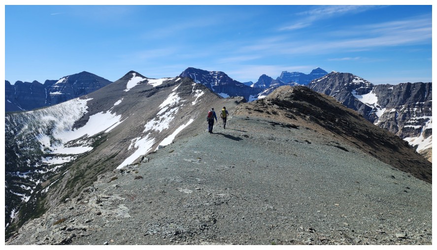
My turn to take up the rear (probably because I'm just slower than the other guys, not necessarily for photos ops!)
There will be many photos of that terrific view to the west
And many to the ridge ahead of us and behind us (photo by Dave)
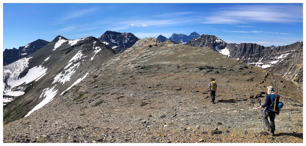
Ahead
To the west again
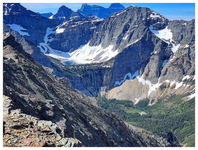
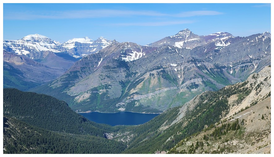
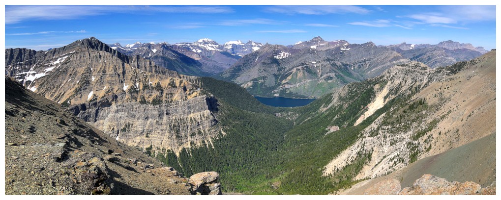
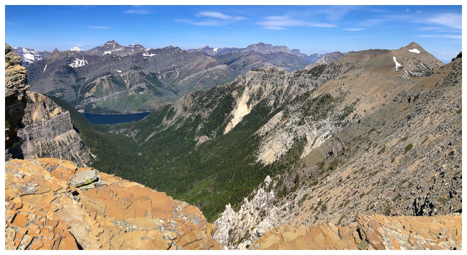
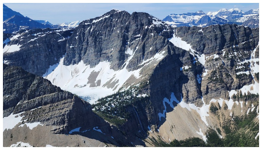
Crypt Lake in the middle of the photo (photo by Dave)
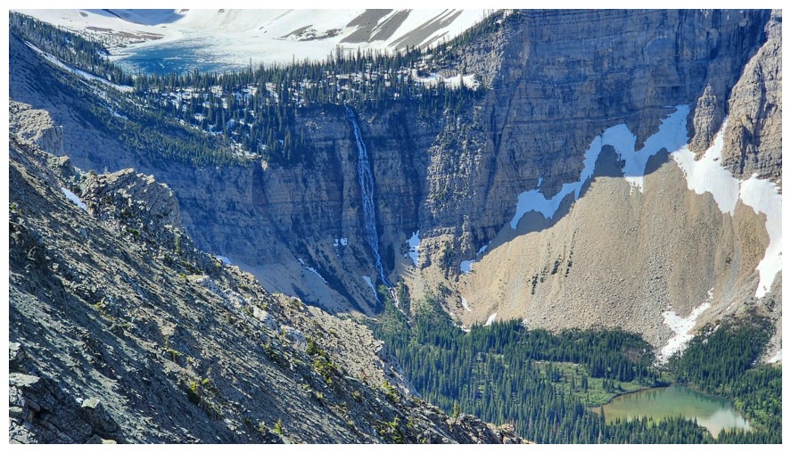
Close-up of the lake and the huge waterfall below (photo by Dave)
A
quintessential mountain photo by Dave: striking peaks, a little snow,
the green of forest, the greys and beiges of the rock, a lake, and a
waterfall
The tarn below Mount Boswell (photo by Dave)
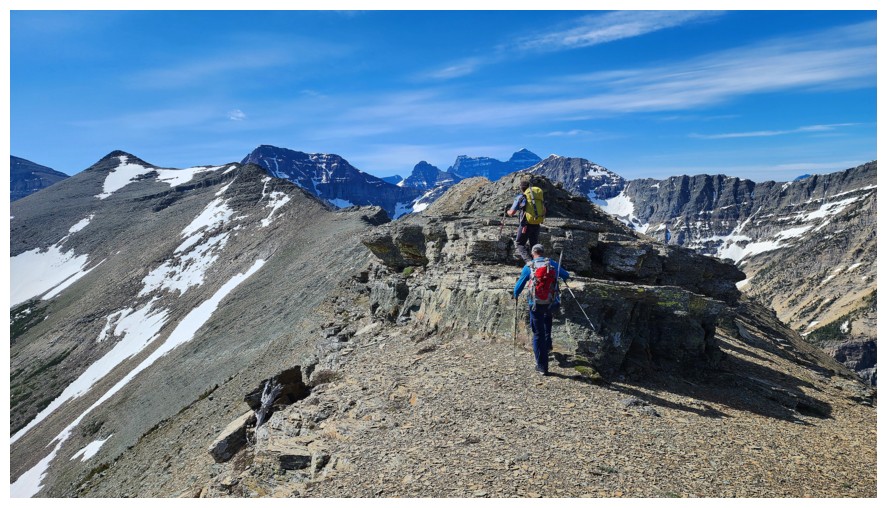
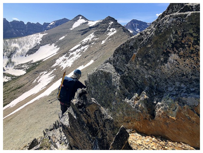
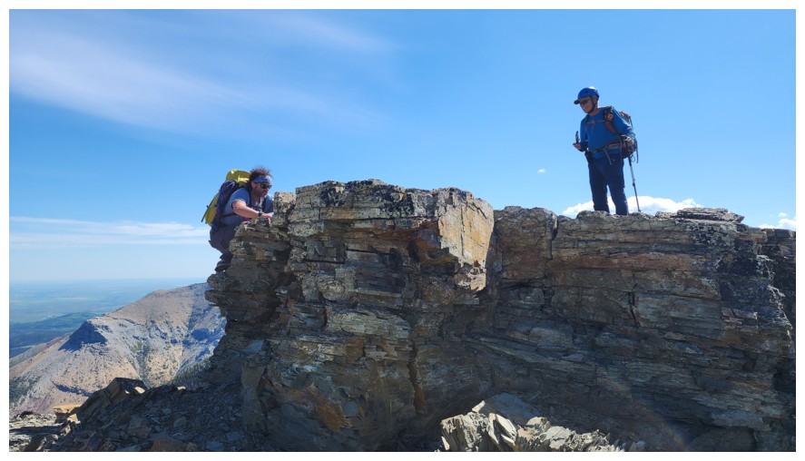
Brad approaches a slightly tricky step on the ridge (photo by Dave)
Easy does it here. It's more exposed than it appears.
My turn (photo by Dave)
Brad has worked his way down to the left (photo by Dave)
Dave and I at the tricky section (photo by Brad)
Finally, some lichen!
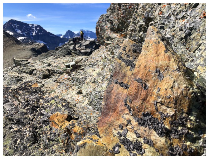
Small and blurry Brad and Dave, but I got the cool rock in focus!
Looking back at the tricky section (photo by Dave)
Back onto easier but still interesting terrain (photo by Dave)
Another cool section of the ridge (photo by Dave)
I'm definitely going to have a moment here with the lichen-covered rock!
Dave skirts a rock band before heading back to the ridge
It will be a long moment
Ooh!
Back on the ridge (photo by Dave)
Cool rock find by Dave (photo by Dave)
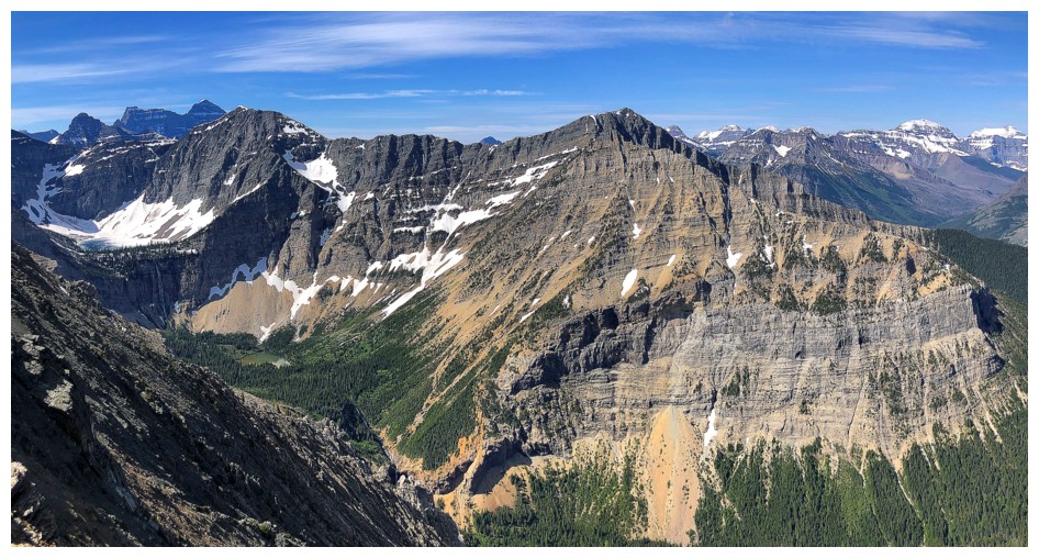
West and north
The scene is even more quintessential now with mountain extraordinaire Brad in it (photo by Dave)
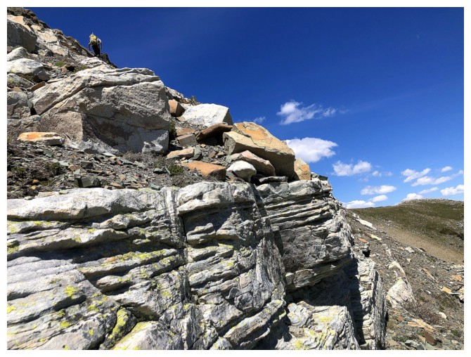
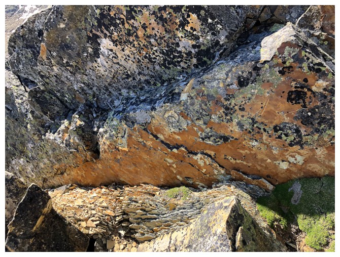
Amazing layers of rock here
Bypassing this section on the left is possible, but what fun would that be? (photo by Dave)
Brad and Dave take the interesting route
Brad guides us through the maze-like terrain (photo by Dave)
Too bad E. Bikeman couldn't transfer his "e-power" into his legs! (photo by Dave)
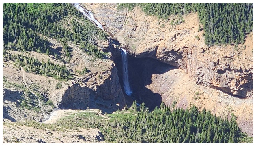
Close-up of Burnt Rock Falls (photo by Dave)
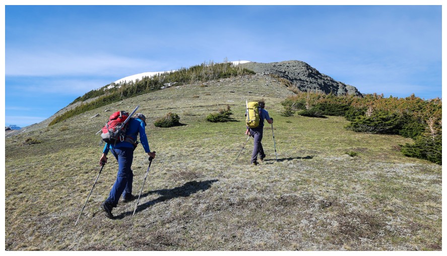
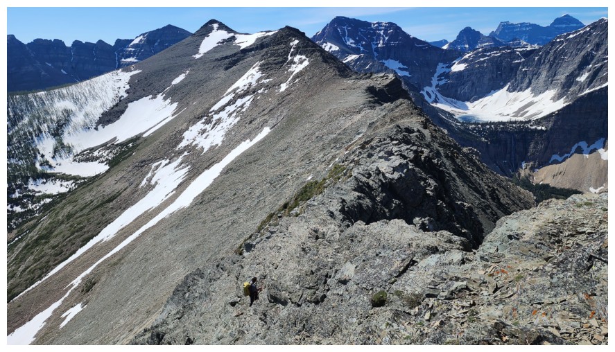
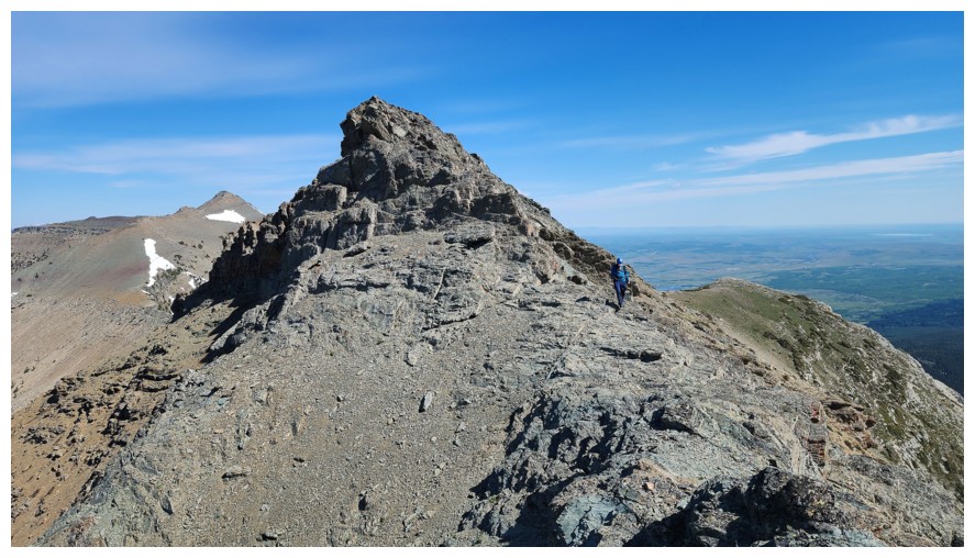
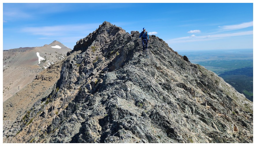
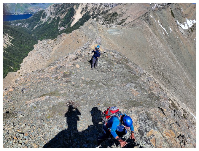
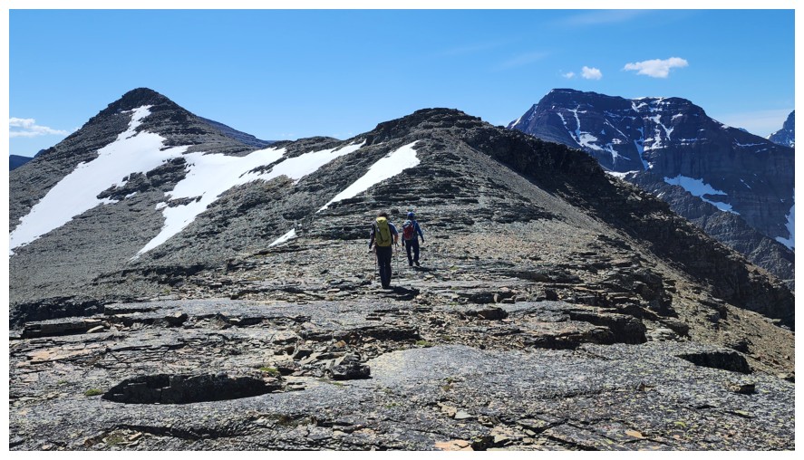
The next highpoint is upon us (photo by Dave)
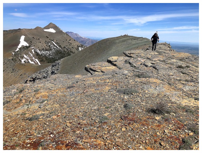
Good footing throughout this ridgewalk/scramble(photo by Dave)
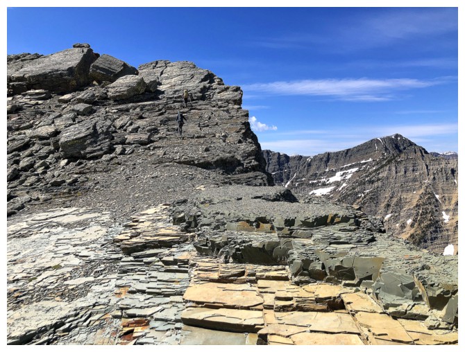
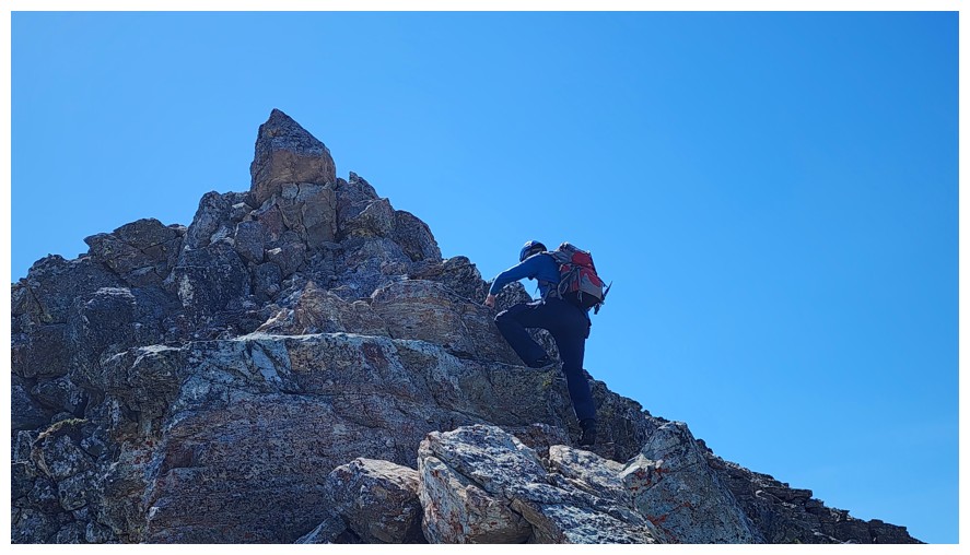
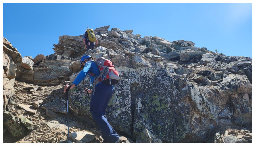
Almost at the top (photo by Dave)
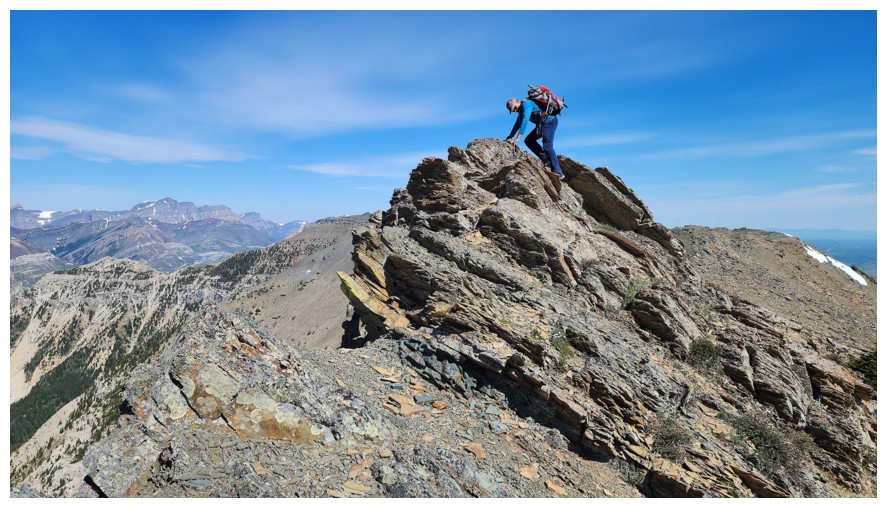
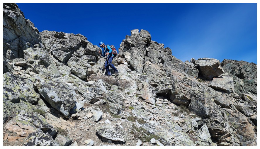
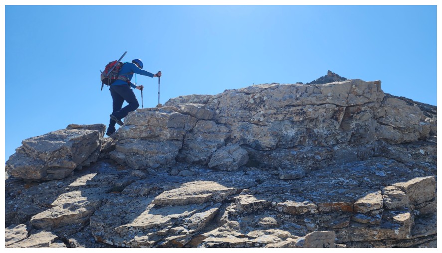
Some easy and fun scrambling (photo by Dave)
Brad ascends a step...
...Brad photographs me ascending the step...(photo by Brad)
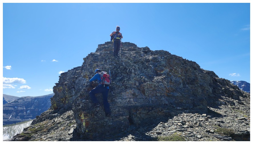
...Dave photographs me while Brad does the same (photo by Dave)
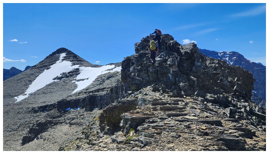
The interesting terrain continues (photo by Dave)
More unnecessary but enjoyable scrambling (photo by Dave)
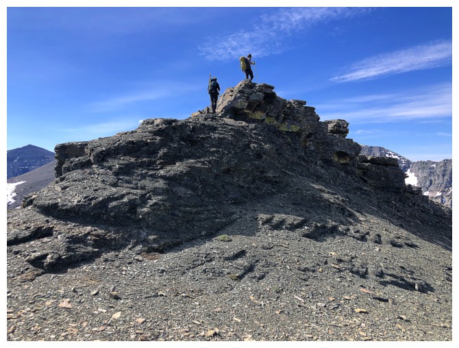
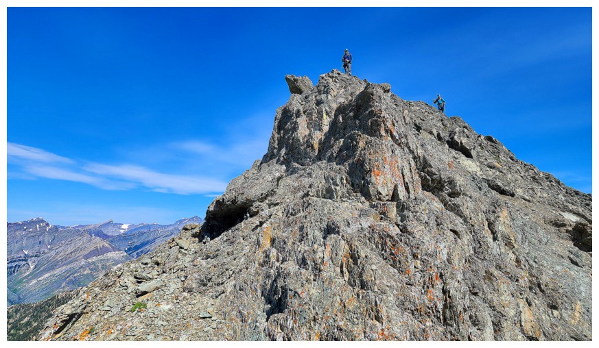
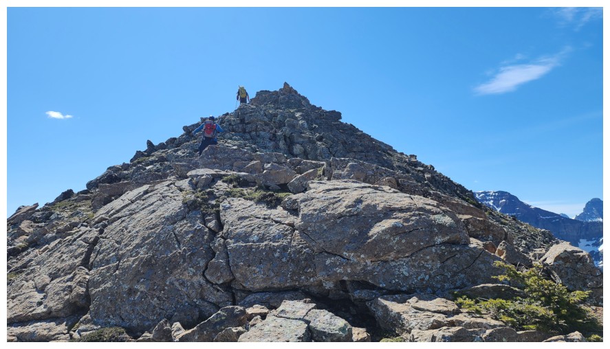
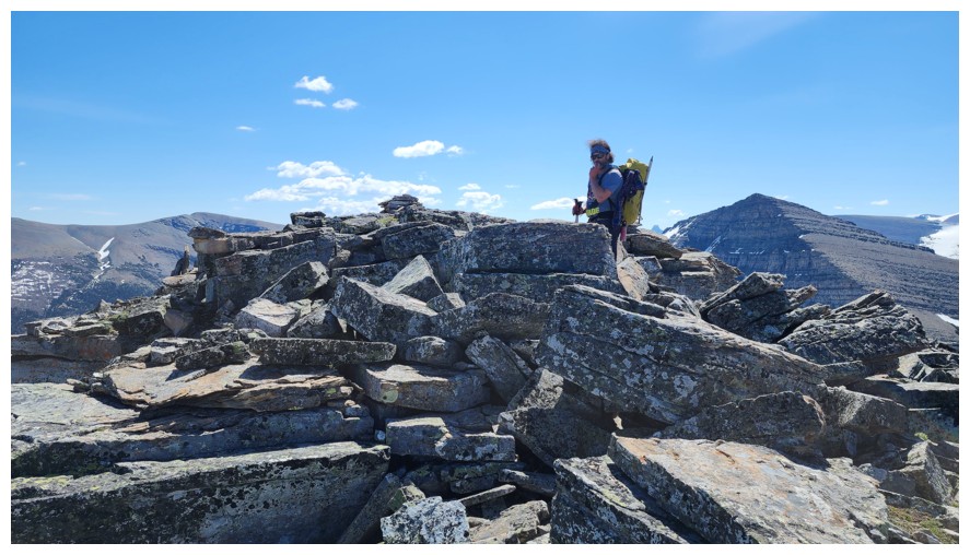
The summit (far left) is finally within striking distance (photo by Dave)
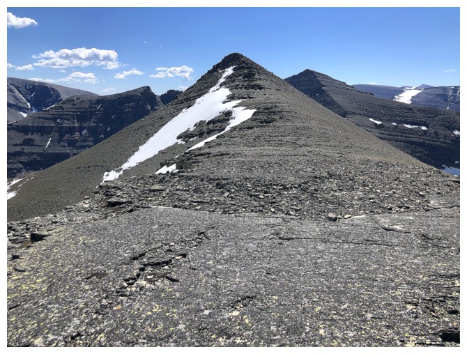
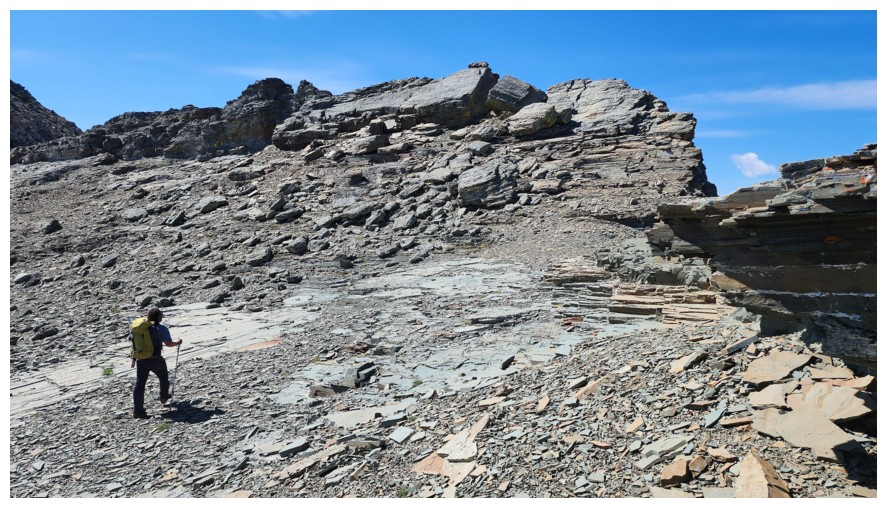
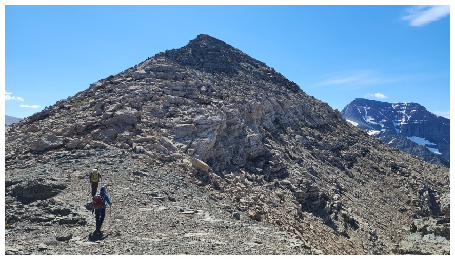
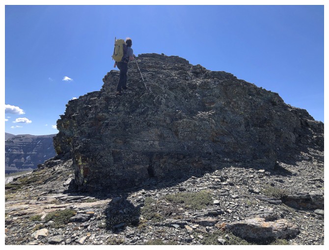
The last of the "ups" for Arras
At the base and excited about finishing the ascent (photo by Dave)
Dave too
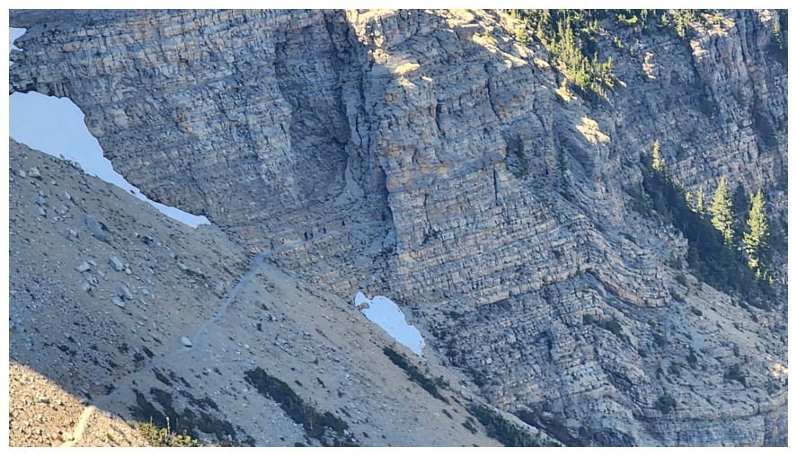
Hikers nearing the tunnel on the world-famous Crypt Lake hike (photo by Dave)
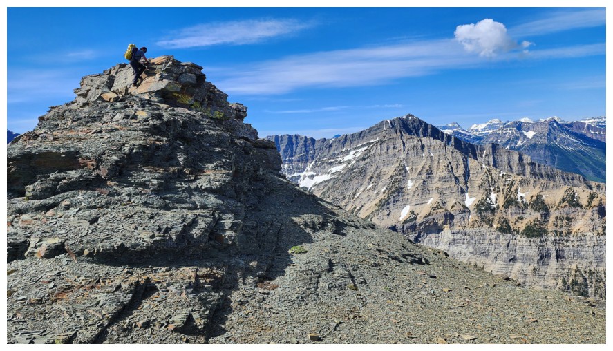
Last few metres (photo by Dave)
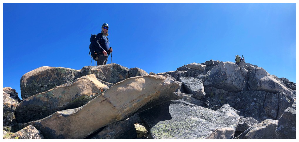
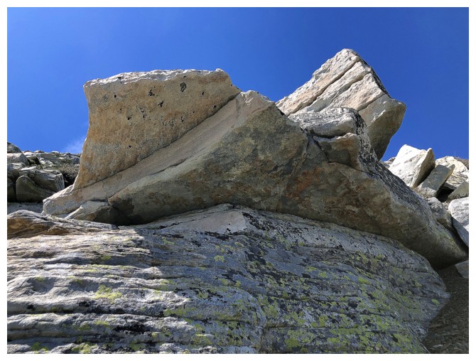
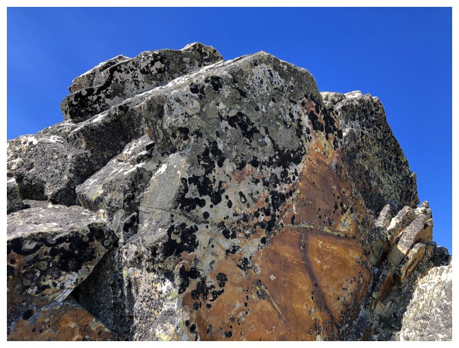
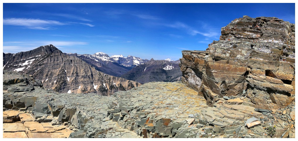
Beautiful blocky rock up top
Brad arrives at the summit first (photo by Dave)
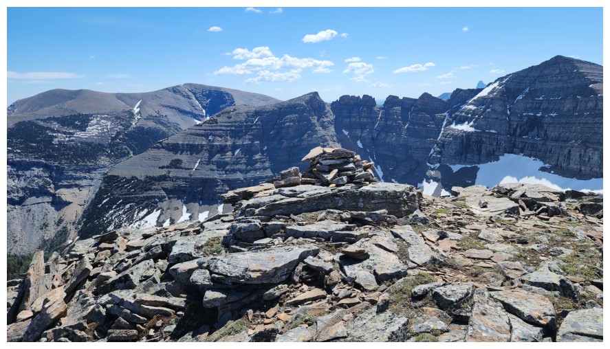
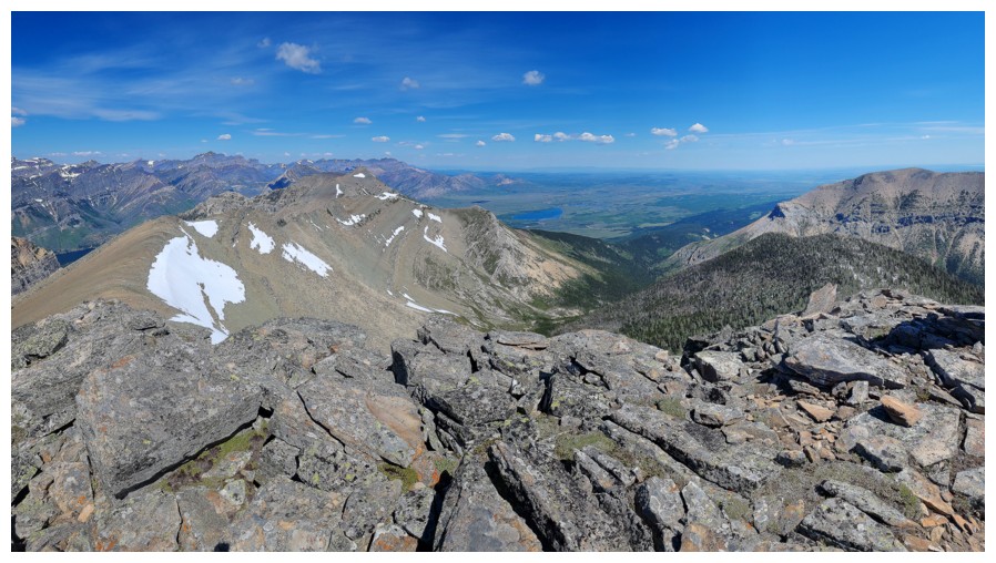
The cairn and view to the southeast (photo by Dave)
Southwest (photo by Dave)
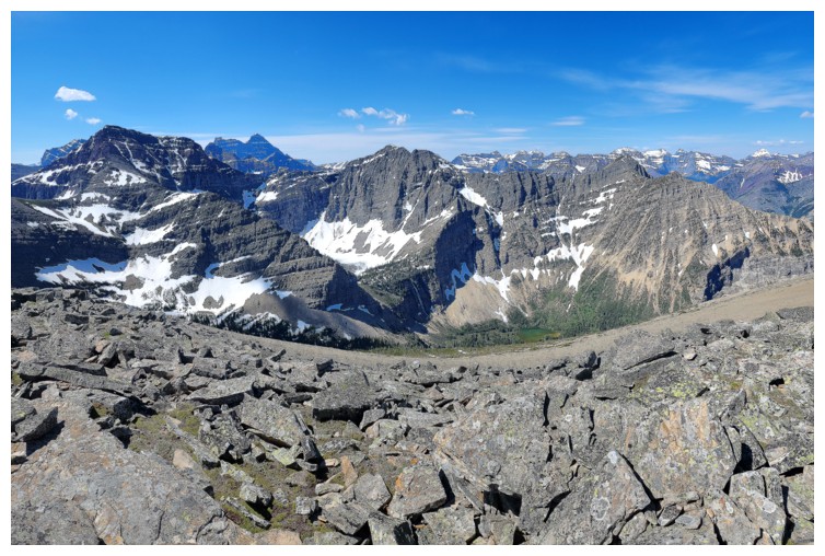
Northwest (photo by Dave)
North (photo by Dave)
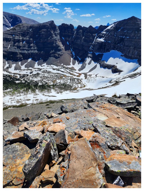
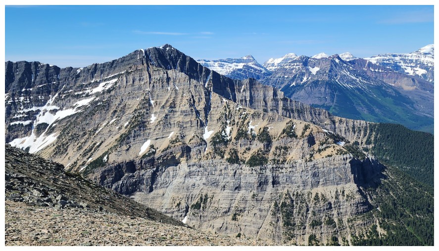
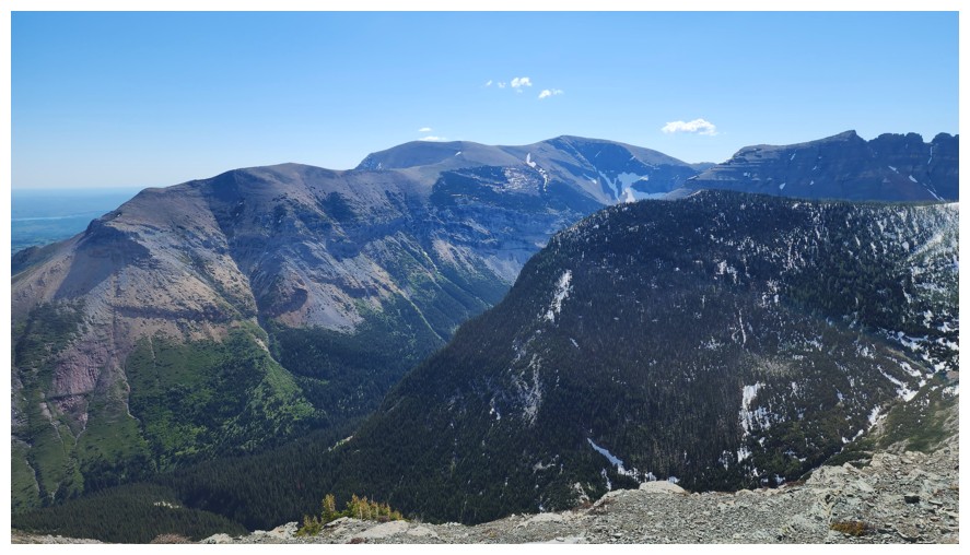
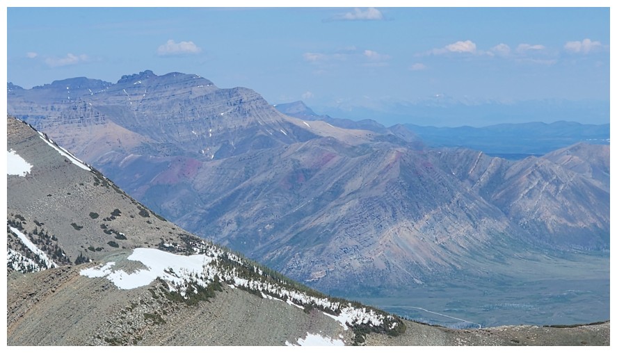
The stegosaurus-like ridge between Sofa Mountain and the highest point of Vimy Ridge. I tried but failed that route twice (photo by Dave).
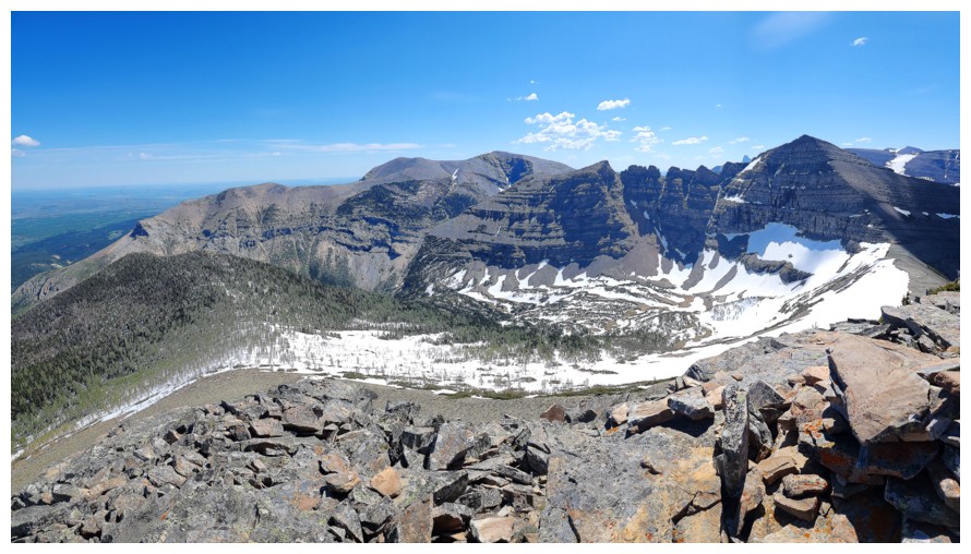
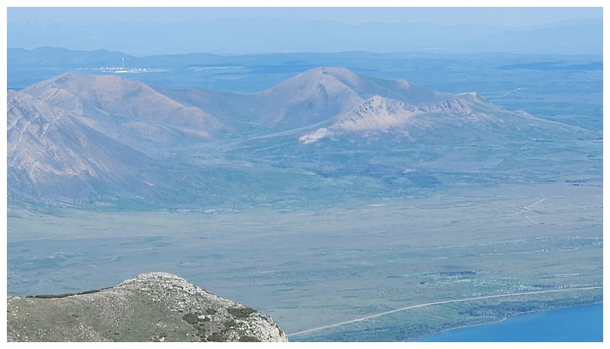
View to the east (photo by Dave)
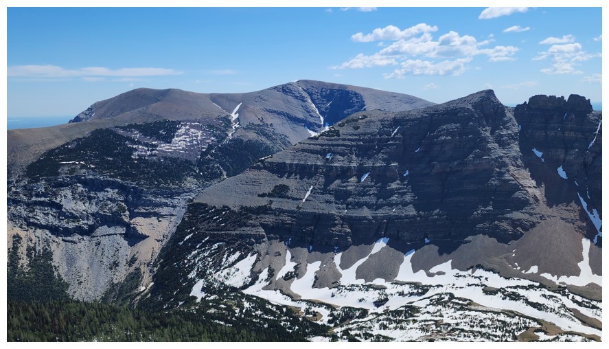
Close-up
of Sofa and the some of the traverse to Vimy. I made it to the slopey
highpoint near the right on my second attempt (photo by Dave).
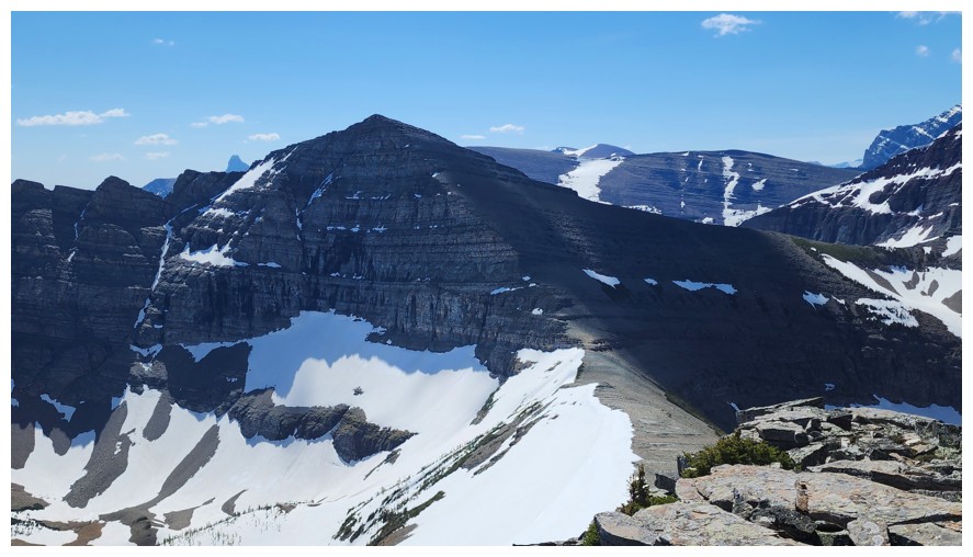
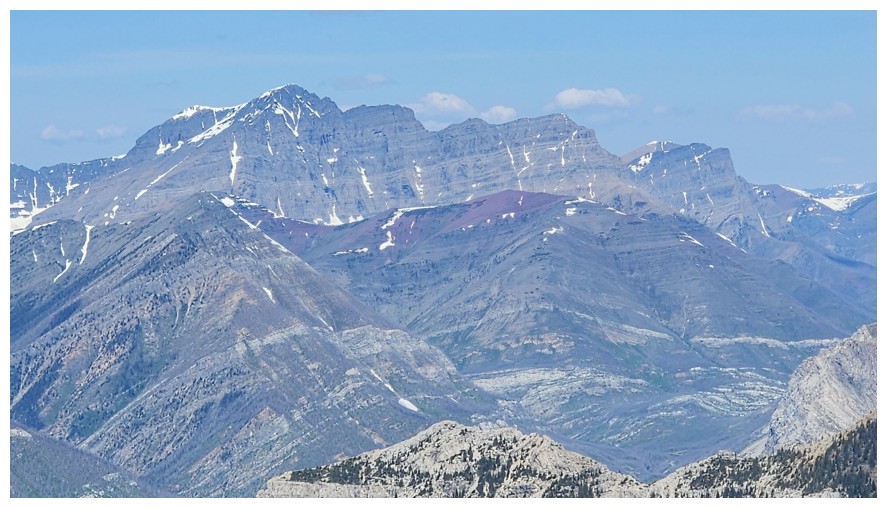
To the southeast sits the highest summit of the Vimy Ridge massif, unless you include Crypt Peak (photo by Dave)
Crypt Peak in the centre - still my favourite scramble in all of the Rockies (photo by Dave)
Mount Cleveland (photo by Dave)
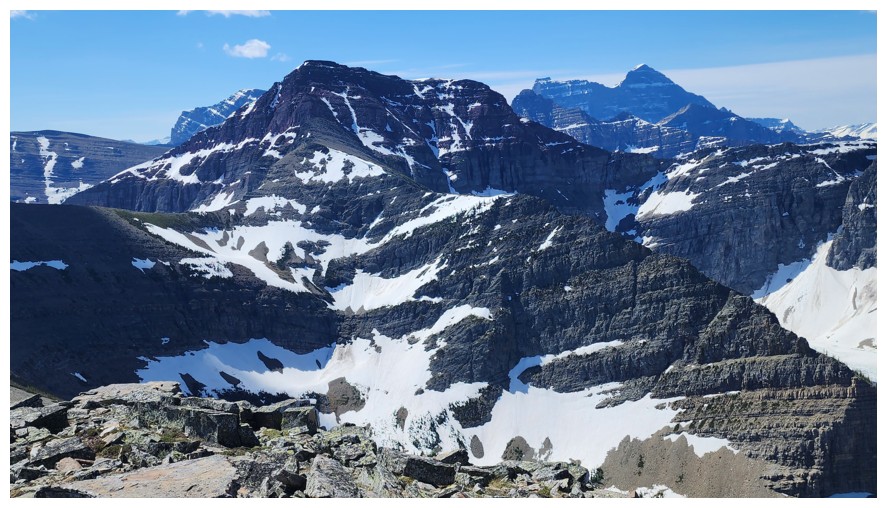
A
significant summit between Boswell and Crypt. It has been unofficially
named Wilson Peak (Ridge) by some. Surprisingly, it's the second
highest point on the Crypt Peak circuit route. Also unofficial Crypt Peak is the highest and official Vimy Peak is
the lowest (photo by Dave).
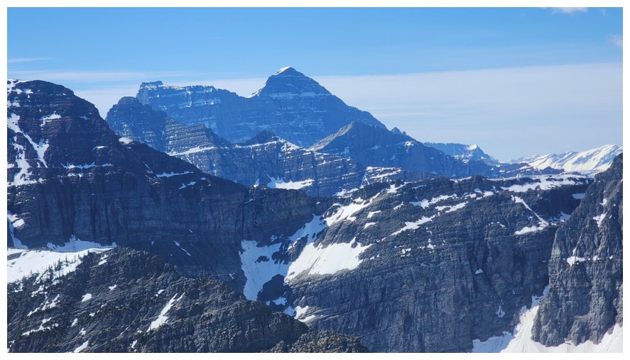
Mount Boswell (photo by Dave)
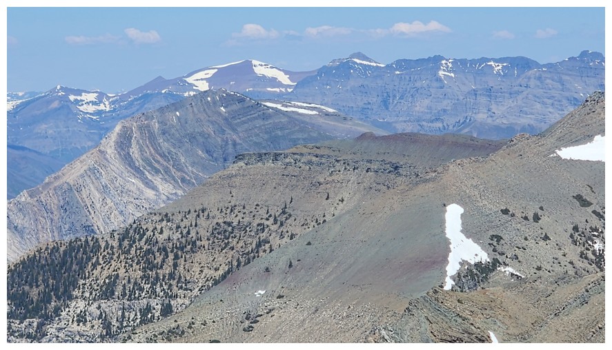
Long Knife Peak (snowy one at the far left), and many of the peaks around Mount Alderson (photo by Dave)
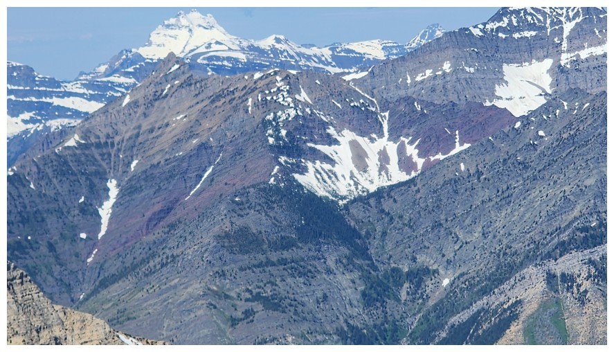
Closer look at Long Knife, with Mount Richards in front of Long Knife (photo by Dave)
Mount Blakiston, with Ruby Ridge in front (photo by Dave)
A
bunch of familiar peaks line the horizon to the northwest: Avion
Ridge, Newman Peak, Newman Senior, Glendowan, Cloudowan, Cloudowan NE,
and Cloudy Ridge (photo by Dave)
Further east sit Galwey, Dungarvan, Rogan, and Bellevue (photo by Dave)
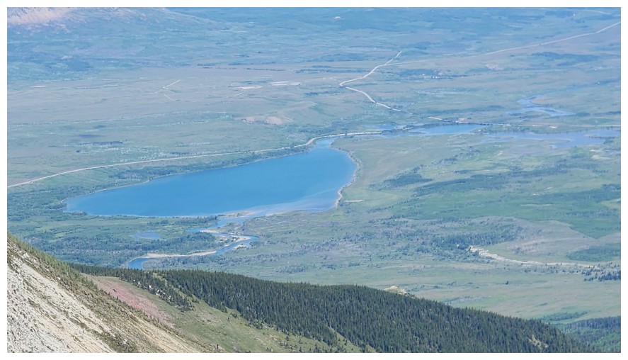
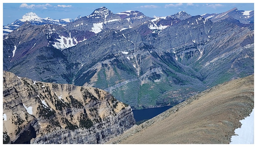
The Lower Waterton Lake (photo by Dave)
Lakeview Ridge even further east (photo by Dave)
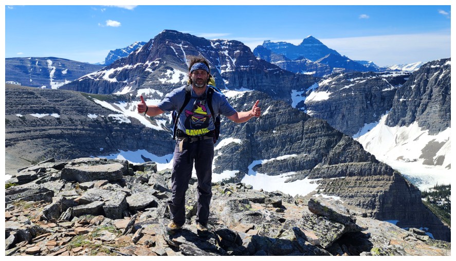
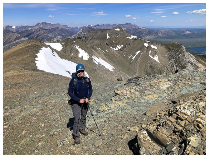
Summit poses: C.U. Faroutinfront (photo by Dave)
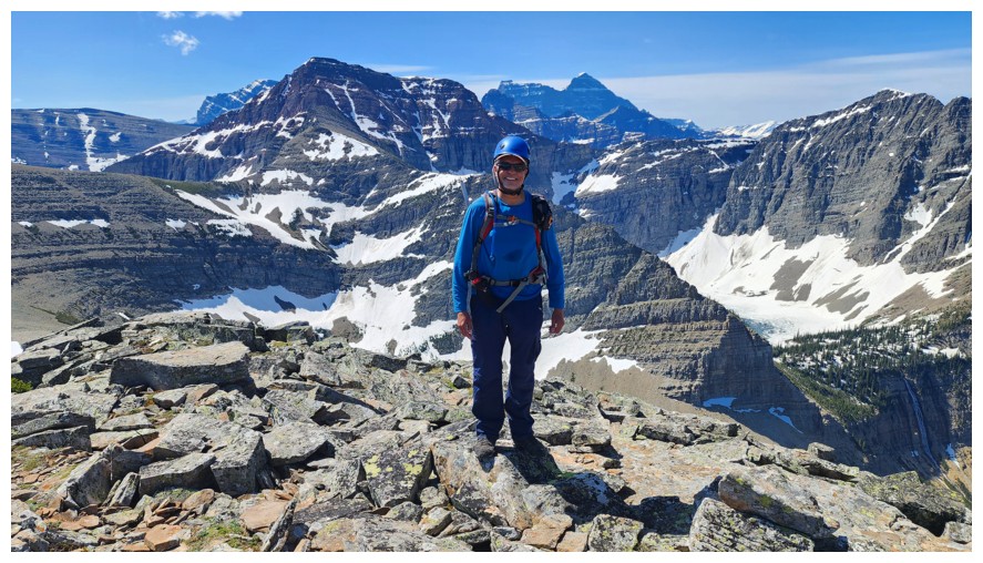
E. Bikeless (photo by Brad)
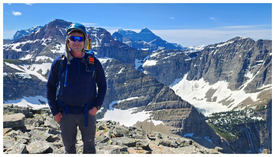
E. Bikeman (photo by Dave)
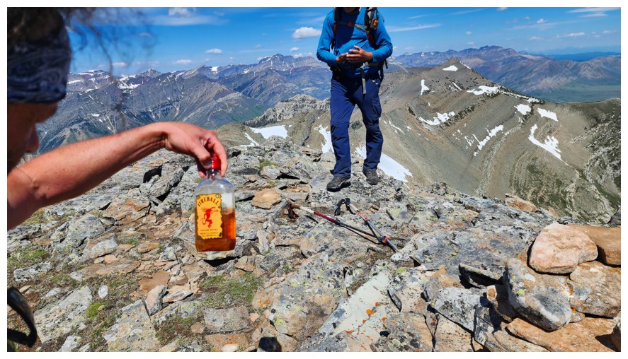
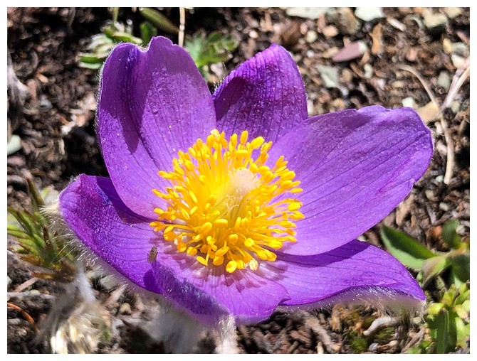
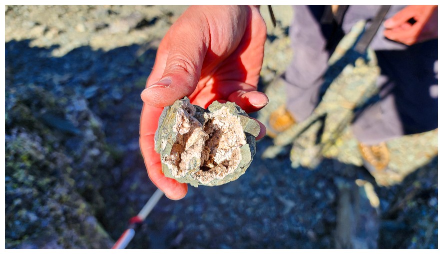
More importantly C.U. has found the good stuff (photo by Dave)
The Boys check out the summit register
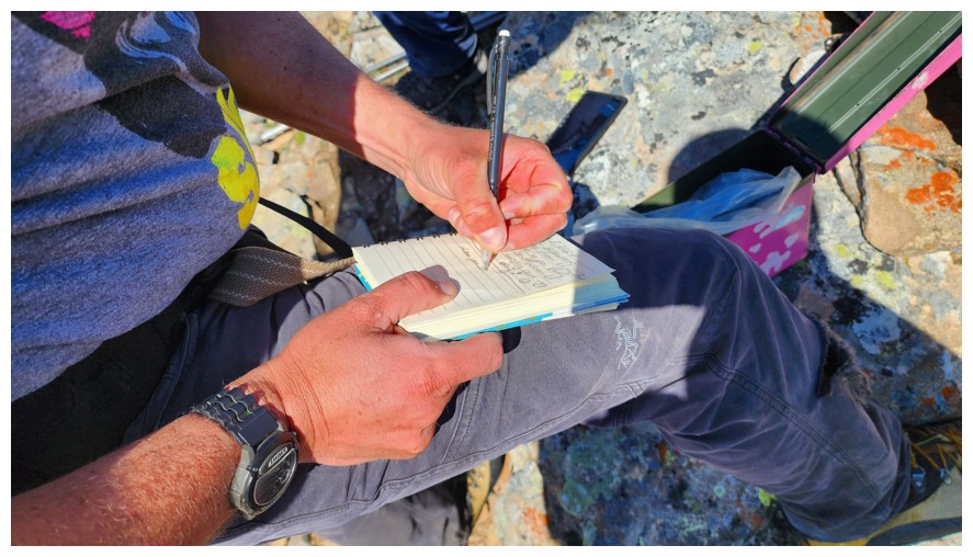
Brad signs it (photo by Dave)
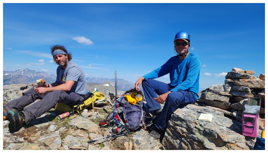
The much-needed food break (photo by Dave)
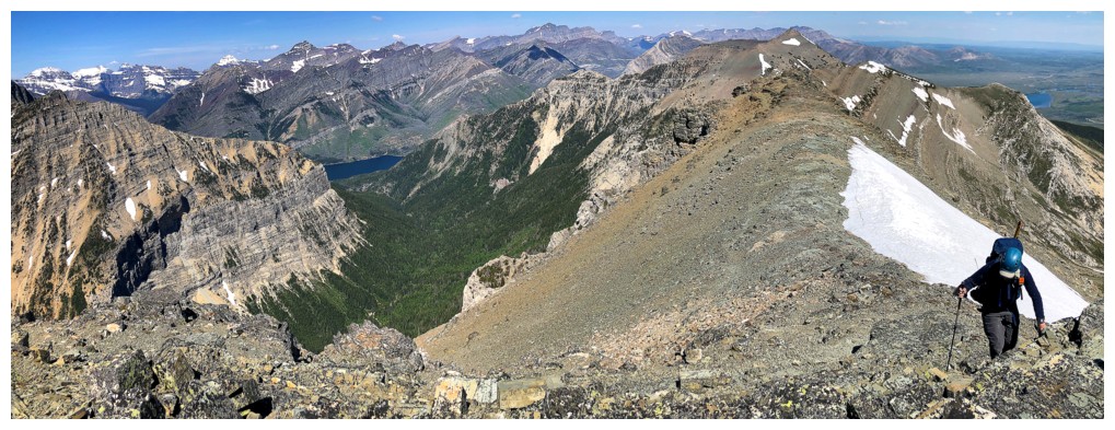
Another view to the east and our next destination at the left
Click HERE to continue to Petit Vimy
Click HERE to go directly to Dave's report for Petit Vimy
LOG