Bakery Peak III
March 16, 2024
Mountain height: 2410 m
Elevation gain:
approximately 900 m
Ascent time: 5:00
Descent time: 2:30
Solo scramble
with some mountaineering.
Another day in
the mountains where the primary objective was to stay away from avalanche
terrain. As such I headed south to The Castle. The outliers of mountains on the
eastern edge are usually the first to become snow-free and have the lowest
avalanche risk.
After much self-debate
and driving to several trailheads, 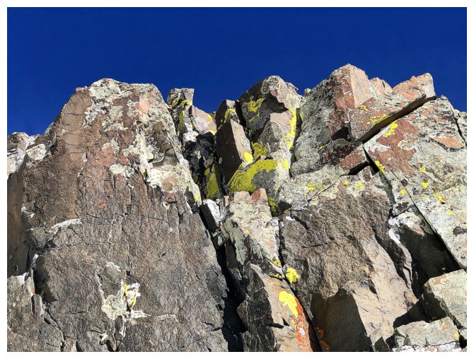 I settled on an attempt of Bakery Peak,
using the descent route Dave and I used on our first attempt. Under the
rationale that the remaining snow might make the ascent easier with crampons
and an ice axe, I set off on foot, figuratively kicking myself for not bringing
a bike.
I settled on an attempt of Bakery Peak,
using the descent route Dave and I used on our first attempt. Under the
rationale that the remaining snow might make the ascent easier with crampons
and an ice axe, I set off on foot, figuratively kicking myself for not bringing
a bike.
Getting to the
ascent slopes turned into a less than trivial affair; a combination of
wallowing through deep snow in the bush or trying to follow the snow-filled creek.
Eventually, I conceded that snowshoes were needed and once on my feet, progress
improved dramatically. 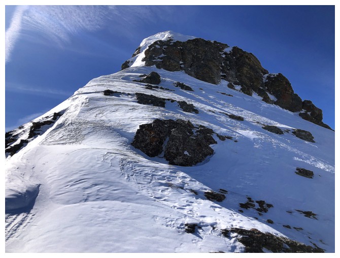 The ‘shoes were also great for the lower section of the
snow gully I chose to ascend. When the grade increased, I replaced the
snowshoes with crampons and continued up.
The ‘shoes were also great for the lower section of the
snow gully I chose to ascend. When the grade increased, I replaced the
snowshoes with crampons and continued up.
I thought the
ridge would be reached in relatively short order and I couldn’t have been more
wrong! This side of the mountain makes for a great descent route, but I would
learn has little to be desired as an ascent route (excluding the beautiful rock
throughout). In addition to the slope being extremely foreshortened, the snow
was too inconsistent to offer easy travel, and more importantly, the unusually
hot Sun (for mid-March) was energy-zapping.
I gained the
ridge eventually, but not without considerable effort and a
considerable amount
of sweating! Physically depleted, I decided continuing on towards
Bakery was
not in the cards for the day. Also, the snow-covered final section
looked far
from a pushover. However, as alluded to, the weather was
spectacular for mid-March – temperatures in the low teens, barely a
wisp of
wind, and beautifully clear skies - "resistance was futile"! I took a short
break, deciding that there was no harm in starting up the ridge and
then
turning around if necessary.
Turns out the
“necessary” was unnecessary. Slowly plodding up the ridge, I soon regained
some energy and was able to find an easy route around the left side near the
top, instead of going straight up it. A nostalgic, scenic, and super enjoyable
trek to Bakery’s summit followed. Saying “Hi” to Sven, The Cairn was a poor
substitute for having Dave’s engaging company, but better than a kick in the
teeth!
Regardless of
how far I made it up Bakery, the plan was always to return via The Croissant
and possibly The Muffin. However, once back down to the point where I gained
the ridge, my previous level of exhaustion was rearing its uninvited head
again. I settled for returning, more or less the way I came up.
A wicked day of
stunning scenery and views, but when I repeat Bakery (a trip definitely worthy
of multiple ascents), I’ll stick to the magnificent route via The Muffin and/or
The Croissant.
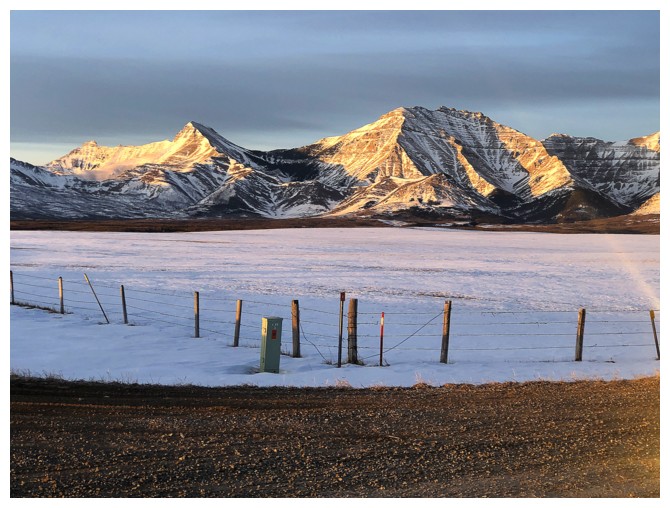
Morning Sun on four of my favourites...
...Galwey, North Galwey, and Rogan...
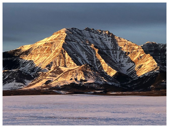
...and Dungarvan
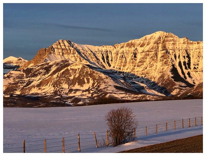
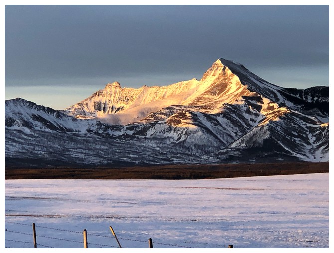
Mount Roche (right) fits into "the best of" category too. Mount Yarrow at the left and Yarrow Ridge in front and at the left.
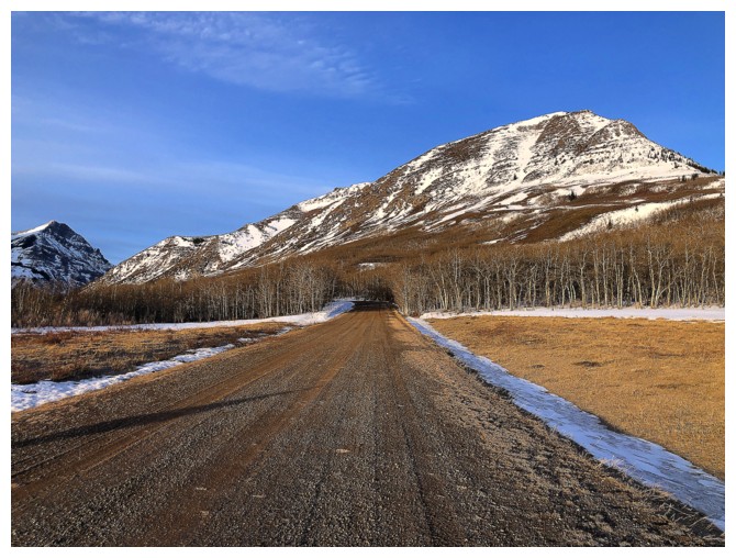
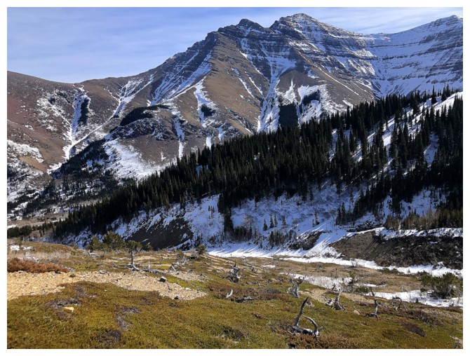
The Muffin is the first peak you see from the trailhead
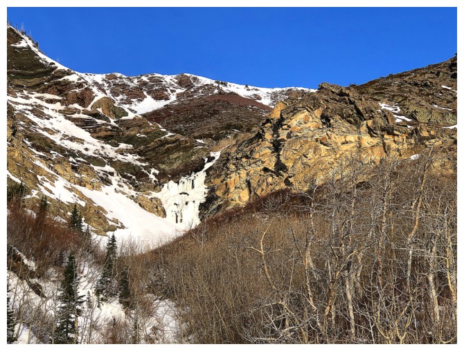
Passing by the frozen waterfall that boasts some of the coolest scenery you may encounter in Southern Alberta
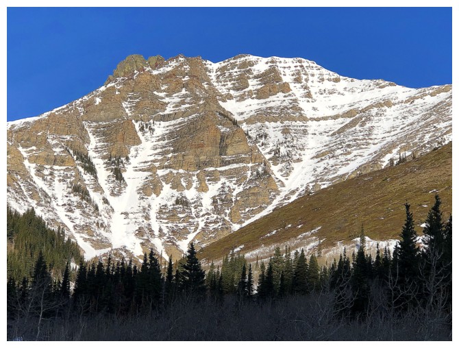
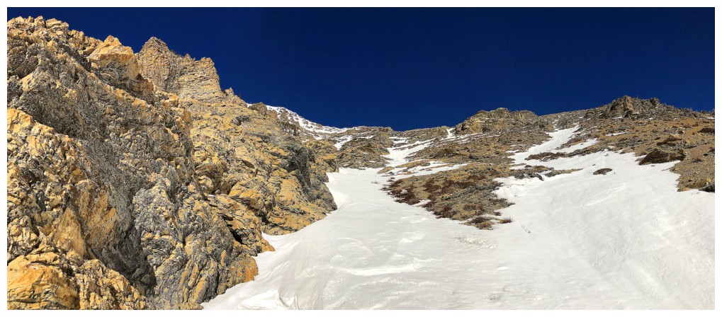
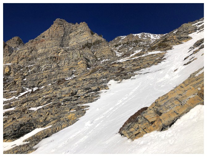
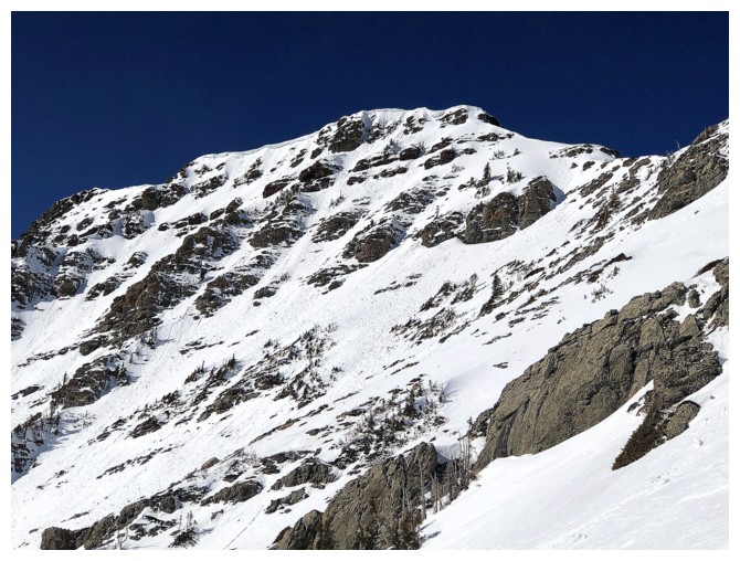
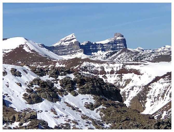
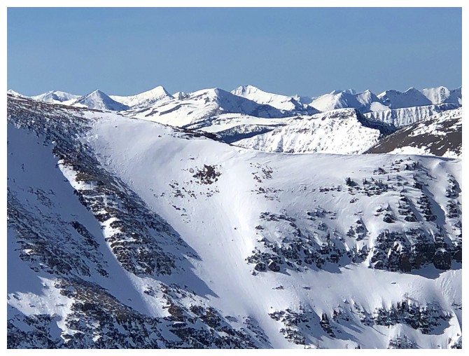
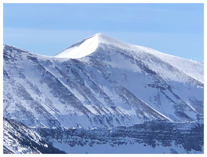
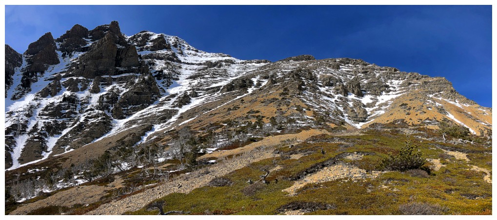
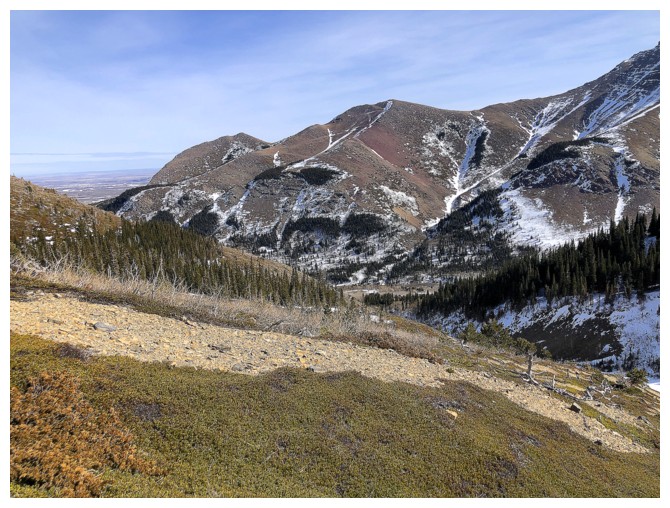
The objective and others appear - Icing On The Loaf Peak (far left), and Bakery Peak (immediately right of Icing)
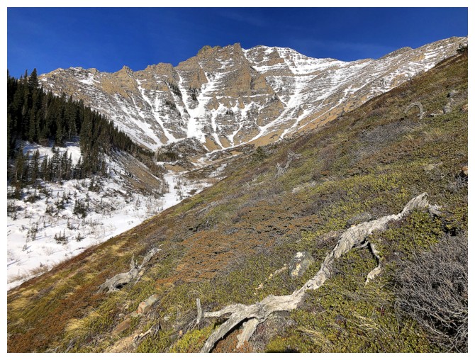
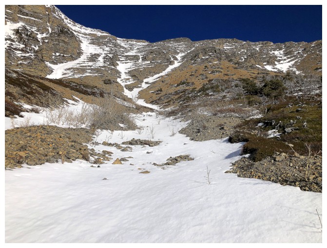
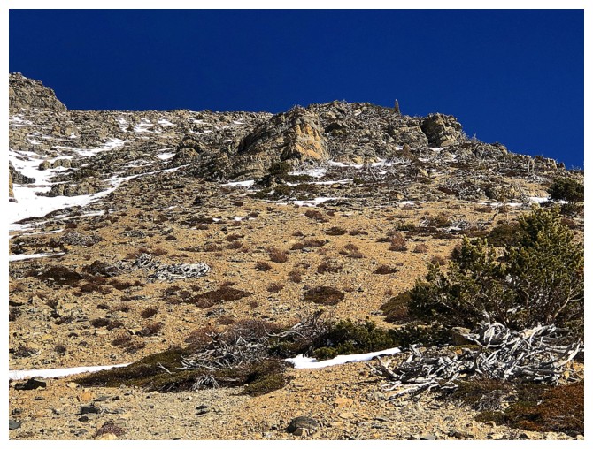
Traversing snow-free slopes after fighting the bush for a while
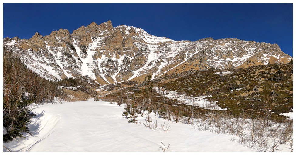
Back down into the drainage, where snowshoes worked perfectly. The
ascent route I took goes from left to right, up one of the snow
gullies.
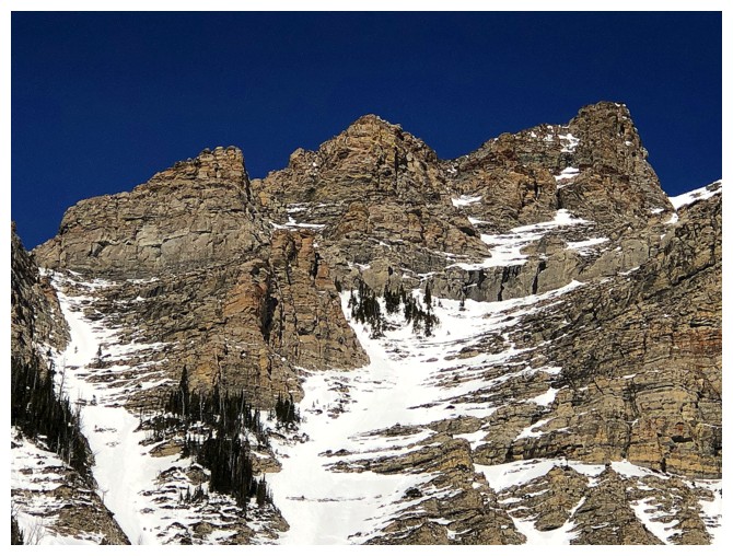
Close-up of the upper ridge that Mark and I ascended for Icing
Good combination of snow-filled gullies and snow-free slopes on both sides
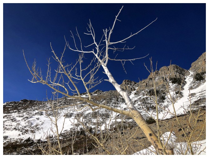
My kind of tree - half white, half brown!
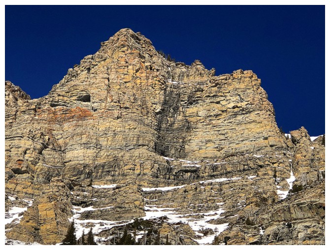
The rock scenery lining the upper ridge is a constant source of awe
Snowshoeing up the snow gully. I would soon trade them for crampons and an ice axe.
Always the option for a snow-free ascent
But I'm sticking to the snow for now
Easy to see why

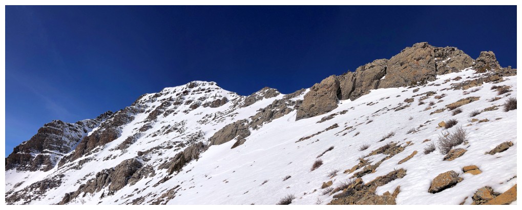
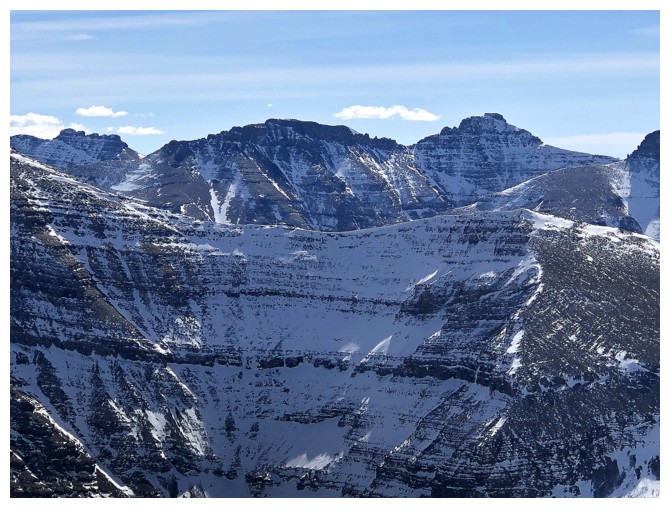
Looking over to the far end of Spionkop Ridge and Mount Roche
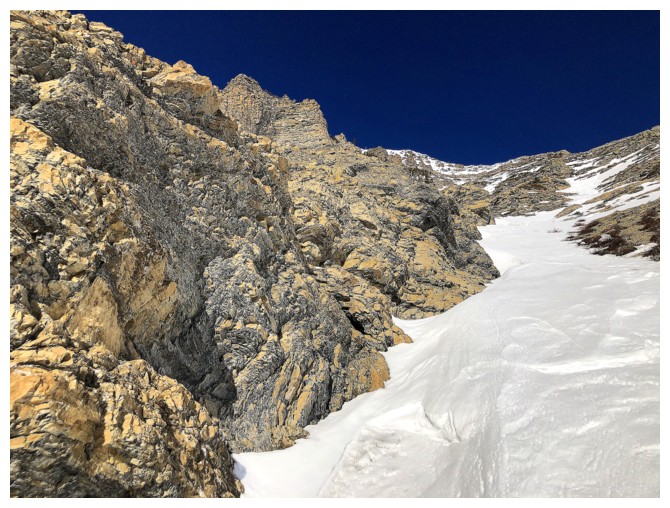
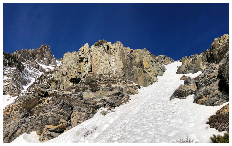
Traded the snowshoes for crampons and an ice axe here. The terrain ahead is much steeper than it looks.
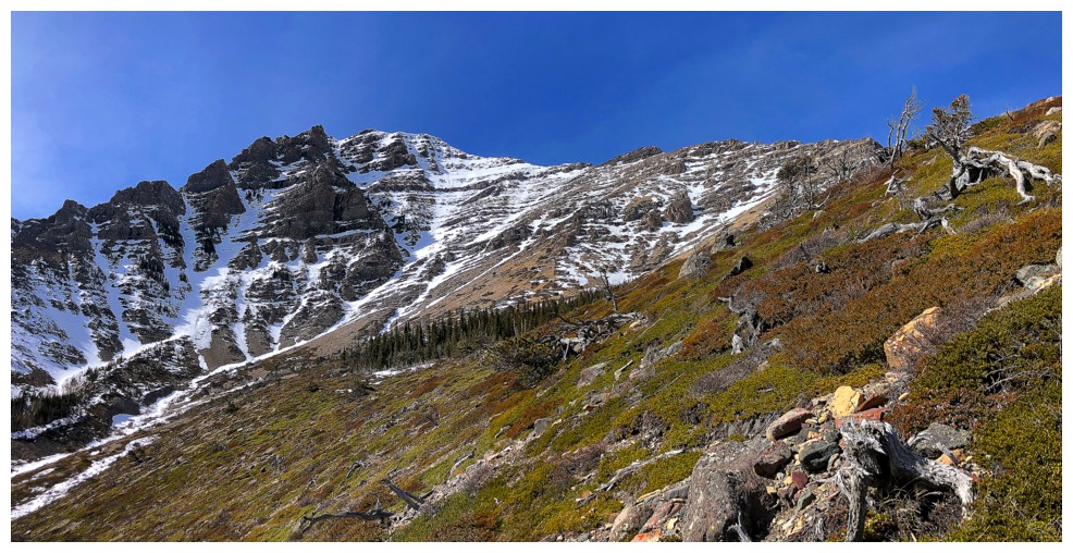
Better representation of the grade of the slope
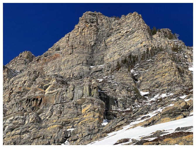
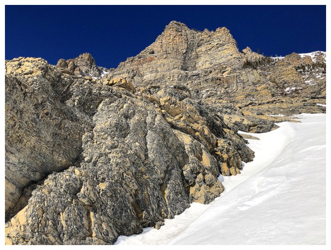
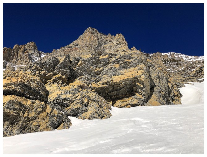
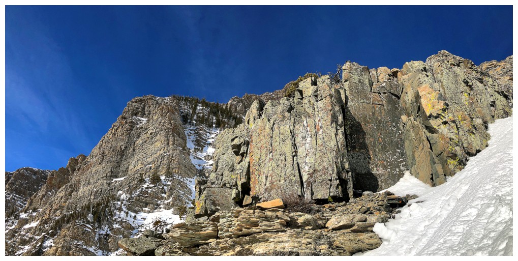
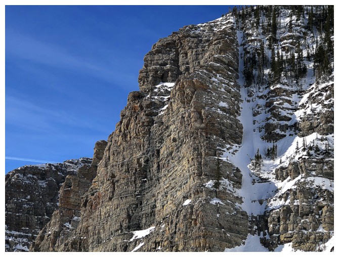
Still mesmerized by the towering rock walls above
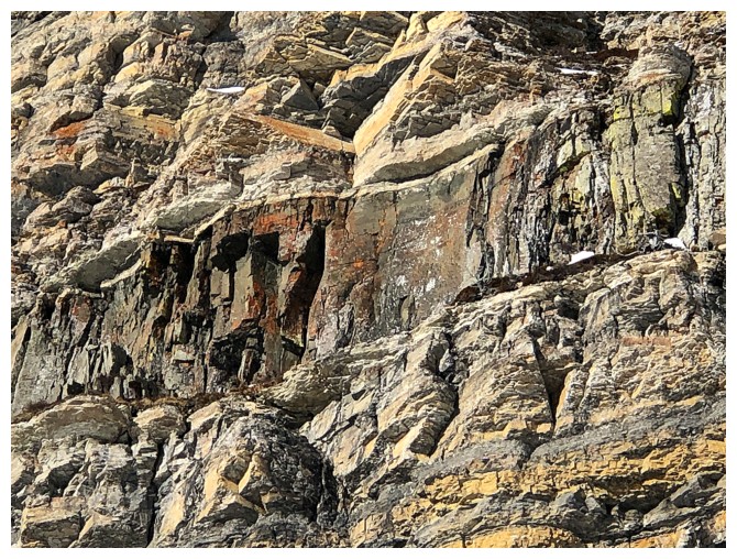
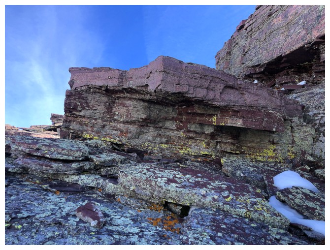
The band of igneous rock (Purcell sill) makes an auspicious appearance
So does another band of rock on the right side of the ascent gully
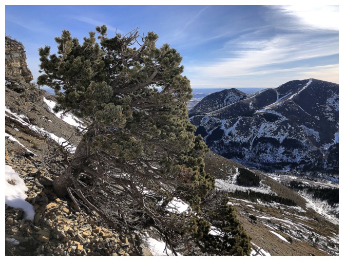
Very few trees on this slope, so better photograph those few
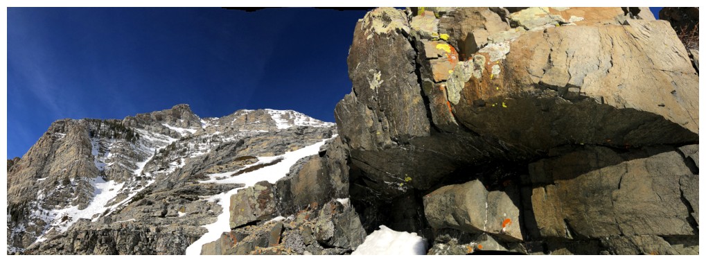
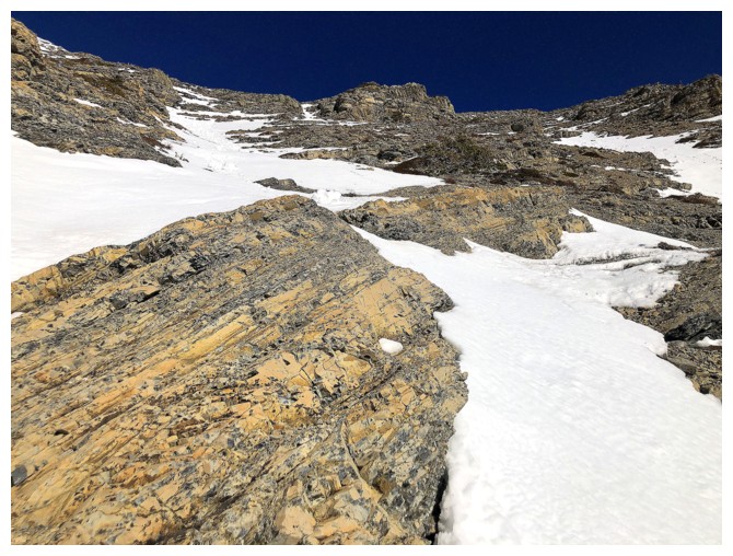
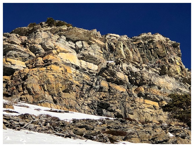
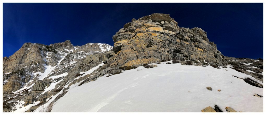 Approaching that rock band
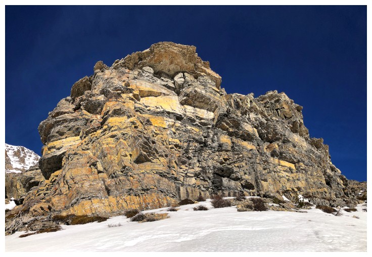
Closer
At the base
Decided to go around the left side, following the snow gully
The gully is steep but cuts right through the igneous band
Same as above
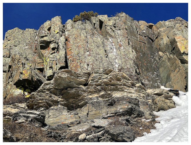
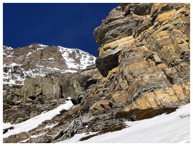
Close-up of the magma
Same as above
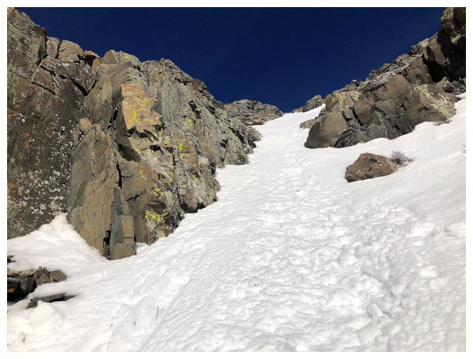
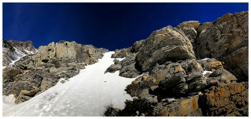
Heading up the gully
Had to stop multiple times to check out the cool rock
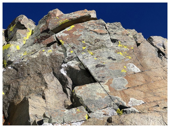
Like this stuff
And again
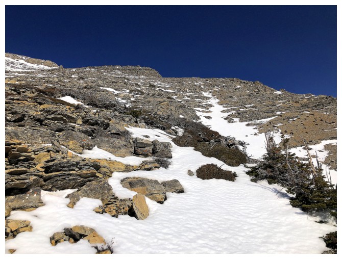
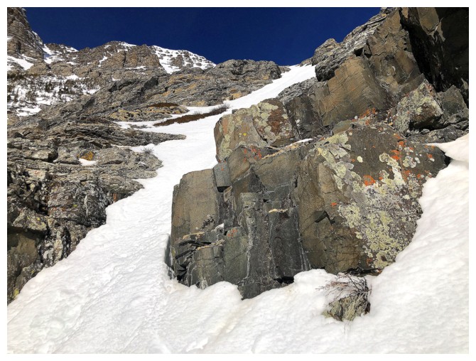
Gentler terrain above the rock band, but still a long way to go before
reaching the ridge. At this point, the heat of day was zapping my
energy.
So I'll take lots of breaks and photograph the wonderful scenery
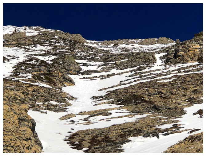
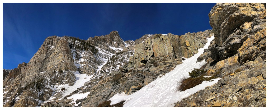
Now there's a snow gully!
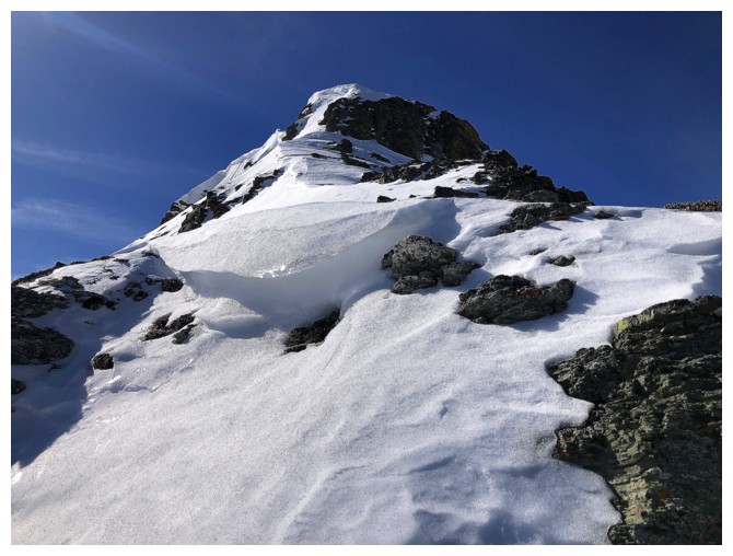
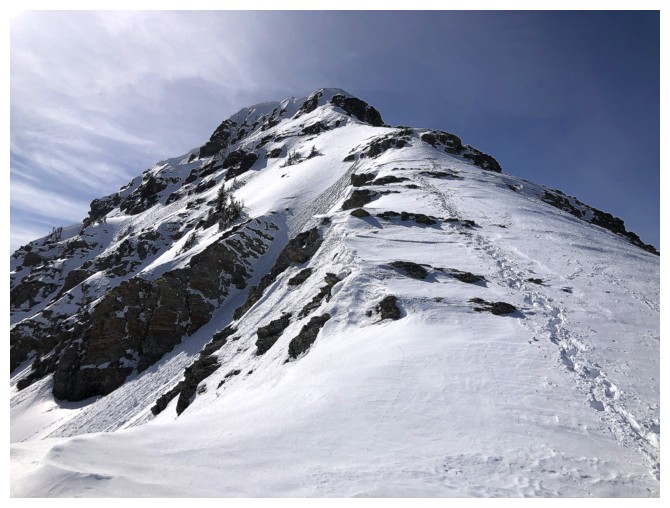
The upper ridge of Bakery is still holding a ton of snow (as it should be in mid-March)
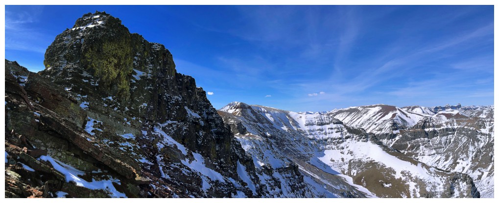
Bigger view of the upcoming challenges
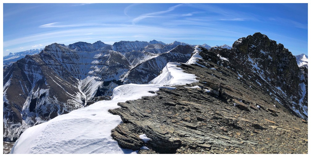
Finally on the ridge. That took way more effort than anticipated!
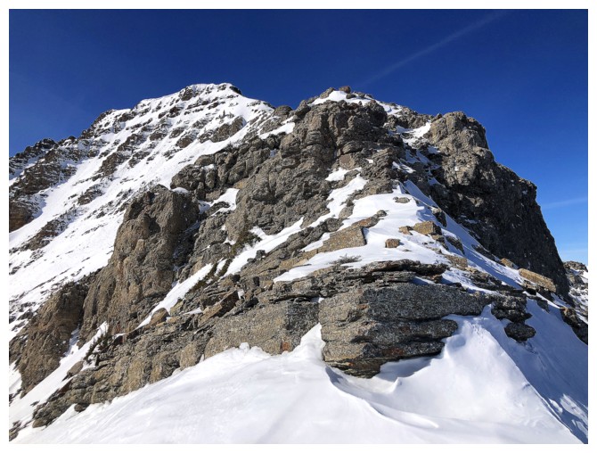
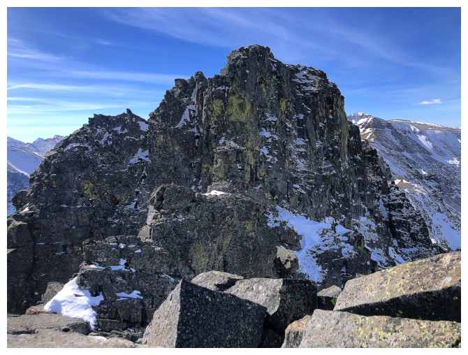
Approaching the second challenge on the ridge. Fortunately, I bypassed the first by gaining the ridge passed it.
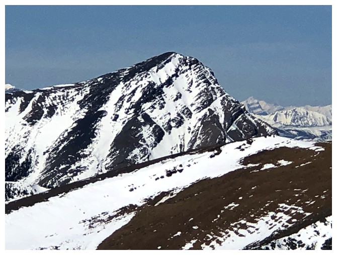
Windsor Mountain and Castle Peak
Drywood Mountain to the north
Looking down another snow gully I could have ascended to the ridge.
Once again, however, the terrain is far steeper than it appears.
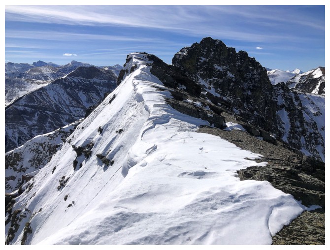
The fun continues. This ridge is a sheer joy to ascend, with or without snow.
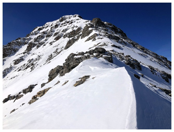
Same as above
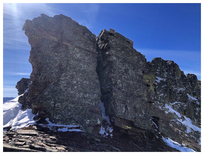
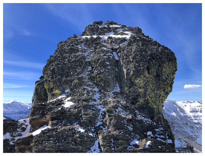
This rock step can be tackled head-on
Easy terrain above the step
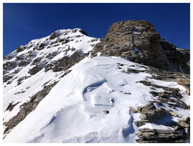
Close-up of the upper section of the ridge
I wasn't confident I could safely ascend the rock step at the top, so I went around it on the right side
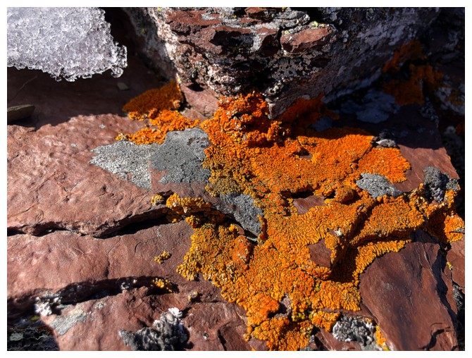
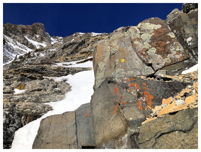
Distracted by orange lichen on red argillite
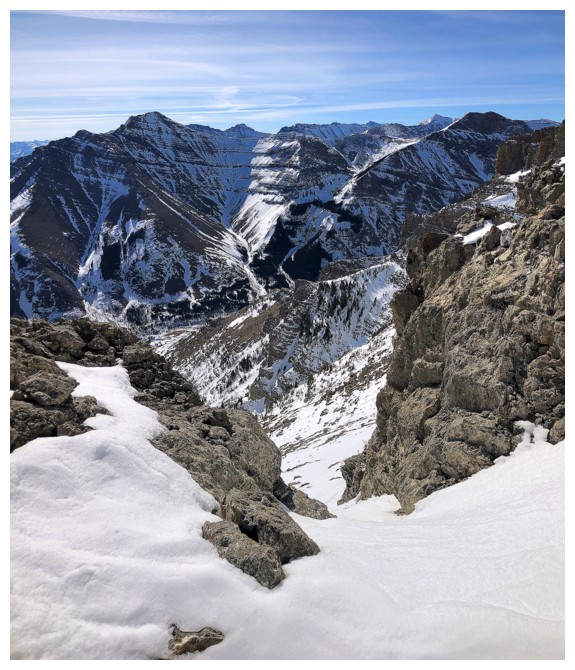
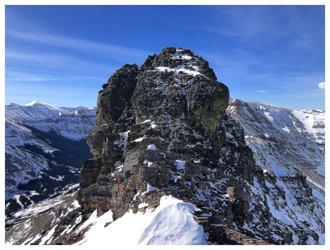
Atop the rock step and looking at the delicious traverse to Bakery
View to the north again
Back to the ridge in front
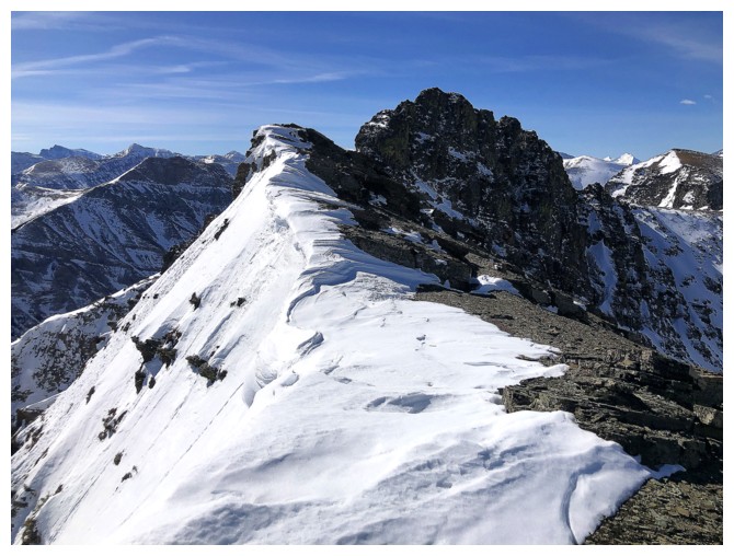
The terrain on the left is now epically steep!
Nice cornice
Looking down to some of the route I took up (not the steep, snowy stuff)
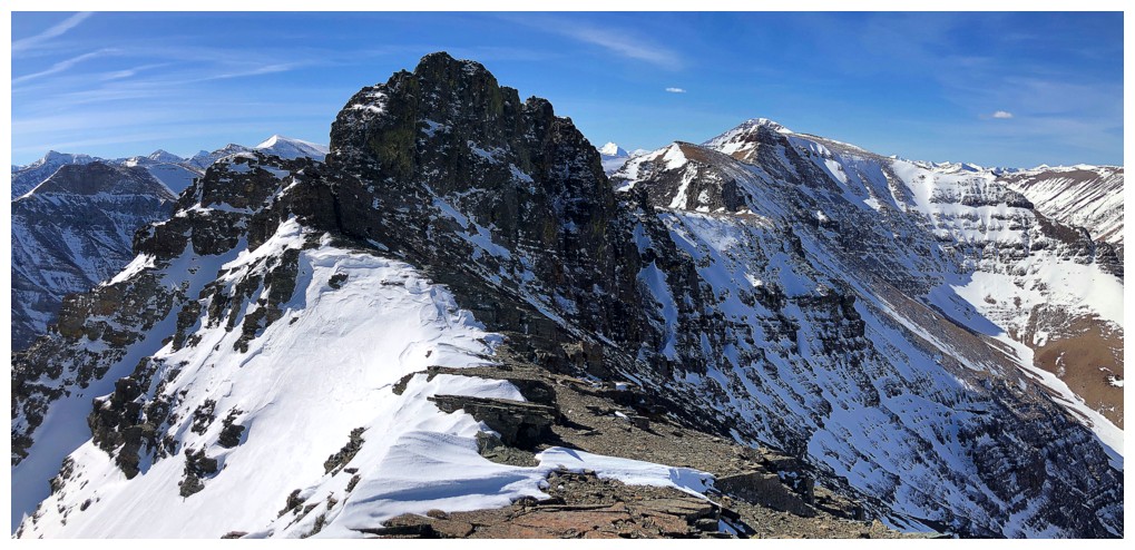
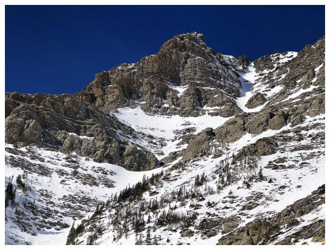
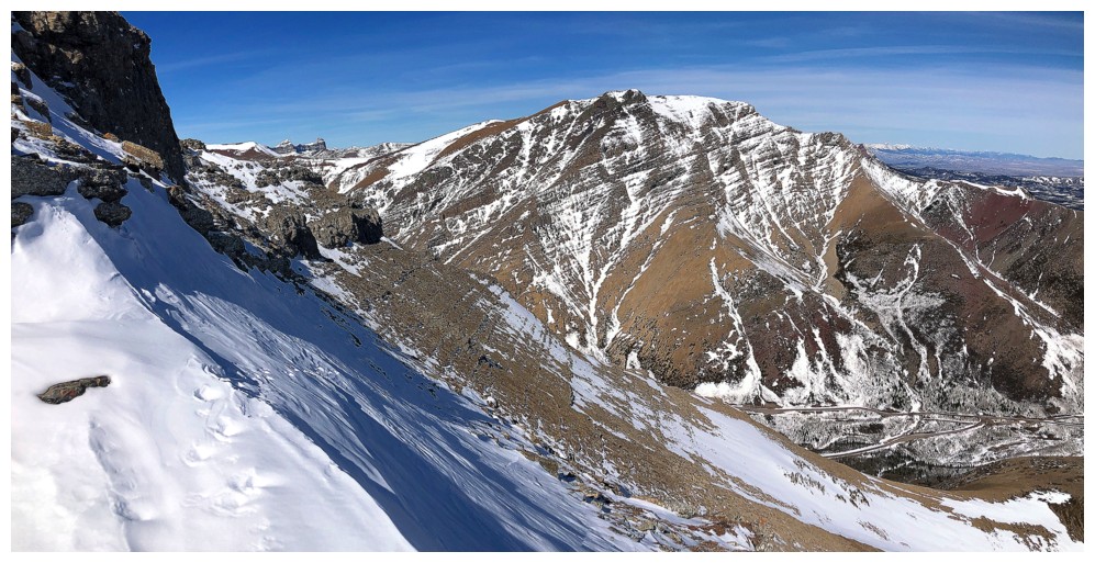
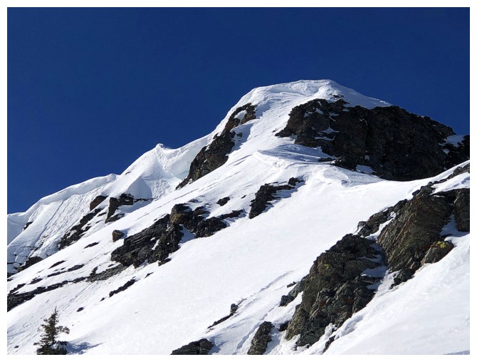
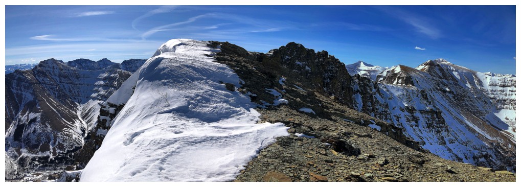
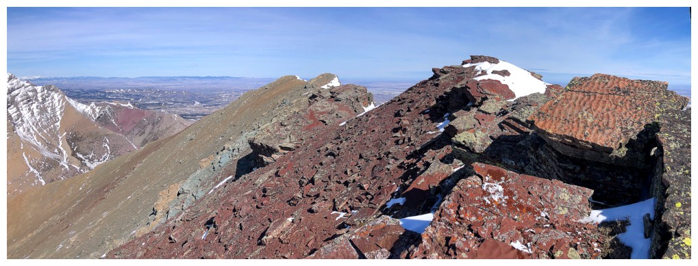
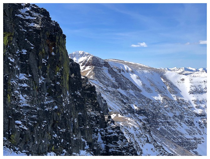
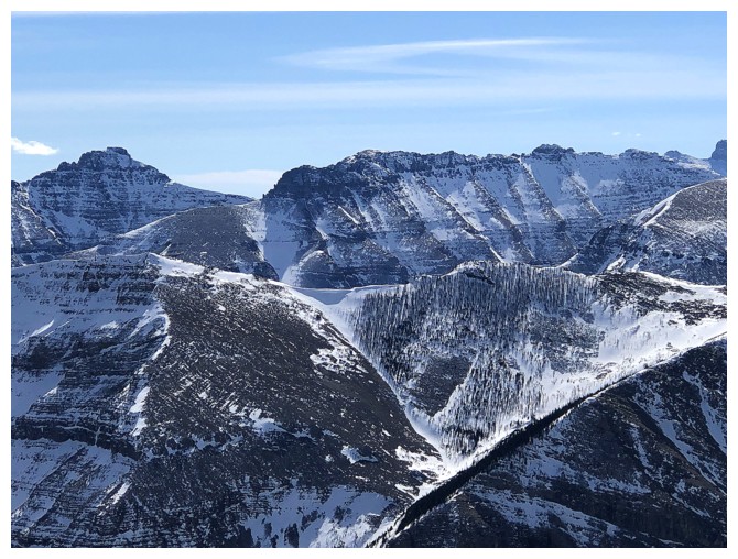
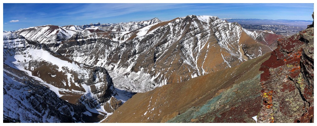
Bakery is the lower point immediately left of the highest point. The highest point is Icing On The Loaf Peak. Pastry Peak and the true summit of Loaf are visible to the right.
Bigger view
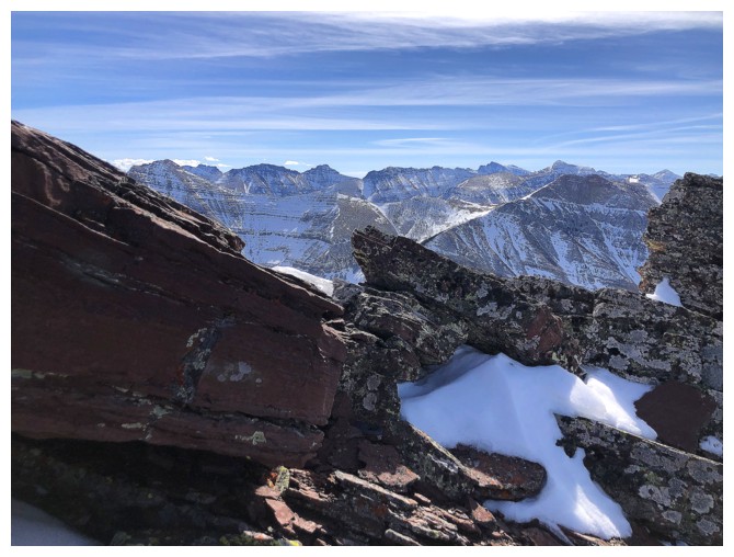
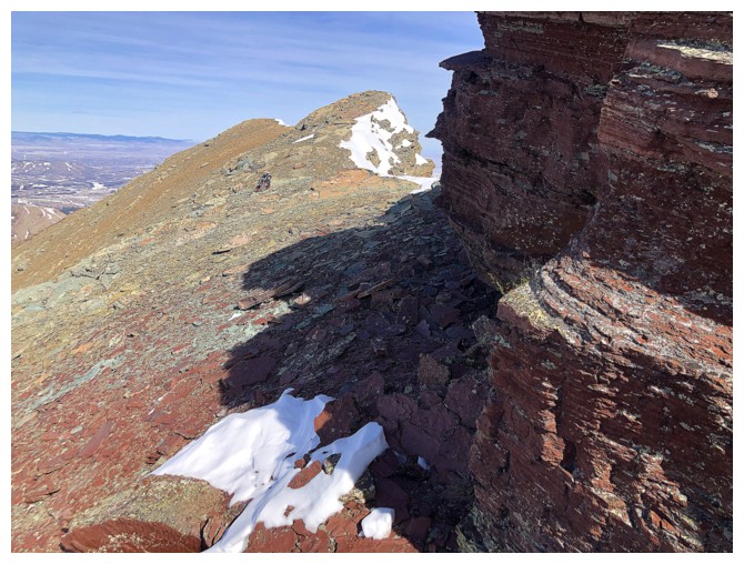
The butt-crack of Bakery
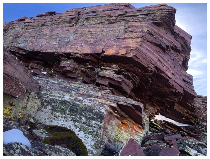
The summit ridge is lined with stunning red argillite, but is best seen
on the south side of the ridge, where the Sun is. This is the north
side.
Same as above
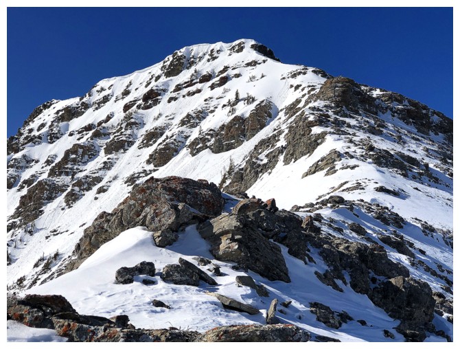
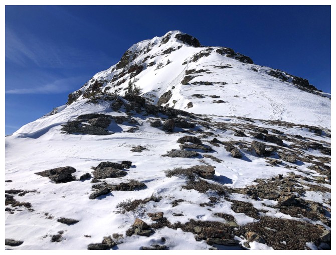
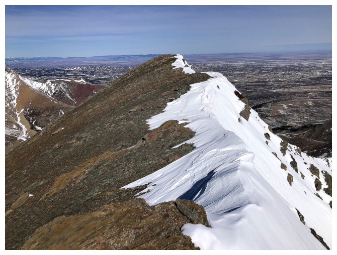
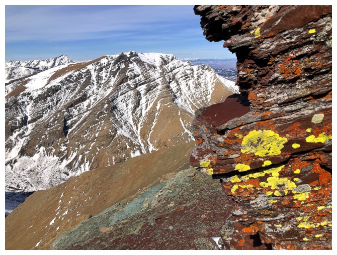
Closing in on the summit of Bakery
The view behind
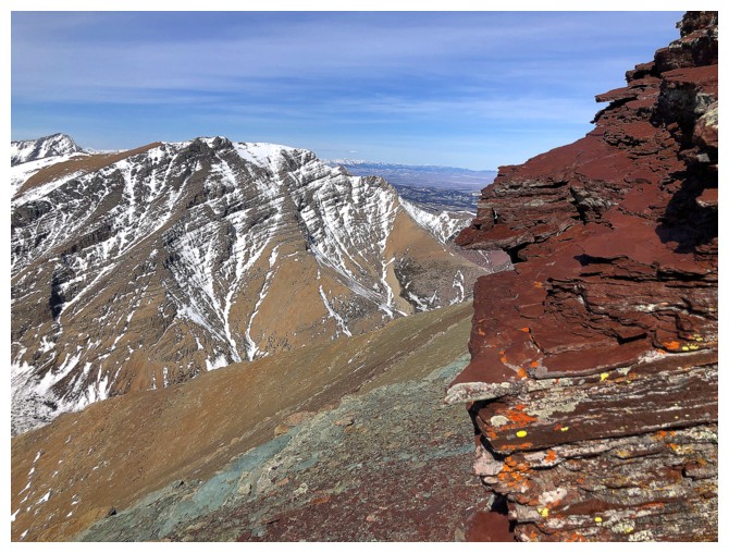
The summit block has more bark than bite - it's an easy/moderate scramble
Looking back again - hard not to, now that the Sun is shining on the red rock
Ready to scramble to the top
At the summit, Icing is front and centre
The true summit of Loaf can just be seen, right of the rock face
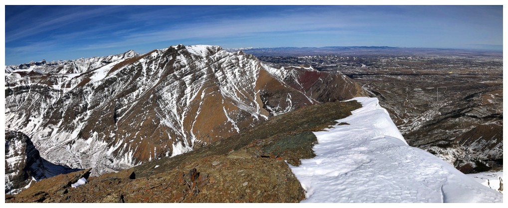
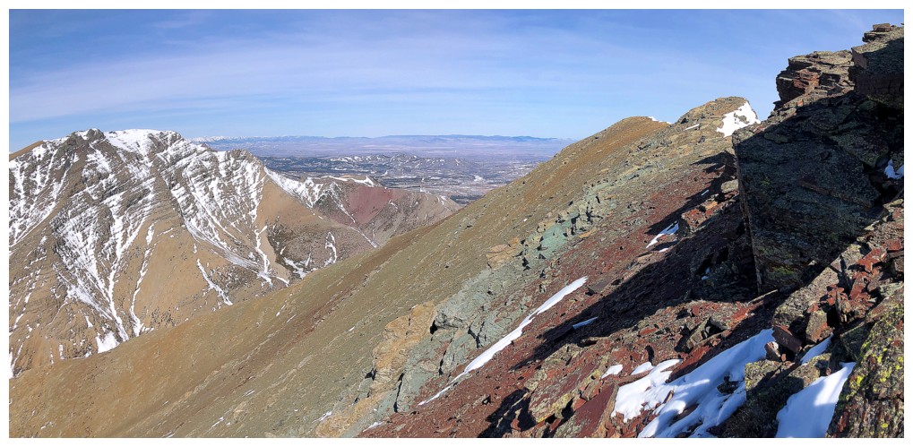
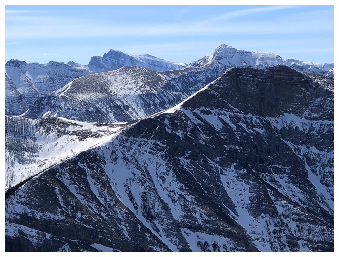
Peaks to the west
Victoria Peak - were it
not for the more challenging approach, now that the first kilometre of
the access road is off-limits, I would probably ascend this peak at
least once a year - it's a beaut!
Mount Darrah (far right) and several of its outliers
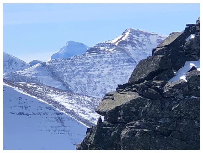
Kinnerly Peak in the background
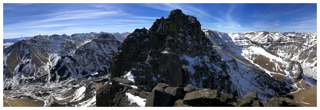
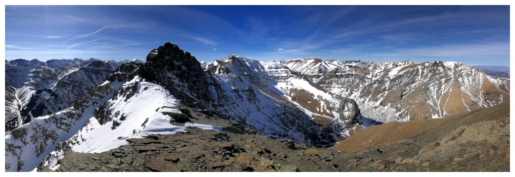
Summit Pano 1
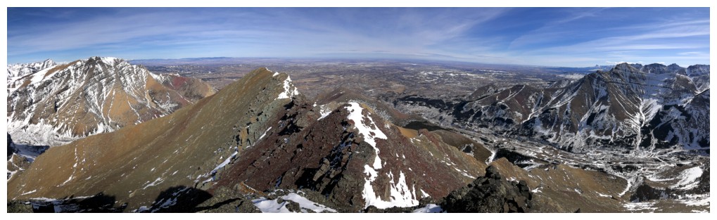
Summit Pano 2
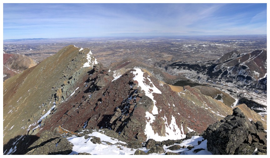
Close-up of Summit Pano 2
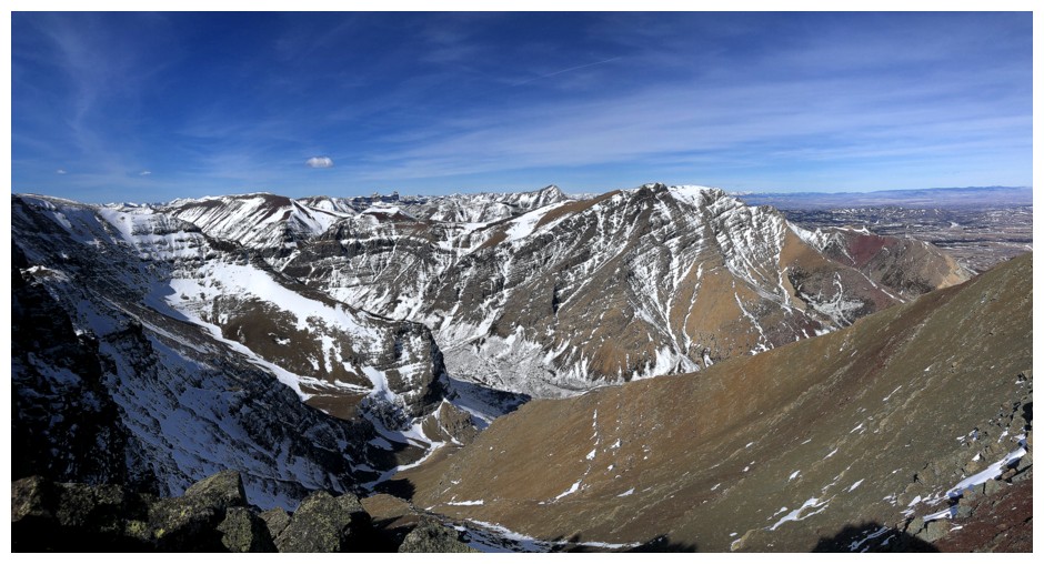
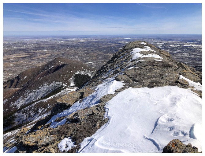
View to the north
The true summit of Spionkop Ridge
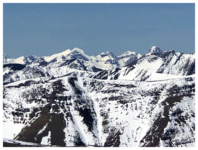
Dungarvan, Cloudy Ridge Junior, and Cloudy Ridge
Cloudy Ridge, Cloudowan Northeast, and Cloudowan Peak
The west summit of Mount Roche in the foreground; Mount Glendowan right of centre
All of the above with some red argillite
The red rock looks so much better with the Sun shining on it
So does the lichen
Or without
Circumventing the butt-crack
Looking back at the upper part of the route
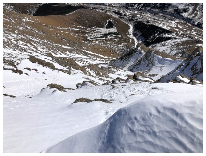
Staying high on the slopes for the last part of the descent to avoid the bushy and very snowy drainage
Same as above
The Eaglet and Raptor Peak lie at the the far east of Mount Roche
Parting glance at Bakery Peak - a fine and tasty objective!
The End
LOG