Redwood Peak IV
Drywood Southwest IV
Little
Bo-Peak III
June 14, 2024
Mountain heights: 2340 m, 2482 m, 2340 m
Total elevation gain: approximately
1300 m
Round-trip time: 7:00
Solo scramble.
Not the day I
was expecting at all, but a fine one nonetheless!
I had to bail
on an attempt of Alderson Peak with Brad and Lance, due to having a very
unpleasant and energy-zapping cold. Instead of leaving Calgary at 4:30 am, I
didn’t leave until 6:30 am. I decided to see how I felt once I arrived in the
Waterton area. 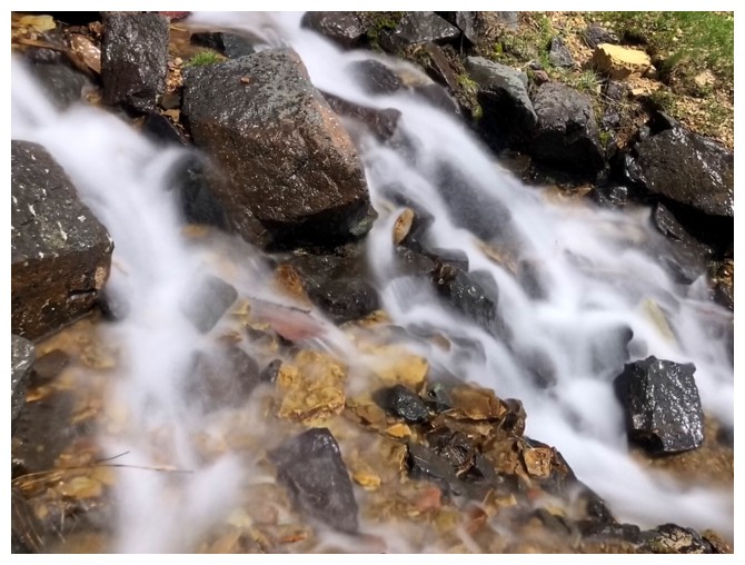 A 3-hour drive and a dose of acetaminophen later and I found
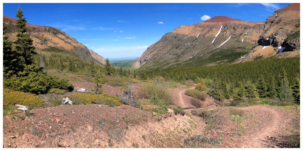
myself at the Bovin Lake trailhead.
A 3-hour drive and a dose of acetaminophen later and I found
myself at the Bovin Lake trailhead.
In 2009, as
part of a wonderful day with Amber, Janina, and Scott, I had traversed from the
highpoint above Bovin Lake (Little Bo-Peak) to the summit of Victoria Ridge.
That part of day had been plagued with volatile weather that detracted from the
experience. I had always wanted to return with completely clear skies and
that’s how they appeared as I geared up at the trailhead. My intention was to
ebike to Bovin Lake, ascend Little Bo-Peak, and then tackle the traverse to Victoria Ridge.
Unfortunately,
three factors conspired to ensure the traverse would not come to fruition on
this day:
1.
A build-up of
clouds to the west – as stated, completely clear skies were a mandatory
condition for the route.
2.
A severe
increase in headwind speed – even with the added power of an ebike, riding into
the wind was increasingly difficult, especially on the uphill sections.
3.
I had not
charged the battery on my bike, and it reached a critically low level, several
kilometres up the Bovin Lake Trail – even though most of the return trip would
be downhill, I wanted a little power for the few uphill sections.
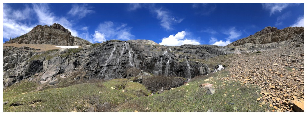
About 2.5
kilometres away from Bovin Lake, 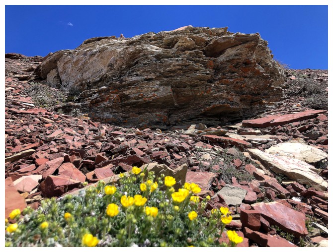 I abandoned the intended route and had to
think of an alternate plan. Fortuitously, I just happened to stop where a gap
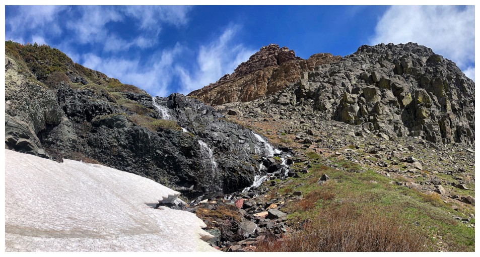
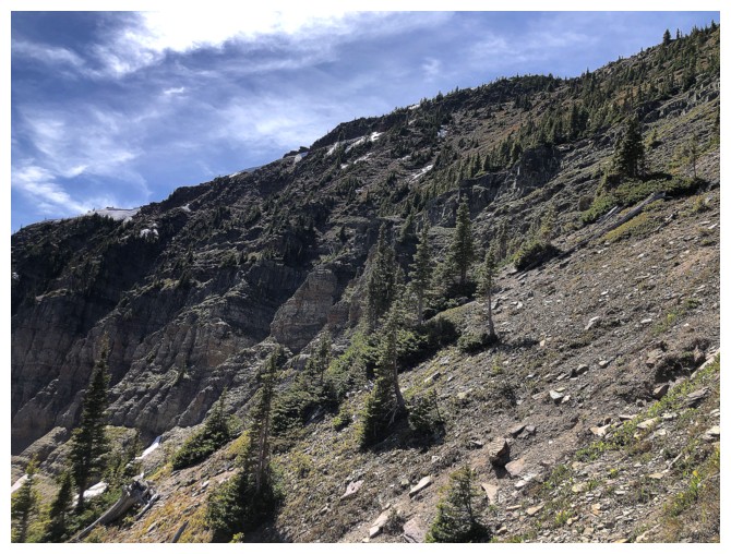
between two rock walls on the south side of Drywood Mountain appeared to potentially offer a
route to the ridge above. After ascending a dried-up drainage to the west rock
wall, I traversed below it to find an easy route up between it and the east wall. And not
only was the route easy but featured a beautiful stream running down the
middle. Of course, that meant long exposure photo time – a relatively new
addiction that is giving my red argillite one a run for its money!
I abandoned the intended route and had to
think of an alternate plan. Fortuitously, I just happened to stop where a gap
between two rock walls on the south side of Drywood Mountain appeared to potentially offer a
route to the ridge above. After ascending a dried-up drainage to the west rock
wall, I traversed below it to find an easy route up between it and the east wall. And not
only was the route easy but featured a beautiful stream running down the
middle. Of course, that meant long exposure photo time – a relatively new
addiction that is giving my red argillite one a run for its money!
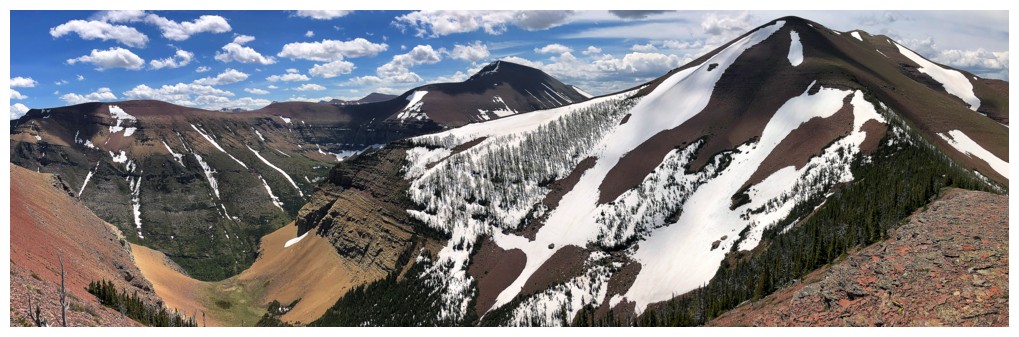
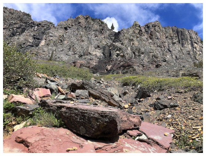
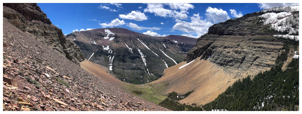
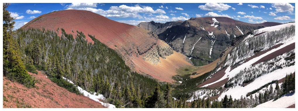
I eventually
reached the wonderful hanging valley I had salivated over a couple of times
while traversing from Drywood’s true summit to its southwest summit. It was
also at this point that I started to wonder if this was route Brad, Dave and
Lance had competed in 2018 – the same one I had failed to find
in 2021.
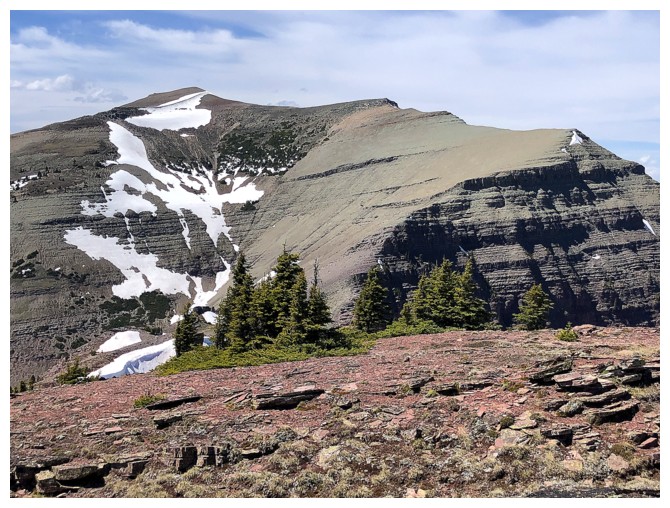
From the
hanging valley, the middle peak of Drywood (we are calling it Redwood Peak) was
relatively close and so I first clawed my way up to the summit. The wind en
route was insane,  threatening to knock me off my feet or clean off the mountain
– luckily the ascent was devoid of any exposed terrain.
threatening to knock me off my feet or clean off the mountain
– luckily the ascent was devoid of any exposed terrain.
I didn’t stay
at the Redwood summit, having already decided to continue to Drywood Southwest
and then down to Bovin Lake. 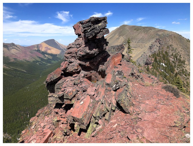 The build-up of clouds to the west seemed to have
reached its maximum and the wind died down enough to allow easier travel. Plus,
I wanted a good look at Bovin Lake.
The build-up of clouds to the west seemed to have
reached its maximum and the wind died down enough to allow easier travel. Plus,
I wanted a good look at Bovin Lake.
Not
surprisingly (these days), I forgot that the lake is not visible from the
Southwest summit and by the time you have descended its southwest ridge enough
to get a look, you are so close to Little Bo-Peak that an ascent of that little gem is pretty much
mandatory. I also forgot that the short section from the Southwest/Bo-Peak col
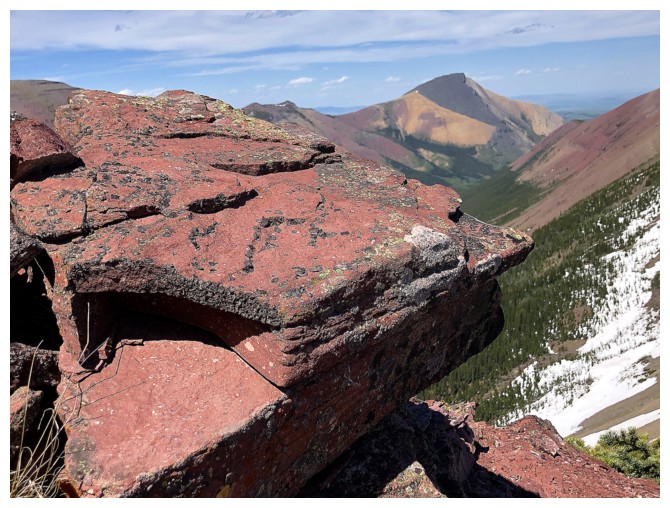
to the summit of Bo-Peak is probably the most scenic and interesting part of
the trip, courtesy of some amazing red argillite scenery and terrific views of Bovin Lake and Loaf Mountain.
After another
very brief summit stay, I returned to the col, descended to Bovin Lake, took a
bunch of photos of the cool ice still remaining on the lake, hiked the Bovin
Lake trail to my bike, then cruised back to the start.
Awesome route
that I would very likely repeat.
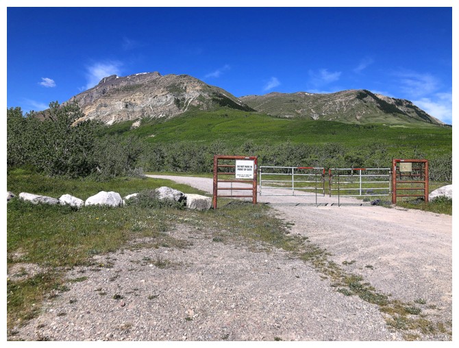
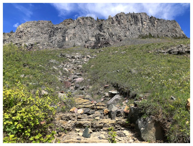
At the trailhead
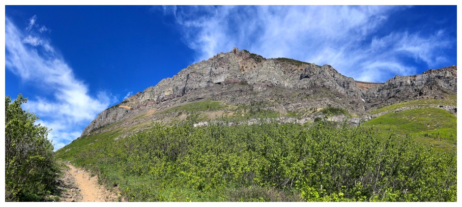
Passing by a different route I once took up Redwood
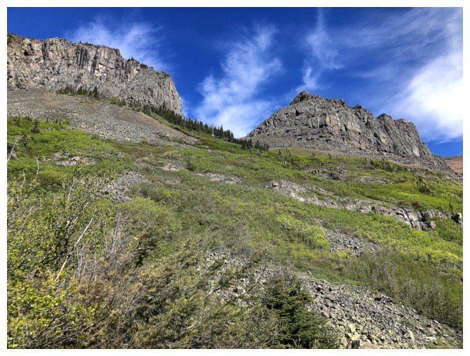
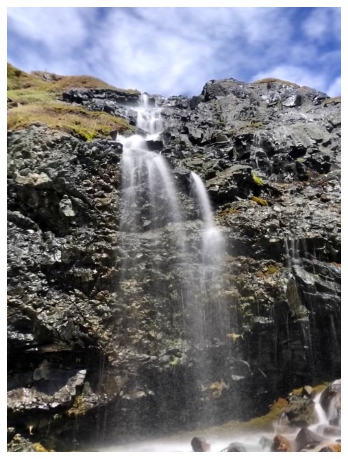
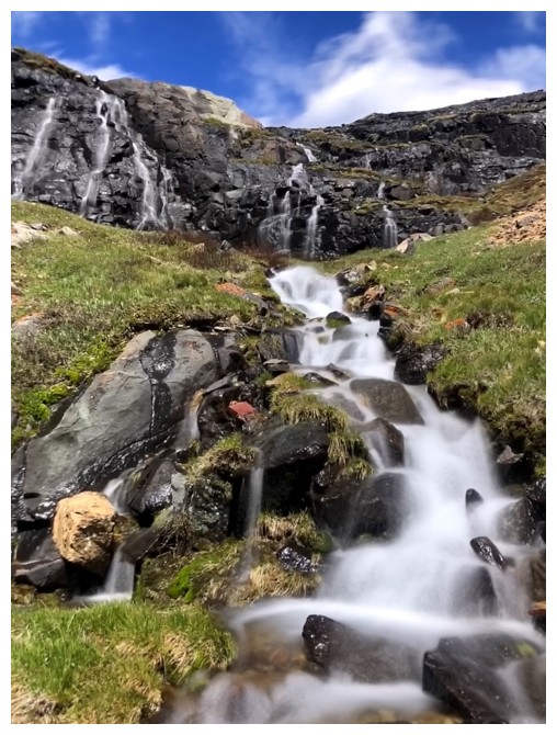
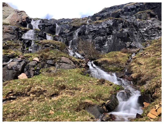
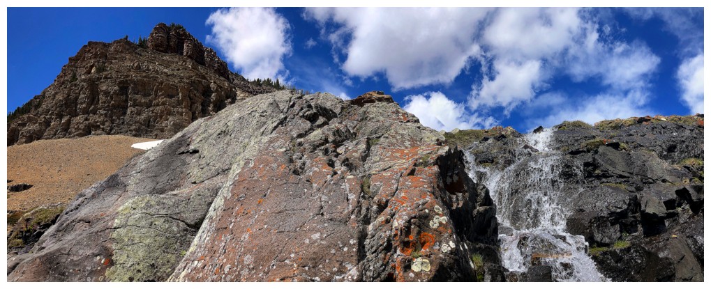
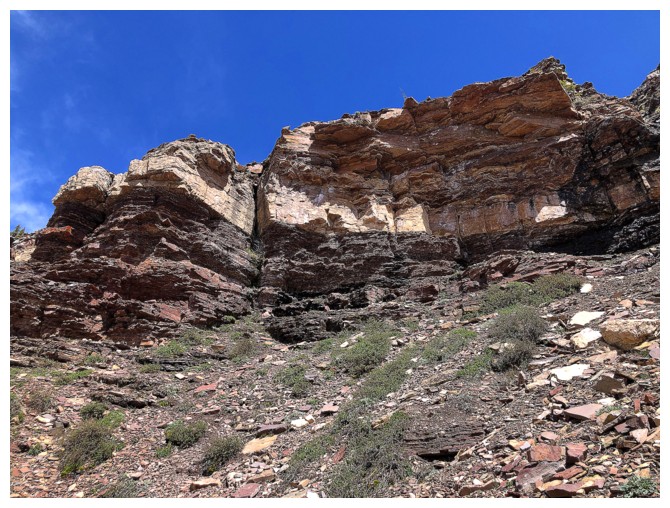
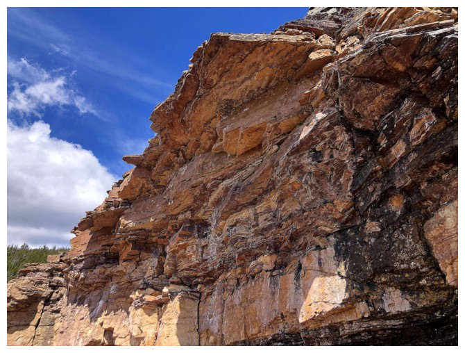
The new route goes between these rock walls
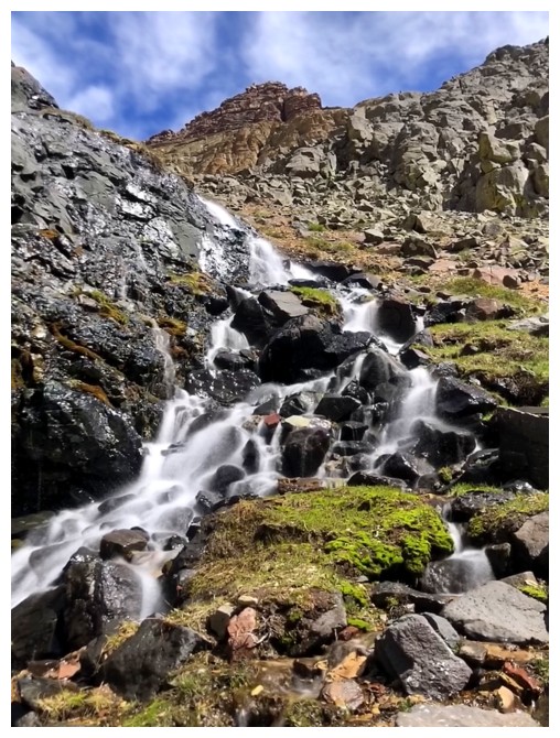
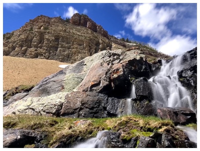
A rocky drainage made easy work of getting up to the base of the west wall
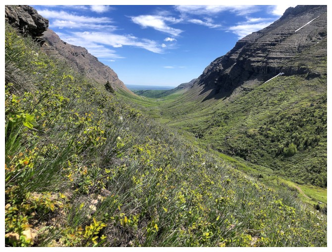
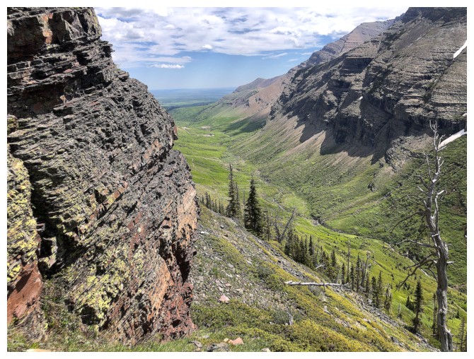
The green of the valley was eye-catching throughout
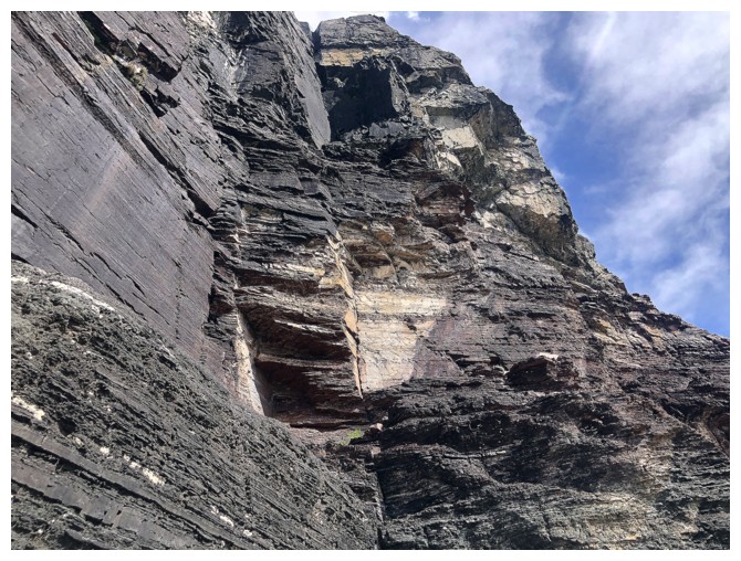
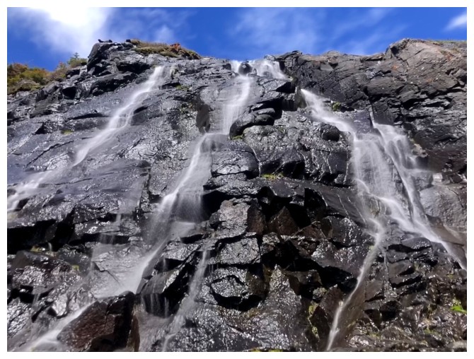
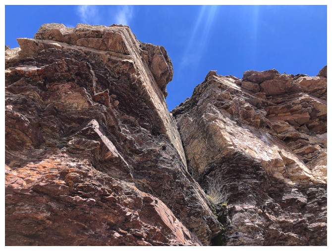
The gap between the walls
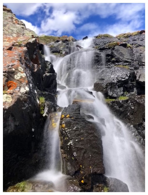
But first I wanted to get right up to the base
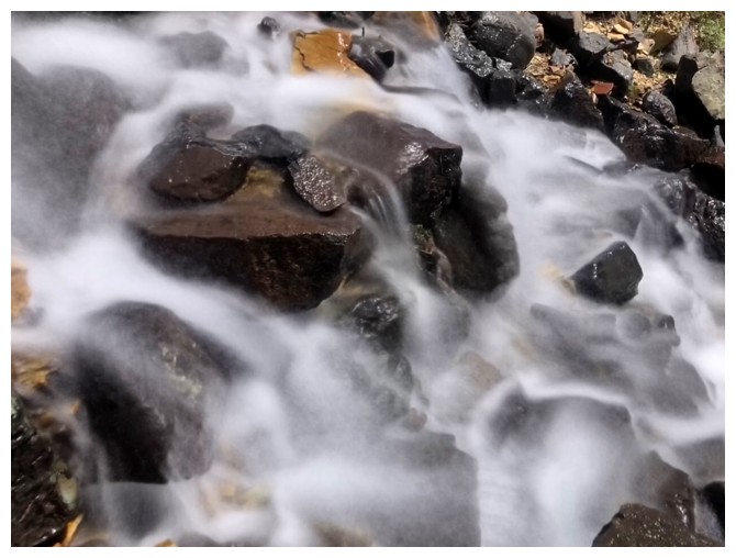
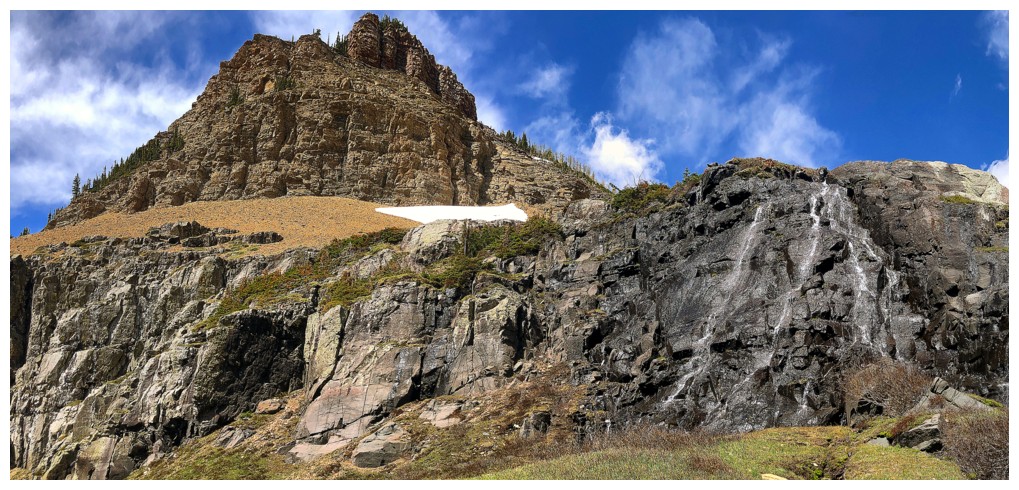
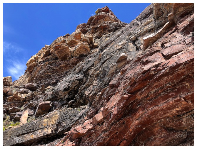
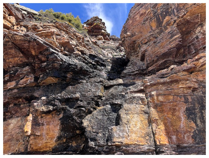
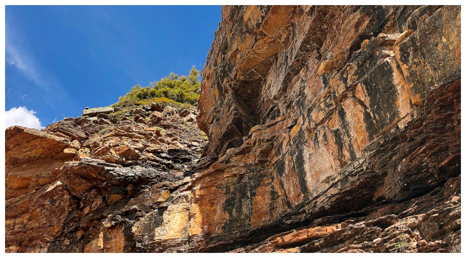
At the base, looking up at the water-streaked black rock
Traversing east along the base required a few minor elevation losses
Still traversing
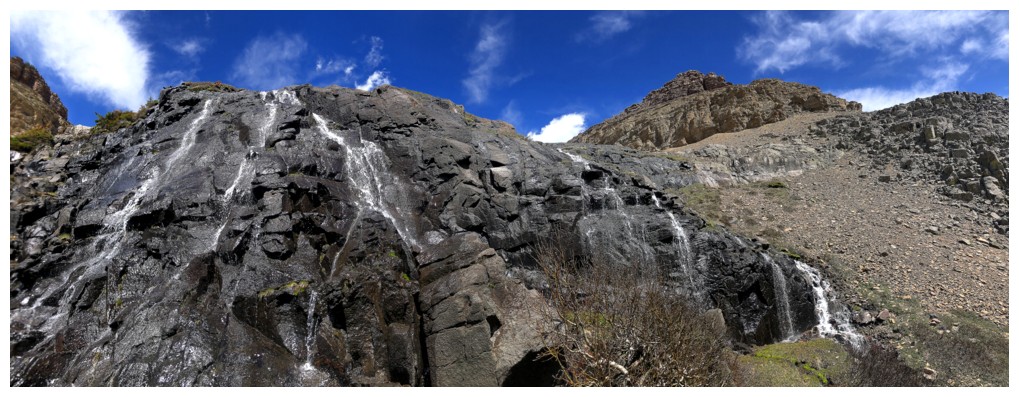
Things are looking good for a weakness between the walls

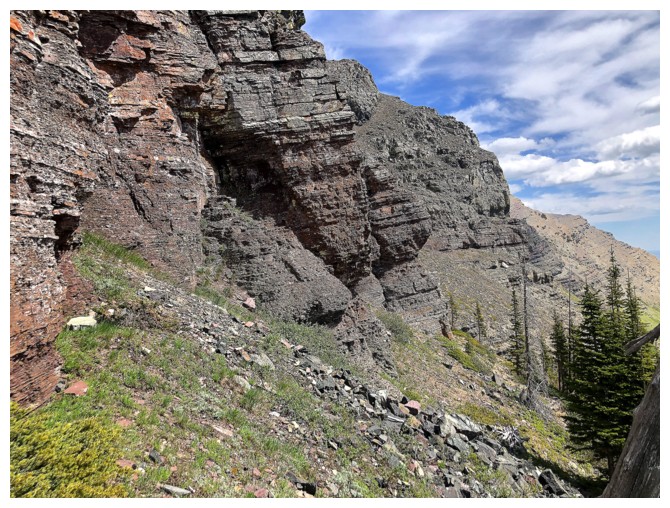
The impressive southeast side of the west wall
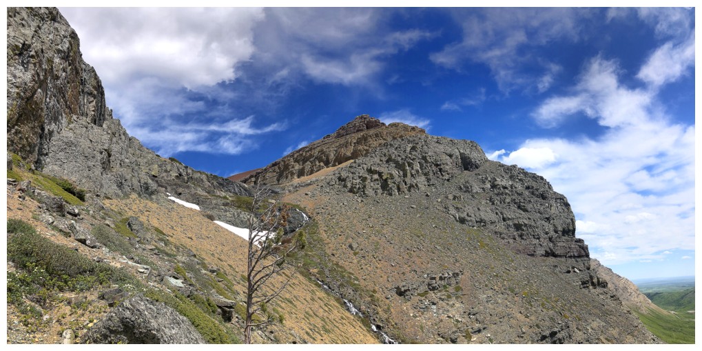
Eureka! A weakness AND a cool drainage!
Everyone knows what time it is now!
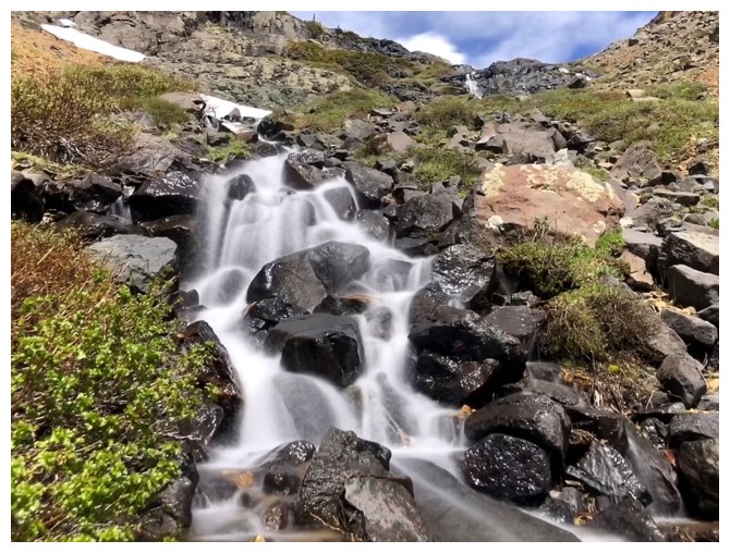
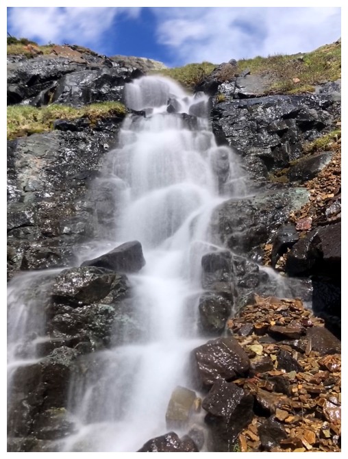
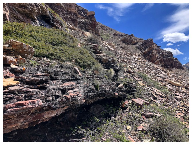
There are easy and more challenging routes up through the gap.
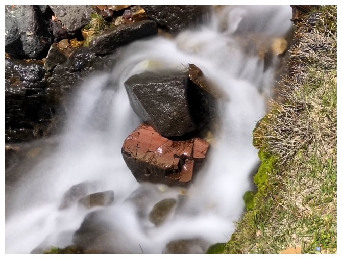
I chose a route that kept me close to the running water.
....for obvious reasons!
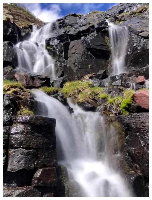
The west side
The east side
Straight up the middle
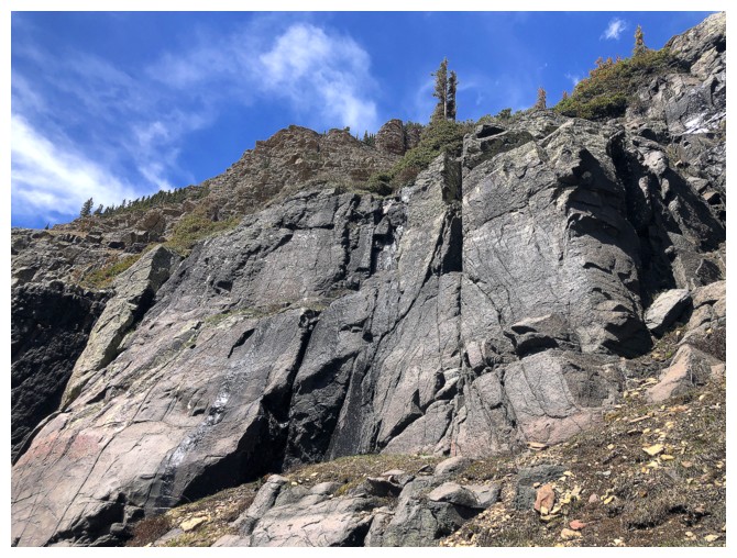
Good scrambling on solid rock here
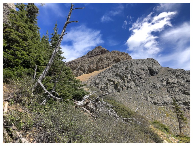
Looking back to Pastry Peak
Lots of wandering back and forth
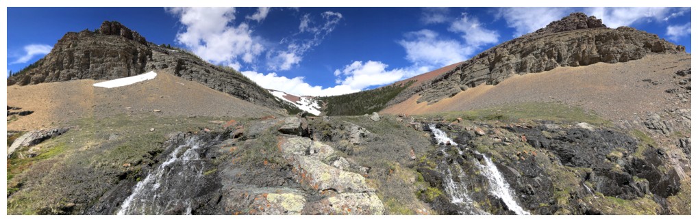
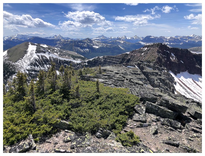
After zig-zagging all over the place the hanging valley is finally reached
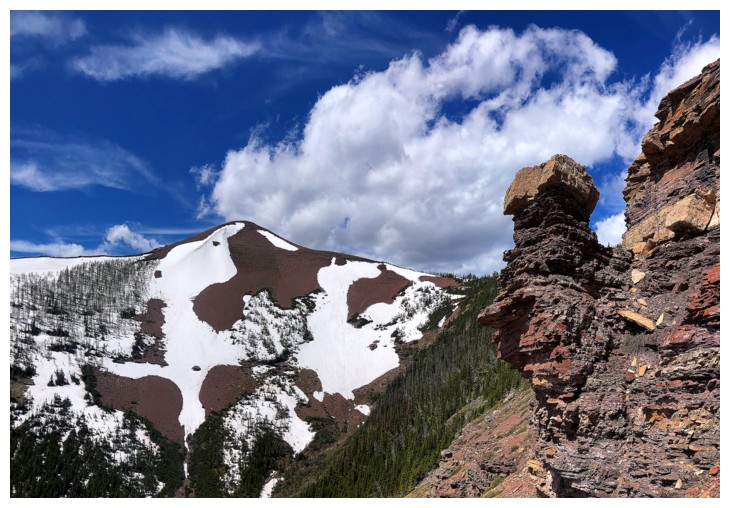
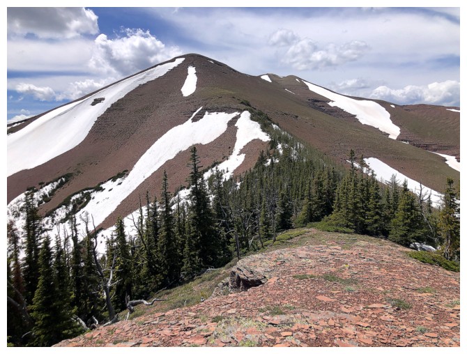
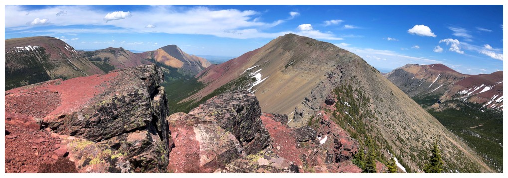
Redwood Peak on the right side of the valley
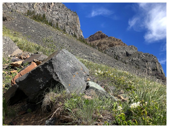
Random boulders strewn across the landscape (just needed an excuse to use the word "strewn'!)
Gaining elevation on the right (east) side
The false summit of the Southwest summit is on the left side
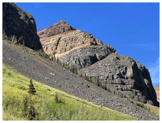
Eventually a super colourful rock band is encountered
The weakness through the band
But first, some more zig-zagging is required to see the rock band
Interesting pinnacle near the left
Approaching the pinnacle
Past the pinnacle
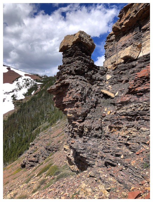
Close-up
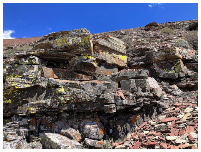
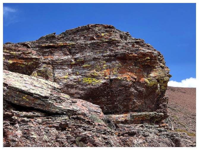
A little lichen to add to the already terrific scenery
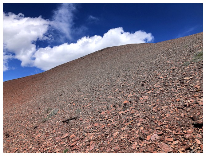
Above the band lies nothing but red argillite scree slopes
I stand corrected!
The true summit of Loaf Mountain
Now there's nothing but scree!
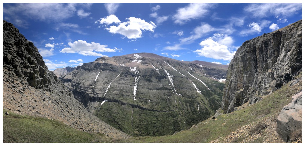
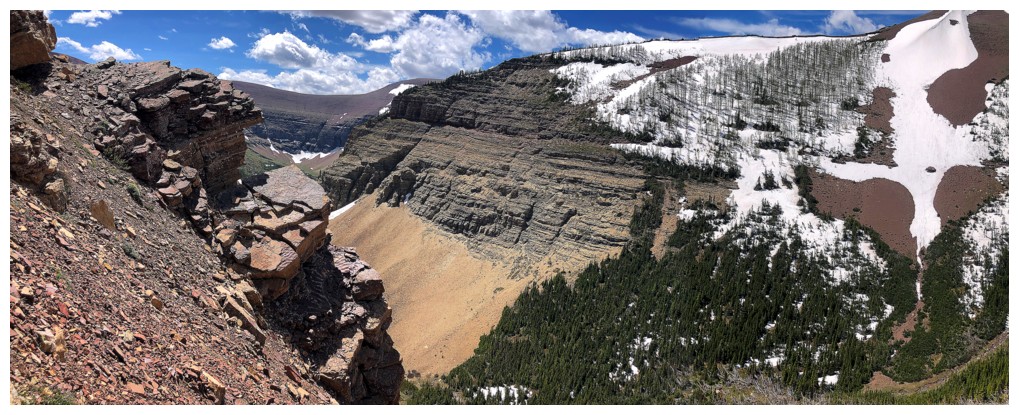
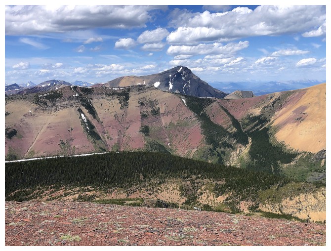
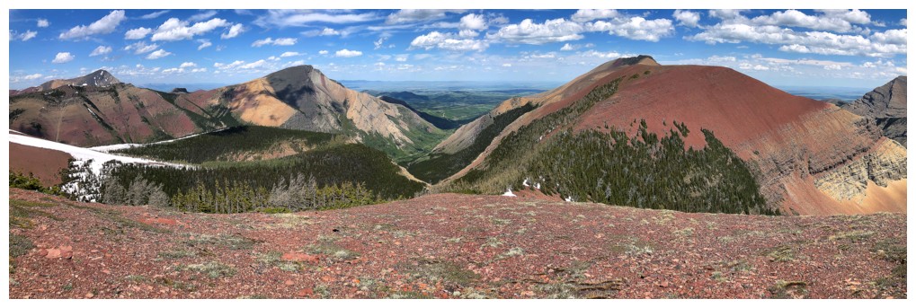
Loaf Mountain almost in its entirety (The Muffin and The Croissant are missing). Left to right: Ciabatta, Bakery Peak, Icing On The Loaf Peak, The Breadsticks, Pastry Peak, Loaf Mountain. I'm sure Dave and I can find a few more tasty highpoints on the massif!
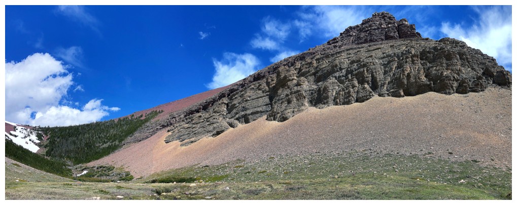
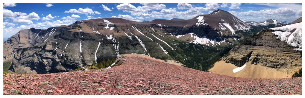
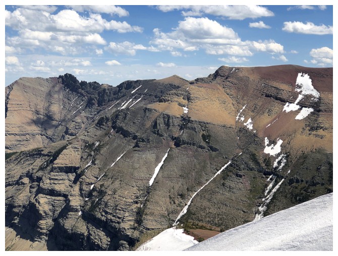
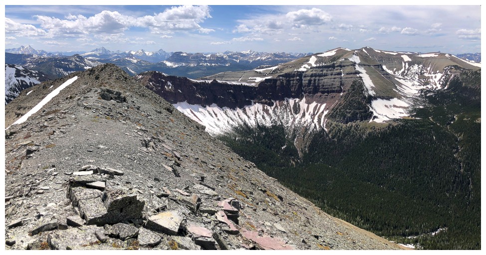
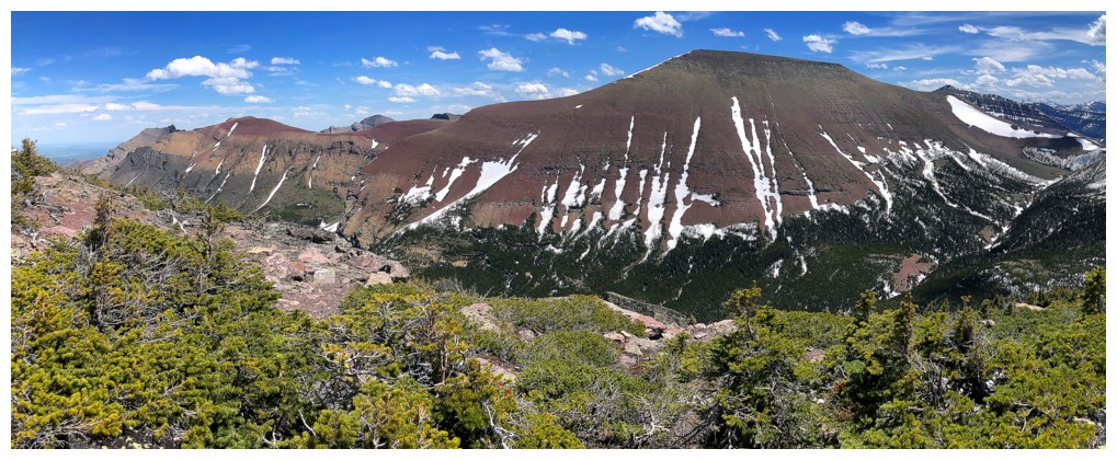
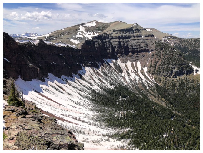
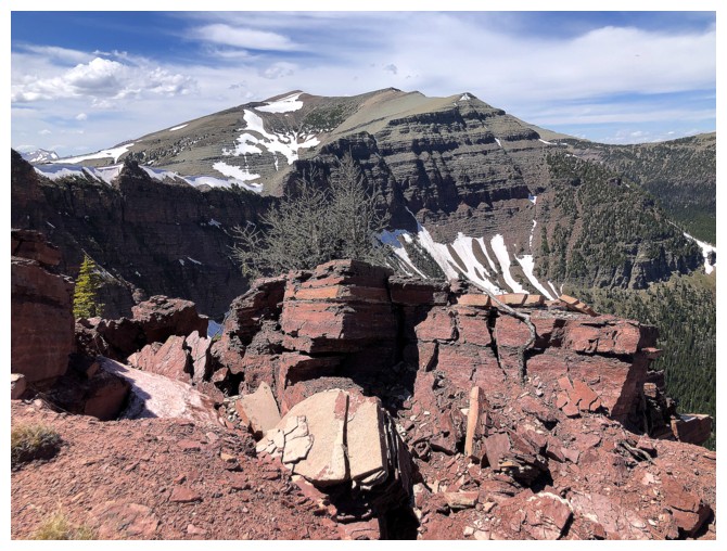
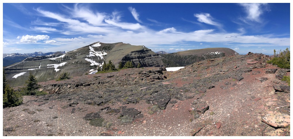
First good look at the true summit of Drywood Mountain
Same as above
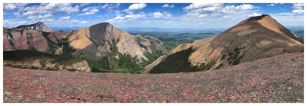
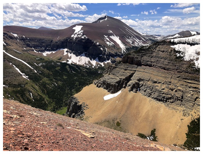
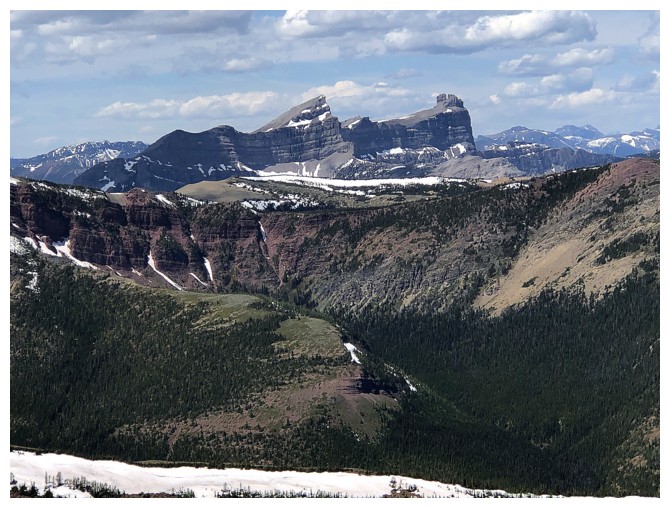
Add Pincher Ridge (mind-blowing recent trip) and Victoria Peak to the view
Everything from Drywood Southwest (left) to Pincher Ridge
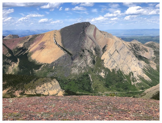
Close-up of Pincher Ridge
Victoria Peak will always be the mountain that started my love affair with The Castle, back in 2004
Windsor Mountain and Castle Peak
Mount Glendowan (left of centre) and Mount Blakiston (right of centre)
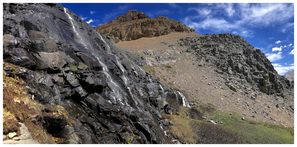
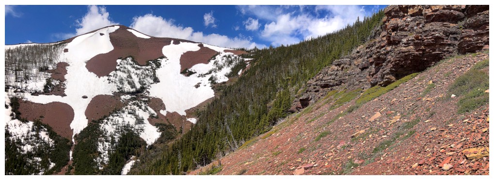
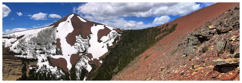
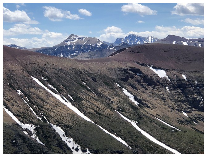
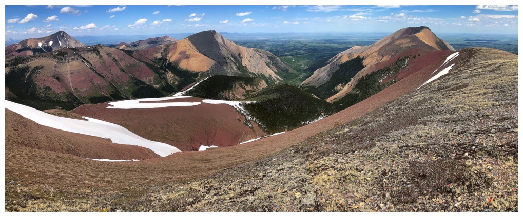
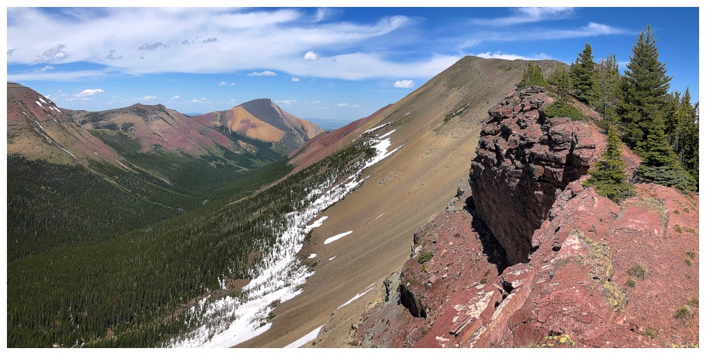
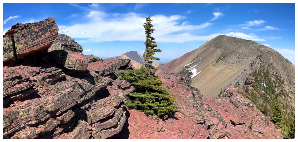
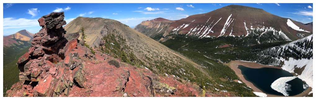
Looking southwest to the Southwest summit
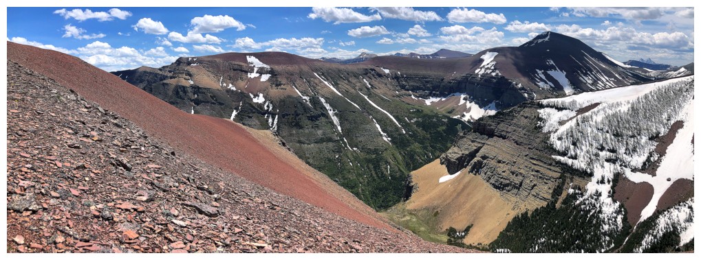
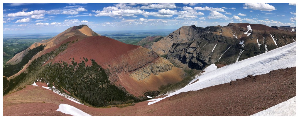
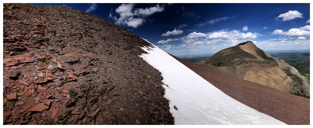
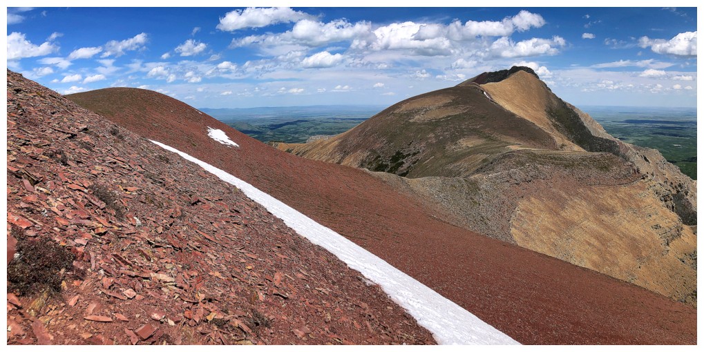
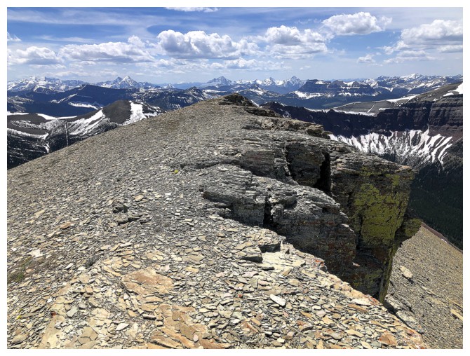
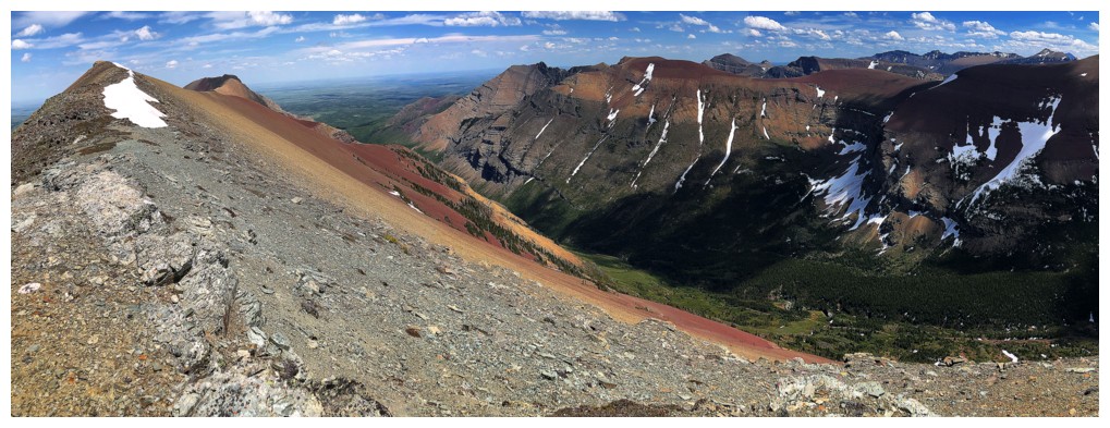
Losing elevation to the Redwood/Southwest col is one of the highlights of the trip because of the amazing colours

The hanging valley is far below now
Can't forget the things nearby
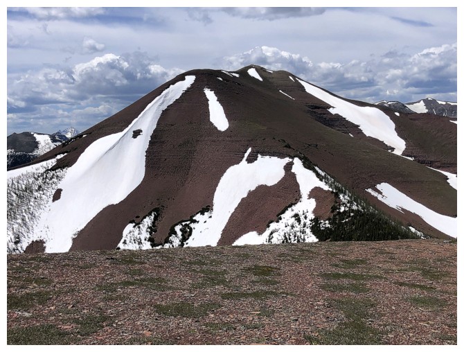
Approaching the col
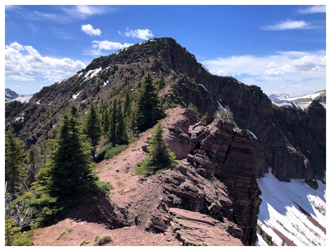
This is where Redwood Peak really earns its unofficial name!
There too
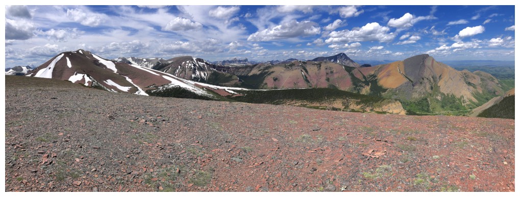
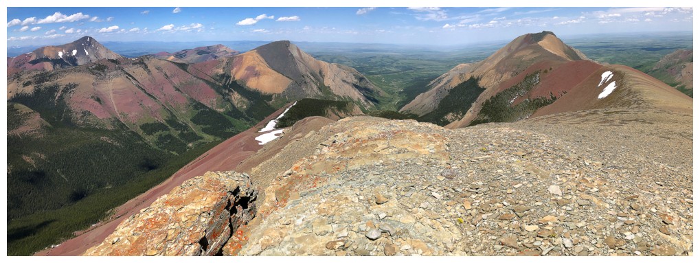
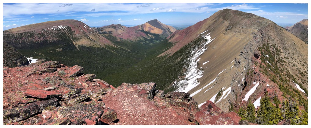
20 years ago this view of the east end of Loaf Mountain would have been
unremarkable to me. Now that I see Bakery, Icing, Ciabatta, The
Breadsticks, and Pastry in that view, it's incredible!
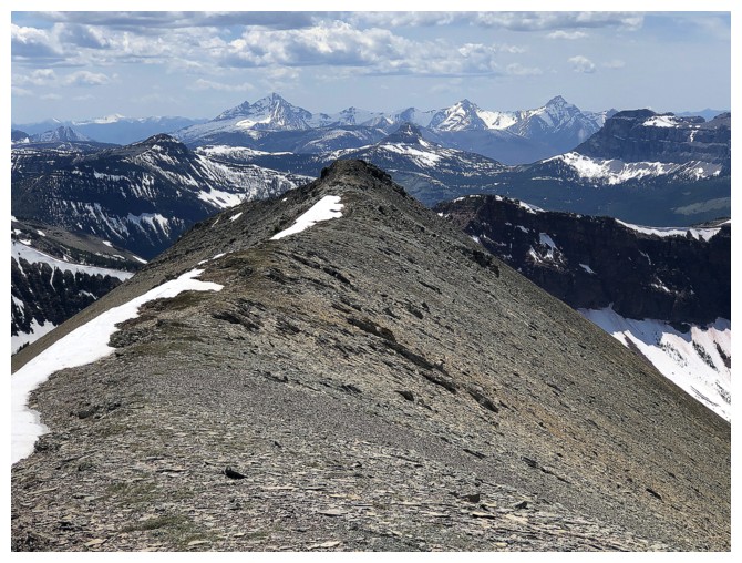
You really need to walk backwards for this part of the trip!
Almost at the summit of Southwest and still walking backwards
Metres away from the top
Summit view to the west. According to every topo map I could find
Drywood Southwest is depicted to be about 30 metres higher than the
true summit at the northeast end. I recorded values of 2490 m
(Southwest) and 2475 m (true) back in 2005. I would only say that it is highly likely the Southwest summit is the highest point on the massif.
 Leaving the summit right away because I can't see Bovin Lake
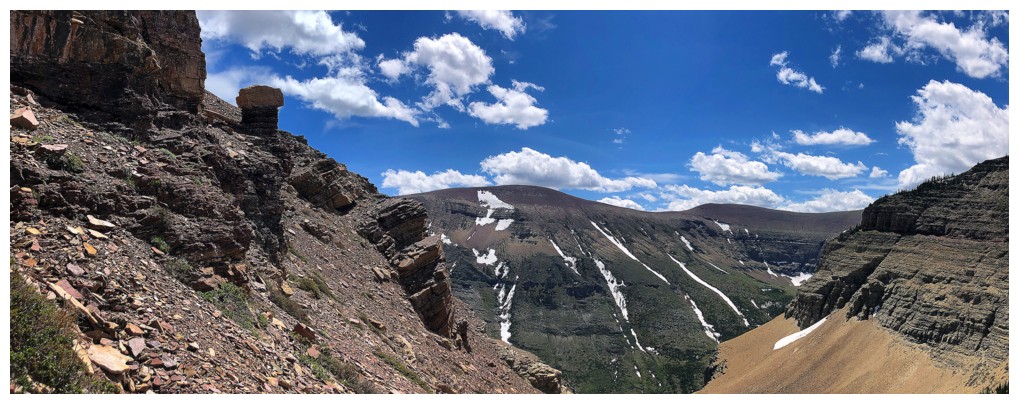
Victoria Ridge at the right. I'll be back to repeat that traverse another day.
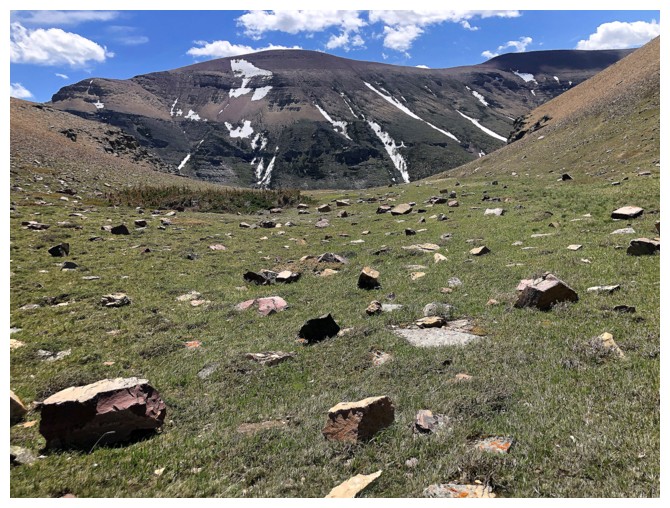
Pleasant run-in with some greenery
More greenery and a different view of Loaf's awesome length
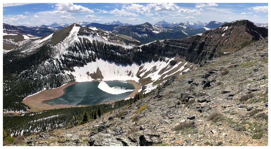
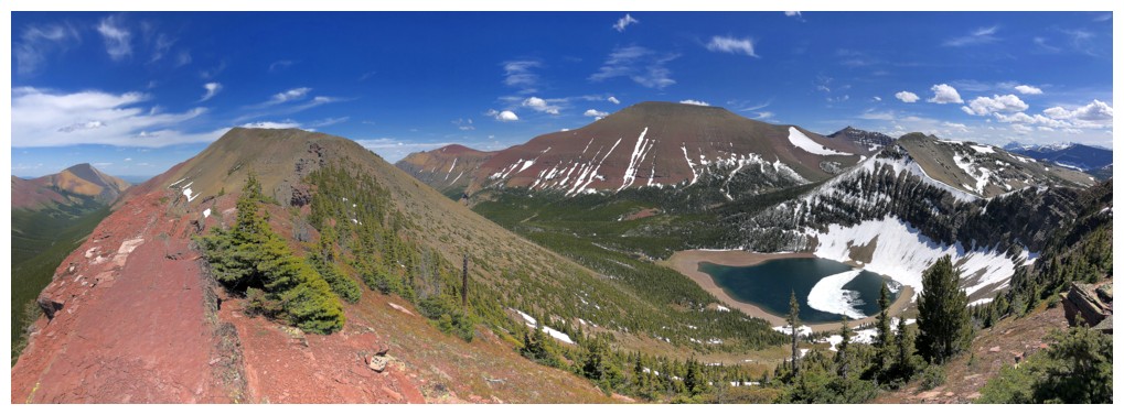
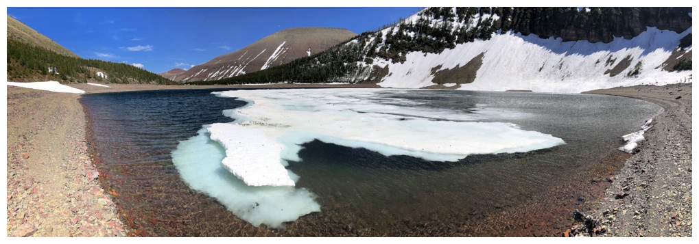
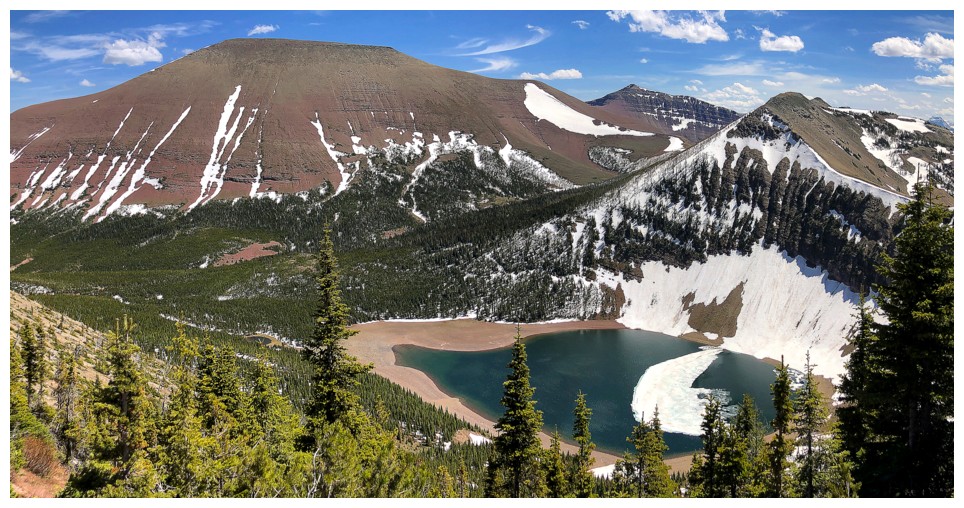
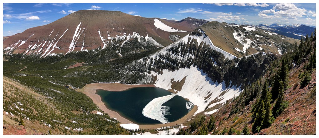
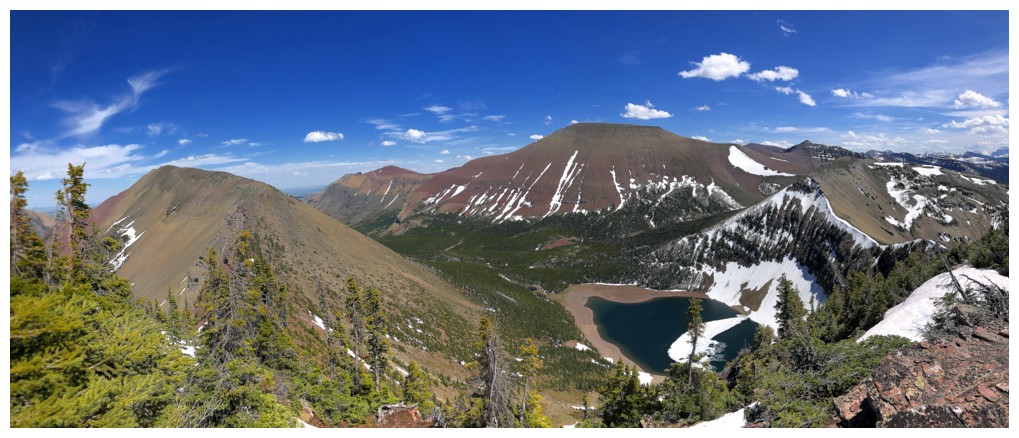
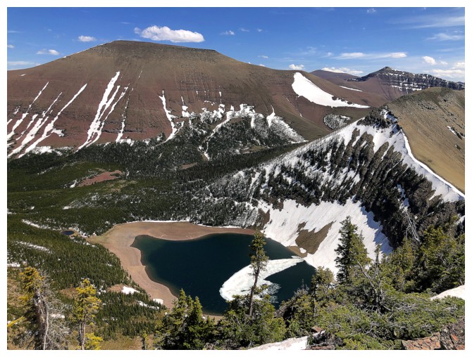
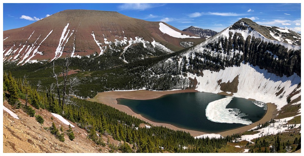
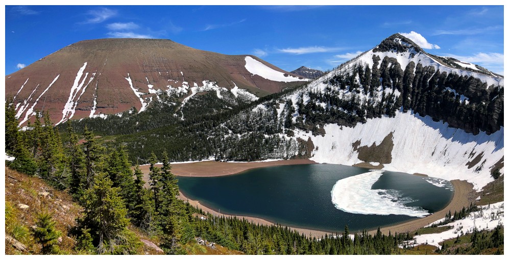
Bovin Lake - finally!
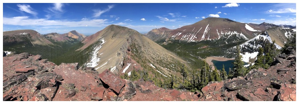
Little Bo-Peak at the left
Easy and enjoyable travel towards Little Bo
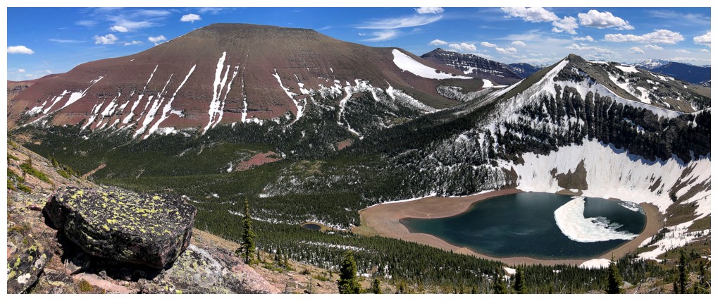
Bovin Lake and Loaf Mountain will be the center of attention for the rest of the ascent
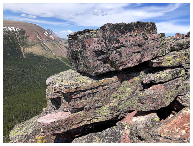
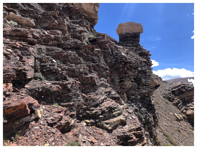
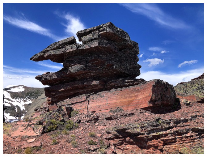
So will the odd, cool rock balanced atop other cool rocks
The near vertical east side of Victoria Ridge offers nothing in the way of scrambling (unless you are Alex Honnold)
The ascent of Little Bo is short and wonderfully scenic
Primarily because the peak is all red argillite
Looking back
Little Bo-Peak's sister peak Little Bo-Blue Peak at the right
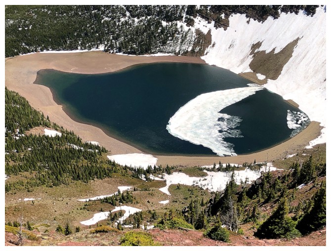
Still some ice of the lake, which makes a lakeshore visit even more appealing
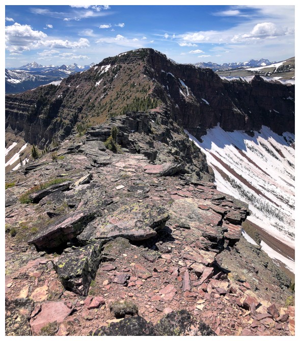
Little Bo-Peak could also be named Redwood Junior
The pinnacle at the left is one of the coolest features of the ascent
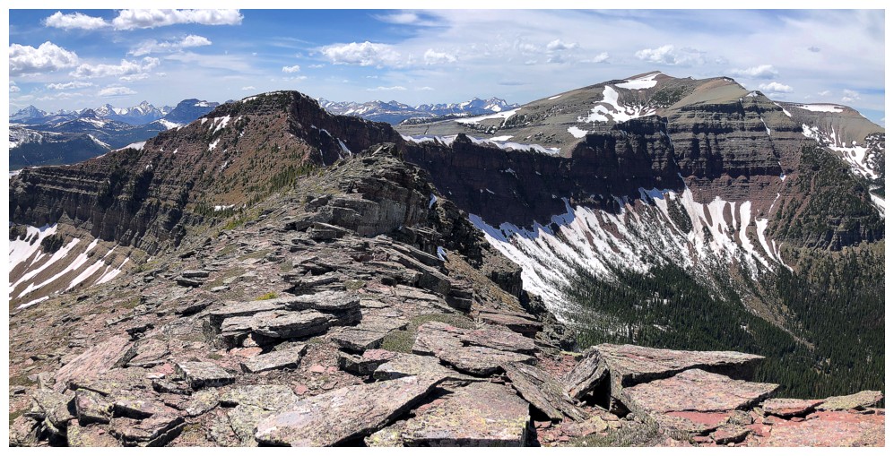
At the summit
Bovin Lake is not entirely visible from the top, but that can be remedied by traversing over to Little Bo-Blue
View to Victoria Ridge. I've been aching to repeat one of the best ridge-scrambles in the Rockies that goes from Victoria Peak to Victoria Ridge, but access is more challenging now. Someday...
Close-up
More summit views
Same as above
Sweet rock
Back at the pinnacle
Descending towards the lake
Looking back up the descent route
Getting closer
Almost there
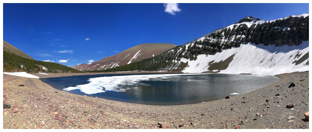
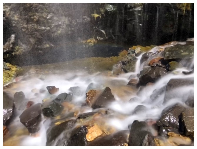
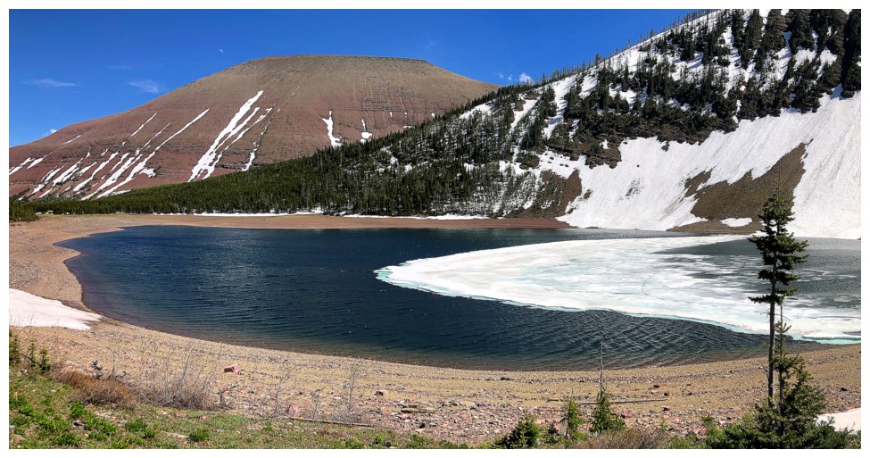
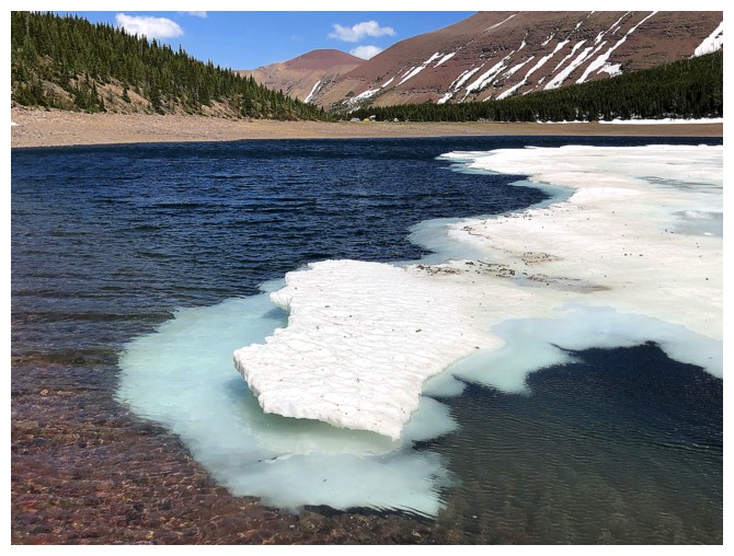
At the lakeshore
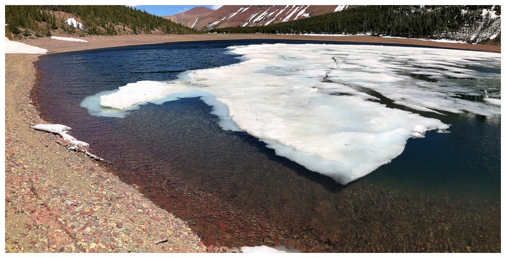
The ice
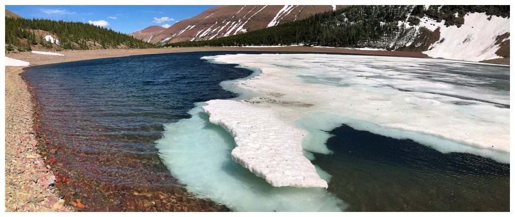
Not quite the awesome experience I had at Wall Lake in 2021, but satisfying nonetheless
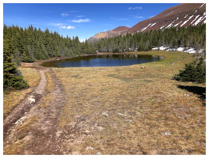
A small tarn east of Bovin Lake
The hike out is easy and colourful (sounds familiar!)
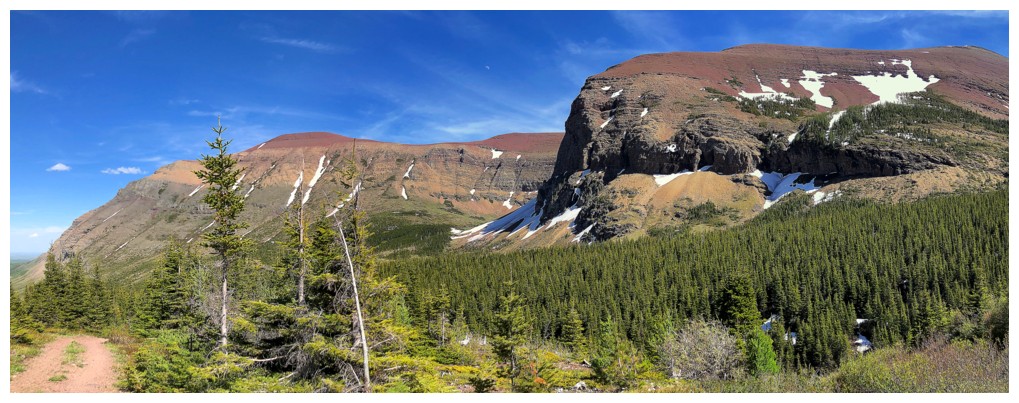
Loaf Mountain also boasts some of the best red argillite scenery in the southern Rockies
Back to where I left my bike and the view of the first part of the route up
The End
LOG