Drywood
Mountain VIII
February 12, 2026
Mountain height: 2464 m
Elevation gain: 930 m
Ascent time: 4:00
Descent time: 2:25
Solo scramble.
Disappointingly,
when the “mainly sunny” forecast changed to “mainly cloudy” overnight, I was
forced to change plans from a reasonably big objective to an exploratory trip.
I eventually settled on a line I had seen from Pincher Ridge on the north side
of Drywood Mountain, west of the Spirko inspired route I used in 2011. 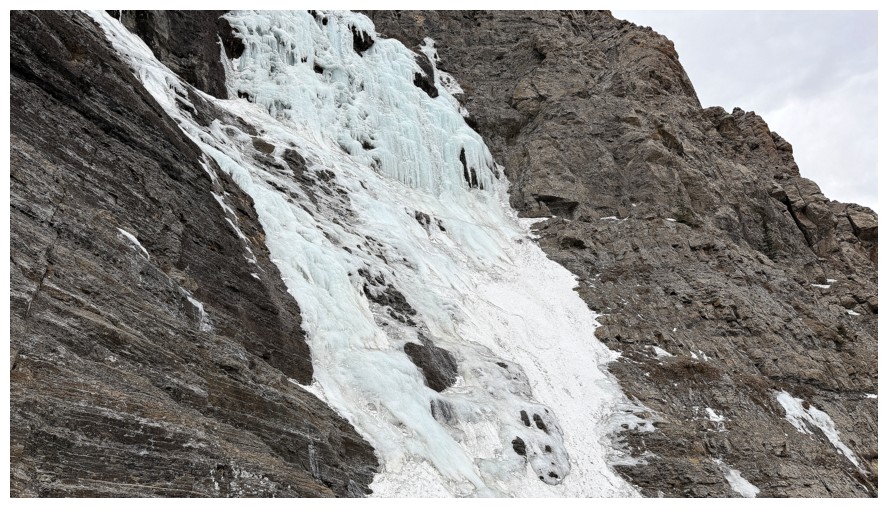 The new route
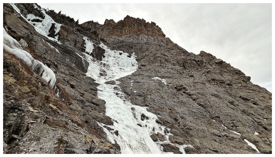
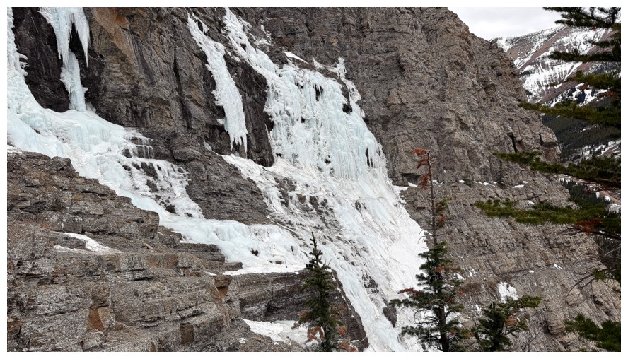
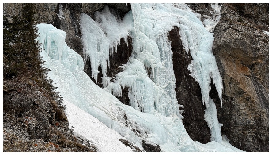
would first visit the popular ice climb, The Gasser, and then hopefully ascend a drainage to the left of the ice.
The new route
would first visit the popular ice climb, The Gasser, and then hopefully ascend a drainage to the left of the ice.
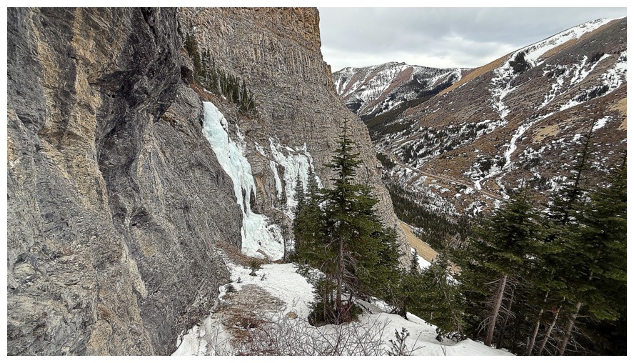
The approach to
the climb went with surprising ease, thanks to a terrific trail that leads
right into the drainage where the ice sits. The base of the climb was also
reached without too much ado. En route I passed by the subsidiary drainage that
was the intended line of ascent, noting it appeared to be straightforward.
However, in my
zeal to get a closer look at The Gasser, I soon found myself ascending
increasingly steep and challenging terrain towards the ice climb and away from
the subsidiary drainage. Traversing over to the route became impossible due to
cliffs below and downclimbing what I had come up was unsavoury at best.
Instead, I continued right up to the rock face, hoping I could follow the ledge at
the base to safer terrain.
Luckily, the
ledge was mostly snow-free, granting me easy and interesting travel; unluckily,
it was not exposure-free and at one point I spent ten minutes chopping two steps
into a small frozen waterfall that was barring the way (a repeat of Woody VII,
a few weeks earlier). A slip here would have sent me immediately over a huge
cliff and so I made sure those steps were bomber! Beyond that, much easier
terrain led to the ridge above.
Decision time.
The weather sucked (cloudy and extremely windy) and I was still 400 vertical
metres from the summit. 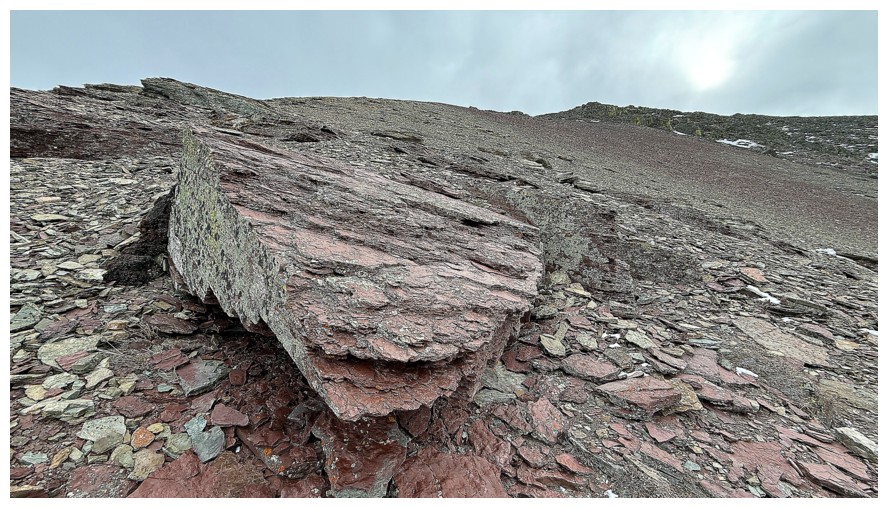 However, the intervening terrain looked
straightforward, if not inspiring. I decided to finish the job. The saving
grace of the earlier ledge traverse was complete shelter from the wind. Now out
in the open, the wind was merciless. Though not quite a repeat of Bridle Peak V (where I was actually concerned for my life for
several minutes near the summit!), that wind sucked much of the enjoyment out
of the remainder of the ascent. I eventually reached the summit ridge, battled
my way to the top, took 5 photos, and then turned around immediately.
However, the intervening terrain looked
straightforward, if not inspiring. I decided to finish the job. The saving
grace of the earlier ledge traverse was complete shelter from the wind. Now out
in the open, the wind was merciless. Though not quite a repeat of Bridle Peak V (where I was actually concerned for my life for
several minutes near the summit!), that wind sucked much of the enjoyment out
of the remainder of the ascent. I eventually reached the summit ridge, battled
my way to the top, took 5 photos, and then turned around immediately.
The
obvious
route choice for getting down the mountain was via the route I had
initially intended
to ascend. I was hoping to stay on the ridge through most of the
descent, but
the wind had other ideas – it was relentless and I relented, quickly
leaving
the ridge and heading into the gully. The gully did provide a decent
route down,
however, much of it was deceivingly steep and quite tedious to descend.
And in
a normal February, the snow in the centre would probably offer easy
plunge-stepping. Unfortunately, an unusually warm and snow-less second
month had hardened whatever snow remained in the area almost to ice.
Even with crampons and an ice axe I
would not have descended the snow. Nevertheless, I made it down
unscathed (if
not expediently) and enjoyed a much easier return to the start.
Mixed reviews
for this route. Firstly, I would never repeat my actual ascent route. Going up
the way I came down would certainly be preferable and I would attempt it when
there is either no snow, or snow that’s actually fun to ascend, not
traumatizing. Having ascended Drywood Mountain via 5 different routes, I would
rank this one as #4. A repeat ascent may happen, but only in perfect weather
conditions.
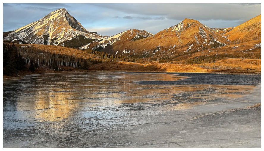
Quick stop at Butcher Lake. Very unusual to see open water in February.
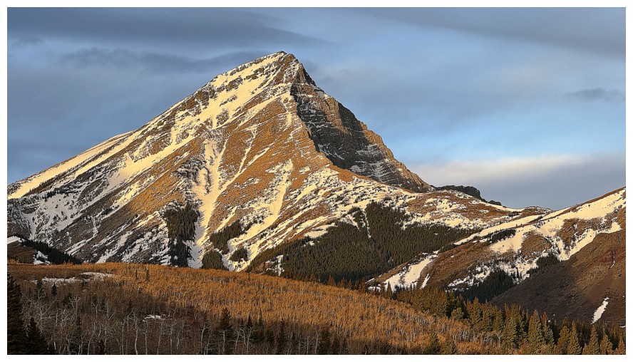
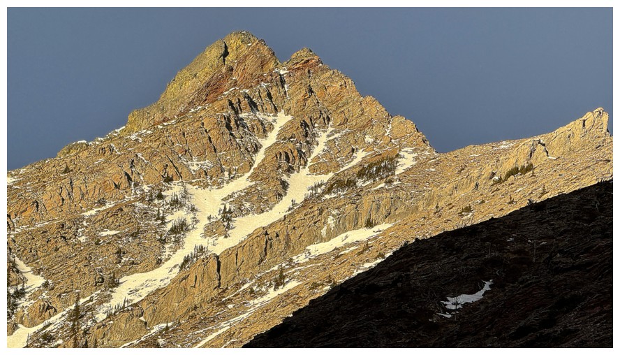
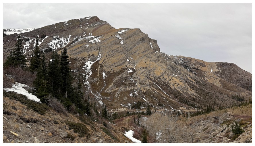
Magnificent Victoria Peak
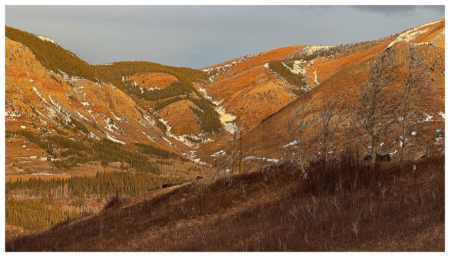
I considered trying a partial new route up Prairie Bluff, near the left side, but decided it would wait for another day
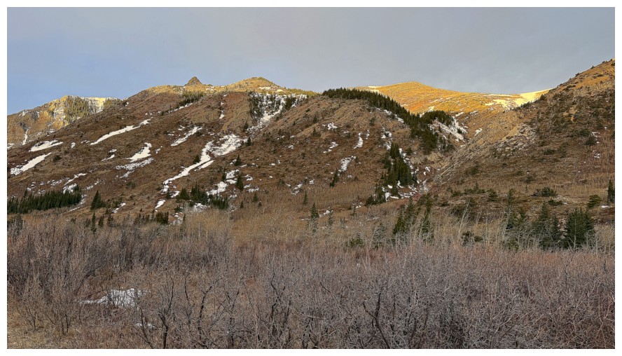
Hiking the Drywood Falls trail and getting a good look at a fantastic route I took up Bridle Peak, a few weeks earlier
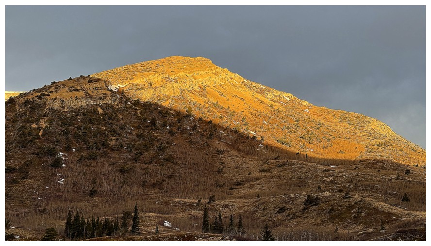
Sun on Cinch Hill
The route up Bridle (up the middle) doesn't look like much from the trail, but it's a "ring-a-ding-dong-dandy"!
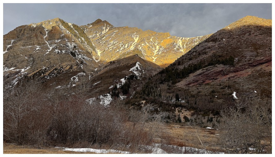
The Sun lighting up the summit of Pincher Ridge
Mourning the last of the Sun's direct rays I will see for the reminder of the trip
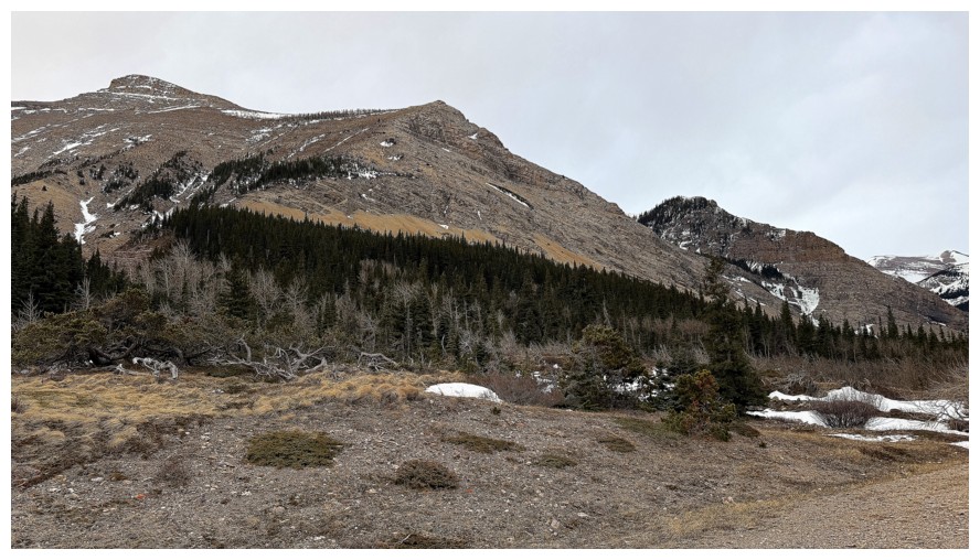
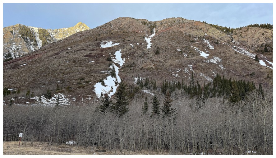
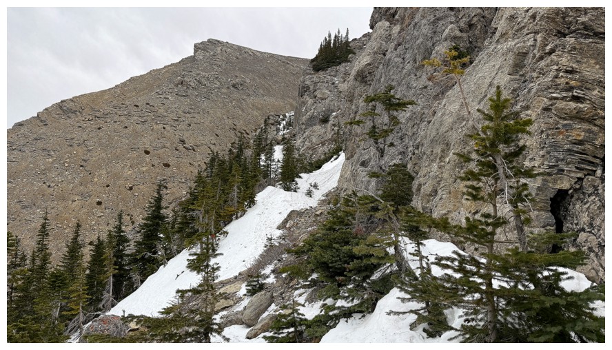
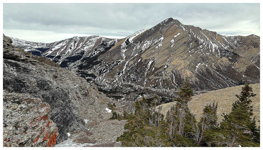
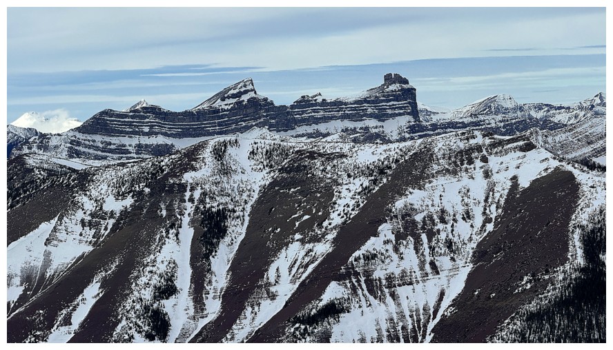
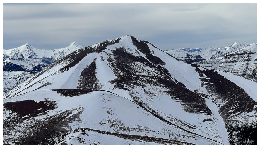
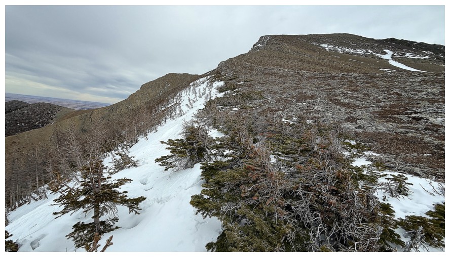
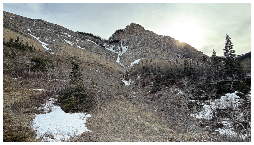
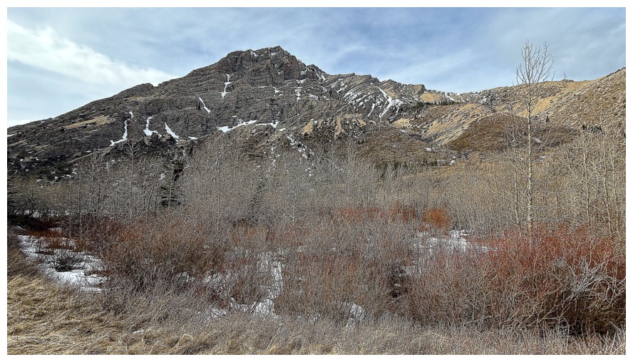
Passing the north ridge route up Drywood

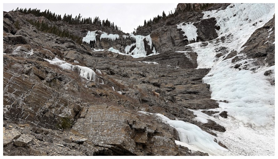
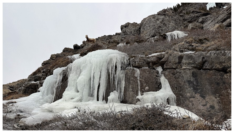
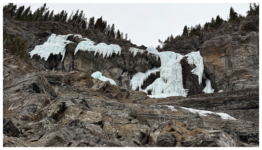
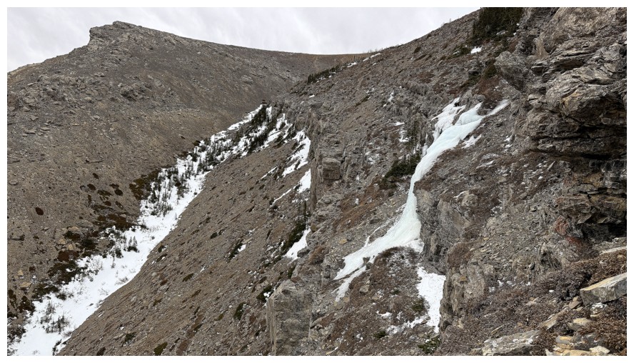
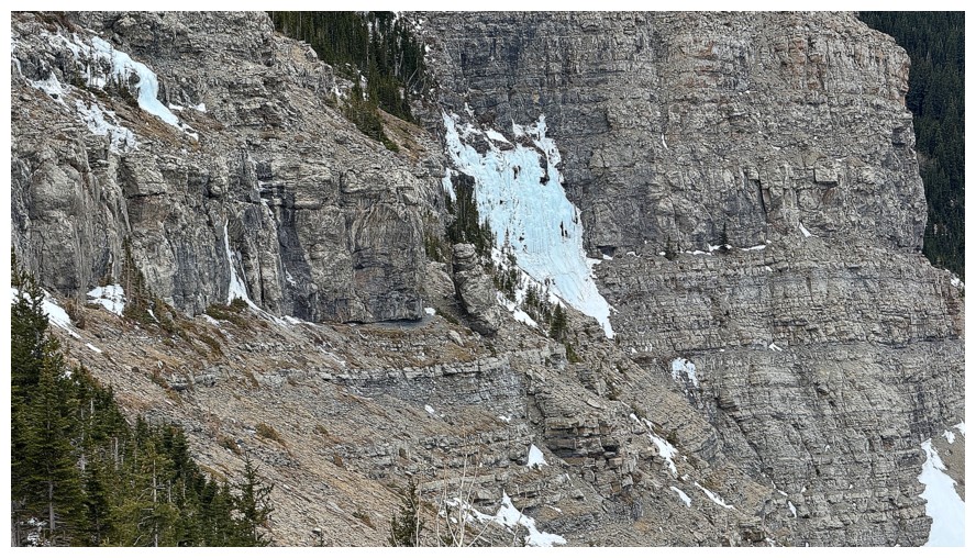
Off the main trail and heading towards The Gasser, just left of centre
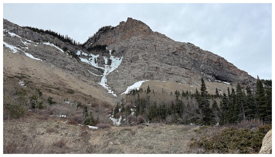
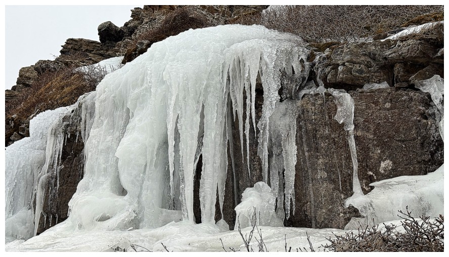
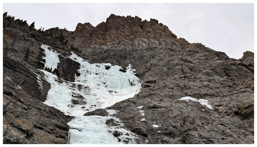
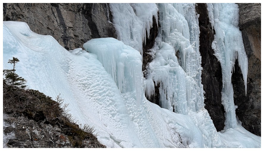
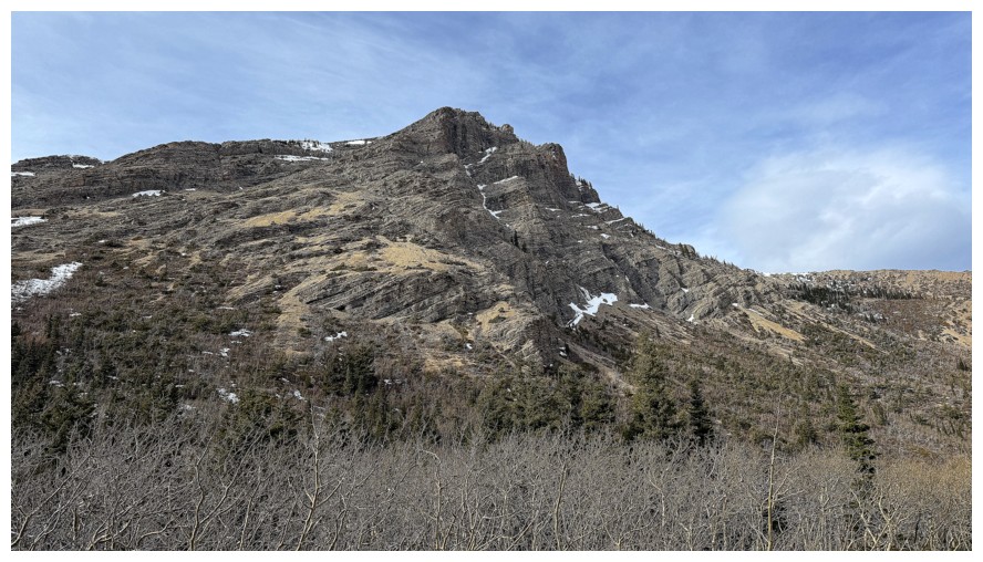
The Gasser
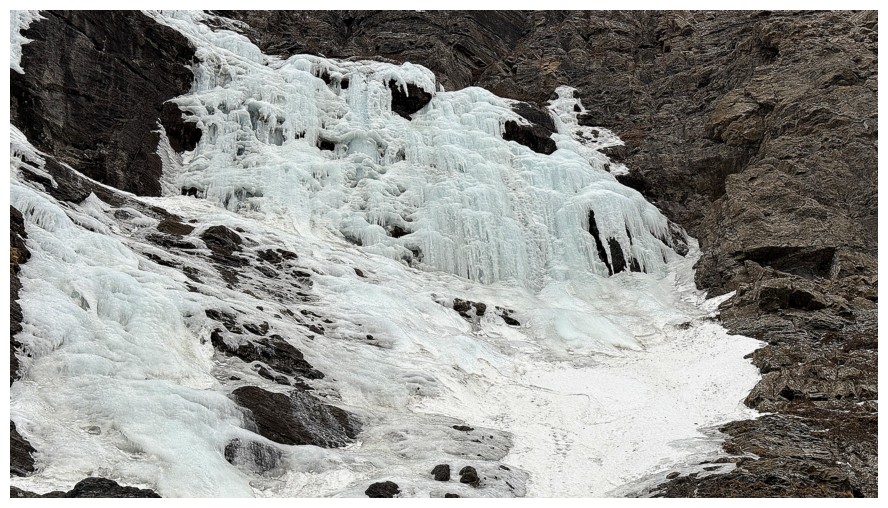
Close-up - it appears to have succumbed to the unusually warm January and February weather
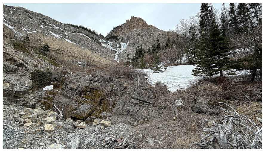
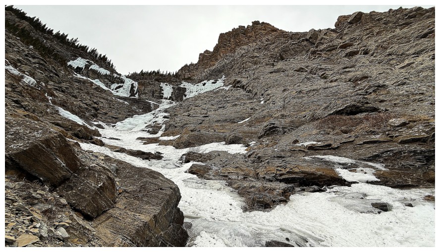
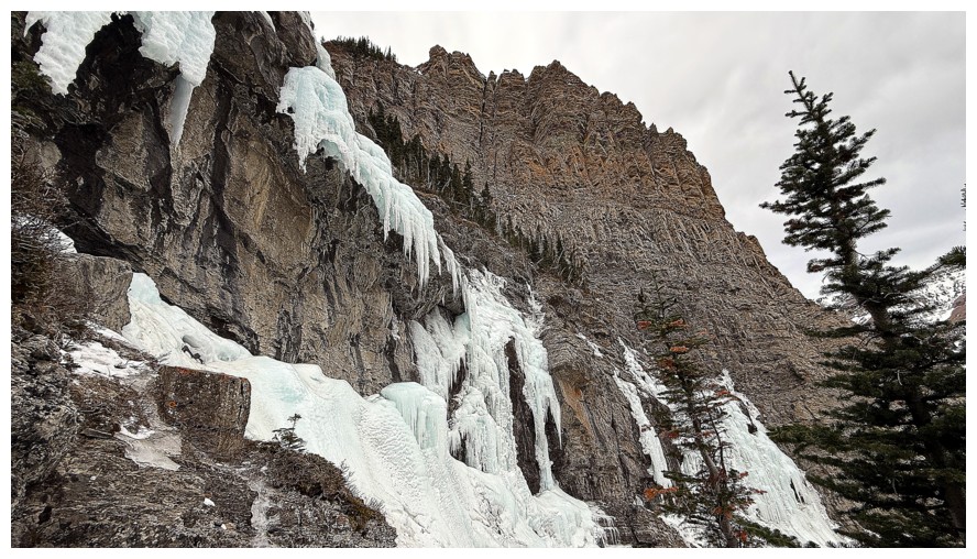
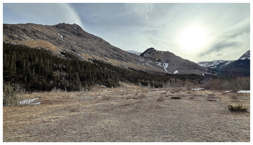
In the drainage that leads to the ice climbs
At first the drainage is completely dry
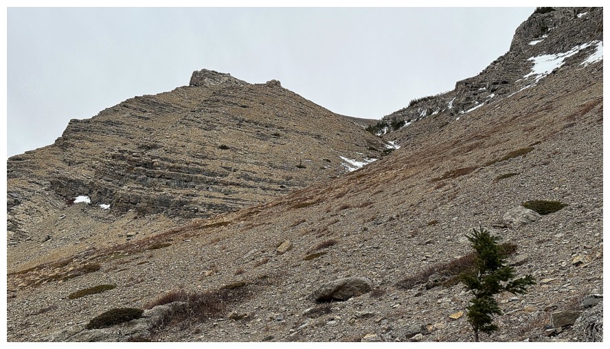
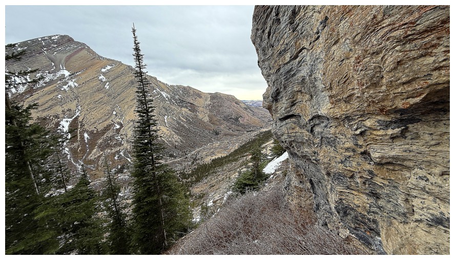
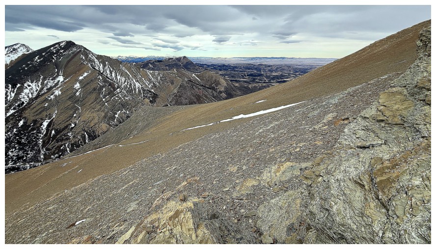
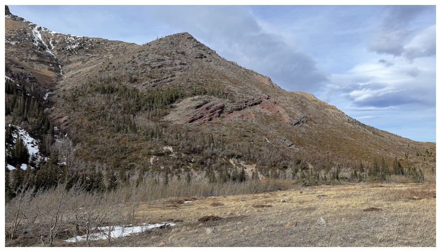
Pincher Ridge is going to dominate until I've gained a significant amount of elevation
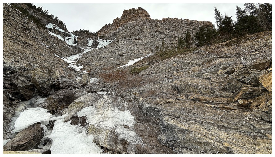
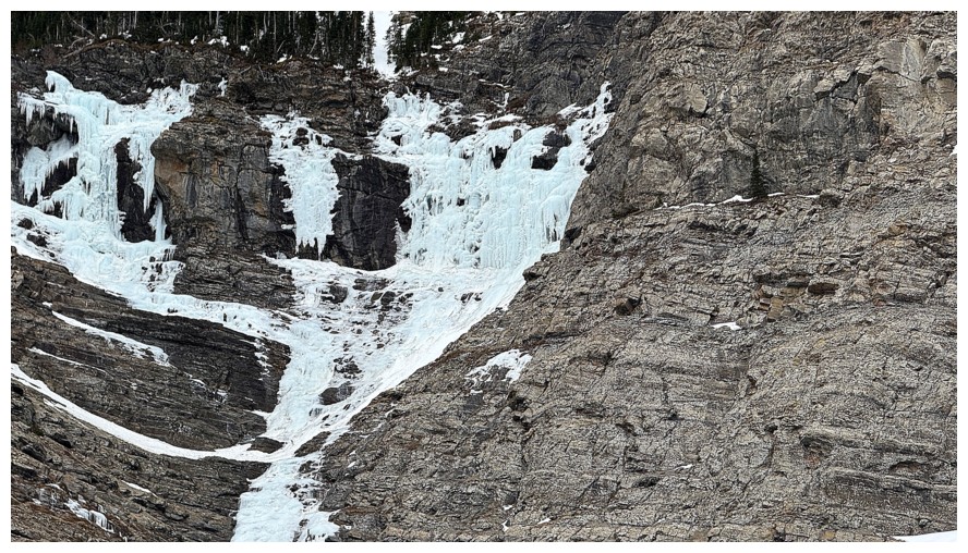
Ice starts to appear
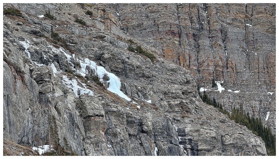
Looking left to the route I intended to ascend
Instead I'm ascending these cools slabs towards The Gasser
Getting closer to the climbs
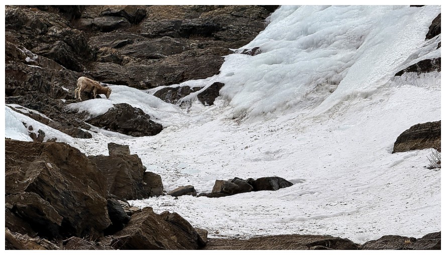
I have some company. This little guy got as much photo attention as the mountain scenery.
Still going up, even though I should have stopped here, descended a little, and then traversed over to the intended line
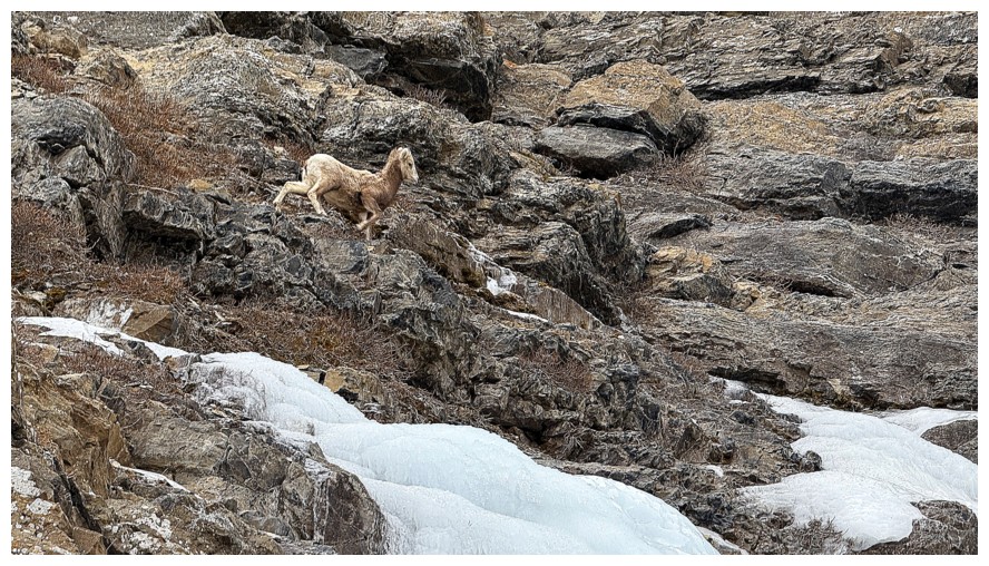
I tried to steer clear of the animal but he/she kept changing direction
Ascending increasingly steep terrain near the ice
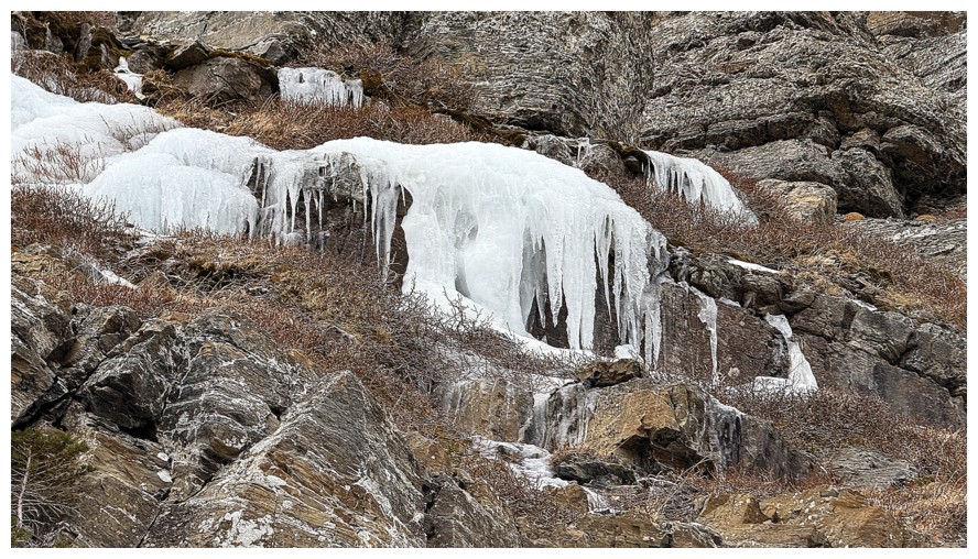
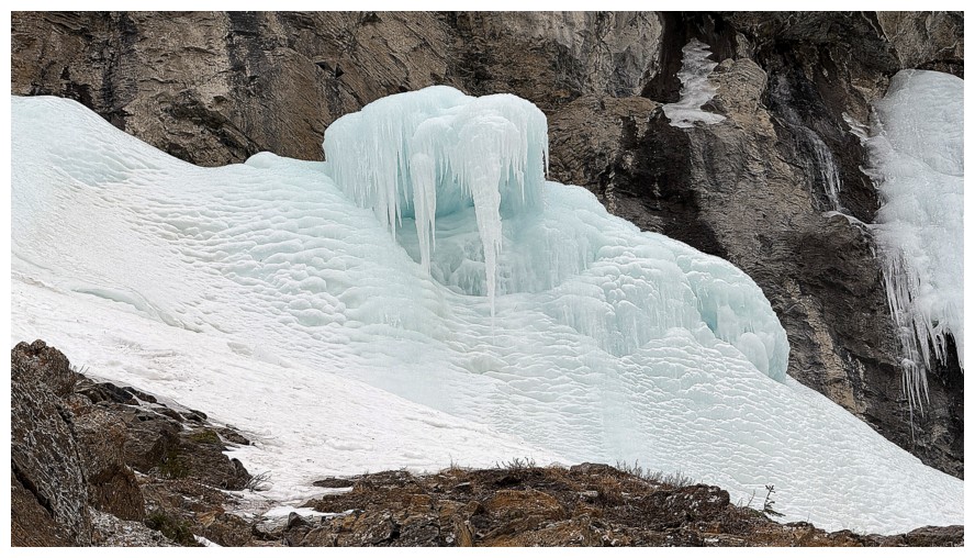
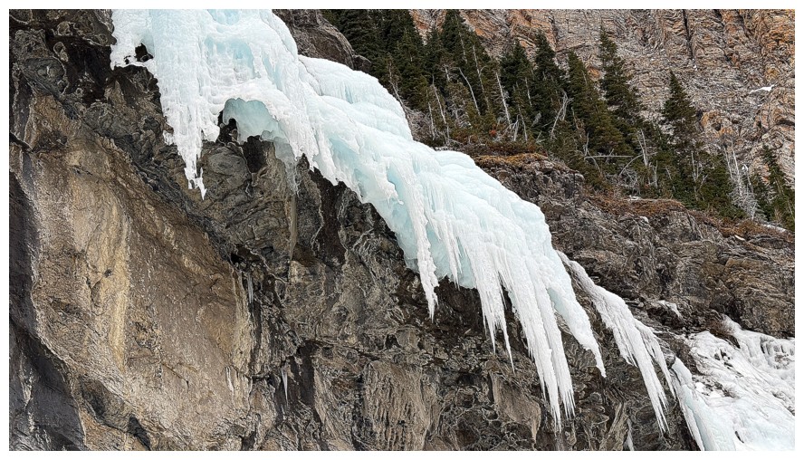
Hard to turn around when the area is littered with cool ice formations
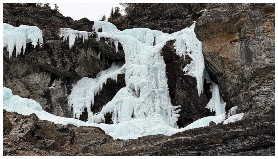
This might be the "Fluffy Saves the Day" ice climb
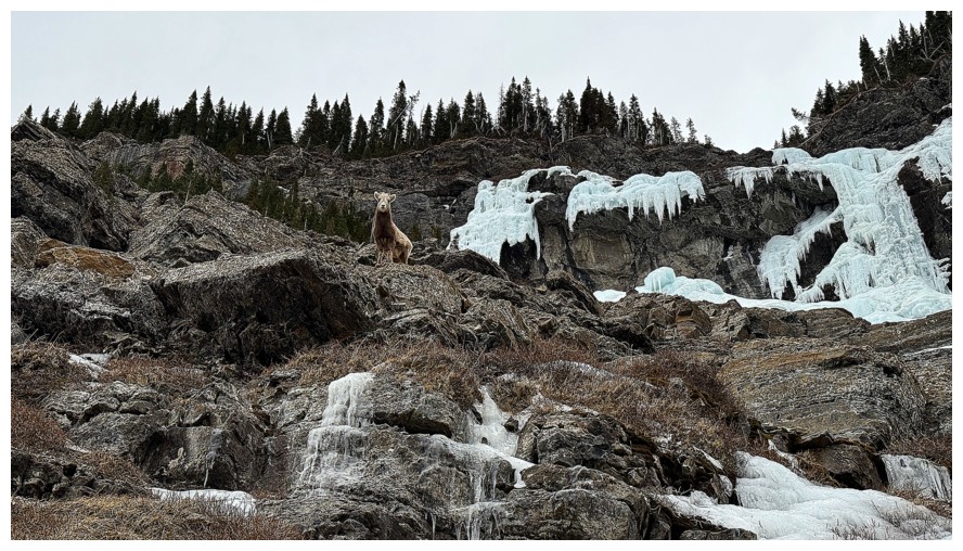
Apparently he/she is not camera shy
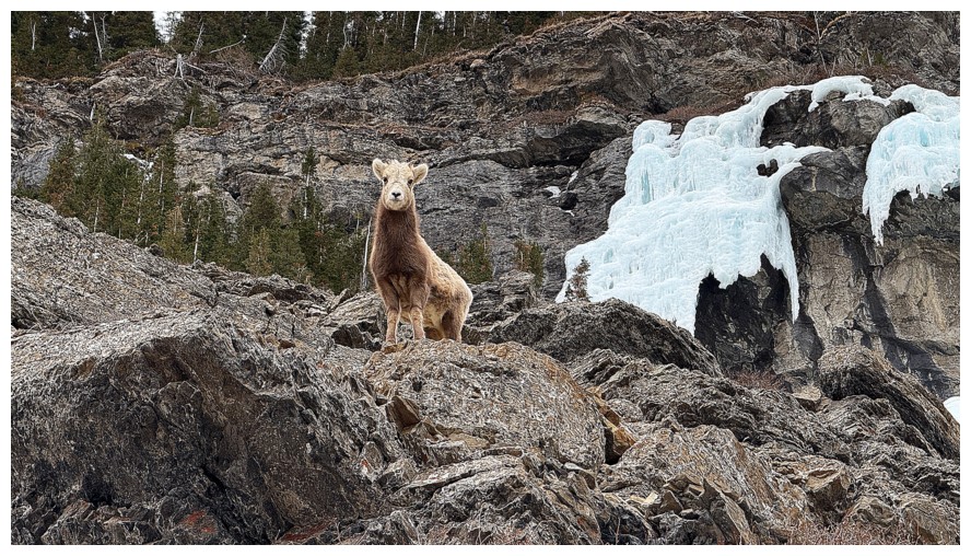 Close-up
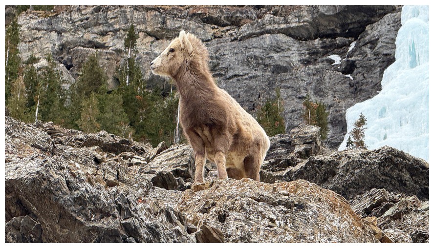
Definitely keeping an eye on me
Another cool chunk of ice
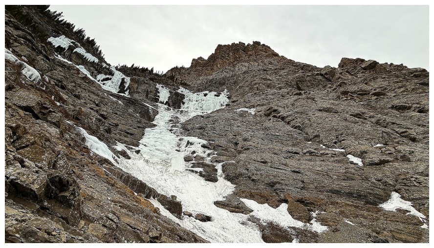
Looking down the route
Best shot of the upper part of The Gasser
I wanted to get right up to the ice formation near the lower left, but the terrain was getting dangerously steep
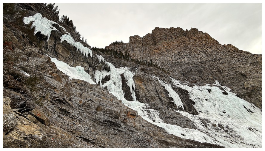
Fluffy, The Gasser, and the amazing rock above The Gasser
The chunk of ice I wanted to get close to - this is a zoomed in shot, taken from afar
Now at the same height as The Gasser, having ascended some very steep snow slopes
The aforementioned amazing rock
Lots of other cool ice formations to check out
Leaving the area
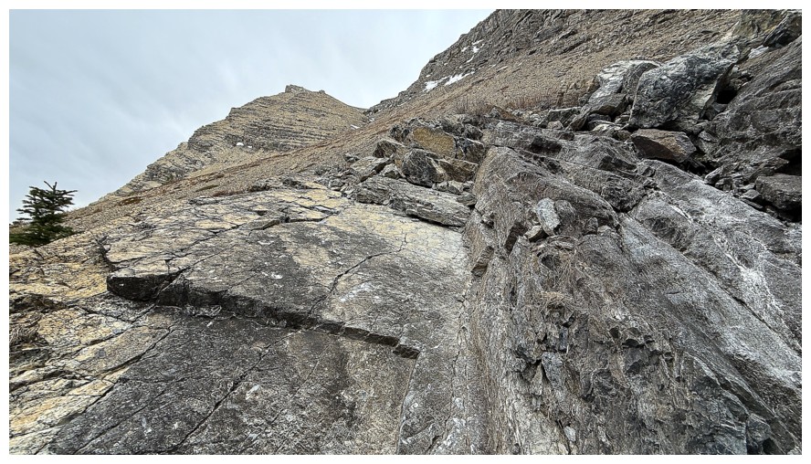
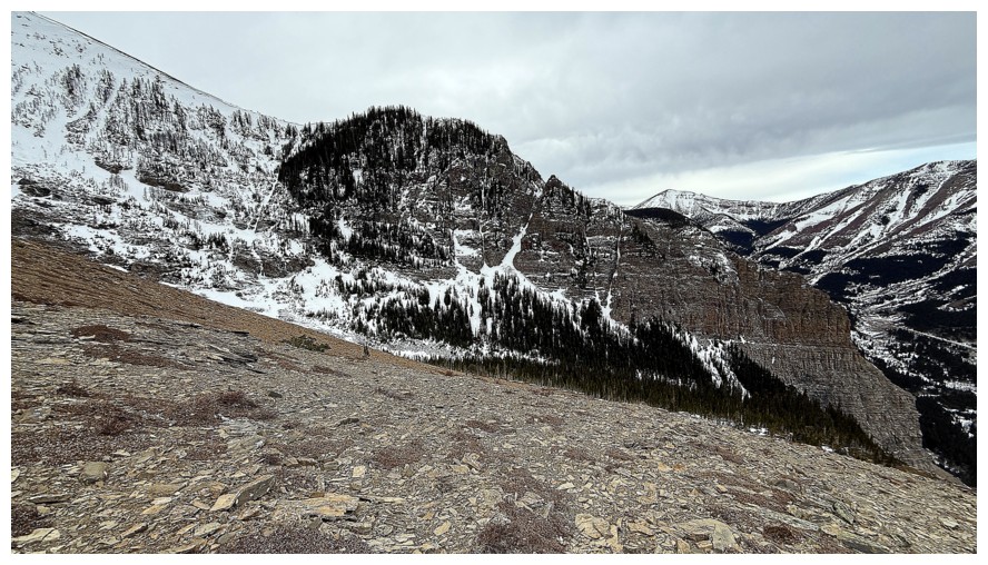
 Following a ledge below the enormous rock band above and hoping it leads to "freedom"!
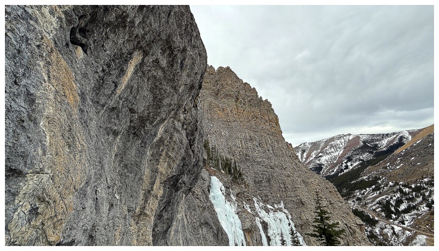
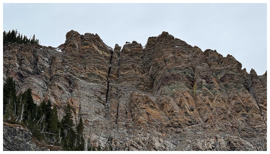
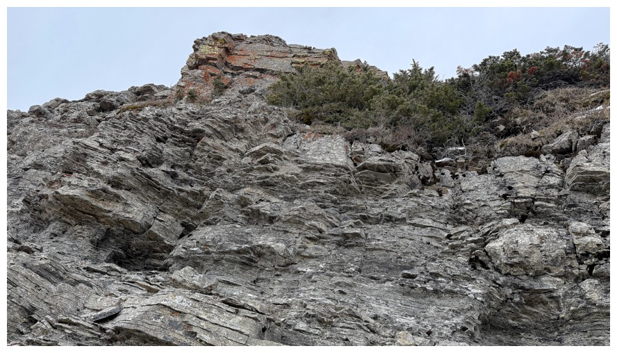
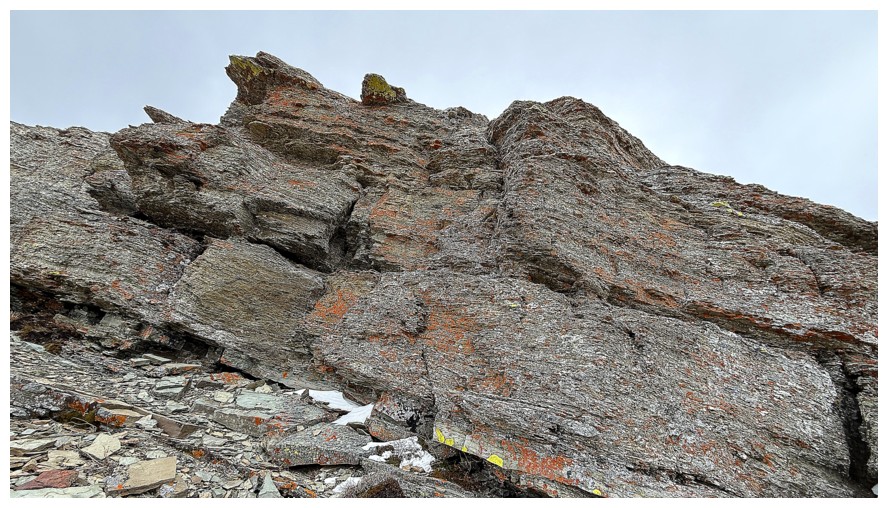
The rock above
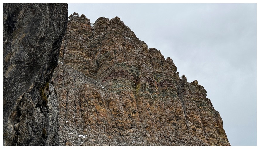
This rock would be fantastic on a clear day with the Sun on it
Much of the rock is very solid and would offer good climbing, but not scrambling
The wall is near vertical
Things are looking good here
Not happy to see snow on the ledge but it turned out to be inconsequential

Looking back
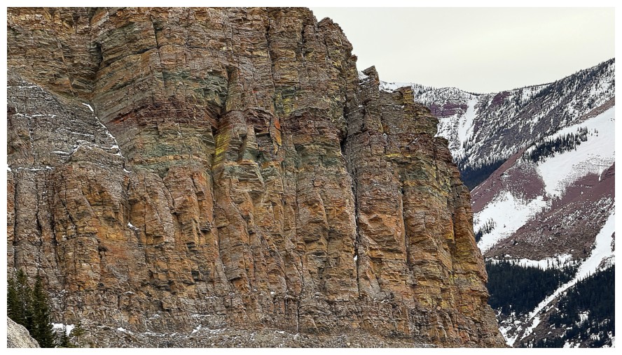
Still enamoured with that rock above The Gasser
Another ledge near the left
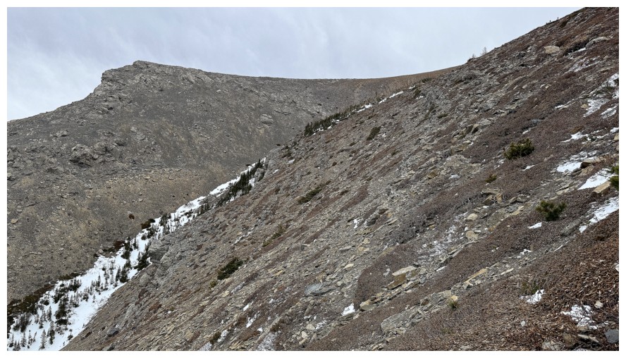
Pincher framed between my ascent route at the left and the eventual descent route at the right
It's getting very exposed and that ice right of centre is blocking the route - good thing I had my ice axe to chop steps
The rock gets less vertical, but it would still be a very stiff scramble with severe consequences if you slipped
Freedom!
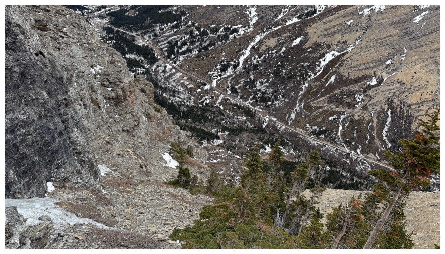
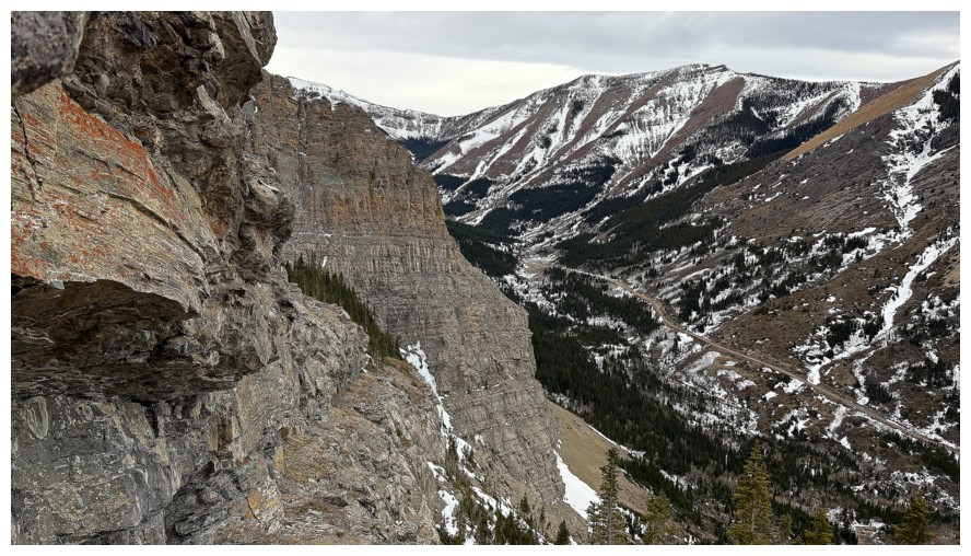
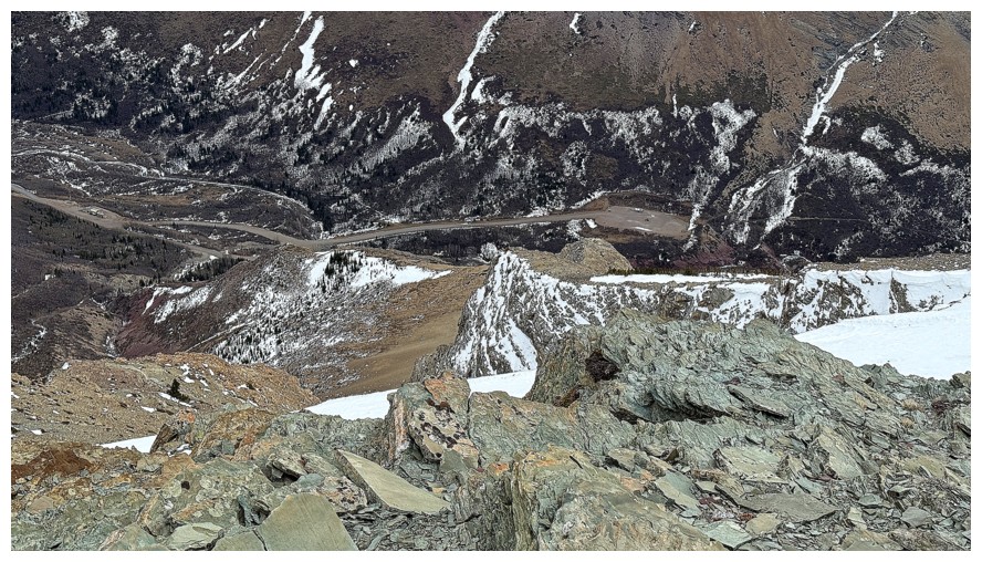
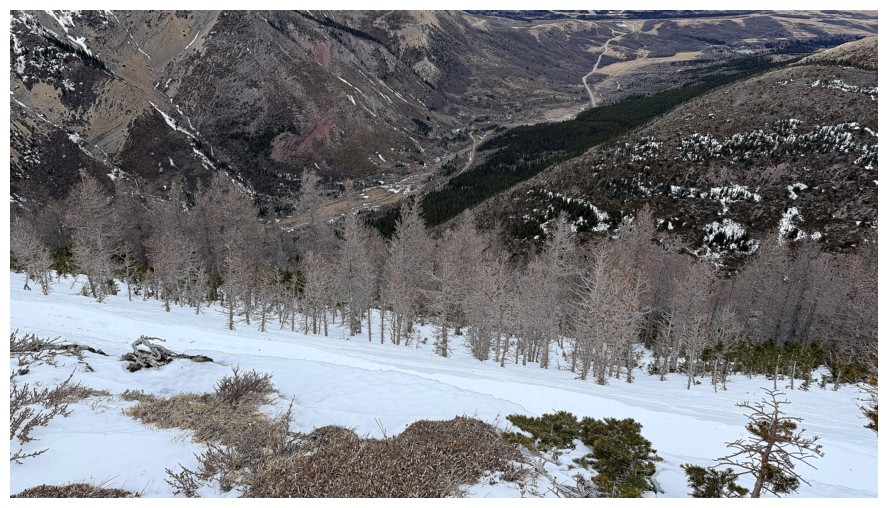
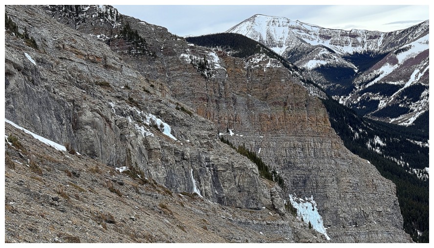
Again, looking down the route, with the Drywood Falls trail far below
The terrain above The Gasser might be ideal for another exploratory trip
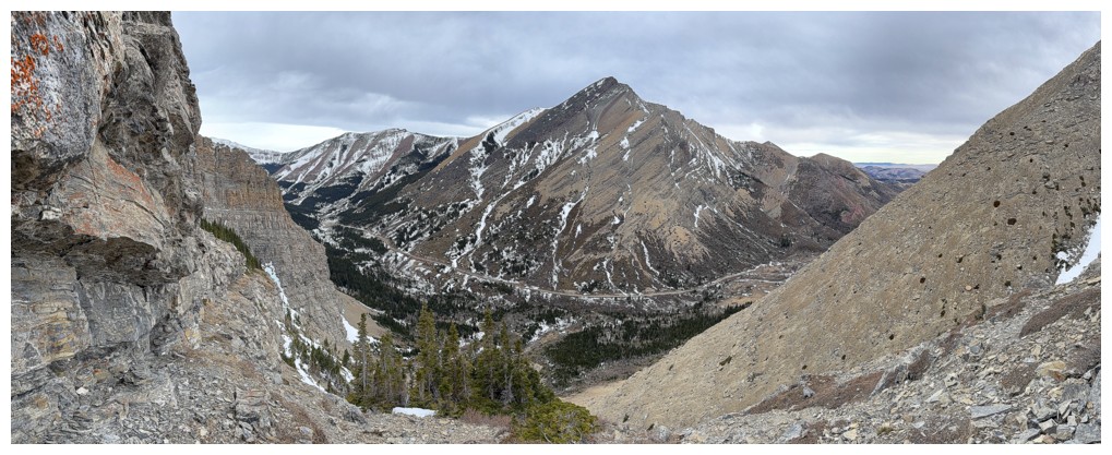
Above all the difficulties and deciding if I want to go all the way to the summit, just left of centre
Interesting snow couloir that would be right up Brad and Dave's alley. The southwest summit of Pincher Ridge behind.
The cloud cover has killed the colours
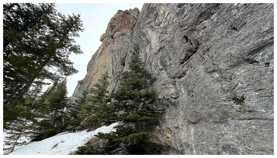
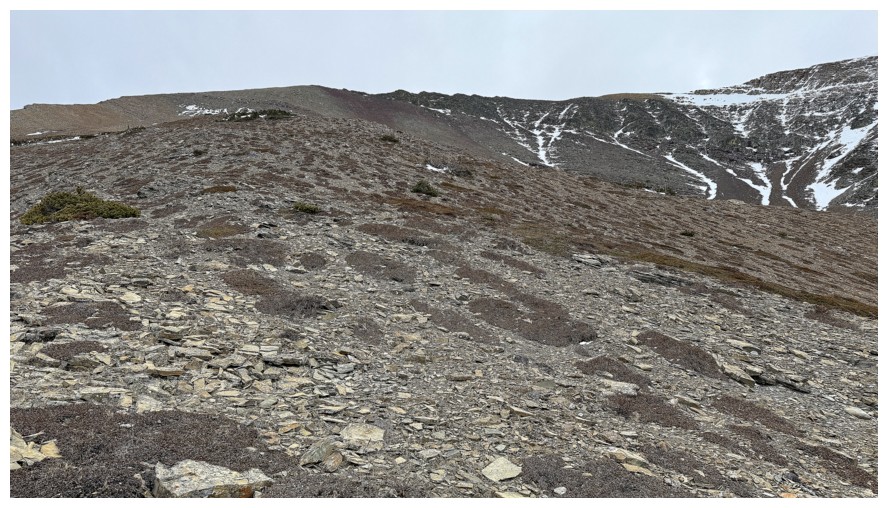
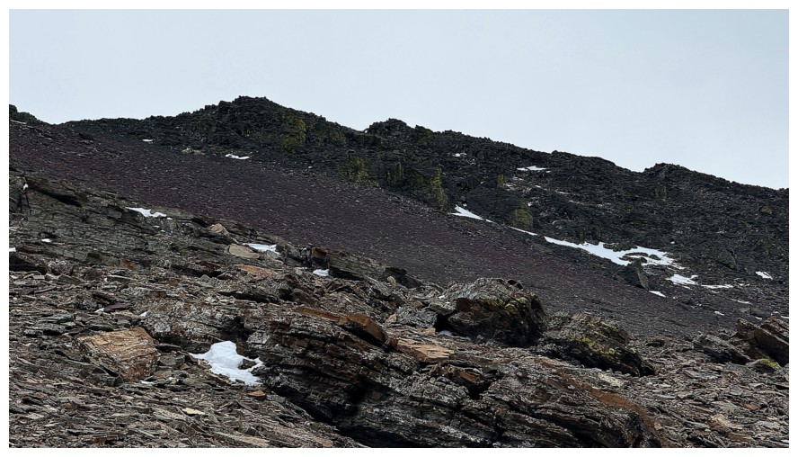
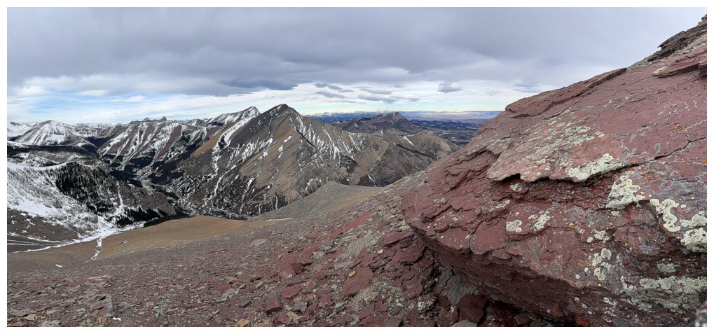
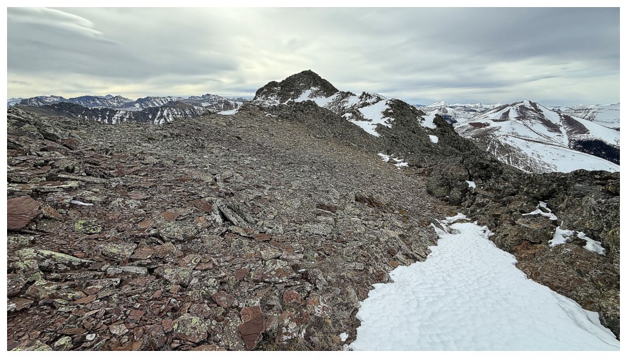
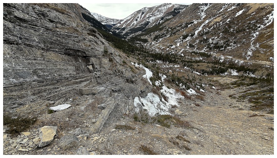
One of very few rock bands along the somewhat mundane route
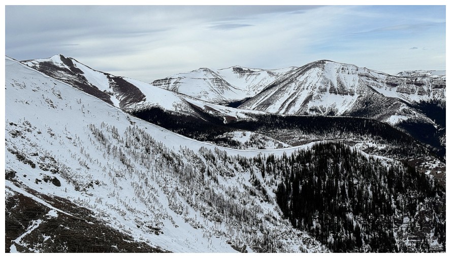
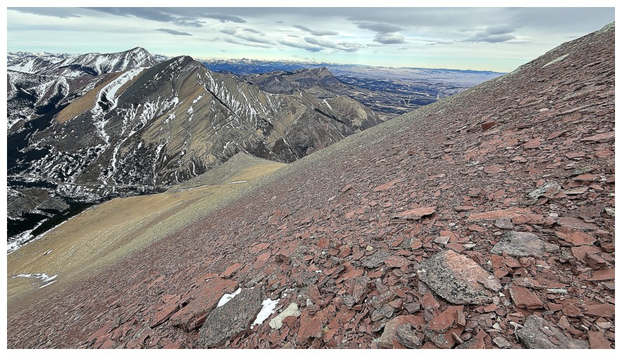
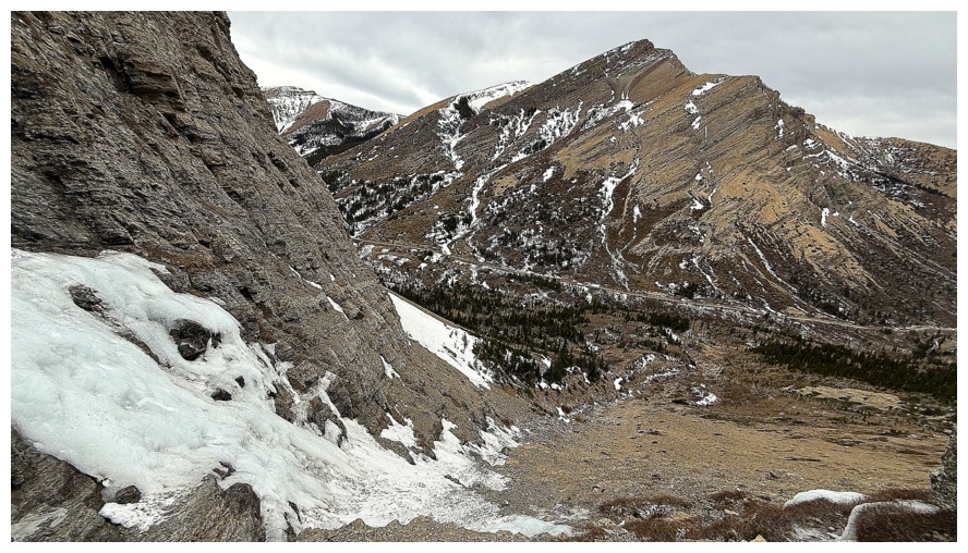
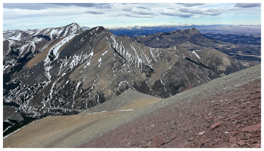
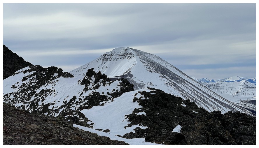
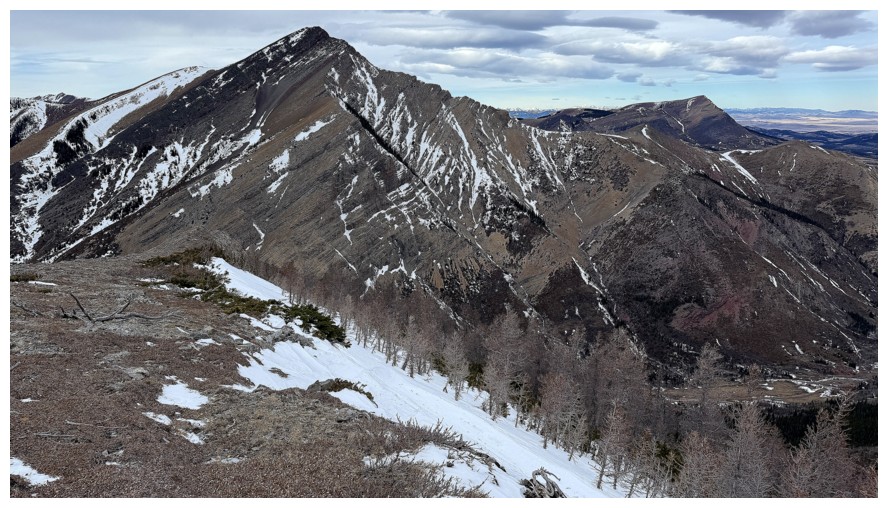
The summit of Victoria Ridge in the centre
The intended descent ridge to the north
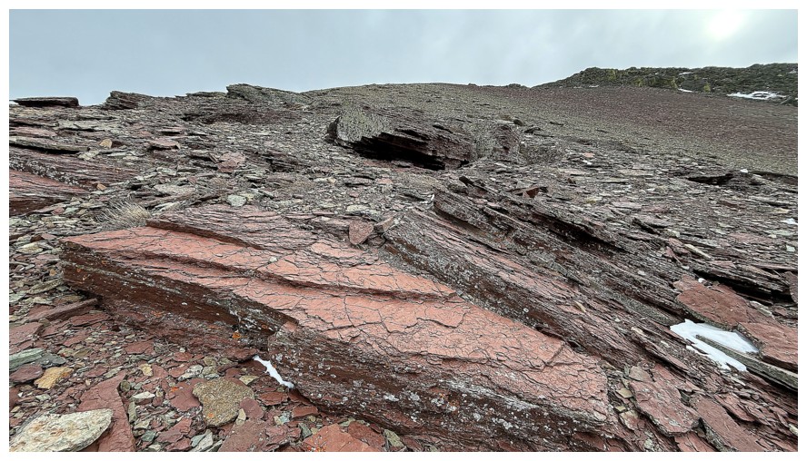
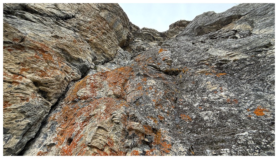
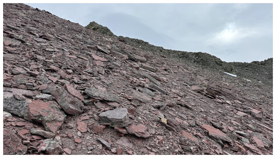
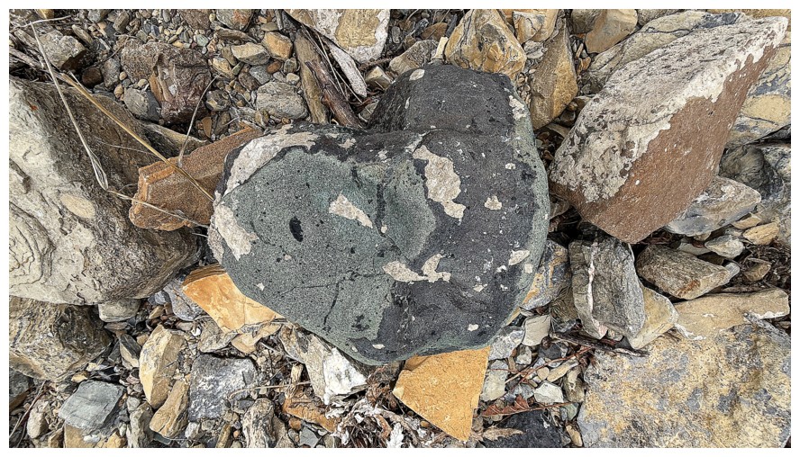
Happy to encounter some red argillite; not happy about the absence of the Sun
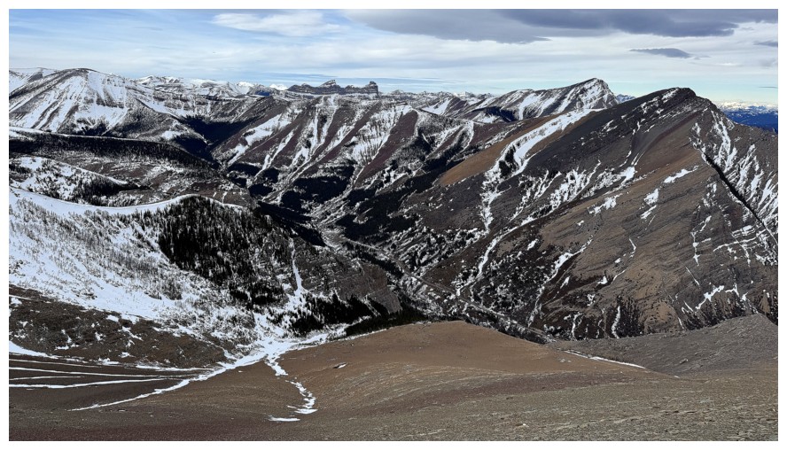
Castle Peak and Windsor Mountain join the view in the distant centre
There they are
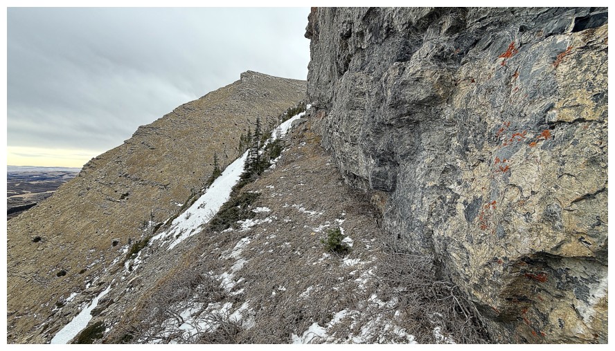
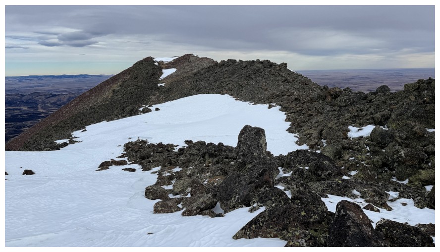
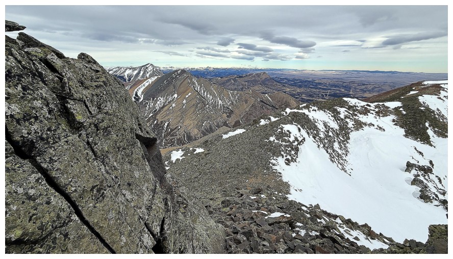
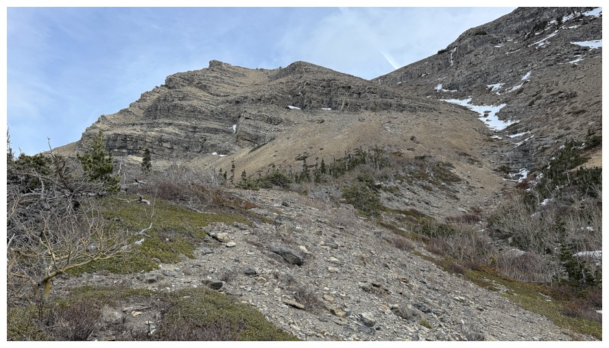
A tiring slog to the summit ridge, exacerbated by super strong winds
Cool delineation of rock types
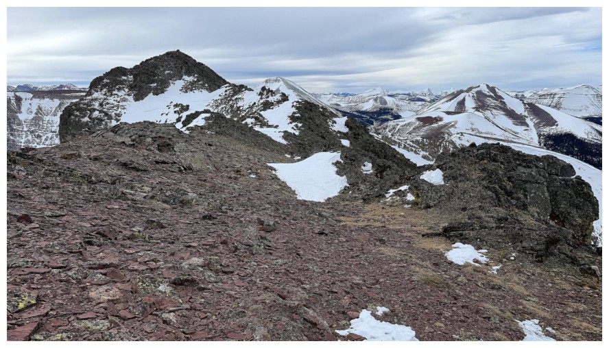
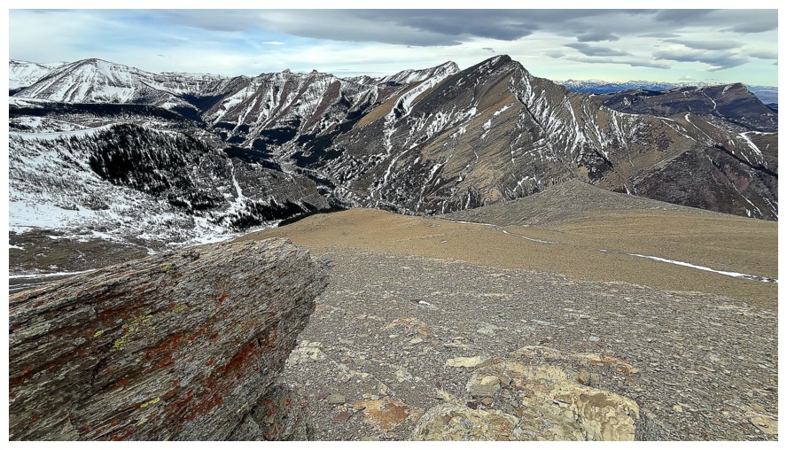
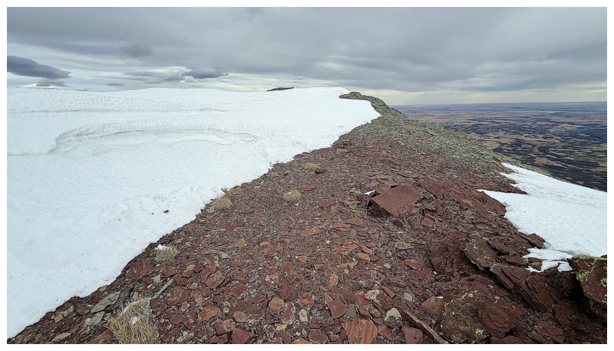
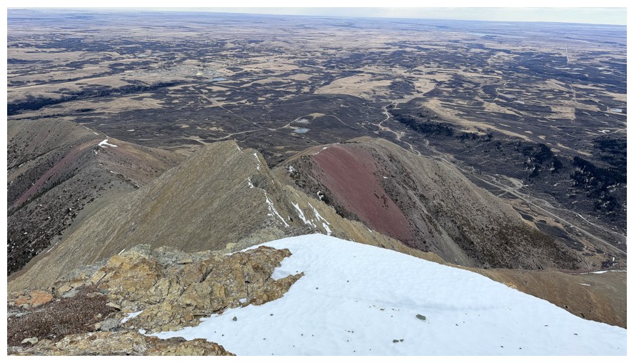
On the summit ridge; summit at the left.
The view in the other direction
Always an interesting hike/scramble to the summit from here, but the wind was merciless
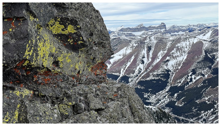
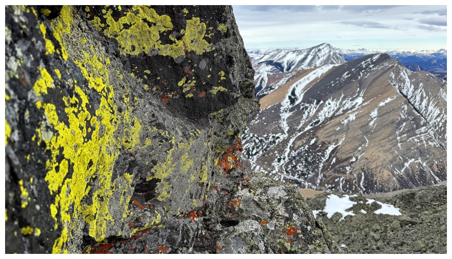
Photographing the lichen, but more importantly getting a moment of shelter from the wind
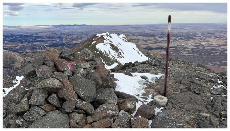 At the top
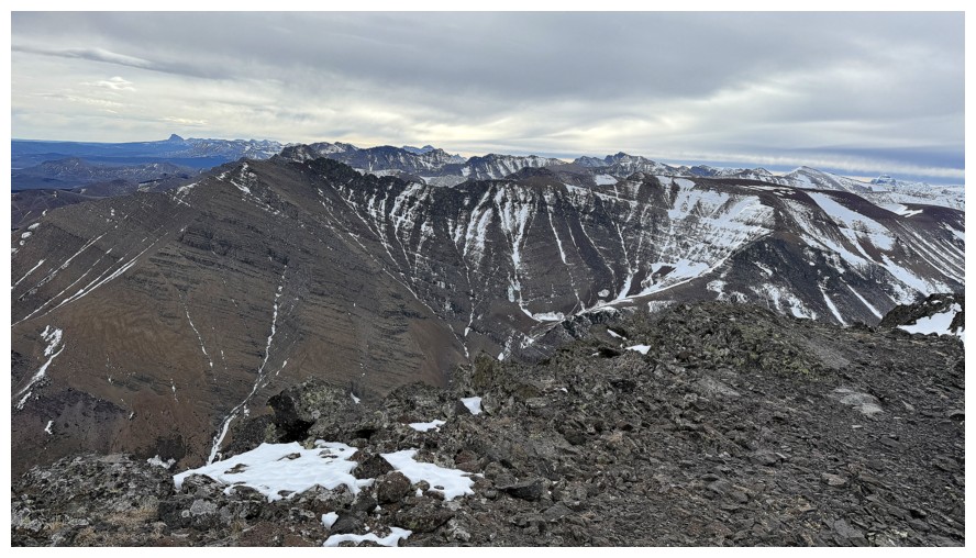
View to the south
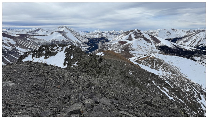
West
Northwest
North
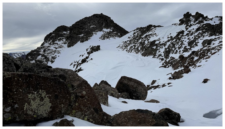
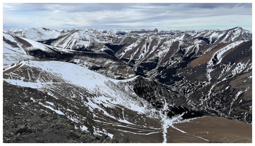
Already descending
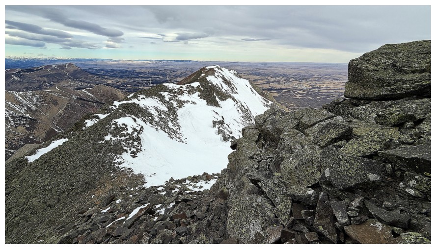
I was hoping to follow the ridge throughout the descent, but that proved to be a challenge because of the wind
Another lichen break
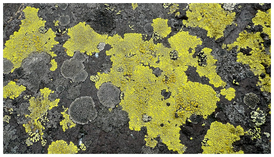
Close-up
Looking back to the summit
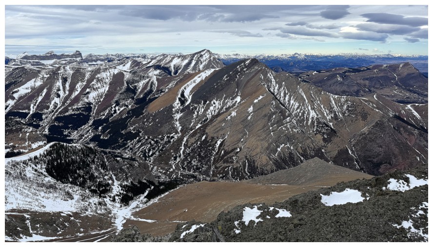
Able to enjoy a few colourful moments on the ridge
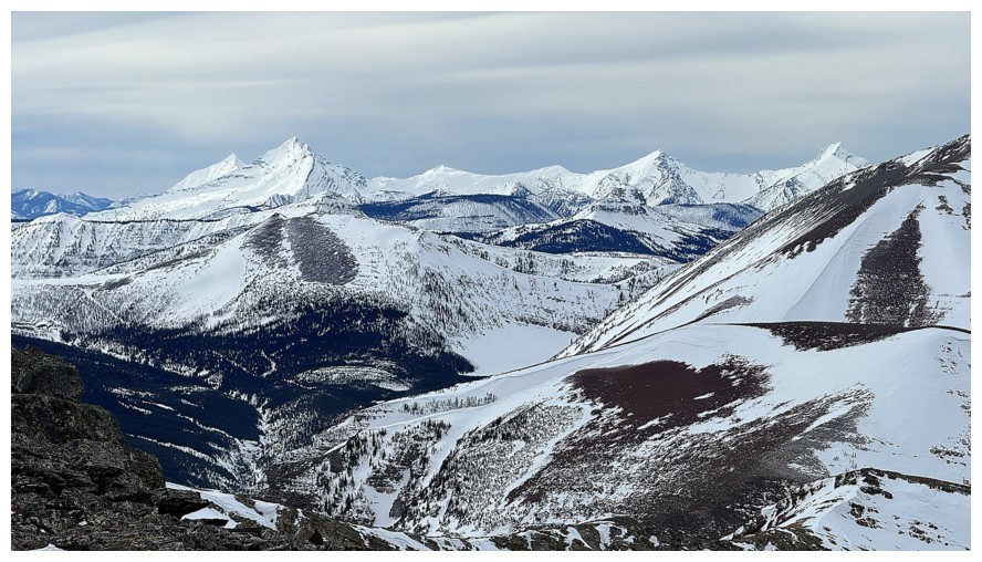
Distant peaks to the southwest, including Kenow and Miskwasini
Loaf Mountain
Redwood Peak
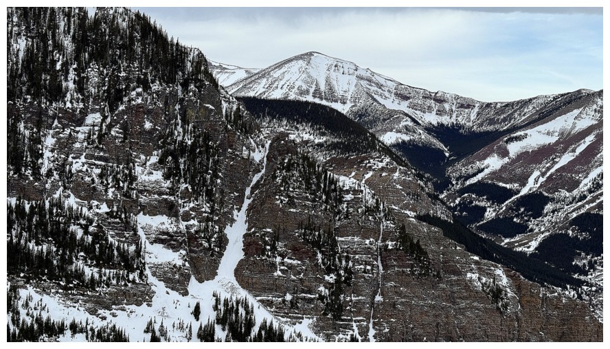
Looking down some of the route Dave and I took in 2025
Looking down the northeast ridge. That's a route I would gladly repeat. Woody just right of centre - many more explorations of that gem are planned.
"The Twig" near the left and more of the northeast ridge route
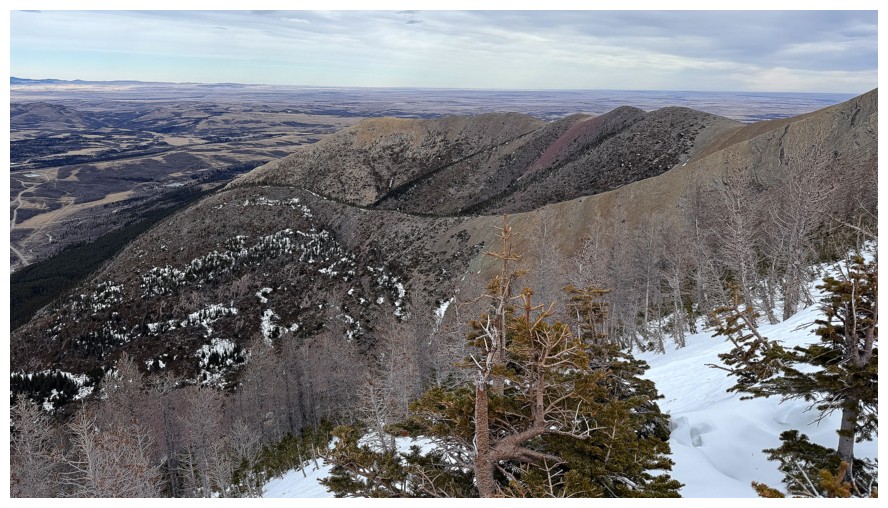
Looking back up the ridge I've descended so far
Larches at the right
Close-up of them
Heading into the mostly wind-sheltered drainage (the initial ascent route) after being pummelled by the wind
Close-up of The Gasser
Close-up of the ice that provided the crux of the trip
Less close-up
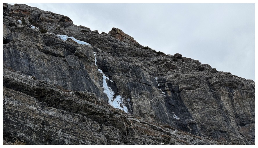
Better view of the ice and the consequences of slipping
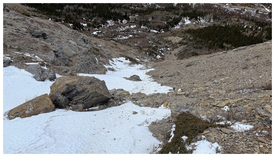
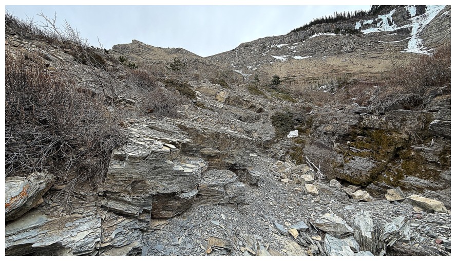
Looking down the descent drainage. If the snow wasn't like ice, the route would have been more enjoyable and less tedious.
The lower part of the route
Nice rock
At the bottom of the route looking up it
Goodbye to The Gasser
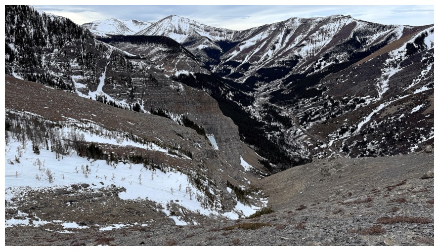
A ridge on the south ridge of Pincher Ridge that I have partially seen but would like to explore more
Parting glance at the north side of Drywood
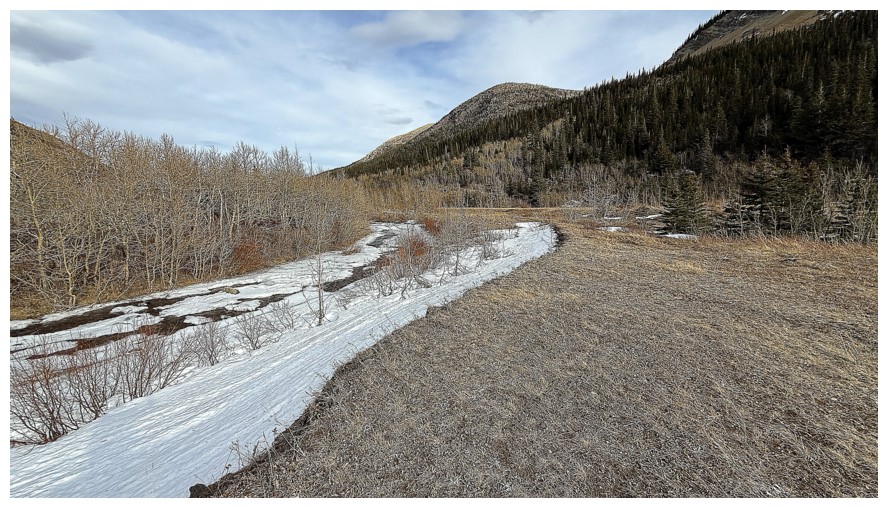
Pleasant travel near Drywood Creek
The challenging east ridge of Pincher
May have to check out that red argillite band in the future!
The End
LOG